
Notification settings New notifications
China Mosque Travel Guide: Eight Historic Mosque Complexes in Longhui, Shaoyang, Hunan (Segment 2 of 3)
Articles • Hasan09 posted the article • 0 comments • 156 views • 2026-06-30 06:24
Summary: This China mosque travel guide covers eight historic mosque complexes in Longhui, Shaoyang, Hunan, with local Hui Muslim heritage and mosque travel details kept in clear English.
Relics at Shanjie Ancient Mosque include stone pillar bases, wood carvings, and calligraphy of the mihrab in the kiln niche.
The stone couplet on the main gate reads: Clear the murky and promote the pure to follow the great path; preserve the truth and remove the false so that every generation has successors. The calligraphy was written by Ma Linyi, a Hui Muslim educator and Minister of Education in Shaoyang during the Republic of China. He is known as the Father of Northwest Education and the founder of modern Chinese Hui Muslim education.
Ma Linyi was born in Shaoyang, Hunan, in 1865. He passed the imperial examinations in 1902 and went to Japan on a government scholarship in 1904 to study teacher training. During that time, he met Sun Yat-sen, joined the Tongmenghui in 1905, and returned home to work on new government policies and modern education. In 1906, he founded Xiejin Primary School in Shaoyang, which was the first modern school for Hui Muslims in Hunan.
In 1908, he was transferred to the Qing government's Ministry of Education as a director. That same year, he helped establish the Beijing First Islamic Primary School inside the Niujie Mosque and later helped found the Islamic Education Association. While serving as Vice Minister of Education in 1912, Ma Linyi founded the Chinese Islamic Progressive Association with the support of Sun Yat-sen and served as its president.
While in charge of education in Gansu, Ma Linyi founded 277 schools of various types and set up the Gansu Islamic Education Promotion Office, spreading over a hundred Islamic primary schools across Gansu, Ningxia, and Qinghai. He selected over a hundred young people from the Northwest for government-funded study abroad, laying the foundation for modern basic education in the Northwest.
In 1928, Ma Linyi helped found the Islamic Middle School in Niujie and served as its vice chairman. In 1929, Ma Linyi became a board member of the Beiping Chengda Teachers' College. He actively updated the curriculum and improved teaching methods, helping Chengda develop into a modern school. In his later years, Ma Linyi devoted himself to the faith and served as an advisor to Wang Jingzhai for his translation of Islamic classics. view all
Summary: This China mosque travel guide covers eight historic mosque complexes in Longhui, Shaoyang, Hunan, with local Hui Muslim heritage and mosque travel details kept in clear English.
Relics at Shanjie Ancient Mosque include stone pillar bases, wood carvings, and calligraphy of the mihrab in the kiln niche.
The stone couplet on the main gate reads: Clear the murky and promote the pure to follow the great path; preserve the truth and remove the false so that every generation has successors. The calligraphy was written by Ma Linyi, a Hui Muslim educator and Minister of Education in Shaoyang during the Republic of China. He is known as the Father of Northwest Education and the founder of modern Chinese Hui Muslim education.
Ma Linyi was born in Shaoyang, Hunan, in 1865. He passed the imperial examinations in 1902 and went to Japan on a government scholarship in 1904 to study teacher training. During that time, he met Sun Yat-sen, joined the Tongmenghui in 1905, and returned home to work on new government policies and modern education. In 1906, he founded Xiejin Primary School in Shaoyang, which was the first modern school for Hui Muslims in Hunan.
In 1908, he was transferred to the Qing government's Ministry of Education as a director. That same year, he helped establish the Beijing First Islamic Primary School inside the Niujie Mosque and later helped found the Islamic Education Association. While serving as Vice Minister of Education in 1912, Ma Linyi founded the Chinese Islamic Progressive Association with the support of Sun Yat-sen and served as its president.
While in charge of education in Gansu, Ma Linyi founded 277 schools of various types and set up the Gansu Islamic Education Promotion Office, spreading over a hundred Islamic primary schools across Gansu, Ningxia, and Qinghai. He selected over a hundred young people from the Northwest for government-funded study abroad, laying the foundation for modern basic education in the Northwest.
In 1928, Ma Linyi helped found the Islamic Middle School in Niujie and served as its vice chairman. In 1929, Ma Linyi became a board member of the Beiping Chengda Teachers' College. He actively updated the curriculum and improved teaching methods, helping Chengda develop into a modern school. In his later years, Ma Linyi devoted himself to the faith and served as an advisor to Wang Jingzhai for his translation of Islamic classics.
Best Halal Restaurants in Beijing: 10 Local Muslim Food Spots Worth Trying (Segment 1 of 3)
Articles • yusuf908 posted the article • 0 comments • 132 views • 2026-06-30 06:24
Summary: This guide to the best halal restaurants in Beijing keeps the original list of local Muslim food spots, Hui Muslim food, and practical halal dining details.
The Qingxiangge restaurant at Dongdaqiao was replaced by Jinfang Snacks this year, and I just went to try it recently. Once inside, I found it is completely different from the old shop at Ciqikou. It uses a self-service tray system with small bowls of stewed dishes, small portions of stir-fries, and a huge variety of mixed salads, noodles, and snacks. It is incredibly rich in options. Small bowls and small plates are rare in traditional Beijing restaurants, making them perfect for people who want to try several different dishes.
We ordered winter melon meatball soup (donggua cuan wanzi), stir-stir-fried meat with eggs and wood ear mushrooms (muxu rou), stir-fried green beans with pork (biandou chaorou), sea bream fillets (diaoyu pian), and healthy mixed vegetables (yangsheng cai), with corn and red bean rice for our main course. The cheaper meat dishes are mostly chicken, while the beef stew is priced like a standard old Beijing restaurant for Hui Muslims. The winter melon meatball soup goes great with rice, and eating rice soaked in the broth feels just like being a kid again.
Jinfang Snack Shop is celebrating its 100th anniversary this year, so it can finally call itself a century-old shop. Jinfang was originally called Rongxiangcheng Hui Muslim Snack Shop, founded in 1926 outside Chongwenmen by Man Leting (known as Man Liu), a Hui Muslim from Dezhou, Shandong. Man Leting started out with beef and mutton. At first, he bought high-quality cattle and sheep every autumn to raise in Madian, slaughtering and selling them as needed. His business improved significantly in the 1940s, so he expanded his storefront and later began selling cooked foods like roasted mutton (shao yangrou). view all
Summary: This guide to the best halal restaurants in Beijing keeps the original list of local Muslim food spots, Hui Muslim food, and practical halal dining details.
The Qingxiangge restaurant at Dongdaqiao was replaced by Jinfang Snacks this year, and I just went to try it recently. Once inside, I found it is completely different from the old shop at Ciqikou. It uses a self-service tray system with small bowls of stewed dishes, small portions of stir-fries, and a huge variety of mixed salads, noodles, and snacks. It is incredibly rich in options. Small bowls and small plates are rare in traditional Beijing restaurants, making them perfect for people who want to try several different dishes.
We ordered winter melon meatball soup (donggua cuan wanzi), stir-stir-fried meat with eggs and wood ear mushrooms (muxu rou), stir-fried green beans with pork (biandou chaorou), sea bream fillets (diaoyu pian), and healthy mixed vegetables (yangsheng cai), with corn and red bean rice for our main course. The cheaper meat dishes are mostly chicken, while the beef stew is priced like a standard old Beijing restaurant for Hui Muslims. The winter melon meatball soup goes great with rice, and eating rice soaked in the broth feels just like being a kid again.
Jinfang Snack Shop is celebrating its 100th anniversary this year, so it can finally call itself a century-old shop. Jinfang was originally called Rongxiangcheng Hui Muslim Snack Shop, founded in 1926 outside Chongwenmen by Man Leting (known as Man Liu), a Hui Muslim from Dezhou, Shandong. Man Leting started out with beef and mutton. At first, he bought high-quality cattle and sheep every autumn to raise in Madian, slaughtering and selling them as needed. His business improved significantly in the 1940s, so he expanded his storefront and later began selling cooked foods like roasted mutton (shao yangrou).
Best Halal Restaurants in Beijing: 10 Local Muslim Food Spots Worth Trying (Segment 2 of 3)
Articles • yusuf908 posted the article • 0 comments • 127 views • 2026-06-30 06:24
Summary: This guide to the best halal restaurants in Beijing keeps the original list of local Muslim food spots, Hui Muslim food, and practical halal dining details.
Pot-stewed lamb is a classic Russian main course. Traditionally, it is cooked during long, cold winters by stewing meat in a clay pot over a wood-burning fireplace, then sealing the lid and burying it in the fireplace embers for several hours. Their pot-stewed lamb broth is very fresh, similar to Xinjiang cup-stewed lamb (gangzirou), but the lamb is a bit tough rather than tender.
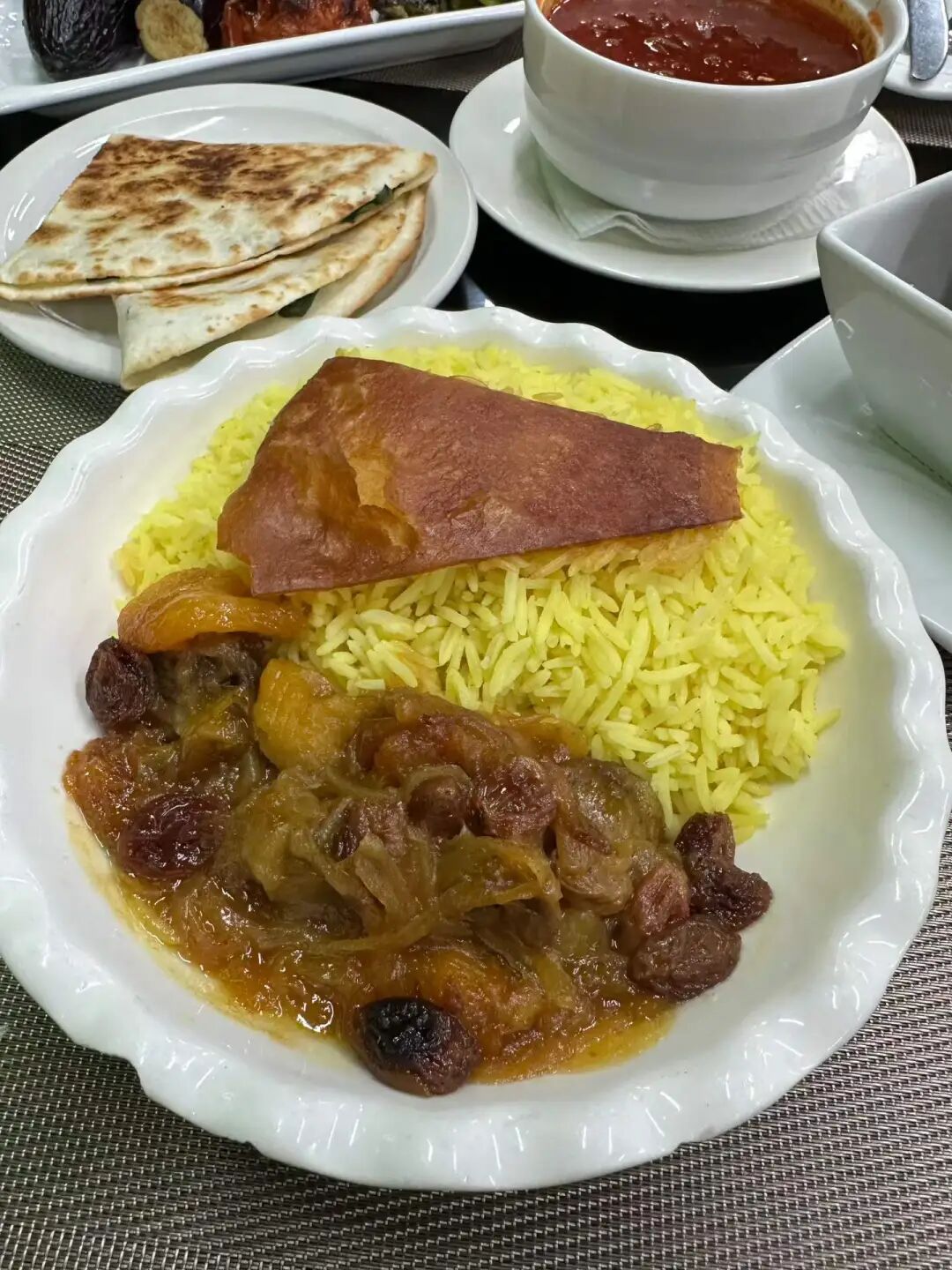
I really like the Azerbaijani pilaf. I made sure to eat the authentic version when I visited Azerbaijan, and after coming back, I think both Ruilin and Dardanelles make a good version. Azerbaijani pilaf is dyed yellow with saffron and includes dried apricots, prunes, chestnuts, and raisins. The lamb is salty and savory, while the dried fruits add sweetness, creating a very rich flavor profile.
I finally had the cheese beef burger at Yilan Liyuan on Niujie this weekend. They only have regular and California-style options now. The California-style burger adds lettuce and tomato, and you can order it as a single or double patty. They do not let you eat inside the shop, so you have to eat at the entrance or take it away. I waited five minutes at the door and it was ready. The single-layer size is decent, and the crust was baked hot on the spot, but the filling felt a bit dense and not very fluffy. The meat pie tastes good, but it feels a bit loose, as if it wasn't packed tightly enough. Overall it is pretty good, but it would be even better if there were other things to pair it with. view all
Summary: This guide to the best halal restaurants in Beijing keeps the original list of local Muslim food spots, Hui Muslim food, and practical halal dining details.
Pot-stewed lamb is a classic Russian main course. Traditionally, it is cooked during long, cold winters by stewing meat in a clay pot over a wood-burning fireplace, then sealing the lid and burying it in the fireplace embers for several hours. Their pot-stewed lamb broth is very fresh, similar to Xinjiang cup-stewed lamb (gangzirou), but the lamb is a bit tough rather than tender.
I really like the Azerbaijani pilaf. I made sure to eat the authentic version when I visited Azerbaijan, and after coming back, I think both Ruilin and Dardanelles make a good version. Azerbaijani pilaf is dyed yellow with saffron and includes dried apricots, prunes, chestnuts, and raisins. The lamb is salty and savory, while the dried fruits add sweetness, creating a very rich flavor profile.
I finally had the cheese beef burger at Yilan Liyuan on Niujie this weekend. They only have regular and California-style options now. The California-style burger adds lettuce and tomato, and you can order it as a single or double patty. They do not let you eat inside the shop, so you have to eat at the entrance or take it away. I waited five minutes at the door and it was ready. The single-layer size is decent, and the crust was baked hot on the spot, but the filling felt a bit dense and not very fluffy. The meat pie tastes good, but it feels a bit loose, as if it wasn't packed tightly enough. Overall it is pretty good, but it would be even better if there were other things to pair it with.
China Mosque Travel Guide: Eight Historic Mosque Complexes in Longhui, Shaoyang, Hunan (Segment 2 of 3)
Articles • yusuf908 posted the article • 0 comments • 126 views • 2026-06-30 06:24
Summary: This China mosque travel guide covers eight historic mosque complexes in Longhui, Shaoyang, Hunan, with local Hui Muslim heritage and mosque travel details kept in clear English.
Relics at Shanjie Ancient Mosque include stone pillar bases, wood carvings, and calligraphy of the mihrab in the kiln niche.
The stone couplet on the main gate reads: Clear the murky and promote the pure to follow the great path; preserve the truth and remove the false so that every generation has successors. The calligraphy was written by Ma Linyi, a Hui Muslim educator and Minister of Education in Shaoyang during the Republic of China. He is known as the Father of Northwest Education and the founder of modern Chinese Hui Muslim education.
Ma Linyi was born in Shaoyang, Hunan, in 1865. He passed the imperial examinations in 1902 and went to Japan on a government scholarship in 1904 to study teacher training. During that time, he met Sun Yat-sen, joined the Tongmenghui in 1905, and returned home to work on new government policies and modern education. In 1906, he founded Xiejin Primary School in Shaoyang, which was the first modern school for Hui Muslims in Hunan.
In 1908, he was transferred to the Qing government's Ministry of Education as a director. That same year, he helped establish the Beijing First Islamic Primary School inside the Niujie Mosque and later helped found the Islamic Education Association. While serving as Vice Minister of Education in 1912, Ma Linyi founded the Chinese Islamic Progressive Association with the support of Sun Yat-sen and served as its president.
While in charge of education in Gansu, Ma Linyi founded 277 schools of various types and set up the Gansu Islamic Education Promotion Office, spreading over a hundred Islamic primary schools across Gansu, Ningxia, and Qinghai. He selected over a hundred young people from the Northwest for government-funded study abroad, laying the foundation for modern basic education in the Northwest.
In 1928, Ma Linyi helped found the Islamic Middle School in Niujie and served as its vice chairman. In 1929, Ma Linyi became a board member of the Beiping Chengda Teachers' College. He actively updated the curriculum and improved teaching methods, helping Chengda develop into a modern school. In his later years, Ma Linyi devoted himself to the faith and served as an advisor to Wang Jingzhai for his translation of Islamic classics. view all
Summary: This China mosque travel guide covers eight historic mosque complexes in Longhui, Shaoyang, Hunan, with local Hui Muslim heritage and mosque travel details kept in clear English.
Relics at Shanjie Ancient Mosque include stone pillar bases, wood carvings, and calligraphy of the mihrab in the kiln niche.
The stone couplet on the main gate reads: Clear the murky and promote the pure to follow the great path; preserve the truth and remove the false so that every generation has successors. The calligraphy was written by Ma Linyi, a Hui Muslim educator and Minister of Education in Shaoyang during the Republic of China. He is known as the Father of Northwest Education and the founder of modern Chinese Hui Muslim education.
Ma Linyi was born in Shaoyang, Hunan, in 1865. He passed the imperial examinations in 1902 and went to Japan on a government scholarship in 1904 to study teacher training. During that time, he met Sun Yat-sen, joined the Tongmenghui in 1905, and returned home to work on new government policies and modern education. In 1906, he founded Xiejin Primary School in Shaoyang, which was the first modern school for Hui Muslims in Hunan.
In 1908, he was transferred to the Qing government's Ministry of Education as a director. That same year, he helped establish the Beijing First Islamic Primary School inside the Niujie Mosque and later helped found the Islamic Education Association. While serving as Vice Minister of Education in 1912, Ma Linyi founded the Chinese Islamic Progressive Association with the support of Sun Yat-sen and served as its president.
While in charge of education in Gansu, Ma Linyi founded 277 schools of various types and set up the Gansu Islamic Education Promotion Office, spreading over a hundred Islamic primary schools across Gansu, Ningxia, and Qinghai. He selected over a hundred young people from the Northwest for government-funded study abroad, laying the foundation for modern basic education in the Northwest.
In 1928, Ma Linyi helped found the Islamic Middle School in Niujie and served as its vice chairman. In 1929, Ma Linyi became a board member of the Beiping Chengda Teachers' College. He actively updated the curriculum and improved teaching methods, helping Chengda develop into a modern school. In his later years, Ma Linyi devoted himself to the faith and served as an advisor to Wang Jingzhai for his translation of Islamic classics.
China Mosque Travel Guide: Eight Historic Mosque Complexes in Longhui, Shaoyang, Hunan (Part 1 of 5)
Articles • yusuf908 posted the article • 0 comments • 121 views • 2026-06-30 06:24
Summary: This China mosque travel guide covers eight historic mosque complexes in Longhui, Shaoyang, Hunan, with local Hui Muslim heritage and mosque travel details kept in clear English.
This article summarizes the key points about the eight mosques (sifang) in Longhui County, Shaoyang, Hunan. It keeps the original paragraph and image order. It is for readers interested in Muslim life, Islamic culture, and Chinese Islamic writing. It also helps people search for content like Chinese halal food.
Longhui County in Shaoyang City, Hunan, has a large population of Hui Muslims. I visited eight mosques there: Taohuaping Mosque, Shanjie Ancient Mosque, East Mosque, West Mosque, South Mosque, North Mosque, Luobai Mosque, and Niejiaoting Mosque. I will share them with you below.
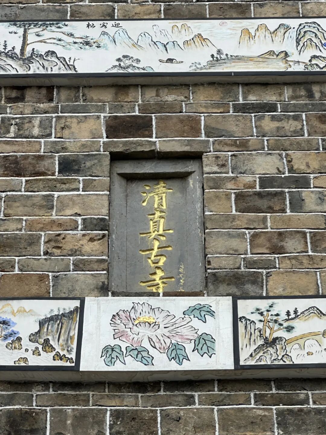
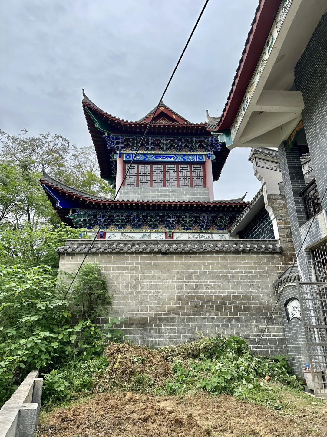
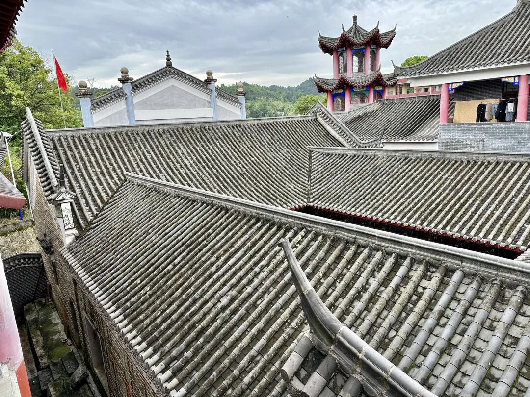
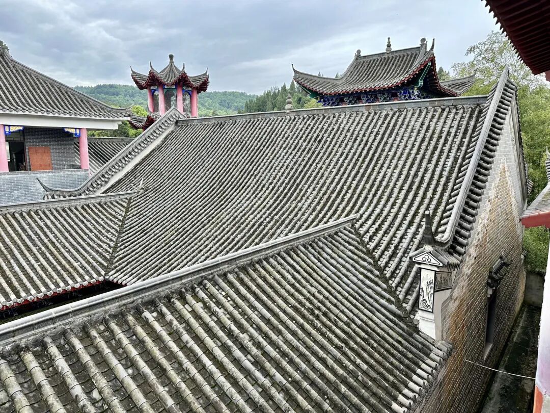
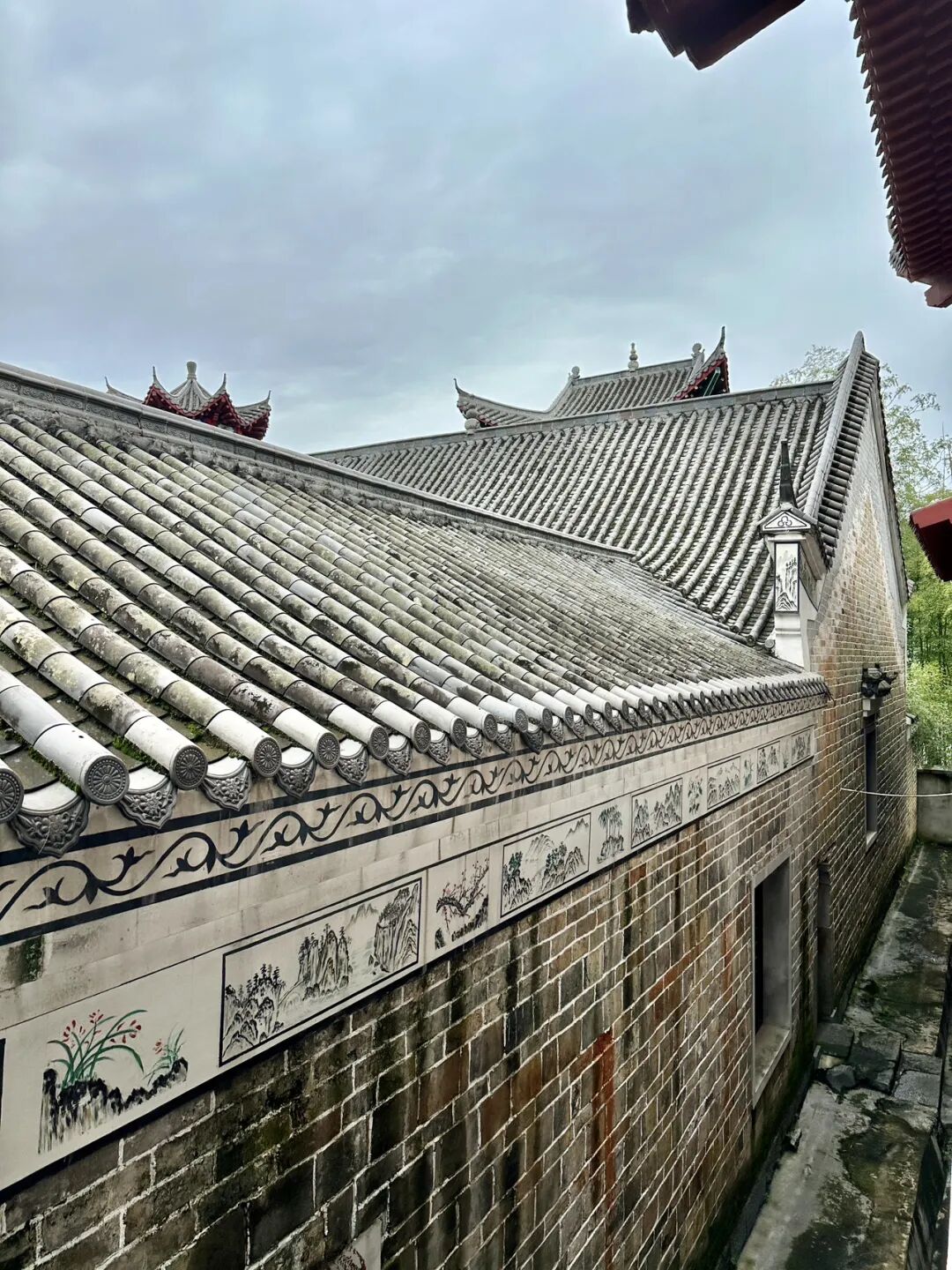
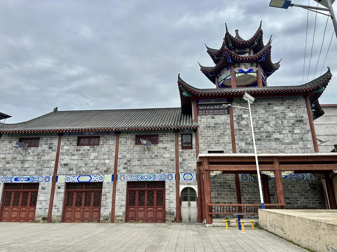
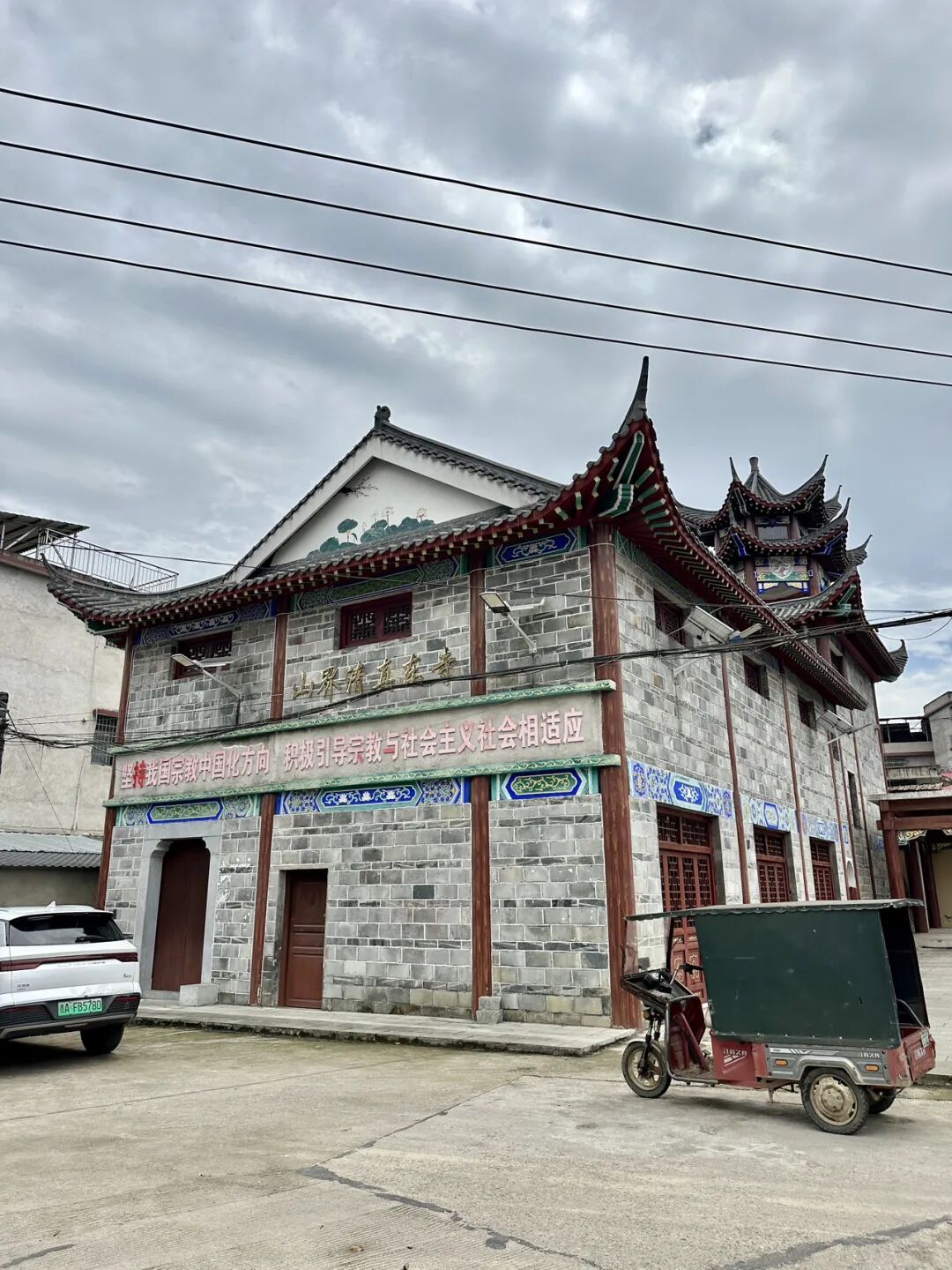
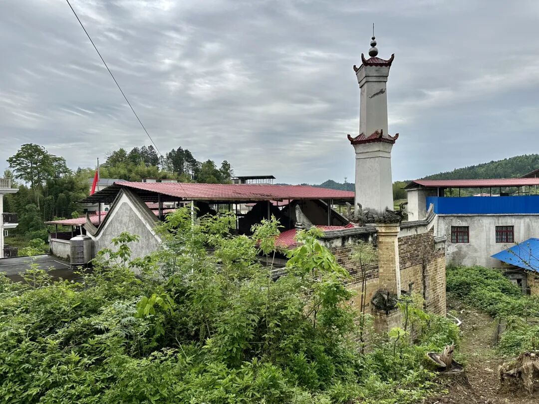
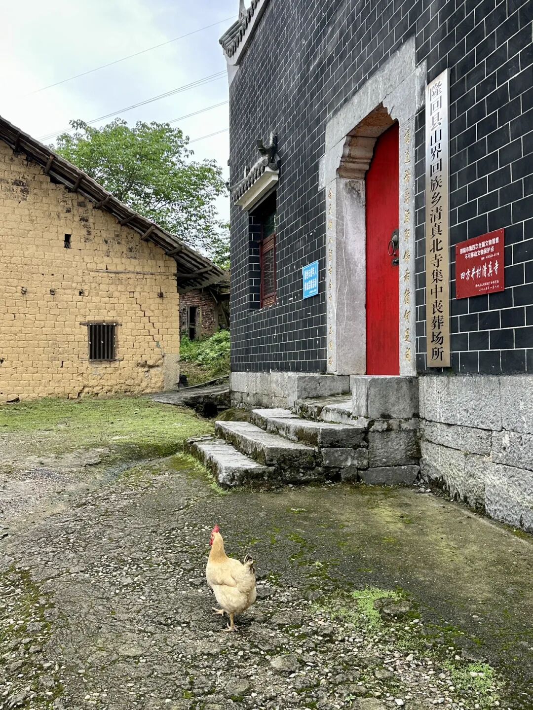
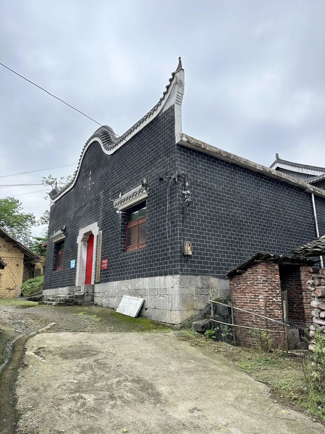
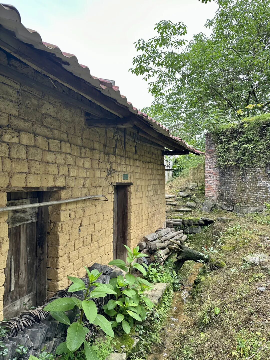
Shanjie Ancient Mosque in Longhui County, Shaoyang, Hunan, is located in Laowuli, Shanjie Township. It was first built in 1444 (the ninth year of the Zhengtong reign of the Ming Dynasty) and is the oldest mosque in Longhui. During the Hongwu reign of the Ming Dynasty, Ma Zhi, the third son of Ma Cheng, the ancestor of the Ma family Hui Muslims in Shaoyang, moved from Shaoyang to Majia Ferry in Longhui to settle down. He was the first Hui Muslim in Longhui, and Shanjie Ancient Mosque was built by the Ma family.
Shanjie Ancient Mosque was renovated in 1919 and rebuilt into its current appearance in 2018.
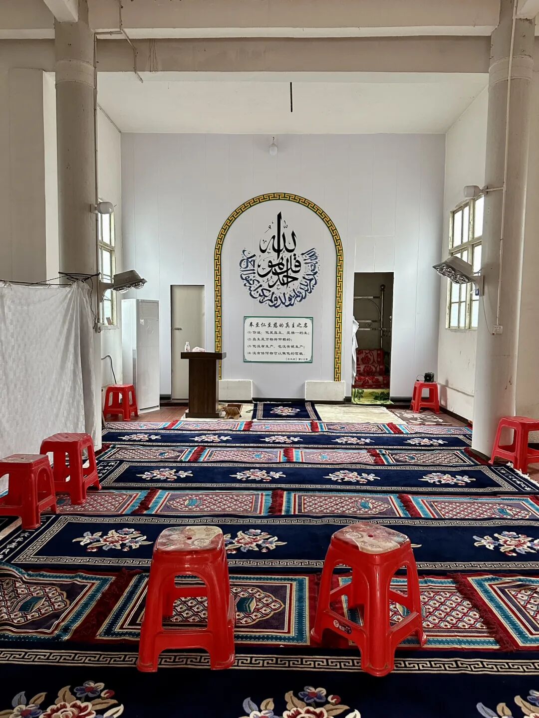
Shanjie Ancient Mosque has a long tradition of teaching Islamic scripture. The head imams who have taught there include Ma Yulang, Ma Fujiu, Ma Fucheng, Ma Yucheng, Ma Yaochi, and Ding Zhenyi. They also hired imams from other places like Huang Xingxiang and Li Desheng. Ma Fucheng, an imam from this mosque, taught there for the longest time. In 1945, Imam Ma Yucheng taught at the ancient mosque and recruited many students (hailifan), marking the peak of the mosque's religious activities. To this day, the mosque continues its educational work and has trained many excellent young people.
On September 2, 1939, the Wugang County, Hunan branch of the China Islamic National Salvation Association was officially established at the mosque. The mosque's imam, Ma Fucheng, was elected as an officer. Inspired by the call to resist Japanese aggression and save the country, young Hui Muslims from the mosque, including Ma Qiyun, Ma Wuyang from the North Mosque, and Su Xingmin from Beishan, signed up for the army, took up arms, and headed to the front lines in East China.
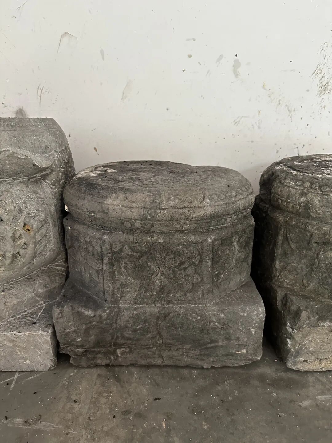
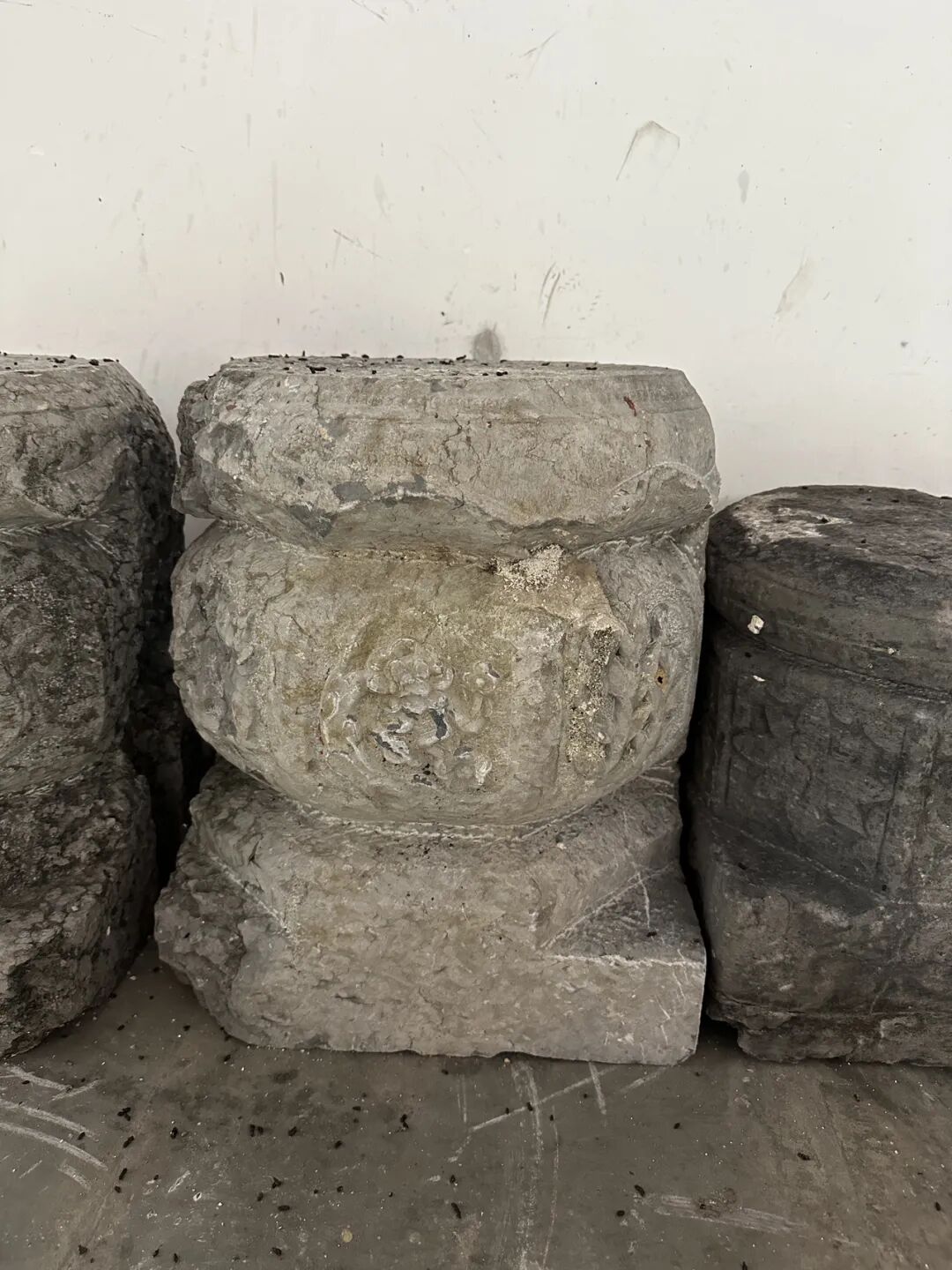
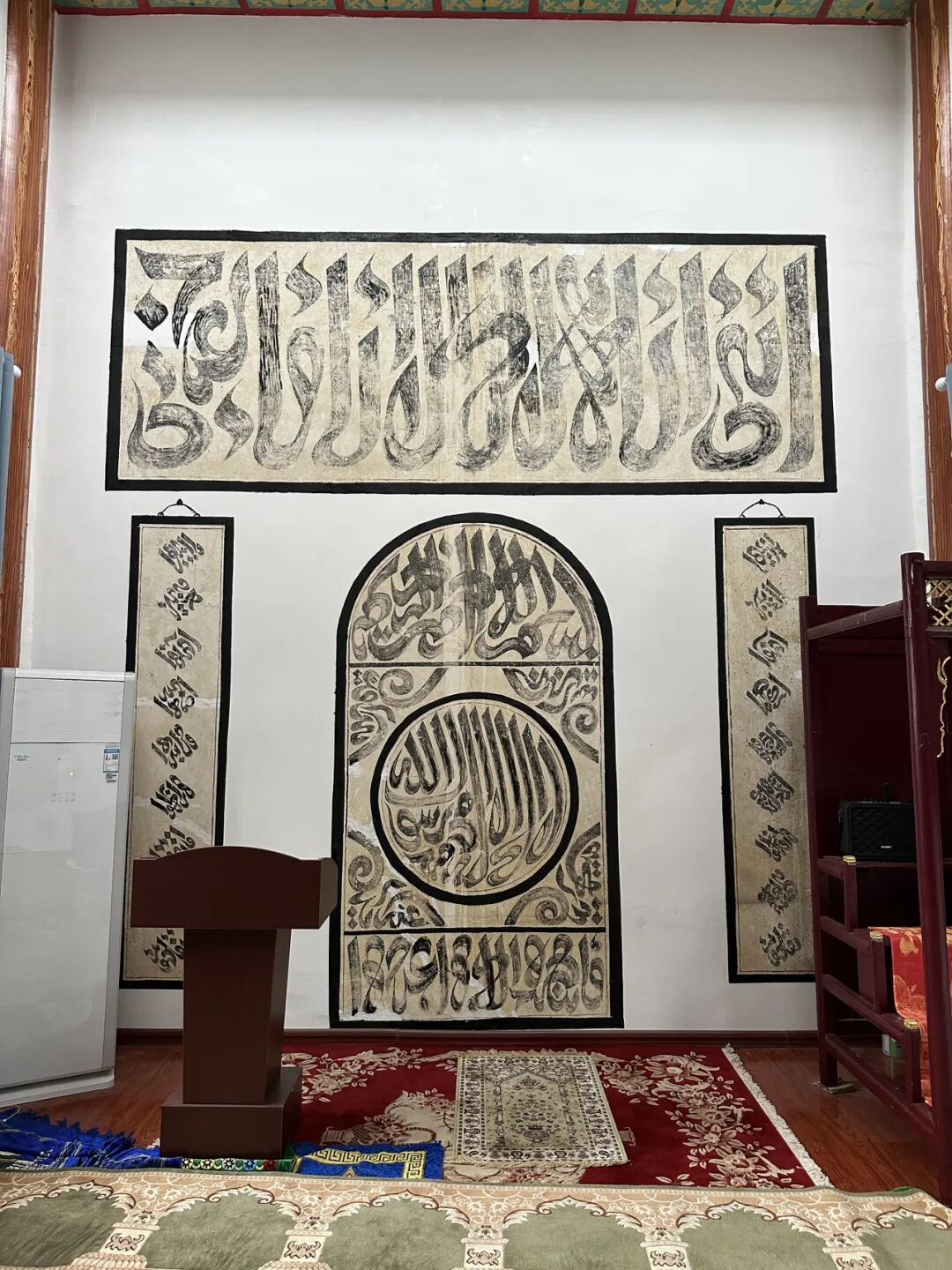
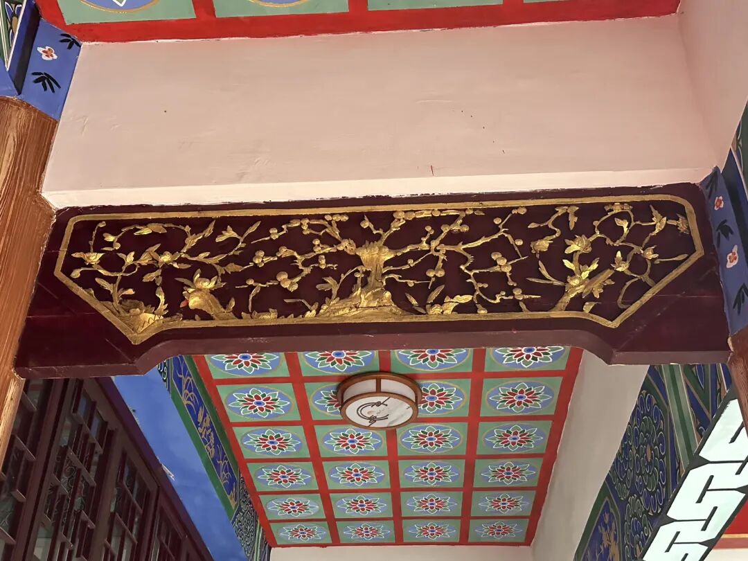
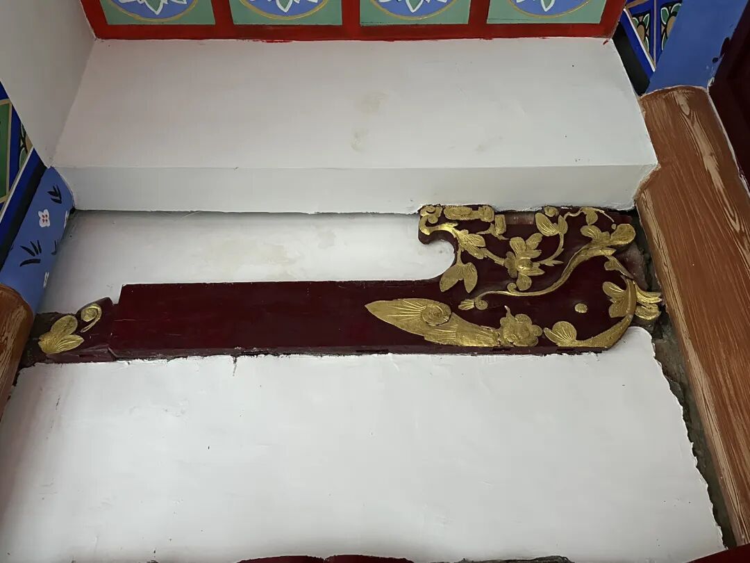
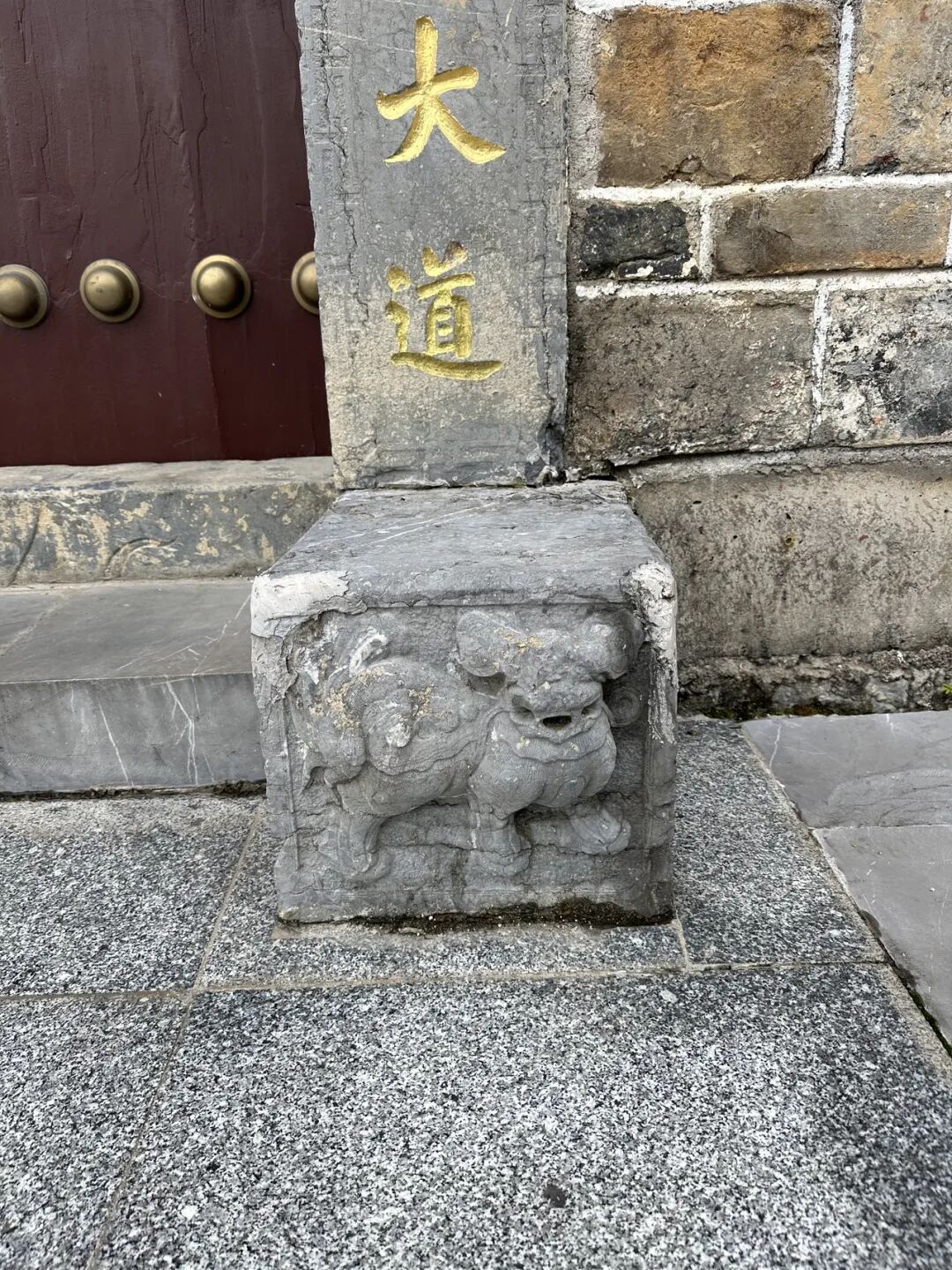
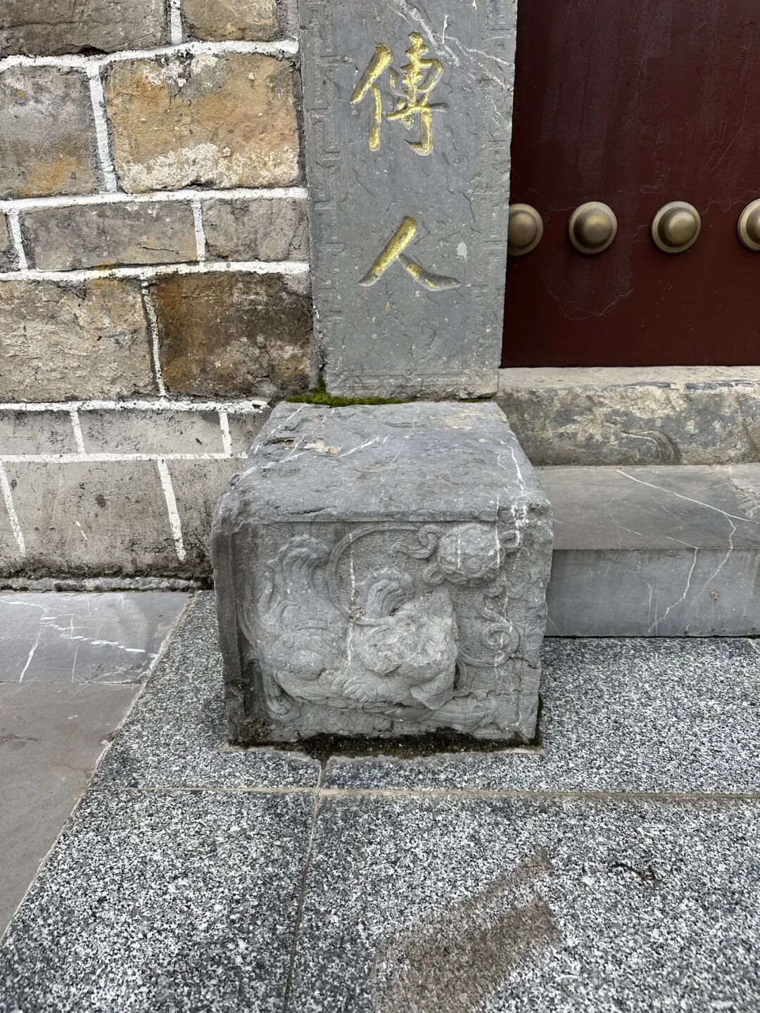
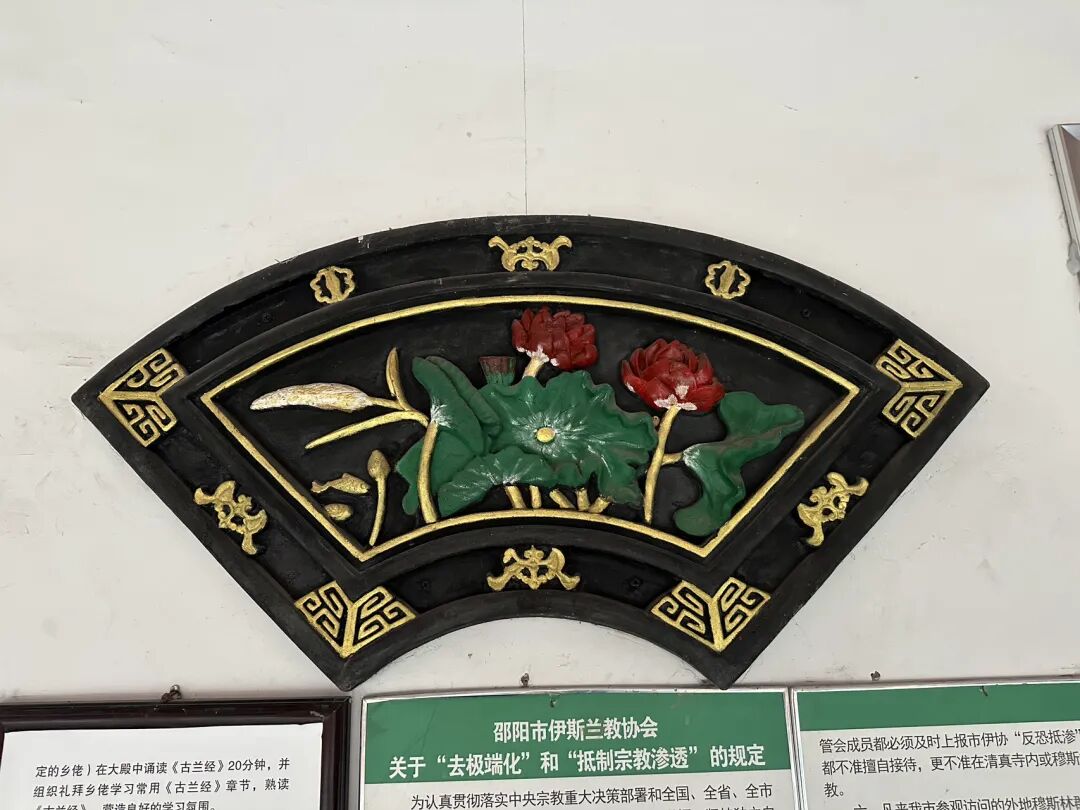
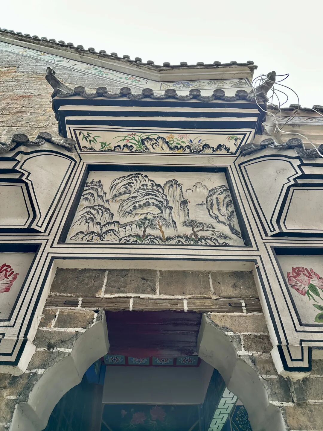
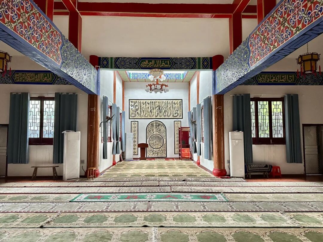
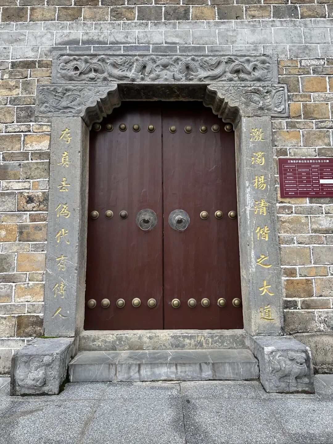
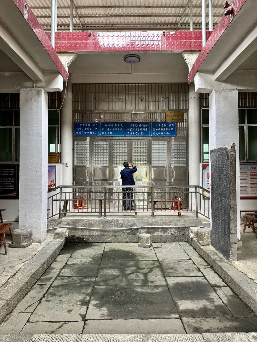
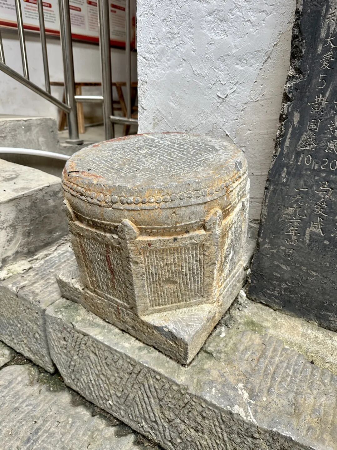
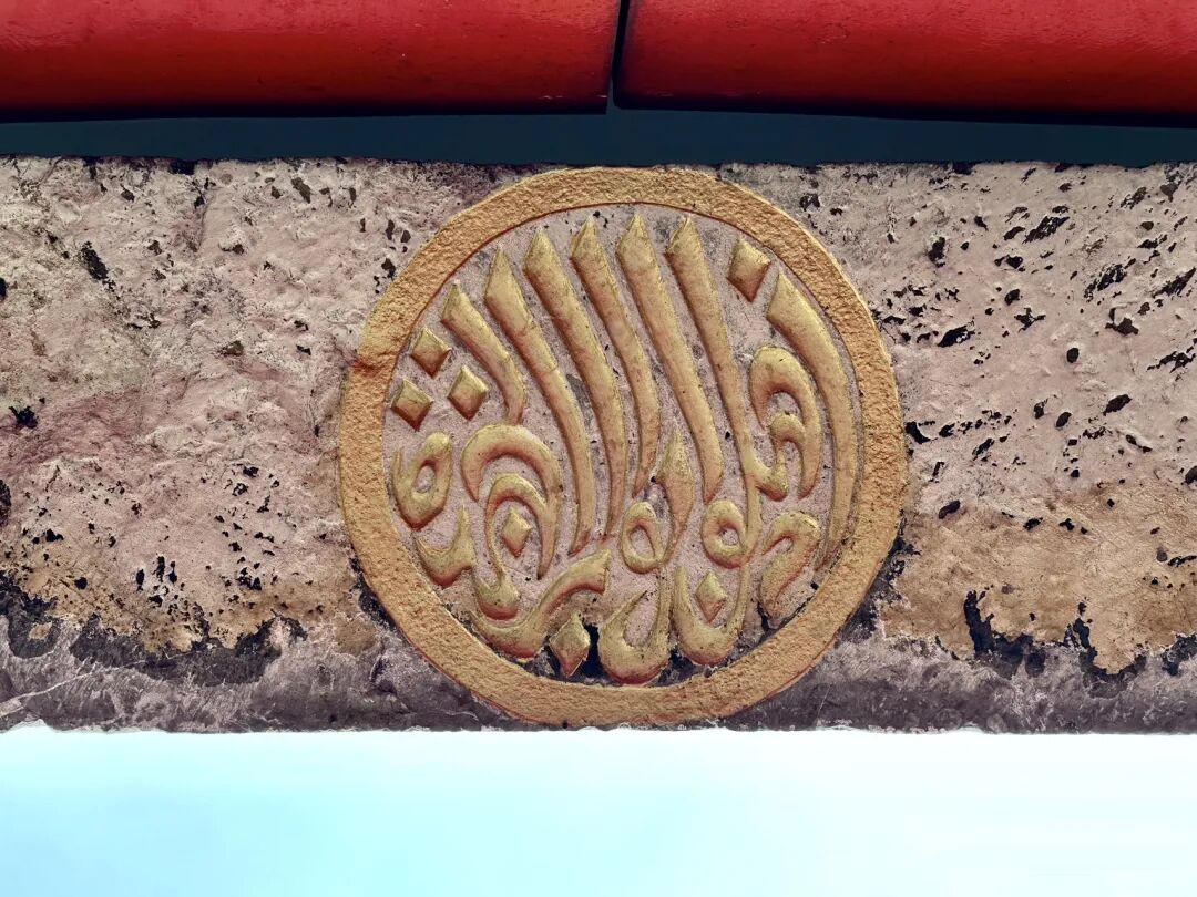
Relics at Shanjie Ancient Mosque include stone pillar bases, wood carvings, and calligraphy of the mihrab in the kiln niche.
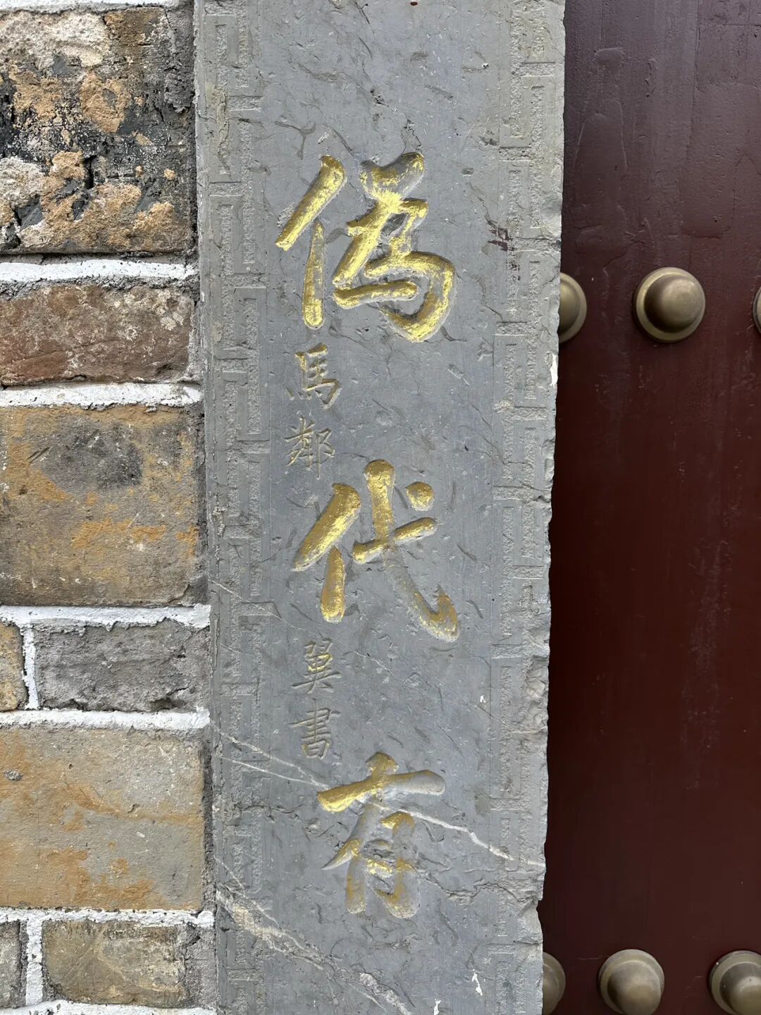
The stone couplet on the main gate reads: Clear the murky and promote the pure to follow the great path; preserve the truth and remove the false so that every generation has successors. The calligraphy was written by Ma Linyi, a Hui Muslim educator and Minister of Education in Shaoyang during the Republic of China. He is known as the Father of Northwest Education and the founder of modern Chinese Hui Muslim education.
Ma Linyi was born in Shaoyang, Hunan, in 1865. He passed the imperial examinations in 1902 and went to Japan on a government scholarship in 1904 to study teacher training. During that time, he met Sun Yat-sen, joined the Tongmenghui in 1905, and returned home to work on new government policies and modern education. In 1906, he founded Xiejin Primary School in Shaoyang, which was the first modern school for Hui Muslims in Hunan.
In 1908, he was transferred to the Qing government's Ministry of Education as a director. That same year, he helped establish the Beijing First Islamic Primary School inside the Niujie Mosque and later helped found the Islamic Education Association. While serving as Vice Minister of Education in 1912, Ma Linyi founded the Chinese Islamic Progressive Association with the support of Sun Yat-sen and served as its president.
While in charge of education in Gansu, Ma Linyi founded 277 schools of various types and set up the Gansu Islamic Education Promotion Office, spreading over a hundred Islamic primary schools across Gansu, Ningxia, and Qinghai. He selected over a hundred young people from the Northwest for government-funded study abroad, laying the foundation for modern basic education in the Northwest.
In 1928, Ma Linyi helped found the Islamic Middle School in Niujie and served as its vice chairman. In 1929, Ma Linyi became a board member of the Beiping Chengda Teachers' College. He actively updated the curriculum and improved teaching methods, helping Chengda develop into a modern school. In his later years, Ma Linyi devoted himself to the faith and served as an advisor to Wang Jingzhai for his translation of Islamic classics.
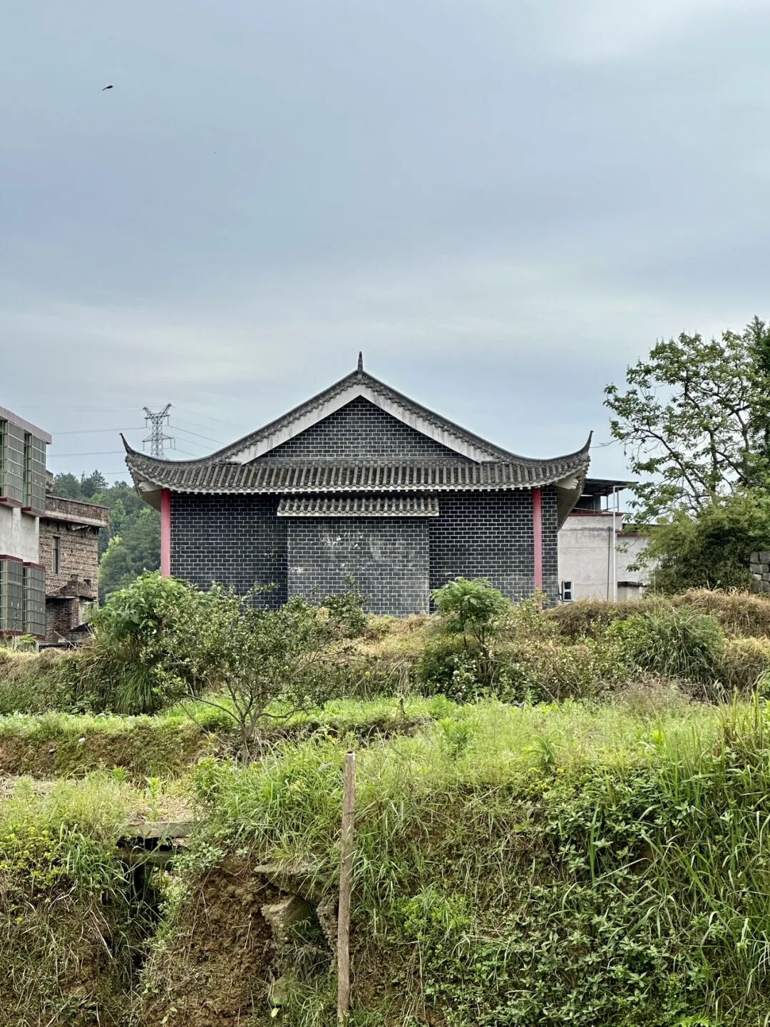
Shanjie East Mosque was first built in 1728 (the fifth year of the Yongzheng reign). The mosque has hired many imams over the years, including Su Yuebo, Ma Yulang, Ma Baochu, Zheng Liansheng, Ma Yuechi, Ma Yucheng, Tang Yuanqi, Hai Shiquan, Ma Chengyong, Ding Baohua, Ma Gen'ao, Ma Xiang'ao, and Ma Wuquan. Students from as far as Hainan and Guangxi came to study under the great imam Ma Yucheng in Gansu, and the local religious community was very prosperous.
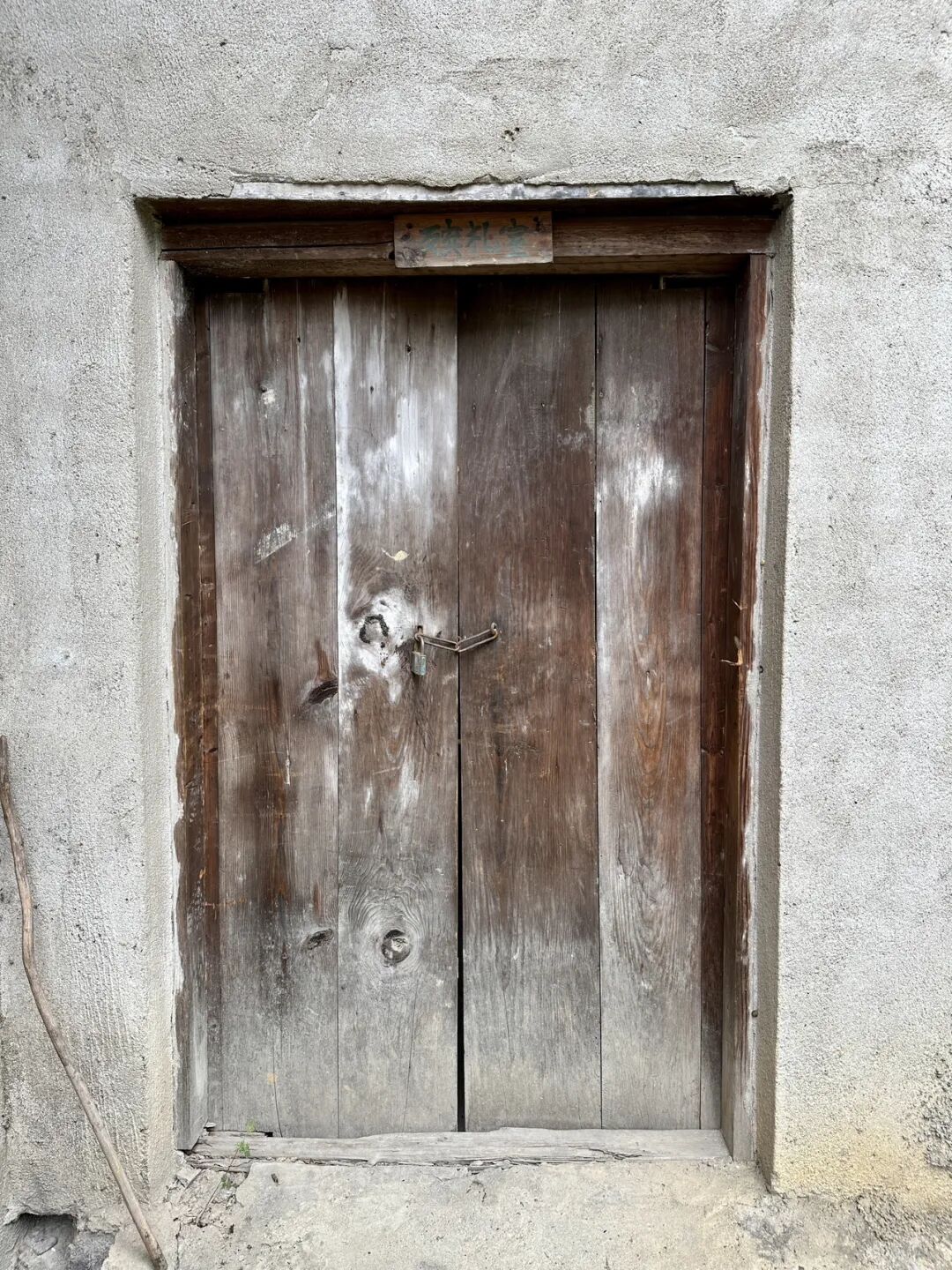
It is a pity that the mosque was locked when I visited, so I could not go inside. view all
Summary: This China mosque travel guide covers eight historic mosque complexes in Longhui, Shaoyang, Hunan, with local Hui Muslim heritage and mosque travel details kept in clear English.
This article summarizes the key points about the eight mosques (sifang) in Longhui County, Shaoyang, Hunan. It keeps the original paragraph and image order. It is for readers interested in Muslim life, Islamic culture, and Chinese Islamic writing. It also helps people search for content like Chinese halal food.
Longhui County in Shaoyang City, Hunan, has a large population of Hui Muslims. I visited eight mosques there: Taohuaping Mosque, Shanjie Ancient Mosque, East Mosque, West Mosque, South Mosque, North Mosque, Luobai Mosque, and Niejiaoting Mosque. I will share them with you below.
Shanjie Ancient Mosque in Longhui County, Shaoyang, Hunan, is located in Laowuli, Shanjie Township. It was first built in 1444 (the ninth year of the Zhengtong reign of the Ming Dynasty) and is the oldest mosque in Longhui. During the Hongwu reign of the Ming Dynasty, Ma Zhi, the third son of Ma Cheng, the ancestor of the Ma family Hui Muslims in Shaoyang, moved from Shaoyang to Majia Ferry in Longhui to settle down. He was the first Hui Muslim in Longhui, and Shanjie Ancient Mosque was built by the Ma family.
Shanjie Ancient Mosque was renovated in 1919 and rebuilt into its current appearance in 2018.
Shanjie Ancient Mosque has a long tradition of teaching Islamic scripture. The head imams who have taught there include Ma Yulang, Ma Fujiu, Ma Fucheng, Ma Yucheng, Ma Yaochi, and Ding Zhenyi. They also hired imams from other places like Huang Xingxiang and Li Desheng. Ma Fucheng, an imam from this mosque, taught there for the longest time. In 1945, Imam Ma Yucheng taught at the ancient mosque and recruited many students (hailifan), marking the peak of the mosque's religious activities. To this day, the mosque continues its educational work and has trained many excellent young people.
On September 2, 1939, the Wugang County, Hunan branch of the China Islamic National Salvation Association was officially established at the mosque. The mosque's imam, Ma Fucheng, was elected as an officer. Inspired by the call to resist Japanese aggression and save the country, young Hui Muslims from the mosque, including Ma Qiyun, Ma Wuyang from the North Mosque, and Su Xingmin from Beishan, signed up for the army, took up arms, and headed to the front lines in East China.
Relics at Shanjie Ancient Mosque include stone pillar bases, wood carvings, and calligraphy of the mihrab in the kiln niche.
The stone couplet on the main gate reads: Clear the murky and promote the pure to follow the great path; preserve the truth and remove the false so that every generation has successors. The calligraphy was written by Ma Linyi, a Hui Muslim educator and Minister of Education in Shaoyang during the Republic of China. He is known as the Father of Northwest Education and the founder of modern Chinese Hui Muslim education.
Ma Linyi was born in Shaoyang, Hunan, in 1865. He passed the imperial examinations in 1902 and went to Japan on a government scholarship in 1904 to study teacher training. During that time, he met Sun Yat-sen, joined the Tongmenghui in 1905, and returned home to work on new government policies and modern education. In 1906, he founded Xiejin Primary School in Shaoyang, which was the first modern school for Hui Muslims in Hunan.
In 1908, he was transferred to the Qing government's Ministry of Education as a director. That same year, he helped establish the Beijing First Islamic Primary School inside the Niujie Mosque and later helped found the Islamic Education Association. While serving as Vice Minister of Education in 1912, Ma Linyi founded the Chinese Islamic Progressive Association with the support of Sun Yat-sen and served as its president.
While in charge of education in Gansu, Ma Linyi founded 277 schools of various types and set up the Gansu Islamic Education Promotion Office, spreading over a hundred Islamic primary schools across Gansu, Ningxia, and Qinghai. He selected over a hundred young people from the Northwest for government-funded study abroad, laying the foundation for modern basic education in the Northwest.
In 1928, Ma Linyi helped found the Islamic Middle School in Niujie and served as its vice chairman. In 1929, Ma Linyi became a board member of the Beiping Chengda Teachers' College. He actively updated the curriculum and improved teaching methods, helping Chengda develop into a modern school. In his later years, Ma Linyi devoted himself to the faith and served as an advisor to Wang Jingzhai for his translation of Islamic classics.
Shanjie East Mosque was first built in 1728 (the fifth year of the Yongzheng reign). The mosque has hired many imams over the years, including Su Yuebo, Ma Yulang, Ma Baochu, Zheng Liansheng, Ma Yuechi, Ma Yucheng, Tang Yuanqi, Hai Shiquan, Ma Chengyong, Ding Baohua, Ma Gen'ao, Ma Xiang'ao, and Ma Wuquan. Students from as far as Hainan and Guangxi came to study under the great imam Ma Yucheng in Gansu, and the local religious community was very prosperous.
It is a pity that the mosque was locked when I visited, so I could not go inside.
China Mosque Travel Guide: Eight Historic Mosque Complexes in Longhui, Shaoyang, Hunan (Part 1 of 2)
Articles • Hasan09 posted the article • 0 comments • 122 views • 2026-06-30 06:24
Summary: This China mosque travel guide covers eight historic mosque complexes in Longhui, Shaoyang, Hunan, with local Hui Muslim heritage and mosque travel details kept in clear English.
This article summarizes the key points about the eight mosques (sifang) in Longhui County, Shaoyang, Hunan. It keeps the original paragraph and image order. It is for readers interested in Muslim life, Islamic culture, and Chinese Islamic writing. It also helps people search for content like Chinese halal food.
Longhui County in Shaoyang City, Hunan, has a large population of Hui Muslims. I visited eight mosques there: Taohuaping Mosque, Shanjie Ancient Mosque, East Mosque, West Mosque, South Mosque, North Mosque, Luobai Mosque, and Niejiaoting Mosque. I will share them with you below.
Shanjie Ancient Mosque in Longhui County, Shaoyang, Hunan, is located in Laowuli, Shanjie Township. It was first built in 1444 (the ninth year of the Zhengtong reign of the Ming Dynasty) and is the oldest mosque in Longhui. During the Hongwu reign of the Ming Dynasty, Ma Zhi, the third son of Ma Cheng, the ancestor of the Ma family Hui Muslims in Shaoyang, moved from Shaoyang to Majia Ferry in Longhui to settle down. He was the first Hui Muslim in Longhui, and Shanjie Ancient Mosque was built by the Ma family.
Shanjie Ancient Mosque was renovated in 1919 and rebuilt into its current appearance in 2018.
Shanjie Ancient Mosque has a long tradition of teaching Islamic scripture. The head imams who have taught there include Ma Yulang, Ma Fujiu, Ma Fucheng, Ma Yucheng, Ma Yaochi, and Ding Zhenyi. They also hired imams from other places like Huang Xingxiang and Li Desheng. Ma Fucheng, an imam from this mosque, taught there for the longest time. In 1945, Imam Ma Yucheng taught at the ancient mosque and recruited many students (hailifan), marking the peak of the mosque's religious activities. To this day, the mosque continues its educational work and has trained many excellent young people.
On September 2, 1939, the Wugang County, Hunan branch of the China Islamic National Salvation Association was officially established at the mosque. The mosque's imam, Ma Fucheng, was elected as an officer. Inspired by the call to resist Japanese aggression and save the country, young Hui Muslims from the mosque, including Ma Qiyun, Ma Wuyang from the North Mosque, and Su Xingmin from Beishan, signed up for the army, took up arms, and headed to the front lines in East China.
Relics at Shanjie Ancient Mosque include stone pillar bases, wood carvings, and calligraphy of the mihrab in the kiln niche.
The stone couplet on the main gate reads: Clear the murky and promote the pure to follow the great path; preserve the truth and remove the false so that every generation has successors. The calligraphy was written by Ma Linyi, a Hui Muslim educator and Minister of Education in Shaoyang during the Republic of China. He is known as the Father of Northwest Education and the founder of modern Chinese Hui Muslim education.
Ma Linyi was born in Shaoyang, Hunan, in 1865. He passed the imperial examinations in 1902 and went to Japan on a government scholarship in 1904 to study teacher training. During that time, he met Sun Yat-sen, joined the Tongmenghui in 1905, and returned home to work on new government policies and modern education. In 1906, he founded Xiejin Primary School in Shaoyang, which was the first modern school for Hui Muslims in Hunan.
In 1908, he was transferred to the Qing government's Ministry of Education as a director. That same year, he helped establish the Beijing First Islamic Primary School inside the Niujie Mosque and later helped found the Islamic Education Association. While serving as Vice Minister of Education in 1912, Ma Linyi founded the Chinese Islamic Progressive Association with the support of Sun Yat-sen and served as its president.
While in charge of education in Gansu, Ma Linyi founded 277 schools of various types and set up the Gansu Islamic Education Promotion Office, spreading over a hundred Islamic primary schools across Gansu, Ningxia, and Qinghai. He selected over a hundred young people from the Northwest for government-funded study abroad, laying the foundation for modern basic education in the Northwest.
In 1928, Ma Linyi helped found the Islamic Middle School in Niujie and served as its vice chairman. In 1929, Ma Linyi became a board member of the Beiping Chengda Teachers' College. He actively updated the curriculum and improved teaching methods, helping Chengda develop into a modern school. In his later years, Ma Linyi devoted himself to the faith and served as an advisor to Wang Jingzhai for his translation of Islamic classics.
Shanjie East Mosque was first built in 1728 (the fifth year of the Yongzheng reign). The mosque has hired many imams over the years, including Su Yuebo, Ma Yulang, Ma Baochu, Zheng Liansheng, Ma Yuechi, Ma Yucheng, Tang Yuanqi, Hai Shiquan, Ma Chengyong, Ding Baohua, Ma Gen'ao, Ma Xiang'ao, and Ma Wuquan. Students from as far as Hainan and Guangxi came to study under the great imam Ma Yucheng in Gansu, and the local religious community was very prosperous.
It is a pity that the mosque was locked when I visited, so I could not go inside.
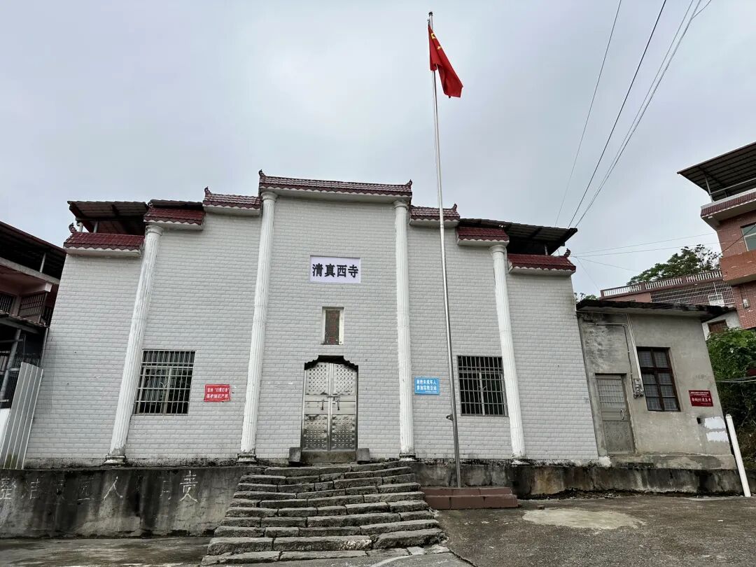
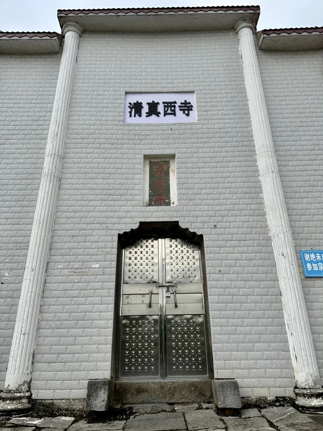
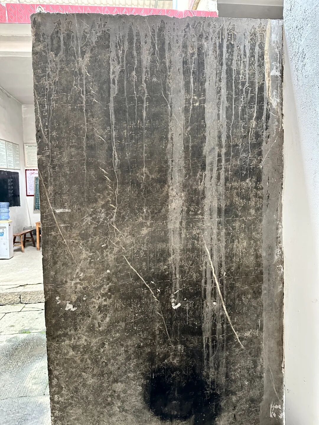
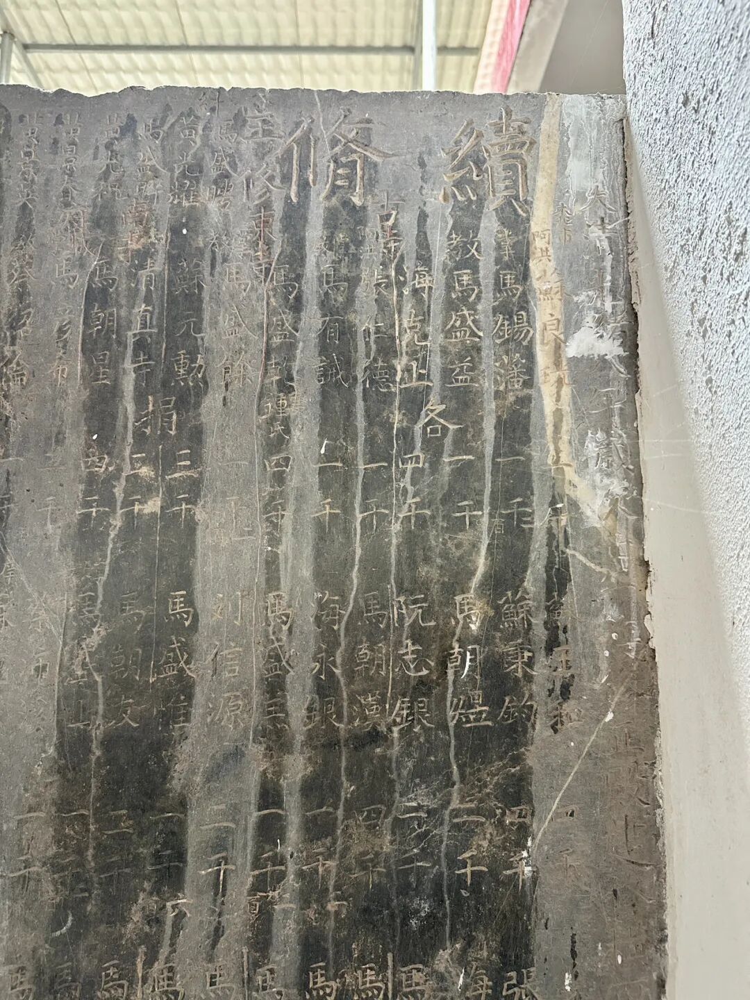
Shanjie West Mosque, also known as Jiajian Village Mosque, was first built in 1836 (the 16th year of the Daoguang reign). It was expanded during the Guangxu and Republic of China periods, and the local Hui Muslims there are surnamed Ma, Huang, and Zheng. The imams who have served at the mosque include Ma Chaoxin, Zheng Liansheng, Ma Daocheng, Ma Fucheng, and Ma Liangxu. The main hall of the West Mosque collapsed in 1991. It was being rebuilt when a flood destroyed it in 1996. After raising funds again, it was officially completed at the end of 1996 and renovated again in 2013.
The mosque houses a stone tablet from the 11th year of the Guangxu reign titled 'Record of Continued Mosque Repairs,' which lists the names of the donors at that time and serves as a precious historical record.
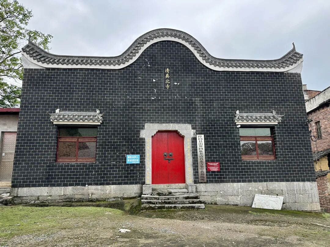
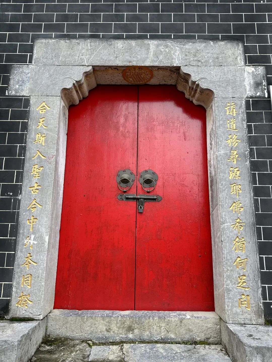
Shanjie North Mosque, also called Sifangjing Mosque, was first built in 1824 (the 4th year of the Daoguang reign), and the local Hui Muslims there are surnamed Ma. The main hall was destroyed after 1966. It was rebuilt in 1991 and again in 2000, with only the original stone gate pillars remaining. The pillars are carved with a couplet by the Republic of China educator Ma Linyi: 'To study the Way, one must seek the source; why ask about Jesus, Buddha, or the Greeks? To unite with Heaven is to enter the path of the sages; ancient and modern, Chinese and foreign, all share the same principle.'
Regrettably, the Shanjie North Mosque was also locked when I visited, and I could not enter. view all
Summary: This China mosque travel guide covers eight historic mosque complexes in Longhui, Shaoyang, Hunan, with local Hui Muslim heritage and mosque travel details kept in clear English.
This article summarizes the key points about the eight mosques (sifang) in Longhui County, Shaoyang, Hunan. It keeps the original paragraph and image order. It is for readers interested in Muslim life, Islamic culture, and Chinese Islamic writing. It also helps people search for content like Chinese halal food.
Longhui County in Shaoyang City, Hunan, has a large population of Hui Muslims. I visited eight mosques there: Taohuaping Mosque, Shanjie Ancient Mosque, East Mosque, West Mosque, South Mosque, North Mosque, Luobai Mosque, and Niejiaoting Mosque. I will share them with you below.
Shanjie Ancient Mosque in Longhui County, Shaoyang, Hunan, is located in Laowuli, Shanjie Township. It was first built in 1444 (the ninth year of the Zhengtong reign of the Ming Dynasty) and is the oldest mosque in Longhui. During the Hongwu reign of the Ming Dynasty, Ma Zhi, the third son of Ma Cheng, the ancestor of the Ma family Hui Muslims in Shaoyang, moved from Shaoyang to Majia Ferry in Longhui to settle down. He was the first Hui Muslim in Longhui, and Shanjie Ancient Mosque was built by the Ma family.
Shanjie Ancient Mosque was renovated in 1919 and rebuilt into its current appearance in 2018.
Shanjie Ancient Mosque has a long tradition of teaching Islamic scripture. The head imams who have taught there include Ma Yulang, Ma Fujiu, Ma Fucheng, Ma Yucheng, Ma Yaochi, and Ding Zhenyi. They also hired imams from other places like Huang Xingxiang and Li Desheng. Ma Fucheng, an imam from this mosque, taught there for the longest time. In 1945, Imam Ma Yucheng taught at the ancient mosque and recruited many students (hailifan), marking the peak of the mosque's religious activities. To this day, the mosque continues its educational work and has trained many excellent young people.
On September 2, 1939, the Wugang County, Hunan branch of the China Islamic National Salvation Association was officially established at the mosque. The mosque's imam, Ma Fucheng, was elected as an officer. Inspired by the call to resist Japanese aggression and save the country, young Hui Muslims from the mosque, including Ma Qiyun, Ma Wuyang from the North Mosque, and Su Xingmin from Beishan, signed up for the army, took up arms, and headed to the front lines in East China.
Relics at Shanjie Ancient Mosque include stone pillar bases, wood carvings, and calligraphy of the mihrab in the kiln niche.
The stone couplet on the main gate reads: Clear the murky and promote the pure to follow the great path; preserve the truth and remove the false so that every generation has successors. The calligraphy was written by Ma Linyi, a Hui Muslim educator and Minister of Education in Shaoyang during the Republic of China. He is known as the Father of Northwest Education and the founder of modern Chinese Hui Muslim education.
Ma Linyi was born in Shaoyang, Hunan, in 1865. He passed the imperial examinations in 1902 and went to Japan on a government scholarship in 1904 to study teacher training. During that time, he met Sun Yat-sen, joined the Tongmenghui in 1905, and returned home to work on new government policies and modern education. In 1906, he founded Xiejin Primary School in Shaoyang, which was the first modern school for Hui Muslims in Hunan.
In 1908, he was transferred to the Qing government's Ministry of Education as a director. That same year, he helped establish the Beijing First Islamic Primary School inside the Niujie Mosque and later helped found the Islamic Education Association. While serving as Vice Minister of Education in 1912, Ma Linyi founded the Chinese Islamic Progressive Association with the support of Sun Yat-sen and served as its president.
While in charge of education in Gansu, Ma Linyi founded 277 schools of various types and set up the Gansu Islamic Education Promotion Office, spreading over a hundred Islamic primary schools across Gansu, Ningxia, and Qinghai. He selected over a hundred young people from the Northwest for government-funded study abroad, laying the foundation for modern basic education in the Northwest.
In 1928, Ma Linyi helped found the Islamic Middle School in Niujie and served as its vice chairman. In 1929, Ma Linyi became a board member of the Beiping Chengda Teachers' College. He actively updated the curriculum and improved teaching methods, helping Chengda develop into a modern school. In his later years, Ma Linyi devoted himself to the faith and served as an advisor to Wang Jingzhai for his translation of Islamic classics.
Shanjie East Mosque was first built in 1728 (the fifth year of the Yongzheng reign). The mosque has hired many imams over the years, including Su Yuebo, Ma Yulang, Ma Baochu, Zheng Liansheng, Ma Yuechi, Ma Yucheng, Tang Yuanqi, Hai Shiquan, Ma Chengyong, Ding Baohua, Ma Gen'ao, Ma Xiang'ao, and Ma Wuquan. Students from as far as Hainan and Guangxi came to study under the great imam Ma Yucheng in Gansu, and the local religious community was very prosperous.
It is a pity that the mosque was locked when I visited, so I could not go inside.
Shanjie West Mosque, also known as Jiajian Village Mosque, was first built in 1836 (the 16th year of the Daoguang reign). It was expanded during the Guangxu and Republic of China periods, and the local Hui Muslims there are surnamed Ma, Huang, and Zheng. The imams who have served at the mosque include Ma Chaoxin, Zheng Liansheng, Ma Daocheng, Ma Fucheng, and Ma Liangxu. The main hall of the West Mosque collapsed in 1991. It was being rebuilt when a flood destroyed it in 1996. After raising funds again, it was officially completed at the end of 1996 and renovated again in 2013.
The mosque houses a stone tablet from the 11th year of the Guangxu reign titled 'Record of Continued Mosque Repairs,' which lists the names of the donors at that time and serves as a precious historical record.
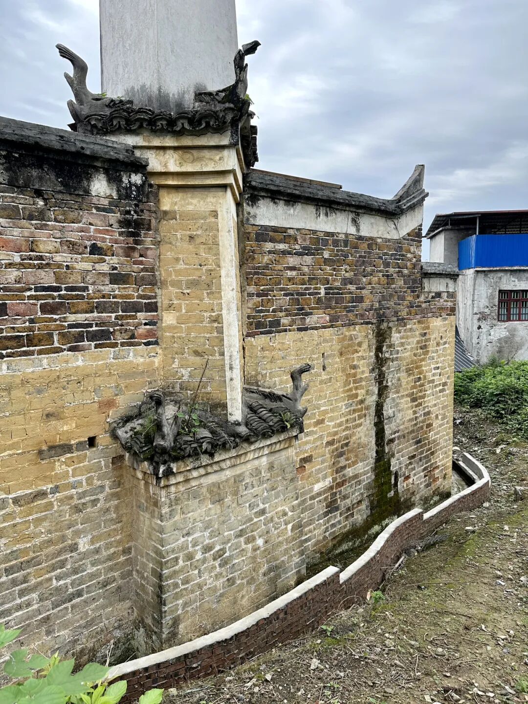
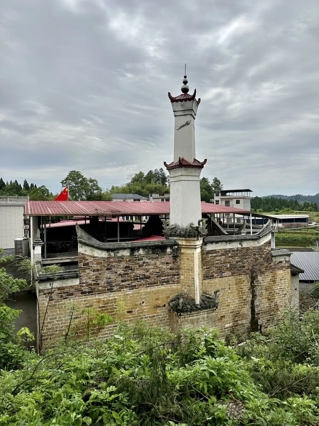
Shanjie North Mosque, also called Sifangjing Mosque, was first built in 1824 (the 4th year of the Daoguang reign), and the local Hui Muslims there are surnamed Ma. The main hall was destroyed after 1966. It was rebuilt in 1991 and again in 2000, with only the original stone gate pillars remaining. The pillars are carved with a couplet by the Republic of China educator Ma Linyi: 'To study the Way, one must seek the source; why ask about Jesus, Buddha, or the Greeks? To unite with Heaven is to enter the path of the sages; ancient and modern, Chinese and foreign, all share the same principle.'
Regrettably, the Shanjie North Mosque was also locked when I visited, and I could not enter.
China Mosque Travel Guide: Eight Historic Mosque Complexes in Longhui, Shaoyang, Hunan (Part 1 of 2)
Articles • yusuf908 posted the article • 0 comments • 132 views • 2026-06-30 06:24
Summary: This China mosque travel guide covers eight historic mosque complexes in Longhui, Shaoyang, Hunan, with local Hui Muslim heritage and mosque travel details kept in clear English.
This article summarizes the key points about the eight mosques (sifang) in Longhui County, Shaoyang, Hunan. It keeps the original paragraph and image order. It is for readers interested in Muslim life, Islamic culture, and Chinese Islamic writing. It also helps people search for content like Chinese halal food.
Longhui County in Shaoyang City, Hunan, has a large population of Hui Muslims. I visited eight mosques there: Taohuaping Mosque, Shanjie Ancient Mosque, East Mosque, West Mosque, South Mosque, North Mosque, Luobai Mosque, and Niejiaoting Mosque. I will share them with you below.
Shanjie Ancient Mosque in Longhui County, Shaoyang, Hunan, is located in Laowuli, Shanjie Township. It was first built in 1444 (the ninth year of the Zhengtong reign of the Ming Dynasty) and is the oldest mosque in Longhui. During the Hongwu reign of the Ming Dynasty, Ma Zhi, the third son of Ma Cheng, the ancestor of the Ma family Hui Muslims in Shaoyang, moved from Shaoyang to Majia Ferry in Longhui to settle down. He was the first Hui Muslim in Longhui, and Shanjie Ancient Mosque was built by the Ma family.
Shanjie Ancient Mosque was renovated in 1919 and rebuilt into its current appearance in 2018.
Shanjie Ancient Mosque has a long tradition of teaching Islamic scripture. The head imams who have taught there include Ma Yulang, Ma Fujiu, Ma Fucheng, Ma Yucheng, Ma Yaochi, and Ding Zhenyi. They also hired imams from other places like Huang Xingxiang and Li Desheng. Ma Fucheng, an imam from this mosque, taught there for the longest time. In 1945, Imam Ma Yucheng taught at the ancient mosque and recruited many students (hailifan), marking the peak of the mosque's religious activities. To this day, the mosque continues its educational work and has trained many excellent young people.
On September 2, 1939, the Wugang County, Hunan branch of the China Islamic National Salvation Association was officially established at the mosque. The mosque's imam, Ma Fucheng, was elected as an officer. Inspired by the call to resist Japanese aggression and save the country, young Hui Muslims from the mosque, including Ma Qiyun, Ma Wuyang from the North Mosque, and Su Xingmin from Beishan, signed up for the army, took up arms, and headed to the front lines in East China.
Relics at Shanjie Ancient Mosque include stone pillar bases, wood carvings, and calligraphy of the mihrab in the kiln niche.
The stone couplet on the main gate reads: Clear the murky and promote the pure to follow the great path; preserve the truth and remove the false so that every generation has successors. The calligraphy was written by Ma Linyi, a Hui Muslim educator and Minister of Education in Shaoyang during the Republic of China. He is known as the Father of Northwest Education and the founder of modern Chinese Hui Muslim education.
Ma Linyi was born in Shaoyang, Hunan, in 1865. He passed the imperial examinations in 1902 and went to Japan on a government scholarship in 1904 to study teacher training. During that time, he met Sun Yat-sen, joined the Tongmenghui in 1905, and returned home to work on new government policies and modern education. In 1906, he founded Xiejin Primary School in Shaoyang, which was the first modern school for Hui Muslims in Hunan.
In 1908, he was transferred to the Qing government's Ministry of Education as a director. That same year, he helped establish the Beijing First Islamic Primary School inside the Niujie Mosque and later helped found the Islamic Education Association. While serving as Vice Minister of Education in 1912, Ma Linyi founded the Chinese Islamic Progressive Association with the support of Sun Yat-sen and served as its president.
While in charge of education in Gansu, Ma Linyi founded 277 schools of various types and set up the Gansu Islamic Education Promotion Office, spreading over a hundred Islamic primary schools across Gansu, Ningxia, and Qinghai. He selected over a hundred young people from the Northwest for government-funded study abroad, laying the foundation for modern basic education in the Northwest.
In 1928, Ma Linyi helped found the Islamic Middle School in Niujie and served as its vice chairman. In 1929, Ma Linyi became a board member of the Beiping Chengda Teachers' College. He actively updated the curriculum and improved teaching methods, helping Chengda develop into a modern school. In his later years, Ma Linyi devoted himself to the faith and served as an advisor to Wang Jingzhai for his translation of Islamic classics.
Shanjie East Mosque was first built in 1728 (the fifth year of the Yongzheng reign). The mosque has hired many imams over the years, including Su Yuebo, Ma Yulang, Ma Baochu, Zheng Liansheng, Ma Yuechi, Ma Yucheng, Tang Yuanqi, Hai Shiquan, Ma Chengyong, Ding Baohua, Ma Gen'ao, Ma Xiang'ao, and Ma Wuquan. Students from as far as Hainan and Guangxi came to study under the great imam Ma Yucheng in Gansu, and the local religious community was very prosperous.
It is a pity that the mosque was locked when I visited, so I could not go inside.
Shanjie West Mosque, also known as Jiajian Village Mosque, was first built in 1836 (the 16th year of the Daoguang reign). It was expanded during the Guangxu and Republic of China periods, and the local Hui Muslims there are surnamed Ma, Huang, and Zheng. The imams who have served at the mosque include Ma Chaoxin, Zheng Liansheng, Ma Daocheng, Ma Fucheng, and Ma Liangxu. The main hall of the West Mosque collapsed in 1991. It was being rebuilt when a flood destroyed it in 1996. After raising funds again, it was officially completed at the end of 1996 and renovated again in 2013.
The mosque houses a stone tablet from the 11th year of the Guangxu reign titled 'Record of Continued Mosque Repairs,' which lists the names of the donors at that time and serves as a precious historical record.
Shanjie North Mosque, also called Sifangjing Mosque, was first built in 1824 (the 4th year of the Daoguang reign), and the local Hui Muslims there are surnamed Ma. The main hall was destroyed after 1966. It was rebuilt in 1991 and again in 2000, with only the original stone gate pillars remaining. The pillars are carved with a couplet by the Republic of China educator Ma Linyi: 'To study the Way, one must seek the source; why ask about Jesus, Buddha, or the Greeks? To unite with Heaven is to enter the path of the sages; ancient and modern, Chinese and foreign, all share the same principle.'
Regrettably, the Shanjie North Mosque was also locked when I visited, and I could not enter. view all
Summary: This China mosque travel guide covers eight historic mosque complexes in Longhui, Shaoyang, Hunan, with local Hui Muslim heritage and mosque travel details kept in clear English.
This article summarizes the key points about the eight mosques (sifang) in Longhui County, Shaoyang, Hunan. It keeps the original paragraph and image order. It is for readers interested in Muslim life, Islamic culture, and Chinese Islamic writing. It also helps people search for content like Chinese halal food.
Longhui County in Shaoyang City, Hunan, has a large population of Hui Muslims. I visited eight mosques there: Taohuaping Mosque, Shanjie Ancient Mosque, East Mosque, West Mosque, South Mosque, North Mosque, Luobai Mosque, and Niejiaoting Mosque. I will share them with you below.
Shanjie Ancient Mosque in Longhui County, Shaoyang, Hunan, is located in Laowuli, Shanjie Township. It was first built in 1444 (the ninth year of the Zhengtong reign of the Ming Dynasty) and is the oldest mosque in Longhui. During the Hongwu reign of the Ming Dynasty, Ma Zhi, the third son of Ma Cheng, the ancestor of the Ma family Hui Muslims in Shaoyang, moved from Shaoyang to Majia Ferry in Longhui to settle down. He was the first Hui Muslim in Longhui, and Shanjie Ancient Mosque was built by the Ma family.
Shanjie Ancient Mosque was renovated in 1919 and rebuilt into its current appearance in 2018.
Shanjie Ancient Mosque has a long tradition of teaching Islamic scripture. The head imams who have taught there include Ma Yulang, Ma Fujiu, Ma Fucheng, Ma Yucheng, Ma Yaochi, and Ding Zhenyi. They also hired imams from other places like Huang Xingxiang and Li Desheng. Ma Fucheng, an imam from this mosque, taught there for the longest time. In 1945, Imam Ma Yucheng taught at the ancient mosque and recruited many students (hailifan), marking the peak of the mosque's religious activities. To this day, the mosque continues its educational work and has trained many excellent young people.
On September 2, 1939, the Wugang County, Hunan branch of the China Islamic National Salvation Association was officially established at the mosque. The mosque's imam, Ma Fucheng, was elected as an officer. Inspired by the call to resist Japanese aggression and save the country, young Hui Muslims from the mosque, including Ma Qiyun, Ma Wuyang from the North Mosque, and Su Xingmin from Beishan, signed up for the army, took up arms, and headed to the front lines in East China.
Relics at Shanjie Ancient Mosque include stone pillar bases, wood carvings, and calligraphy of the mihrab in the kiln niche.
The stone couplet on the main gate reads: Clear the murky and promote the pure to follow the great path; preserve the truth and remove the false so that every generation has successors. The calligraphy was written by Ma Linyi, a Hui Muslim educator and Minister of Education in Shaoyang during the Republic of China. He is known as the Father of Northwest Education and the founder of modern Chinese Hui Muslim education.
Ma Linyi was born in Shaoyang, Hunan, in 1865. He passed the imperial examinations in 1902 and went to Japan on a government scholarship in 1904 to study teacher training. During that time, he met Sun Yat-sen, joined the Tongmenghui in 1905, and returned home to work on new government policies and modern education. In 1906, he founded Xiejin Primary School in Shaoyang, which was the first modern school for Hui Muslims in Hunan.
In 1908, he was transferred to the Qing government's Ministry of Education as a director. That same year, he helped establish the Beijing First Islamic Primary School inside the Niujie Mosque and later helped found the Islamic Education Association. While serving as Vice Minister of Education in 1912, Ma Linyi founded the Chinese Islamic Progressive Association with the support of Sun Yat-sen and served as its president.
While in charge of education in Gansu, Ma Linyi founded 277 schools of various types and set up the Gansu Islamic Education Promotion Office, spreading over a hundred Islamic primary schools across Gansu, Ningxia, and Qinghai. He selected over a hundred young people from the Northwest for government-funded study abroad, laying the foundation for modern basic education in the Northwest.
In 1928, Ma Linyi helped found the Islamic Middle School in Niujie and served as its vice chairman. In 1929, Ma Linyi became a board member of the Beiping Chengda Teachers' College. He actively updated the curriculum and improved teaching methods, helping Chengda develop into a modern school. In his later years, Ma Linyi devoted himself to the faith and served as an advisor to Wang Jingzhai for his translation of Islamic classics.
Shanjie East Mosque was first built in 1728 (the fifth year of the Yongzheng reign). The mosque has hired many imams over the years, including Su Yuebo, Ma Yulang, Ma Baochu, Zheng Liansheng, Ma Yuechi, Ma Yucheng, Tang Yuanqi, Hai Shiquan, Ma Chengyong, Ding Baohua, Ma Gen'ao, Ma Xiang'ao, and Ma Wuquan. Students from as far as Hainan and Guangxi came to study under the great imam Ma Yucheng in Gansu, and the local religious community was very prosperous.
It is a pity that the mosque was locked when I visited, so I could not go inside.
Shanjie West Mosque, also known as Jiajian Village Mosque, was first built in 1836 (the 16th year of the Daoguang reign). It was expanded during the Guangxu and Republic of China periods, and the local Hui Muslims there are surnamed Ma, Huang, and Zheng. The imams who have served at the mosque include Ma Chaoxin, Zheng Liansheng, Ma Daocheng, Ma Fucheng, and Ma Liangxu. The main hall of the West Mosque collapsed in 1991. It was being rebuilt when a flood destroyed it in 1996. After raising funds again, it was officially completed at the end of 1996 and renovated again in 2013.
The mosque houses a stone tablet from the 11th year of the Guangxu reign titled 'Record of Continued Mosque Repairs,' which lists the names of the donors at that time and serves as a precious historical record.
Shanjie North Mosque, also called Sifangjing Mosque, was first built in 1824 (the 4th year of the Daoguang reign), and the local Hui Muslims there are surnamed Ma. The main hall was destroyed after 1966. It was rebuilt in 1991 and again in 2000, with only the original stone gate pillars remaining. The pillars are carved with a couplet by the Republic of China educator Ma Linyi: 'To study the Way, one must seek the source; why ask about Jesus, Buddha, or the Greeks? To unite with Heaven is to enter the path of the sages; ancient and modern, Chinese and foreign, all share the same principle.'
Regrettably, the Shanjie North Mosque was also locked when I visited, and I could not enter.
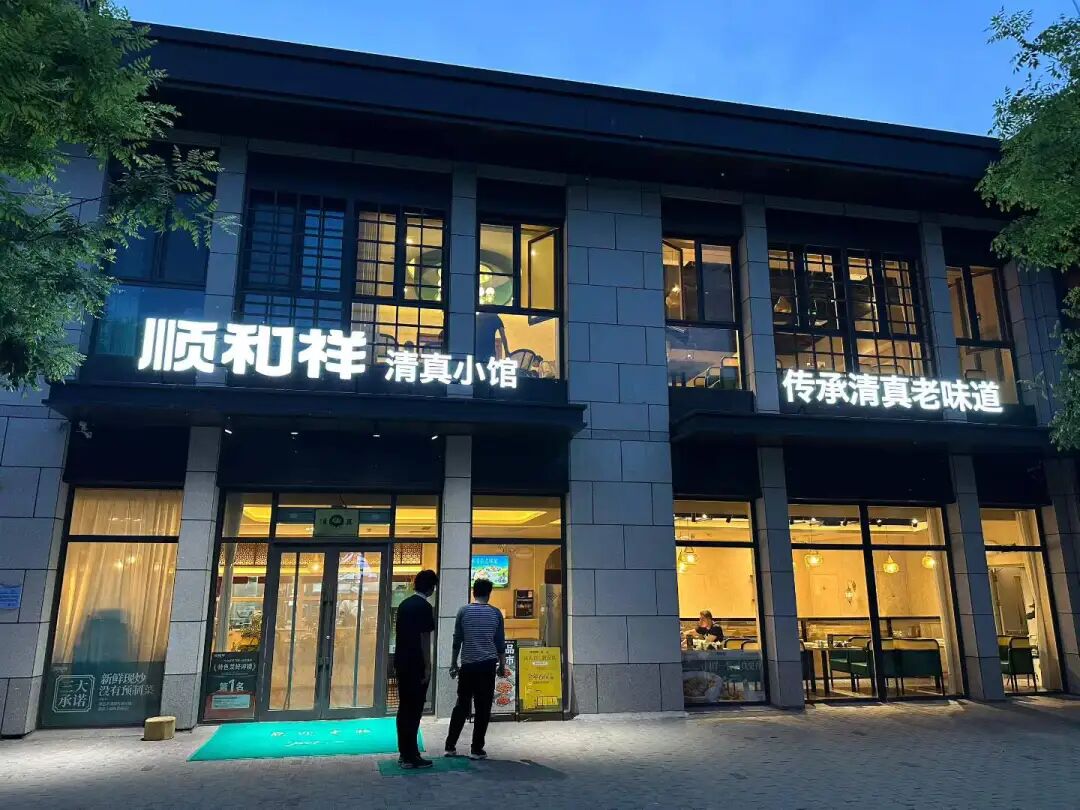
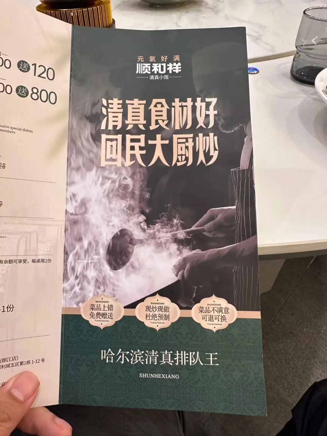
Best Halal Restaurants in Beijing: 10 Local Muslim Food Spots Worth Trying
Articles • yusuf908 posted the article • 0 comments • 150 views • 2026-06-30 06:24
Summary: This guide to the best halal restaurants in Beijing keeps the original list of local Muslim food spots, Hui Muslim food, and practical halal dining details.
This article summarizes the key points of '10 Halal Restaurants in Beijing Worth Trying (Part 9),' keeping the original paragraph and image order. It is for readers interested in Muslim life, Islamic culture, and Chinese Islamic articles, and makes it easy to search for topics like Uyghur culture, marriage and family, and the ninth installment.
The list includes Shunhexiang Harbin-style stir-fry in Tongzhou, Fenghong Old Beijing Flavor in Changping, Aidamu Xinjiang street barbecue in Shilihe, Ruilin Azerbaijani restaurant near Ritan, Yilan Liyuan American-style burgers on Niujie, Guxiangzhai Tianjin-style shaved ice in Hufangqiao, Niujie's Big Green Bag stinky tofu, Zafran Pakistani restaurant in Xinyuanli, Jinfang Snack Bar in Dongdaqiao, and Ali & Wang's rotating kebab in Sanlitun.
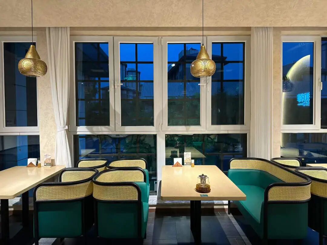
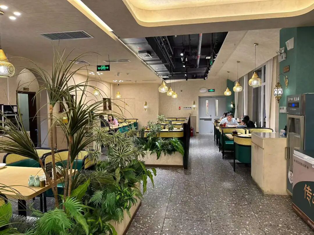
I heard that the Harbin Hui Muslim stir-fry restaurant Shunhexiang opened in Beijing's Tongzhou sub-center, so I came to try it out for dinner. The restaurant is located in a new residential complex along the Grand Canal in Tongzhou. The environment is great, and the private room's turntable is button-controlled, making it easy to reach the dishes.
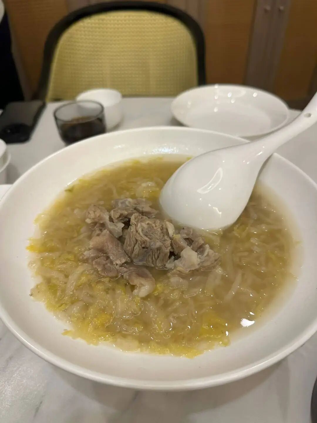
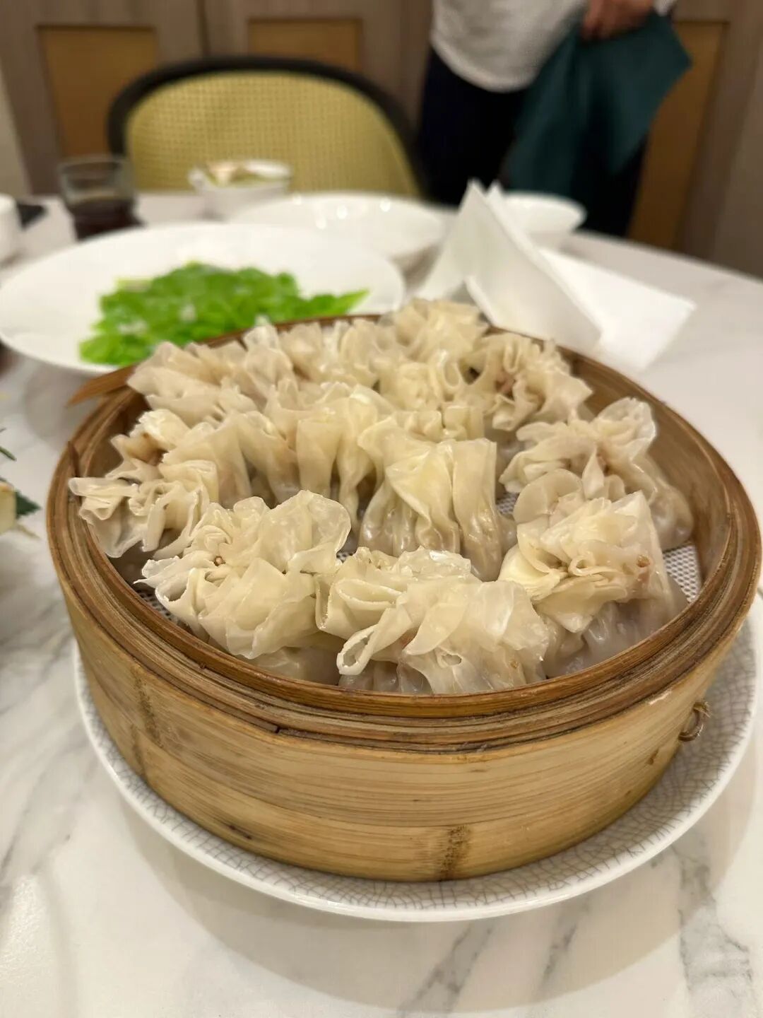
They specialize in Heilongjiang Hui Muslim cuisine and have also added some southern Chinese dishes to their menu. We ordered the savory sweet and sour pork (guobaorou), sauerkraut beef rib stew, colorful starch noodles (dalapi), stir-fried lily bulbs with bamboo shoots, and beef steamed dumplings (shaomai). The best of these was the steamed dumplings. The skin was thin and chewy, and the filling was fragrant and not greasy. I think they are better than the other Hui Muslim steamed dumplings currently in Beijing. The sweet and sour pork had a good texture and wasn't fried too hard. I think it's better than another Heilongjiang Hui Muslim restaurant in Beijing. The sauerkraut tasted great, but there was very little beef, and there were very few lily bulbs in the lily bulb and bamboo shoot dish. Overall, the restaurant is definitely worth a visit. The biggest problem is that it is too far from the city center, almost reaching Hebei. It is best suited for those driving there or people working in the sub-center.
On Sunday, I was in Changping and had Beijing-style food for lunch at Fenghong Old Beijing Flavor in Xiaotangshan.
We ordered the three-person set meal, which included half a roast duck, grilled meat on a round iron plate (zhizi kaorou), stir-fried mixed vegetables (chao hecai), and duck frame tofu soup. This three-person set is a great value, and we were stuffed after finishing it. The duck tasted good, and the kids really liked it. The portion of stir-fried mixed vegetables (chao hecai) was huge, and it tasted great too.
The grilled meat on a round iron plate (zhizi kaorou) was a hit with both the Xinjiang and Hunan people at our table; the meat was tender but still had a nice chew. However, it must have been pre-marinated because it was spicy and couldn't be made mild, so the kids couldn't eat it. Duck frame soup is a must-have with roast duck; it was very savory and we couldn't stop drinking it.
Besides roast duck, they also serve traditional Hui Muslims' eight big bowls (badawan). If you are visiting Changping, you should come here to eat. They don't close in the afternoon, so it is perfect for a late meal after sightseeing.
In the evening, we went to Shilihe to eat barbecue at Aidamu. I had heard they were very famous, but this was my first time eating there, and I was truly impressed. They have basically brought the level of a local Xinjiang night market to Beijing; eating there felt just like being back in Xinjiang.
There is a large parking lot right across from the restaurant, making it very convenient if you drive there. When we arrived at 6:30, the place was already packed, so we set up a table in the parking lot across the street. Since the temperature has risen in May, it is perfect for eating barbecue outdoors.
At their place, you grab the skewers yourself from the freezer. We had lamb liver, lamb heart, lamb skewers, and lamb chops. The lamb liver was very tender, definitely top-tier for Beijing. The lamb heart had more chew than the liver, and it was also quite good. The lamb skewers had no gamey smell at all, just the pure aroma of lamb, which is very rare in Beijing.
We had the pilaf (zhuafan) fresh out of the pot at seven o'clock. It was shiny and oily, though the lamb was a bit tougher compared to the skewers. Overall, it was still good. I happened to hear the table next to us complaining that their rice was undercooked. Actually, I think pilaf is only good when the rice is a bit firm. If the rice is too soft and mushy, it just becomes regular steamed rice.
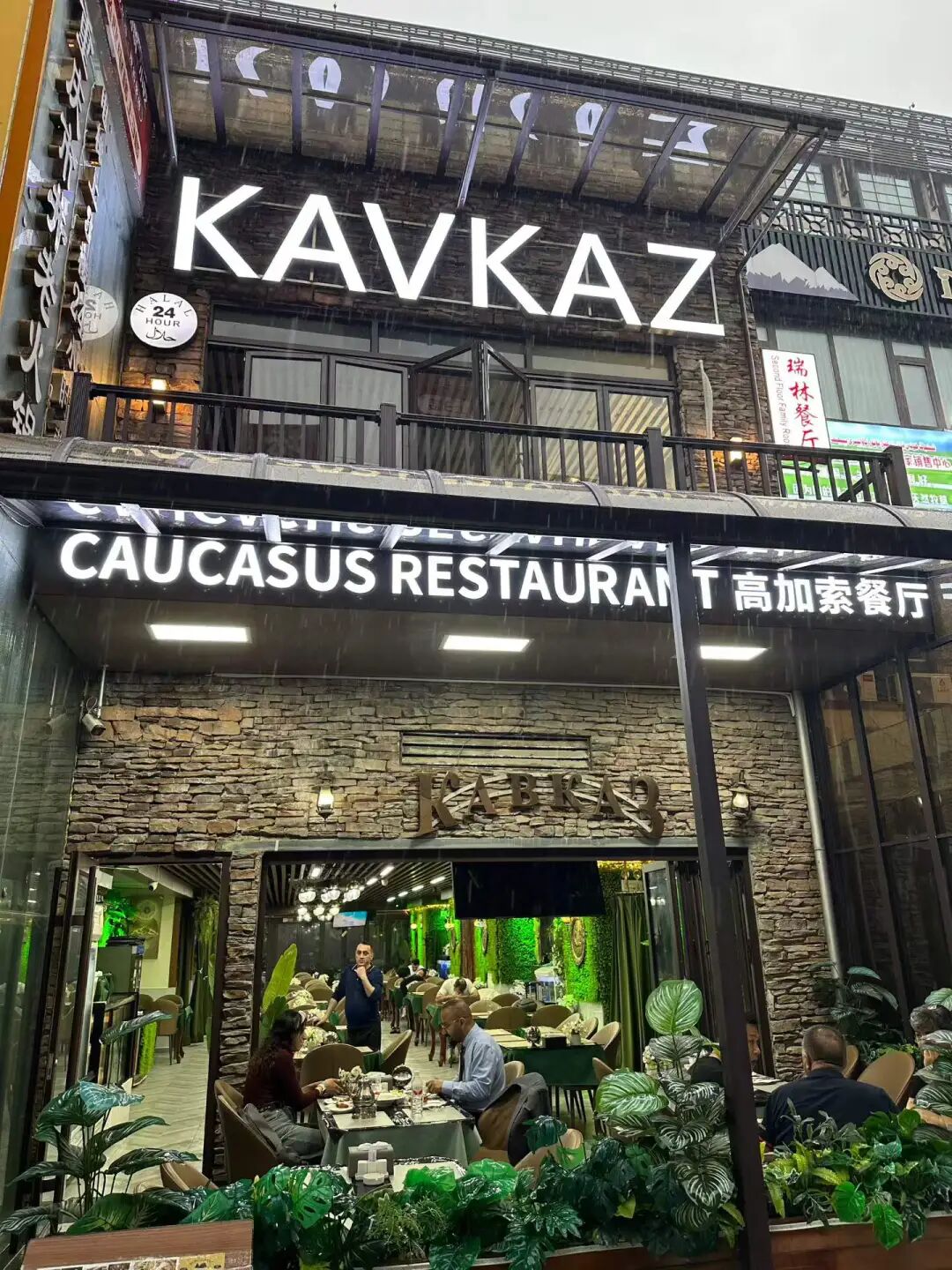
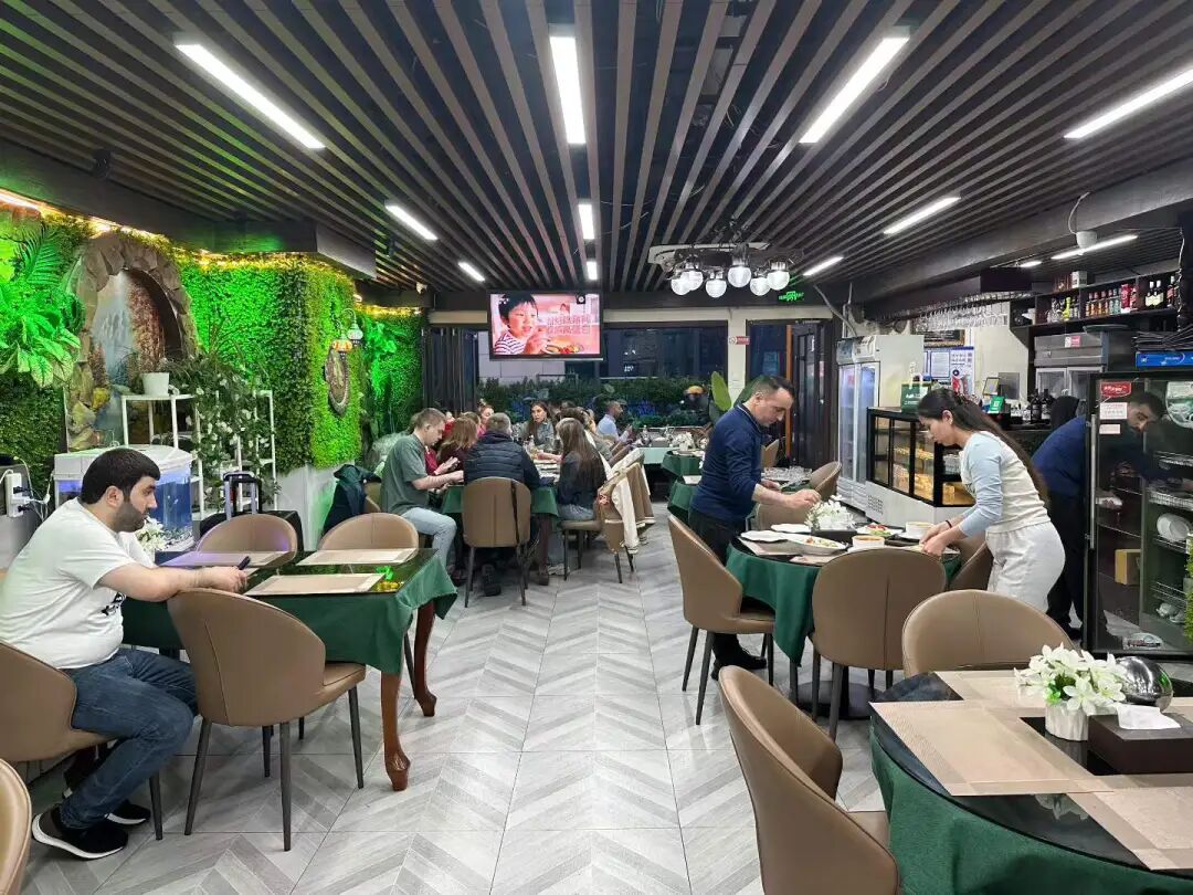
On the weekend, we had dinner at Kavkaz Ruilin, a long-standing Azerbaijani restaurant on Ritan Upper Street, to enjoy some Russian and Caucasian food. This is a classic former Soviet-style restaurant in Beijing that has been open for over a decade. It mostly serves merchants from Russian-speaking regions who come to Yabaolu to source goods. Its Chinese name used to be Ruilin, but it has been changed to Ruilin.
After the Soviet Union collapsed in the 1990s, many traders (daoye) took green-skinned trains to Beijing and headed straight to Yabaolu to stock up on goods. They brought down jackets, leather shoes, toys, and other small items back home to sell for huge profits. Yabaolu gradually grew from street stalls and tents into Beijing's largest wholesale market for Russian-speaking regions, and more former Soviet-style restaurants opened up on nearby Ritan Upper Street. Over a decade ago, Ritan Upper Street was mainly home to Central Asian and Azerbaijani restaurants, including Uzbek and Kazakh spots.
Over the last decade, Russia's economic decline, the shift of markets to places like Yiwu, Guangzhou, and Suifenhe, and the rise of cross-border e-commerce have caused trade with Russia on Yabaolu to shrink. Yitan Shangjie has gradually become a hub for Uyghur restaurants. Besides Dardanelles and Desert Rose, which focus on Turkish food, the only other Azerbaijani restaurant is Ruilin. For Central Asian food, there is the Turkmenistan restaurant Merv downstairs, which also serves Russian dishes.
At first, Ruilin had dim lighting, making it a good spot for traders to talk business, but many Chinese people were afraid to go inside. In recent years, the lighting at Ruilin has become brighter, but when we visited, there were only Russian-speaking customers, and we did not see any other Chinese people eating there.
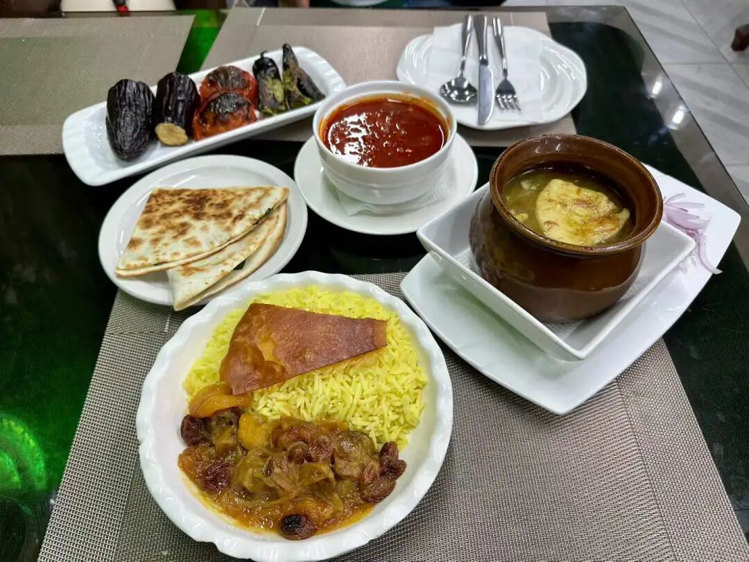
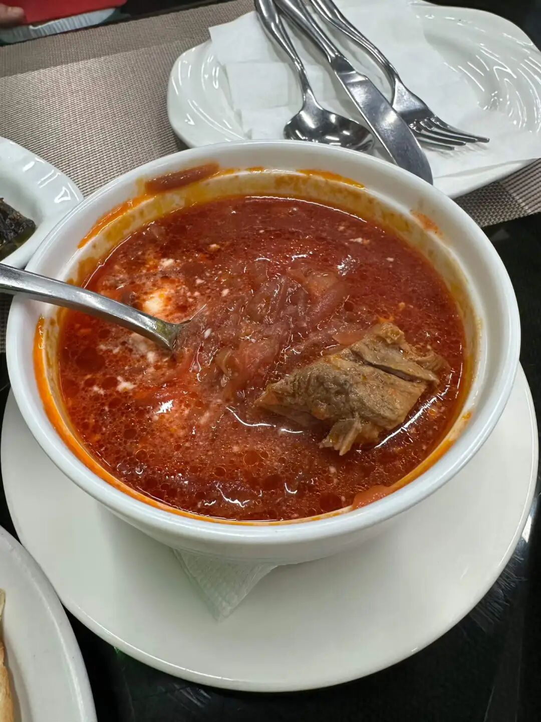
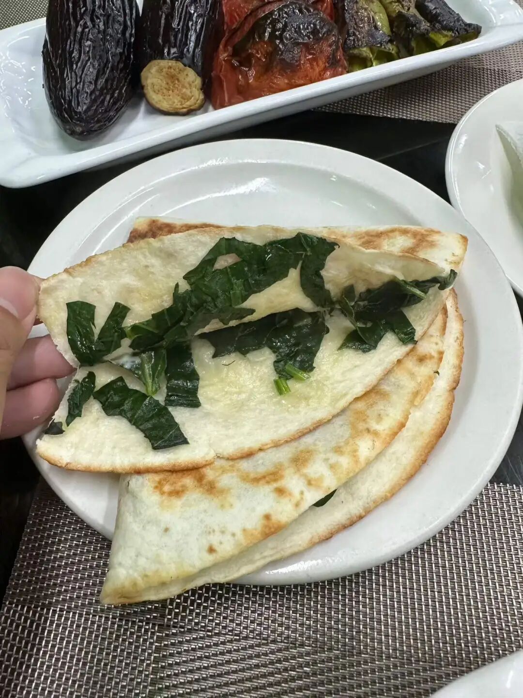
We ordered borscht (hongcaitang), pot-stewed lamb (manguan yangrou), chive pancakes (jiucaibing), Azerbaijani pilaf (zhuafan), and grilled vegetables. Their borscht is closer to the Russian style than the one at Merv. Merv's beef soup has a stronger flavor, while their version has a more intense beet taste, which is also quite good.
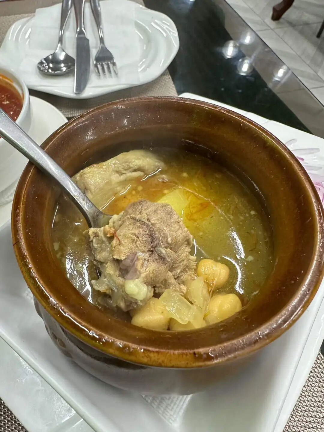
Pot-stewed lamb is a classic Russian main course. Traditionally, it is cooked during long, cold winters by stewing meat in a clay pot over a wood-burning fireplace, then sealing the lid and burying it in the fireplace embers for several hours. Their pot-stewed lamb broth is very fresh, similar to Xinjiang cup-stewed lamb (gangzirou), but the lamb is a bit tough rather than tender.
I really like the Azerbaijani pilaf. I made sure to eat the authentic version when I visited Azerbaijan, and after coming back, I think both Ruilin and Dardanelles make a good version. Azerbaijani pilaf is dyed yellow with saffron and includes dried apricots, prunes, chestnuts, and raisins. The lamb is salty and savory, while the dried fruits add sweetness, creating a very rich flavor profile.
I finally had the cheese beef burger at Yilan Liyuan on Niujie this weekend. They only have regular and California-style options now. The California-style burger adds lettuce and tomato, and you can order it as a single or double patty. They do not let you eat inside the shop, so you have to eat at the entrance or take it away. I waited five minutes at the door and it was ready. The single-layer size is decent, and the crust was baked hot on the spot, but the filling felt a bit dense and not very fluffy. The meat pie tastes good, but it feels a bit loose, as if it wasn't packed tightly enough. Overall it is pretty good, but it would be even better if there were other things to pair it with.
A Tianjin halal shaved ice and steamed pancake (zhengbing) shop called Guxiangzhai has opened at Hufangqiao. Since the weather is getting warmer lately, many people are coming to eat shaved ice. For my first visit, I chose the traditional-style shaved ice. It contains sour hawthorn paste (suanmogao), red hawthorn fruit, dried apricots, strawberries, mulberries, pineapple, orange, fresh apricots, and red beans. It actually has more ingredients than the truly traditional version, and it is mainly sweet and sour to whet your appetite. Sour hawthorn paste (suanmogao) is the soul of Tianjin traditional shaved ice. It is made by grinding dried wild sour jujubes into powder and boiling it with rock sugar. You can buy large blocks of sour hawthorn paste (suanmogao) at the entrance of the archway of the South Mosque (Nandasi) in the Northwest Corner. It also tastes great when mixed directly with water.
Their dinosaur egg three-apricot shaved ice is also a signature item. It contains Kashgar Hami apricots, Yengisar Saimaiti red apricots, Aksu Situan dried apricots, and secret-recipe preserved fruit made from wild hawthorn from Shanxi. It sounds very good.
They also sell various snacks. We bought a steamed pancake (zhengbing) with a red hawthorn filling, which is sweet and sour and perfect for breakfast. It is a pity that the rice cakes (gaogan) were sold out, so I bought a rice cake (migao) with a sour hawthorn paste flavor. It was a bit dry, but the taste was still good. I also bought a snack called "five blacks," which contains black rice, black beans, black mulberries, black goji berries, and black sesame seeds. It sounds very healthy.
Across from the China Academy of Chinese Medical Sciences on Niujie Street, the roast lamb leg shop with the big green sign sells stinky tofu with sauce. The sauce is made from beef bone broth (niubanggu aotang), and it really has a meaty flavor. I remember eating fried stinky tofu topped with fermented bean curd sauce from a cart run by local Hui Muslims on Binjiang Road in Tianjin. That flavor was truly satisfying.
A new alcohol-free Pakistani restaurant called Zafran just opened in Jiayi Plaza near Liangmaqiao. It is very close to the Liangma River, and since it only opened a few days ago, I came specifically to try it.
I looked at the menu and was surprised to find many Afghan Pashtun dishes. I asked the server, and he is a Pashtun from Peshawar. I decided to order a few Pashtun dishes to try, as some of them cannot be found in other Pakistani restaurants.
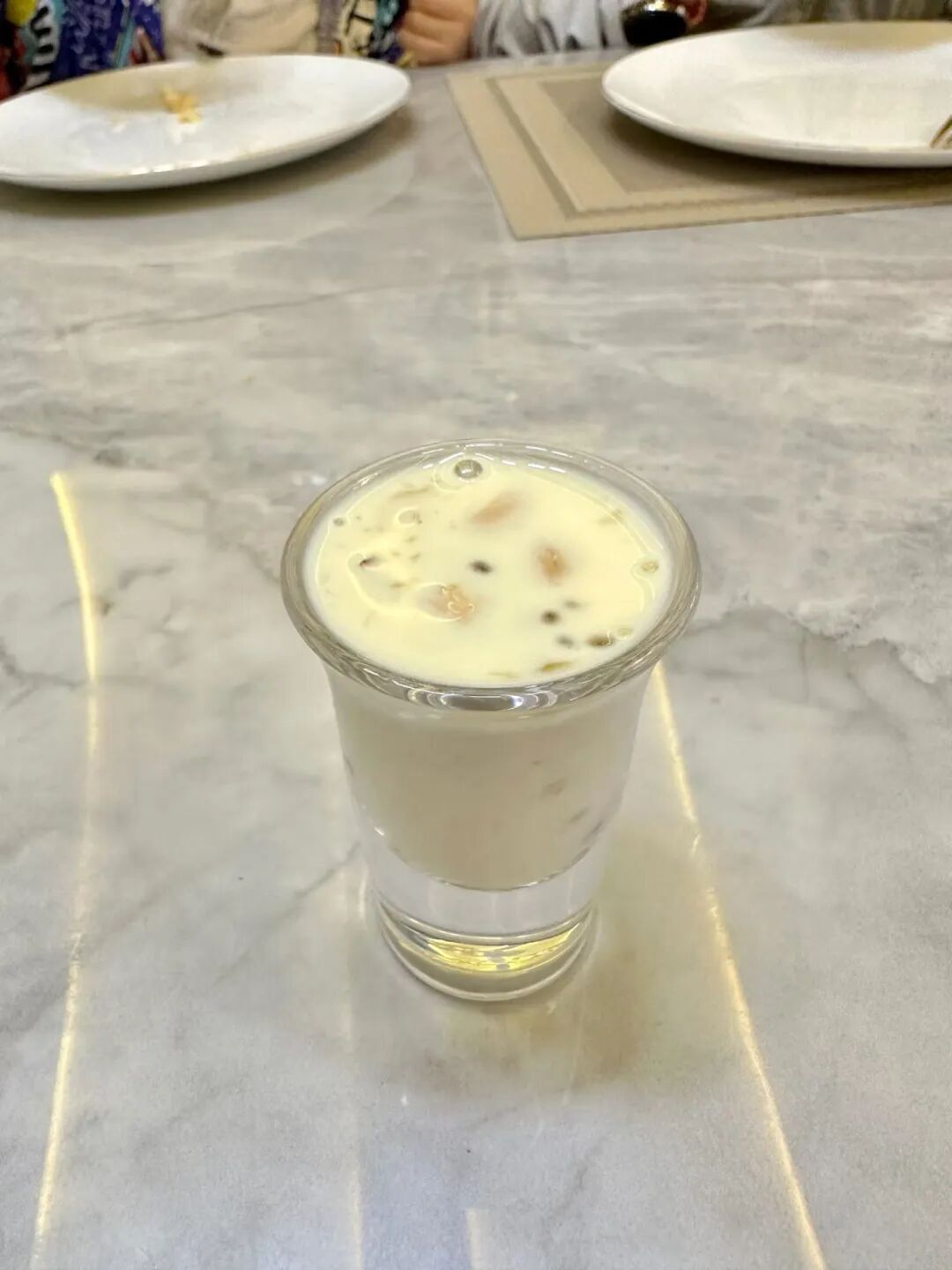
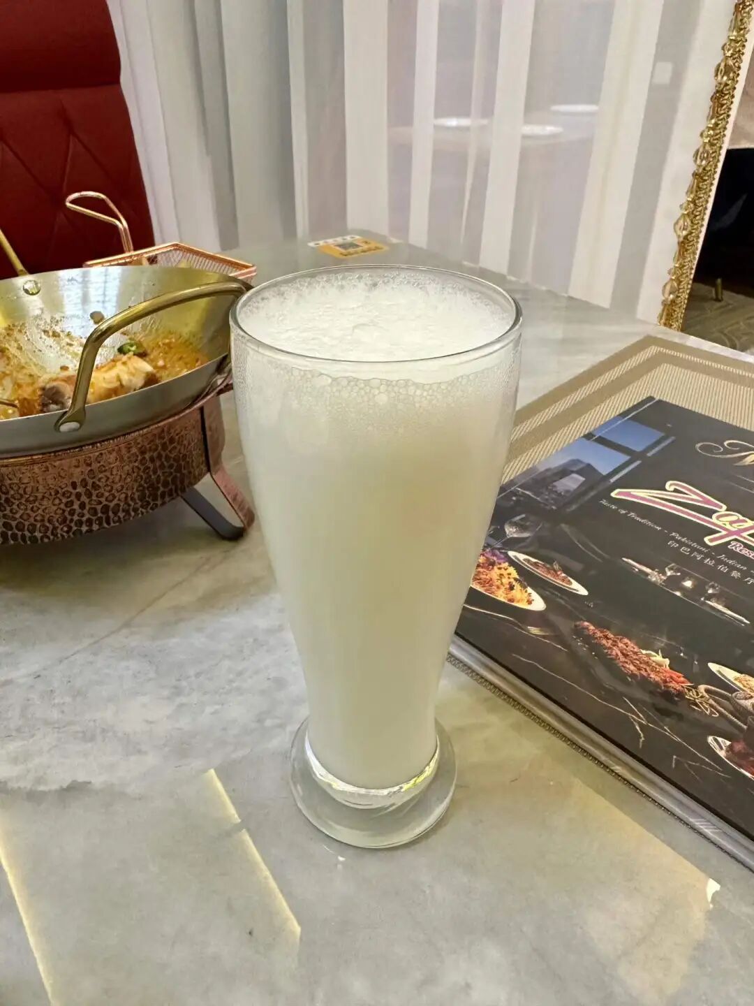
First, I must praise their excellent service. The Pashtun waiter, Anas Khan, always greeted us with a smile and even did a fist bump with my son, Suleiman. As soon as we sat down, they brought us black tea, lemon water, and fried dough twists (mayezi). Later, they served a special dried fruit milkshake with walnuts and almonds. Finally, they gave Suleiman a small cup of thin yogurt drink (lassi) and a piece of baklava, which made him very happy.
The atmosphere is also very nice, with curtained sofa areas on one side that are perfect for families. There are no large private rooms, but if you have a big group, you can push tables together in the main dining area. There is also outdoor seating at the entrance, which is great for having desserts and drinks in the summer.
We ordered Afghan pilaf, Peshawar-style lamb, and Kandahar naan. You can tell these are Pashtun specialties just by their names. We also ordered a Caesar salad, french fries, and salty yogurt drink (lassi). Since they just opened, they gave us a 30% discount, which was a great deal.
Afghan pilaf originated in the border region between northern Afghanistan and Uzbekistan. It is known as Qabili Palaw in Afghanistan and later spread from there to West Asia, Central Asia, and Pakistan. Afghan pilaf (pulao) differs from Xinjiang pilaf because it uses long-grain aromatic rice from South Asia and a bit of saffron for color. It is cooked with ghee and vegetable oil, and the carrots are sliced thinly. It also includes cinnamon, cardamom, and cloves, giving it a stronger spice flavor than Xinjiang pilaf. Their Afghan pilaf includes fresh almonds and raisins, but the meat is a bit tough and hard for children to chew. The spice flavor is very rich.
This was my first time eating Peshawar Shinwari lamb, and I highly recommend it! The lamb is very tender and the seasoning is excellent. Peshawar Shinwari lamb is cooked in a metal wok called a karahi. It is a classic main dish for the Pashtun people in northern Pakistan, especially prepared after the animal sacrifice during Eid al-Adha. It is made with fresh bone-in lamb, salt, garlic, and green chilies, without the heavy spices found in southern Pakistan.
Their Kandahar flatbread (nan) is also amazing and pairs perfectly with the Peshawar lamb. Kandahar flatbread is also popular in Pakistan. It is very fluffy because milk and sugar are added to the dough, making it more fragrant.
I also recommend their yogurt drink (lassi). It is not too sour, but it is very appetizing.
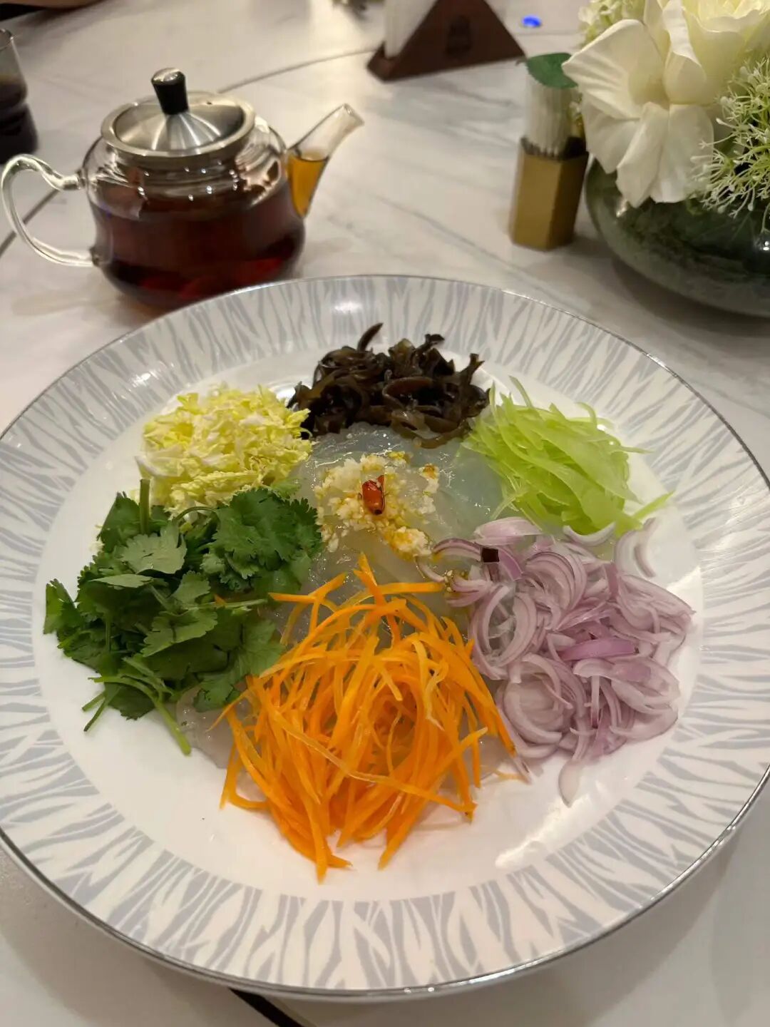
The Qingxiangge restaurant at Dongdaqiao was replaced by Jinfang Snacks this year, and I just went to try it recently. Once inside, I found it is completely different from the old shop at Ciqikou. It uses a self-service tray system with small bowls of stewed dishes, small portions of stir-fries, and a huge variety of mixed salads, noodles, and snacks. It is incredibly rich in options. Small bowls and small plates are rare in traditional Beijing restaurants, making them perfect for people who want to try several different dishes.
We ordered winter melon meatball soup (donggua cuan wanzi), stir-stir-fried meat with eggs and wood ear mushrooms (muxu rou), stir-fried green beans with pork (biandou chaorou), sea bream fillets (diaoyu pian), and healthy mixed vegetables (yangsheng cai), with corn and red bean rice for our main course. The cheaper meat dishes are mostly chicken, while the beef stew is priced like a standard old Beijing restaurant for Hui Muslims. The winter melon meatball soup goes great with rice, and eating rice soaked in the broth feels just like being a kid again.
Jinfang Snack Shop is celebrating its 100th anniversary this year, so it can finally call itself a century-old shop. Jinfang was originally called Rongxiangcheng Hui Muslim Snack Shop, founded in 1926 outside Chongwenmen by Man Leting (known as Man Liu), a Hui Muslim from Dezhou, Shandong. Man Leting started out with beef and mutton. At first, he bought high-quality cattle and sheep every autumn to raise in Madian, slaughtering and selling them as needed. His business improved significantly in the 1940s, so he expanded his storefront and later began selling cooked foods like roasted mutton (shao yangrou).
In the past, spring and summer were the growing seasons for sheep, so they were usually only slaughtered after autumn. Because of this, some mutton shops would switch to selling cold food during the summer. In the 1940s, Man Leting bought Japanese refrigeration equipment to sell homemade popsicles, soda, and other cold drinks, and business was booming. In 1949, mutton shipments from Inner Mongolia to Beijing were blocked, and the sheep trade hit rock bottom. Just then, Man Leiting's fellow townsman Man Kaiqi came to join him. Man Kaiqi had a background in a pastry shop, so Man Liu stopped selling lamb and switched to snacks and cold dishes, making Rongxiangcheng a famous Hui Muslim snack shop outside Chongwenmen. After the public-private partnership in 1956, Man Leiting's son Man Kaitong became the manager, and in 1958, they stopped making popsicles to focus on snacks like almond tofu (xingren doufu) and sweet rice balls (yuanxiao). In 1966, Rongxiangcheng was officially renamed Jinfang Hui Muslim Snack Shop, and in 1971, it began to focus on sweet rice balls (yuanxiao), which have drawn long lines every year around the Lantern Festival since the 1990s.
A new shawarma rotisserie shop just opened at the north entrance of Sanlitun SOHO. We went there for dinner; one of the guys working there is from Turkmenistan and the other is from Russia, and almost all the customers were foreigners. The wraps and burgers tasted okay, though the garlic sauce was quite strong. But when we went, they were just starting to roast a new batch of beef, so the pre-sliced beef wasn't very hot. Also, the flatbread wraps they used weren't warm. Still, the vibe is just like a rotisserie shop on a Middle Eastern street; there are no seats, so you grab one to eat on the go and pretend you are in Damascus.
Part 1: 10 halal restaurants in Beijing worth trying: Pakistani restaurant Lahore Courtyard, Henan Jiaozuo beef knife-cut noodles Maimairehong, halal Mongolian food Hulun Aile, West African Ghana Tribe Garden, Xi'an Xing Laosi meatball spicy soup, Xinjiang Changji Jinying meatball soup, Xinjiang Hotan Canteen, Syrian BRBR, Beijing fusion food Gulou Chimian, and Beijing traditional food Xilaisun.
Part 2: 10 halal restaurants in Beijing worth trying (Part 2): UAE restaurant Gulf Mandi Restaurant, Xinjiang Mansion Xihan meatball soup, Xinjiang Mansion lobby Altay afternoon tea, Muhejia revolving hot pot, Xinjiang Urumqi Nazilan (closed), Beijing pastry shop Baoyuanzhai (closed), Pakistani Samosa China-Pakistan Friendship Restaurant, Ma Ye Roast Duck (closed), Bangladeshi Benjibi Restaurant, and Huairou Shihu Cheng Resort.
Part 3: 10 new Beijing restaurants I recently tried. JM Italian Coffee Dongsi branch, halal Hunan-style stir-fry Huixiangyun (now closed) Wangjing branch, Shandong Dezhou Old Ma's lamb soup (yangtang) and steamed dumplings (zhengjiao), Sanlitun Philly cheesesteak (now closed), Pakistani Roma Restaurant (now closed), Muyuzhai garlic lamb intestines (lan suan yang chang), Inner Mongolia Lianying steamed dumplings (shaomai) Caoyuan Shiliuhong, Wangfujing Gansu spicy hot pot (malatang), and Yuezhen Yayuan halal courtyard restaurant.
Part 4: 10 halal restaurants in Beijing worth trying. Hotan rose pilaf (zhua fan) Yizhuang branch, Taiba Western-style bakery, Taiba South Sanlitun Road street shop, Zhaotong small meat skewers Guijie Ganmaya BBQ (now closed), Baixiaobei Heilongjiang BBQ shop, Yunnan Muwenzhai dry-pot beef, Sanlitun Xinjiang restaurant Jiangjiang, Huixiangyun halal Hunan restaurant Zuojiazhuang branch, Yili ice cream shop Bazaar Sweetheart, and Dongzhimen Inner Qianyuan Hotel.
Part 5: 10 halal restaurants in Beijing worth trying. Sandyq Kazakhstan restaurant, Kashgar restaurant, Ahmed restaurant, Jingbalang Naan Bazaar, MacMac Lebanese restaurant, Humaer Xinjiang specialty food, Lao Huihui dumpling restaurant Zoo branch, Fresh Milk Town (now closed) Shuangjing branch, Nawab restaurant, and Liuji Watch Repair BBQ shop.
Part 6: 10 halal restaurants in Beijing worth trying. Hongyunlou Huaiyang cuisine, Sanhe beef noodles (now closed), JM Coffee and Bakery Dajixiang branch, Wanhe fatty beef, Xiangqing roast duck (now closed), Culture Pakistani restaurant, Italian Firenze Western restaurant, Niujie Dashuntang, Zhenweizhai Tianjin cuisine, and Dardanelles children's meal.
Part 7: 10 halal restaurants in Beijing worth trying. JM Western restaurant Chaonei branch, Palestinian restaurant Rose City, Baoding beef soup with flatbread (niurou zhaobing), Pakistani restaurant Al Rayyan, Yili Loulan restaurant Guijie branch, Dianxinyuan Yunnan cuisine, Heilongjiang Suihua restaurant Muxiangyuan, Sanlitun Turkish restaurant, Chaoyangmen fast food stall, and Pakistani buffet Habibi.
Part 8: 10 halal restaurants in Beijing worth trying. Xinjiang Hui Muslim home-style cooking Yige Huangluobo, Liaoning Hui Muslim spicy hot pot (malatang), Hebei Daming Hui Muslim meat pie (roubing) Yimian Liaoyuan (now closed), Hebei Chengde Hui Muslim steamed dumplings (shaomai) Dongtucheng branch, Xilaishun Xisi branch, Longfusi market, Heilongjiang Suihua Hui Muslim Mashi Muxiangyuan Baizhifang branch, Turpan Uyghur restaurant Tianshan, Niujie cafe Sanwanghu, and Heilongjiang Hui Muslim iron pot stew (tieguo dun). view all
Summary: This guide to the best halal restaurants in Beijing keeps the original list of local Muslim food spots, Hui Muslim food, and practical halal dining details.
This article summarizes the key points of '10 Halal Restaurants in Beijing Worth Trying (Part 9),' keeping the original paragraph and image order. It is for readers interested in Muslim life, Islamic culture, and Chinese Islamic articles, and makes it easy to search for topics like Uyghur culture, marriage and family, and the ninth installment.
The list includes Shunhexiang Harbin-style stir-fry in Tongzhou, Fenghong Old Beijing Flavor in Changping, Aidamu Xinjiang street barbecue in Shilihe, Ruilin Azerbaijani restaurant near Ritan, Yilan Liyuan American-style burgers on Niujie, Guxiangzhai Tianjin-style shaved ice in Hufangqiao, Niujie's Big Green Bag stinky tofu, Zafran Pakistani restaurant in Xinyuanli, Jinfang Snack Bar in Dongdaqiao, and Ali & Wang's rotating kebab in Sanlitun.
I heard that the Harbin Hui Muslim stir-fry restaurant Shunhexiang opened in Beijing's Tongzhou sub-center, so I came to try it out for dinner. The restaurant is located in a new residential complex along the Grand Canal in Tongzhou. The environment is great, and the private room's turntable is button-controlled, making it easy to reach the dishes.
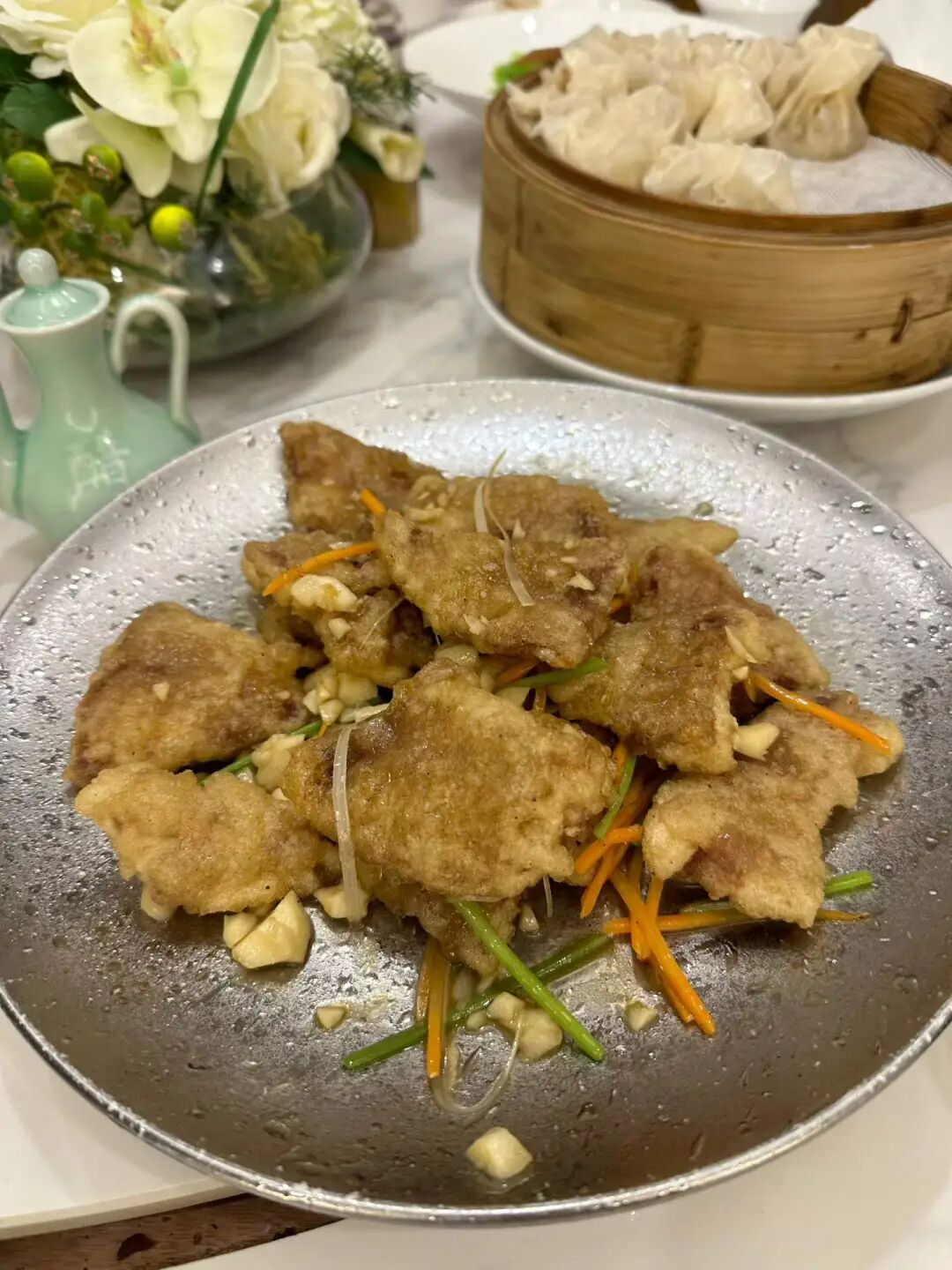
They specialize in Heilongjiang Hui Muslim cuisine and have also added some southern Chinese dishes to their menu. We ordered the savory sweet and sour pork (guobaorou), sauerkraut beef rib stew, colorful starch noodles (dalapi), stir-fried lily bulbs with bamboo shoots, and beef steamed dumplings (shaomai). The best of these was the steamed dumplings. The skin was thin and chewy, and the filling was fragrant and not greasy. I think they are better than the other Hui Muslim steamed dumplings currently in Beijing. The sweet and sour pork had a good texture and wasn't fried too hard. I think it's better than another Heilongjiang Hui Muslim restaurant in Beijing. The sauerkraut tasted great, but there was very little beef, and there were very few lily bulbs in the lily bulb and bamboo shoot dish. Overall, the restaurant is definitely worth a visit. The biggest problem is that it is too far from the city center, almost reaching Hebei. It is best suited for those driving there or people working in the sub-center.
On Sunday, I was in Changping and had Beijing-style food for lunch at Fenghong Old Beijing Flavor in Xiaotangshan.
We ordered the three-person set meal, which included half a roast duck, grilled meat on a round iron plate (zhizi kaorou), stir-fried mixed vegetables (chao hecai), and duck frame tofu soup. This three-person set is a great value, and we were stuffed after finishing it. The duck tasted good, and the kids really liked it. The portion of stir-fried mixed vegetables (chao hecai) was huge, and it tasted great too.
The grilled meat on a round iron plate (zhizi kaorou) was a hit with both the Xinjiang and Hunan people at our table; the meat was tender but still had a nice chew. However, it must have been pre-marinated because it was spicy and couldn't be made mild, so the kids couldn't eat it. Duck frame soup is a must-have with roast duck; it was very savory and we couldn't stop drinking it.
Besides roast duck, they also serve traditional Hui Muslims' eight big bowls (badawan). If you are visiting Changping, you should come here to eat. They don't close in the afternoon, so it is perfect for a late meal after sightseeing.
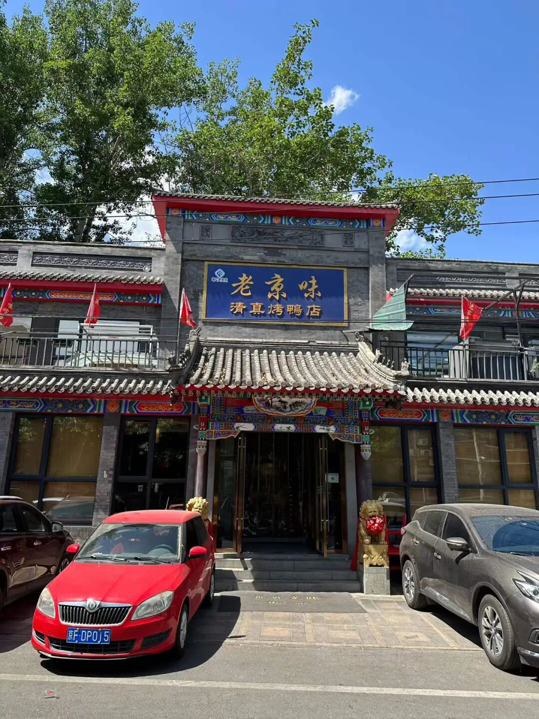
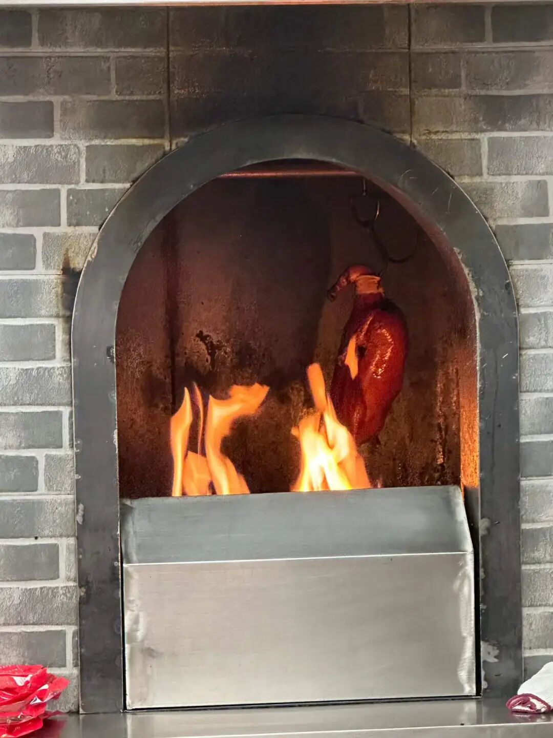
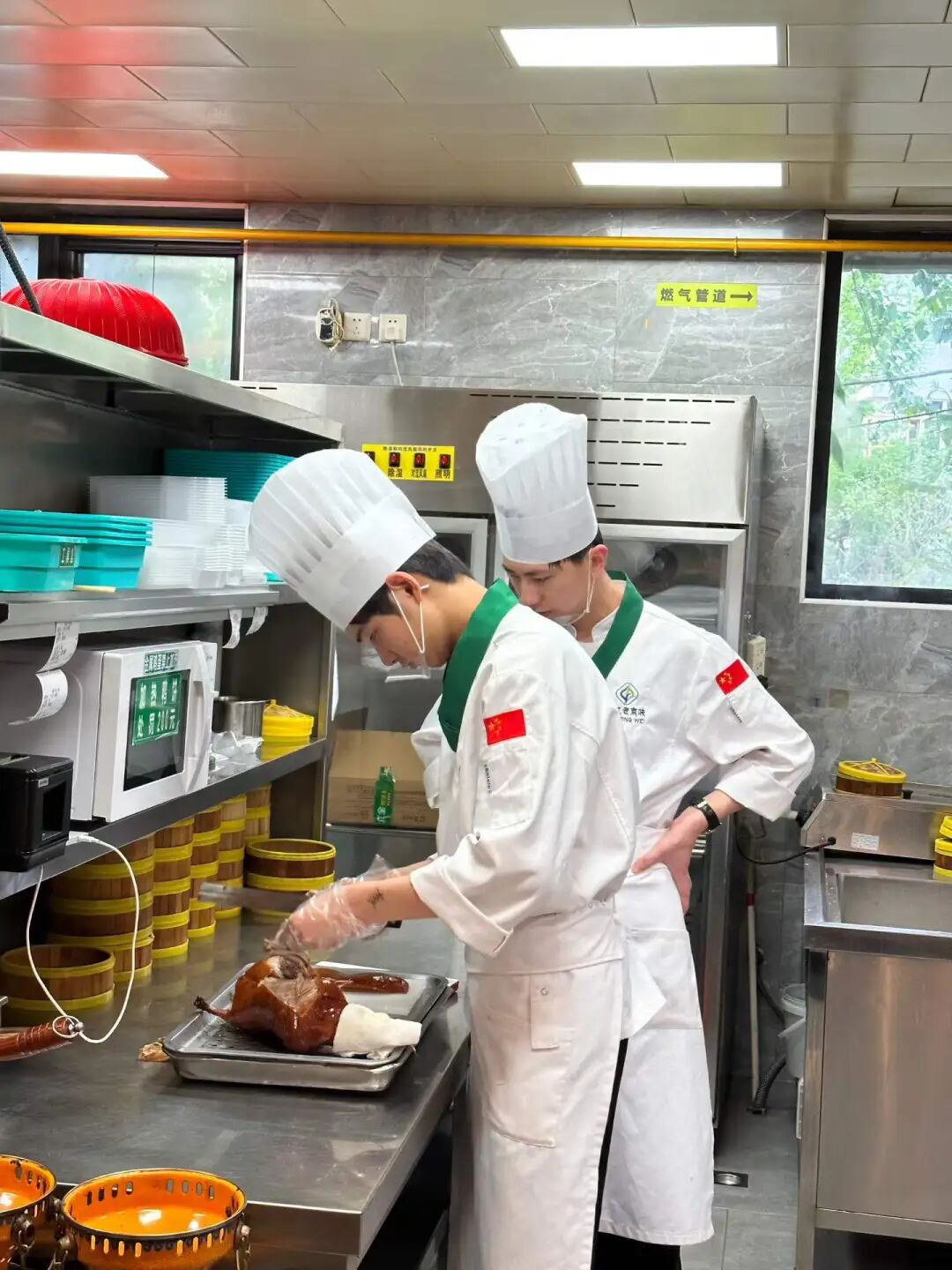
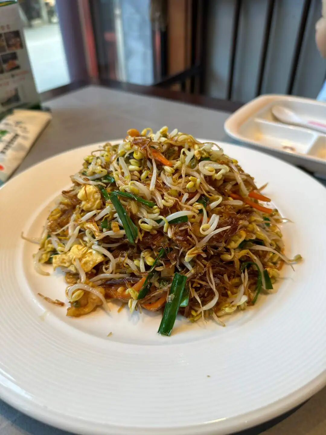
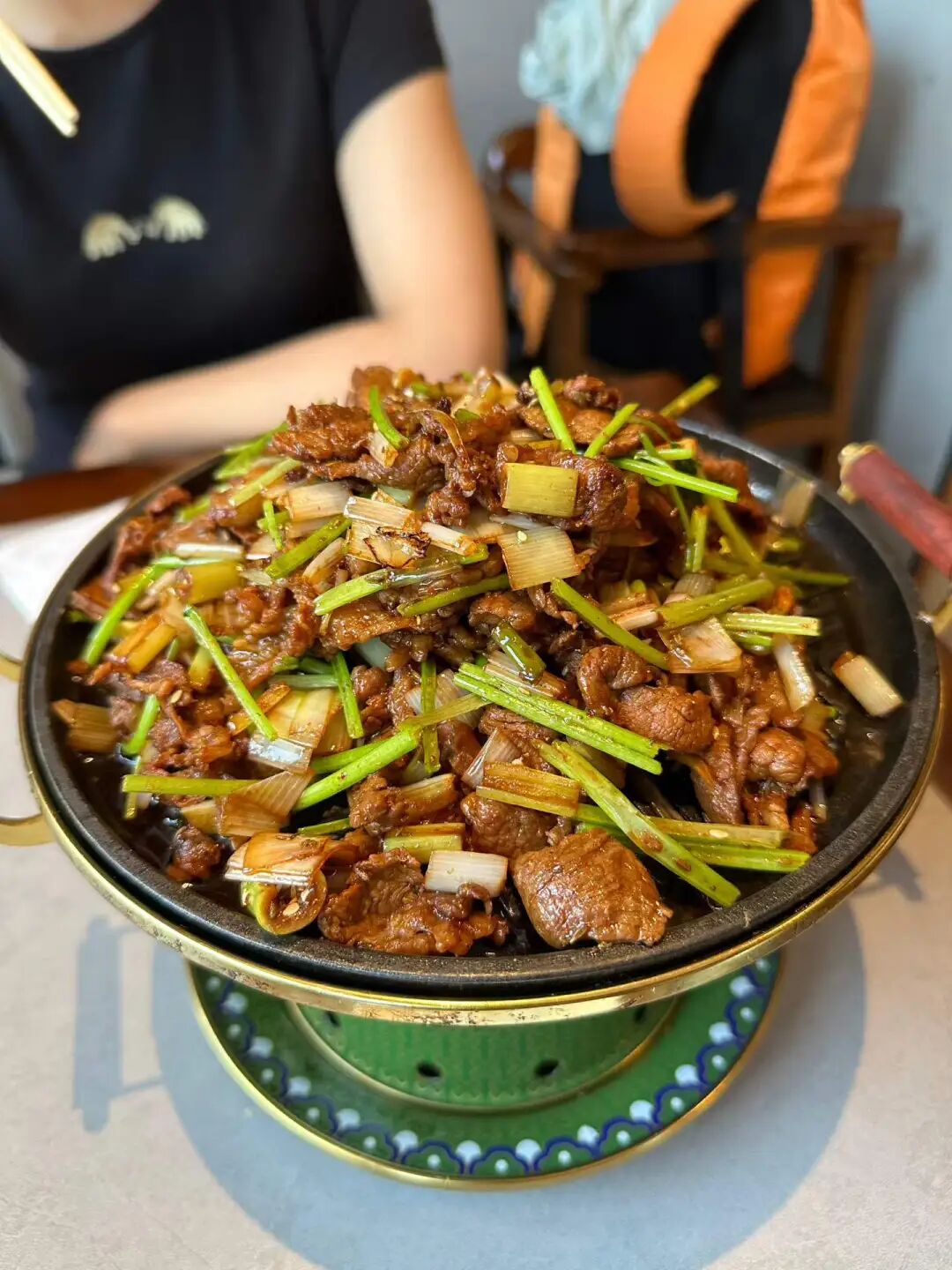
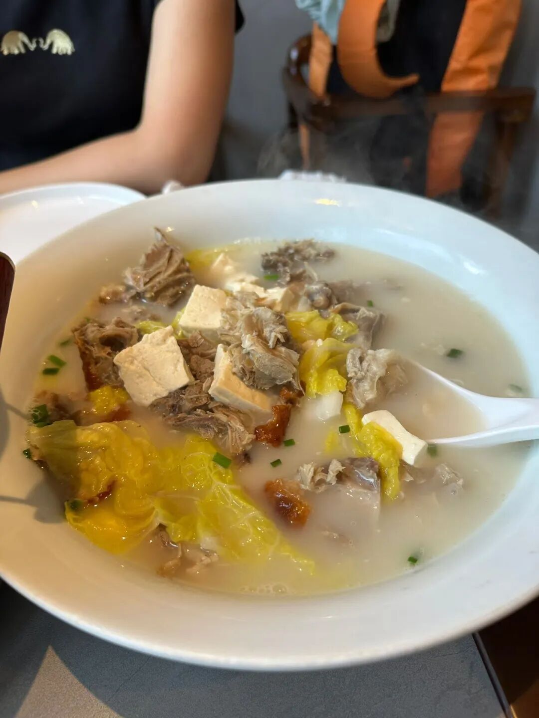
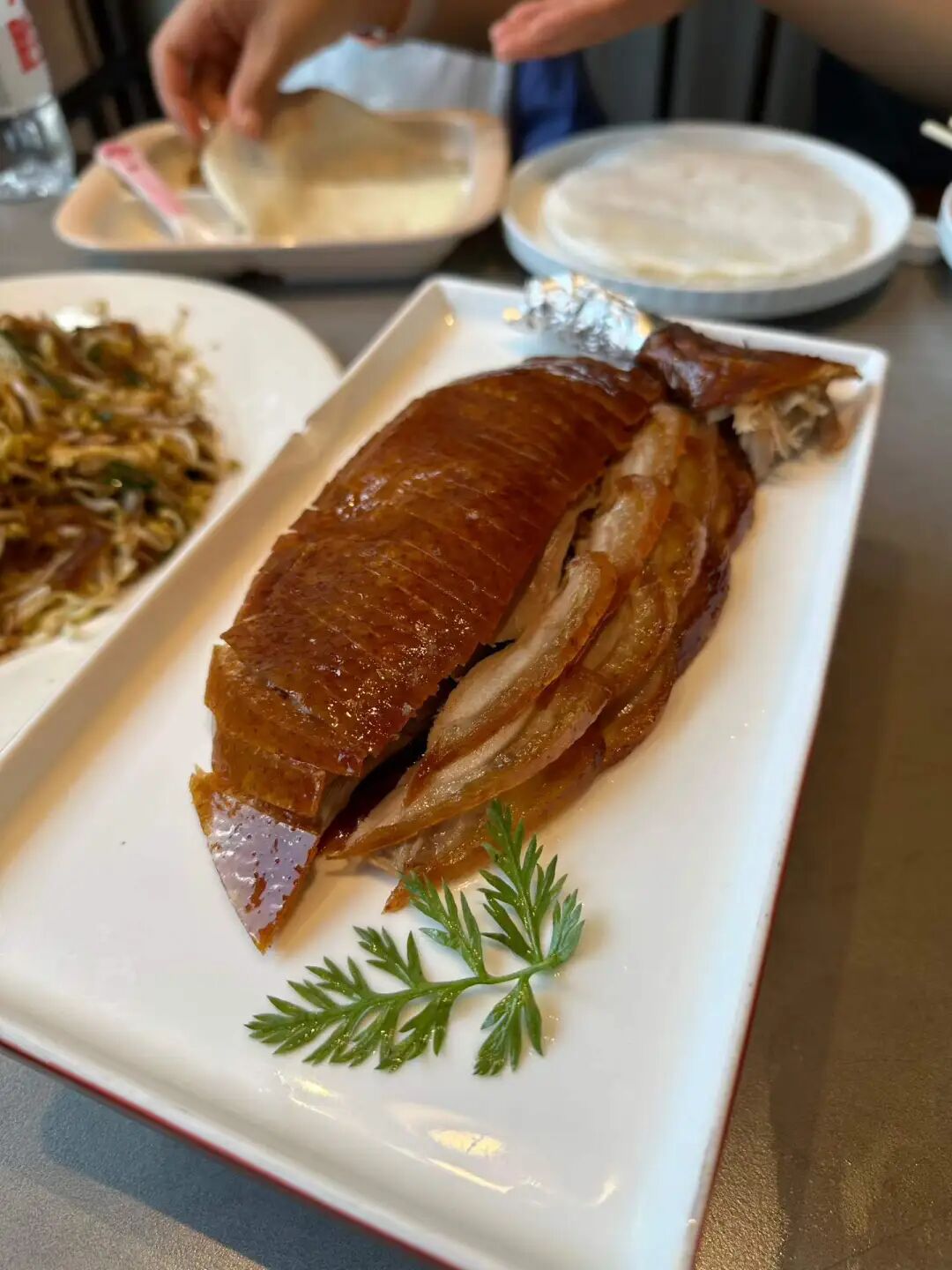
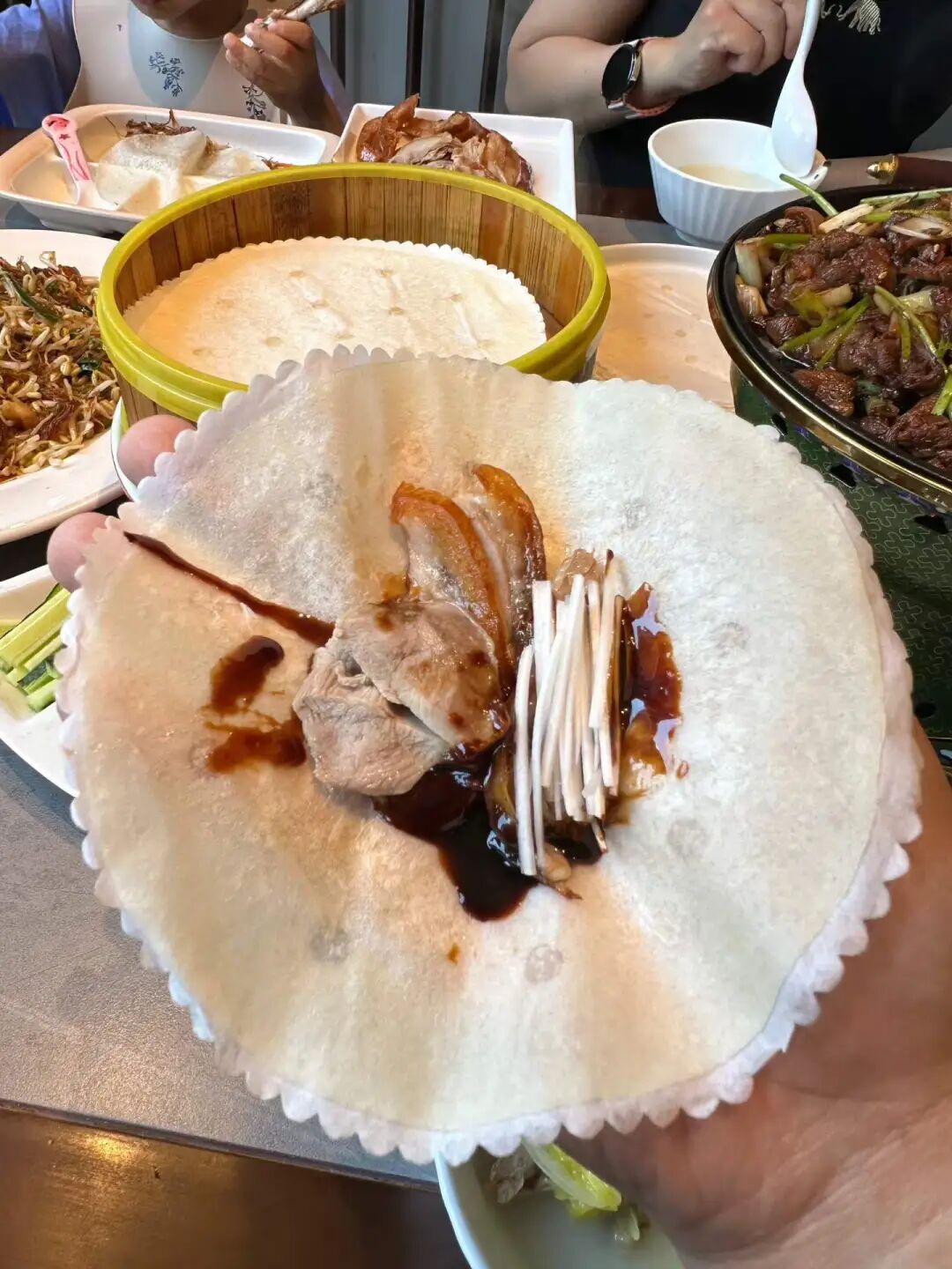
In the evening, we went to Shilihe to eat barbecue at Aidamu. I had heard they were very famous, but this was my first time eating there, and I was truly impressed. They have basically brought the level of a local Xinjiang night market to Beijing; eating there felt just like being back in Xinjiang.
There is a large parking lot right across from the restaurant, making it very convenient if you drive there. When we arrived at 6:30, the place was already packed, so we set up a table in the parking lot across the street. Since the temperature has risen in May, it is perfect for eating barbecue outdoors.
At their place, you grab the skewers yourself from the freezer. We had lamb liver, lamb heart, lamb skewers, and lamb chops. The lamb liver was very tender, definitely top-tier for Beijing. The lamb heart had more chew than the liver, and it was also quite good. The lamb skewers had no gamey smell at all, just the pure aroma of lamb, which is very rare in Beijing.
We had the pilaf (zhuafan) fresh out of the pot at seven o'clock. It was shiny and oily, though the lamb was a bit tougher compared to the skewers. Overall, it was still good. I happened to hear the table next to us complaining that their rice was undercooked. Actually, I think pilaf is only good when the rice is a bit firm. If the rice is too soft and mushy, it just becomes regular steamed rice.
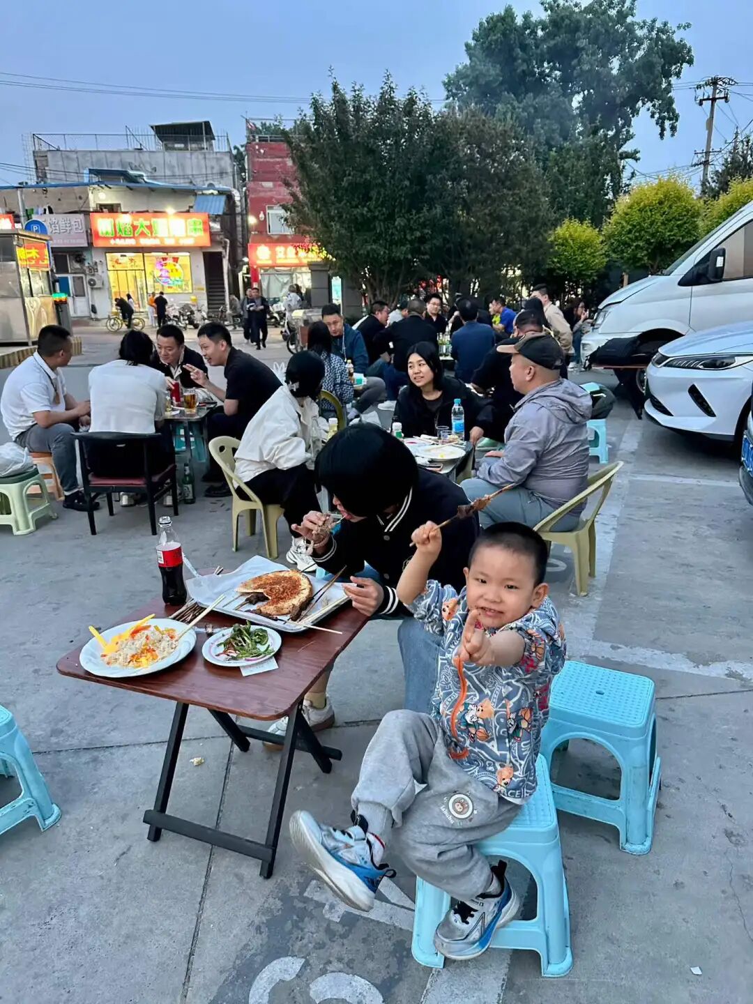
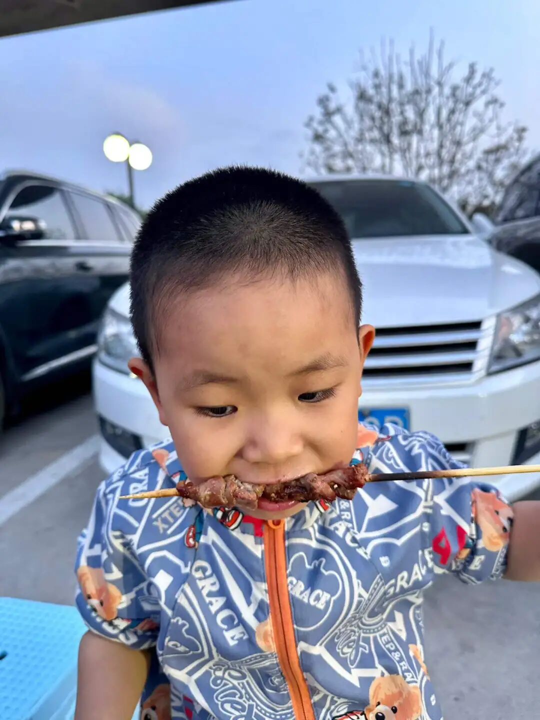
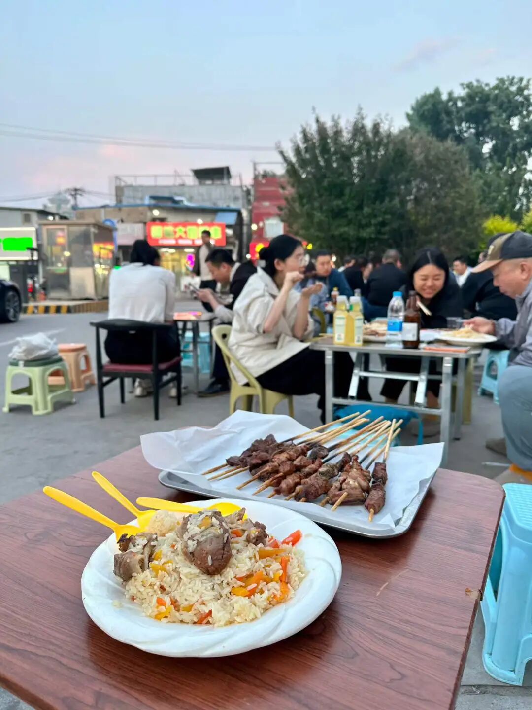
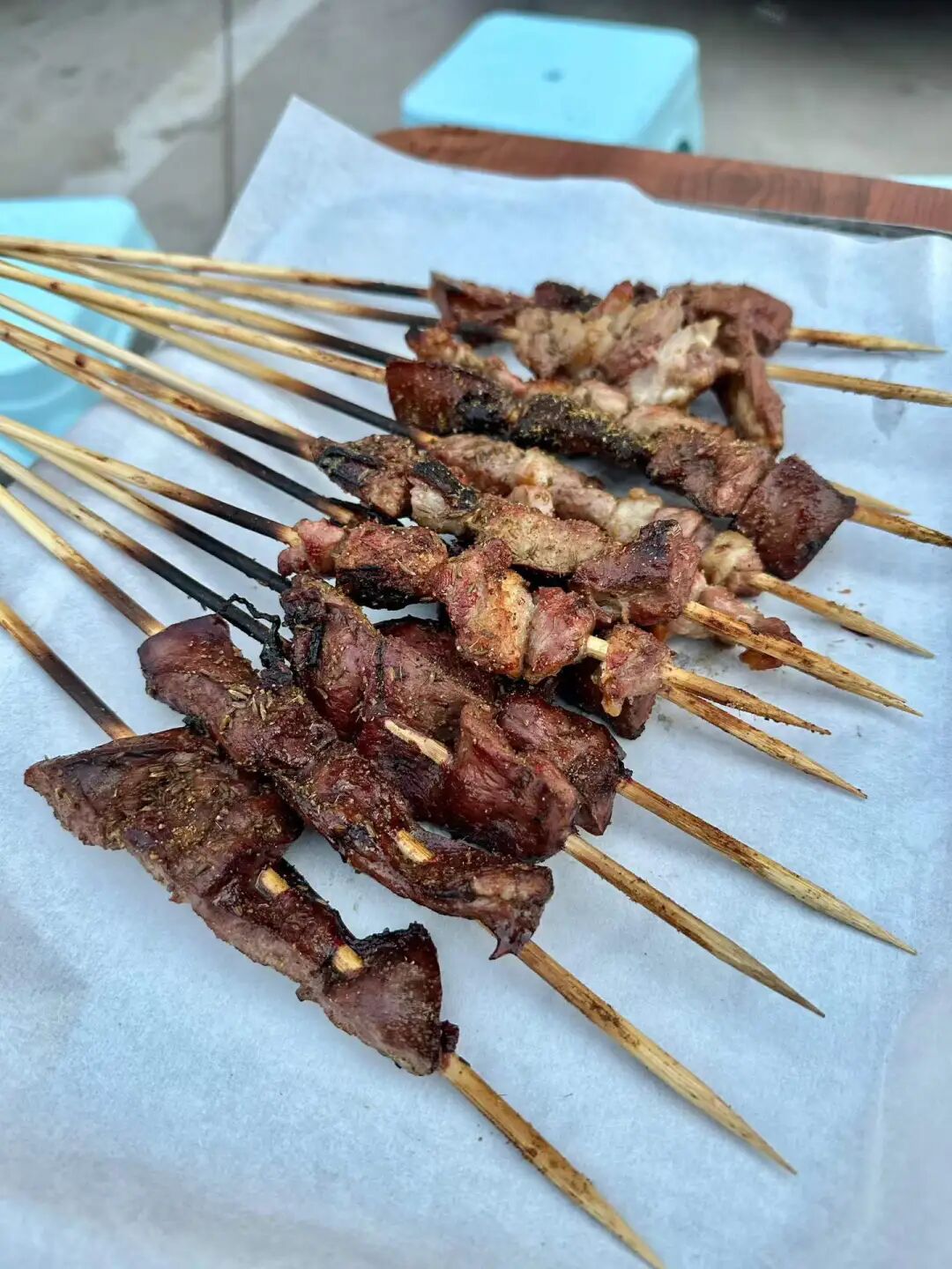
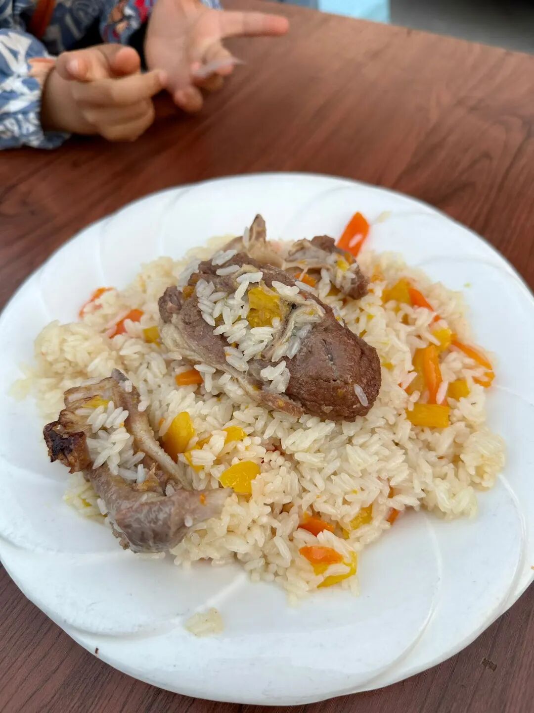
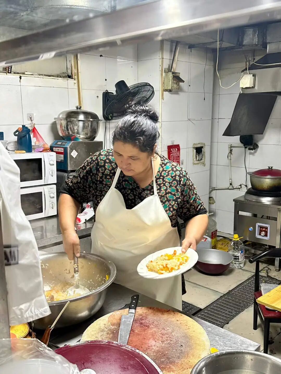
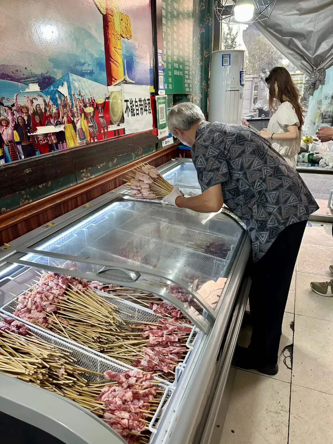
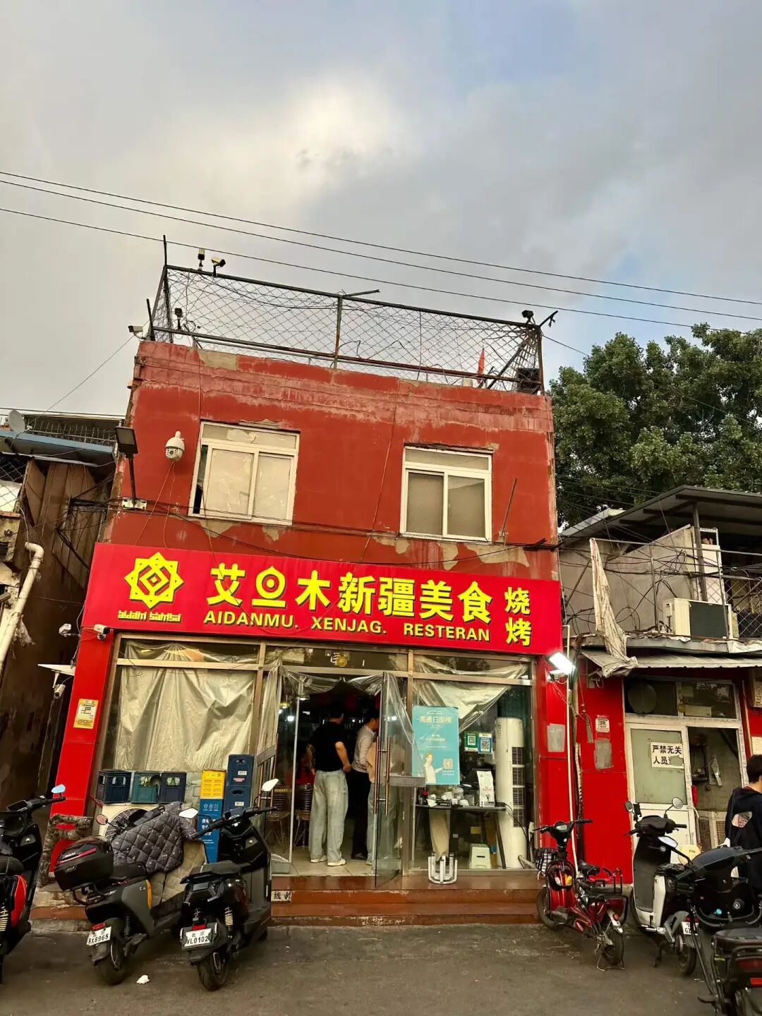
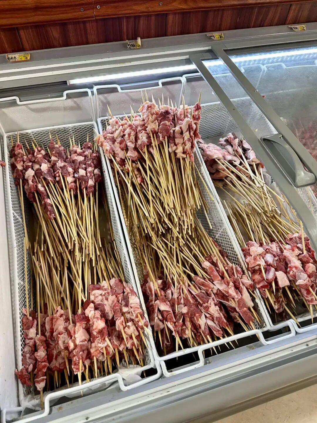
On the weekend, we had dinner at Kavkaz Ruilin, a long-standing Azerbaijani restaurant on Ritan Upper Street, to enjoy some Russian and Caucasian food. This is a classic former Soviet-style restaurant in Beijing that has been open for over a decade. It mostly serves merchants from Russian-speaking regions who come to Yabaolu to source goods. Its Chinese name used to be Ruilin, but it has been changed to Ruilin.
After the Soviet Union collapsed in the 1990s, many traders (daoye) took green-skinned trains to Beijing and headed straight to Yabaolu to stock up on goods. They brought down jackets, leather shoes, toys, and other small items back home to sell for huge profits. Yabaolu gradually grew from street stalls and tents into Beijing's largest wholesale market for Russian-speaking regions, and more former Soviet-style restaurants opened up on nearby Ritan Upper Street. Over a decade ago, Ritan Upper Street was mainly home to Central Asian and Azerbaijani restaurants, including Uzbek and Kazakh spots.
Over the last decade, Russia's economic decline, the shift of markets to places like Yiwu, Guangzhou, and Suifenhe, and the rise of cross-border e-commerce have caused trade with Russia on Yabaolu to shrink. Yitan Shangjie has gradually become a hub for Uyghur restaurants. Besides Dardanelles and Desert Rose, which focus on Turkish food, the only other Azerbaijani restaurant is Ruilin. For Central Asian food, there is the Turkmenistan restaurant Merv downstairs, which also serves Russian dishes.
At first, Ruilin had dim lighting, making it a good spot for traders to talk business, but many Chinese people were afraid to go inside. In recent years, the lighting at Ruilin has become brighter, but when we visited, there were only Russian-speaking customers, and we did not see any other Chinese people eating there.
We ordered borscht (hongcaitang), pot-stewed lamb (manguan yangrou), chive pancakes (jiucaibing), Azerbaijani pilaf (zhuafan), and grilled vegetables. Their borscht is closer to the Russian style than the one at Merv. Merv's beef soup has a stronger flavor, while their version has a more intense beet taste, which is also quite good.
Pot-stewed lamb is a classic Russian main course. Traditionally, it is cooked during long, cold winters by stewing meat in a clay pot over a wood-burning fireplace, then sealing the lid and burying it in the fireplace embers for several hours. Their pot-stewed lamb broth is very fresh, similar to Xinjiang cup-stewed lamb (gangzirou), but the lamb is a bit tough rather than tender.
I really like the Azerbaijani pilaf. I made sure to eat the authentic version when I visited Azerbaijan, and after coming back, I think both Ruilin and Dardanelles make a good version. Azerbaijani pilaf is dyed yellow with saffron and includes dried apricots, prunes, chestnuts, and raisins. The lamb is salty and savory, while the dried fruits add sweetness, creating a very rich flavor profile.
I finally had the cheese beef burger at Yilan Liyuan on Niujie this weekend. They only have regular and California-style options now. The California-style burger adds lettuce and tomato, and you can order it as a single or double patty. They do not let you eat inside the shop, so you have to eat at the entrance or take it away. I waited five minutes at the door and it was ready. The single-layer size is decent, and the crust was baked hot on the spot, but the filling felt a bit dense and not very fluffy. The meat pie tastes good, but it feels a bit loose, as if it wasn't packed tightly enough. Overall it is pretty good, but it would be even better if there were other things to pair it with.
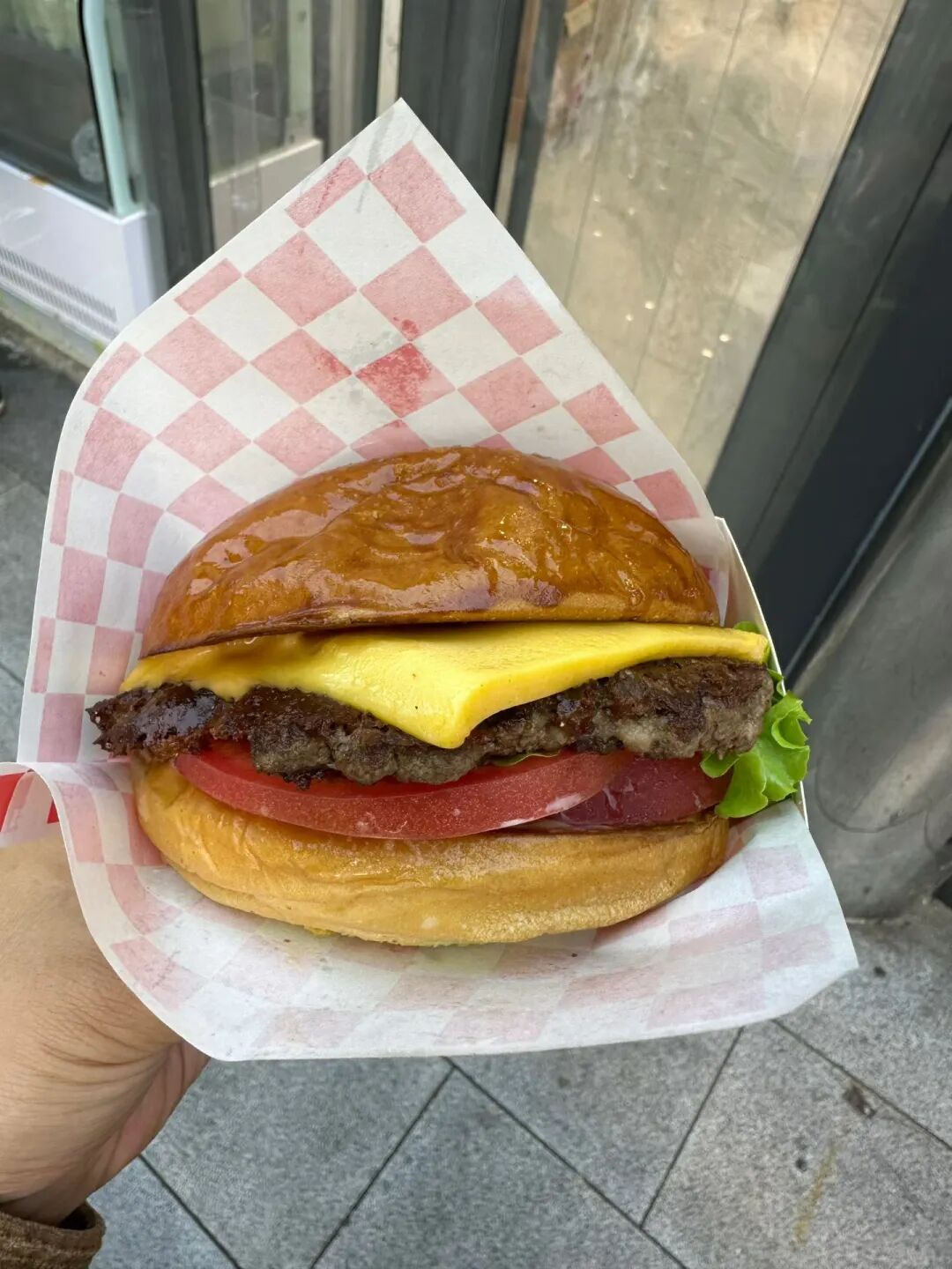
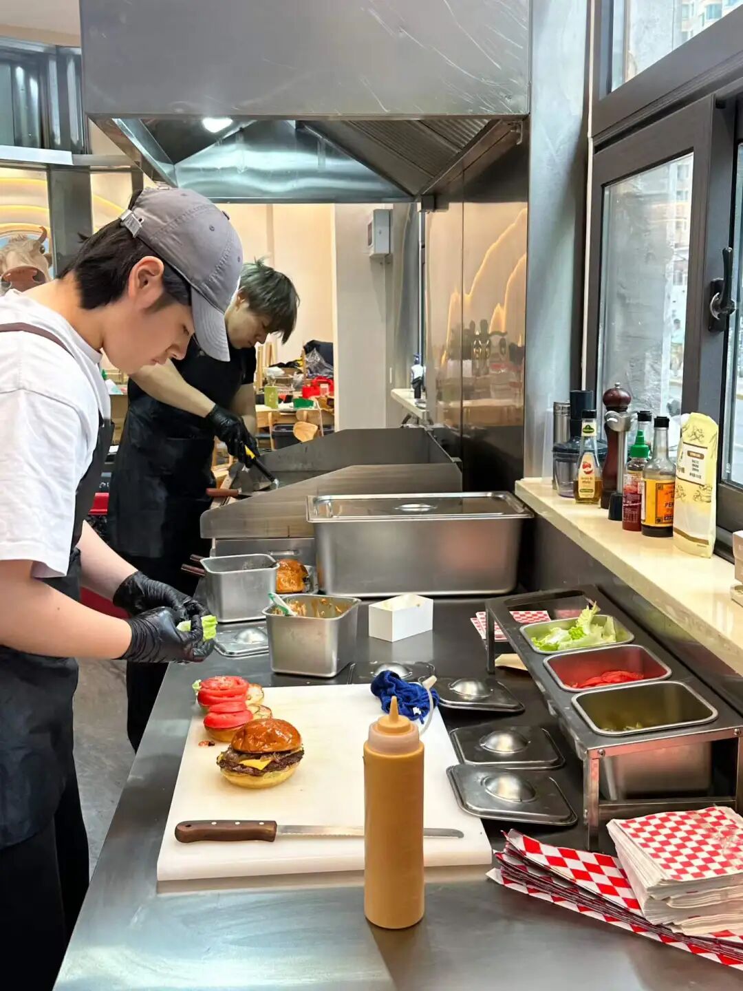
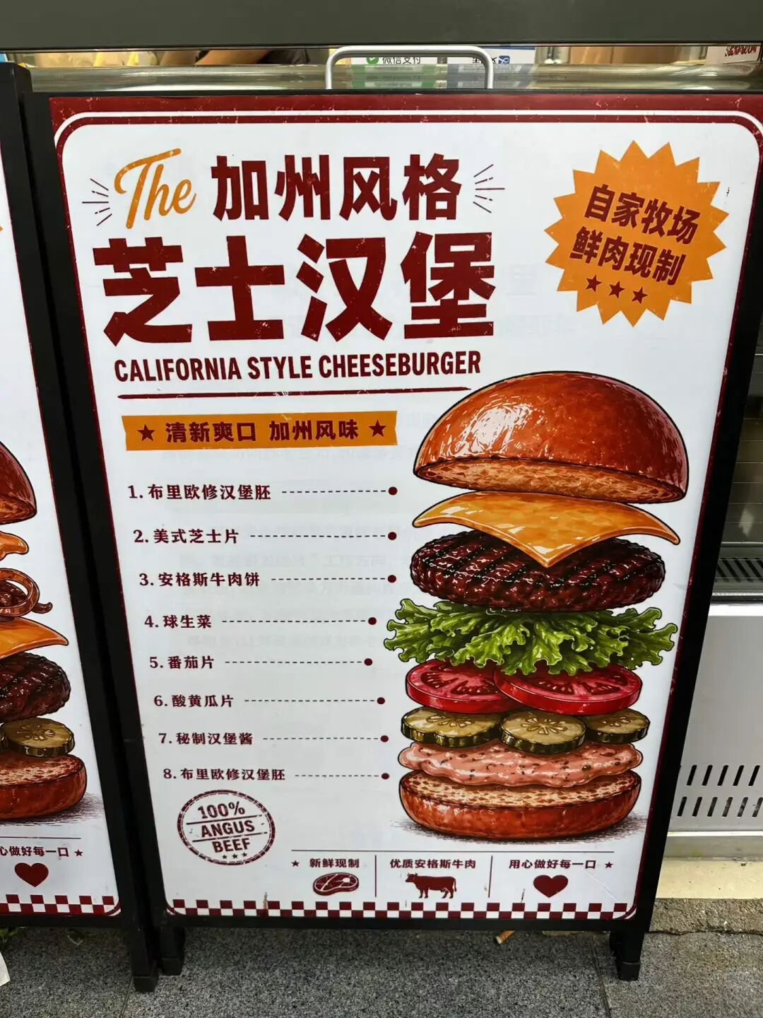
A Tianjin halal shaved ice and steamed pancake (zhengbing) shop called Guxiangzhai has opened at Hufangqiao. Since the weather is getting warmer lately, many people are coming to eat shaved ice. For my first visit, I chose the traditional-style shaved ice. It contains sour hawthorn paste (suanmogao), red hawthorn fruit, dried apricots, strawberries, mulberries, pineapple, orange, fresh apricots, and red beans. It actually has more ingredients than the truly traditional version, and it is mainly sweet and sour to whet your appetite. Sour hawthorn paste (suanmogao) is the soul of Tianjin traditional shaved ice. It is made by grinding dried wild sour jujubes into powder and boiling it with rock sugar. You can buy large blocks of sour hawthorn paste (suanmogao) at the entrance of the archway of the South Mosque (Nandasi) in the Northwest Corner. It also tastes great when mixed directly with water.
Their dinosaur egg three-apricot shaved ice is also a signature item. It contains Kashgar Hami apricots, Yengisar Saimaiti red apricots, Aksu Situan dried apricots, and secret-recipe preserved fruit made from wild hawthorn from Shanxi. It sounds very good.
They also sell various snacks. We bought a steamed pancake (zhengbing) with a red hawthorn filling, which is sweet and sour and perfect for breakfast. It is a pity that the rice cakes (gaogan) were sold out, so I bought a rice cake (migao) with a sour hawthorn paste flavor. It was a bit dry, but the taste was still good. I also bought a snack called "five blacks," which contains black rice, black beans, black mulberries, black goji berries, and black sesame seeds. It sounds very healthy.
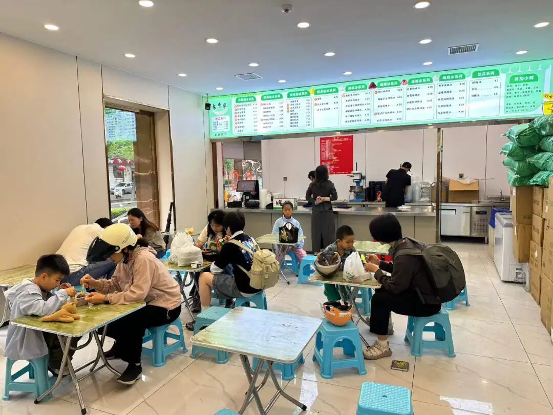
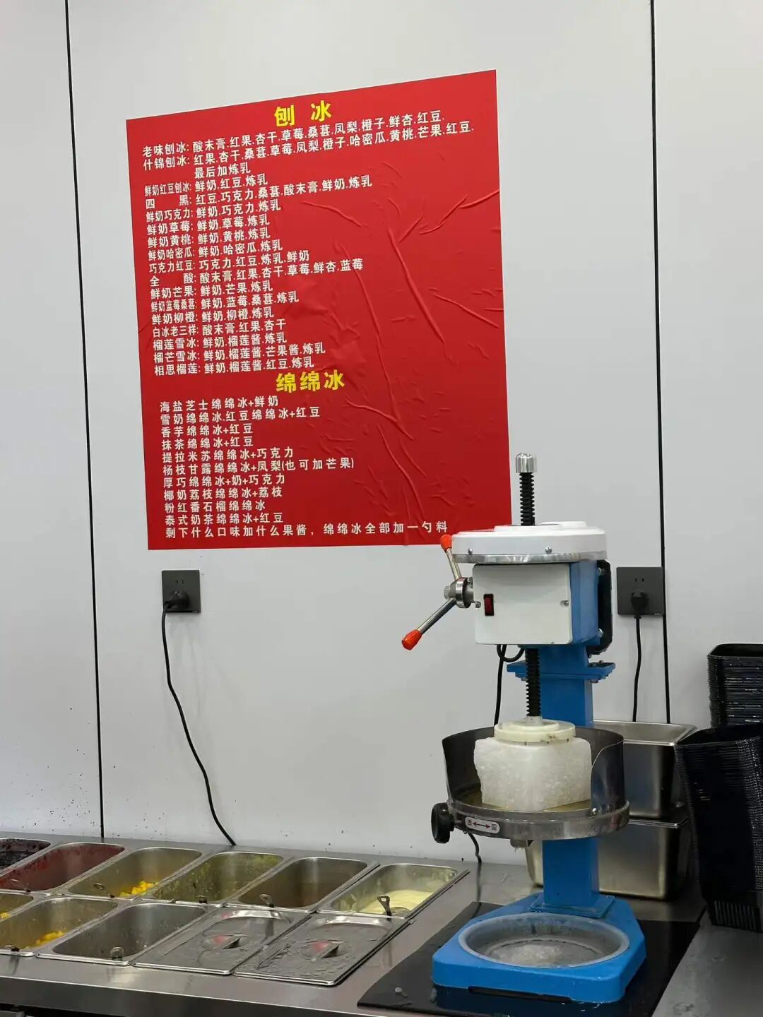
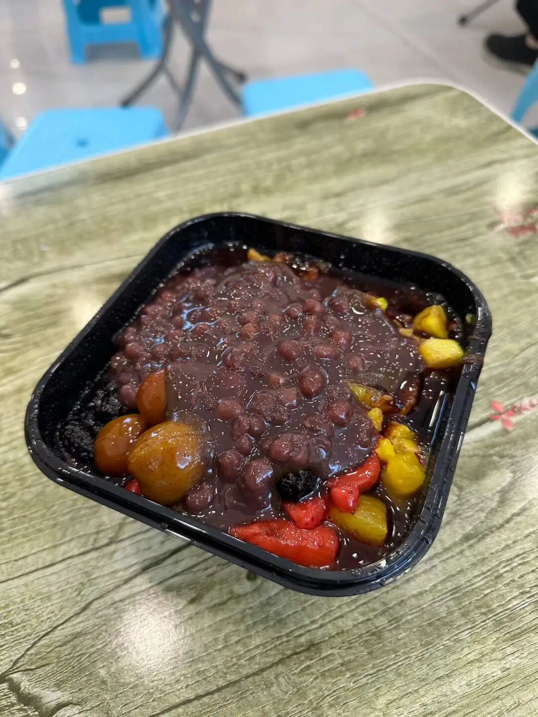
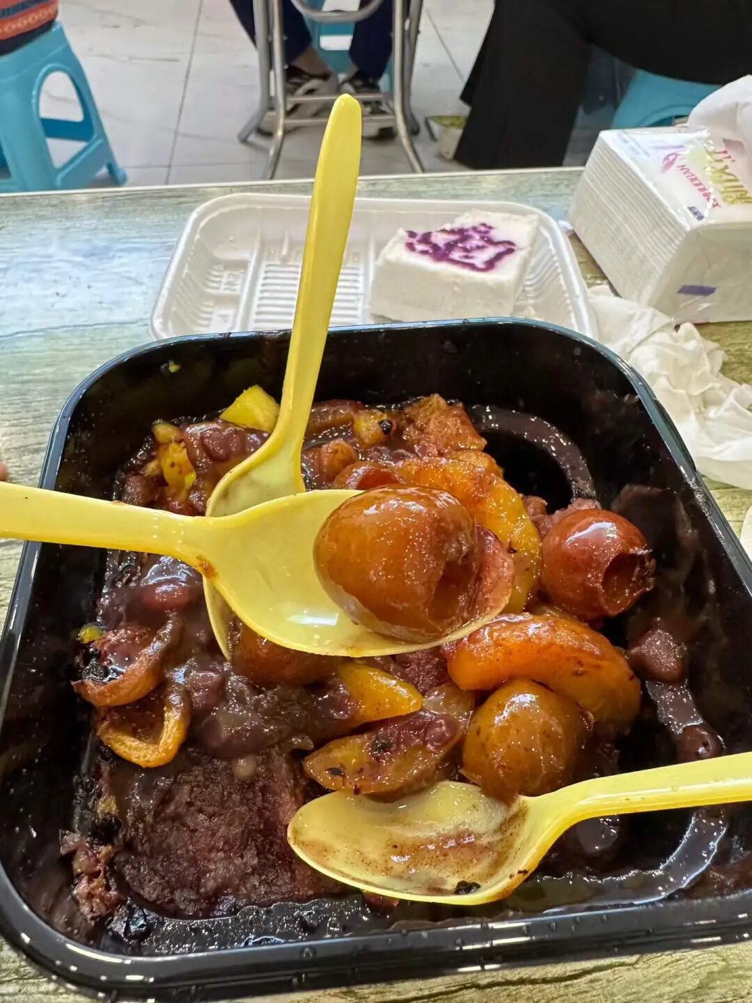
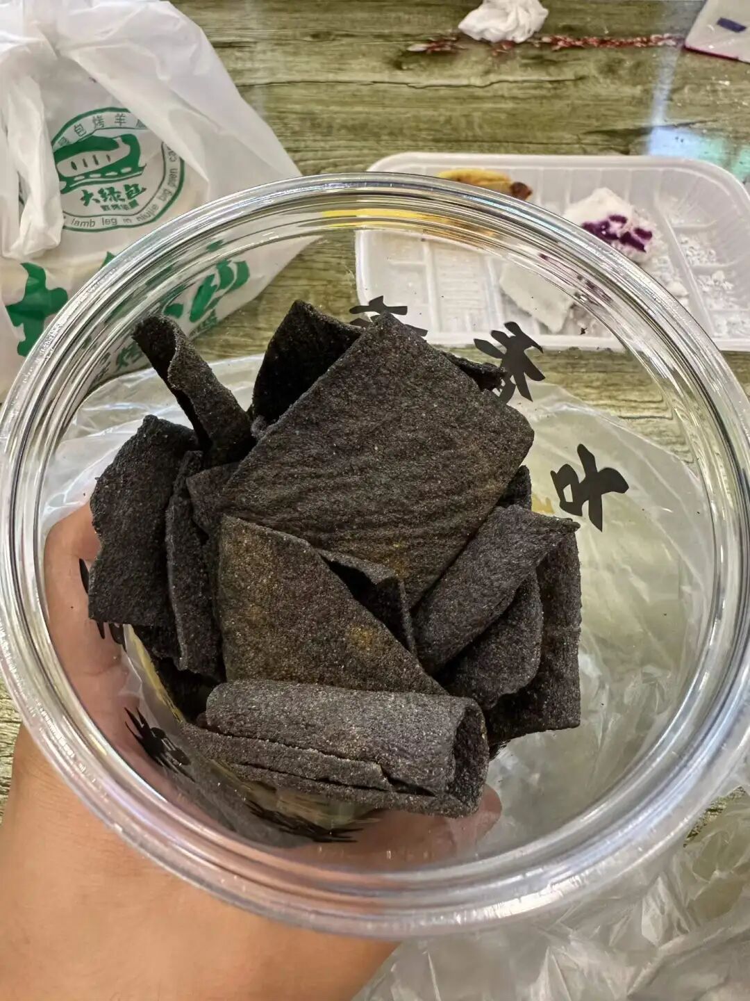
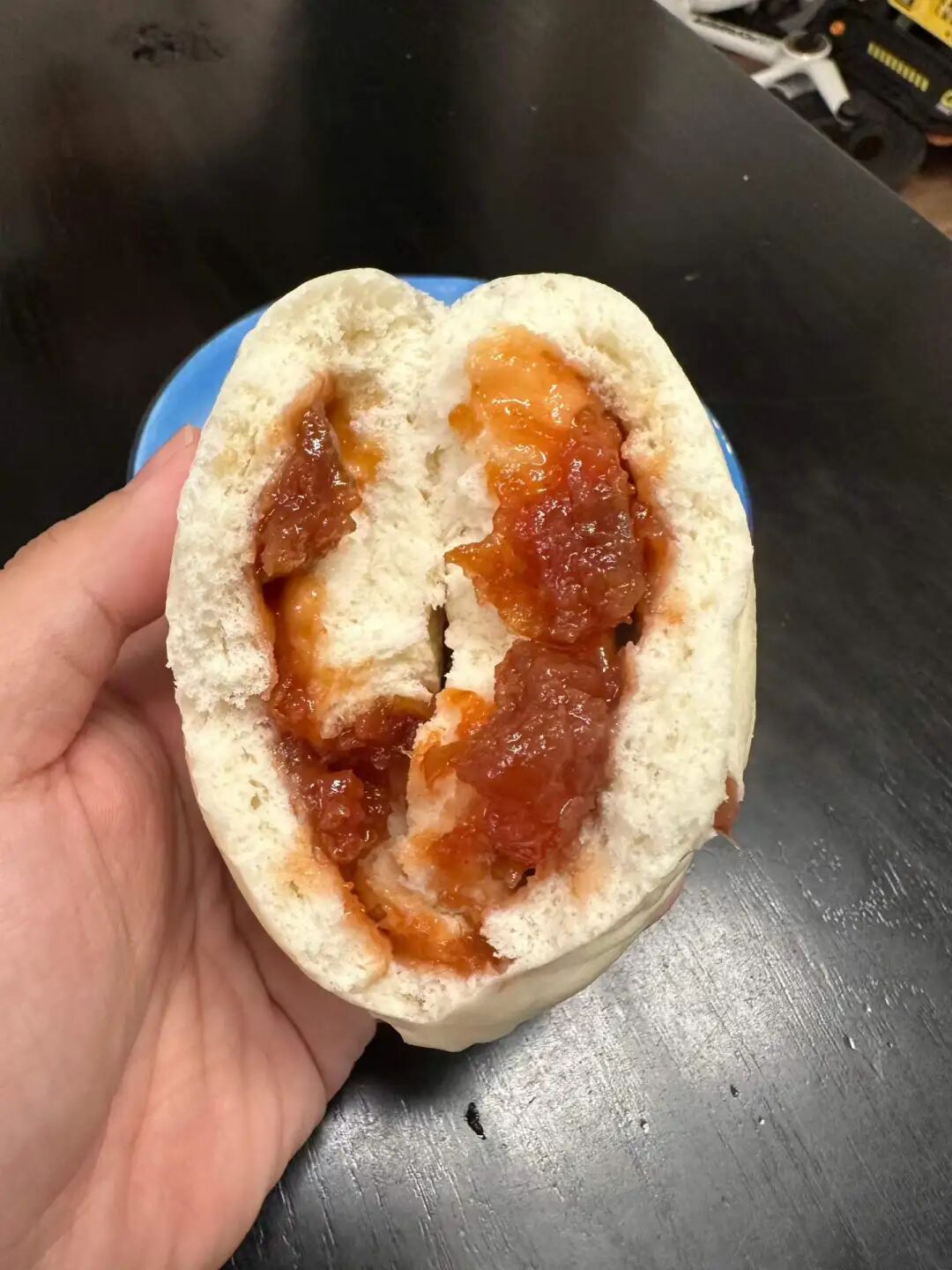
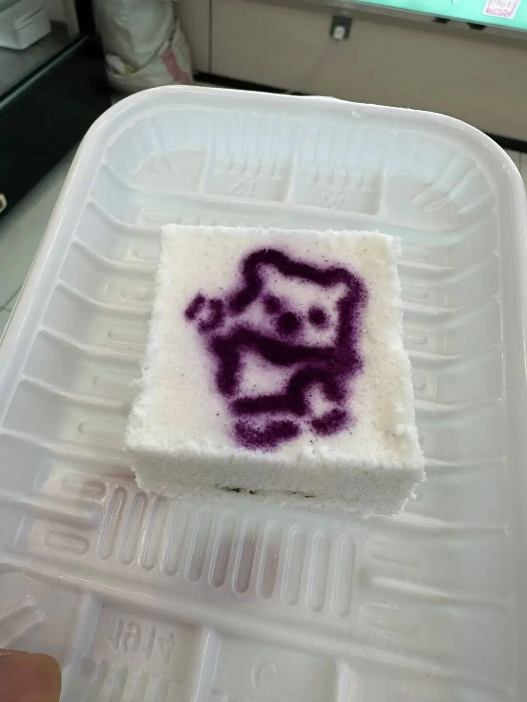
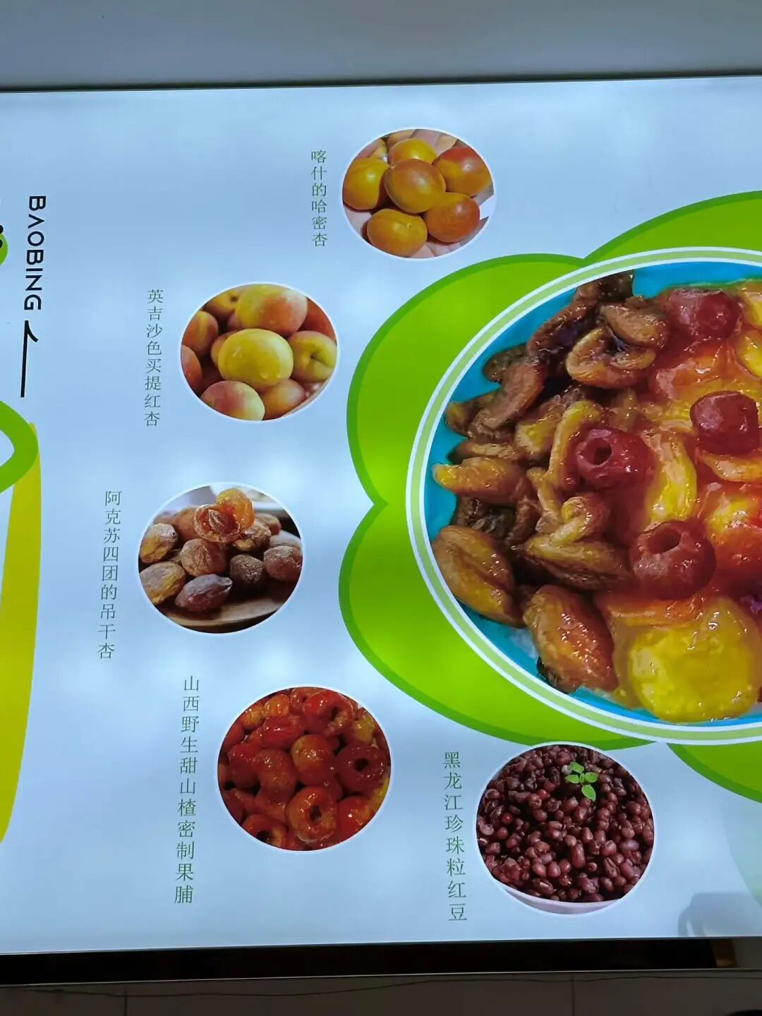
Across from the China Academy of Chinese Medical Sciences on Niujie Street, the roast lamb leg shop with the big green sign sells stinky tofu with sauce. The sauce is made from beef bone broth (niubanggu aotang), and it really has a meaty flavor. I remember eating fried stinky tofu topped with fermented bean curd sauce from a cart run by local Hui Muslims on Binjiang Road in Tianjin. That flavor was truly satisfying.
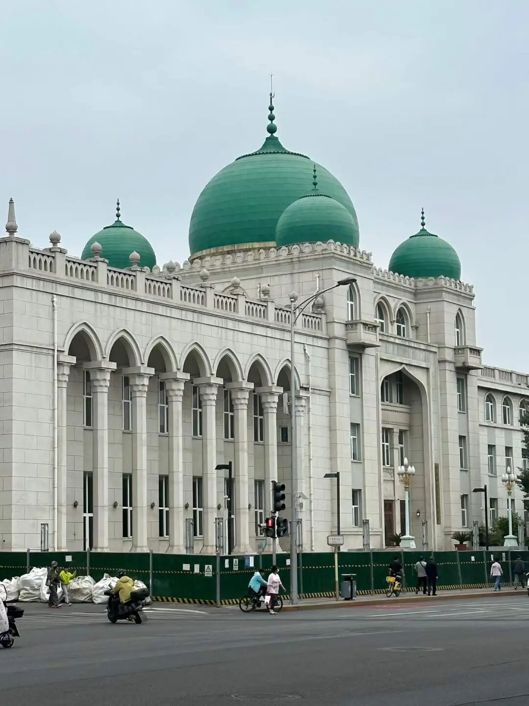
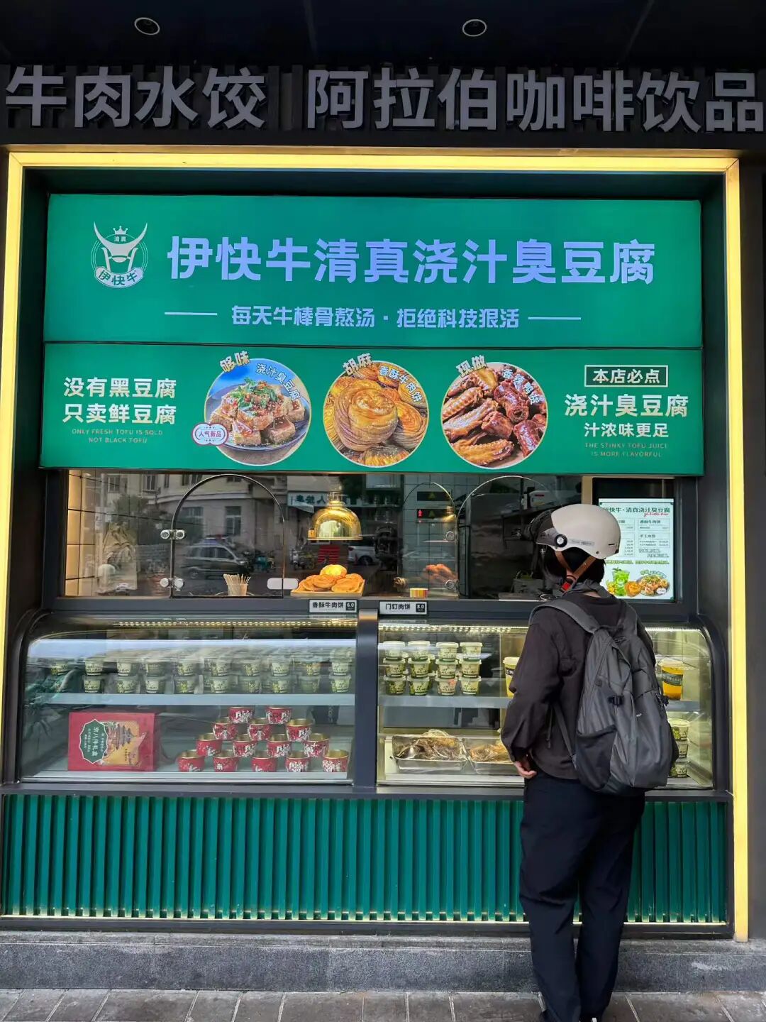
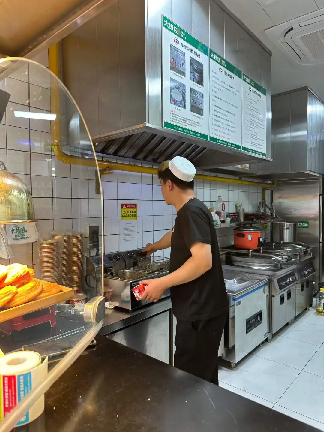
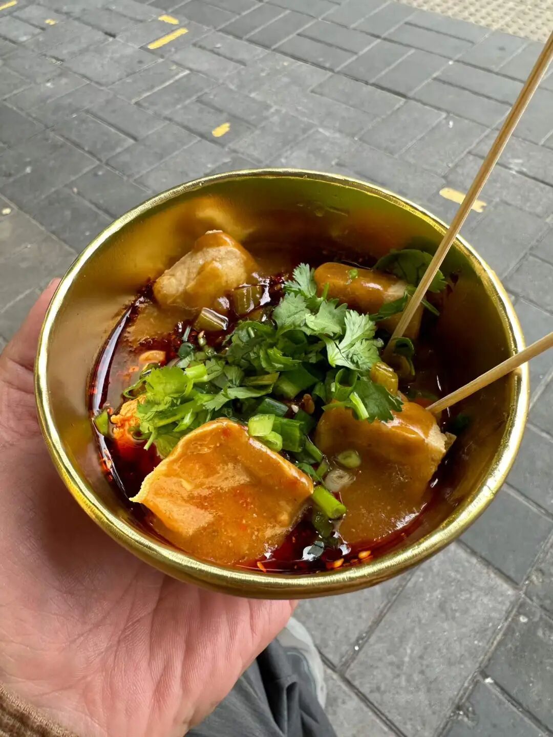
A new alcohol-free Pakistani restaurant called Zafran just opened in Jiayi Plaza near Liangmaqiao. It is very close to the Liangma River, and since it only opened a few days ago, I came specifically to try it.
I looked at the menu and was surprised to find many Afghan Pashtun dishes. I asked the server, and he is a Pashtun from Peshawar. I decided to order a few Pashtun dishes to try, as some of them cannot be found in other Pakistani restaurants.
First, I must praise their excellent service. The Pashtun waiter, Anas Khan, always greeted us with a smile and even did a fist bump with my son, Suleiman. As soon as we sat down, they brought us black tea, lemon water, and fried dough twists (mayezi). Later, they served a special dried fruit milkshake with walnuts and almonds. Finally, they gave Suleiman a small cup of thin yogurt drink (lassi) and a piece of baklava, which made him very happy.
The atmosphere is also very nice, with curtained sofa areas on one side that are perfect for families. There are no large private rooms, but if you have a big group, you can push tables together in the main dining area. There is also outdoor seating at the entrance, which is great for having desserts and drinks in the summer.
We ordered Afghan pilaf, Peshawar-style lamb, and Kandahar naan. You can tell these are Pashtun specialties just by their names. We also ordered a Caesar salad, french fries, and salty yogurt drink (lassi). Since they just opened, they gave us a 30% discount, which was a great deal.
Afghan pilaf originated in the border region between northern Afghanistan and Uzbekistan. It is known as Qabili Palaw in Afghanistan and later spread from there to West Asia, Central Asia, and Pakistan. Afghan pilaf (pulao) differs from Xinjiang pilaf because it uses long-grain aromatic rice from South Asia and a bit of saffron for color. It is cooked with ghee and vegetable oil, and the carrots are sliced thinly. It also includes cinnamon, cardamom, and cloves, giving it a stronger spice flavor than Xinjiang pilaf. Their Afghan pilaf includes fresh almonds and raisins, but the meat is a bit tough and hard for children to chew. The spice flavor is very rich.
This was my first time eating Peshawar Shinwari lamb, and I highly recommend it! The lamb is very tender and the seasoning is excellent. Peshawar Shinwari lamb is cooked in a metal wok called a karahi. It is a classic main dish for the Pashtun people in northern Pakistan, especially prepared after the animal sacrifice during Eid al-Adha. It is made with fresh bone-in lamb, salt, garlic, and green chilies, without the heavy spices found in southern Pakistan.
Their Kandahar flatbread (nan) is also amazing and pairs perfectly with the Peshawar lamb. Kandahar flatbread is also popular in Pakistan. It is very fluffy because milk and sugar are added to the dough, making it more fragrant.
I also recommend their yogurt drink (lassi). It is not too sour, but it is very appetizing.
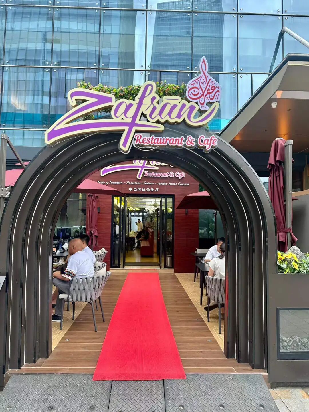
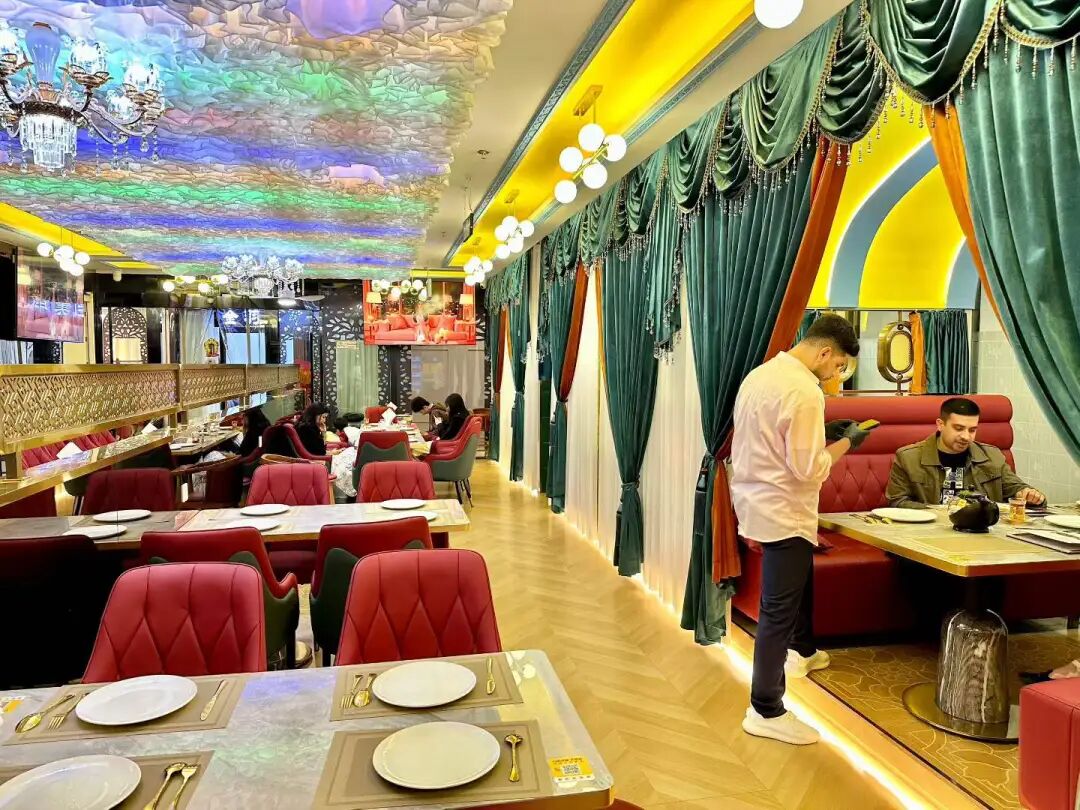
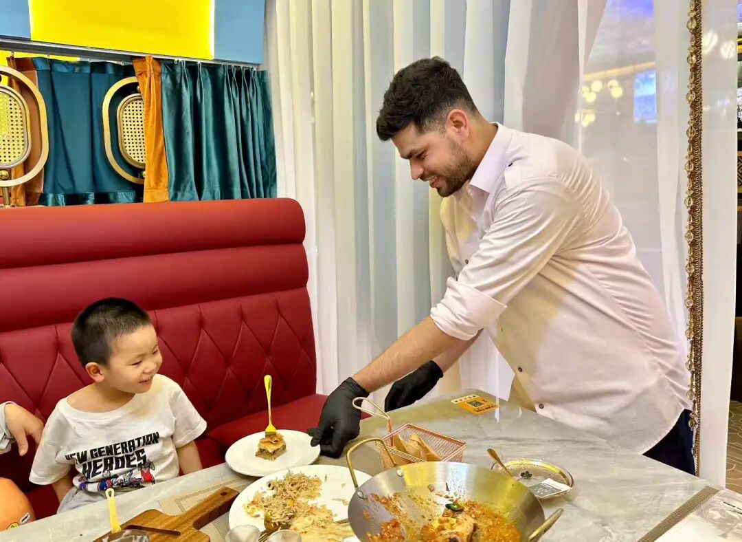
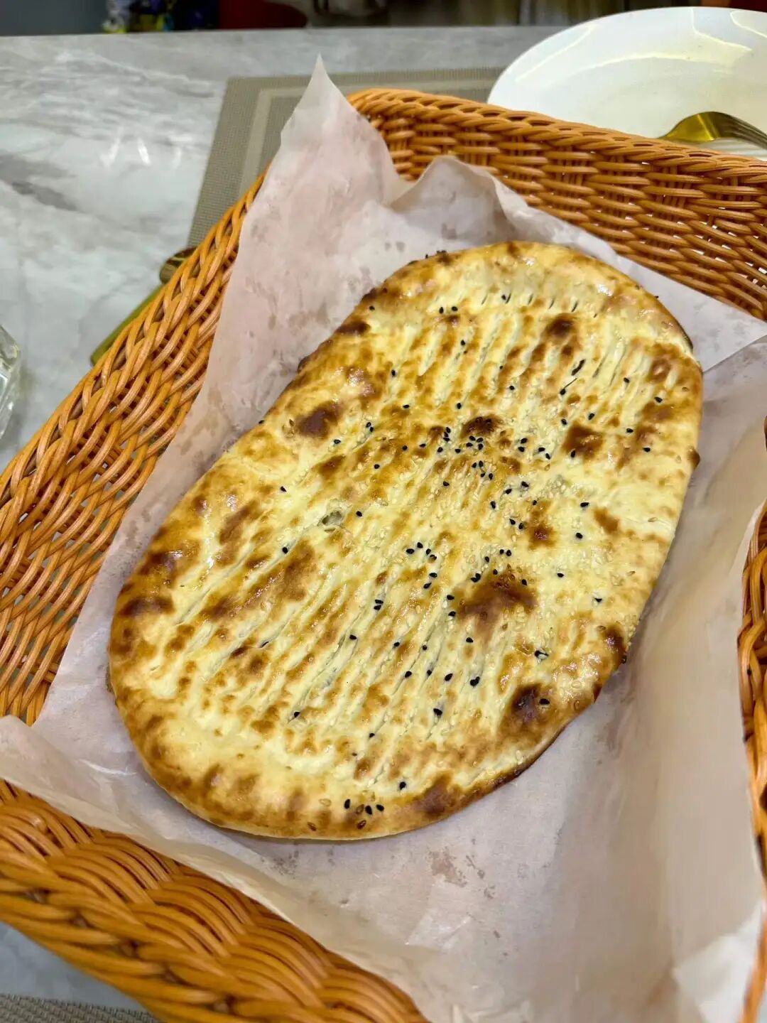
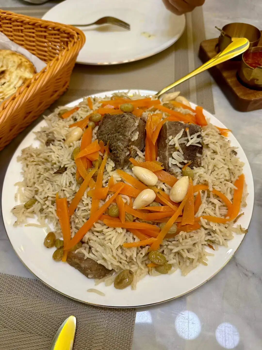
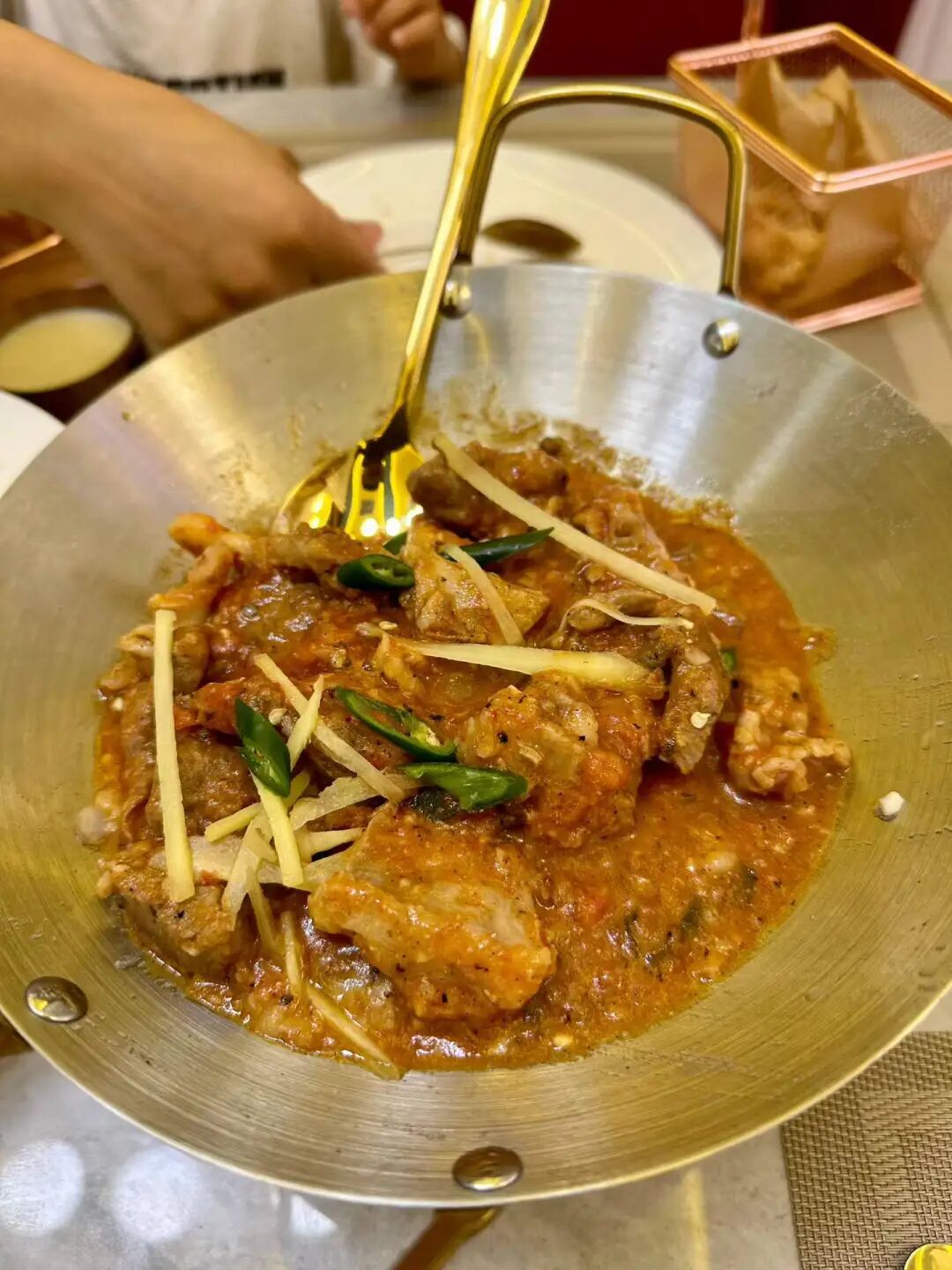
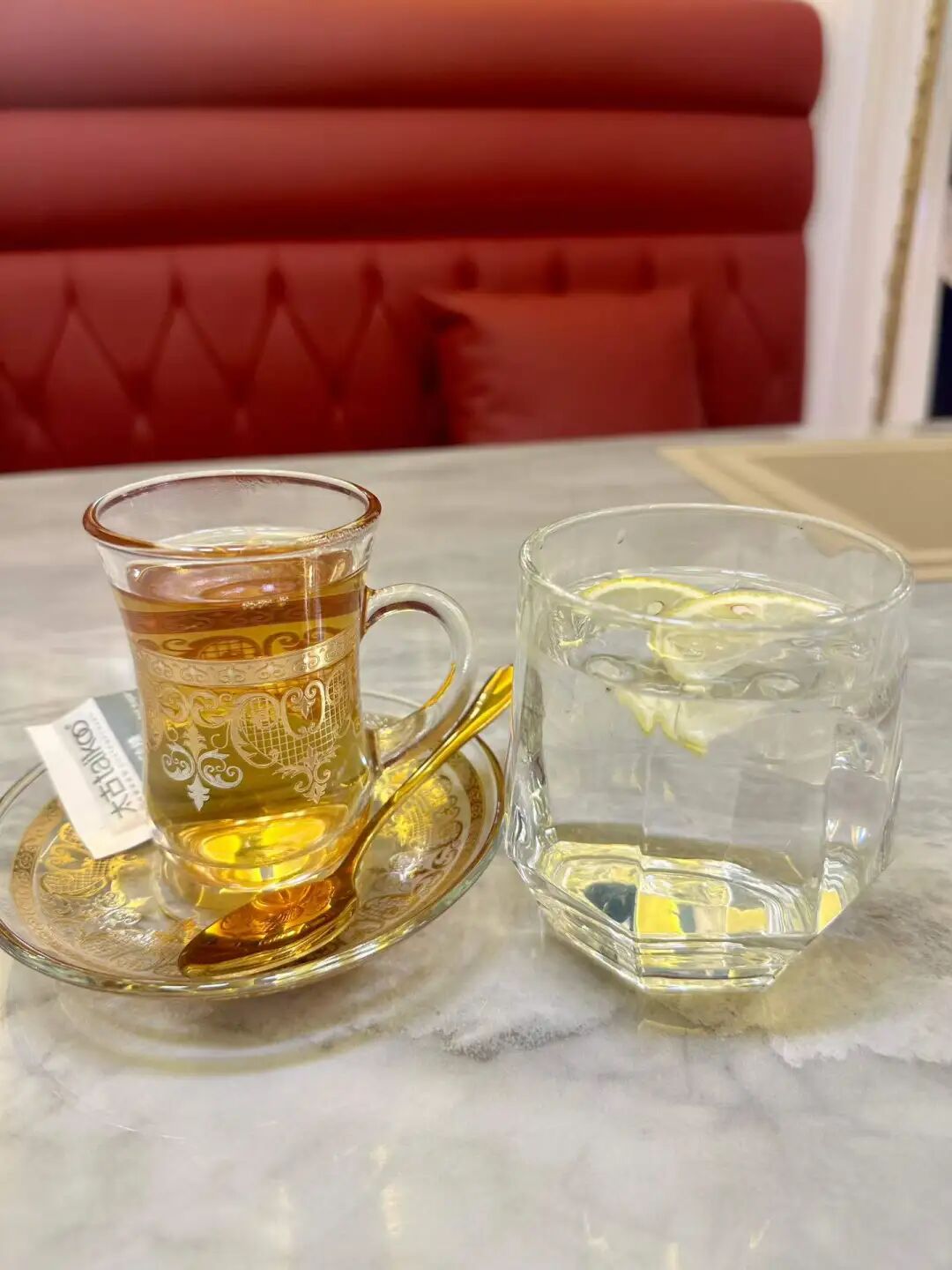
The Qingxiangge restaurant at Dongdaqiao was replaced by Jinfang Snacks this year, and I just went to try it recently. Once inside, I found it is completely different from the old shop at Ciqikou. It uses a self-service tray system with small bowls of stewed dishes, small portions of stir-fries, and a huge variety of mixed salads, noodles, and snacks. It is incredibly rich in options. Small bowls and small plates are rare in traditional Beijing restaurants, making them perfect for people who want to try several different dishes.
We ordered winter melon meatball soup (donggua cuan wanzi), stir-stir-fried meat with eggs and wood ear mushrooms (muxu rou), stir-fried green beans with pork (biandou chaorou), sea bream fillets (diaoyu pian), and healthy mixed vegetables (yangsheng cai), with corn and red bean rice for our main course. The cheaper meat dishes are mostly chicken, while the beef stew is priced like a standard old Beijing restaurant for Hui Muslims. The winter melon meatball soup goes great with rice, and eating rice soaked in the broth feels just like being a kid again.
Jinfang Snack Shop is celebrating its 100th anniversary this year, so it can finally call itself a century-old shop. Jinfang was originally called Rongxiangcheng Hui Muslim Snack Shop, founded in 1926 outside Chongwenmen by Man Leting (known as Man Liu), a Hui Muslim from Dezhou, Shandong. Man Leting started out with beef and mutton. At first, he bought high-quality cattle and sheep every autumn to raise in Madian, slaughtering and selling them as needed. His business improved significantly in the 1940s, so he expanded his storefront and later began selling cooked foods like roasted mutton (shao yangrou).
In the past, spring and summer were the growing seasons for sheep, so they were usually only slaughtered after autumn. Because of this, some mutton shops would switch to selling cold food during the summer. In the 1940s, Man Leting bought Japanese refrigeration equipment to sell homemade popsicles, soda, and other cold drinks, and business was booming. In 1949, mutton shipments from Inner Mongolia to Beijing were blocked, and the sheep trade hit rock bottom. Just then, Man Leiting's fellow townsman Man Kaiqi came to join him. Man Kaiqi had a background in a pastry shop, so Man Liu stopped selling lamb and switched to snacks and cold dishes, making Rongxiangcheng a famous Hui Muslim snack shop outside Chongwenmen. After the public-private partnership in 1956, Man Leiting's son Man Kaitong became the manager, and in 1958, they stopped making popsicles to focus on snacks like almond tofu (xingren doufu) and sweet rice balls (yuanxiao). In 1966, Rongxiangcheng was officially renamed Jinfang Hui Muslim Snack Shop, and in 1971, it began to focus on sweet rice balls (yuanxiao), which have drawn long lines every year around the Lantern Festival since the 1990s.
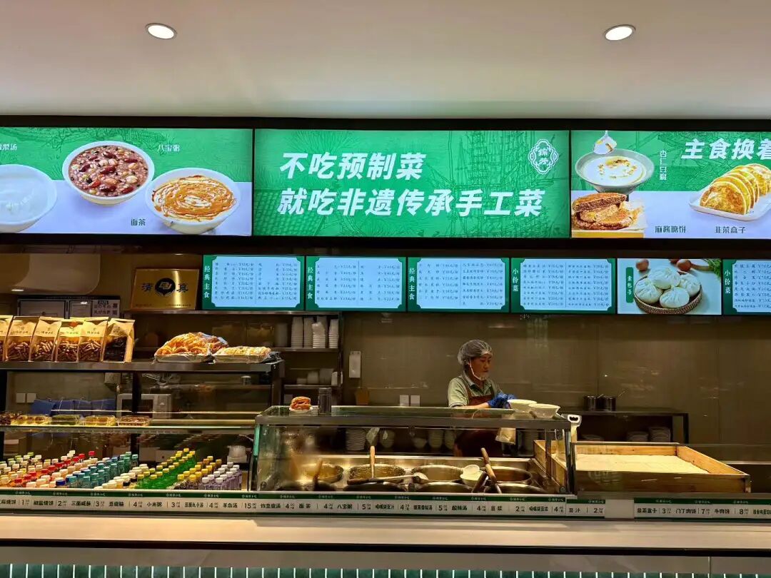
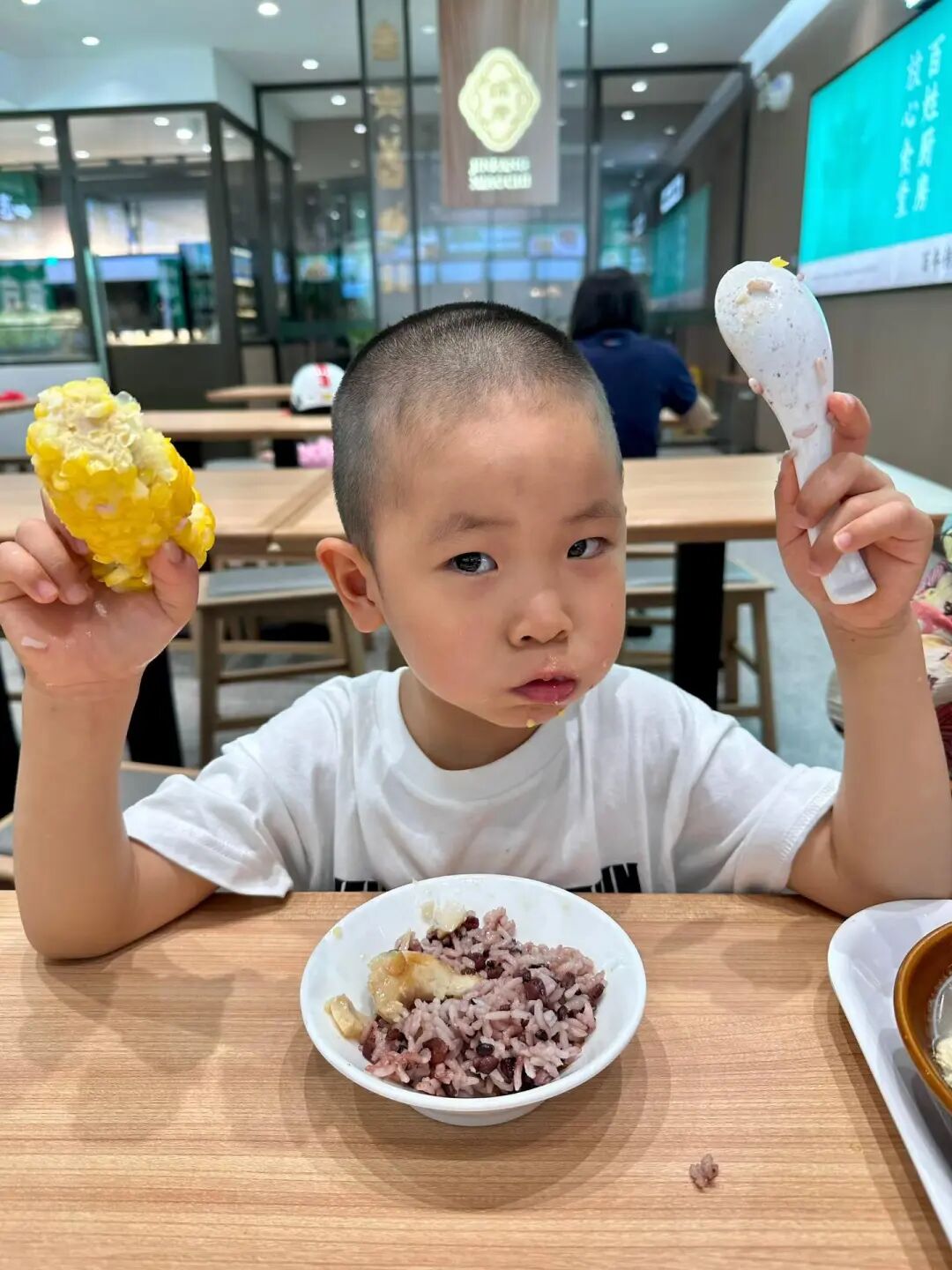
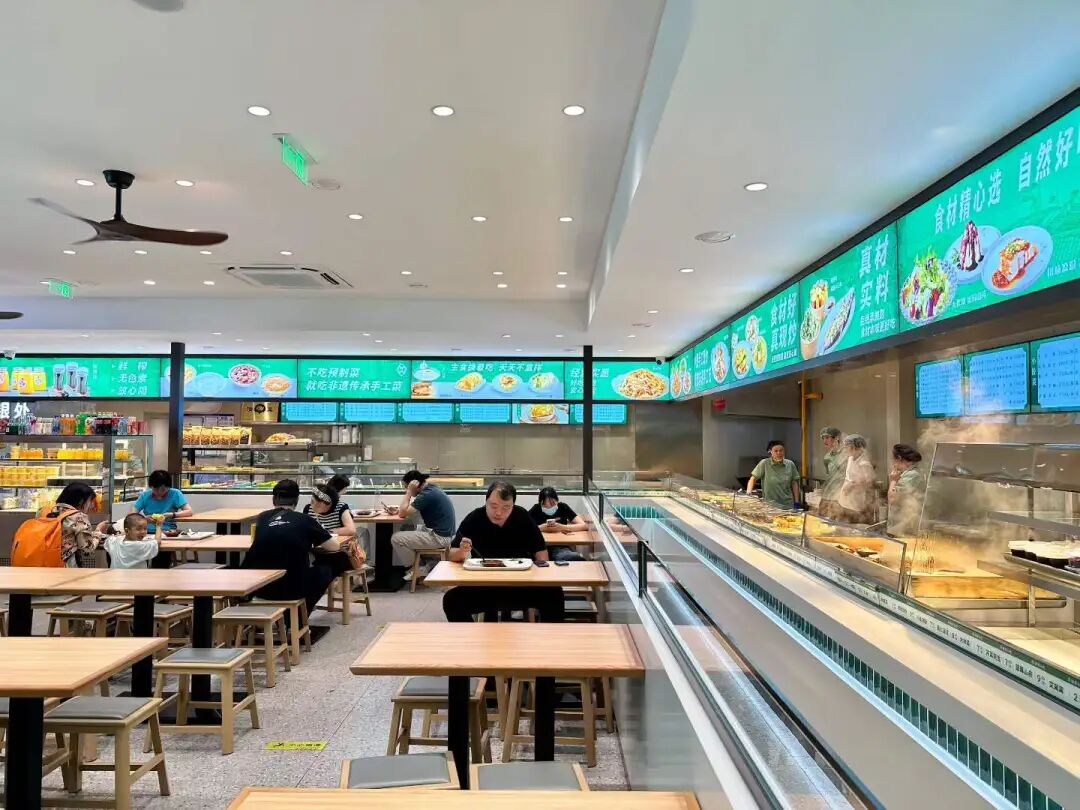
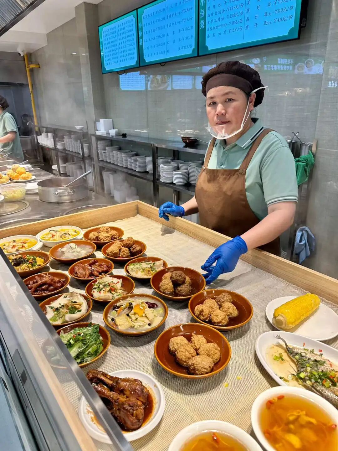
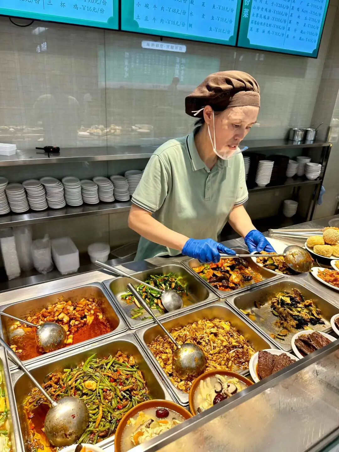
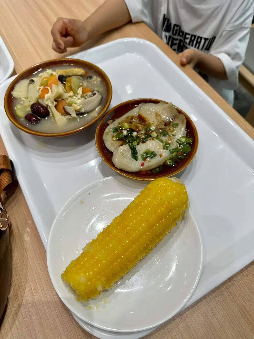
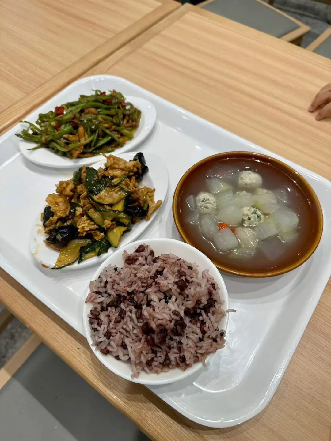
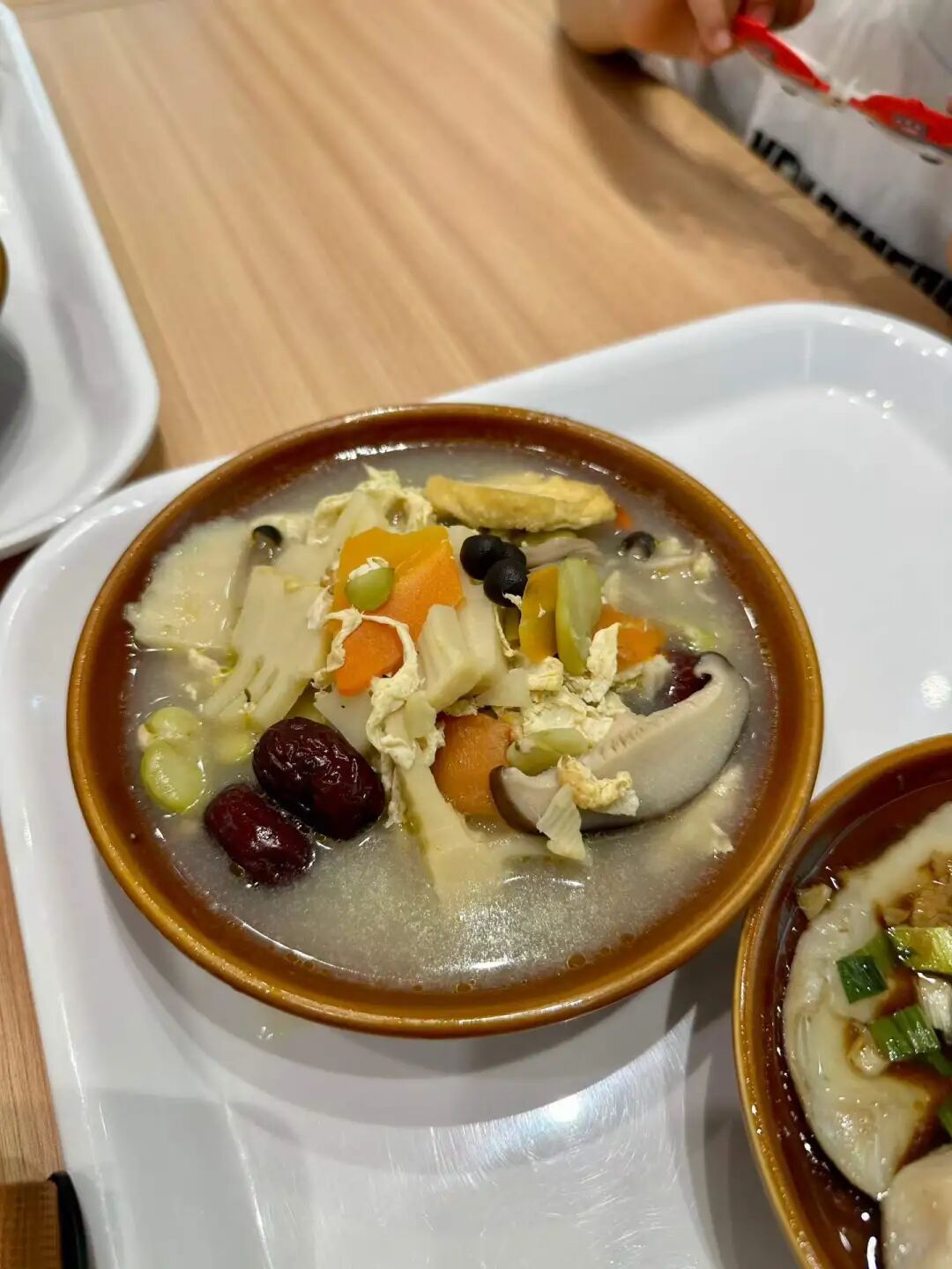
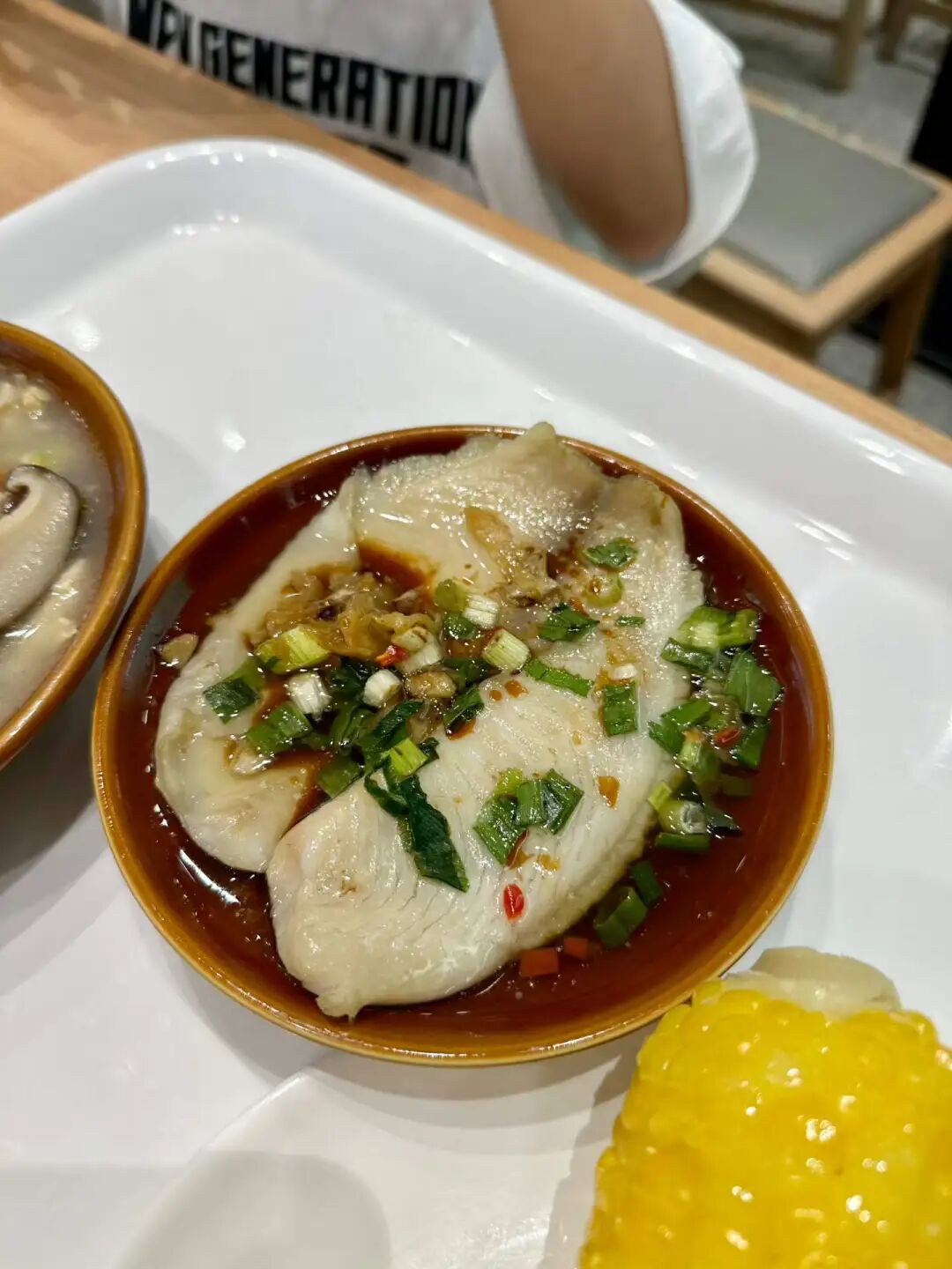
A new shawarma rotisserie shop just opened at the north entrance of Sanlitun SOHO. We went there for dinner; one of the guys working there is from Turkmenistan and the other is from Russia, and almost all the customers were foreigners. The wraps and burgers tasted okay, though the garlic sauce was quite strong. But when we went, they were just starting to roast a new batch of beef, so the pre-sliced beef wasn't very hot. Also, the flatbread wraps they used weren't warm. Still, the vibe is just like a rotisserie shop on a Middle Eastern street; there are no seats, so you grab one to eat on the go and pretend you are in Damascus.
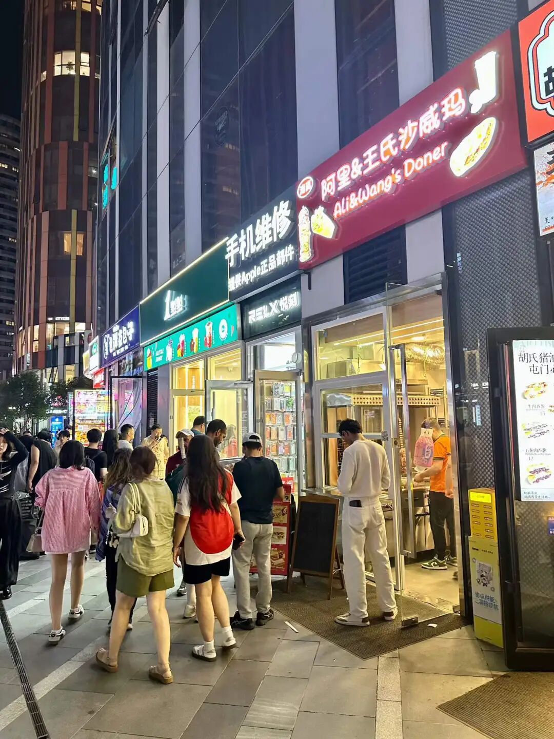
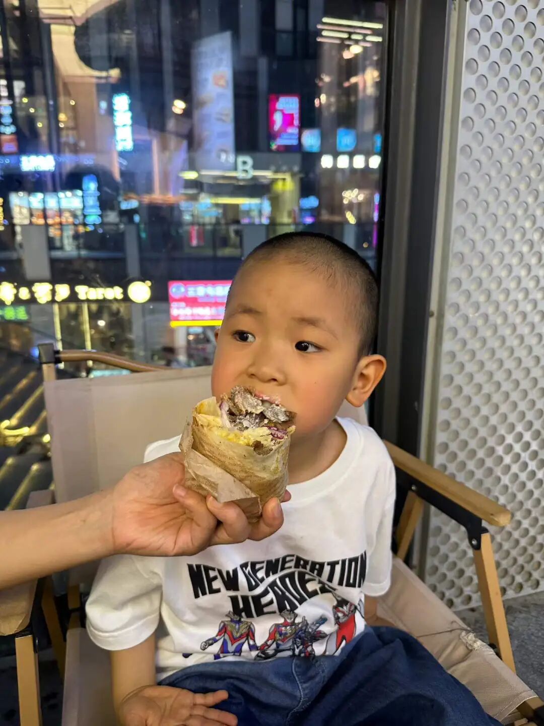
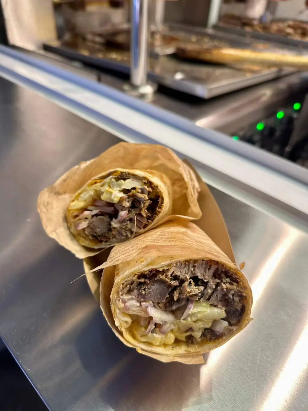
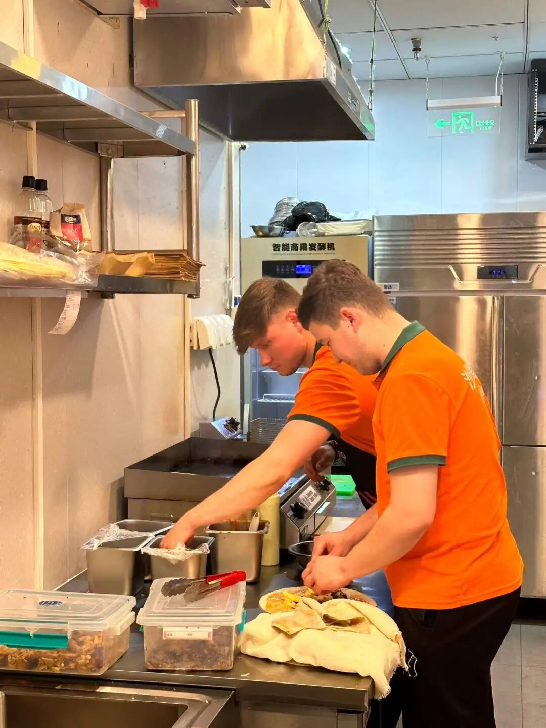
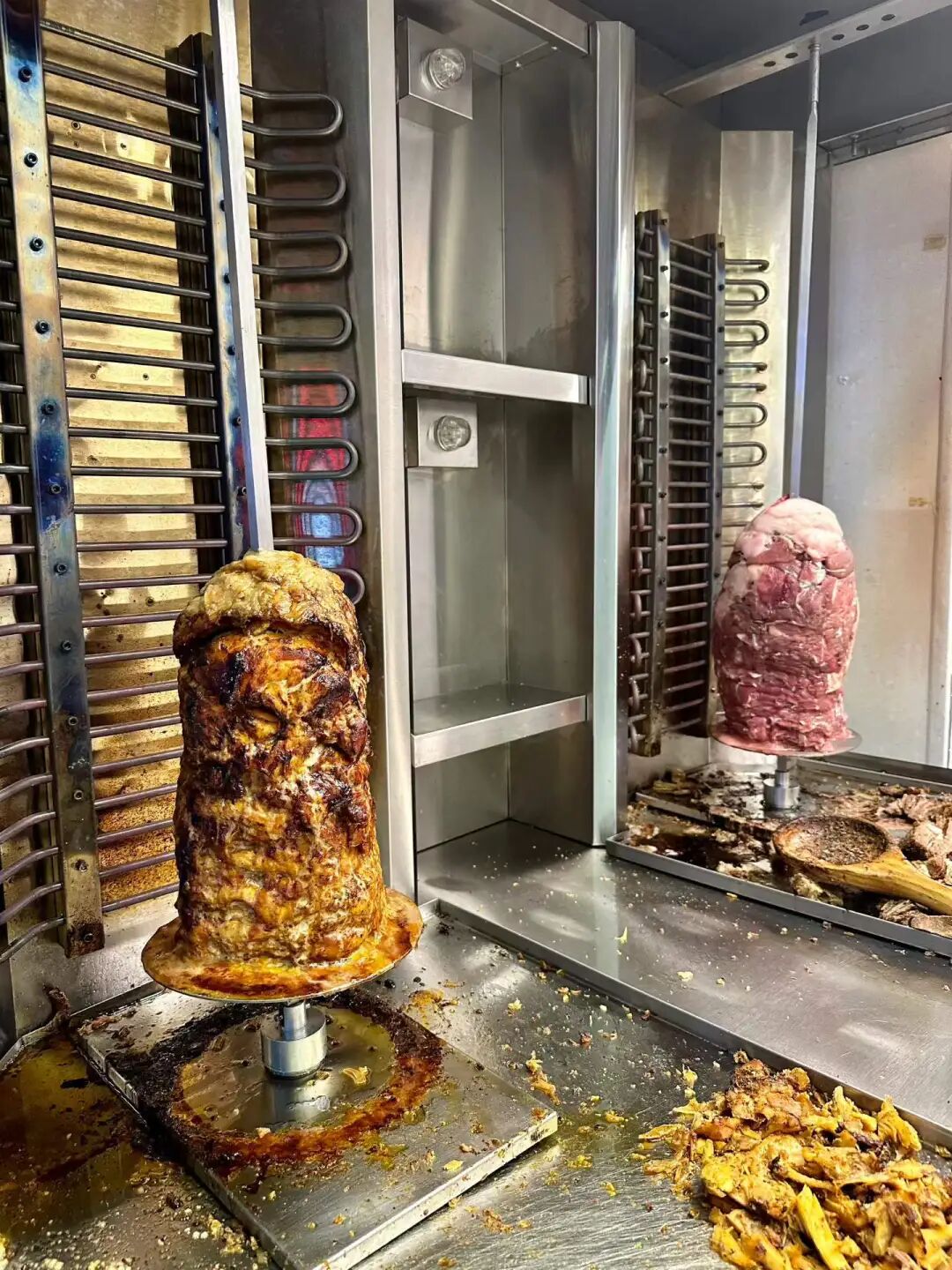
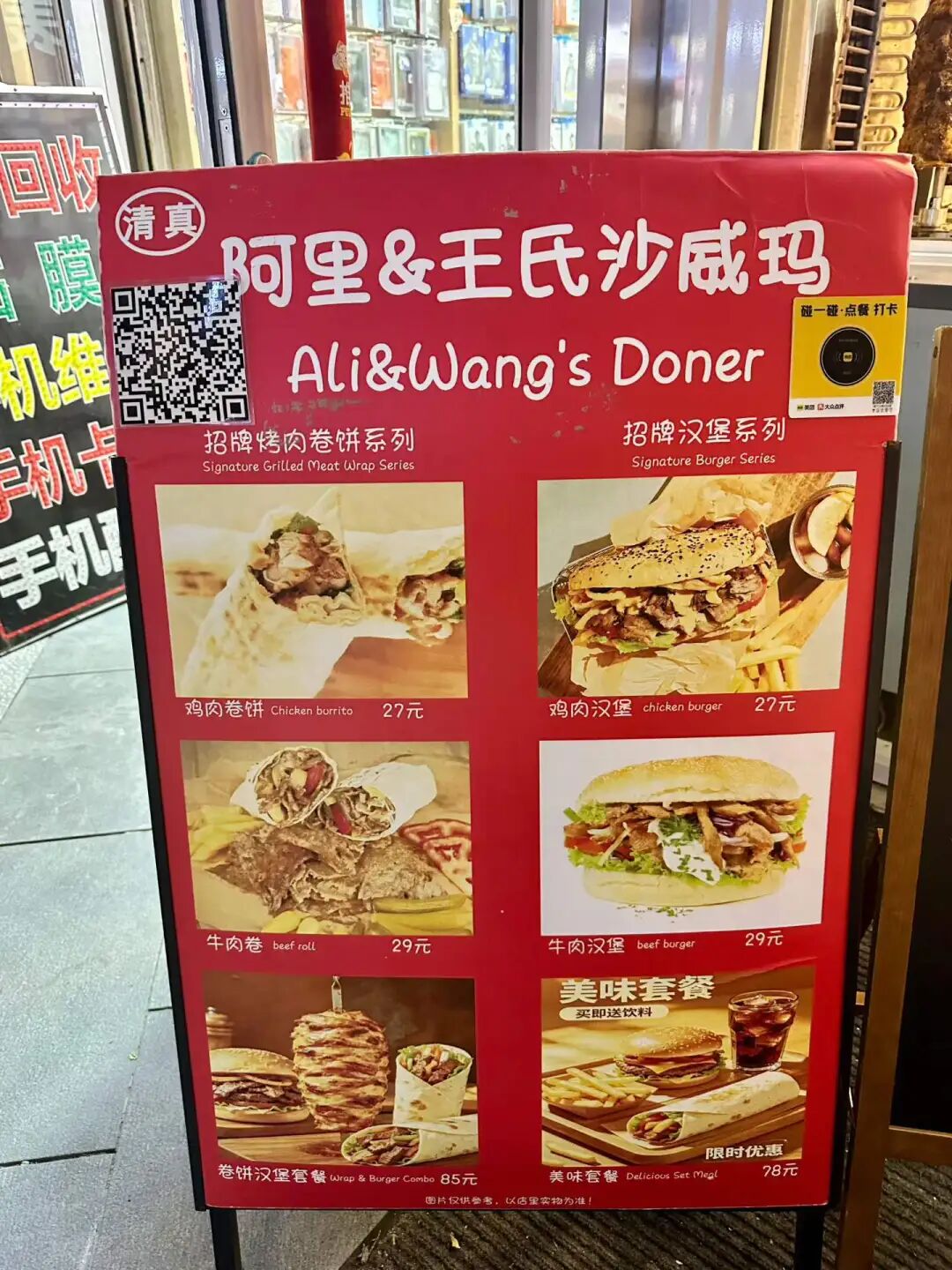
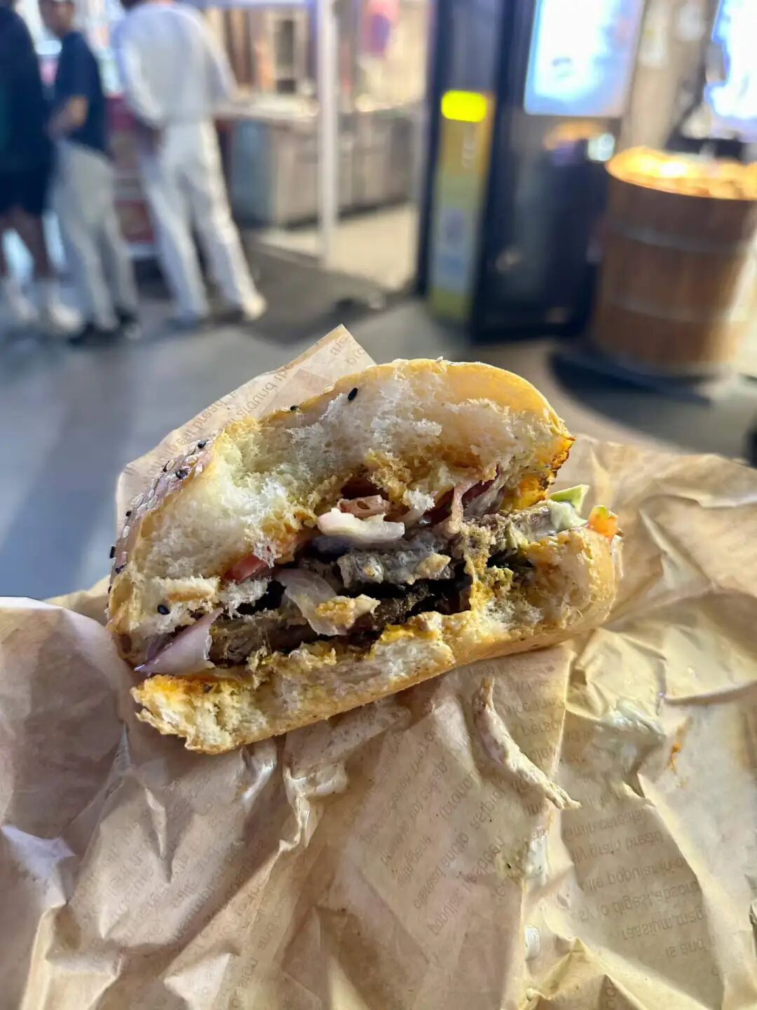
Part 1: 10 halal restaurants in Beijing worth trying: Pakistani restaurant Lahore Courtyard, Henan Jiaozuo beef knife-cut noodles Maimairehong, halal Mongolian food Hulun Aile, West African Ghana Tribe Garden, Xi'an Xing Laosi meatball spicy soup, Xinjiang Changji Jinying meatball soup, Xinjiang Hotan Canteen, Syrian BRBR, Beijing fusion food Gulou Chimian, and Beijing traditional food Xilaisun.
Part 2: 10 halal restaurants in Beijing worth trying (Part 2): UAE restaurant Gulf Mandi Restaurant, Xinjiang Mansion Xihan meatball soup, Xinjiang Mansion lobby Altay afternoon tea, Muhejia revolving hot pot, Xinjiang Urumqi Nazilan (closed), Beijing pastry shop Baoyuanzhai (closed), Pakistani Samosa China-Pakistan Friendship Restaurant, Ma Ye Roast Duck (closed), Bangladeshi Benjibi Restaurant, and Huairou Shihu Cheng Resort.
Part 3: 10 new Beijing restaurants I recently tried. JM Italian Coffee Dongsi branch, halal Hunan-style stir-fry Huixiangyun (now closed) Wangjing branch, Shandong Dezhou Old Ma's lamb soup (yangtang) and steamed dumplings (zhengjiao), Sanlitun Philly cheesesteak (now closed), Pakistani Roma Restaurant (now closed), Muyuzhai garlic lamb intestines (lan suan yang chang), Inner Mongolia Lianying steamed dumplings (shaomai) Caoyuan Shiliuhong, Wangfujing Gansu spicy hot pot (malatang), and Yuezhen Yayuan halal courtyard restaurant.
Part 4: 10 halal restaurants in Beijing worth trying. Hotan rose pilaf (zhua fan) Yizhuang branch, Taiba Western-style bakery, Taiba South Sanlitun Road street shop, Zhaotong small meat skewers Guijie Ganmaya BBQ (now closed), Baixiaobei Heilongjiang BBQ shop, Yunnan Muwenzhai dry-pot beef, Sanlitun Xinjiang restaurant Jiangjiang, Huixiangyun halal Hunan restaurant Zuojiazhuang branch, Yili ice cream shop Bazaar Sweetheart, and Dongzhimen Inner Qianyuan Hotel.
Part 5: 10 halal restaurants in Beijing worth trying. Sandyq Kazakhstan restaurant, Kashgar restaurant, Ahmed restaurant, Jingbalang Naan Bazaar, MacMac Lebanese restaurant, Humaer Xinjiang specialty food, Lao Huihui dumpling restaurant Zoo branch, Fresh Milk Town (now closed) Shuangjing branch, Nawab restaurant, and Liuji Watch Repair BBQ shop.
Part 6: 10 halal restaurants in Beijing worth trying. Hongyunlou Huaiyang cuisine, Sanhe beef noodles (now closed), JM Coffee and Bakery Dajixiang branch, Wanhe fatty beef, Xiangqing roast duck (now closed), Culture Pakistani restaurant, Italian Firenze Western restaurant, Niujie Dashuntang, Zhenweizhai Tianjin cuisine, and Dardanelles children's meal.
Part 7: 10 halal restaurants in Beijing worth trying. JM Western restaurant Chaonei branch, Palestinian restaurant Rose City, Baoding beef soup with flatbread (niurou zhaobing), Pakistani restaurant Al Rayyan, Yili Loulan restaurant Guijie branch, Dianxinyuan Yunnan cuisine, Heilongjiang Suihua restaurant Muxiangyuan, Sanlitun Turkish restaurant, Chaoyangmen fast food stall, and Pakistani buffet Habibi.
Part 8: 10 halal restaurants in Beijing worth trying. Xinjiang Hui Muslim home-style cooking Yige Huangluobo, Liaoning Hui Muslim spicy hot pot (malatang), Hebei Daming Hui Muslim meat pie (roubing) Yimian Liaoyuan (now closed), Hebei Chengde Hui Muslim steamed dumplings (shaomai) Dongtucheng branch, Xilaishun Xisi branch, Longfusi market, Heilongjiang Suihua Hui Muslim Mashi Muxiangyuan Baizhifang branch, Turpan Uyghur restaurant Tianshan, Niujie cafe Sanwanghu, and Heilongjiang Hui Muslim iron pot stew (tieguo dun).
China Mosque Travel Guide: Eight Historic Mosque Complexes in Longhui, Shaoyang, Hunan
Articles • yusuf908 posted the article • 0 comments • 132 views • 2026-06-30 06:24
Summary: This China mosque travel guide covers eight historic mosque complexes in Longhui, Shaoyang, Hunan, with local Hui Muslim heritage and mosque travel details kept in clear English.
This article summarizes the key points about the eight mosques (sifang) in Longhui County, Shaoyang, Hunan. It keeps the original paragraph and image order. It is for readers interested in Muslim life, Islamic culture, and Chinese Islamic writing. It also helps people search for content like Chinese halal food.
Longhui County in Shaoyang City, Hunan, has a large population of Hui Muslims. I visited eight mosques there: Taohuaping Mosque, Shanjie Ancient Mosque, East Mosque, West Mosque, South Mosque, North Mosque, Luobai Mosque, and Niejiaoting Mosque. I will share them with you below.
Shanjie Ancient Mosque in Longhui County, Shaoyang, Hunan, is located in Laowuli, Shanjie Township. It was first built in 1444 (the ninth year of the Zhengtong reign of the Ming Dynasty) and is the oldest mosque in Longhui. During the Hongwu reign of the Ming Dynasty, Ma Zhi, the third son of Ma Cheng, the ancestor of the Ma family Hui Muslims in Shaoyang, moved from Shaoyang to Majia Ferry in Longhui to settle down. He was the first Hui Muslim in Longhui, and Shanjie Ancient Mosque was built by the Ma family.
Shanjie Ancient Mosque was renovated in 1919 and rebuilt into its current appearance in 2018.
Shanjie Ancient Mosque has a long tradition of teaching Islamic scripture. The head imams who have taught there include Ma Yulang, Ma Fujiu, Ma Fucheng, Ma Yucheng, Ma Yaochi, and Ding Zhenyi. They also hired imams from other places like Huang Xingxiang and Li Desheng. Ma Fucheng, an imam from this mosque, taught there for the longest time. In 1945, Imam Ma Yucheng taught at the ancient mosque and recruited many students (hailifan), marking the peak of the mosque's religious activities. To this day, the mosque continues its educational work and has trained many excellent young people.
On September 2, 1939, the Wugang County, Hunan branch of the China Islamic National Salvation Association was officially established at the mosque. The mosque's imam, Ma Fucheng, was elected as an officer. Inspired by the call to resist Japanese aggression and save the country, young Hui Muslims from the mosque, including Ma Qiyun, Ma Wuyang from the North Mosque, and Su Xingmin from Beishan, signed up for the army, took up arms, and headed to the front lines in East China.
Relics at Shanjie Ancient Mosque include stone pillar bases, wood carvings, and calligraphy of the mihrab in the kiln niche.
The stone couplet on the main gate reads: Clear the murky and promote the pure to follow the great path; preserve the truth and remove the false so that every generation has successors. The calligraphy was written by Ma Linyi, a Hui Muslim educator and Minister of Education in Shaoyang during the Republic of China. He is known as the Father of Northwest Education and the founder of modern Chinese Hui Muslim education.
Ma Linyi was born in Shaoyang, Hunan, in 1865. He passed the imperial examinations in 1902 and went to Japan on a government scholarship in 1904 to study teacher training. During that time, he met Sun Yat-sen, joined the Tongmenghui in 1905, and returned home to work on new government policies and modern education. In 1906, he founded Xiejin Primary School in Shaoyang, which was the first modern school for Hui Muslims in Hunan.
In 1908, he was transferred to the Qing government's Ministry of Education as a director. That same year, he helped establish the Beijing First Islamic Primary School inside the Niujie Mosque and later helped found the Islamic Education Association. While serving as Vice Minister of Education in 1912, Ma Linyi founded the Chinese Islamic Progressive Association with the support of Sun Yat-sen and served as its president.
While in charge of education in Gansu, Ma Linyi founded 277 schools of various types and set up the Gansu Islamic Education Promotion Office, spreading over a hundred Islamic primary schools across Gansu, Ningxia, and Qinghai. He selected over a hundred young people from the Northwest for government-funded study abroad, laying the foundation for modern basic education in the Northwest.
In 1928, Ma Linyi helped found the Islamic Middle School in Niujie and served as its vice chairman. In 1929, Ma Linyi became a board member of the Beiping Chengda Teachers' College. He actively updated the curriculum and improved teaching methods, helping Chengda develop into a modern school. In his later years, Ma Linyi devoted himself to the faith and served as an advisor to Wang Jingzhai for his translation of Islamic classics.
Shanjie East Mosque was first built in 1728 (the fifth year of the Yongzheng reign). The mosque has hired many imams over the years, including Su Yuebo, Ma Yulang, Ma Baochu, Zheng Liansheng, Ma Yuechi, Ma Yucheng, Tang Yuanqi, Hai Shiquan, Ma Chengyong, Ding Baohua, Ma Gen'ao, Ma Xiang'ao, and Ma Wuquan. Students from as far as Hainan and Guangxi came to study under the great imam Ma Yucheng in Gansu, and the local religious community was very prosperous.
It is a pity that the mosque was locked when I visited, so I could not go inside.
Shanjie West Mosque, also known as Jiajian Village Mosque, was first built in 1836 (the 16th year of the Daoguang reign). It was expanded during the Guangxu and Republic of China periods, and the local Hui Muslims there are surnamed Ma, Huang, and Zheng. The imams who have served at the mosque include Ma Chaoxin, Zheng Liansheng, Ma Daocheng, Ma Fucheng, and Ma Liangxu. The main hall of the West Mosque collapsed in 1991. It was being rebuilt when a flood destroyed it in 1996. After raising funds again, it was officially completed at the end of 1996 and renovated again in 2013.
The mosque houses a stone tablet from the 11th year of the Guangxu reign titled 'Record of Continued Mosque Repairs,' which lists the names of the donors at that time and serves as a precious historical record.
Shanjie North Mosque, also called Sifangjing Mosque, was first built in 1824 (the 4th year of the Daoguang reign), and the local Hui Muslims there are surnamed Ma. The main hall was destroyed after 1966. It was rebuilt in 1991 and again in 2000, with only the original stone gate pillars remaining. The pillars are carved with a couplet by the Republic of China educator Ma Linyi: 'To study the Way, one must seek the source; why ask about Jesus, Buddha, or the Greeks? To unite with Heaven is to enter the path of the sages; ancient and modern, Chinese and foreign, all share the same principle.'
Regrettably, the Shanjie North Mosque was also locked when I visited, and I could not enter.
Shanjie South Mosque was first built in 1768 (the 33rd year of the Qianlong reign). The local Hui Muslims are surnamed Ma, and the imams who have taught there include Ma Baochu, Zheng Liansheng, Li Bashan, Ma Fucheng, Ma Daocheng, and Ma Fu'en.
Ma Yingdong, a local resident, went to study in Japan in 1905 and joined the Tongmenghui. In 1907, he helped organize the 'Eastern Islamic Education Association' and founded its journal, 'Awakening the Hui' (Xing Hui Pian). After returning home from his studies, Ma Yingdong dedicated himself to Hui Muslim education and founded the modern Gongjin Primary School at Shanjie South Mosque, where he served as principal.
It is a pity that the Shanjie South Mosque was locked when I visited, so I could not go inside.
Luobai Mosque was first built in 1933, and the local community members are of the Ding surname. Hui Muslims moved to Luobai in the early Qing Dynasty. For a long time, they were affiliated with the Shanjie South Mosque, but the distance made it very inconvenient. In 1933, Imam Ding Zhenyi, a Luobai Hui Muslim who taught at the Gansu Hui Language Institute, resigned from his teaching position to return home and organize the construction of a mosque. Imam Ding traveled everywhere to raise funds and finally built Luobai Mosque at the top of the Yaolong residential area in Luobai.
Imam Ding Zhenyi taught at the Luobai village primary school in 1939, and during that time, he started an introductory class for Islamic studies at Luobai Mosque. Later, he served as the imam of Hetian Mosque in Shaoyang and Liutang Mosque in Guilin, Guangxi. He also worked as a teacher at the primary school attached to Guilin Chengda Normal School, dean and professor at the Guilin Hui Language Institute, and professor at the Hainan Hui Language School. He helped organize the Wugang Branch of the Hunan Chapter of the China Islamic National Salvation Association and served as its general secretary.
Luobai Mosque was torn down in 1970, rebuilt in 1985, and rebuilt again in 2000 into the building that stands today. The mosque still has the original door plaque reading "Islamic Mosque" (Qingzhen Jiaotang) and a pair of couplets by the Republican-era educator Ma Linyi: "When seeking the source of the truth, why ask about Jesus, Buddha, or others? To unite with Heaven is to enter the path of the sages; ancient and modern, East and West, the principle is the same."
Niejiaoting Mosque was first built in 1926, and the community members are of the Ma, Hai, and Su surnames. Most of the Hui Muslims in Beishan Township, where Niejiaoting is located, moved there from other places in the late Qing Dynasty. Because it was inconvenient to perform namaz, Ma Youde, Ma Daofeng, Hai Liancheng, and others raised funds to build the mosque. The imams at the mosque include Ma Chunming, Ma Youlin, Imam Bu, Imam Zhang, Hai Siquan, and Deng Mengjun. Niejia Pavilion Mosque was destroyed after 1966, rebuilt later, and then rebuilt again in 2008.
The mosque houses the 1948 "Zhaoxiu Mosque Stele," which serves as a precious historical witness.
Taohuaping Mosque is in the center of the county. It was first built in 1820 (the 25th year of the Jiaqing reign). In 1827 (the 7th year of the Daoguang reign), it was expanded after buying shops owned by the Su and Ma families on the front street. In 1834 (the 14th year of the Daoguang reign), it bought three more shops in front of the mosque. In 1841 (the 21st year of the Daoguang reign), the rear hall was renovated, and in 1850 (the 30th year of the Daoguang reign), the front gate archway, garden, and second gate were built.
In 1941, the Taohuaping branch of the China Islamic National Salvation Association was established inside Taohuaping Mosque. It did a lot of work for anti-Japanese propaganda, provided housing for refugees from other areas, raised money for winter clothes for soldiers, and helped with evacuations. In 1941, Bai Chongxi performed worship at Taohuaping Mosque and issued a plaque stating, "Troops are forbidden from stationing inside the mosque."
Taohuaping Mosque was expanded again in 1953 and was finally rebuilt into its current structure in 2019. Currently, Taohuaping Mosque is the mosque with the second-highest number of visitors in Longhui County, after the ancient Shanjie Mosque.
Taohuaping Mosque preserves a large number of stone tablets from the Qing Dynasty and the Republic of China, which are precious historical records:
The 1859 "Stele for Renovating the Front Gate"
The 1846 "Restoring the School" stele
The 1841 "Renovating the Rear Hall" stele
The 1834 "Righteous School Stele Record"
The 1822 "Everlasting Innovation, Building and Repairing the Everlasting, Immortal Names of Public Donors" stele
The 1928 "School Construction and Repair Stele"
The 1910 "Jingxin Hall" stele
The 1875 stele view all
Summary: This China mosque travel guide covers eight historic mosque complexes in Longhui, Shaoyang, Hunan, with local Hui Muslim heritage and mosque travel details kept in clear English.
This article summarizes the key points about the eight mosques (sifang) in Longhui County, Shaoyang, Hunan. It keeps the original paragraph and image order. It is for readers interested in Muslim life, Islamic culture, and Chinese Islamic writing. It also helps people search for content like Chinese halal food.
Longhui County in Shaoyang City, Hunan, has a large population of Hui Muslims. I visited eight mosques there: Taohuaping Mosque, Shanjie Ancient Mosque, East Mosque, West Mosque, South Mosque, North Mosque, Luobai Mosque, and Niejiaoting Mosque. I will share them with you below.
Shanjie Ancient Mosque in Longhui County, Shaoyang, Hunan, is located in Laowuli, Shanjie Township. It was first built in 1444 (the ninth year of the Zhengtong reign of the Ming Dynasty) and is the oldest mosque in Longhui. During the Hongwu reign of the Ming Dynasty, Ma Zhi, the third son of Ma Cheng, the ancestor of the Ma family Hui Muslims in Shaoyang, moved from Shaoyang to Majia Ferry in Longhui to settle down. He was the first Hui Muslim in Longhui, and Shanjie Ancient Mosque was built by the Ma family.
Shanjie Ancient Mosque was renovated in 1919 and rebuilt into its current appearance in 2018.
Shanjie Ancient Mosque has a long tradition of teaching Islamic scripture. The head imams who have taught there include Ma Yulang, Ma Fujiu, Ma Fucheng, Ma Yucheng, Ma Yaochi, and Ding Zhenyi. They also hired imams from other places like Huang Xingxiang and Li Desheng. Ma Fucheng, an imam from this mosque, taught there for the longest time. In 1945, Imam Ma Yucheng taught at the ancient mosque and recruited many students (hailifan), marking the peak of the mosque's religious activities. To this day, the mosque continues its educational work and has trained many excellent young people.
On September 2, 1939, the Wugang County, Hunan branch of the China Islamic National Salvation Association was officially established at the mosque. The mosque's imam, Ma Fucheng, was elected as an officer. Inspired by the call to resist Japanese aggression and save the country, young Hui Muslims from the mosque, including Ma Qiyun, Ma Wuyang from the North Mosque, and Su Xingmin from Beishan, signed up for the army, took up arms, and headed to the front lines in East China.
Relics at Shanjie Ancient Mosque include stone pillar bases, wood carvings, and calligraphy of the mihrab in the kiln niche.
The stone couplet on the main gate reads: Clear the murky and promote the pure to follow the great path; preserve the truth and remove the false so that every generation has successors. The calligraphy was written by Ma Linyi, a Hui Muslim educator and Minister of Education in Shaoyang during the Republic of China. He is known as the Father of Northwest Education and the founder of modern Chinese Hui Muslim education.
Ma Linyi was born in Shaoyang, Hunan, in 1865. He passed the imperial examinations in 1902 and went to Japan on a government scholarship in 1904 to study teacher training. During that time, he met Sun Yat-sen, joined the Tongmenghui in 1905, and returned home to work on new government policies and modern education. In 1906, he founded Xiejin Primary School in Shaoyang, which was the first modern school for Hui Muslims in Hunan.
In 1908, he was transferred to the Qing government's Ministry of Education as a director. That same year, he helped establish the Beijing First Islamic Primary School inside the Niujie Mosque and later helped found the Islamic Education Association. While serving as Vice Minister of Education in 1912, Ma Linyi founded the Chinese Islamic Progressive Association with the support of Sun Yat-sen and served as its president.
While in charge of education in Gansu, Ma Linyi founded 277 schools of various types and set up the Gansu Islamic Education Promotion Office, spreading over a hundred Islamic primary schools across Gansu, Ningxia, and Qinghai. He selected over a hundred young people from the Northwest for government-funded study abroad, laying the foundation for modern basic education in the Northwest.
In 1928, Ma Linyi helped found the Islamic Middle School in Niujie and served as its vice chairman. In 1929, Ma Linyi became a board member of the Beiping Chengda Teachers' College. He actively updated the curriculum and improved teaching methods, helping Chengda develop into a modern school. In his later years, Ma Linyi devoted himself to the faith and served as an advisor to Wang Jingzhai for his translation of Islamic classics.
Shanjie East Mosque was first built in 1728 (the fifth year of the Yongzheng reign). The mosque has hired many imams over the years, including Su Yuebo, Ma Yulang, Ma Baochu, Zheng Liansheng, Ma Yuechi, Ma Yucheng, Tang Yuanqi, Hai Shiquan, Ma Chengyong, Ding Baohua, Ma Gen'ao, Ma Xiang'ao, and Ma Wuquan. Students from as far as Hainan and Guangxi came to study under the great imam Ma Yucheng in Gansu, and the local religious community was very prosperous.
It is a pity that the mosque was locked when I visited, so I could not go inside.
Shanjie West Mosque, also known as Jiajian Village Mosque, was first built in 1836 (the 16th year of the Daoguang reign). It was expanded during the Guangxu and Republic of China periods, and the local Hui Muslims there are surnamed Ma, Huang, and Zheng. The imams who have served at the mosque include Ma Chaoxin, Zheng Liansheng, Ma Daocheng, Ma Fucheng, and Ma Liangxu. The main hall of the West Mosque collapsed in 1991. It was being rebuilt when a flood destroyed it in 1996. After raising funds again, it was officially completed at the end of 1996 and renovated again in 2013.
The mosque houses a stone tablet from the 11th year of the Guangxu reign titled 'Record of Continued Mosque Repairs,' which lists the names of the donors at that time and serves as a precious historical record.
Shanjie North Mosque, also called Sifangjing Mosque, was first built in 1824 (the 4th year of the Daoguang reign), and the local Hui Muslims there are surnamed Ma. The main hall was destroyed after 1966. It was rebuilt in 1991 and again in 2000, with only the original stone gate pillars remaining. The pillars are carved with a couplet by the Republic of China educator Ma Linyi: 'To study the Way, one must seek the source; why ask about Jesus, Buddha, or the Greeks? To unite with Heaven is to enter the path of the sages; ancient and modern, Chinese and foreign, all share the same principle.'
Regrettably, the Shanjie North Mosque was also locked when I visited, and I could not enter.
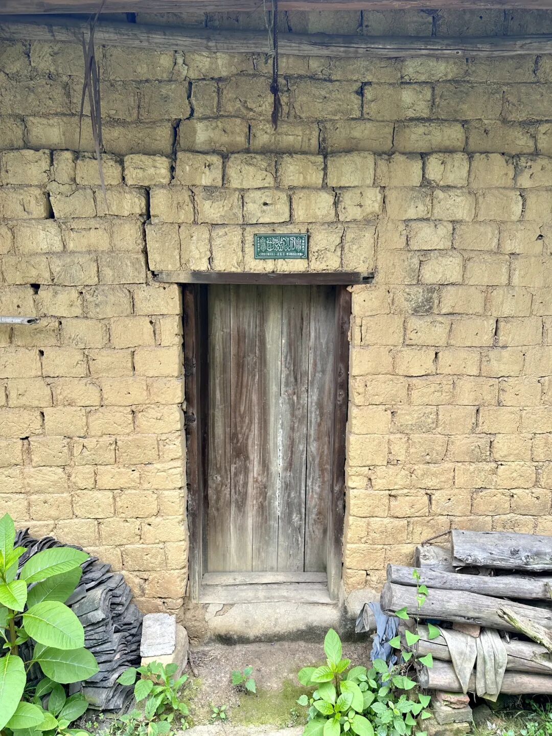
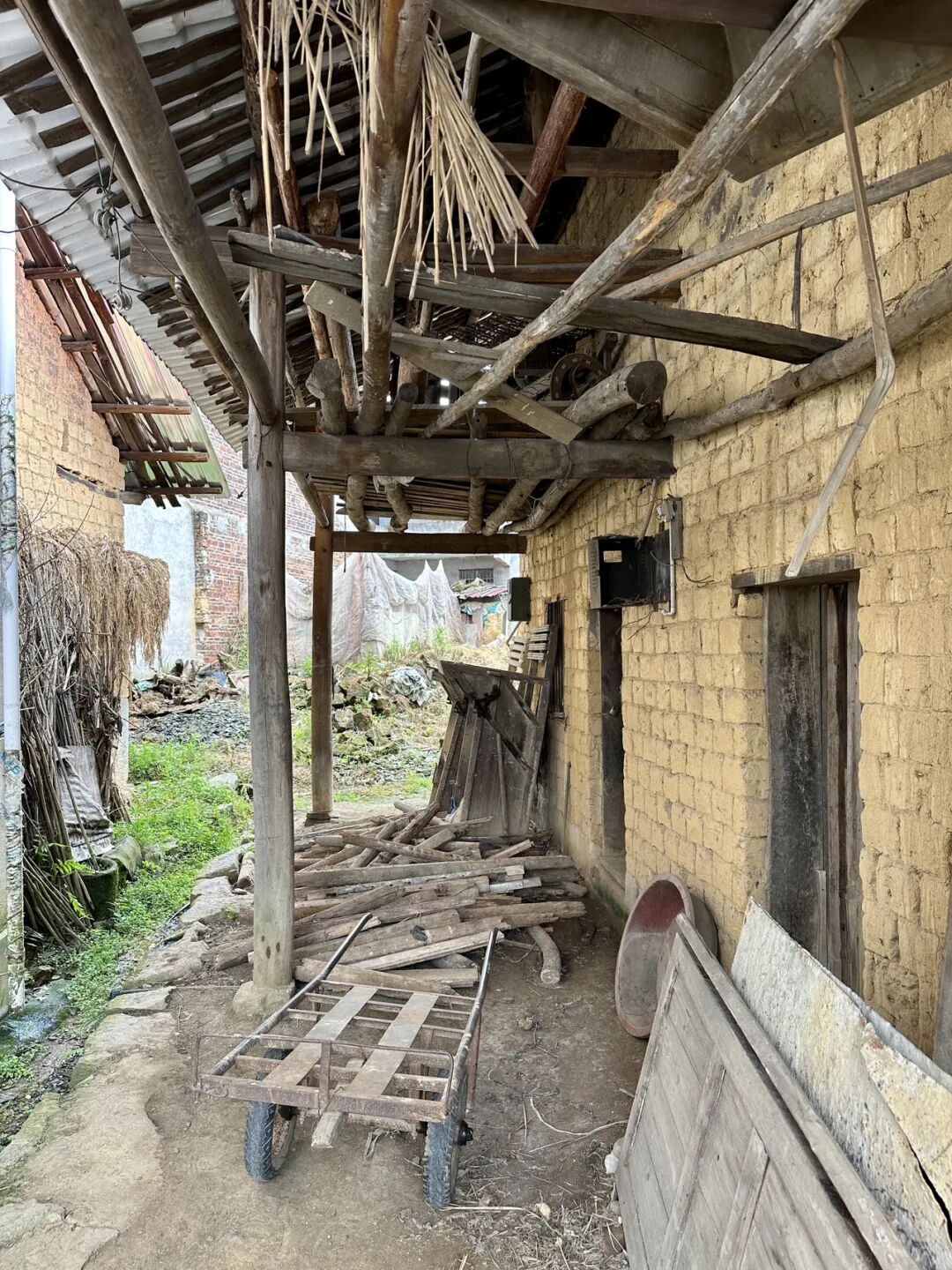
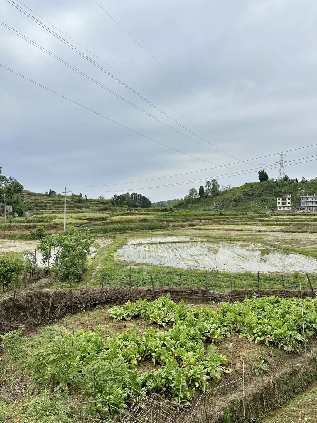
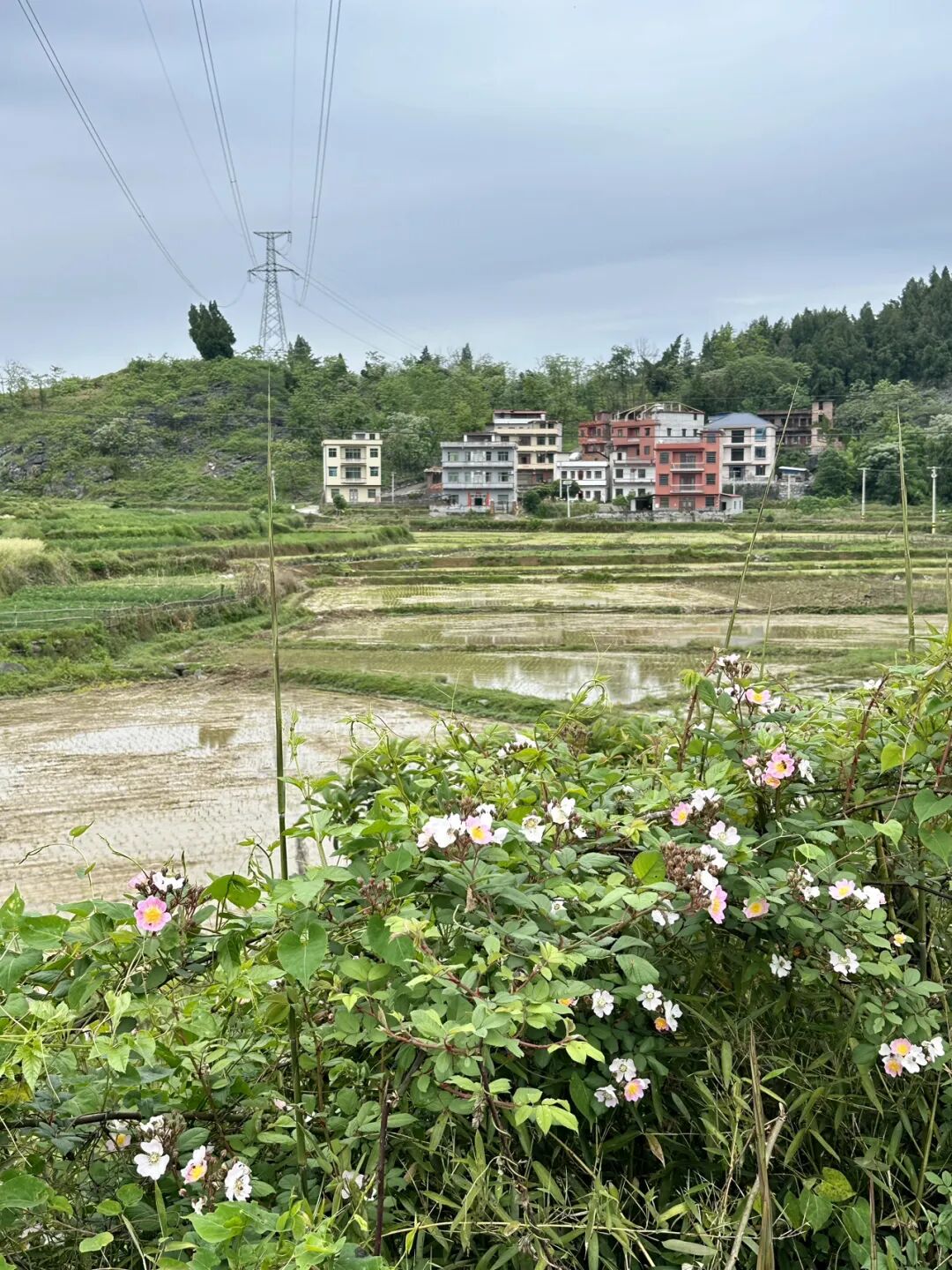
Shanjie South Mosque was first built in 1768 (the 33rd year of the Qianlong reign). The local Hui Muslims are surnamed Ma, and the imams who have taught there include Ma Baochu, Zheng Liansheng, Li Bashan, Ma Fucheng, Ma Daocheng, and Ma Fu'en.
Ma Yingdong, a local resident, went to study in Japan in 1905 and joined the Tongmenghui. In 1907, he helped organize the 'Eastern Islamic Education Association' and founded its journal, 'Awakening the Hui' (Xing Hui Pian). After returning home from his studies, Ma Yingdong dedicated himself to Hui Muslim education and founded the modern Gongjin Primary School at Shanjie South Mosque, where he served as principal.
It is a pity that the Shanjie South Mosque was locked when I visited, so I could not go inside.
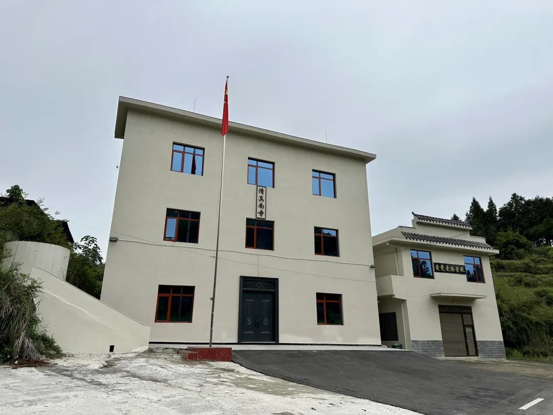
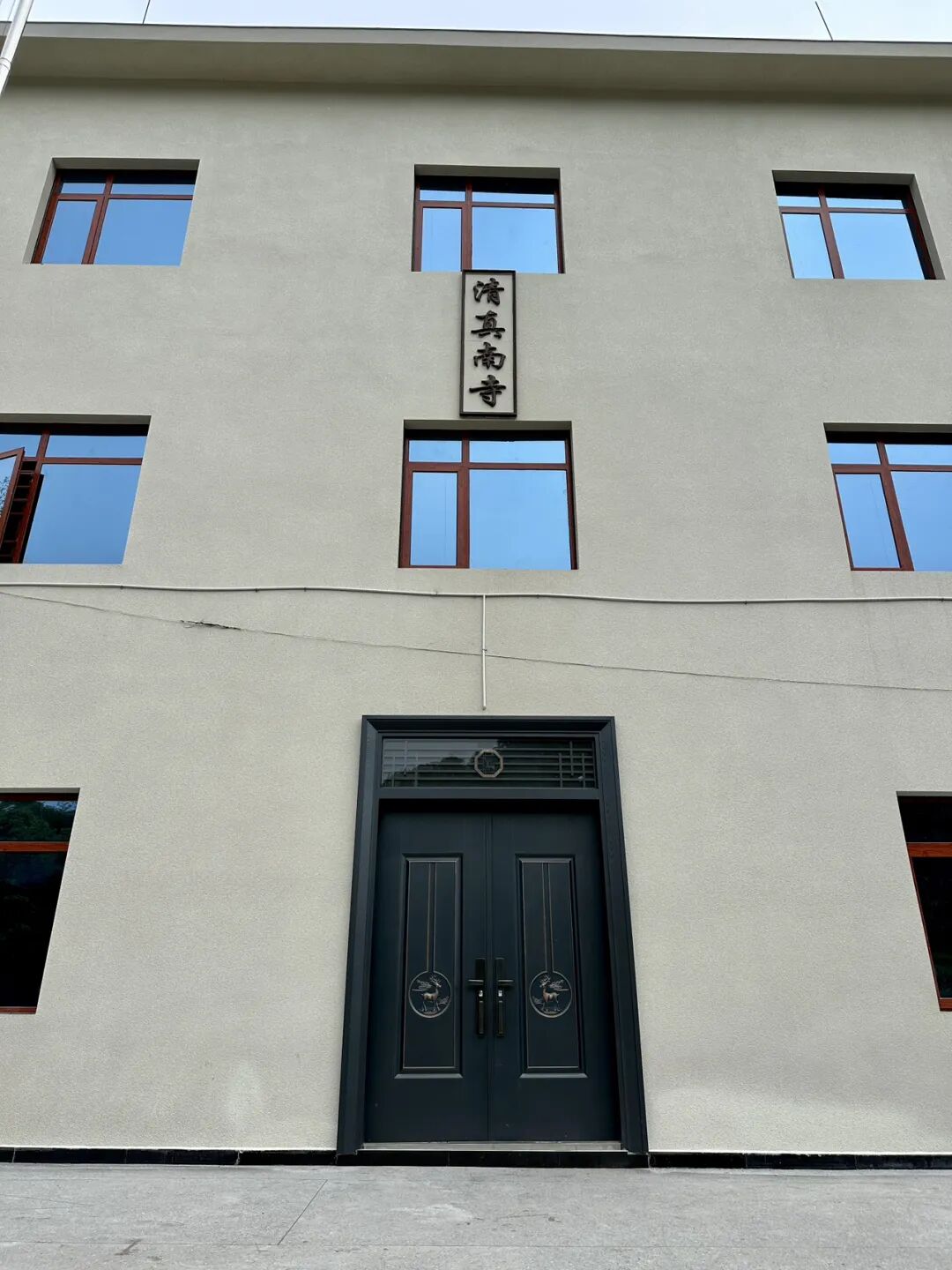
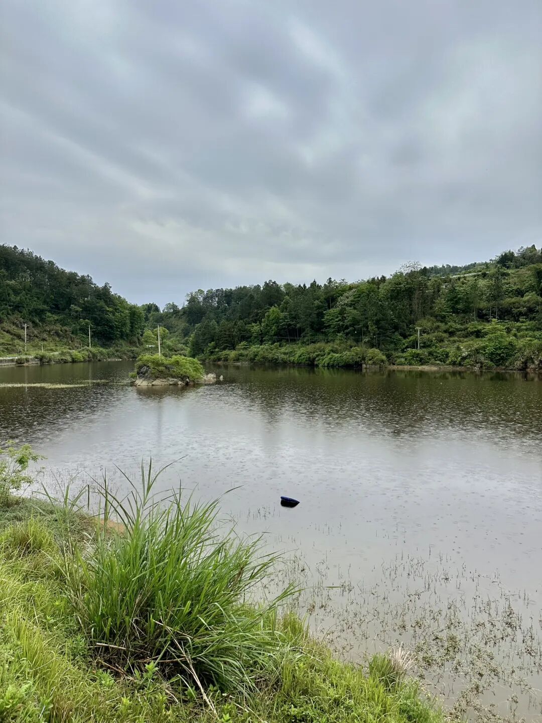
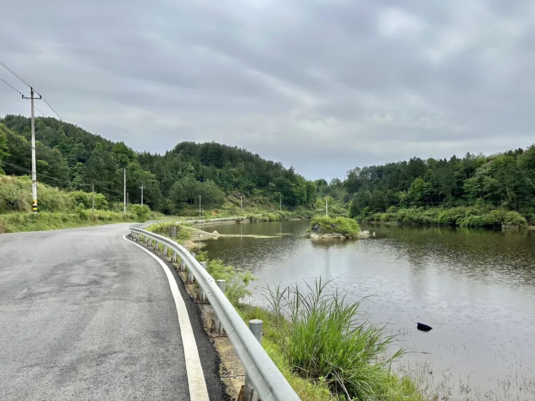
Luobai Mosque was first built in 1933, and the local community members are of the Ding surname. Hui Muslims moved to Luobai in the early Qing Dynasty. For a long time, they were affiliated with the Shanjie South Mosque, but the distance made it very inconvenient. In 1933, Imam Ding Zhenyi, a Luobai Hui Muslim who taught at the Gansu Hui Language Institute, resigned from his teaching position to return home and organize the construction of a mosque. Imam Ding traveled everywhere to raise funds and finally built Luobai Mosque at the top of the Yaolong residential area in Luobai.
Imam Ding Zhenyi taught at the Luobai village primary school in 1939, and during that time, he started an introductory class for Islamic studies at Luobai Mosque. Later, he served as the imam of Hetian Mosque in Shaoyang and Liutang Mosque in Guilin, Guangxi. He also worked as a teacher at the primary school attached to Guilin Chengda Normal School, dean and professor at the Guilin Hui Language Institute, and professor at the Hainan Hui Language School. He helped organize the Wugang Branch of the Hunan Chapter of the China Islamic National Salvation Association and served as its general secretary.
Luobai Mosque was torn down in 1970, rebuilt in 1985, and rebuilt again in 2000 into the building that stands today. The mosque still has the original door plaque reading "Islamic Mosque" (Qingzhen Jiaotang) and a pair of couplets by the Republican-era educator Ma Linyi: "When seeking the source of the truth, why ask about Jesus, Buddha, or others? To unite with Heaven is to enter the path of the sages; ancient and modern, East and West, the principle is the same."
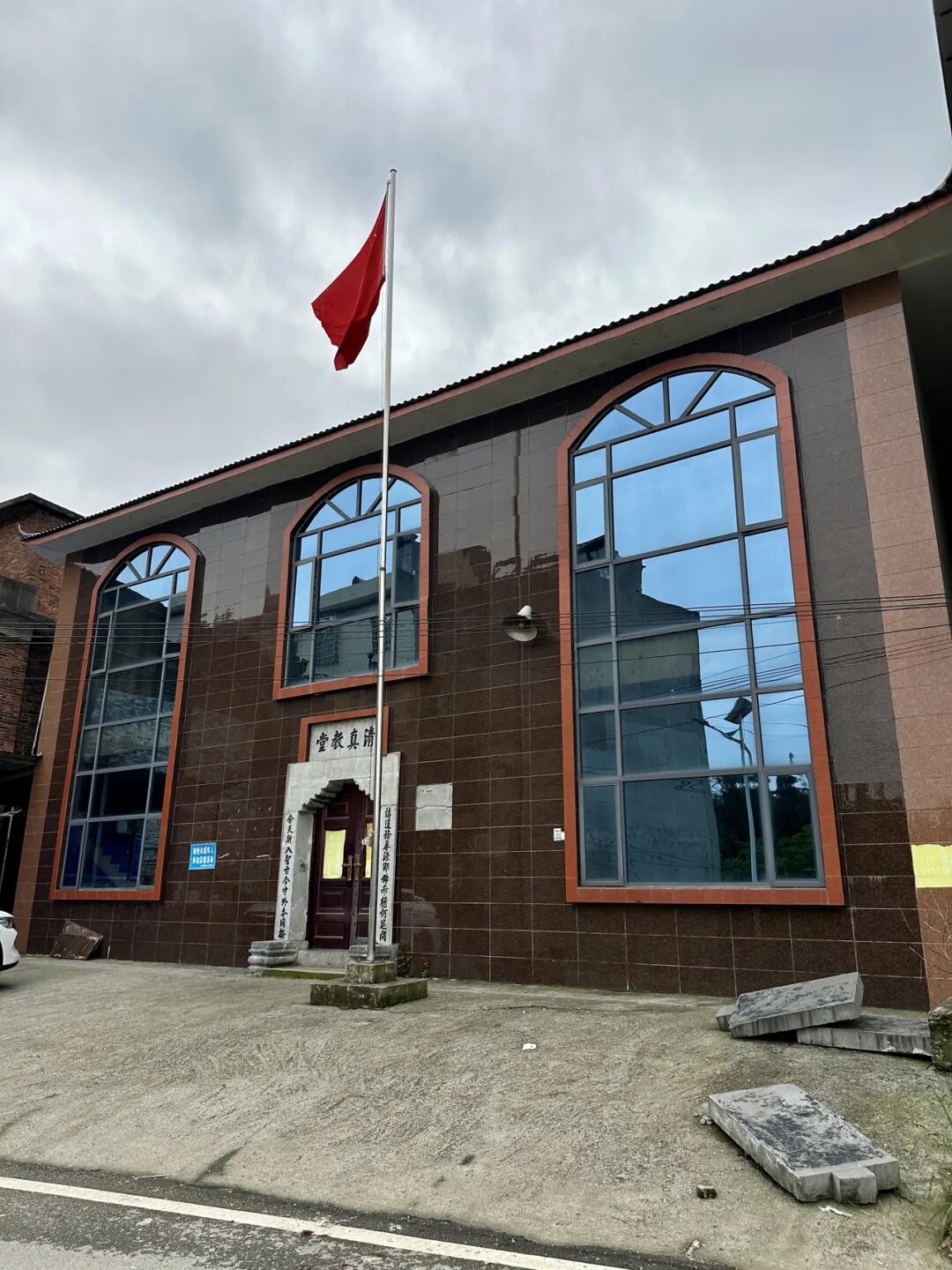
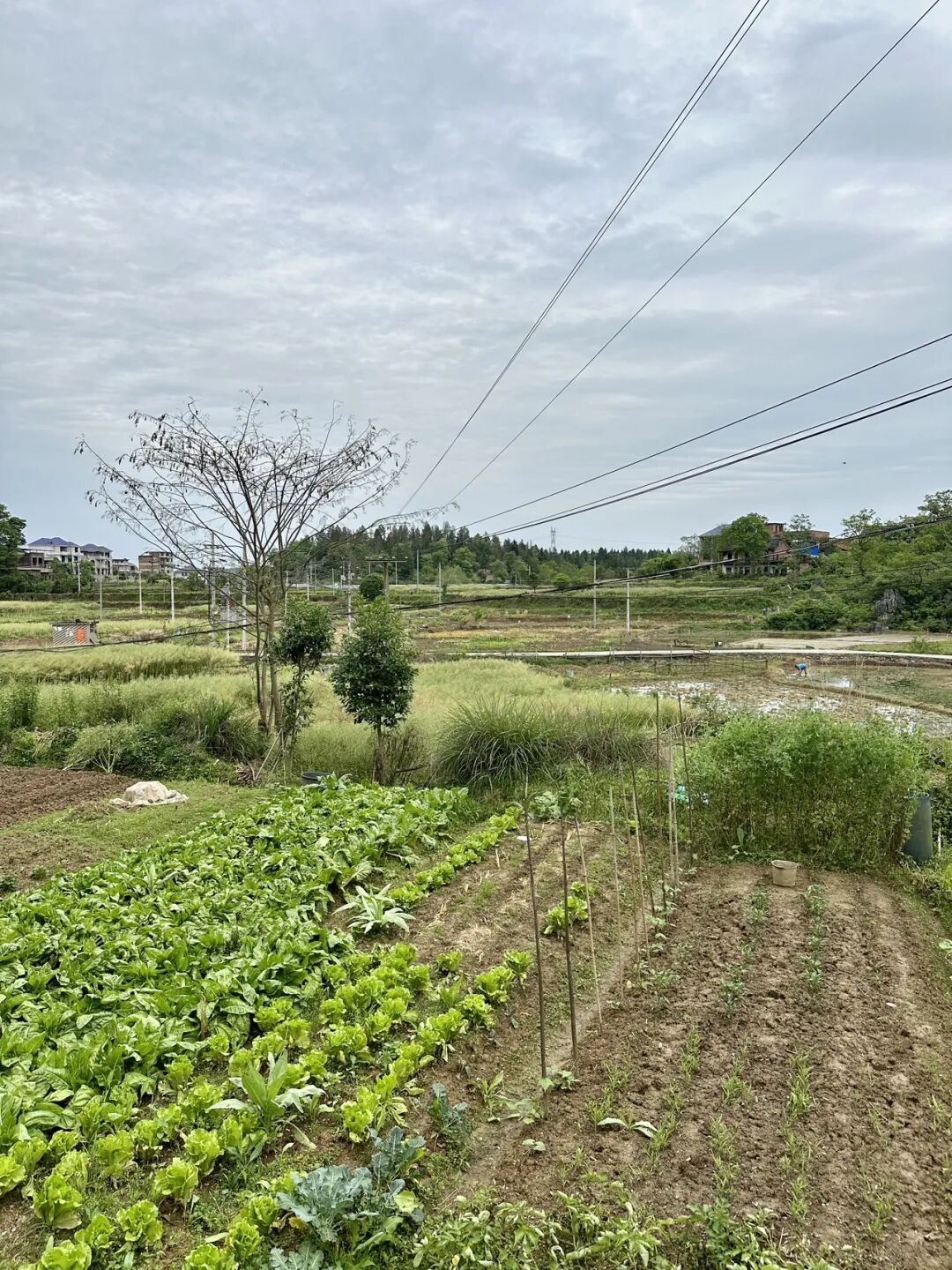
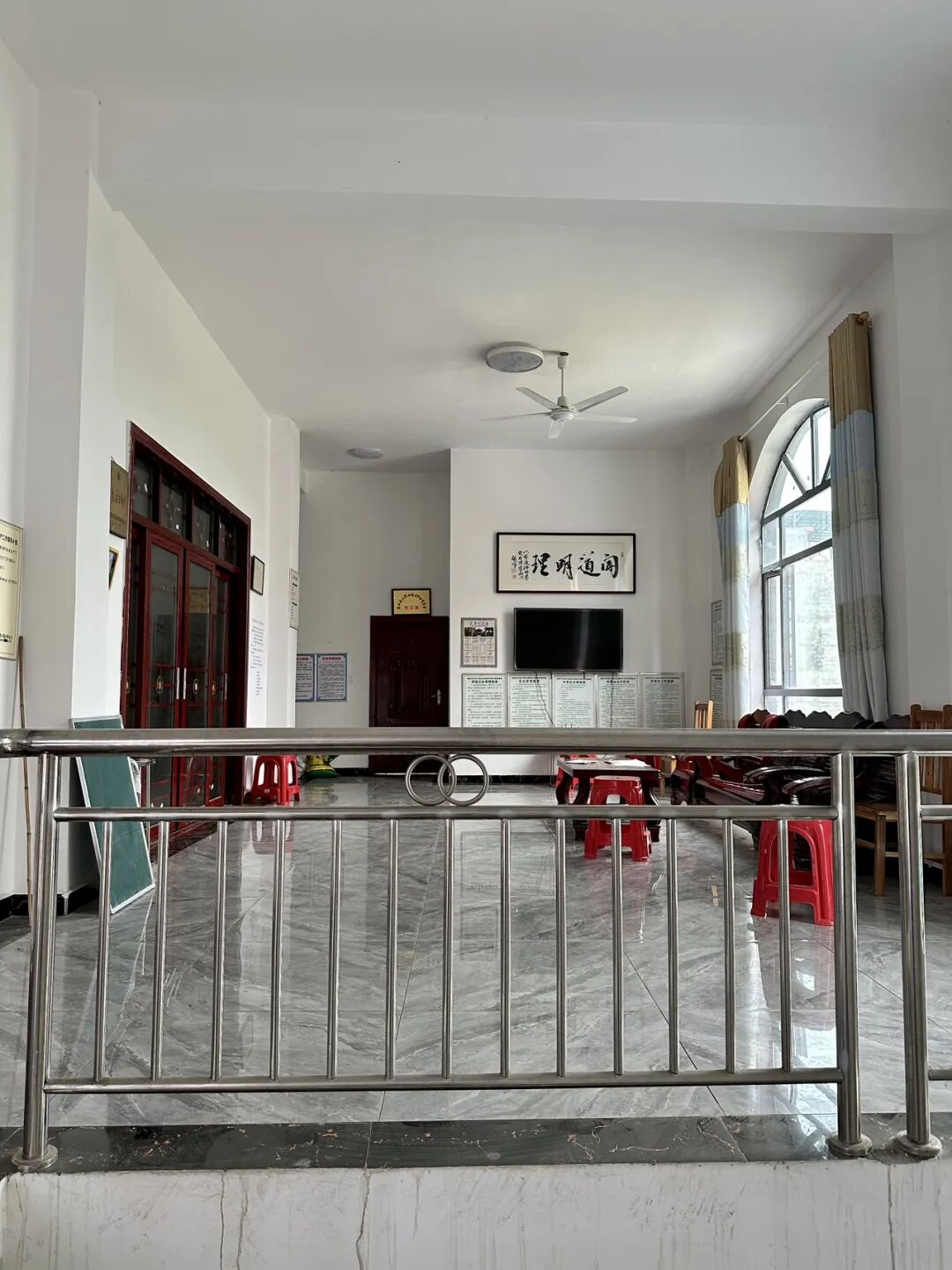
Niejiaoting Mosque was first built in 1926, and the community members are of the Ma, Hai, and Su surnames. Most of the Hui Muslims in Beishan Township, where Niejiaoting is located, moved there from other places in the late Qing Dynasty. Because it was inconvenient to perform namaz, Ma Youde, Ma Daofeng, Hai Liancheng, and others raised funds to build the mosque. The imams at the mosque include Ma Chunming, Ma Youlin, Imam Bu, Imam Zhang, Hai Siquan, and Deng Mengjun. Niejia Pavilion Mosque was destroyed after 1966, rebuilt later, and then rebuilt again in 2008.
The mosque houses the 1948 "Zhaoxiu Mosque Stele," which serves as a precious historical witness.
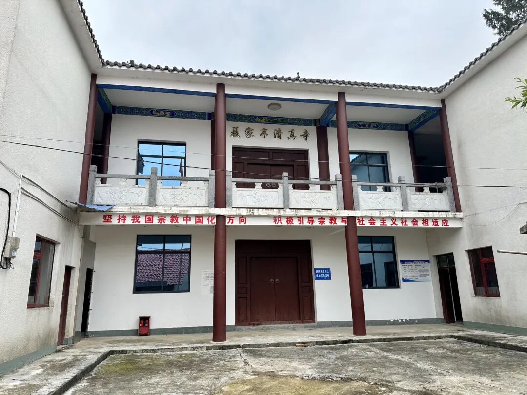
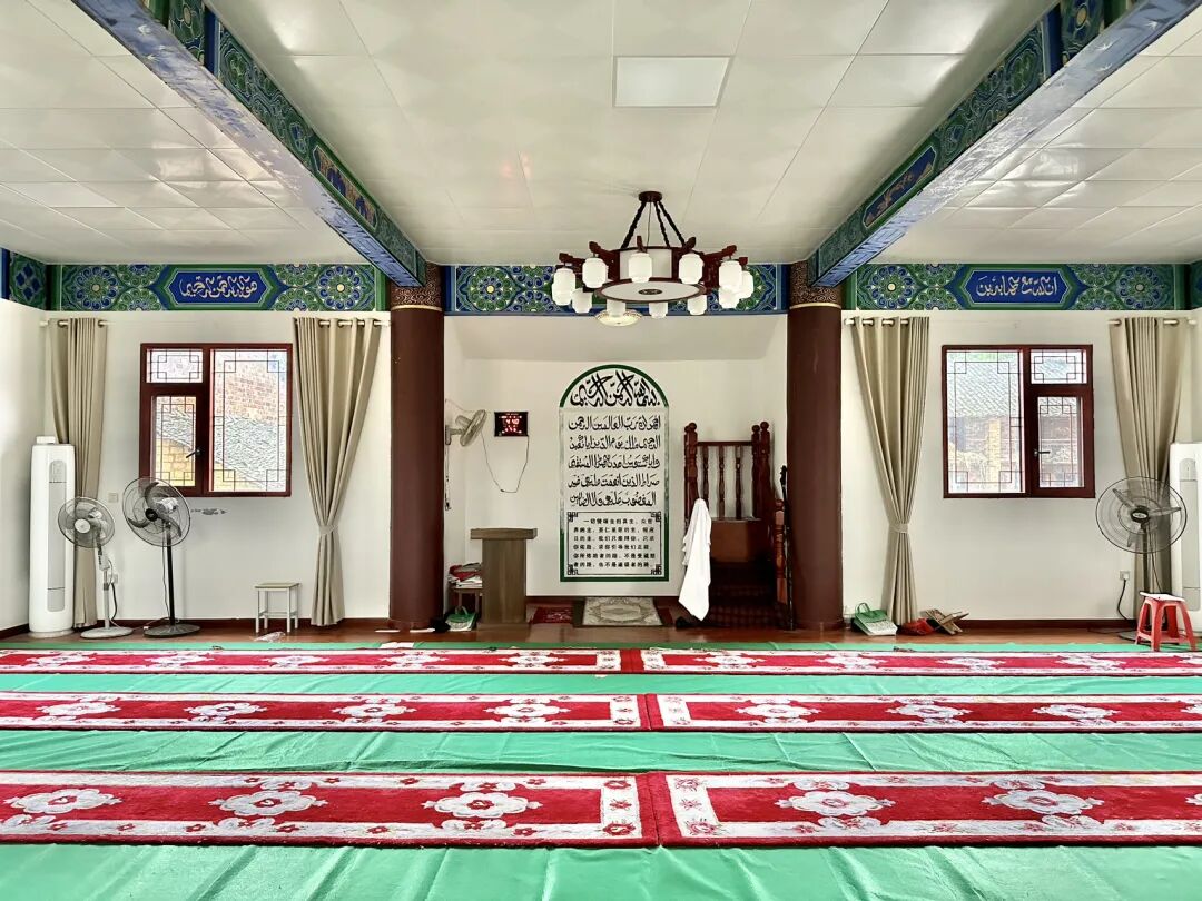
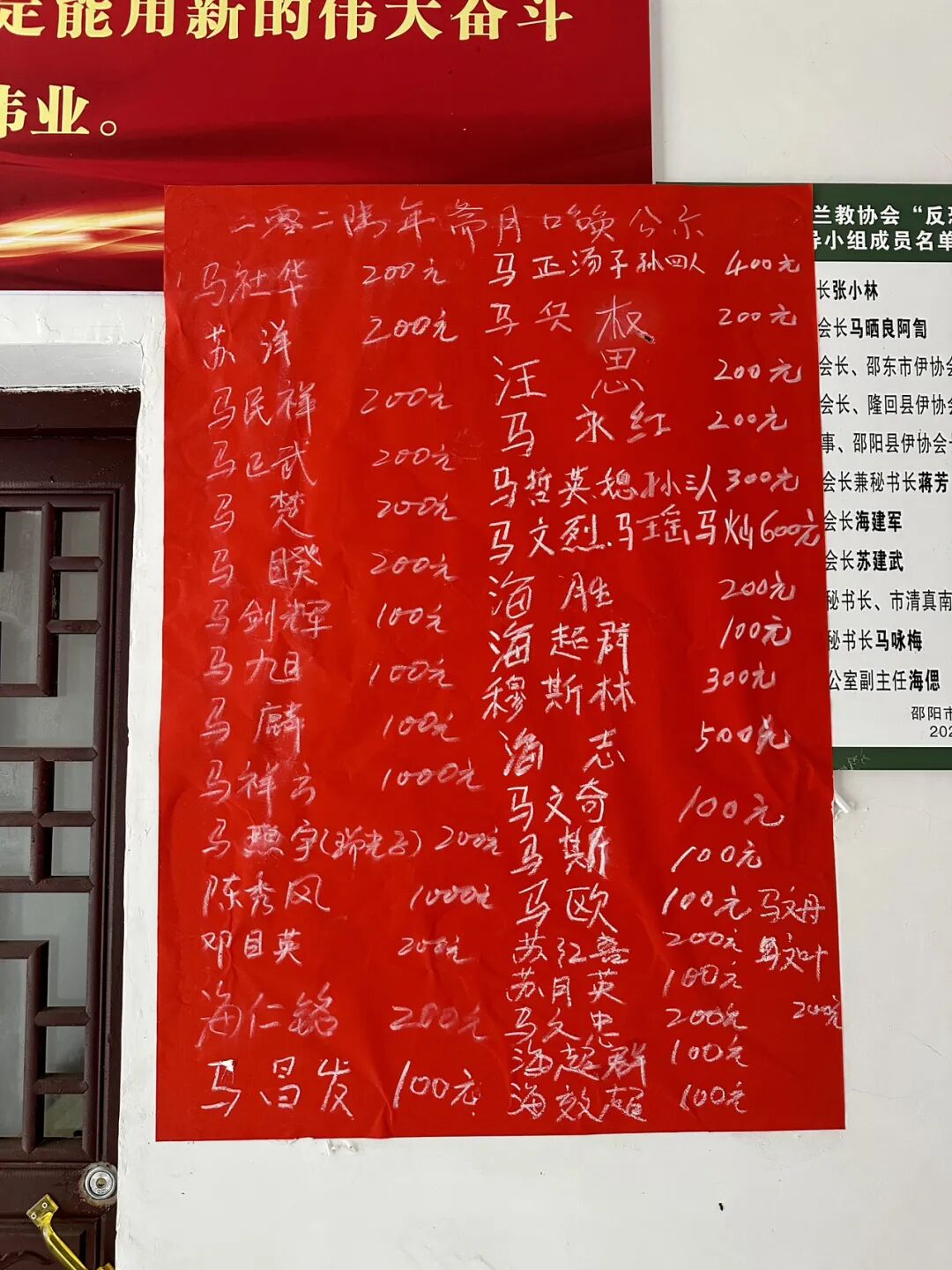
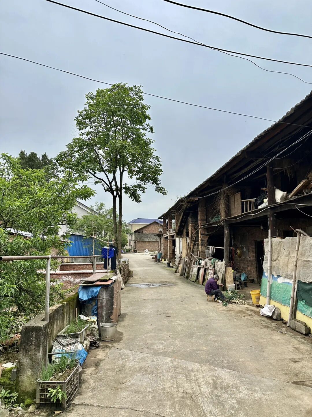
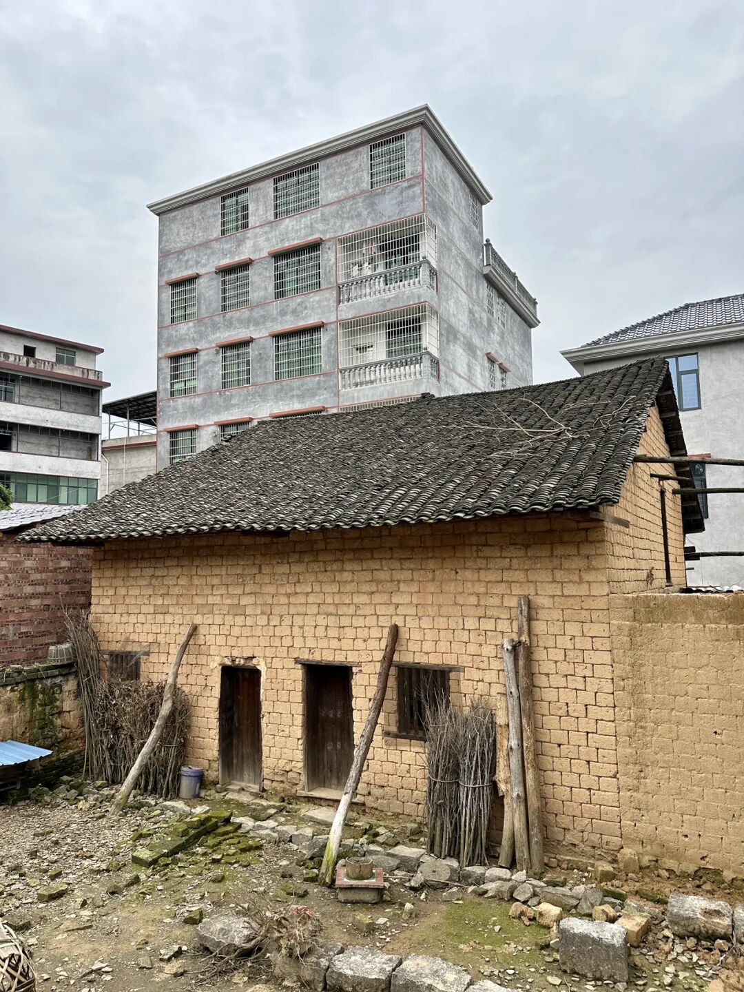
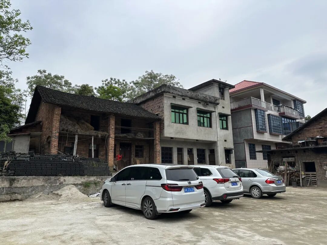
Taohuaping Mosque is in the center of the county. It was first built in 1820 (the 25th year of the Jiaqing reign). In 1827 (the 7th year of the Daoguang reign), it was expanded after buying shops owned by the Su and Ma families on the front street. In 1834 (the 14th year of the Daoguang reign), it bought three more shops in front of the mosque. In 1841 (the 21st year of the Daoguang reign), the rear hall was renovated, and in 1850 (the 30th year of the Daoguang reign), the front gate archway, garden, and second gate were built.
In 1941, the Taohuaping branch of the China Islamic National Salvation Association was established inside Taohuaping Mosque. It did a lot of work for anti-Japanese propaganda, provided housing for refugees from other areas, raised money for winter clothes for soldiers, and helped with evacuations. In 1941, Bai Chongxi performed worship at Taohuaping Mosque and issued a plaque stating, "Troops are forbidden from stationing inside the mosque."
Taohuaping Mosque was expanded again in 1953 and was finally rebuilt into its current structure in 2019. Currently, Taohuaping Mosque is the mosque with the second-highest number of visitors in Longhui County, after the ancient Shanjie Mosque.
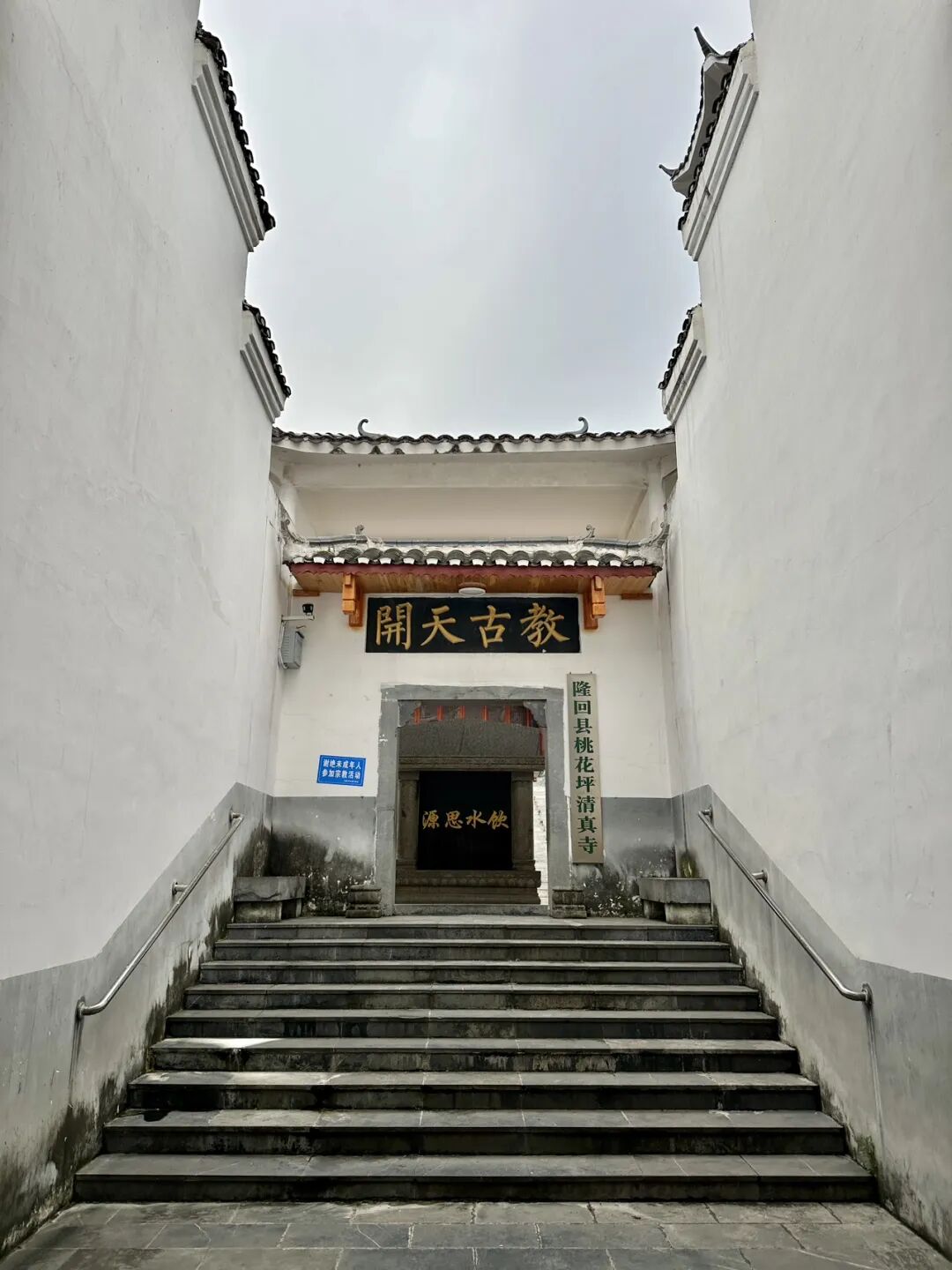
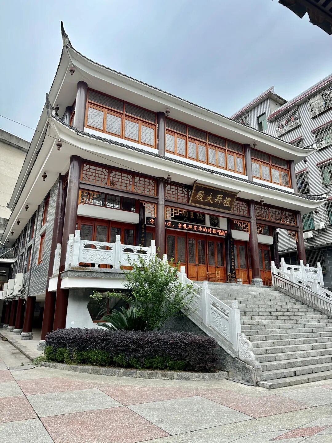
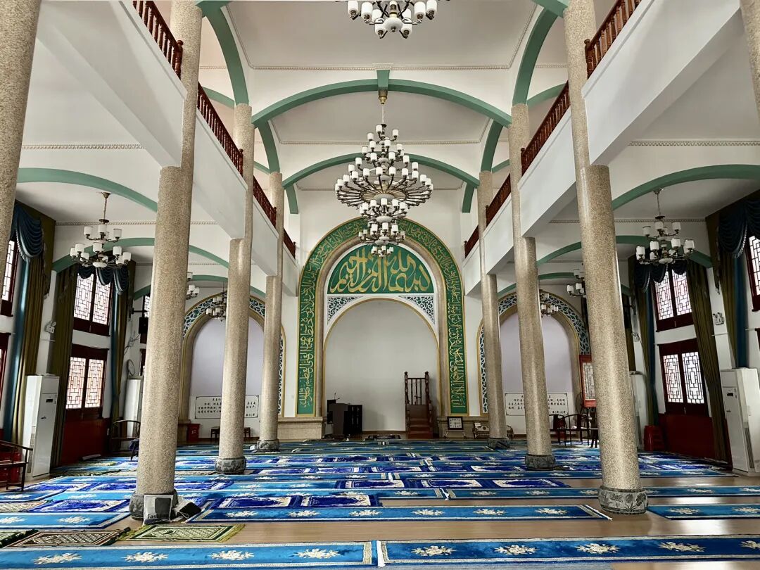
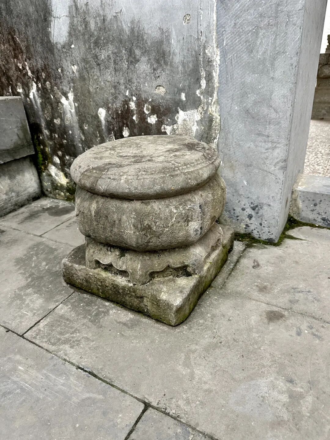
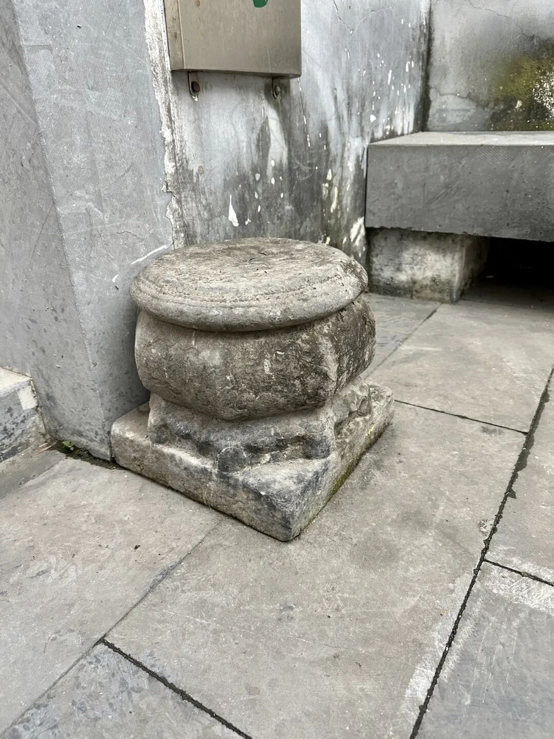
Taohuaping Mosque preserves a large number of stone tablets from the Qing Dynasty and the Republic of China, which are precious historical records:
The 1859 "Stele for Renovating the Front Gate"
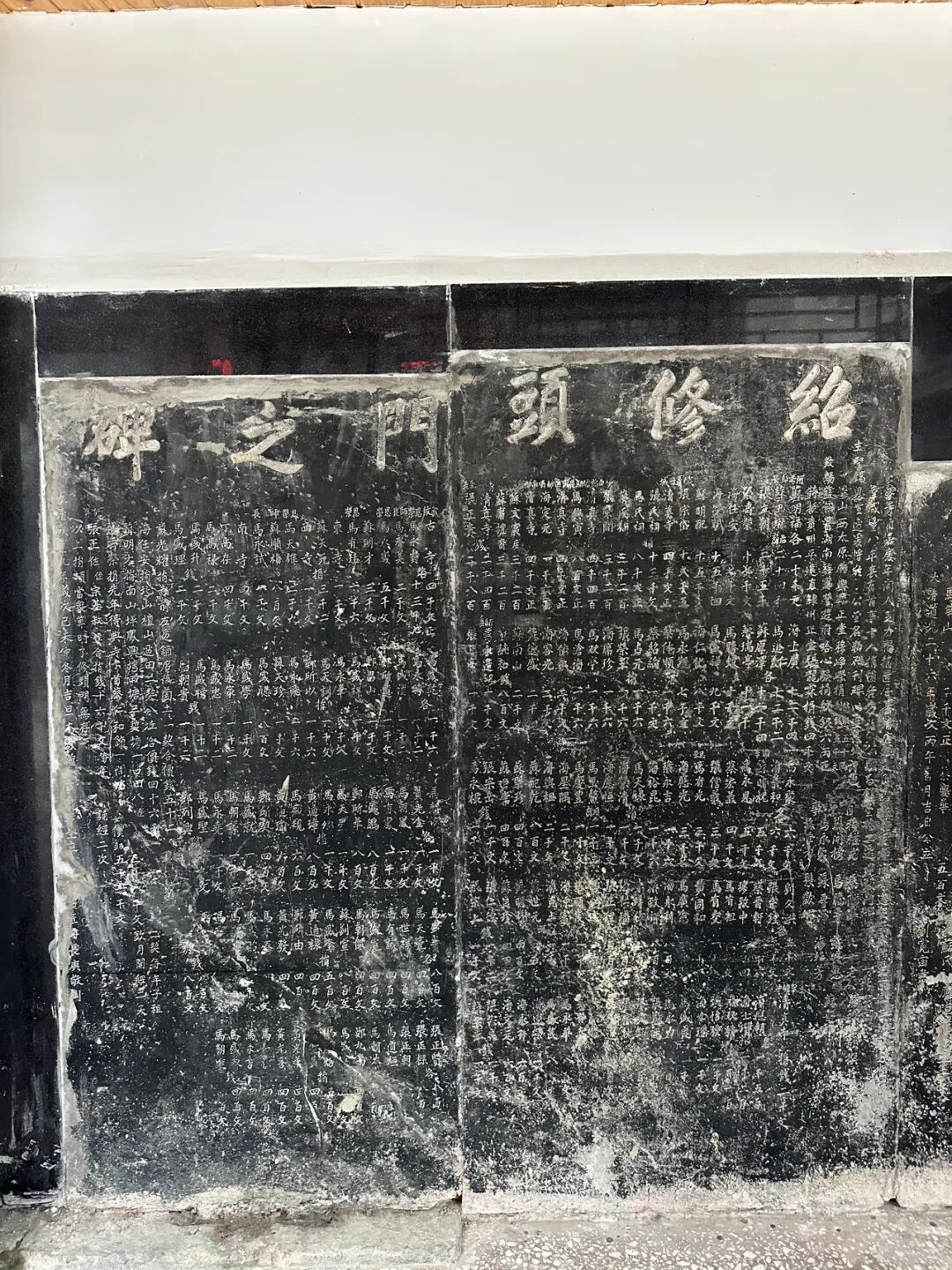
The 1846 "Restoring the School" stele
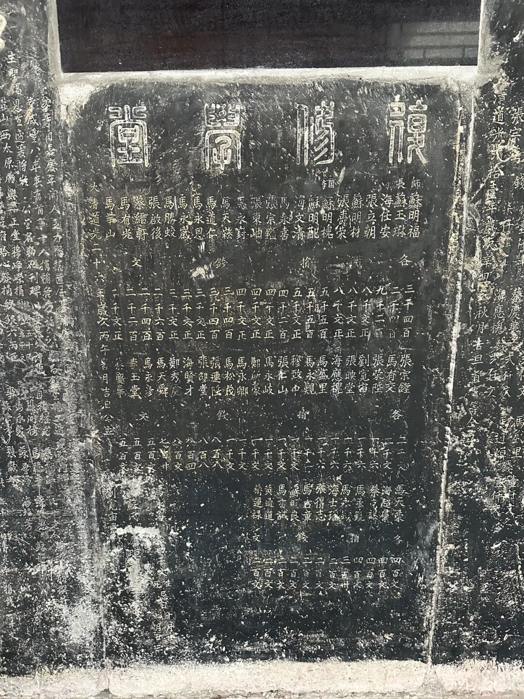
The 1841 "Renovating the Rear Hall" stele
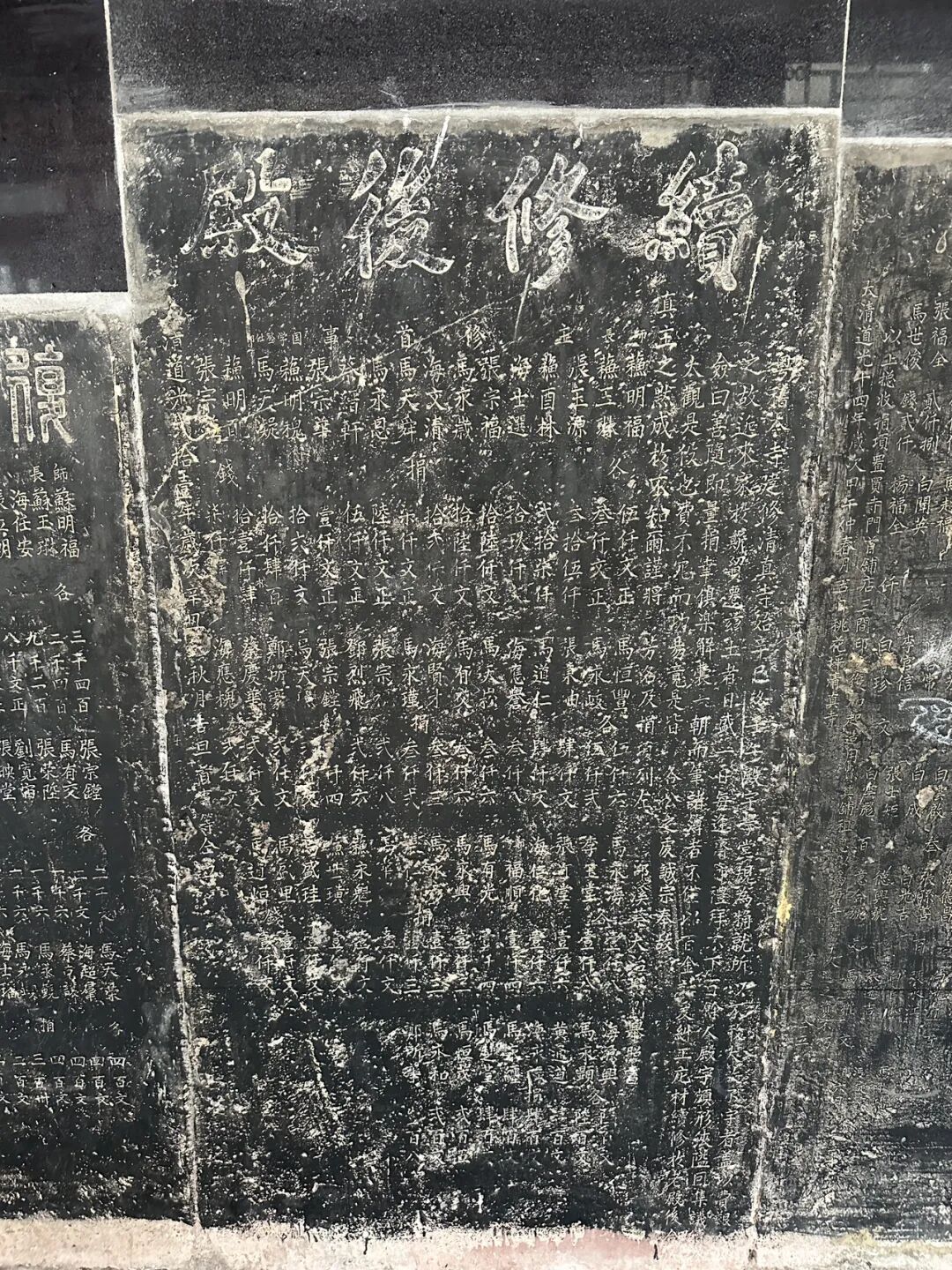
The 1834 "Righteous School Stele Record"
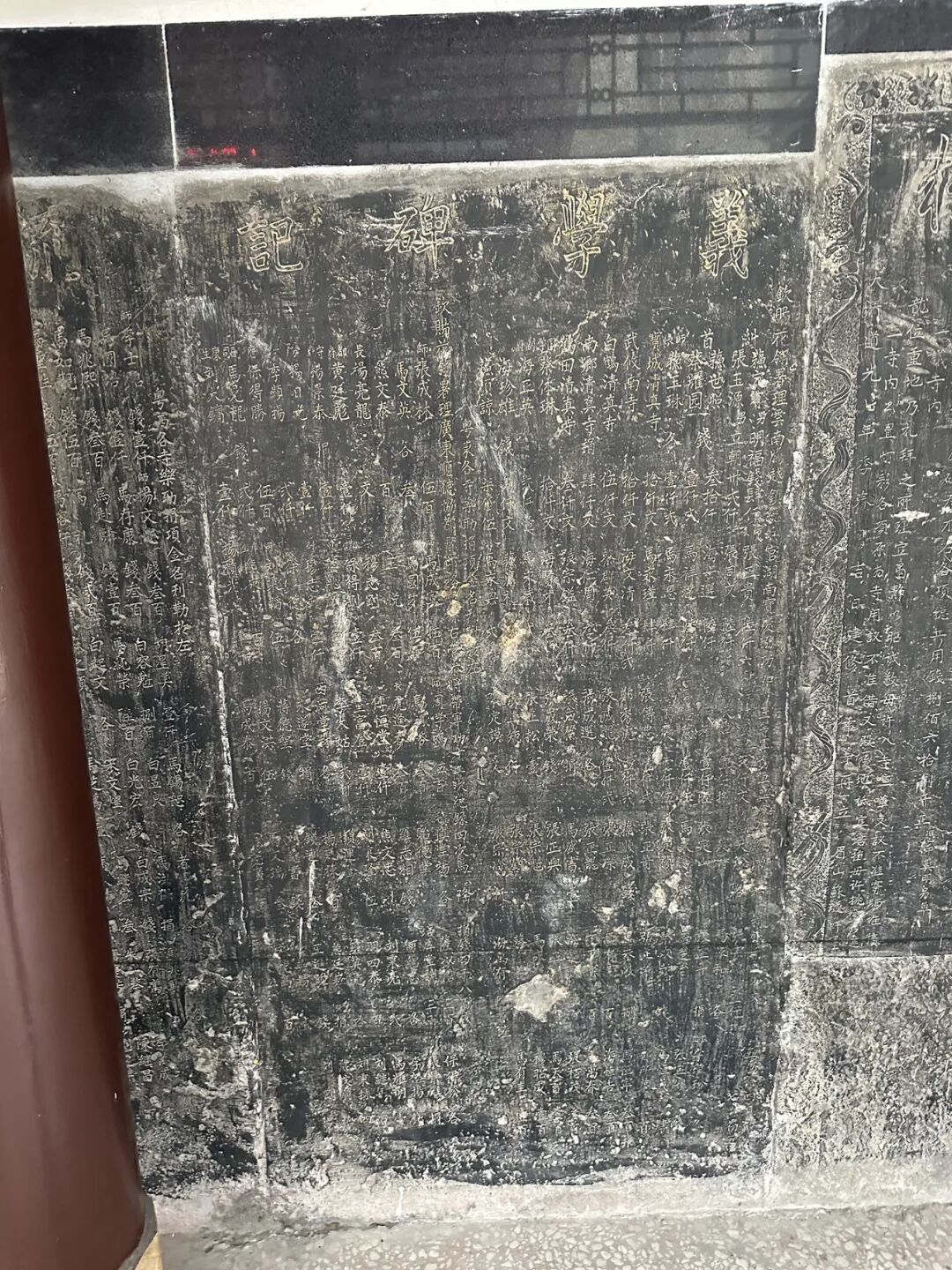
The 1822 "Everlasting Innovation, Building and Repairing the Everlasting, Immortal Names of Public Donors" stele
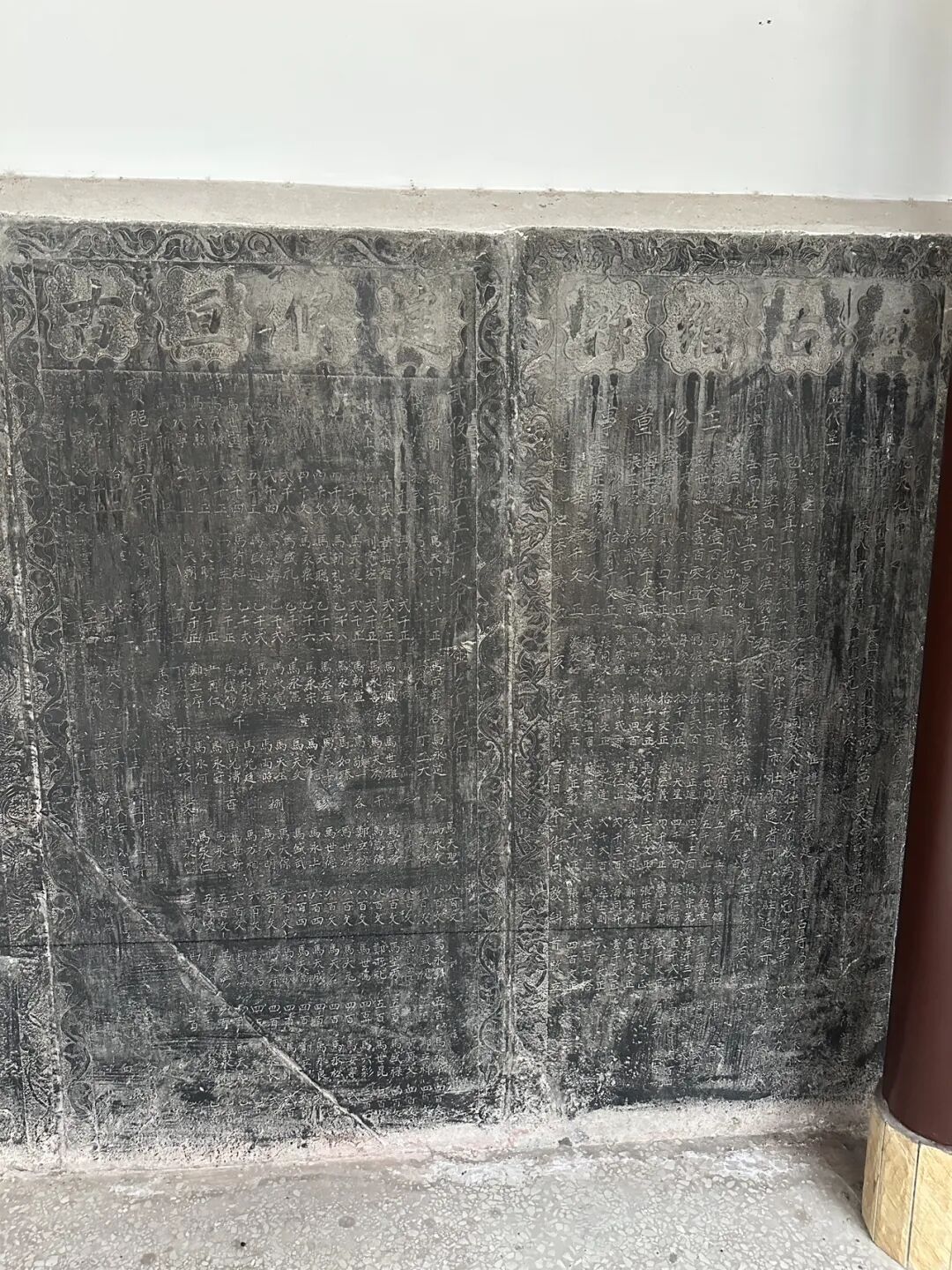
The 1928 "School Construction and Repair Stele"
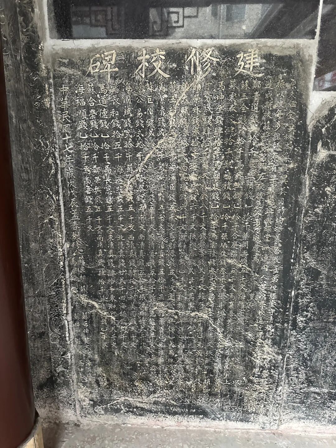
The 1910 "Jingxin Hall" stele
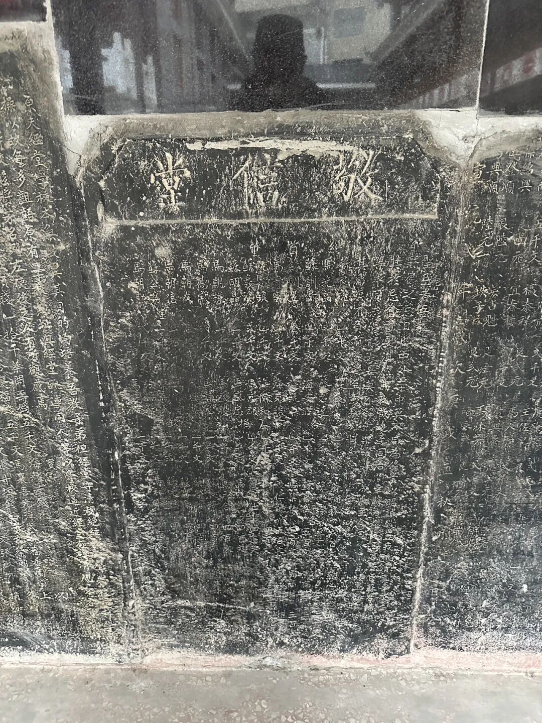
The 1875 stele
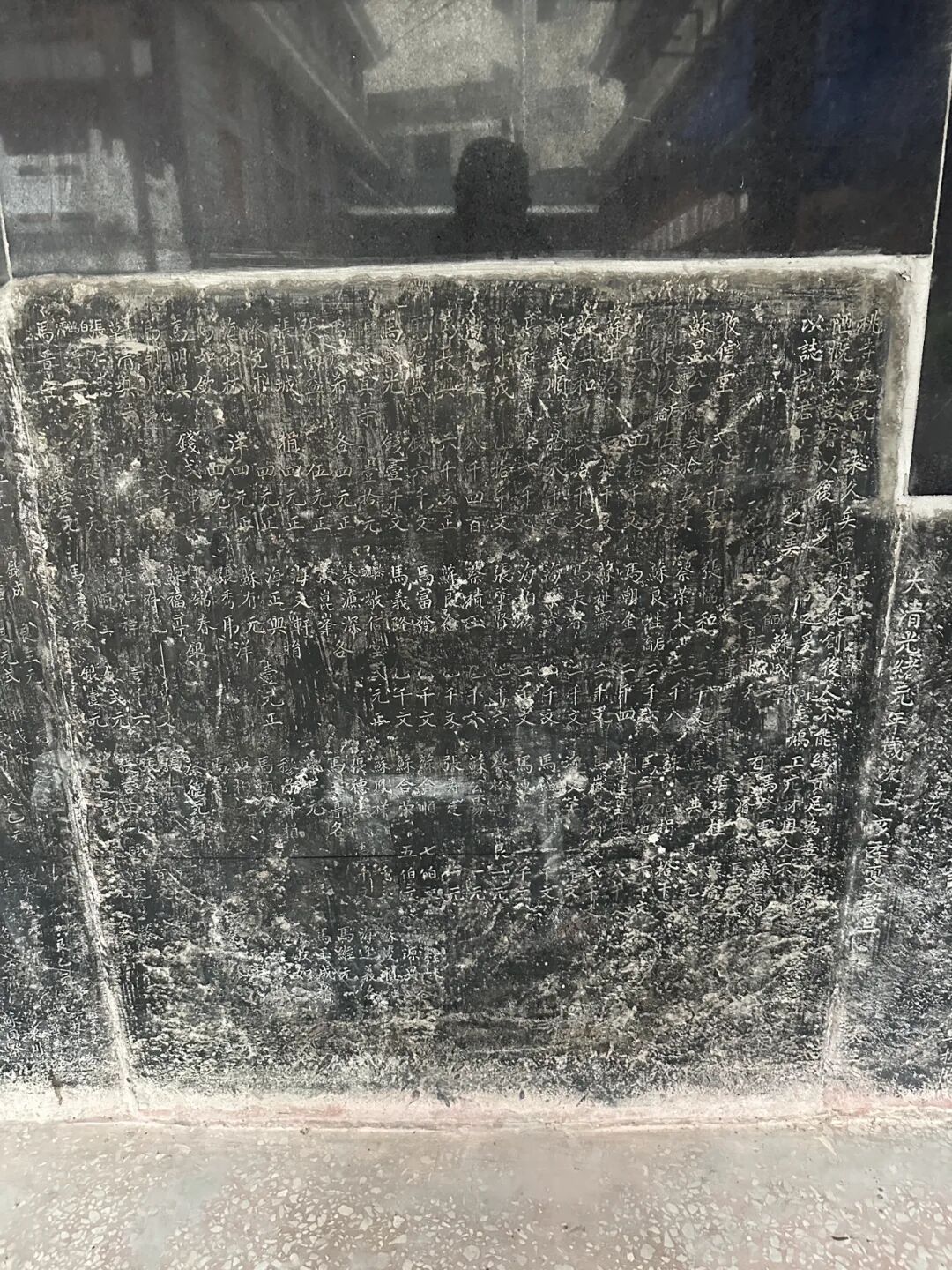
Best Halal Restaurants in Beijing: 10 Local Muslim Food Spots Worth Trying (Segment 3 of 3)
Articles • yusuf908 posted the article • 0 comments • 157 views • 2026-06-22 06:36
Summary: This guide to the best halal restaurants in Beijing keeps the original list of local Muslim food spots, Hui Muslim food, and practical halal dining details.
Part 1: 10 halal restaurants in Beijing worth trying: Pakistani restaurant Lahore Courtyard, Henan Jiaozuo beef knife-cut noodles Maimairehong, halal Mongolian food Hulun Aile, West African Ghana Tribe Garden, Xi'an Xing Laosi meatball spicy soup, Xinjiang Changji Jinying meatball soup, Xinjiang Hotan Canteen, Syrian BRBR, Beijing fusion food Gulou Chimian, and Beijing traditional food Xilaisun.
Part 2: 10 halal restaurants in Beijing worth trying (Part 2): UAE restaurant Gulf Mandi Restaurant, Xinjiang Mansion Xihan meatball soup, Xinjiang Mansion lobby Altay afternoon tea, Muhejia revolving hot pot, Xinjiang Urumqi Nazilan (closed), Beijing pastry shop Baoyuanzhai (closed), Pakistani Samosa China-Pakistan Friendship Restaurant, Ma Ye Roast Duck (closed), Bangladeshi Benjibi Restaurant, and Huairou Shihu Cheng Resort.
Part 3: 10 new Beijing restaurants I recently tried. JM Italian Coffee Dongsi branch, halal Hunan-style stir-fry Huixiangyun (now closed) Wangjing branch, Shandong Dezhou Old Ma's lamb soup (yangtang) and steamed dumplings (zhengjiao), Sanlitun Philly cheesesteak (now closed), Pakistani Roma Restaurant (now closed), Muyuzhai garlic lamb intestines (lan suan yang chang), Inner Mongolia Lianying steamed dumplings (shaomai) Caoyuan Shiliuhong, Wangfujing Gansu spicy hot pot (malatang), and Yuezhen Yayuan halal courtyard restaurant.
Part 4: 10 halal restaurants in Beijing worth trying. Hotan rose pilaf (zhua fan) Yizhuang branch, Taiba Western-style bakery, Taiba South Sanlitun Road street shop, Zhaotong small meat skewers Guijie Ganmaya BBQ (now closed), Baixiaobei Heilongjiang BBQ shop, Yunnan Muwenzhai dry-pot beef, Sanlitun Xinjiang restaurant Jiangjiang, Huixiangyun halal Hunan restaurant Zuojiazhuang branch, Yili ice cream shop Bazaar Sweetheart, and Dongzhimen Inner Qianyuan Hotel. view all
Summary: This guide to the best halal restaurants in Beijing keeps the original list of local Muslim food spots, Hui Muslim food, and practical halal dining details.
Part 1: 10 halal restaurants in Beijing worth trying: Pakistani restaurant Lahore Courtyard, Henan Jiaozuo beef knife-cut noodles Maimairehong, halal Mongolian food Hulun Aile, West African Ghana Tribe Garden, Xi'an Xing Laosi meatball spicy soup, Xinjiang Changji Jinying meatball soup, Xinjiang Hotan Canteen, Syrian BRBR, Beijing fusion food Gulou Chimian, and Beijing traditional food Xilaisun.
Part 2: 10 halal restaurants in Beijing worth trying (Part 2): UAE restaurant Gulf Mandi Restaurant, Xinjiang Mansion Xihan meatball soup, Xinjiang Mansion lobby Altay afternoon tea, Muhejia revolving hot pot, Xinjiang Urumqi Nazilan (closed), Beijing pastry shop Baoyuanzhai (closed), Pakistani Samosa China-Pakistan Friendship Restaurant, Ma Ye Roast Duck (closed), Bangladeshi Benjibi Restaurant, and Huairou Shihu Cheng Resort.
Part 3: 10 new Beijing restaurants I recently tried. JM Italian Coffee Dongsi branch, halal Hunan-style stir-fry Huixiangyun (now closed) Wangjing branch, Shandong Dezhou Old Ma's lamb soup (yangtang) and steamed dumplings (zhengjiao), Sanlitun Philly cheesesteak (now closed), Pakistani Roma Restaurant (now closed), Muyuzhai garlic lamb intestines (lan suan yang chang), Inner Mongolia Lianying steamed dumplings (shaomai) Caoyuan Shiliuhong, Wangfujing Gansu spicy hot pot (malatang), and Yuezhen Yayuan halal courtyard restaurant.
Part 4: 10 halal restaurants in Beijing worth trying. Hotan rose pilaf (zhua fan) Yizhuang branch, Taiba Western-style bakery, Taiba South Sanlitun Road street shop, Zhaotong small meat skewers Guijie Ganmaya BBQ (now closed), Baixiaobei Heilongjiang BBQ shop, Yunnan Muwenzhai dry-pot beef, Sanlitun Xinjiang restaurant Jiangjiang, Huixiangyun halal Hunan restaurant Zuojiazhuang branch, Yili ice cream shop Bazaar Sweetheart, and Dongzhimen Inner Qianyuan Hotel.
Best Halal Restaurants in Beijing: 10 Local Muslim Food Spots Worth Trying (Segment 2 of 3)
Articles • yusuf908 posted the article • 0 comments • 155 views • 2026-06-22 06:36
Summary: This guide to the best halal restaurants in Beijing keeps the original list of local Muslim food spots, Hui Muslim food, and practical halal dining details.
In the past, spring and summer were the growing seasons for sheep, so they were usually only slaughtered after autumn. Because of this, some mutton shops would switch to selling cold food during the summer. In the 1940s, Man Leting bought Japanese refrigeration equipment to sell homemade popsicles, soda, and other cold drinks, and business was booming. In 1949, mutton shipments from Inner Mongolia to Beijing were blocked, and the sheep trade hit rock bottom. Just then, Man Leiting's fellow townsman Man Kaiqi came to join him. Man Kaiqi had a background in a pastry shop, so Man Liu stopped selling lamb and switched to snacks and cold dishes, making Rongxiangcheng a famous Hui Muslim snack shop outside Chongwenmen. After the public-private partnership in 1956, Man Leiting's son Man Kaitong became the manager, and in 1958, they stopped making popsicles to focus on snacks like almond tofu (xingren doufu) and sweet rice balls (yuanxiao). In 1966, Rongxiangcheng was officially renamed Jinfang Hui Muslim Snack Shop, and in 1971, it began to focus on sweet rice balls (yuanxiao), which have drawn long lines every year around the Lantern Festival since the 1990s.
A new shawarma rotisserie shop just opened at the north entrance of Sanlitun SOHO. We went there for dinner; one of the guys working there is from Turkmenistan and the other is from Russia, and almost all the customers were foreigners. The wraps and burgers tasted okay, though the garlic sauce was quite strong. But when we went, they were just starting to roast a new batch of beef, so the pre-sliced beef wasn't very hot. Also, the flatbread wraps they used weren't warm. Still, the vibe is just like a rotisserie shop on a Middle Eastern street; there are no seats, so you grab one to eat on the go and pretend you are in Damascus. view all
Summary: This guide to the best halal restaurants in Beijing keeps the original list of local Muslim food spots, Hui Muslim food, and practical halal dining details.
In the past, spring and summer were the growing seasons for sheep, so they were usually only slaughtered after autumn. Because of this, some mutton shops would switch to selling cold food during the summer. In the 1940s, Man Leting bought Japanese refrigeration equipment to sell homemade popsicles, soda, and other cold drinks, and business was booming. In 1949, mutton shipments from Inner Mongolia to Beijing were blocked, and the sheep trade hit rock bottom. Just then, Man Leiting's fellow townsman Man Kaiqi came to join him. Man Kaiqi had a background in a pastry shop, so Man Liu stopped selling lamb and switched to snacks and cold dishes, making Rongxiangcheng a famous Hui Muslim snack shop outside Chongwenmen. After the public-private partnership in 1956, Man Leiting's son Man Kaitong became the manager, and in 1958, they stopped making popsicles to focus on snacks like almond tofu (xingren doufu) and sweet rice balls (yuanxiao). In 1966, Rongxiangcheng was officially renamed Jinfang Hui Muslim Snack Shop, and in 1971, it began to focus on sweet rice balls (yuanxiao), which have drawn long lines every year around the Lantern Festival since the 1990s.
A new shawarma rotisserie shop just opened at the north entrance of Sanlitun SOHO. We went there for dinner; one of the guys working there is from Turkmenistan and the other is from Russia, and almost all the customers were foreigners. The wraps and burgers tasted okay, though the garlic sauce was quite strong. But when we went, they were just starting to roast a new batch of beef, so the pre-sliced beef wasn't very hot. Also, the flatbread wraps they used weren't warm. Still, the vibe is just like a rotisserie shop on a Middle Eastern street; there are no seats, so you grab one to eat on the go and pretend you are in Damascus.
Best Halal Restaurants in Beijing: 10 Local Muslim Food Spots Worth Trying (Segment 3 of 3)
Articles • yusuf908 posted the article • 0 comments • 150 views • 2026-06-22 06:35
Summary: This guide to the best halal restaurants in Beijing keeps the original list of local Muslim food spots, Hui Muslim food, and practical halal dining details.
A Tianjin halal shaved ice and steamed pancake (zhengbing) shop called Guxiangzhai has opened at Hufangqiao. Since the weather is getting warmer lately, many people are coming to eat shaved ice. For my first visit, I chose the traditional-style shaved ice. It contains sour hawthorn paste (suanmogao), red hawthorn fruit, dried apricots, strawberries, mulberries, pineapple, orange, fresh apricots, and red beans. It actually has more ingredients than the truly traditional version, and it is mainly sweet and sour to whet your appetite. Sour hawthorn paste (suanmogao) is the soul of Tianjin traditional shaved ice. It is made by grinding dried wild sour jujubes into powder and boiling it with rock sugar. You can buy large blocks of sour hawthorn paste (suanmogao) at the entrance of the archway of the South Mosque (Nandasi) in the Northwest Corner. It also tastes great when mixed directly with water.
Their dinosaur egg three-apricot shaved ice is also a signature item. It contains Kashgar Hami apricots, Yengisar Saimaiti red apricots, Aksu Situan dried apricots, and secret-recipe preserved fruit made from wild hawthorn from Shanxi. It sounds very good.
They also sell various snacks. We bought a steamed pancake (zhengbing) with a red hawthorn filling, which is sweet and sour and perfect for breakfast. It is a pity that the rice cakes (gaogan) were sold out, so I bought a rice cake (migao) with a sour hawthorn paste flavor. It was a bit dry, but the taste was still good. I also bought a snack called "five blacks," which contains black rice, black beans, black mulberries, black goji berries, and black sesame seeds. It sounds very healthy. view all
Summary: This guide to the best halal restaurants in Beijing keeps the original list of local Muslim food spots, Hui Muslim food, and practical halal dining details.
A Tianjin halal shaved ice and steamed pancake (zhengbing) shop called Guxiangzhai has opened at Hufangqiao. Since the weather is getting warmer lately, many people are coming to eat shaved ice. For my first visit, I chose the traditional-style shaved ice. It contains sour hawthorn paste (suanmogao), red hawthorn fruit, dried apricots, strawberries, mulberries, pineapple, orange, fresh apricots, and red beans. It actually has more ingredients than the truly traditional version, and it is mainly sweet and sour to whet your appetite. Sour hawthorn paste (suanmogao) is the soul of Tianjin traditional shaved ice. It is made by grinding dried wild sour jujubes into powder and boiling it with rock sugar. You can buy large blocks of sour hawthorn paste (suanmogao) at the entrance of the archway of the South Mosque (Nandasi) in the Northwest Corner. It also tastes great when mixed directly with water.
Their dinosaur egg three-apricot shaved ice is also a signature item. It contains Kashgar Hami apricots, Yengisar Saimaiti red apricots, Aksu Situan dried apricots, and secret-recipe preserved fruit made from wild hawthorn from Shanxi. It sounds very good.
They also sell various snacks. We bought a steamed pancake (zhengbing) with a red hawthorn filling, which is sweet and sour and perfect for breakfast. It is a pity that the rice cakes (gaogan) were sold out, so I bought a rice cake (migao) with a sour hawthorn paste flavor. It was a bit dry, but the taste was still good. I also bought a snack called "five blacks," which contains black rice, black beans, black mulberries, black goji berries, and black sesame seeds. It sounds very healthy.
Best Halal Restaurants in Beijing: 10 Local Muslim Food Spots Worth Trying (Segment 1 of 3)
Articles • yusuf908 posted the article • 0 comments • 148 views • 2026-06-22 06:35
Summary: This guide to the best halal restaurants in Beijing keeps the original list of local Muslim food spots, Hui Muslim food, and practical halal dining details.
On the weekend, we had dinner at Kavkaz Ruilin, a long-standing Azerbaijani restaurant on Ritan Upper Street, to enjoy some Russian and Caucasian food. This is a classic former Soviet-style restaurant in Beijing that has been open for over a decade. It mostly serves merchants from Russian-speaking regions who come to Yabaolu to source goods. Its Chinese name used to be Ruilin, but it has been changed to Ruilin.
After the Soviet Union collapsed in the 1990s, many traders (daoye) took green-skinned trains to Beijing and headed straight to Yabaolu to stock up on goods. They brought down jackets, leather shoes, toys, and other small items back home to sell for huge profits. Yabaolu gradually grew from street stalls and tents into Beijing's largest wholesale market for Russian-speaking regions, and more former Soviet-style restaurants opened up on nearby Ritan Upper Street. Over a decade ago, Ritan Upper Street was mainly home to Central Asian and Azerbaijani restaurants, including Uzbek and Kazakh spots.
Over the last decade, Russia's economic decline, the shift of markets to places like Yiwu, Guangzhou, and Suifenhe, and the rise of cross-border e-commerce have caused trade with Russia on Yabaolu to shrink. Yitan Shangjie has gradually become a hub for Uyghur restaurants. Besides Dardanelles and Desert Rose, which focus on Turkish food, the only other Azerbaijani restaurant is Ruilin. For Central Asian food, there is the Turkmenistan restaurant Merv downstairs, which also serves Russian dishes.
At first, Ruilin had dim lighting, making it a good spot for traders to talk business, but many Chinese people were afraid to go inside. In recent years, the lighting at Ruilin has become brighter, but when we visited, there were only Russian-speaking customers, and we did not see any other Chinese people eating there.
We ordered borscht (hongcaitang), pot-stewed lamb (manguan yangrou), chive pancakes (jiucaibing), Azerbaijani pilaf (zhuafan), and grilled vegetables. Their borscht is closer to the Russian style than the one at Merv. Merv's beef soup has a stronger flavor, while their version has a more intense beet taste, which is also quite good. view all
Summary: This guide to the best halal restaurants in Beijing keeps the original list of local Muslim food spots, Hui Muslim food, and practical halal dining details.
On the weekend, we had dinner at Kavkaz Ruilin, a long-standing Azerbaijani restaurant on Ritan Upper Street, to enjoy some Russian and Caucasian food. This is a classic former Soviet-style restaurant in Beijing that has been open for over a decade. It mostly serves merchants from Russian-speaking regions who come to Yabaolu to source goods. Its Chinese name used to be Ruilin, but it has been changed to Ruilin.
After the Soviet Union collapsed in the 1990s, many traders (daoye) took green-skinned trains to Beijing and headed straight to Yabaolu to stock up on goods. They brought down jackets, leather shoes, toys, and other small items back home to sell for huge profits. Yabaolu gradually grew from street stalls and tents into Beijing's largest wholesale market for Russian-speaking regions, and more former Soviet-style restaurants opened up on nearby Ritan Upper Street. Over a decade ago, Ritan Upper Street was mainly home to Central Asian and Azerbaijani restaurants, including Uzbek and Kazakh spots.
Over the last decade, Russia's economic decline, the shift of markets to places like Yiwu, Guangzhou, and Suifenhe, and the rise of cross-border e-commerce have caused trade with Russia on Yabaolu to shrink. Yitan Shangjie has gradually become a hub for Uyghur restaurants. Besides Dardanelles and Desert Rose, which focus on Turkish food, the only other Azerbaijani restaurant is Ruilin. For Central Asian food, there is the Turkmenistan restaurant Merv downstairs, which also serves Russian dishes.
At first, Ruilin had dim lighting, making it a good spot for traders to talk business, but many Chinese people were afraid to go inside. In recent years, the lighting at Ruilin has become brighter, but when we visited, there were only Russian-speaking customers, and we did not see any other Chinese people eating there.
We ordered borscht (hongcaitang), pot-stewed lamb (manguan yangrou), chive pancakes (jiucaibing), Azerbaijani pilaf (zhuafan), and grilled vegetables. Their borscht is closer to the Russian style than the one at Merv. Merv's beef soup has a stronger flavor, while their version has a more intense beet taste, which is also quite good.
Best Halal Restaurants in Beijing: 10 Local Muslim Food Spots Worth Trying (Segment 3 of 3)
Articles • yusuf908 posted the article • 0 comments • 142 views • 2026-06-22 06:35
Summary: This guide to the best halal restaurants in Beijing keeps the original list of local Muslim food spots, Hui Muslim food, and practical halal dining details.
We had the pilaf (zhuafan) fresh out of the pot at seven o'clock. It was shiny and oily, though the lamb was a bit tougher compared to the skewers. Overall, it was still good. I happened to hear the table next to us complaining that their rice was undercooked. Actually, I think pilaf is only good when the rice is a bit firm. If the rice is too soft and mushy, it just becomes regular steamed rice. view all
Summary: This guide to the best halal restaurants in Beijing keeps the original list of local Muslim food spots, Hui Muslim food, and practical halal dining details.
We had the pilaf (zhuafan) fresh out of the pot at seven o'clock. It was shiny and oily, though the lamb was a bit tougher compared to the skewers. Overall, it was still good. I happened to hear the table next to us complaining that their rice was undercooked. Actually, I think pilaf is only good when the rice is a bit firm. If the rice is too soft and mushy, it just becomes regular steamed rice.
Best Halal Restaurants in Beijing: 10 Local Muslim Food Spots Worth Trying (Segment 2 of 3)
Articles • yusuf908 posted the article • 0 comments • 158 views • 2026-06-22 06:35
Summary: This guide to the best halal restaurants in Beijing keeps the original list of local Muslim food spots, Hui Muslim food, and practical halal dining details.
We ordered the three-person set meal, which included half a roast duck, grilled meat on a round iron plate (zhizi kaorou), stir-fried mixed vegetables (chao hecai), and duck frame tofu soup. This three-person set is a great value, and we were stuffed after finishing it. The duck tasted good, and the kids really liked it. The portion of stir-fried mixed vegetables (chao hecai) was huge, and it tasted great too.
The grilled meat on a round iron plate (zhizi kaorou) was a hit with both the Xinjiang and Hunan people at our table; the meat was tender but still had a nice chew. However, it must have been pre-marinated because it was spicy and couldn't be made mild, so the kids couldn't eat it. Duck frame soup is a must-have with roast duck; it was very savory and we couldn't stop drinking it.
Besides roast duck, they also serve traditional Hui Muslims' eight big bowls (badawan). If you are visiting Changping, you should come here to eat. They don't close in the afternoon, so it is perfect for a late meal after sightseeing.
In the evening, we went to Shilihe to eat barbecue at Aidamu. I had heard they were very famous, but this was my first time eating there, and I was truly impressed. They have basically brought the level of a local Xinjiang night market to Beijing; eating there felt just like being back in Xinjiang.
There is a large parking lot right across from the restaurant, making it very convenient if you drive there. When we arrived at 6:30, the place was already packed, so we set up a table in the parking lot across the street. Since the temperature has risen in May, it is perfect for eating barbecue outdoors.
At their place, you grab the skewers yourself from the freezer. We had lamb liver, lamb heart, lamb skewers, and lamb chops. The lamb liver was very tender, definitely top-tier for Beijing. The lamb heart had more chew than the liver, and it was also quite good. The lamb skewers had no gamey smell at all, just the pure aroma of lamb, which is very rare in Beijing. view all
Summary: This guide to the best halal restaurants in Beijing keeps the original list of local Muslim food spots, Hui Muslim food, and practical halal dining details.
We ordered the three-person set meal, which included half a roast duck, grilled meat on a round iron plate (zhizi kaorou), stir-fried mixed vegetables (chao hecai), and duck frame tofu soup. This three-person set is a great value, and we were stuffed after finishing it. The duck tasted good, and the kids really liked it. The portion of stir-fried mixed vegetables (chao hecai) was huge, and it tasted great too.
The grilled meat on a round iron plate (zhizi kaorou) was a hit with both the Xinjiang and Hunan people at our table; the meat was tender but still had a nice chew. However, it must have been pre-marinated because it was spicy and couldn't be made mild, so the kids couldn't eat it. Duck frame soup is a must-have with roast duck; it was very savory and we couldn't stop drinking it.
Besides roast duck, they also serve traditional Hui Muslims' eight big bowls (badawan). If you are visiting Changping, you should come here to eat. They don't close in the afternoon, so it is perfect for a late meal after sightseeing.
In the evening, we went to Shilihe to eat barbecue at Aidamu. I had heard they were very famous, but this was my first time eating there, and I was truly impressed. They have basically brought the level of a local Xinjiang night market to Beijing; eating there felt just like being back in Xinjiang.
There is a large parking lot right across from the restaurant, making it very convenient if you drive there. When we arrived at 6:30, the place was already packed, so we set up a table in the parking lot across the street. Since the temperature has risen in May, it is perfect for eating barbecue outdoors.
At their place, you grab the skewers yourself from the freezer. We had lamb liver, lamb heart, lamb skewers, and lamb chops. The lamb liver was very tender, definitely top-tier for Beijing. The lamb heart had more chew than the liver, and it was also quite good. The lamb skewers had no gamey smell at all, just the pure aroma of lamb, which is very rare in Beijing.
Best Halal Restaurants in Beijing: 10 Local Muslim Food Spots Worth Trying (Segment 1 of 3)
Articles • yusuf908 posted the article • 0 comments • 156 views • 2026-06-22 06:35
Summary: This guide to the best halal restaurants in Beijing keeps the original list of local Muslim food spots, Hui Muslim food, and practical halal dining details.
This article summarizes the key points of '10 Halal Restaurants in Beijing Worth Trying (Part 9),' keeping the original paragraph and image order. It is for readers interested in Muslim life, Islamic culture, and Chinese Islamic articles, and makes it easy to search for topics like Uyghur culture, marriage and family, and the ninth installment.
The list includes Shunhexiang Harbin-style stir-fry in Tongzhou, Fenghong Old Beijing Flavor in Changping, Aidamu Xinjiang street barbecue in Shilihe, Ruilin Azerbaijani restaurant near Ritan, Yilan Liyuan American-style burgers on Niujie, Guxiangzhai Tianjin-style shaved ice in Hufangqiao, Niujie's Big Green Bag stinky tofu, Zafran Pakistani restaurant in Xinyuanli, Jinfang Snack Bar in Dongdaqiao, and Ali & Wang's rotating kebab in Sanlitun.
I heard that the Harbin Hui Muslim stir-fry restaurant Shunhexiang opened in Beijing's Tongzhou sub-center, so I came to try it out for dinner. The restaurant is located in a new residential complex along the Grand Canal in Tongzhou. The environment is great, and the private room's turntable is button-controlled, making it easy to reach the dishes.
They specialize in Heilongjiang Hui Muslim cuisine and have also added some southern Chinese dishes to their menu. We ordered the savory sweet and sour pork (guobaorou), sauerkraut beef rib stew, colorful starch noodles (dalapi), stir-fried lily bulbs with bamboo shoots, and beef steamed dumplings (shaomai). The best of these was the steamed dumplings. The skin was thin and chewy, and the filling was fragrant and not greasy. I think they are better than the other Hui Muslim steamed dumplings currently in Beijing. The sweet and sour pork had a good texture and wasn't fried too hard. I think it's better than another Heilongjiang Hui Muslim restaurant in Beijing. The sauerkraut tasted great, but there was very little beef, and there were very few lily bulbs in the lily bulb and bamboo shoot dish. Overall, the restaurant is definitely worth a visit. The biggest problem is that it is too far from the city center, almost reaching Hebei. It is best suited for those driving there or people working in the sub-center.
On Sunday, I was in Changping and had Beijing-style food for lunch at Fenghong Old Beijing Flavor in Xiaotangshan. view all
Summary: This guide to the best halal restaurants in Beijing keeps the original list of local Muslim food spots, Hui Muslim food, and practical halal dining details.
This article summarizes the key points of '10 Halal Restaurants in Beijing Worth Trying (Part 9),' keeping the original paragraph and image order. It is for readers interested in Muslim life, Islamic culture, and Chinese Islamic articles, and makes it easy to search for topics like Uyghur culture, marriage and family, and the ninth installment.
The list includes Shunhexiang Harbin-style stir-fry in Tongzhou, Fenghong Old Beijing Flavor in Changping, Aidamu Xinjiang street barbecue in Shilihe, Ruilin Azerbaijani restaurant near Ritan, Yilan Liyuan American-style burgers on Niujie, Guxiangzhai Tianjin-style shaved ice in Hufangqiao, Niujie's Big Green Bag stinky tofu, Zafran Pakistani restaurant in Xinyuanli, Jinfang Snack Bar in Dongdaqiao, and Ali & Wang's rotating kebab in Sanlitun.
I heard that the Harbin Hui Muslim stir-fry restaurant Shunhexiang opened in Beijing's Tongzhou sub-center, so I came to try it out for dinner. The restaurant is located in a new residential complex along the Grand Canal in Tongzhou. The environment is great, and the private room's turntable is button-controlled, making it easy to reach the dishes.
They specialize in Heilongjiang Hui Muslim cuisine and have also added some southern Chinese dishes to their menu. We ordered the savory sweet and sour pork (guobaorou), sauerkraut beef rib stew, colorful starch noodles (dalapi), stir-fried lily bulbs with bamboo shoots, and beef steamed dumplings (shaomai). The best of these was the steamed dumplings. The skin was thin and chewy, and the filling was fragrant and not greasy. I think they are better than the other Hui Muslim steamed dumplings currently in Beijing. The sweet and sour pork had a good texture and wasn't fried too hard. I think it's better than another Heilongjiang Hui Muslim restaurant in Beijing. The sauerkraut tasted great, but there was very little beef, and there were very few lily bulbs in the lily bulb and bamboo shoot dish. Overall, the restaurant is definitely worth a visit. The biggest problem is that it is too far from the city center, almost reaching Hebei. It is best suited for those driving there or people working in the sub-center.
On Sunday, I was in Changping and had Beijing-style food for lunch at Fenghong Old Beijing Flavor in Xiaotangshan.
China Mosque Travel Guide: Eight Historic Mosque Complexes in Longhui, Shaoyang, Hunan (Segment 3 of 3)
Articles • yusuf908 posted the article • 0 comments • 150 views • 2026-06-22 06:34
Summary: This China mosque travel guide covers eight historic mosque complexes in Longhui, Shaoyang, Hunan, with local Hui Muslim heritage and mosque travel details kept in clear English.
Shanjie East Mosque was first built in 1728 (the fifth year of the Yongzheng reign). The mosque has hired many imams over the years, including Su Yuebo, Ma Yulang, Ma Baochu, Zheng Liansheng, Ma Yuechi, Ma Yucheng, Tang Yuanqi, Hai Shiquan, Ma Chengyong, Ding Baohua, Ma Gen'ao, Ma Xiang'ao, and Ma Wuquan. Students from as far as Hainan and Guangxi came to study under the great imam Ma Yucheng in Gansu, and the local religious community was very prosperous.
It is a pity that the mosque was locked when I visited, so I could not go inside. view all
Summary: This China mosque travel guide covers eight historic mosque complexes in Longhui, Shaoyang, Hunan, with local Hui Muslim heritage and mosque travel details kept in clear English.
Shanjie East Mosque was first built in 1728 (the fifth year of the Yongzheng reign). The mosque has hired many imams over the years, including Su Yuebo, Ma Yulang, Ma Baochu, Zheng Liansheng, Ma Yuechi, Ma Yucheng, Tang Yuanqi, Hai Shiquan, Ma Chengyong, Ding Baohua, Ma Gen'ao, Ma Xiang'ao, and Ma Wuquan. Students from as far as Hainan and Guangxi came to study under the great imam Ma Yucheng in Gansu, and the local religious community was very prosperous.
It is a pity that the mosque was locked when I visited, so I could not go inside.
China Mosque Travel Guide: Eight Historic Mosque Complexes in Longhui, Shaoyang, Hunan (Segment 1 of 3)
Articles • yusuf908 posted the article • 0 comments • 160 views • 2026-06-22 06:34
Summary: This China mosque travel guide covers eight historic mosque complexes in Longhui, Shaoyang, Hunan, with local Hui Muslim heritage and mosque travel details kept in clear English.
This article summarizes the key points about the eight mosques (sifang) in Longhui County, Shaoyang, Hunan. It keeps the original paragraph and image order. It is for readers interested in Muslim life, Islamic culture, and Chinese Islamic writing. It also helps people search for content like Chinese halal food.
Longhui County in Shaoyang City, Hunan, has a large population of Hui Muslims. I visited eight mosques there: Taohuaping Mosque, Shanjie Ancient Mosque, East Mosque, West Mosque, South Mosque, North Mosque, Luobai Mosque, and Niejiaoting Mosque. I will share them with you below.
Shanjie Ancient Mosque in Longhui County, Shaoyang, Hunan, is located in Laowuli, Shanjie Township. It was first built in 1444 (the ninth year of the Zhengtong reign of the Ming Dynasty) and is the oldest mosque in Longhui. During the Hongwu reign of the Ming Dynasty, Ma Zhi, the third son of Ma Cheng, the ancestor of the Ma family Hui Muslims in Shaoyang, moved from Shaoyang to Majia Ferry in Longhui to settle down. He was the first Hui Muslim in Longhui, and Shanjie Ancient Mosque was built by the Ma family.
Shanjie Ancient Mosque was renovated in 1919 and rebuilt into its current appearance in 2018.
Shanjie Ancient Mosque has a long tradition of teaching Islamic scripture. The head imams who have taught there include Ma Yulang, Ma Fujiu, Ma Fucheng, Ma Yucheng, Ma Yaochi, and Ding Zhenyi. They also hired imams from other places like Huang Xingxiang and Li Desheng. Ma Fucheng, an imam from this mosque, taught there for the longest time. In 1945, Imam Ma Yucheng taught at the ancient mosque and recruited many students (hailifan), marking the peak of the mosque's religious activities. To this day, the mosque continues its educational work and has trained many excellent young people.
On September 2, 1939, the Wugang County, Hunan branch of the China Islamic National Salvation Association was officially established at the mosque. The mosque's imam, Ma Fucheng, was elected as an officer. Inspired by the call to resist Japanese aggression and save the country, young Hui Muslims from the mosque, including Ma Qiyun, Ma Wuyang from the North Mosque, and Su Xingmin from Beishan, signed up for the army, took up arms, and headed to the front lines in East China. view all
Summary: This China mosque travel guide covers eight historic mosque complexes in Longhui, Shaoyang, Hunan, with local Hui Muslim heritage and mosque travel details kept in clear English.
This article summarizes the key points about the eight mosques (sifang) in Longhui County, Shaoyang, Hunan. It keeps the original paragraph and image order. It is for readers interested in Muslim life, Islamic culture, and Chinese Islamic writing. It also helps people search for content like Chinese halal food.
Longhui County in Shaoyang City, Hunan, has a large population of Hui Muslims. I visited eight mosques there: Taohuaping Mosque, Shanjie Ancient Mosque, East Mosque, West Mosque, South Mosque, North Mosque, Luobai Mosque, and Niejiaoting Mosque. I will share them with you below.
Shanjie Ancient Mosque in Longhui County, Shaoyang, Hunan, is located in Laowuli, Shanjie Township. It was first built in 1444 (the ninth year of the Zhengtong reign of the Ming Dynasty) and is the oldest mosque in Longhui. During the Hongwu reign of the Ming Dynasty, Ma Zhi, the third son of Ma Cheng, the ancestor of the Ma family Hui Muslims in Shaoyang, moved from Shaoyang to Majia Ferry in Longhui to settle down. He was the first Hui Muslim in Longhui, and Shanjie Ancient Mosque was built by the Ma family.
Shanjie Ancient Mosque was renovated in 1919 and rebuilt into its current appearance in 2018.
Shanjie Ancient Mosque has a long tradition of teaching Islamic scripture. The head imams who have taught there include Ma Yulang, Ma Fujiu, Ma Fucheng, Ma Yucheng, Ma Yaochi, and Ding Zhenyi. They also hired imams from other places like Huang Xingxiang and Li Desheng. Ma Fucheng, an imam from this mosque, taught there for the longest time. In 1945, Imam Ma Yucheng taught at the ancient mosque and recruited many students (hailifan), marking the peak of the mosque's religious activities. To this day, the mosque continues its educational work and has trained many excellent young people.
On September 2, 1939, the Wugang County, Hunan branch of the China Islamic National Salvation Association was officially established at the mosque. The mosque's imam, Ma Fucheng, was elected as an officer. Inspired by the call to resist Japanese aggression and save the country, young Hui Muslims from the mosque, including Ma Qiyun, Ma Wuyang from the North Mosque, and Su Xingmin from Beishan, signed up for the army, took up arms, and headed to the front lines in East China.
Best Halal Restaurants in Beijing: 10 Local Muslim Food Spots Worth Trying (Part 5 of 5)
Articles • yusuf908 posted the article • 0 comments • 145 views • 2026-06-22 06:33
Summary: This guide to the best halal restaurants in Beijing keeps the original list of local Muslim food spots, Hui Muslim food, and practical halal dining details.
Part 5: 10 halal restaurants in Beijing worth trying. Sandyq Kazakhstan restaurant, Kashgar restaurant, Ahmed restaurant, Jingbalang Naan Bazaar, MacMac Lebanese restaurant, Humaer Xinjiang specialty food, Lao Huihui dumpling restaurant Zoo branch, Fresh Milk Town (now closed) Shuangjing branch, Nawab restaurant, and Liuji Watch Repair BBQ shop.
Part 6: 10 halal restaurants in Beijing worth trying. Hongyunlou Huaiyang cuisine, Sanhe beef noodles (now closed), JM Coffee and Bakery Dajixiang branch, Wanhe fatty beef, Xiangqing roast duck (now closed), Culture Pakistani restaurant, Italian Firenze Western restaurant, Niujie Dashuntang, Zhenweizhai Tianjin cuisine, and Dardanelles children's meal.
Part 7: 10 halal restaurants in Beijing worth trying. JM Western restaurant Chaonei branch, Palestinian restaurant Rose City, Baoding beef soup with flatbread (niurou zhaobing), Pakistani restaurant Al Rayyan, Yili Loulan restaurant Guijie branch, Dianxinyuan Yunnan cuisine, Heilongjiang Suihua restaurant Muxiangyuan, Sanlitun Turkish restaurant, Chaoyangmen fast food stall, and Pakistani buffet Habibi.
Part 8: 10 halal restaurants in Beijing worth trying. Xinjiang Hui Muslim home-style cooking Yige Huangluobo, Liaoning Hui Muslim spicy hot pot (malatang), Hebei Daming Hui Muslim meat pie (roubing) Yimian Liaoyuan (now closed), Hebei Chengde Hui Muslim steamed dumplings (shaomai) Dongtucheng branch, Xilaishun Xisi branch, Longfusi market, Heilongjiang Suihua Hui Muslim Mashi Muxiangyuan Baizhifang branch, Turpan Uyghur restaurant Tianshan, Niujie cafe Sanwanghu, and Heilongjiang Hui Muslim iron pot stew (tieguo dun). view all
Summary: This guide to the best halal restaurants in Beijing keeps the original list of local Muslim food spots, Hui Muslim food, and practical halal dining details.
Part 5: 10 halal restaurants in Beijing worth trying. Sandyq Kazakhstan restaurant, Kashgar restaurant, Ahmed restaurant, Jingbalang Naan Bazaar, MacMac Lebanese restaurant, Humaer Xinjiang specialty food, Lao Huihui dumpling restaurant Zoo branch, Fresh Milk Town (now closed) Shuangjing branch, Nawab restaurant, and Liuji Watch Repair BBQ shop.
Part 6: 10 halal restaurants in Beijing worth trying. Hongyunlou Huaiyang cuisine, Sanhe beef noodles (now closed), JM Coffee and Bakery Dajixiang branch, Wanhe fatty beef, Xiangqing roast duck (now closed), Culture Pakistani restaurant, Italian Firenze Western restaurant, Niujie Dashuntang, Zhenweizhai Tianjin cuisine, and Dardanelles children's meal.
Part 7: 10 halal restaurants in Beijing worth trying. JM Western restaurant Chaonei branch, Palestinian restaurant Rose City, Baoding beef soup with flatbread (niurou zhaobing), Pakistani restaurant Al Rayyan, Yili Loulan restaurant Guijie branch, Dianxinyuan Yunnan cuisine, Heilongjiang Suihua restaurant Muxiangyuan, Sanlitun Turkish restaurant, Chaoyangmen fast food stall, and Pakistani buffet Habibi.
Part 8: 10 halal restaurants in Beijing worth trying. Xinjiang Hui Muslim home-style cooking Yige Huangluobo, Liaoning Hui Muslim spicy hot pot (malatang), Hebei Daming Hui Muslim meat pie (roubing) Yimian Liaoyuan (now closed), Hebei Chengde Hui Muslim steamed dumplings (shaomai) Dongtucheng branch, Xilaishun Xisi branch, Longfusi market, Heilongjiang Suihua Hui Muslim Mashi Muxiangyuan Baizhifang branch, Turpan Uyghur restaurant Tianshan, Niujie cafe Sanwanghu, and Heilongjiang Hui Muslim iron pot stew (tieguo dun).
Best Halal Restaurants in Beijing: 10 Local Muslim Food Spots Worth Trying (Part 3 of 5)
Articles • yusuf908 posted the article • 0 comments • 150 views • 2026-06-22 06:33
Summary: This guide to the best halal restaurants in Beijing keeps the original list of local Muslim food spots, Hui Muslim food, and practical halal dining details.
Across from the China Academy of Chinese Medical Sciences on Niujie Street, the roast lamb leg shop with the big green sign sells stinky tofu with sauce. The sauce is made from beef bone broth (niubanggu aotang), and it really has a meaty flavor. I remember eating fried stinky tofu topped with fermented bean curd sauce from a cart run by local Hui Muslims on Binjiang Road in Tianjin. That flavor was truly satisfying.
A new alcohol-free Pakistani restaurant called Zafran just opened in Jiayi Plaza near Liangmaqiao. It is very close to the Liangma River, and since it only opened a few days ago, I came specifically to try it.
I looked at the menu and was surprised to find many Afghan Pashtun dishes. I asked the server, and he is a Pashtun from Peshawar. I decided to order a few Pashtun dishes to try, as some of them cannot be found in other Pakistani restaurants.
First, I must praise their excellent service. The Pashtun waiter, Anas Khan, always greeted us with a smile and even did a fist bump with my son, Suleiman. As soon as we sat down, they brought us black tea, lemon water, and fried dough twists (mayezi). Later, they served a special dried fruit milkshake with walnuts and almonds. Finally, they gave Suleiman a small cup of thin yogurt drink (lassi) and a piece of baklava, which made him very happy.
The atmosphere is also very nice, with curtained sofa areas on one side that are perfect for families. There are no large private rooms, but if you have a big group, you can push tables together in the main dining area. There is also outdoor seating at the entrance, which is great for having desserts and drinks in the summer.
We ordered Afghan pilaf, Peshawar-style lamb, and Kandahar naan. You can tell these are Pashtun specialties just by their names. We also ordered a Caesar salad, french fries, and salty yogurt drink (lassi). Since they just opened, they gave us a 30% discount, which was a great deal.
Afghan pilaf originated in the border region between northern Afghanistan and Uzbekistan. It is known as Qabili Palaw in Afghanistan and later spread from there to West Asia, Central Asia, and Pakistan. Afghan pilaf (pulao) differs from Xinjiang pilaf because it uses long-grain aromatic rice from South Asia and a bit of saffron for color. It is cooked with ghee and vegetable oil, and the carrots are sliced thinly. It also includes cinnamon, cardamom, and cloves, giving it a stronger spice flavor than Xinjiang pilaf. Their Afghan pilaf includes fresh almonds and raisins, but the meat is a bit tough and hard for children to chew. The spice flavor is very rich.
This was my first time eating Peshawar Shinwari lamb, and I highly recommend it! The lamb is very tender and the seasoning is excellent. Peshawar Shinwari lamb is cooked in a metal wok called a karahi. It is a classic main dish for the Pashtun people in northern Pakistan, especially prepared after the animal sacrifice during Eid al-Adha. It is made with fresh bone-in lamb, salt, garlic, and green chilies, without the heavy spices found in southern Pakistan.
Their Kandahar flatbread (nan) is also amazing and pairs perfectly with the Peshawar lamb. Kandahar flatbread is also popular in Pakistan. It is very fluffy because milk and sugar are added to the dough, making it more fragrant.
I also recommend their yogurt drink (lassi). It is not too sour, but it is very appetizing. view all
Summary: This guide to the best halal restaurants in Beijing keeps the original list of local Muslim food spots, Hui Muslim food, and practical halal dining details.
Across from the China Academy of Chinese Medical Sciences on Niujie Street, the roast lamb leg shop with the big green sign sells stinky tofu with sauce. The sauce is made from beef bone broth (niubanggu aotang), and it really has a meaty flavor. I remember eating fried stinky tofu topped with fermented bean curd sauce from a cart run by local Hui Muslims on Binjiang Road in Tianjin. That flavor was truly satisfying.
A new alcohol-free Pakistani restaurant called Zafran just opened in Jiayi Plaza near Liangmaqiao. It is very close to the Liangma River, and since it only opened a few days ago, I came specifically to try it.
I looked at the menu and was surprised to find many Afghan Pashtun dishes. I asked the server, and he is a Pashtun from Peshawar. I decided to order a few Pashtun dishes to try, as some of them cannot be found in other Pakistani restaurants.
First, I must praise their excellent service. The Pashtun waiter, Anas Khan, always greeted us with a smile and even did a fist bump with my son, Suleiman. As soon as we sat down, they brought us black tea, lemon water, and fried dough twists (mayezi). Later, they served a special dried fruit milkshake with walnuts and almonds. Finally, they gave Suleiman a small cup of thin yogurt drink (lassi) and a piece of baklava, which made him very happy.
The atmosphere is also very nice, with curtained sofa areas on one side that are perfect for families. There are no large private rooms, but if you have a big group, you can push tables together in the main dining area. There is also outdoor seating at the entrance, which is great for having desserts and drinks in the summer.
We ordered Afghan pilaf, Peshawar-style lamb, and Kandahar naan. You can tell these are Pashtun specialties just by their names. We also ordered a Caesar salad, french fries, and salty yogurt drink (lassi). Since they just opened, they gave us a 30% discount, which was a great deal.
Afghan pilaf originated in the border region between northern Afghanistan and Uzbekistan. It is known as Qabili Palaw in Afghanistan and later spread from there to West Asia, Central Asia, and Pakistan. Afghan pilaf (pulao) differs from Xinjiang pilaf because it uses long-grain aromatic rice from South Asia and a bit of saffron for color. It is cooked with ghee and vegetable oil, and the carrots are sliced thinly. It also includes cinnamon, cardamom, and cloves, giving it a stronger spice flavor than Xinjiang pilaf. Their Afghan pilaf includes fresh almonds and raisins, but the meat is a bit tough and hard for children to chew. The spice flavor is very rich.
This was my first time eating Peshawar Shinwari lamb, and I highly recommend it! The lamb is very tender and the seasoning is excellent. Peshawar Shinwari lamb is cooked in a metal wok called a karahi. It is a classic main dish for the Pashtun people in northern Pakistan, especially prepared after the animal sacrifice during Eid al-Adha. It is made with fresh bone-in lamb, salt, garlic, and green chilies, without the heavy spices found in southern Pakistan.
Their Kandahar flatbread (nan) is also amazing and pairs perfectly with the Peshawar lamb. Kandahar flatbread is also popular in Pakistan. It is very fluffy because milk and sugar are added to the dough, making it more fragrant.
I also recommend their yogurt drink (lassi). It is not too sour, but it is very appetizing.
China Mosque Travel Guide: Eight Historic Mosque Complexes in Longhui, Shaoyang, Hunan (Part 4 of 5)
Articles • yusuf908 posted the article • 0 comments • 160 views • 2026-06-22 06:32
Summary: This China mosque travel guide covers eight historic mosque complexes in Longhui, Shaoyang, Hunan, with local Hui Muslim heritage and mosque travel details kept in clear English.
Taohuaping Mosque is in the center of the county. It was first built in 1820 (the 25th year of the Jiaqing reign). In 1827 (the 7th year of the Daoguang reign), it was expanded after buying shops owned by the Su and Ma families on the front street. In 1834 (the 14th year of the Daoguang reign), it bought three more shops in front of the mosque. In 1841 (the 21st year of the Daoguang reign), the rear hall was renovated, and in 1850 (the 30th year of the Daoguang reign), the front gate archway, garden, and second gate were built.
In 1941, the Taohuaping branch of the China Islamic National Salvation Association was established inside Taohuaping Mosque. It did a lot of work for anti-Japanese propaganda, provided housing for refugees from other areas, raised money for winter clothes for soldiers, and helped with evacuations. In 1941, Bai Chongxi performed worship at Taohuaping Mosque and issued a plaque stating, "Troops are forbidden from stationing inside the mosque."
Taohuaping Mosque was expanded again in 1953 and was finally rebuilt into its current structure in 2019. Currently, Taohuaping Mosque is the mosque with the second-highest number of visitors in Longhui County, after the ancient Shanjie Mosque.
Taohuaping Mosque preserves a large number of stone tablets from the Qing Dynasty and the Republic of China, which are precious historical records:
The 1859 "Stele for Renovating the Front Gate"
The 1846 "Restoring the School" stele
The 1841 "Renovating the Rear Hall" stele
The 1834 "Righteous School Stele Record"
The 1822 "Everlasting Innovation, Building and Repairing the Everlasting, Immortal Names of Public Donors" stele
The 1928 "School Construction and Repair Stele"
The 1910 "Jingxin Hall" stele view all
Summary: This China mosque travel guide covers eight historic mosque complexes in Longhui, Shaoyang, Hunan, with local Hui Muslim heritage and mosque travel details kept in clear English.
Taohuaping Mosque is in the center of the county. It was first built in 1820 (the 25th year of the Jiaqing reign). In 1827 (the 7th year of the Daoguang reign), it was expanded after buying shops owned by the Su and Ma families on the front street. In 1834 (the 14th year of the Daoguang reign), it bought three more shops in front of the mosque. In 1841 (the 21st year of the Daoguang reign), the rear hall was renovated, and in 1850 (the 30th year of the Daoguang reign), the front gate archway, garden, and second gate were built.
In 1941, the Taohuaping branch of the China Islamic National Salvation Association was established inside Taohuaping Mosque. It did a lot of work for anti-Japanese propaganda, provided housing for refugees from other areas, raised money for winter clothes for soldiers, and helped with evacuations. In 1941, Bai Chongxi performed worship at Taohuaping Mosque and issued a plaque stating, "Troops are forbidden from stationing inside the mosque."
Taohuaping Mosque was expanded again in 1953 and was finally rebuilt into its current structure in 2019. Currently, Taohuaping Mosque is the mosque with the second-highest number of visitors in Longhui County, after the ancient Shanjie Mosque.
Taohuaping Mosque preserves a large number of stone tablets from the Qing Dynasty and the Republic of China, which are precious historical records:
The 1859 "Stele for Renovating the Front Gate"
The 1846 "Restoring the School" stele
The 1841 "Renovating the Rear Hall" stele
The 1834 "Righteous School Stele Record"
The 1822 "Everlasting Innovation, Building and Repairing the Everlasting, Immortal Names of Public Donors" stele
The 1928 "School Construction and Repair Stele"
The 1910 "Jingxin Hall" stele
China Mosque Travel Guide: Eight Historic Mosque Complexes in Longhui, Shaoyang, Hunan (Part 3 of 5)
Articles • yusuf908 posted the article • 0 comments • 152 views • 2026-06-22 06:32
Summary: This China mosque travel guide covers eight historic mosque complexes in Longhui, Shaoyang, Hunan, with local Hui Muslim heritage and mosque travel details kept in clear English.
Shanjie South Mosque was first built in 1768 (the 33rd year of the Qianlong reign). The local Hui Muslims are surnamed Ma, and the imams who have taught there include Ma Baochu, Zheng Liansheng, Li Bashan, Ma Fucheng, Ma Daocheng, and Ma Fu'en.
Ma Yingdong, a local resident, went to study in Japan in 1905 and joined the Tongmenghui. In 1907, he helped organize the 'Eastern Islamic Education Association' and founded its journal, 'Awakening the Hui' (Xing Hui Pian). After returning home from his studies, Ma Yingdong dedicated himself to Hui Muslim education and founded the modern Gongjin Primary School at Shanjie South Mosque, where he served as principal.
It is a pity that the Shanjie South Mosque was locked when I visited, so I could not go inside.
Luobai Mosque was first built in 1933, and the local community members are of the Ding surname. Hui Muslims moved to Luobai in the early Qing Dynasty. For a long time, they were affiliated with the Shanjie South Mosque, but the distance made it very inconvenient. In 1933, Imam Ding Zhenyi, a Luobai Hui Muslim who taught at the Gansu Hui Language Institute, resigned from his teaching position to return home and organize the construction of a mosque. Imam Ding traveled everywhere to raise funds and finally built Luobai Mosque at the top of the Yaolong residential area in Luobai.
Imam Ding Zhenyi taught at the Luobai village primary school in 1939, and during that time, he started an introductory class for Islamic studies at Luobai Mosque. Later, he served as the imam of Hetian Mosque in Shaoyang and Liutang Mosque in Guilin, Guangxi. He also worked as a teacher at the primary school attached to Guilin Chengda Normal School, dean and professor at the Guilin Hui Language Institute, and professor at the Hainan Hui Language School. He helped organize the Wugang Branch of the Hunan Chapter of the China Islamic National Salvation Association and served as its general secretary.
Luobai Mosque was torn down in 1970, rebuilt in 1985, and rebuilt again in 2000 into the building that stands today. The mosque still has the original door plaque reading "Islamic Mosque" (Qingzhen Jiaotang) and a pair of couplets by the Republican-era educator Ma Linyi: "When seeking the source of the truth, why ask about Jesus, Buddha, or others? To unite with Heaven is to enter the path of the sages; ancient and modern, East and West, the principle is the same."
Niejiaoting Mosque was first built in 1926, and the community members are of the Ma, Hai, and Su surnames. Most of the Hui Muslims in Beishan Township, where Niejiaoting is located, moved there from other places in the late Qing Dynasty. Because it was inconvenient to perform namaz, Ma Youde, Ma Daofeng, Hai Liancheng, and others raised funds to build the mosque. The imams at the mosque include Ma Chunming, Ma Youlin, Imam Bu, Imam Zhang, Hai Siquan, and Deng Mengjun. Niejia Pavilion Mosque was destroyed after 1966, rebuilt later, and then rebuilt again in 2008.
The mosque houses the 1948 "Zhaoxiu Mosque Stele," which serves as a precious historical witness. view all
Summary: This China mosque travel guide covers eight historic mosque complexes in Longhui, Shaoyang, Hunan, with local Hui Muslim heritage and mosque travel details kept in clear English.
Shanjie South Mosque was first built in 1768 (the 33rd year of the Qianlong reign). The local Hui Muslims are surnamed Ma, and the imams who have taught there include Ma Baochu, Zheng Liansheng, Li Bashan, Ma Fucheng, Ma Daocheng, and Ma Fu'en.
Ma Yingdong, a local resident, went to study in Japan in 1905 and joined the Tongmenghui. In 1907, he helped organize the 'Eastern Islamic Education Association' and founded its journal, 'Awakening the Hui' (Xing Hui Pian). After returning home from his studies, Ma Yingdong dedicated himself to Hui Muslim education and founded the modern Gongjin Primary School at Shanjie South Mosque, where he served as principal.
It is a pity that the Shanjie South Mosque was locked when I visited, so I could not go inside.
Luobai Mosque was first built in 1933, and the local community members are of the Ding surname. Hui Muslims moved to Luobai in the early Qing Dynasty. For a long time, they were affiliated with the Shanjie South Mosque, but the distance made it very inconvenient. In 1933, Imam Ding Zhenyi, a Luobai Hui Muslim who taught at the Gansu Hui Language Institute, resigned from his teaching position to return home and organize the construction of a mosque. Imam Ding traveled everywhere to raise funds and finally built Luobai Mosque at the top of the Yaolong residential area in Luobai.
Imam Ding Zhenyi taught at the Luobai village primary school in 1939, and during that time, he started an introductory class for Islamic studies at Luobai Mosque. Later, he served as the imam of Hetian Mosque in Shaoyang and Liutang Mosque in Guilin, Guangxi. He also worked as a teacher at the primary school attached to Guilin Chengda Normal School, dean and professor at the Guilin Hui Language Institute, and professor at the Hainan Hui Language School. He helped organize the Wugang Branch of the Hunan Chapter of the China Islamic National Salvation Association and served as its general secretary.
Luobai Mosque was torn down in 1970, rebuilt in 1985, and rebuilt again in 2000 into the building that stands today. The mosque still has the original door plaque reading "Islamic Mosque" (Qingzhen Jiaotang) and a pair of couplets by the Republican-era educator Ma Linyi: "When seeking the source of the truth, why ask about Jesus, Buddha, or others? To unite with Heaven is to enter the path of the sages; ancient and modern, East and West, the principle is the same."
Niejiaoting Mosque was first built in 1926, and the community members are of the Ma, Hai, and Su surnames. Most of the Hui Muslims in Beishan Township, where Niejiaoting is located, moved there from other places in the late Qing Dynasty. Because it was inconvenient to perform namaz, Ma Youde, Ma Daofeng, Hai Liancheng, and others raised funds to build the mosque. The imams at the mosque include Ma Chunming, Ma Youlin, Imam Bu, Imam Zhang, Hai Siquan, and Deng Mengjun. Niejia Pavilion Mosque was destroyed after 1966, rebuilt later, and then rebuilt again in 2008.
The mosque houses the 1948 "Zhaoxiu Mosque Stele," which serves as a precious historical witness.
China Mosque Travel Guide: Eight Historic Mosque Complexes in Longhui, Shaoyang, Hunan (Part 2 of 5)
Articles • yusuf908 posted the article • 0 comments • 156 views • 2026-06-22 06:32
Summary: This China mosque travel guide covers eight historic mosque complexes in Longhui, Shaoyang, Hunan, with local Hui Muslim heritage and mosque travel details kept in clear English.
Shanjie West Mosque, also known as Jiajian Village Mosque, was first built in 1836 (the 16th year of the Daoguang reign). It was expanded during the Guangxu and Republic of China periods, and the local Hui Muslims there are surnamed Ma, Huang, and Zheng. The imams who have served at the mosque include Ma Chaoxin, Zheng Liansheng, Ma Daocheng, Ma Fucheng, and Ma Liangxu. The main hall of the West Mosque collapsed in 1991. It was being rebuilt when a flood destroyed it in 1996. After raising funds again, it was officially completed at the end of 1996 and renovated again in 2013.
The mosque houses a stone tablet from the 11th year of the Guangxu reign titled 'Record of Continued Mosque Repairs,' which lists the names of the donors at that time and serves as a precious historical record.
Shanjie North Mosque, also called Sifangjing Mosque, was first built in 1824 (the 4th year of the Daoguang reign), and the local Hui Muslims there are surnamed Ma. The main hall was destroyed after 1966. It was rebuilt in 1991 and again in 2000, with only the original stone gate pillars remaining. The pillars are carved with a couplet by the Republic of China educator Ma Linyi: 'To study the Way, one must seek the source; why ask about Jesus, Buddha, or the Greeks? To unite with Heaven is to enter the path of the sages; ancient and modern, Chinese and foreign, all share the same principle.'
Regrettably, the Shanjie North Mosque was also locked when I visited, and I could not enter. view all
Summary: This China mosque travel guide covers eight historic mosque complexes in Longhui, Shaoyang, Hunan, with local Hui Muslim heritage and mosque travel details kept in clear English.
Shanjie West Mosque, also known as Jiajian Village Mosque, was first built in 1836 (the 16th year of the Daoguang reign). It was expanded during the Guangxu and Republic of China periods, and the local Hui Muslims there are surnamed Ma, Huang, and Zheng. The imams who have served at the mosque include Ma Chaoxin, Zheng Liansheng, Ma Daocheng, Ma Fucheng, and Ma Liangxu. The main hall of the West Mosque collapsed in 1991. It was being rebuilt when a flood destroyed it in 1996. After raising funds again, it was officially completed at the end of 1996 and renovated again in 2013.
The mosque houses a stone tablet from the 11th year of the Guangxu reign titled 'Record of Continued Mosque Repairs,' which lists the names of the donors at that time and serves as a precious historical record.
Shanjie North Mosque, also called Sifangjing Mosque, was first built in 1824 (the 4th year of the Daoguang reign), and the local Hui Muslims there are surnamed Ma. The main hall was destroyed after 1966. It was rebuilt in 1991 and again in 2000, with only the original stone gate pillars remaining. The pillars are carved with a couplet by the Republic of China educator Ma Linyi: 'To study the Way, one must seek the source; why ask about Jesus, Buddha, or the Greeks? To unite with Heaven is to enter the path of the sages; ancient and modern, Chinese and foreign, all share the same principle.'
Regrettably, the Shanjie North Mosque was also locked when I visited, and I could not enter.
China Mosque Travel Guide: Eight Historic Mosque Complexes in Longhui, Shaoyang, Hunan (Part 5 of 5)
Articles • yusuf908 posted the article • 0 comments • 135 views • 2026-06-22 06:32
Summary: This China mosque travel guide covers eight historic mosque complexes in Longhui, Shaoyang, Hunan, with local Hui Muslim heritage and mosque travel details kept in clear English.
The 1875 stele view all
Summary: This China mosque travel guide covers eight historic mosque complexes in Longhui, Shaoyang, Hunan, with local Hui Muslim heritage and mosque travel details kept in clear English.
The 1875 stele
Muslim History Guide to Damascus: Caliph Muawiyah I Tomb and Early Islamic Heritage
Articles • yusuf908 posted the article • 0 comments • 263 views • 2026-06-22 06:27
Summary: This Muslim history guide to Damascus covers Caliph Muawiyah I's tomb, the Prophet's Companion, early Islamic history, and Muslim heritage.
This article organizes key points from the original text about visiting the tomb of the scripture scribe and companion of the Prophet, Caliph Muawiyah I. It keeps the original paragraph and image order. It is for readers interested in Muslim life, Islamic culture, and Chinese Islamic writing. It also helps with searching for topics like Shia, Sunni, and Ramadan.
Bab al-Saghir Cemetery in the south of the old city of Damascus is a very ancient graveyard. It holds the graves of many companions of the Prophet, such as Bilal, as well as several children of Imam Ali and Imam Hussein. Near these graves is a tomb tightly enclosed by layers of iron railings. It is inscribed with the name Muawiyah ibn Abi Sufyan, the first caliph of the Umayyad Dynasty. This is the burial place of a highly controversial caliph in religious history. He is both respected and hated, but he was a key figure who shaped early religious history: Muawiyah I.
During Ramadan in 2025, the Saudi MBC studio aired a series called Muawiyah. With a production cost of 100 million US dollars, it is the most expensive television series in Arab history. The show caused huge controversy and sparked massive discussion as soon as it aired. Iraq and Iran directly banned the series, and Al-Azhar University in Egypt issued a fatwa calling on people not to watch it.
In the Sunni narrative, Muawiyah's sister Ramla married the noble Prophet in 628. Muawiyah converted to the faith in 630. Because he was literate, the noble Prophet appointed him as a scribe, making him a scripture scribe. After Abu Bakr was elected caliph in 632, Muawiyah became a commander in the conquest of Syria. He followed Caliph Umar into Jerusalem in 637 and was later appointed governor of Damascus. He served as governor of Syria during the time of Caliph Uthman and organized the first naval battle in religious history. Sunnis believe he made a great contribution to the unity of the Caliphate and recognize his status as a companion of the Prophet and a scripture scribe.
In the Shia narrative, Muawiyah opposed the election of Ali as caliph, which triggered the first civil war in the faith. After Ali was assassinated, he forced Hasan to abdicate. Shia Muslims deny Muawiyah's status as a companion of the Prophet and a scripture scribe, and even consider him a disbeliever.
Muawiyah I died of illness in Damascus in 680 and was buried in the Bab al-Saghir cemetery. Several documents from the 9th and 10th centuries mention the tomb of Muawiyah I, including records that Ibn Tulun, a ruler of Egypt and Syria, built four porticos for the tomb in the 9th century. The current tomb of Muawiyah I was renovated in modern times. For a long time, this site was attacked by Shia visitors from places like Iran and Iraq, who damaged the fences and threw stones and shoes.
Next to the tomb of Muawiyah I is another tomb enclosed by iron railings, where the fifth Umayyad Caliph Abd al-Malik (reigned 685-705) and the sixth Caliph al-Walid I (reigned 705-715) are buried.
In his early years, Abd al-Malik lived a pious life in Medina and was a Tabi'un, meaning a follower of the Prophet's companions and one of the first generation born into the faith. In 683, the people of Medina opposed the rule of Muawiyah I's son, Yazid I, and expelled all Umayyads from the city, forcing Abd al-Malik to flee to Damascus. After the direct descendants of Muawiyah I passed away, Abd al-Malik, his distant cousin, was elected Caliph in 685. During his 20-year reign, Abd al-Malik constantly quelled internal divisions within the Umayyad Caliphate while resisting attacks from the Byzantine Empire. In the final years of his rule, the country was peaceful and his power was secure. His main achievements include introducing a unified currency to replace Byzantine and Sassanid coins, and replacing Greek and Persian with Arabic as the official language. He ordered the construction of the Dome of the Rock in Jerusalem, which is the oldest surviving Islamic building.
During the reign of Al-Walid I, the Arab Empire conquered Morocco, the Iberian Peninsula, the Sindh region of South Asia, and Transoxiana in Central Asia, reaching its largest territorial extent in history. He used the massive wealth from these conquests to build and expand many mosques, most the Umayyad Mosque in Damascus, the Al-Aqsa Mosque in Jerusalem, and the Prophet's Mosque in Medina. He also built the famous ancient city of Anjar in Lebanon and the Umayyad Mosque in Baalbek. He was the first caliph to implement a social welfare system, which earned him great respect among the poor and the disabled. Under his rule, the Umayyad Dynasty was prosperous and reached its peak.
Umayyad coins on display at the 'Forging Narratives: The Coinage Heritage of Saudi Arabia' special exhibition at the National Museum of Saudi Arabia.
First are the gold coins from the time of Caliph Muawiyah I. The front shows the Byzantine Emperor Heraclius (reigned 610-641) and his two sons, Constantine III and Heraclonas, while the back features Latin text. Unlike Byzantine gold coins, the Umayyad gold coins lack crosses on the emperor's crown and scepter, and the cross on the steps on the back has only a vertical bar without a horizontal one.
Umayyad gold coins from this period reflect the early culture of the Umayyad Dynasty, which continued to inherit Byzantine culture. When Bedouin nomads from the Arabian Peninsula poured into the magnificent city of Damascus, they saw a rich and colorful Byzantine culture everywhere. Because of this, they continued to use Byzantine culture in areas outside of religion, such as music, art, and architecture, becoming the heirs to Byzantine culture.
In 693, Caliph Abd al-Malik minted gold dinars in Damascus, and in 696, he removed human figures, keeping only Arabic text. During the same period, Abd al-Malik also promoted the replacement of Greek with Arabic in Syria, eventually making Arabic the sole official language of the Umayyad Dynasty. From this point on, the Umayyad Caliphate stopped being just an inheritor of Byzantine and Sassanid cultures and turned into a true Arab civilization.
I visited Qasr Kharana in Jordan, which was built in 710 during the reign of Caliph al-Walid I.
The most special thing about Qasr Kharana is how it blends Byzantine and Sassanid architectural styles. The palace is built with plaster and rubble, and the second floor features barrel vaults supported by transverse arches, which is a typical Sassanid style, though it still differs from Sassanid buildings in Iran. The arches at Qasr Kharana do not connect to the load-bearing walls but rest on corbels, and they use new types of wooden lintels to make the building more flexible and earthquake-resistant.
Hammam al-Sarah in Jordan was built in the early 8th century during the reign of Caliph Abd al-Malik or al-Walid I.
The bathhouse was built using neatly cut, medium-sized stones and decorated with intricately carved fluted moldings. Inside the main hall, there is a beautifully designed fountain supplied with water from an elevated water tower on the east side. There is also a walled garden site nearby, which is known as the oldest Islamic garden site.
The Umayyad Mosque in Damascus was built under the direction of Caliph al-Walid I in 706. He kept the outer walls of the Roman mosque's inner sanctuary and moved the Corinthian columns and arcades from inside the mosque to the main hall, finishing the new mosque in 715 and making it a 'wonder of the world' in the writings of medieval Muslim scholars.
Before the Great Mosque of Damascus was built, traditional mosques were all flat-roofed halls. The Great Mosque of Damascus uses a basilica-style layout, featuring three wide, long halls and a central nave topped by a tall dome.
The Great Mosque of Damascus is world-famous for its rich Umayyad-era mosaic decorations. These mosaics show various natural landscapes and buildings in a late Roman style, following a classic naturalistic approach.
Some Arabic historical records suggest the craftsmen and materials for the mosaics came from the Byzantine capital of Constantinople, but a 2022 chemical analysis study showed that most of the mosaics were actually made in Egypt. Although these mosaic images show traces of Byzantine style, some scholars believe their craftsmanship is more consistent with mosaic techniques from Syria, Palestine, and Egypt.
The meaning of the mosaic images has been a subject of long-standing debate. Some believe they represent the known world at that time, others think they depict Damascus and the Barada River, and some argue they show scenes of Paradise. Currently, there is more evidence for the Paradise theory, as the landscapes without human figures fit the idea of an empty Paradise waiting for people to arrive after the Day of Resurrection.
The ancient city of Anjar in Lebanon was built by al-Abbas, the son of Caliph al-Walid I, between 714 and 715. This place has been an important route connecting Beirut and Damascus since ancient times, and it was listed as a UNESCO World Heritage site in 1984.
It is believed that the ancient city of Anjar likely used many captives brought back by Prince al-Abbas from his campaigns against the Byzantine Empire as laborers, which is why the stone carvings have a strong Byzantine style. The entire ancient city is based on a Roman city plan, with a rectangular layout surrounded by thick walls, where two main roads intersect at four gates to divide the city into four sections. The main road is lined with columns and rows of shops that look like Roman tabernae, while a classic four-sided Roman gate known as a tetrapylon stands at the intersection. The city is divided into four functional areas: the southeast holds the grand palace and mosque, the northeast contains the small palace (harem) and bathhouse, and the northwest and southwest are residential zones.
The Umayyad Mosque in Baalbek, Lebanon, was also built by the Umayyad Caliph al-Walid I in 715, the same year as the Umayyad Mosque in Damascus. These two mosques stand together as the oldest surviving masjid buildings in the world.
Compared to the Umayyad Mosque in Damascus, the Baalbek Umayyad Mosque is simpler, but its overall style is very similar. Some stone parts inside the main hall may have been taken from the nearby Roman-era Baalbek Citadel, and the column capitals show a strong Roman-Byzantine style. view all
Summary: This Muslim history guide to Damascus covers Caliph Muawiyah I's tomb, the Prophet's Companion, early Islamic history, and Muslim heritage.
This article organizes key points from the original text about visiting the tomb of the scripture scribe and companion of the Prophet, Caliph Muawiyah I. It keeps the original paragraph and image order. It is for readers interested in Muslim life, Islamic culture, and Chinese Islamic writing. It also helps with searching for topics like Shia, Sunni, and Ramadan.
Bab al-Saghir Cemetery in the south of the old city of Damascus is a very ancient graveyard. It holds the graves of many companions of the Prophet, such as Bilal, as well as several children of Imam Ali and Imam Hussein. Near these graves is a tomb tightly enclosed by layers of iron railings. It is inscribed with the name Muawiyah ibn Abi Sufyan, the first caliph of the Umayyad Dynasty. This is the burial place of a highly controversial caliph in religious history. He is both respected and hated, but he was a key figure who shaped early religious history: Muawiyah I.
During Ramadan in 2025, the Saudi MBC studio aired a series called Muawiyah. With a production cost of 100 million US dollars, it is the most expensive television series in Arab history. The show caused huge controversy and sparked massive discussion as soon as it aired. Iraq and Iran directly banned the series, and Al-Azhar University in Egypt issued a fatwa calling on people not to watch it.
In the Sunni narrative, Muawiyah's sister Ramla married the noble Prophet in 628. Muawiyah converted to the faith in 630. Because he was literate, the noble Prophet appointed him as a scribe, making him a scripture scribe. After Abu Bakr was elected caliph in 632, Muawiyah became a commander in the conquest of Syria. He followed Caliph Umar into Jerusalem in 637 and was later appointed governor of Damascus. He served as governor of Syria during the time of Caliph Uthman and organized the first naval battle in religious history. Sunnis believe he made a great contribution to the unity of the Caliphate and recognize his status as a companion of the Prophet and a scripture scribe.
In the Shia narrative, Muawiyah opposed the election of Ali as caliph, which triggered the first civil war in the faith. After Ali was assassinated, he forced Hasan to abdicate. Shia Muslims deny Muawiyah's status as a companion of the Prophet and a scripture scribe, and even consider him a disbeliever.
Muawiyah I died of illness in Damascus in 680 and was buried in the Bab al-Saghir cemetery. Several documents from the 9th and 10th centuries mention the tomb of Muawiyah I, including records that Ibn Tulun, a ruler of Egypt and Syria, built four porticos for the tomb in the 9th century. The current tomb of Muawiyah I was renovated in modern times. For a long time, this site was attacked by Shia visitors from places like Iran and Iraq, who damaged the fences and threw stones and shoes.
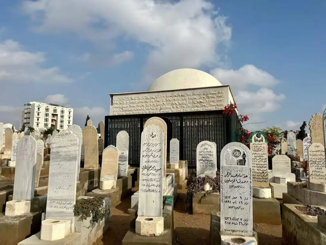
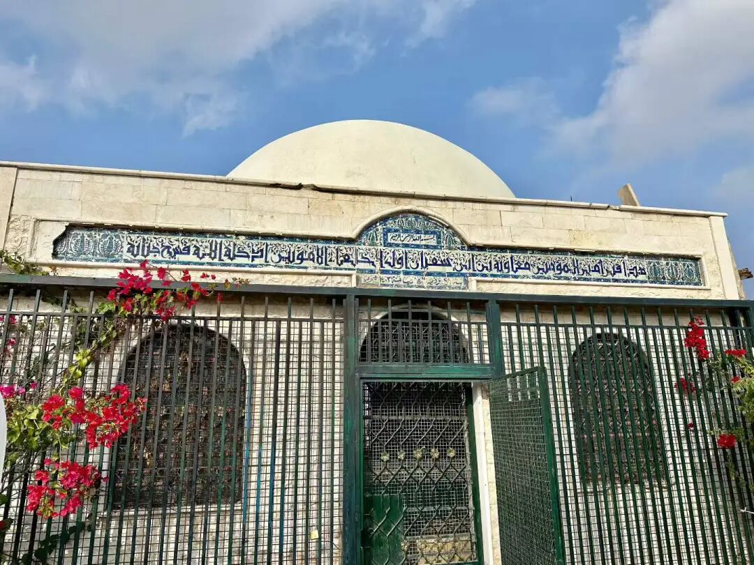
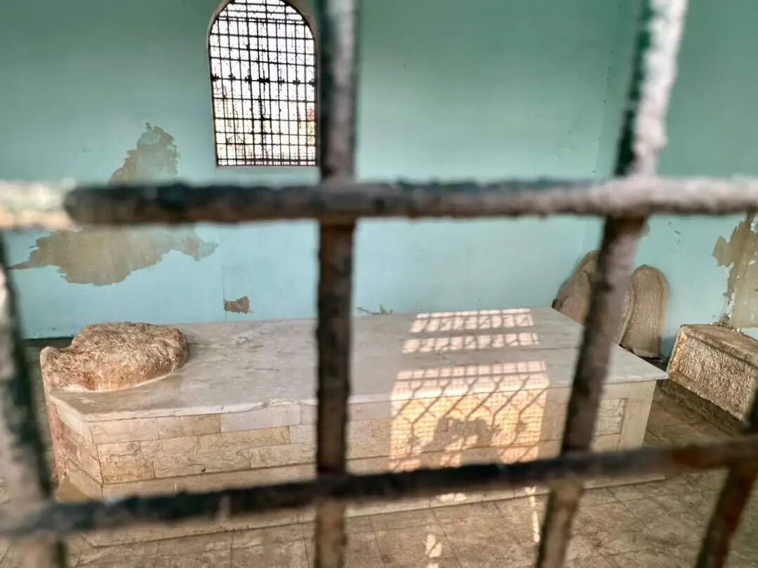
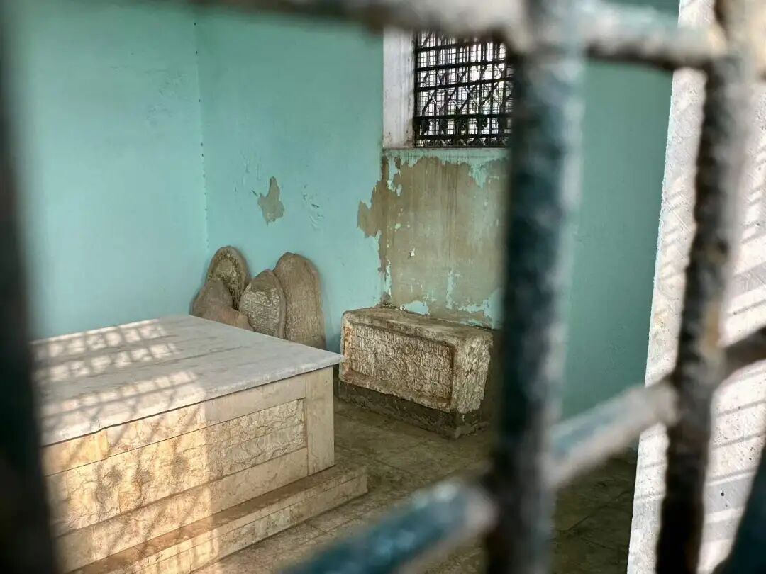
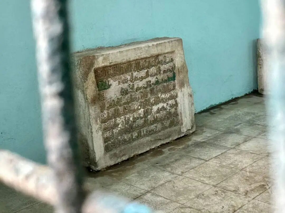
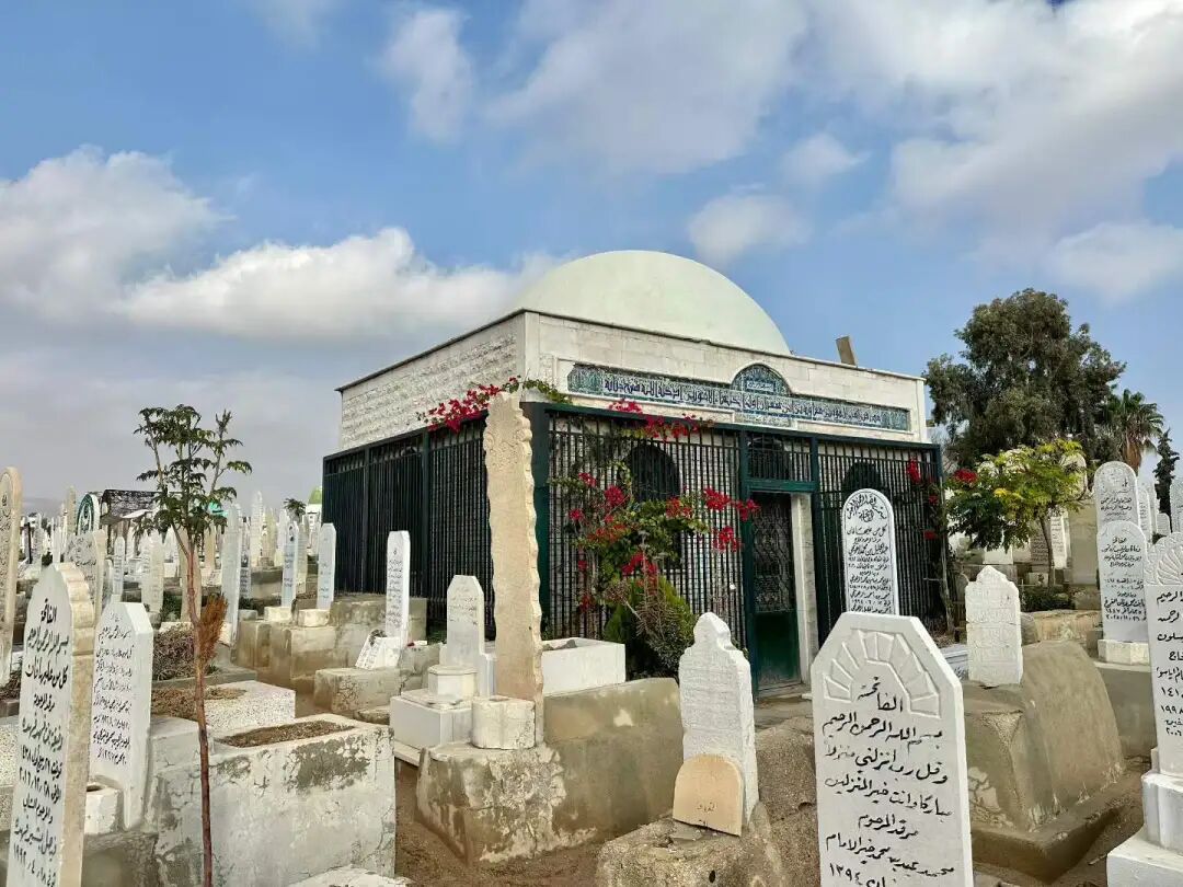
Next to the tomb of Muawiyah I is another tomb enclosed by iron railings, where the fifth Umayyad Caliph Abd al-Malik (reigned 685-705) and the sixth Caliph al-Walid I (reigned 705-715) are buried.
In his early years, Abd al-Malik lived a pious life in Medina and was a Tabi'un, meaning a follower of the Prophet's companions and one of the first generation born into the faith. In 683, the people of Medina opposed the rule of Muawiyah I's son, Yazid I, and expelled all Umayyads from the city, forcing Abd al-Malik to flee to Damascus. After the direct descendants of Muawiyah I passed away, Abd al-Malik, his distant cousin, was elected Caliph in 685. During his 20-year reign, Abd al-Malik constantly quelled internal divisions within the Umayyad Caliphate while resisting attacks from the Byzantine Empire. In the final years of his rule, the country was peaceful and his power was secure. His main achievements include introducing a unified currency to replace Byzantine and Sassanid coins, and replacing Greek and Persian with Arabic as the official language. He ordered the construction of the Dome of the Rock in Jerusalem, which is the oldest surviving Islamic building.
During the reign of Al-Walid I, the Arab Empire conquered Morocco, the Iberian Peninsula, the Sindh region of South Asia, and Transoxiana in Central Asia, reaching its largest territorial extent in history. He used the massive wealth from these conquests to build and expand many mosques, most the Umayyad Mosque in Damascus, the Al-Aqsa Mosque in Jerusalem, and the Prophet's Mosque in Medina. He also built the famous ancient city of Anjar in Lebanon and the Umayyad Mosque in Baalbek. He was the first caliph to implement a social welfare system, which earned him great respect among the poor and the disabled. Under his rule, the Umayyad Dynasty was prosperous and reached its peak.
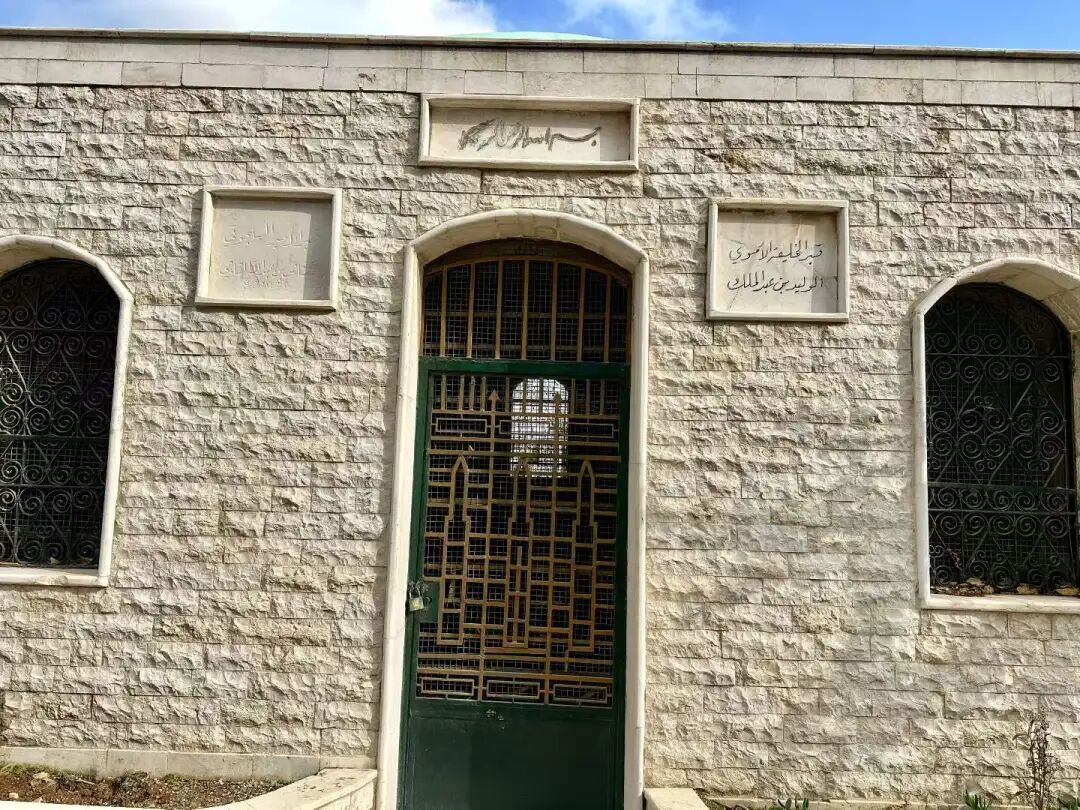
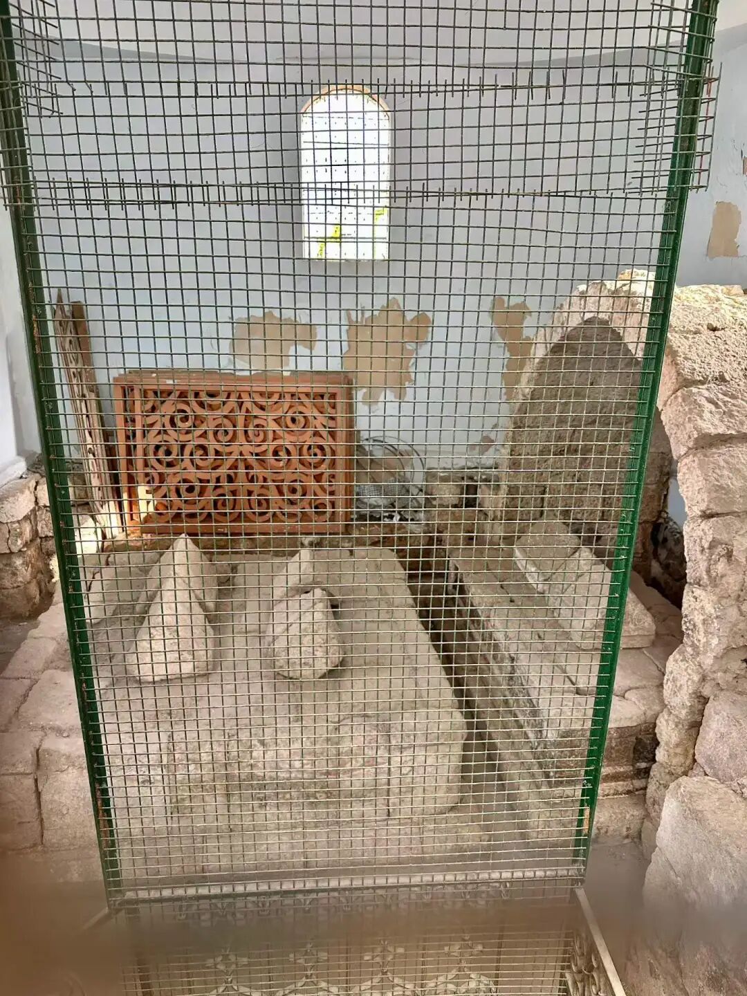
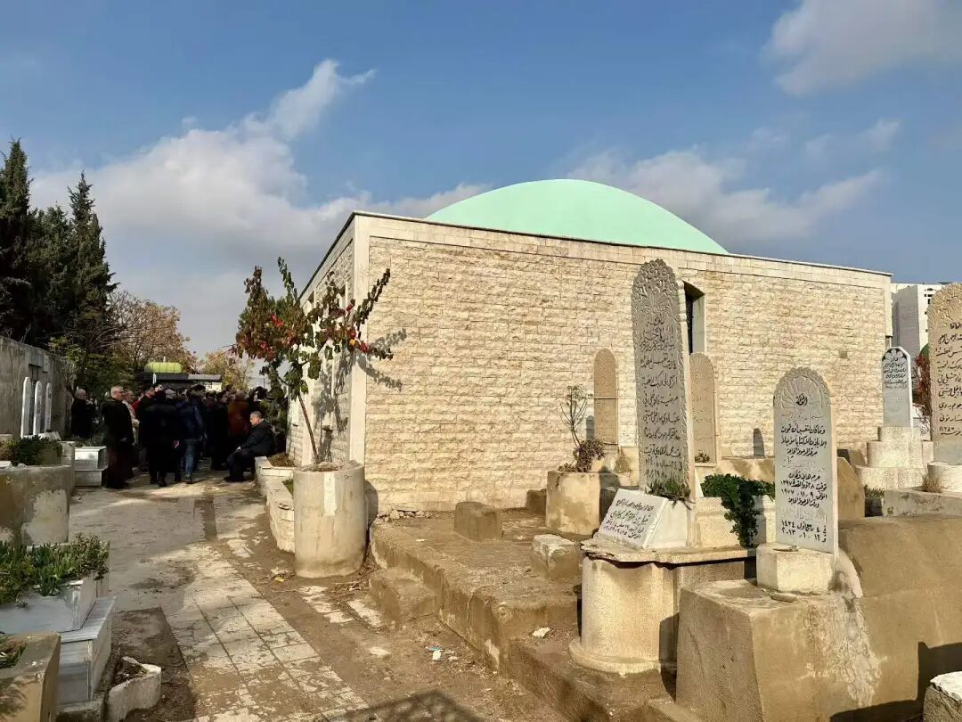
Umayyad coins on display at the 'Forging Narratives: The Coinage Heritage of Saudi Arabia' special exhibition at the National Museum of Saudi Arabia.
First are the gold coins from the time of Caliph Muawiyah I. The front shows the Byzantine Emperor Heraclius (reigned 610-641) and his two sons, Constantine III and Heraclonas, while the back features Latin text. Unlike Byzantine gold coins, the Umayyad gold coins lack crosses on the emperor's crown and scepter, and the cross on the steps on the back has only a vertical bar without a horizontal one.
Umayyad gold coins from this period reflect the early culture of the Umayyad Dynasty, which continued to inherit Byzantine culture. When Bedouin nomads from the Arabian Peninsula poured into the magnificent city of Damascus, they saw a rich and colorful Byzantine culture everywhere. Because of this, they continued to use Byzantine culture in areas outside of religion, such as music, art, and architecture, becoming the heirs to Byzantine culture.
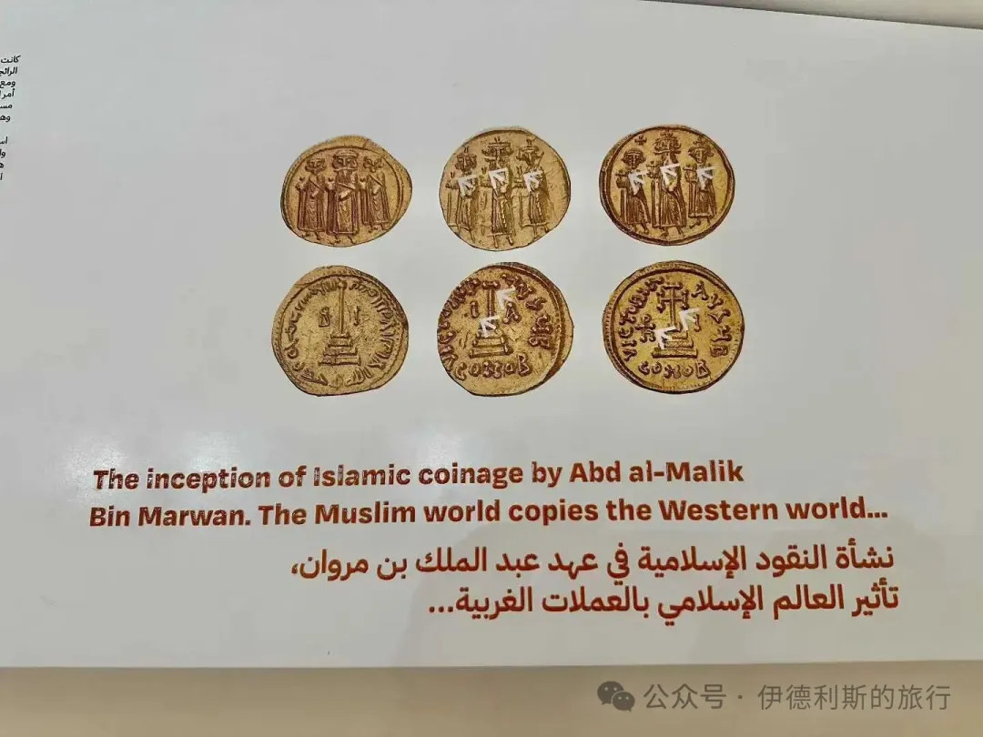
In 693, Caliph Abd al-Malik minted gold dinars in Damascus, and in 696, he removed human figures, keeping only Arabic text. During the same period, Abd al-Malik also promoted the replacement of Greek with Arabic in Syria, eventually making Arabic the sole official language of the Umayyad Dynasty. From this point on, the Umayyad Caliphate stopped being just an inheritor of Byzantine and Sassanid cultures and turned into a true Arab civilization.
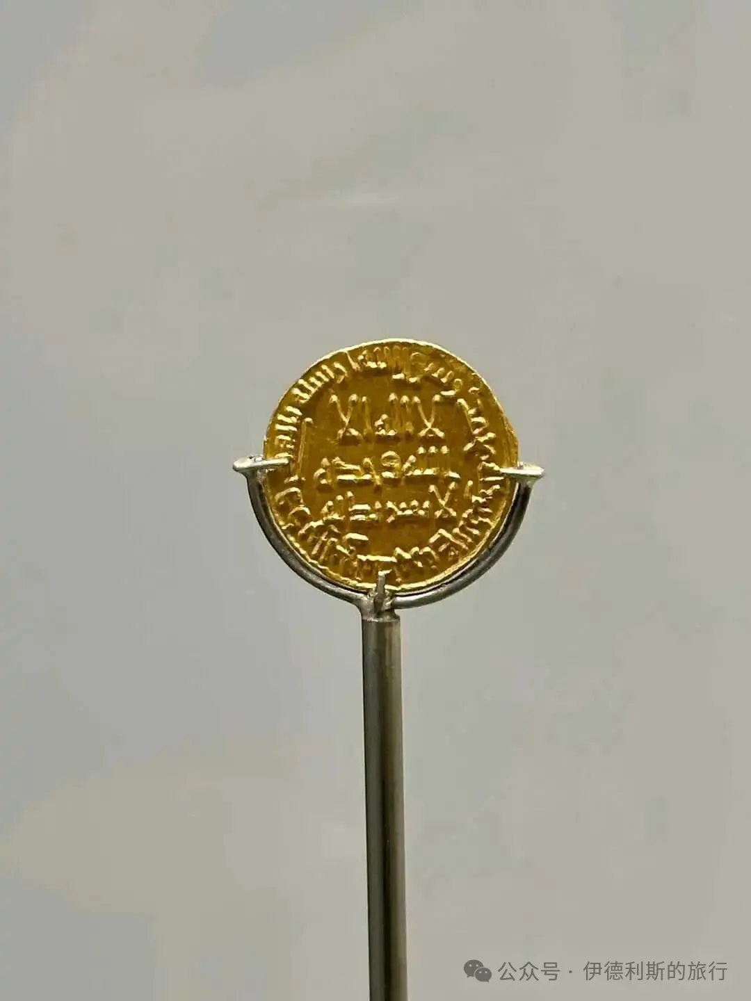
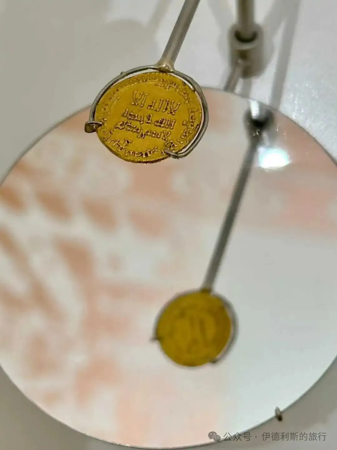
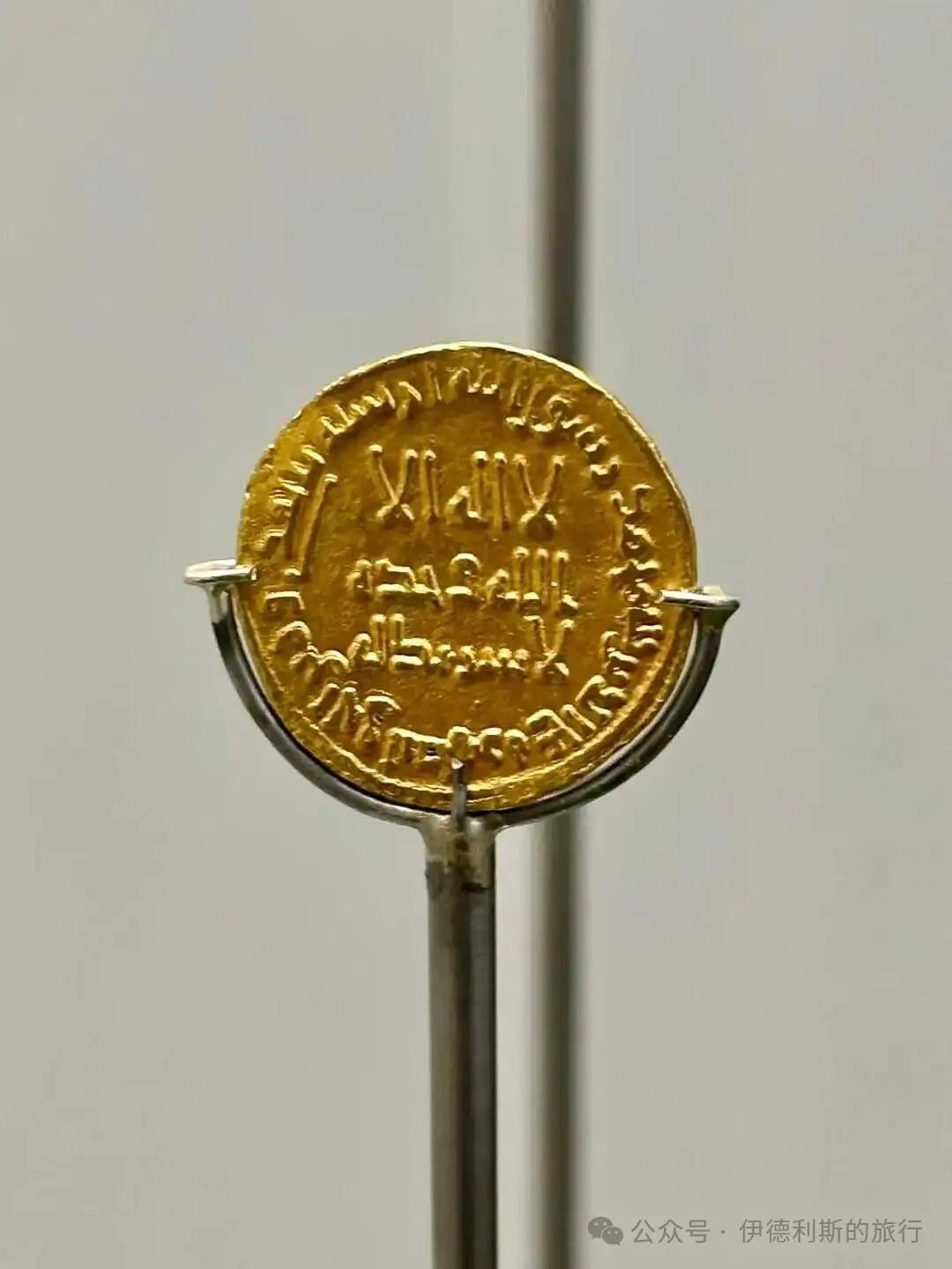
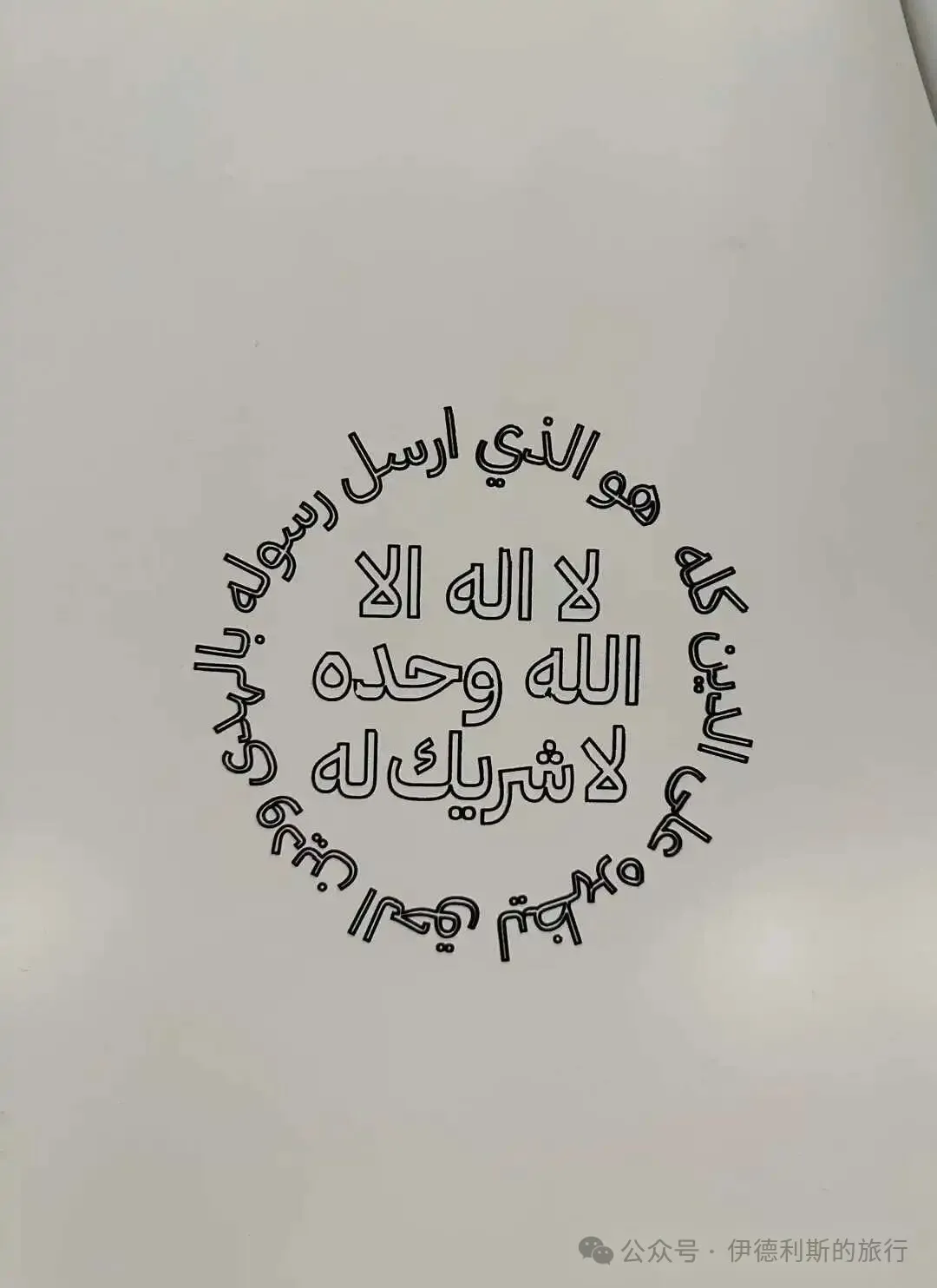
I visited Qasr Kharana in Jordan, which was built in 710 during the reign of Caliph al-Walid I.
The most special thing about Qasr Kharana is how it blends Byzantine and Sassanid architectural styles. The palace is built with plaster and rubble, and the second floor features barrel vaults supported by transverse arches, which is a typical Sassanid style, though it still differs from Sassanid buildings in Iran. The arches at Qasr Kharana do not connect to the load-bearing walls but rest on corbels, and they use new types of wooden lintels to make the building more flexible and earthquake-resistant.
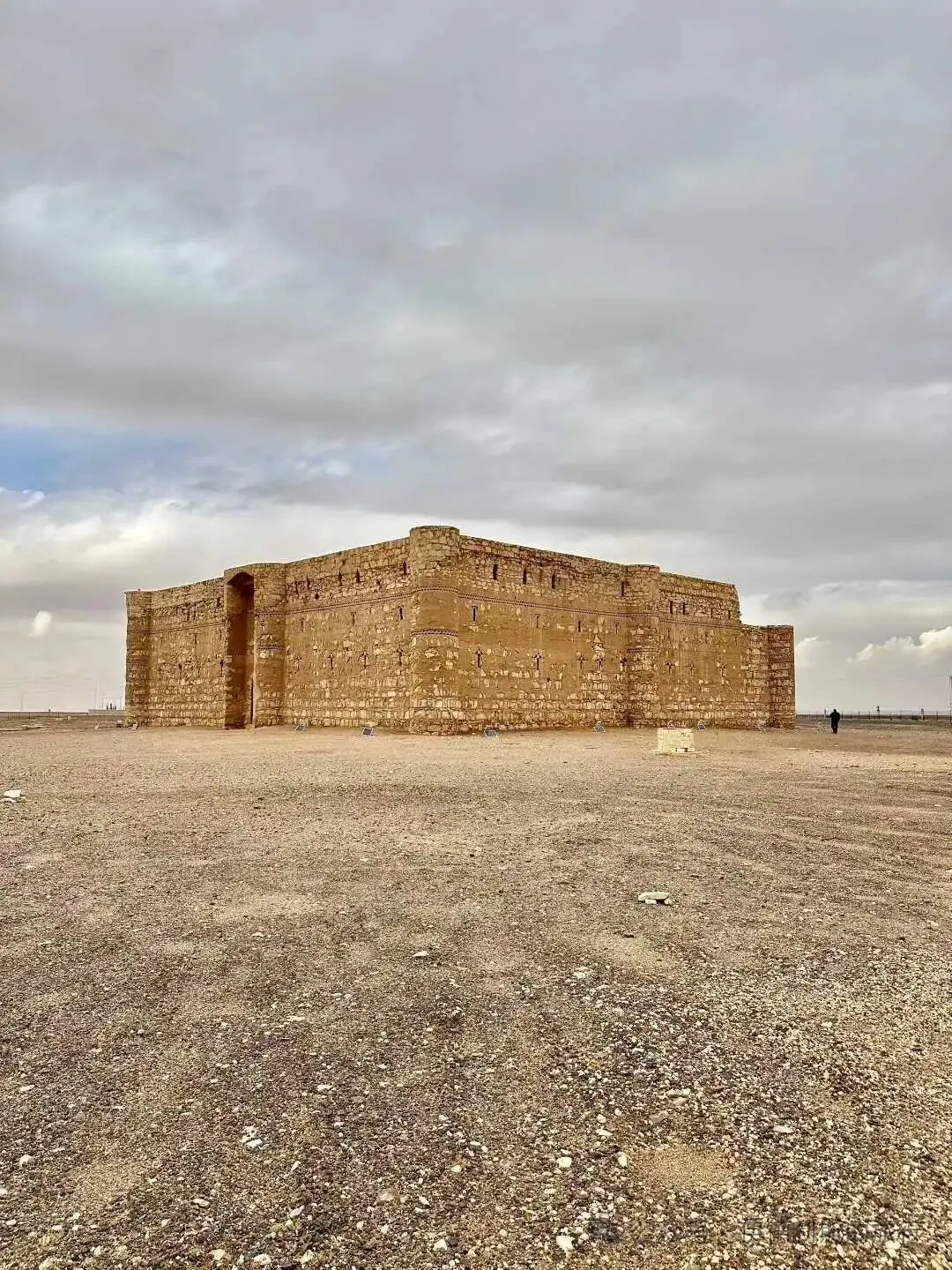
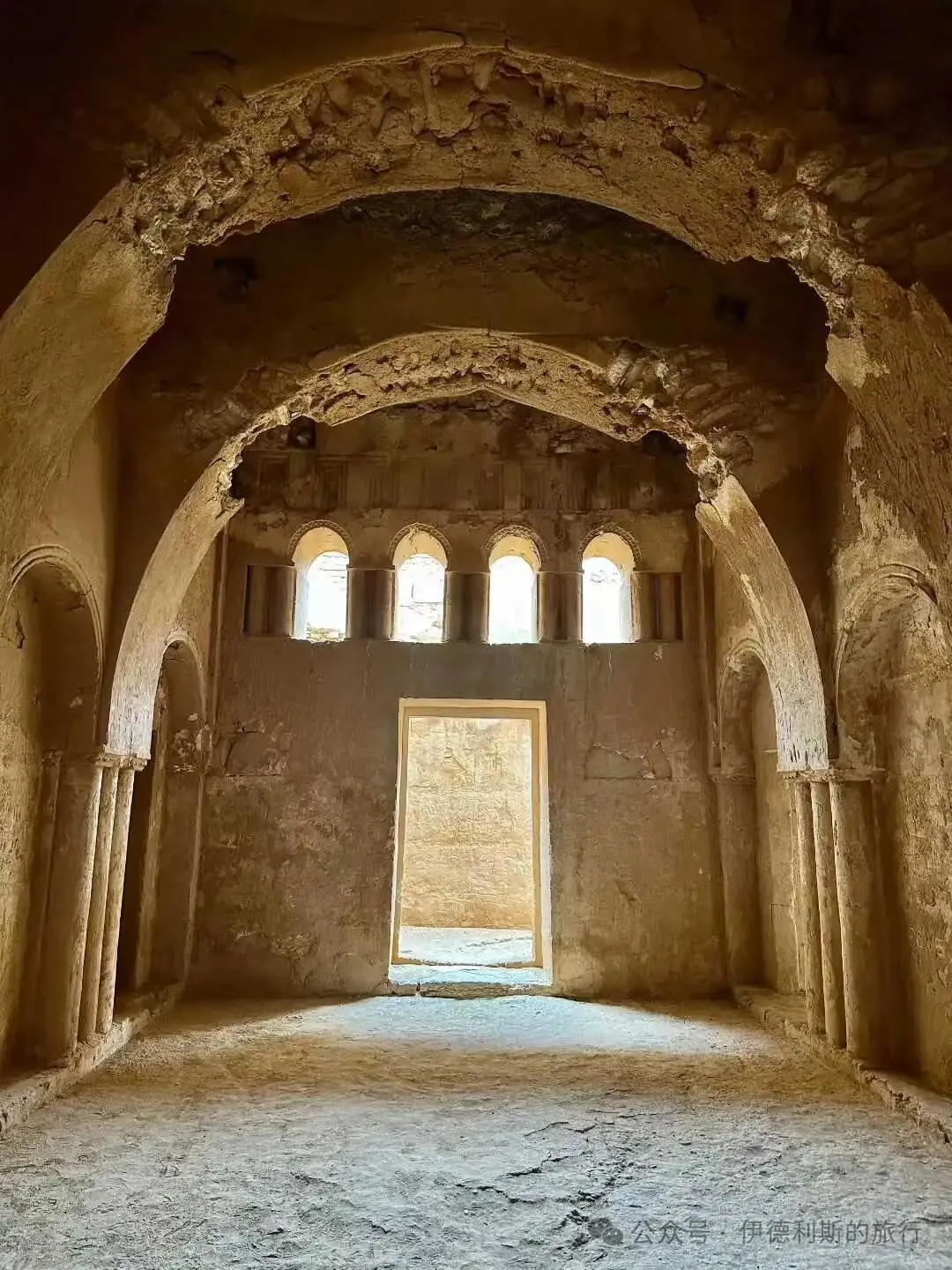
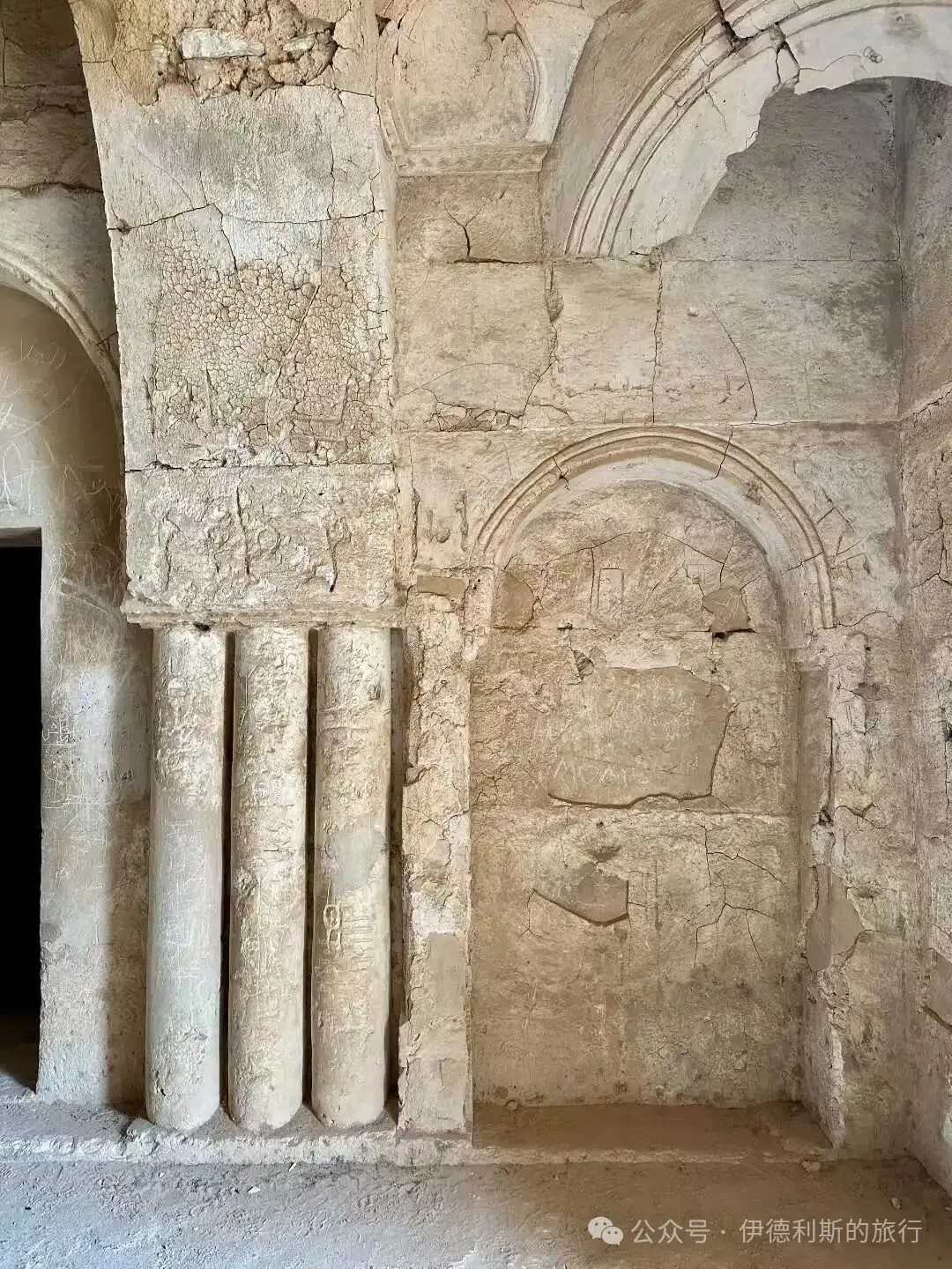
Hammam al-Sarah in Jordan was built in the early 8th century during the reign of Caliph Abd al-Malik or al-Walid I.
The bathhouse was built using neatly cut, medium-sized stones and decorated with intricately carved fluted moldings. Inside the main hall, there is a beautifully designed fountain supplied with water from an elevated water tower on the east side. There is also a walled garden site nearby, which is known as the oldest Islamic garden site.
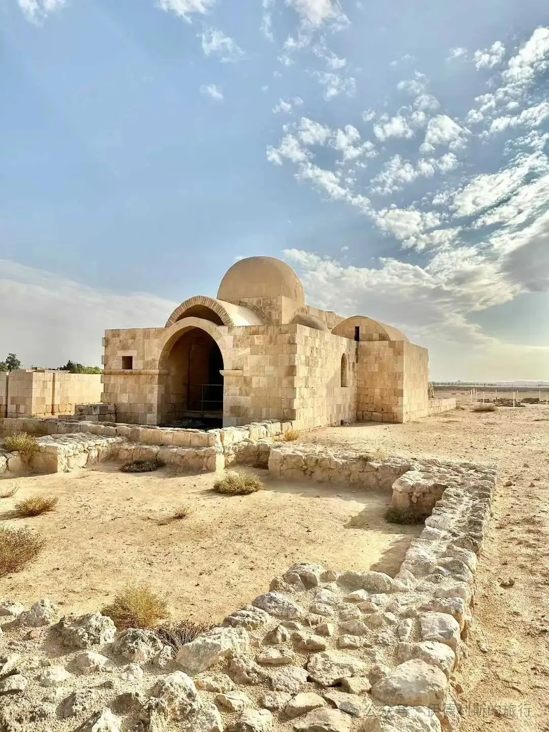
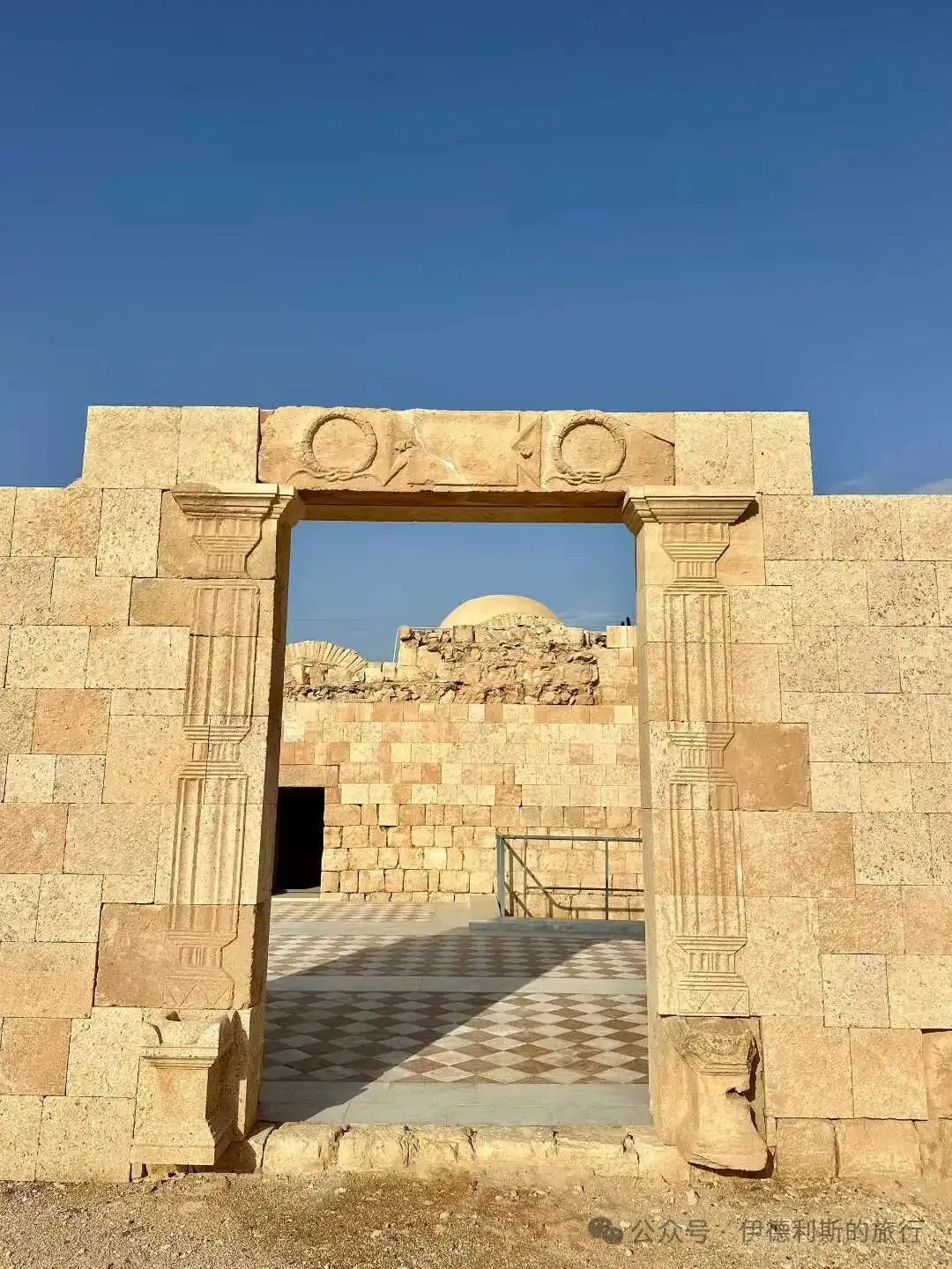
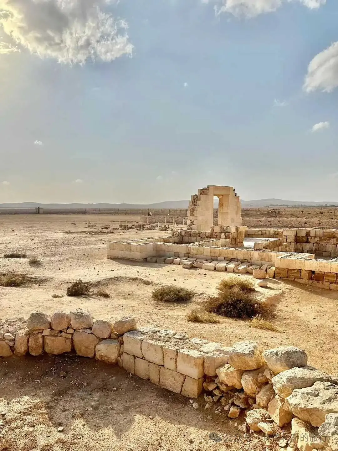
The Umayyad Mosque in Damascus was built under the direction of Caliph al-Walid I in 706. He kept the outer walls of the Roman mosque's inner sanctuary and moved the Corinthian columns and arcades from inside the mosque to the main hall, finishing the new mosque in 715 and making it a 'wonder of the world' in the writings of medieval Muslim scholars.
Before the Great Mosque of Damascus was built, traditional mosques were all flat-roofed halls. The Great Mosque of Damascus uses a basilica-style layout, featuring three wide, long halls and a central nave topped by a tall dome.
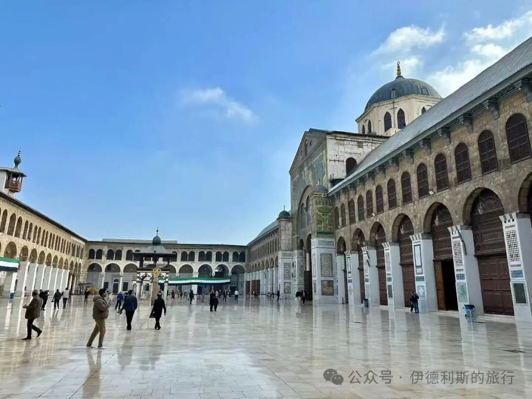
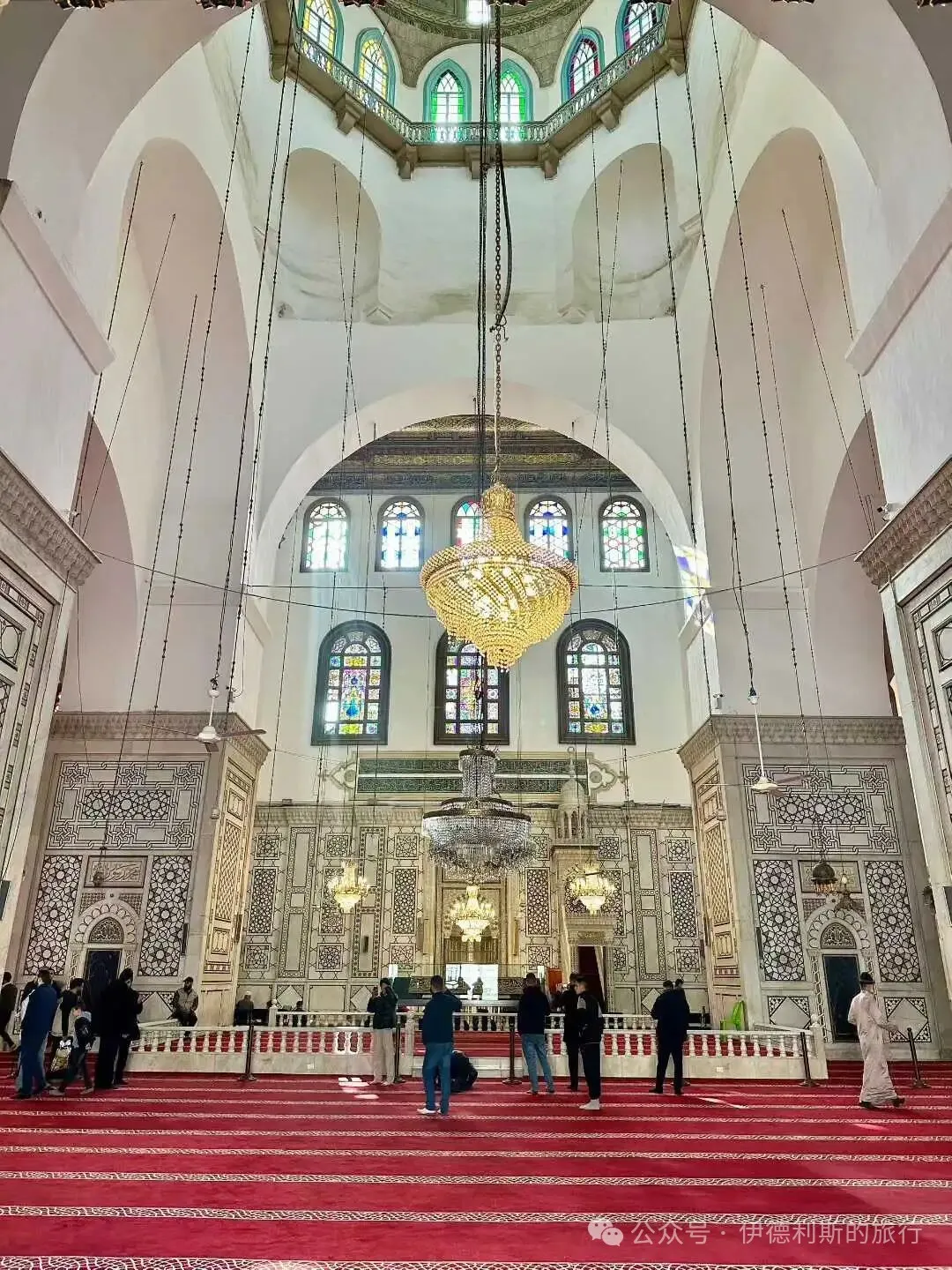
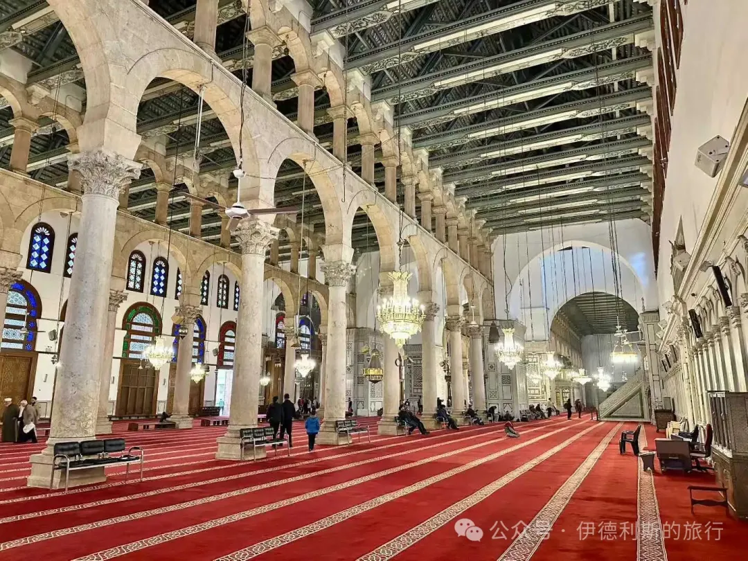
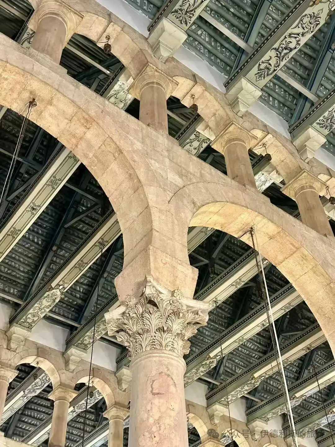
The Great Mosque of Damascus is world-famous for its rich Umayyad-era mosaic decorations. These mosaics show various natural landscapes and buildings in a late Roman style, following a classic naturalistic approach.
Some Arabic historical records suggest the craftsmen and materials for the mosaics came from the Byzantine capital of Constantinople, but a 2022 chemical analysis study showed that most of the mosaics were actually made in Egypt. Although these mosaic images show traces of Byzantine style, some scholars believe their craftsmanship is more consistent with mosaic techniques from Syria, Palestine, and Egypt.
The meaning of the mosaic images has been a subject of long-standing debate. Some believe they represent the known world at that time, others think they depict Damascus and the Barada River, and some argue they show scenes of Paradise. Currently, there is more evidence for the Paradise theory, as the landscapes without human figures fit the idea of an empty Paradise waiting for people to arrive after the Day of Resurrection.
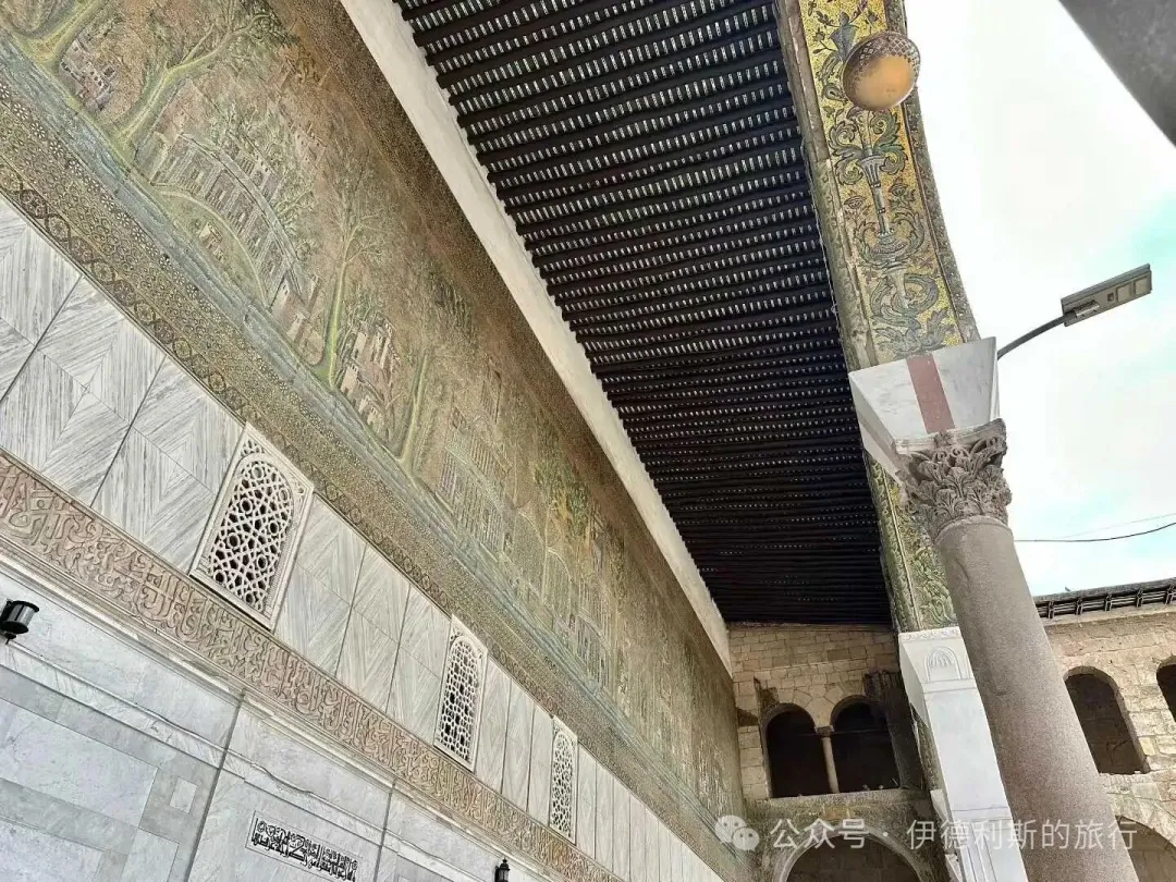
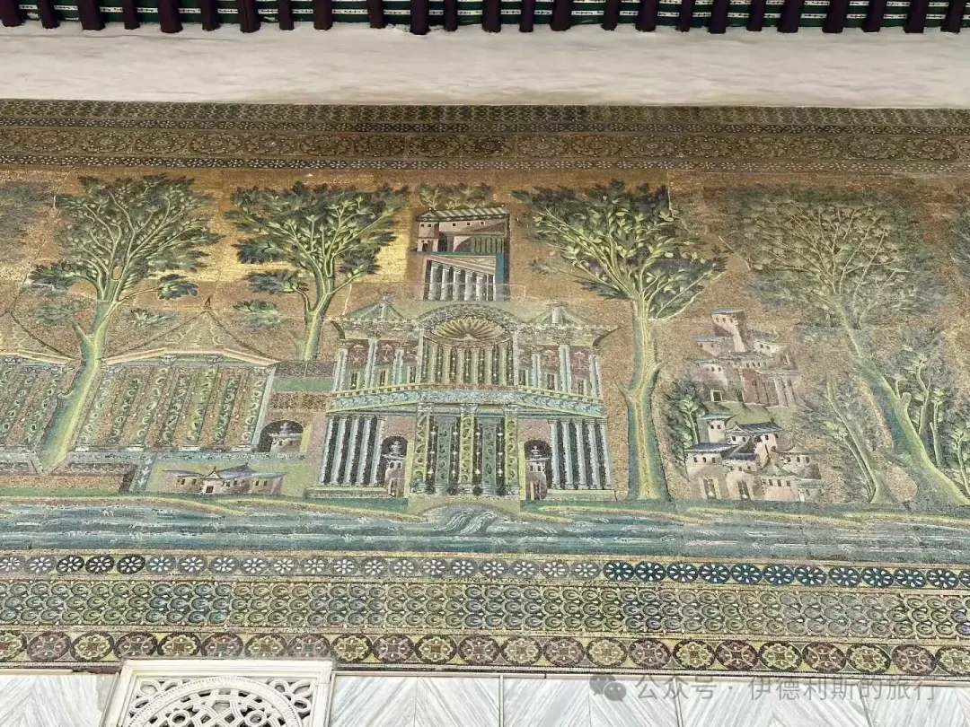
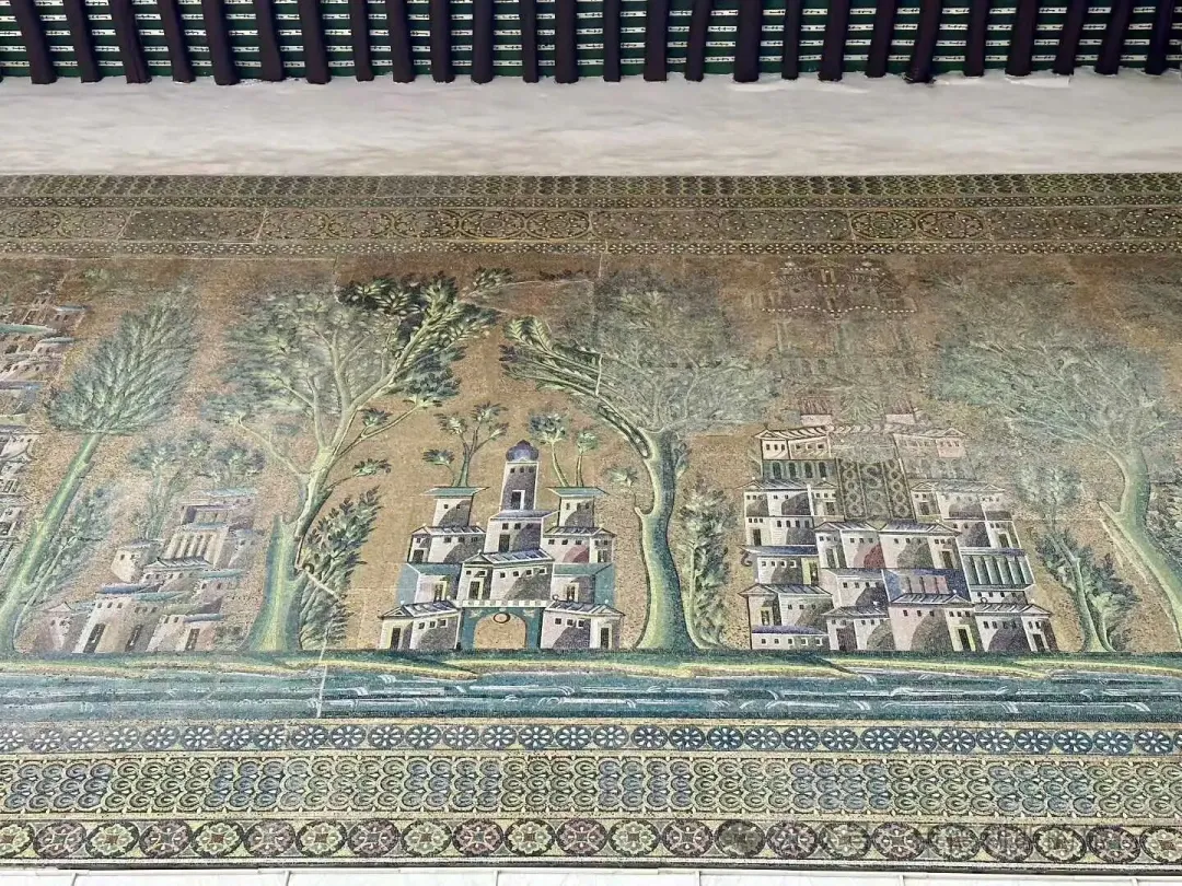
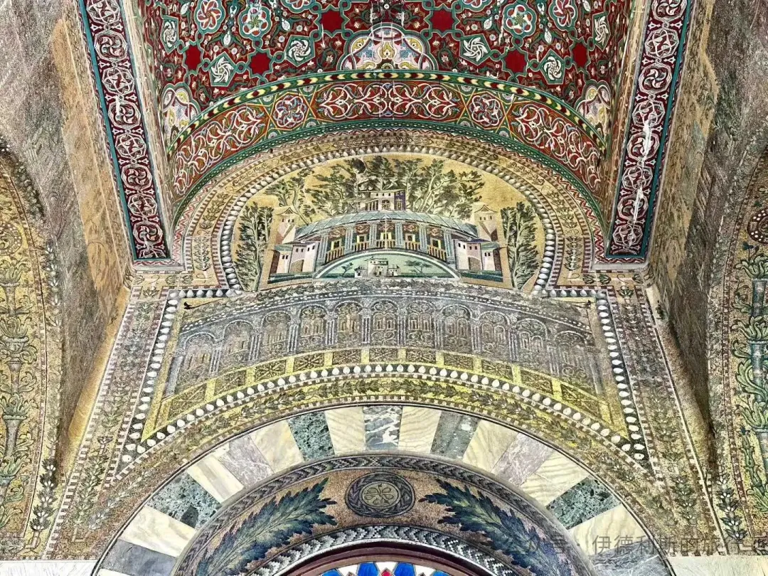
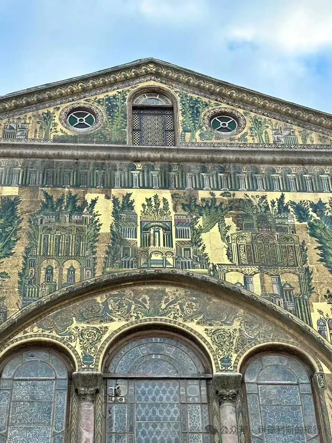
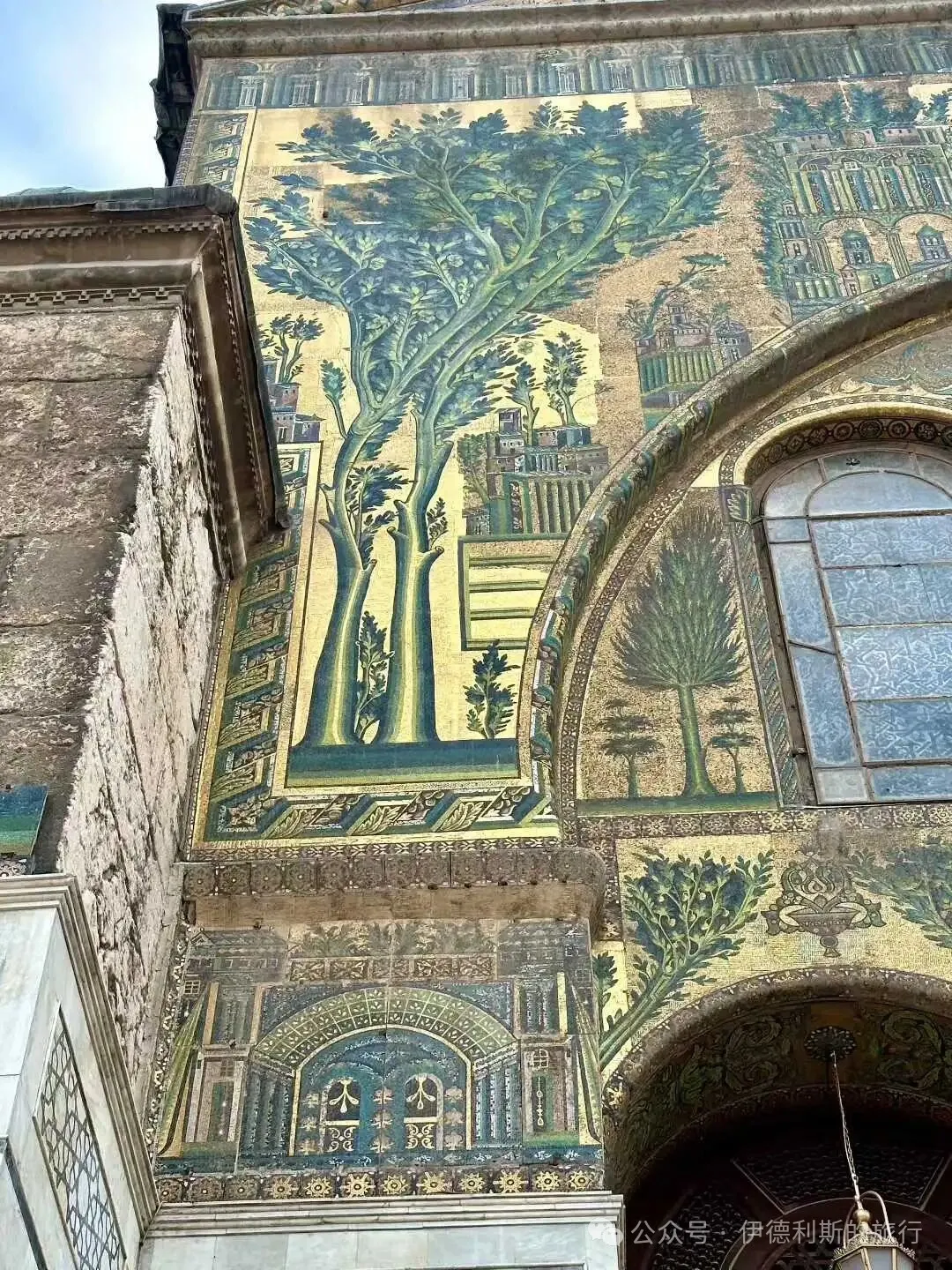
The ancient city of Anjar in Lebanon was built by al-Abbas, the son of Caliph al-Walid I, between 714 and 715. This place has been an important route connecting Beirut and Damascus since ancient times, and it was listed as a UNESCO World Heritage site in 1984.
It is believed that the ancient city of Anjar likely used many captives brought back by Prince al-Abbas from his campaigns against the Byzantine Empire as laborers, which is why the stone carvings have a strong Byzantine style. The entire ancient city is based on a Roman city plan, with a rectangular layout surrounded by thick walls, where two main roads intersect at four gates to divide the city into four sections. The main road is lined with columns and rows of shops that look like Roman tabernae, while a classic four-sided Roman gate known as a tetrapylon stands at the intersection. The city is divided into four functional areas: the southeast holds the grand palace and mosque, the northeast contains the small palace (harem) and bathhouse, and the northwest and southwest are residential zones.
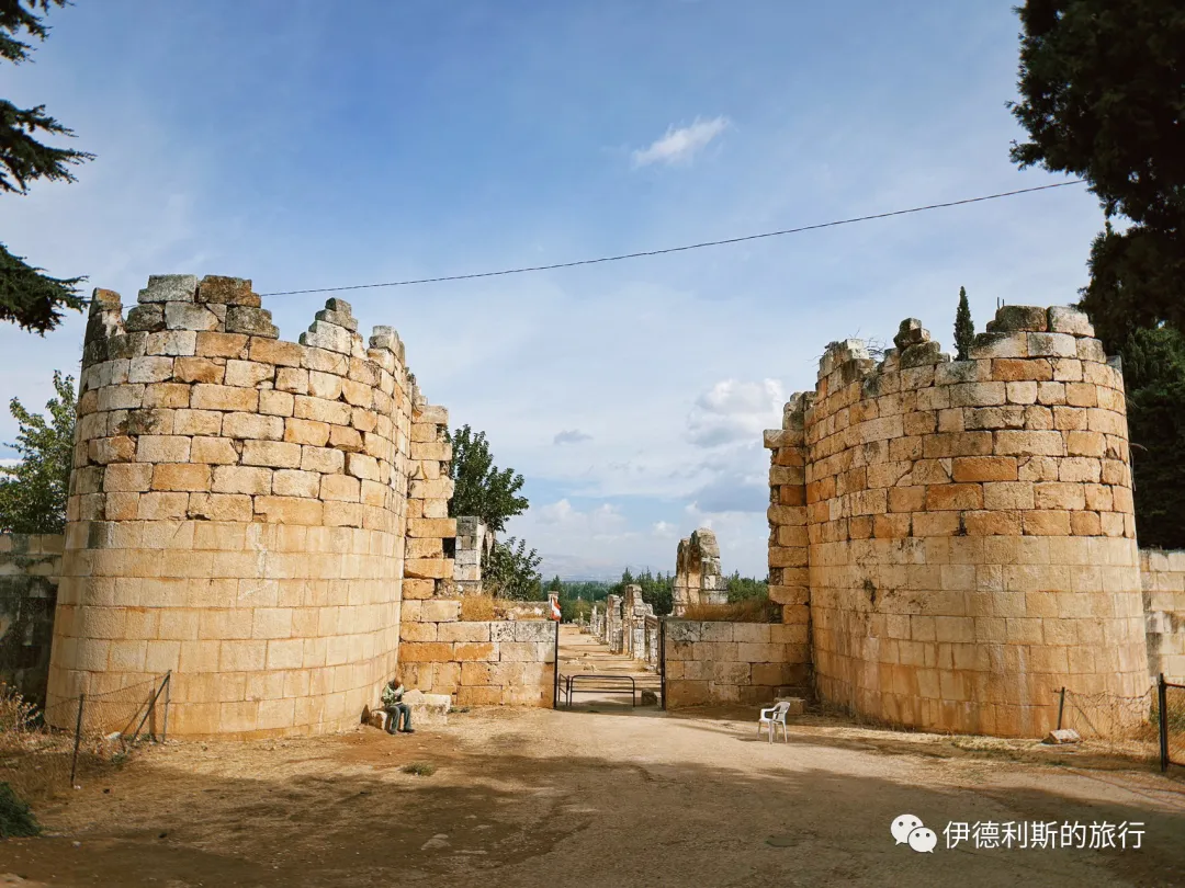
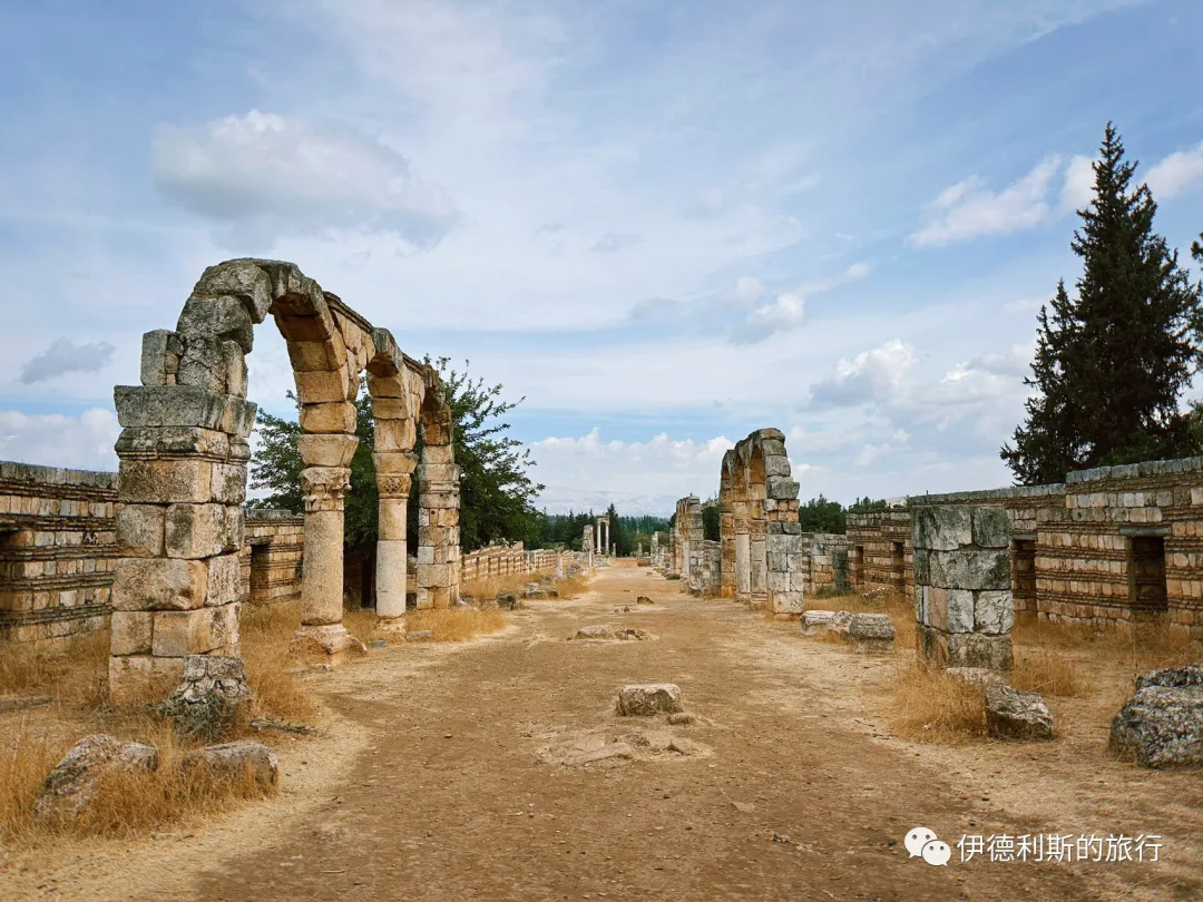
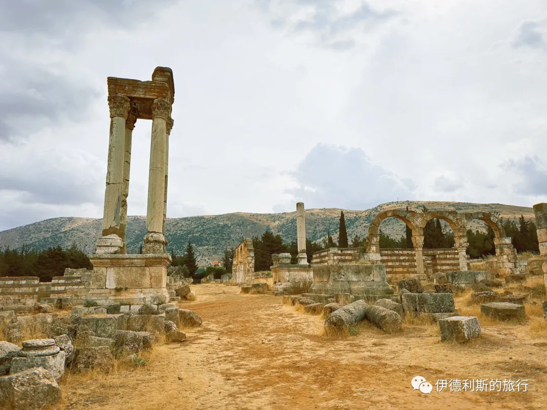
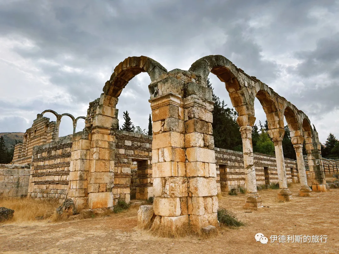
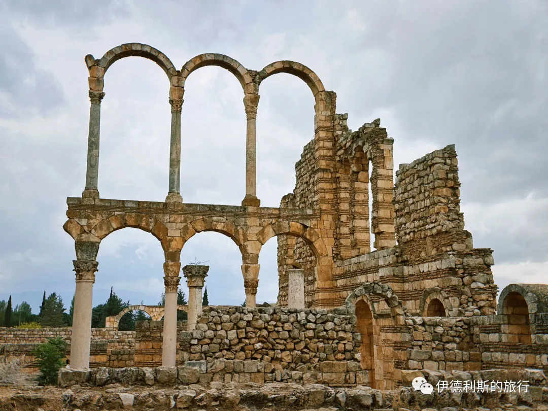
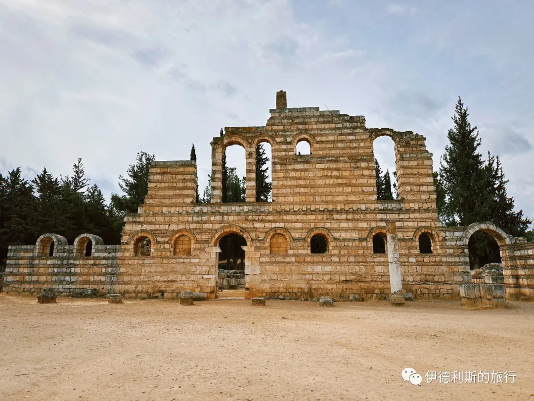
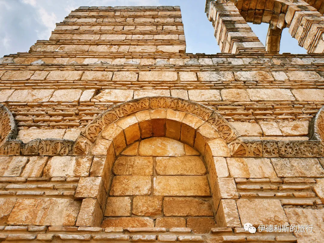
The Umayyad Mosque in Baalbek, Lebanon, was also built by the Umayyad Caliph al-Walid I in 715, the same year as the Umayyad Mosque in Damascus. These two mosques stand together as the oldest surviving masjid buildings in the world.
Compared to the Umayyad Mosque in Damascus, the Baalbek Umayyad Mosque is simpler, but its overall style is very similar. Some stone parts inside the main hall may have been taken from the nearby Roman-era Baalbek Citadel, and the column capitals show a strong Roman-Byzantine style.
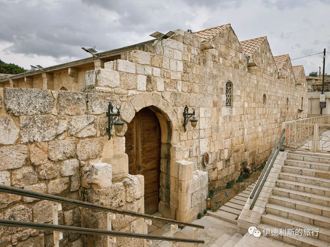
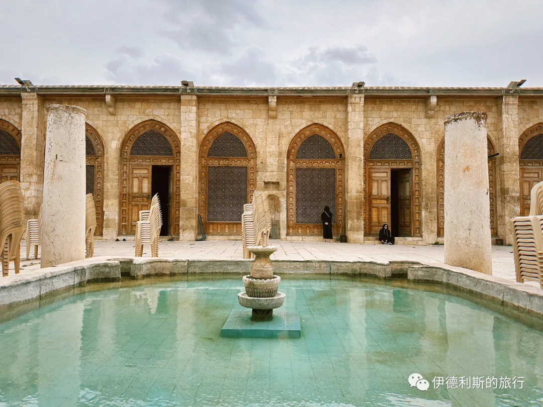
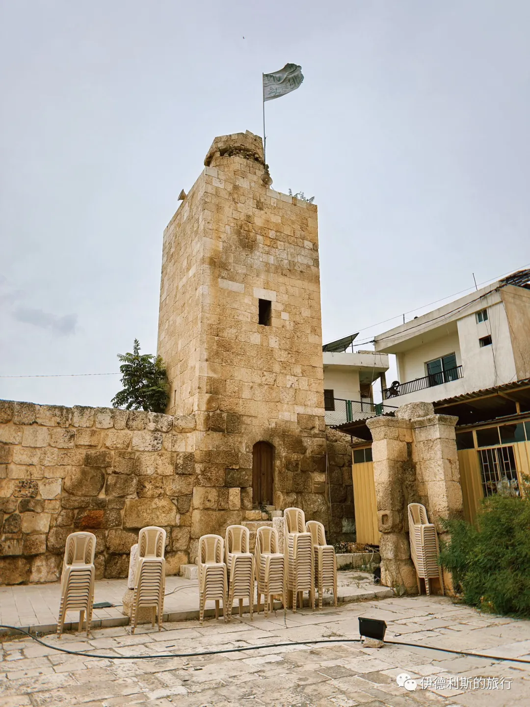
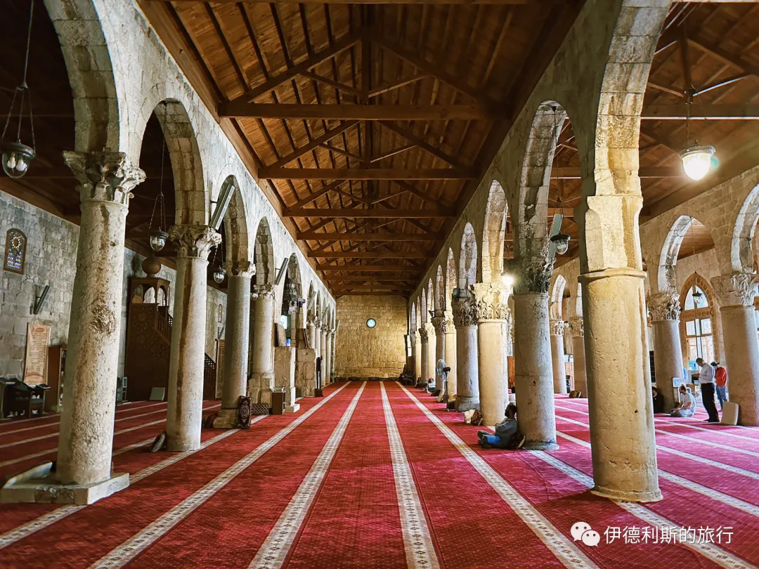
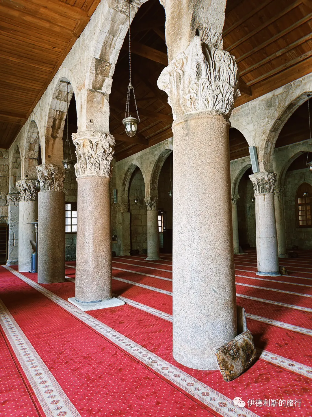
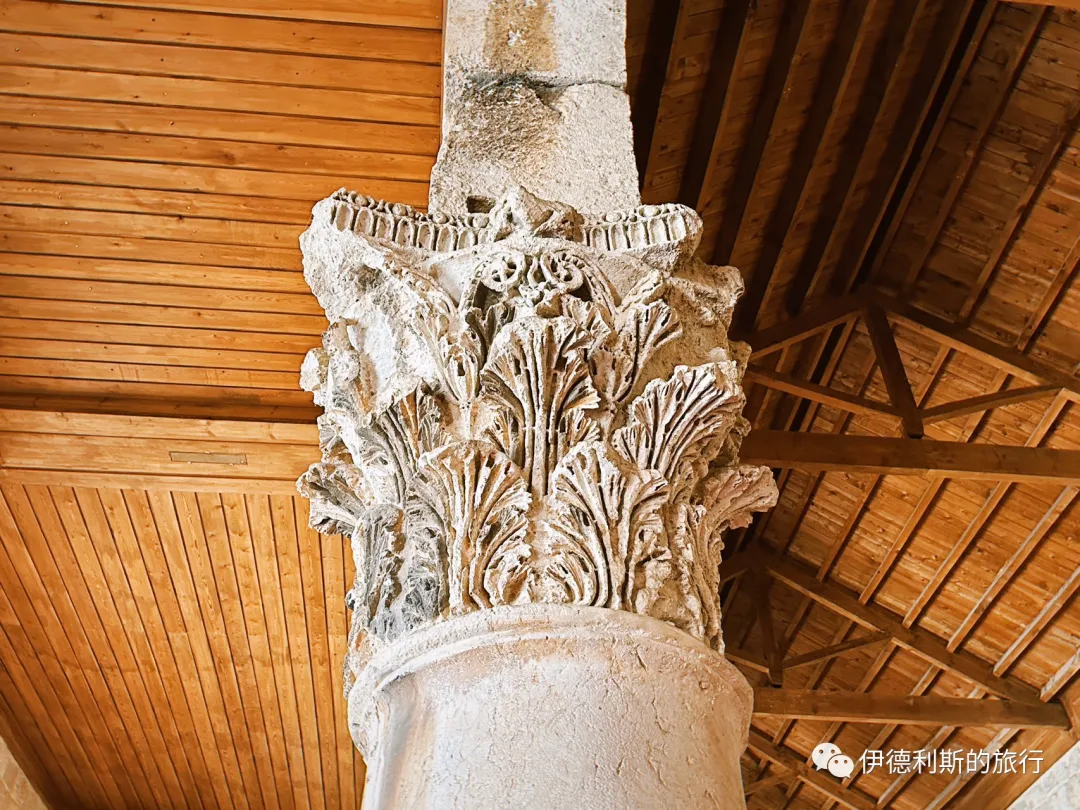
Muslim History Guide to Damascus: Sufi Sage Ibn Arabi, Mosque Area and Shrine Visit
Articles • yusuf908 posted the article • 0 comments • 164 views • 2026-06-22 06:27
Summary: This Muslim history guide to Damascus follows Sufi sage Ibn Arabi, mosque-area travel, shrine history, and Islamic heritage from the original article.
This article summarizes the key points of visiting the Sufi sage Ibn Arabi in Damascus. It keeps the original paragraph and image order. It is for readers interested in Muslim life, Islamic culture, and Chinese Islamic writing. It also helps with searching for content on namaz, Hajj, and Ramadan.
Salihiyah, located at the foot of Mount Qasioun, is the most important historic district in Damascus outside the old city. Historic buildings from the Ayyubid, Mamluk, and Ottoman dynasties stand along both sides of the Friday market (Jumu'ah market). Some look plain from the outside but are hundreds of years old.
After the Crusaders captured Jerusalem in 1099, many scholars, jurists, and civilians fled to Damascus for refuge. In 1156, the famous Hanbali scholar Ibn Qudamah moved from the West Bank to Damascus to escape the Crusaders and later settled in Salihiyah. He once admired this land and said, 'This is a place of barakah (blessing).'
Saladin, the founder of the Ayyubid dynasty, wanted to provide a safe and stable environment for the scholars and immigrants who fled from Jerusalem to Damascus. Because Ibn Qudamah's home at the foot of Mount Qasioun in the north of the city had become an academic center for the Hanbali school, Saladin decided to build the Salihiyah community at the foot of Mount Qasioun.
The most famous landmark in Salihiyah is the Shaikh Mohiddin Mosque (Masjid Shaikh Mohiddin), which houses the tomb of the famous Sufi sage Ibn Arabi.
Ibn Arabi was born in 1165 in what is now southern Spain, which was then called Al-Andalus. Starting at age 28, he traveled throughout the Middle East for many years, performed Hajj multiple times, and lived in Tunisia, Morocco, and Mecca. At age 58, he finally chose to settle in Damascus to focus on teaching and writing. He passed away in Damascus in 1240 at the age of 75. After Ibn Arabi passed away, his works were translated into Persian, Turkish, and Urdu. They had a great influence on the entire Muslim world, and he is known as a founder of the development of Sufism.
The shrine (gongbei) of Ibn Arabi was originally quite small. In 1518, Ottoman Sultan Selim I ordered its reconstruction during his visit to Damascus, which showed how much the Ottoman Empire valued Sufis at the time. After it was built, the shrine was first named the Selimiye Mosque after the Sultan. Because Ibn Arabi’s title, Muhyiddin, means 'reviver of the faith,' the mosque is also known as the Sheikh Muhyiddin Mosque. On the first Friday (Jumu'ah) of Ramadan after the mosque was finished, the Sultan personally visited to attend prayers and gifted the mosque a pair of silver socks.
The mosque blends architectural styles from the late Mamluk and early Ottoman periods. The shrine is located below the mosque, and you enter it by taking the stairs on the east side of the courtyard. Inside the shrine, besides Ibn Arabi himself, lie his two sons and his followers.
The tiles on the walls of the shrine were laid in 1760.
The Sheikh Muhyiddin Mosque follows a traditional Damascus layout, with a courtyard surrounding the front of the main prayer hall and an Ottoman-style minaret built above the main gate. The walls are covered in yellow and white marble, and there is a Damascus-style pool in the middle of the courtyard. The wall decorations mix Ottoman and Mamluk styles, and the Corinthian capitals on the stone pillars of the main hall feature beautiful carvings. The two large candlesticks in front of the mihrab are also very characteristic of the Ottoman style.
When I first arrived at the Sheikh Muhyiddin Mosque, I happened to catch a funeral prayer (janazah) for a sheikh, and I could really feel the strong religious atmosphere here.
Not far to the east of the Sheikh Muhyiddin Mosque is the Hanabila, another famous mosque in the Salihiya district. Hanabila Mosque is a famous early Ayyubid dynasty mosque in Syria. It was founded between 1208 and 1210 by the famous Hanbali scholar Ibn Qudama. He was born in Jerusalem and settled in Damascus in 1197, which became his main center for scholarship.
The mosque follows the Ayyubid architectural style. It centers on a courtyard, and the main prayer hall follows the layout of the Umayyad Mosque in Damascus, though its structure is more compact. The mosque still has a beautiful pulpit (minbar) and window carvings that are over 800 years old.
Rukniyah Madrasa is located on the far east side of the Salihiyah district in Damascus. It was built in 1224 by the Ayyubid governor of Damascus, Rukn al-Din Mankurs al-Falaki, who is also buried there. Rukniyah Madrasa is the first Ayyubid building with a courtyard covered by a dome. The building consists of two square sections: the larger part is the madrasa, and the smaller part is the tomb. The minaret was added later.
Because the Ayyubid dynasty was busy fighting the Crusades, the architectural style of this period is known for being simple, sturdy, and durable. Rukniyah Madrasa belongs to the Hanafi school of law. It has now been converted into a mosque, and the main hall is not open except during the five daily namaz prayers.
Abd al-Ghani al-Nabulsi Mosque was built in 1764 by Sheikh Mustafa al-Nabulsi, the grandson of the famous Syrian Sufi sheikh and poet Abd al-Ghani al-Nabulsi. Both Sheikh Abd al-Ghani al-Nabulsi and Sheikh Mustafa al-Nabulsi are buried there. Unfortunately, since most mosques in Damascus do not open their doors except for the five daily namaz prayers, I could not go inside.
Sheikh Abd al-Ghani's family came from the Banu Jama'a. For generations, they served as chief judges and great Sufi sheikhs during the Mamluk dynasty. One branch of his family settled in Damascus after the Ottoman Empire conquered the Mamluk dynasty in 1516. They continued to hold positions such as the Shafi'i Grand Mufti of Damascus and teachers at the Umayyad Mosque.
Sheikh Abd al-Ghani was born in Damascus in 1641. His father switched from the Shafi'i school to the Hanafi school after a debate with Hanafi students. This was the mainstream school of the Ottoman Empire at the time. Abdul-Ghani began studying Islamic law as a child. He joined the Qadiriyya and Naqshbandiyya Sufi orders and spent seven years in quiet retreat at home. He traveled widely across the Middle East and wrote over 200 books. He was especially known for his deep research into the Sufi sage Ibn Arabi.
Before Sheikh Abdul-Ghani, the Salhiyya district of Damascus followed the Hanbali school of law. He was the first to bring Hanafi and Shafi'i ideas to the area and hosted many Hanafi students in his home.
The Jharkasiya Madrasa is on the market street in the Salhiyya district of Damascus. It was built in 1237 by the Ayyubid general Salim al-Din al-Hattra for his teacher, the Ayyubid general Jharkas ibn Abdullah. Both Jharkas ibn Abdullah and Salim al-Din al-Hattra are buried inside.
Jharkas was a commander in Saladin's personal guard and witnessed all of Saladin's military campaigns. The Jharkasiya Madrasa has a very rare double-domed tomb. Historically, the school taught both Hanafi and Shafi'i law, but today it serves as a mosque.
The Mershadiyeh Madrasa is on the west side of the Salhiyya district in Damascus. It was built in 1252 with funding from Khadija Khatun, the daughter of the Ayyubid Emir of Damascus, Al-Mu'azzam Isa. She is buried in the courtyard after her passing.
The square minaret of the madrasa is the only surviving example of 13th-century Ayyubid architecture in Damascus. The madrasa is currently closed. You must contact the Syrian Directorate-General of Antiquities and Museums to enter.
The Takrityya Madrasa is on the far west side of the Salhiyya district in Damascus. It was built in 1298 by the Emir Taqi al-Din al-Takriti, who is buried inside. This building dates back to the Mamluk period, but it keeps the strict and simple architectural style of the Ayyubid dynasty. The Mongol army destroyed this place in 1300, but it was rebuilt later.
Rabia Khatun, the sister of Ayyubid founder Saladin, built the Sahiba Madrasa in 1233, and her tomb is inside. People call this madrasa a model of Ayyubid architecture because of its thick walls and beautiful carvings that only use simple geometric shapes.
This madrasa once taught the Hanbali school of thought, which was the mainstream school at the time. Today, it is a primary school for girls, and generations of local residents have studied here.
Juma Market, the main road of the Salihiya historic neighborhood in Damascus.
The market in Salihiya grew quickly during the Ayyubid dynasty as more people moved here from Jerusalem. The Juma Market in front of the gongbei of the Sufi sage Ibn Arabi only sold goods after Friday namaz at first, but it eventually became a permanent market while keeping the name Juma Market. It is still a great place for nearby residents to shop today.
Handwritten signs at the market. view all
Summary: This Muslim history guide to Damascus follows Sufi sage Ibn Arabi, mosque-area travel, shrine history, and Islamic heritage from the original article.
This article summarizes the key points of visiting the Sufi sage Ibn Arabi in Damascus. It keeps the original paragraph and image order. It is for readers interested in Muslim life, Islamic culture, and Chinese Islamic writing. It also helps with searching for content on namaz, Hajj, and Ramadan.
Salihiyah, located at the foot of Mount Qasioun, is the most important historic district in Damascus outside the old city. Historic buildings from the Ayyubid, Mamluk, and Ottoman dynasties stand along both sides of the Friday market (Jumu'ah market). Some look plain from the outside but are hundreds of years old.
After the Crusaders captured Jerusalem in 1099, many scholars, jurists, and civilians fled to Damascus for refuge. In 1156, the famous Hanbali scholar Ibn Qudamah moved from the West Bank to Damascus to escape the Crusaders and later settled in Salihiyah. He once admired this land and said, 'This is a place of barakah (blessing).'
Saladin, the founder of the Ayyubid dynasty, wanted to provide a safe and stable environment for the scholars and immigrants who fled from Jerusalem to Damascus. Because Ibn Qudamah's home at the foot of Mount Qasioun in the north of the city had become an academic center for the Hanbali school, Saladin decided to build the Salihiyah community at the foot of Mount Qasioun.
The most famous landmark in Salihiyah is the Shaikh Mohiddin Mosque (Masjid Shaikh Mohiddin), which houses the tomb of the famous Sufi sage Ibn Arabi.
Ibn Arabi was born in 1165 in what is now southern Spain, which was then called Al-Andalus. Starting at age 28, he traveled throughout the Middle East for many years, performed Hajj multiple times, and lived in Tunisia, Morocco, and Mecca. At age 58, he finally chose to settle in Damascus to focus on teaching and writing. He passed away in Damascus in 1240 at the age of 75. After Ibn Arabi passed away, his works were translated into Persian, Turkish, and Urdu. They had a great influence on the entire Muslim world, and he is known as a founder of the development of Sufism.
The shrine (gongbei) of Ibn Arabi was originally quite small. In 1518, Ottoman Sultan Selim I ordered its reconstruction during his visit to Damascus, which showed how much the Ottoman Empire valued Sufis at the time. After it was built, the shrine was first named the Selimiye Mosque after the Sultan. Because Ibn Arabi’s title, Muhyiddin, means 'reviver of the faith,' the mosque is also known as the Sheikh Muhyiddin Mosque. On the first Friday (Jumu'ah) of Ramadan after the mosque was finished, the Sultan personally visited to attend prayers and gifted the mosque a pair of silver socks.
The mosque blends architectural styles from the late Mamluk and early Ottoman periods. The shrine is located below the mosque, and you enter it by taking the stairs on the east side of the courtyard. Inside the shrine, besides Ibn Arabi himself, lie his two sons and his followers.
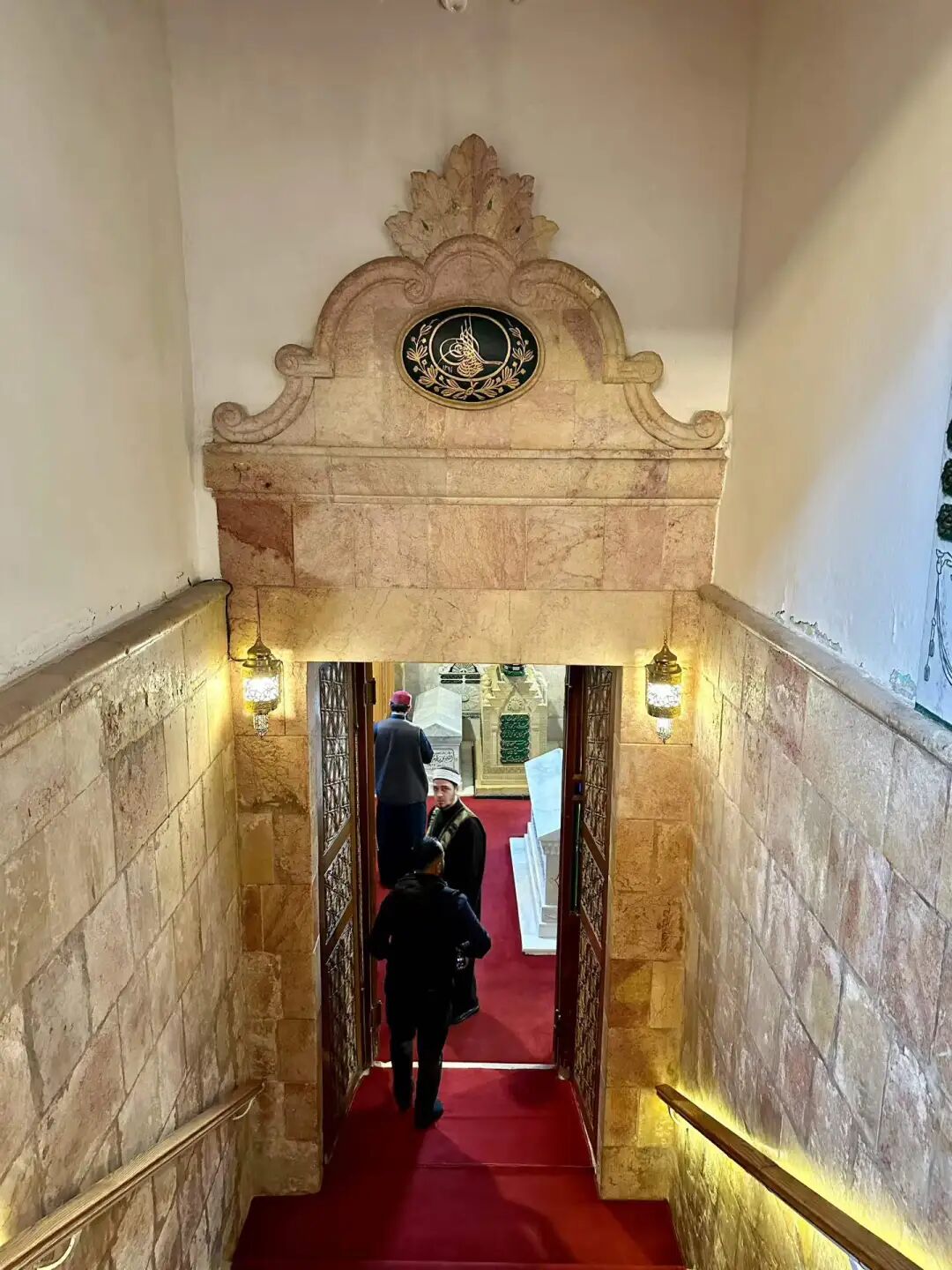
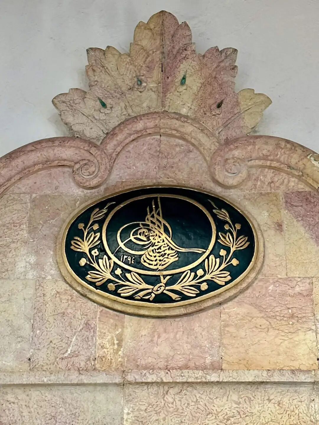
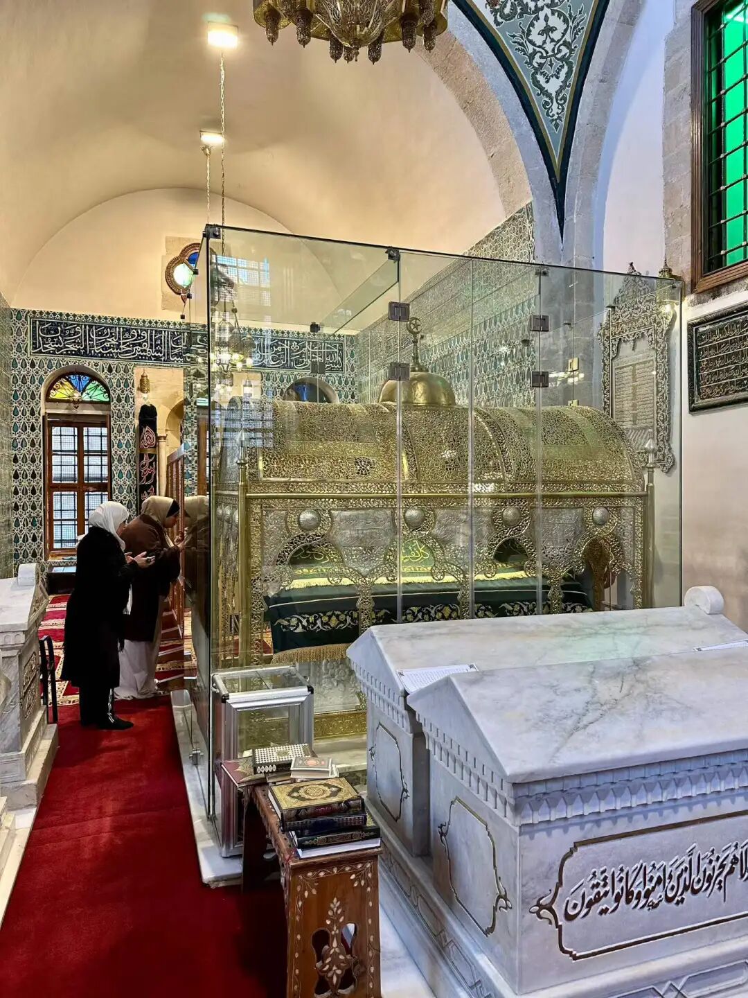
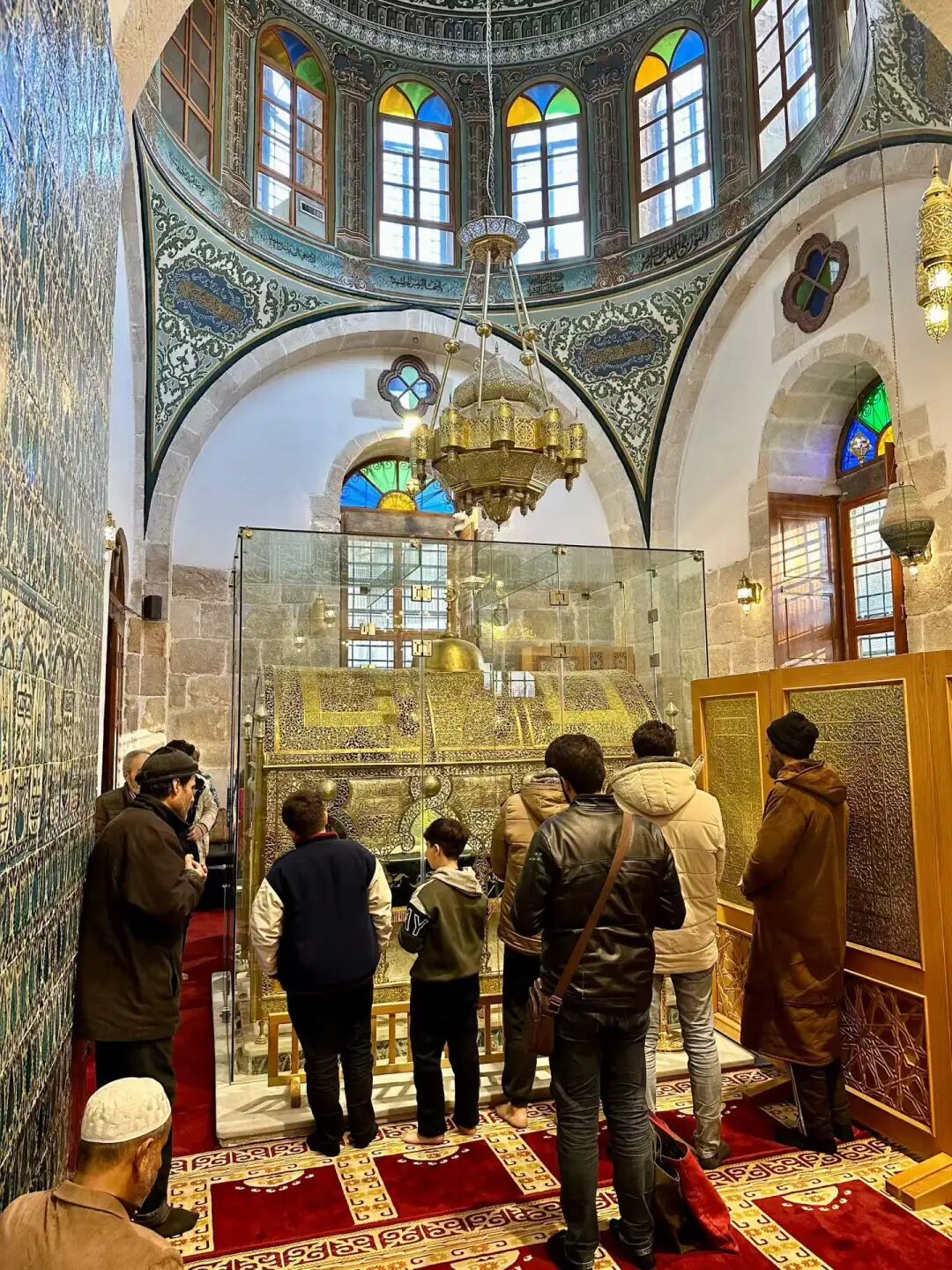
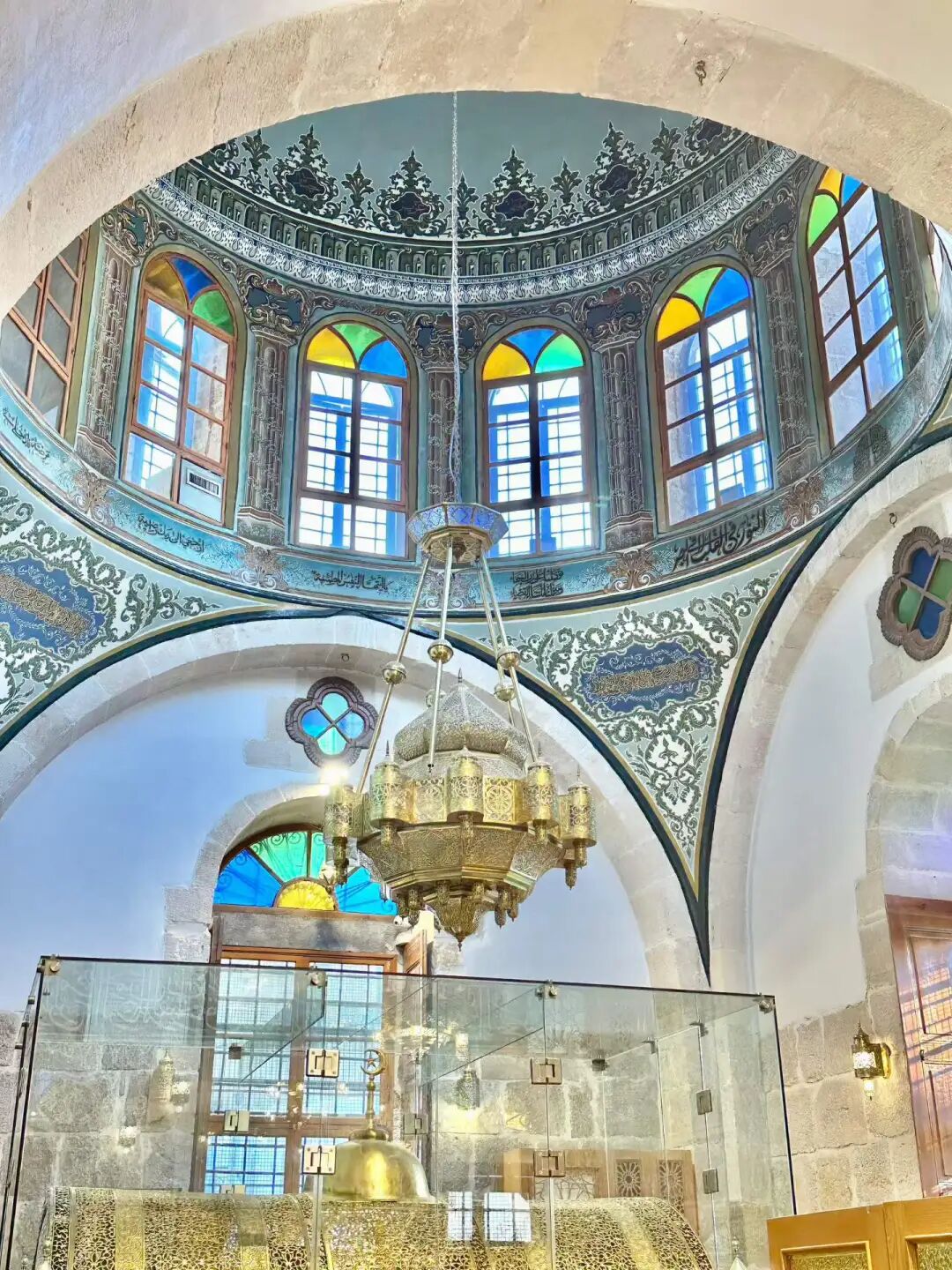
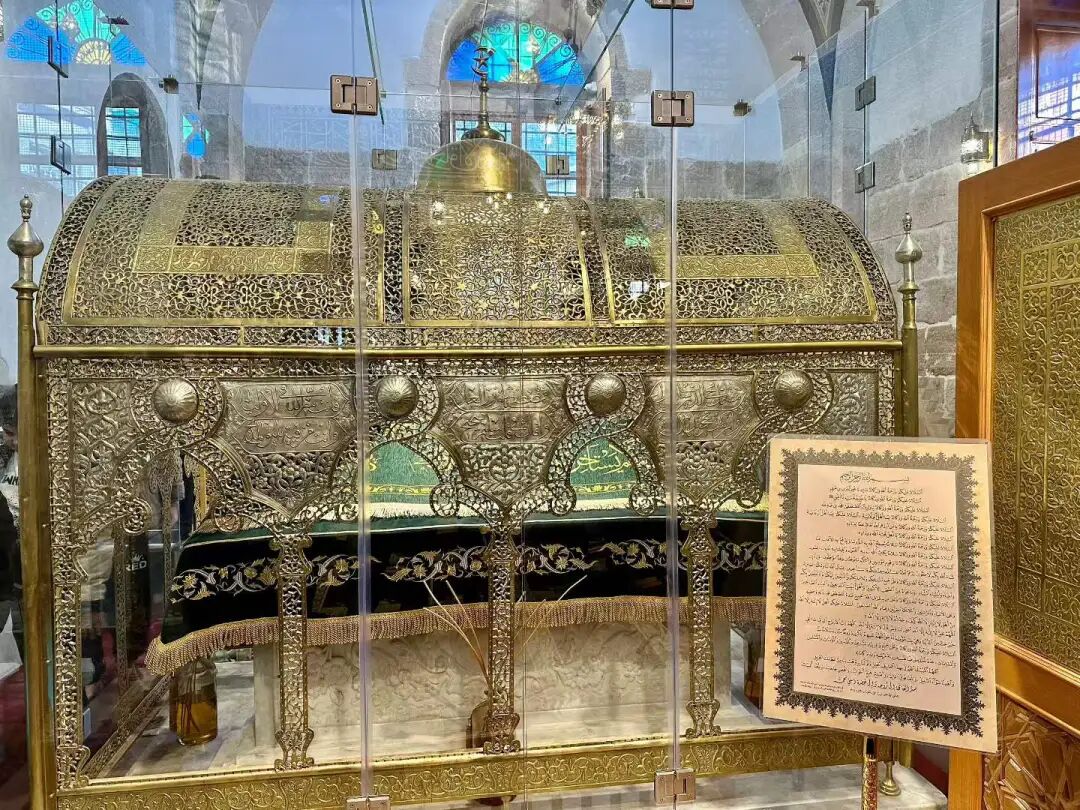
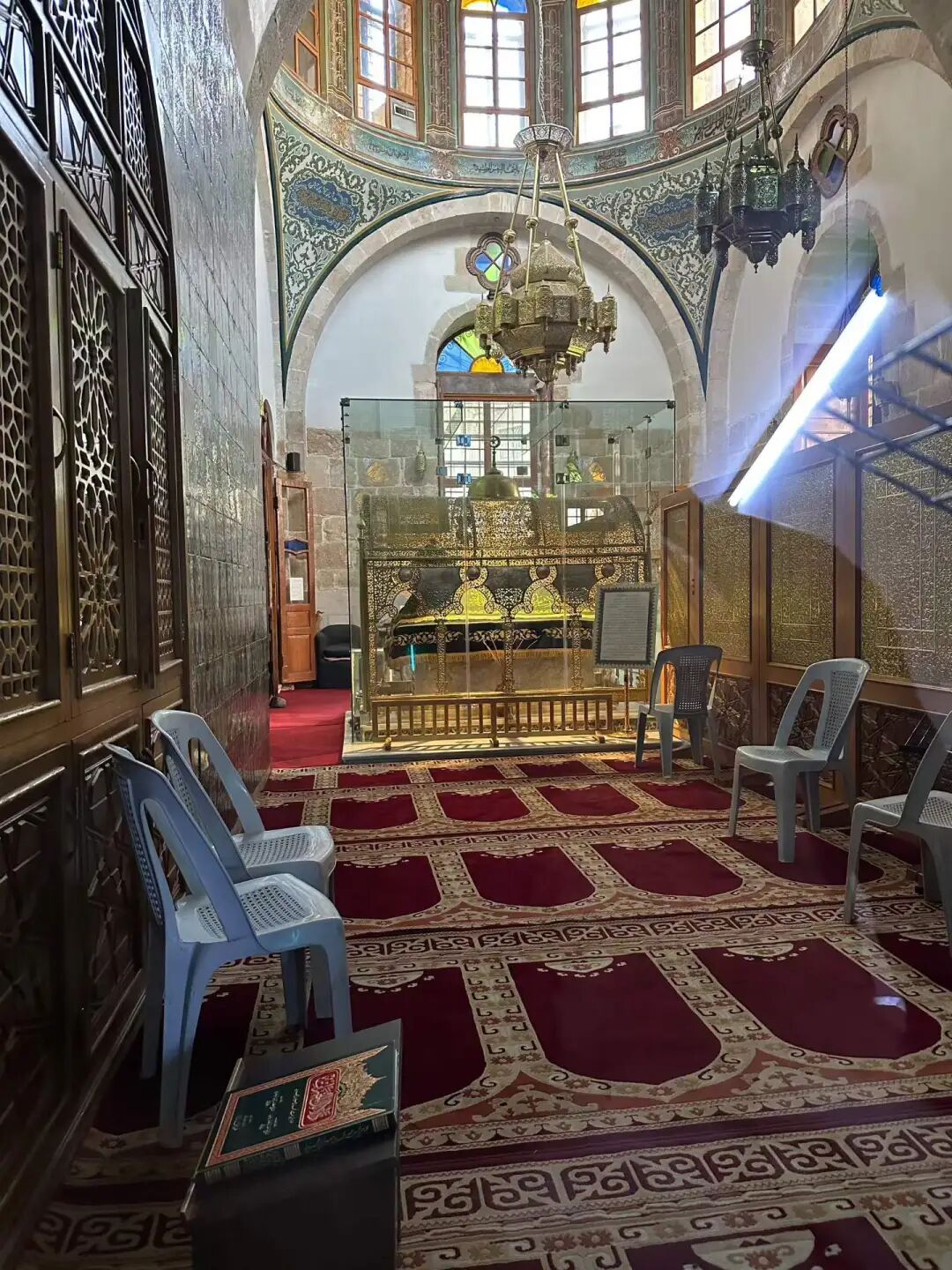
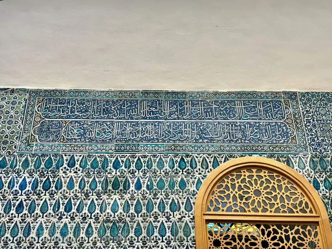
The tiles on the walls of the shrine were laid in 1760.
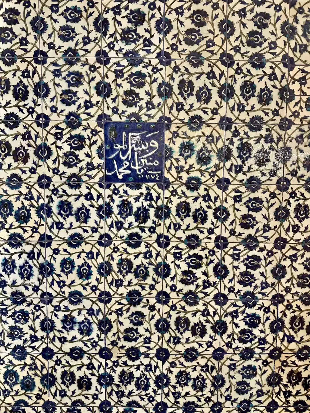
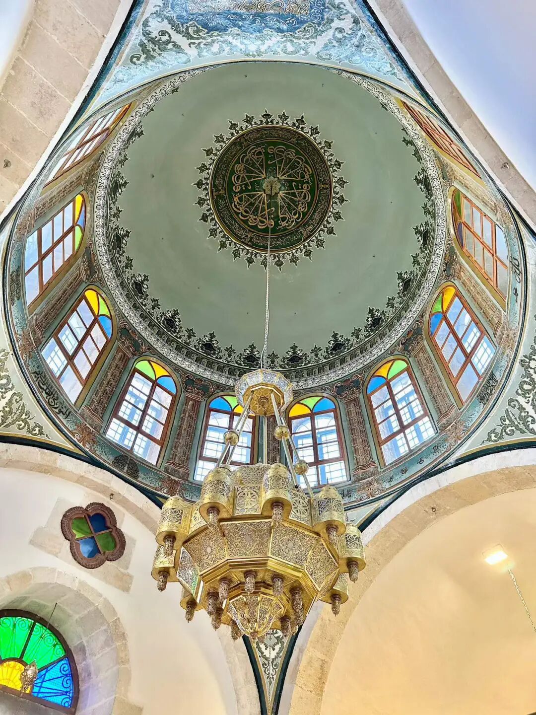
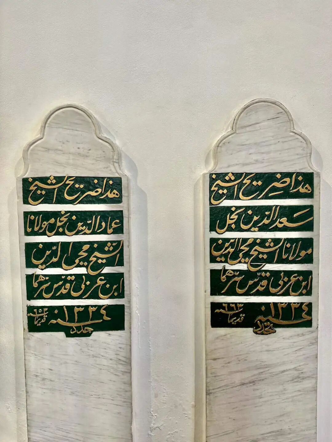
The Sheikh Muhyiddin Mosque follows a traditional Damascus layout, with a courtyard surrounding the front of the main prayer hall and an Ottoman-style minaret built above the main gate. The walls are covered in yellow and white marble, and there is a Damascus-style pool in the middle of the courtyard. The wall decorations mix Ottoman and Mamluk styles, and the Corinthian capitals on the stone pillars of the main hall feature beautiful carvings. The two large candlesticks in front of the mihrab are also very characteristic of the Ottoman style.
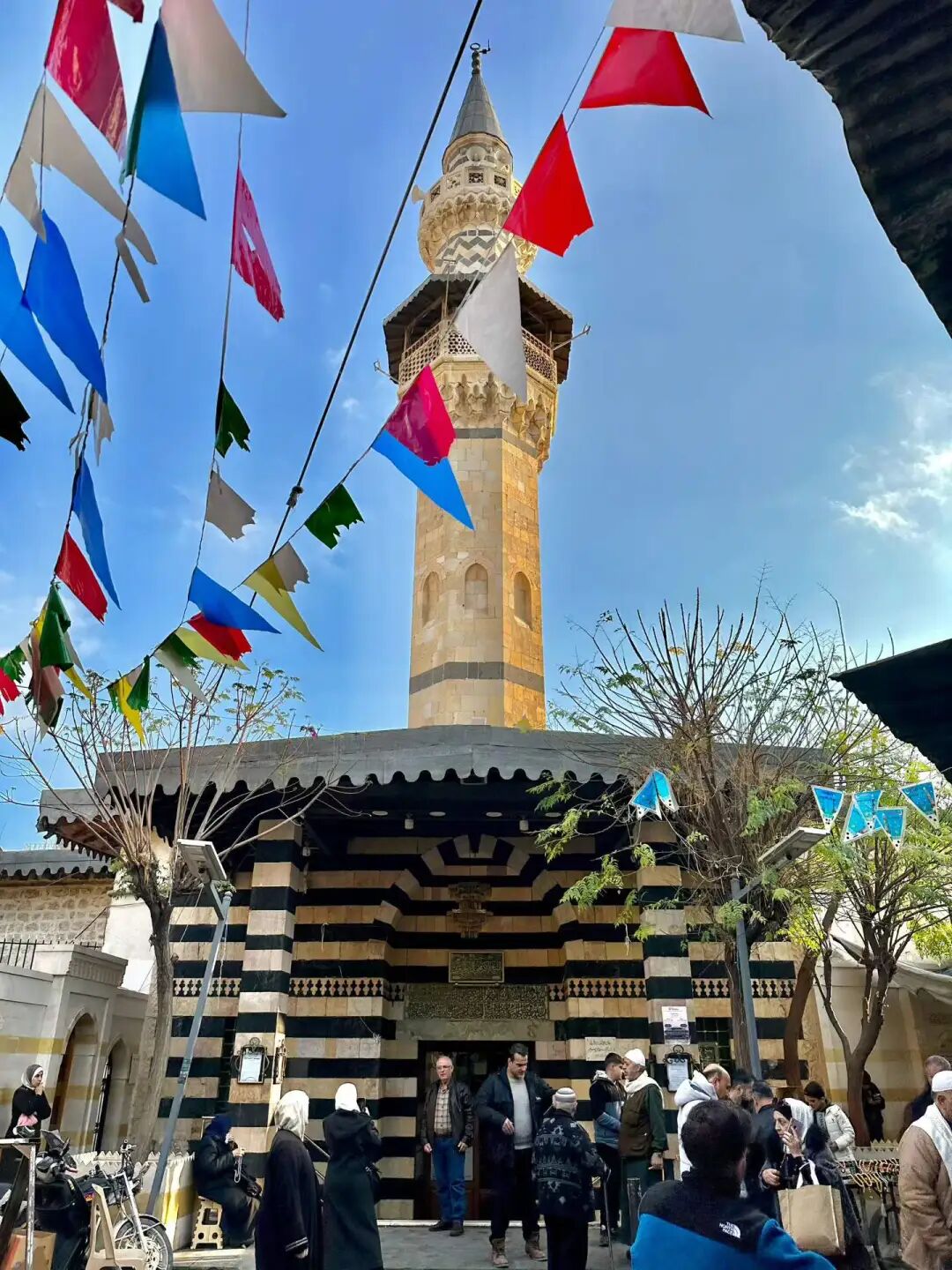
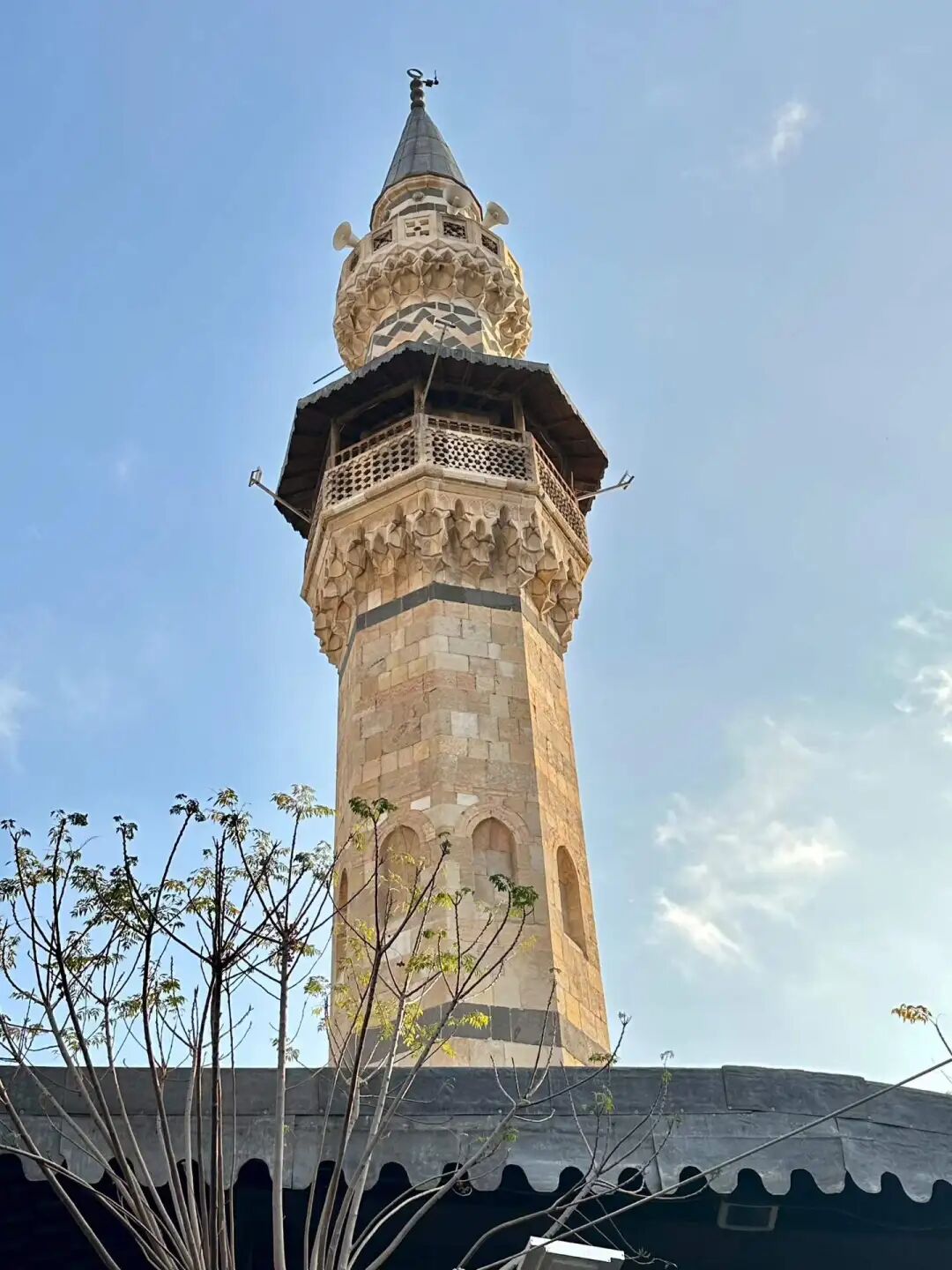
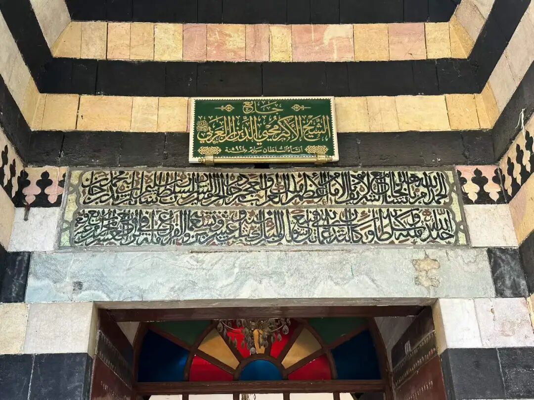
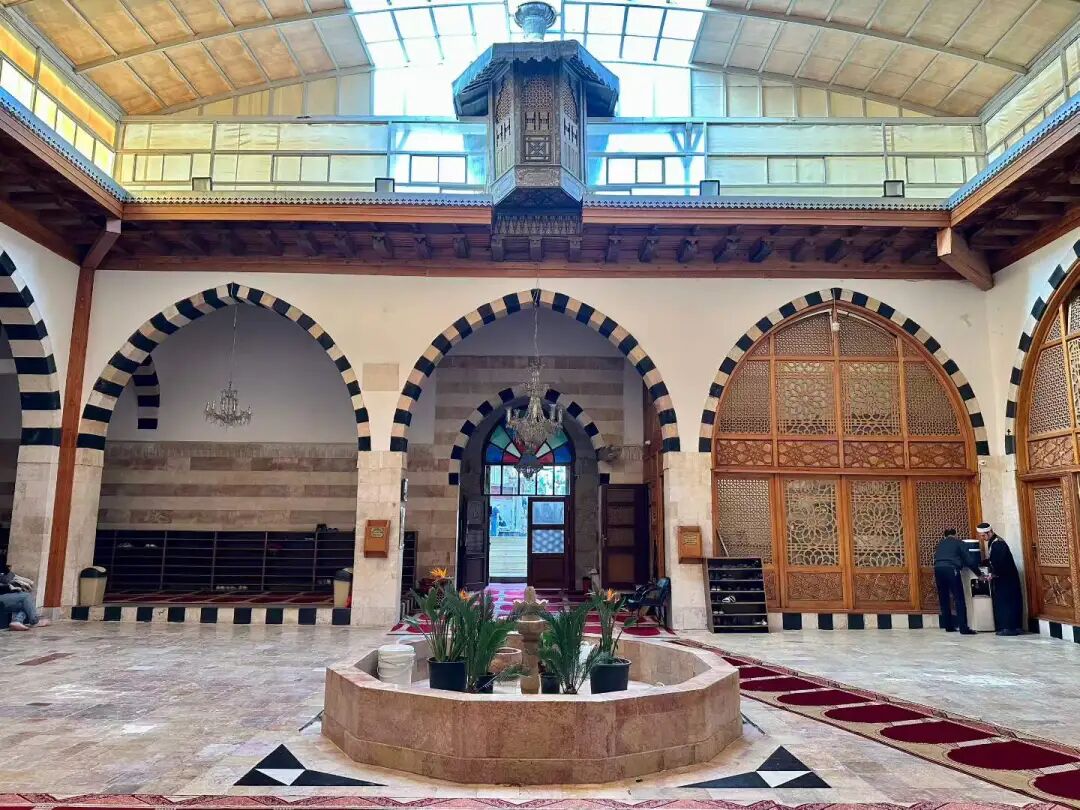
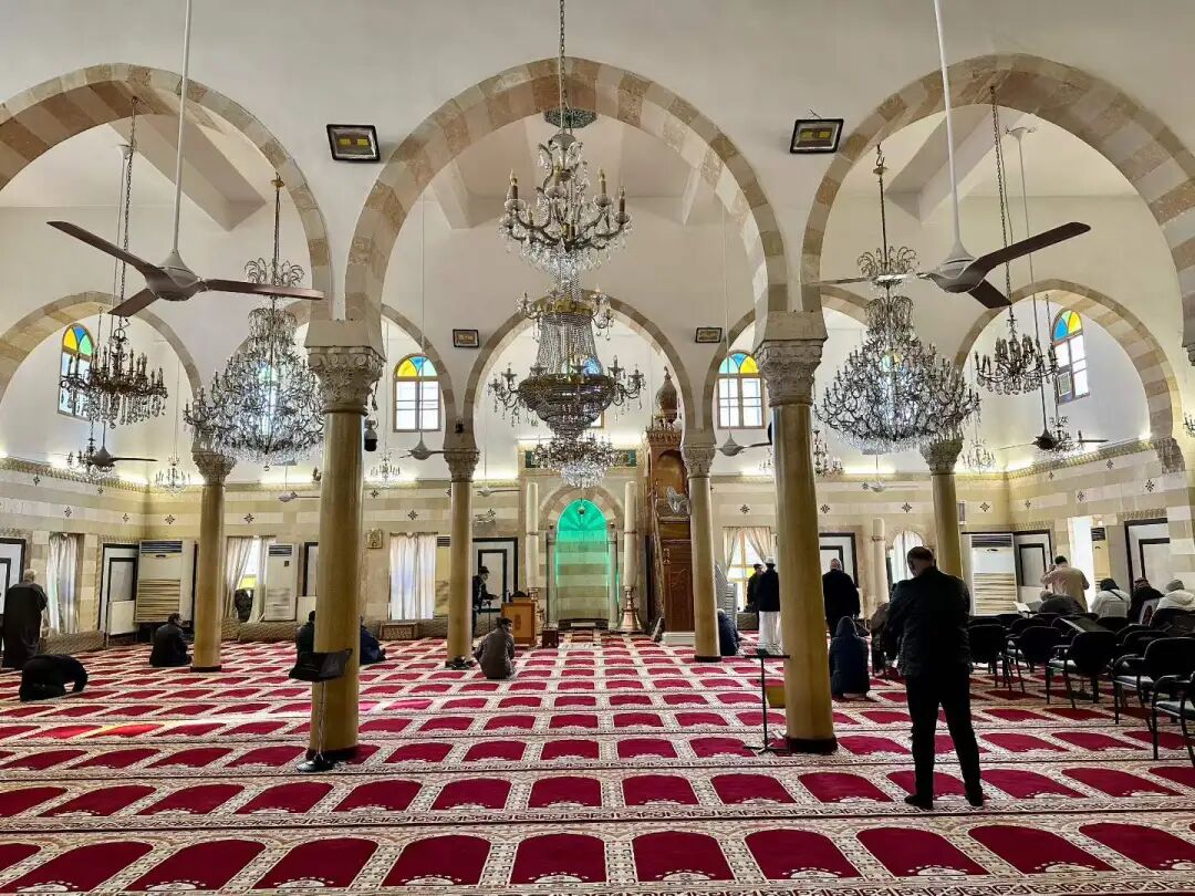
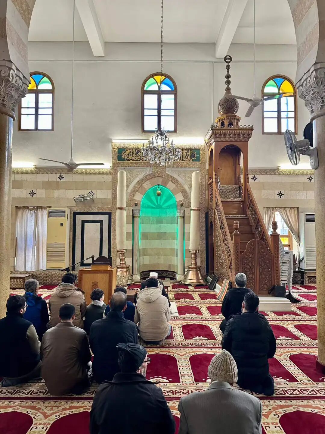
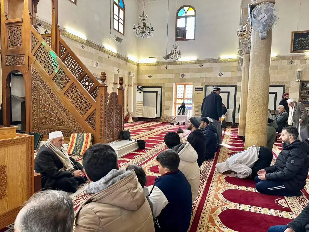
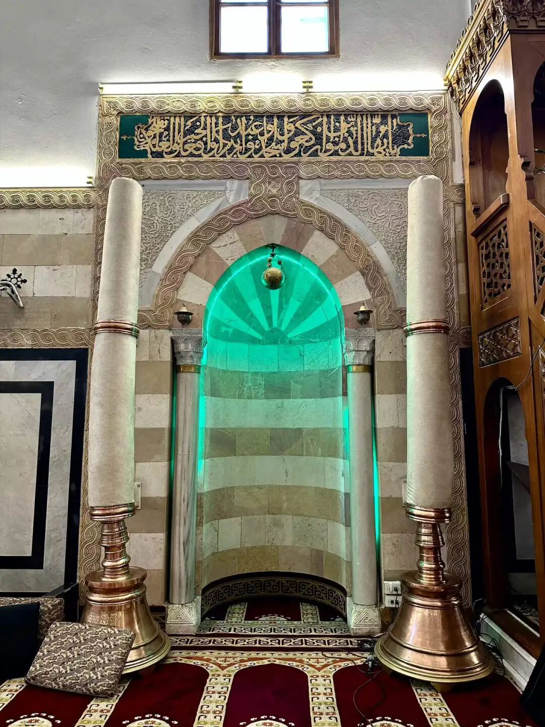
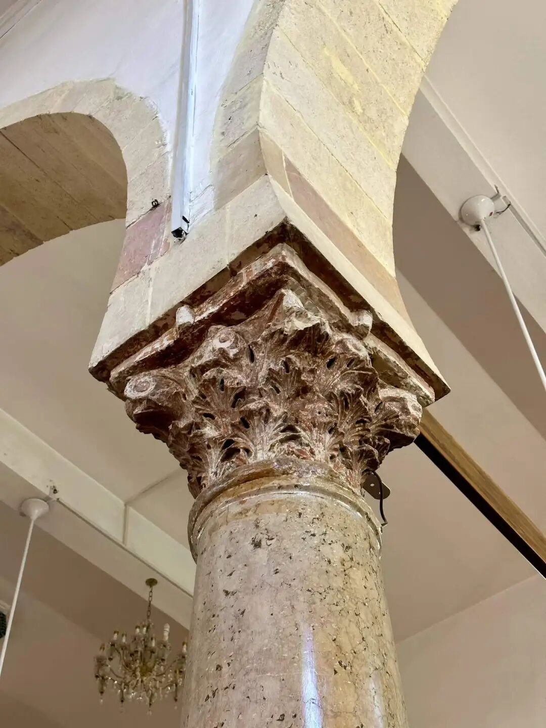
When I first arrived at the Sheikh Muhyiddin Mosque, I happened to catch a funeral prayer (janazah) for a sheikh, and I could really feel the strong religious atmosphere here.
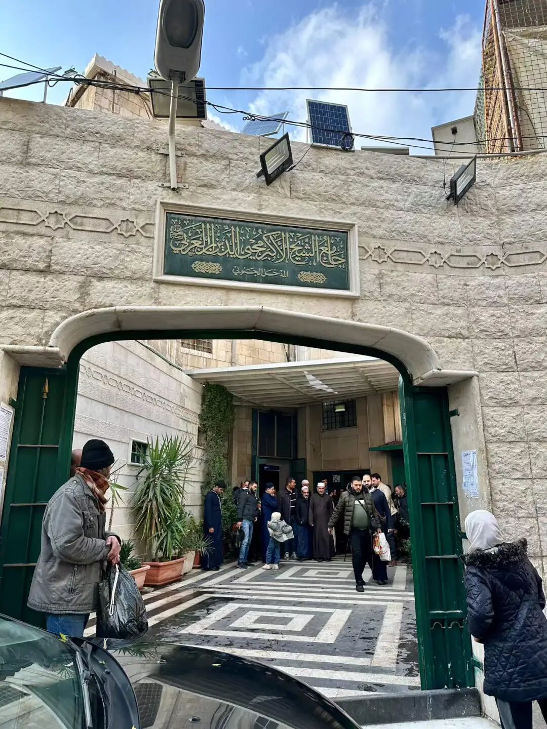
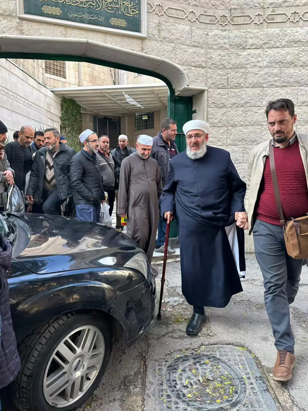
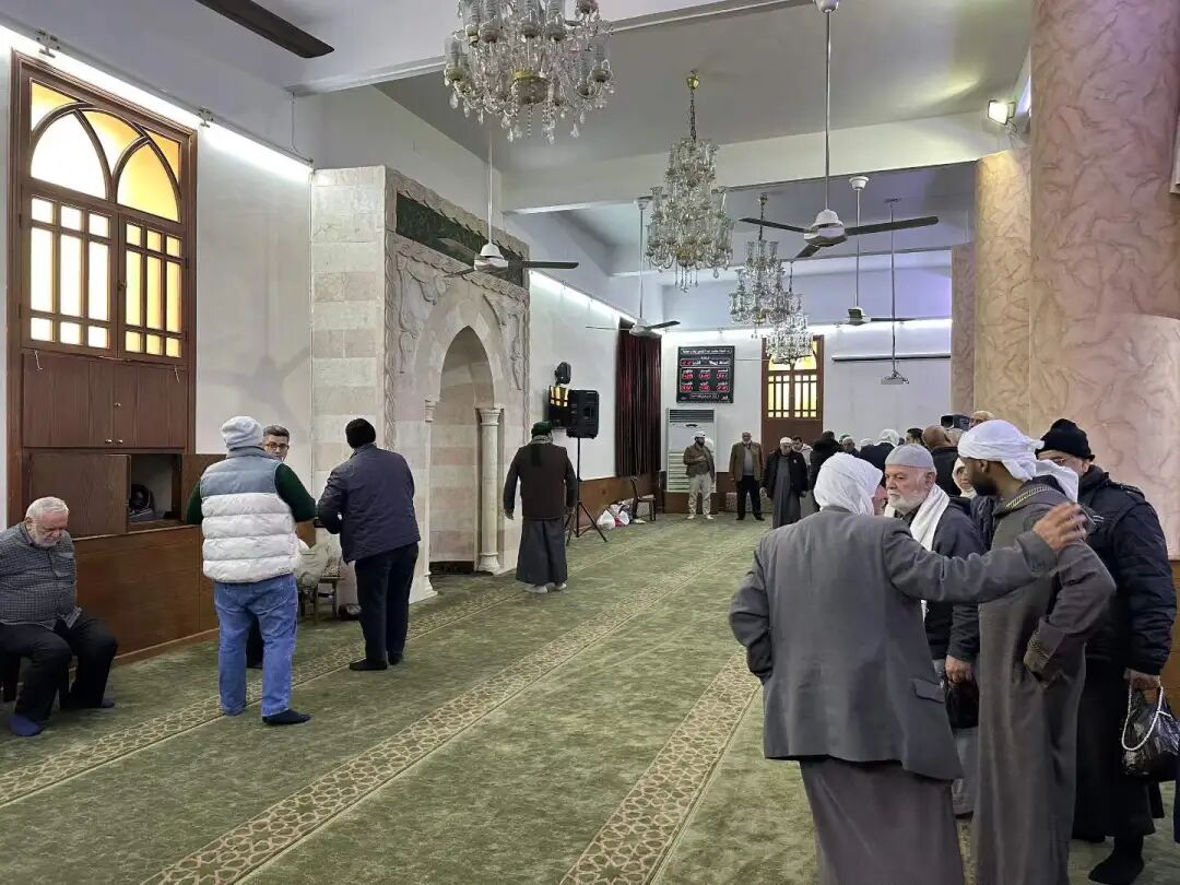
Not far to the east of the Sheikh Muhyiddin Mosque is the Hanabila, another famous mosque in the Salihiya district. Hanabila Mosque is a famous early Ayyubid dynasty mosque in Syria. It was founded between 1208 and 1210 by the famous Hanbali scholar Ibn Qudama. He was born in Jerusalem and settled in Damascus in 1197, which became his main center for scholarship.
The mosque follows the Ayyubid architectural style. It centers on a courtyard, and the main prayer hall follows the layout of the Umayyad Mosque in Damascus, though its structure is more compact. The mosque still has a beautiful pulpit (minbar) and window carvings that are over 800 years old.
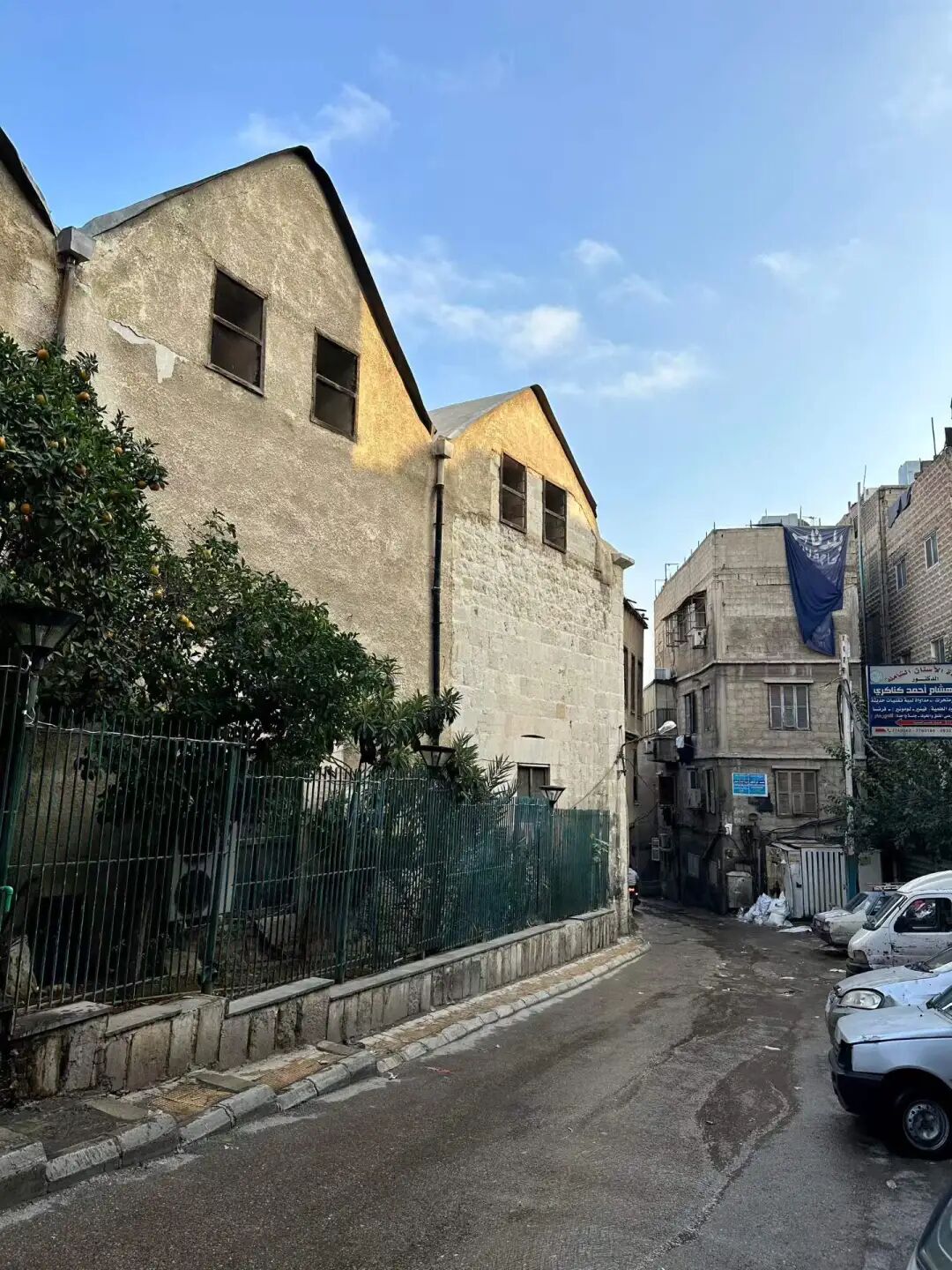
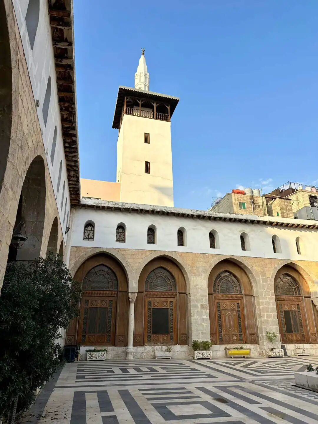
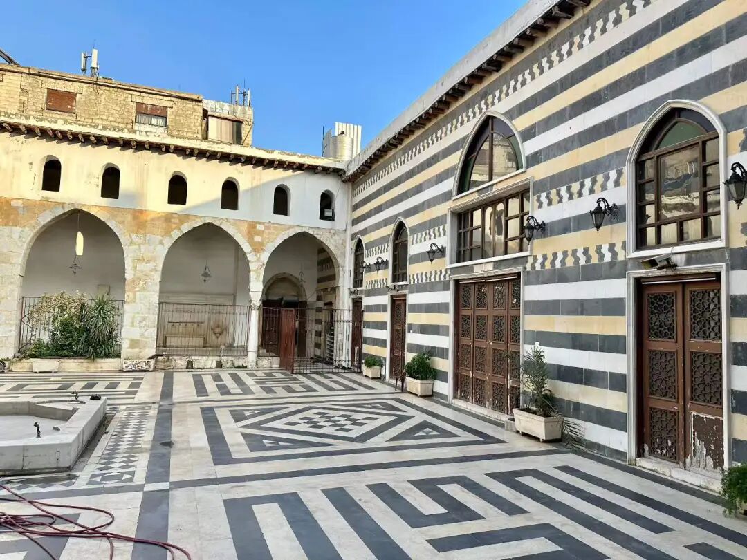
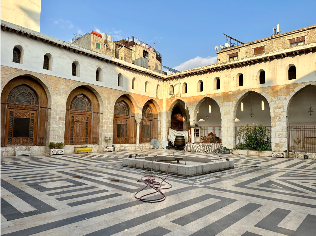
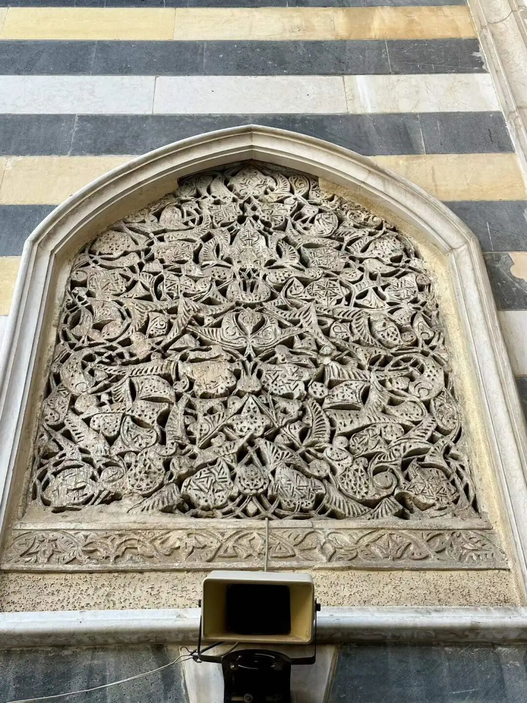
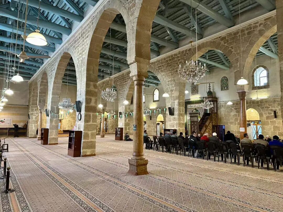
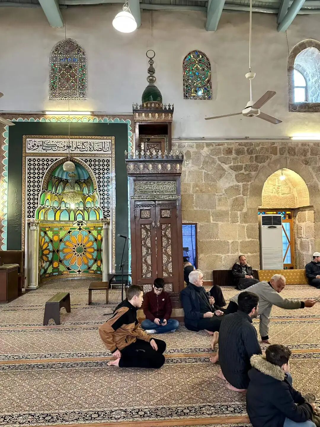
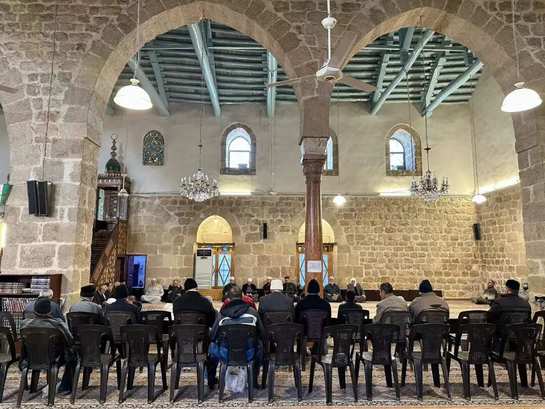
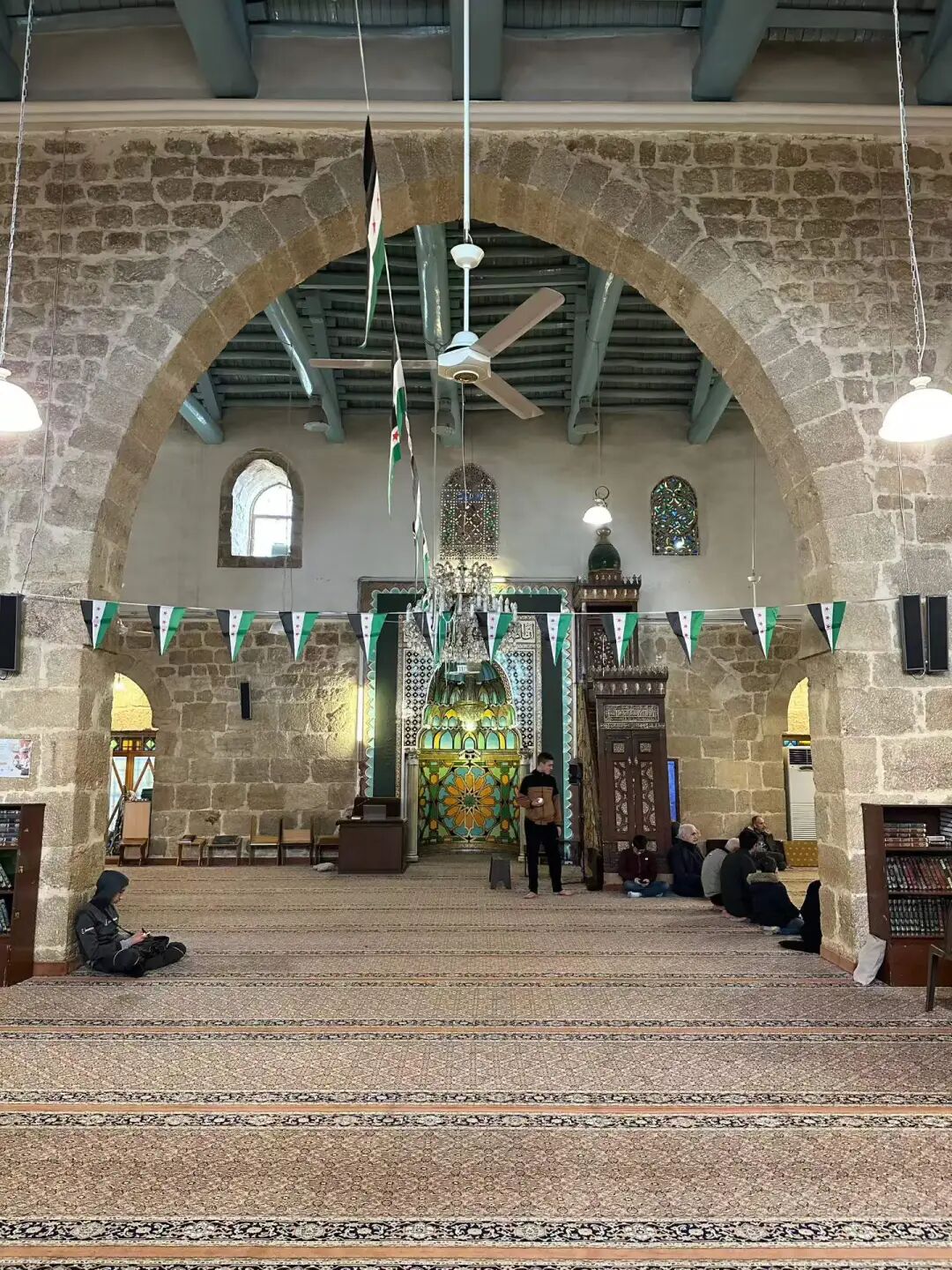
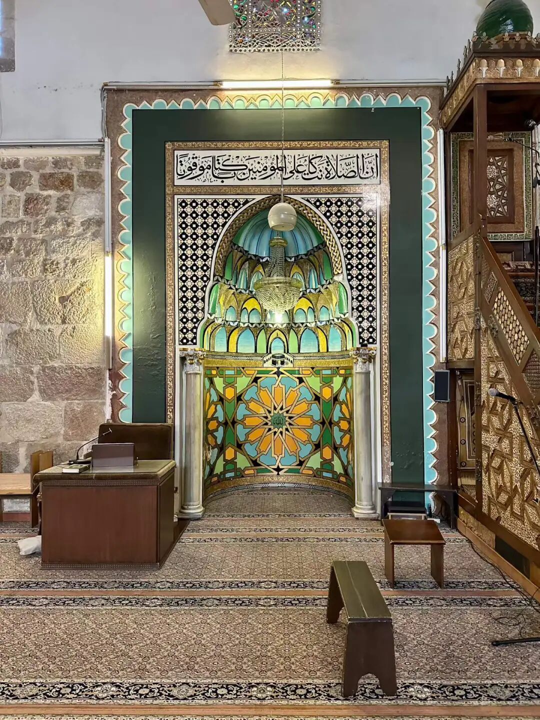
Rukniyah Madrasa is located on the far east side of the Salihiyah district in Damascus. It was built in 1224 by the Ayyubid governor of Damascus, Rukn al-Din Mankurs al-Falaki, who is also buried there. Rukniyah Madrasa is the first Ayyubid building with a courtyard covered by a dome. The building consists of two square sections: the larger part is the madrasa, and the smaller part is the tomb. The minaret was added later.
Because the Ayyubid dynasty was busy fighting the Crusades, the architectural style of this period is known for being simple, sturdy, and durable. Rukniyah Madrasa belongs to the Hanafi school of law. It has now been converted into a mosque, and the main hall is not open except during the five daily namaz prayers.
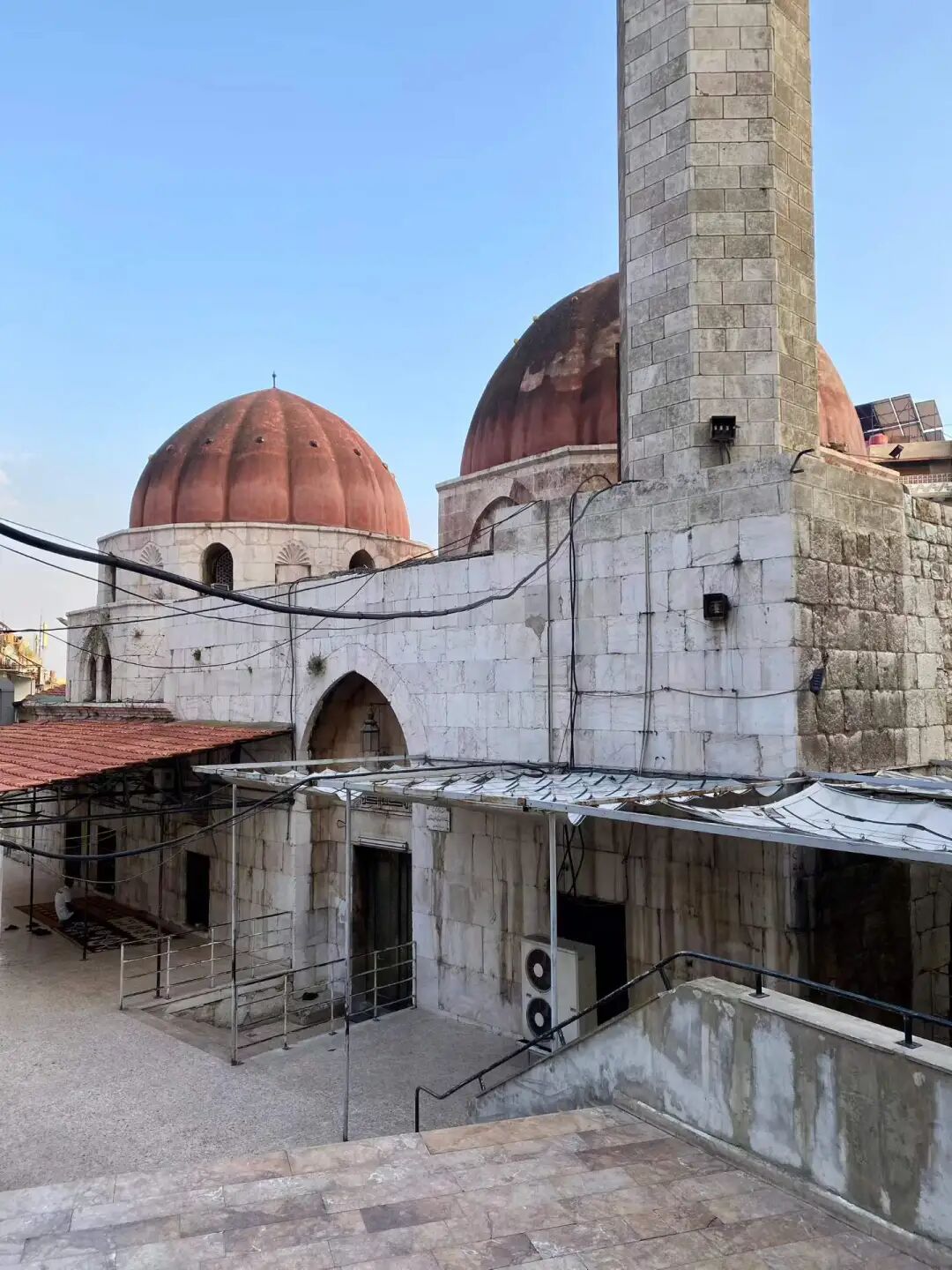
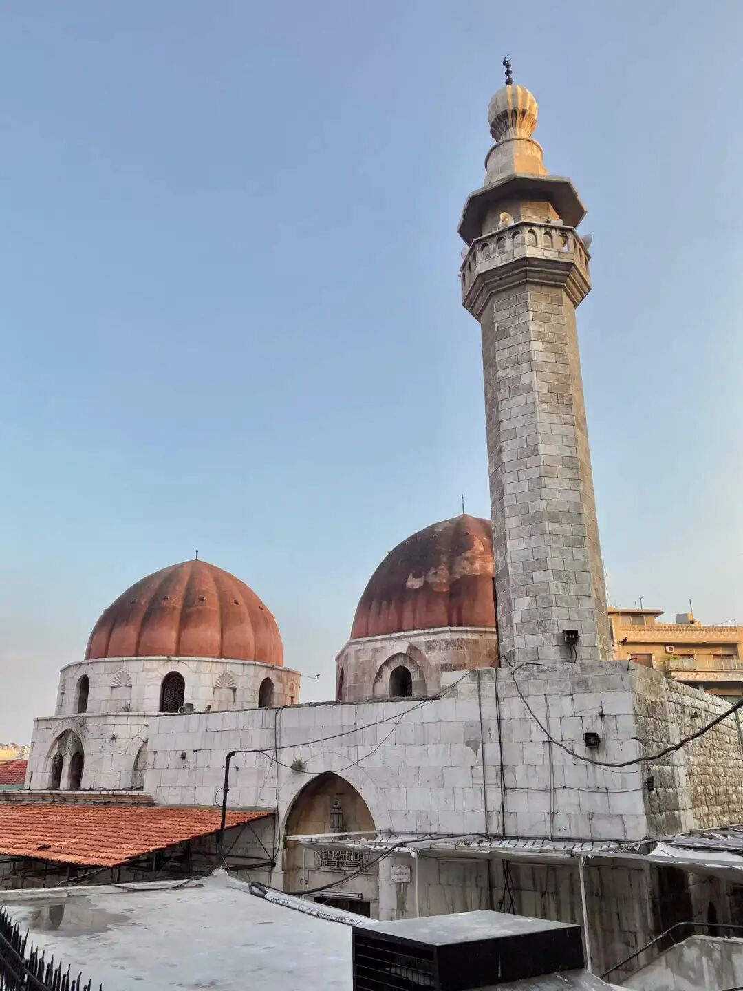
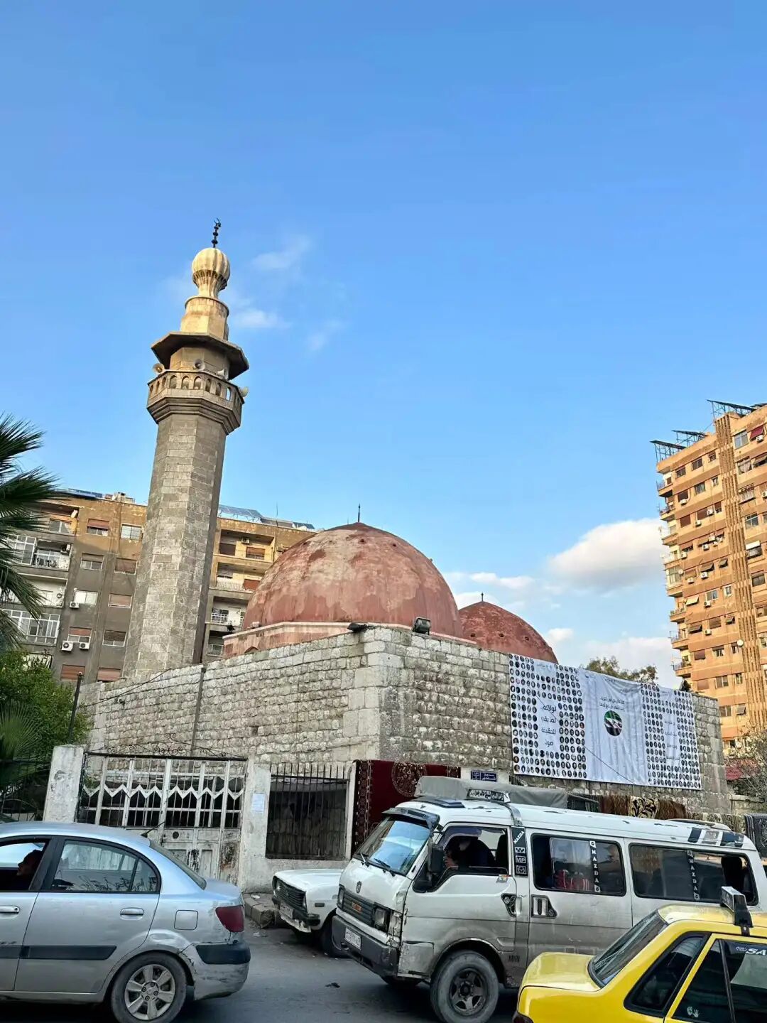
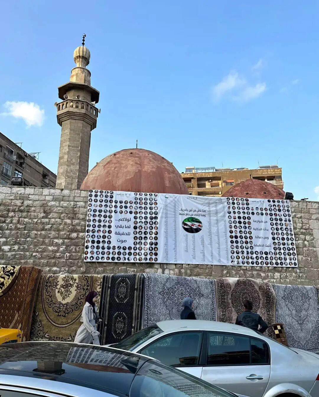
Abd al-Ghani al-Nabulsi Mosque was built in 1764 by Sheikh Mustafa al-Nabulsi, the grandson of the famous Syrian Sufi sheikh and poet Abd al-Ghani al-Nabulsi. Both Sheikh Abd al-Ghani al-Nabulsi and Sheikh Mustafa al-Nabulsi are buried there. Unfortunately, since most mosques in Damascus do not open their doors except for the five daily namaz prayers, I could not go inside.
Sheikh Abd al-Ghani's family came from the Banu Jama'a. For generations, they served as chief judges and great Sufi sheikhs during the Mamluk dynasty. One branch of his family settled in Damascus after the Ottoman Empire conquered the Mamluk dynasty in 1516. They continued to hold positions such as the Shafi'i Grand Mufti of Damascus and teachers at the Umayyad Mosque.
Sheikh Abd al-Ghani was born in Damascus in 1641. His father switched from the Shafi'i school to the Hanafi school after a debate with Hanafi students. This was the mainstream school of the Ottoman Empire at the time. Abdul-Ghani began studying Islamic law as a child. He joined the Qadiriyya and Naqshbandiyya Sufi orders and spent seven years in quiet retreat at home. He traveled widely across the Middle East and wrote over 200 books. He was especially known for his deep research into the Sufi sage Ibn Arabi.
Before Sheikh Abdul-Ghani, the Salhiyya district of Damascus followed the Hanbali school of law. He was the first to bring Hanafi and Shafi'i ideas to the area and hosted many Hanafi students in his home.
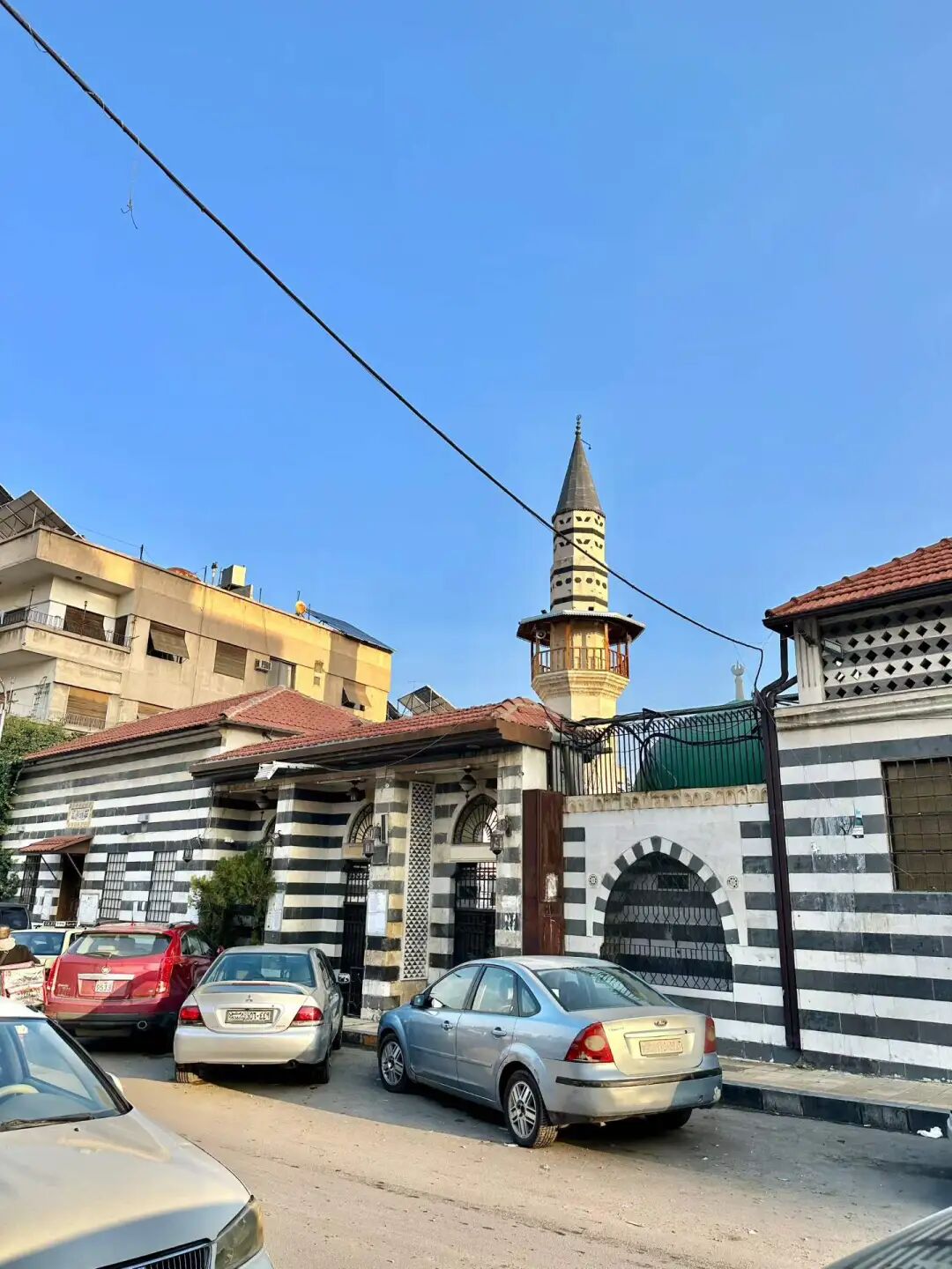
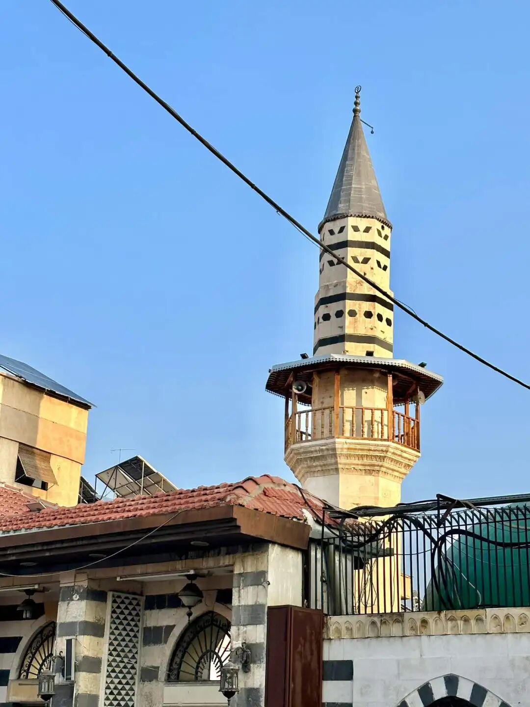
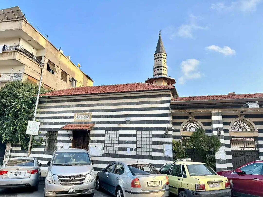
The Jharkasiya Madrasa is on the market street in the Salhiyya district of Damascus. It was built in 1237 by the Ayyubid general Salim al-Din al-Hattra for his teacher, the Ayyubid general Jharkas ibn Abdullah. Both Jharkas ibn Abdullah and Salim al-Din al-Hattra are buried inside.
Jharkas was a commander in Saladin's personal guard and witnessed all of Saladin's military campaigns. The Jharkasiya Madrasa has a very rare double-domed tomb. Historically, the school taught both Hanafi and Shafi'i law, but today it serves as a mosque.
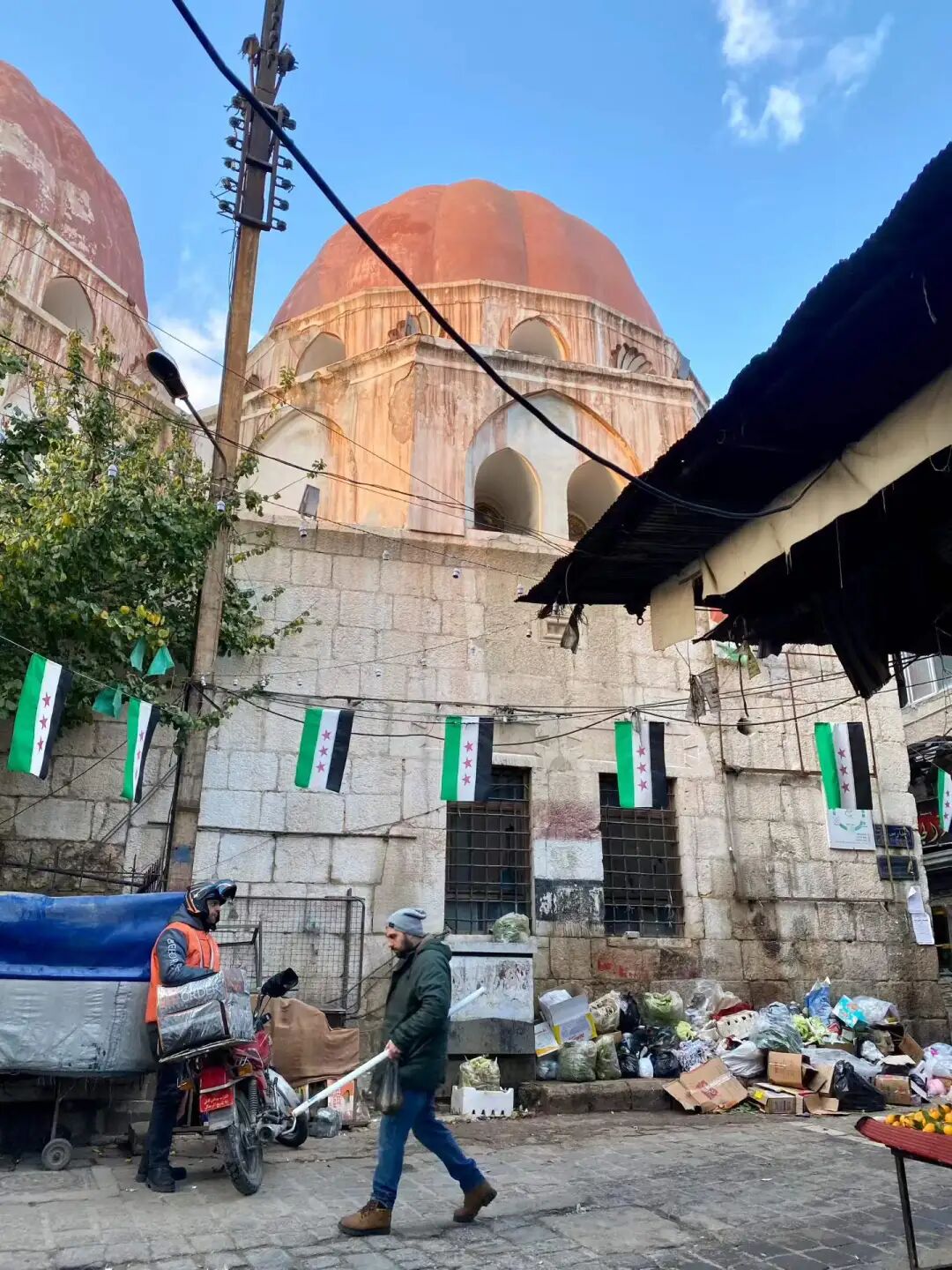
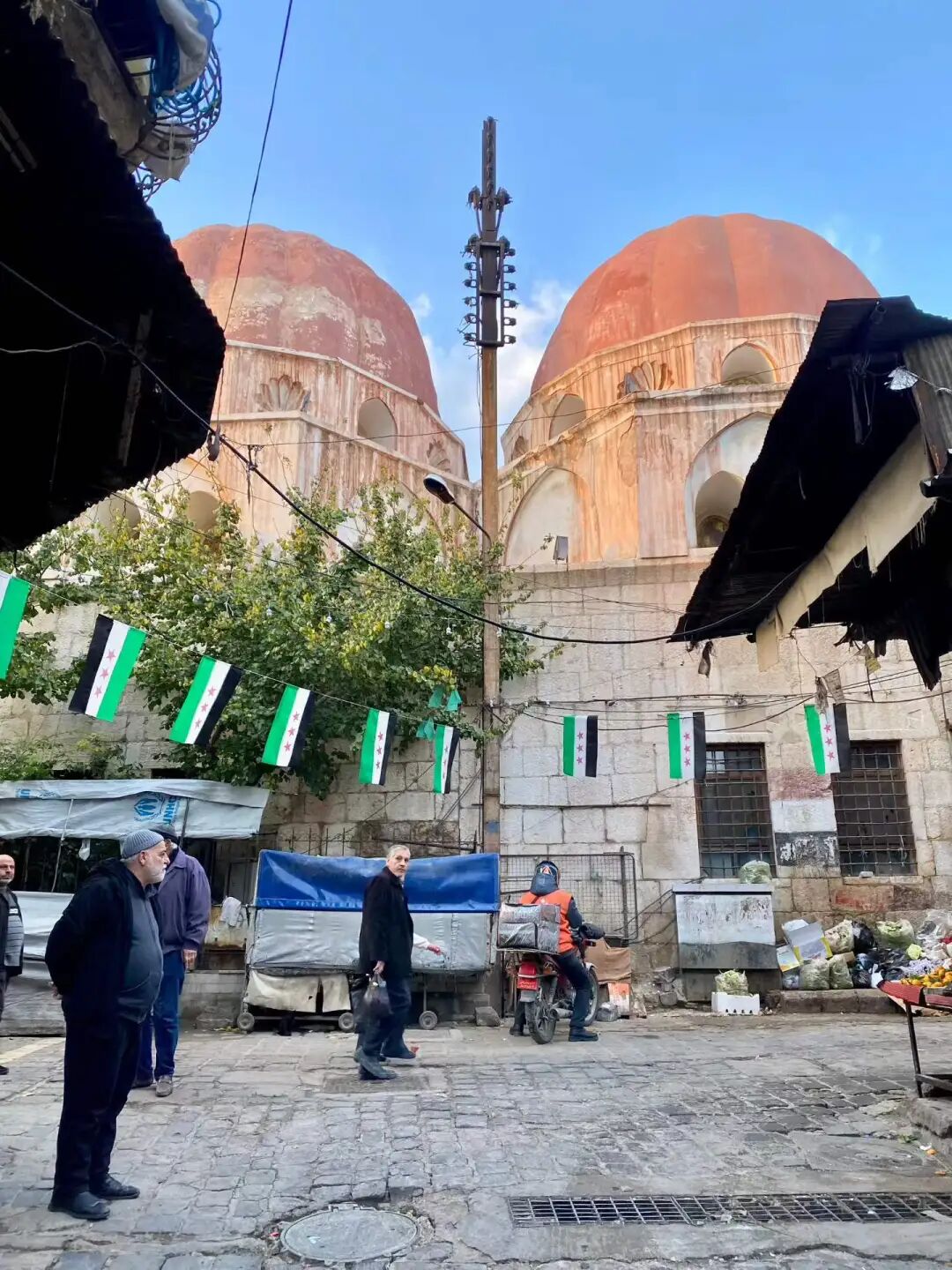
The Mershadiyeh Madrasa is on the west side of the Salhiyya district in Damascus. It was built in 1252 with funding from Khadija Khatun, the daughter of the Ayyubid Emir of Damascus, Al-Mu'azzam Isa. She is buried in the courtyard after her passing.
The square minaret of the madrasa is the only surviving example of 13th-century Ayyubid architecture in Damascus. The madrasa is currently closed. You must contact the Syrian Directorate-General of Antiquities and Museums to enter.
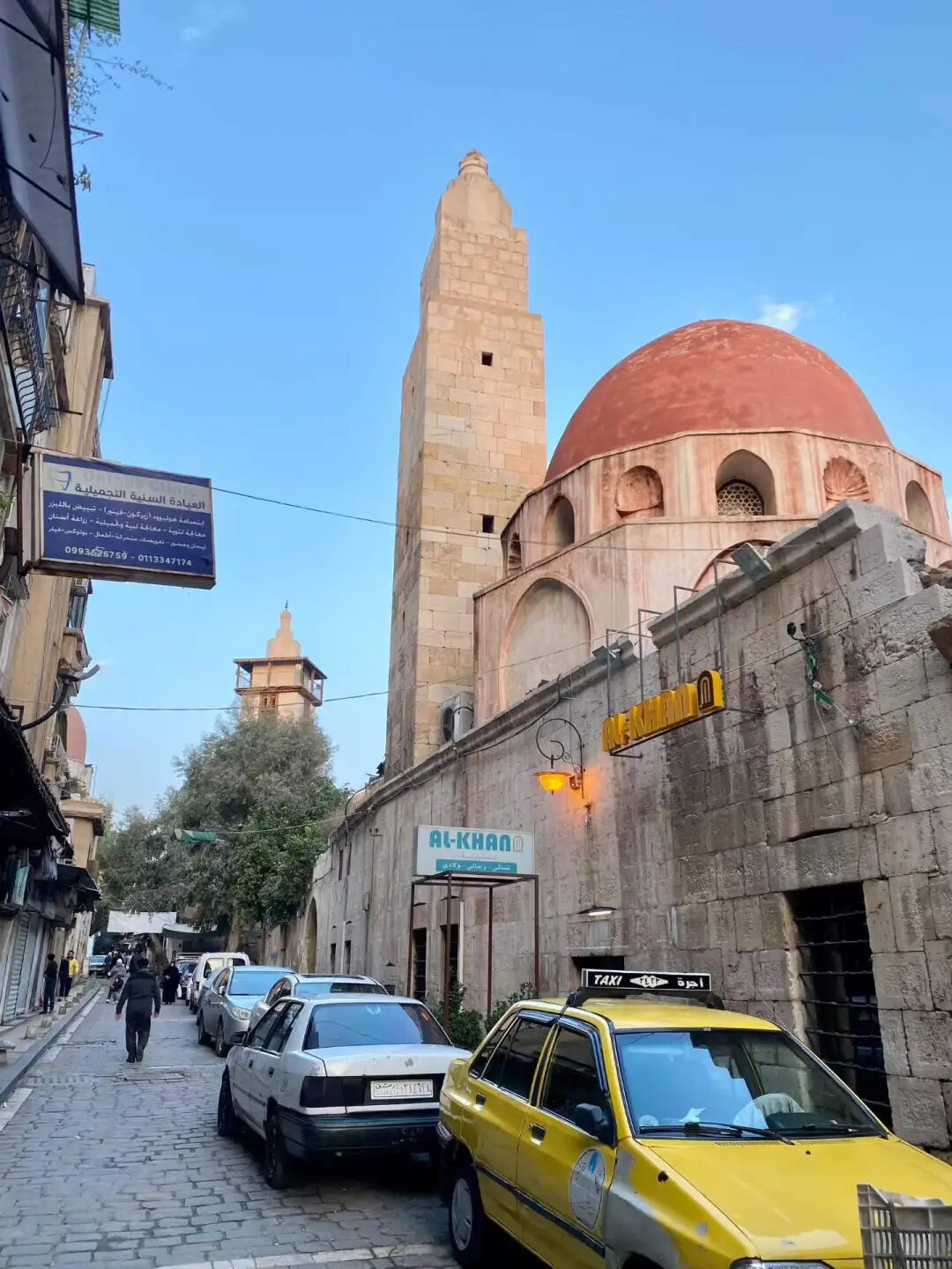
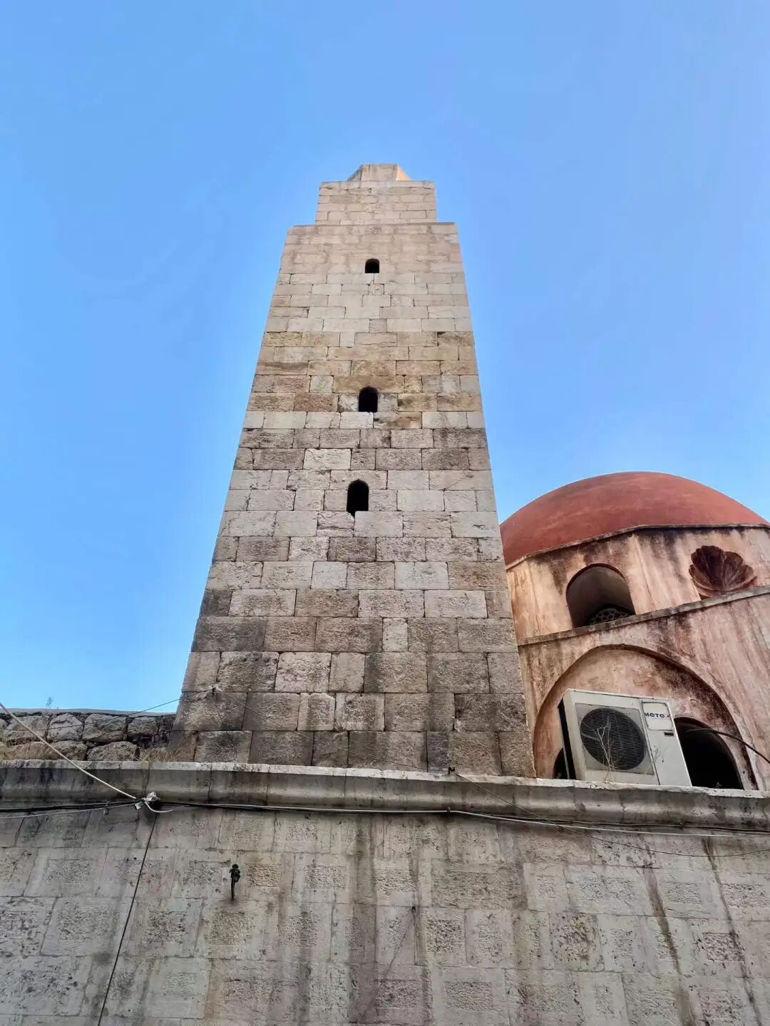
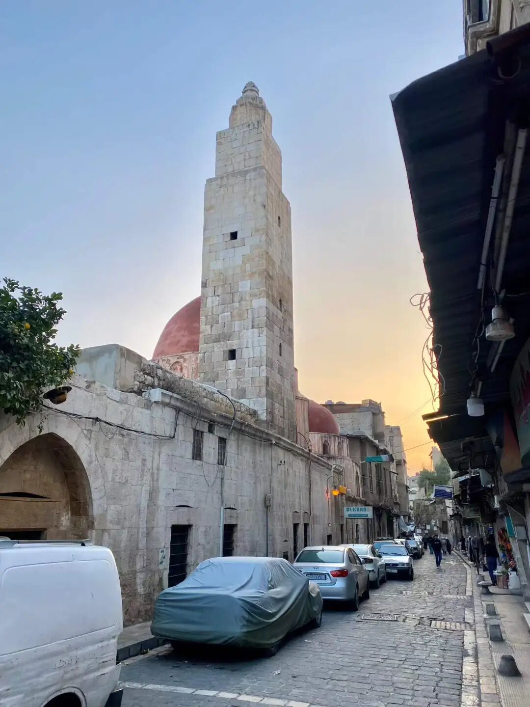
The Takrityya Madrasa is on the far west side of the Salhiyya district in Damascus. It was built in 1298 by the Emir Taqi al-Din al-Takriti, who is buried inside. This building dates back to the Mamluk period, but it keeps the strict and simple architectural style of the Ayyubid dynasty. The Mongol army destroyed this place in 1300, but it was rebuilt later.
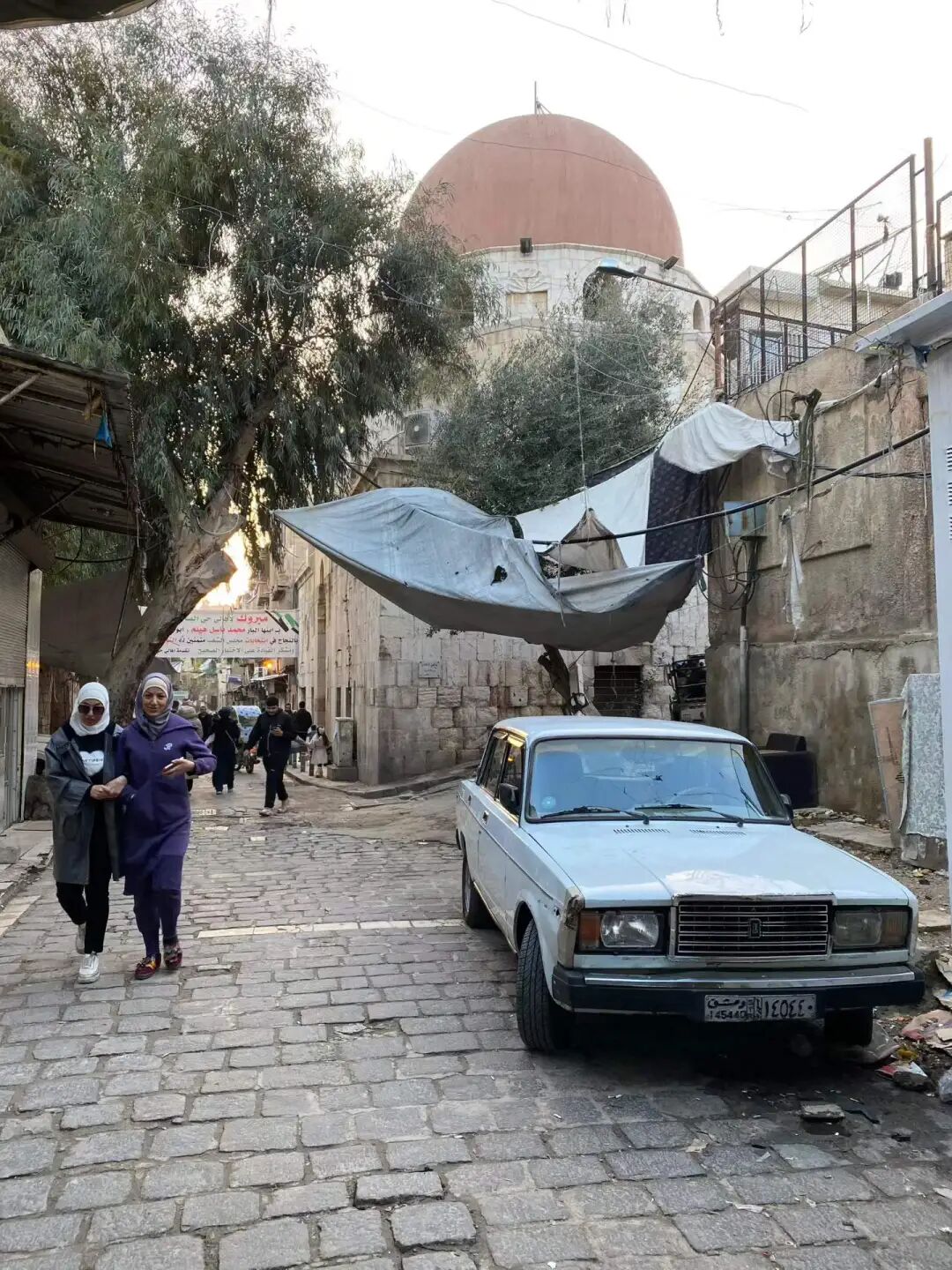
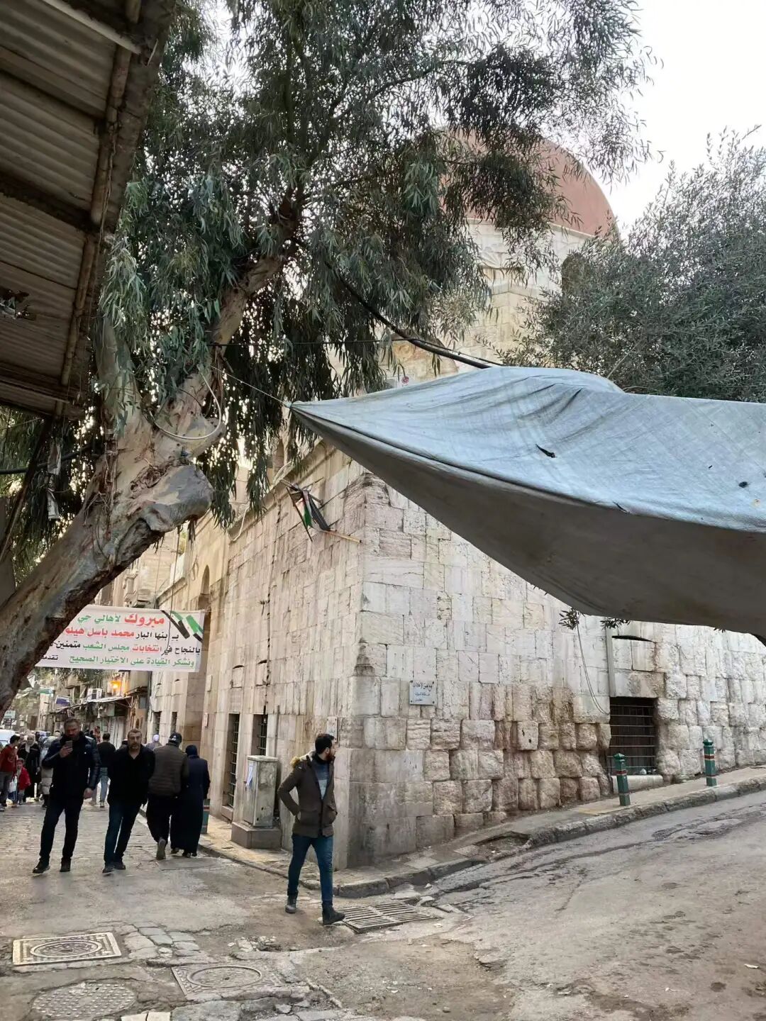
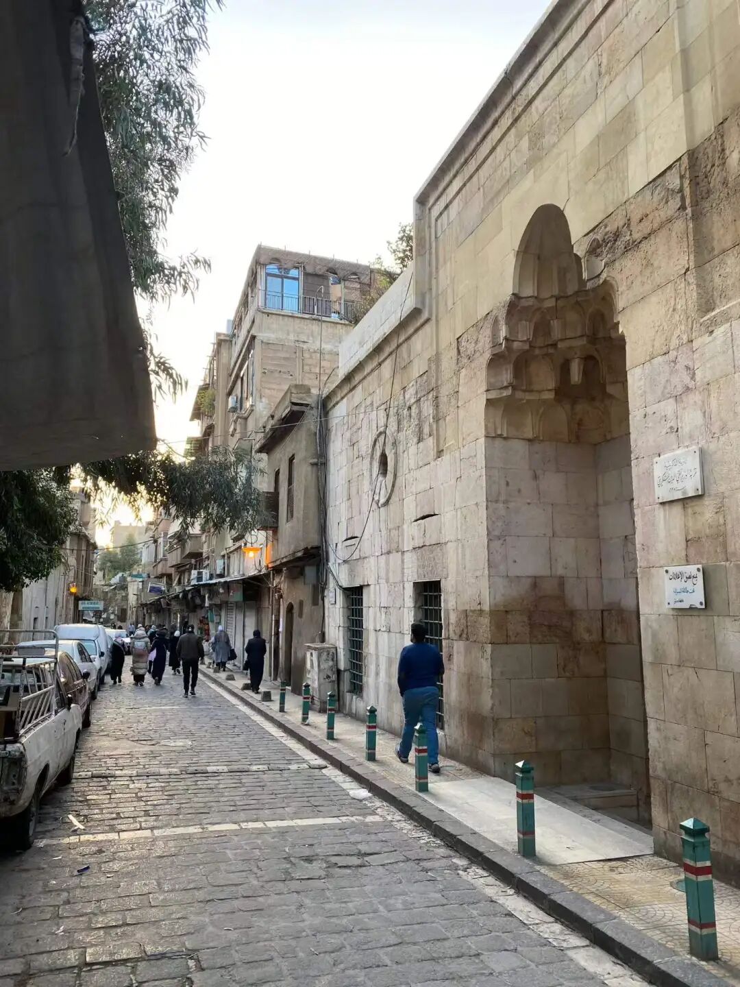
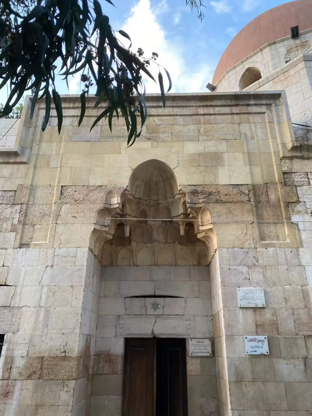
Rabia Khatun, the sister of Ayyubid founder Saladin, built the Sahiba Madrasa in 1233, and her tomb is inside. People call this madrasa a model of Ayyubid architecture because of its thick walls and beautiful carvings that only use simple geometric shapes.
This madrasa once taught the Hanbali school of thought, which was the mainstream school at the time. Today, it is a primary school for girls, and generations of local residents have studied here.
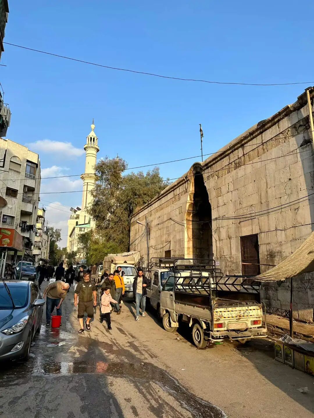
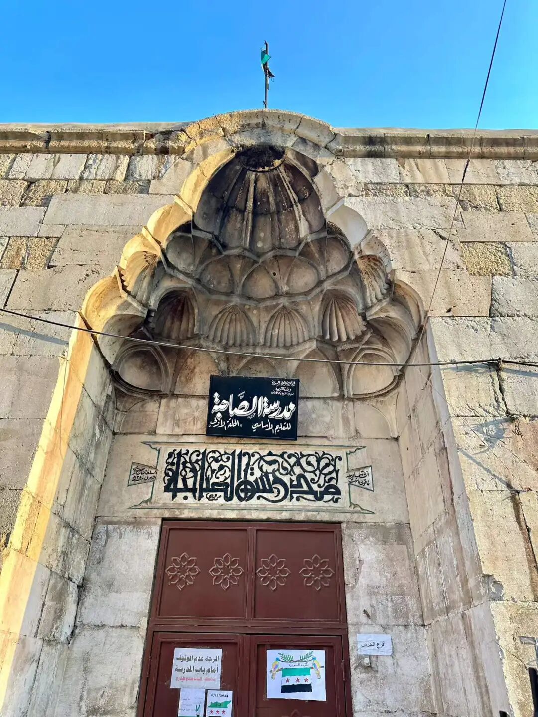
Juma Market, the main road of the Salihiya historic neighborhood in Damascus.
The market in Salihiya grew quickly during the Ayyubid dynasty as more people moved here from Jerusalem. The Juma Market in front of the gongbei of the Sufi sage Ibn Arabi only sold goods after Friday namaz at first, but it eventually became a permanent market while keeping the name Juma Market. It is still a great place for nearby residents to shop today.
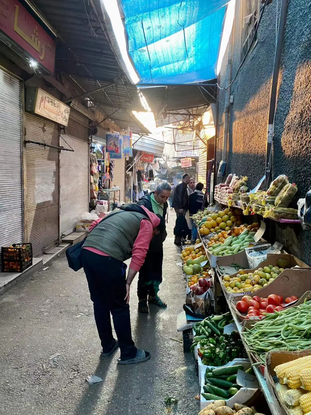
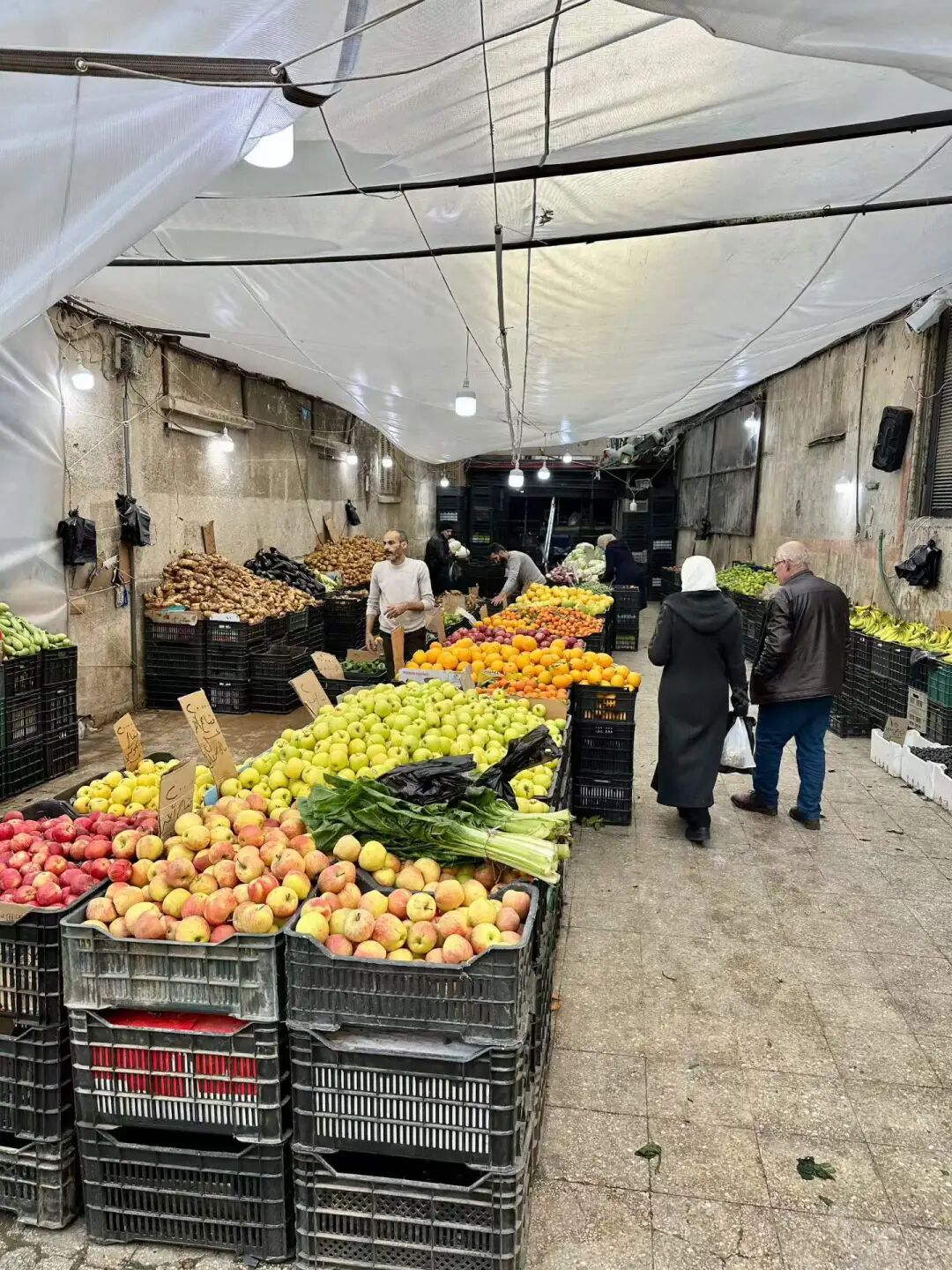
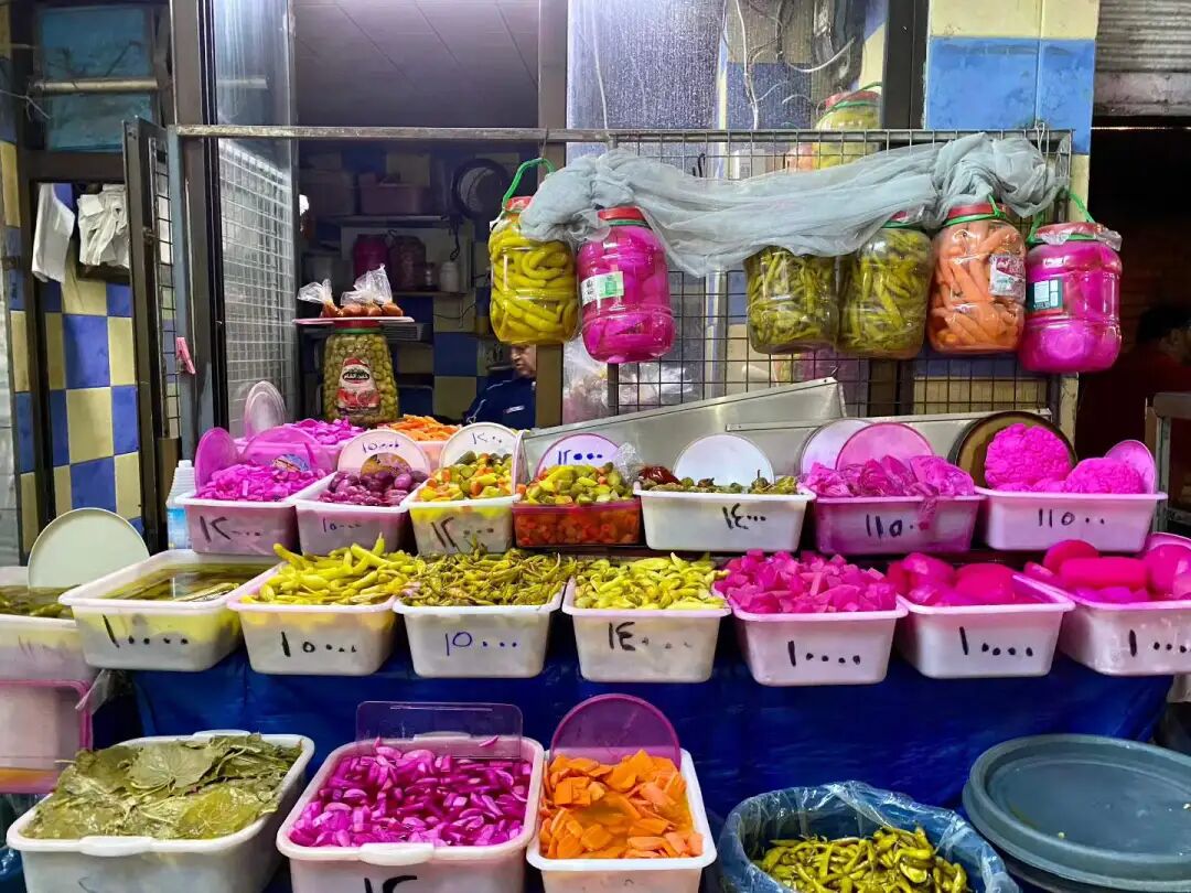
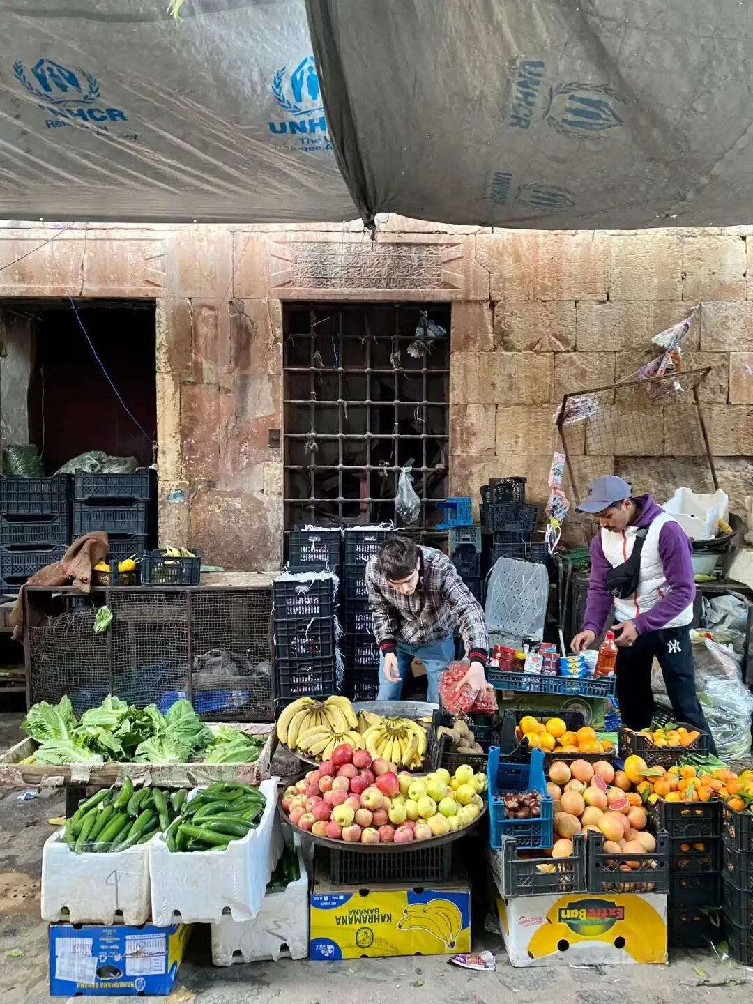
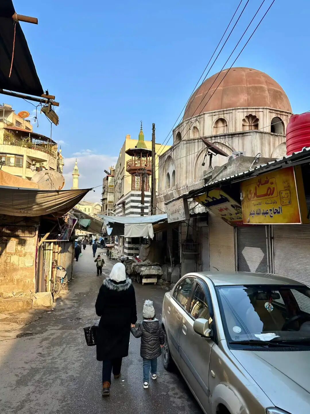
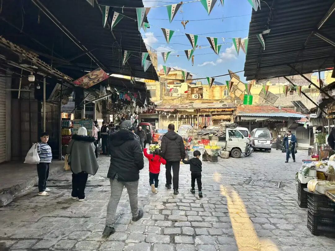
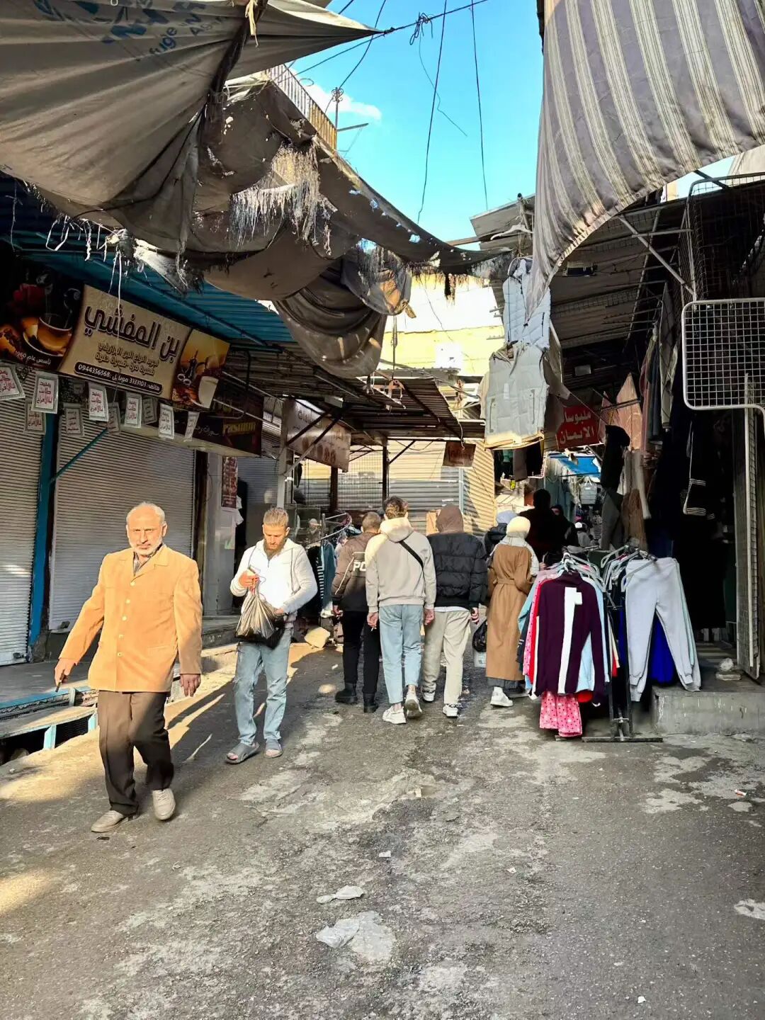
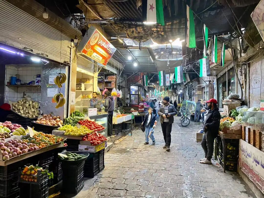
Handwritten signs at the market.
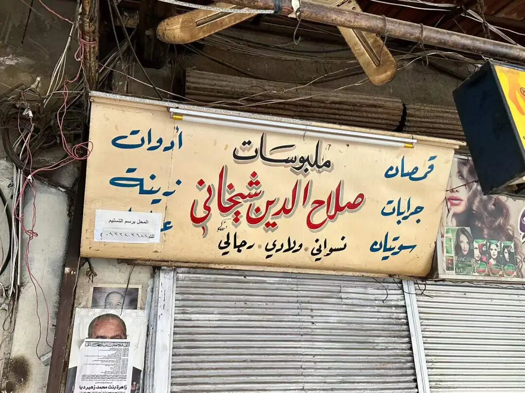
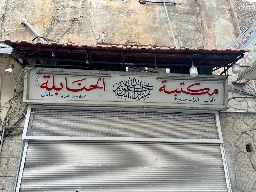
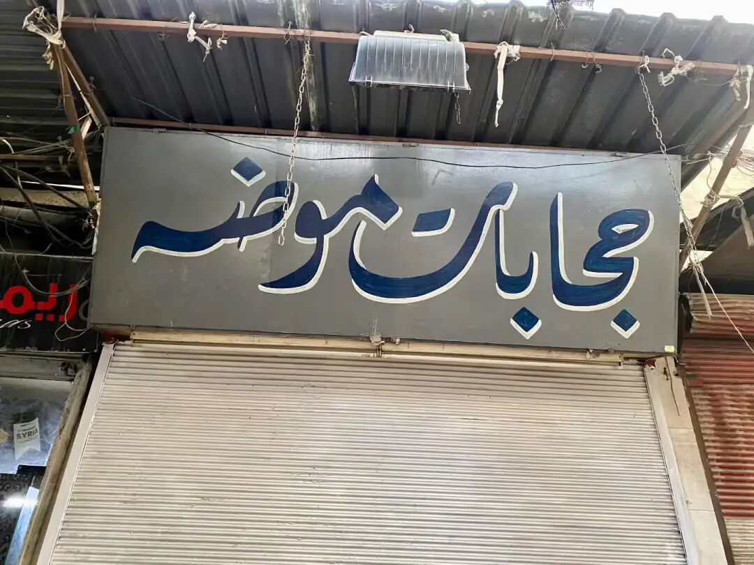
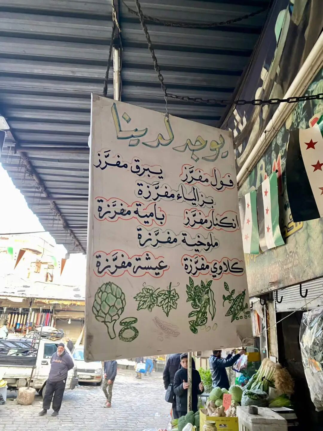
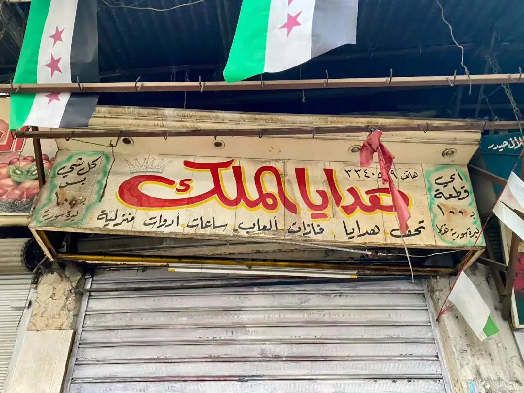
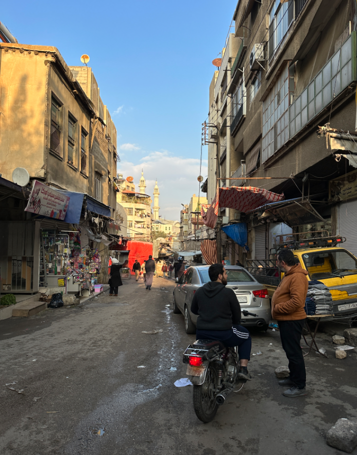
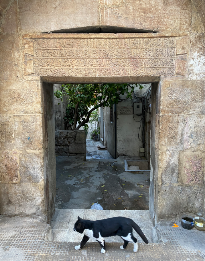
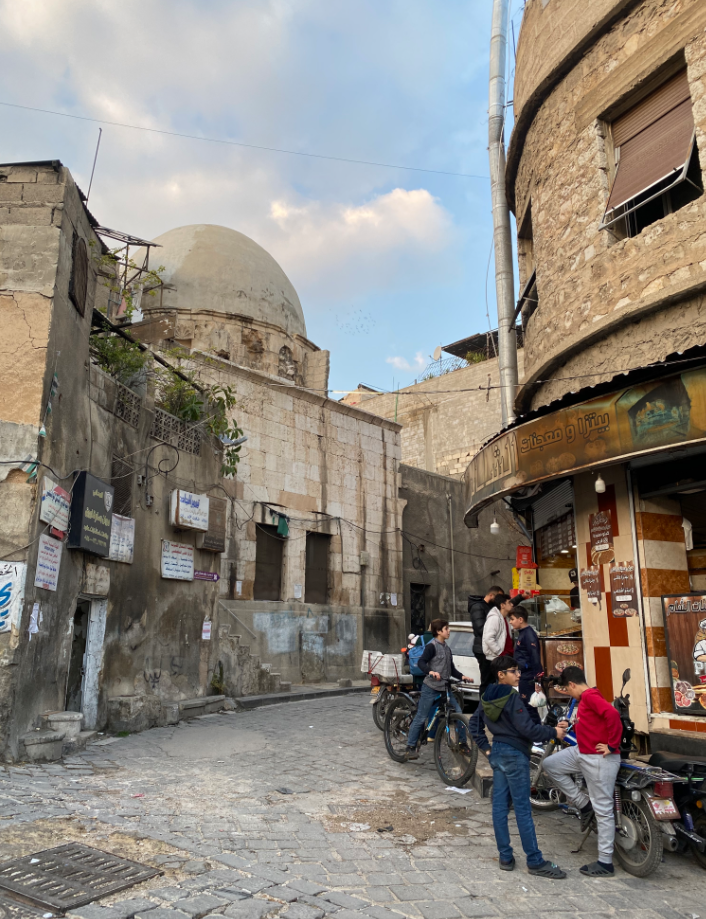
Beijing Halal Food Guide: Guyuan Stewed Snacks, Tianjin Tea Soup and Nanjing Chicken Soup
Articles • yusuf908 posted the article • 0 comments • 151 views • 2026-06-22 06:27
Summary: This Beijing halal food guide covers Guyuan stewed snacks, Tianjin tea soup, Nanjing chicken soup, halal food in China, and food festival details.
This article summarizes the key points of the Beijing Exhibition Center International Food Fair, covering Guyuan stewed snacks (huixiaochi), Tianjin tea soup (chatang), and Nanjing chicken soup. It keeps the original paragraph and image order, making it perfect for readers interested in Muslim life, Islamic culture, and Chinese Islamic writing. It also helps with searching for content related to Uyghur culture, Guyuan stewed snacks, and Tianjin tea soup.
Summer is here, and there are more and more food streets in Beijing, with several popping up every weekend.
I went to the Beijing Exhibition Center International Food Fair at night. There was so much good food that I could eat specialties from Ningxia, Gansu, Xinjiang, Beijing, Tianjin, and Nanjing. I was stuffed by the end of the night. The food festival runs until Sunday and is well worth a visit.
As soon as you enter the west entrance, you see the Ningxia stalls. From inside to outside, there is Yuanzhou Impression Guyuan Taste from Moshikou Street in Shijingshan, Baicao Tan Lamb from Lianhua Bridge, Jingyu Yanyu from Guomao, and the Ningxia Building from Andingmen.
I did not expect to find Guyuan food here! We tried the Guyuan specialty stewed snacks (huixiaochi), which is one of the ten classic bowls of the Hui Muslims in Guyuan. This is similar to the noodle soup (fentang) of Northwest China, which is usually cooked in a big pot during dry, cold weather and eaten with fried dough (youxiang).
The core of Guyuan stewed snacks is egg-stuffed meat slices (jiaban), meatballs, and mung bean jelly (liangfen), all stewed together with a rich, fresh broth and vegetables. However, this stall did not have meatballs; they used egg-stuffed meat slices and meat slices instead. Egg-stuffed meat slices are made by mixing eggs, starch, and flour into a batter, spreading it thin, sandwiching it with lamb filling, steaming it, and cutting it into diamond-shaped pieces. They are soft and chewy with a meaty aroma, and you can add side dishes like wood ear mushrooms, vermicelli, tofu, and spinach.
I then bought some hand-grabbed meat (shouzhuarou) and served it with chive flower sauce, onions, and sweet garlic. It tasted pretty good.
After eating, I bought some fermented oat drink (tianbeizi) and homemade xylitol yogurt at a stall in the Ningxia Building. Drinking tianbeizi in the summer is very refreshing.
I was pleasantly surprised to find two Hui Muslim snack stalls from Tianjin at this Beijing International Food Festival held at the Beijing Exhibition Center: Yuansuzhai Old-Style Fried Rolls (juanquan) from Honghuli and Chatang Hui from the Northwest Corner.
Yuansuzhai sells old-style fried rolls, curry chicken rolls, and peppercorn duck rolls, all served with homemade dark plum juice (wumeitang). The old-style fried rolls are vegetarian and filled with bean sprouts. The curry chicken roll skin is thicker and crispier, tasting a bit like a South Asian samosa. Traditionally, these rolls should be wrapped in a large flatbread (dabing), but they provided small thin pancakes instead so festival guests could try more varieties. I thought that was a great idea. I really love their homemade dark plum juice. I bought some when I visited Honghuli last time. It contains mulberries, osmanthus, roselle, dried tangerine peel, hawthorn, dark plum, licorice, and mint. It is very cooling and quenches thirst.
Yuansuzhai has a hundred-year history and has been passed down through four generations. They started selling fried rolls at a stall in North Zhulin near the Sancha River estuary in the 1920s. North Zhulin was originally a low-lying river beach along the Ziya River. It became solid land in the late Qing Dynasty. By the late Qing and Republican eras, it became a settlement for fishermen, boatmen, and dock workers living in makeshift shelters. Many Hui Muslim snack stalls gathered there, selling items like fried rolls, savory crepe strips (guobacai), and fried cakes (zhagao). The Tongyizhuang Mosque in North Zhulin was built during the Guangxu reign of the Qing Dynasty. It is 150 years old and is the only historical building preserved after the North Zhulin area was demolished.
In the late 1980s, Tianjin began large-scale urban renewal. Old districts like North Zhulin, Tongyizhuang, Xiyuzhuang, Hebei Street, and Beidaguan were demolished, and residents were relocated to Jiayuanli in the Beichen District. In the early 1990s, Yuansuzhai moved to the Jiayuanli commercial street along with the demolition of Beizhulin, becoming a landmark snack spot in Jiayuanli. The Jiayuanli shop closed in 2017, and the fourth-generation owner moved Yuansuzhai again to the Honghuli food street on Honghu South Road, starting with a breakfast cart before opening a formal storefront.
Chatang Hui is an old shop at the entrance of the South Mosque (Nandasi) in the Northwest Corner of Tianjin, with a century of history and four generations of heritage. Chatang (tea soup) first came to Tianjin via the Grand Canal. It was originally made with broomcorn millet flour, but later red sorghum flour was added, giving it a unique red color. Making chatang requires a large dragon-spout copper pot and the 'phoenix three nods' technique, a smooth motion that ensures not a drop spills when pouring. Traditional toppings include brown sugar, white sugar, sesame, crushed peanuts, raisins, and candied fruit shreds (qinghongsi), making it sweet and tangy.
At the Beijing International Food Festival, the Xinjiang stall featuring big plate chicken (dapanji), pilaf (zhuafan), and lamb skewers (yangrouchuan) from the Xinjiang Building is very popular.
Before leaving, I was surprised to find a stall for the old Nanjing halal brand, Lvliuju! They sell various traditional Nanjing snacks, honey lotus root (mizhi ou), green sticky rice balls (qingtuan), water chestnut cake (mati gao), as well as hot osmanthus sugar taro seedlings (guihua tang yumiao) and chicken broth tofu (jizhi huilu gan). Even though we were full, we ordered a bowl of chicken broth tofu. The bean curd soaked in chicken broth was incredibly fresh, and the broth with bean sprouts and wood ear mushrooms was delicious. Chicken broth tofu gets its name because the fried tofu puffs are repeatedly simmered in broth. To make it, the chicken broth must be simmered for six hours and cooked with bean sprouts, wood ear mushrooms, and winter bamboo shoots, making the tofu soft and full of chicken flavor.
Lvliuju was founded in 1912 at Taoye Ferry along the Qinhuai River in Nanjing. It was named Lvliuju because of the shady green willow trees along the riverbank. Lvliuju started as a high-end vegetarian restaurant. Famous figures like Kong Xiangxi, Chiang Ching-kuo, Bai Chongxi, and the Soong sisters often dined here. After 1949, Lvliuju closed for a period. It reopened in 1963 on Yanggongjing, Taiping South Road, where they hired the famous chef Chen Bingyu to continue serving authentic vegetarian dishes. A major specialty of Lvliuju is vegetarian dishes that taste like meat. Their vegetarian chicken and vegetarian duck, made from tofu skin, gluten, and dried bean curd sticks seasoned with traditional Chinese herbs, are delicious. In 1987, Lvliuju added halal dishes to its vegetarian menu and became a halal restaurant. It still keeps vegetarian food as its specialty and is now recognized as a national-level intangible cultural heritage. view all
Summary: This Beijing halal food guide covers Guyuan stewed snacks, Tianjin tea soup, Nanjing chicken soup, halal food in China, and food festival details.
This article summarizes the key points of the Beijing Exhibition Center International Food Fair, covering Guyuan stewed snacks (huixiaochi), Tianjin tea soup (chatang), and Nanjing chicken soup. It keeps the original paragraph and image order, making it perfect for readers interested in Muslim life, Islamic culture, and Chinese Islamic writing. It also helps with searching for content related to Uyghur culture, Guyuan stewed snacks, and Tianjin tea soup.
Summer is here, and there are more and more food streets in Beijing, with several popping up every weekend.
I went to the Beijing Exhibition Center International Food Fair at night. There was so much good food that I could eat specialties from Ningxia, Gansu, Xinjiang, Beijing, Tianjin, and Nanjing. I was stuffed by the end of the night. The food festival runs until Sunday and is well worth a visit.
As soon as you enter the west entrance, you see the Ningxia stalls. From inside to outside, there is Yuanzhou Impression Guyuan Taste from Moshikou Street in Shijingshan, Baicao Tan Lamb from Lianhua Bridge, Jingyu Yanyu from Guomao, and the Ningxia Building from Andingmen.
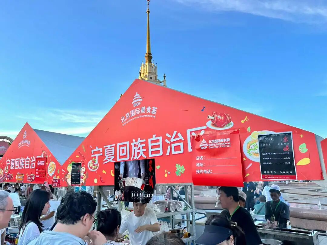
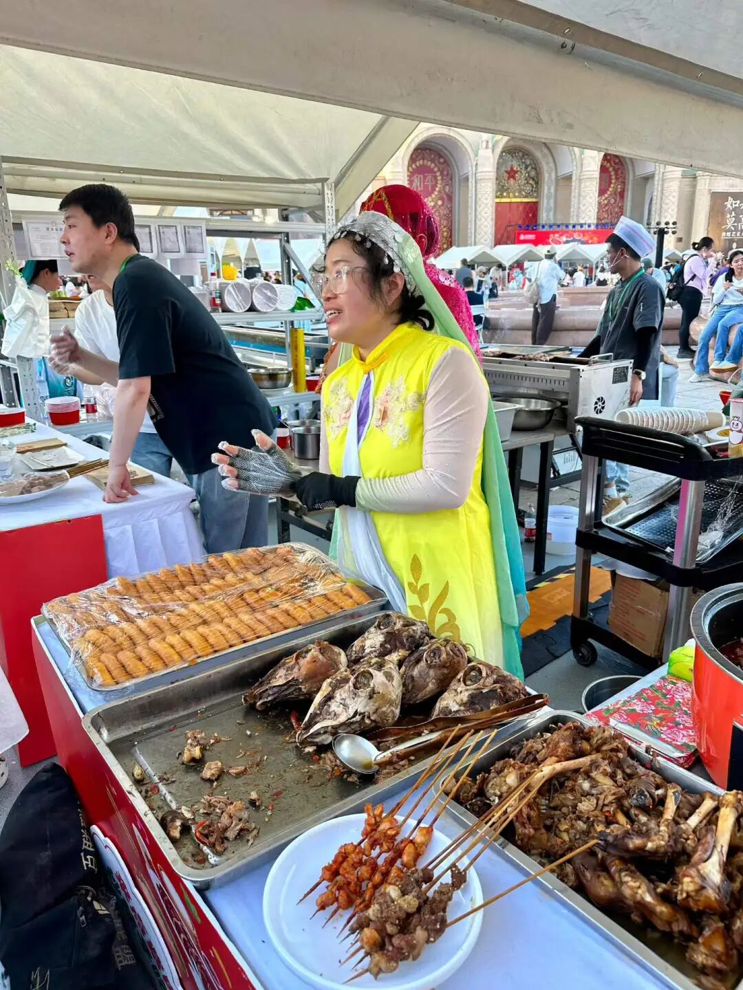
I did not expect to find Guyuan food here! We tried the Guyuan specialty stewed snacks (huixiaochi), which is one of the ten classic bowls of the Hui Muslims in Guyuan. This is similar to the noodle soup (fentang) of Northwest China, which is usually cooked in a big pot during dry, cold weather and eaten with fried dough (youxiang).
The core of Guyuan stewed snacks is egg-stuffed meat slices (jiaban), meatballs, and mung bean jelly (liangfen), all stewed together with a rich, fresh broth and vegetables. However, this stall did not have meatballs; they used egg-stuffed meat slices and meat slices instead. Egg-stuffed meat slices are made by mixing eggs, starch, and flour into a batter, spreading it thin, sandwiching it with lamb filling, steaming it, and cutting it into diamond-shaped pieces. They are soft and chewy with a meaty aroma, and you can add side dishes like wood ear mushrooms, vermicelli, tofu, and spinach.
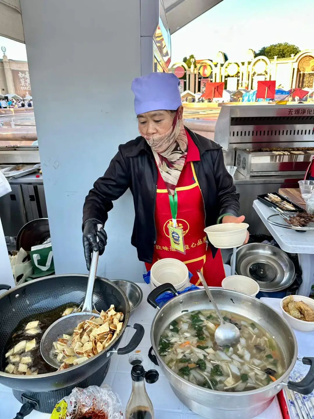
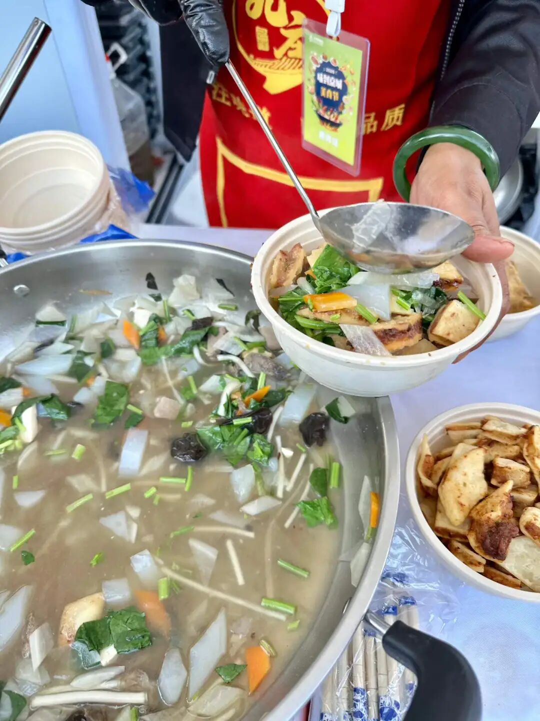
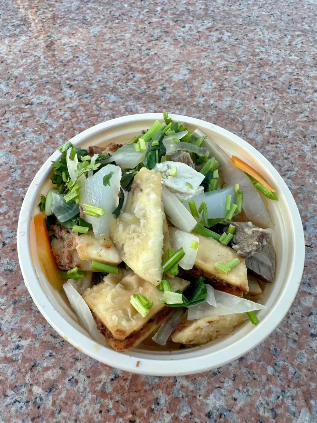
I then bought some hand-grabbed meat (shouzhuarou) and served it with chive flower sauce, onions, and sweet garlic. It tasted pretty good.
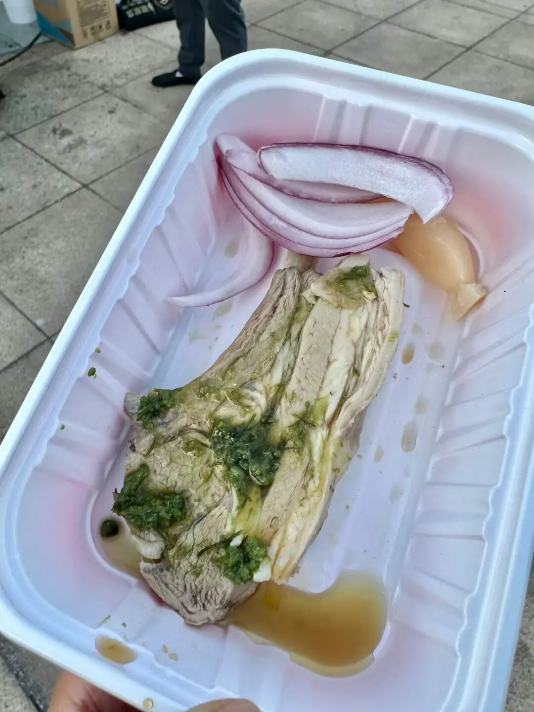
After eating, I bought some fermented oat drink (tianbeizi) and homemade xylitol yogurt at a stall in the Ningxia Building. Drinking tianbeizi in the summer is very refreshing.
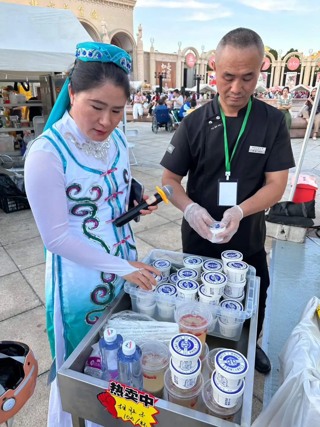
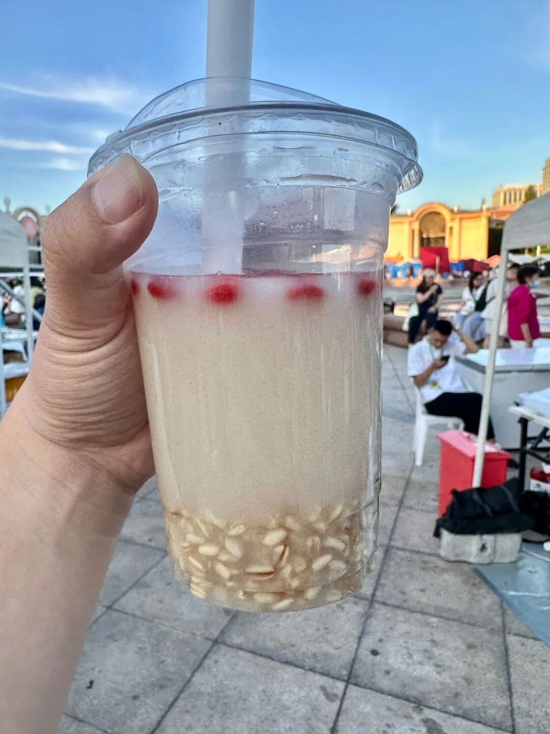
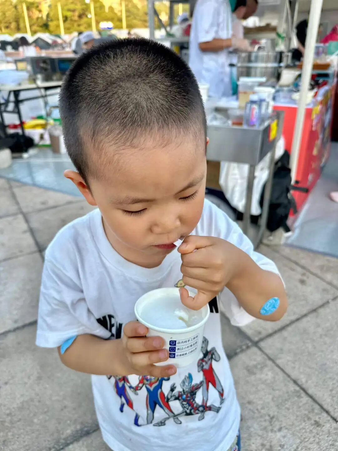
I was pleasantly surprised to find two Hui Muslim snack stalls from Tianjin at this Beijing International Food Festival held at the Beijing Exhibition Center: Yuansuzhai Old-Style Fried Rolls (juanquan) from Honghuli and Chatang Hui from the Northwest Corner.
Yuansuzhai sells old-style fried rolls, curry chicken rolls, and peppercorn duck rolls, all served with homemade dark plum juice (wumeitang). The old-style fried rolls are vegetarian and filled with bean sprouts. The curry chicken roll skin is thicker and crispier, tasting a bit like a South Asian samosa. Traditionally, these rolls should be wrapped in a large flatbread (dabing), but they provided small thin pancakes instead so festival guests could try more varieties. I thought that was a great idea. I really love their homemade dark plum juice. I bought some when I visited Honghuli last time. It contains mulberries, osmanthus, roselle, dried tangerine peel, hawthorn, dark plum, licorice, and mint. It is very cooling and quenches thirst.
Yuansuzhai has a hundred-year history and has been passed down through four generations. They started selling fried rolls at a stall in North Zhulin near the Sancha River estuary in the 1920s. North Zhulin was originally a low-lying river beach along the Ziya River. It became solid land in the late Qing Dynasty. By the late Qing and Republican eras, it became a settlement for fishermen, boatmen, and dock workers living in makeshift shelters. Many Hui Muslim snack stalls gathered there, selling items like fried rolls, savory crepe strips (guobacai), and fried cakes (zhagao). The Tongyizhuang Mosque in North Zhulin was built during the Guangxu reign of the Qing Dynasty. It is 150 years old and is the only historical building preserved after the North Zhulin area was demolished.
In the late 1980s, Tianjin began large-scale urban renewal. Old districts like North Zhulin, Tongyizhuang, Xiyuzhuang, Hebei Street, and Beidaguan were demolished, and residents were relocated to Jiayuanli in the Beichen District. In the early 1990s, Yuansuzhai moved to the Jiayuanli commercial street along with the demolition of Beizhulin, becoming a landmark snack spot in Jiayuanli. The Jiayuanli shop closed in 2017, and the fourth-generation owner moved Yuansuzhai again to the Honghuli food street on Honghu South Road, starting with a breakfast cart before opening a formal storefront.
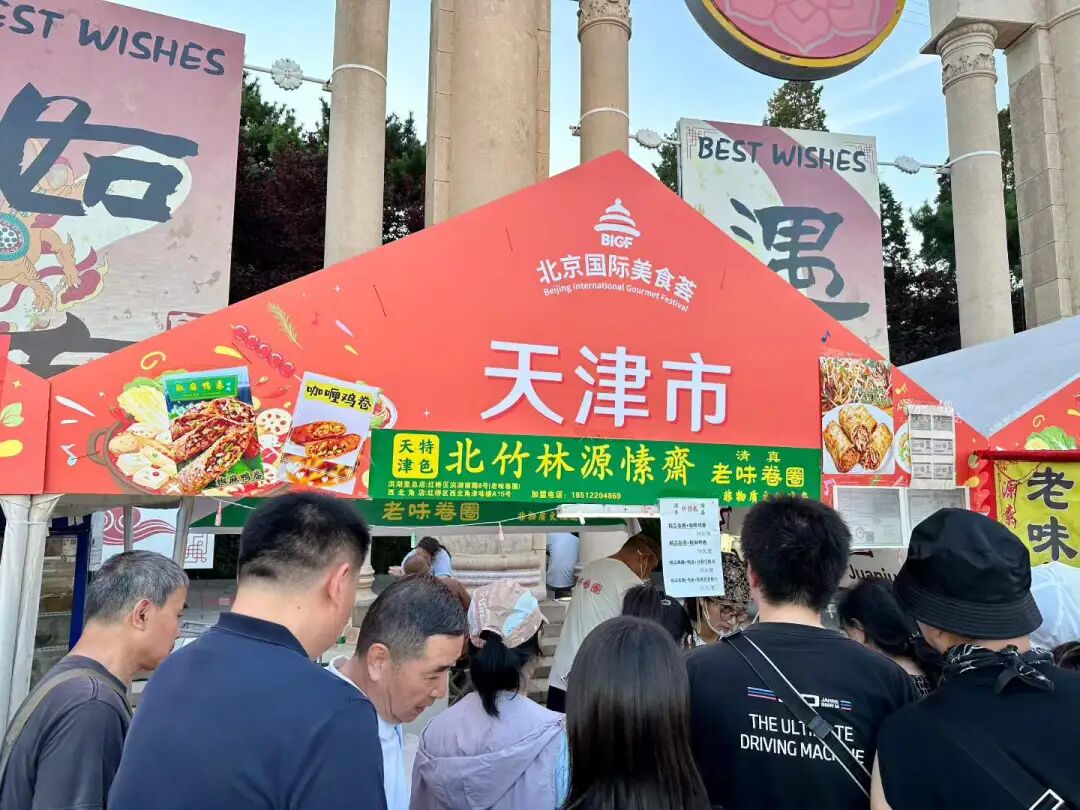
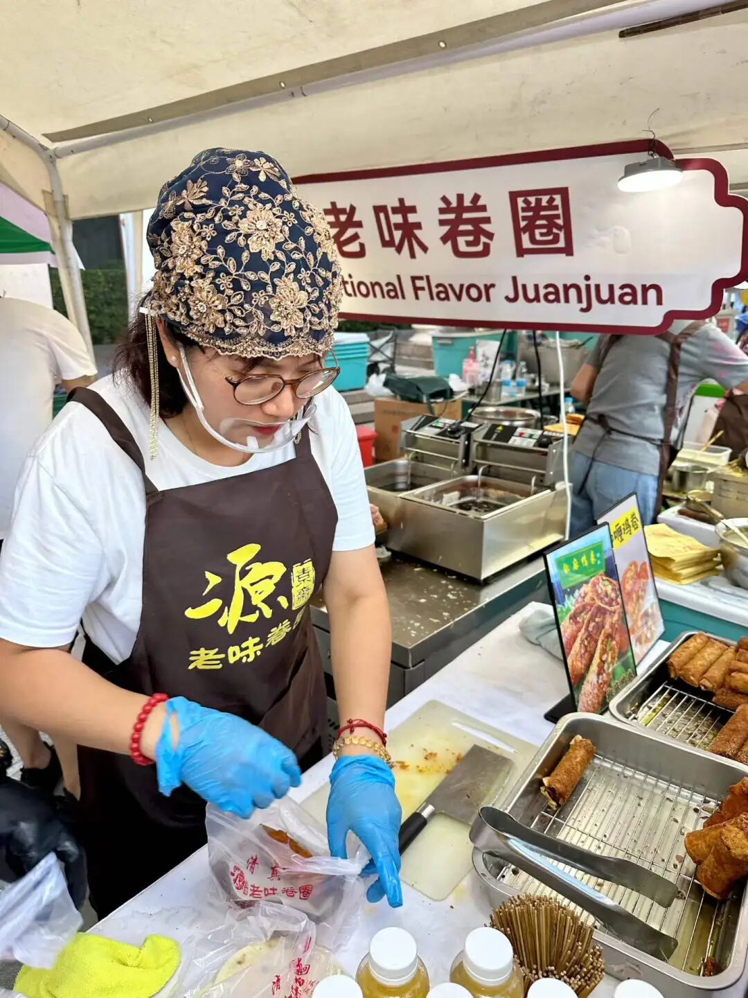
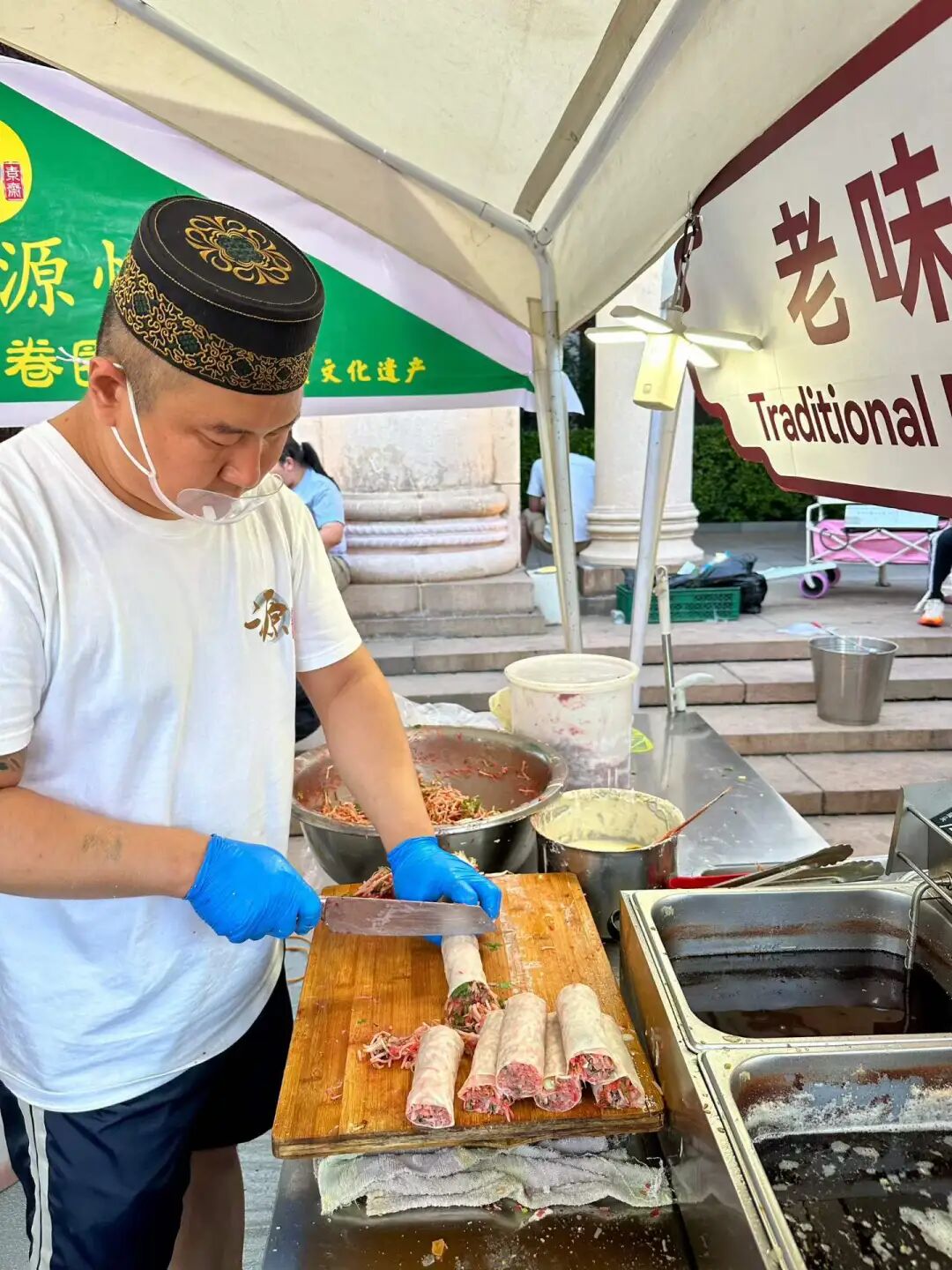
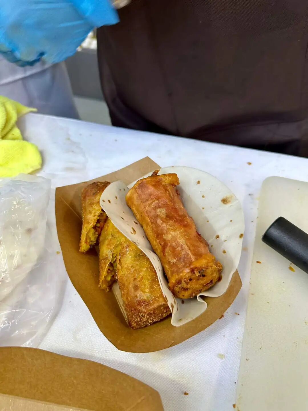
Chatang Hui is an old shop at the entrance of the South Mosque (Nandasi) in the Northwest Corner of Tianjin, with a century of history and four generations of heritage. Chatang (tea soup) first came to Tianjin via the Grand Canal. It was originally made with broomcorn millet flour, but later red sorghum flour was added, giving it a unique red color. Making chatang requires a large dragon-spout copper pot and the 'phoenix three nods' technique, a smooth motion that ensures not a drop spills when pouring. Traditional toppings include brown sugar, white sugar, sesame, crushed peanuts, raisins, and candied fruit shreds (qinghongsi), making it sweet and tangy.
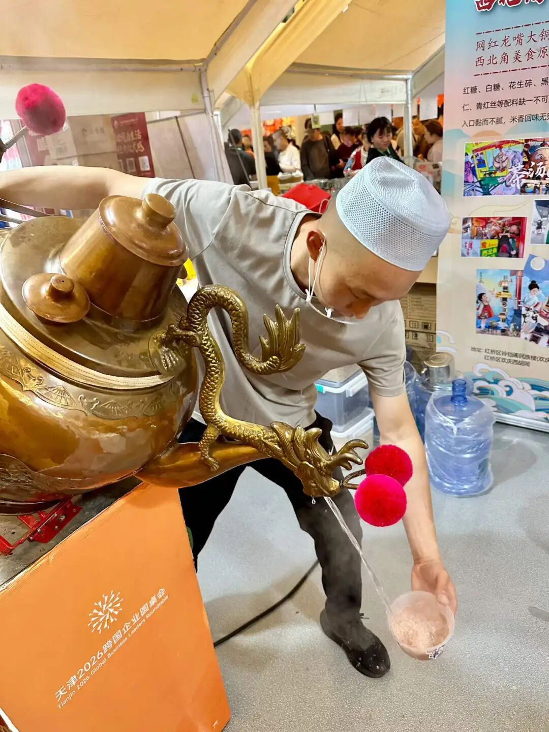
At the Beijing International Food Festival, the Xinjiang stall featuring big plate chicken (dapanji), pilaf (zhuafan), and lamb skewers (yangrouchuan) from the Xinjiang Building is very popular.
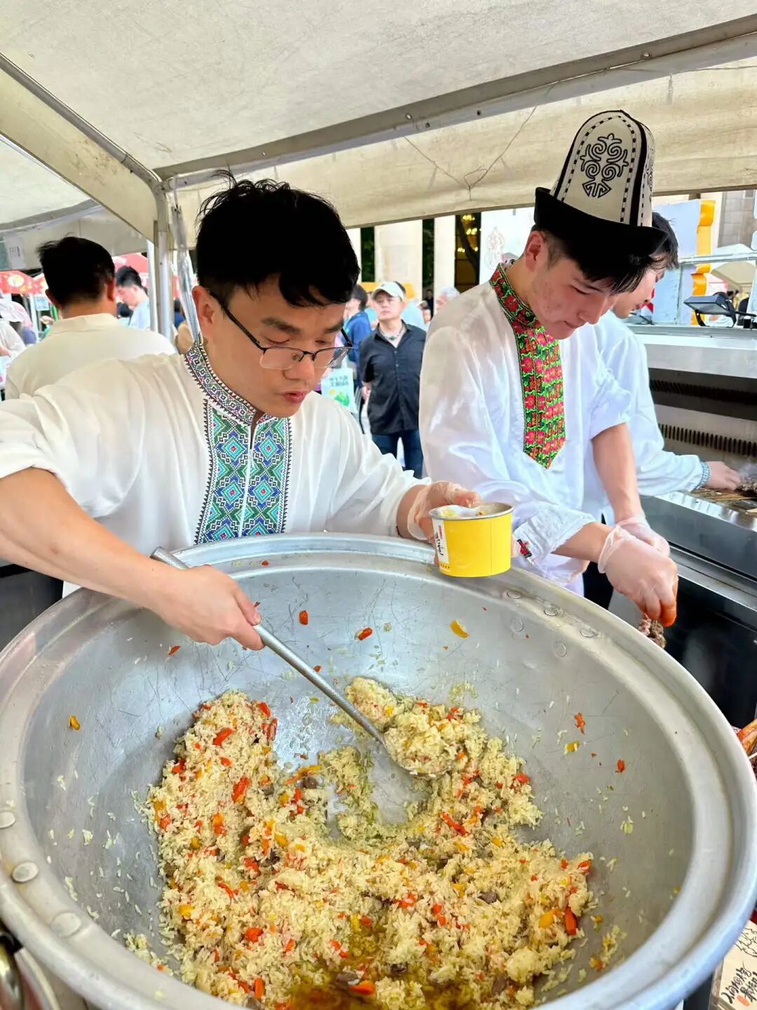
Before leaving, I was surprised to find a stall for the old Nanjing halal brand, Lvliuju! They sell various traditional Nanjing snacks, honey lotus root (mizhi ou), green sticky rice balls (qingtuan), water chestnut cake (mati gao), as well as hot osmanthus sugar taro seedlings (guihua tang yumiao) and chicken broth tofu (jizhi huilu gan). Even though we were full, we ordered a bowl of chicken broth tofu. The bean curd soaked in chicken broth was incredibly fresh, and the broth with bean sprouts and wood ear mushrooms was delicious. Chicken broth tofu gets its name because the fried tofu puffs are repeatedly simmered in broth. To make it, the chicken broth must be simmered for six hours and cooked with bean sprouts, wood ear mushrooms, and winter bamboo shoots, making the tofu soft and full of chicken flavor.
Lvliuju was founded in 1912 at Taoye Ferry along the Qinhuai River in Nanjing. It was named Lvliuju because of the shady green willow trees along the riverbank. Lvliuju started as a high-end vegetarian restaurant. Famous figures like Kong Xiangxi, Chiang Ching-kuo, Bai Chongxi, and the Soong sisters often dined here. After 1949, Lvliuju closed for a period. It reopened in 1963 on Yanggongjing, Taiping South Road, where they hired the famous chef Chen Bingyu to continue serving authentic vegetarian dishes. A major specialty of Lvliuju is vegetarian dishes that taste like meat. Their vegetarian chicken and vegetarian duck, made from tofu skin, gluten, and dried bean curd sticks seasoned with traditional Chinese herbs, are delicious. In 1987, Lvliuju added halal dishes to its vegetarian menu and became a halal restaurant. It still keeps vegetarian food as its specialty and is now recognized as a national-level intangible cultural heritage.
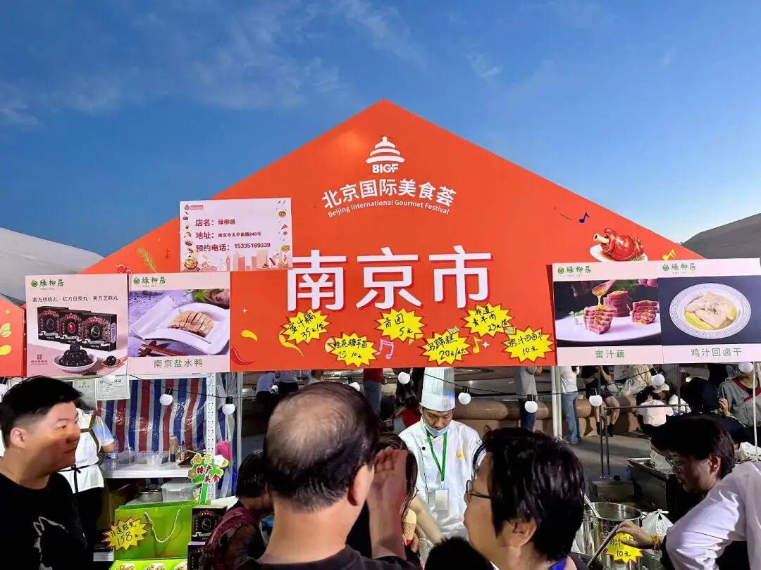
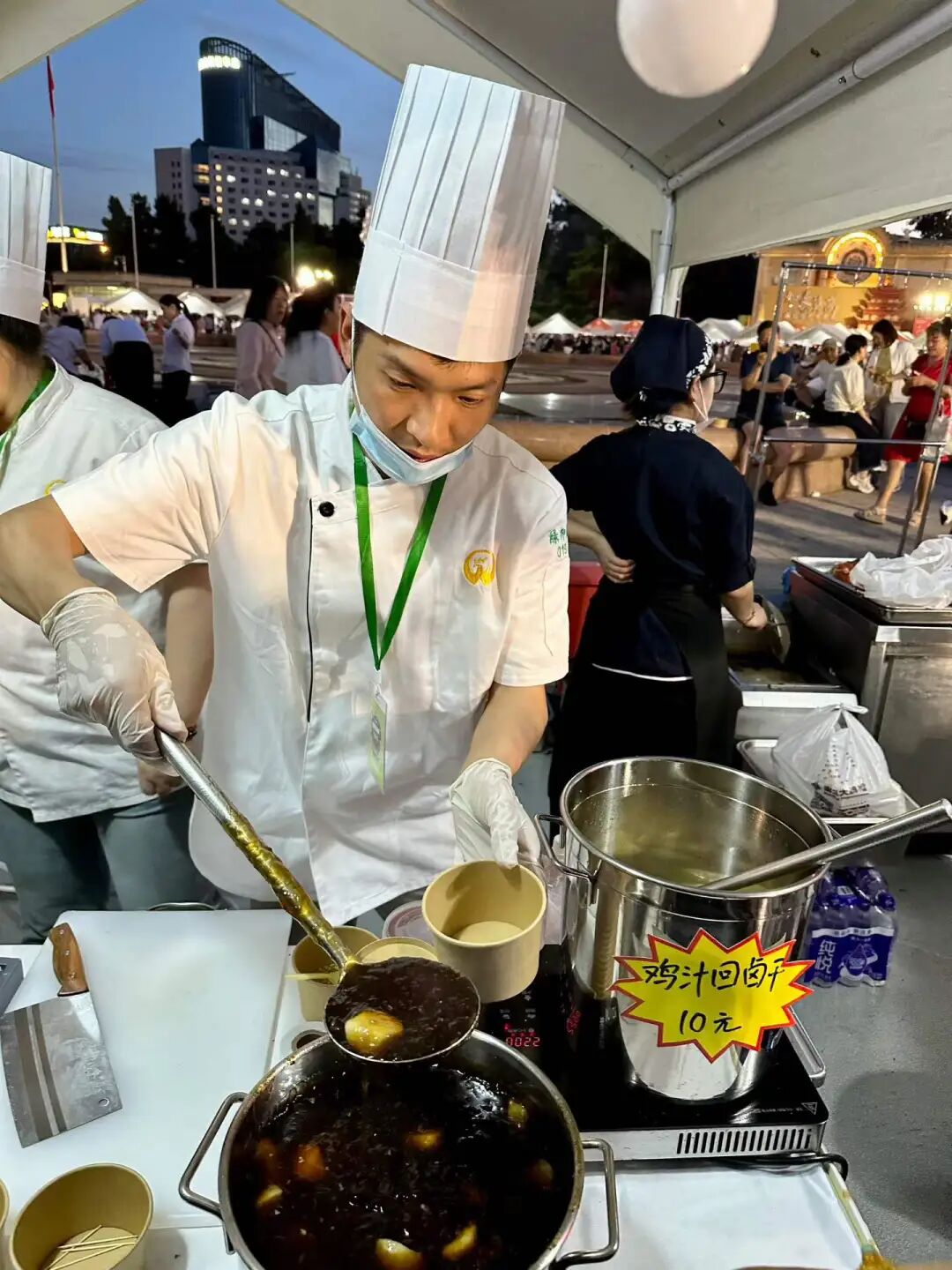
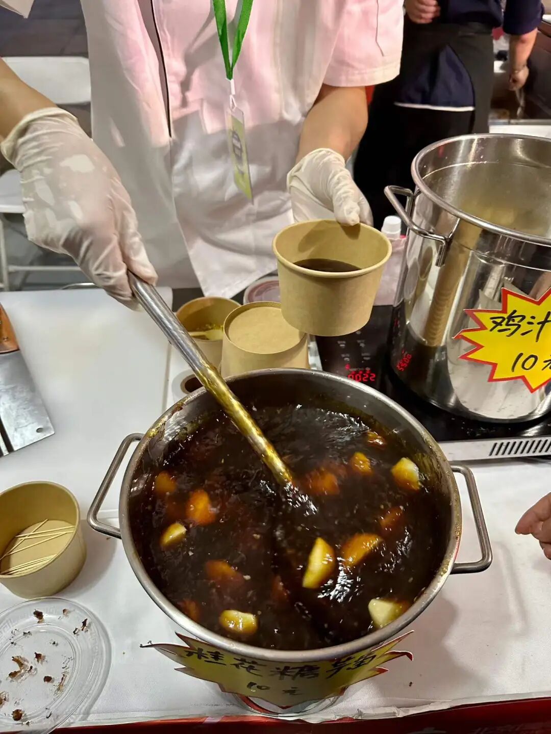
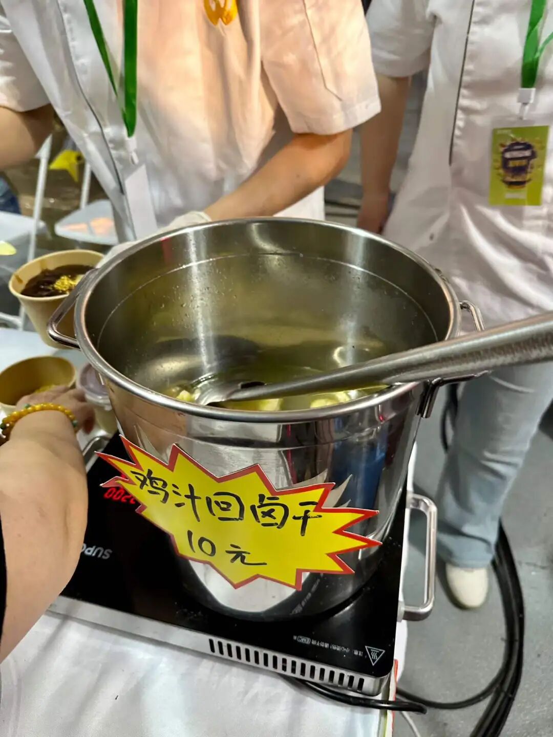
Muslim History Guide to Damascus: Bilal Tomb, First Muezzin and Islamic Heritage
Articles • yusuf908 posted the article • 0 comments • 164 views • 2026-06-22 06:27
Summary: This Muslim history guide to Damascus covers Bilal's tomb, the first muezzin, the Prophet's Companion, and Muslim heritage in the original travel account.
This article summarizes the key points of visiting the tomb of Bilal, the first muezzin and companion of the Prophet. It keeps the original paragraph and image order, making it perfect for readers interested in Muslim life, Islamic culture, and Chinese Islamic writing. It also helps those searching for content on Shia Islam, Hajj, and marriage and family.
While in Damascus, I made a special trip to the ancient Bab al-Saghir cemetery in the south of the city to visit the tomb of Bilal, the first muezzin chosen by the Prophet and the first African convert. I went to pay my respects to this companion (Sahaba) of the Prophet.
Bilal's tomb is just inside the north gate of the cemetery, and the tomb structure was rebuilt by later generations. The cemetery is open to people of all faiths and offers free dates and sesame cookies (Barazek).
Bilal was born in Mecca in 580. His mother was a slave from Abyssinia in East Africa, so he worked hard from a young age for the Umayyad family, who were nobles of the Quraysh tribe. When the Prophet began his mission, Bilal chose to give up idol worship and became one of the earliest converts to the faith. When his master Umayyad found out, he punished and tortured him severely. He whipped him, tied him to the sand, placed hot stones on his chest, and dragged him around Mecca while children mocked him. But Bilal only repeated, "Ahad, Ahad..." which means "The One, The One..." When the Prophet heard about this, he sent Abu Bakr to buy Bilal's freedom, and Bilal was then able to follow the Prophet closely. Because he had a loud and clear voice, Bilal was chosen by the Prophet to be the first muezzin.
In Medina, the Prophet appointed Bilal as the treasurer, and he distributed relief funds to widows, orphans, and the poor. After the reconquest of Mecca in 630, Bilal gave the first call to prayer (adhan) at the Kaaba. This act is remembered as a key moment in the history of the faith, symbolizing the establishment of the religion as the core belief of Mecca.
After the Caliphate conquered Syria in 634, Bilal moved to Damascus to live, and he eventually passed away there.
In a sermon (wa'z) given by Imam Sha in Dujiangyan, he shared the most famous story about how, after the Prophet passed away, he could not bear to see anything in Medina that reminded him of the Prophet. So, he moved to Damascus to live.
One day, he dreamed that the Prophet asked him, 'Have you abandoned us and abandoned Medina?' After waking up, he returned to Medina. At the repeated request of Hasan and Husayn, he performed the call to prayer (adhan). While reciting, he remembered every detail of his life with the Prophet. Overcome with grief, he fell from the high platform. He returned to Damascus and passed away shortly after.
People say during the Assad regime in Syria, the tomb of Bilal (Bilali mu) was closed for over ten years. It was not until after Assad fell in December 2024 that the tomb of Bilal reopened to visitors.
An inscription in the cemetery shows that the Sadaf Foundation from Konya, Turkey, renovated the site in 2009. view all
Summary: This Muslim history guide to Damascus covers Bilal's tomb, the first muezzin, the Prophet's Companion, and Muslim heritage in the original travel account.
This article summarizes the key points of visiting the tomb of Bilal, the first muezzin and companion of the Prophet. It keeps the original paragraph and image order, making it perfect for readers interested in Muslim life, Islamic culture, and Chinese Islamic writing. It also helps those searching for content on Shia Islam, Hajj, and marriage and family.
While in Damascus, I made a special trip to the ancient Bab al-Saghir cemetery in the south of the city to visit the tomb of Bilal, the first muezzin chosen by the Prophet and the first African convert. I went to pay my respects to this companion (Sahaba) of the Prophet.
Bilal's tomb is just inside the north gate of the cemetery, and the tomb structure was rebuilt by later generations. The cemetery is open to people of all faiths and offers free dates and sesame cookies (Barazek).
Bilal was born in Mecca in 580. His mother was a slave from Abyssinia in East Africa, so he worked hard from a young age for the Umayyad family, who were nobles of the Quraysh tribe. When the Prophet began his mission, Bilal chose to give up idol worship and became one of the earliest converts to the faith. When his master Umayyad found out, he punished and tortured him severely. He whipped him, tied him to the sand, placed hot stones on his chest, and dragged him around Mecca while children mocked him. But Bilal only repeated, "Ahad, Ahad..." which means "The One, The One..." When the Prophet heard about this, he sent Abu Bakr to buy Bilal's freedom, and Bilal was then able to follow the Prophet closely. Because he had a loud and clear voice, Bilal was chosen by the Prophet to be the first muezzin.
In Medina, the Prophet appointed Bilal as the treasurer, and he distributed relief funds to widows, orphans, and the poor. After the reconquest of Mecca in 630, Bilal gave the first call to prayer (adhan) at the Kaaba. This act is remembered as a key moment in the history of the faith, symbolizing the establishment of the religion as the core belief of Mecca.
After the Caliphate conquered Syria in 634, Bilal moved to Damascus to live, and he eventually passed away there.
In a sermon (wa'z) given by Imam Sha in Dujiangyan, he shared the most famous story about how, after the Prophet passed away, he could not bear to see anything in Medina that reminded him of the Prophet. So, he moved to Damascus to live.
One day, he dreamed that the Prophet asked him, 'Have you abandoned us and abandoned Medina?' After waking up, he returned to Medina. At the repeated request of Hasan and Husayn, he performed the call to prayer (adhan). While reciting, he remembered every detail of his life with the Prophet. Overcome with grief, he fell from the high platform. He returned to Damascus and passed away shortly after.
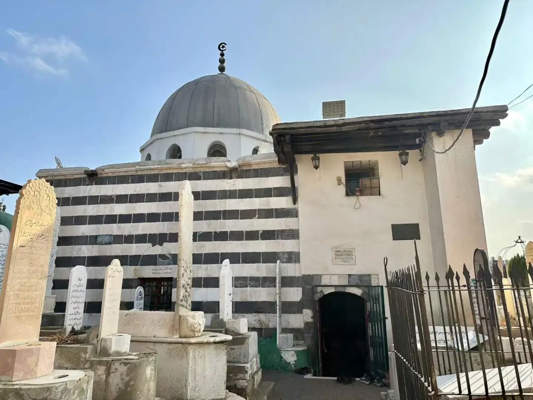
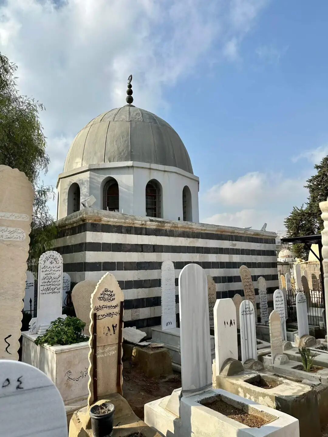
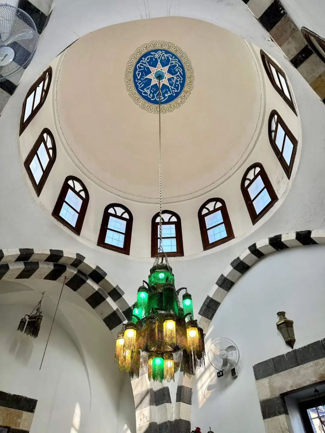
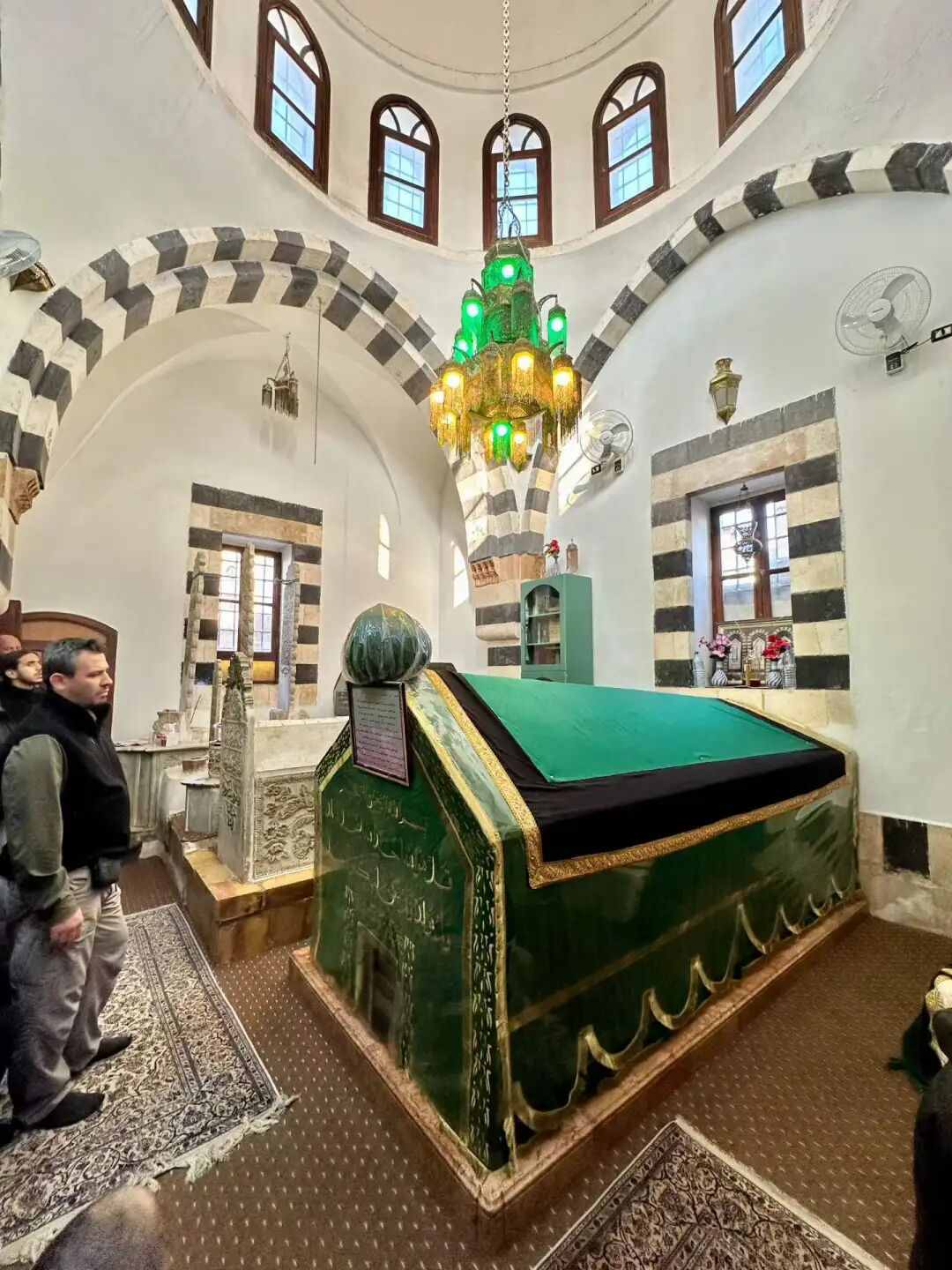
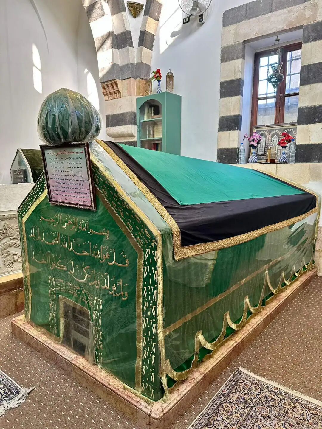
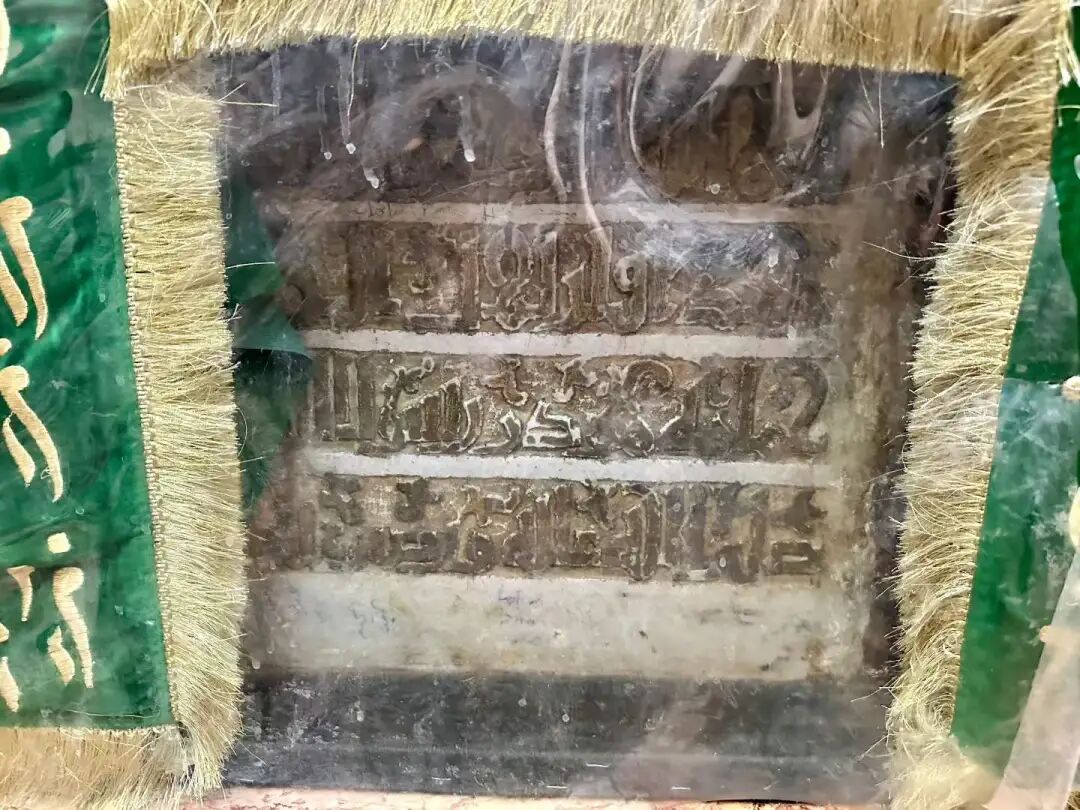
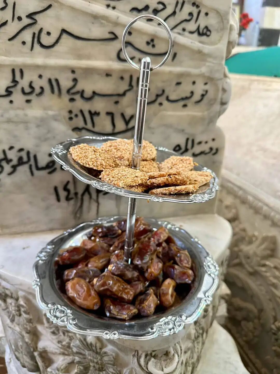
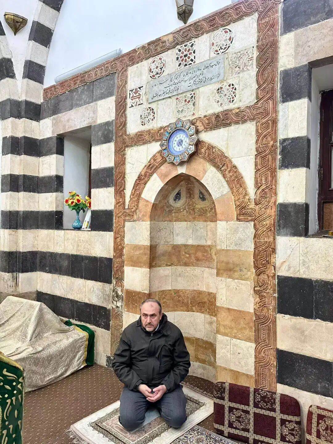
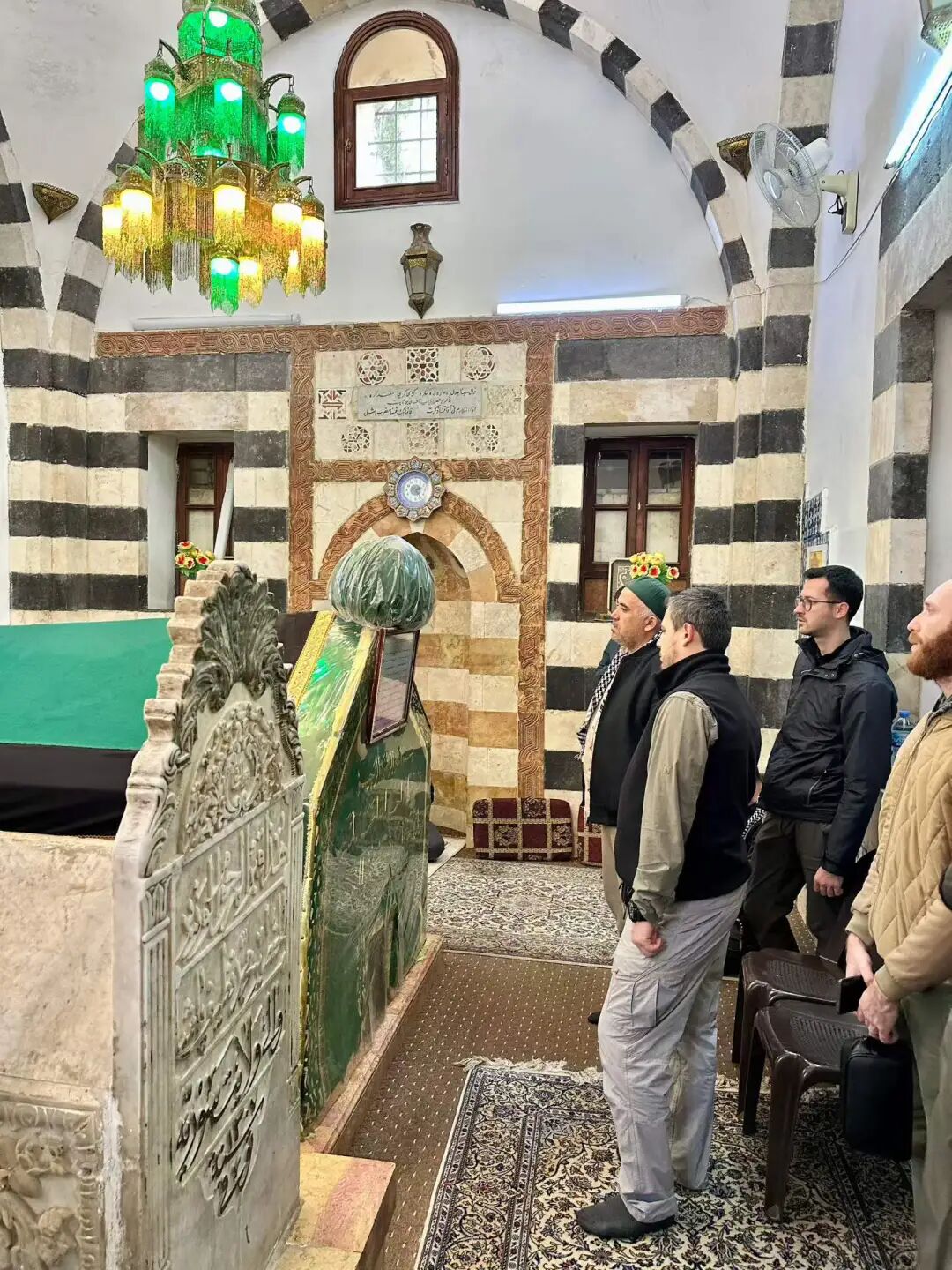
People say during the Assad regime in Syria, the tomb of Bilal (Bilali mu) was closed for over ten years. It was not until after Assad fell in December 2024 that the tomb of Bilal reopened to visitors.
An inscription in the cemetery shows that the Sadaf Foundation from Konya, Turkey, renovated the site in 2009.
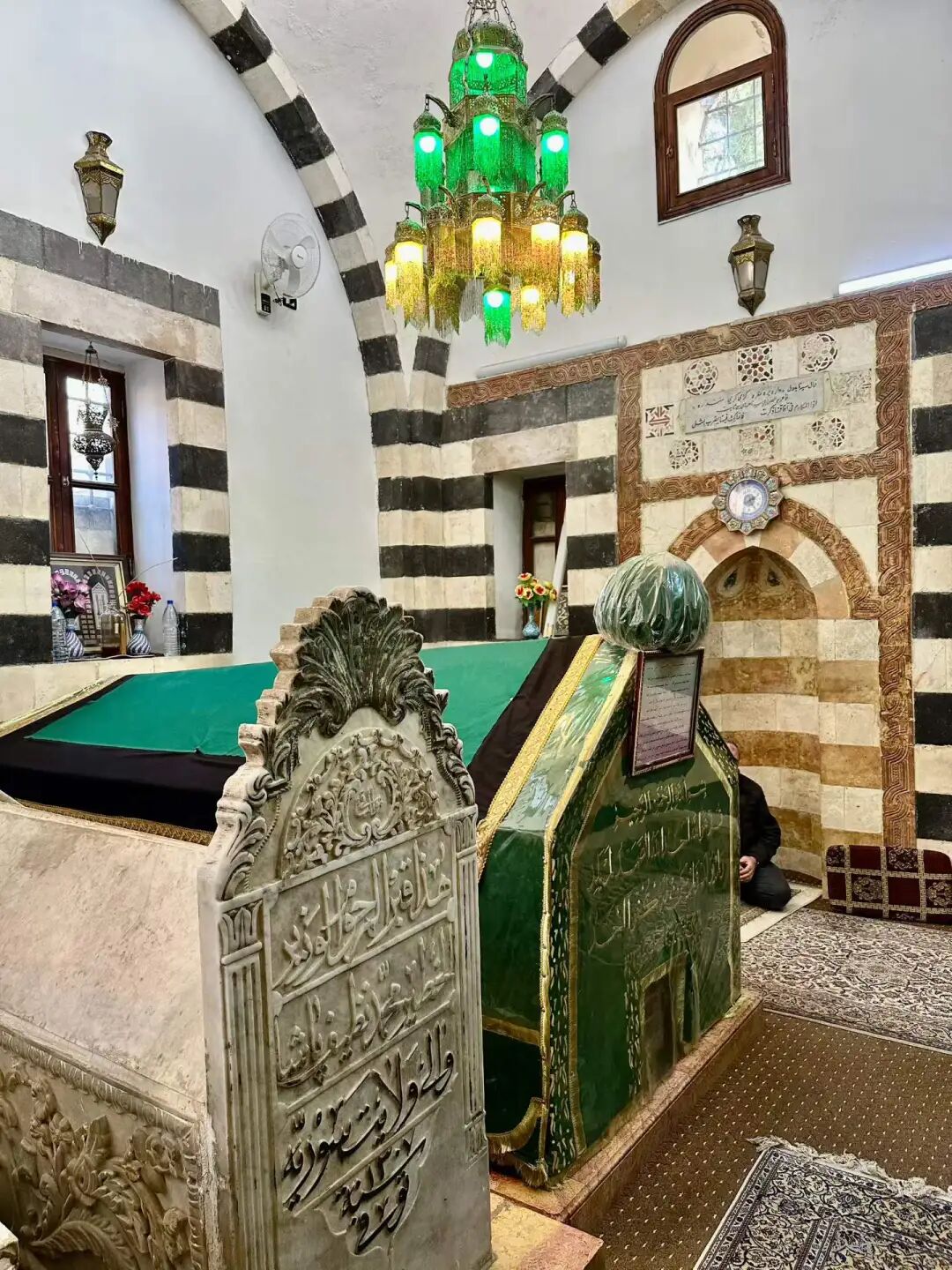
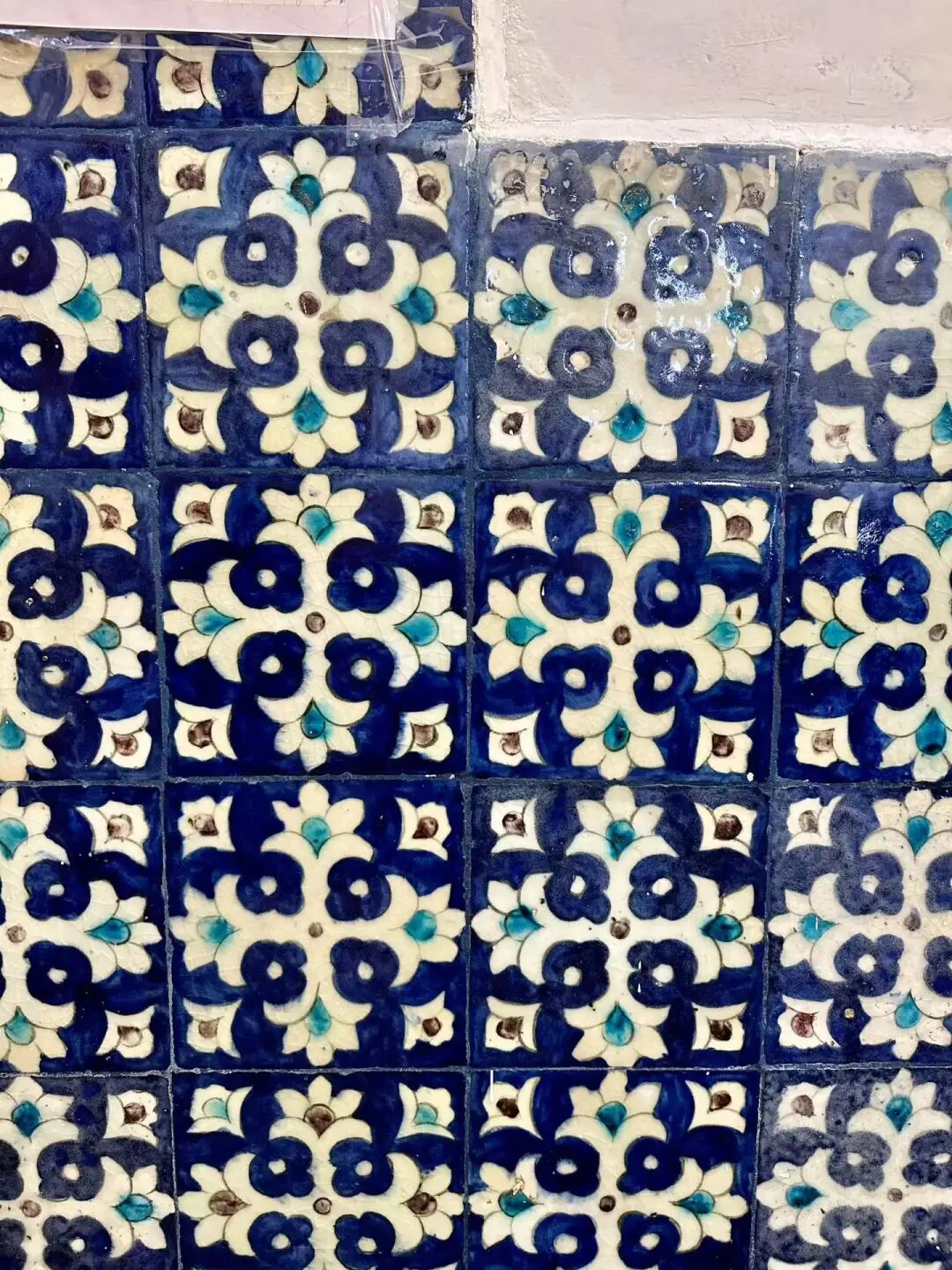
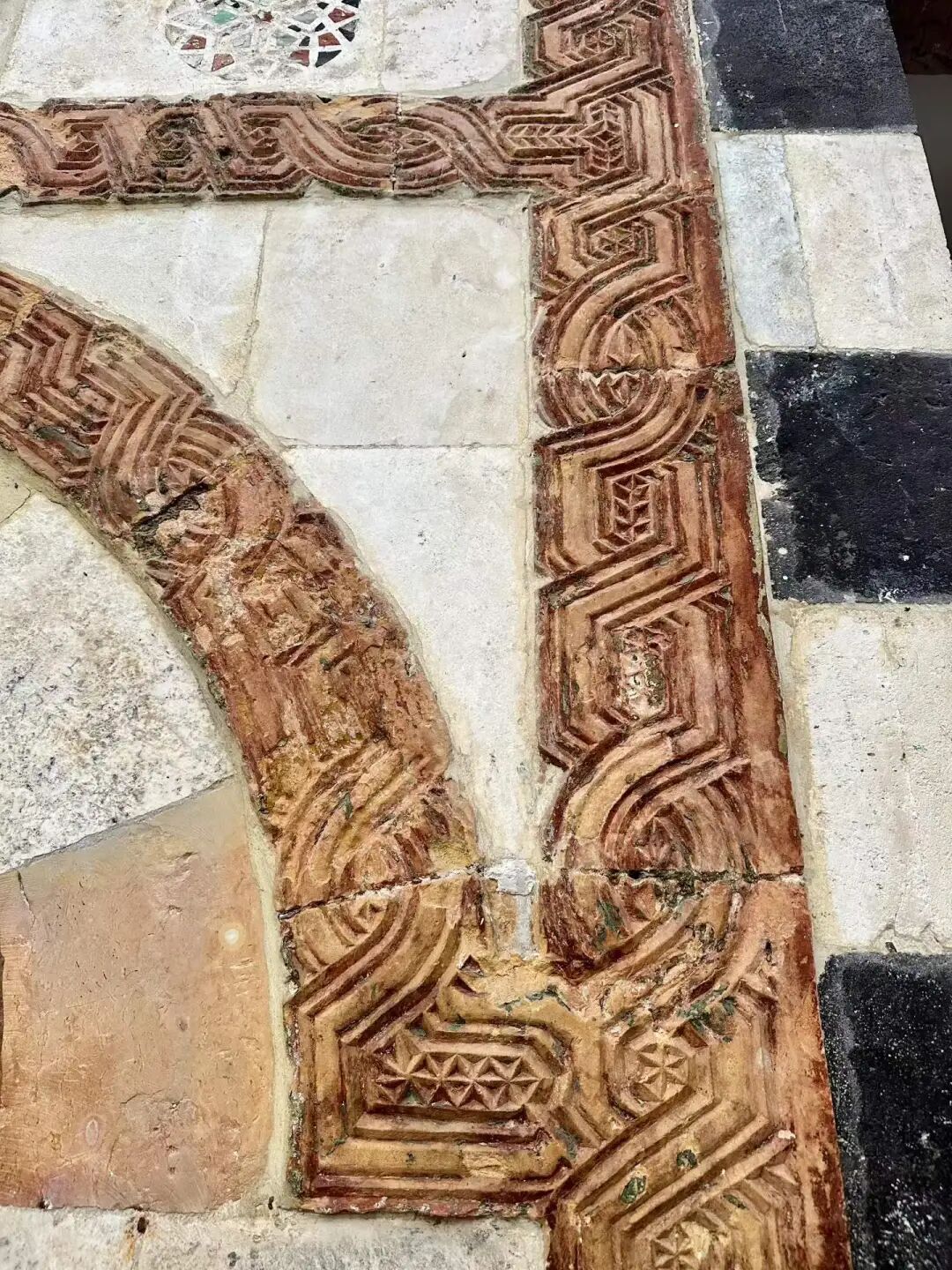
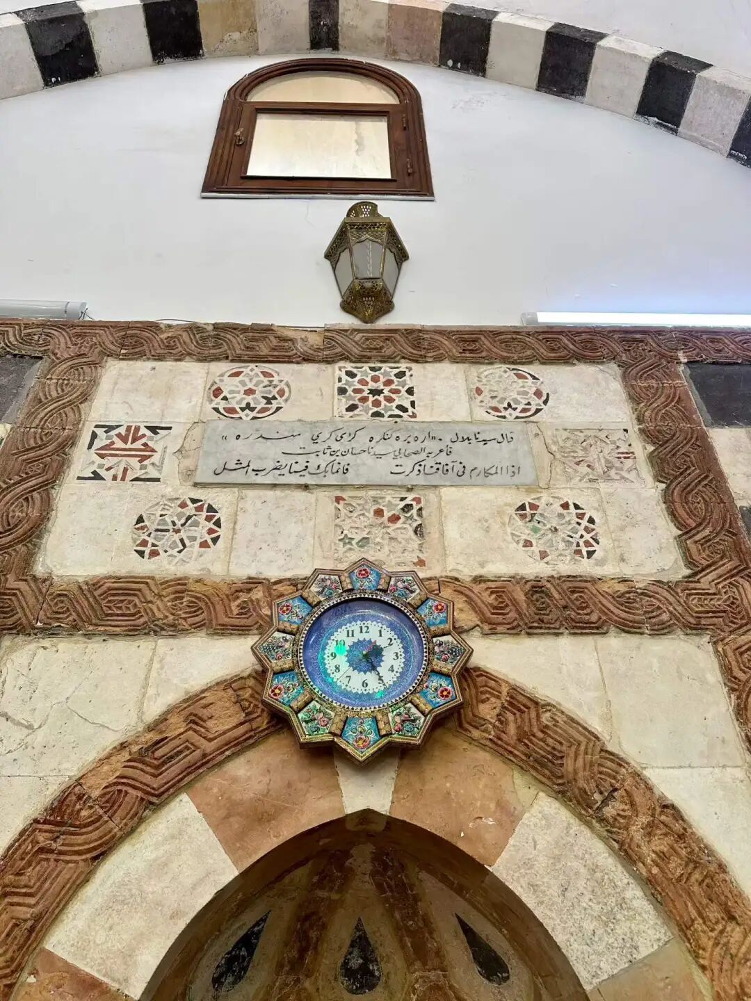
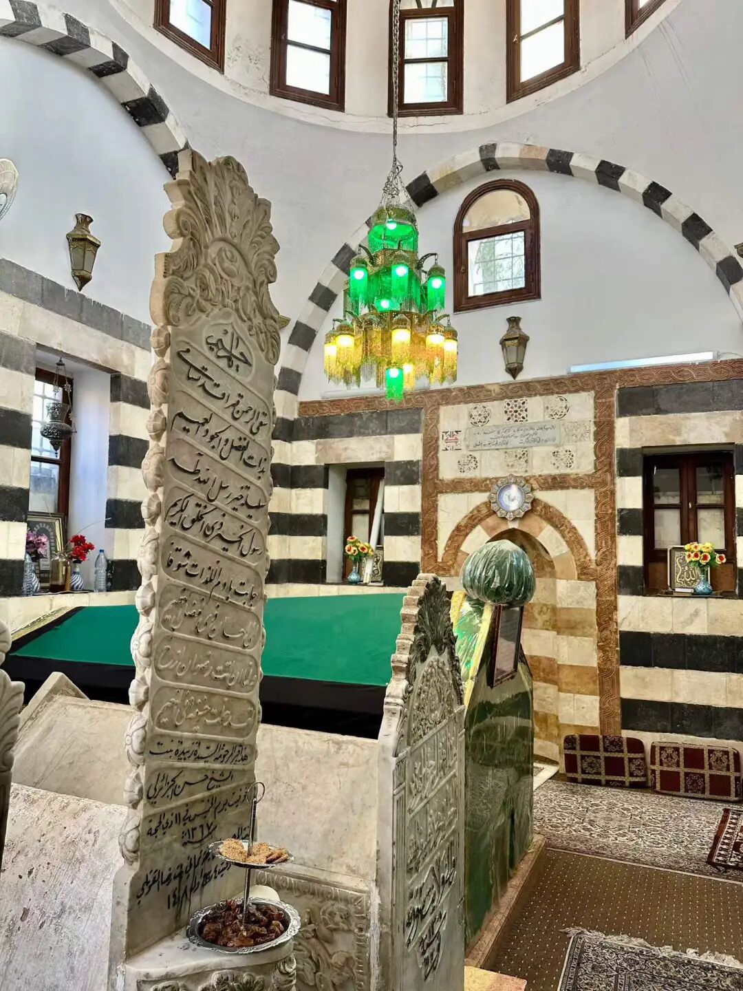
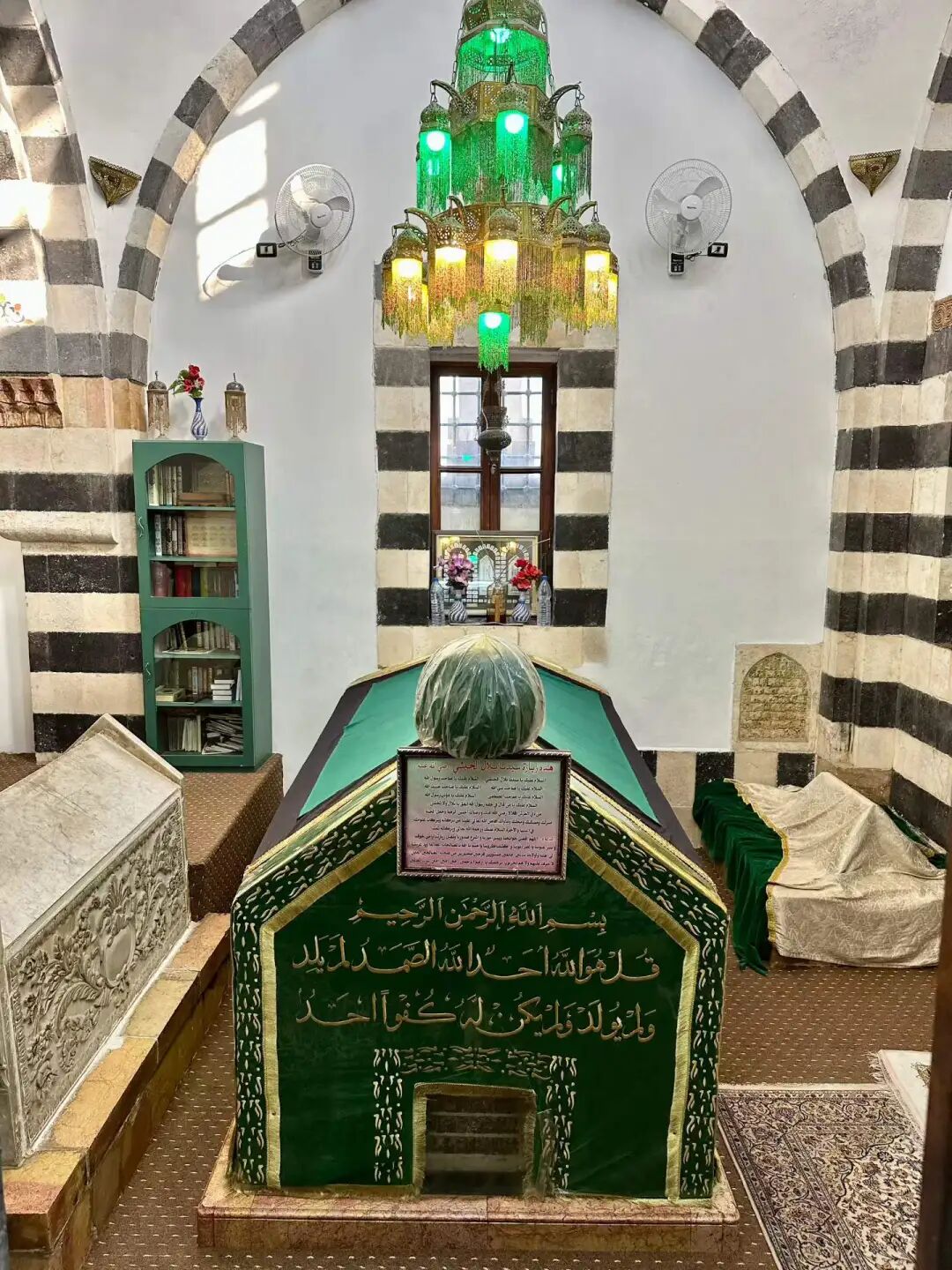
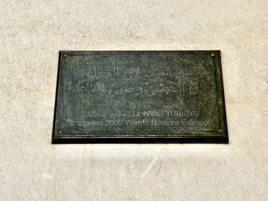
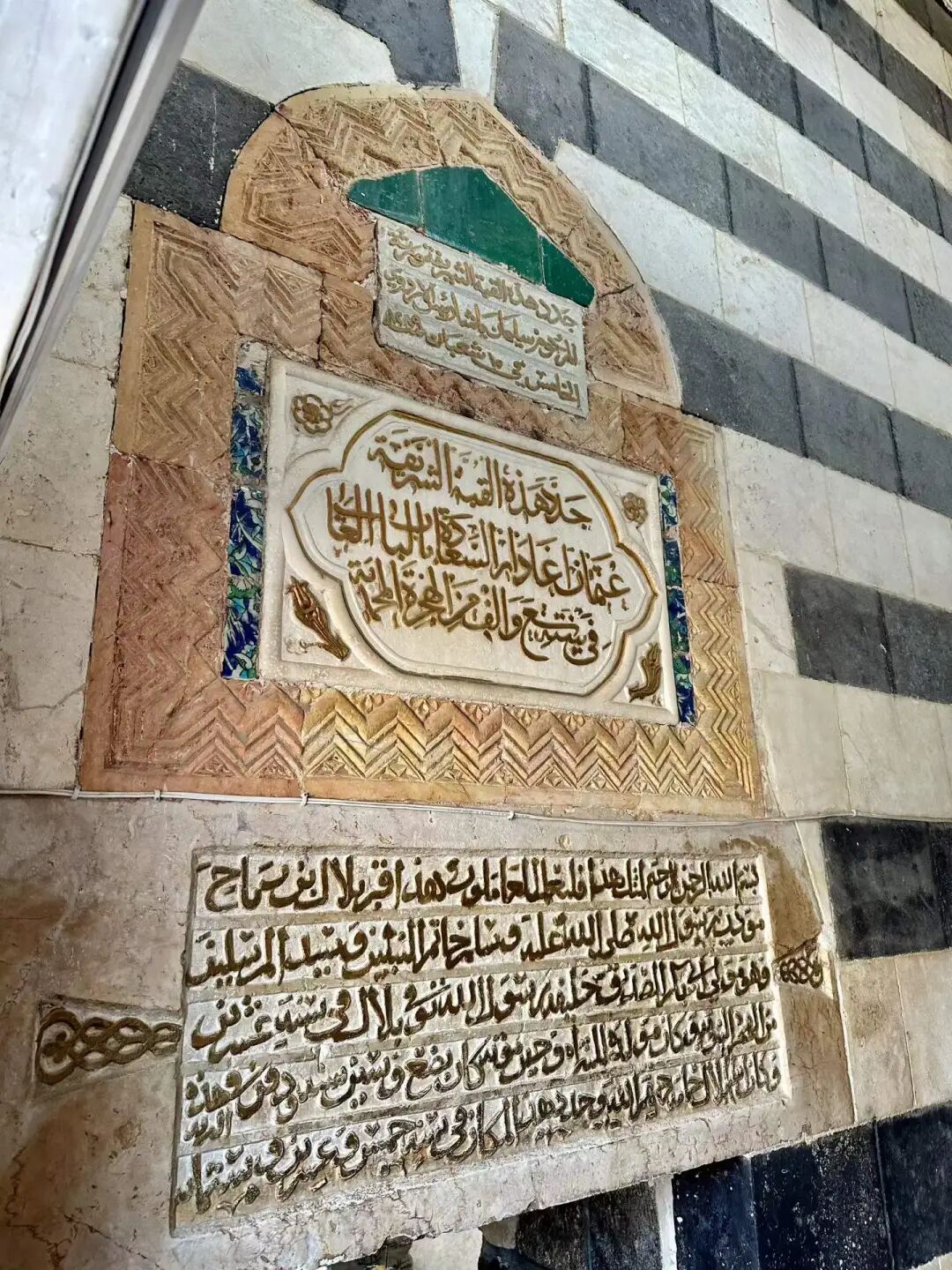
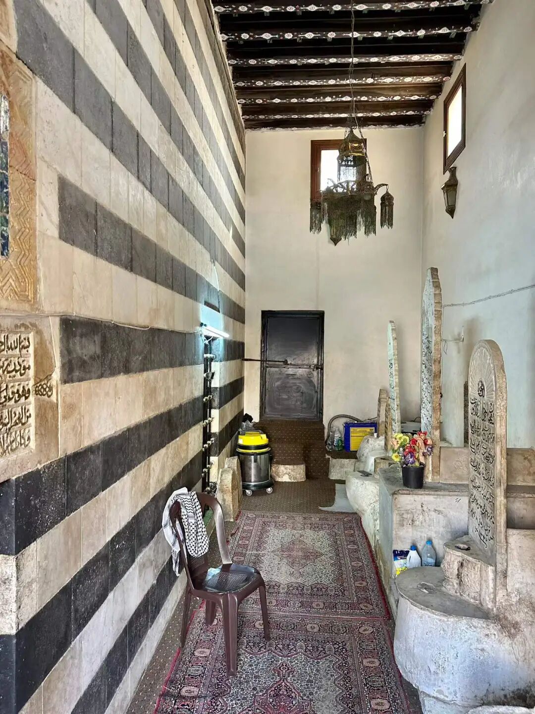
Muslim Travel Guide to Sichuan: Dujiangyan During Ramadan and Old Mosque Road Trip
Articles • yusuf908 posted the article • 0 comments • 162 views • 2026-06-22 06:27
Summary: This Muslim travel guide to Sichuan follows Dujiangyan during Ramadan, old mosque visits, and China mosque travel details from the original road trip.
This article summarizes the key points of 'Driving to Sichuan for Ancient Mosques during Spring Festival (Part 15): Dujiangyan during Ramadan.' It keeps the original paragraph and image order. It is for readers interested in Muslim life, Islamic culture, and Chinese Islamic writing. It also helps with searching for topics like Ramadan, Part 15, and Dujiangyan during Ramadan.
I had heard for a long time that the Ramadan atmosphere at the Dujiangyan mosque in Sichuan was excellent, and I finally got to experience it this time.
At the mosque, we had beef stewed with lotus root (niurou dun ou), cold chicken with sauce (liangban ji), steamed beef with rice flour (fenzheng niurou), twice-cooked beef (huiguo niurou), steamed eggs (zheng jidan), stir-fried garlic sprouts (chao suantai), lettuce stems braised with meat (wosun shaorou), and home-style tofu (jiachang doufu). These were all authentic Sichuan dishes.
Dujiangyan truly lives up to its reputation as the pearl of the Islamic community in western Sichuan. Many people came for the iftar meal. Chairman Sha said that in previous years they served eleven dishes and often had leftovers. This year, he specifically asked to simplify it to seven dishes and one soup. I felt the amount of food was just right.
The Hui Muslims in Dujiangyan come from diverse backgrounds. The Hai family moved from Shaoyang, Hunan, during the Wanli period of the Ming Dynasty. The Guanxian Ma family moved from Shaanxi in the mid-Ming Dynasty. The Lan family moved from Tuqiao, Chengdu, during the Qing Dynasty. The Su family moved from Xiaojin County, Sichuan, in the early Qing Dynasty. The Songpan Zhang family moved from Songpan, Sichuan, in the early Qing Dynasty. The Hebei Zhang family moved from Pidu District, Chengdu, during the Tongzhi period. The Shaanxi Ma family moved from Weinan, Shaanxi, during the Jiaqing period of the Qing Dynasty. The Qi family moved from Weinan, Shaanxi, during the Daoguang period. The Li family moved from Huihuiying in Pidu District, Chengdu, in the late Qing Dynasty. The Maogong Ma family moved from Xiaojin County, Sichuan, in the early years of the Republic of China. The Shandong Jiang family moved from Yanting, Sichuan, in the early years of the Republic of China. The Taiyuan Cai family moved from Xiaojin County, Sichuan, in the first year of the Republic of China.
The ancestor of the Dujiangyan Hai family, Hai Mengshi, was from Shunyi, Beijing. In the first year of the Hongwu period of the Ming Dynasty, he was appointed as a commander of the Imperial Guard. His grandson, Hai Chaofan, moved from Shaoyang, Hunan, to Sichuan during the Ming Wanli period.
The 'Hebei Zhang' family's ancestral home was Zhangjiawan in Tongzhou, Beijing. At the end of the Ming Dynasty, three Zhang brothers moved to Lianglukou in Pidu District, Chengdu, and led the construction of the Zhang Family Mosque (Zhangjia Si). During the Tongzhi period, Zhang Yongchun ran a Muslim restaurant on West Street in Dujiangyan and settled there.
The 'Maogong Ma' family's ancestral home was Tianbei Village in Weinan, Shaanxi. They entered Sichuan during the Qianlong period and settled in Xiaojin County. In the first year of the Republic of China, they moved to Huangchengba in Chengdu due to the Railway Protection Movement. In the sixth year of the Republic of China, their house was destroyed during the warlord chaos, and they moved to Dujiangyan again. Ma Rucong, an imam from this family, served as an imam at the Dujiangyan mosque for 33 years and passed away in 1962.
The Li family of Hui Muslims moved here from Tangyuan Town in Pidu District, Chengdu, during the Tongzhi reign. Li Guangming, a member of the family, was known as one of the Three Heroes of Guan County. He served as the magistrate of Xiaojin County during the Republic of China era, stood up to powerful figures, and was later killed by bandits.
The ancestors of the Shaanxi Ma family came from Qiaotian Village in Weinan, Shaanxi. In the 13th year of the Jiaqing reign, Ma Yingxian moved to Dujiangyan because of the White Lotus and Tianli uprisings. In the 6th year of the Daoguang reign, he bought a piece of land on South Street in Dujiangyan and opened the Daxing Mule and Horse Inn, which operated until 1949.
Next to the mosque is the Jiang Jiuxiang Pickles Workshop. Their five-kernel pine mushroom (wuren songrong) is delicious. It tastes great on its own and is a perfect match for porridge.
Dujiangyan Guan County Ancient City at night.
Starting the fast (suhur) at the Dujiangyan mosque in the morning is a special experience when everyone does it together.
Imam Sha Fuquan has been employed at the Dujiangyan mosque for 32 years. Imam Sha is from Xichang. His ancestors were descendants of Yelu Timur, the grandson of Sayyid Ajjal Shams al-Din. Yelu Timur served as the Pingzhang Zhengshi of Jianchang Road at the end of the Yuan Dynasty. He submitted to the Ming Dynasty in 1382 (the 15th year of the Hongwu reign) and was appointed as the Commander of Jianchang Guard. In 1392 (the 25th year of the Hongwu reign), he rebelled again, led an army of ten thousand to attack the city, and was captured and executed after failing. His descendants scattered. One branch fled to Huangcaoping in Miyi County, Panzhihua, where they hid their identities and changed their surname to Sha. By the third generation, they moved to Xichang, where they have lived ever since.
In 1987, Imam Sha studied under the famous Imam Yang Hua in Shaguoying, Xichang. He received his graduation robe (chuanyi guazhang) in 1990 and was admitted to the China Islamic Institute that same year. After graduating in 1994, he was hired by the Dujiangyan mosque, where he has worked ever since. Over the past thirty years, Imam Sha has taught hundreds of students (hailifan) and made significant contributions to the faith in Sichuan and the entire Southwest region. After the 2008 Wenchuan earthquake, Imam Sha led the restoration of the Dujiangyan mosque, giving it a brand-new look. view all
Summary: This Muslim travel guide to Sichuan follows Dujiangyan during Ramadan, old mosque visits, and China mosque travel details from the original road trip.
This article summarizes the key points of 'Driving to Sichuan for Ancient Mosques during Spring Festival (Part 15): Dujiangyan during Ramadan.' It keeps the original paragraph and image order. It is for readers interested in Muslim life, Islamic culture, and Chinese Islamic writing. It also helps with searching for topics like Ramadan, Part 15, and Dujiangyan during Ramadan.
I had heard for a long time that the Ramadan atmosphere at the Dujiangyan mosque in Sichuan was excellent, and I finally got to experience it this time.
At the mosque, we had beef stewed with lotus root (niurou dun ou), cold chicken with sauce (liangban ji), steamed beef with rice flour (fenzheng niurou), twice-cooked beef (huiguo niurou), steamed eggs (zheng jidan), stir-fried garlic sprouts (chao suantai), lettuce stems braised with meat (wosun shaorou), and home-style tofu (jiachang doufu). These were all authentic Sichuan dishes.
Dujiangyan truly lives up to its reputation as the pearl of the Islamic community in western Sichuan. Many people came for the iftar meal. Chairman Sha said that in previous years they served eleven dishes and often had leftovers. This year, he specifically asked to simplify it to seven dishes and one soup. I felt the amount of food was just right.
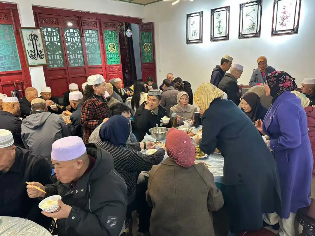
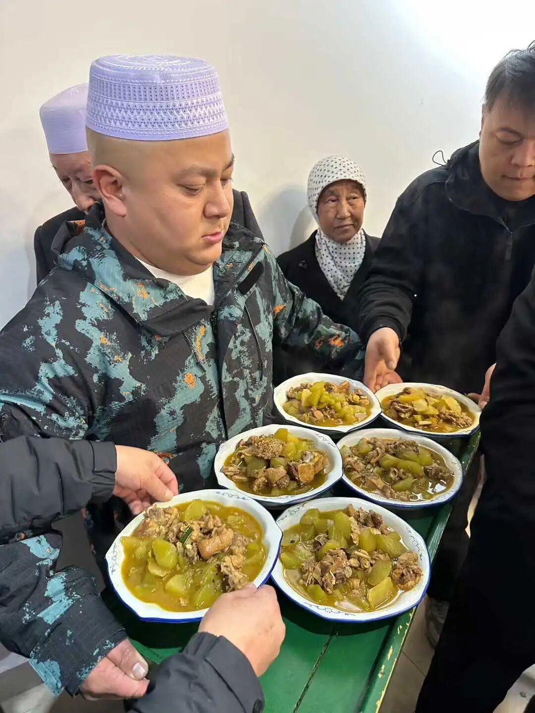
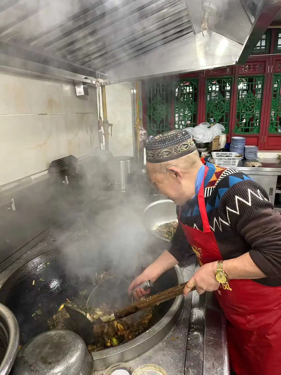
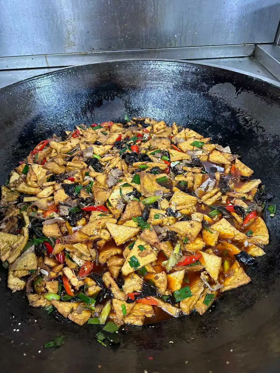
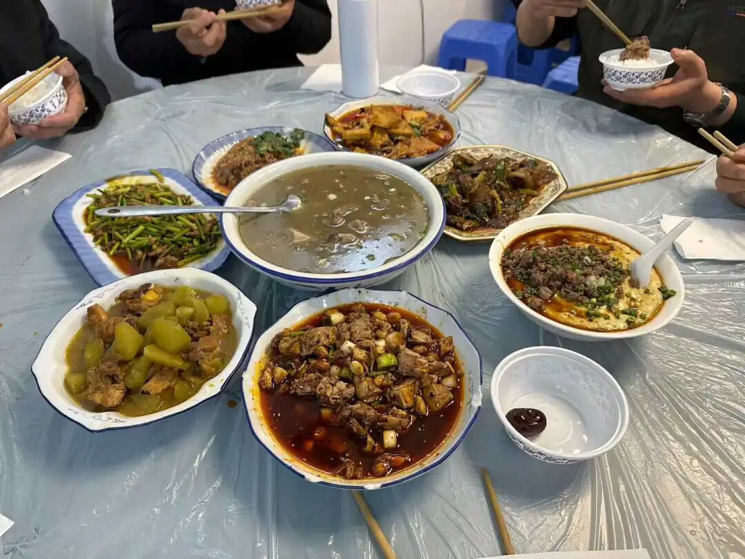
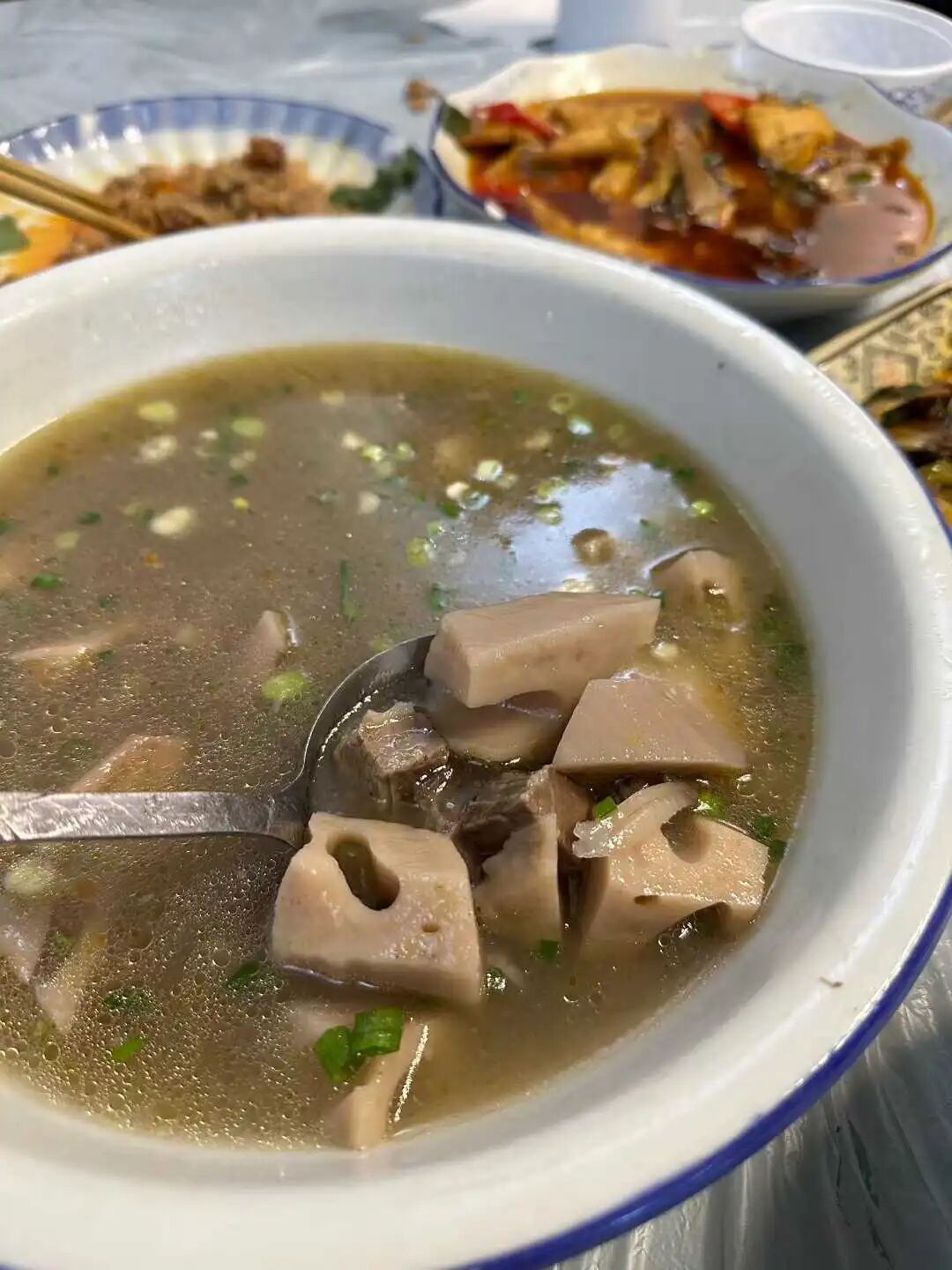
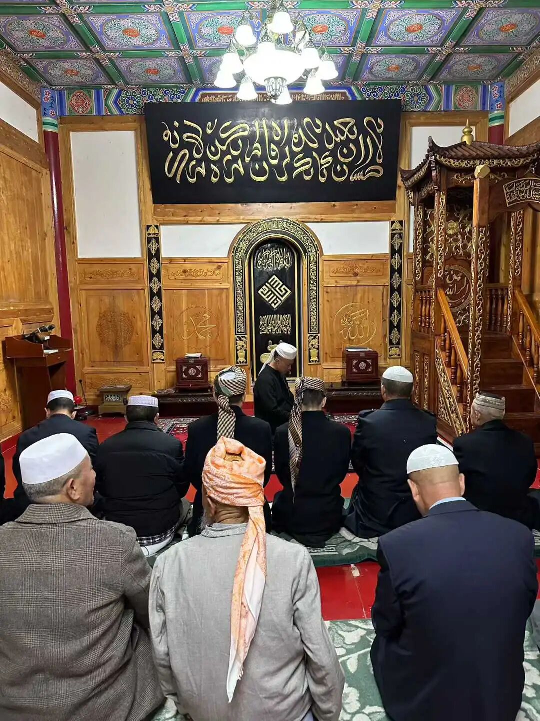
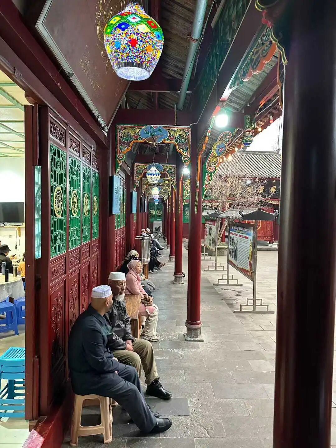
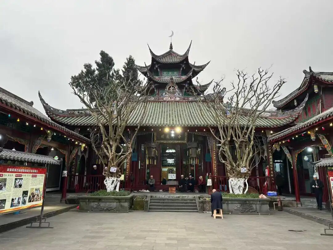
The Hui Muslims in Dujiangyan come from diverse backgrounds. The Hai family moved from Shaoyang, Hunan, during the Wanli period of the Ming Dynasty. The Guanxian Ma family moved from Shaanxi in the mid-Ming Dynasty. The Lan family moved from Tuqiao, Chengdu, during the Qing Dynasty. The Su family moved from Xiaojin County, Sichuan, in the early Qing Dynasty. The Songpan Zhang family moved from Songpan, Sichuan, in the early Qing Dynasty. The Hebei Zhang family moved from Pidu District, Chengdu, during the Tongzhi period. The Shaanxi Ma family moved from Weinan, Shaanxi, during the Jiaqing period of the Qing Dynasty. The Qi family moved from Weinan, Shaanxi, during the Daoguang period. The Li family moved from Huihuiying in Pidu District, Chengdu, in the late Qing Dynasty. The Maogong Ma family moved from Xiaojin County, Sichuan, in the early years of the Republic of China. The Shandong Jiang family moved from Yanting, Sichuan, in the early years of the Republic of China. The Taiyuan Cai family moved from Xiaojin County, Sichuan, in the first year of the Republic of China.
The ancestor of the Dujiangyan Hai family, Hai Mengshi, was from Shunyi, Beijing. In the first year of the Hongwu period of the Ming Dynasty, he was appointed as a commander of the Imperial Guard. His grandson, Hai Chaofan, moved from Shaoyang, Hunan, to Sichuan during the Ming Wanli period.
The 'Hebei Zhang' family's ancestral home was Zhangjiawan in Tongzhou, Beijing. At the end of the Ming Dynasty, three Zhang brothers moved to Lianglukou in Pidu District, Chengdu, and led the construction of the Zhang Family Mosque (Zhangjia Si). During the Tongzhi period, Zhang Yongchun ran a Muslim restaurant on West Street in Dujiangyan and settled there.
The 'Maogong Ma' family's ancestral home was Tianbei Village in Weinan, Shaanxi. They entered Sichuan during the Qianlong period and settled in Xiaojin County. In the first year of the Republic of China, they moved to Huangchengba in Chengdu due to the Railway Protection Movement. In the sixth year of the Republic of China, their house was destroyed during the warlord chaos, and they moved to Dujiangyan again. Ma Rucong, an imam from this family, served as an imam at the Dujiangyan mosque for 33 years and passed away in 1962.
The Li family of Hui Muslims moved here from Tangyuan Town in Pidu District, Chengdu, during the Tongzhi reign. Li Guangming, a member of the family, was known as one of the Three Heroes of Guan County. He served as the magistrate of Xiaojin County during the Republic of China era, stood up to powerful figures, and was later killed by bandits.
The ancestors of the Shaanxi Ma family came from Qiaotian Village in Weinan, Shaanxi. In the 13th year of the Jiaqing reign, Ma Yingxian moved to Dujiangyan because of the White Lotus and Tianli uprisings. In the 6th year of the Daoguang reign, he bought a piece of land on South Street in Dujiangyan and opened the Daxing Mule and Horse Inn, which operated until 1949.
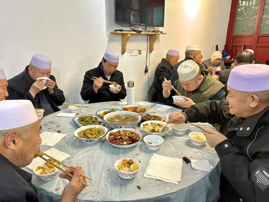
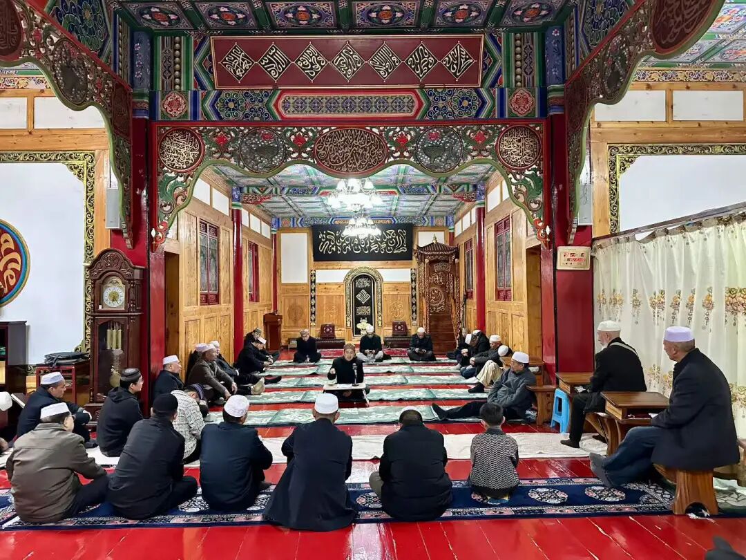
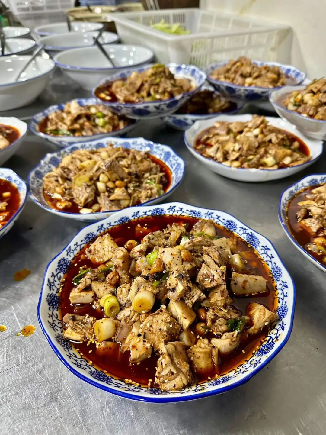
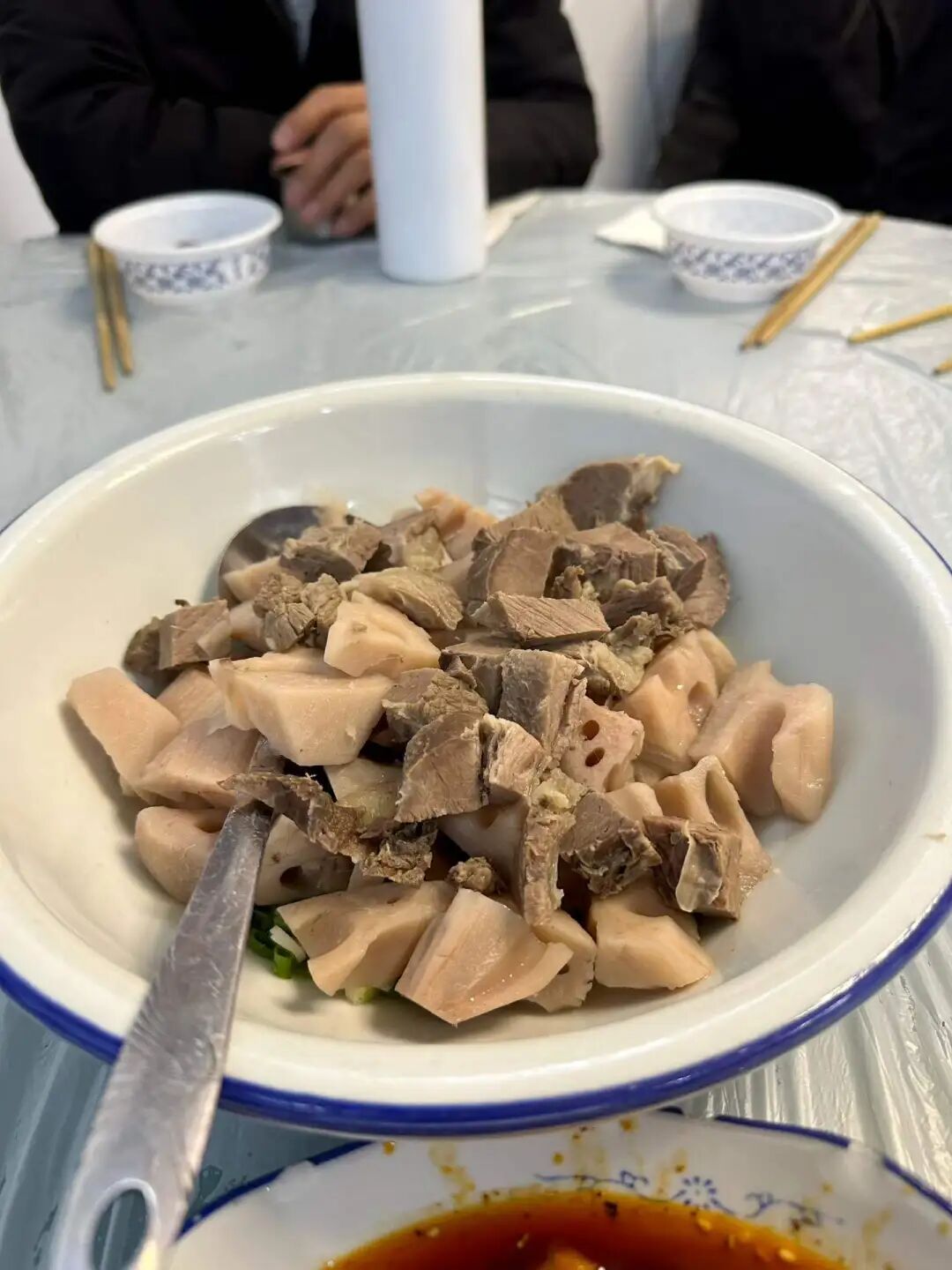
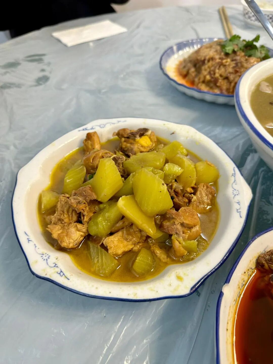
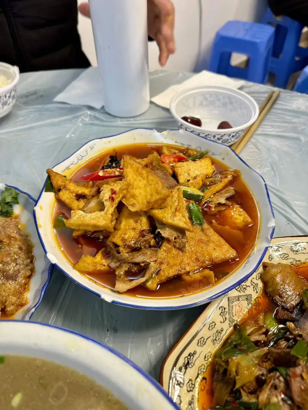
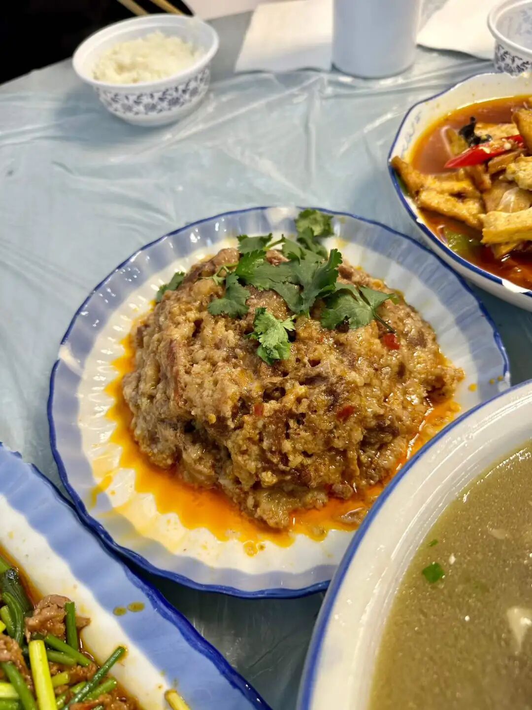
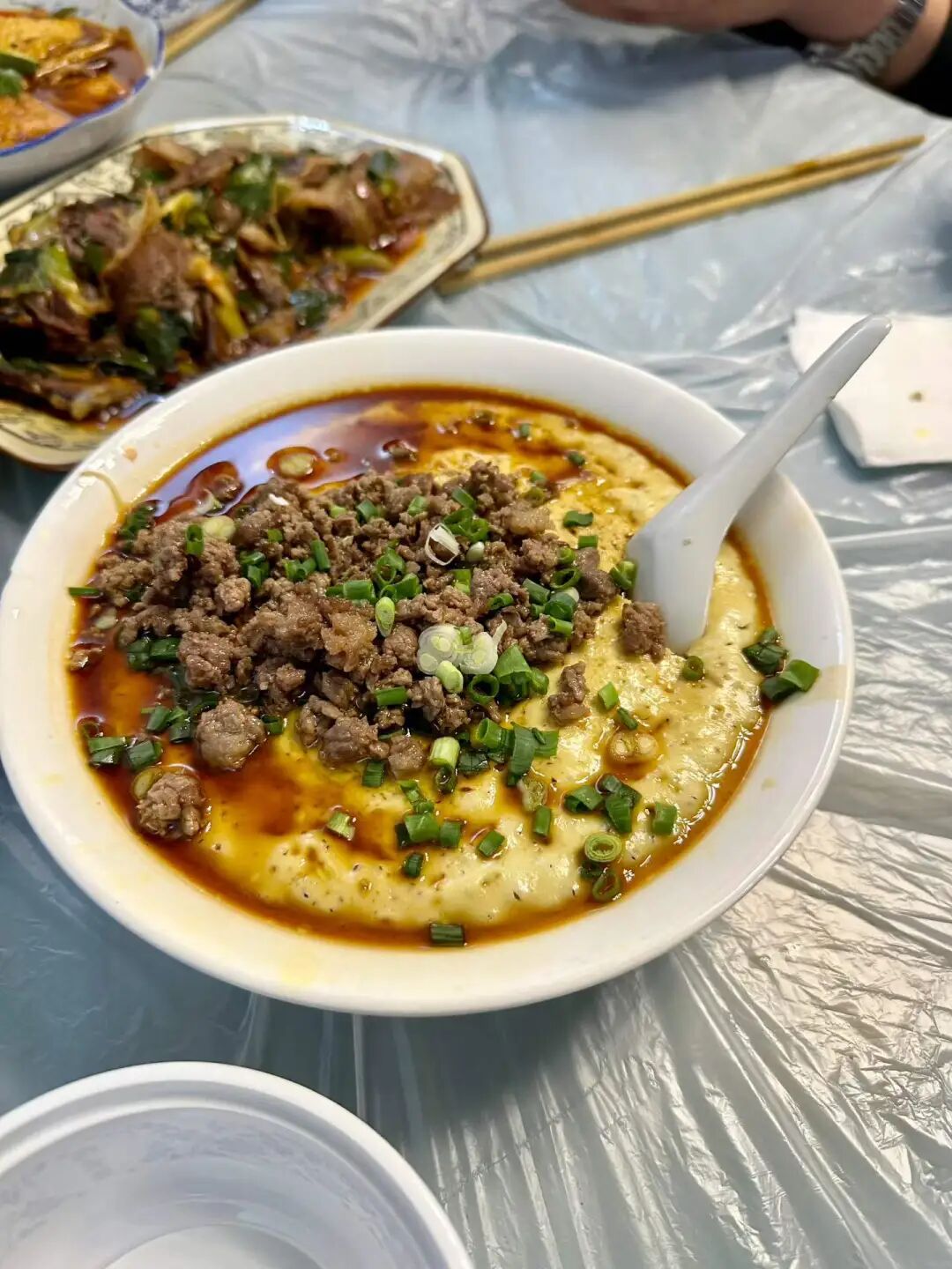
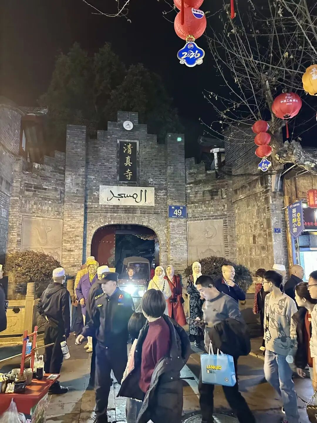
Next to the mosque is the Jiang Jiuxiang Pickles Workshop. Their five-kernel pine mushroom (wuren songrong) is delicious. It tastes great on its own and is a perfect match for porridge.
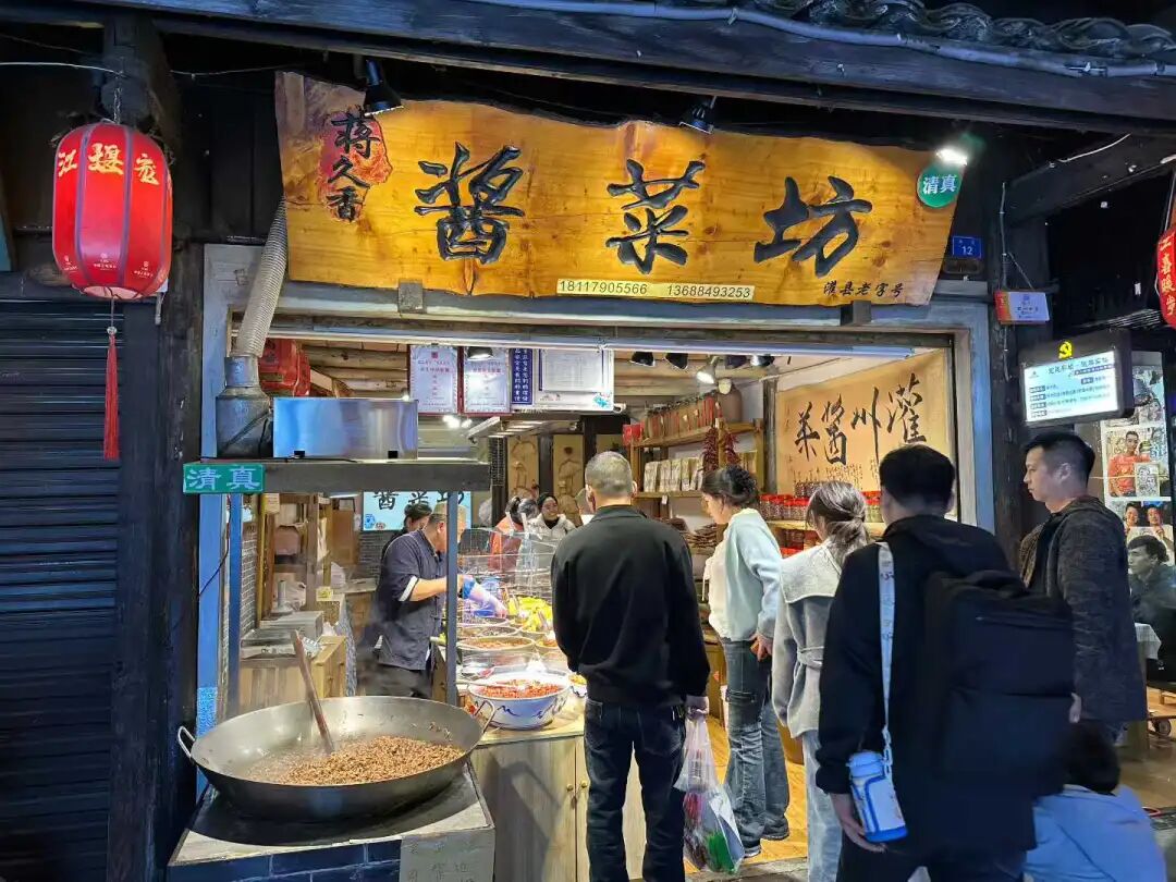
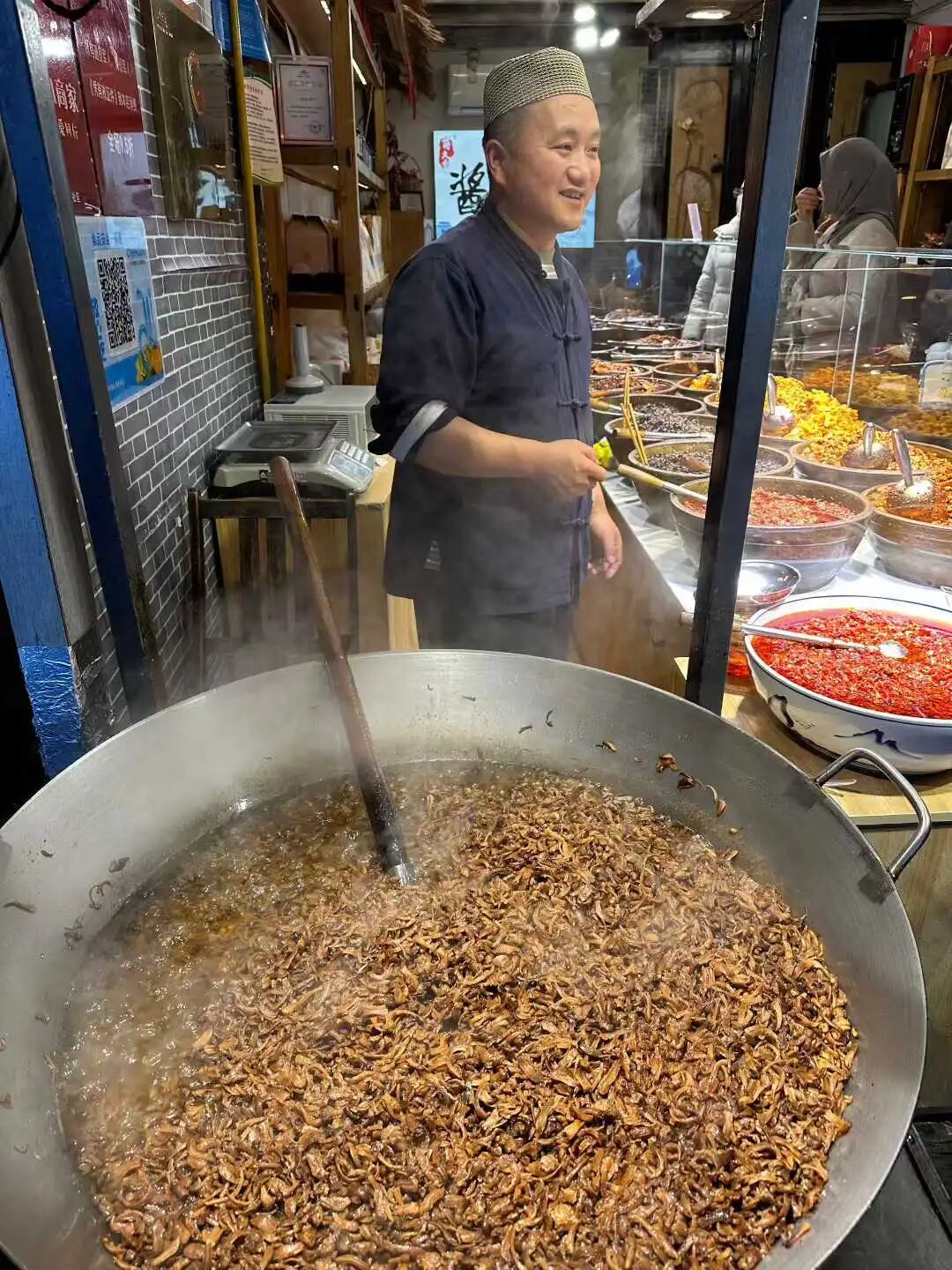
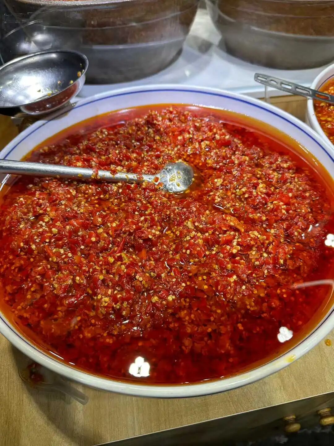
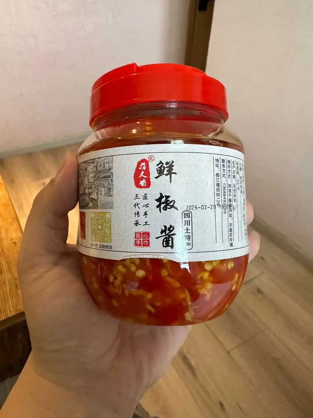
Dujiangyan Guan County Ancient City at night.
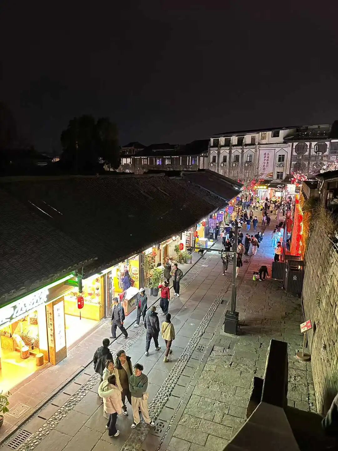
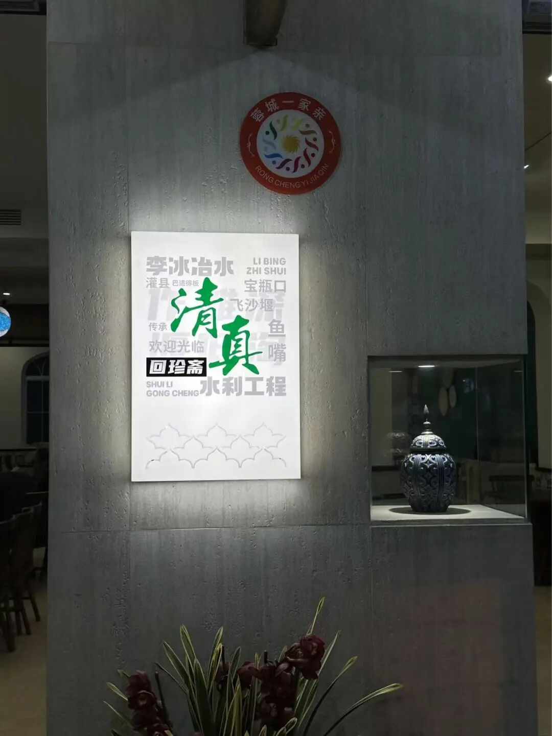
Starting the fast (suhur) at the Dujiangyan mosque in the morning is a special experience when everyone does it together.
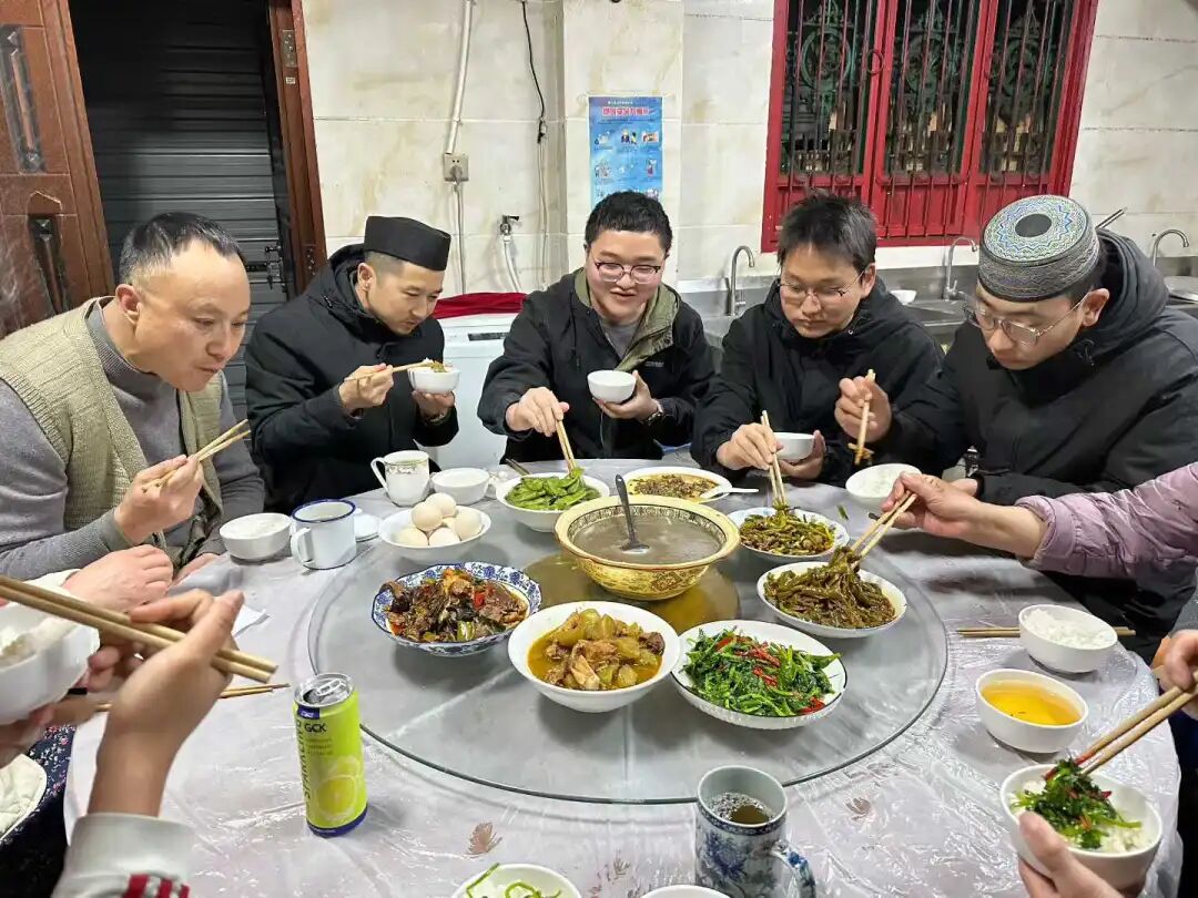
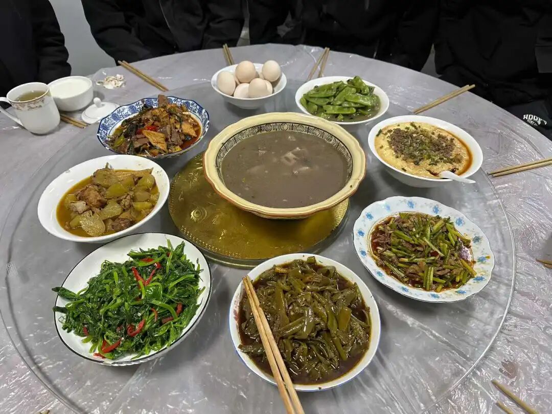
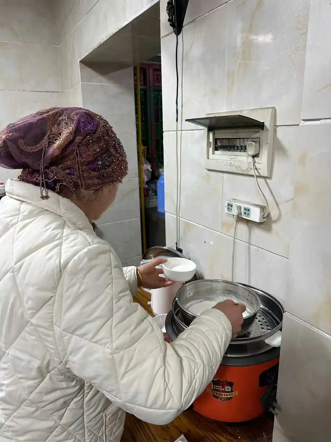
Imam Sha Fuquan has been employed at the Dujiangyan mosque for 32 years. Imam Sha is from Xichang. His ancestors were descendants of Yelu Timur, the grandson of Sayyid Ajjal Shams al-Din. Yelu Timur served as the Pingzhang Zhengshi of Jianchang Road at the end of the Yuan Dynasty. He submitted to the Ming Dynasty in 1382 (the 15th year of the Hongwu reign) and was appointed as the Commander of Jianchang Guard. In 1392 (the 25th year of the Hongwu reign), he rebelled again, led an army of ten thousand to attack the city, and was captured and executed after failing. His descendants scattered. One branch fled to Huangcaoping in Miyi County, Panzhihua, where they hid their identities and changed their surname to Sha. By the third generation, they moved to Xichang, where they have lived ever since.
In 1987, Imam Sha studied under the famous Imam Yang Hua in Shaguoying, Xichang. He received his graduation robe (chuanyi guazhang) in 1990 and was admitted to the China Islamic Institute that same year. After graduating in 1994, he was hired by the Dujiangyan mosque, where he has worked ever since. Over the past thirty years, Imam Sha has taught hundreds of students (hailifan) and made significant contributions to the faith in Sichuan and the entire Southwest region. After the 2008 Wenchuan earthquake, Imam Sha led the restoration of the Dujiangyan mosque, giving it a brand-new look.
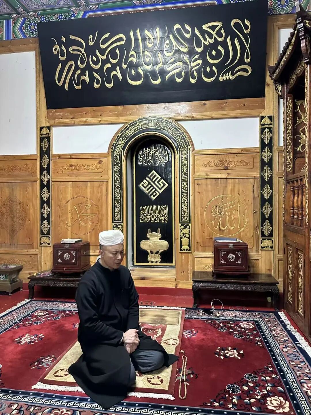
China Mosque Travel Guide: Mosque Plaques, Couplets, Islamic Calligraphy and Hui Muslim Heritage
Articles • yusuf908 posted the article • 0 comments • 151 views • 2026-06-22 06:27
Summary: This China mosque travel guide focuses on mosque plaques, couplets, Islamic calligraphy, Muslim heritage, and the original 151-200 item sequence.
This article summarizes the key points of "Appreciation of Islamic Plaques and Couplets (151-200)". It keeps the original paragraph and image order. It is for readers interested in Muslim life, Islamic culture, and Chinese Islamic writing. It also helps people search for namaz, Islamic plaque and couplet appreciation, and guides for mosques and prayer.
151. "Mastering Heaven and Man" at Niujie Mosque in Beijing.
An auspicious day in the early tenth lunar month of the Jiaxu year, the thirteenth year of the Tongzhi reign.
Respectfully erected by Ma Rulong, Imperial-bestowed Yellow Jacket wearer and Commander-in-Chief of Hunan Province, titled Fashishang'a Baturu.
Ma Rulong was a Hui Muslim from Jianshui, Yunnan. He started as a military scholar and served as Commander-in-Chief of Yunnan and later Hunan.
152. "Governing the Principles of Numbers" at Niujie Mosque in Beijing.
An auspicious day in the first month of winter, the Jiaxu year, the thirteenth year of the Tongzhi reign.
Respectfully erected by Ma Rulong, Imperial-bestowed Yellow Jacket wearer and Commander-in-Chief of Hunan Province, titled Fashishang'a Baturu.
153. "Governing the Two and Five" at Nanxiapo Mosque in Beijing.
The third lunar month of the Renyin year (1902).
Calligraphy by Prince Qing.
The plaque is a replica. Yikuang was named Prince Qing in 1894 and served as a high official in the late Qing Dynasty.
Liu Zhi wrote in the Rites of Islam (Tianfang Dianli) that 'revering the five pillars fulfills the way of heaven;' 'upholding the five social relationships fulfills the way of man.' The five pillars are the declaration of faith, namaz, fasting, charity, and the pilgrimage, while the five relationships are ruler and subject, father and son, husband and wife, brothers, and friends.
154. Arabic plaque at Haopan Mosque in Guangzhou
An auspicious day in the first month of summer, the seventh year of the Republic of China
Respectfully presented by the Jiangnan Tongshan Hall
During the Ming and Qing dynasties, many Hui Muslims from the Jiangsu, Zhejiang, and Shanghai regions came to Guangzhou for business. They often chose to live near the foreign trading houses on Haopan Street and the shops in the Xiguan area, which had a significant impact on Haopan Mosque.
155. Arabic plaque at Xiaodongying Mosque in Guangzhou
Erected on an auspicious day in the fifth lunar month of the Bingyin year, the fifth year of the Tongzhi reign
Respectfully inscribed by Li Chengyi from Dingyuan County, Fengyang Prefecture, Jiangnan
156. 'The Hundred-Word Eulogy to the Most Holy written by Emperor Taizu of Ming' at Xiaodongying Mosque in Guangzhou
Mid-third lunar month, spring of the sixth year of the Tongzhi reign of the Great Qing Dynasty, during the festival.
Respectfully written and erected by Zixiang Yang Yongchun after ritual cleansing.
157. Xiaodongying Mosque in Guangzhou, "The Teaching Has an Authentic Lineage."
An auspicious day in the eleventh lunar month, the thirty-fourth year of the Guangxu reign of the Great Qing Dynasty, which is 1,324 years after the passing of the Prophet.
Erected by Liao Shouqi, a member of the faith from Jiangxia County, Hubei, led by his son Dalian.
158. Wutong Mosque in Guilin, "All Things Reveal the Truth."
The second year of the Xuantong reign, Gengxu year, on an auspicious day.
Respectfully erected by Peng Jiahua.
159. Wutong Mosque in Guilin.
Praising Muhammad to honor the ancient teacher, through the ages keeping the true purpose.
Seeing the mosque filled with plaques and couplets praising the Prophet, I felt inspired by the literature and, despite my limited knowledge, dared to compose a couplet as a memento.
Respectfully inscribed by Su Zonghan, former commissioner of Longteng County and acting magistrate of Yining County.
Yining County was located around Wutong Town in the Lingui District of Guilin, Guangxi. It was abolished and merged into Lingchuan in 1951. In the early Republic of China period, it had a county magistrate.
160. Chongshan Mosque (Chongshan Si) in Guilin: "Rectify the heart and be sincere."
An auspicious day in the sixth lunar month of the jiashen year, the tenth year of the Guangxu reign.
Respectfully erected by local resident Zhang Weicheng.
161. Binju Mosque (Binju Si) in Dali: "The true source of all things."
An auspicious day in the last month of summer in the guihai year of the Republic of China.
Respectfully written by Yang Liren from Nancheng.
162. Binju Mosque (Binju Si) in Dali.
Only one, only pure, the essence of the teaching encompasses all phenomena.
Not two, not mixed, the way of the truth connects heaven, earth, and humanity.
An auspicious day in the summer of the twelfth year of the Republic of China.
Respectfully written by Yang Liren from Nancheng.
163. Dawumaolin Mosque in Dali
Broaden your vision and open your heart, break through the void and clear away worldly appearances, explore the divine and understand transformation to reach the original source.
Leave behind worldly feelings with sincere will, forget the distinction between self and objects to unite humanity and heaven, return to the truth and align with the profound mystery.
Respectfully presented by Ma Yuanshan, principal of Yanzhen School, along with all his students.
An auspicious day in the middle of winter, the 25th year of the Republic of China.
164. Daoyuan Qingzhen Mosque of the Mi family in Mami Factory, Dali.
Respectfully erected by the imperial guard wearing a peacock feather, acting major of the Menghua Right Battalion, and commander of the second battalion of the Yunnan provincial patrol force...
The first month of spring, the first year of the Xuantong reign.
Everyone is welcome to read and leave comments.
165. Chengyi Buer Mosque in Donglianhua, Dali.
An auspicious day in the first month of summer, the Bingyin year, the 15th year of the Republic of China.
Qing dynasty appointed General Zhenwei, acting deputy brigade commander, specially conferred as colonel of the Weiyuan Battalion in Yunnan.
Respectfully erected by Republic of China Army Major General Yang Shengqi.
166. "Universal Mercy and All-Encompassing" (Puci Wanyou) at Tuogu Mosque in Zhaotong.
The first month of winter in the 11th year of the Qianlong reign of the Great Qing Dynasty.
Ye Daxiong, Imperial-appointed Commander of Zhaotong and Dongxiong in Yunnan, Hereditary Cavalry Commandant.
167. "Pure Truth and Elegant Transformation" (Qingzhen Yahua) at Tiejiawan Mosque in Zhaotong.
Respectfully erected by Tie Chengjin, acting officer of the second company of the left vanguard, Zhaotong Garrison, Yunnan, with a one-rank promotion.
An auspicious day in the last ten days of the eighth lunar month, 24th year of the Daoguang reign.
168. "Great Virtue and Simple Transformation" (Dade Dunhua) at Tiejiawan Mosque in Zhaotong.
An auspicious day in the third month of autumn, 15th year of the Jiaqing reign of the Great Qing Dynasty.
Respectfully inscribed by Ye Daxiong, Imperial-bestowed Commander-in-Chief of Zhaotong, Dongxiong, and surrounding areas, Hereditary Cavalry Commandant.
169. "Mysterious Wonder and Great Power" (Xuanqi Daneng) at Chachong Mosque in Zhaotong.
Respectfully erected by Sa Depin, Vice-General authorized to wear the peacock feather and expectant Assistant Regional Commander.
An auspicious day in the first month of the Bingwu year, the 32nd year of the Guangxu reign.
170. "Eternal Breath" at Fengming Mosque in Dali.
An auspicious day in the spring of the 11th year of the Republic of China.
Respectfully erected by Ding Guotai of Shaanxi.
171. "Shining on Everything" at Dazhuang Mosque in Kaiyuan.
An auspicious day in the second month of the 11th year of the Guangxu reign.
... Erected by Ma Weiqi of the Suiyuan Left Battalion Training Army.
Ma Weiqi was a Hui Muslim from Dazhuang, Kaiyuan, Yunnan. He was skilled in calligraphy, following the style of Yan Zhenqing, with powerful brushwork and grand momentum. In the 9th year of the Guangxu reign, Ma Weiqi was ordered to Vietnam to resist the French. He defeated the French army many times and was promoted to the rank of vice-general for his military achievements, receiving the title "Boduo Huan Baturu".
172. "Nurturing All Things" at Dazhuang Mosque in Kaiyuan.
An auspicious day in the first month of winter in the Jiachen year, the 24th year of the Daoguang reign.
Respectfully erected by Ma Dingbang, the top-ranked military graduate in the imperial examinations of the 15th year of the Daoguang reign.
173. Dazhuang Mosque in Kaiyuan, 'Praise be to Allah without end' (Yu Mu Bu Yi)
An auspicious day in the middle of winter, the third year of the Daoguang reign (1823)
Respectfully erected by Xu Yaozong, acting commander of the Linyuan and Chengjiang military districts
174. Dazhuang Mosque in Kaiyuan
Reason is not found in sleep; to complete the beginning and the end, one must seek the one true Master
The Way is based on sincerity and uprightness; to emulate the virtuous and the holy, one must strictly observe the five daily prayers (namaz)
Respectfully erected by Xu Yaozong
175. Dazhuang Mosque in Kaiyuan
Analyzing ancient doubts and confusion in only thirty volumes
Including the scriptures of the former saints, a great collection of the Way
Inscribed by Ma Chuqing, a successful candidate in the imperial examinations during the Dingyou year of the Qing dynasty
176. 'Imperial Edict Platform' (Shengyu Tai) at Liren Mosque in Kunming
Erected in the 34th year of the Republic of China.
177. Tangzi Mosque in Xundian, Yunnan: "Ten Thousand Things from One Source" (Wanshu Yiben).
New Year's Day, 30th year of the Republic of China.
Respectfully gifted by Yunnan Army Major General Ma Deming.
178. Tangzi Mosque in Xundian, Yunnan: "The Only and the Pure" (Weiyi Weijing).
New Year's Day, 30th year of the Republic of China.
Respectfully gifted by Yunnan Army Lieutenant General Ma Cong.
179. Tangzi Mosque in Xundian, Yunnan: "Promote Religion and Build the Nation" (Xingjiao Jianguo).
New Year's Day, 30th year of the Republic of China.
Inscribed by Bai Chongxi.
180. Beiyingjie Mosque in Xundian, Yunnan: "The Original Source of All Things" (Wanyou Yuanzong).
Respectfully inscribed by Jin Huaijin, a palace graduate (jinshi) and imperial guard, serving as deputy commander of the military camp with a rank promotion of three levels.
The first year of the Yongzheng reign, the year of Guimao, in the middle of the sixth lunar month, on an auspicious day.
181. Beiying Street Mosque in Xundian, Yunnan: 'The Only True Faith' (Qingzhen Bu'er).
Respectfully inscribed by Qian Dengxi, the Circuit Intendant of the Eastern Yunnan Military Defense.
Erected in the summer of the 24th year of the Guangxu reign.
182. Jinniudao Mosque in Kunming: 'The Way Spread from the West' (Dao Zi Xi Chuan).
The middle of the fourth lunar month, in the Yiwei year of the Guangxu reign of the Great Qing Dynasty, on an auspicious day.
Written by Ma Weiqi, the acting Regional Commander of the Linyuan and Chengjiang areas in Yunnan, who holds the title of Boduohuan Baturu.
Respectfully erected by Zhang Mingming, the top scholar (zhuangyuan) of the Jiaxu year, first-rank imperial guard, and specially appointed acting Deputy General of the Chuxiong Garrison in Yunnan and Deputy General of the Yunnan-Guizhou Governor's Command.
Everyone is welcome to add more information.
183. Tangjia Mosque in Chengdu: 'Ascending to the Shore of the Way' (Dao An Dan Deng).
An auspicious day in the first lunar month of the Bingshen year of the Guangxu reign.
Tang Chuanyou from Dongzou.
Tang Chuanyou was a Qing Dynasty calligrapher whose art was famous throughout the capital. His son, Tang Chenglie, worked as an official in Sichuan, so he brought his father there to spend his final years in comfort. The plaque text comes from the Book of Songs (Shijing) phrase 'first climb to the shore,' and Liu Zhi also wrote in Five Watch Moon (Wugeng Yue): 'From here, step by step forward, climb to the shore of the path to see the mystery.'
184. Tuqiao Shang Mosque in Chengdu: 'Uphold Good Rules Forever' (Shishou Lianggui)
Jiayin year of the Yongzheng reign
29th year of the Guangxu reign
Inscribed by Prince Guo
Respectfully erected by Ma Zhonglong, a third-rank guard with a peacock feather from Guizhou Province
In 1734 (the 12th year of the Yongzheng reign), Prince Guo Yunli, the 17th son of Emperor Kangxi, was ordered to go to Kangding to handle the return of the 7th Dalai Lama to Tibet. Before reaching Kangding, he inspected troops in Chengdu and gifted two plaques to Gulou Mosque: 'Uphold Good Rules Forever' (Shishou Lianggui) and 'Origin of Worldly Laws' (Shifa Yuanliu). The original 'Uphold Good Rules Forever' plaque was kept at Huangcheng Mosque but was destroyed in the 1960s and 1970s. The one at Tuqiao Mosque was made during the Guangxu reign.
185. Chengdu Tuqiao Shang Mosque: 'Wonderful Origin of Islam' (Miaoyuan Qingzhen)
Imperial-appointed Commander-in-Chief of Yunnan Province, Left Metropolitan Commander, Hereditary Cavalry Captain, recorded six times for military merit, oversaw the construction of the Great Hero Hall.
Imperial-appointed Commander-in-Chief of Yunnan Province, General-in-Chief, recorded five times for military merit, erected by Ma Hua.
An auspicious day in the middle of winter, in the year of Jisi, the 27th year of the Qianlong reign of the Great Qing Dynasty.
186. Chengdu Tuqiao Upper Mosque, 'Like Timely Rain'.
An auspicious day in the last ten days of the third month of autumn, in the year of Guisi, the 13th year of the Daoguang reign.
Respectfully inscribed by Ma Tenglong, the Imperial-appointed Regional Commander of Chongqing, Sichuan.
187. Chengdu Tuqiao Upper Mosque, 'Boundless Nurturing'.
188. Chengdu Tuqiao Upper Mosque, 'Revere the Righteous and Expel the Evil'.
The third month of spring, the first year of the Republic of China.
The humble followers of the community.
189. Chengdu Dujiangyan Mosque, 'Uphold Good Traditions for Generations'.
The last month of winter, in the year of Jiayin, during the Yongzheng reign.
Inscribed by Prince Guo
Prince Guo was the seventeenth son of the Kangxi Emperor. In the twelfth year of the Yongzheng reign, he traveled to Taining to escort the Dalai Lama back to Tibet. While inspecting provincial garrisons and Green Standard Army troops, he passed through Chengdu and wrote a plaque for Gulou Mosque. The Dujiangyan Mosque also made a copy of the plaque to keep inside the building.
190. Dujiangyan Mosque in Chengdu: "Origin of Worldly Dharma"
The last month of winter, in the year of Jiayin, during the Yongzheng reign.
Inscribed by Prince Guo
191. Dujiangyan Mosque in Chengdu: "Success Through Non-Action"
Early summer of the Guimao year, the twenty-ninth year of the Guangxu reign of the Great Qing Dynasty.
Respectfully written and erected by Ma Weiqi, Commander-in-Chief of Sichuan.
Ma Weiqi was a Hui Muslim from Dazhuang, Kaiyuan, Yunnan. He was skilled in calligraphy, following the style of Yan Zhenqing, with powerful brushwork and grand momentum. In the 9th year of the Guangxu reign, Ma Weiqi was ordered to Vietnam to resist the French. He defeated the French army many times and was promoted to the rank of vice-general for his military achievements, receiving the title "Boduo Huan Baturu". While serving as Commander-in-Chief of Sichuan, Ma Weiqi led troops to suppress a rebellion by lamas and local chieftains in Batang, Tibet. He overcame snowstorms, dangerous terrain, and food shortages to restore peace to the entire region. He was rewarded with a first-rank button and granted the title of General Jianwei. During his time as Commander-in-Chief of Sichuan, Ma Weiqi greatly supported the local Muslim community. He recommended several imams for positions in Sichuan, including Imam Wang Jiapeng, who is known as one of the four great modern imams of Yunnan.
192. Dujiangyan Mosque in Chengdu: "Promote Religion and Build the Nation"
An auspicious day in the mid-autumn of the 35th year of the Republic of China.
Inscribed by Bai Chongxi.
Bai Chongxi wrote this in 1946 while visiting his in-law, Ma Jianqing, in Sichuan. Bai Chongxi was the Minister of National Defense of the Republic of China at the time. Bai Chongxi cared deeply about ethnic education. He built Northwest Middle School in Chengdu, Sichuan, and Jiansheng Middle School in Xichang.
193. Dujiangyan Mosque in Chengdu: "Originality and Unique Respect"
An auspicious day in the seventh month of the lunar calendar in the seventh year of the Xianfeng reign.
Presented by Chen Tianzhu, a fifth-rank official with a blue feather and a battalion commander of the Anfu Camp in Sichuan, who held the priority rank of thousand-man commander.
194. Dujiangyan Mosque in Chengdu: "The Religion Flourishes in True Unity"
An auspicious day in the last month of winter in the 14th year of the Qianlong reign (the year of Jisi).
The signature section was destroyed in the 1960s and 1970s. In 2019, I photographed it without the signature. When I returned in 2026, I found the signature had been added: Presented by Ha Panlong, an imperial-appointed top scholar, first-rank imperial guard, and commander of the Songpan Garrison.
Ha Panlong was a Hui Muslim from Suning, Hebei. He passed the provincial civil service exam in the 10th year of the Yongzheng reign and earned the top rank in the martial arts imperial examination in the second year of the Qianlong reign, after which he was appointed as a first-rank imperial guard. In the 13th year of the Qianlong reign, Ha Panlong was ordered to Jinchuan. As the commander of the Songpan garrison, he led troops to attack Meinuo Valley, Kezu Village, and Qiushui City, winning every battle. In the second month of the 14th year of the Qianlong reign, the Jinchuan campaign ended. Ha Panlong was promoted by three ranks and received two additional merit records.
195. Dujiangyan Mosque, Chengdu, "Ancient Mosque (Qingzhen Gusi)"
An auspicious day in the tenth lunar month of the Xinwei year of the Tongzhi reign.
The West Mosque of Guan County in Dujiangyan was located on Shaanxi Lane inside the ancient city of Guan County. It was built in 1862 (the first year of the Tongzhi reign) by Hui Muslims from Songpan, Sichuan. During the Xianfeng and Tongzhi years, Hui Muslims from Songpan with the surnames Jia, Qi, Mi, and Yu traveled south along the Songmao Ancient Road for business. They settled in the ancient city of Guan County and pooled their money to build the West Mosque of Guan County.
In 1959, the West Mosque of Guan County was torn down to build the Guan County People's Hospital. Today, the second gate of the Dujiangyan mosque displays a plaque from the tenth year of the Tongzhi reign that reads "Ancient Mosque (Qingzhen Gusi)." This is the original plaque that hung on the gate of the West Mosque.
196. Qinggang Mosque, Meishan, Sichuan, "Ancient Faith of the Beginning (Kaitian Gujiao)"
An auspicious day in the first ten days of the eleventh lunar month of the Guihai year of the Jiaqing reign.
Respectfully presented by Ma X Yan, a soldier of the Left Garrison of the Chengdu City Guard stationed at the Renshou outpost, who received a two-rank promotion for military merit and a one-rank promotion for imperial favor, plus a two-rank promotion from the Emperor.
It is not very clear, so please feel free to correct me.
197. The "one and only" plaque at Qinggang Mosque in Meishan, Sichuan.
Respectfully presented by Ma Pengcheng, a battalion commander (qian zong) overseeing the Renshou garrison.
A lucky day in the second month of the 25th year of the Daoguang reign.
198. The "utmost silence and stillness" plaque at Qinggang Mosque in Meishan, Sichuan.
A lucky day in the fifth month of the eighth year of the Republic of China, respectfully presented.
In celebration of the mosque reconstruction.
Erected by nine members of the Cai family from the Kai generation.
199. The "a world apart" plaque at Qinggang Mosque in Meishan, Sichuan.
Respectfully presented.
In celebration of the mosque reconstruction.
Congratulations from the Han people of Qingshi.
200. Qinggang Mosque (Qinggang Si) in Meishan, Sichuan.
Erected by the mosque leaders in the third month of the eighth year of the Republic of China (1919).
Appreciating mosque plaques and couplets (items 101-150).
Appreciating mosque plaques and couplets (items 51-100).
Appreciating mosque plaques and couplets (items 1-50). view all
Summary: This China mosque travel guide focuses on mosque plaques, couplets, Islamic calligraphy, Muslim heritage, and the original 151-200 item sequence.
This article summarizes the key points of "Appreciation of Islamic Plaques and Couplets (151-200)". It keeps the original paragraph and image order. It is for readers interested in Muslim life, Islamic culture, and Chinese Islamic writing. It also helps people search for namaz, Islamic plaque and couplet appreciation, and guides for mosques and prayer.
151. "Mastering Heaven and Man" at Niujie Mosque in Beijing.
An auspicious day in the early tenth lunar month of the Jiaxu year, the thirteenth year of the Tongzhi reign.
Respectfully erected by Ma Rulong, Imperial-bestowed Yellow Jacket wearer and Commander-in-Chief of Hunan Province, titled Fashishang'a Baturu.
Ma Rulong was a Hui Muslim from Jianshui, Yunnan. He started as a military scholar and served as Commander-in-Chief of Yunnan and later Hunan.
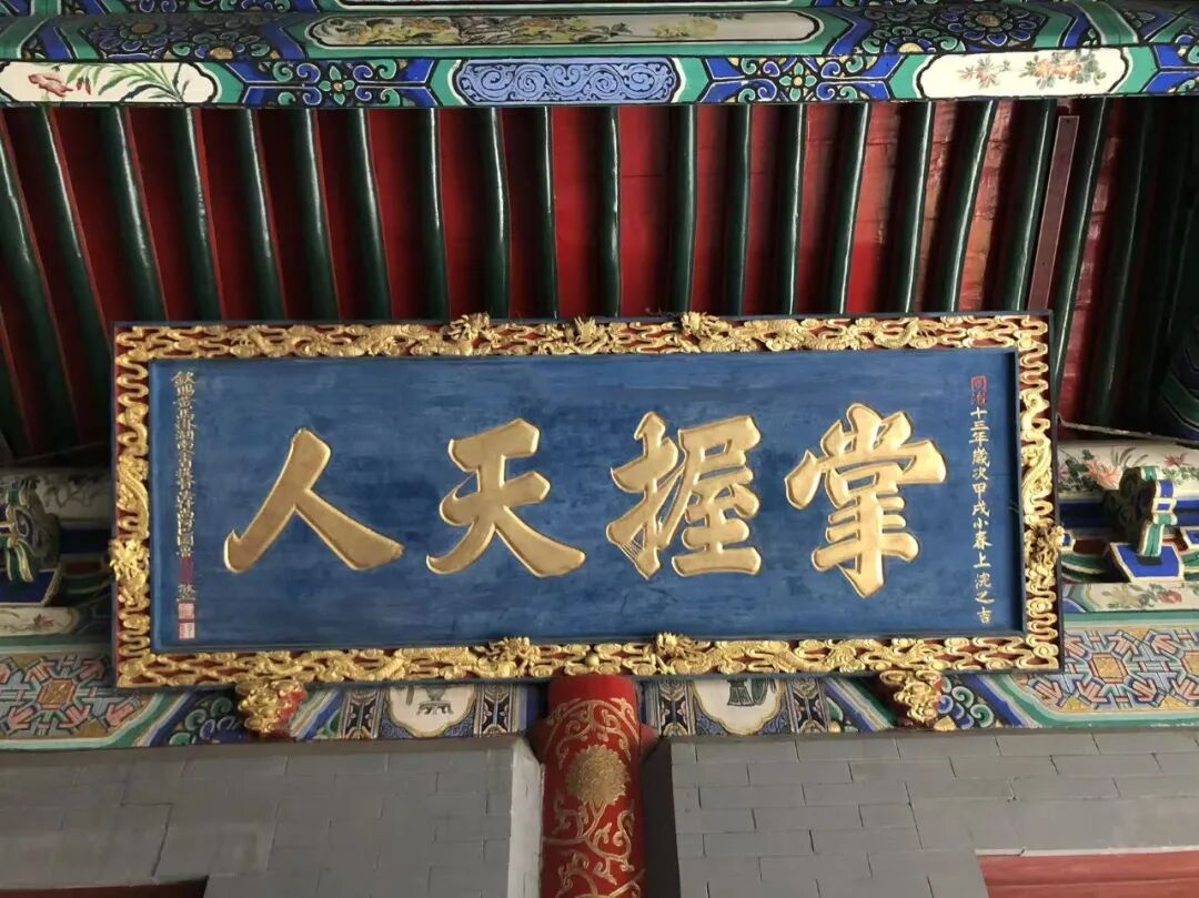
152. "Governing the Principles of Numbers" at Niujie Mosque in Beijing.
An auspicious day in the first month of winter, the Jiaxu year, the thirteenth year of the Tongzhi reign.
Respectfully erected by Ma Rulong, Imperial-bestowed Yellow Jacket wearer and Commander-in-Chief of Hunan Province, titled Fashishang'a Baturu.
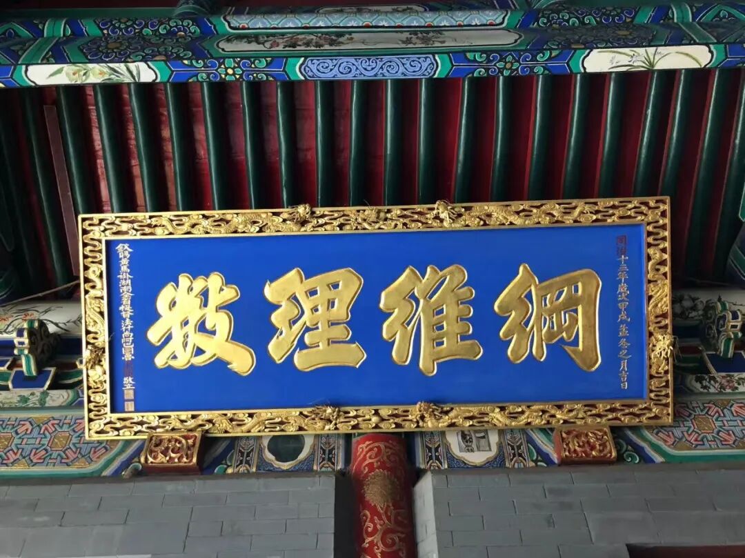
153. "Governing the Two and Five" at Nanxiapo Mosque in Beijing.
The third lunar month of the Renyin year (1902).
Calligraphy by Prince Qing.
The plaque is a replica. Yikuang was named Prince Qing in 1894 and served as a high official in the late Qing Dynasty.
Liu Zhi wrote in the Rites of Islam (Tianfang Dianli) that 'revering the five pillars fulfills the way of heaven;' 'upholding the five social relationships fulfills the way of man.' The five pillars are the declaration of faith, namaz, fasting, charity, and the pilgrimage, while the five relationships are ruler and subject, father and son, husband and wife, brothers, and friends.
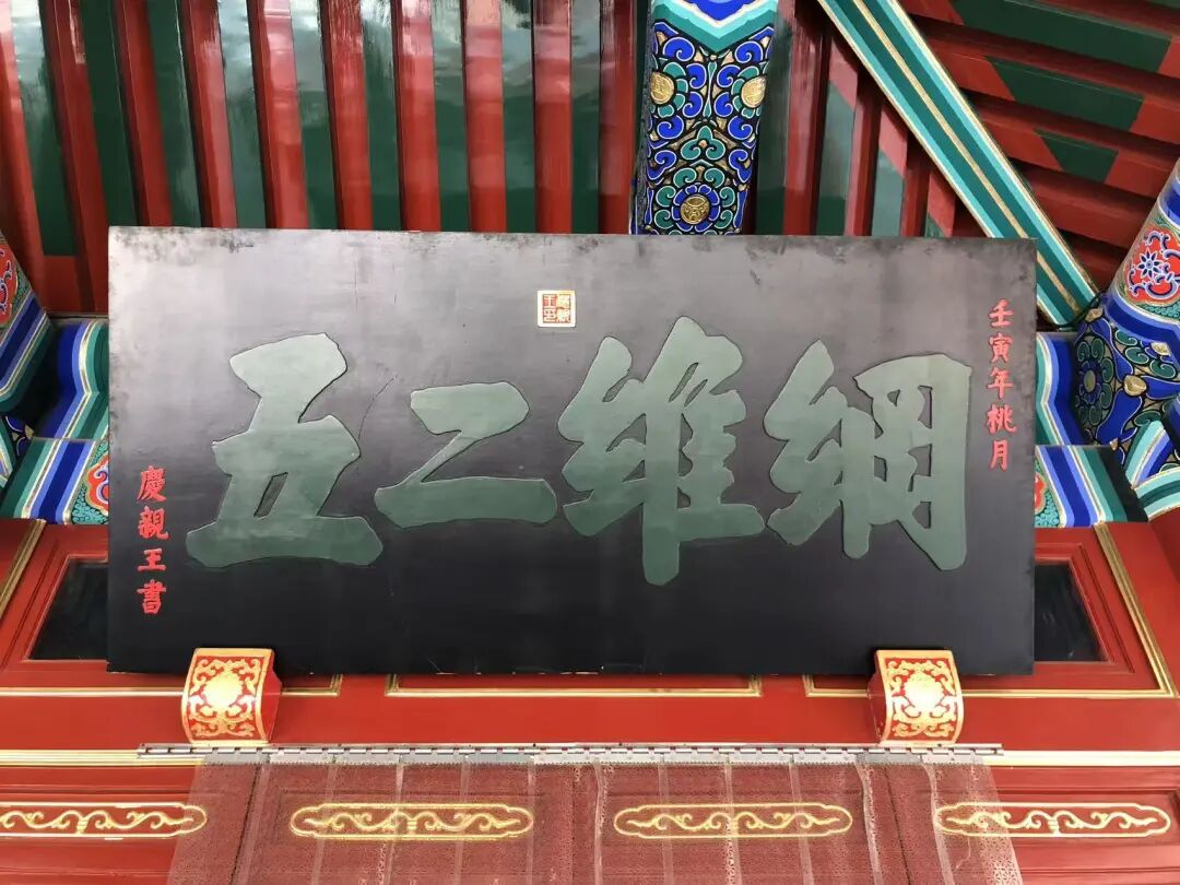
154. Arabic plaque at Haopan Mosque in Guangzhou
An auspicious day in the first month of summer, the seventh year of the Republic of China
Respectfully presented by the Jiangnan Tongshan Hall
During the Ming and Qing dynasties, many Hui Muslims from the Jiangsu, Zhejiang, and Shanghai regions came to Guangzhou for business. They often chose to live near the foreign trading houses on Haopan Street and the shops in the Xiguan area, which had a significant impact on Haopan Mosque.
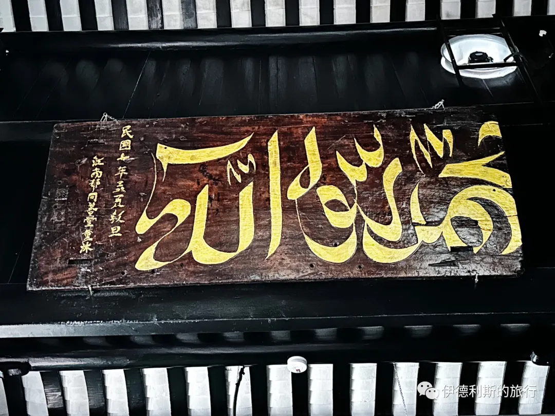
155. Arabic plaque at Xiaodongying Mosque in Guangzhou
Erected on an auspicious day in the fifth lunar month of the Bingyin year, the fifth year of the Tongzhi reign
Respectfully inscribed by Li Chengyi from Dingyuan County, Fengyang Prefecture, Jiangnan
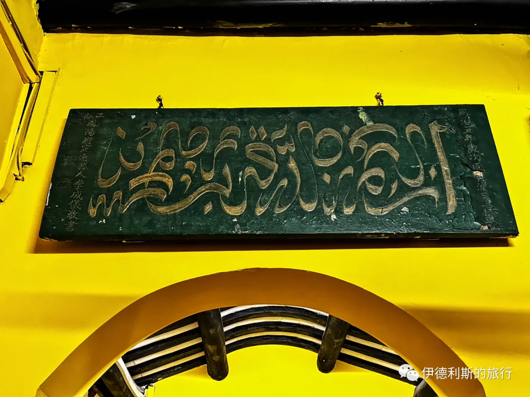
156. 'The Hundred-Word Eulogy to the Most Holy written by Emperor Taizu of Ming' at Xiaodongying Mosque in Guangzhou
Mid-third lunar month, spring of the sixth year of the Tongzhi reign of the Great Qing Dynasty, during the festival.
Respectfully written and erected by Zixiang Yang Yongchun after ritual cleansing.
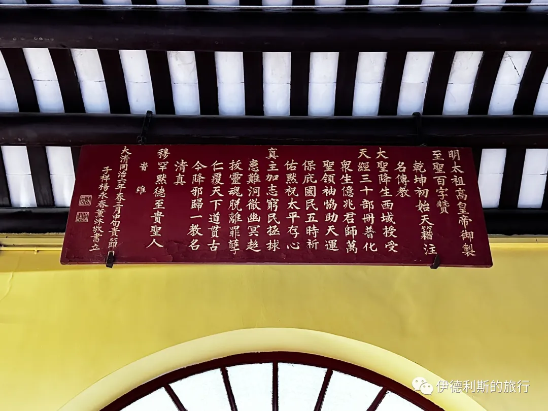
157. Xiaodongying Mosque in Guangzhou, "The Teaching Has an Authentic Lineage."
An auspicious day in the eleventh lunar month, the thirty-fourth year of the Guangxu reign of the Great Qing Dynasty, which is 1,324 years after the passing of the Prophet.
Erected by Liao Shouqi, a member of the faith from Jiangxia County, Hubei, led by his son Dalian.
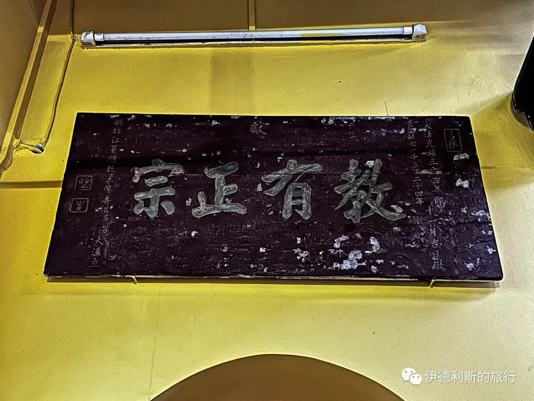
158. Wutong Mosque in Guilin, "All Things Reveal the Truth."
The second year of the Xuantong reign, Gengxu year, on an auspicious day.
Respectfully erected by Peng Jiahua.
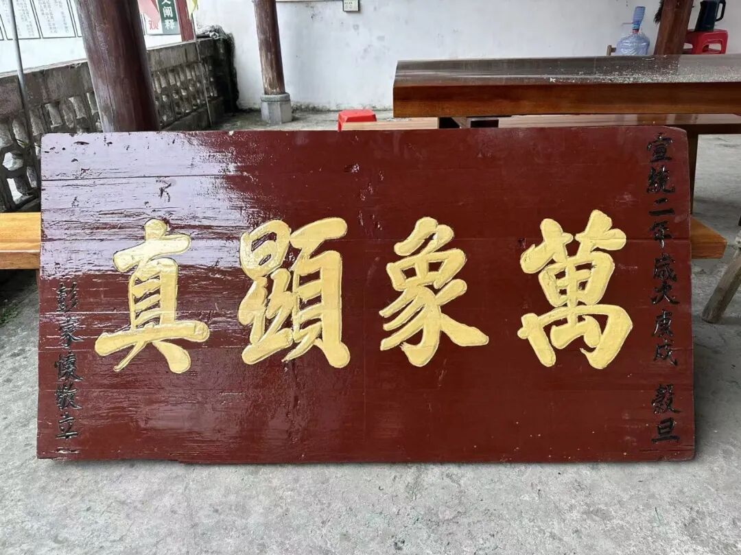
159. Wutong Mosque in Guilin.
Praising Muhammad to honor the ancient teacher, through the ages keeping the true purpose.
Seeing the mosque filled with plaques and couplets praising the Prophet, I felt inspired by the literature and, despite my limited knowledge, dared to compose a couplet as a memento.
Respectfully inscribed by Su Zonghan, former commissioner of Longteng County and acting magistrate of Yining County.
Yining County was located around Wutong Town in the Lingui District of Guilin, Guangxi. It was abolished and merged into Lingchuan in 1951. In the early Republic of China period, it had a county magistrate.
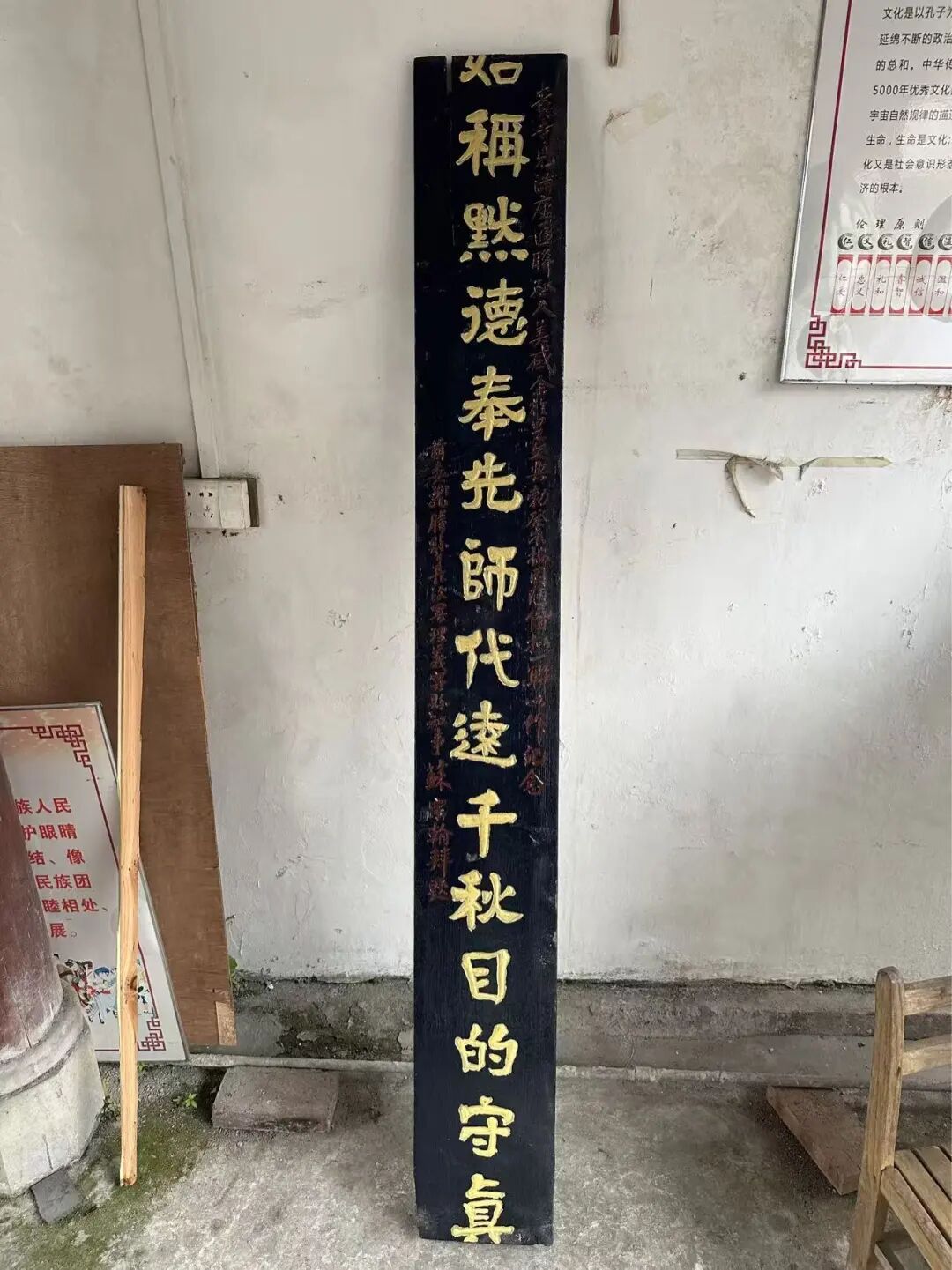
160. Chongshan Mosque (Chongshan Si) in Guilin: "Rectify the heart and be sincere."
An auspicious day in the sixth lunar month of the jiashen year, the tenth year of the Guangxu reign.
Respectfully erected by local resident Zhang Weicheng.
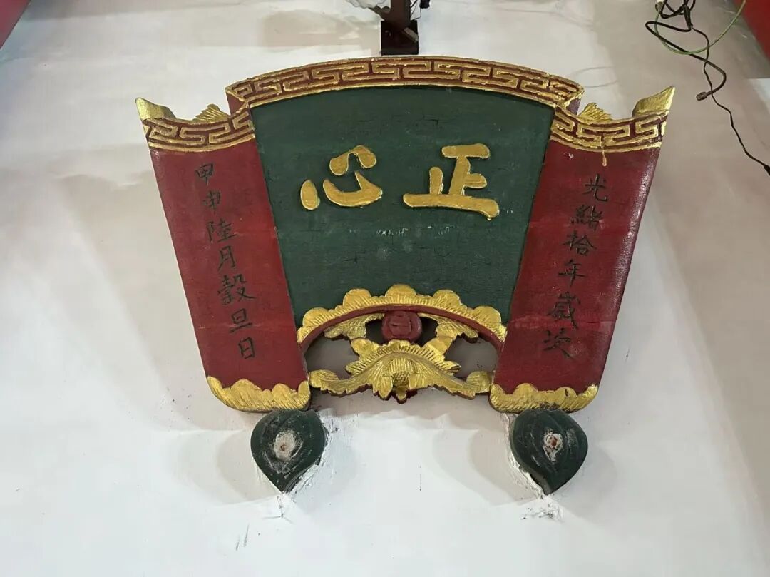
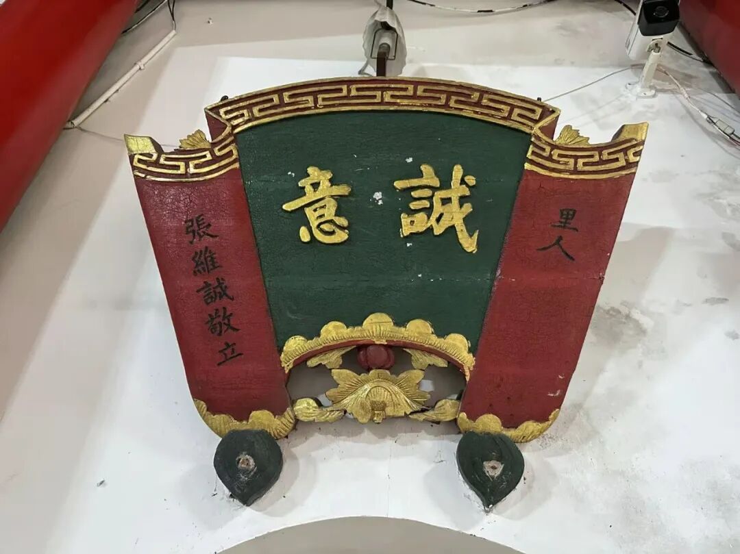
161. Binju Mosque (Binju Si) in Dali: "The true source of all things."
An auspicious day in the last month of summer in the guihai year of the Republic of China.
Respectfully written by Yang Liren from Nancheng.
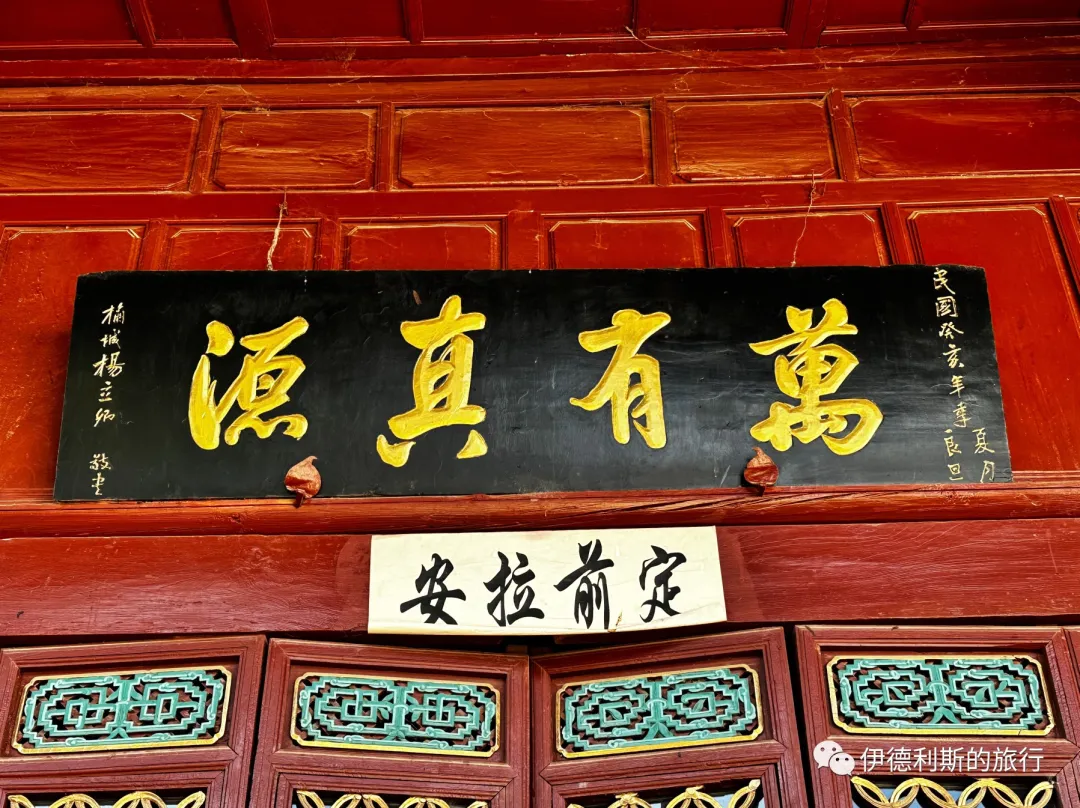
162. Binju Mosque (Binju Si) in Dali.
Only one, only pure, the essence of the teaching encompasses all phenomena.
Not two, not mixed, the way of the truth connects heaven, earth, and humanity.
An auspicious day in the summer of the twelfth year of the Republic of China.
Respectfully written by Yang Liren from Nancheng.
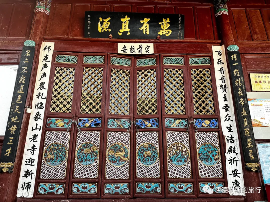
163. Dawumaolin Mosque in Dali
Broaden your vision and open your heart, break through the void and clear away worldly appearances, explore the divine and understand transformation to reach the original source.
Leave behind worldly feelings with sincere will, forget the distinction between self and objects to unite humanity and heaven, return to the truth and align with the profound mystery.
Respectfully presented by Ma Yuanshan, principal of Yanzhen School, along with all his students.
An auspicious day in the middle of winter, the 25th year of the Republic of China.
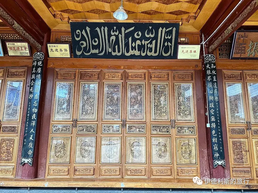
164. Daoyuan Qingzhen Mosque of the Mi family in Mami Factory, Dali.
Respectfully erected by the imperial guard wearing a peacock feather, acting major of the Menghua Right Battalion, and commander of the second battalion of the Yunnan provincial patrol force...
The first month of spring, the first year of the Xuantong reign.
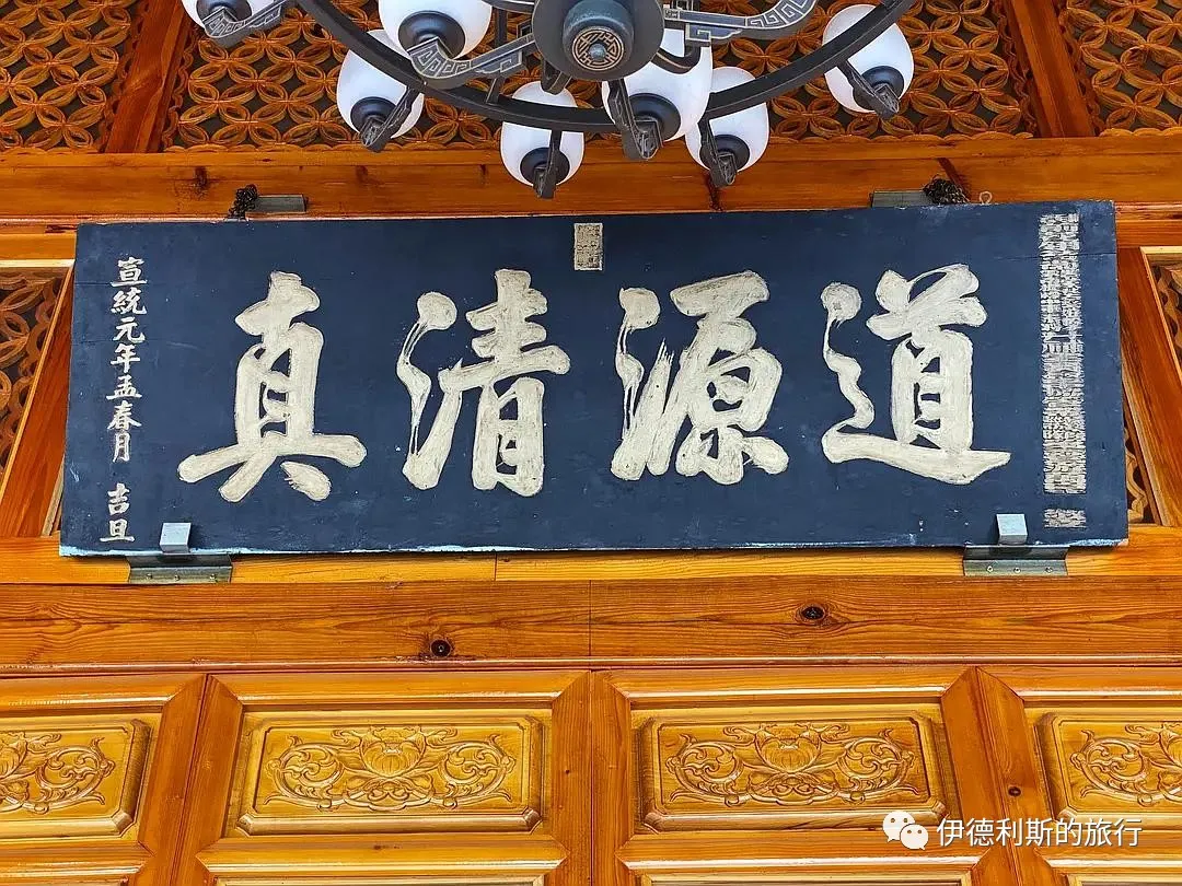
Everyone is welcome to read and leave comments.
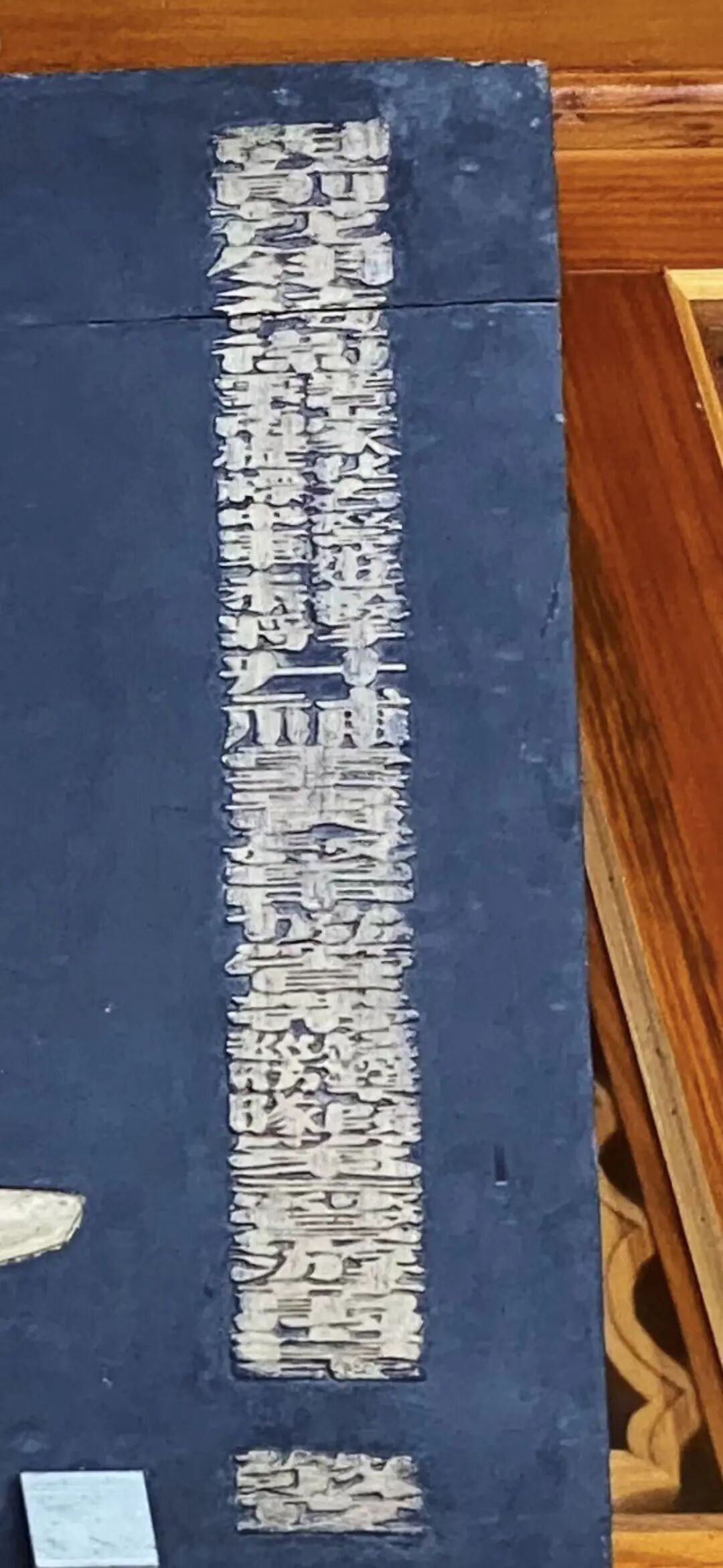
165. Chengyi Buer Mosque in Donglianhua, Dali.
An auspicious day in the first month of summer, the Bingyin year, the 15th year of the Republic of China.
Qing dynasty appointed General Zhenwei, acting deputy brigade commander, specially conferred as colonel of the Weiyuan Battalion in Yunnan.
Respectfully erected by Republic of China Army Major General Yang Shengqi.
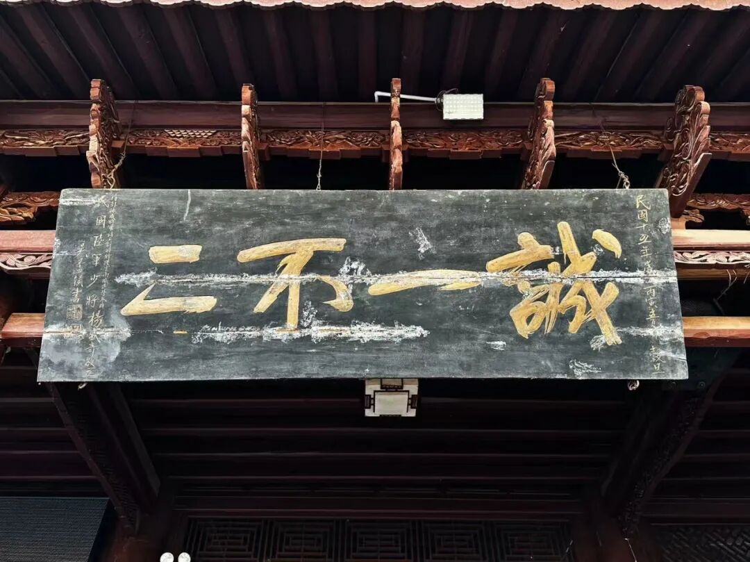
166. "Universal Mercy and All-Encompassing" (Puci Wanyou) at Tuogu Mosque in Zhaotong.
The first month of winter in the 11th year of the Qianlong reign of the Great Qing Dynasty.
Ye Daxiong, Imperial-appointed Commander of Zhaotong and Dongxiong in Yunnan, Hereditary Cavalry Commandant.
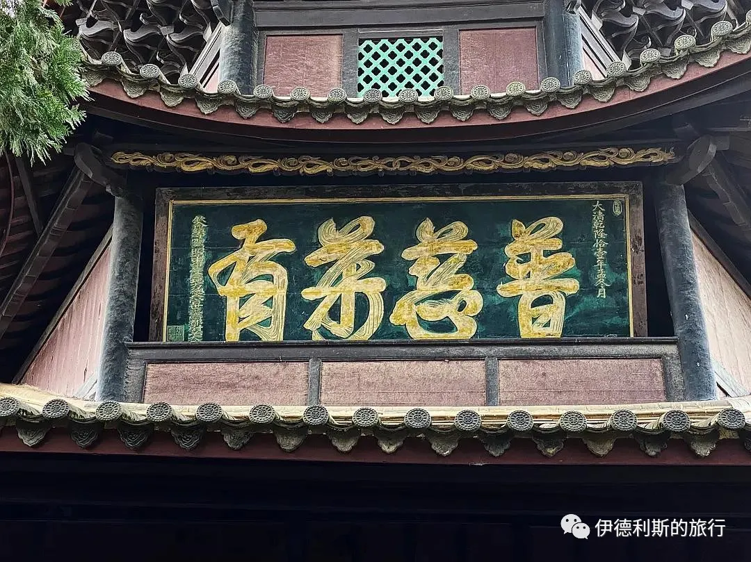
167. "Pure Truth and Elegant Transformation" (Qingzhen Yahua) at Tiejiawan Mosque in Zhaotong.
Respectfully erected by Tie Chengjin, acting officer of the second company of the left vanguard, Zhaotong Garrison, Yunnan, with a one-rank promotion.
An auspicious day in the last ten days of the eighth lunar month, 24th year of the Daoguang reign.
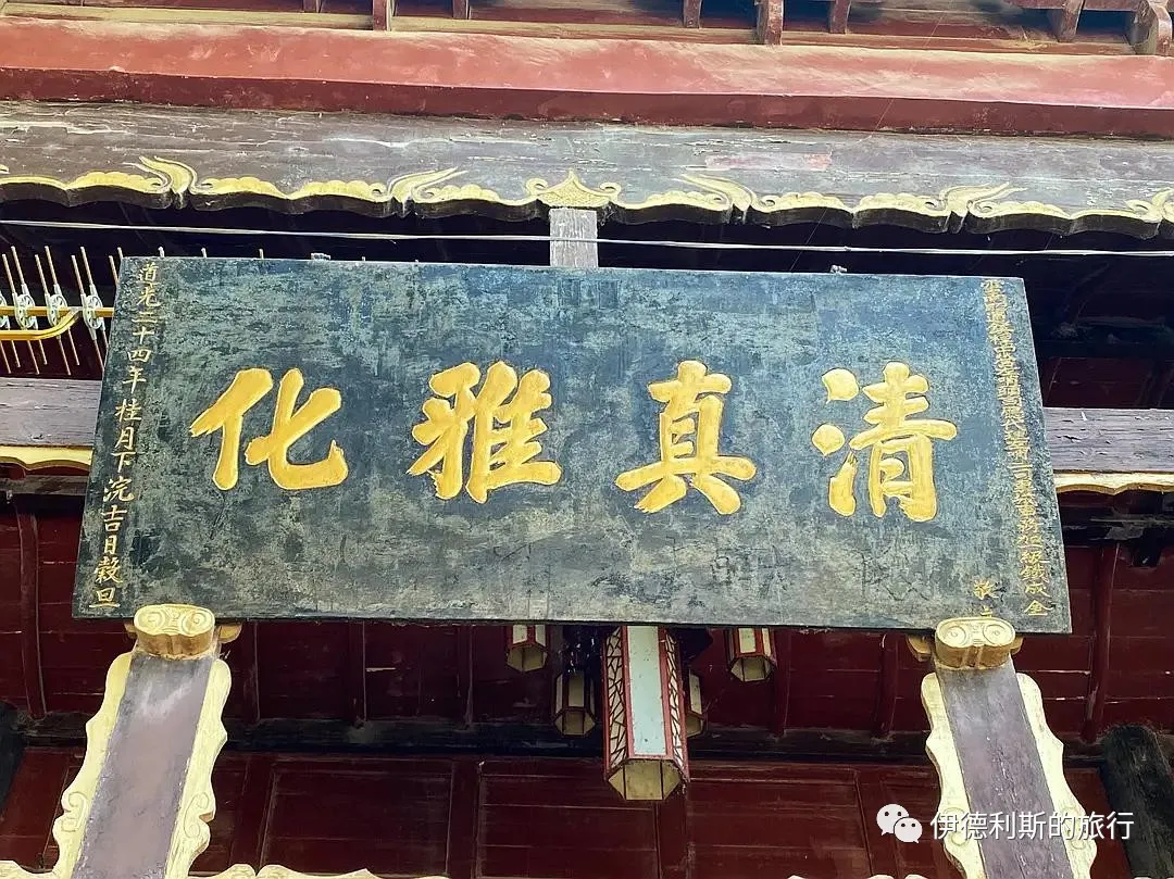
168. "Great Virtue and Simple Transformation" (Dade Dunhua) at Tiejiawan Mosque in Zhaotong.
An auspicious day in the third month of autumn, 15th year of the Jiaqing reign of the Great Qing Dynasty.
Respectfully inscribed by Ye Daxiong, Imperial-bestowed Commander-in-Chief of Zhaotong, Dongxiong, and surrounding areas, Hereditary Cavalry Commandant.
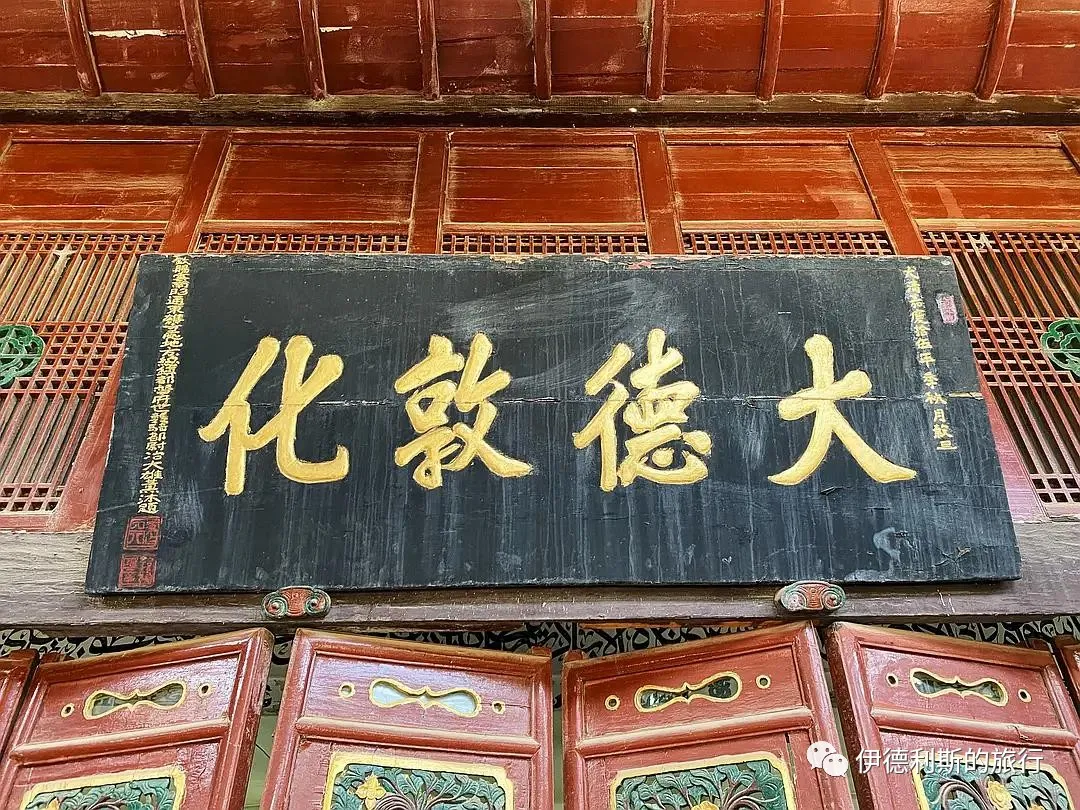
169. "Mysterious Wonder and Great Power" (Xuanqi Daneng) at Chachong Mosque in Zhaotong.
Respectfully erected by Sa Depin, Vice-General authorized to wear the peacock feather and expectant Assistant Regional Commander.
An auspicious day in the first month of the Bingwu year, the 32nd year of the Guangxu reign.
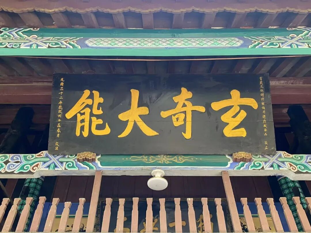
170. "Eternal Breath" at Fengming Mosque in Dali.
An auspicious day in the spring of the 11th year of the Republic of China.
Respectfully erected by Ding Guotai of Shaanxi.
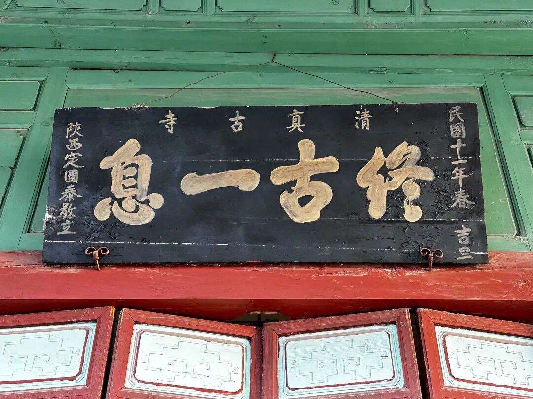
171. "Shining on Everything" at Dazhuang Mosque in Kaiyuan.
An auspicious day in the second month of the 11th year of the Guangxu reign.
... Erected by Ma Weiqi of the Suiyuan Left Battalion Training Army.
Ma Weiqi was a Hui Muslim from Dazhuang, Kaiyuan, Yunnan. He was skilled in calligraphy, following the style of Yan Zhenqing, with powerful brushwork and grand momentum. In the 9th year of the Guangxu reign, Ma Weiqi was ordered to Vietnam to resist the French. He defeated the French army many times and was promoted to the rank of vice-general for his military achievements, receiving the title "Boduo Huan Baturu".
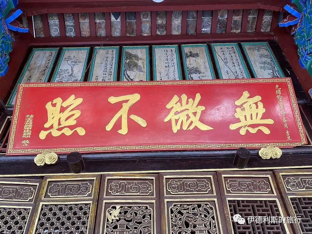
172. "Nurturing All Things" at Dazhuang Mosque in Kaiyuan.
An auspicious day in the first month of winter in the Jiachen year, the 24th year of the Daoguang reign.
Respectfully erected by Ma Dingbang, the top-ranked military graduate in the imperial examinations of the 15th year of the Daoguang reign.
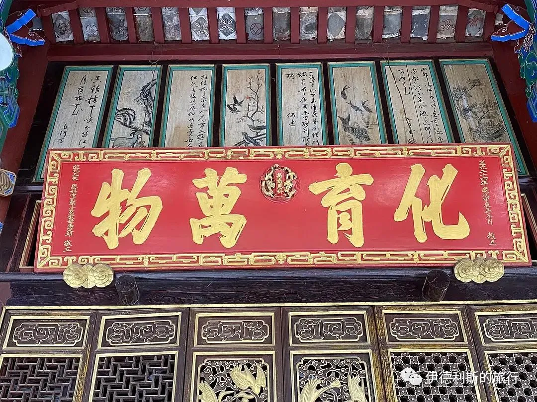
173. Dazhuang Mosque in Kaiyuan, 'Praise be to Allah without end' (Yu Mu Bu Yi)
An auspicious day in the middle of winter, the third year of the Daoguang reign (1823)
Respectfully erected by Xu Yaozong, acting commander of the Linyuan and Chengjiang military districts
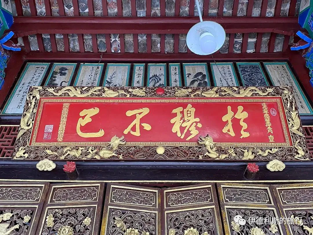
174. Dazhuang Mosque in Kaiyuan
Reason is not found in sleep; to complete the beginning and the end, one must seek the one true Master
The Way is based on sincerity and uprightness; to emulate the virtuous and the holy, one must strictly observe the five daily prayers (namaz)
Respectfully erected by Xu Yaozong
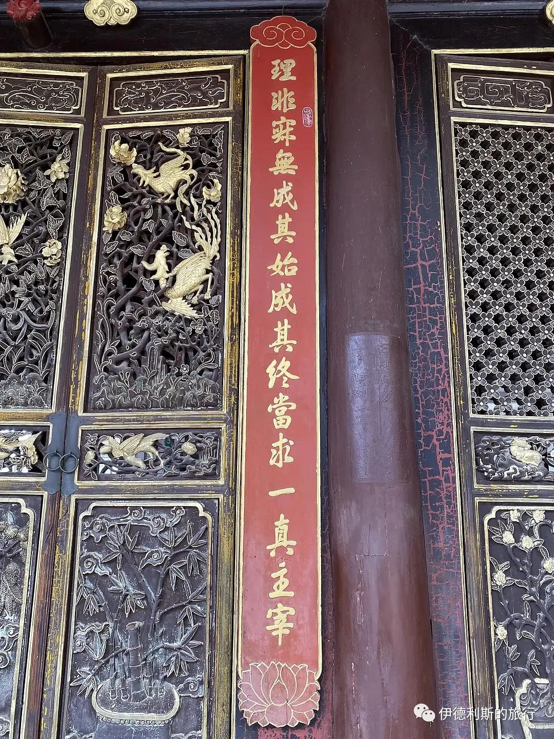
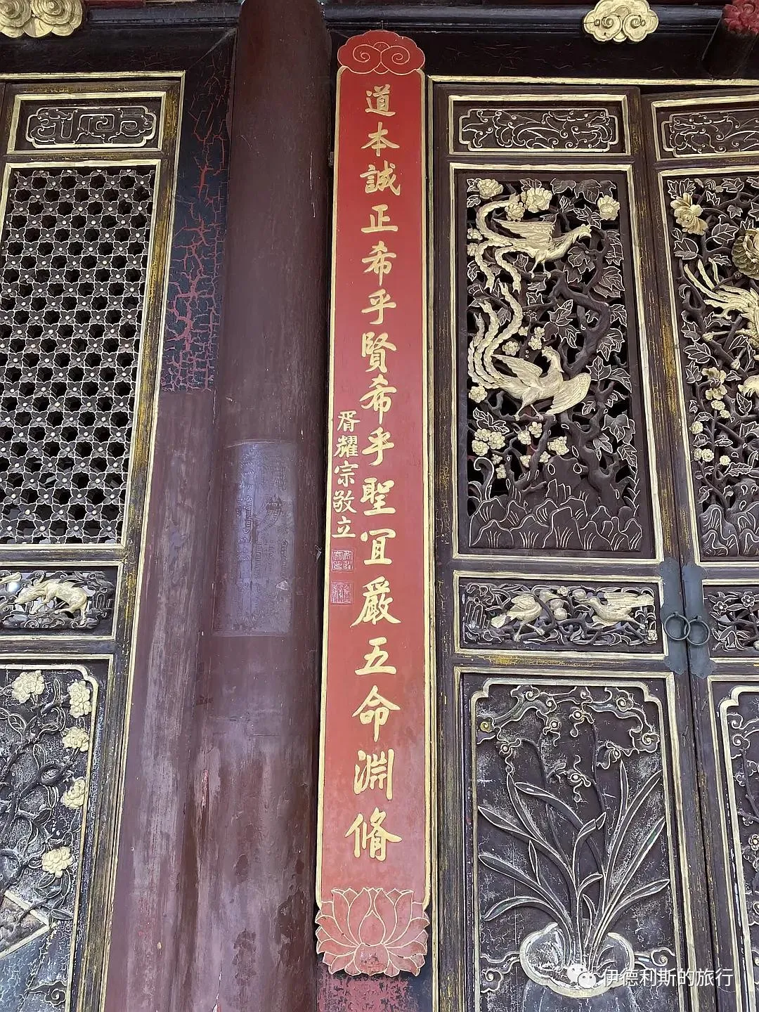
175. Dazhuang Mosque in Kaiyuan
Analyzing ancient doubts and confusion in only thirty volumes
Including the scriptures of the former saints, a great collection of the Way
Inscribed by Ma Chuqing, a successful candidate in the imperial examinations during the Dingyou year of the Qing dynasty
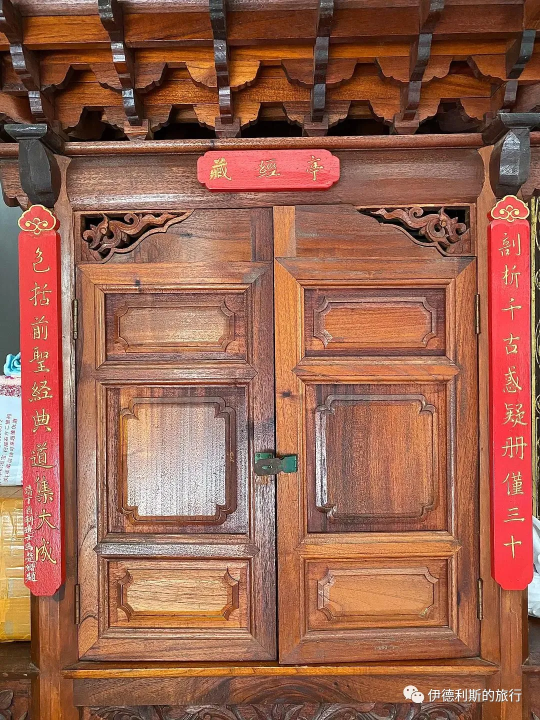
176. 'Imperial Edict Platform' (Shengyu Tai) at Liren Mosque in Kunming
Erected in the 34th year of the Republic of China.
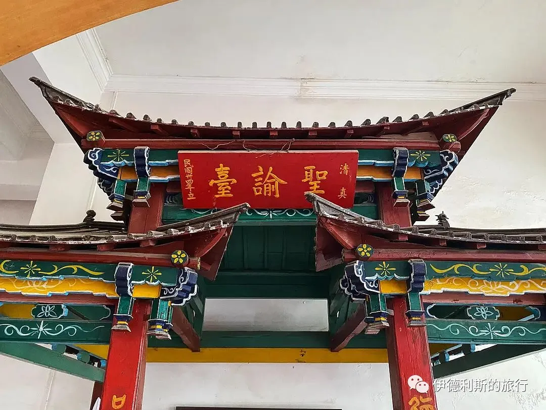
177. Tangzi Mosque in Xundian, Yunnan: "Ten Thousand Things from One Source" (Wanshu Yiben).
New Year's Day, 30th year of the Republic of China.
Respectfully gifted by Yunnan Army Major General Ma Deming.
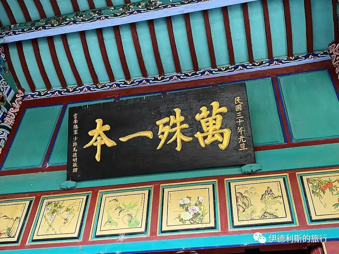
178. Tangzi Mosque in Xundian, Yunnan: "The Only and the Pure" (Weiyi Weijing).
New Year's Day, 30th year of the Republic of China.
Respectfully gifted by Yunnan Army Lieutenant General Ma Cong.
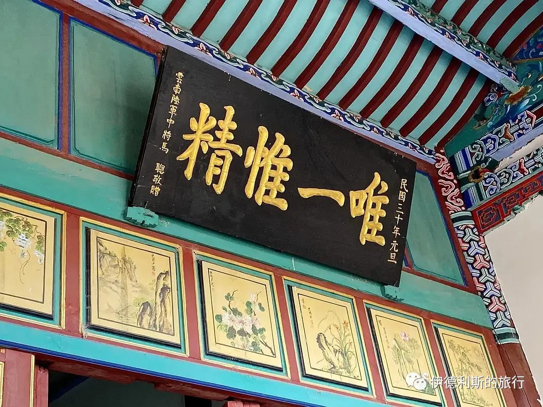
179. Tangzi Mosque in Xundian, Yunnan: "Promote Religion and Build the Nation" (Xingjiao Jianguo).
New Year's Day, 30th year of the Republic of China.
Inscribed by Bai Chongxi.
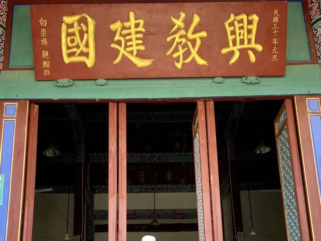
180. Beiyingjie Mosque in Xundian, Yunnan: "The Original Source of All Things" (Wanyou Yuanzong).
Respectfully inscribed by Jin Huaijin, a palace graduate (jinshi) and imperial guard, serving as deputy commander of the military camp with a rank promotion of three levels.
The first year of the Yongzheng reign, the year of Guimao, in the middle of the sixth lunar month, on an auspicious day.
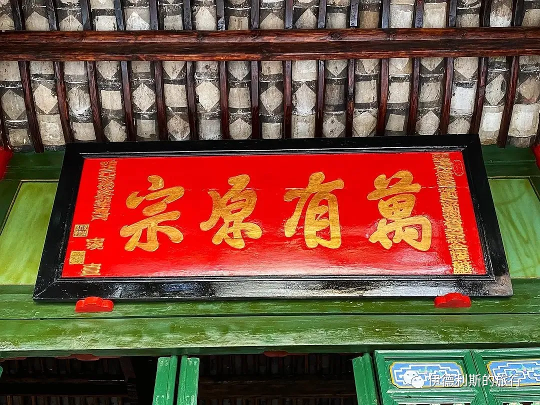
181. Beiying Street Mosque in Xundian, Yunnan: 'The Only True Faith' (Qingzhen Bu'er).
Respectfully inscribed by Qian Dengxi, the Circuit Intendant of the Eastern Yunnan Military Defense.
Erected in the summer of the 24th year of the Guangxu reign.
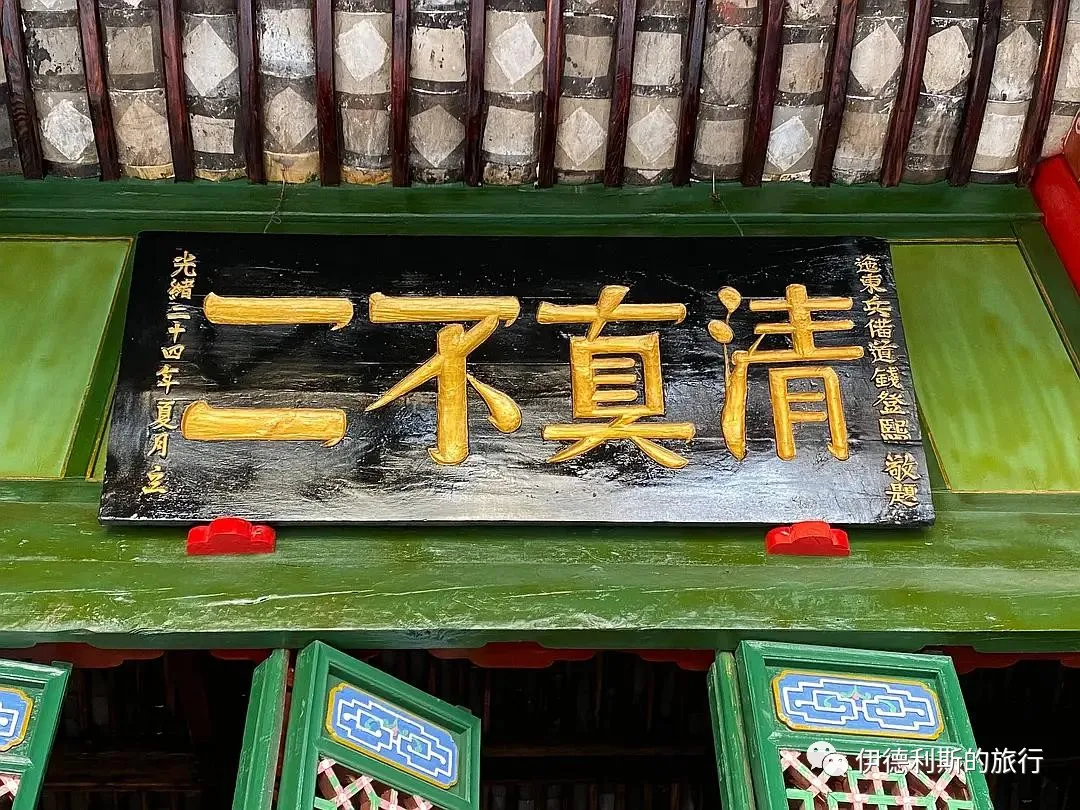
182. Jinniudao Mosque in Kunming: 'The Way Spread from the West' (Dao Zi Xi Chuan).
The middle of the fourth lunar month, in the Yiwei year of the Guangxu reign of the Great Qing Dynasty, on an auspicious day.
Written by Ma Weiqi, the acting Regional Commander of the Linyuan and Chengjiang areas in Yunnan, who holds the title of Boduohuan Baturu.
Respectfully erected by Zhang Mingming, the top scholar (zhuangyuan) of the Jiaxu year, first-rank imperial guard, and specially appointed acting Deputy General of the Chuxiong Garrison in Yunnan and Deputy General of the Yunnan-Guizhou Governor's Command.
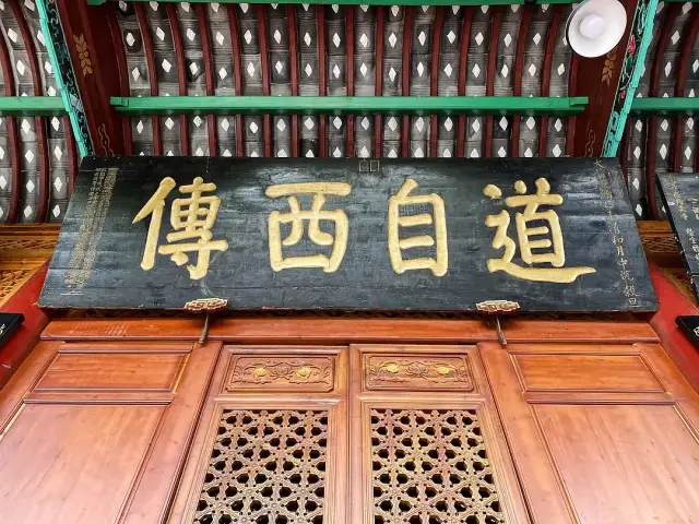
Everyone is welcome to add more information.
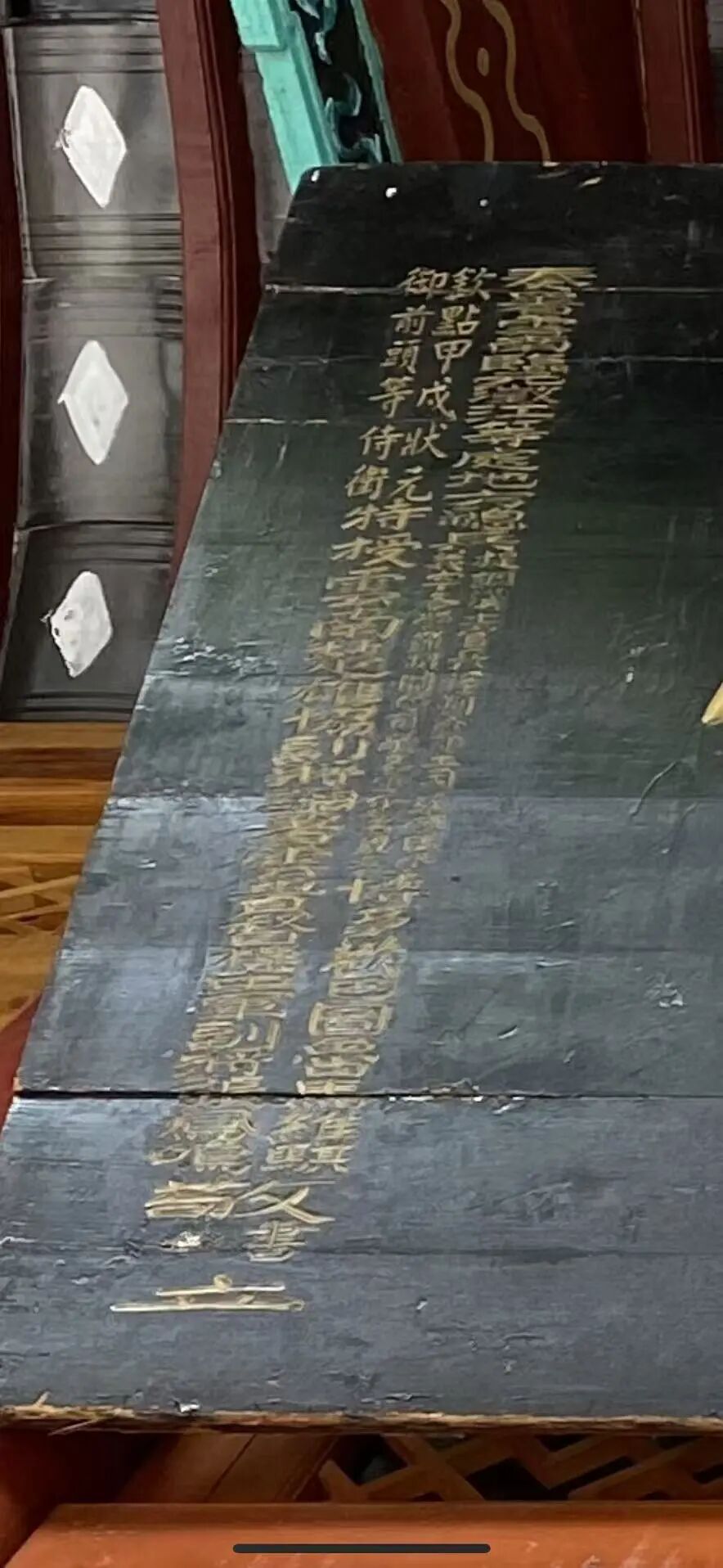
183. Tangjia Mosque in Chengdu: 'Ascending to the Shore of the Way' (Dao An Dan Deng).
An auspicious day in the first lunar month of the Bingshen year of the Guangxu reign.
Tang Chuanyou from Dongzou.
Tang Chuanyou was a Qing Dynasty calligrapher whose art was famous throughout the capital. His son, Tang Chenglie, worked as an official in Sichuan, so he brought his father there to spend his final years in comfort. The plaque text comes from the Book of Songs (Shijing) phrase 'first climb to the shore,' and Liu Zhi also wrote in Five Watch Moon (Wugeng Yue): 'From here, step by step forward, climb to the shore of the path to see the mystery.'
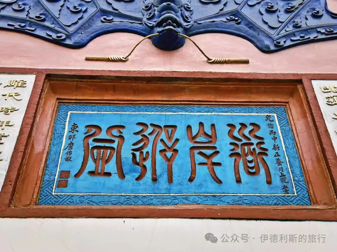
184. Tuqiao Shang Mosque in Chengdu: 'Uphold Good Rules Forever' (Shishou Lianggui)
Jiayin year of the Yongzheng reign
29th year of the Guangxu reign
Inscribed by Prince Guo
Respectfully erected by Ma Zhonglong, a third-rank guard with a peacock feather from Guizhou Province
In 1734 (the 12th year of the Yongzheng reign), Prince Guo Yunli, the 17th son of Emperor Kangxi, was ordered to go to Kangding to handle the return of the 7th Dalai Lama to Tibet. Before reaching Kangding, he inspected troops in Chengdu and gifted two plaques to Gulou Mosque: 'Uphold Good Rules Forever' (Shishou Lianggui) and 'Origin of Worldly Laws' (Shifa Yuanliu). The original 'Uphold Good Rules Forever' plaque was kept at Huangcheng Mosque but was destroyed in the 1960s and 1970s. The one at Tuqiao Mosque was made during the Guangxu reign.
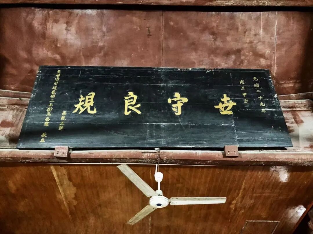
185. Chengdu Tuqiao Shang Mosque: 'Wonderful Origin of Islam' (Miaoyuan Qingzhen)
Imperial-appointed Commander-in-Chief of Yunnan Province, Left Metropolitan Commander, Hereditary Cavalry Captain, recorded six times for military merit, oversaw the construction of the Great Hero Hall.
Imperial-appointed Commander-in-Chief of Yunnan Province, General-in-Chief, recorded five times for military merit, erected by Ma Hua.
An auspicious day in the middle of winter, in the year of Jisi, the 27th year of the Qianlong reign of the Great Qing Dynasty.
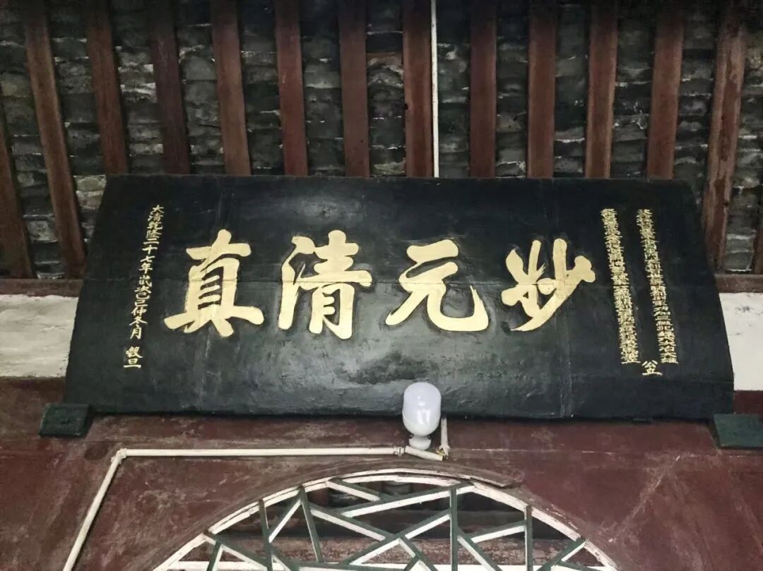
186. Chengdu Tuqiao Upper Mosque, 'Like Timely Rain'.
An auspicious day in the last ten days of the third month of autumn, in the year of Guisi, the 13th year of the Daoguang reign.
Respectfully inscribed by Ma Tenglong, the Imperial-appointed Regional Commander of Chongqing, Sichuan.
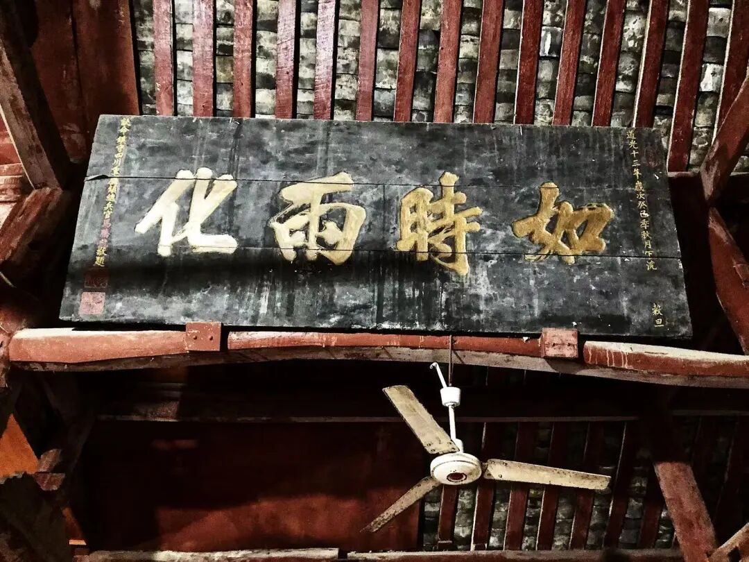
187. Chengdu Tuqiao Upper Mosque, 'Boundless Nurturing'.
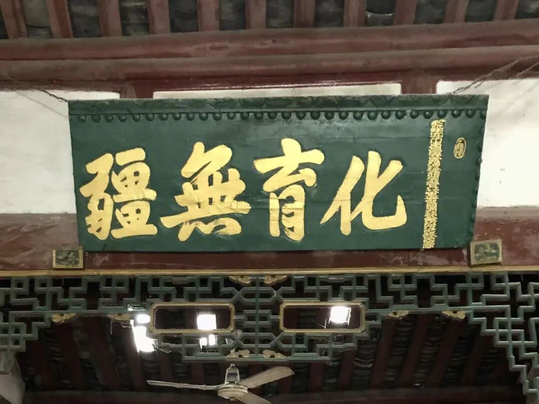
188. Chengdu Tuqiao Upper Mosque, 'Revere the Righteous and Expel the Evil'.
The third month of spring, the first year of the Republic of China.
The humble followers of the community.
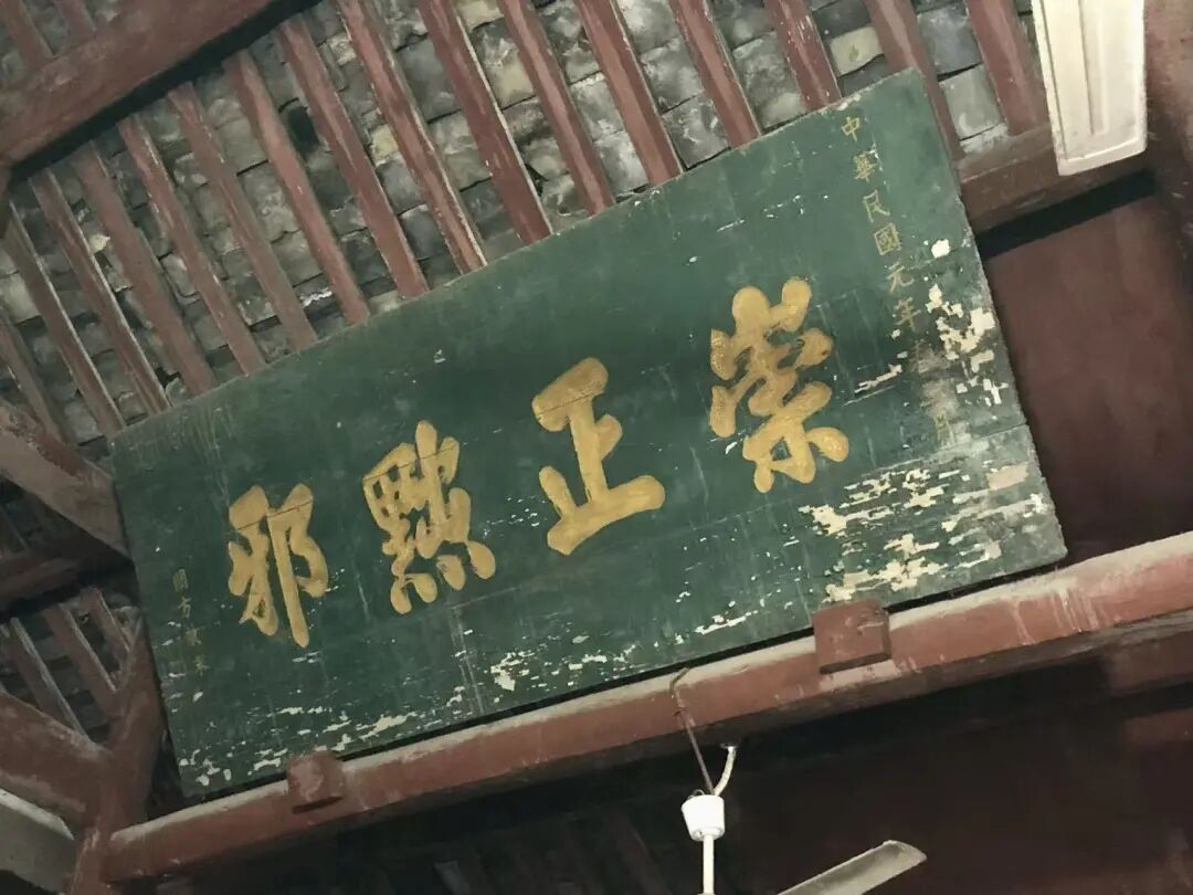
189. Chengdu Dujiangyan Mosque, 'Uphold Good Traditions for Generations'.
The last month of winter, in the year of Jiayin, during the Yongzheng reign.
Inscribed by Prince Guo
Prince Guo was the seventeenth son of the Kangxi Emperor. In the twelfth year of the Yongzheng reign, he traveled to Taining to escort the Dalai Lama back to Tibet. While inspecting provincial garrisons and Green Standard Army troops, he passed through Chengdu and wrote a plaque for Gulou Mosque. The Dujiangyan Mosque also made a copy of the plaque to keep inside the building.
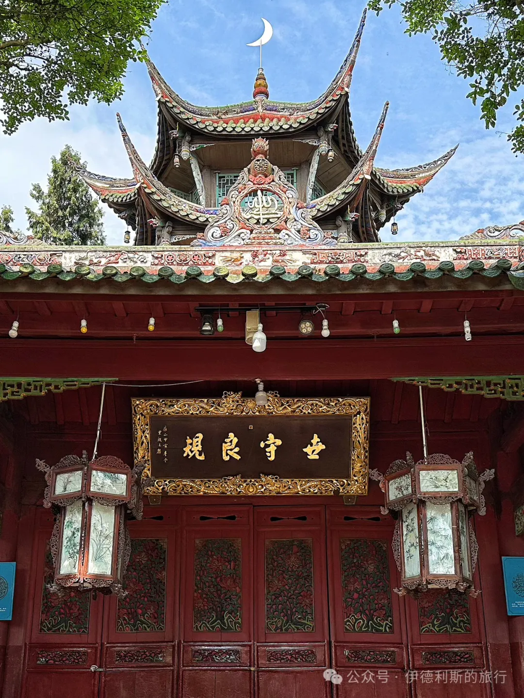
190. Dujiangyan Mosque in Chengdu: "Origin of Worldly Dharma"
The last month of winter, in the year of Jiayin, during the Yongzheng reign.
Inscribed by Prince Guo
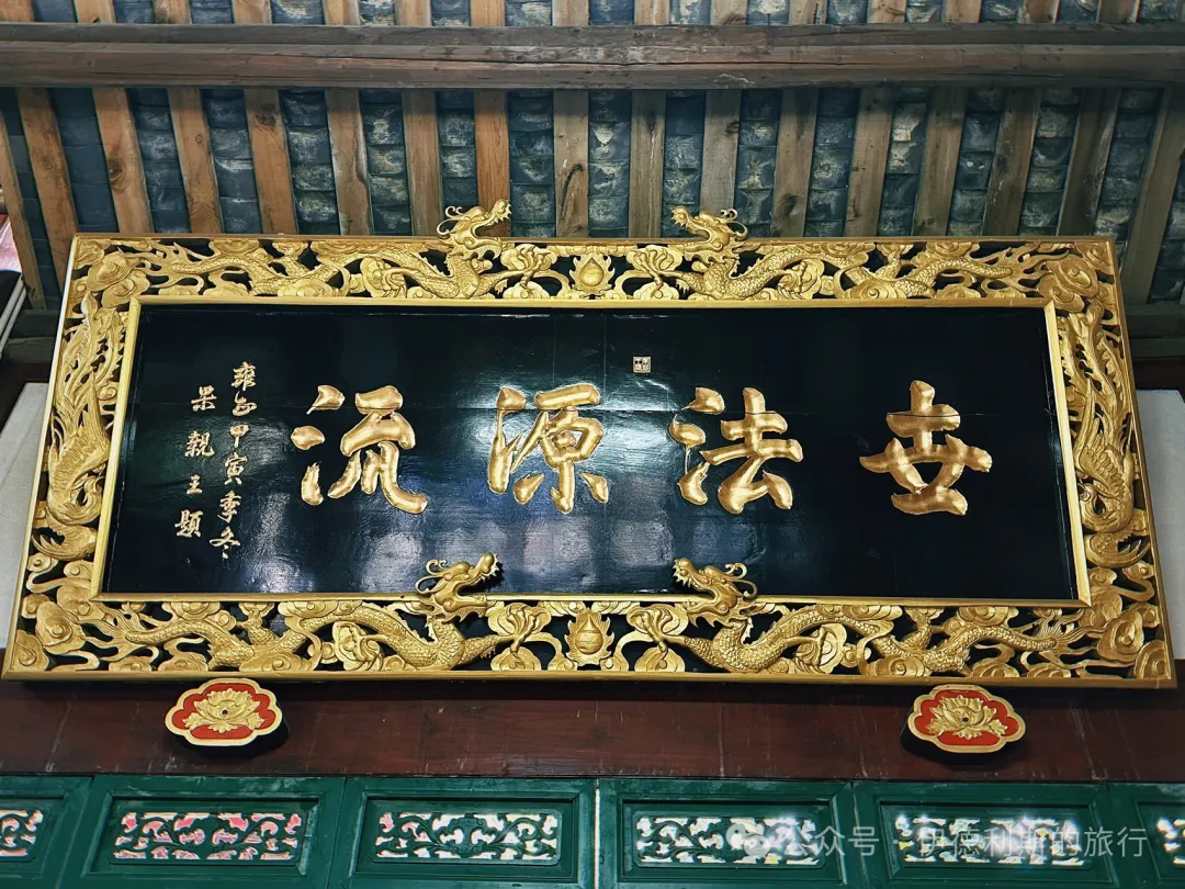
191. Dujiangyan Mosque in Chengdu: "Success Through Non-Action"
Early summer of the Guimao year, the twenty-ninth year of the Guangxu reign of the Great Qing Dynasty.
Respectfully written and erected by Ma Weiqi, Commander-in-Chief of Sichuan.
Ma Weiqi was a Hui Muslim from Dazhuang, Kaiyuan, Yunnan. He was skilled in calligraphy, following the style of Yan Zhenqing, with powerful brushwork and grand momentum. In the 9th year of the Guangxu reign, Ma Weiqi was ordered to Vietnam to resist the French. He defeated the French army many times and was promoted to the rank of vice-general for his military achievements, receiving the title "Boduo Huan Baturu". While serving as Commander-in-Chief of Sichuan, Ma Weiqi led troops to suppress a rebellion by lamas and local chieftains in Batang, Tibet. He overcame snowstorms, dangerous terrain, and food shortages to restore peace to the entire region. He was rewarded with a first-rank button and granted the title of General Jianwei. During his time as Commander-in-Chief of Sichuan, Ma Weiqi greatly supported the local Muslim community. He recommended several imams for positions in Sichuan, including Imam Wang Jiapeng, who is known as one of the four great modern imams of Yunnan.
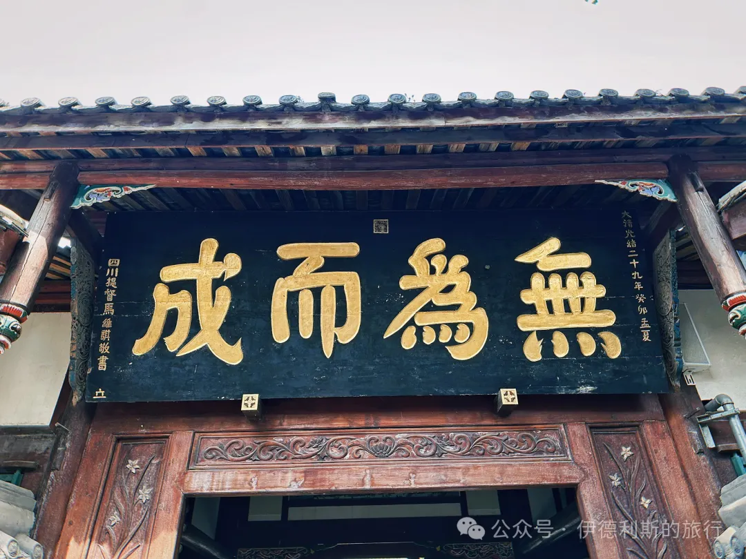
192. Dujiangyan Mosque in Chengdu: "Promote Religion and Build the Nation"
An auspicious day in the mid-autumn of the 35th year of the Republic of China.
Inscribed by Bai Chongxi.
Bai Chongxi wrote this in 1946 while visiting his in-law, Ma Jianqing, in Sichuan. Bai Chongxi was the Minister of National Defense of the Republic of China at the time. Bai Chongxi cared deeply about ethnic education. He built Northwest Middle School in Chengdu, Sichuan, and Jiansheng Middle School in Xichang.
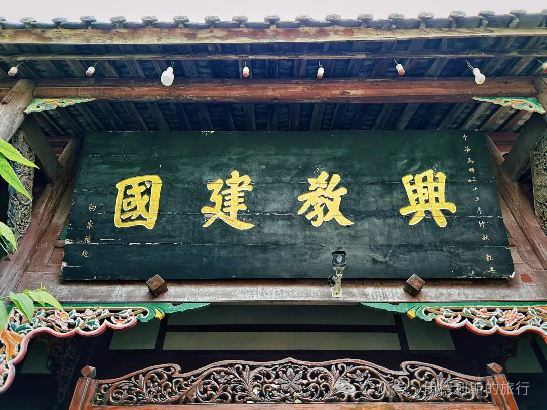
193. Dujiangyan Mosque in Chengdu: "Originality and Unique Respect"
An auspicious day in the seventh month of the lunar calendar in the seventh year of the Xianfeng reign.
Presented by Chen Tianzhu, a fifth-rank official with a blue feather and a battalion commander of the Anfu Camp in Sichuan, who held the priority rank of thousand-man commander.
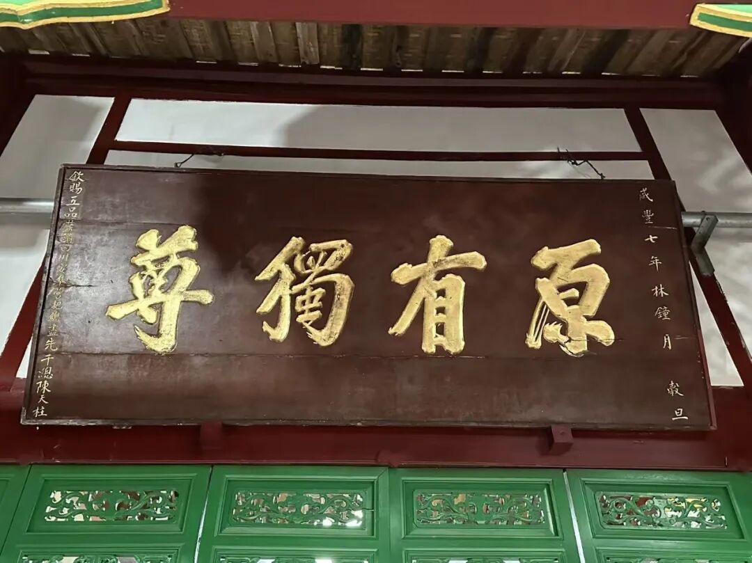
194. Dujiangyan Mosque in Chengdu: "The Religion Flourishes in True Unity"
An auspicious day in the last month of winter in the 14th year of the Qianlong reign (the year of Jisi).
The signature section was destroyed in the 1960s and 1970s. In 2019, I photographed it without the signature. When I returned in 2026, I found the signature had been added: Presented by Ha Panlong, an imperial-appointed top scholar, first-rank imperial guard, and commander of the Songpan Garrison.
Ha Panlong was a Hui Muslim from Suning, Hebei. He passed the provincial civil service exam in the 10th year of the Yongzheng reign and earned the top rank in the martial arts imperial examination in the second year of the Qianlong reign, after which he was appointed as a first-rank imperial guard. In the 13th year of the Qianlong reign, Ha Panlong was ordered to Jinchuan. As the commander of the Songpan garrison, he led troops to attack Meinuo Valley, Kezu Village, and Qiushui City, winning every battle. In the second month of the 14th year of the Qianlong reign, the Jinchuan campaign ended. Ha Panlong was promoted by three ranks and received two additional merit records.
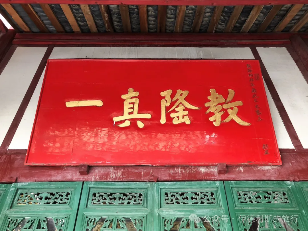
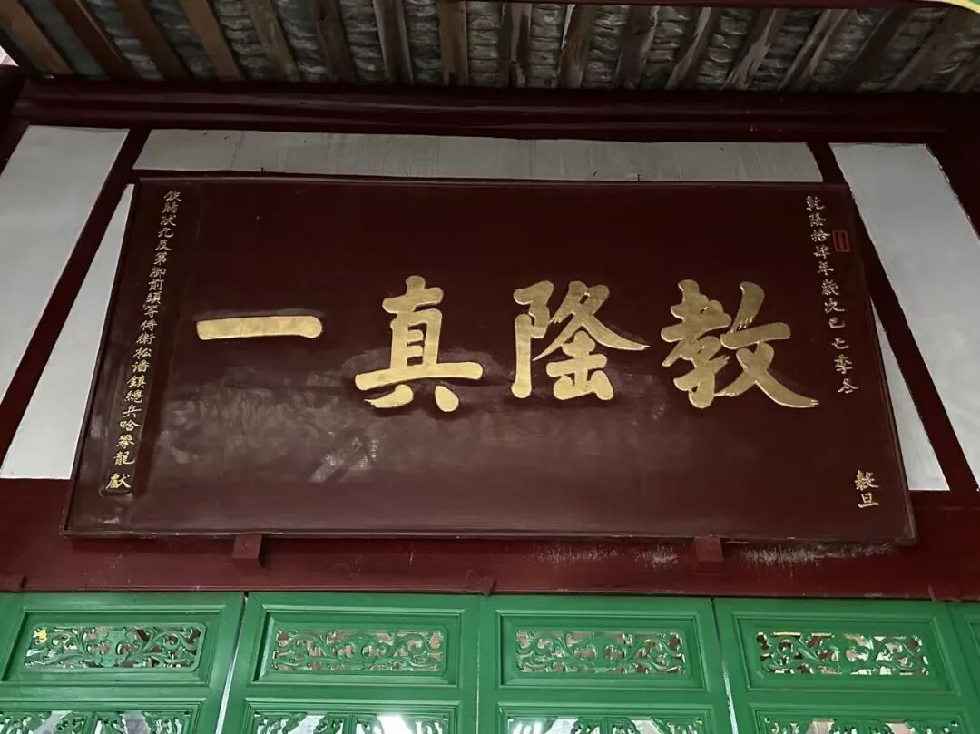
195. Dujiangyan Mosque, Chengdu, "Ancient Mosque (Qingzhen Gusi)"
An auspicious day in the tenth lunar month of the Xinwei year of the Tongzhi reign.
The West Mosque of Guan County in Dujiangyan was located on Shaanxi Lane inside the ancient city of Guan County. It was built in 1862 (the first year of the Tongzhi reign) by Hui Muslims from Songpan, Sichuan. During the Xianfeng and Tongzhi years, Hui Muslims from Songpan with the surnames Jia, Qi, Mi, and Yu traveled south along the Songmao Ancient Road for business. They settled in the ancient city of Guan County and pooled their money to build the West Mosque of Guan County.
In 1959, the West Mosque of Guan County was torn down to build the Guan County People's Hospital. Today, the second gate of the Dujiangyan mosque displays a plaque from the tenth year of the Tongzhi reign that reads "Ancient Mosque (Qingzhen Gusi)." This is the original plaque that hung on the gate of the West Mosque.
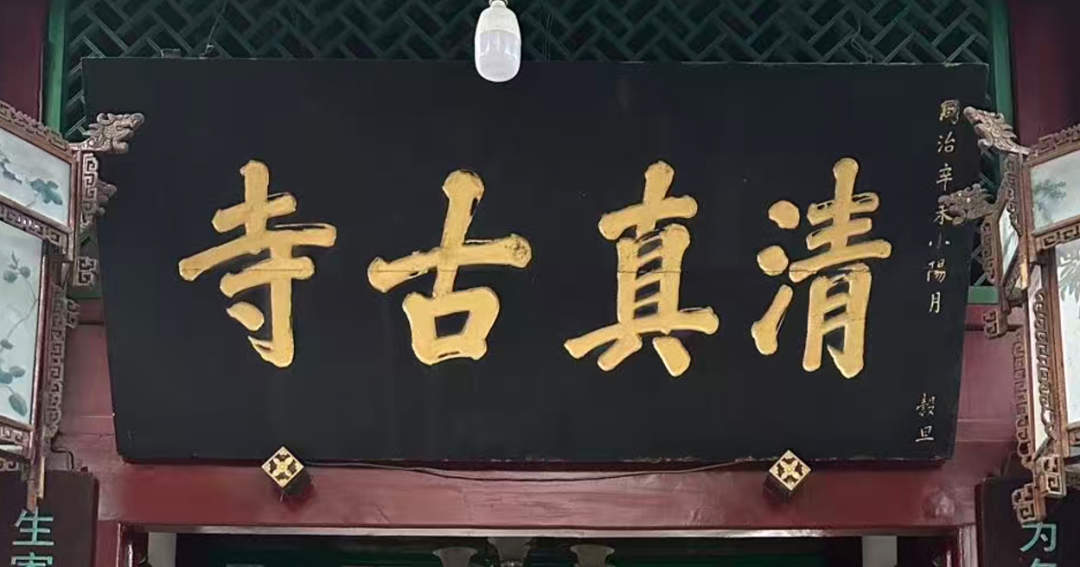
196. Qinggang Mosque, Meishan, Sichuan, "Ancient Faith of the Beginning (Kaitian Gujiao)"
An auspicious day in the first ten days of the eleventh lunar month of the Guihai year of the Jiaqing reign.
Respectfully presented by Ma X Yan, a soldier of the Left Garrison of the Chengdu City Guard stationed at the Renshou outpost, who received a two-rank promotion for military merit and a one-rank promotion for imperial favor, plus a two-rank promotion from the Emperor.
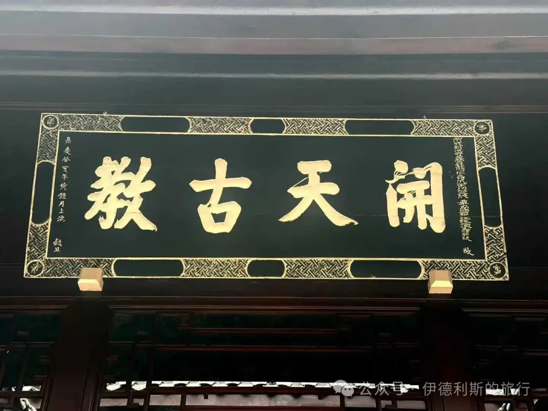
It is not very clear, so please feel free to correct me.
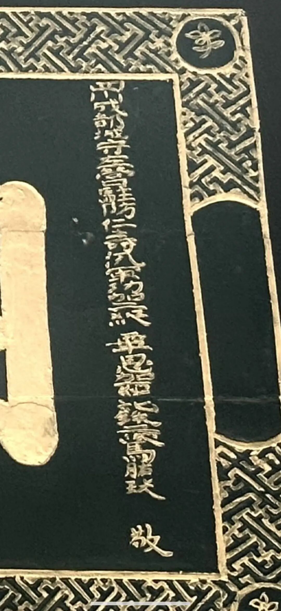
197. The "one and only" plaque at Qinggang Mosque in Meishan, Sichuan.
Respectfully presented by Ma Pengcheng, a battalion commander (qian zong) overseeing the Renshou garrison.
A lucky day in the second month of the 25th year of the Daoguang reign.
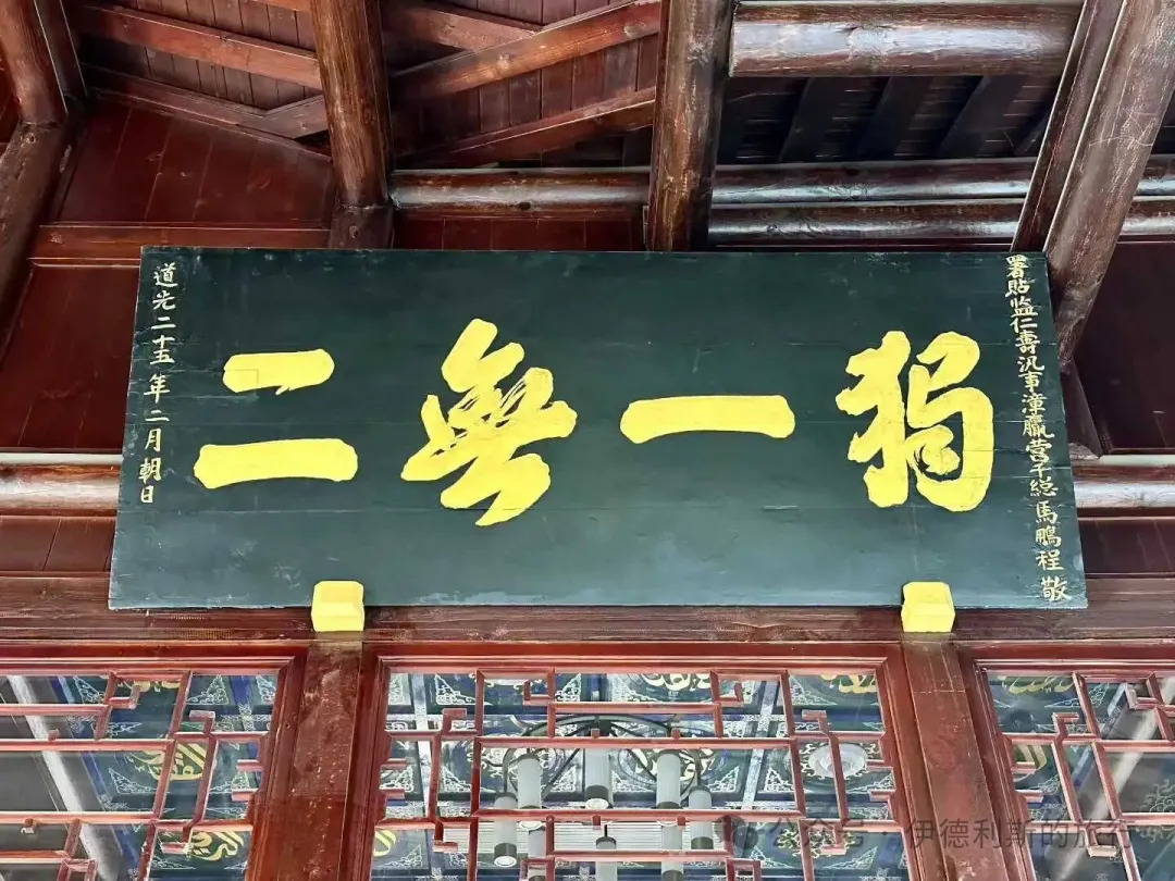
198. The "utmost silence and stillness" plaque at Qinggang Mosque in Meishan, Sichuan.
A lucky day in the fifth month of the eighth year of the Republic of China, respectfully presented.
In celebration of the mosque reconstruction.
Erected by nine members of the Cai family from the Kai generation.
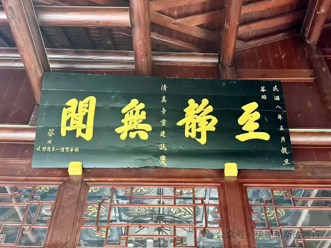
199. The "a world apart" plaque at Qinggang Mosque in Meishan, Sichuan.
Respectfully presented.
In celebration of the mosque reconstruction.
Congratulations from the Han people of Qingshi.
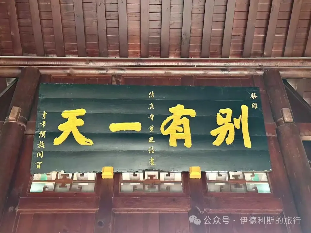
200. Qinggang Mosque (Qinggang Si) in Meishan, Sichuan.
Erected by the mosque leaders in the third month of the eighth year of the Republic of China (1919).
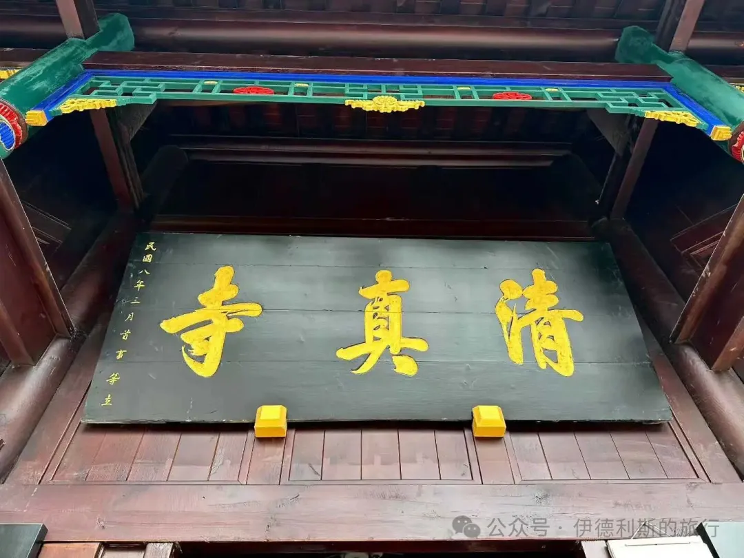
Appreciating mosque plaques and couplets (items 101-150).
Appreciating mosque plaques and couplets (items 51-100).
Appreciating mosque plaques and couplets (items 1-50).