
Halal Travel Guide: Khujand, Tajikistan — Night Walks, Food and Muslim Heritage
Reposted from the web
Summary: Khujand, Tajikistan — Night Walks, Food and Muslim Heritage is presented here as a firsthand travel account in clear English, beginning with this scene: Khujand was the final stop on my 2019 Spring Festival trip through Central Asia. Although I only stayed for one night, it left me with many unforgettable memories. The account keeps its focus on Khujand Travel, Tajikistan Travel, Muslim Heritage while preserving the names, places, food, and historical details from the Chinese source.
Khujand was the final stop on my 2019 Spring Festival trip through Central Asia. Although I only stayed for one night, it left me with many unforgettable memories.
Table of Contents
1. Heading to Khujand
2. A Tajik city in the Fergana Valley
3. The city of Cyrus and Alexander
4. Traditional Tajik hats
5. The Syr Darya River
6. Thursday Bazaar
7. Saint's tomb
8. Dinner
9. The uncle playing the accordion
10. Khujand night view
1. Heading to Khujand
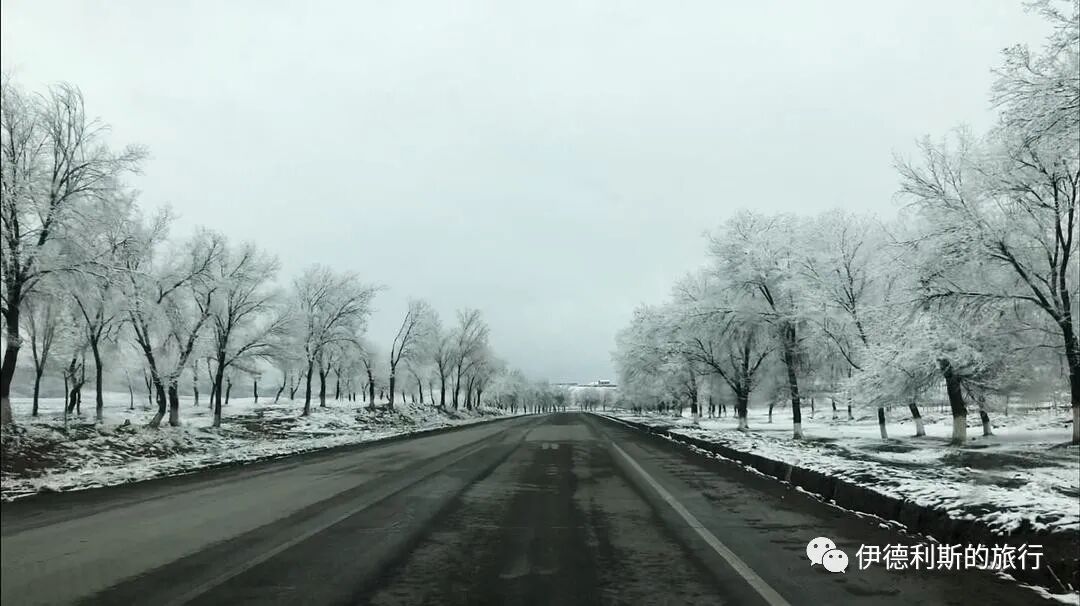
On the morning of February 14, 2019, I was in Penjikent, a border city in the far west of Tajikistan, waiting for a shared taxi to the capital, Dushanbe. However, because of a blizzard the night before, the mountain road to Dushanbe, which sits at an altitude of over 3,000 meters, remained closed. After waiting all morning, I was told there was no hope of the road to Dushanbe opening that day. I changed my plans and decided to head to Khujand, Tajikistan's second-largest city.
Around noon, our car left Penjikent heading east, driving through the Zeravshan River valley. The Zeravshan River, formerly known as the Sughd River, is called the mother river of the Sogdians. It flows through the most important Sogdian cities of Bukhara, Samarkand, and Penjikent, where countless stories of the Sogdian people have unfolded.
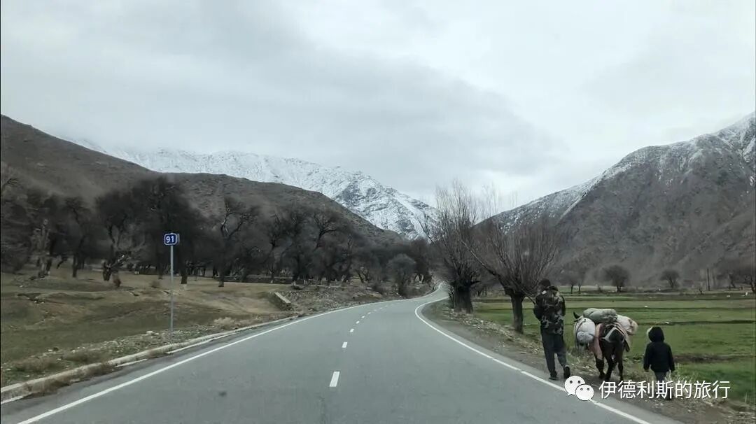
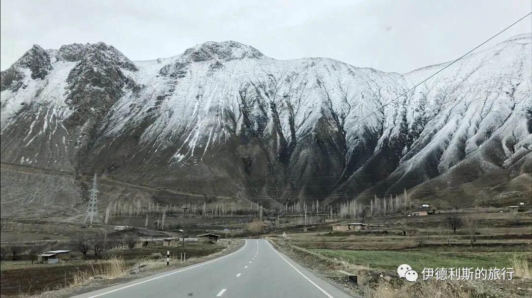
An hour later, we moved from the Zeravshan River valley into the upper Zeravshan River gorge, where all vegetation disappeared.
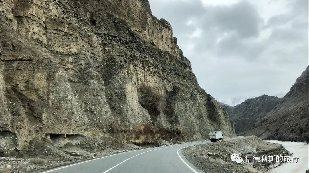
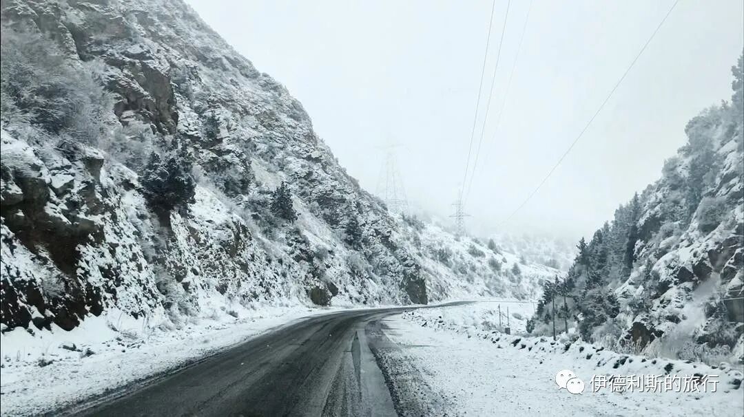
Then we drove north, entered Tajikistan's main north-south highway, and began crossing the Turkestan mountain range. The Turkestan range has an average altitude of over 3,000 meters, with its highest peak reaching over 5,000 meters. As the altitude rose sharply, the temperature dropped suddenly and visibility became very low.
We finally crossed the Turkestan range, headed north into the Fergana Valley, and arrived in Khujand after four hours.
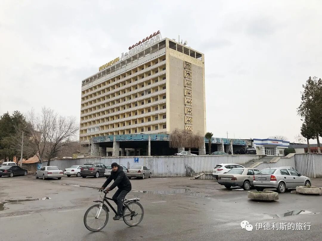
The driver dropped me off directly at the Khujand Grand Hotel I had booked on Booking.com. The receptionist was a young Russian woman. Her English wasn't very good, but we communicated using a mix of Russian and English words and eventually understood each other.
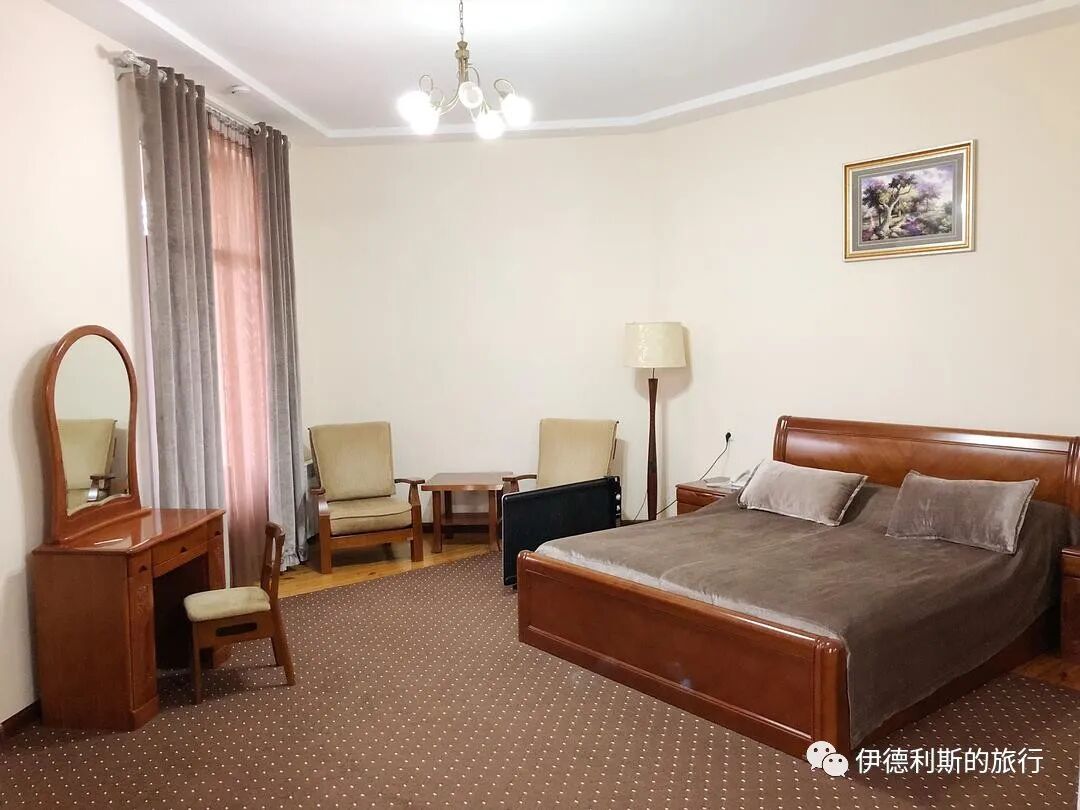
The suite I stayed in
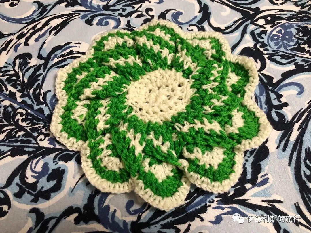
I bought a wool coaster before I left
2. A Tajik city in the Fergana Valley
Khujand is located at the entrance to the Fergana Valley and is the only large city in the valley with a Tajik majority. After the Soviet Union redrew the borders of Central Asia in 1924, Khujand was incorporated into the Uzbek Soviet Socialist Republic (Uzbek SSR).
When the establishment of a Tajik Autonomous Oblast within the Uzbek Republic was discussed in 1924, the issue of the Tajiks in the western Fergana Valley was already mentioned. But the prevailing view at the time was to include this land in the Uzbek Republic. This was because the Tajiks and Uzbeks here had deeply intertwined farmland and their economic ties were inseparable. the main point of contention at the time was the distinction between settled and nomadic peoples, so the conflict between the settled Uzbeks and Tajiks seemed insignificant. Although a Tajik subcommittee was set up within the territorial commission, it was actually very passive and simply agreed to the routes proposed by the Uzbek side.
However, after the Central Asian border demarcation ended, conflicts between the Uzbek and Tajik sides began to intensify. After 1926, the leaders and elites of the Tajik Autonomous Republic began to protest continuously, demanding to join the Soviet Union directly to ensure the normal development and cultural independence of the Tajik people. The Soviet Union agreed to this request. One reason was a concern about the dominant position of the Uzbek Republic in Central Asia, and another was the desire to use a "Tajik nation-state" to influence the Afghan civil war and attract the Tajiks of Afghanistan.
In 1929, the Tajik and Uzbek territorial demarcation commission began its work. The leaders of the Uzbek Republic quickly agreed to transfer the Khujand region, which was dominated by Tajiks in western Fergana, to the Tajik Republic, in order to gain the upper hand in the cities of Samarkand and Bukhara, which had large Tajik populations.
With Khujand incorporated into the Tajik Republic, the current territorial layout of Tajikistan was officially formed. This is why there is a protrusion on the north side of Tajikistan.
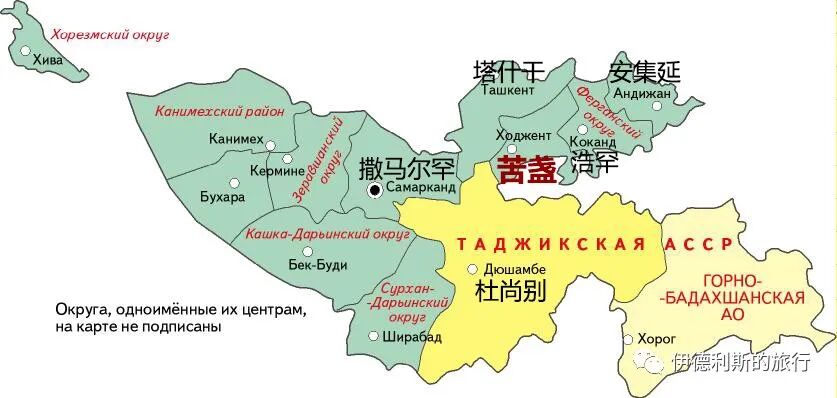
In 1927, blue represented the Uzbek SSR, and yellow represented the subordinate Tajik ASSR.
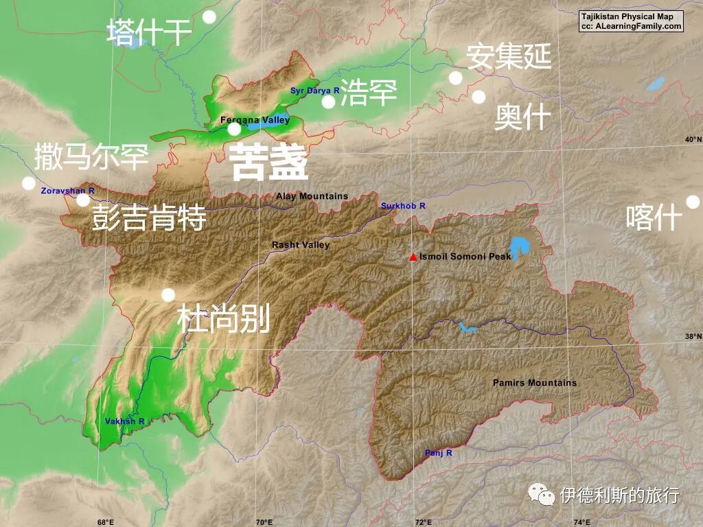
On today's map of Tajikistan, Khujand sits in a northern protrusion that reaches into the Fergana Valley.
3. The city of Cyrus and Alexander
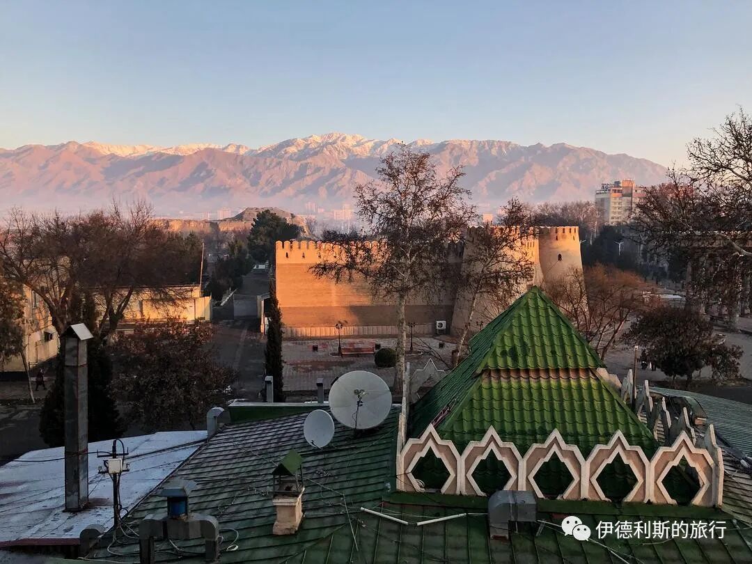
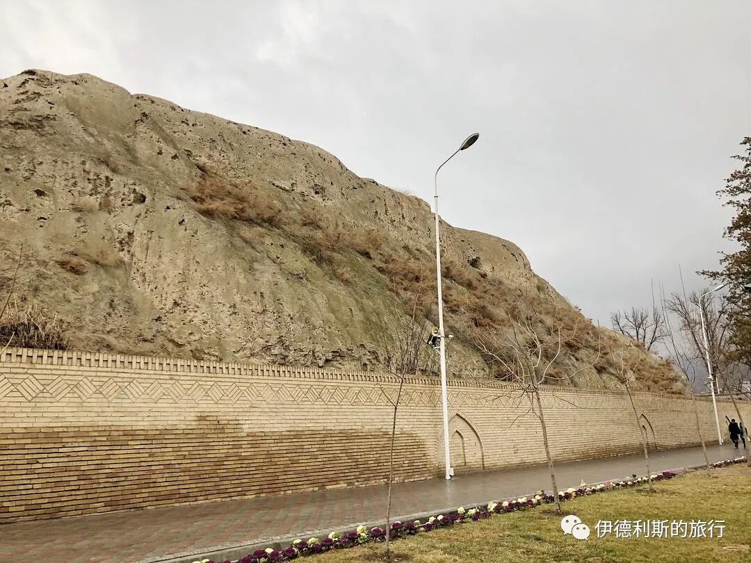
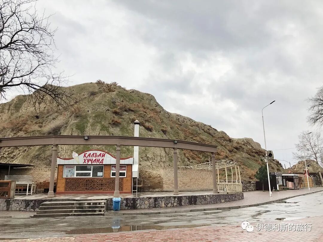
From my hotel room window, I could see the most important historical site in Khujand: the Khujand Fortress.
Between 545 and 539 BC, the Persian Emperor Cyrus the Great led an eastern campaign into Central Asia and established the province of Sogdia in the Transoxiana region. To counter the Saka people on the north bank of the Syr Darya River, Cyrus the Great built seven cities on the south bank in 544 BC. The largest was called Cyropolis, which became one of the earliest and most famous cities of the Sogdians.
In 329 BC, the army of Alexander the Great entered the Transoxiana region. According to the Anabasis of Alexander, the Sogdians resisted the Greek army fiercely, and Alexander himself even suffered a broken leg from an arrow during the fighting. After reaching the south bank of the Syr Darya, Alexander used siege ladders and stone-throwing machines to capture five cities in a row before finally arriving at Cyropolis. The Greek army entered the city through a water channel beneath the walls, and about 8,000 residents were killed. Most of them were Sogdians defending the city.
After taking Cyropolis, Alexander built the furthest Greek city on its foundation, naming it Alexandria Eschate, and moved many Greeks there.
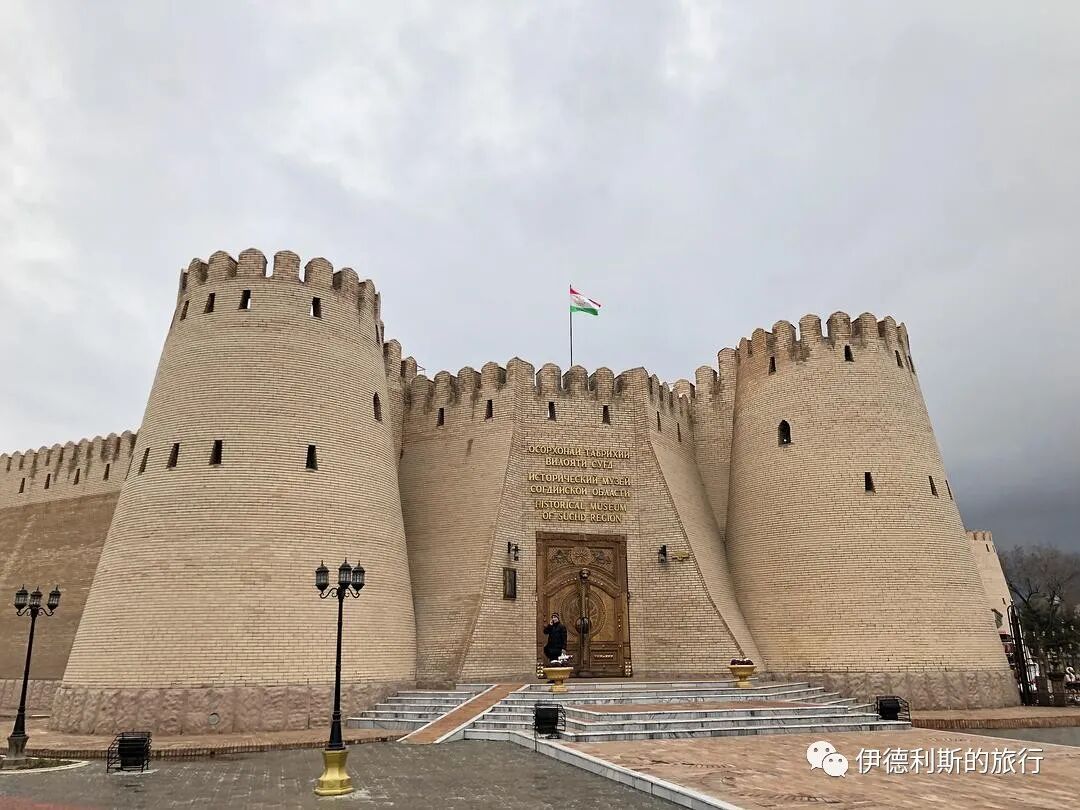
There is still no definitive evidence for the exact locations of Cyropolis and Alexandria Eschate, but the Khujand Fortress is the most likely site. Although the earliest visible walls of the Khujand Fortress date back no further than the 10th century AD, archaeological excavations show layers from the Hellenistic and ancient Persian periods beneath the walls, along with many unearthed Hellenistic coins and pottery.
The Khujand Fortress has been rebuilt many times in history, with the current main structure dating to the 10th century AD. Between 1219 and 1220, the city of Khujand was besieged by Genghis Khan's Mongol army, which severely damaged the fortress. It was rebuilt again in the 15th century.
In 1999, a section of the eastern wall, which dated back to the 8th or 10th century, underwent a historically inaccurate restoration and was converted into the Sughd Museum and the Museum of Archaeology and Fortification. I was very disappointed that I couldn't visit the museum because it was already closed when I arrived in Khujand.
From May 17 to 24, 1866, Russia captured the Khujand Fortress. Mikhail Afrikanovich Terentʹev, a Russian officer, orientalist, linguist, and writer who was present, took photos of the fortress that were later included in the Turkestan Album.
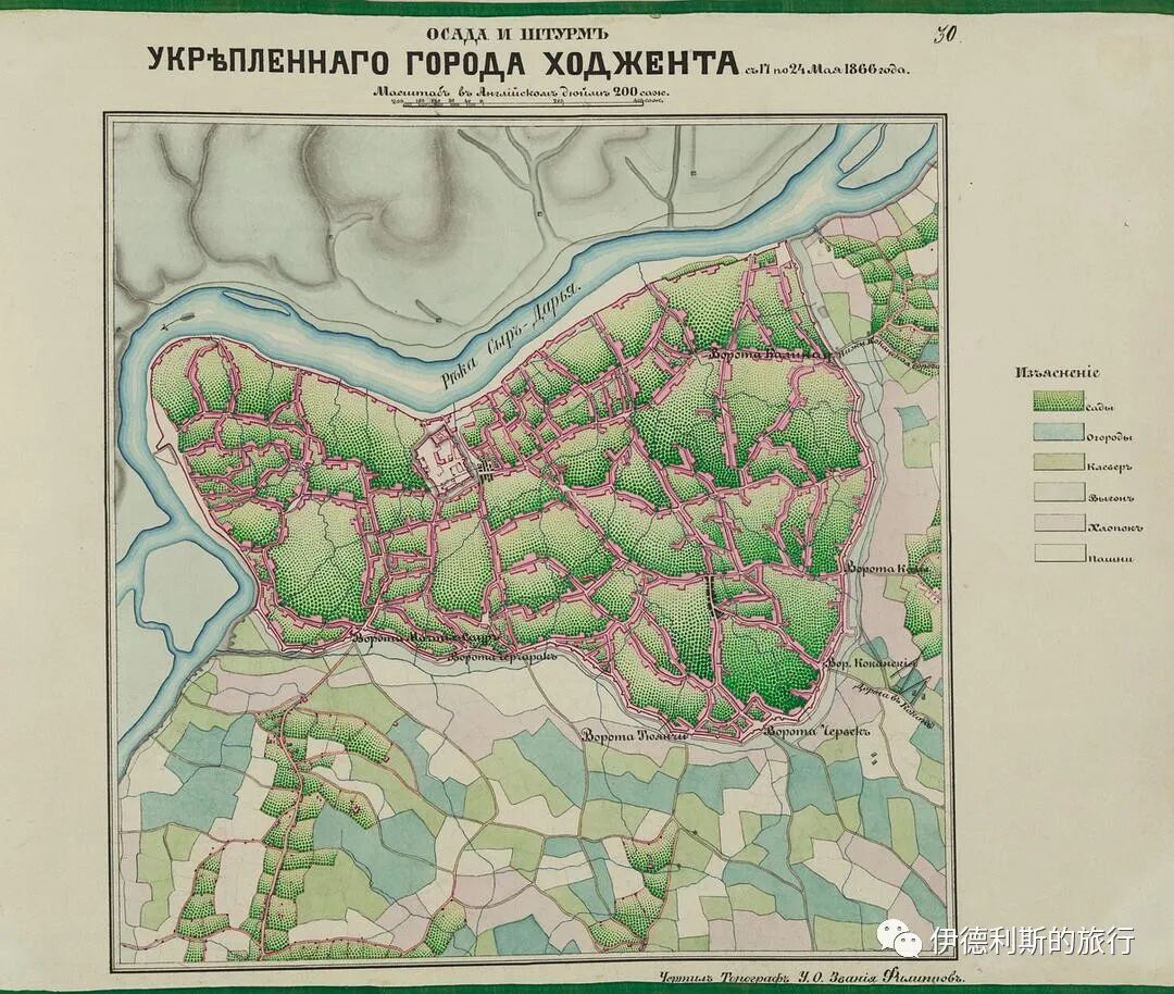
This image is a battle map used during the Russian siege of Khujand in May 1866. The map shows the central Khujand Fortress and the outer city walls.
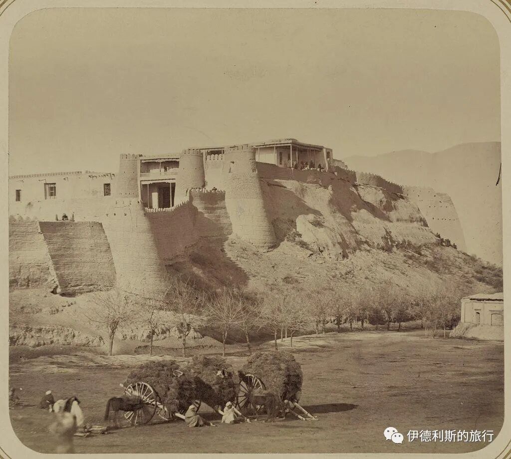
Khujand Fortress.
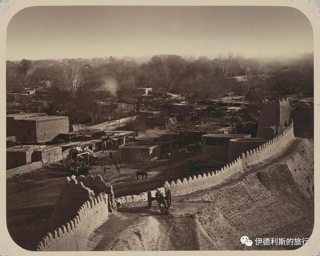
Looking at the market from the city walls.
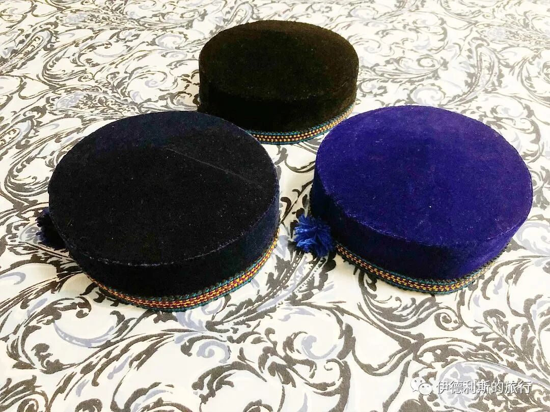
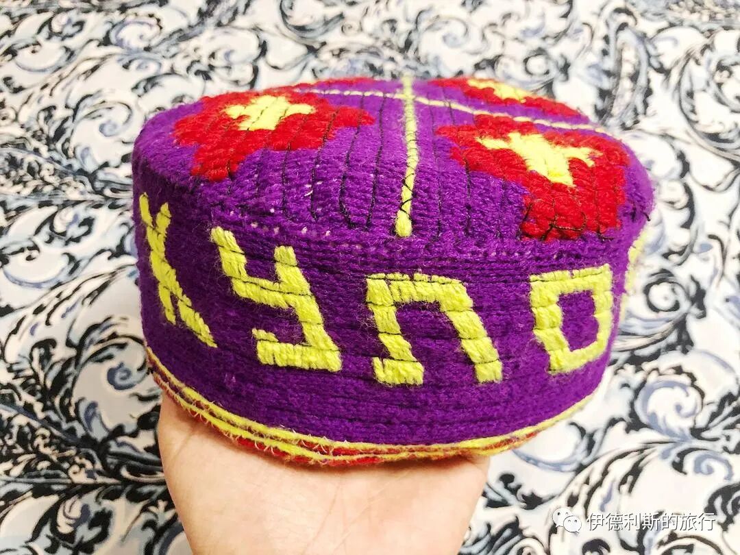
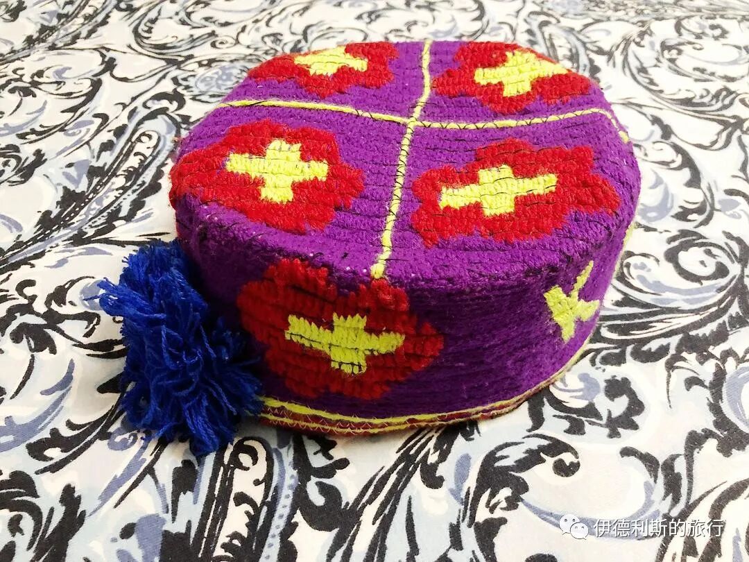
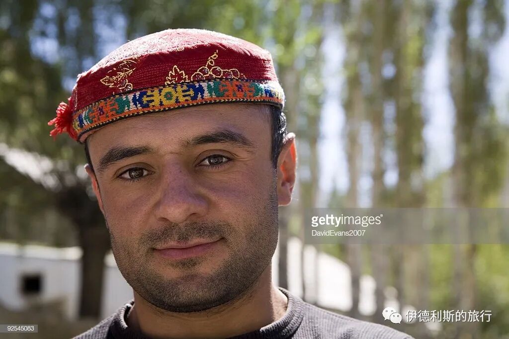
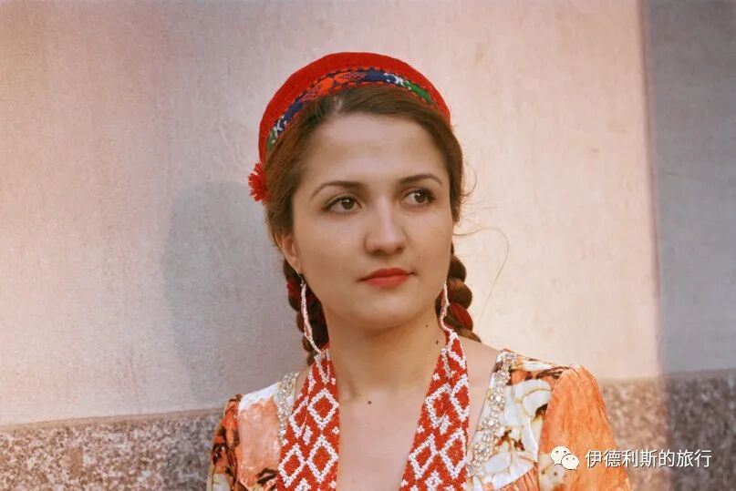
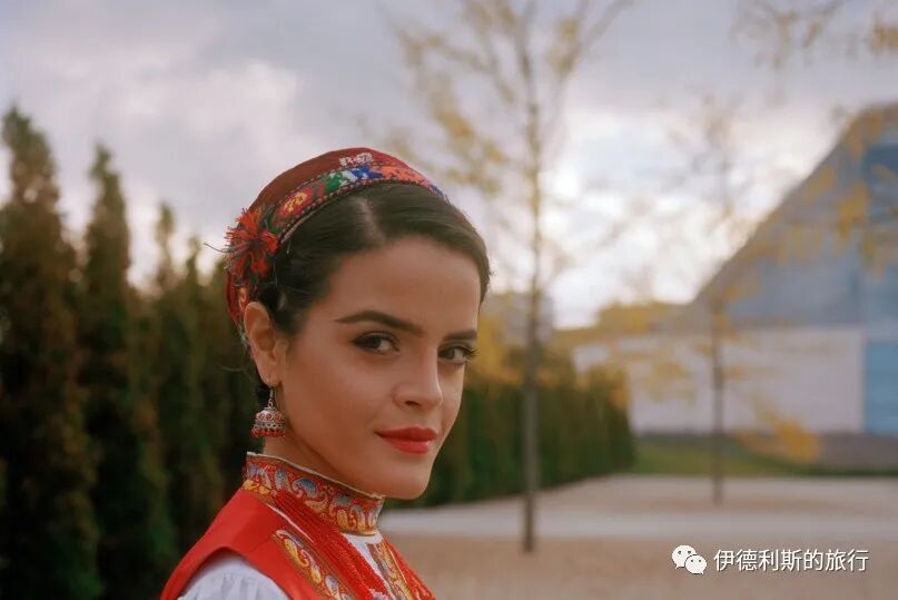
4. Traditional Tajik hats
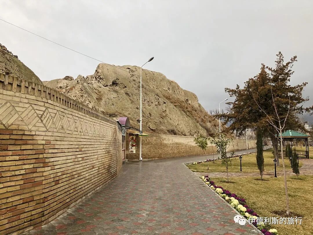
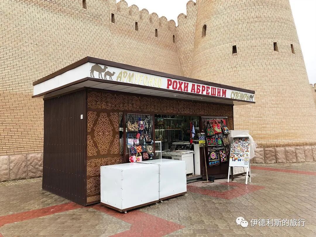
The east side of the Khujand Fortress has been turned into a small park. At a shop near the wall, I bought a few hats worn by people from the Badakhshan region of Tajikistan and the Kulob area on the edge of the Pamirs. The style of these hats is clearly different from the skullcaps (dopa) worn by lowland Tajiks; they have wool trim on the edges and decorative borders.
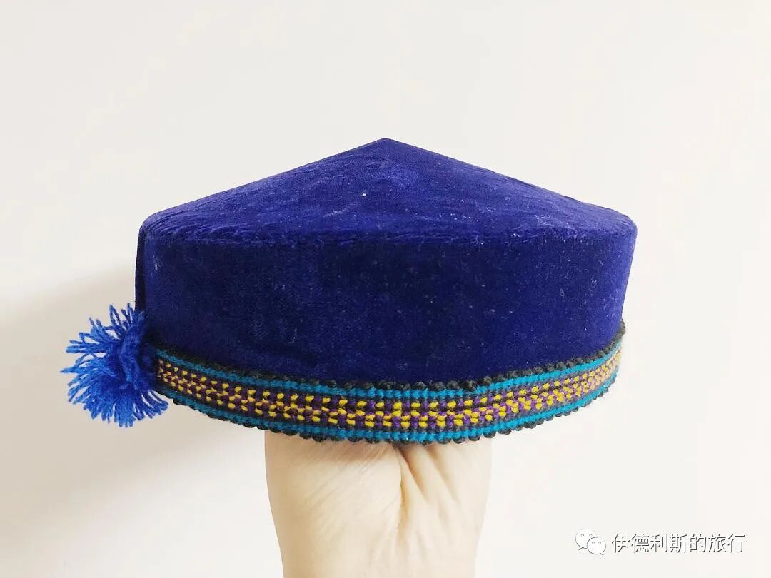
Below is a hat worn by the Pamiri people of Tajikistan that I found online; you can see it also has pom-poms on the side.
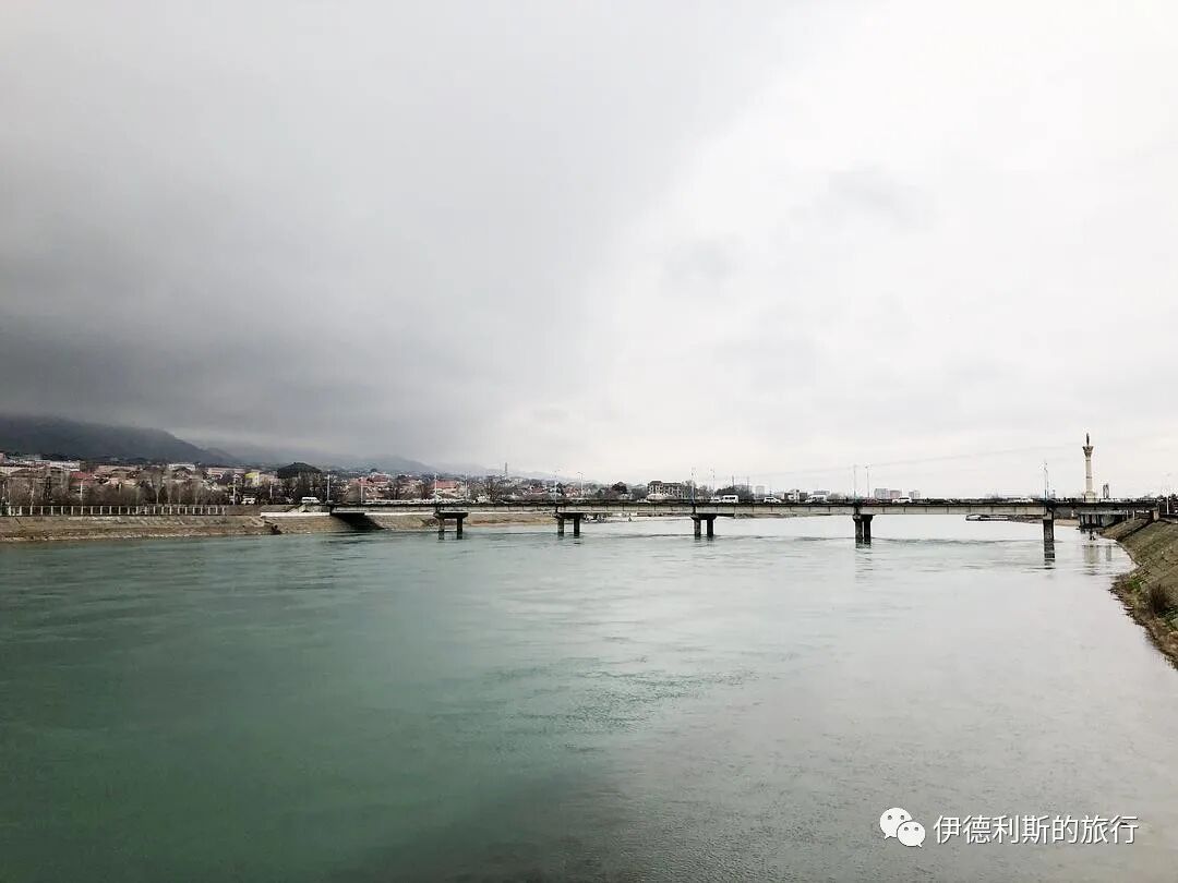
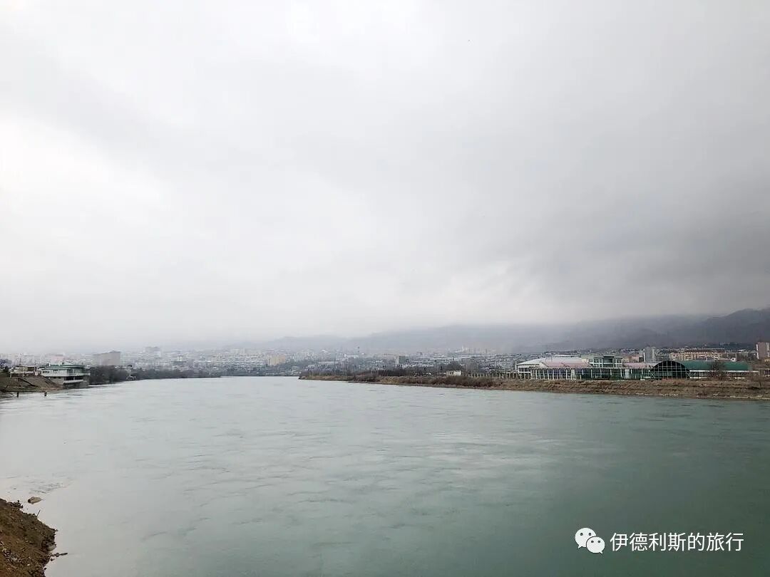
5. The Syr Darya River
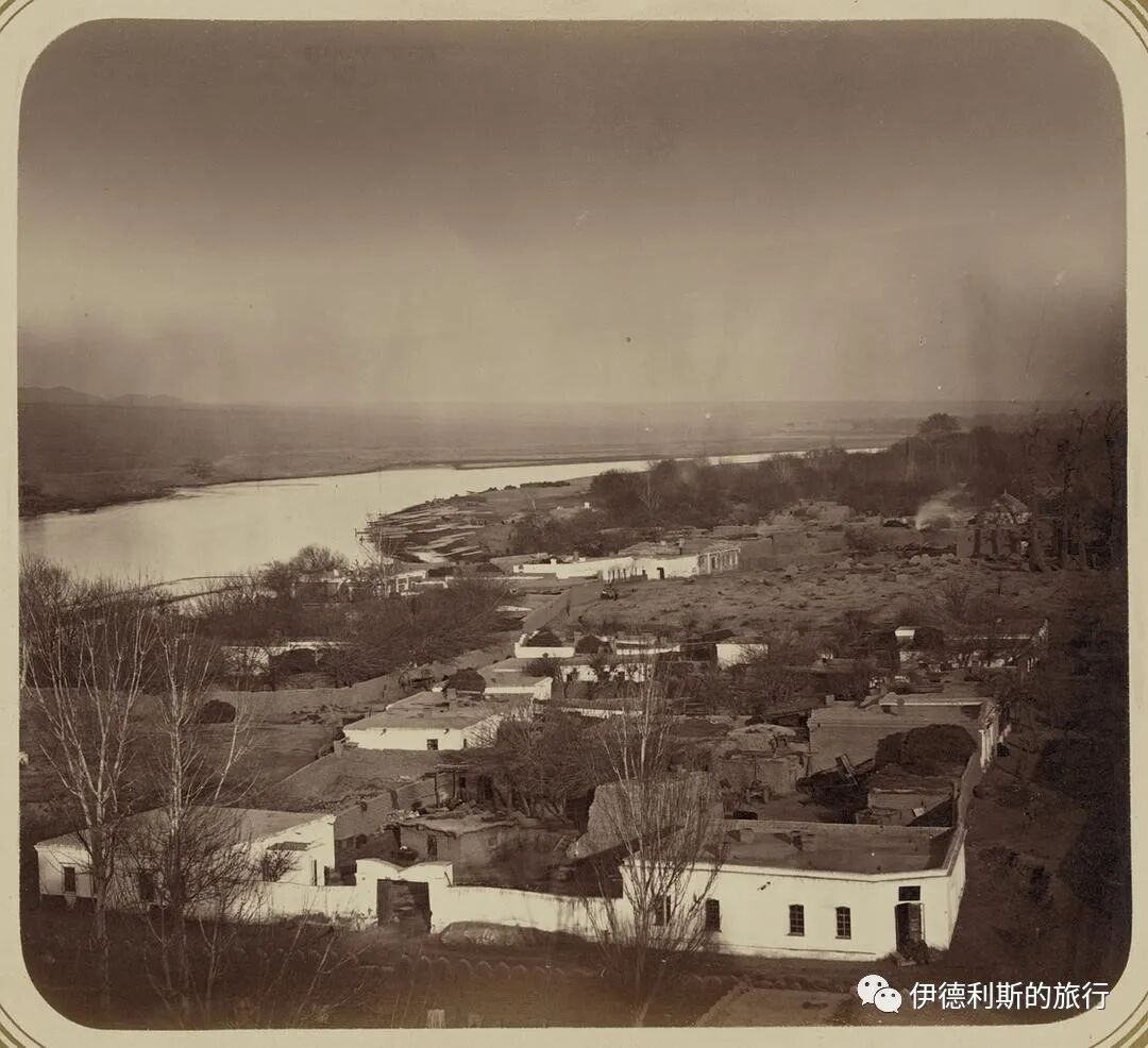
Not far to the north of the Khujand Fortress is the Syr Darya River. The Syr Darya originates in the Tianshan Mountains, flows west into the Fergana Valley, and exits the valley after passing through Khujand.
The Syr Darya River near Khujand, photographed for the Turkestan Album, which was edited by Russian orientalist Aleksandr L. Kun between 1865 and 1872.
Sculptures by the river.
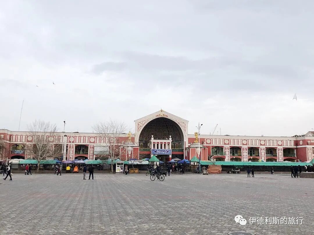
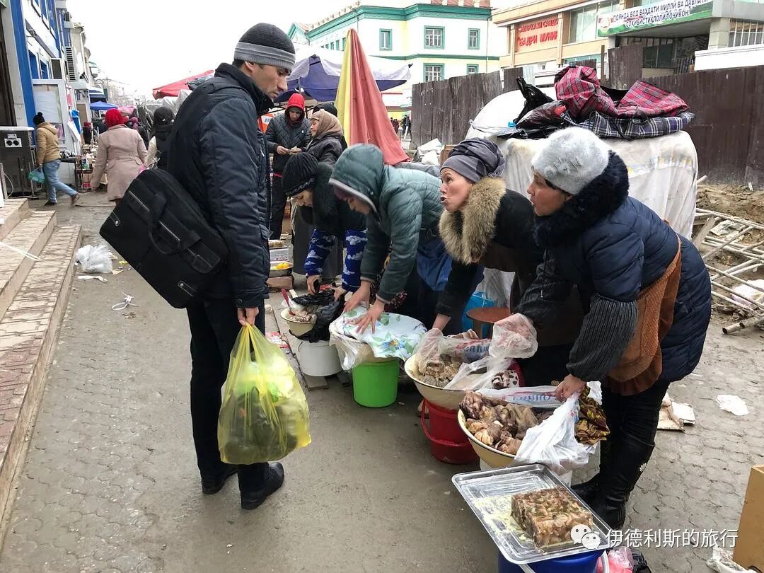
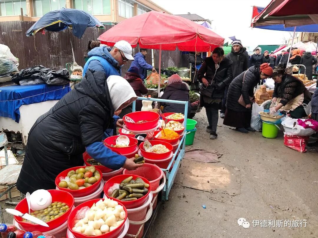
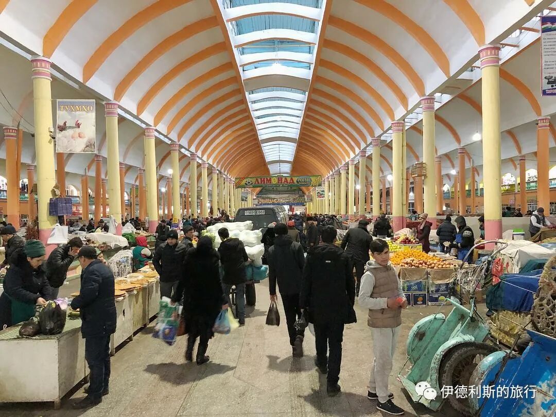
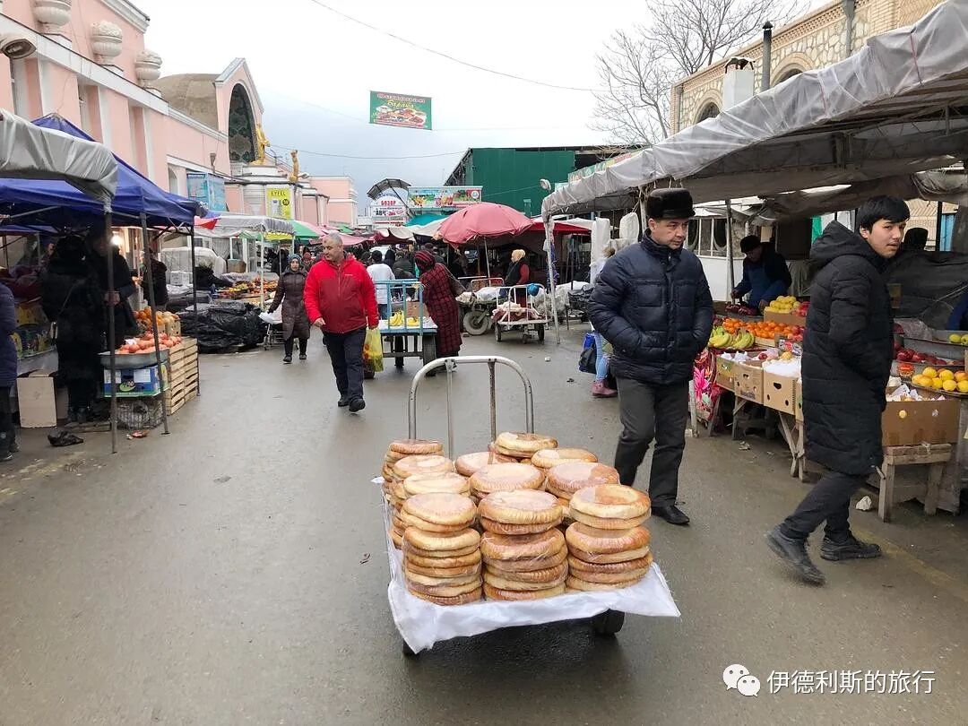
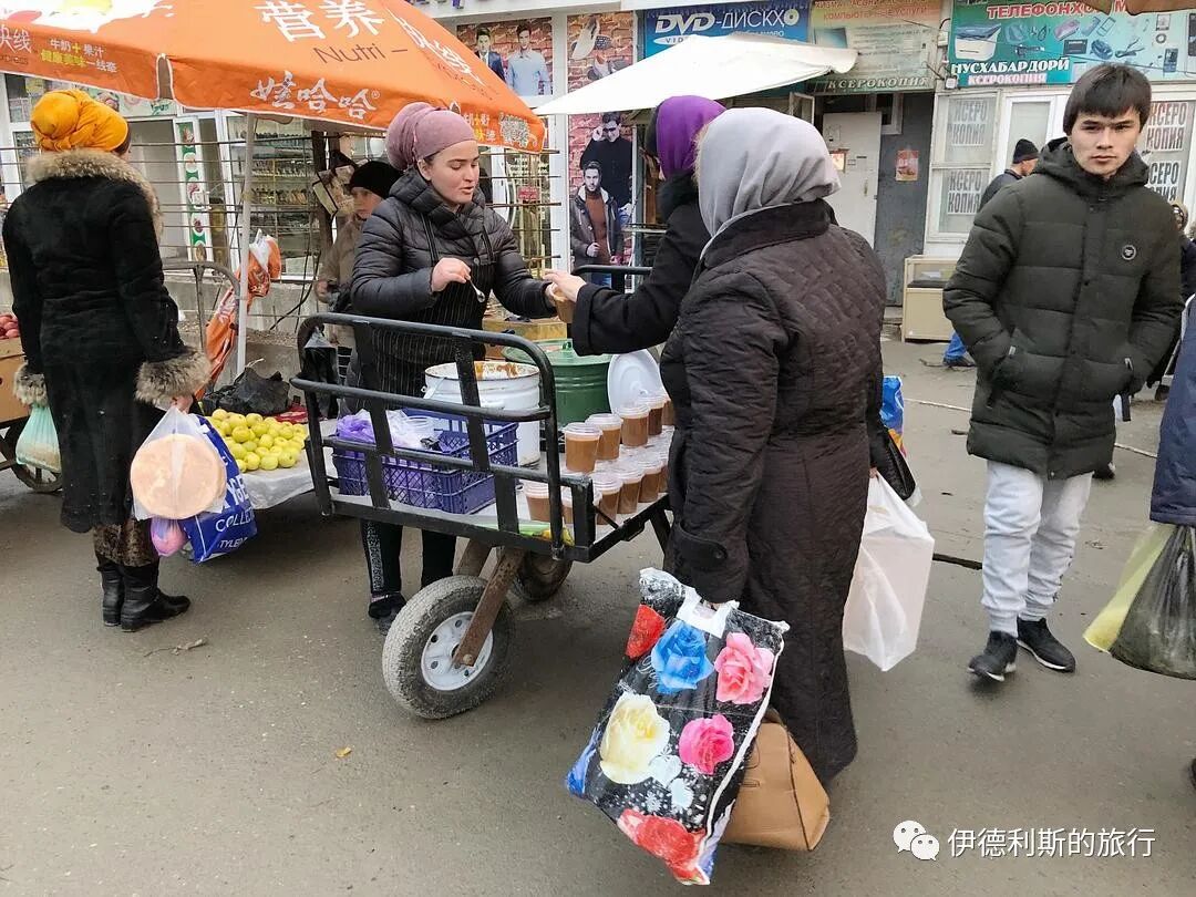
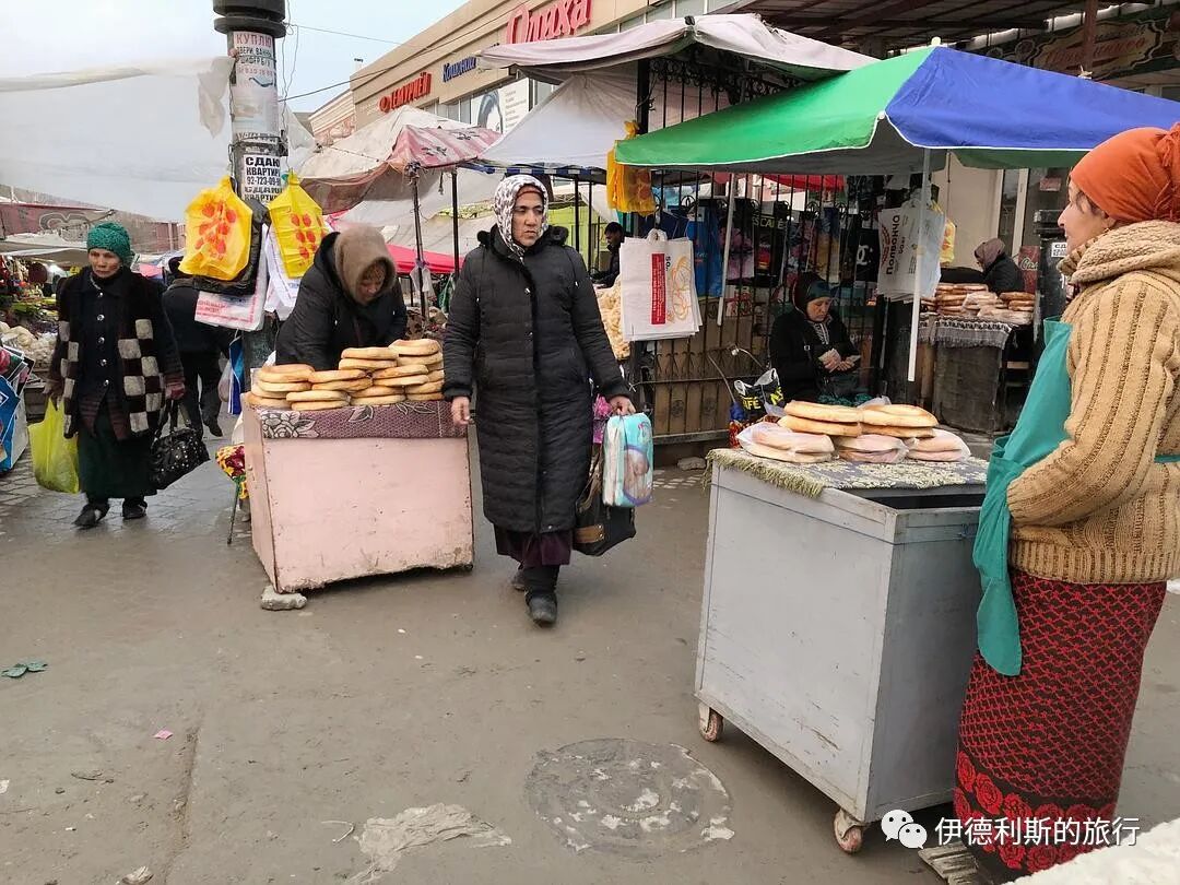
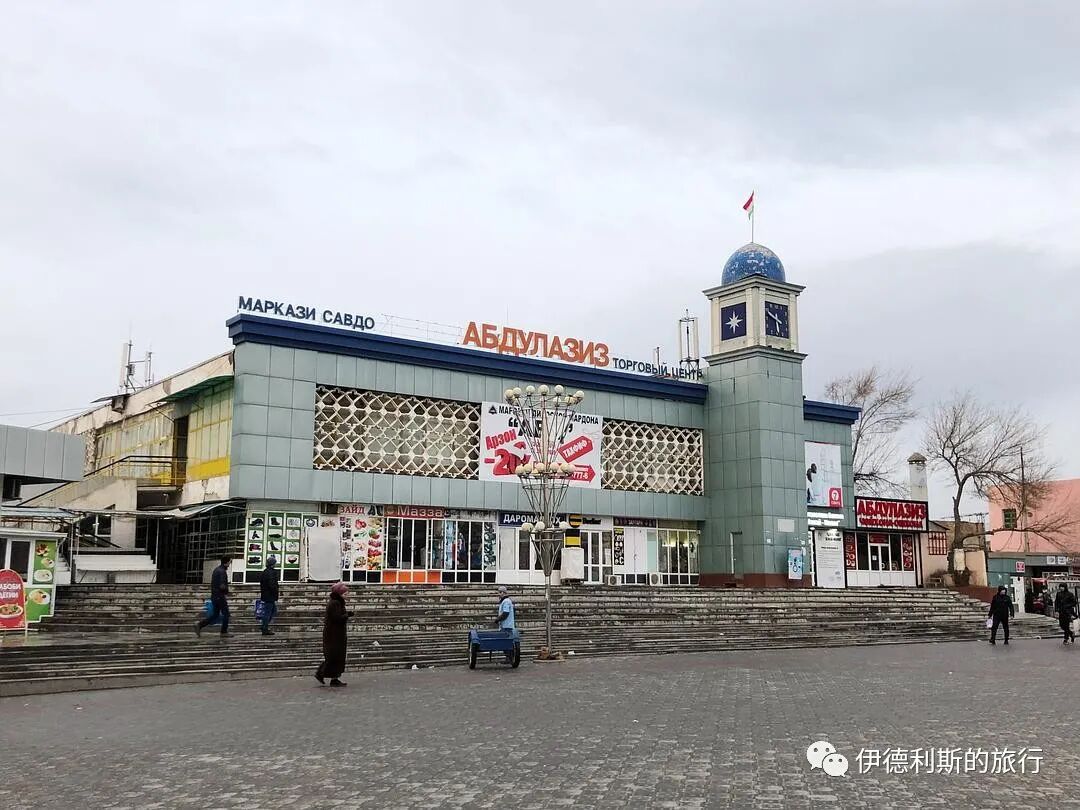
6. Thursday Bazaar
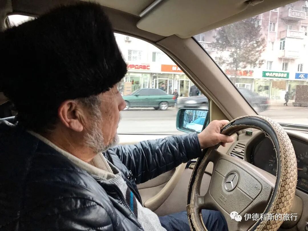
Then I caught a ride with an older man to the Panjshanbe Bazaar. Even though we didn't speak the same language, we chatted the whole way. Using hand gestures, I understood that the Panjshanbe Bazaar has two main entrances, which one is closest to the main road, and the best way to walk through it.
The Panjshanbe Bazaar is actually open every day, but it is busiest on Thursdays. It is known as the largest bazaar in the Fergana Valley. The main hall was built in 1964 and is one of the most important Soviet buildings in Khujand.
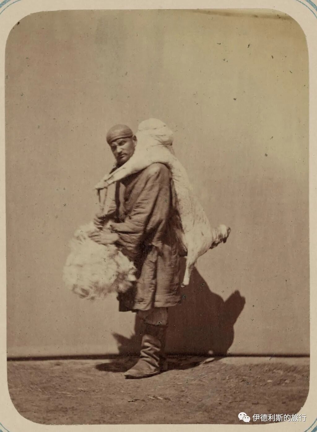
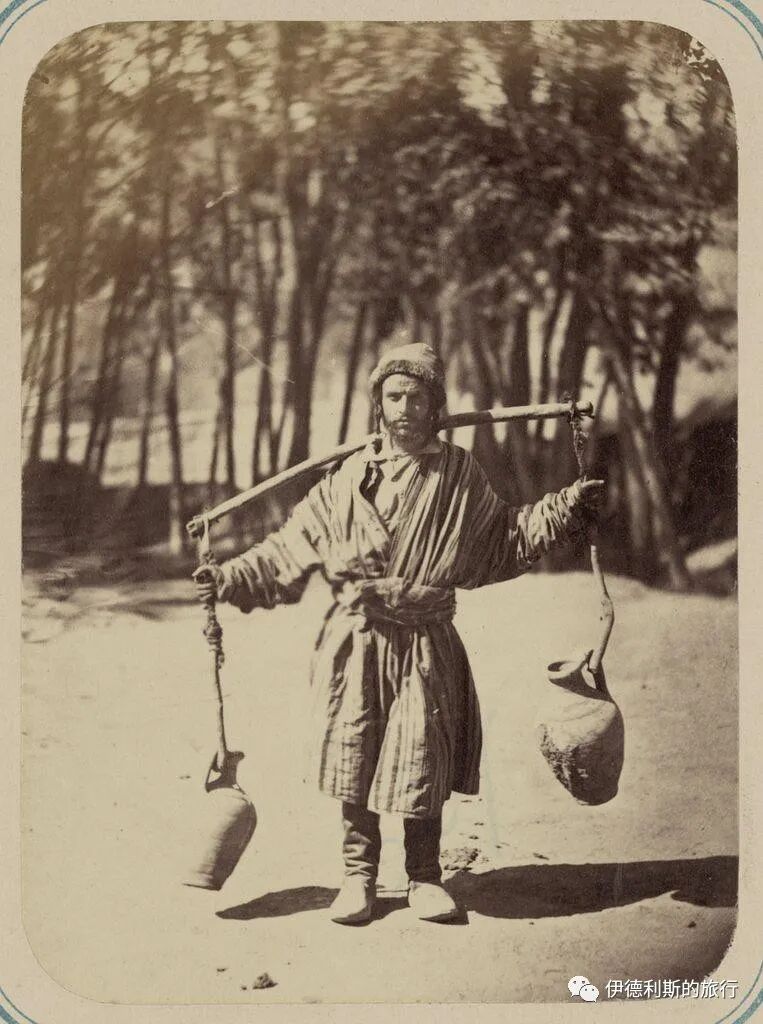
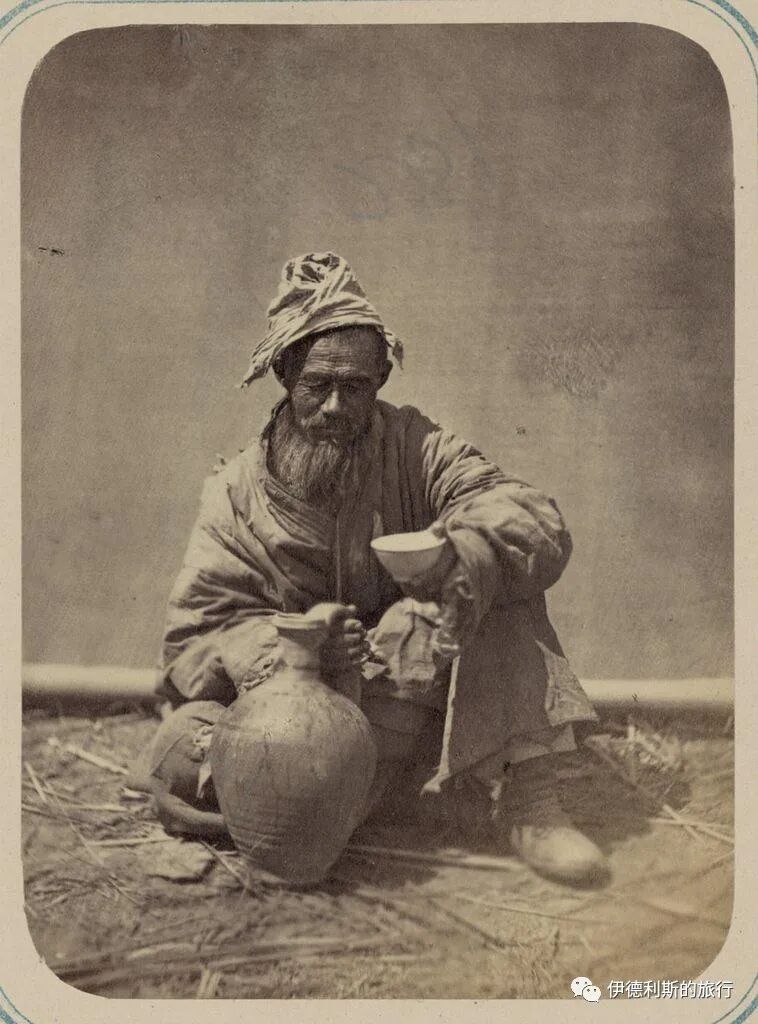
People of Khujand in the 1860s and 1870s, from the Turkestan Album.
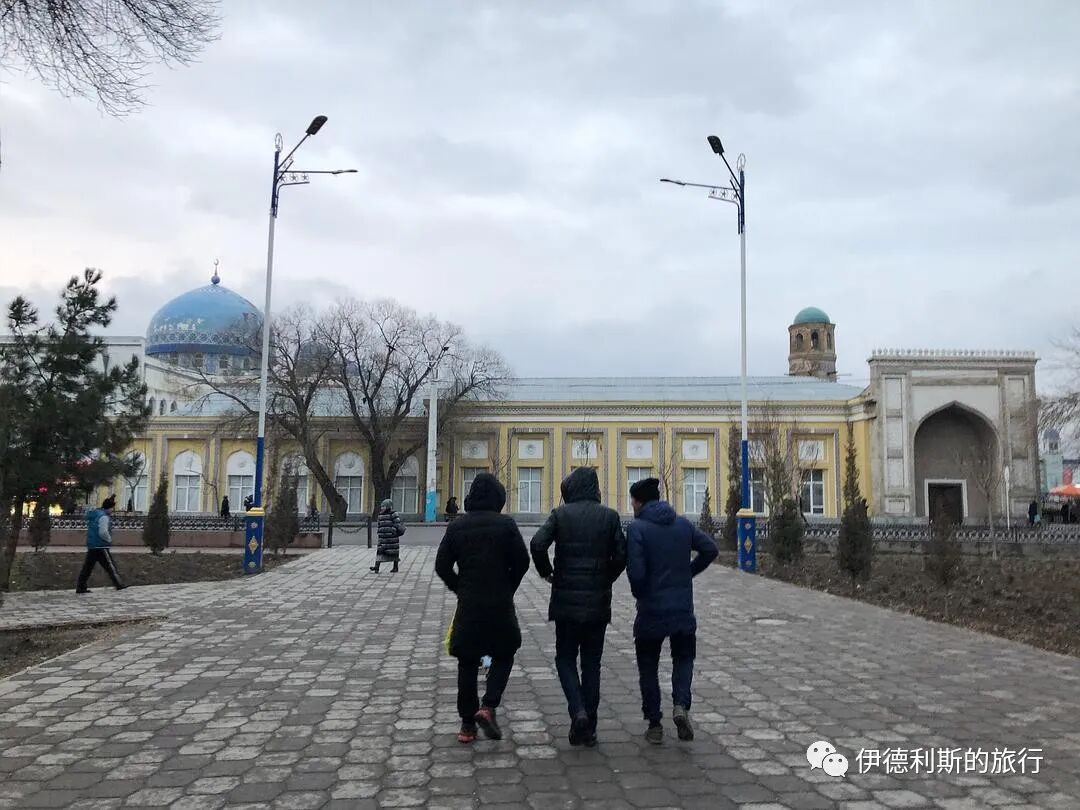
7. Saint's tomb
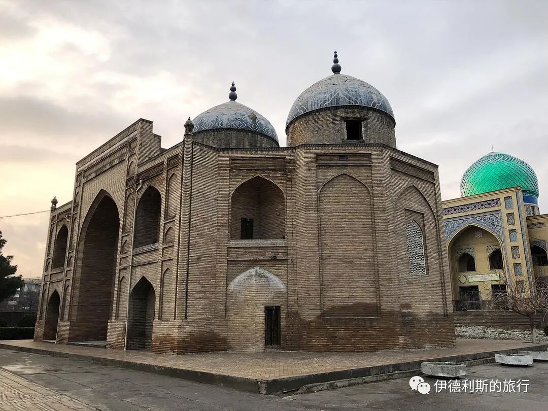
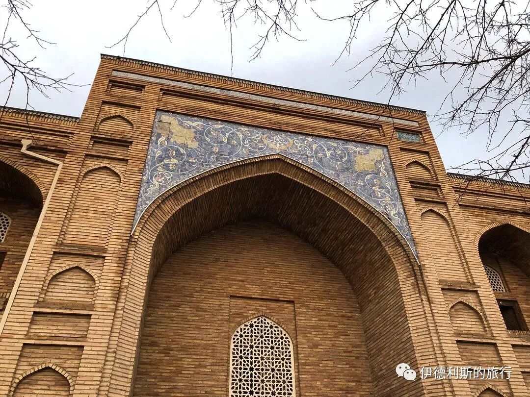
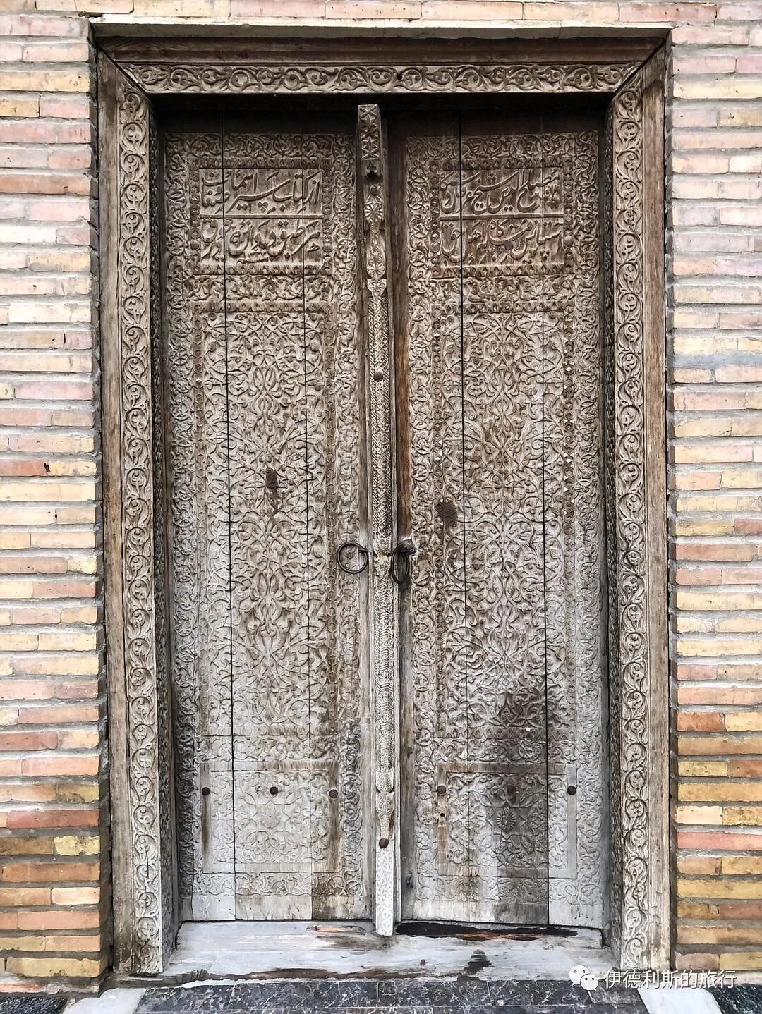
Sheikh Muslihiddin (1133–1223) was a poet and ruler of Khujand. His tomb was originally outside the suburbs of Khujand, but later those who revered him moved it to its current location. The original tomb was quite small and was later destroyed by the Mongols. People rebuilt the tomb after the 14th century, rebuilt it again into its current form in the 16th century, and built the current minaret in 1865. During the Soviet era, this place served as a regional history museum, and it only returned to its religious function after the museum moved out in the 1990s.
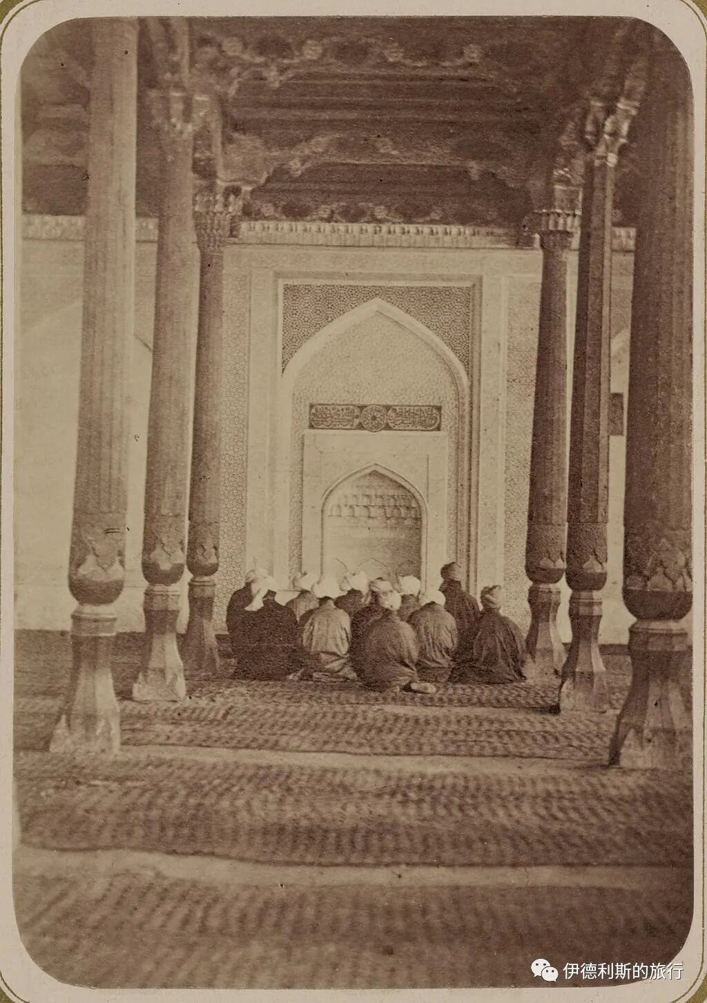
The tomb mosque in the 1860s-70s from the Turkestan Album.
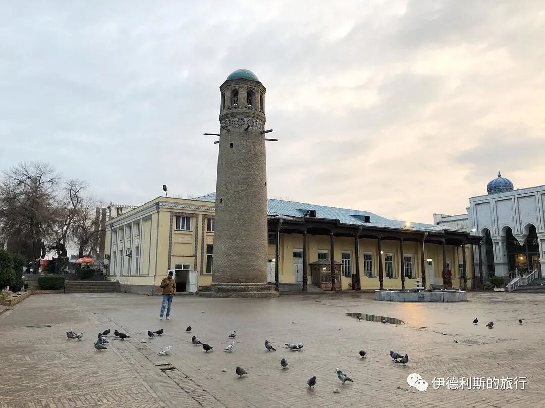
A 19th-century minaret.
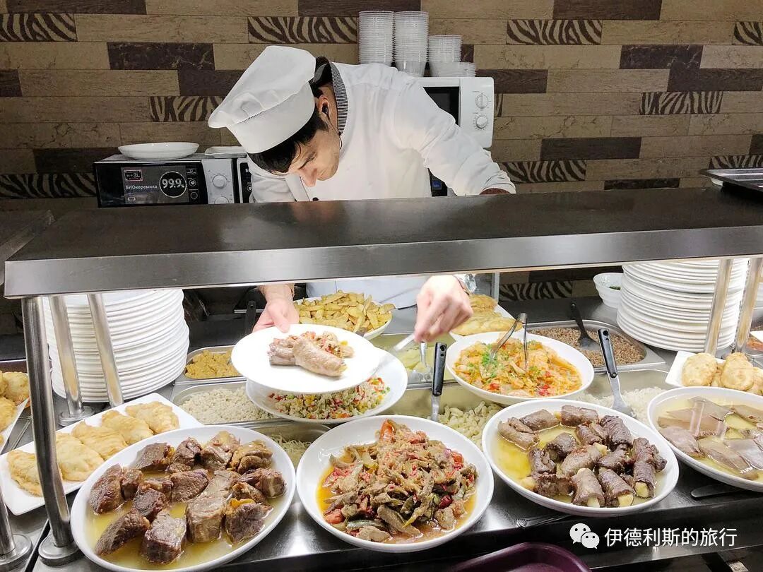
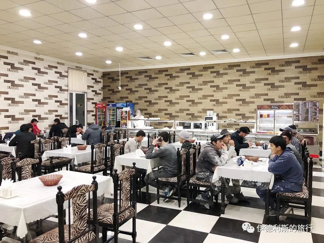
8. Dinner
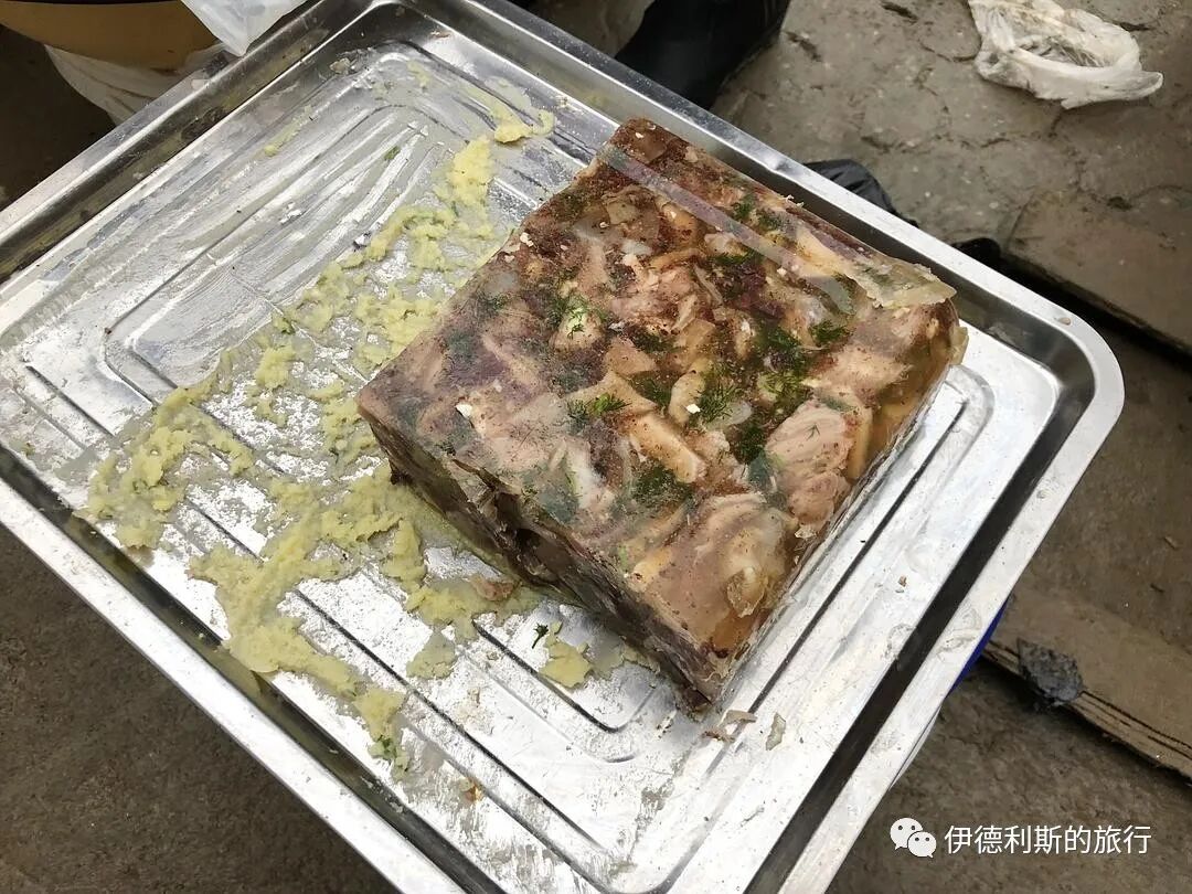
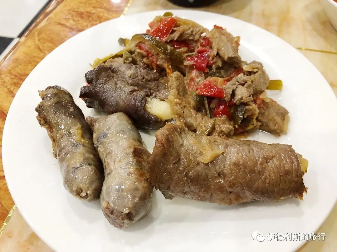
It was almost dark after I finished walking around the Thursday Bazaar, so I strolled toward my accommodation while looking for a restaurant. As I walked, I suddenly smelled grilled meat. A young man at the door called out to me, so I went into this barbecue restaurant. Besides the grilled meat, the restaurant had various self-service options. I ordered horse sausage (machangzi), beef wrapped with potatoes, flatbread (nang), and rice soup (mastava). The meat skewers they served were really huge, and I couldn't finish them in the end. The young waiters inside were all very kind, always smiling and asking how my meal was. One of the young men spoke fluent English, and I had a great time chatting with him.
Grilled meat (kaorou).
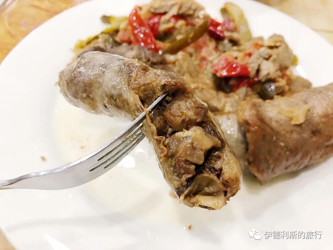
Horse sausage (machangzi).
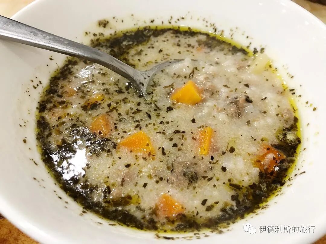
Rice soup (mitang).
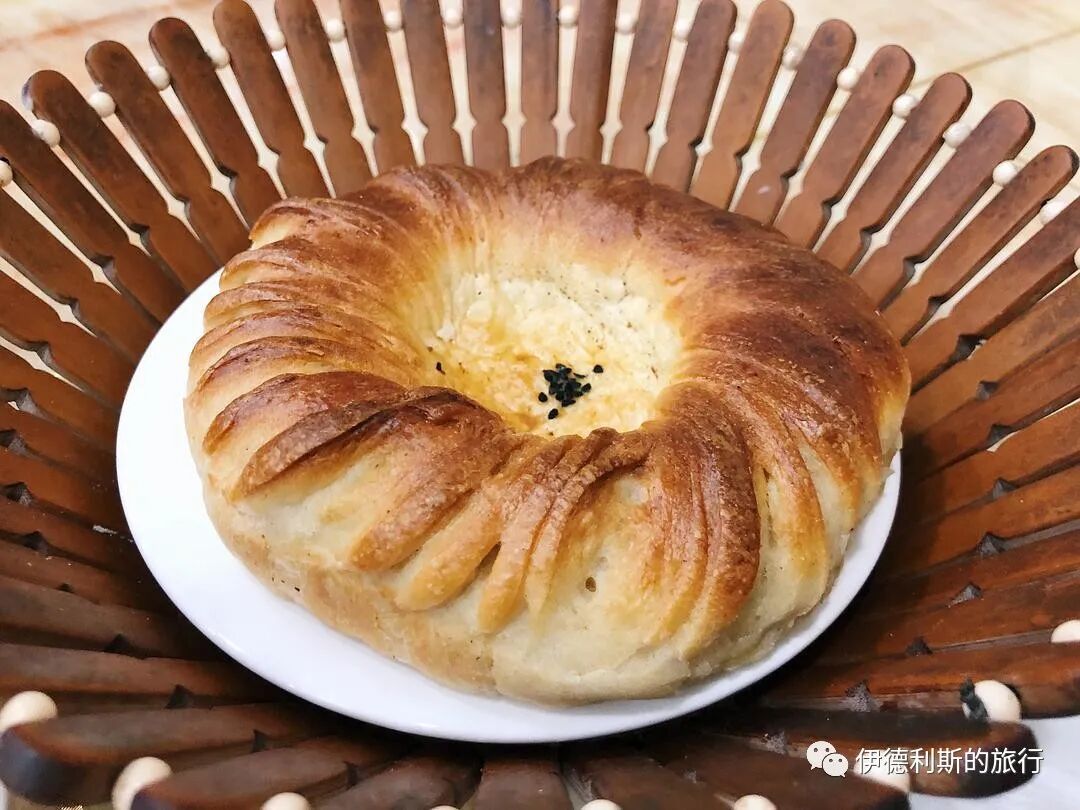
Flatbread (nang).
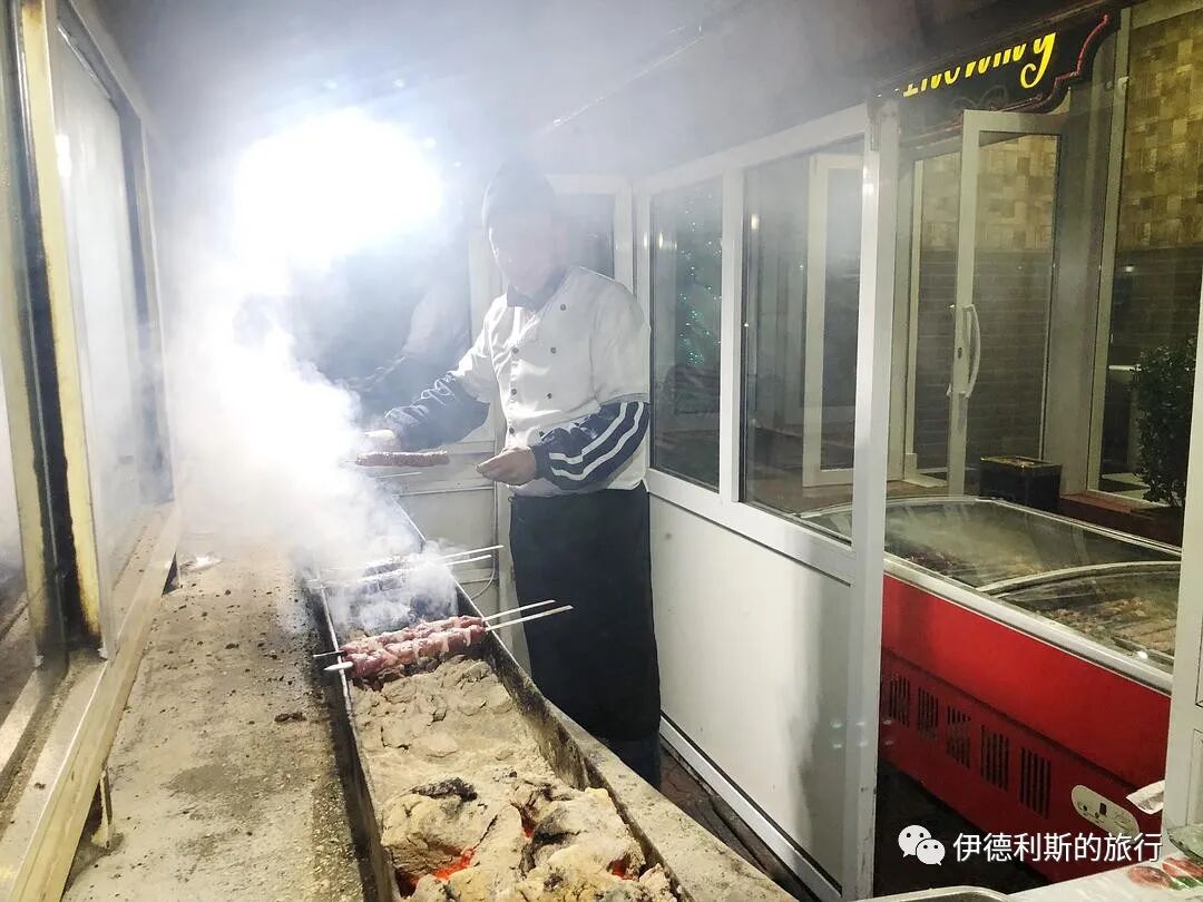
The barbecue uncle.
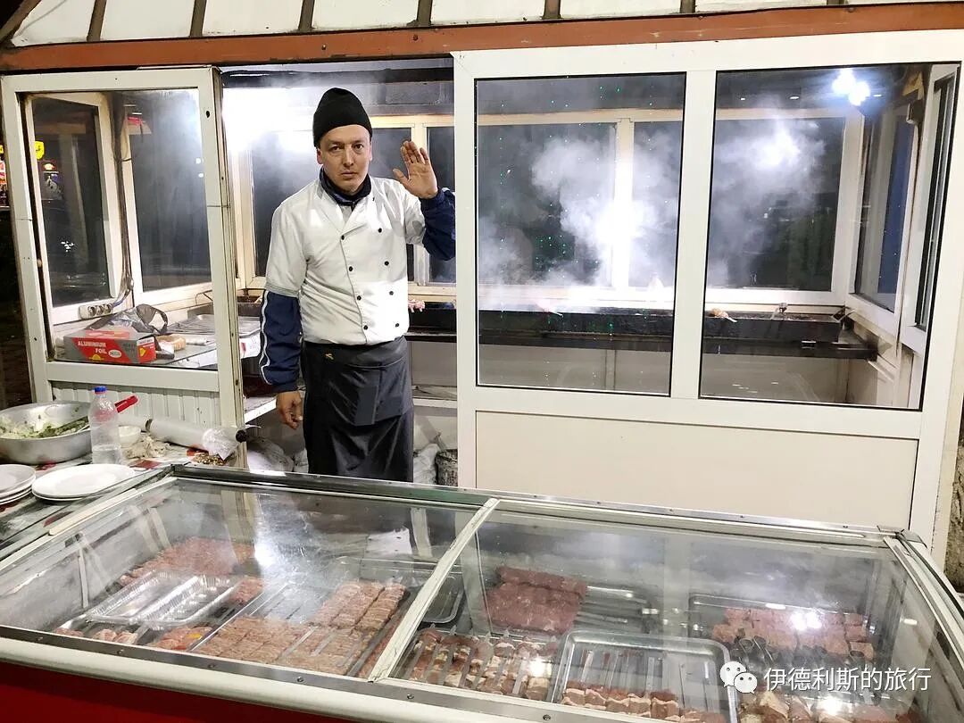
The barbecue uncle.
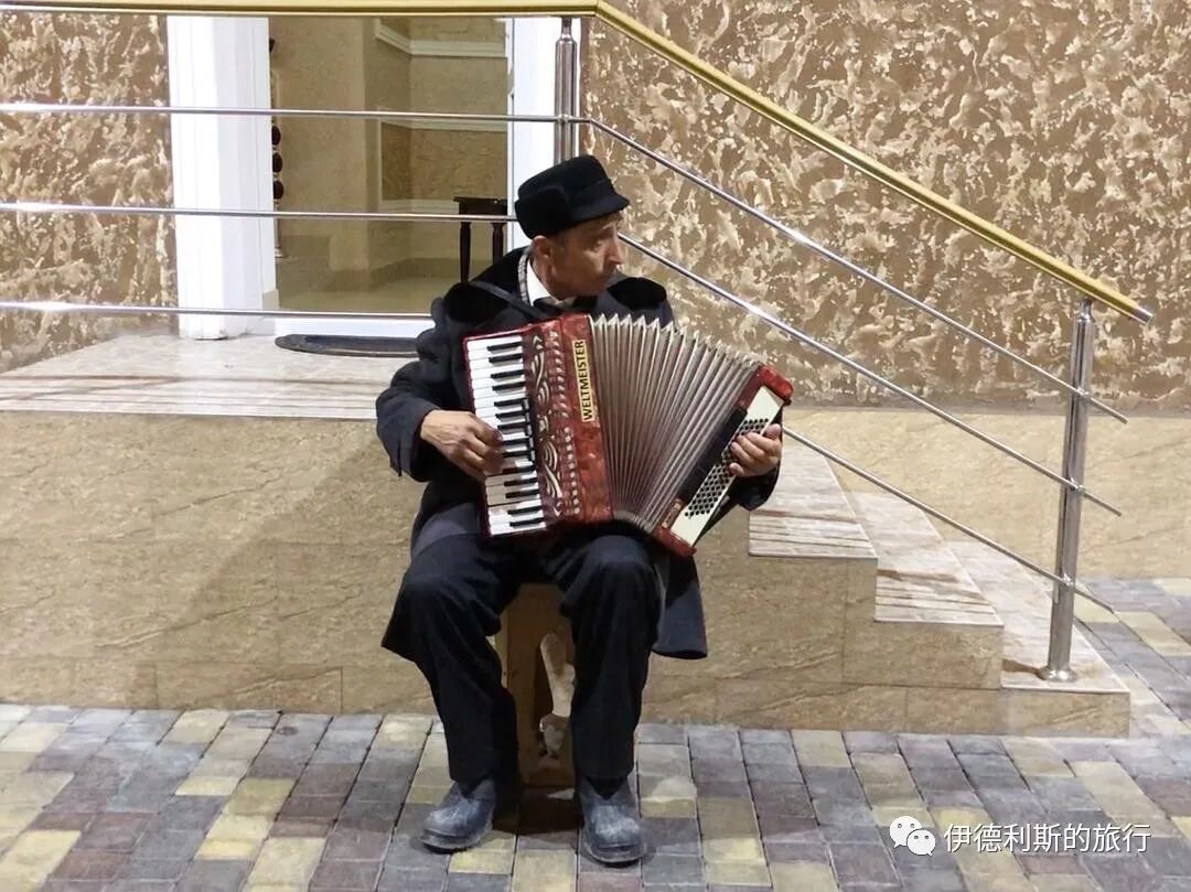
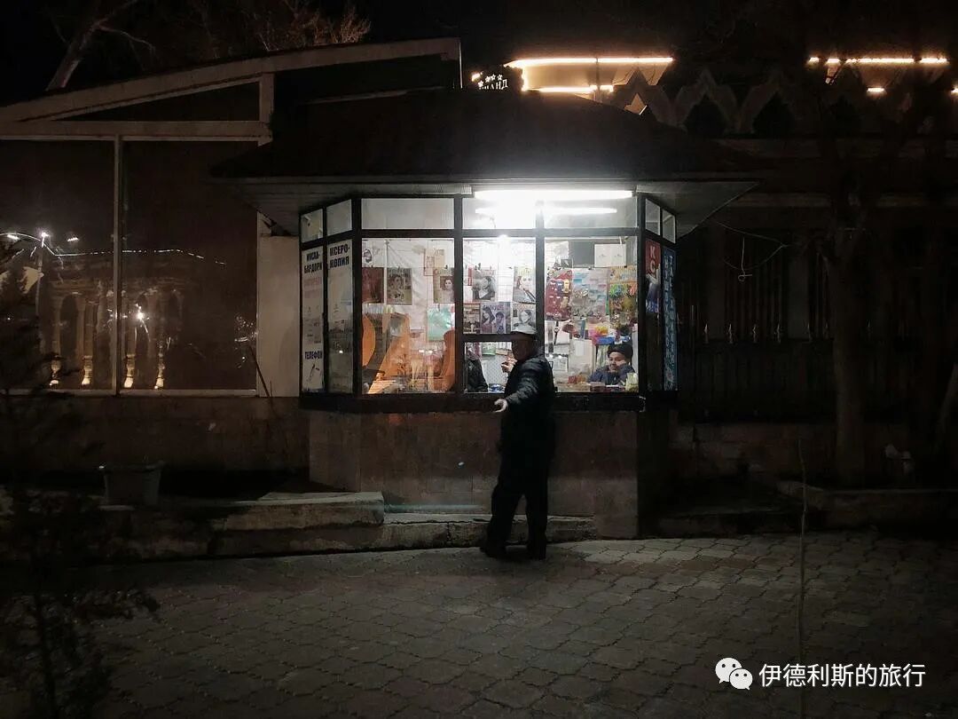
9. The uncle playing the accordion
After dinner, I strolled back to my hotel and met an uncle playing the accordion in the courtyard of a restaurant next to the hotel. The uncle's job was to go from one private room to another in the restaurant to sing for the guests. When there were no new guests, the uncle sang a few songs for me too. The uncle could sing all kinds of Uzbek, Tajik, and Soviet songs, and you could see the marks left by the Soviet era on him.
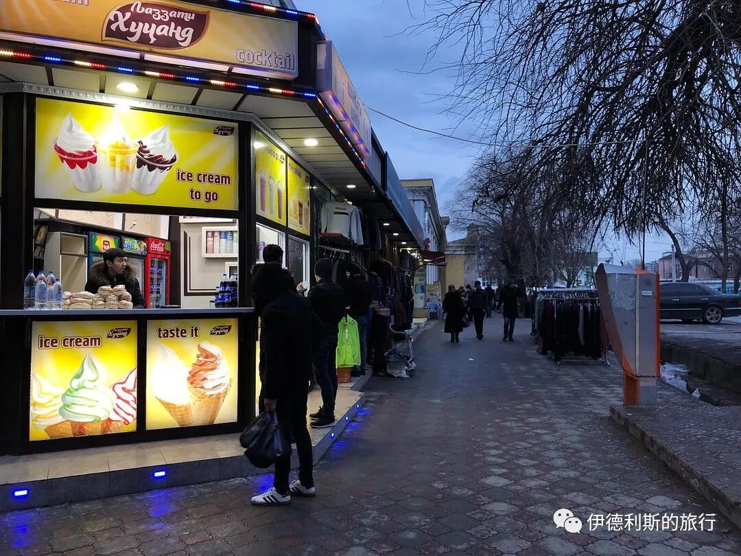
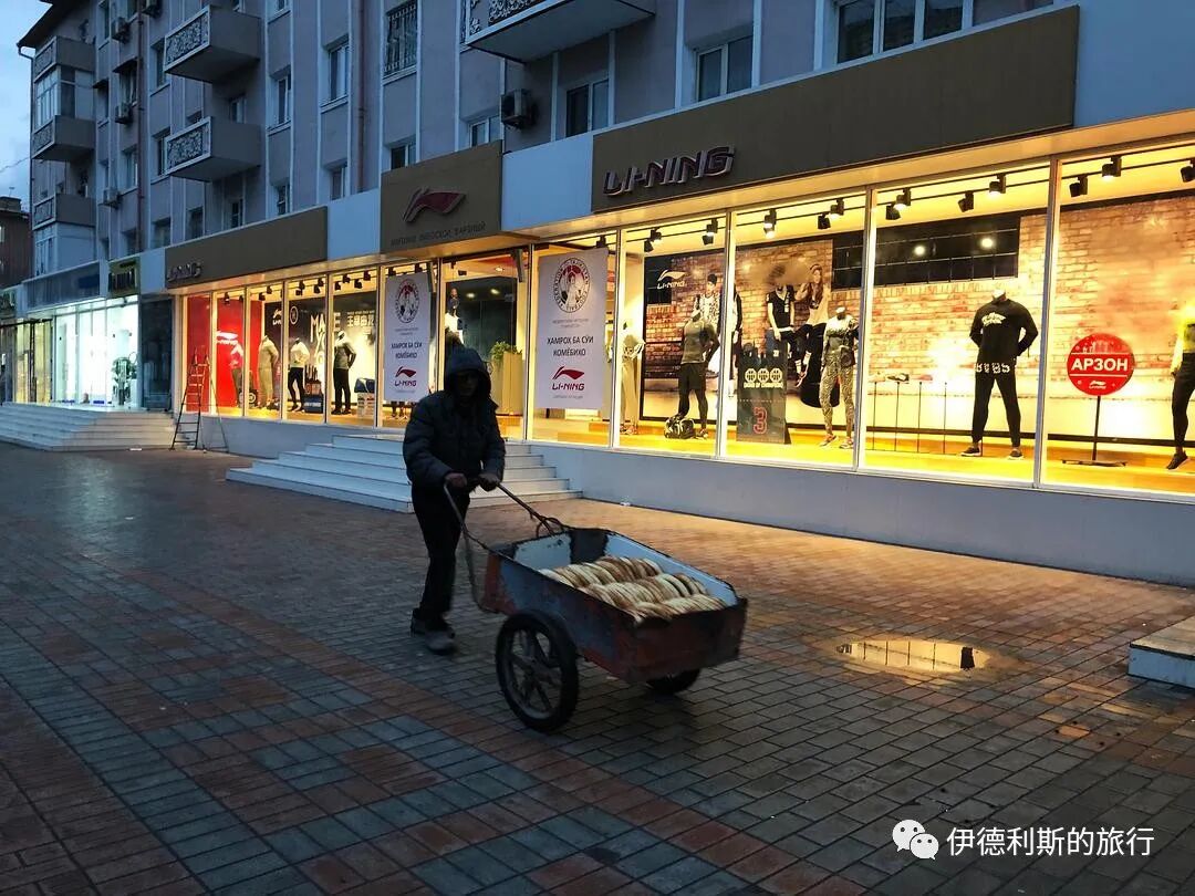
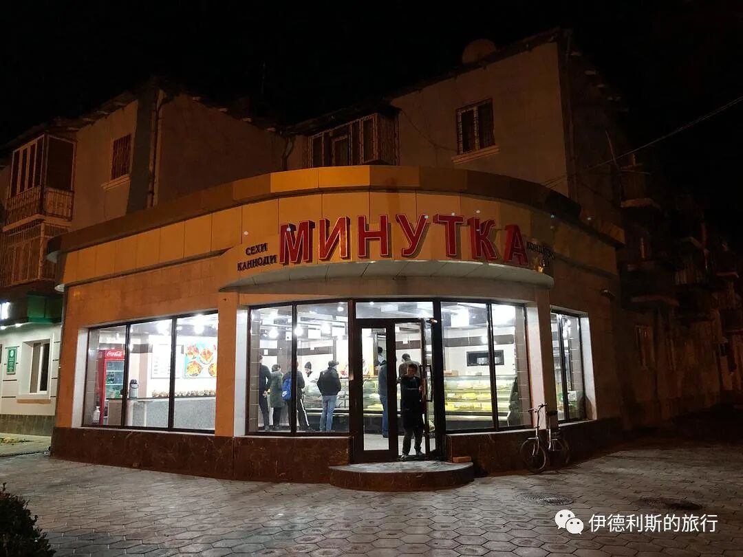
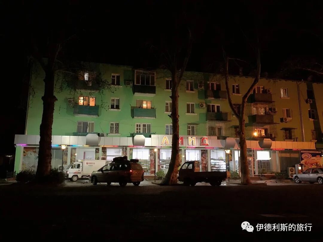
10. Khujand night view
I walked around the streets of Khujand at night. Since it was the last night of this trip, I was a bit reluctant to leave, so I took more night photos to share with everyone.
Shops on the Thursday Bazaar square.
World War II Memorial.

Summary: Khujand, Tajikistan — Night Walks, Food and Muslim Heritage is presented here as a firsthand travel account in clear English, beginning with this scene: Khujand was the final stop on my 2019 Spring Festival trip through Central Asia. Although I only stayed for one night, it left me with many unforgettable memories. The account keeps its focus on Khujand Travel, Tajikistan Travel, Muslim Heritage while preserving the names, places, food, and historical details from the Chinese source.
Khujand was the final stop on my 2019 Spring Festival trip through Central Asia. Although I only stayed for one night, it left me with many unforgettable memories.
Table of Contents
1. Heading to Khujand
2. A Tajik city in the Fergana Valley
3. The city of Cyrus and Alexander
4. Traditional Tajik hats
5. The Syr Darya River
6. Thursday Bazaar
7. Saint's tomb
8. Dinner
9. The uncle playing the accordion
10. Khujand night view
1. Heading to Khujand
On the morning of February 14, 2019, I was in Penjikent, a border city in the far west of Tajikistan, waiting for a shared taxi to the capital, Dushanbe. However, because of a blizzard the night before, the mountain road to Dushanbe, which sits at an altitude of over 3,000 meters, remained closed. After waiting all morning, I was told there was no hope of the road to Dushanbe opening that day. I changed my plans and decided to head to Khujand, Tajikistan's second-largest city.
Around noon, our car left Penjikent heading east, driving through the Zeravshan River valley. The Zeravshan River, formerly known as the Sughd River, is called the mother river of the Sogdians. It flows through the most important Sogdian cities of Bukhara, Samarkand, and Penjikent, where countless stories of the Sogdian people have unfolded.
An hour later, we moved from the Zeravshan River valley into the upper Zeravshan River gorge, where all vegetation disappeared.
Then we drove north, entered Tajikistan's main north-south highway, and began crossing the Turkestan mountain range. The Turkestan range has an average altitude of over 3,000 meters, with its highest peak reaching over 5,000 meters. As the altitude rose sharply, the temperature dropped suddenly and visibility became very low.
We finally crossed the Turkestan range, headed north into the Fergana Valley, and arrived in Khujand after four hours.
The driver dropped me off directly at the Khujand Grand Hotel I had booked on Booking.com. The receptionist was a young Russian woman. Her English wasn't very good, but we communicated using a mix of Russian and English words and eventually understood each other.
The suite I stayed in
I bought a wool coaster before I left
2. A Tajik city in the Fergana Valley
Khujand is located at the entrance to the Fergana Valley and is the only large city in the valley with a Tajik majority. After the Soviet Union redrew the borders of Central Asia in 1924, Khujand was incorporated into the Uzbek Soviet Socialist Republic (Uzbek SSR).
When the establishment of a Tajik Autonomous Oblast within the Uzbek Republic was discussed in 1924, the issue of the Tajiks in the western Fergana Valley was already mentioned. But the prevailing view at the time was to include this land in the Uzbek Republic. This was because the Tajiks and Uzbeks here had deeply intertwined farmland and their economic ties were inseparable. the main point of contention at the time was the distinction between settled and nomadic peoples, so the conflict between the settled Uzbeks and Tajiks seemed insignificant. Although a Tajik subcommittee was set up within the territorial commission, it was actually very passive and simply agreed to the routes proposed by the Uzbek side.
However, after the Central Asian border demarcation ended, conflicts between the Uzbek and Tajik sides began to intensify. After 1926, the leaders and elites of the Tajik Autonomous Republic began to protest continuously, demanding to join the Soviet Union directly to ensure the normal development and cultural independence of the Tajik people. The Soviet Union agreed to this request. One reason was a concern about the dominant position of the Uzbek Republic in Central Asia, and another was the desire to use a "Tajik nation-state" to influence the Afghan civil war and attract the Tajiks of Afghanistan.
In 1929, the Tajik and Uzbek territorial demarcation commission began its work. The leaders of the Uzbek Republic quickly agreed to transfer the Khujand region, which was dominated by Tajiks in western Fergana, to the Tajik Republic, in order to gain the upper hand in the cities of Samarkand and Bukhara, which had large Tajik populations.
With Khujand incorporated into the Tajik Republic, the current territorial layout of Tajikistan was officially formed. This is why there is a protrusion on the north side of Tajikistan.
In 1927, blue represented the Uzbek SSR, and yellow represented the subordinate Tajik ASSR.
On today's map of Tajikistan, Khujand sits in a northern protrusion that reaches into the Fergana Valley.
3. The city of Cyrus and Alexander
From my hotel room window, I could see the most important historical site in Khujand: the Khujand Fortress.
Between 545 and 539 BC, the Persian Emperor Cyrus the Great led an eastern campaign into Central Asia and established the province of Sogdia in the Transoxiana region. To counter the Saka people on the north bank of the Syr Darya River, Cyrus the Great built seven cities on the south bank in 544 BC. The largest was called Cyropolis, which became one of the earliest and most famous cities of the Sogdians.
In 329 BC, the army of Alexander the Great entered the Transoxiana region. According to the Anabasis of Alexander, the Sogdians resisted the Greek army fiercely, and Alexander himself even suffered a broken leg from an arrow during the fighting. After reaching the south bank of the Syr Darya, Alexander used siege ladders and stone-throwing machines to capture five cities in a row before finally arriving at Cyropolis. The Greek army entered the city through a water channel beneath the walls, and about 8,000 residents were killed. Most of them were Sogdians defending the city.
After taking Cyropolis, Alexander built the furthest Greek city on its foundation, naming it Alexandria Eschate, and moved many Greeks there.
There is still no definitive evidence for the exact locations of Cyropolis and Alexandria Eschate, but the Khujand Fortress is the most likely site. Although the earliest visible walls of the Khujand Fortress date back no further than the 10th century AD, archaeological excavations show layers from the Hellenistic and ancient Persian periods beneath the walls, along with many unearthed Hellenistic coins and pottery.
The Khujand Fortress has been rebuilt many times in history, with the current main structure dating to the 10th century AD. Between 1219 and 1220, the city of Khujand was besieged by Genghis Khan's Mongol army, which severely damaged the fortress. It was rebuilt again in the 15th century.
In 1999, a section of the eastern wall, which dated back to the 8th or 10th century, underwent a historically inaccurate restoration and was converted into the Sughd Museum and the Museum of Archaeology and Fortification. I was very disappointed that I couldn't visit the museum because it was already closed when I arrived in Khujand.
From May 17 to 24, 1866, Russia captured the Khujand Fortress. Mikhail Afrikanovich Terentʹev, a Russian officer, orientalist, linguist, and writer who was present, took photos of the fortress that were later included in the Turkestan Album.
This image is a battle map used during the Russian siege of Khujand in May 1866. The map shows the central Khujand Fortress and the outer city walls.
Khujand Fortress.
Looking at the market from the city walls.
4. Traditional Tajik hats
The east side of the Khujand Fortress has been turned into a small park. At a shop near the wall, I bought a few hats worn by people from the Badakhshan region of Tajikistan and the Kulob area on the edge of the Pamirs. The style of these hats is clearly different from the skullcaps (dopa) worn by lowland Tajiks; they have wool trim on the edges and decorative borders.
Below is a hat worn by the Pamiri people of Tajikistan that I found online; you can see it also has pom-poms on the side.
5. The Syr Darya River
Not far to the north of the Khujand Fortress is the Syr Darya River. The Syr Darya originates in the Tianshan Mountains, flows west into the Fergana Valley, and exits the valley after passing through Khujand.
The Syr Darya River near Khujand, photographed for the Turkestan Album, which was edited by Russian orientalist Aleksandr L. Kun between 1865 and 1872.
Sculptures by the river.
6. Thursday Bazaar
Then I caught a ride with an older man to the Panjshanbe Bazaar. Even though we didn't speak the same language, we chatted the whole way. Using hand gestures, I understood that the Panjshanbe Bazaar has two main entrances, which one is closest to the main road, and the best way to walk through it.
The Panjshanbe Bazaar is actually open every day, but it is busiest on Thursdays. It is known as the largest bazaar in the Fergana Valley. The main hall was built in 1964 and is one of the most important Soviet buildings in Khujand.
People of Khujand in the 1860s and 1870s, from the Turkestan Album.
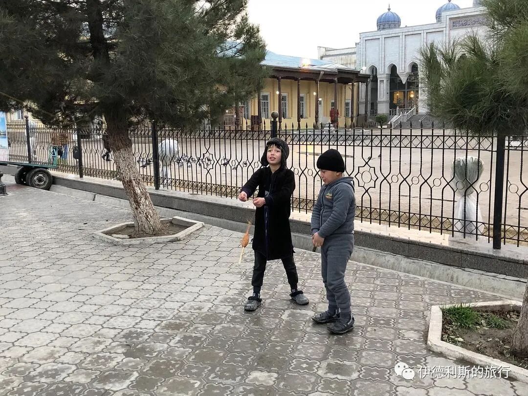
7. Saint's tomb
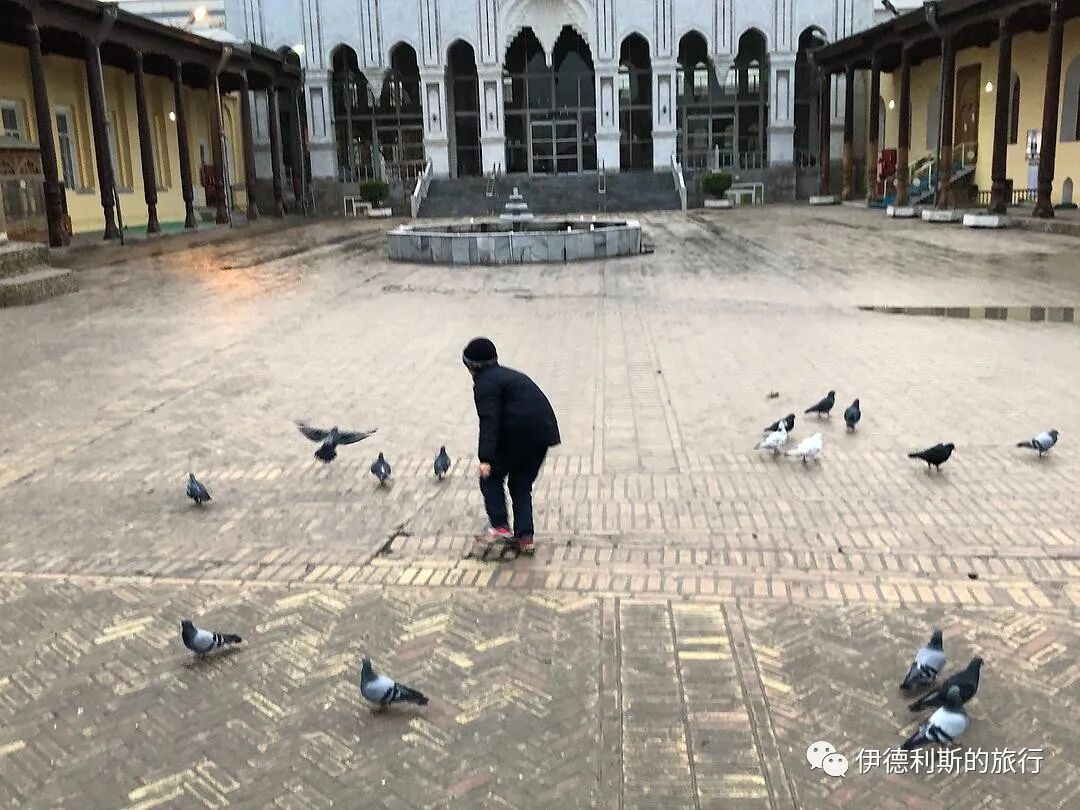
Sheikh Muslihiddin (1133–1223) was a poet and ruler of Khujand. His tomb was originally outside the suburbs of Khujand, but later those who revered him moved it to its current location. The original tomb was quite small and was later destroyed by the Mongols. People rebuilt the tomb after the 14th century, rebuilt it again into its current form in the 16th century, and built the current minaret in 1865. During the Soviet era, this place served as a regional history museum, and it only returned to its religious function after the museum moved out in the 1990s.
The tomb mosque in the 1860s-70s from the Turkestan Album.
A 19th-century minaret.
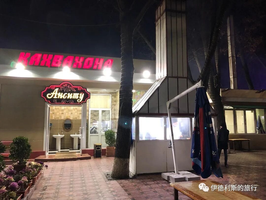
8. Dinner
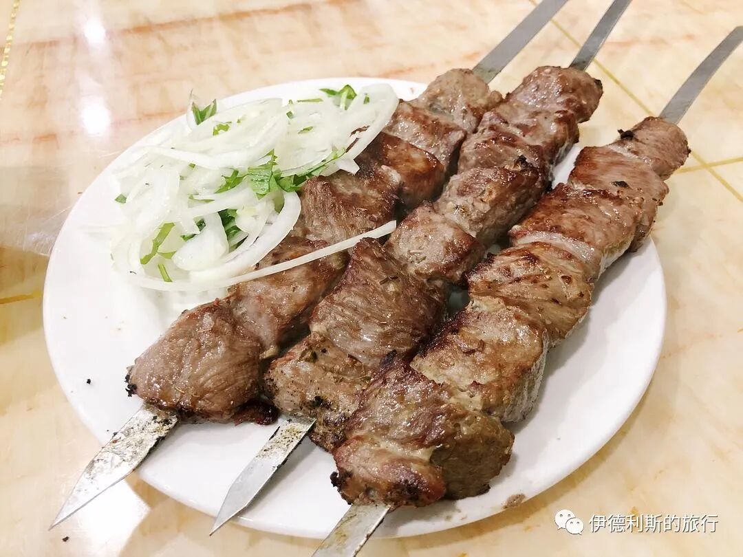
It was almost dark after I finished walking around the Thursday Bazaar, so I strolled toward my accommodation while looking for a restaurant. As I walked, I suddenly smelled grilled meat. A young man at the door called out to me, so I went into this barbecue restaurant. Besides the grilled meat, the restaurant had various self-service options. I ordered horse sausage (machangzi), beef wrapped with potatoes, flatbread (nang), and rice soup (mastava). The meat skewers they served were really huge, and I couldn't finish them in the end. The young waiters inside were all very kind, always smiling and asking how my meal was. One of the young men spoke fluent English, and I had a great time chatting with him.
Grilled meat (kaorou).
Horse sausage (machangzi).
Rice soup (mitang).
Flatbread (nang).
The barbecue uncle.
The barbecue uncle.
9. The uncle playing the accordion
After dinner, I strolled back to my hotel and met an uncle playing the accordion in the courtyard of a restaurant next to the hotel. The uncle's job was to go from one private room to another in the restaurant to sing for the guests. When there were no new guests, the uncle sang a few songs for me too. The uncle could sing all kinds of Uzbek, Tajik, and Soviet songs, and you could see the marks left by the Soviet era on him.
10. Khujand night view
I walked around the streets of Khujand at night. Since it was the last night of this trip, I was a bit reluctant to leave, so I took more night photos to share with everyone.
Shops on the Thursday Bazaar square.
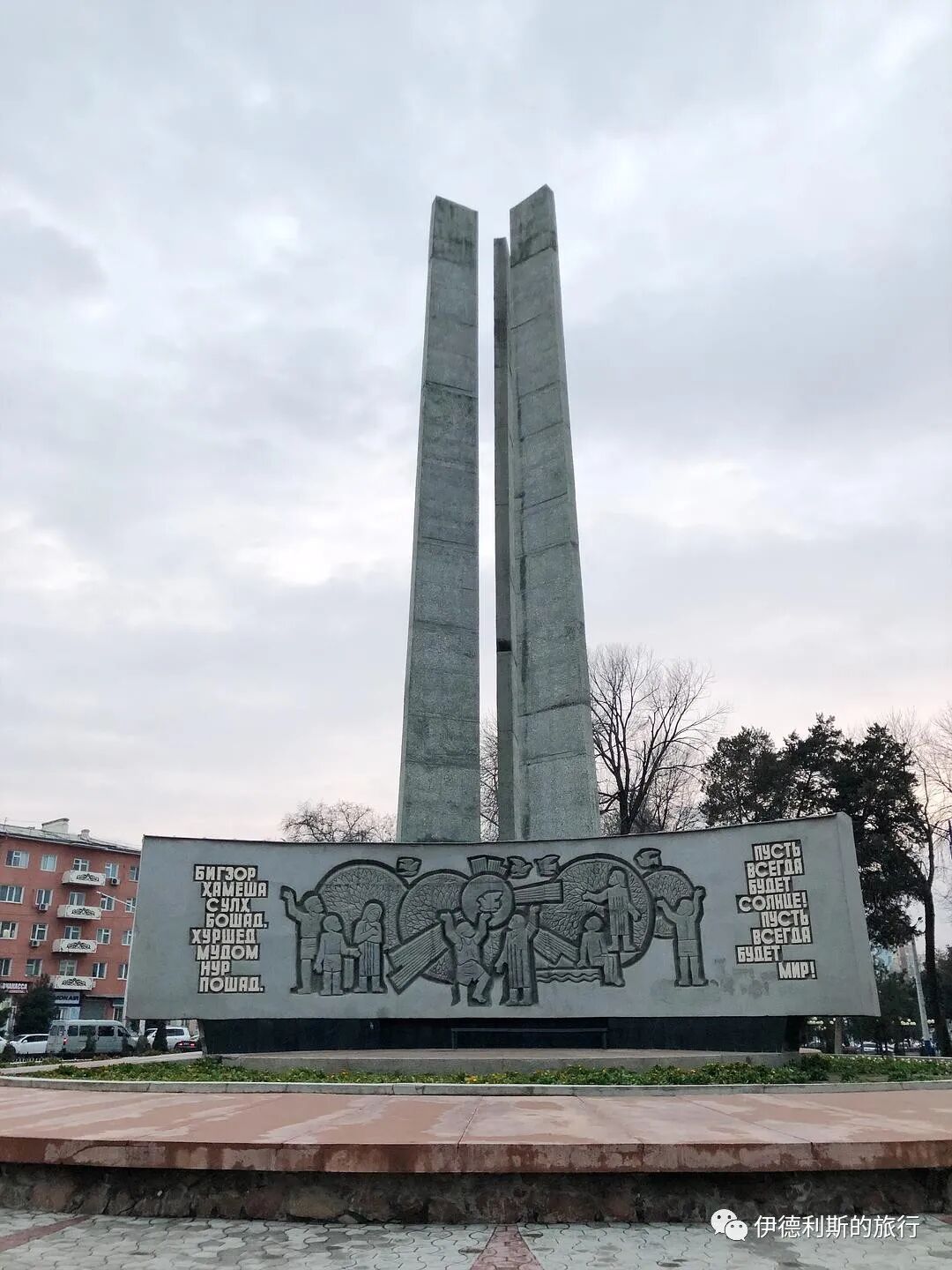
World War II Memorial.