

Islamic World
Islamic World in 1550: Chain Madrasa in Crimea (Part 1A-1b-1b)
Articles • ali2007fr posted the article • 0 comments • 83 views • 2026-05-18 09:38
Summary: This block continues the Crimean Khanate site and mosque section from Islamic World in 1550, preserving the original order of text and images.
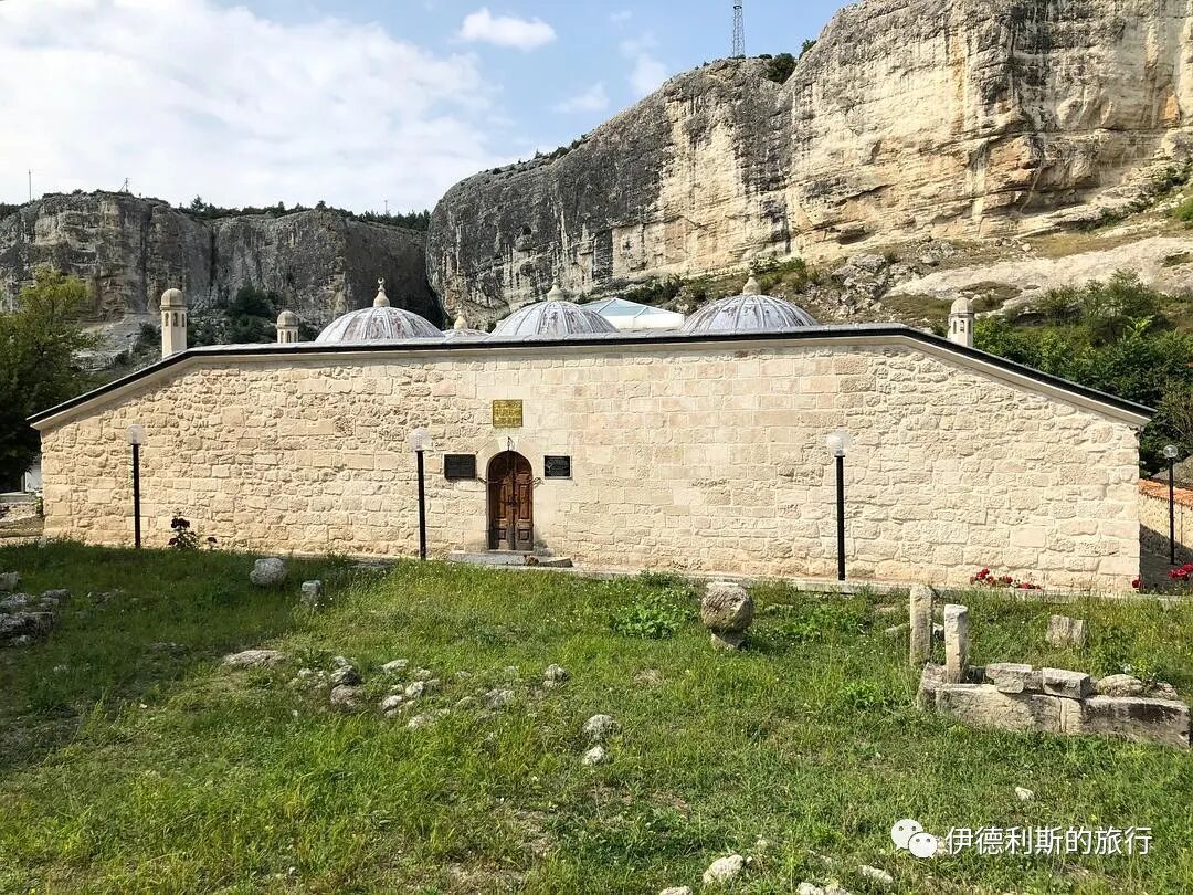
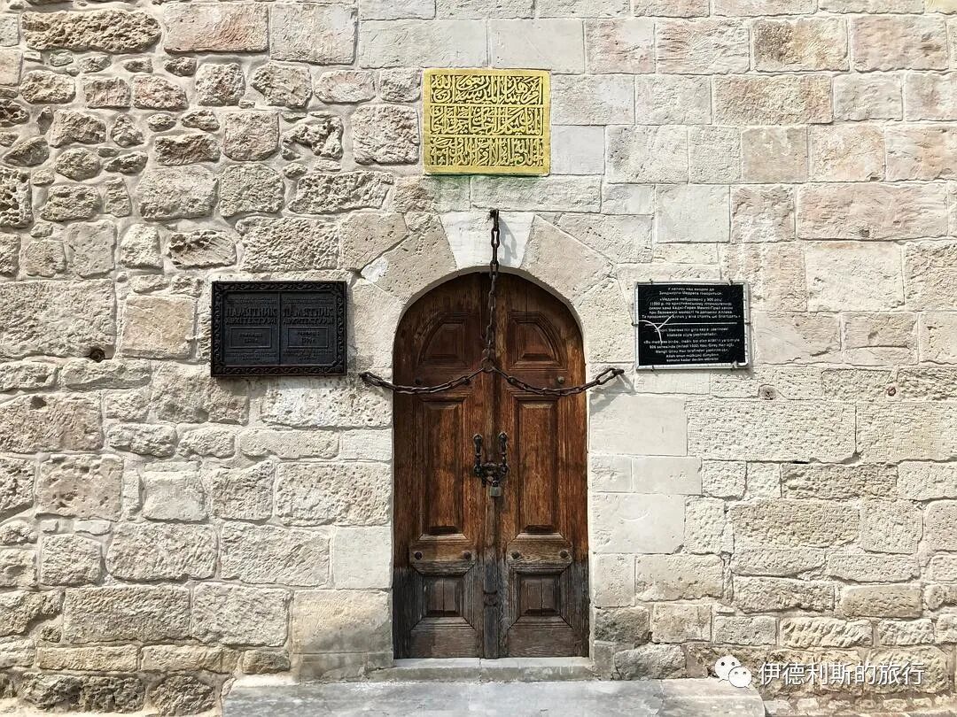
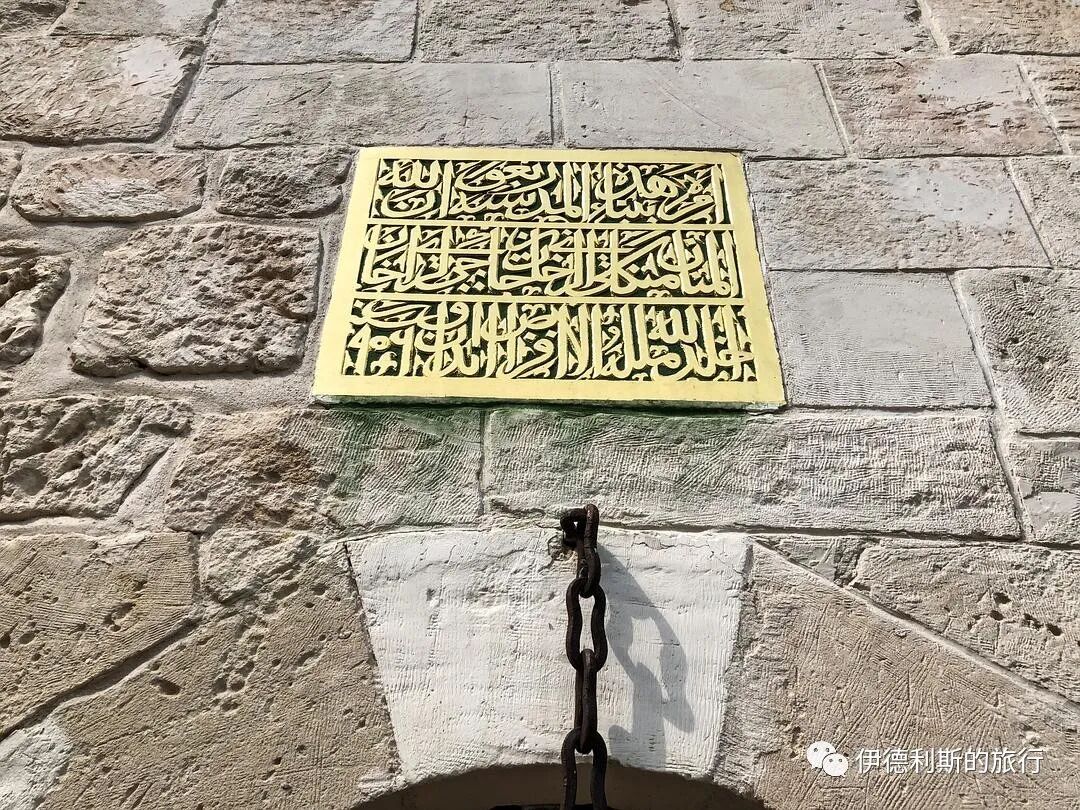
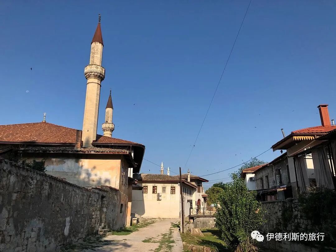
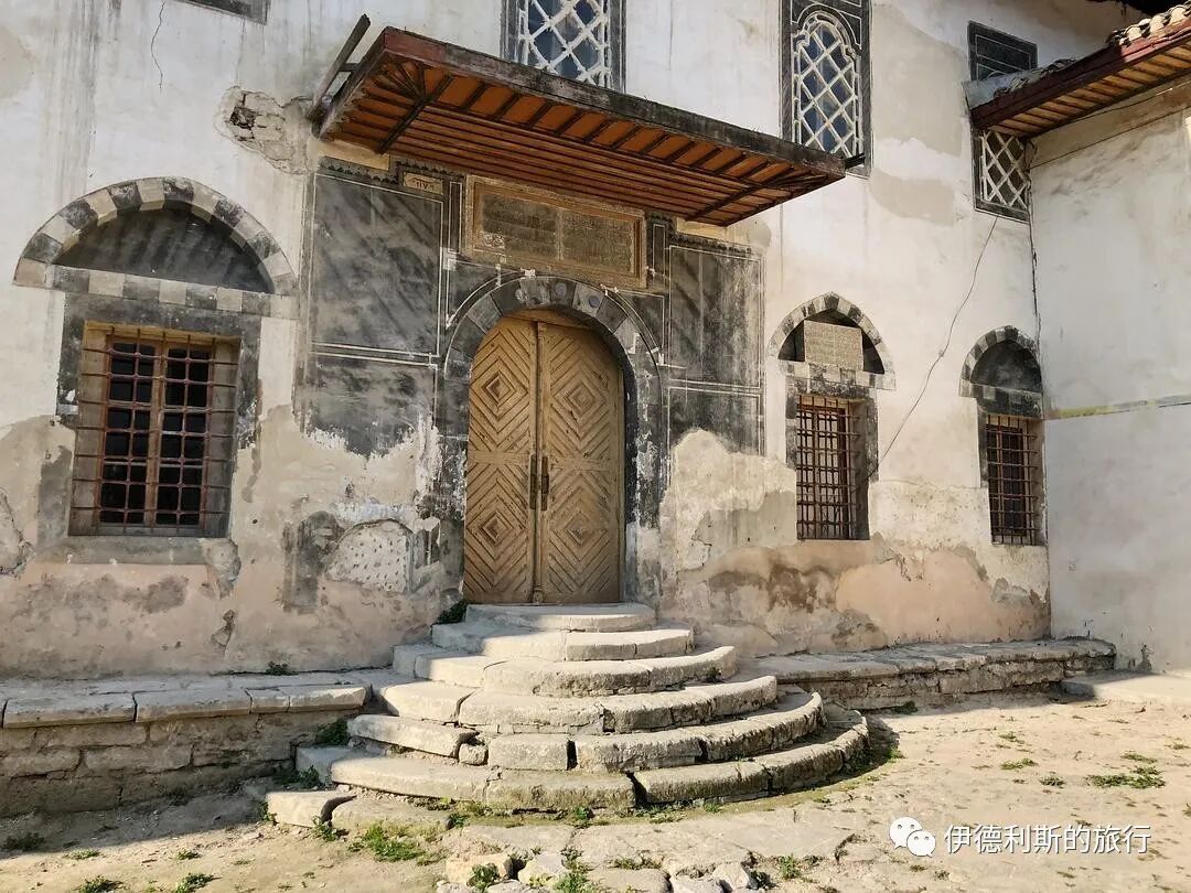
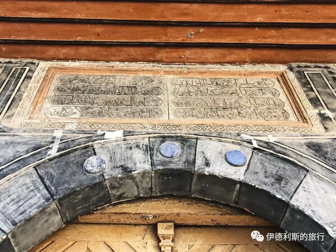
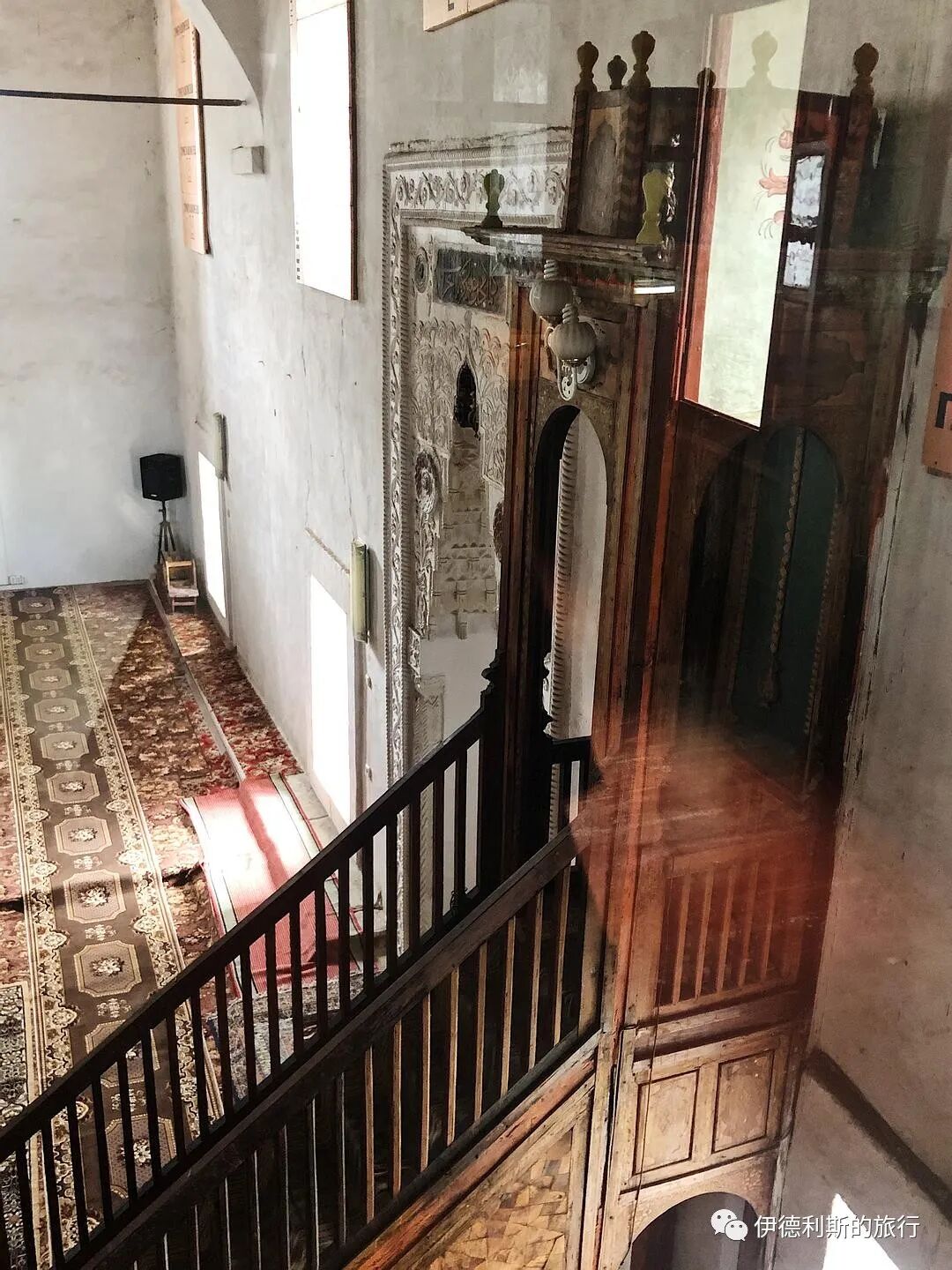
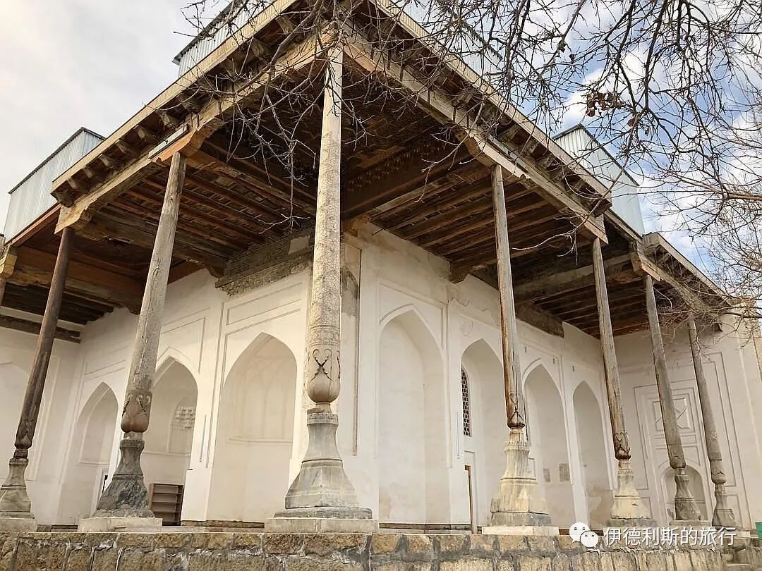
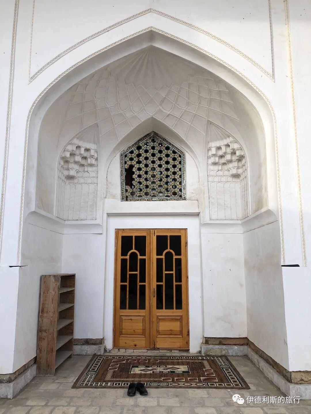
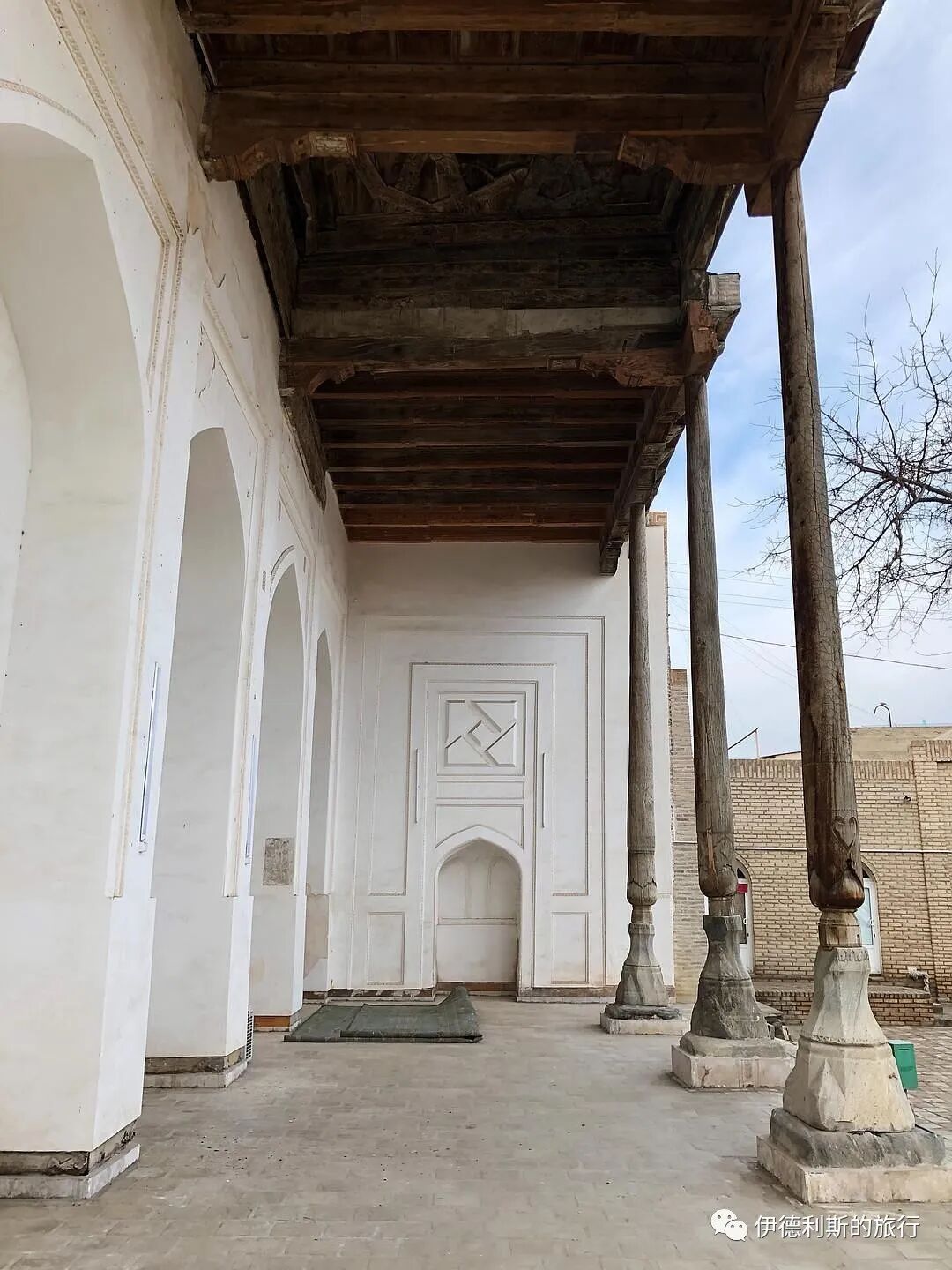
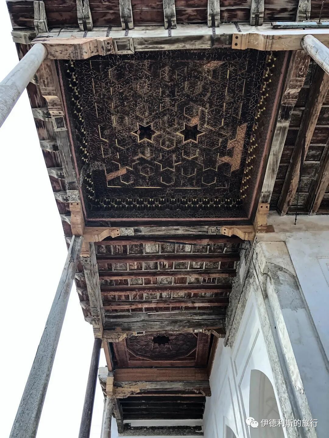
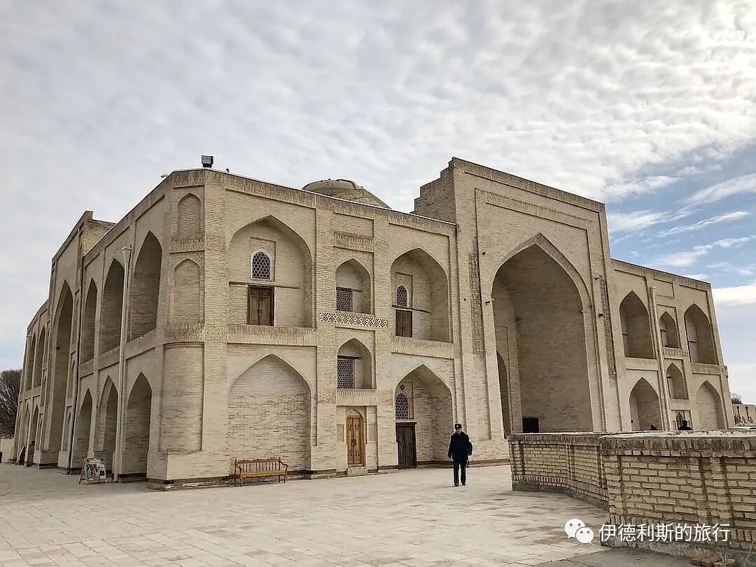
The Chain Madrasa (Zıncırlı Medrese) was built in 1500 by order of the Crimean Khan Meñli I Giray. The name of the madrasa comes from the Turkic word "Zyngyr," which means "chain." A chain hangs above the main gate of the madrasa, so everyone who enters has to lower their head. The madrasa is rectangular with a central courtyard, an entrance on one side, and 11 rooms on the other three sides. At the time, the madrasa taught Turkish and Arabic grammar, calligraphy, arithmetic, ethics, logic, proof theory, fiqh, or Islamic law, theology, and hadith studies. The full course of study took ten years.
In 1909, influenced by the Crimean Tatar Enlightenment movement, Gasprinski built a new two-story madrasa next to the old one. The madrasa closed in 1917 and became the Meñli Giray Research Institute. The institute was abolished in 1923. Later, it served as a teacher's college, a medical school, a wartime sanatorium used by German military personnel, and a mental health clinic after the war. Today, it is managed by the Bakhchysarai History, Culture, and Archaeology Museum.
Block 2 of 2 for Part 1A-1b-1 view all
Summary: This block continues the Crimean Khanate site and mosque section from Islamic World in 1550, preserving the original order of text and images.
The Chain Madrasa (Zıncırlı Medrese) was built in 1500 by order of the Crimean Khan Meñli I Giray. The name of the madrasa comes from the Turkic word "Zyngyr," which means "chain." A chain hangs above the main gate of the madrasa, so everyone who enters has to lower their head. The madrasa is rectangular with a central courtyard, an entrance on one side, and 11 rooms on the other three sides. At the time, the madrasa taught Turkish and Arabic grammar, calligraphy, arithmetic, ethics, logic, proof theory, fiqh, or Islamic law, theology, and hadith studies. The full course of study took ten years.
In 1909, influenced by the Crimean Tatar Enlightenment movement, Gasprinski built a new two-story madrasa next to the old one. The madrasa closed in 1917 and became the Meñli Giray Research Institute. The institute was abolished in 1923. Later, it served as a teacher's college, a medical school, a wartime sanatorium used by German military personnel, and a mental health clinic after the war. Today, it is managed by the Bakhchysarai History, Culture, and Archaeology Museum.
Block 2 of 2 for Part 1A-1b-1
Islamic World in 1550: Mongol Empire Legacy and Muslim History (Part 1)
Articles • ali2007fr posted the article • 0 comments • 84 views • 2026-05-18 09:38
Summary: Islamic World in 1550: Mongol Empire Legacy and Muslim History is presented here as a firsthand travel account in clear English, beginning with this scene: In our last article, "A Journey Through the Islamic World in 1550 (Part 1)," we crossed the African continent, traveled from Egypt into the Ottoman Empire, and visited Tabriz in Iran. The account keeps its focus on Mongol Empire, Islamic World, Muslim History while preserving the names, places, food, and historical details from the Chinese source.
In our last article, "A Journey Through the Islamic World in 1550 (Part 1)," we crossed the African continent, traveled from Egypt into the Ottoman Empire, and visited Tabriz in Iran. This time, we will visit 12 countries ruled by the descendants of Genghis Khan, moving from Eastern Europe into North Asia and Central Asia, and finally into South Asia.
In the early 13th century, as the Mongol Empire expanded, Genghis Khan began dividing his lands among his sons. Orda and Batu, the sons of Genghis Khan's eldest son Jochi, received lands in southern Russia and Kazakhstan, which gradually formed the Golden Horde. Hulagu Khan, the son of Genghis Khan's fourth son Tolui, received lands in Iran, Turkmenistan, Afghanistan, and parts of West Asia, which gradually formed the Ilkhanate. After the Yuan Dynasty was established in 1271, the original families of Ogedei and Chagatai, led by Kaidu, opposed Kublai Khan. This led to the formation of the Ogedei Khanate and the Chagatai Khanate, completing the four great Mongol khanates.
After the 14th century, the territory of the Ogedei Khanate was first divided between the Chagatai Khanate and the Yuan Dynasty, and later the Ilkhanate and the Chagatai Khanate also began to split apart. The Golden Horde was the last to decline, splitting into several khanates in the early 15th century.
In 1550, there were 12 countries and regimes established by descendants of Genghis Khan, ruling a vast area from Russia, Kazakhstan, Uzbekistan, and China's Xinjiang to Afghanistan, Pakistan, and India. They were:
1. The Crimean Khanate ruled the Crimean Peninsula.
2. The Astrakhan Khanate ruled the Volga Delta.
3. The Nogai Horde ruled the region between the Volga and Ural rivers.
4. The Qasim Khanate ruled Kasimov in the modern-day Ryazan Oblast of Russia.
5. The Kazan Khanate ruled the middle Volga region.
6. The Siberian Khanate ruled the area around the Irtysh River.
7. The Kazakh Khanate ruled the Kazakh Steppe.
8. The Khanate of Khiva ruled the Khwarezm region.
9. The Khanate of Bukhara ruled the Transoxiana region of Central Asia.
10. The Yarkent Khanate ruled the southern Xinjiang region.
11. Haidar ruled the Kashmir region.
12. The Arghun dynasty ruled southern Afghanistan and the Sindh region of Pakistan.
Additionally, the Mughal Empire was briefly overthrown at this time, and its second emperor, Humayun, was in exile in Persia.
1. The Crimean Khanate in Ukraine (1441–1783).
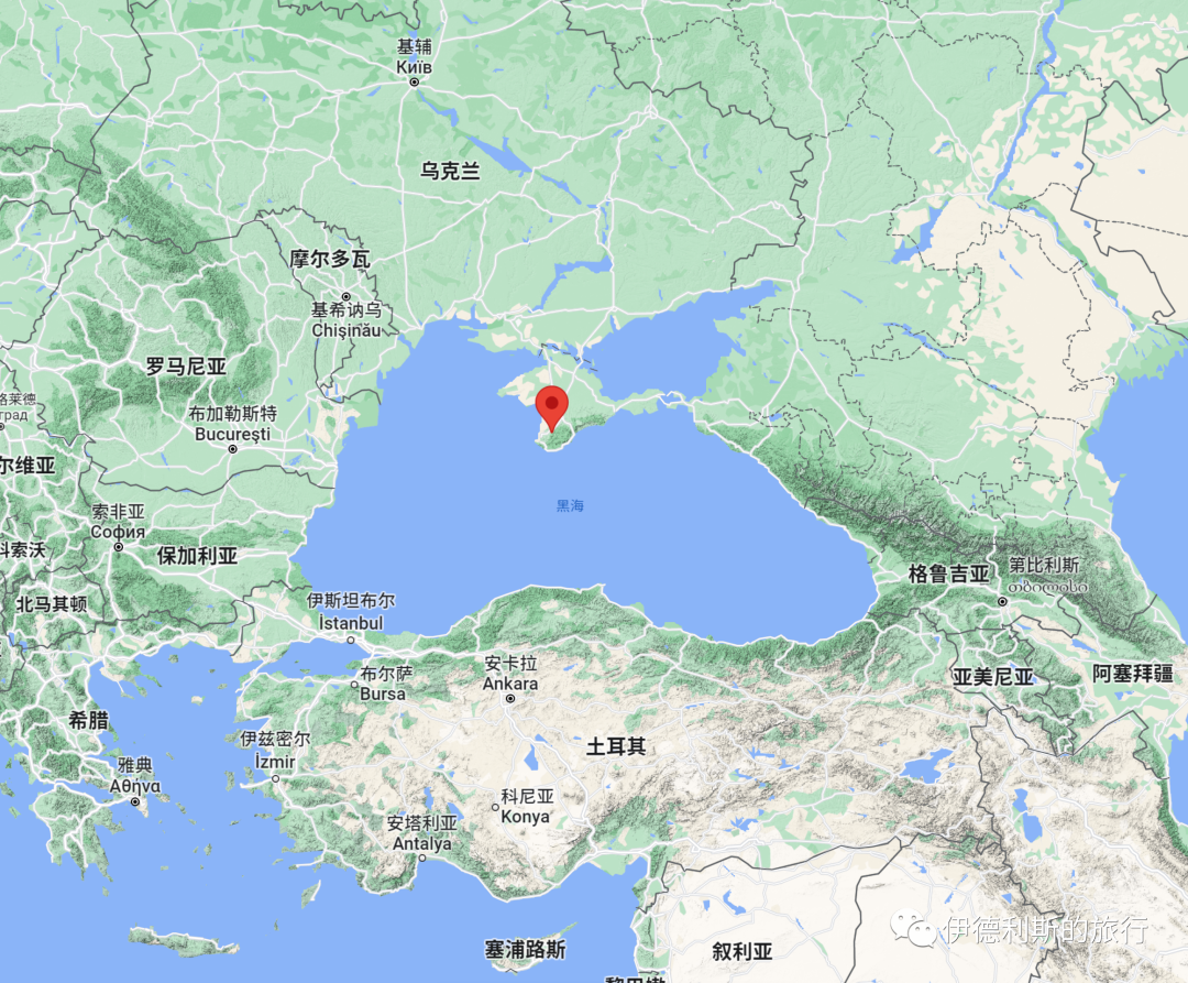
We start this journey on the Crimean Peninsula on the northern shore of the Black Sea.
The Khan of the Crimean Khanate was a descendant of Tuka-Timur, the thirteenth son of Jochi, who was Genghis Khan's eldest son. In the 1260s, the Golden Horde gave the Crimean Peninsula to the ancestor of the Crimean Khans, Uran Timur, to rule. The khanate was officially established in 1441.
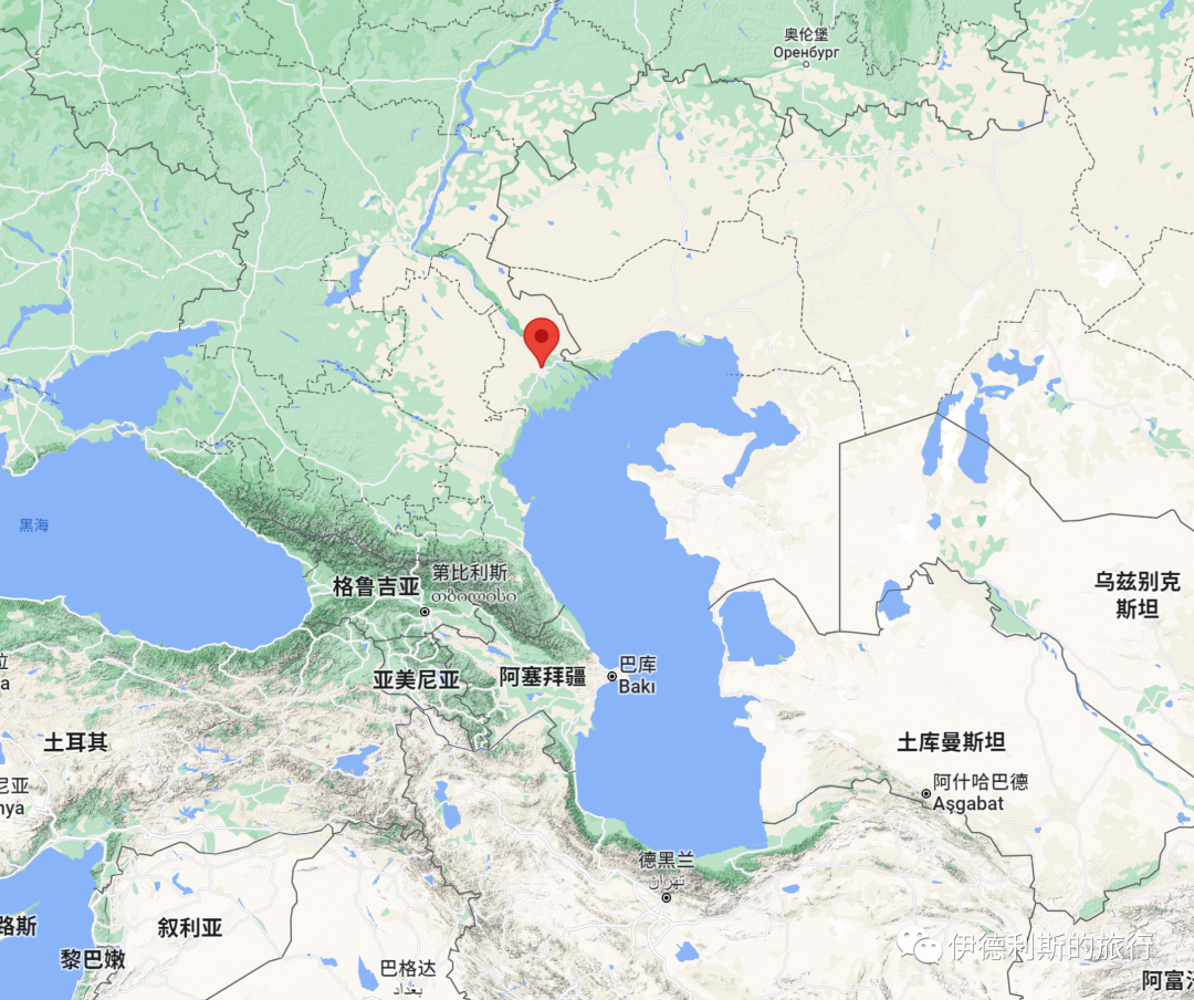
Around 1500, the Crimean Khan Mengli I Giray built the capital of Salachik. In 1532, Sahib I Giray, the son of Mengli I Giray, established a new capital called Bakhchisarai in a valley two kilometers downstream from Salachik. For the next 250 years, generations of Crimean Khans built palaces and various mosque buildings here.
In 1550, the Khan ruling the Crimean Khanate was Sahib I Giray. He ascended the throne with the help of the Ottoman Empire. Later, he joined forces with the Ottoman Sultan Suleiman the Magnificent to attack the Moldavians, and in 1541, he raided Moscow and brought back spoils of war.
The location of Bakhchisarai, the capital of the Crimean Khanate.
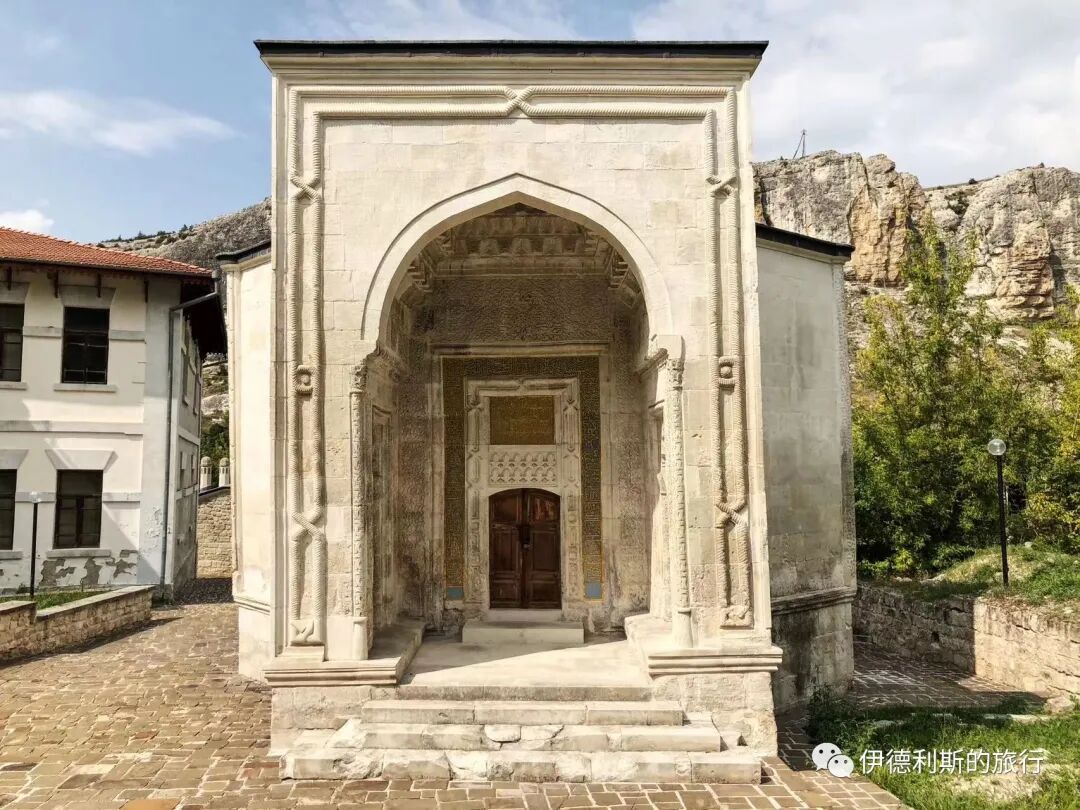
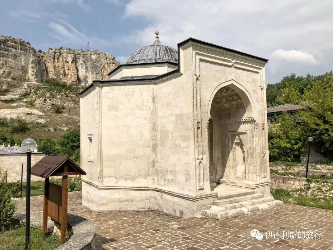
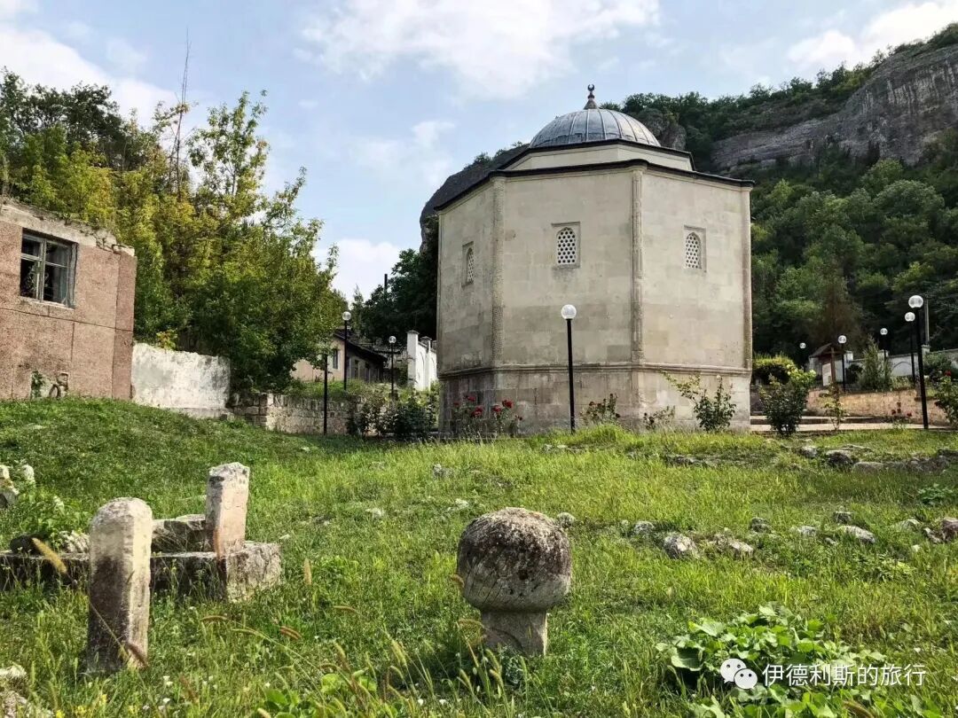
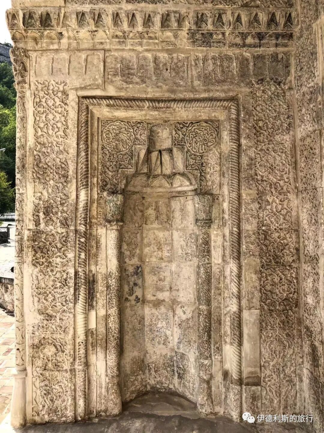
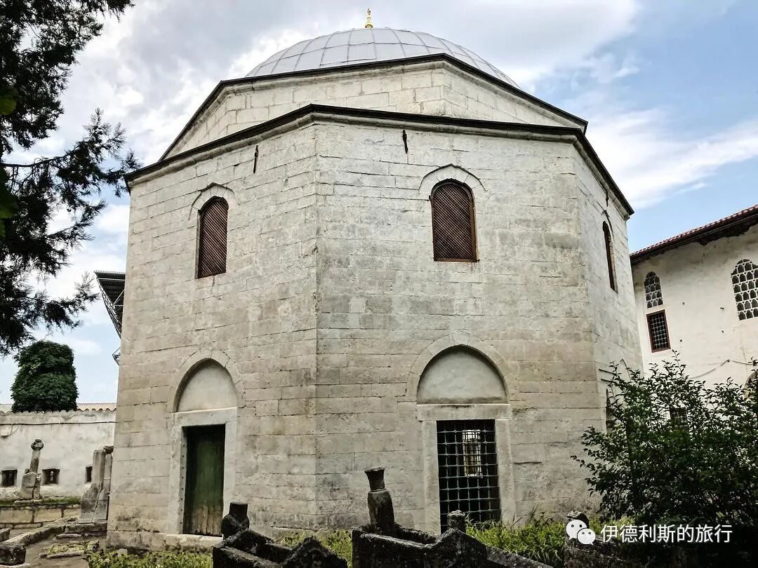
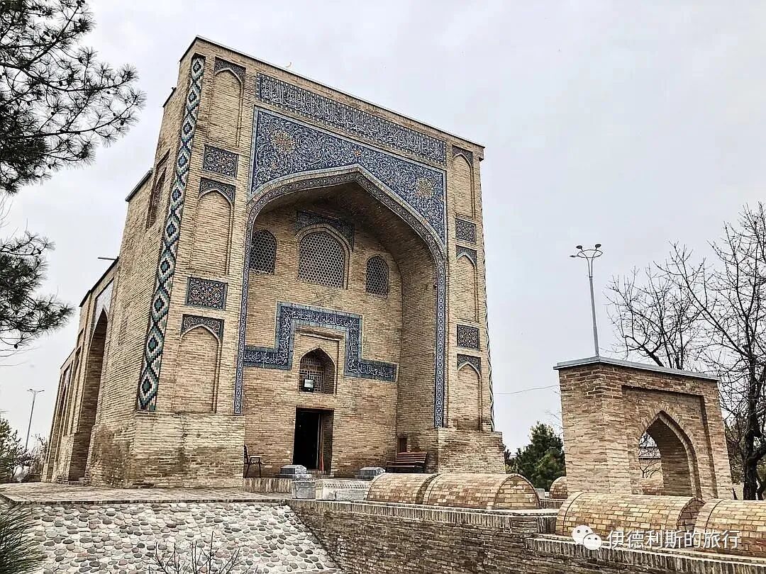
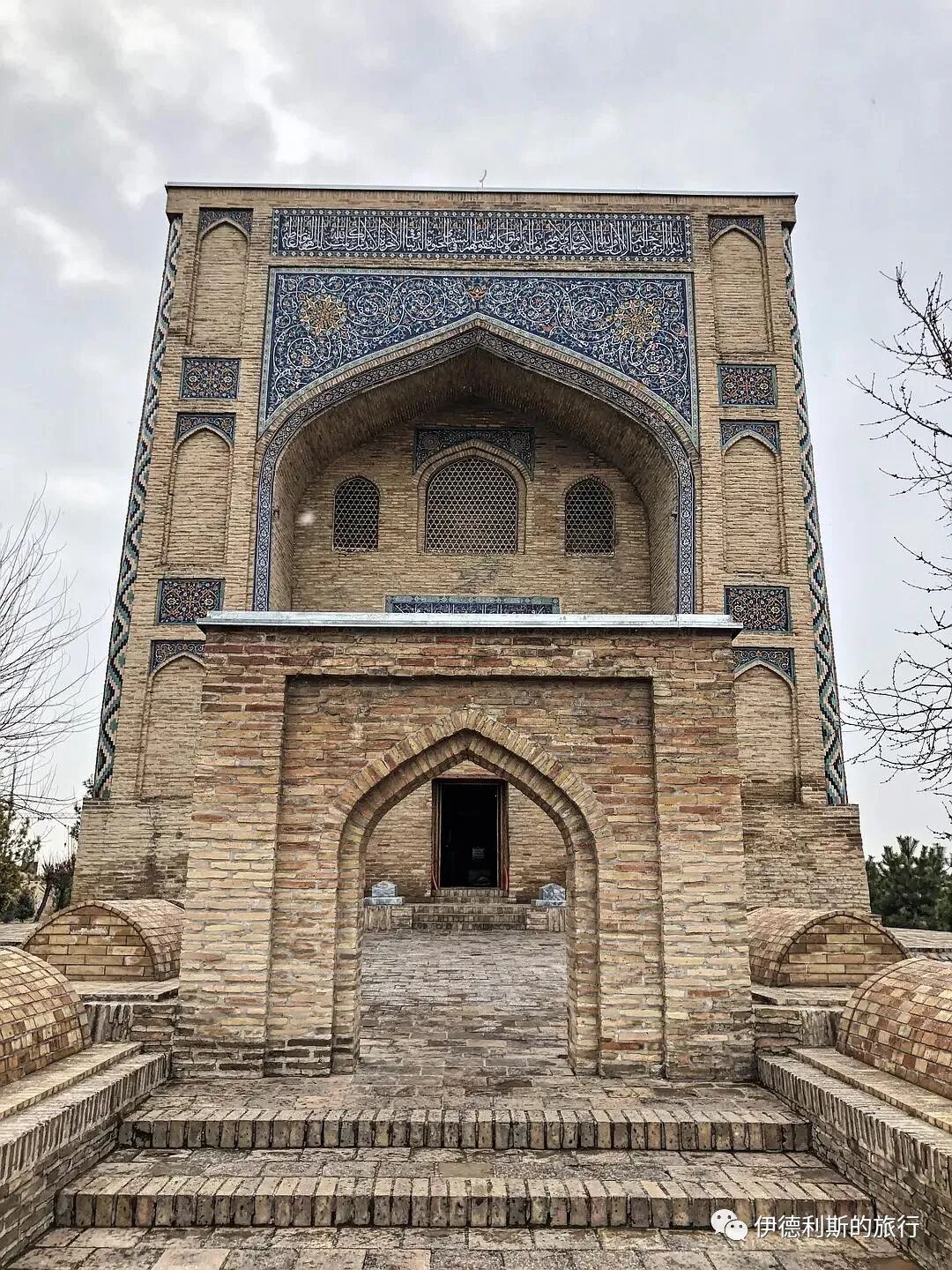
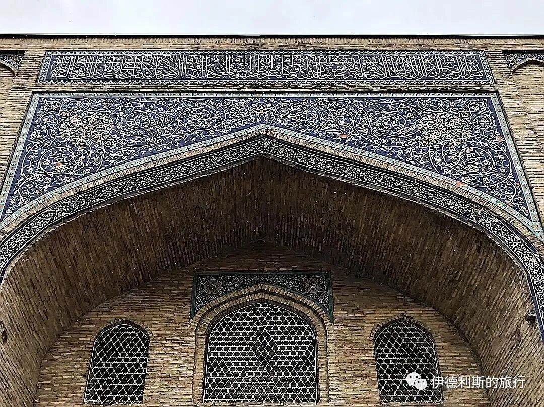
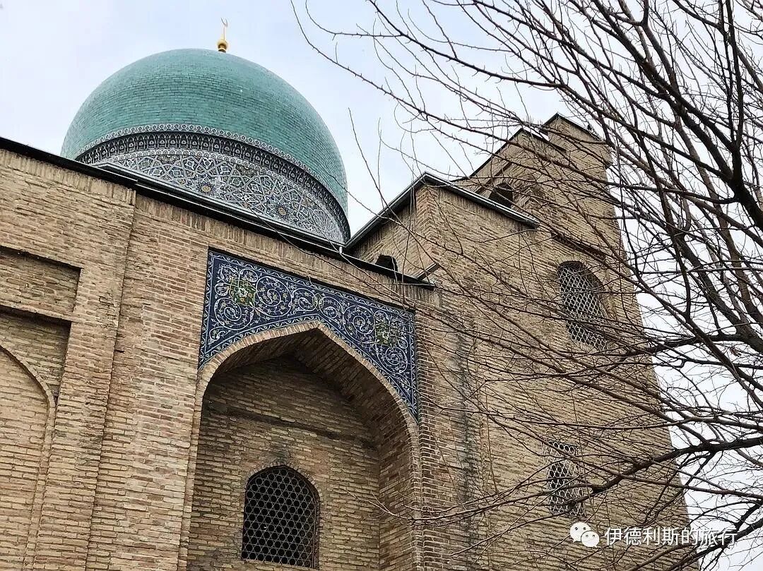
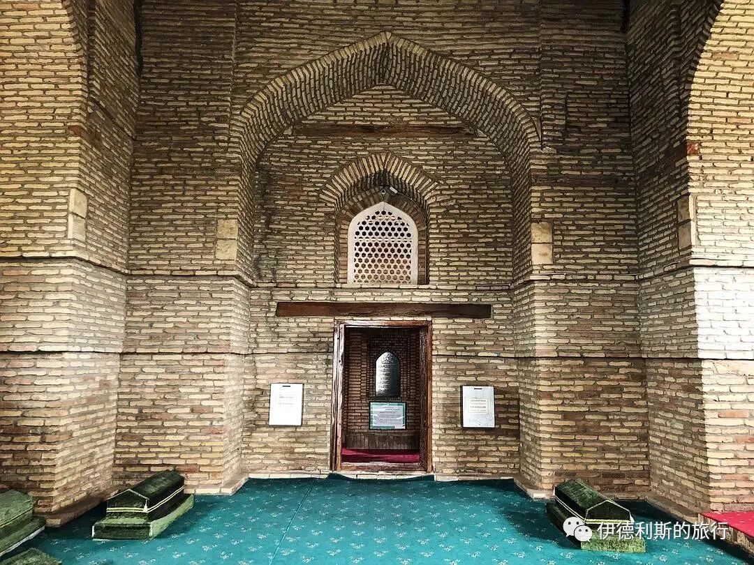
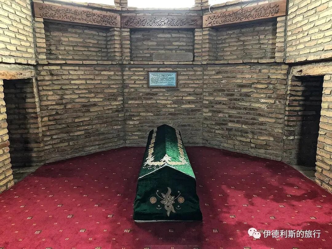
The tomb of Haji I Giray (Dürbe Hacı I Giray) was built in 1501 by Mengli I Giray for his father, the founding Khan of Crimea. It is an octagonal tomb with a lead dome.
Archaeological excavations from 2006 to 2007 examined 18 graves inside the mausoleum, including 13 adults and 5 children. They were wrapped in silk and satin, with some resting on pillows stuffed with fabric scraps and fruit seeds. The mausoleum holds 8 stone sarcophagi covered in velvet, silk, and silver-threaded fabric. These likely include 4 Crimean Khans: Hacı I Giray himself, Meñli I Giray, Nur Devlet—who fought Meñli I Giray for the throne for years before losing—and Sahib I Giray, the son of Meñli I Giray and builder of Bakhchysarai.
After research finished in 2009, these individuals were reburied with Muslim rites.
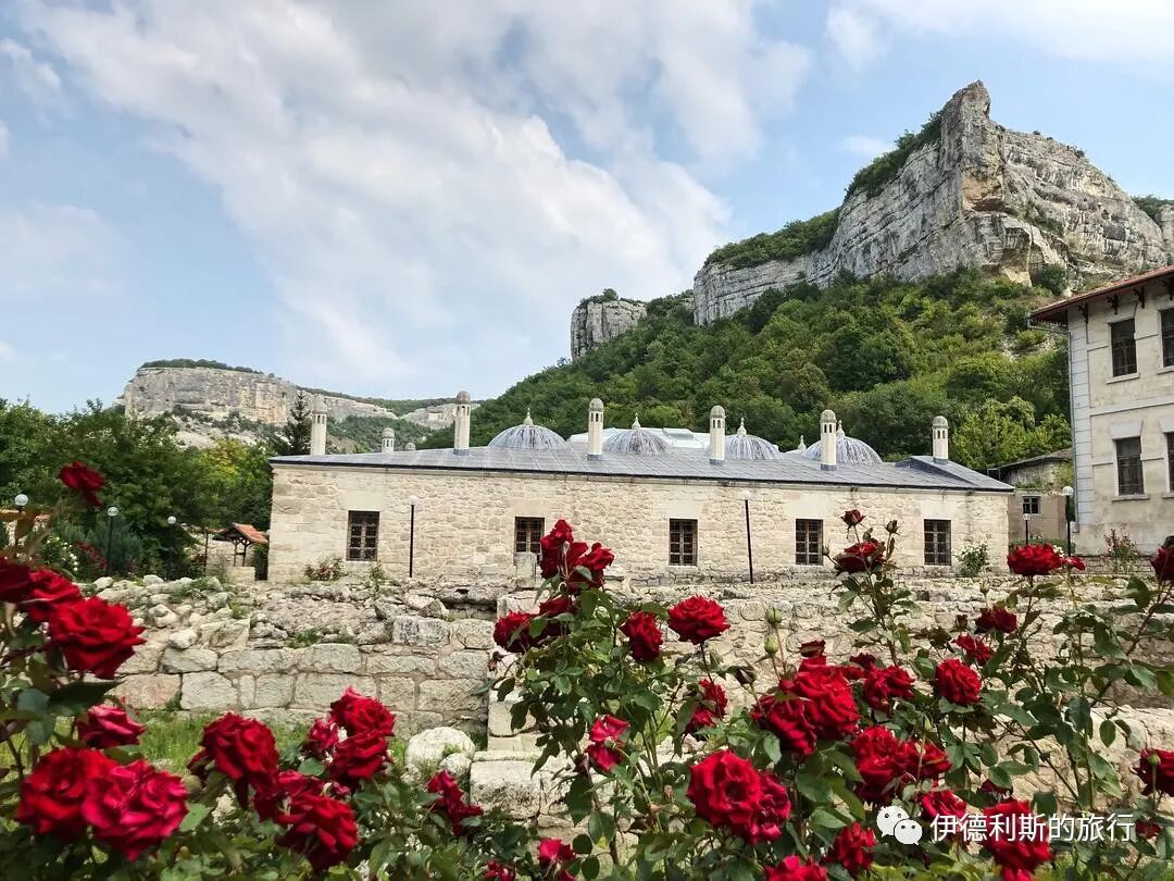
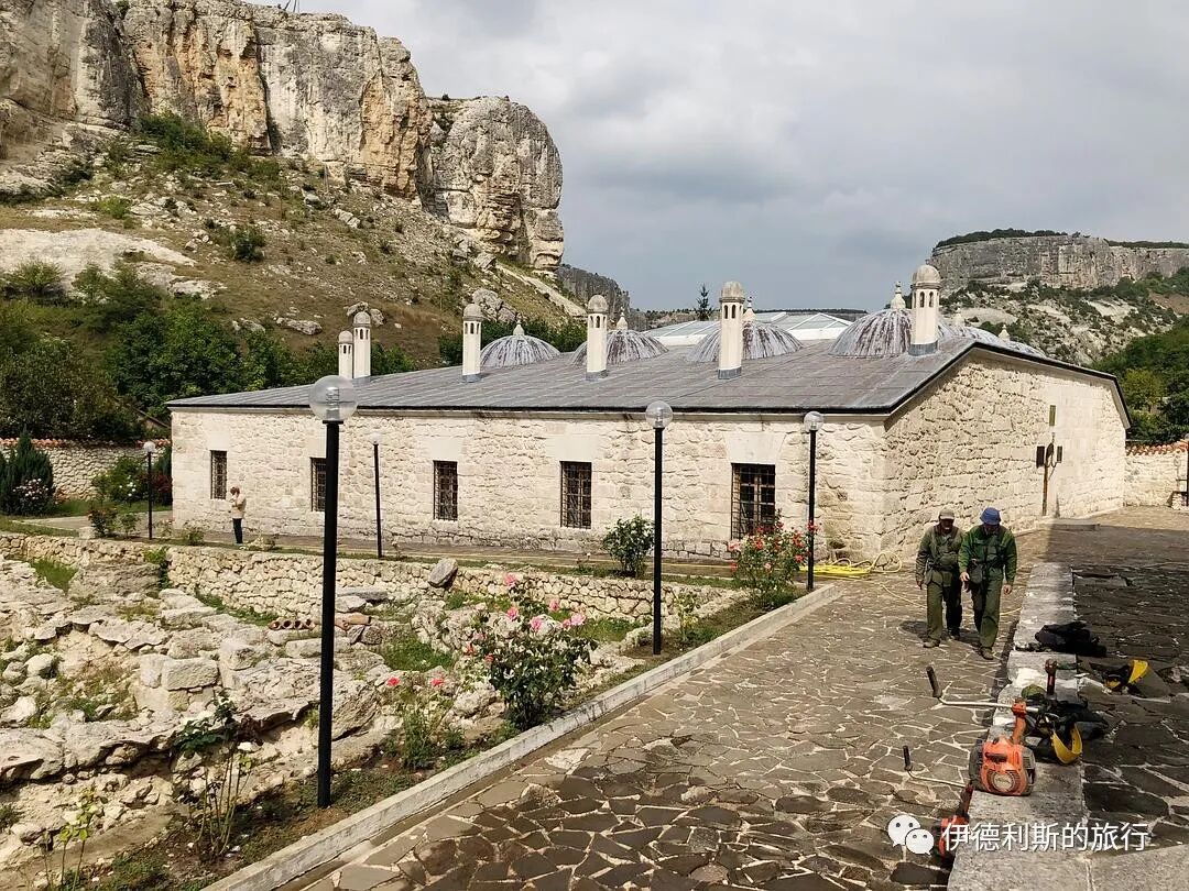
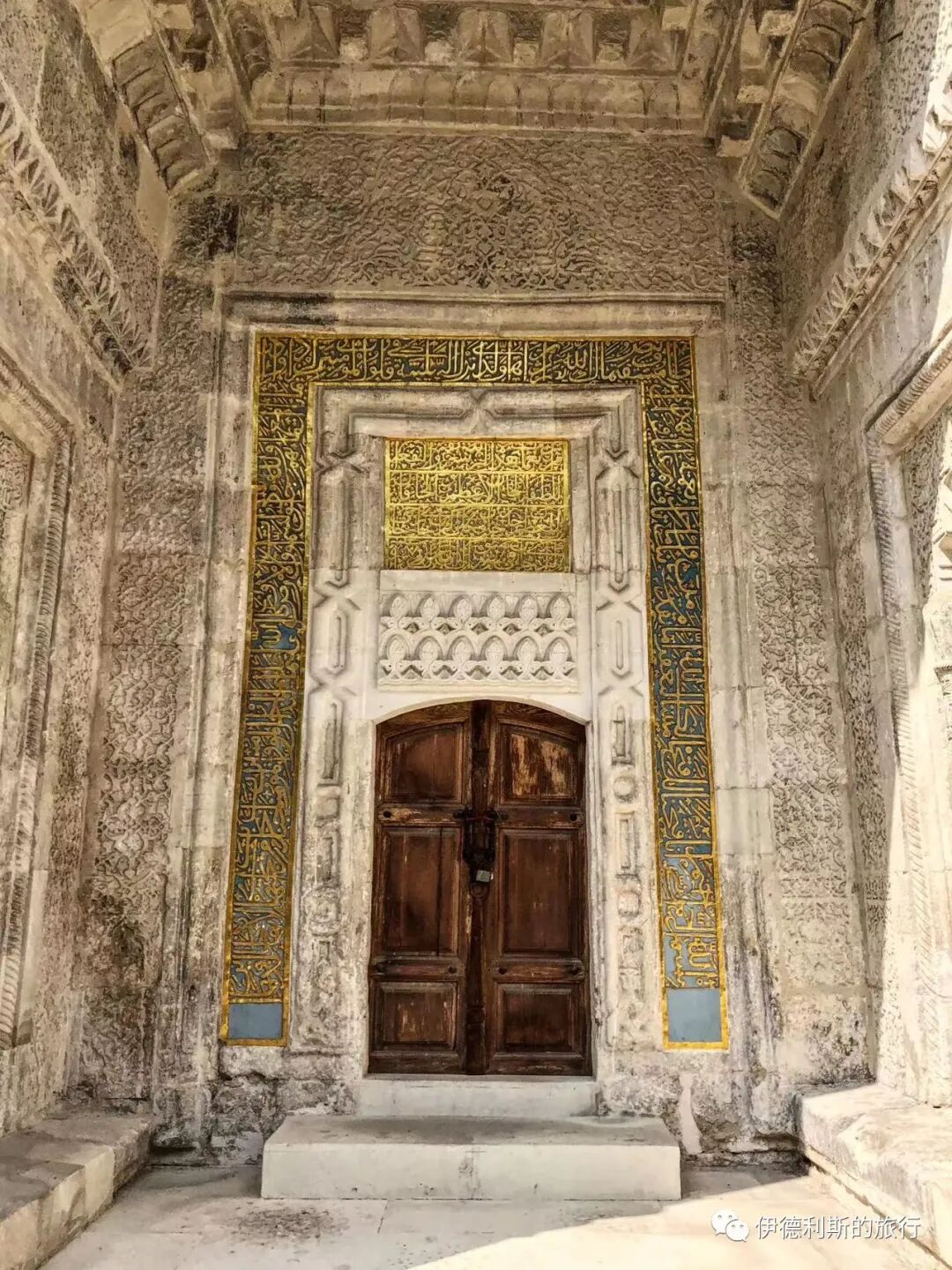
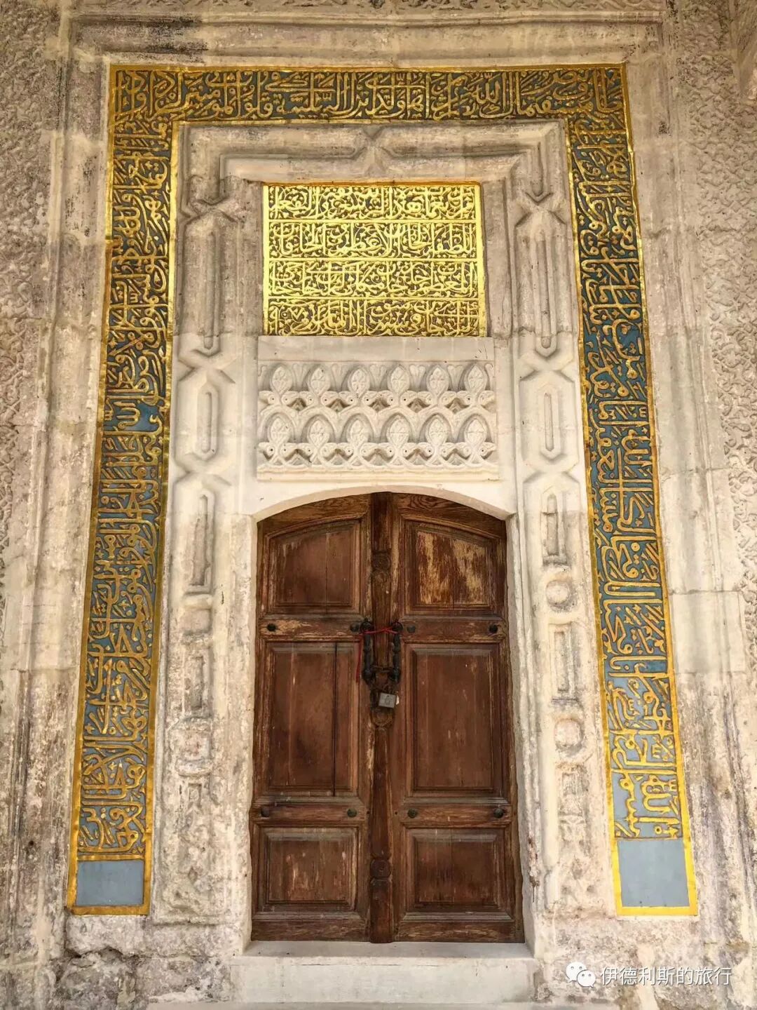
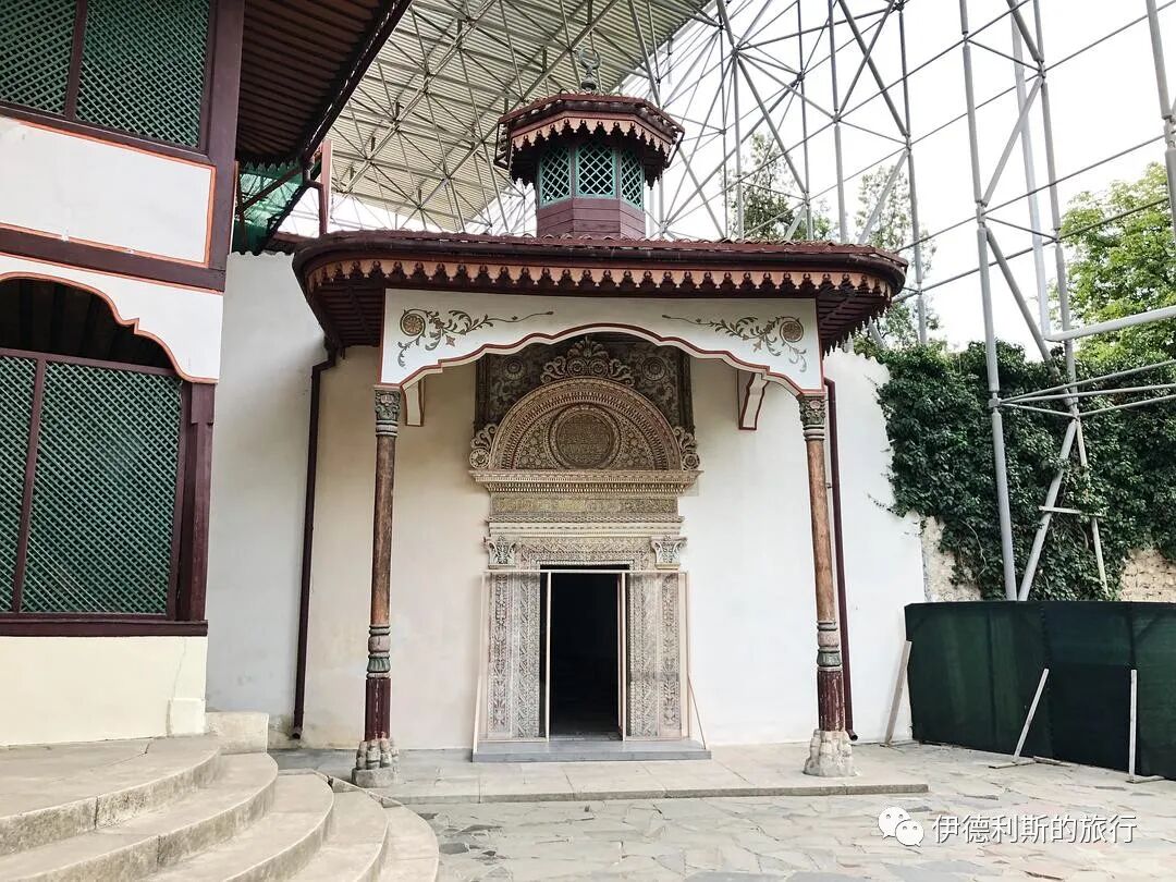
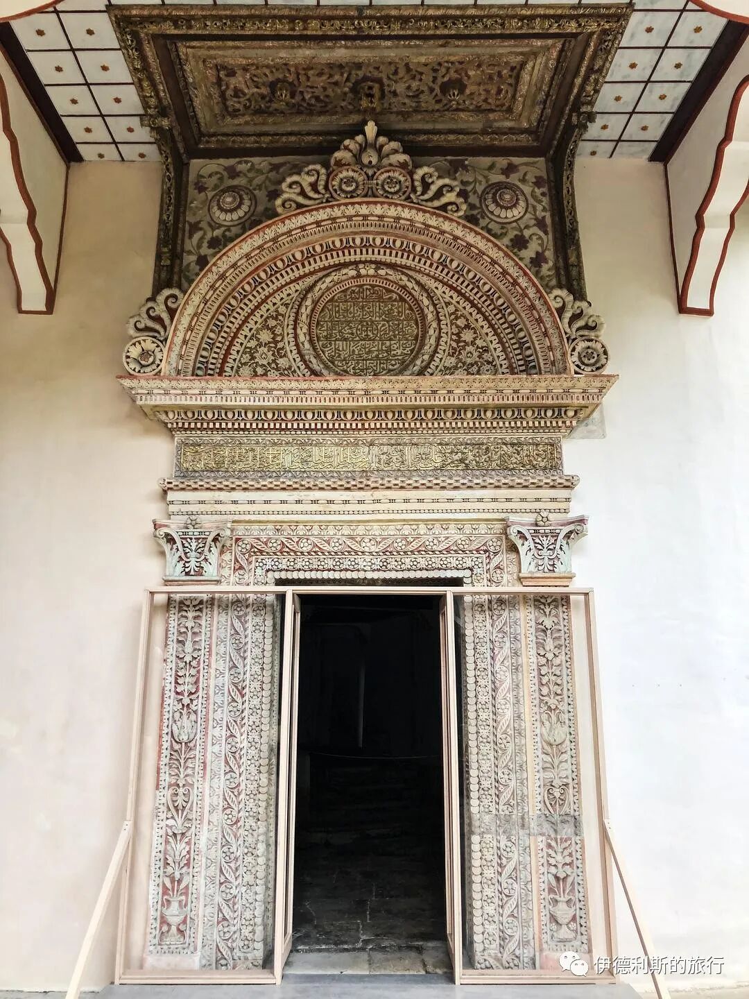
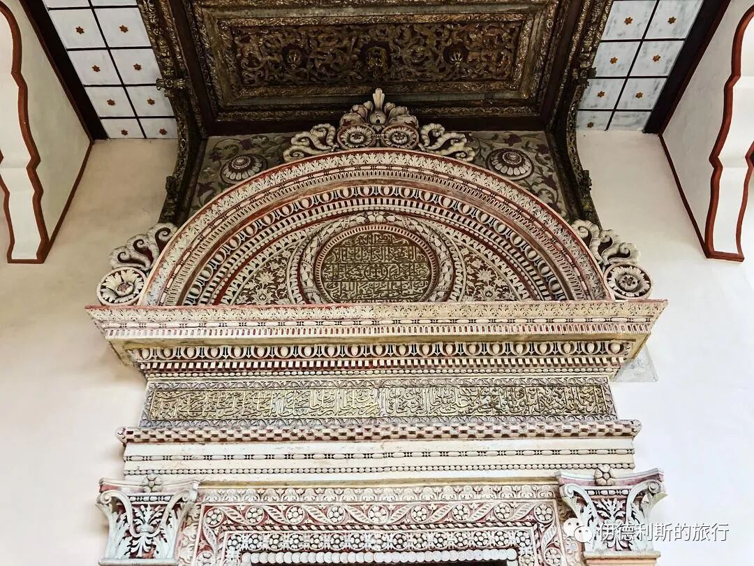
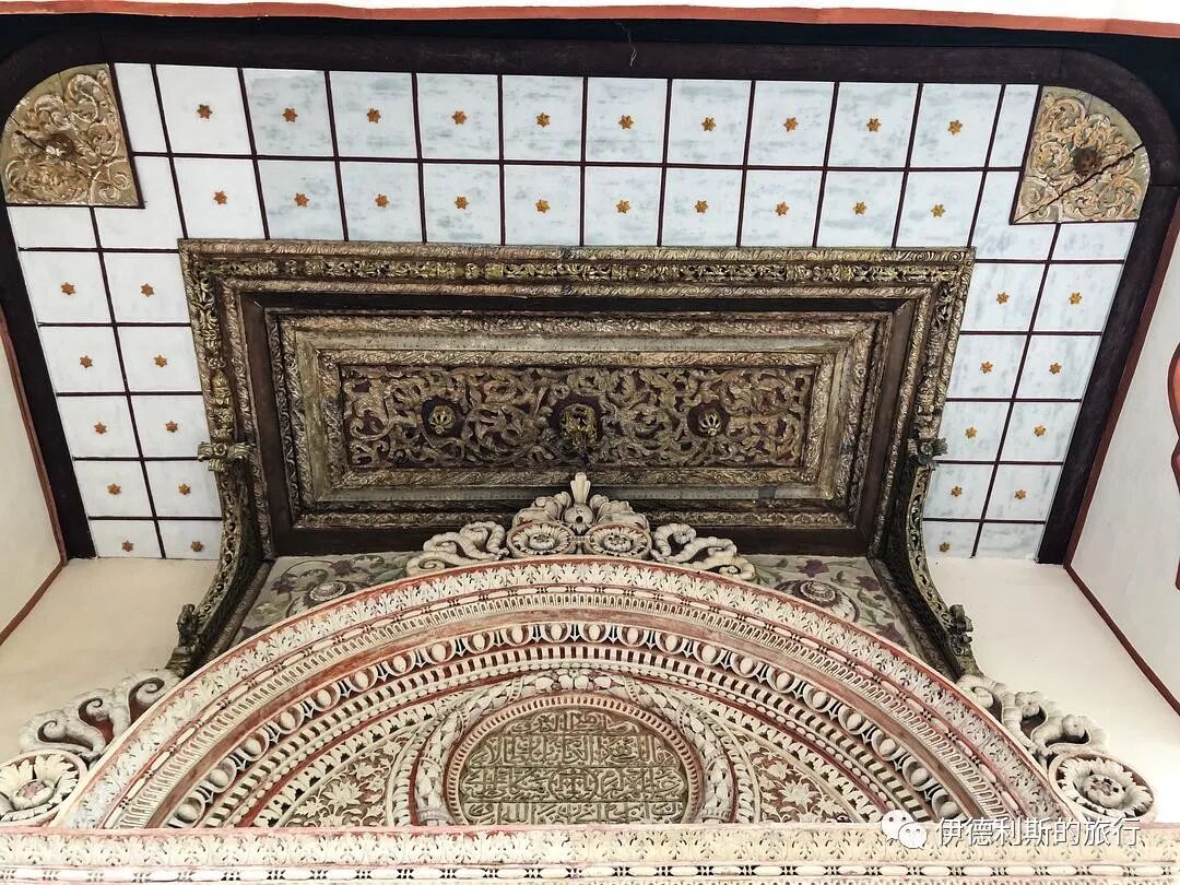
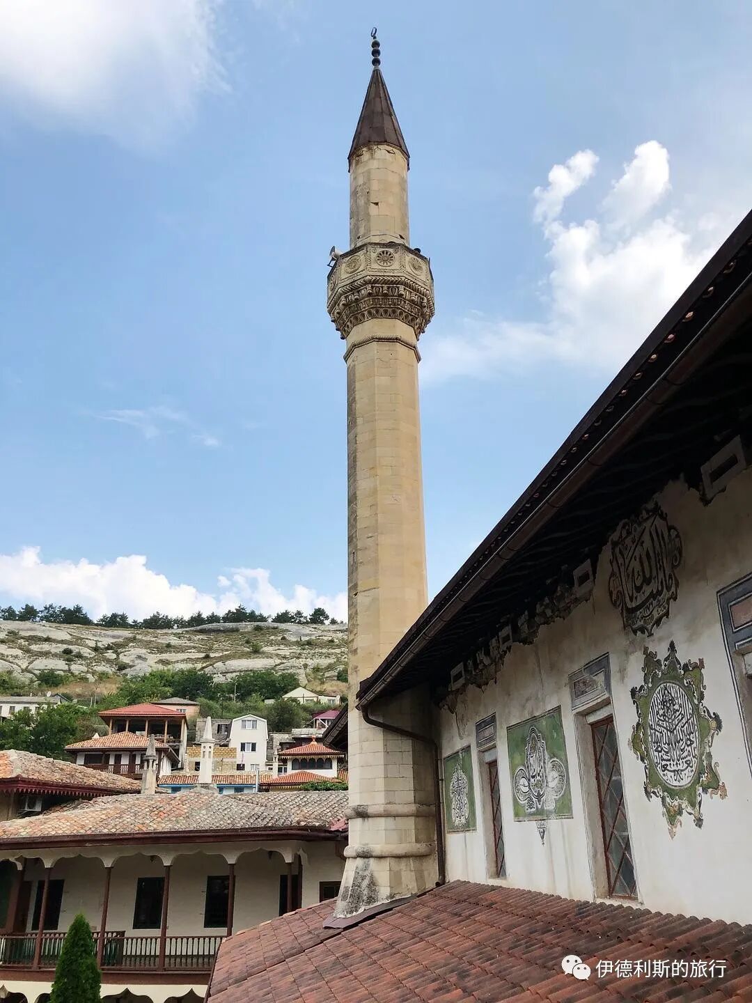
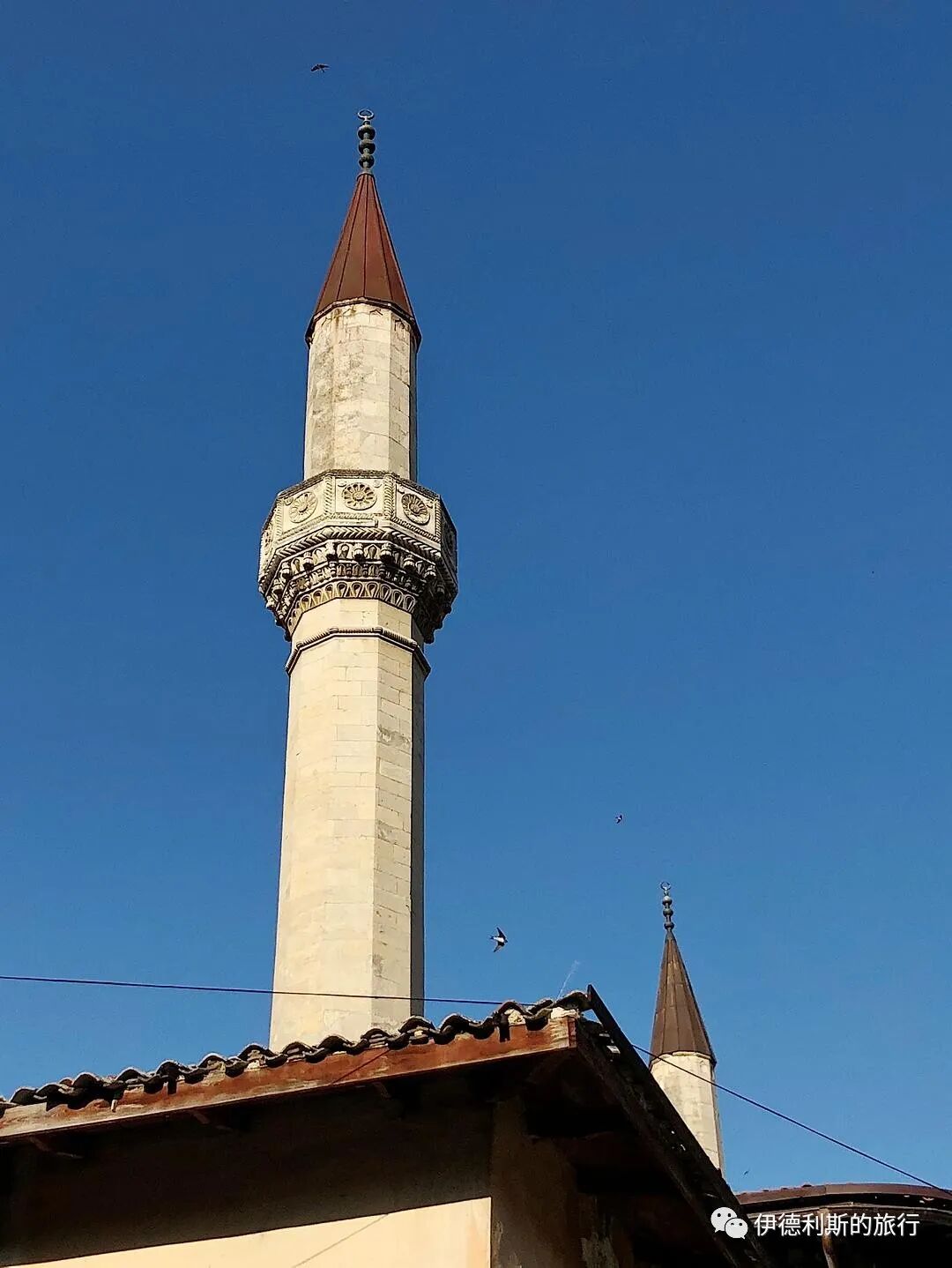
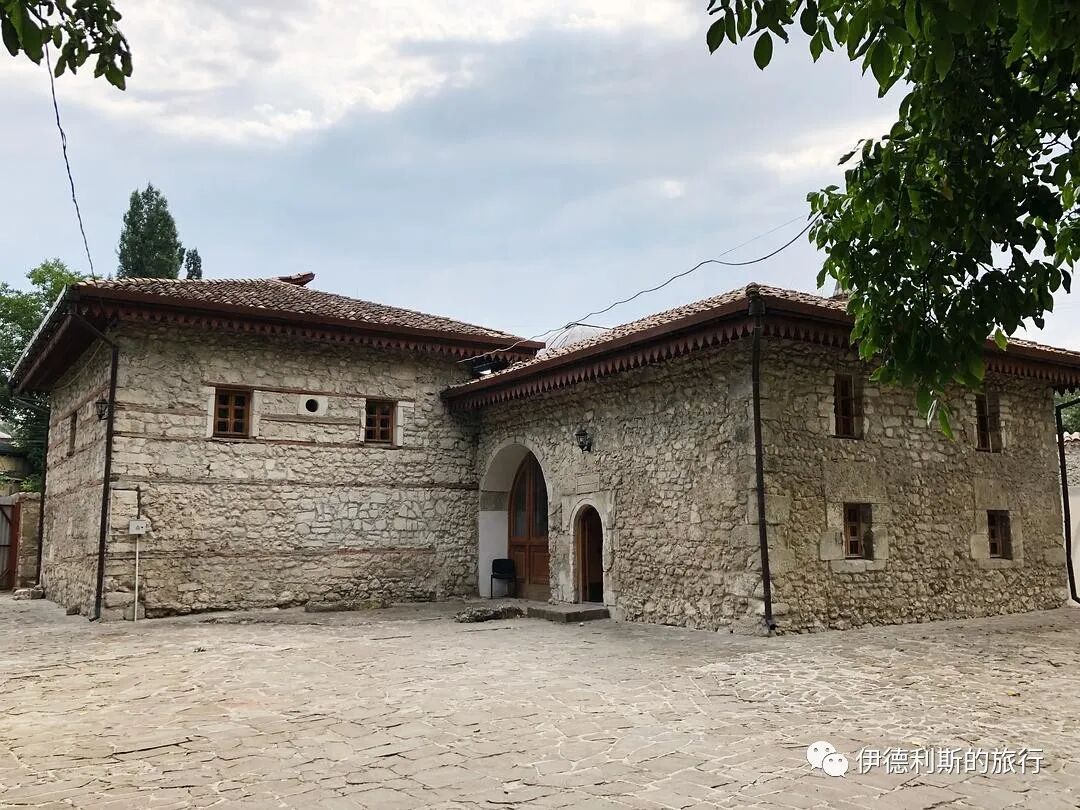
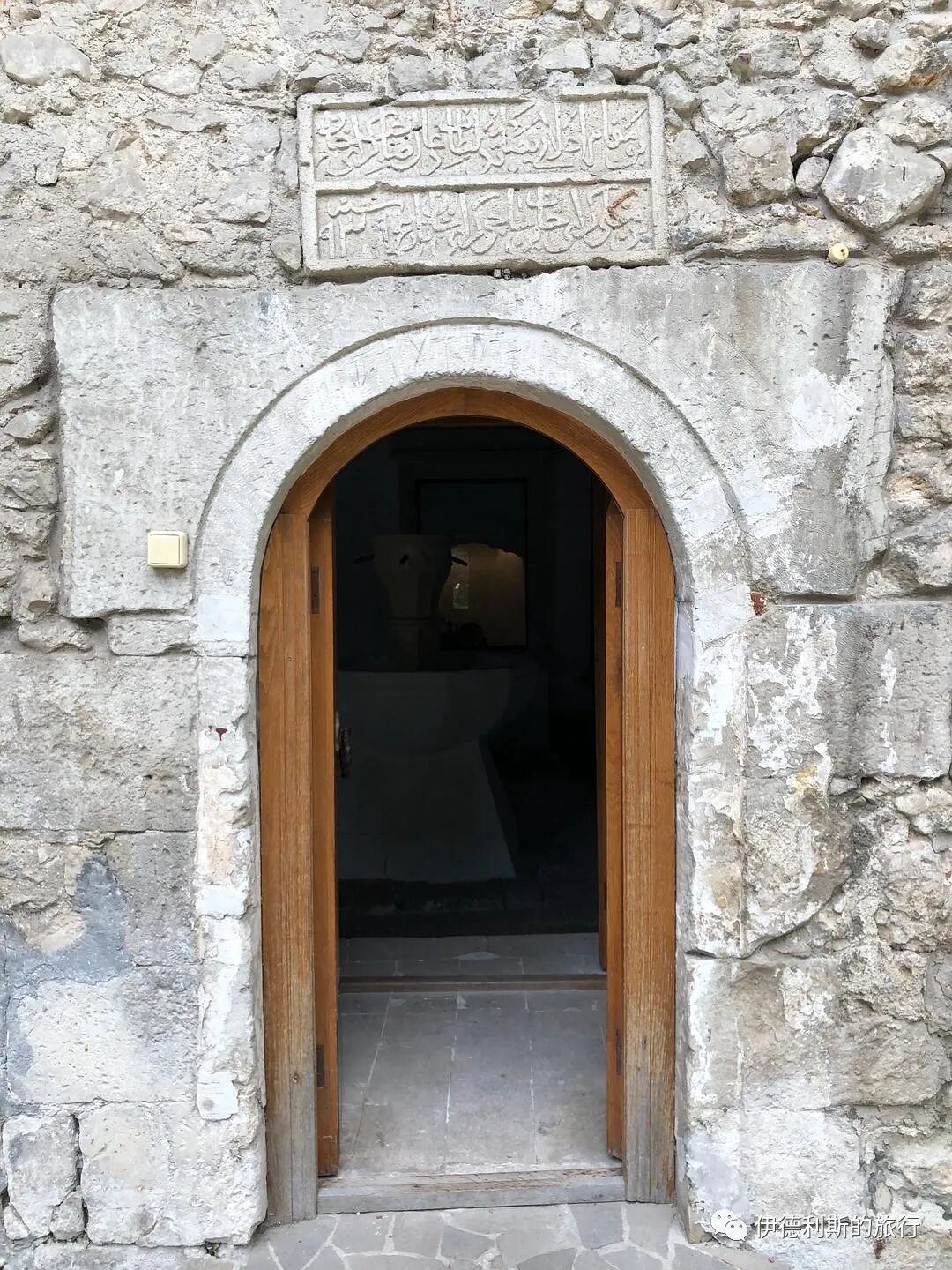
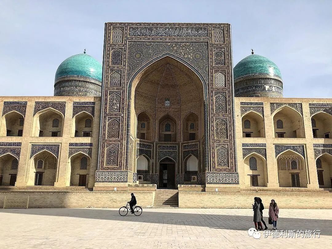
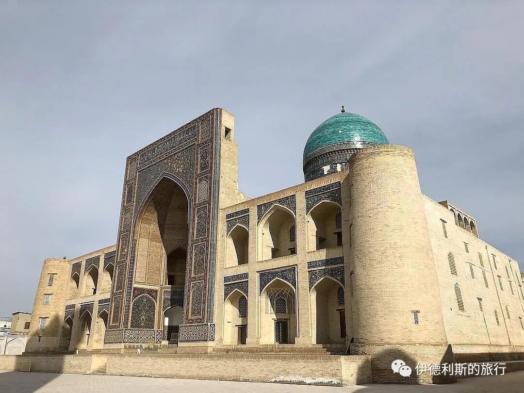
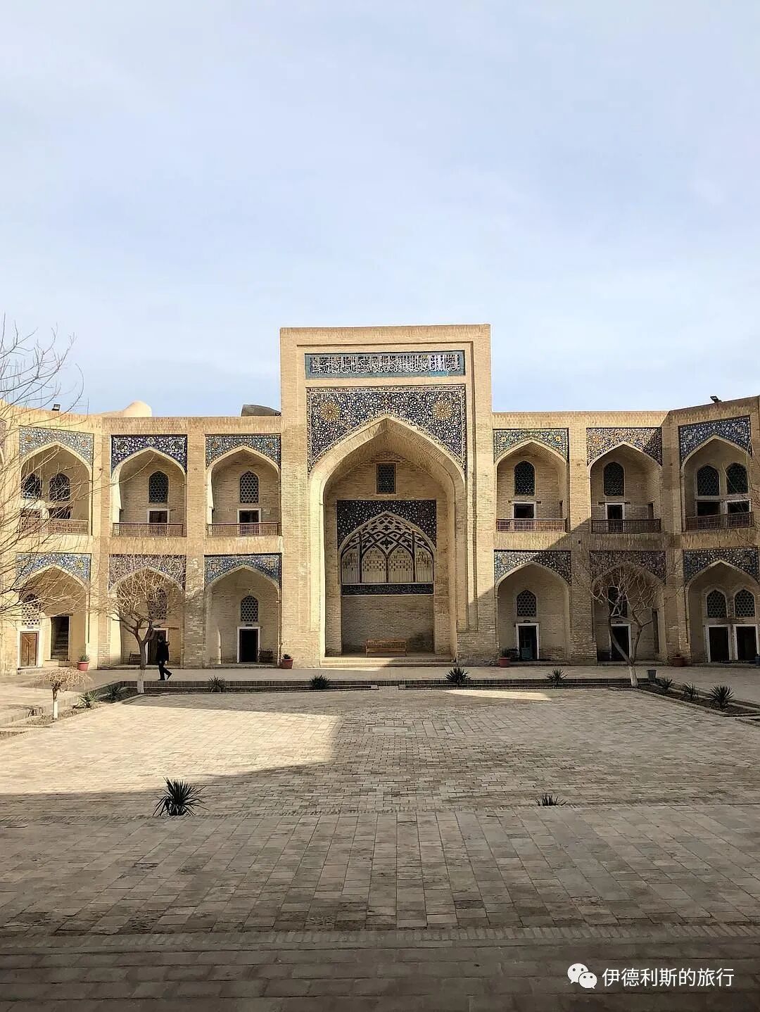
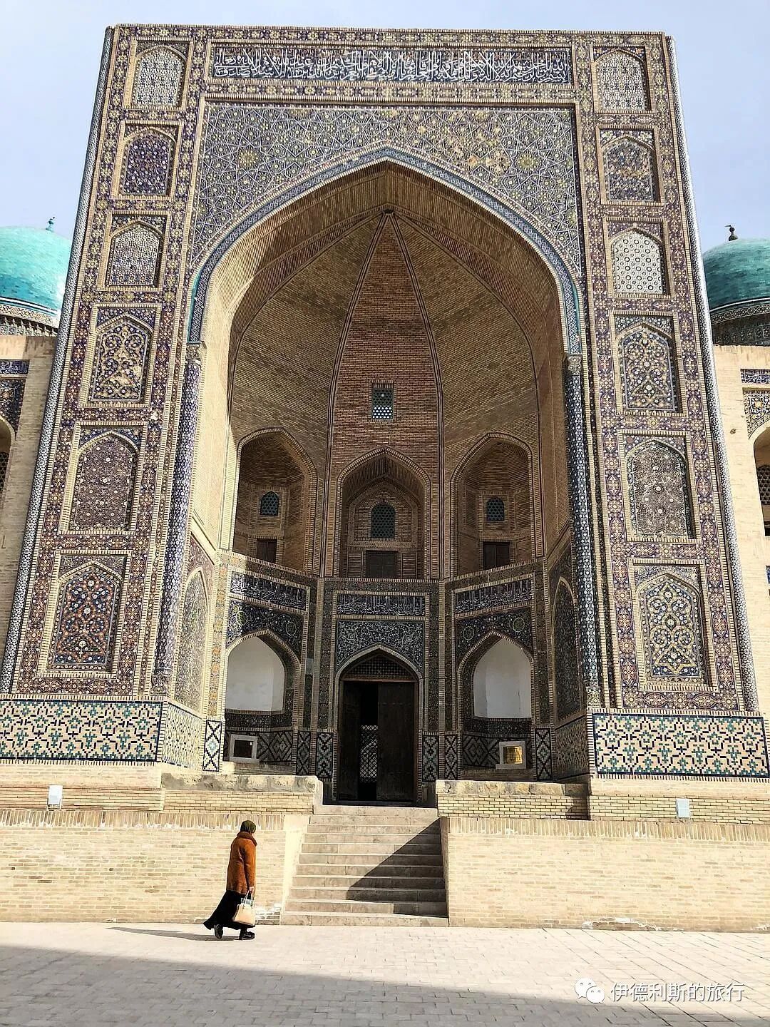
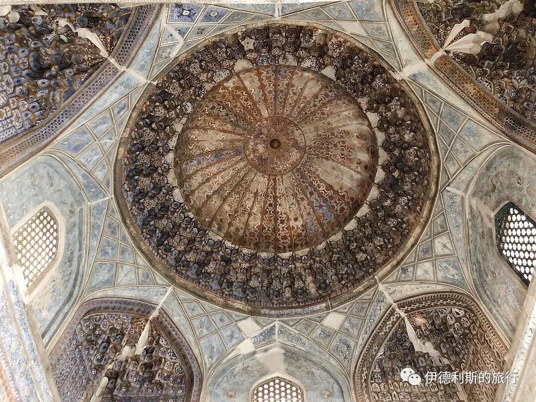
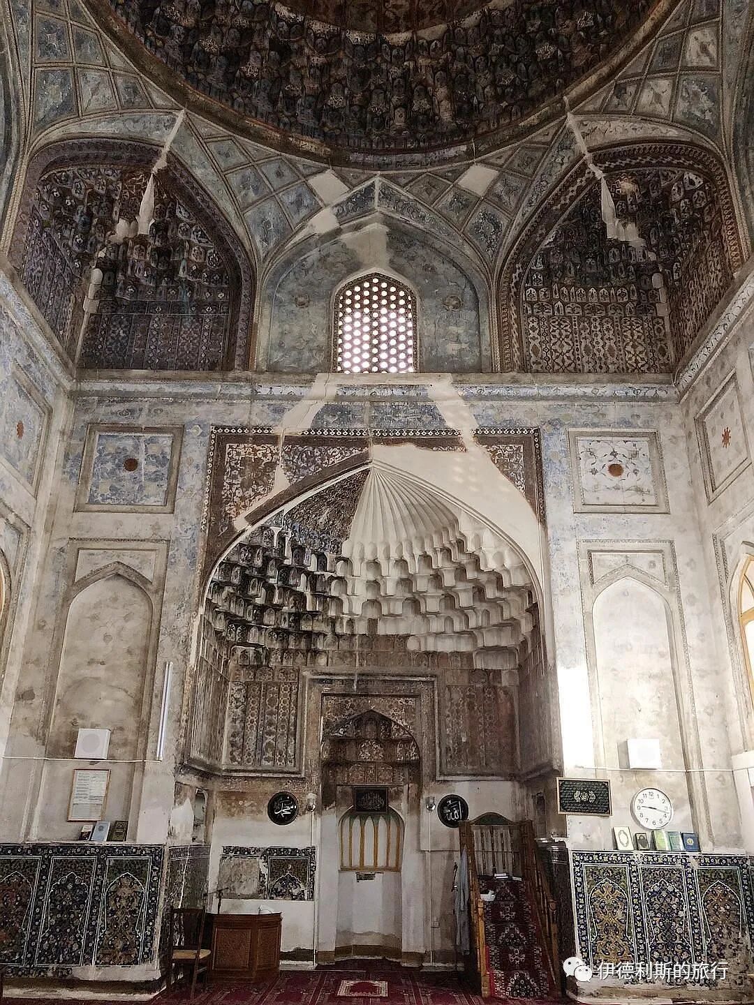
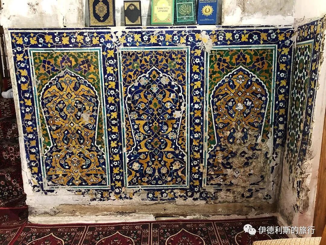
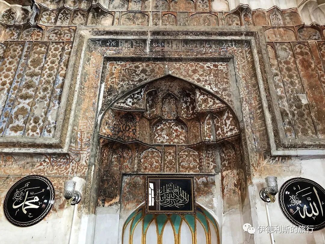
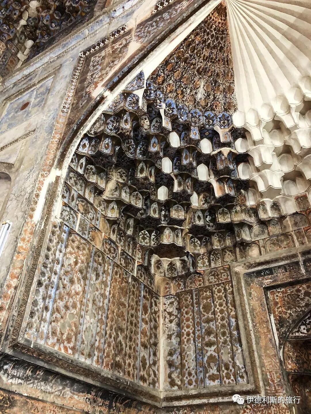
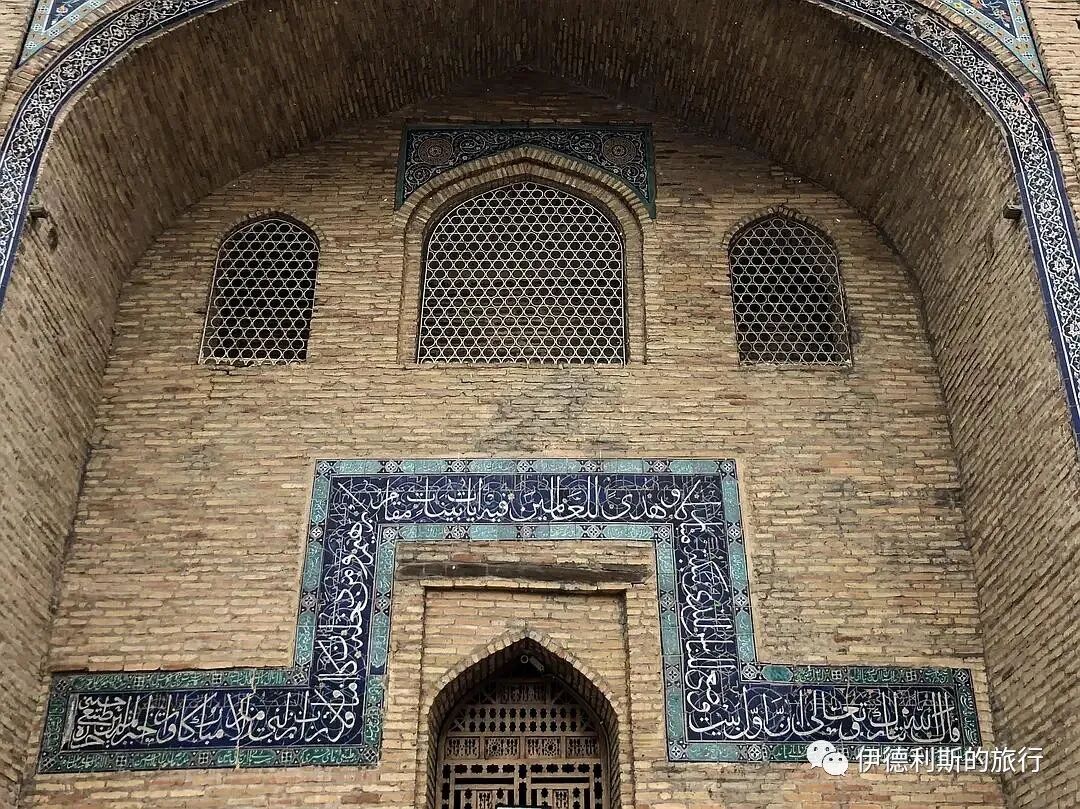
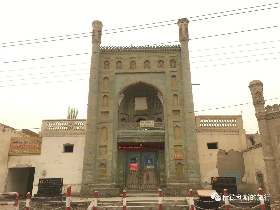
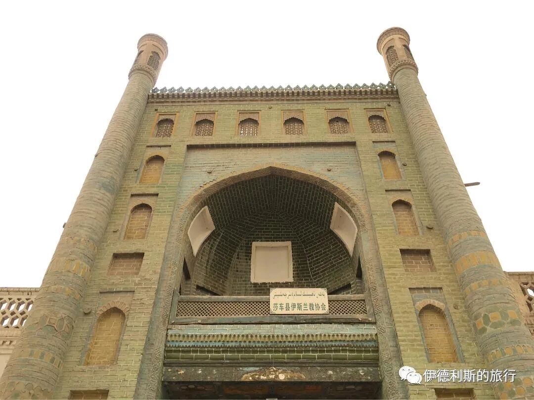
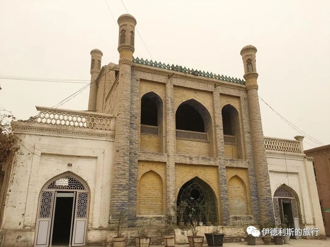
The Chain Madrasa (Zıncırlı Medrese) was built in 1500 by order of the Crimean Khan Meñli I Giray. The name of the madrasa comes from the Turkic word "Zyngyr," which means "chain." A chain hangs above the main gate of the madrasa, forcing everyone who enters to bow their head. The madrasa is rectangular with a central courtyard, an entrance on one side, and 11 rooms on the other three sides. At the time, the madrasa taught Turkish and Arabic grammar, calligraphy, arithmetic, ethics, logic, proof theory, Islamic law (sharia), theology, and hadith studies. The full course of study took ten years.
In 1909, influenced by the Crimean Tatar Enlightenment movement, Gasprinski built a new two-story madrasa next to the old one. The madrasa closed in 1917 and became the Meñli Giray Research Institute. The institute was abolished in 1923. Later, it served as a teacher's college, a medical school, a sanatorium for German soldiers, and a post-war psychiatric clinic. Today, it is managed by the Bakhchysarai History, Culture, and Archaeology Museum.
The Iron Gate (Demir Qapı) is the oldest structure in the Khan's Palace. It was built between 1503 and 1504 for the Crimean Khan by the architect Aleviz Novy, who had been invited by Ivan the Great to build churches in Moscow. The Iron Gate was likely first built at the Crimean Khan's previous residence, Devlet-Saray, and moved to the main palace building after the Bakhchysarai Khan's Palace was completed in 1532. "Demir Qapı" means "iron gate" in Crimean Tatar. The doorway is made of limestone and features Lombard-Venetian Renaissance decorative styles.
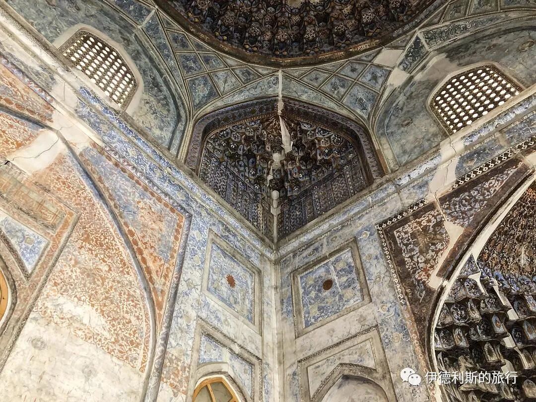
The Great Khan Mosque (Büyük Han Cami) in the Bakhchysarai Khan's Palace was built in 1532 and is one of the earliest structures in the palace. The original mosque had multiple domes, similar to the Seljuk-style mosques popular in the Ottoman Empire during the 15th century. The mosque was destroyed by fire in 1736. It was later restored by Khan Selamet II Giray (who reigned from 1740 to 1743) and converted to a tiled roof.
During the Soviet era, the mosque was closed and turned into an exhibition hall for the archaeological museum. After Russia occupied Crimea in 2014, the mosque underwent repairs, some of which caused damage to the building.
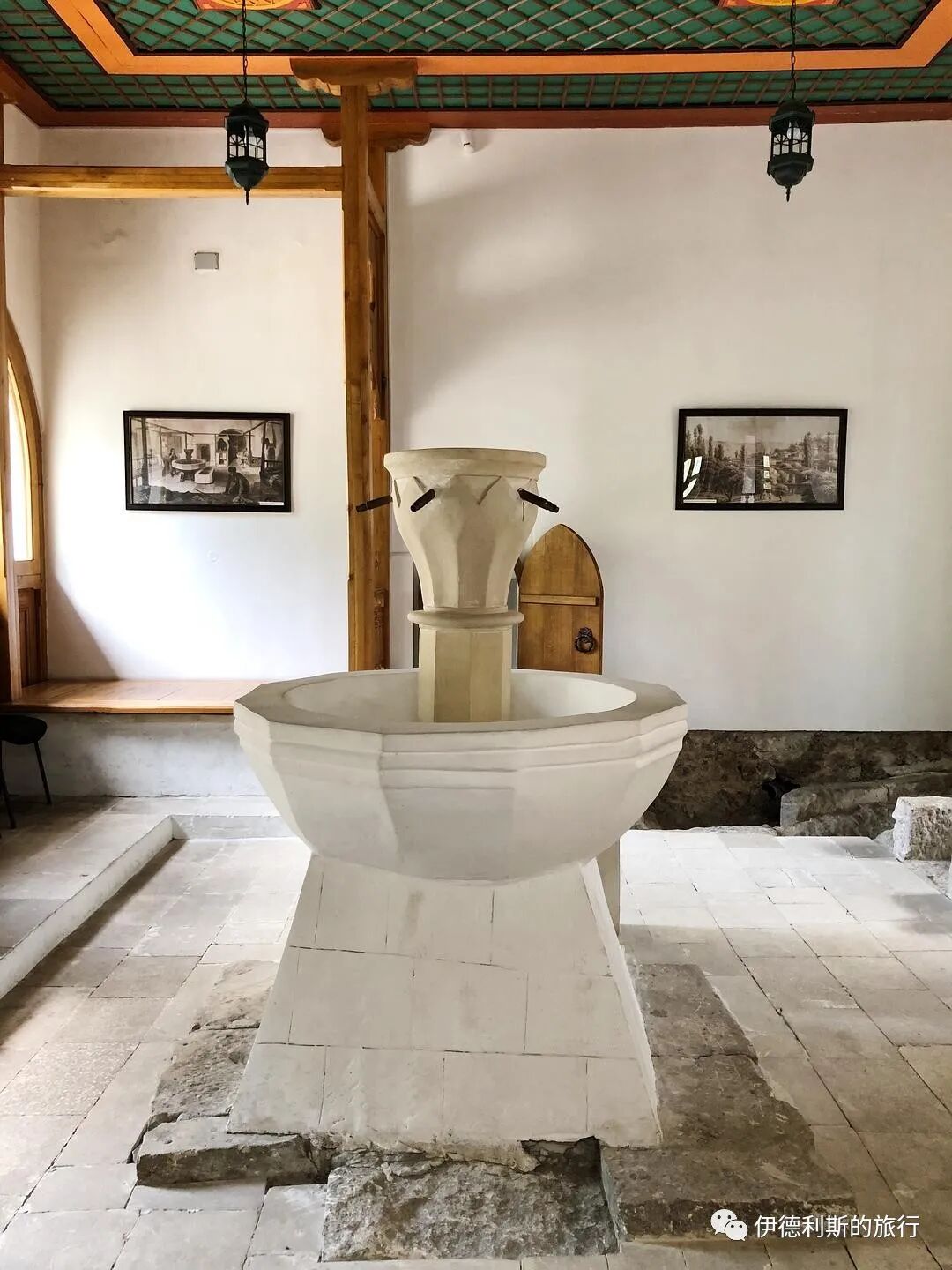
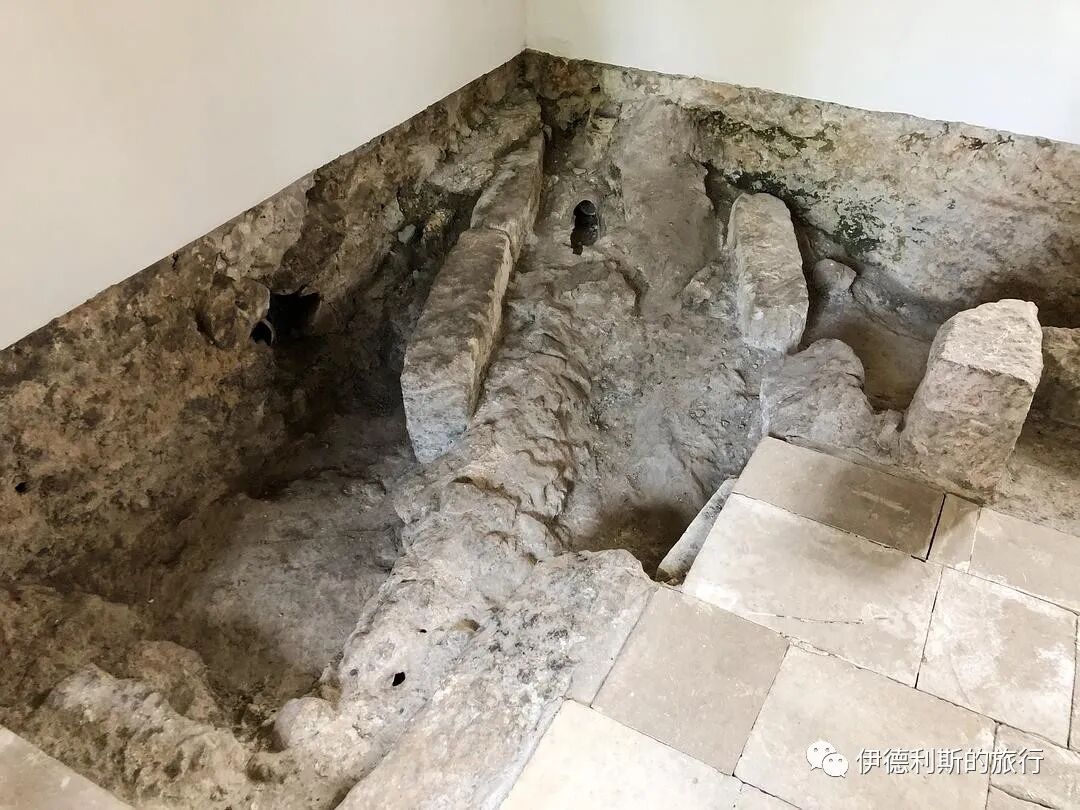
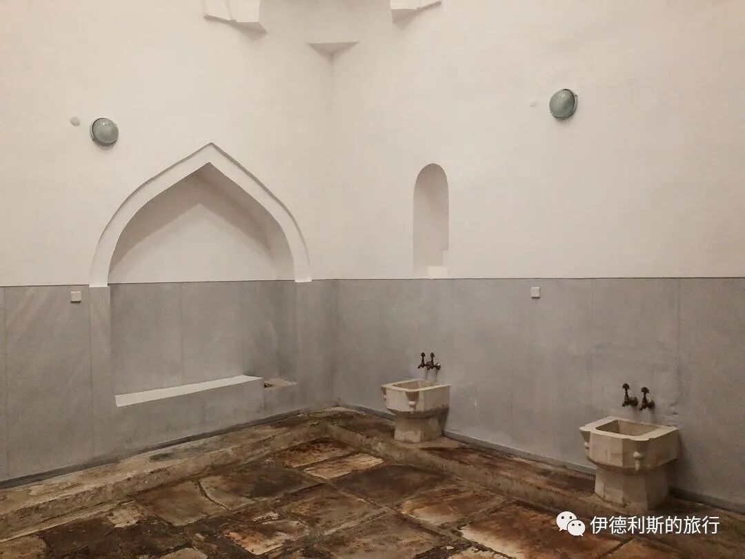
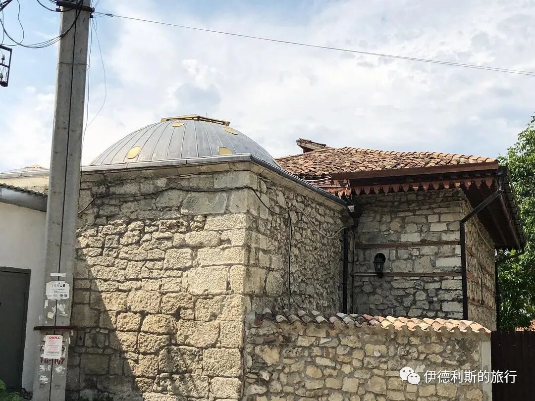
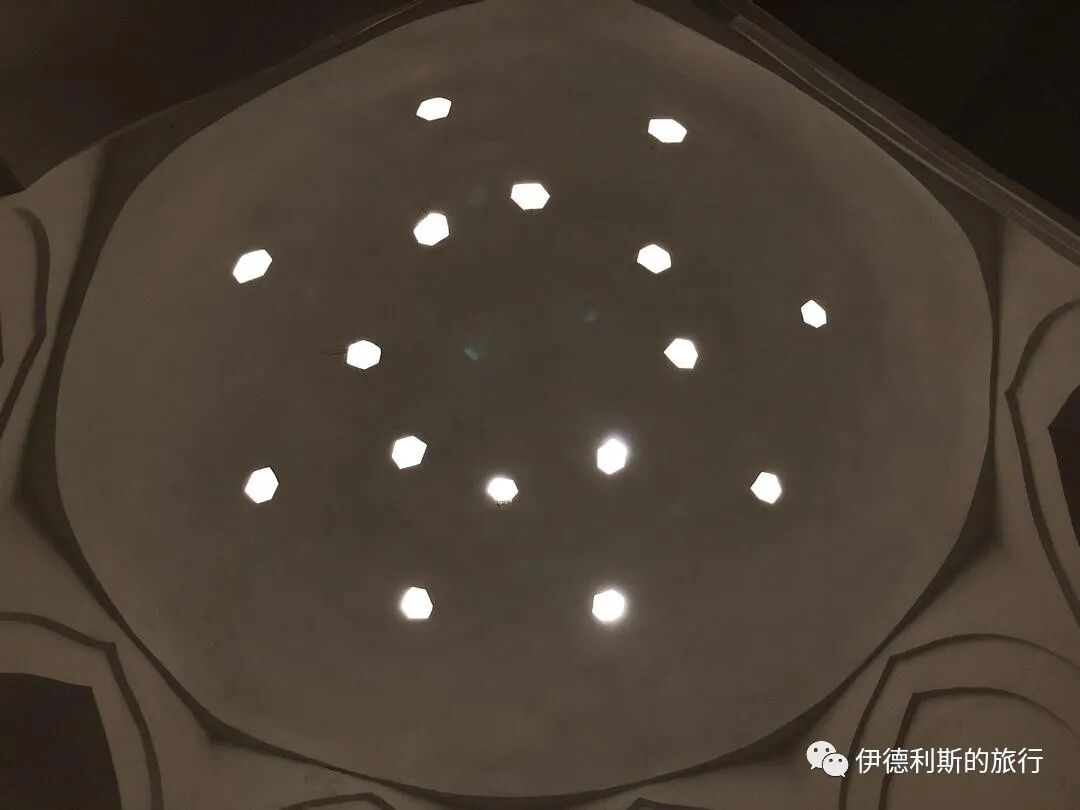
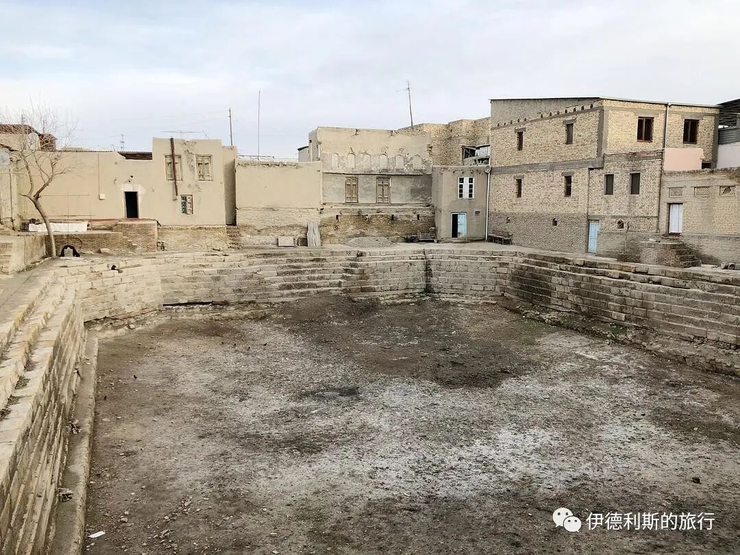
The SaryGuzel Bathhouse was built in 1532 by order of the Crimean Khan Sahib I Giray. Like the Great Khan Mosque, it is one of the earliest buildings in the Bakhchysarai Khan's Palace. In Crimean Tatar, "Sarı" means "yellow or fair-skinned," and "Güzel" means "beautiful." The SaryGuzel Bathhouse is a typical Turkish bath. A furnace in the basement heated the floor with rising hot air, and cold and hot water were supplied through lead pipes. The bathhouse is divided into men's and women's sections, each with its own dome. The domes have star-shaped cutouts for ventilation and light, and there is an indoor courtyard with a fountain at the exit.
The SaryGuzel Bathhouse operated until 1924, when it was closed because it was considered unsafe. It has since been repaired and is now open for exhibitions.
The Khan's cemetery holds the grave of the Crimean Khan Devlet I Giray (reigned 1551–1577). He was appointed Kalga (the second-in-command after the Khan) in 1530. Later, due to court struggles, he went to Istanbul and gradually gained the trust of the Ottoman Sultan Suleiman the Magnificent. In 1551, with the help of Suleiman the Magnificent, he became the Crimean Khan.
2. The Astrakhan Khanate of Russia (1466–1556)
We continue east to the mouth of the Volga River.
The Astrakhan Khanate was located in the Volga Delta. Its founder, Mahmud bin Küchük, was a prince of the Golden Horde. The Astrakhan Khanate was mainly inhabited by Astrakhan Tatars and Nogais. The Khanate's caravans traveled between Moscow, Kazan, Crimea, Central Asia, and the Transcaucasus region. In 1532, the Astrakhan Khanate began to have contact with Russia. After Russia conquered Kazan in 1552, the Astrakhan Khanate could not escape the same fate.
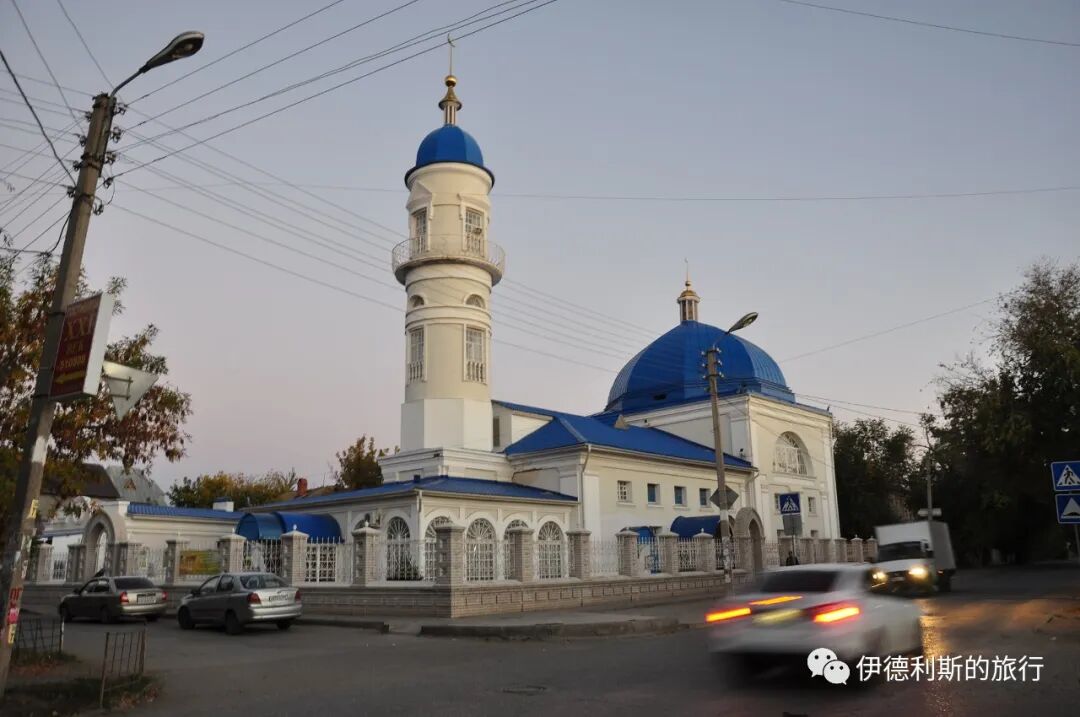
In 1550, the capital of the Astrakhan Khanate was Hajji Tarkhan, located on the right bank of the Volga River, 12 kilometers north of the modern city of Astrakhan. The city of Hajji Tarkhan was built by the Golden Horde in the late 13th century, appeared in the Travels of Ibn Battuta in the 14th century, was destroyed by Timur's army in 1395, and was rebuilt by the Astrakhan Khanate in the 15th century. The city was occupied by the Crimean Khanate in 1547 and was finally burned down by Ivan the Terrible in 1556.
There are currently about 60,000 Astrakhan Tatars in Russia. Most live in the Astrakhan Oblast, with half living in the city of Astrakhan, where they have their own community and several mosques.
The location of the city of Hajji Tarkhan.
The White Mosque in Astrakhan, photographed by Polinadelia in 2014.
3. The Nogai Horde in Russia and Kazakhstan (1440–1634)
Continuing east from the Volga River, you reach the grasslands of the Nogai tribes.
Nogai was the great-grandson of Jochi, the eldest son of Genghis Khan, and an important leader of the Golden Horde who ruled many Turkic-speaking tribes in the 13th century. A century later, the Golden Horde general Edigu ruled a large area from the Volga to the Ural River, and the tribes under his rule were also called the Nogai Horde.
We can find history about the Nogai Horde in the early 16th century in Russian records. In 1521, the Nogai were driven west by the Kazakhs and crossed the Volga River to attack Astrakhan. In 1522, the Kazakhs captured the capital of the Nogai Horde. In 1523, the Nogai Horde defeated the army that had briefly occupied Astrakhan.
In 1550, the Khan of the Kazan Khanate was Yosuf Khan (1549–1555), who had helped Moscow against the Kazan Khanate in 1549.
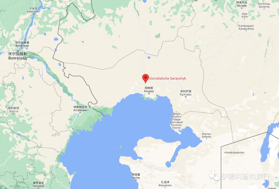
Saray-Jük was the capital of the Nogai Horde, located on the border of Europe and Asia in western Kazakhstan. This city sat on a trade route between Europe and China and was an important commercial hub during the Golden Horde period. After being destroyed by Timur in 1395, it was rebuilt in the 1430s and 1440s.
The location of Saray-Jük.
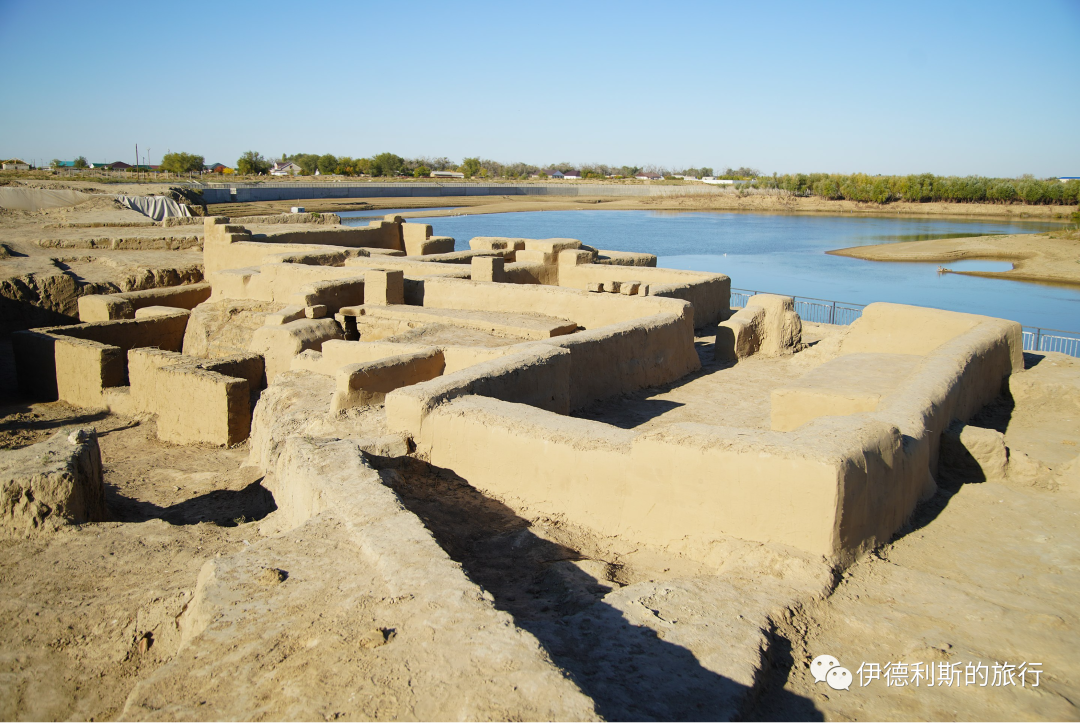
The ruins of Saray-Jük, photographed by Yakov Fedorov in 2020.
4. The Qasim Khanate in Russia (1452–1681)
We head north to the modern-day Ryazan Oblast in Russia.
The Qasim Khanate was located in Russia's Ryazan Oblast. Its founder, Qasim Khan, was the son of Ulugh Muhammad, the founder of the Kazan Khanate. The Qasim Khanate served as a buffer state between the Grand Duchy of Moscow and the Kazan Khanate and was under heavy Russian control.
In 1550, the Khan of the Qasim Khanate was Shahghali, who was installed as the Khan of the Kazan Khanate three times as a Russian vassal. In 1546, Shahghali was overthrown by the people of Kazan and fled back to the Qasim Khanate. Between 1547 and 1551, he participated in several Russian attacks on the Kazan Khanate and took part in the final Russian conquest of Kazan in 1552.
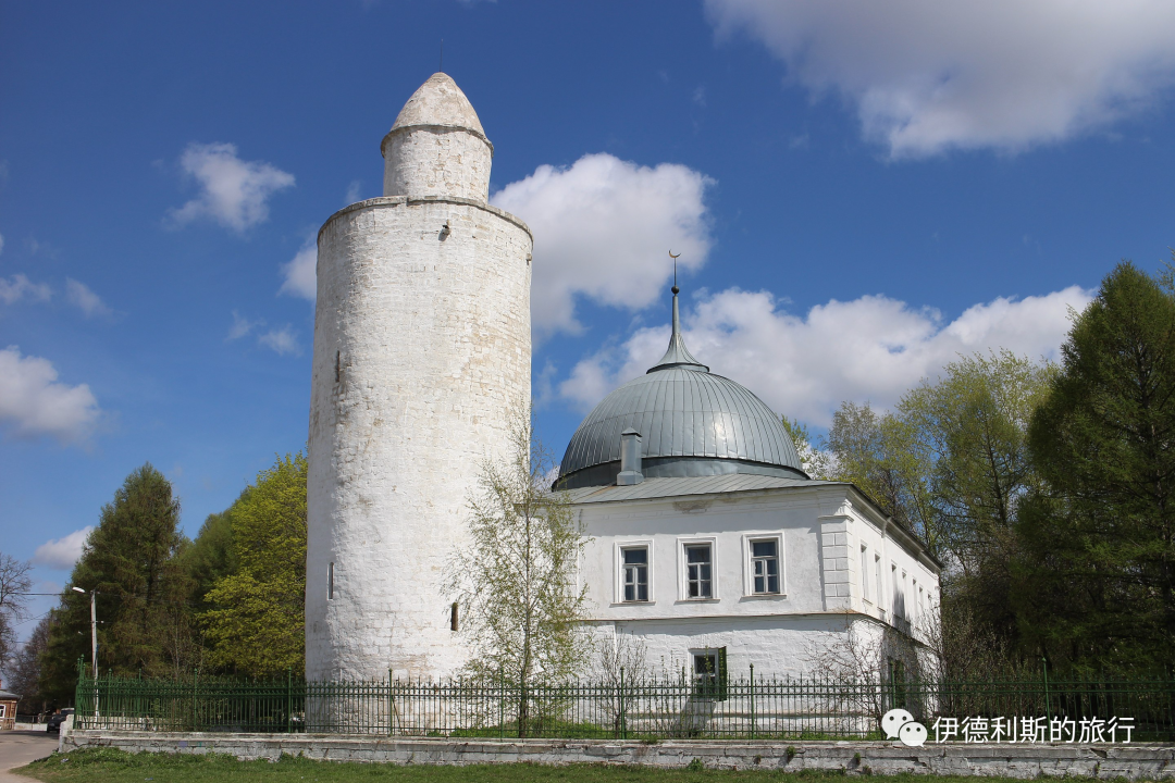
The capital of the Qasim Khanate, Qasimov, is located on the left bank of the Oka River in Russia's Ryazan Oblast, where one thousand Tatar-speaking Qasim Tatars still live today. The Khan Mosque in Qasimov was built by Shahghali in the mid-16th century. It was ordered to be demolished by Peter the Great in 1702, but the minaret (bangke ta) was preserved. This minaret is very similar to the Light Tower (Guangta) of the Huaisheng Mosque in Guangzhou.
The Khan Mosque in Qasimov, photographed by Alexander Novikov in 2014.
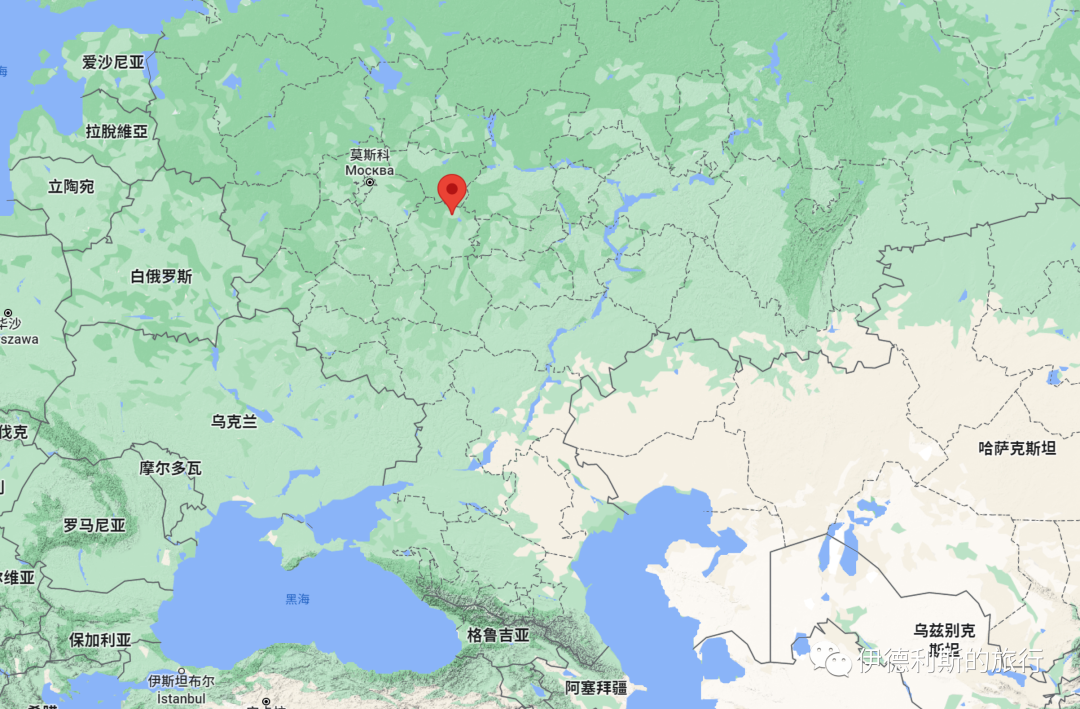
The location of Qasimov.
5. The Kazan Khanate in Russia (1438–1552)
We headed east to the city of Kazan on the banks of the Volga River.
The Kazan Khanate was founded by Ulugh Muhammad, a descendant of Genghis Khan's eldest son Jochi, who had ruled the Golden Horde twice. He lost control of the Golden Horde in 1436, then led his army to the Volga River and officially established the Kazan Khanate after capturing Kazan in 1438.
In 1521, the Kazan Khanate formed an alliance with the Astrakhan, Crimean, and Nogai Khanates to resist Moscow together. This caused dissatisfaction among pro-Russian factions within the Kazan Khanate, leading the state into internal conflict.
In 1550, the Khan of the Kazan Khanate was the four-year-old Ötemish Giray, though the actual rulers were his mother, Söyembikä, and the prime minister (uğlan) Qoşçaq. Seeing the instability in the Kazan Khanate, Ivan the Terrible of Russia sent a large army to besiege Kazan in February 1550, but the thawing of the Volga River forced the Russians to retreat and only attack the outskirts of the city. Throughout that year, Söyembikä and Qoşçaq fought against the pro-Russian faction, and relations with Russia continued to worsen.
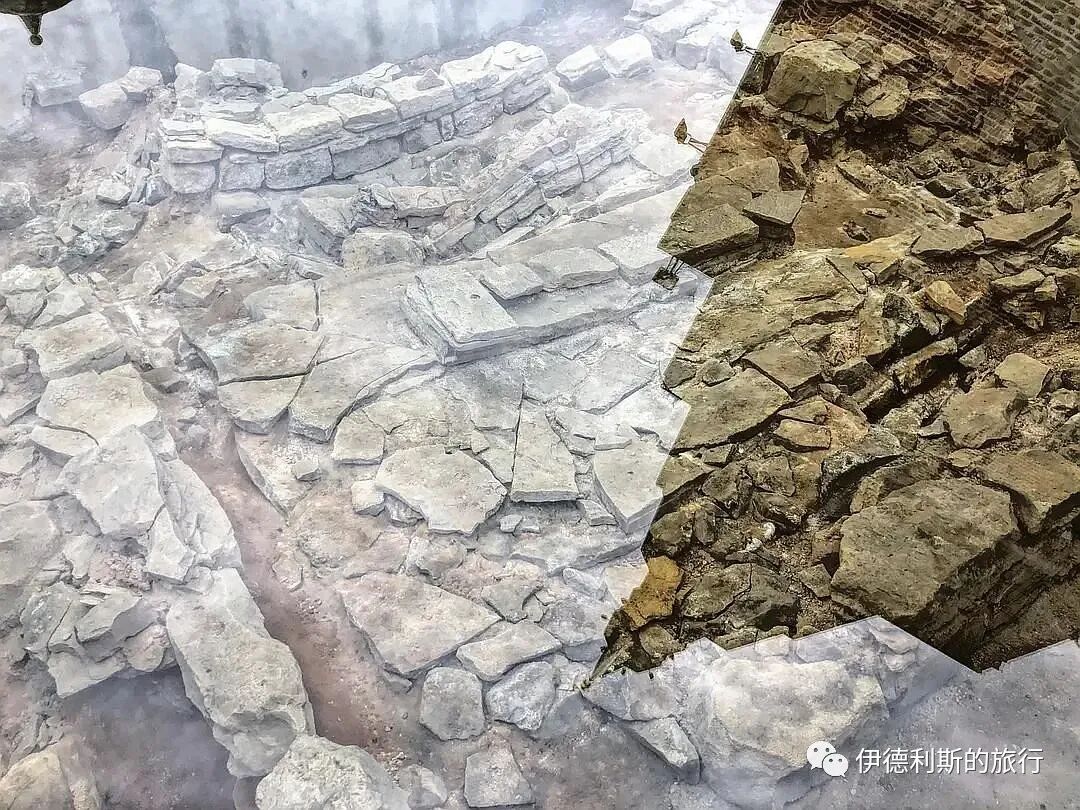
The Kazan Khanate built many homes and public buildings in Kazan, including the Khan's palace, courtyards, mosques, and tombs, with tall minarets defining the city's skyline. In 1552, Ivan the Terrible invaded Kazan, destroyed the Kazan Khanate, and drove all Tatars out of the city, allowing only Russians to settle there. Between 1556 and 1562, Ivan the Terrible ordered the construction of the Kazan Kremlin on the site of the old Kazan Khanate fortress. The mosques, the Kazan Khan's palace, and the tombs were initially used as armories and ammunition depots, but were eventually completely demolished in the 18th century.
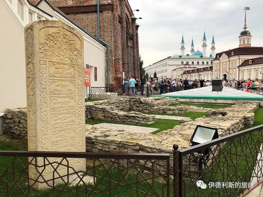
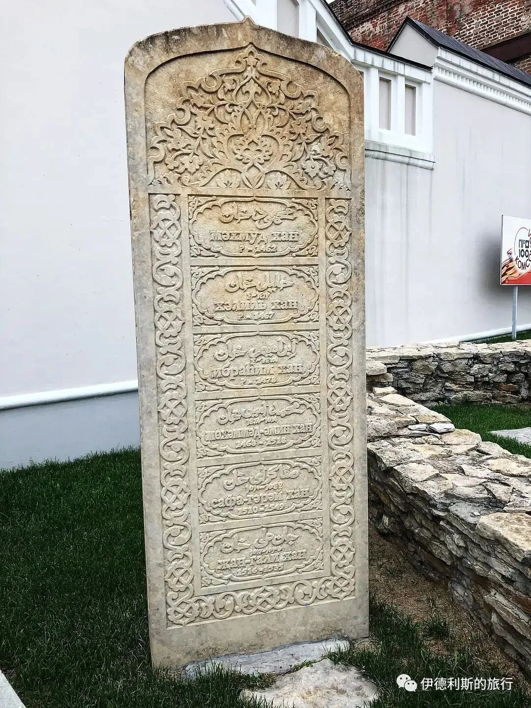
In 1977, hydraulic engineers accidentally dug up a grave while laying rainwater pipes at the Kazan Kremlin and immediately contacted the archaeology department. Archaeological excavations lasted for 10 years, eventually uncovering five graves, two of which were confirmed to be those of the actual founders of the Kazan Khanate: Mäxmüd Khan (died 1463 or 1466) and his grandson, Möxämmät Ämin (died 1518). The tomb was originally made of white stone and finally collapsed in the 17th century.
For further research, the remains of the two Kazan Khans, Mäxmüd and Möxämmät Ämin, were kept at the Institute of Archaeology of the Tatarstan Academy of Sciences for 40 years. In May 2017, after continuous efforts by the Tatar Muslims of Kazan, the two Kazan Khans were finally reburied not far from their original graves.
Between 2004 and 2005, the Institute of Archaeology of the Tatarstan Academy of Sciences re-excavated the Kazan Khan tombs and discovered the graves of four more Khans: Xalil (died 1467), İbrahim (died 1478), Safa Giray (died 1549), and Canghali (died 1535). Today, these four Kazan Khan graves are protected under a glass roof. Safa Giray Khan came from the Giray family of the Crimean Khanate and served as the Khan of Kazan three times: from 1524–1531, 1535–1546, and 1546–1549. Safa Giray was an anti-Russian Khan. His first reign ended due to Moscow's attack on Kazan, and he regained the throne four years later after Kazan nobles overthrew the pro-Russian Khan. Eleven years later, due to internal unrest in Kazan, he was overthrown again by a pro-Russian Khan. Safa Giray fled to his father-in-law's Nogai tribe, and a few months later, he returned to Kazan with a Nogai army to become the Khan for the third time. Canghali Khan was originally the Khan of the Qasim Khanate, a vassal state of the Grand Duchy of Moscow. In 1532, Grand Prince Vasily III of Moscow defeated the Kazan Khan Safa Giray and installed the 16-year-old Canghali as the pro-Russian Khan of Kazan. He died in 1535 during a coup by Kazan nobles.
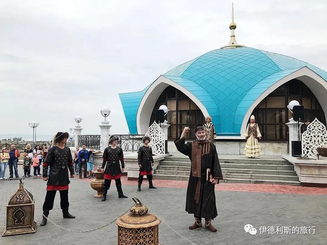
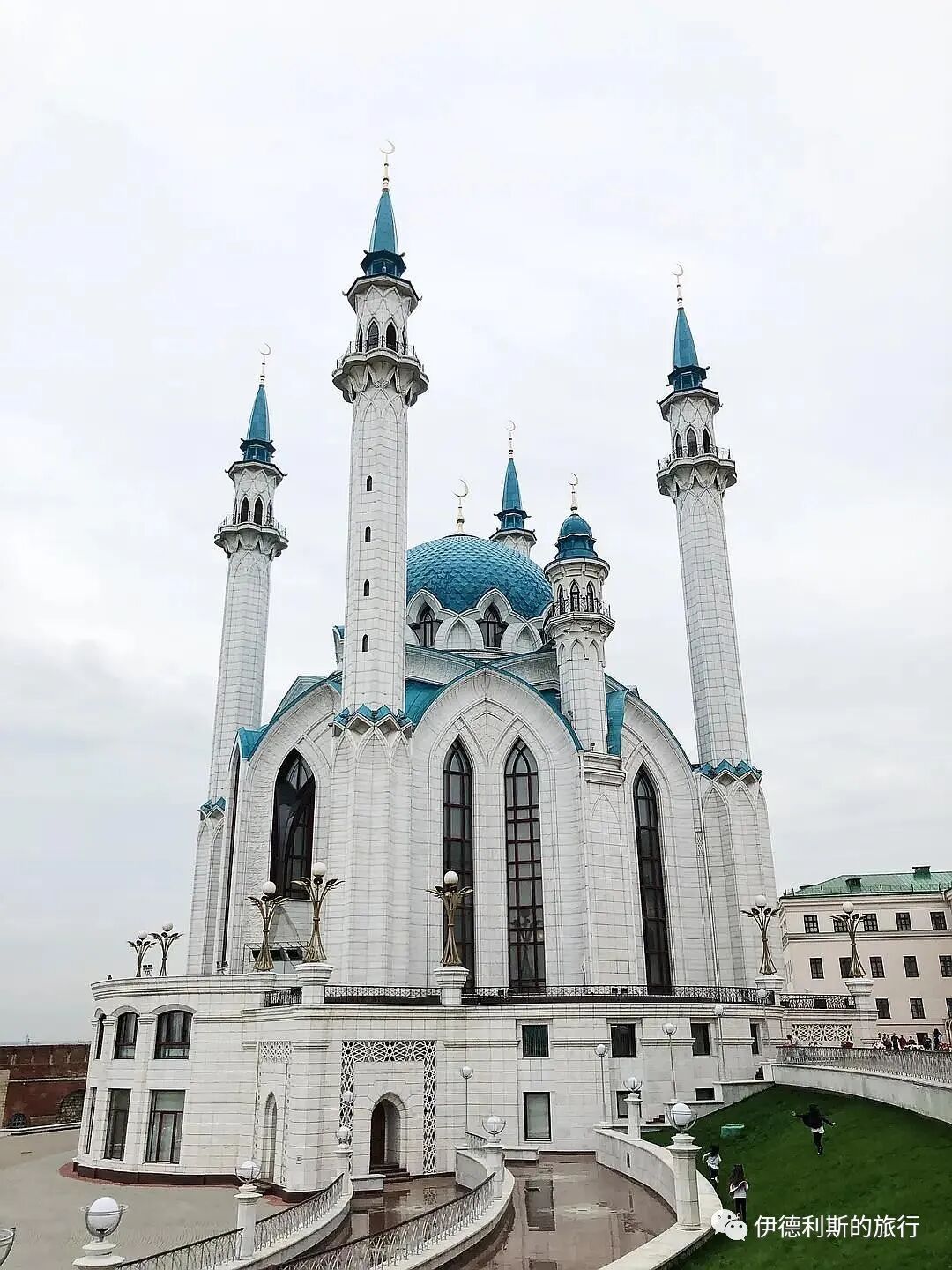
There is a performance about the Siege of Kazan at the entrance of the Kul Sharif Mosque inside the Kazan Kremlin. In 1552, when Ivan the Terrible besieged Kazan, the last imam of the Kazan Khanate, Seid Kul Sharif, led the people in a final resistance and died in the city. Today, Seid Kul Sharif is a national hero for the Kazan Tatars, and the new Kul Sharif Mosque built in 2005 is named after him.
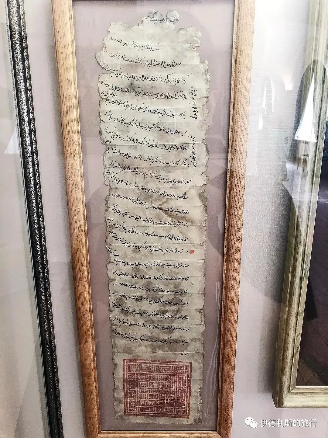
The National Museum of the Republic of Tatarstan houses a letter written in 1523 by the Kazan Khan Sahib I Giray (reigned 1521–1524). A replica of this letter is also inside the Kazan Kremlin. In 1521, to resist the control of the Grand Duchy of Moscow, the Kazan Khanate overthrew the pro-Moscow Khan Shahghali and welcomed Sahib I Giray from Crimea to Kazan to become the new Khan.
6. The Siberian Khanate of Russia (1468-1598)
We continue heading east to the meeting point of the Irtysh River and the Siberian River.
The Siberian (Sibir) Khanate was north of the Kazakh Khanate. It was the northernmost Muslim state in history, reaching all the way to the coast of the Arctic Ocean. In the 16th century, the capital of the Siberian Khanate was Qashliq, located on the right bank of the Irtysh River. Qashliq, also called the City of Siberia, was very prosperous in the early 16th century and had close trade ties with the Kazan Khanate. Later, it was permanently destroyed by the Cossacks, and it is hard to find any traces of it now.
The location of Qashliq city
7. The Kazakh Khanate of Kazakhstan (1465-1847)
Moving south from Siberia, we enter the vast Kazakh steppe.
The founders of the Kazakh Khanate, Janybek Khan and Kerey Khan, were both descendants of Tuqa Temur, the thirteenth son of Jochi, who was the eldest son of Genghis Khan.
In 1550, the Khanate was ruled by Haqnazar Khan (1537-1580). At that time, the Kazakh Khanate had rivals on all sides. He first defeated the Nogai Khanate, then the Khanate of Khiva and the Oirats, and then the Siberian Khanate and the Yarkent Khanate. This made the Kazakh Khanate stronger than ever, earning him the title of King of Turan (Shah-i-Turan).
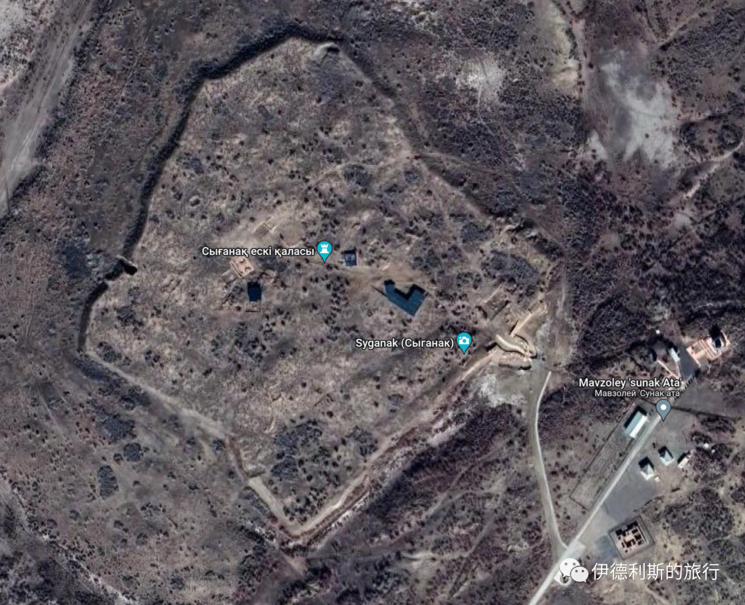
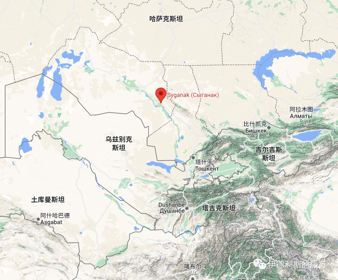
The capital of the Kazakh Khanate at that time was Sighnaq, located in what is now the Kyzylorda Region of Kazakhstan. This was originally the capital of the Blue Horde and served as an important trade point for steppe tribes to exchange goods with the southern farming regions.
Sighnaq photographed by Azamat Nurlybekov in 2022
The location of Sighnaq
8. The Khanate of Khiva in Turkmenistan (1511–1920)
Continuing southwest, we go deep into the heart of Central Asia.
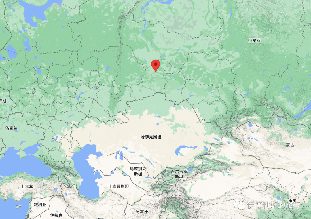
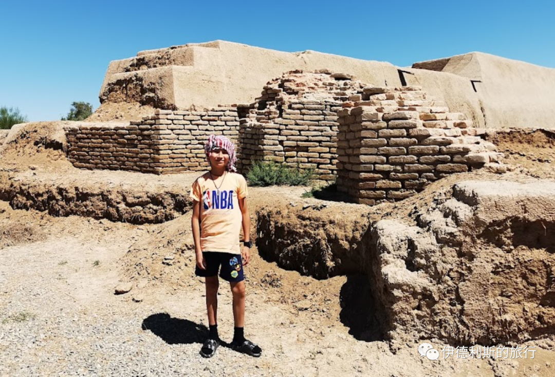
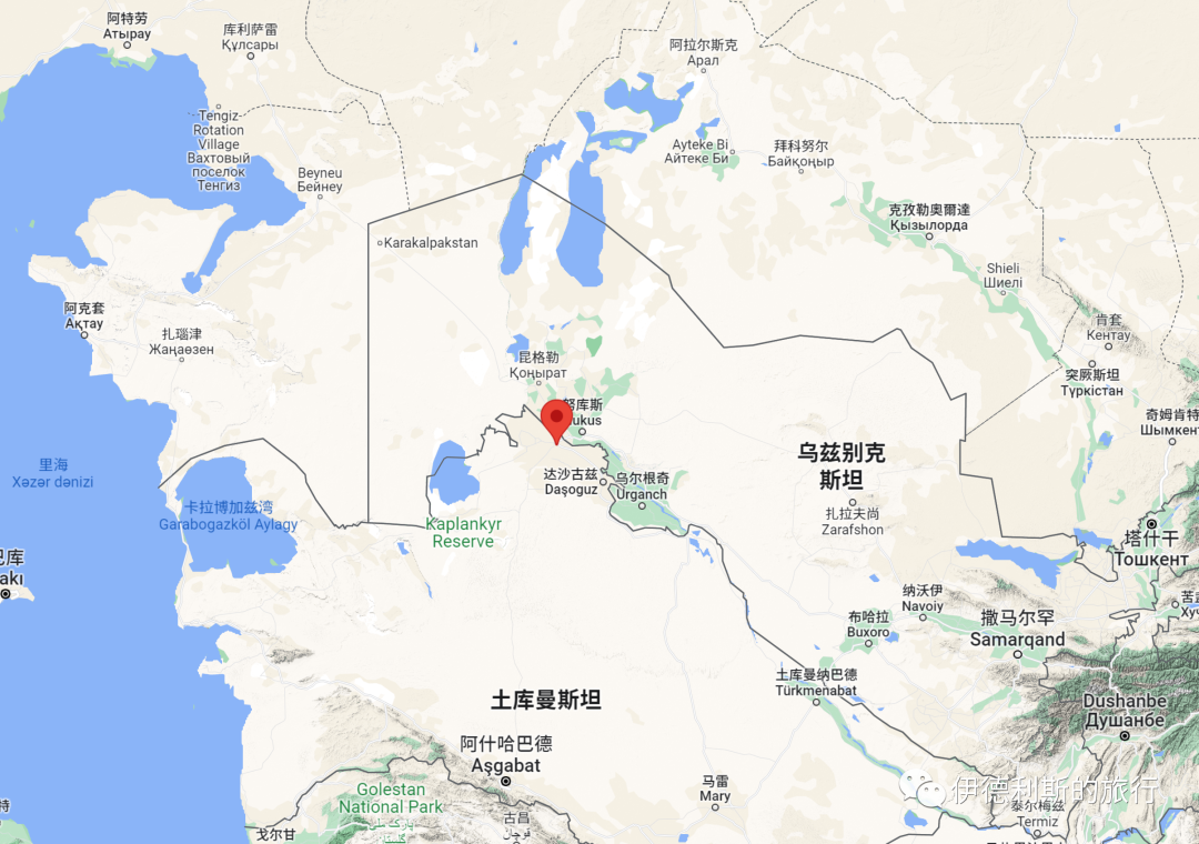
The Khanate of Khiva was located in the Khwarezm region south of the Aral Sea. It called itself Khwarezm, and its rulers were descendants of Shiban, the fifth son of Jochi, who was the eldest son of Genghis Khan. In the 16th century, the capital of the Khanate of Khiva was Konye-Urgench, located on the border of northern Turkmenistan and Uzbekistan. After the Khanate moved its capital to Khiva in the 17th century, this place was gradually abandoned. It was named a UNESCO World Heritage site in 2005.
Before the Mongol conquest of Khwarezm, Konye-Urgench was one of the wealthiest cities in Central Asia. Most of the current ruins belong to that period, and very few remains from the Khanate of Khiva period have been preserved.
The location of Konye-Urgench
9. The Khanate of Bukhara in Uzbekistan (1500–1785)
Let us continue east into the ancient city of Bukhara.
In the early 16th century, Muhammad Shaybani, a descendant of Shiban (the fifth son of Jochi, Genghis Khan's eldest son), led Uzbek tribes living in the northern Central Asian steppes to overthrow the Timurid dynasty's rule in Transoxiana. He established the Shaybanid Dynasty (1506-1598), opening a new chapter in the history of the Transoxiana region of Central Asia.
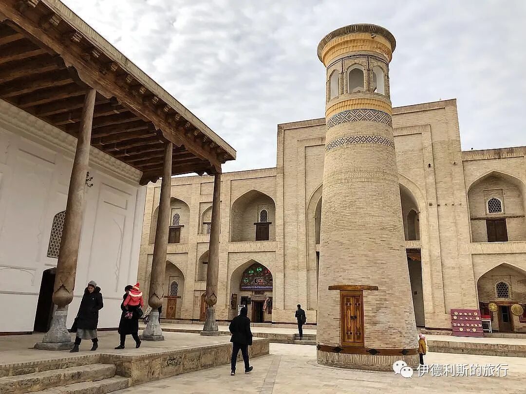
The capital of the Shaybanid Dynasty was initially in Samarkand, but it moved to Bukhara after 1533, which is why later generations called it the Khanate of Bukhara. Bukhara served as the capital of the Khanate of Bukhara for 252 years, from 1533 to 1785, and many buildings constructed during that time remain today.
The Mir-i-Arab Madrasa was built in 1535 by order of Ubaidullah, the Khan of the Shaybanid Dynasty (reigned 1533-1539). It was named after the Khan's Sufi mentor, Mir-i-Arab (also known as Sheikh Abdullah Yamani).
To compete for territory, Khan Ubaidullah fought many wars against the Persian Safavid dynasty, the most famous being the siege of the ancient Afghan city of Herat. During many raids on Persia, the Shaybanid Dynasty captured many prisoners. People say the Khan used the money from selling three thousand Persian captives to build the Mir-i-Arab Madrasa.
The Mir-i-Arab Madrasa was built opposite the famous Kalyan mosque in Bukhara, forming a facing structure known as a "kosh."
The Mir-i-Arab Madrasa closed in the 1920s but reopened in 1947. It became the only open madrasa in Bukhara at the time, and almost all the imams of that era were trained at this school.
The Khoja Zaynuddin mosque was built in the first half of the 16th century, located next to an ancient pond (Hauz) in Bukhara. This architectural style is known as a mosque-khanaka (Mosque-Khanaka). It serves as both a mosque and a Sufi center, where people can perform namaz and hold religious gatherings (ermeli).
The Bahouddin Naqshbandi Complex is an important Sufi holy site in Central Asia, often called the 'Little Mecca' of the region. It holds the tomb of Hazrat Muhammad Bahauddin Shah Naqshband, the founder of the famous Naqshbandia Sufi order.
During the Shaybanid dynasty, the Naqshbandia order eventually outperformed other Sufi groups to become the dominant order in the khanate. Unlike other Sufi orders that favored seclusion and leaving the world behind, the Naqshbandia order followed the principles set by its founder: 'solitude in the crowd, travel in the world, caution in action, and enjoyment of the moment.'
In 1544, the Shaybanid Khan Abdulaziz (who reigned from 1539 to 1550) built a Dakhma platform with marble railings at the shrine, along with a Sufi lodge (Khanaqa) nearby. Later, a large cemetery for Bukhara's rulers appeared near the shrine, as every ruler felt honored to be buried close to it.
During the Shaybanid period of the Bukhara Khanate, Tashkent's population and size gradually recovered, making it a commercial and cultural hub along the Silk Road. Most of the historical buildings still standing in Tashkent today were built during this time. Abu Bakr Mohammed Kaffal Shashi was a famous imam and scholar in Tashkent during the Samanid dynasty. After he passed away in 976, he was buried in a garden on the outskirts of Tashkent. The current Kaffal Shashi mausoleum was rebuilt in 1541 during the Shaybanid dynasty. It features the design of a Sufi lodge (Khanaqah), including a tall archway (Iwan) and a dome. Inside, besides Kaffal Shashi, his students are also buried there, including his three main disciples. The mausoleum was once covered in beautiful tiles, but only parts remain today, and they have been restored. Additionally, the window lattices on the mausoleum gate are already 500 years old. According to Tashkent legends, applying dust from this mausoleum to one's face can help a woman become pregnant, which attracts many women who are struggling to conceive.
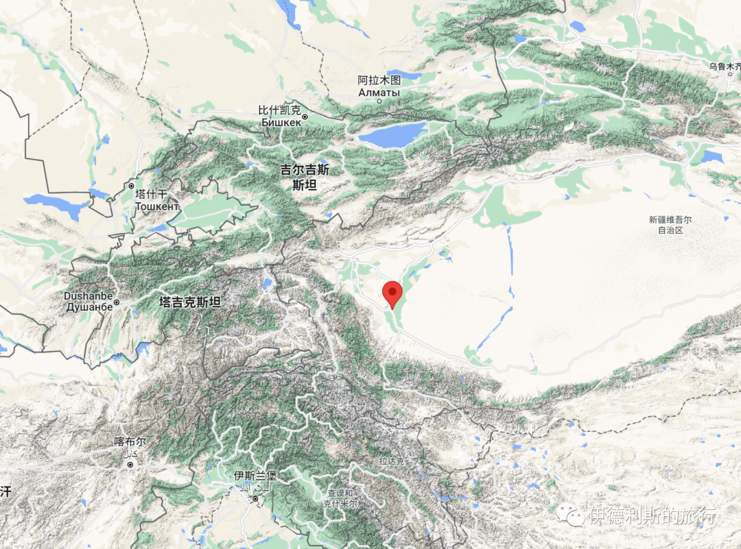
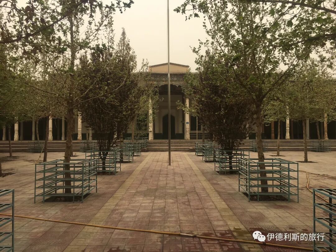
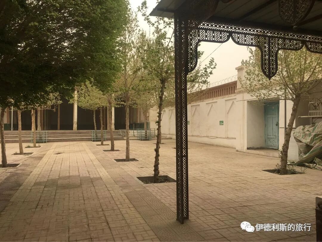
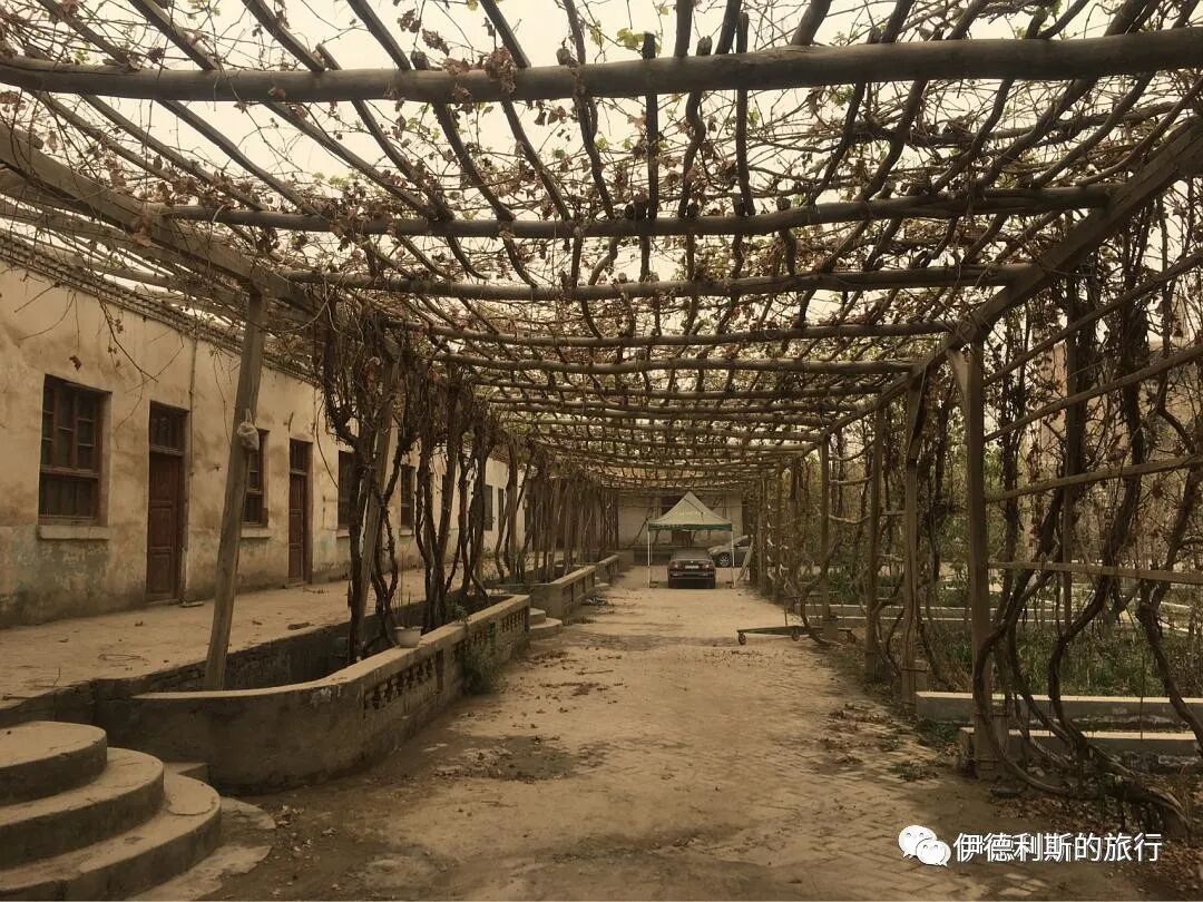
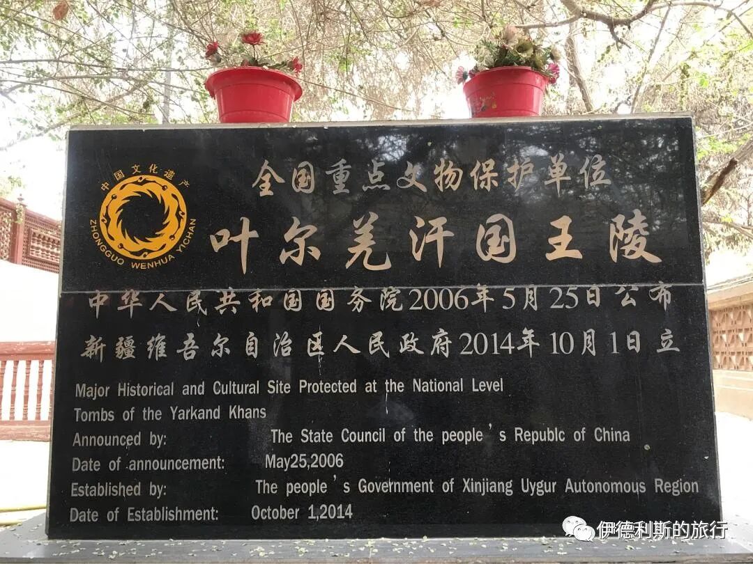
10. The Yarkent Khanate in China (1514-1680)
We crossed the Tianshan Mountains and arrived at the city of Shache in southern Xinjiang.
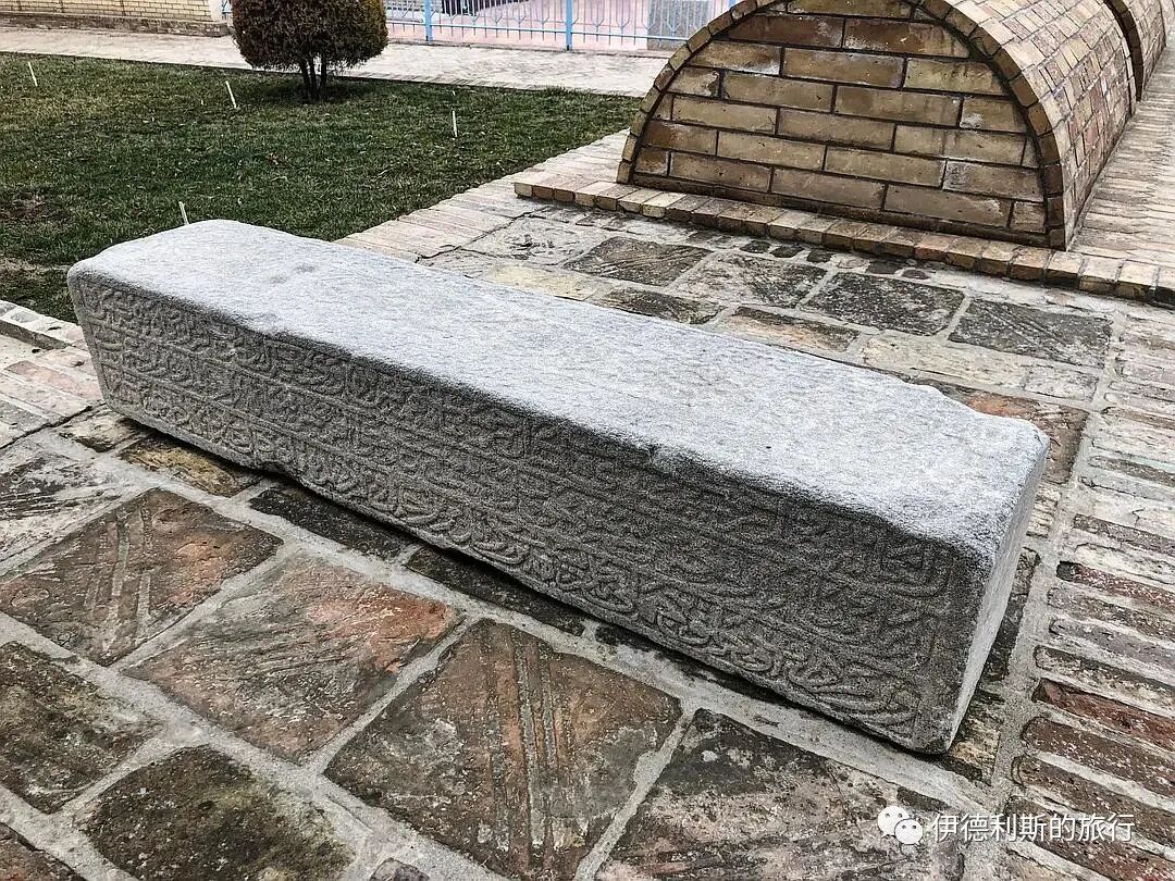
The Yarkent (Yarkent) Khanate was a state established in 1514 by Sultan Said Khan, a descendant of the Eastern Chagatai royal family. With Yarkent city (Shache) as its capital, it ruled southern Xinjiang and surrounding areas for over a hundred years until it was annexed by the Dzungar Khanate in 1680.
During the Yarkent Khanate's rule over southern Xinjiang, the Chagatai Mongols eventually shifted from nomadic life to settled living and merged into the Uyghur people. The Uyghurs also gradually developed into a modern ethnic group during this period, and the Twelve Muqam was finalized at this time as well.
'Yarkent Khanate' is actually a name used by modern scholars. In earlier local documents, the Persian word 'Moghuliye' was used, which means 'Mongol State'. Around the same time, Sultan Said Khan's cousin Babur established a state in northern India and also called it 'Moghul'. To distinguish them, Chinese usually translates them as 'Mengwu'er' and 'Mowo'er' respectively.
The founder of the Yarkent Khanate, Said Khan, was the third son of Ahmad Alaq, the ruler of Uyghurstan (modern-day Turpan area) in the eastern part of the Eastern Chagatai Khanate. In 1514, after stabilizing the Transoxiana region, the Uzbek army prepared to wipe out the Chagatai Mongols. After careful thought and discussion, Said Khan decided he could not withstand the Uzbek army's attack, so he left the Fergana Valley, crossed the Tianshan Mountains, and headed toward Yarkent.
In the spring of 1514, Said Khan led his army across the Tianshan Mountains and reached Kashgar via the Torugart Pass. At that time, southern Xinjiang was ruled by Abu Bakr, the leader of the Mongol Dughlat tribe. He was recruiting soldiers in Yarkent city. Said Khan fought a fierce battle outside the city against the Kashgar garrison and defeated the enemy. The enemy closed the gates and refused to come out, so Said Khan could not take the city and turned to attack the city of Yengisar. Said Khan besieged Yengisar for two months and finally captured it after six days of intense fighting.
Hearing that Yengisar had fallen, the Kashgar garrison abandoned the city and fled, so Said Khan marched directly toward Yarkent. When Abu Bakr heard this, he abandoned the city and fled to Hotan, and soon after, Said Khan entered Yarkent city. On September 3, 1514, Said Khan officially ascended the throne and established the Yarkent Khanate.
In 1516, Sultan Said reconciled with his older brother, Mansur Khan, who ruled the eastern part of the Eastern Chagatai Khanate. He agreed to mention Mansur's name during the khutbah (sermon) and to mint coins bearing Mansur's name. Southern Xinjiang welcomed long-awaited peace and order that year. The Tarikh-i-Rashidi describes it this way:
The reconciliation between these two brothers brought safety and prosperity to the residents. Anyone could travel alone between Hami in China and the Fergana region without needing food supplies or fearing robbery.
The location of Yarkand city.
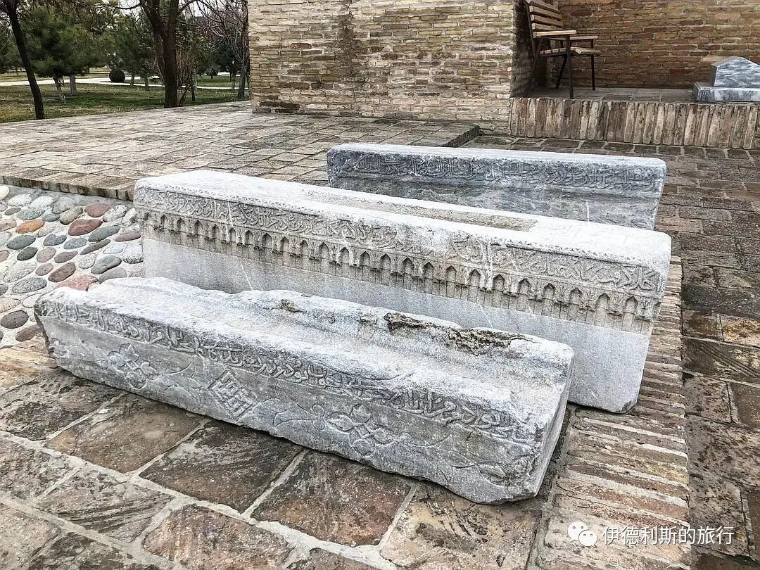
Today, there is a site in the old city of Yarkand called Ordakul, which means royal palace pond. This was likely the location of the Yarkand Khanate's royal palace. The Tarikh-i-Rashidi describes Yarkand city during the early Yarkand Khanate period like this:
They diverted rivers into the city and built gardens. The main roads were lined with poplar trees. People walking around the city could spend half their journey in the shade of these trees, and most of the tree-lined paths had water channels on both sides.
Ordakul Mosque
To the west of Ordakul is the Jami Mosque. Jami is also translated as Jumu'ah, which refers to the weekly Friday congregational prayer. The Jami Mosque was reportedly founded by Sultan Said and later expanded during the reign of Abdullah Khan (reigned 1638–1669).
After settling down in the oases of southern Xinjiang, many Chagatai Mongols began to complain about city life and missed the nomadic life on the steppes of their homeland, Moghulistan. the small pastures in the southern Xinjiang oases could not support the needs of the Mongol army. In 1522, Sultan Said sent his son, Abdurashid Khan, to lead troops into Moghulistan and conquer the Kyrgyz people living there.
In 1526, the Kazakhs entered Moghulistan and joined forces with the Kyrgyz, reaching a total of over 200,000 people. Sultan Said realized his strength was not enough to fight them, so he ordered all the Chagatai Mongols to return to southern Xinjiang. The Chagatai Mongols' five-year attempt to return to their nomadic homeland ultimately ended in failure.
After the failure in the north, Sultan Said turned his attention to attacking the south. In 1529, Sultan Said raided the Badakhshan region, which lay between the Yarkand Khanate and the Mughal Empire. This raid caused conflict between Sultan Said and his cousin, Emperor Babur. Emperor Babur wrote a letter to Sultan Said warning him that if he continued, you will know the rest yourself.
In 1532, Sultan Said personally led an army south to prepare for an expedition to Lhasa. While crossing the Karakoram Mountains, Sultan Said suffered from severe altitude sickness and lost his strength. In 1533, he decided to return to Yarkand to recover, but he died from altitude sickness while crossing the Karakoram Mountains again.
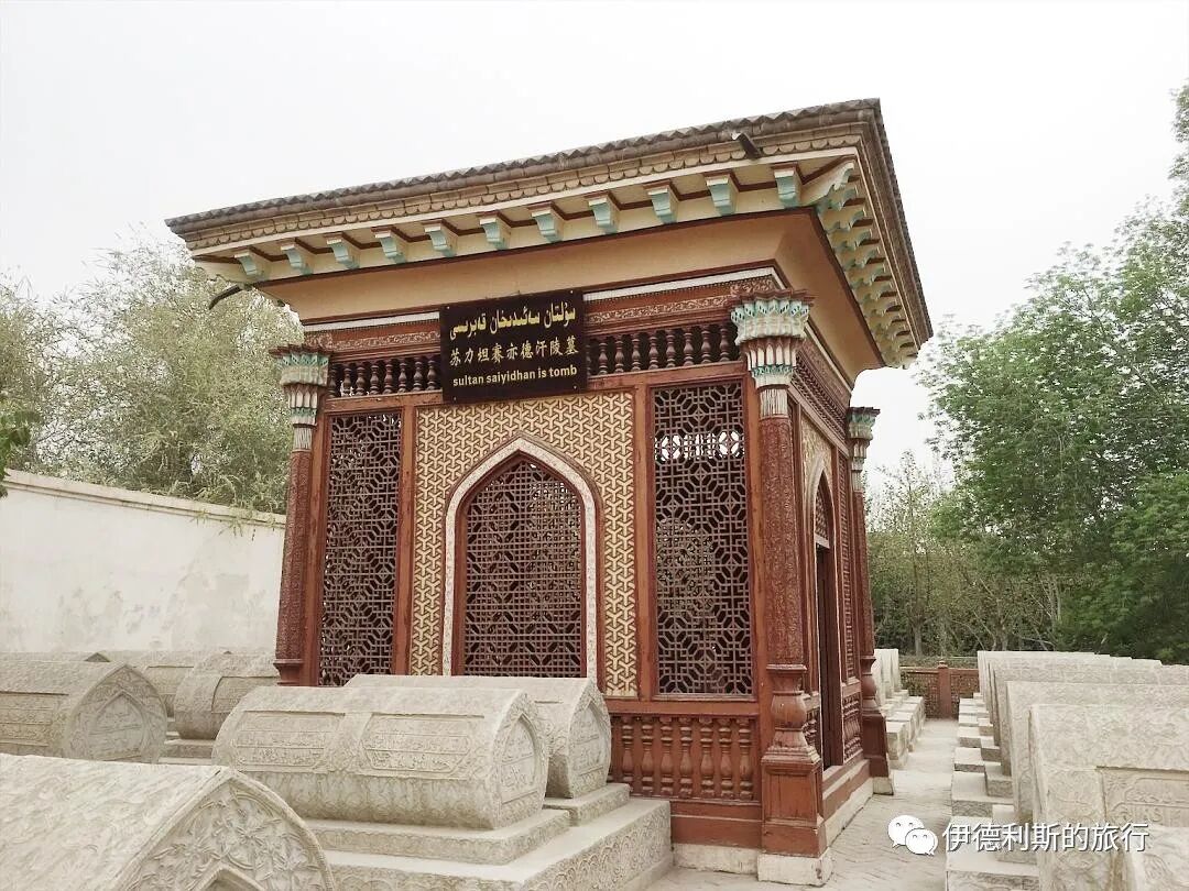
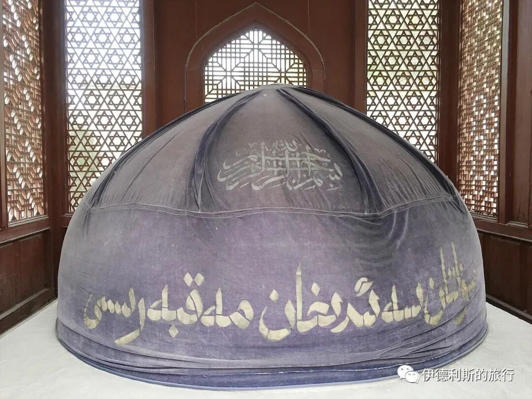
After Sultan Said died in 1533, his son, Abdurashid Khan (reigned 1533–1560), succeeded him. Abdurashid Khan built a mausoleum for his father at the west gate of Yarkand city. Later, this also became the royal mausoleum of the Yarkand Khanate.
The current mausoleum of Sultan Said was rebuilt in 1997. view all
Summary: Islamic World in 1550: Mongol Empire Legacy and Muslim History is presented here as a firsthand travel account in clear English, beginning with this scene: In our last article, "A Journey Through the Islamic World in 1550 (Part 1)," we crossed the African continent, traveled from Egypt into the Ottoman Empire, and visited Tabriz in Iran. The account keeps its focus on Mongol Empire, Islamic World, Muslim History while preserving the names, places, food, and historical details from the Chinese source.
In our last article, "A Journey Through the Islamic World in 1550 (Part 1)," we crossed the African continent, traveled from Egypt into the Ottoman Empire, and visited Tabriz in Iran. This time, we will visit 12 countries ruled by the descendants of Genghis Khan, moving from Eastern Europe into North Asia and Central Asia, and finally into South Asia.
In the early 13th century, as the Mongol Empire expanded, Genghis Khan began dividing his lands among his sons. Orda and Batu, the sons of Genghis Khan's eldest son Jochi, received lands in southern Russia and Kazakhstan, which gradually formed the Golden Horde. Hulagu Khan, the son of Genghis Khan's fourth son Tolui, received lands in Iran, Turkmenistan, Afghanistan, and parts of West Asia, which gradually formed the Ilkhanate. After the Yuan Dynasty was established in 1271, the original families of Ogedei and Chagatai, led by Kaidu, opposed Kublai Khan. This led to the formation of the Ogedei Khanate and the Chagatai Khanate, completing the four great Mongol khanates.
After the 14th century, the territory of the Ogedei Khanate was first divided between the Chagatai Khanate and the Yuan Dynasty, and later the Ilkhanate and the Chagatai Khanate also began to split apart. The Golden Horde was the last to decline, splitting into several khanates in the early 15th century.
In 1550, there were 12 countries and regimes established by descendants of Genghis Khan, ruling a vast area from Russia, Kazakhstan, Uzbekistan, and China's Xinjiang to Afghanistan, Pakistan, and India. They were:
1. The Crimean Khanate ruled the Crimean Peninsula.
2. The Astrakhan Khanate ruled the Volga Delta.
3. The Nogai Horde ruled the region between the Volga and Ural rivers.
4. The Qasim Khanate ruled Kasimov in the modern-day Ryazan Oblast of Russia.
5. The Kazan Khanate ruled the middle Volga region.
6. The Siberian Khanate ruled the area around the Irtysh River.
7. The Kazakh Khanate ruled the Kazakh Steppe.
8. The Khanate of Khiva ruled the Khwarezm region.
9. The Khanate of Bukhara ruled the Transoxiana region of Central Asia.
10. The Yarkent Khanate ruled the southern Xinjiang region.
11. Haidar ruled the Kashmir region.
12. The Arghun dynasty ruled southern Afghanistan and the Sindh region of Pakistan.
Additionally, the Mughal Empire was briefly overthrown at this time, and its second emperor, Humayun, was in exile in Persia.
1. The Crimean Khanate in Ukraine (1441–1783).
We start this journey on the Crimean Peninsula on the northern shore of the Black Sea.
The Khan of the Crimean Khanate was a descendant of Tuka-Timur, the thirteenth son of Jochi, who was Genghis Khan's eldest son. In the 1260s, the Golden Horde gave the Crimean Peninsula to the ancestor of the Crimean Khans, Uran Timur, to rule. The khanate was officially established in 1441.
Around 1500, the Crimean Khan Mengli I Giray built the capital of Salachik. In 1532, Sahib I Giray, the son of Mengli I Giray, established a new capital called Bakhchisarai in a valley two kilometers downstream from Salachik. For the next 250 years, generations of Crimean Khans built palaces and various mosque buildings here.
In 1550, the Khan ruling the Crimean Khanate was Sahib I Giray. He ascended the throne with the help of the Ottoman Empire. Later, he joined forces with the Ottoman Sultan Suleiman the Magnificent to attack the Moldavians, and in 1541, he raided Moscow and brought back spoils of war.
The location of Bakhchisarai, the capital of the Crimean Khanate.
The tomb of Haji I Giray (Dürbe Hacı I Giray) was built in 1501 by Mengli I Giray for his father, the founding Khan of Crimea. It is an octagonal tomb with a lead dome.
Archaeological excavations from 2006 to 2007 examined 18 graves inside the mausoleum, including 13 adults and 5 children. They were wrapped in silk and satin, with some resting on pillows stuffed with fabric scraps and fruit seeds. The mausoleum holds 8 stone sarcophagi covered in velvet, silk, and silver-threaded fabric. These likely include 4 Crimean Khans: Hacı I Giray himself, Meñli I Giray, Nur Devlet—who fought Meñli I Giray for the throne for years before losing—and Sahib I Giray, the son of Meñli I Giray and builder of Bakhchysarai.
After research finished in 2009, these individuals were reburied with Muslim rites.
The Chain Madrasa (Zıncırlı Medrese) was built in 1500 by order of the Crimean Khan Meñli I Giray. The name of the madrasa comes from the Turkic word "Zyngyr," which means "chain." A chain hangs above the main gate of the madrasa, forcing everyone who enters to bow their head. The madrasa is rectangular with a central courtyard, an entrance on one side, and 11 rooms on the other three sides. At the time, the madrasa taught Turkish and Arabic grammar, calligraphy, arithmetic, ethics, logic, proof theory, Islamic law (sharia), theology, and hadith studies. The full course of study took ten years.
In 1909, influenced by the Crimean Tatar Enlightenment movement, Gasprinski built a new two-story madrasa next to the old one. The madrasa closed in 1917 and became the Meñli Giray Research Institute. The institute was abolished in 1923. Later, it served as a teacher's college, a medical school, a sanatorium for German soldiers, and a post-war psychiatric clinic. Today, it is managed by the Bakhchysarai History, Culture, and Archaeology Museum.
The Iron Gate (Demir Qapı) is the oldest structure in the Khan's Palace. It was built between 1503 and 1504 for the Crimean Khan by the architect Aleviz Novy, who had been invited by Ivan the Great to build churches in Moscow. The Iron Gate was likely first built at the Crimean Khan's previous residence, Devlet-Saray, and moved to the main palace building after the Bakhchysarai Khan's Palace was completed in 1532. "Demir Qapı" means "iron gate" in Crimean Tatar. The doorway is made of limestone and features Lombard-Venetian Renaissance decorative styles.
The Great Khan Mosque (Büyük Han Cami) in the Bakhchysarai Khan's Palace was built in 1532 and is one of the earliest structures in the palace. The original mosque had multiple domes, similar to the Seljuk-style mosques popular in the Ottoman Empire during the 15th century. The mosque was destroyed by fire in 1736. It was later restored by Khan Selamet II Giray (who reigned from 1740 to 1743) and converted to a tiled roof.
During the Soviet era, the mosque was closed and turned into an exhibition hall for the archaeological museum. After Russia occupied Crimea in 2014, the mosque underwent repairs, some of which caused damage to the building.
The SaryGuzel Bathhouse was built in 1532 by order of the Crimean Khan Sahib I Giray. Like the Great Khan Mosque, it is one of the earliest buildings in the Bakhchysarai Khan's Palace. In Crimean Tatar, "Sarı" means "yellow or fair-skinned," and "Güzel" means "beautiful." The SaryGuzel Bathhouse is a typical Turkish bath. A furnace in the basement heated the floor with rising hot air, and cold and hot water were supplied through lead pipes. The bathhouse is divided into men's and women's sections, each with its own dome. The domes have star-shaped cutouts for ventilation and light, and there is an indoor courtyard with a fountain at the exit.
The SaryGuzel Bathhouse operated until 1924, when it was closed because it was considered unsafe. It has since been repaired and is now open for exhibitions.
The Khan's cemetery holds the grave of the Crimean Khan Devlet I Giray (reigned 1551–1577). He was appointed Kalga (the second-in-command after the Khan) in 1530. Later, due to court struggles, he went to Istanbul and gradually gained the trust of the Ottoman Sultan Suleiman the Magnificent. In 1551, with the help of Suleiman the Magnificent, he became the Crimean Khan.
2. The Astrakhan Khanate of Russia (1466–1556)
We continue east to the mouth of the Volga River.
The Astrakhan Khanate was located in the Volga Delta. Its founder, Mahmud bin Küchük, was a prince of the Golden Horde. The Astrakhan Khanate was mainly inhabited by Astrakhan Tatars and Nogais. The Khanate's caravans traveled between Moscow, Kazan, Crimea, Central Asia, and the Transcaucasus region. In 1532, the Astrakhan Khanate began to have contact with Russia. After Russia conquered Kazan in 1552, the Astrakhan Khanate could not escape the same fate.
In 1550, the capital of the Astrakhan Khanate was Hajji Tarkhan, located on the right bank of the Volga River, 12 kilometers north of the modern city of Astrakhan. The city of Hajji Tarkhan was built by the Golden Horde in the late 13th century, appeared in the Travels of Ibn Battuta in the 14th century, was destroyed by Timur's army in 1395, and was rebuilt by the Astrakhan Khanate in the 15th century. The city was occupied by the Crimean Khanate in 1547 and was finally burned down by Ivan the Terrible in 1556.
There are currently about 60,000 Astrakhan Tatars in Russia. Most live in the Astrakhan Oblast, with half living in the city of Astrakhan, where they have their own community and several mosques.
The location of the city of Hajji Tarkhan.
The White Mosque in Astrakhan, photographed by Polinadelia in 2014.
3. The Nogai Horde in Russia and Kazakhstan (1440–1634)
Continuing east from the Volga River, you reach the grasslands of the Nogai tribes.
Nogai was the great-grandson of Jochi, the eldest son of Genghis Khan, and an important leader of the Golden Horde who ruled many Turkic-speaking tribes in the 13th century. A century later, the Golden Horde general Edigu ruled a large area from the Volga to the Ural River, and the tribes under his rule were also called the Nogai Horde.
We can find history about the Nogai Horde in the early 16th century in Russian records. In 1521, the Nogai were driven west by the Kazakhs and crossed the Volga River to attack Astrakhan. In 1522, the Kazakhs captured the capital of the Nogai Horde. In 1523, the Nogai Horde defeated the army that had briefly occupied Astrakhan.
In 1550, the Khan of the Kazan Khanate was Yosuf Khan (1549–1555), who had helped Moscow against the Kazan Khanate in 1549.
Saray-Jük was the capital of the Nogai Horde, located on the border of Europe and Asia in western Kazakhstan. This city sat on a trade route between Europe and China and was an important commercial hub during the Golden Horde period. After being destroyed by Timur in 1395, it was rebuilt in the 1430s and 1440s.
The location of Saray-Jük.
The ruins of Saray-Jük, photographed by Yakov Fedorov in 2020.
4. The Qasim Khanate in Russia (1452–1681)
We head north to the modern-day Ryazan Oblast in Russia.
The Qasim Khanate was located in Russia's Ryazan Oblast. Its founder, Qasim Khan, was the son of Ulugh Muhammad, the founder of the Kazan Khanate. The Qasim Khanate served as a buffer state between the Grand Duchy of Moscow and the Kazan Khanate and was under heavy Russian control.
In 1550, the Khan of the Qasim Khanate was Shahghali, who was installed as the Khan of the Kazan Khanate three times as a Russian vassal. In 1546, Shahghali was overthrown by the people of Kazan and fled back to the Qasim Khanate. Between 1547 and 1551, he participated in several Russian attacks on the Kazan Khanate and took part in the final Russian conquest of Kazan in 1552.
The capital of the Qasim Khanate, Qasimov, is located on the left bank of the Oka River in Russia's Ryazan Oblast, where one thousand Tatar-speaking Qasim Tatars still live today. The Khan Mosque in Qasimov was built by Shahghali in the mid-16th century. It was ordered to be demolished by Peter the Great in 1702, but the minaret (bangke ta) was preserved. This minaret is very similar to the Light Tower (Guangta) of the Huaisheng Mosque in Guangzhou.
The Khan Mosque in Qasimov, photographed by Alexander Novikov in 2014.
The location of Qasimov.
5. The Kazan Khanate in Russia (1438–1552)
We headed east to the city of Kazan on the banks of the Volga River.
The Kazan Khanate was founded by Ulugh Muhammad, a descendant of Genghis Khan's eldest son Jochi, who had ruled the Golden Horde twice. He lost control of the Golden Horde in 1436, then led his army to the Volga River and officially established the Kazan Khanate after capturing Kazan in 1438.
In 1521, the Kazan Khanate formed an alliance with the Astrakhan, Crimean, and Nogai Khanates to resist Moscow together. This caused dissatisfaction among pro-Russian factions within the Kazan Khanate, leading the state into internal conflict.
In 1550, the Khan of the Kazan Khanate was the four-year-old Ötemish Giray, though the actual rulers were his mother, Söyembikä, and the prime minister (uğlan) Qoşçaq. Seeing the instability in the Kazan Khanate, Ivan the Terrible of Russia sent a large army to besiege Kazan in February 1550, but the thawing of the Volga River forced the Russians to retreat and only attack the outskirts of the city. Throughout that year, Söyembikä and Qoşçaq fought against the pro-Russian faction, and relations with Russia continued to worsen.
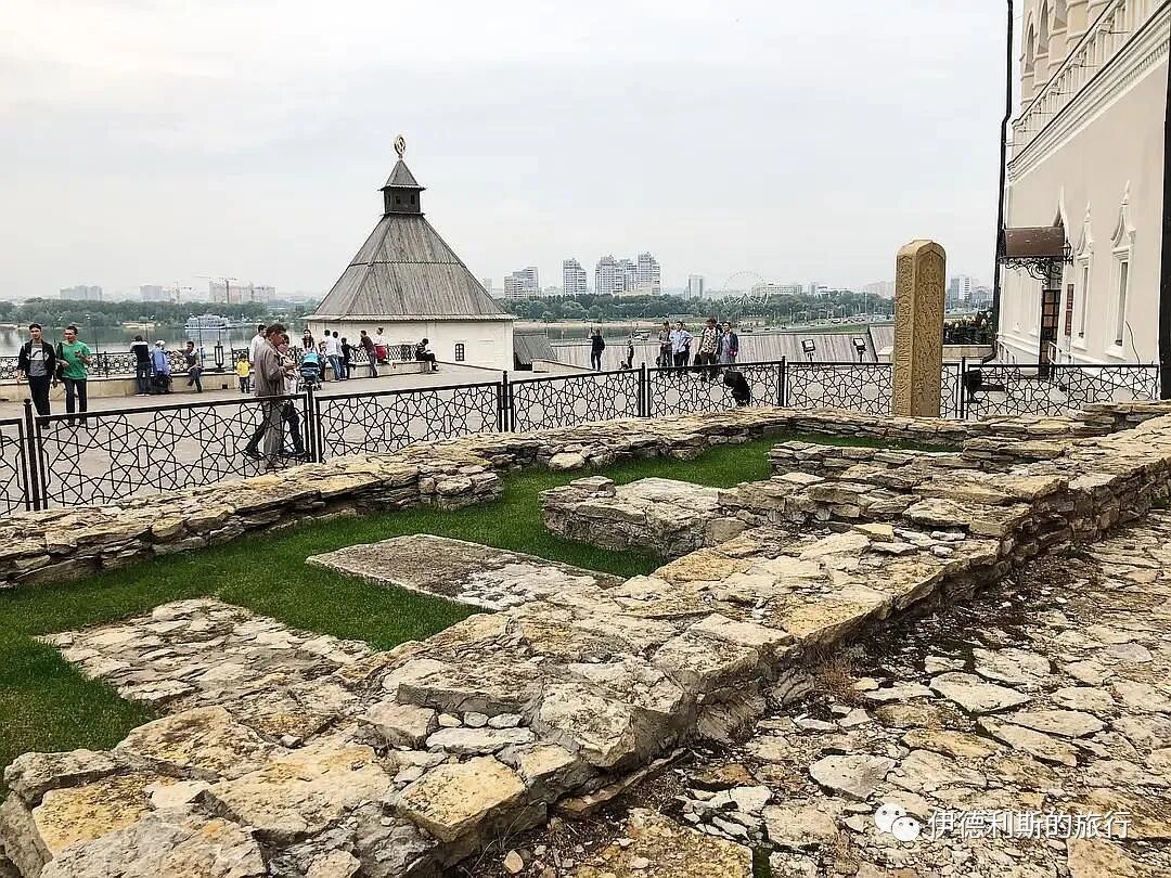
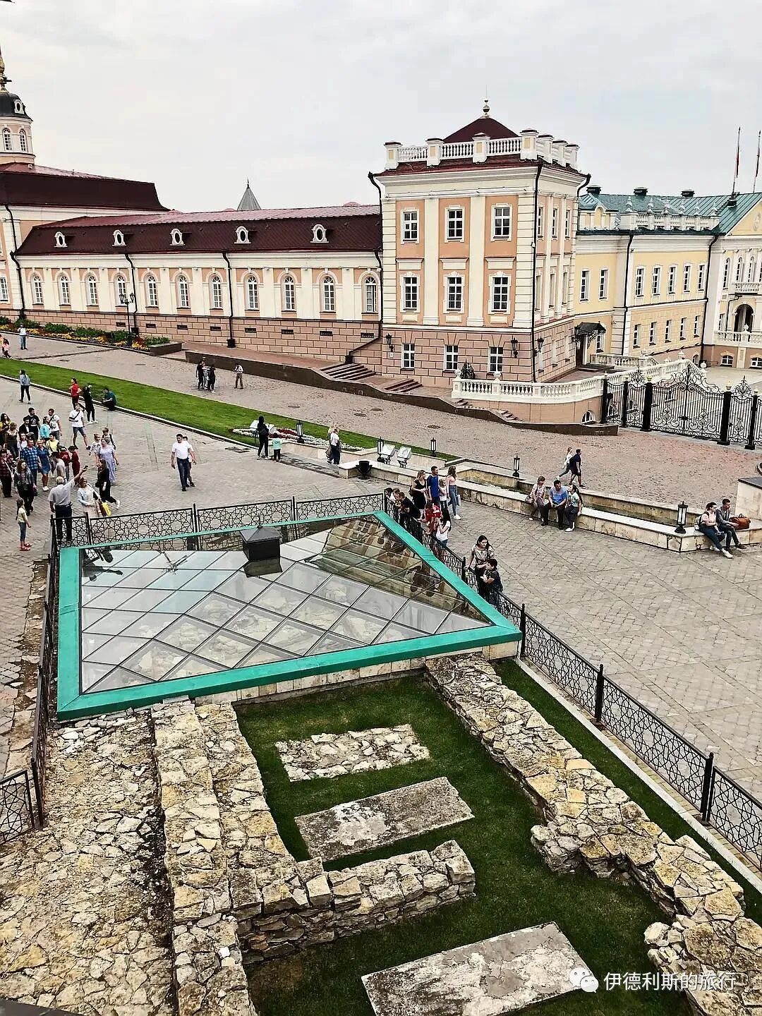
The Kazan Khanate built many homes and public buildings in Kazan, including the Khan's palace, courtyards, mosques, and tombs, with tall minarets defining the city's skyline. In 1552, Ivan the Terrible invaded Kazan, destroyed the Kazan Khanate, and drove all Tatars out of the city, allowing only Russians to settle there. Between 1556 and 1562, Ivan the Terrible ordered the construction of the Kazan Kremlin on the site of the old Kazan Khanate fortress. The mosques, the Kazan Khan's palace, and the tombs were initially used as armories and ammunition depots, but were eventually completely demolished in the 18th century.
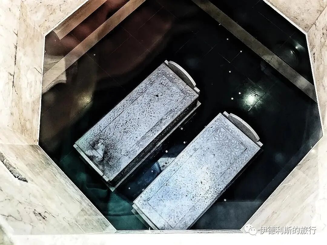
In 1977, hydraulic engineers accidentally dug up a grave while laying rainwater pipes at the Kazan Kremlin and immediately contacted the archaeology department. Archaeological excavations lasted for 10 years, eventually uncovering five graves, two of which were confirmed to be those of the actual founders of the Kazan Khanate: Mäxmüd Khan (died 1463 or 1466) and his grandson, Möxämmät Ämin (died 1518). The tomb was originally made of white stone and finally collapsed in the 17th century.
For further research, the remains of the two Kazan Khans, Mäxmüd and Möxämmät Ämin, were kept at the Institute of Archaeology of the Tatarstan Academy of Sciences for 40 years. In May 2017, after continuous efforts by the Tatar Muslims of Kazan, the two Kazan Khans were finally reburied not far from their original graves.
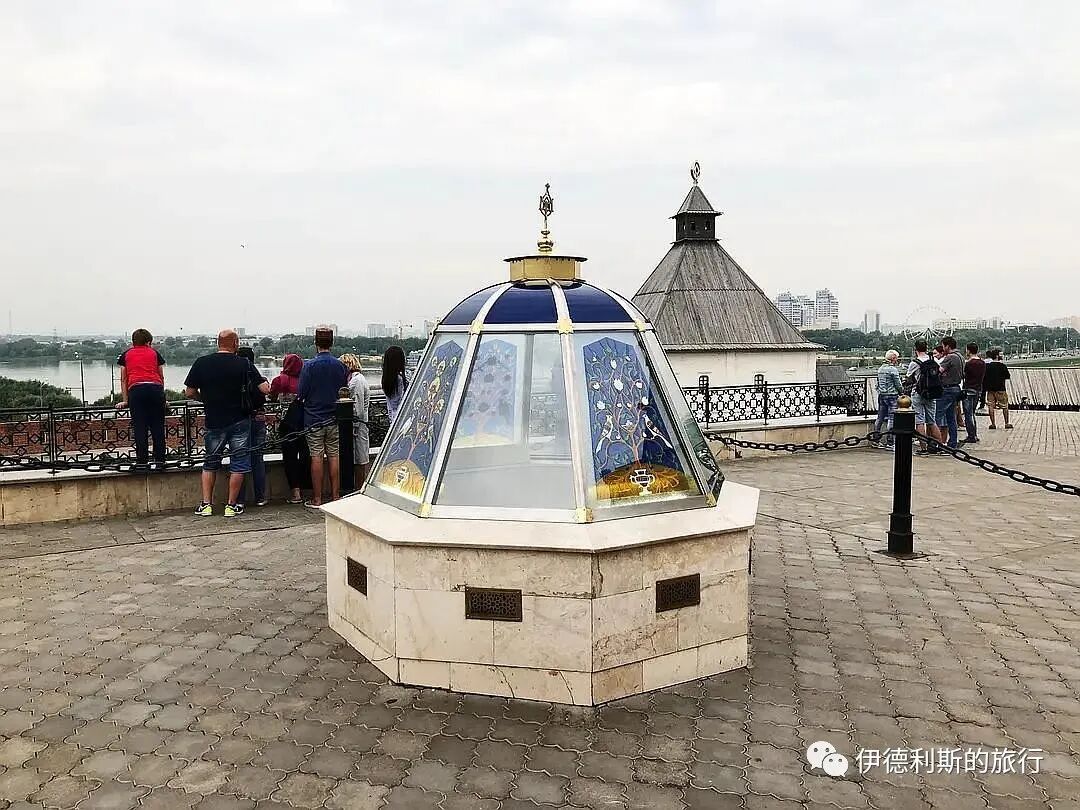
Between 2004 and 2005, the Institute of Archaeology of the Tatarstan Academy of Sciences re-excavated the Kazan Khan tombs and discovered the graves of four more Khans: Xalil (died 1467), İbrahim (died 1478), Safa Giray (died 1549), and Canghali (died 1535). Today, these four Kazan Khan graves are protected under a glass roof. Safa Giray Khan came from the Giray family of the Crimean Khanate and served as the Khan of Kazan three times: from 1524–1531, 1535–1546, and 1546–1549. Safa Giray was an anti-Russian Khan. His first reign ended due to Moscow's attack on Kazan, and he regained the throne four years later after Kazan nobles overthrew the pro-Russian Khan. Eleven years later, due to internal unrest in Kazan, he was overthrown again by a pro-Russian Khan. Safa Giray fled to his father-in-law's Nogai tribe, and a few months later, he returned to Kazan with a Nogai army to become the Khan for the third time. Canghali Khan was originally the Khan of the Qasim Khanate, a vassal state of the Grand Duchy of Moscow. In 1532, Grand Prince Vasily III of Moscow defeated the Kazan Khan Safa Giray and installed the 16-year-old Canghali as the pro-Russian Khan of Kazan. He died in 1535 during a coup by Kazan nobles.
There is a performance about the Siege of Kazan at the entrance of the Kul Sharif Mosque inside the Kazan Kremlin. In 1552, when Ivan the Terrible besieged Kazan, the last imam of the Kazan Khanate, Seid Kul Sharif, led the people in a final resistance and died in the city. Today, Seid Kul Sharif is a national hero for the Kazan Tatars, and the new Kul Sharif Mosque built in 2005 is named after him.
The National Museum of the Republic of Tatarstan houses a letter written in 1523 by the Kazan Khan Sahib I Giray (reigned 1521–1524). A replica of this letter is also inside the Kazan Kremlin. In 1521, to resist the control of the Grand Duchy of Moscow, the Kazan Khanate overthrew the pro-Moscow Khan Shahghali and welcomed Sahib I Giray from Crimea to Kazan to become the new Khan.
6. The Siberian Khanate of Russia (1468-1598)
We continue heading east to the meeting point of the Irtysh River and the Siberian River.
The Siberian (Sibir) Khanate was north of the Kazakh Khanate. It was the northernmost Muslim state in history, reaching all the way to the coast of the Arctic Ocean. In the 16th century, the capital of the Siberian Khanate was Qashliq, located on the right bank of the Irtysh River. Qashliq, also called the City of Siberia, was very prosperous in the early 16th century and had close trade ties with the Kazan Khanate. Later, it was permanently destroyed by the Cossacks, and it is hard to find any traces of it now.
The location of Qashliq city
7. The Kazakh Khanate of Kazakhstan (1465-1847)
Moving south from Siberia, we enter the vast Kazakh steppe.
The founders of the Kazakh Khanate, Janybek Khan and Kerey Khan, were both descendants of Tuqa Temur, the thirteenth son of Jochi, who was the eldest son of Genghis Khan.
In 1550, the Khanate was ruled by Haqnazar Khan (1537-1580). At that time, the Kazakh Khanate had rivals on all sides. He first defeated the Nogai Khanate, then the Khanate of Khiva and the Oirats, and then the Siberian Khanate and the Yarkent Khanate. This made the Kazakh Khanate stronger than ever, earning him the title of King of Turan (Shah-i-Turan).
The capital of the Kazakh Khanate at that time was Sighnaq, located in what is now the Kyzylorda Region of Kazakhstan. This was originally the capital of the Blue Horde and served as an important trade point for steppe tribes to exchange goods with the southern farming regions.
Sighnaq photographed by Azamat Nurlybekov in 2022
The location of Sighnaq
8. The Khanate of Khiva in Turkmenistan (1511–1920)
Continuing southwest, we go deep into the heart of Central Asia.
The Khanate of Khiva was located in the Khwarezm region south of the Aral Sea. It called itself Khwarezm, and its rulers were descendants of Shiban, the fifth son of Jochi, who was the eldest son of Genghis Khan. In the 16th century, the capital of the Khanate of Khiva was Konye-Urgench, located on the border of northern Turkmenistan and Uzbekistan. After the Khanate moved its capital to Khiva in the 17th century, this place was gradually abandoned. It was named a UNESCO World Heritage site in 2005.
Before the Mongol conquest of Khwarezm, Konye-Urgench was one of the wealthiest cities in Central Asia. Most of the current ruins belong to that period, and very few remains from the Khanate of Khiva period have been preserved.
The location of Konye-Urgench
9. The Khanate of Bukhara in Uzbekistan (1500–1785)
Let us continue east into the ancient city of Bukhara.
In the early 16th century, Muhammad Shaybani, a descendant of Shiban (the fifth son of Jochi, Genghis Khan's eldest son), led Uzbek tribes living in the northern Central Asian steppes to overthrow the Timurid dynasty's rule in Transoxiana. He established the Shaybanid Dynasty (1506-1598), opening a new chapter in the history of the Transoxiana region of Central Asia.
The capital of the Shaybanid Dynasty was initially in Samarkand, but it moved to Bukhara after 1533, which is why later generations called it the Khanate of Bukhara. Bukhara served as the capital of the Khanate of Bukhara for 252 years, from 1533 to 1785, and many buildings constructed during that time remain today.
The Mir-i-Arab Madrasa was built in 1535 by order of Ubaidullah, the Khan of the Shaybanid Dynasty (reigned 1533-1539). It was named after the Khan's Sufi mentor, Mir-i-Arab (also known as Sheikh Abdullah Yamani).
To compete for territory, Khan Ubaidullah fought many wars against the Persian Safavid dynasty, the most famous being the siege of the ancient Afghan city of Herat. During many raids on Persia, the Shaybanid Dynasty captured many prisoners. People say the Khan used the money from selling three thousand Persian captives to build the Mir-i-Arab Madrasa.
The Mir-i-Arab Madrasa was built opposite the famous Kalyan mosque in Bukhara, forming a facing structure known as a "kosh."
The Mir-i-Arab Madrasa closed in the 1920s but reopened in 1947. It became the only open madrasa in Bukhara at the time, and almost all the imams of that era were trained at this school.
The Khoja Zaynuddin mosque was built in the first half of the 16th century, located next to an ancient pond (Hauz) in Bukhara. This architectural style is known as a mosque-khanaka (Mosque-Khanaka). It serves as both a mosque and a Sufi center, where people can perform namaz and hold religious gatherings (ermeli).
The Bahouddin Naqshbandi Complex is an important Sufi holy site in Central Asia, often called the 'Little Mecca' of the region. It holds the tomb of Hazrat Muhammad Bahauddin Shah Naqshband, the founder of the famous Naqshbandia Sufi order.
During the Shaybanid dynasty, the Naqshbandia order eventually outperformed other Sufi groups to become the dominant order in the khanate. Unlike other Sufi orders that favored seclusion and leaving the world behind, the Naqshbandia order followed the principles set by its founder: 'solitude in the crowd, travel in the world, caution in action, and enjoyment of the moment.'
In 1544, the Shaybanid Khan Abdulaziz (who reigned from 1539 to 1550) built a Dakhma platform with marble railings at the shrine, along with a Sufi lodge (Khanaqa) nearby. Later, a large cemetery for Bukhara's rulers appeared near the shrine, as every ruler felt honored to be buried close to it.
During the Shaybanid period of the Bukhara Khanate, Tashkent's population and size gradually recovered, making it a commercial and cultural hub along the Silk Road. Most of the historical buildings still standing in Tashkent today were built during this time. Abu Bakr Mohammed Kaffal Shashi was a famous imam and scholar in Tashkent during the Samanid dynasty. After he passed away in 976, he was buried in a garden on the outskirts of Tashkent. The current Kaffal Shashi mausoleum was rebuilt in 1541 during the Shaybanid dynasty. It features the design of a Sufi lodge (Khanaqah), including a tall archway (Iwan) and a dome. Inside, besides Kaffal Shashi, his students are also buried there, including his three main disciples. The mausoleum was once covered in beautiful tiles, but only parts remain today, and they have been restored. Additionally, the window lattices on the mausoleum gate are already 500 years old. According to Tashkent legends, applying dust from this mausoleum to one's face can help a woman become pregnant, which attracts many women who are struggling to conceive.
10. The Yarkent Khanate in China (1514-1680)
We crossed the Tianshan Mountains and arrived at the city of Shache in southern Xinjiang.
The Yarkent (Yarkent) Khanate was a state established in 1514 by Sultan Said Khan, a descendant of the Eastern Chagatai royal family. With Yarkent city (Shache) as its capital, it ruled southern Xinjiang and surrounding areas for over a hundred years until it was annexed by the Dzungar Khanate in 1680.
During the Yarkent Khanate's rule over southern Xinjiang, the Chagatai Mongols eventually shifted from nomadic life to settled living and merged into the Uyghur people. The Uyghurs also gradually developed into a modern ethnic group during this period, and the Twelve Muqam was finalized at this time as well.
'Yarkent Khanate' is actually a name used by modern scholars. In earlier local documents, the Persian word 'Moghuliye' was used, which means 'Mongol State'. Around the same time, Sultan Said Khan's cousin Babur established a state in northern India and also called it 'Moghul'. To distinguish them, Chinese usually translates them as 'Mengwu'er' and 'Mowo'er' respectively.
The founder of the Yarkent Khanate, Said Khan, was the third son of Ahmad Alaq, the ruler of Uyghurstan (modern-day Turpan area) in the eastern part of the Eastern Chagatai Khanate. In 1514, after stabilizing the Transoxiana region, the Uzbek army prepared to wipe out the Chagatai Mongols. After careful thought and discussion, Said Khan decided he could not withstand the Uzbek army's attack, so he left the Fergana Valley, crossed the Tianshan Mountains, and headed toward Yarkent.
In the spring of 1514, Said Khan led his army across the Tianshan Mountains and reached Kashgar via the Torugart Pass. At that time, southern Xinjiang was ruled by Abu Bakr, the leader of the Mongol Dughlat tribe. He was recruiting soldiers in Yarkent city. Said Khan fought a fierce battle outside the city against the Kashgar garrison and defeated the enemy. The enemy closed the gates and refused to come out, so Said Khan could not take the city and turned to attack the city of Yengisar. Said Khan besieged Yengisar for two months and finally captured it after six days of intense fighting.
Hearing that Yengisar had fallen, the Kashgar garrison abandoned the city and fled, so Said Khan marched directly toward Yarkent. When Abu Bakr heard this, he abandoned the city and fled to Hotan, and soon after, Said Khan entered Yarkent city. On September 3, 1514, Said Khan officially ascended the throne and established the Yarkent Khanate.
In 1516, Sultan Said reconciled with his older brother, Mansur Khan, who ruled the eastern part of the Eastern Chagatai Khanate. He agreed to mention Mansur's name during the khutbah (sermon) and to mint coins bearing Mansur's name. Southern Xinjiang welcomed long-awaited peace and order that year. The Tarikh-i-Rashidi describes it this way:
The reconciliation between these two brothers brought safety and prosperity to the residents. Anyone could travel alone between Hami in China and the Fergana region without needing food supplies or fearing robbery.
The location of Yarkand city.
Today, there is a site in the old city of Yarkand called Ordakul, which means royal palace pond. This was likely the location of the Yarkand Khanate's royal palace. The Tarikh-i-Rashidi describes Yarkand city during the early Yarkand Khanate period like this:
They diverted rivers into the city and built gardens. The main roads were lined with poplar trees. People walking around the city could spend half their journey in the shade of these trees, and most of the tree-lined paths had water channels on both sides.
Ordakul Mosque
To the west of Ordakul is the Jami Mosque. Jami is also translated as Jumu'ah, which refers to the weekly Friday congregational prayer. The Jami Mosque was reportedly founded by Sultan Said and later expanded during the reign of Abdullah Khan (reigned 1638–1669).
After settling down in the oases of southern Xinjiang, many Chagatai Mongols began to complain about city life and missed the nomadic life on the steppes of their homeland, Moghulistan. the small pastures in the southern Xinjiang oases could not support the needs of the Mongol army. In 1522, Sultan Said sent his son, Abdurashid Khan, to lead troops into Moghulistan and conquer the Kyrgyz people living there.
In 1526, the Kazakhs entered Moghulistan and joined forces with the Kyrgyz, reaching a total of over 200,000 people. Sultan Said realized his strength was not enough to fight them, so he ordered all the Chagatai Mongols to return to southern Xinjiang. The Chagatai Mongols' five-year attempt to return to their nomadic homeland ultimately ended in failure.
After the failure in the north, Sultan Said turned his attention to attacking the south. In 1529, Sultan Said raided the Badakhshan region, which lay between the Yarkand Khanate and the Mughal Empire. This raid caused conflict between Sultan Said and his cousin, Emperor Babur. Emperor Babur wrote a letter to Sultan Said warning him that if he continued, you will know the rest yourself.
In 1532, Sultan Said personally led an army south to prepare for an expedition to Lhasa. While crossing the Karakoram Mountains, Sultan Said suffered from severe altitude sickness and lost his strength. In 1533, he decided to return to Yarkand to recover, but he died from altitude sickness while crossing the Karakoram Mountains again.
After Sultan Said died in 1533, his son, Abdurashid Khan (reigned 1533–1560), succeeded him. Abdurashid Khan built a mausoleum for his father at the west gate of Yarkand city. Later, this also became the royal mausoleum of the Yarkand Khanate.
The current mausoleum of Sultan Said was rebuilt in 1997.
Islamic World in 1550: Mongol Empire Legacy and Muslim History (Part 1)
Articles • ali2007fr posted the article • 0 comments • 93 views • 2026-05-18 09:38
Summary: Islamic World in 1550: Mongol Empire Legacy and Muslim History is presented here as a firsthand travel account in clear English, beginning with this scene: In our last article, "A Journey Through the Islamic World in 1550 (Part 1)," we crossed the African continent, traveled from Egypt into the Ottoman Empire, and visited Tabriz in Iran. The account keeps its focus on Mongol Empire, Islamic World, Muslim History while preserving the names, places, food, and historical details from the Chinese source.
In our last article, "A Journey Through the Islamic World in 1550 (Part 1)," we crossed the African continent, traveled from Egypt into the Ottoman Empire, and visited Tabriz in Iran. This time, we will visit 12 countries ruled by the descendants of Genghis Khan, moving from Eastern Europe into North Asia and Central Asia, and finally into South Asia.
In the early 13th century, as the Mongol Empire expanded, Genghis Khan began dividing his lands among his sons. Orda and Batu, the sons of Genghis Khan's eldest son Jochi, received lands in southern Russia and Kazakhstan, which gradually formed the Golden Horde. Hulagu Khan, the son of Genghis Khan's fourth son Tolui, received lands in Iran, Turkmenistan, Afghanistan, and parts of West Asia, which gradually formed the Ilkhanate. After the Yuan Dynasty was established in 1271, the original families of Ogedei and Chagatai, led by Kaidu, opposed Kublai Khan. This led to the formation of the Ogedei Khanate and the Chagatai Khanate, completing the four great Mongol khanates.
After the 14th century, the territory of the Ogedei Khanate was first divided between the Chagatai Khanate and the Yuan Dynasty, and later the Ilkhanate and the Chagatai Khanate also began to split apart. The Golden Horde was the last to decline, splitting into several khanates in the early 15th century.
In 1550, there were 12 countries and regimes established by descendants of Genghis Khan, ruling a vast area from Russia, Kazakhstan, Uzbekistan, and China's Xinjiang to Afghanistan, Pakistan, and India. They were:
1. The Crimean Khanate ruled the Crimean Peninsula.
2. The Astrakhan Khanate ruled the Volga Delta.
3. The Nogai Horde ruled the region between the Volga and Ural rivers.
4. The Qasim Khanate ruled Kasimov in the modern-day Ryazan Oblast of Russia.
5. The Kazan Khanate ruled the middle Volga region.
6. The Siberian Khanate ruled the area around the Irtysh River.
7. The Kazakh Khanate ruled the Kazakh Steppe.
8. The Khanate of Khiva ruled the Khwarezm region.
9. The Khanate of Bukhara ruled the Transoxiana region of Central Asia.
10. The Yarkent Khanate ruled the southern Xinjiang region.
11. Haidar ruled the Kashmir region.
12. The Arghun dynasty ruled southern Afghanistan and the Sindh region of Pakistan.
Additionally, the Mughal Empire was briefly overthrown at this time, and its second emperor, Humayun, was in exile in Persia.
1. The Crimean Khanate in Ukraine (1441–1783).
We start this journey on the Crimean Peninsula on the northern shore of the Black Sea.
The Khan of the Crimean Khanate was a descendant of Tuka-Timur, the thirteenth son of Jochi, who was Genghis Khan's eldest son. In the 1260s, the Golden Horde gave the Crimean Peninsula to the ancestor of the Crimean Khans, Uran Timur, to rule. The khanate was officially established in 1441.
Around 1500, the Crimean Khan Mengli I Giray built the capital of Salachik. In 1532, Sahib I Giray, the son of Mengli I Giray, established a new capital called Bakhchisarai in a valley two kilometers downstream from Salachik. For the next 250 years, generations of Crimean Khans built palaces and various mosque buildings here.
In 1550, the Khan ruling the Crimean Khanate was Sahib I Giray. He ascended the throne with the help of the Ottoman Empire. Later, he joined forces with the Ottoman Sultan Suleiman the Magnificent to attack the Moldavians, and in 1541, he raided Moscow and brought back spoils of war.
The location of Bakhchisarai, the capital of the Crimean Khanate.
The tomb of Haji I Giray (Dürbe Hacı I Giray) was built in 1501 by Mengli I Giray for his father, the founding Khan of Crimea. It is an octagonal tomb with a lead dome.
Archaeological excavations from 2006 to 2007 examined 18 graves inside the mausoleum, including 13 adults and 5 children. They were wrapped in silk and satin, with some resting on pillows stuffed with fabric scraps and fruit seeds. The mausoleum holds 8 stone sarcophagi covered in velvet, silk, and silver-threaded fabric. These likely include 4 Crimean Khans: Hacı I Giray himself, Meñli I Giray, Nur Devlet—who fought Meñli I Giray for the throne for years before losing—and Sahib I Giray, the son of Meñli I Giray and builder of Bakhchysarai.
After research finished in 2009, these individuals were reburied with Muslim rites.
The Chain Madrasa (Zıncırlı Medrese) was built in 1500 by order of the Crimean Khan Meñli I Giray. The name of the madrasa comes from the Turkic word "Zyngyr," which means "chain." A chain hangs above the main gate of the madrasa, forcing everyone who enters to bow their head. The madrasa is rectangular with a central courtyard, an entrance on one side, and 11 rooms on the other three sides. At the time, the madrasa taught Turkish and Arabic grammar, calligraphy, arithmetic, ethics, logic, proof theory, Islamic law (sharia), theology, and hadith studies. The full course of study took ten years.
In 1909, influenced by the Crimean Tatar Enlightenment movement, Gasprinski built a new two-story madrasa next to the old one. The madrasa closed in 1917 and became the Meñli Giray Research Institute. The institute was abolished in 1923. Later, it served as a teacher's college, a medical school, a sanatorium for German soldiers, and a post-war psychiatric clinic. Today, it is managed by the Bakhchysarai History, Culture, and Archaeology Museum.
The Iron Gate (Demir Qapı) is the oldest structure in the Khan's Palace. It was built between 1503 and 1504 for the Crimean Khan by the architect Aleviz Novy, who had been invited by Ivan the Great to build churches in Moscow. The Iron Gate was likely first built at the Crimean Khan's previous residence, Devlet-Saray, and moved to the main palace building after the Bakhchysarai Khan's Palace was completed in 1532. "Demir Qapı" means "iron gate" in Crimean Tatar. The doorway is made of limestone and features Lombard-Venetian Renaissance decorative styles.
The Great Khan Mosque (Büyük Han Cami) in the Bakhchysarai Khan's Palace was built in 1532 and is one of the earliest structures in the palace. The original mosque had multiple domes, similar to the Seljuk-style mosques popular in the Ottoman Empire during the 15th century. The mosque was destroyed by fire in 1736. It was later restored by Khan Selamet II Giray (who reigned from 1740 to 1743) and converted to a tiled roof.
During the Soviet era, the mosque was closed and turned into an exhibition hall for the archaeological museum. After Russia occupied Crimea in 2014, the mosque underwent repairs, some of which caused damage to the building.
The SaryGuzel Bathhouse was built in 1532 by order of the Crimean Khan Sahib I Giray. Like the Great Khan Mosque, it is one of the earliest buildings in the Bakhchysarai Khan's Palace. In Crimean Tatar, "Sarı" means "yellow or fair-skinned," and "Güzel" means "beautiful." The SaryGuzel Bathhouse is a typical Turkish bath. A furnace in the basement heated the floor with rising hot air, and cold and hot water were supplied through lead pipes. The bathhouse is divided into men's and women's sections, each with its own dome. The domes have star-shaped cutouts for ventilation and light, and there is an indoor courtyard with a fountain at the exit.
The SaryGuzel Bathhouse operated until 1924, when it was closed because it was considered unsafe. It has since been repaired and is now open for exhibitions.
The Khan's cemetery holds the grave of the Crimean Khan Devlet I Giray (reigned 1551–1577). He was appointed Kalga (the second-in-command after the Khan) in 1530. Later, due to court struggles, he went to Istanbul and gradually gained the trust of the Ottoman Sultan Suleiman the Magnificent. In 1551, with the help of Suleiman the Magnificent, he became the Crimean Khan.
2. The Astrakhan Khanate of Russia (1466–1556)
We continue east to the mouth of the Volga River.
The Astrakhan Khanate was located in the Volga Delta. Its founder, Mahmud bin Küchük, was a prince of the Golden Horde. The Astrakhan Khanate was mainly inhabited by Astrakhan Tatars and Nogais. The Khanate's caravans traveled between Moscow, Kazan, Crimea, Central Asia, and the Transcaucasus region. In 1532, the Astrakhan Khanate began to have contact with Russia. After Russia conquered Kazan in 1552, the Astrakhan Khanate could not escape the same fate.
In 1550, the capital of the Astrakhan Khanate was Hajji Tarkhan, located on the right bank of the Volga River, 12 kilometers north of the modern city of Astrakhan. The city of Hajji Tarkhan was built by the Golden Horde in the late 13th century, appeared in the Travels of Ibn Battuta in the 14th century, was destroyed by Timur's army in 1395, and was rebuilt by the Astrakhan Khanate in the 15th century. The city was occupied by the Crimean Khanate in 1547 and was finally burned down by Ivan the Terrible in 1556.
There are currently about 60,000 Astrakhan Tatars in Russia. Most live in the Astrakhan Oblast, with half living in the city of Astrakhan, where they have their own community and several mosques.
The location of the city of Hajji Tarkhan.
The White Mosque in Astrakhan, photographed by Polinadelia in 2014.
3. The Nogai Horde in Russia and Kazakhstan (1440–1634)
Continuing east from the Volga River, you reach the grasslands of the Nogai tribes.
Nogai was the great-grandson of Jochi, the eldest son of Genghis Khan, and an important leader of the Golden Horde who ruled many Turkic-speaking tribes in the 13th century. A century later, the Golden Horde general Edigu ruled a large area from the Volga to the Ural River, and the tribes under his rule were also called the Nogai Horde.
We can find history about the Nogai Horde in the early 16th century in Russian records. In 1521, the Nogai were driven west by the Kazakhs and crossed the Volga River to attack Astrakhan. In 1522, the Kazakhs captured the capital of the Nogai Horde. In 1523, the Nogai Horde defeated the army that had briefly occupied Astrakhan.
In 1550, the Khan of the Kazan Khanate was Yosuf Khan (1549–1555), who had helped Moscow against the Kazan Khanate in 1549.
Saray-Jük was the capital of the Nogai Horde, located on the border of Europe and Asia in western Kazakhstan. This city sat on a trade route between Europe and China and was an important commercial hub during the Golden Horde period. After being destroyed by Timur in 1395, it was rebuilt in the 1430s and 1440s.
The location of Saray-Jük.
The ruins of Saray-Jük, photographed by Yakov Fedorov in 2020.
4. The Qasim Khanate in Russia (1452–1681)
We head north to the modern-day Ryazan Oblast in Russia.
The Qasim Khanate was located in Russia's Ryazan Oblast. Its founder, Qasim Khan, was the son of Ulugh Muhammad, the founder of the Kazan Khanate. The Qasim Khanate served as a buffer state between the Grand Duchy of Moscow and the Kazan Khanate and was under heavy Russian control.
In 1550, the Khan of the Qasim Khanate was Shahghali, who was installed as the Khan of the Kazan Khanate three times as a Russian vassal. In 1546, Shahghali was overthrown by the people of Kazan and fled back to the Qasim Khanate. Between 1547 and 1551, he participated in several Russian attacks on the Kazan Khanate and took part in the final Russian conquest of Kazan in 1552.
The capital of the Qasim Khanate, Qasimov, is located on the left bank of the Oka River in Russia's Ryazan Oblast, where one thousand Tatar-speaking Qasim Tatars still live today. The Khan Mosque in Qasimov was built by Shahghali in the mid-16th century. It was ordered to be demolished by Peter the Great in 1702, but the minaret (bangke ta) was preserved. This minaret is very similar to the Light Tower (Guangta) of the Huaisheng Mosque in Guangzhou.
The Khan Mosque in Qasimov, photographed by Alexander Novikov in 2014.
The location of Qasimov.
5. The Kazan Khanate in Russia (1438–1552)
We headed east to the city of Kazan on the banks of the Volga River.
The Kazan Khanate was founded by Ulugh Muhammad, a descendant of Genghis Khan's eldest son Jochi, who had ruled the Golden Horde twice. He lost control of the Golden Horde in 1436, then led his army to the Volga River and officially established the Kazan Khanate after capturing Kazan in 1438.
In 1521, the Kazan Khanate formed an alliance with the Astrakhan, Crimean, and Nogai Khanates to resist Moscow together. This caused dissatisfaction among pro-Russian factions within the Kazan Khanate, leading the state into internal conflict.
In 1550, the Khan of the Kazan Khanate was the four-year-old Ötemish Giray, though the actual rulers were his mother, Söyembikä, and the prime minister (uğlan) Qoşçaq. Seeing the instability in the Kazan Khanate, Ivan the Terrible of Russia sent a large army to besiege Kazan in February 1550, but the thawing of the Volga River forced the Russians to retreat and only attack the outskirts of the city. Throughout that year, Söyembikä and Qoşçaq fought against the pro-Russian faction, and relations with Russia continued to worsen.
The Kazan Khanate built many homes and public buildings in Kazan, including the Khan's palace, courtyards, mosques, and tombs, with tall minarets defining the city's skyline. In 1552, Ivan the Terrible invaded Kazan, destroyed the Kazan Khanate, and drove all Tatars out of the city, allowing only Russians to settle there. Between 1556 and 1562, Ivan the Terrible ordered the construction of the Kazan Kremlin on the site of the old Kazan Khanate fortress. The mosques, the Kazan Khan's palace, and the tombs were initially used as armories and ammunition depots, but were eventually completely demolished in the 18th century.
In 1977, hydraulic engineers accidentally dug up a grave while laying rainwater pipes at the Kazan Kremlin and immediately contacted the archaeology department. Archaeological excavations lasted for 10 years, eventually uncovering five graves, two of which were confirmed to be those of the actual founders of the Kazan Khanate: Mäxmüd Khan (died 1463 or 1466) and his grandson, Möxämmät Ämin (died 1518). The tomb was originally made of white stone and finally collapsed in the 17th century.
For further research, the remains of the two Kazan Khans, Mäxmüd and Möxämmät Ämin, were kept at the Institute of Archaeology of the Tatarstan Academy of Sciences for 40 years. In May 2017, after continuous efforts by the Tatar Muslims of Kazan, the two Kazan Khans were finally reburied not far from their original graves.
Between 2004 and 2005, the Institute of Archaeology of the Tatarstan Academy of Sciences re-excavated the Kazan Khan tombs and discovered the graves of four more Khans: Xalil (died 1467), İbrahim (died 1478), Safa Giray (died 1549), and Canghali (died 1535). Today, these four Kazan Khan graves are protected under a glass roof. Safa Giray Khan came from the Giray family of the Crimean Khanate and served as the Khan of Kazan three times: from 1524–1531, 1535–1546, and 1546–1549. Safa Giray was an anti-Russian Khan. His first reign ended due to Moscow's attack on Kazan, and he regained the throne four years later after Kazan nobles overthrew the pro-Russian Khan. Eleven years later, due to internal unrest in Kazan, he was overthrown again by a pro-Russian Khan. Safa Giray fled to his father-in-law's Nogai tribe, and a few months later, he returned to Kazan with a Nogai army to become the Khan for the third time. Canghali Khan was originally the Khan of the Qasim Khanate, a vassal state of the Grand Duchy of Moscow. In 1532, Grand Prince Vasily III of Moscow defeated the Kazan Khan Safa Giray and installed the 16-year-old Canghali as the pro-Russian Khan of Kazan. He died in 1535 during a coup by Kazan nobles.
There is a performance about the Siege of Kazan at the entrance of the Kul Sharif Mosque inside the Kazan Kremlin. In 1552, when Ivan the Terrible besieged Kazan, the last imam of the Kazan Khanate, Seid Kul Sharif, led the people in a final resistance and died in the city. Today, Seid Kul Sharif is a national hero for the Kazan Tatars, and the new Kul Sharif Mosque built in 2005 is named after him.
The National Museum of the Republic of Tatarstan houses a letter written in 1523 by the Kazan Khan Sahib I Giray (reigned 1521–1524). A replica of this letter is also inside the Kazan Kremlin. In 1521, to resist the control of the Grand Duchy of Moscow, the Kazan Khanate overthrew the pro-Moscow Khan Shahghali and welcomed Sahib I Giray from Crimea to Kazan to become the new Khan.
6. The Siberian Khanate of Russia (1468-1598)
We continue heading east to the meeting point of the Irtysh River and the Siberian River.
The Siberian (Sibir) Khanate was north of the Kazakh Khanate. It was the northernmost Muslim state in history, reaching all the way to the coast of the Arctic Ocean. In the 16th century, the capital of the Siberian Khanate was Qashliq, located on the right bank of the Irtysh River. Qashliq, also called the City of Siberia, was very prosperous in the early 16th century and had close trade ties with the Kazan Khanate. Later, it was permanently destroyed by the Cossacks, and it is hard to find any traces of it now.
The location of Qashliq city
7. The Kazakh Khanate of Kazakhstan (1465-1847)
Moving south from Siberia, we enter the vast Kazakh steppe.
The founders of the Kazakh Khanate, Janybek Khan and Kerey Khan, were both descendants of Tuqa Temur, the thirteenth son of Jochi, who was the eldest son of Genghis Khan.
In 1550, the Khanate was ruled by Haqnazar Khan (1537-1580). At that time, the Kazakh Khanate had rivals on all sides. He first defeated the Nogai Khanate, then the Khanate of Khiva and the Oirats, and then the Siberian Khanate and the Yarkent Khanate. This made the Kazakh Khanate stronger than ever, earning him the title of King of Turan (Shah-i-Turan).
The capital of the Kazakh Khanate at that time was Sighnaq, located in what is now the Kyzylorda Region of Kazakhstan. This was originally the capital of the Blue Horde and served as an important trade point for steppe tribes to exchange goods with the southern farming regions.
Sighnaq photographed by Azamat Nurlybekov in 2022
The location of Sighnaq
8. The Khanate of Khiva in Turkmenistan (1511–1920)
Continuing southwest, we go deep into the heart of Central Asia.
The Khanate of Khiva was located in the Khwarezm region south of the Aral Sea. It called itself Khwarezm, and its rulers were descendants of Shiban, the fifth son of Jochi, who was the eldest son of Genghis Khan. In the 16th century, the capital of the Khanate of Khiva was Konye-Urgench, located on the border of northern Turkmenistan and Uzbekistan. After the Khanate moved its capital to Khiva in the 17th century, this place was gradually abandoned. It was named a UNESCO World Heritage site in 2005.
Before the Mongol conquest of Khwarezm, Konye-Urgench was one of the wealthiest cities in Central Asia. Most of the current ruins belong to that period, and very few remains from the Khanate of Khiva period have been preserved.
The location of Konye-Urgench
9. The Khanate of Bukhara in Uzbekistan (1500–1785)
Let us continue east into the ancient city of Bukhara.
In the early 16th century, Muhammad Shaybani, a descendant of Shiban (the fifth son of Jochi, Genghis Khan's eldest son), led Uzbek tribes living in the northern Central Asian steppes to overthrow the Timurid dynasty's rule in Transoxiana. He established the Shaybanid Dynasty (1506-1598), opening a new chapter in the history of the Transoxiana region of Central Asia.
The capital of the Shaybanid Dynasty was initially in Samarkand, but it moved to Bukhara after 1533, which is why later generations called it the Khanate of Bukhara. Bukhara served as the capital of the Khanate of Bukhara for 252 years, from 1533 to 1785, and many buildings constructed during that time remain today.
The Mir-i-Arab Madrasa was built in 1535 by order of Ubaidullah, the Khan of the Shaybanid Dynasty (reigned 1533-1539). It was named after the Khan's Sufi mentor, Mir-i-Arab (also known as Sheikh Abdullah Yamani).
To compete for territory, Khan Ubaidullah fought many wars against the Persian Safavid dynasty, the most famous being the siege of the ancient Afghan city of Herat. During many raids on Persia, the Shaybanid Dynasty captured many prisoners. People say the Khan used the money from selling three thousand Persian captives to build the Mir-i-Arab Madrasa.
The Mir-i-Arab Madrasa was built opposite the famous Kalyan mosque in Bukhara, forming a facing structure known as a "kosh."
The Mir-i-Arab Madrasa closed in the 1920s but reopened in 1947. It became the only open madrasa in Bukhara at the time, and almost all the imams of that era were trained at this school.
The Khoja Zaynuddin mosque was built in the first half of the 16th century, located next to an ancient pond (Hauz) in Bukhara. This architectural style is known as a mosque-khanaka (Mosque-Khanaka). It serves as both a mosque and a Sufi center, where people can perform namaz and hold religious gatherings (ermeli).
The Bahouddin Naqshbandi Complex is an important Sufi holy site in Central Asia, often called the 'Little Mecca' of the region. It holds the tomb of Hazrat Muhammad Bahauddin Shah Naqshband, the founder of the famous Naqshbandia Sufi order.
During the Shaybanid dynasty, the Naqshbandia order eventually outperformed other Sufi groups to become the dominant order in the khanate. Unlike other Sufi orders that favored seclusion and leaving the world behind, the Naqshbandia order followed the principles set by its founder: 'solitude in the crowd, travel in the world, caution in action, and enjoyment of the moment.'
In 1544, the Shaybanid Khan Abdulaziz (who reigned from 1539 to 1550) built a Dakhma platform with marble railings at the shrine, along with a Sufi lodge (Khanaqa) nearby. Later, a large cemetery for Bukhara's rulers appeared near the shrine, as every ruler felt honored to be buried close to it.
During the Shaybanid period of the Bukhara Khanate, Tashkent's population and size gradually recovered, making it a commercial and cultural hub along the Silk Road. Most of the historical buildings still standing in Tashkent today were built during this time. Abu Bakr Mohammed Kaffal Shashi was a famous imam and scholar in Tashkent during the Samanid dynasty. After he passed away in 976, he was buried in a garden on the outskirts of Tashkent. The current Kaffal Shashi mausoleum was rebuilt in 1541 during the Shaybanid dynasty. It features the design of a Sufi lodge (Khanaqah), including a tall archway (Iwan) and a dome. Inside, besides Kaffal Shashi, his students are also buried there, including his three main disciples. The mausoleum was once covered in beautiful tiles, but only parts remain today, and they have been restored. Additionally, the window lattices on the mausoleum gate are already 500 years old. According to Tashkent legends, applying dust from this mausoleum to one's face can help a woman become pregnant, which attracts many women who are struggling to conceive.
10. The Yarkent Khanate in China (1514-1680)
We crossed the Tianshan Mountains and arrived at the city of Shache in southern Xinjiang.
The Yarkent (Yarkent) Khanate was a state established in 1514 by Sultan Said Khan, a descendant of the Eastern Chagatai royal family. With Yarkent city (Shache) as its capital, it ruled southern Xinjiang and surrounding areas for over a hundred years until it was annexed by the Dzungar Khanate in 1680.
During the Yarkent Khanate's rule over southern Xinjiang, the Chagatai Mongols eventually shifted from nomadic life to settled living and merged into the Uyghur people. The Uyghurs also gradually developed into a modern ethnic group during this period, and the Twelve Muqam was finalized at this time as well.
'Yarkent Khanate' is actually a name used by modern scholars. In earlier local documents, the Persian word 'Moghuliye' was used, which means 'Mongol State'. Around the same time, Sultan Said Khan's cousin Babur established a state in northern India and also called it 'Moghul'. To distinguish them, Chinese usually translates them as 'Mengwu'er' and 'Mowo'er' respectively.
The founder of the Yarkent Khanate, Said Khan, was the third son of Ahmad Alaq, the ruler of Uyghurstan (modern-day Turpan area) in the eastern part of the Eastern Chagatai Khanate. In 1514, after stabilizing the Transoxiana region, the Uzbek army prepared to wipe out the Chagatai Mongols. After careful thought and discussion, Said Khan decided he could not withstand the Uzbek army's attack, so he left the Fergana Valley, crossed the Tianshan Mountains, and headed toward Yarkent.
In the spring of 1514, Said Khan led his army across the Tianshan Mountains and reached Kashgar via the Torugart Pass. At that time, southern Xinjiang was ruled by Abu Bakr, the leader of the Mongol Dughlat tribe. He was recruiting soldiers in Yarkent city. Said Khan fought a fierce battle outside the city against the Kashgar garrison and defeated the enemy. The enemy closed the gates and refused to come out, so Said Khan could not take the city and turned to attack the city of Yengisar. Said Khan besieged Yengisar for two months and finally captured it after six days of intense fighting.
Hearing that Yengisar had fallen, the Kashgar garrison abandoned the city and fled, so Said Khan marched directly toward Yarkent. When Abu Bakr heard this, he abandoned the city and fled to Hotan, and soon after, Said Khan entered Yarkent city. On September 3, 1514, Said Khan officially ascended the throne and established the Yarkent Khanate.
In 1516, Sultan Said reconciled with his older brother, Mansur Khan, who ruled the eastern part of the Eastern Chagatai Khanate. He agreed to mention Mansur's name during the khutbah (sermon) and to mint coins bearing Mansur's name. Southern Xinjiang welcomed long-awaited peace and order that year. The Tarikh-i-Rashidi describes it this way:
The reconciliation between these two brothers brought safety and prosperity to the residents. Anyone could travel alone between Hami in China and the Fergana region without needing food supplies or fearing robbery.
The location of Yarkand city.
Today, there is a site in the old city of Yarkand called Ordakul, which means royal palace pond. This was likely the location of the Yarkand Khanate's royal palace. The Tarikh-i-Rashidi describes Yarkand city during the early Yarkand Khanate period like this:
They diverted rivers into the city and built gardens. The main roads were lined with poplar trees. People walking around the city could spend half their journey in the shade of these trees, and most of the tree-lined paths had water channels on both sides.
Ordakul Mosque
To the west of Ordakul is the Jami Mosque. Jami is also translated as Jumu'ah, which refers to the weekly Friday congregational prayer. The Jami Mosque was reportedly founded by Sultan Said and later expanded during the reign of Abdullah Khan (reigned 1638–1669).
After settling down in the oases of southern Xinjiang, many Chagatai Mongols began to complain about city life and missed the nomadic life on the steppes of their homeland, Moghulistan. the small pastures in the southern Xinjiang oases could not support the needs of the Mongol army. In 1522, Sultan Said sent his son, Abdurashid Khan, to lead troops into Moghulistan and conquer the Kyrgyz people living there.
In 1526, the Kazakhs entered Moghulistan and joined forces with the Kyrgyz, reaching a total of over 200,000 people. Sultan Said realized his strength was not enough to fight them, so he ordered all the Chagatai Mongols to return to southern Xinjiang. The Chagatai Mongols' five-year attempt to return to their nomadic homeland ultimately ended in failure.
After the failure in the north, Sultan Said turned his attention to attacking the south. In 1529, Sultan Said raided the Badakhshan region, which lay between the Yarkand Khanate and the Mughal Empire. This raid caused conflict between Sultan Said and his cousin, Emperor Babur. Emperor Babur wrote a letter to Sultan Said warning him that if he continued, you will know the rest yourself.
In 1532, Sultan Said personally led an army south to prepare for an expedition to Lhasa. While crossing the Karakoram Mountains, Sultan Said suffered from severe altitude sickness and lost his strength. In 1533, he decided to return to Yarkand to recover, but he died from altitude sickness while crossing the Karakoram Mountains again.
After Sultan Said died in 1533, his son, Abdurashid Khan (reigned 1533–1560), succeeded him. Abdurashid Khan built a mausoleum for his father at the west gate of Yarkand city. Later, this also became the royal mausoleum of the Yarkand Khanate.
The current mausoleum of Sultan Said was rebuilt in 1997. view all
Summary: Islamic World in 1550: Mongol Empire Legacy and Muslim History is presented here as a firsthand travel account in clear English, beginning with this scene: In our last article, "A Journey Through the Islamic World in 1550 (Part 1)," we crossed the African continent, traveled from Egypt into the Ottoman Empire, and visited Tabriz in Iran. The account keeps its focus on Mongol Empire, Islamic World, Muslim History while preserving the names, places, food, and historical details from the Chinese source.
In our last article, "A Journey Through the Islamic World in 1550 (Part 1)," we crossed the African continent, traveled from Egypt into the Ottoman Empire, and visited Tabriz in Iran. This time, we will visit 12 countries ruled by the descendants of Genghis Khan, moving from Eastern Europe into North Asia and Central Asia, and finally into South Asia.
In the early 13th century, as the Mongol Empire expanded, Genghis Khan began dividing his lands among his sons. Orda and Batu, the sons of Genghis Khan's eldest son Jochi, received lands in southern Russia and Kazakhstan, which gradually formed the Golden Horde. Hulagu Khan, the son of Genghis Khan's fourth son Tolui, received lands in Iran, Turkmenistan, Afghanistan, and parts of West Asia, which gradually formed the Ilkhanate. After the Yuan Dynasty was established in 1271, the original families of Ogedei and Chagatai, led by Kaidu, opposed Kublai Khan. This led to the formation of the Ogedei Khanate and the Chagatai Khanate, completing the four great Mongol khanates.
After the 14th century, the territory of the Ogedei Khanate was first divided between the Chagatai Khanate and the Yuan Dynasty, and later the Ilkhanate and the Chagatai Khanate also began to split apart. The Golden Horde was the last to decline, splitting into several khanates in the early 15th century.
In 1550, there were 12 countries and regimes established by descendants of Genghis Khan, ruling a vast area from Russia, Kazakhstan, Uzbekistan, and China's Xinjiang to Afghanistan, Pakistan, and India. They were:
1. The Crimean Khanate ruled the Crimean Peninsula.
2. The Astrakhan Khanate ruled the Volga Delta.
3. The Nogai Horde ruled the region between the Volga and Ural rivers.
4. The Qasim Khanate ruled Kasimov in the modern-day Ryazan Oblast of Russia.
5. The Kazan Khanate ruled the middle Volga region.
6. The Siberian Khanate ruled the area around the Irtysh River.
7. The Kazakh Khanate ruled the Kazakh Steppe.
8. The Khanate of Khiva ruled the Khwarezm region.
9. The Khanate of Bukhara ruled the Transoxiana region of Central Asia.
10. The Yarkent Khanate ruled the southern Xinjiang region.
11. Haidar ruled the Kashmir region.
12. The Arghun dynasty ruled southern Afghanistan and the Sindh region of Pakistan.
Additionally, the Mughal Empire was briefly overthrown at this time, and its second emperor, Humayun, was in exile in Persia.
1. The Crimean Khanate in Ukraine (1441–1783).
We start this journey on the Crimean Peninsula on the northern shore of the Black Sea.
The Khan of the Crimean Khanate was a descendant of Tuka-Timur, the thirteenth son of Jochi, who was Genghis Khan's eldest son. In the 1260s, the Golden Horde gave the Crimean Peninsula to the ancestor of the Crimean Khans, Uran Timur, to rule. The khanate was officially established in 1441.
Around 1500, the Crimean Khan Mengli I Giray built the capital of Salachik. In 1532, Sahib I Giray, the son of Mengli I Giray, established a new capital called Bakhchisarai in a valley two kilometers downstream from Salachik. For the next 250 years, generations of Crimean Khans built palaces and various mosque buildings here.
In 1550, the Khan ruling the Crimean Khanate was Sahib I Giray. He ascended the throne with the help of the Ottoman Empire. Later, he joined forces with the Ottoman Sultan Suleiman the Magnificent to attack the Moldavians, and in 1541, he raided Moscow and brought back spoils of war.
The location of Bakhchisarai, the capital of the Crimean Khanate.
The tomb of Haji I Giray (Dürbe Hacı I Giray) was built in 1501 by Mengli I Giray for his father, the founding Khan of Crimea. It is an octagonal tomb with a lead dome.
Archaeological excavations from 2006 to 2007 examined 18 graves inside the mausoleum, including 13 adults and 5 children. They were wrapped in silk and satin, with some resting on pillows stuffed with fabric scraps and fruit seeds. The mausoleum holds 8 stone sarcophagi covered in velvet, silk, and silver-threaded fabric. These likely include 4 Crimean Khans: Hacı I Giray himself, Meñli I Giray, Nur Devlet—who fought Meñli I Giray for the throne for years before losing—and Sahib I Giray, the son of Meñli I Giray and builder of Bakhchysarai.
After research finished in 2009, these individuals were reburied with Muslim rites.
The Chain Madrasa (Zıncırlı Medrese) was built in 1500 by order of the Crimean Khan Meñli I Giray. The name of the madrasa comes from the Turkic word "Zyngyr," which means "chain." A chain hangs above the main gate of the madrasa, forcing everyone who enters to bow their head. The madrasa is rectangular with a central courtyard, an entrance on one side, and 11 rooms on the other three sides. At the time, the madrasa taught Turkish and Arabic grammar, calligraphy, arithmetic, ethics, logic, proof theory, Islamic law (sharia), theology, and hadith studies. The full course of study took ten years.
In 1909, influenced by the Crimean Tatar Enlightenment movement, Gasprinski built a new two-story madrasa next to the old one. The madrasa closed in 1917 and became the Meñli Giray Research Institute. The institute was abolished in 1923. Later, it served as a teacher's college, a medical school, a sanatorium for German soldiers, and a post-war psychiatric clinic. Today, it is managed by the Bakhchysarai History, Culture, and Archaeology Museum.
The Iron Gate (Demir Qapı) is the oldest structure in the Khan's Palace. It was built between 1503 and 1504 for the Crimean Khan by the architect Aleviz Novy, who had been invited by Ivan the Great to build churches in Moscow. The Iron Gate was likely first built at the Crimean Khan's previous residence, Devlet-Saray, and moved to the main palace building after the Bakhchysarai Khan's Palace was completed in 1532. "Demir Qapı" means "iron gate" in Crimean Tatar. The doorway is made of limestone and features Lombard-Venetian Renaissance decorative styles.
The Great Khan Mosque (Büyük Han Cami) in the Bakhchysarai Khan's Palace was built in 1532 and is one of the earliest structures in the palace. The original mosque had multiple domes, similar to the Seljuk-style mosques popular in the Ottoman Empire during the 15th century. The mosque was destroyed by fire in 1736. It was later restored by Khan Selamet II Giray (who reigned from 1740 to 1743) and converted to a tiled roof.
During the Soviet era, the mosque was closed and turned into an exhibition hall for the archaeological museum. After Russia occupied Crimea in 2014, the mosque underwent repairs, some of which caused damage to the building.
The SaryGuzel Bathhouse was built in 1532 by order of the Crimean Khan Sahib I Giray. Like the Great Khan Mosque, it is one of the earliest buildings in the Bakhchysarai Khan's Palace. In Crimean Tatar, "Sarı" means "yellow or fair-skinned," and "Güzel" means "beautiful." The SaryGuzel Bathhouse is a typical Turkish bath. A furnace in the basement heated the floor with rising hot air, and cold and hot water were supplied through lead pipes. The bathhouse is divided into men's and women's sections, each with its own dome. The domes have star-shaped cutouts for ventilation and light, and there is an indoor courtyard with a fountain at the exit.
The SaryGuzel Bathhouse operated until 1924, when it was closed because it was considered unsafe. It has since been repaired and is now open for exhibitions.
The Khan's cemetery holds the grave of the Crimean Khan Devlet I Giray (reigned 1551–1577). He was appointed Kalga (the second-in-command after the Khan) in 1530. Later, due to court struggles, he went to Istanbul and gradually gained the trust of the Ottoman Sultan Suleiman the Magnificent. In 1551, with the help of Suleiman the Magnificent, he became the Crimean Khan.
2. The Astrakhan Khanate of Russia (1466–1556)
We continue east to the mouth of the Volga River.
The Astrakhan Khanate was located in the Volga Delta. Its founder, Mahmud bin Küchük, was a prince of the Golden Horde. The Astrakhan Khanate was mainly inhabited by Astrakhan Tatars and Nogais. The Khanate's caravans traveled between Moscow, Kazan, Crimea, Central Asia, and the Transcaucasus region. In 1532, the Astrakhan Khanate began to have contact with Russia. After Russia conquered Kazan in 1552, the Astrakhan Khanate could not escape the same fate.
In 1550, the capital of the Astrakhan Khanate was Hajji Tarkhan, located on the right bank of the Volga River, 12 kilometers north of the modern city of Astrakhan. The city of Hajji Tarkhan was built by the Golden Horde in the late 13th century, appeared in the Travels of Ibn Battuta in the 14th century, was destroyed by Timur's army in 1395, and was rebuilt by the Astrakhan Khanate in the 15th century. The city was occupied by the Crimean Khanate in 1547 and was finally burned down by Ivan the Terrible in 1556.
There are currently about 60,000 Astrakhan Tatars in Russia. Most live in the Astrakhan Oblast, with half living in the city of Astrakhan, where they have their own community and several mosques.
The location of the city of Hajji Tarkhan.
The White Mosque in Astrakhan, photographed by Polinadelia in 2014.
3. The Nogai Horde in Russia and Kazakhstan (1440–1634)
Continuing east from the Volga River, you reach the grasslands of the Nogai tribes.
Nogai was the great-grandson of Jochi, the eldest son of Genghis Khan, and an important leader of the Golden Horde who ruled many Turkic-speaking tribes in the 13th century. A century later, the Golden Horde general Edigu ruled a large area from the Volga to the Ural River, and the tribes under his rule were also called the Nogai Horde.
We can find history about the Nogai Horde in the early 16th century in Russian records. In 1521, the Nogai were driven west by the Kazakhs and crossed the Volga River to attack Astrakhan. In 1522, the Kazakhs captured the capital of the Nogai Horde. In 1523, the Nogai Horde defeated the army that had briefly occupied Astrakhan.
In 1550, the Khan of the Kazan Khanate was Yosuf Khan (1549–1555), who had helped Moscow against the Kazan Khanate in 1549.
Saray-Jük was the capital of the Nogai Horde, located on the border of Europe and Asia in western Kazakhstan. This city sat on a trade route between Europe and China and was an important commercial hub during the Golden Horde period. After being destroyed by Timur in 1395, it was rebuilt in the 1430s and 1440s.
The location of Saray-Jük.
The ruins of Saray-Jük, photographed by Yakov Fedorov in 2020.
4. The Qasim Khanate in Russia (1452–1681)
We head north to the modern-day Ryazan Oblast in Russia.
The Qasim Khanate was located in Russia's Ryazan Oblast. Its founder, Qasim Khan, was the son of Ulugh Muhammad, the founder of the Kazan Khanate. The Qasim Khanate served as a buffer state between the Grand Duchy of Moscow and the Kazan Khanate and was under heavy Russian control.
In 1550, the Khan of the Qasim Khanate was Shahghali, who was installed as the Khan of the Kazan Khanate three times as a Russian vassal. In 1546, Shahghali was overthrown by the people of Kazan and fled back to the Qasim Khanate. Between 1547 and 1551, he participated in several Russian attacks on the Kazan Khanate and took part in the final Russian conquest of Kazan in 1552.
The capital of the Qasim Khanate, Qasimov, is located on the left bank of the Oka River in Russia's Ryazan Oblast, where one thousand Tatar-speaking Qasim Tatars still live today. The Khan Mosque in Qasimov was built by Shahghali in the mid-16th century. It was ordered to be demolished by Peter the Great in 1702, but the minaret (bangke ta) was preserved. This minaret is very similar to the Light Tower (Guangta) of the Huaisheng Mosque in Guangzhou.
The Khan Mosque in Qasimov, photographed by Alexander Novikov in 2014.
The location of Qasimov.
5. The Kazan Khanate in Russia (1438–1552)
We headed east to the city of Kazan on the banks of the Volga River.
The Kazan Khanate was founded by Ulugh Muhammad, a descendant of Genghis Khan's eldest son Jochi, who had ruled the Golden Horde twice. He lost control of the Golden Horde in 1436, then led his army to the Volga River and officially established the Kazan Khanate after capturing Kazan in 1438.
In 1521, the Kazan Khanate formed an alliance with the Astrakhan, Crimean, and Nogai Khanates to resist Moscow together. This caused dissatisfaction among pro-Russian factions within the Kazan Khanate, leading the state into internal conflict.
In 1550, the Khan of the Kazan Khanate was the four-year-old Ötemish Giray, though the actual rulers were his mother, Söyembikä, and the prime minister (uğlan) Qoşçaq. Seeing the instability in the Kazan Khanate, Ivan the Terrible of Russia sent a large army to besiege Kazan in February 1550, but the thawing of the Volga River forced the Russians to retreat and only attack the outskirts of the city. Throughout that year, Söyembikä and Qoşçaq fought against the pro-Russian faction, and relations with Russia continued to worsen.
The Kazan Khanate built many homes and public buildings in Kazan, including the Khan's palace, courtyards, mosques, and tombs, with tall minarets defining the city's skyline. In 1552, Ivan the Terrible invaded Kazan, destroyed the Kazan Khanate, and drove all Tatars out of the city, allowing only Russians to settle there. Between 1556 and 1562, Ivan the Terrible ordered the construction of the Kazan Kremlin on the site of the old Kazan Khanate fortress. The mosques, the Kazan Khan's palace, and the tombs were initially used as armories and ammunition depots, but were eventually completely demolished in the 18th century.
In 1977, hydraulic engineers accidentally dug up a grave while laying rainwater pipes at the Kazan Kremlin and immediately contacted the archaeology department. Archaeological excavations lasted for 10 years, eventually uncovering five graves, two of which were confirmed to be those of the actual founders of the Kazan Khanate: Mäxmüd Khan (died 1463 or 1466) and his grandson, Möxämmät Ämin (died 1518). The tomb was originally made of white stone and finally collapsed in the 17th century.
For further research, the remains of the two Kazan Khans, Mäxmüd and Möxämmät Ämin, were kept at the Institute of Archaeology of the Tatarstan Academy of Sciences for 40 years. In May 2017, after continuous efforts by the Tatar Muslims of Kazan, the two Kazan Khans were finally reburied not far from their original graves.
Between 2004 and 2005, the Institute of Archaeology of the Tatarstan Academy of Sciences re-excavated the Kazan Khan tombs and discovered the graves of four more Khans: Xalil (died 1467), İbrahim (died 1478), Safa Giray (died 1549), and Canghali (died 1535). Today, these four Kazan Khan graves are protected under a glass roof. Safa Giray Khan came from the Giray family of the Crimean Khanate and served as the Khan of Kazan three times: from 1524–1531, 1535–1546, and 1546–1549. Safa Giray was an anti-Russian Khan. His first reign ended due to Moscow's attack on Kazan, and he regained the throne four years later after Kazan nobles overthrew the pro-Russian Khan. Eleven years later, due to internal unrest in Kazan, he was overthrown again by a pro-Russian Khan. Safa Giray fled to his father-in-law's Nogai tribe, and a few months later, he returned to Kazan with a Nogai army to become the Khan for the third time. Canghali Khan was originally the Khan of the Qasim Khanate, a vassal state of the Grand Duchy of Moscow. In 1532, Grand Prince Vasily III of Moscow defeated the Kazan Khan Safa Giray and installed the 16-year-old Canghali as the pro-Russian Khan of Kazan. He died in 1535 during a coup by Kazan nobles.
There is a performance about the Siege of Kazan at the entrance of the Kul Sharif Mosque inside the Kazan Kremlin. In 1552, when Ivan the Terrible besieged Kazan, the last imam of the Kazan Khanate, Seid Kul Sharif, led the people in a final resistance and died in the city. Today, Seid Kul Sharif is a national hero for the Kazan Tatars, and the new Kul Sharif Mosque built in 2005 is named after him.
The National Museum of the Republic of Tatarstan houses a letter written in 1523 by the Kazan Khan Sahib I Giray (reigned 1521–1524). A replica of this letter is also inside the Kazan Kremlin. In 1521, to resist the control of the Grand Duchy of Moscow, the Kazan Khanate overthrew the pro-Moscow Khan Shahghali and welcomed Sahib I Giray from Crimea to Kazan to become the new Khan.
6. The Siberian Khanate of Russia (1468-1598)
We continue heading east to the meeting point of the Irtysh River and the Siberian River.
The Siberian (Sibir) Khanate was north of the Kazakh Khanate. It was the northernmost Muslim state in history, reaching all the way to the coast of the Arctic Ocean. In the 16th century, the capital of the Siberian Khanate was Qashliq, located on the right bank of the Irtysh River. Qashliq, also called the City of Siberia, was very prosperous in the early 16th century and had close trade ties with the Kazan Khanate. Later, it was permanently destroyed by the Cossacks, and it is hard to find any traces of it now.
The location of Qashliq city
7. The Kazakh Khanate of Kazakhstan (1465-1847)
Moving south from Siberia, we enter the vast Kazakh steppe.
The founders of the Kazakh Khanate, Janybek Khan and Kerey Khan, were both descendants of Tuqa Temur, the thirteenth son of Jochi, who was the eldest son of Genghis Khan.
In 1550, the Khanate was ruled by Haqnazar Khan (1537-1580). At that time, the Kazakh Khanate had rivals on all sides. He first defeated the Nogai Khanate, then the Khanate of Khiva and the Oirats, and then the Siberian Khanate and the Yarkent Khanate. This made the Kazakh Khanate stronger than ever, earning him the title of King of Turan (Shah-i-Turan).
The capital of the Kazakh Khanate at that time was Sighnaq, located in what is now the Kyzylorda Region of Kazakhstan. This was originally the capital of the Blue Horde and served as an important trade point for steppe tribes to exchange goods with the southern farming regions.
Sighnaq photographed by Azamat Nurlybekov in 2022
The location of Sighnaq
8. The Khanate of Khiva in Turkmenistan (1511–1920)
Continuing southwest, we go deep into the heart of Central Asia.
The Khanate of Khiva was located in the Khwarezm region south of the Aral Sea. It called itself Khwarezm, and its rulers were descendants of Shiban, the fifth son of Jochi, who was the eldest son of Genghis Khan. In the 16th century, the capital of the Khanate of Khiva was Konye-Urgench, located on the border of northern Turkmenistan and Uzbekistan. After the Khanate moved its capital to Khiva in the 17th century, this place was gradually abandoned. It was named a UNESCO World Heritage site in 2005.
Before the Mongol conquest of Khwarezm, Konye-Urgench was one of the wealthiest cities in Central Asia. Most of the current ruins belong to that period, and very few remains from the Khanate of Khiva period have been preserved.
The location of Konye-Urgench
9. The Khanate of Bukhara in Uzbekistan (1500–1785)
Let us continue east into the ancient city of Bukhara.
In the early 16th century, Muhammad Shaybani, a descendant of Shiban (the fifth son of Jochi, Genghis Khan's eldest son), led Uzbek tribes living in the northern Central Asian steppes to overthrow the Timurid dynasty's rule in Transoxiana. He established the Shaybanid Dynasty (1506-1598), opening a new chapter in the history of the Transoxiana region of Central Asia.
The capital of the Shaybanid Dynasty was initially in Samarkand, but it moved to Bukhara after 1533, which is why later generations called it the Khanate of Bukhara. Bukhara served as the capital of the Khanate of Bukhara for 252 years, from 1533 to 1785, and many buildings constructed during that time remain today.
The Mir-i-Arab Madrasa was built in 1535 by order of Ubaidullah, the Khan of the Shaybanid Dynasty (reigned 1533-1539). It was named after the Khan's Sufi mentor, Mir-i-Arab (also known as Sheikh Abdullah Yamani).
To compete for territory, Khan Ubaidullah fought many wars against the Persian Safavid dynasty, the most famous being the siege of the ancient Afghan city of Herat. During many raids on Persia, the Shaybanid Dynasty captured many prisoners. People say the Khan used the money from selling three thousand Persian captives to build the Mir-i-Arab Madrasa.
The Mir-i-Arab Madrasa was built opposite the famous Kalyan mosque in Bukhara, forming a facing structure known as a "kosh."
The Mir-i-Arab Madrasa closed in the 1920s but reopened in 1947. It became the only open madrasa in Bukhara at the time, and almost all the imams of that era were trained at this school.
The Khoja Zaynuddin mosque was built in the first half of the 16th century, located next to an ancient pond (Hauz) in Bukhara. This architectural style is known as a mosque-khanaka (Mosque-Khanaka). It serves as both a mosque and a Sufi center, where people can perform namaz and hold religious gatherings (ermeli).
The Bahouddin Naqshbandi Complex is an important Sufi holy site in Central Asia, often called the 'Little Mecca' of the region. It holds the tomb of Hazrat Muhammad Bahauddin Shah Naqshband, the founder of the famous Naqshbandia Sufi order.
During the Shaybanid dynasty, the Naqshbandia order eventually outperformed other Sufi groups to become the dominant order in the khanate. Unlike other Sufi orders that favored seclusion and leaving the world behind, the Naqshbandia order followed the principles set by its founder: 'solitude in the crowd, travel in the world, caution in action, and enjoyment of the moment.'
In 1544, the Shaybanid Khan Abdulaziz (who reigned from 1539 to 1550) built a Dakhma platform with marble railings at the shrine, along with a Sufi lodge (Khanaqa) nearby. Later, a large cemetery for Bukhara's rulers appeared near the shrine, as every ruler felt honored to be buried close to it.
During the Shaybanid period of the Bukhara Khanate, Tashkent's population and size gradually recovered, making it a commercial and cultural hub along the Silk Road. Most of the historical buildings still standing in Tashkent today were built during this time. Abu Bakr Mohammed Kaffal Shashi was a famous imam and scholar in Tashkent during the Samanid dynasty. After he passed away in 976, he was buried in a garden on the outskirts of Tashkent. The current Kaffal Shashi mausoleum was rebuilt in 1541 during the Shaybanid dynasty. It features the design of a Sufi lodge (Khanaqah), including a tall archway (Iwan) and a dome. Inside, besides Kaffal Shashi, his students are also buried there, including his three main disciples. The mausoleum was once covered in beautiful tiles, but only parts remain today, and they have been restored. Additionally, the window lattices on the mausoleum gate are already 500 years old. According to Tashkent legends, applying dust from this mausoleum to one's face can help a woman become pregnant, which attracts many women who are struggling to conceive.
10. The Yarkent Khanate in China (1514-1680)
We crossed the Tianshan Mountains and arrived at the city of Shache in southern Xinjiang.
The Yarkent (Yarkent) Khanate was a state established in 1514 by Sultan Said Khan, a descendant of the Eastern Chagatai royal family. With Yarkent city (Shache) as its capital, it ruled southern Xinjiang and surrounding areas for over a hundred years until it was annexed by the Dzungar Khanate in 1680.
During the Yarkent Khanate's rule over southern Xinjiang, the Chagatai Mongols eventually shifted from nomadic life to settled living and merged into the Uyghur people. The Uyghurs also gradually developed into a modern ethnic group during this period, and the Twelve Muqam was finalized at this time as well.
'Yarkent Khanate' is actually a name used by modern scholars. In earlier local documents, the Persian word 'Moghuliye' was used, which means 'Mongol State'. Around the same time, Sultan Said Khan's cousin Babur established a state in northern India and also called it 'Moghul'. To distinguish them, Chinese usually translates them as 'Mengwu'er' and 'Mowo'er' respectively.
The founder of the Yarkent Khanate, Said Khan, was the third son of Ahmad Alaq, the ruler of Uyghurstan (modern-day Turpan area) in the eastern part of the Eastern Chagatai Khanate. In 1514, after stabilizing the Transoxiana region, the Uzbek army prepared to wipe out the Chagatai Mongols. After careful thought and discussion, Said Khan decided he could not withstand the Uzbek army's attack, so he left the Fergana Valley, crossed the Tianshan Mountains, and headed toward Yarkent.
In the spring of 1514, Said Khan led his army across the Tianshan Mountains and reached Kashgar via the Torugart Pass. At that time, southern Xinjiang was ruled by Abu Bakr, the leader of the Mongol Dughlat tribe. He was recruiting soldiers in Yarkent city. Said Khan fought a fierce battle outside the city against the Kashgar garrison and defeated the enemy. The enemy closed the gates and refused to come out, so Said Khan could not take the city and turned to attack the city of Yengisar. Said Khan besieged Yengisar for two months and finally captured it after six days of intense fighting.
Hearing that Yengisar had fallen, the Kashgar garrison abandoned the city and fled, so Said Khan marched directly toward Yarkent. When Abu Bakr heard this, he abandoned the city and fled to Hotan, and soon after, Said Khan entered Yarkent city. On September 3, 1514, Said Khan officially ascended the throne and established the Yarkent Khanate.
In 1516, Sultan Said reconciled with his older brother, Mansur Khan, who ruled the eastern part of the Eastern Chagatai Khanate. He agreed to mention Mansur's name during the khutbah (sermon) and to mint coins bearing Mansur's name. Southern Xinjiang welcomed long-awaited peace and order that year. The Tarikh-i-Rashidi describes it this way:
The reconciliation between these two brothers brought safety and prosperity to the residents. Anyone could travel alone between Hami in China and the Fergana region without needing food supplies or fearing robbery.
The location of Yarkand city.
Today, there is a site in the old city of Yarkand called Ordakul, which means royal palace pond. This was likely the location of the Yarkand Khanate's royal palace. The Tarikh-i-Rashidi describes Yarkand city during the early Yarkand Khanate period like this:
They diverted rivers into the city and built gardens. The main roads were lined with poplar trees. People walking around the city could spend half their journey in the shade of these trees, and most of the tree-lined paths had water channels on both sides.
Ordakul Mosque
To the west of Ordakul is the Jami Mosque. Jami is also translated as Jumu'ah, which refers to the weekly Friday congregational prayer. The Jami Mosque was reportedly founded by Sultan Said and later expanded during the reign of Abdullah Khan (reigned 1638–1669).
After settling down in the oases of southern Xinjiang, many Chagatai Mongols began to complain about city life and missed the nomadic life on the steppes of their homeland, Moghulistan. the small pastures in the southern Xinjiang oases could not support the needs of the Mongol army. In 1522, Sultan Said sent his son, Abdurashid Khan, to lead troops into Moghulistan and conquer the Kyrgyz people living there.
In 1526, the Kazakhs entered Moghulistan and joined forces with the Kyrgyz, reaching a total of over 200,000 people. Sultan Said realized his strength was not enough to fight them, so he ordered all the Chagatai Mongols to return to southern Xinjiang. The Chagatai Mongols' five-year attempt to return to their nomadic homeland ultimately ended in failure.
After the failure in the north, Sultan Said turned his attention to attacking the south. In 1529, Sultan Said raided the Badakhshan region, which lay between the Yarkand Khanate and the Mughal Empire. This raid caused conflict between Sultan Said and his cousin, Emperor Babur. Emperor Babur wrote a letter to Sultan Said warning him that if he continued, you will know the rest yourself.
In 1532, Sultan Said personally led an army south to prepare for an expedition to Lhasa. While crossing the Karakoram Mountains, Sultan Said suffered from severe altitude sickness and lost his strength. In 1533, he decided to return to Yarkand to recover, but he died from altitude sickness while crossing the Karakoram Mountains again.
After Sultan Said died in 1533, his son, Abdurashid Khan (reigned 1533–1560), succeeded him. Abdurashid Khan built a mausoleum for his father at the west gate of Yarkand city. Later, this also became the royal mausoleum of the Yarkand Khanate.
The current mausoleum of Sultan Said was rebuilt in 1997.
Islamic World in 1550: Mongol Empire Legacy and Muslim History (Part 1A)
Articles • ali2007fr posted the article • 0 comments • 94 views • 2026-05-18 09:38
Summary: Islamic World in 1550: Mongol Empire Legacy and Muslim History (Part 1A) is presented here as a firsthand travel account in clear English, beginning with this scene: In our last article, "A Journey Through the Islamic World in 1550 (Part 1)," we crossed the African continent, traveled from Egypt into the Ottoman Empire, and visited Tabriz in Iran. The account keeps its focus on Mongol Empire, Islamic World, Muslim History while preserving the names, places, food, and historical details from the Chinese source.
In our last article, "A Journey Through the Islamic World in 1550 (Part 1)," we crossed the African continent, traveled from Egypt into the Ottoman Empire, and visited Tabriz in Iran. This time, we will visit 12 countries ruled by the descendants of Genghis Khan, moving from Eastern Europe into North Asia and Central Asia, and finally into South Asia.
In the early 13th century, as the Mongol Empire expanded, Genghis Khan began dividing his lands among his sons. Orda and Batu, the sons of Genghis Khan's eldest son Jochi, received lands in southern Russia and Kazakhstan, which gradually formed the Golden Horde. Hulagu Khan, the son of Genghis Khan's fourth son Tolui, received lands in Iran, Turkmenistan, Afghanistan, and parts of West Asia, which gradually formed the Ilkhanate. After the Yuan Dynasty was established in 1271, the original families of Ogedei and Chagatai, led by Kaidu, opposed Kublai Khan. This led to the formation of the Ogedei Khanate and the Chagatai Khanate, completing the four great Mongol khanates.
After the 14th century, the territory of the Ogedei Khanate was first divided between the Chagatai Khanate and the Yuan Dynasty, and later the Ilkhanate and the Chagatai Khanate also began to split apart. The Golden Horde was the last to decline, splitting into several khanates in the early 15th century.
In 1550, there were 12 countries and regimes established by descendants of Genghis Khan, ruling a vast area from Russia, Kazakhstan, Uzbekistan, and China's Xinjiang to Afghanistan, Pakistan, and India. They were:
1. The Crimean Khanate ruled the Crimean Peninsula.
2. The Astrakhan Khanate ruled the Volga Delta.
3. The Nogai Horde ruled the region between the Volga and Ural rivers.
4. The Qasim Khanate ruled Kasimov in the modern-day Ryazan Oblast of Russia.
5. The Kazan Khanate ruled the middle Volga region.
6. The Siberian Khanate ruled the area around the Irtysh River.
7. The Kazakh Khanate ruled the Kazakh Steppe.
8. The Khanate of Khiva ruled the Khwarezm region.
9. The Khanate of Bukhara ruled the Transoxiana region of Central Asia.
10. The Yarkent Khanate ruled the southern Xinjiang region.
11. Haidar ruled the Kashmir region.
12. The Arghun dynasty ruled southern Afghanistan and the Sindh region of Pakistan.
Additionally, the Mughal Empire was briefly overthrown at this time, and its second emperor, Humayun, was in exile in Persia.
1. The Crimean Khanate in Ukraine (1441–1783).
We start this journey on the Crimean Peninsula on the northern shore of the Black Sea.
The Khan of the Crimean Khanate was a descendant of Tuka-Timur, the thirteenth son of Jochi, who was Genghis Khan's eldest son. In the 1260s, the Golden Horde gave the Crimean Peninsula to the ancestor of the Crimean Khans, Uran Timur, to rule. The khanate was officially established in 1441.
Around 1500, the Crimean Khan Mengli I Giray built the capital of Salachik. In 1532, Sahib I Giray, the son of Mengli I Giray, established a new capital called Bakhchisarai in a valley two kilometers downstream from Salachik. For the next 250 years, generations of Crimean Khans built palaces and various mosque buildings here.
In 1550, the Khan ruling the Crimean Khanate was Sahib I Giray. He ascended the throne with the help of the Ottoman Empire. Later, he joined forces with the Ottoman Sultan Suleiman the Magnificent to attack the Moldavians, and in 1541, he raided Moscow and brought back spoils of war.
The location of Bakhchisarai, the capital of the Crimean Khanate.
The tomb of Haji I Giray (Dürbe Hacı I Giray) was built in 1501 by Mengli I Giray for his father, the founding Khan of Crimea. It is an octagonal tomb with a lead dome.
Archaeological excavations from 2006 to 2007 examined 18 graves inside the mausoleum, including 13 adults and 5 children. They were wrapped in silk and satin, with some resting on pillows stuffed with fabric scraps and fruit seeds. The mausoleum holds 8 stone sarcophagi covered in velvet, silk, and silver-threaded fabric. These likely include 4 Crimean Khans: Hacı I Giray himself, Meñli I Giray, Nur Devlet—who fought Meñli I Giray for the throne for years before losing—and Sahib I Giray, the son of Meñli I Giray and builder of Bakhchysarai.
After research finished in 2009, these individuals were reburied with Muslim rites.
The Chain Madrasa (Zıncırlı Medrese) was built in 1500 by order of the Crimean Khan Meñli I Giray. The name of the madrasa comes from the Turkic word "Zyngyr," which means "chain." A chain hangs above the main gate of the madrasa, forcing everyone who enters to bow their head. The madrasa is rectangular with a central courtyard, an entrance on one side, and 11 rooms on the other three sides. At the time, the madrasa taught Turkish and Arabic grammar, calligraphy, arithmetic, ethics, logic, proof theory, Islamic law (sharia), theology, and hadith studies. The full course of study took ten years.
In 1909, influenced by the Crimean Tatar Enlightenment movement, Gasprinski built a new two-story madrasa next to the old one. The madrasa closed in 1917 and became the Meñli Giray Research Institute. The institute was abolished in 1923. Later, it served as a teacher's college, a medical school, a sanatorium for German soldiers, and a post-war psychiatric clinic. Today, it is managed by the Bakhchysarai History, Culture, and Archaeology Museum.
The Iron Gate (Demir Qapı) is the oldest structure in the Khan's Palace. It was built between 1503 and 1504 for the Crimean Khan by the architect Aleviz Novy, who had been invited by Ivan the Great to build churches in Moscow. The Iron Gate was likely first built at the Crimean Khan's previous residence, Devlet-Saray, and moved to the main palace building after the Bakhchysarai Khan's Palace was completed in 1532. "Demir Qapı" means "iron gate" in Crimean Tatar. The doorway is made of limestone and features Lombard-Venetian Renaissance decorative styles.
The Great Khan Mosque (Büyük Han Cami) in the Bakhchysarai Khan's Palace was built in 1532 and is one of the earliest structures in the palace. The original mosque had multiple domes, similar to the Seljuk-style mosques popular in the Ottoman Empire during the 15th century. The mosque was destroyed by fire in 1736. It was later restored by Khan Selamet II Giray (who reigned from 1740 to 1743) and converted to a tiled roof.
During the Soviet era, the mosque was closed and turned into an exhibition hall for the archaeological museum. After Russia occupied Crimea in 2014, the mosque underwent repairs, some of which caused damage to the building.
The SaryGuzel Bathhouse was built in 1532 by order of the Crimean Khan Sahib I Giray. Like the Great Khan Mosque, it is one of the earliest buildings in the Bakhchysarai Khan's Palace. In Crimean Tatar, "Sarı" means "yellow or fair-skinned," and "Güzel" means "beautiful." The SaryGuzel Bathhouse is a typical Turkish bath. A furnace in the basement heated the floor with rising hot air, and cold and hot water were supplied through lead pipes. The bathhouse is divided into men's and women's sections, each with its own dome. The domes have star-shaped cutouts for ventilation and light, and there is an indoor courtyard with a fountain at the exit.
The SaryGuzel Bathhouse operated until 1924, when it was closed because it was considered unsafe. It has since been repaired and is now open for exhibitions.
The Khan's cemetery holds the grave of the Crimean Khan Devlet I Giray (reigned 1551–1577). He was appointed Kalga (the second-in-command after the Khan) in 1530. Later, due to court struggles, he went to Istanbul and gradually gained the trust of the Ottoman Sultan Suleiman the Magnificent. In 1551, with the help of Suleiman the Magnificent, he became the Crimean Khan.
2. The Astrakhan Khanate of Russia (1466–1556)
We continue east to the mouth of the Volga River.
The Astrakhan Khanate was located in the Volga Delta. Its founder, Mahmud bin Küchük, was a prince of the Golden Horde. The Astrakhan Khanate was mainly inhabited by Astrakhan Tatars and Nogais. The Khanate's caravans traveled between Moscow, Kazan, Crimea, Central Asia, and the Transcaucasus region. In 1532, the Astrakhan Khanate began to have contact with Russia. After Russia conquered Kazan in 1552, the Astrakhan Khanate could not escape the same fate.
In 1550, the capital of the Astrakhan Khanate was Hajji Tarkhan, located on the right bank of the Volga River, 12 kilometers north of the modern city of Astrakhan. The city of Hajji Tarkhan was built by the Golden Horde in the late 13th century, appeared in the Travels of Ibn Battuta in the 14th century, was destroyed by Timur's army in 1395, and was rebuilt by the Astrakhan Khanate in the 15th century. The city was occupied by the Crimean Khanate in 1547 and was finally burned down by Ivan the Terrible in 1556.
There are currently about 60,000 Astrakhan Tatars in Russia. Most live in the Astrakhan Oblast, with half living in the city of Astrakhan, where they have their own community and several mosques.
The location of the city of Hajji Tarkhan.
The White Mosque in Astrakhan, photographed by Polinadelia in 2014.
3. The Nogai Horde in Russia and Kazakhstan (1440–1634)
Continuing east from the Volga River, you reach the grasslands of the Nogai tribes.
Nogai was the great-grandson of Jochi, the eldest son of Genghis Khan, and an important leader of the Golden Horde who ruled many Turkic-speaking tribes in the 13th century. A century later, the Golden Horde general Edigu ruled a large area from the Volga to the Ural River, and the tribes under his rule were also called the Nogai Horde.
We can find history about the Nogai Horde in the early 16th century in Russian records. In 1521, the Nogai were driven west by the Kazakhs and crossed the Volga River to attack Astrakhan. In 1522, the Kazakhs captured the capital of the Nogai Horde. In 1523, the Nogai Horde defeated the army that had briefly occupied Astrakhan.
In 1550, the Khan of the Kazan Khanate was Yosuf Khan (1549–1555), who had helped Moscow against the Kazan Khanate in 1549.
Saray-Jük was the capital of the Nogai Horde, located on the border of Europe and Asia in western Kazakhstan. This city sat on a trade route between Europe and China and was an important commercial hub during the Golden Horde period. After being destroyed by Timur in 1395, it was rebuilt in the 1430s and 1440s.
The location of Saray-Jük.
The ruins of Saray-Jük, photographed by Yakov Fedorov in 2020.
4. The Qasim Khanate in Russia (1452–1681)
We head north to the modern-day Ryazan Oblast in Russia.
The Qasim Khanate was located in Russia's Ryazan Oblast. Its founder, Qasim Khan, was the son of Ulugh Muhammad, the founder of the Kazan Khanate. The Qasim Khanate served as a buffer state between the Grand Duchy of Moscow and the Kazan Khanate and was under heavy Russian control.
In 1550, the Khan of the Qasim Khanate was Shahghali, who was installed as the Khan of the Kazan Khanate three times as a Russian vassal. In 1546, Shahghali was overthrown by the people of Kazan and fled back to the Qasim Khanate. Between 1547 and 1551, he participated in several Russian attacks on the Kazan Khanate and took part in the final Russian conquest of Kazan in 1552.
The capital of the Qasim Khanate, Qasimov, is located on the left bank of the Oka River in Russia's Ryazan Oblast, where one thousand Tatar-speaking Qasim Tatars still live today. The Khan Mosque in Qasimov was built by Shahghali in the mid-16th century. It was ordered to be demolished by Peter the Great in 1702, but the minaret (bangke ta) was preserved. This minaret is very similar to the Light Tower (Guangta) of the Huaisheng Mosque in Guangzhou.
The Khan Mosque in Qasimov, photographed by Alexander Novikov in 2014.
The location of Qasimov.
5. The Kazan Khanate in Russia (1438–1552)
We headed east to the city of Kazan on the banks of the Volga River.
The Kazan Khanate was founded by Ulugh Muhammad, a descendant of Genghis Khan's eldest son Jochi, who had ruled the Golden Horde twice. He lost control of the Golden Horde in 1436, then led his army to the Volga River and officially established the Kazan Khanate after capturing Kazan in 1438.
In 1521, the Kazan Khanate formed an alliance with the Astrakhan, Crimean, and Nogai Khanates to resist Moscow together. This caused dissatisfaction among pro-Russian factions within the Kazan Khanate, leading the state into internal conflict.
In 1550, the Khan of the Kazan Khanate was the four-year-old Ötemish Giray, though the actual rulers were his mother, Söyembikä, and the prime minister (uğlan) Qoşçaq. Seeing the instability in the Kazan Khanate, Ivan the Terrible of Russia sent a large army to besiege Kazan in February 1550, but the thawing of the Volga River forced the Russians to retreat and only attack the outskirts of the city. Throughout that year, Söyembikä and Qoşçaq fought against the pro-Russian faction, and relations with Russia continued to worsen.
The Kazan Khanate built many homes and public buildings in Kazan, including the Khan's palace, courtyards, mosques, and tombs, with tall minarets defining the city's skyline. In 1552, Ivan the Terrible invaded Kazan, destroyed the Kazan Khanate, and drove all Tatars out of the city, allowing only Russians to settle there. Between 1556 and 1562, Ivan the Terrible ordered the construction of the Kazan Kremlin on the site of the old Kazan Khanate fortress. The mosques, the Kazan Khan's palace, and the tombs were initially used as armories and ammunition depots, but were eventually completely demolished in the 18th century.
In 1977, hydraulic engineers accidentally dug up a grave while laying rainwater pipes at the Kazan Kremlin and immediately contacted the archaeology department. Archaeological excavations lasted for 10 years, eventually uncovering five graves, two of which were confirmed to be those of the actual founders of the Kazan Khanate: Mäxmüd Khan (died 1463 or 1466) and his grandson, Möxämmät Ämin (died 1518). The tomb was originally made of white stone and finally collapsed in the 17th century.
For further research, the remains of the two Kazan Khans, Mäxmüd and Möxämmät Ämin, were kept at the Institute of Archaeology of the Tatarstan Academy of Sciences for 40 years. In May 2017, after continuous efforts by the Tatar Muslims of Kazan, the two Kazan Khans were finally reburied not far from their original graves.
Between 2004 and 2005, the Institute of Archaeology of the Tatarstan Academy of Sciences re-excavated the Kazan Khan tombs and discovered the graves of four more Khans: Xalil (died 1467), İbrahim (died 1478), Safa Giray (died 1549), and Canghali (died 1535). Today, these four Kazan Khan graves are protected under a glass roof. Safa Giray Khan came from the Giray family of the Crimean Khanate and served as the Khan of Kazan three times: from 1524–1531, 1535–1546, and 1546–1549. Safa Giray was an anti-Russian Khan. His first reign ended due to Moscow's attack on Kazan, and he regained the throne four years later after Kazan nobles overthrew the pro-Russian Khan. Eleven years later, due to internal unrest in Kazan, he was overthrown again by a pro-Russian Khan. Safa Giray fled to his father-in-law's Nogai tribe, and a few months later, he returned to Kazan with a Nogai army to become the Khan for the third time. Canghali Khan was originally the Khan of the Qasim Khanate, a vassal state of the Grand Duchy of Moscow. In 1532, Grand Prince Vasily III of Moscow defeated the Kazan Khan Safa Giray and installed the 16-year-old Canghali as the pro-Russian Khan of Kazan. He died in 1535 during a coup by Kazan nobles.
There is a performance about the Siege of Kazan at the entrance of the Kul Sharif Mosque inside the Kazan Kremlin. In 1552, when Ivan the Terrible besieged Kazan, the last imam of the Kazan Khanate, Seid Kul Sharif, led the people in a final resistance and died in the city. Today, Seid Kul Sharif is a national hero for the Kazan Tatars, and the new Kul Sharif Mosque built in 2005 is named after him.
The National Museum of the Republic of Tatarstan houses a letter written in 1523 by the Kazan Khan Sahib I Giray (reigned 1521–1524). A replica of this letter is also inside the Kazan Kremlin. In 1521, to resist the control of the Grand Duchy of Moscow, the Kazan Khanate overthrew the pro-Moscow Khan Shahghali and welcomed Sahib I Giray from Crimea to Kazan to become the new Khan.
Block 1 of 2 view all
Summary: Islamic World in 1550: Mongol Empire Legacy and Muslim History (Part 1A) is presented here as a firsthand travel account in clear English, beginning with this scene: In our last article, "A Journey Through the Islamic World in 1550 (Part 1)," we crossed the African continent, traveled from Egypt into the Ottoman Empire, and visited Tabriz in Iran. The account keeps its focus on Mongol Empire, Islamic World, Muslim History while preserving the names, places, food, and historical details from the Chinese source.
In our last article, "A Journey Through the Islamic World in 1550 (Part 1)," we crossed the African continent, traveled from Egypt into the Ottoman Empire, and visited Tabriz in Iran. This time, we will visit 12 countries ruled by the descendants of Genghis Khan, moving from Eastern Europe into North Asia and Central Asia, and finally into South Asia.
In the early 13th century, as the Mongol Empire expanded, Genghis Khan began dividing his lands among his sons. Orda and Batu, the sons of Genghis Khan's eldest son Jochi, received lands in southern Russia and Kazakhstan, which gradually formed the Golden Horde. Hulagu Khan, the son of Genghis Khan's fourth son Tolui, received lands in Iran, Turkmenistan, Afghanistan, and parts of West Asia, which gradually formed the Ilkhanate. After the Yuan Dynasty was established in 1271, the original families of Ogedei and Chagatai, led by Kaidu, opposed Kublai Khan. This led to the formation of the Ogedei Khanate and the Chagatai Khanate, completing the four great Mongol khanates.
After the 14th century, the territory of the Ogedei Khanate was first divided between the Chagatai Khanate and the Yuan Dynasty, and later the Ilkhanate and the Chagatai Khanate also began to split apart. The Golden Horde was the last to decline, splitting into several khanates in the early 15th century.
In 1550, there were 12 countries and regimes established by descendants of Genghis Khan, ruling a vast area from Russia, Kazakhstan, Uzbekistan, and China's Xinjiang to Afghanistan, Pakistan, and India. They were:
1. The Crimean Khanate ruled the Crimean Peninsula.
2. The Astrakhan Khanate ruled the Volga Delta.
3. The Nogai Horde ruled the region between the Volga and Ural rivers.
4. The Qasim Khanate ruled Kasimov in the modern-day Ryazan Oblast of Russia.
5. The Kazan Khanate ruled the middle Volga region.
6. The Siberian Khanate ruled the area around the Irtysh River.
7. The Kazakh Khanate ruled the Kazakh Steppe.
8. The Khanate of Khiva ruled the Khwarezm region.
9. The Khanate of Bukhara ruled the Transoxiana region of Central Asia.
10. The Yarkent Khanate ruled the southern Xinjiang region.
11. Haidar ruled the Kashmir region.
12. The Arghun dynasty ruled southern Afghanistan and the Sindh region of Pakistan.
Additionally, the Mughal Empire was briefly overthrown at this time, and its second emperor, Humayun, was in exile in Persia.
1. The Crimean Khanate in Ukraine (1441–1783).
We start this journey on the Crimean Peninsula on the northern shore of the Black Sea.
The Khan of the Crimean Khanate was a descendant of Tuka-Timur, the thirteenth son of Jochi, who was Genghis Khan's eldest son. In the 1260s, the Golden Horde gave the Crimean Peninsula to the ancestor of the Crimean Khans, Uran Timur, to rule. The khanate was officially established in 1441.
Around 1500, the Crimean Khan Mengli I Giray built the capital of Salachik. In 1532, Sahib I Giray, the son of Mengli I Giray, established a new capital called Bakhchisarai in a valley two kilometers downstream from Salachik. For the next 250 years, generations of Crimean Khans built palaces and various mosque buildings here.
In 1550, the Khan ruling the Crimean Khanate was Sahib I Giray. He ascended the throne with the help of the Ottoman Empire. Later, he joined forces with the Ottoman Sultan Suleiman the Magnificent to attack the Moldavians, and in 1541, he raided Moscow and brought back spoils of war.
The location of Bakhchisarai, the capital of the Crimean Khanate.
The tomb of Haji I Giray (Dürbe Hacı I Giray) was built in 1501 by Mengli I Giray for his father, the founding Khan of Crimea. It is an octagonal tomb with a lead dome.
Archaeological excavations from 2006 to 2007 examined 18 graves inside the mausoleum, including 13 adults and 5 children. They were wrapped in silk and satin, with some resting on pillows stuffed with fabric scraps and fruit seeds. The mausoleum holds 8 stone sarcophagi covered in velvet, silk, and silver-threaded fabric. These likely include 4 Crimean Khans: Hacı I Giray himself, Meñli I Giray, Nur Devlet—who fought Meñli I Giray for the throne for years before losing—and Sahib I Giray, the son of Meñli I Giray and builder of Bakhchysarai.
After research finished in 2009, these individuals were reburied with Muslim rites.
The Chain Madrasa (Zıncırlı Medrese) was built in 1500 by order of the Crimean Khan Meñli I Giray. The name of the madrasa comes from the Turkic word "Zyngyr," which means "chain." A chain hangs above the main gate of the madrasa, forcing everyone who enters to bow their head. The madrasa is rectangular with a central courtyard, an entrance on one side, and 11 rooms on the other three sides. At the time, the madrasa taught Turkish and Arabic grammar, calligraphy, arithmetic, ethics, logic, proof theory, Islamic law (sharia), theology, and hadith studies. The full course of study took ten years.
In 1909, influenced by the Crimean Tatar Enlightenment movement, Gasprinski built a new two-story madrasa next to the old one. The madrasa closed in 1917 and became the Meñli Giray Research Institute. The institute was abolished in 1923. Later, it served as a teacher's college, a medical school, a sanatorium for German soldiers, and a post-war psychiatric clinic. Today, it is managed by the Bakhchysarai History, Culture, and Archaeology Museum.
The Iron Gate (Demir Qapı) is the oldest structure in the Khan's Palace. It was built between 1503 and 1504 for the Crimean Khan by the architect Aleviz Novy, who had been invited by Ivan the Great to build churches in Moscow. The Iron Gate was likely first built at the Crimean Khan's previous residence, Devlet-Saray, and moved to the main palace building after the Bakhchysarai Khan's Palace was completed in 1532. "Demir Qapı" means "iron gate" in Crimean Tatar. The doorway is made of limestone and features Lombard-Venetian Renaissance decorative styles.
The Great Khan Mosque (Büyük Han Cami) in the Bakhchysarai Khan's Palace was built in 1532 and is one of the earliest structures in the palace. The original mosque had multiple domes, similar to the Seljuk-style mosques popular in the Ottoman Empire during the 15th century. The mosque was destroyed by fire in 1736. It was later restored by Khan Selamet II Giray (who reigned from 1740 to 1743) and converted to a tiled roof.
During the Soviet era, the mosque was closed and turned into an exhibition hall for the archaeological museum. After Russia occupied Crimea in 2014, the mosque underwent repairs, some of which caused damage to the building.
The SaryGuzel Bathhouse was built in 1532 by order of the Crimean Khan Sahib I Giray. Like the Great Khan Mosque, it is one of the earliest buildings in the Bakhchysarai Khan's Palace. In Crimean Tatar, "Sarı" means "yellow or fair-skinned," and "Güzel" means "beautiful." The SaryGuzel Bathhouse is a typical Turkish bath. A furnace in the basement heated the floor with rising hot air, and cold and hot water were supplied through lead pipes. The bathhouse is divided into men's and women's sections, each with its own dome. The domes have star-shaped cutouts for ventilation and light, and there is an indoor courtyard with a fountain at the exit.
The SaryGuzel Bathhouse operated until 1924, when it was closed because it was considered unsafe. It has since been repaired and is now open for exhibitions.
The Khan's cemetery holds the grave of the Crimean Khan Devlet I Giray (reigned 1551–1577). He was appointed Kalga (the second-in-command after the Khan) in 1530. Later, due to court struggles, he went to Istanbul and gradually gained the trust of the Ottoman Sultan Suleiman the Magnificent. In 1551, with the help of Suleiman the Magnificent, he became the Crimean Khan.
2. The Astrakhan Khanate of Russia (1466–1556)
We continue east to the mouth of the Volga River.
The Astrakhan Khanate was located in the Volga Delta. Its founder, Mahmud bin Küchük, was a prince of the Golden Horde. The Astrakhan Khanate was mainly inhabited by Astrakhan Tatars and Nogais. The Khanate's caravans traveled between Moscow, Kazan, Crimea, Central Asia, and the Transcaucasus region. In 1532, the Astrakhan Khanate began to have contact with Russia. After Russia conquered Kazan in 1552, the Astrakhan Khanate could not escape the same fate.
In 1550, the capital of the Astrakhan Khanate was Hajji Tarkhan, located on the right bank of the Volga River, 12 kilometers north of the modern city of Astrakhan. The city of Hajji Tarkhan was built by the Golden Horde in the late 13th century, appeared in the Travels of Ibn Battuta in the 14th century, was destroyed by Timur's army in 1395, and was rebuilt by the Astrakhan Khanate in the 15th century. The city was occupied by the Crimean Khanate in 1547 and was finally burned down by Ivan the Terrible in 1556.
There are currently about 60,000 Astrakhan Tatars in Russia. Most live in the Astrakhan Oblast, with half living in the city of Astrakhan, where they have their own community and several mosques.
The location of the city of Hajji Tarkhan.
The White Mosque in Astrakhan, photographed by Polinadelia in 2014.
3. The Nogai Horde in Russia and Kazakhstan (1440–1634)
Continuing east from the Volga River, you reach the grasslands of the Nogai tribes.
Nogai was the great-grandson of Jochi, the eldest son of Genghis Khan, and an important leader of the Golden Horde who ruled many Turkic-speaking tribes in the 13th century. A century later, the Golden Horde general Edigu ruled a large area from the Volga to the Ural River, and the tribes under his rule were also called the Nogai Horde.
We can find history about the Nogai Horde in the early 16th century in Russian records. In 1521, the Nogai were driven west by the Kazakhs and crossed the Volga River to attack Astrakhan. In 1522, the Kazakhs captured the capital of the Nogai Horde. In 1523, the Nogai Horde defeated the army that had briefly occupied Astrakhan.
In 1550, the Khan of the Kazan Khanate was Yosuf Khan (1549–1555), who had helped Moscow against the Kazan Khanate in 1549.
Saray-Jük was the capital of the Nogai Horde, located on the border of Europe and Asia in western Kazakhstan. This city sat on a trade route between Europe and China and was an important commercial hub during the Golden Horde period. After being destroyed by Timur in 1395, it was rebuilt in the 1430s and 1440s.
The location of Saray-Jük.
The ruins of Saray-Jük, photographed by Yakov Fedorov in 2020.
4. The Qasim Khanate in Russia (1452–1681)
We head north to the modern-day Ryazan Oblast in Russia.
The Qasim Khanate was located in Russia's Ryazan Oblast. Its founder, Qasim Khan, was the son of Ulugh Muhammad, the founder of the Kazan Khanate. The Qasim Khanate served as a buffer state between the Grand Duchy of Moscow and the Kazan Khanate and was under heavy Russian control.
In 1550, the Khan of the Qasim Khanate was Shahghali, who was installed as the Khan of the Kazan Khanate three times as a Russian vassal. In 1546, Shahghali was overthrown by the people of Kazan and fled back to the Qasim Khanate. Between 1547 and 1551, he participated in several Russian attacks on the Kazan Khanate and took part in the final Russian conquest of Kazan in 1552.
The capital of the Qasim Khanate, Qasimov, is located on the left bank of the Oka River in Russia's Ryazan Oblast, where one thousand Tatar-speaking Qasim Tatars still live today. The Khan Mosque in Qasimov was built by Shahghali in the mid-16th century. It was ordered to be demolished by Peter the Great in 1702, but the minaret (bangke ta) was preserved. This minaret is very similar to the Light Tower (Guangta) of the Huaisheng Mosque in Guangzhou.
The Khan Mosque in Qasimov, photographed by Alexander Novikov in 2014.
The location of Qasimov.
5. The Kazan Khanate in Russia (1438–1552)
We headed east to the city of Kazan on the banks of the Volga River.
The Kazan Khanate was founded by Ulugh Muhammad, a descendant of Genghis Khan's eldest son Jochi, who had ruled the Golden Horde twice. He lost control of the Golden Horde in 1436, then led his army to the Volga River and officially established the Kazan Khanate after capturing Kazan in 1438.
In 1521, the Kazan Khanate formed an alliance with the Astrakhan, Crimean, and Nogai Khanates to resist Moscow together. This caused dissatisfaction among pro-Russian factions within the Kazan Khanate, leading the state into internal conflict.
In 1550, the Khan of the Kazan Khanate was the four-year-old Ötemish Giray, though the actual rulers were his mother, Söyembikä, and the prime minister (uğlan) Qoşçaq. Seeing the instability in the Kazan Khanate, Ivan the Terrible of Russia sent a large army to besiege Kazan in February 1550, but the thawing of the Volga River forced the Russians to retreat and only attack the outskirts of the city. Throughout that year, Söyembikä and Qoşçaq fought against the pro-Russian faction, and relations with Russia continued to worsen.
The Kazan Khanate built many homes and public buildings in Kazan, including the Khan's palace, courtyards, mosques, and tombs, with tall minarets defining the city's skyline. In 1552, Ivan the Terrible invaded Kazan, destroyed the Kazan Khanate, and drove all Tatars out of the city, allowing only Russians to settle there. Between 1556 and 1562, Ivan the Terrible ordered the construction of the Kazan Kremlin on the site of the old Kazan Khanate fortress. The mosques, the Kazan Khan's palace, and the tombs were initially used as armories and ammunition depots, but were eventually completely demolished in the 18th century.
In 1977, hydraulic engineers accidentally dug up a grave while laying rainwater pipes at the Kazan Kremlin and immediately contacted the archaeology department. Archaeological excavations lasted for 10 years, eventually uncovering five graves, two of which were confirmed to be those of the actual founders of the Kazan Khanate: Mäxmüd Khan (died 1463 or 1466) and his grandson, Möxämmät Ämin (died 1518). The tomb was originally made of white stone and finally collapsed in the 17th century.
For further research, the remains of the two Kazan Khans, Mäxmüd and Möxämmät Ämin, were kept at the Institute of Archaeology of the Tatarstan Academy of Sciences for 40 years. In May 2017, after continuous efforts by the Tatar Muslims of Kazan, the two Kazan Khans were finally reburied not far from their original graves.
Between 2004 and 2005, the Institute of Archaeology of the Tatarstan Academy of Sciences re-excavated the Kazan Khan tombs and discovered the graves of four more Khans: Xalil (died 1467), İbrahim (died 1478), Safa Giray (died 1549), and Canghali (died 1535). Today, these four Kazan Khan graves are protected under a glass roof. Safa Giray Khan came from the Giray family of the Crimean Khanate and served as the Khan of Kazan three times: from 1524–1531, 1535–1546, and 1546–1549. Safa Giray was an anti-Russian Khan. His first reign ended due to Moscow's attack on Kazan, and he regained the throne four years later after Kazan nobles overthrew the pro-Russian Khan. Eleven years later, due to internal unrest in Kazan, he was overthrown again by a pro-Russian Khan. Safa Giray fled to his father-in-law's Nogai tribe, and a few months later, he returned to Kazan with a Nogai army to become the Khan for the third time. Canghali Khan was originally the Khan of the Qasim Khanate, a vassal state of the Grand Duchy of Moscow. In 1532, Grand Prince Vasily III of Moscow defeated the Kazan Khan Safa Giray and installed the 16-year-old Canghali as the pro-Russian Khan of Kazan. He died in 1535 during a coup by Kazan nobles.
There is a performance about the Siege of Kazan at the entrance of the Kul Sharif Mosque inside the Kazan Kremlin. In 1552, when Ivan the Terrible besieged Kazan, the last imam of the Kazan Khanate, Seid Kul Sharif, led the people in a final resistance and died in the city. Today, Seid Kul Sharif is a national hero for the Kazan Tatars, and the new Kul Sharif Mosque built in 2005 is named after him.
The National Museum of the Republic of Tatarstan houses a letter written in 1523 by the Kazan Khan Sahib I Giray (reigned 1521–1524). A replica of this letter is also inside the Kazan Kremlin. In 1521, to resist the control of the Grand Duchy of Moscow, the Kazan Khanate overthrew the pro-Moscow Khan Shahghali and welcomed Sahib I Giray from Crimea to Kazan to become the new Khan.
Block 1 of 2
Islamic World in 1550: Mongol Legacy and Muslim History (Part 1A-1)
Articles • ali2007fr posted the article • 0 comments • 92 views • 2026-05-18 09:38
Summary: Islamic World in 1550: Mongol Empire Legacy and Muslim History (Part 1A) is presented here as a firsthand travel account in clear English, beginning with this scene: In our last article, "A Journey Through the Islamic World in 1550 (Part 1)," we crossed the African continent, traveled from Egypt into the Ottoman Empire, and visited Tabriz in Iran. The account keeps its focus on Mongol Empire, Islamic World, Muslim History while preserving the names, places, food, and historical details from the Chinese source.
In our last article, "A Journey Through the Islamic World in 1550 (Part 1)," we crossed the African continent, traveled from Egypt into the Ottoman Empire, and visited Tabriz in Iran. This time, we will visit 12 countries ruled by the descendants of Genghis Khan, moving from Eastern Europe into North Asia and Central Asia, and finally into South Asia.
In the early 13th century, as the Mongol Empire expanded, Genghis Khan began dividing his lands among his sons. Orda and Batu, the sons of Genghis Khan's eldest son Jochi, received lands in southern Russia and Kazakhstan, which gradually formed the Golden Horde. Hulagu Khan, the son of Genghis Khan's fourth son Tolui, received lands in Iran, Turkmenistan, Afghanistan, and parts of West Asia, which gradually formed the Ilkhanate. After the Yuan Dynasty was established in 1271, the original families of Ogedei and Chagatai, led by Kaidu, opposed Kublai Khan. This led to the formation of the Ogedei Khanate and the Chagatai Khanate, completing the four great Mongol khanates.
After the 14th century, the territory of the Ogedei Khanate was first divided between the Chagatai Khanate and the Yuan Dynasty, and later the Ilkhanate and the Chagatai Khanate also began to split apart. The Golden Horde was the last to decline, splitting into several khanates in the early 15th century.
In 1550, there were 12 countries and regimes established by descendants of Genghis Khan, ruling a vast area from Russia, Kazakhstan, Uzbekistan, and China's Xinjiang to Afghanistan, Pakistan, and India. They were:
1. The Crimean Khanate ruled the Crimean Peninsula.
2. The Astrakhan Khanate ruled the Volga Delta.
3. The Nogai Horde ruled the region between the Volga and Ural rivers.
4. The Qasim Khanate ruled Kasimov in the modern-day Ryazan Oblast of Russia.
5. The Kazan Khanate ruled the middle Volga region.
6. The Siberian Khanate ruled the area around the Irtysh River.
7. The Kazakh Khanate ruled the Kazakh Steppe.
8. The Khanate of Khiva ruled the Khwarezm region.
9. The Khanate of Bukhara ruled the Transoxiana region of Central Asia.
10. The Yarkent Khanate ruled the southern Xinjiang region.
11. Haidar ruled the Kashmir region.
12. The Arghun dynasty ruled southern Afghanistan and the Sindh region of Pakistan.
Additionally, the Mughal Empire was briefly overthrown at this time, and its second emperor, Humayun, was in exile in Persia.
1. The Crimean Khanate in Ukraine (1441–1783).
We start this journey on the Crimean Peninsula on the northern shore of the Black Sea.
The Khan of the Crimean Khanate was a descendant of Tuka-Timur, the thirteenth son of Jochi, who was Genghis Khan's eldest son. In the 1260s, the Golden Horde gave the Crimean Peninsula to the ancestor of the Crimean Khans, Uran Timur, to rule. The khanate was officially established in 1441.
Around 1500, the Crimean Khan Mengli I Giray built the capital of Salachik. In 1532, Sahib I Giray, the son of Mengli I Giray, established a new capital called Bakhchisarai in a valley two kilometers downstream from Salachik. For the next 250 years, generations of Crimean Khans built palaces and various mosque buildings here.
In 1550, the Khan ruling the Crimean Khanate was Sahib I Giray. He ascended the throne with the help of the Ottoman Empire. Later, he joined forces with the Ottoman Sultan Suleiman the Magnificent to attack the Moldavians, and in 1541, he raided Moscow and brought back spoils of war.
The location of Bakhchisarai, the capital of the Crimean Khanate.
The tomb of Haji I Giray (Dürbe Hacı I Giray) was built in 1501 by Mengli I Giray for his father, the founding Khan of Crimea. It is an octagonal tomb with a lead dome.
Archaeological excavations from 2006 to 2007 examined 18 graves inside the mausoleum, including 13 adults and 5 children. They were wrapped in silk and satin, with some resting on pillows stuffed with fabric scraps and fruit seeds. The mausoleum holds 8 stone sarcophagi covered in velvet, silk, and silver-threaded fabric. These likely include 4 Crimean Khans: Hacı I Giray himself, Meñli I Giray, Nur Devlet—who fought Meñli I Giray for the throne for years before losing—and Sahib I Giray, the son of Meñli I Giray and builder of Bakhchysarai.
After research finished in 2009, these individuals were reburied with Muslim rites.
The Chain Madrasa (Zıncırlı Medrese) was built in 1500 by order of the Crimean Khan Meñli I Giray. The name of the madrasa comes from the Turkic word "Zyngyr," which means "chain." A chain hangs above the main gate of the madrasa, forcing everyone who enters to bow their head. The madrasa is rectangular with a central courtyard, an entrance on one side, and 11 rooms on the other three sides. At the time, the madrasa taught Turkish and Arabic grammar, calligraphy, arithmetic, ethics, logic, proof theory, Islamic law (sharia), theology, and hadith studies. The full course of study took ten years.
In 1909, influenced by the Crimean Tatar Enlightenment movement, Gasprinski built a new two-story madrasa next to the old one. The madrasa closed in 1917 and became the Meñli Giray Research Institute. The institute was abolished in 1923. Later, it served as a teacher's college, a medical school, a sanatorium for German soldiers, and a post-war psychiatric clinic. Today, it is managed by the Bakhchysarai History, Culture, and Archaeology Museum.
The Iron Gate (Demir Qapı) is the oldest structure in the Khan's Palace. It was built between 1503 and 1504 for the Crimean Khan by the architect Aleviz Novy, who had been invited by Ivan the Great to build churches in Moscow. The Iron Gate was likely first built at the Crimean Khan's previous residence, Devlet-Saray, and moved to the main palace building after the Bakhchysarai Khan's Palace was completed in 1532. "Demir Qapı" means "iron gate" in Crimean Tatar. The doorway is made of limestone and features Lombard-Venetian Renaissance decorative styles.
The Great Khan Mosque (Büyük Han Cami) in the Bakhchysarai Khan's Palace was built in 1532 and is one of the earliest structures in the palace. The original mosque had multiple domes, similar to the Seljuk-style mosques popular in the Ottoman Empire during the 15th century. The mosque was destroyed by fire in 1736. It was later restored by Khan Selamet II Giray (who reigned from 1740 to 1743) and converted to a tiled roof.
During the Soviet era, the mosque was closed and turned into an exhibition hall for the archaeological museum. After Russia occupied Crimea in 2014, the mosque underwent repairs, some of which caused damage to the building.
The SaryGuzel Bathhouse was built in 1532 by order of the Crimean Khan Sahib I Giray. Like the Great Khan Mosque, it is one of the earliest buildings in the Bakhchysarai Khan's Palace. In Crimean Tatar, "Sarı" means "yellow or fair-skinned," and "Güzel" means "beautiful." The SaryGuzel Bathhouse is a typical Turkish bath. A furnace in the basement heated the floor with rising hot air, and cold and hot water were supplied through lead pipes. The bathhouse is divided into men's and women's sections, each with its own dome. The domes have star-shaped cutouts for ventilation and light, and there is an indoor courtyard with a fountain at the exit.
The SaryGuzel Bathhouse operated until 1924, when it was closed because it was considered unsafe. It has since been repaired and is now open for exhibitions.
The Khan's cemetery holds the grave of the Crimean Khan Devlet I Giray (reigned 1551–1577). He was appointed Kalga (the second-in-command after the Khan) in 1530. Later, due to court struggles, he went to Istanbul and gradually gained the trust of the Ottoman Sultan Suleiman the Magnificent. In 1551, with the help of Suleiman the Magnificent, he became the Crimean Khan.
Block 1 of 3 for Part 1A view all
Summary: Islamic World in 1550: Mongol Empire Legacy and Muslim History (Part 1A) is presented here as a firsthand travel account in clear English, beginning with this scene: In our last article, "A Journey Through the Islamic World in 1550 (Part 1)," we crossed the African continent, traveled from Egypt into the Ottoman Empire, and visited Tabriz in Iran. The account keeps its focus on Mongol Empire, Islamic World, Muslim History while preserving the names, places, food, and historical details from the Chinese source.
In our last article, "A Journey Through the Islamic World in 1550 (Part 1)," we crossed the African continent, traveled from Egypt into the Ottoman Empire, and visited Tabriz in Iran. This time, we will visit 12 countries ruled by the descendants of Genghis Khan, moving from Eastern Europe into North Asia and Central Asia, and finally into South Asia.
In the early 13th century, as the Mongol Empire expanded, Genghis Khan began dividing his lands among his sons. Orda and Batu, the sons of Genghis Khan's eldest son Jochi, received lands in southern Russia and Kazakhstan, which gradually formed the Golden Horde. Hulagu Khan, the son of Genghis Khan's fourth son Tolui, received lands in Iran, Turkmenistan, Afghanistan, and parts of West Asia, which gradually formed the Ilkhanate. After the Yuan Dynasty was established in 1271, the original families of Ogedei and Chagatai, led by Kaidu, opposed Kublai Khan. This led to the formation of the Ogedei Khanate and the Chagatai Khanate, completing the four great Mongol khanates.
After the 14th century, the territory of the Ogedei Khanate was first divided between the Chagatai Khanate and the Yuan Dynasty, and later the Ilkhanate and the Chagatai Khanate also began to split apart. The Golden Horde was the last to decline, splitting into several khanates in the early 15th century.
In 1550, there were 12 countries and regimes established by descendants of Genghis Khan, ruling a vast area from Russia, Kazakhstan, Uzbekistan, and China's Xinjiang to Afghanistan, Pakistan, and India. They were:
1. The Crimean Khanate ruled the Crimean Peninsula.
2. The Astrakhan Khanate ruled the Volga Delta.
3. The Nogai Horde ruled the region between the Volga and Ural rivers.
4. The Qasim Khanate ruled Kasimov in the modern-day Ryazan Oblast of Russia.
5. The Kazan Khanate ruled the middle Volga region.
6. The Siberian Khanate ruled the area around the Irtysh River.
7. The Kazakh Khanate ruled the Kazakh Steppe.
8. The Khanate of Khiva ruled the Khwarezm region.
9. The Khanate of Bukhara ruled the Transoxiana region of Central Asia.
10. The Yarkent Khanate ruled the southern Xinjiang region.
11. Haidar ruled the Kashmir region.
12. The Arghun dynasty ruled southern Afghanistan and the Sindh region of Pakistan.
Additionally, the Mughal Empire was briefly overthrown at this time, and its second emperor, Humayun, was in exile in Persia.
1. The Crimean Khanate in Ukraine (1441–1783).
We start this journey on the Crimean Peninsula on the northern shore of the Black Sea.
The Khan of the Crimean Khanate was a descendant of Tuka-Timur, the thirteenth son of Jochi, who was Genghis Khan's eldest son. In the 1260s, the Golden Horde gave the Crimean Peninsula to the ancestor of the Crimean Khans, Uran Timur, to rule. The khanate was officially established in 1441.
Around 1500, the Crimean Khan Mengli I Giray built the capital of Salachik. In 1532, Sahib I Giray, the son of Mengli I Giray, established a new capital called Bakhchisarai in a valley two kilometers downstream from Salachik. For the next 250 years, generations of Crimean Khans built palaces and various mosque buildings here.
In 1550, the Khan ruling the Crimean Khanate was Sahib I Giray. He ascended the throne with the help of the Ottoman Empire. Later, he joined forces with the Ottoman Sultan Suleiman the Magnificent to attack the Moldavians, and in 1541, he raided Moscow and brought back spoils of war.
The location of Bakhchisarai, the capital of the Crimean Khanate.
The tomb of Haji I Giray (Dürbe Hacı I Giray) was built in 1501 by Mengli I Giray for his father, the founding Khan of Crimea. It is an octagonal tomb with a lead dome.
Archaeological excavations from 2006 to 2007 examined 18 graves inside the mausoleum, including 13 adults and 5 children. They were wrapped in silk and satin, with some resting on pillows stuffed with fabric scraps and fruit seeds. The mausoleum holds 8 stone sarcophagi covered in velvet, silk, and silver-threaded fabric. These likely include 4 Crimean Khans: Hacı I Giray himself, Meñli I Giray, Nur Devlet—who fought Meñli I Giray for the throne for years before losing—and Sahib I Giray, the son of Meñli I Giray and builder of Bakhchysarai.
After research finished in 2009, these individuals were reburied with Muslim rites.
The Chain Madrasa (Zıncırlı Medrese) was built in 1500 by order of the Crimean Khan Meñli I Giray. The name of the madrasa comes from the Turkic word "Zyngyr," which means "chain." A chain hangs above the main gate of the madrasa, forcing everyone who enters to bow their head. The madrasa is rectangular with a central courtyard, an entrance on one side, and 11 rooms on the other three sides. At the time, the madrasa taught Turkish and Arabic grammar, calligraphy, arithmetic, ethics, logic, proof theory, Islamic law (sharia), theology, and hadith studies. The full course of study took ten years.
In 1909, influenced by the Crimean Tatar Enlightenment movement, Gasprinski built a new two-story madrasa next to the old one. The madrasa closed in 1917 and became the Meñli Giray Research Institute. The institute was abolished in 1923. Later, it served as a teacher's college, a medical school, a sanatorium for German soldiers, and a post-war psychiatric clinic. Today, it is managed by the Bakhchysarai History, Culture, and Archaeology Museum.
The Iron Gate (Demir Qapı) is the oldest structure in the Khan's Palace. It was built between 1503 and 1504 for the Crimean Khan by the architect Aleviz Novy, who had been invited by Ivan the Great to build churches in Moscow. The Iron Gate was likely first built at the Crimean Khan's previous residence, Devlet-Saray, and moved to the main palace building after the Bakhchysarai Khan's Palace was completed in 1532. "Demir Qapı" means "iron gate" in Crimean Tatar. The doorway is made of limestone and features Lombard-Venetian Renaissance decorative styles.
The Great Khan Mosque (Büyük Han Cami) in the Bakhchysarai Khan's Palace was built in 1532 and is one of the earliest structures in the palace. The original mosque had multiple domes, similar to the Seljuk-style mosques popular in the Ottoman Empire during the 15th century. The mosque was destroyed by fire in 1736. It was later restored by Khan Selamet II Giray (who reigned from 1740 to 1743) and converted to a tiled roof.
During the Soviet era, the mosque was closed and turned into an exhibition hall for the archaeological museum. After Russia occupied Crimea in 2014, the mosque underwent repairs, some of which caused damage to the building.
The SaryGuzel Bathhouse was built in 1532 by order of the Crimean Khan Sahib I Giray. Like the Great Khan Mosque, it is one of the earliest buildings in the Bakhchysarai Khan's Palace. In Crimean Tatar, "Sarı" means "yellow or fair-skinned," and "Güzel" means "beautiful." The SaryGuzel Bathhouse is a typical Turkish bath. A furnace in the basement heated the floor with rising hot air, and cold and hot water were supplied through lead pipes. The bathhouse is divided into men's and women's sections, each with its own dome. The domes have star-shaped cutouts for ventilation and light, and there is an indoor courtyard with a fountain at the exit.
The SaryGuzel Bathhouse operated until 1924, when it was closed because it was considered unsafe. It has since been repaired and is now open for exhibitions.
The Khan's cemetery holds the grave of the Crimean Khan Devlet I Giray (reigned 1551–1577). He was appointed Kalga (the second-in-command after the Khan) in 1530. Later, due to court struggles, he went to Istanbul and gradually gained the trust of the Ottoman Sultan Suleiman the Magnificent. In 1551, with the help of Suleiman the Magnificent, he became the Crimean Khan.
Block 1 of 3 for Part 1A
Islamic World in 1550: Crimean Khanate Sites and Mosques (Part 1A-1b)
Articles • ali2007fr posted the article • 0 comments • 89 views • 2026-05-18 09:38
Summary: This block continues the Crimean Khanate section of Islamic World in 1550, preserving the same site names, captions, mosque details, images, and historical facts from the Chinese source.
The tomb of Haji I Giray (Dürbe Hacı I Giray) was built in 1501 by Mengli I Giray for his father, the founding Khan of Crimea. It is an octagonal tomb with a lead dome.
Archaeological excavations from 2006 to 2007 examined 18 graves inside the mausoleum, including 13 adults and 5 children. They were wrapped in silk and satin, with some resting on pillows stuffed with fabric scraps and fruit seeds. The mausoleum holds 8 stone sarcophagi covered in velvet, silk, and silver-threaded fabric. These likely include 4 Crimean Khans: Hacı I Giray himself, Meñli I Giray, Nur Devlet—who fought Meñli I Giray for the throne for years before losing—and Sahib I Giray, the son of Meñli I Giray and builder of Bakhchysarai.
After research finished in 2009, these individuals were reburied with Muslim rites.
The Chain Madrasa (Zıncırlı Medrese) was built in 1500 by order of the Crimean Khan Meñli I Giray. The name of the madrasa comes from the Turkic word "Zyngyr," which means "chain." A chain hangs above the main gate of the madrasa, forcing everyone who enters to bow their head. The madrasa is rectangular with a central courtyard, an entrance on one side, and 11 rooms on the other three sides. At the time, the madrasa taught Turkish and Arabic grammar, calligraphy, arithmetic, ethics, logic, proof theory, Islamic law (sharia), theology, and hadith studies. The full course of study took ten years.
In 1909, influenced by the Crimean Tatar Enlightenment movement, Gasprinski built a new two-story madrasa next to the old one. The madrasa closed in 1917 and became the Meñli Giray Research Institute. The institute was abolished in 1923. Later, it served as a teacher's college, a medical school, a sanatorium for German soldiers, and a post-war psychiatric clinic. Today, it is managed by the Bakhchysarai History, Culture, and Archaeology Museum.
The Iron Gate (Demir Qapı) is the oldest structure in the Khan's Palace. It was built between 1503 and 1504 for the Crimean Khan by the architect Aleviz Novy, who had been invited by Ivan the Great to build churches in Moscow. The Iron Gate was likely first built at the Crimean Khan's previous residence, Devlet-Saray, and moved to the main palace building after the Bakhchysarai Khan's Palace was completed in 1532. "Demir Qapı" means "iron gate" in Crimean Tatar. The doorway is made of limestone and features Lombard-Venetian Renaissance decorative styles.
The Great Khan Mosque (Büyük Han Cami) in the Bakhchysarai Khan's Palace was built in 1532 and is one of the earliest structures in the palace. The original mosque had multiple domes, similar to the Seljuk-style mosques popular in the Ottoman Empire during the 15th century. The mosque was destroyed by fire in 1736. It was later restored by Khan Selamet II Giray (who reigned from 1740 to 1743) and converted to a tiled roof.
During the Soviet era, the mosque was closed and turned into an exhibition hall for the archaeological museum. After Russia occupied Crimea in 2014, the mosque underwent repairs, some of which caused damage to the building.
The SaryGuzel Bathhouse was built in 1532 by order of the Crimean Khan Sahib I Giray. Like the Great Khan Mosque, it is one of the earliest buildings in the Bakhchysarai Khan's Palace. In Crimean Tatar, "Sarı" means "yellow or fair-skinned," and "Güzel" means "beautiful." The SaryGuzel Bathhouse is a typical Turkish bath. A furnace in the basement heated the floor with rising hot air, and cold and hot water were supplied through lead pipes. The bathhouse is divided into men's and women's sections, each with its own dome. The domes have star-shaped cutouts for ventilation and light, and there is an indoor courtyard with a fountain at the exit.
The SaryGuzel Bathhouse operated until 1924, when it was closed because it was considered unsafe. It has since been repaired and is now open for exhibitions.
The Khan's cemetery holds the grave of the Crimean Khan Devlet I Giray (reigned 1551–1577). He was appointed Kalga (the second-in-command after the Khan) in 1530. Later, due to court struggles, he went to Istanbul and gradually gained the trust of the Ottoman Sultan Suleiman the Magnificent. In 1551, with the help of Suleiman the Magnificent, he became the Crimean Khan.
Block 2 of 2 for Part 1A-1 view all
Summary: This block continues the Crimean Khanate section of Islamic World in 1550, preserving the same site names, captions, mosque details, images, and historical facts from the Chinese source.
The tomb of Haji I Giray (Dürbe Hacı I Giray) was built in 1501 by Mengli I Giray for his father, the founding Khan of Crimea. It is an octagonal tomb with a lead dome.
Archaeological excavations from 2006 to 2007 examined 18 graves inside the mausoleum, including 13 adults and 5 children. They were wrapped in silk and satin, with some resting on pillows stuffed with fabric scraps and fruit seeds. The mausoleum holds 8 stone sarcophagi covered in velvet, silk, and silver-threaded fabric. These likely include 4 Crimean Khans: Hacı I Giray himself, Meñli I Giray, Nur Devlet—who fought Meñli I Giray for the throne for years before losing—and Sahib I Giray, the son of Meñli I Giray and builder of Bakhchysarai.
After research finished in 2009, these individuals were reburied with Muslim rites.
The Chain Madrasa (Zıncırlı Medrese) was built in 1500 by order of the Crimean Khan Meñli I Giray. The name of the madrasa comes from the Turkic word "Zyngyr," which means "chain." A chain hangs above the main gate of the madrasa, forcing everyone who enters to bow their head. The madrasa is rectangular with a central courtyard, an entrance on one side, and 11 rooms on the other three sides. At the time, the madrasa taught Turkish and Arabic grammar, calligraphy, arithmetic, ethics, logic, proof theory, Islamic law (sharia), theology, and hadith studies. The full course of study took ten years.
In 1909, influenced by the Crimean Tatar Enlightenment movement, Gasprinski built a new two-story madrasa next to the old one. The madrasa closed in 1917 and became the Meñli Giray Research Institute. The institute was abolished in 1923. Later, it served as a teacher's college, a medical school, a sanatorium for German soldiers, and a post-war psychiatric clinic. Today, it is managed by the Bakhchysarai History, Culture, and Archaeology Museum.
The Iron Gate (Demir Qapı) is the oldest structure in the Khan's Palace. It was built between 1503 and 1504 for the Crimean Khan by the architect Aleviz Novy, who had been invited by Ivan the Great to build churches in Moscow. The Iron Gate was likely first built at the Crimean Khan's previous residence, Devlet-Saray, and moved to the main palace building after the Bakhchysarai Khan's Palace was completed in 1532. "Demir Qapı" means "iron gate" in Crimean Tatar. The doorway is made of limestone and features Lombard-Venetian Renaissance decorative styles.
The Great Khan Mosque (Büyük Han Cami) in the Bakhchysarai Khan's Palace was built in 1532 and is one of the earliest structures in the palace. The original mosque had multiple domes, similar to the Seljuk-style mosques popular in the Ottoman Empire during the 15th century. The mosque was destroyed by fire in 1736. It was later restored by Khan Selamet II Giray (who reigned from 1740 to 1743) and converted to a tiled roof.
During the Soviet era, the mosque was closed and turned into an exhibition hall for the archaeological museum. After Russia occupied Crimea in 2014, the mosque underwent repairs, some of which caused damage to the building.
The SaryGuzel Bathhouse was built in 1532 by order of the Crimean Khan Sahib I Giray. Like the Great Khan Mosque, it is one of the earliest buildings in the Bakhchysarai Khan's Palace. In Crimean Tatar, "Sarı" means "yellow or fair-skinned," and "Güzel" means "beautiful." The SaryGuzel Bathhouse is a typical Turkish bath. A furnace in the basement heated the floor with rising hot air, and cold and hot water were supplied through lead pipes. The bathhouse is divided into men's and women's sections, each with its own dome. The domes have star-shaped cutouts for ventilation and light, and there is an indoor courtyard with a fountain at the exit.
The SaryGuzel Bathhouse operated until 1924, when it was closed because it was considered unsafe. It has since been repaired and is now open for exhibitions.
The Khan's cemetery holds the grave of the Crimean Khan Devlet I Giray (reigned 1551–1577). He was appointed Kalga (the second-in-command after the Khan) in 1530. Later, due to court struggles, he went to Istanbul and gradually gained the trust of the Ottoman Sultan Suleiman the Magnificent. In 1551, with the help of Suleiman the Magnificent, he became the Crimean Khan.
Block 2 of 2 for Part 1A-1
Islamic World in 1550: Crimean Khanate Sites and Mosques (Part 1A-1b-1)
Articles • ali2007fr posted the article • 0 comments • 92 views • 2026-05-18 09:38
Summary: This block continues the Crimean Khanate section of Islamic World in 1550, preserving the same site names, captions, mosque details, images, and historical facts from the Chinese source.
The tomb of Haji I Giray (Dürbe Hacı I Giray) was built in 1501 by Mengli I Giray for his father, the founding Khan of Crimea. It is an octagonal tomb with a lead dome.
Archaeological excavations from 2006 to 2007 examined 18 graves inside the mausoleum, including 13 adults and 5 children. They were wrapped in silk and satin, with some resting on pillows stuffed with fabric scraps and fruit seeds. The mausoleum holds 8 stone sarcophagi covered in velvet, silk, and silver-threaded fabric. These likely include 4 Crimean Khans: Hacı I Giray himself, Meñli I Giray, Nur Devlet—who fought Meñli I Giray for the throne for years before losing—and Sahib I Giray, the son of Meñli I Giray and builder of Bakhchysarai.
After research finished in 2009, these individuals were reburied with Muslim rites.
The Chain Madrasa (Zıncırlı Medrese) was built in 1500 by order of the Crimean Khan Meñli I Giray. The name of the madrasa comes from the Turkic word "Zyngyr," which means "chain." A chain hangs above the main gate of the madrasa, forcing everyone who enters to bow their head. The madrasa is rectangular with a central courtyard, an entrance on one side, and 11 rooms on the other three sides. At the time, the madrasa taught Turkish and Arabic grammar, calligraphy, arithmetic, ethics, logic, proof theory, Islamic law (sharia), theology, and hadith studies. The full course of study took ten years.
In 1909, influenced by the Crimean Tatar Enlightenment movement, Gasprinski built a new two-story madrasa next to the old one. The madrasa closed in 1917 and became the Meñli Giray Research Institute. The institute was abolished in 1923. Later, it served as a teacher's college, a medical school, a sanatorium for German soldiers, and a post-war psychiatric clinic. Today, it is managed by the Bakhchysarai History, Culture, and Archaeology Museum.
Block 1 of 4 for Part 1A-1b view all
Summary: This block continues the Crimean Khanate section of Islamic World in 1550, preserving the same site names, captions, mosque details, images, and historical facts from the Chinese source.
The tomb of Haji I Giray (Dürbe Hacı I Giray) was built in 1501 by Mengli I Giray for his father, the founding Khan of Crimea. It is an octagonal tomb with a lead dome.
Archaeological excavations from 2006 to 2007 examined 18 graves inside the mausoleum, including 13 adults and 5 children. They were wrapped in silk and satin, with some resting on pillows stuffed with fabric scraps and fruit seeds. The mausoleum holds 8 stone sarcophagi covered in velvet, silk, and silver-threaded fabric. These likely include 4 Crimean Khans: Hacı I Giray himself, Meñli I Giray, Nur Devlet—who fought Meñli I Giray for the throne for years before losing—and Sahib I Giray, the son of Meñli I Giray and builder of Bakhchysarai.
After research finished in 2009, these individuals were reburied with Muslim rites.
The Chain Madrasa (Zıncırlı Medrese) was built in 1500 by order of the Crimean Khan Meñli I Giray. The name of the madrasa comes from the Turkic word "Zyngyr," which means "chain." A chain hangs above the main gate of the madrasa, forcing everyone who enters to bow their head. The madrasa is rectangular with a central courtyard, an entrance on one side, and 11 rooms on the other three sides. At the time, the madrasa taught Turkish and Arabic grammar, calligraphy, arithmetic, ethics, logic, proof theory, Islamic law (sharia), theology, and hadith studies. The full course of study took ten years.
In 1909, influenced by the Crimean Tatar Enlightenment movement, Gasprinski built a new two-story madrasa next to the old one. The madrasa closed in 1917 and became the Meñli Giray Research Institute. The institute was abolished in 1923. Later, it served as a teacher's college, a medical school, a sanatorium for German soldiers, and a post-war psychiatric clinic. Today, it is managed by the Bakhchysarai History, Culture, and Archaeology Museum.
Block 1 of 4 for Part 1A-1b
Islamic World in 1550: Chain Madrasa in Crimea (Part 1A-1b-1b)
Articles • ali2007fr posted the article • 0 comments • 80 views • 2026-05-18 09:38
Summary: This block continues the Crimean Khanate site and mosque section from Islamic World in 1550, preserving the original order of text and images.
The Chain Madrasa (Zıncırlı Medrese) was built in 1500 by order of the Crimean Khan Meñli I Giray. The name of the madrasa comes from the Turkic word "Zyngyr," which means "chain." A chain hangs above the main gate of the madrasa, forcing everyone who enters to bow their head. The madrasa is rectangular with a central courtyard, an entrance on one side, and 11 rooms on the other three sides. At the time, the madrasa taught Turkish and Arabic grammar, calligraphy, arithmetic, ethics, logic, proof theory, Islamic law (sharia), theology, and hadith studies. The full course of study took ten years.
In 1909, influenced by the Crimean Tatar Enlightenment movement, Gasprinski built a new two-story madrasa next to the old one. The madrasa closed in 1917 and became the Meñli Giray Research Institute. The institute was abolished in 1923. Later, it served as a teacher's college, a medical school, a sanatorium for German soldiers, and a post-war psychiatric clinic. Today, it is managed by the Bakhchysarai History, Culture, and Archaeology Museum.
Block 2 of 2 for Part 1A-1b-1 view all
Summary: This block continues the Crimean Khanate site and mosque section from Islamic World in 1550, preserving the original order of text and images.
The Chain Madrasa (Zıncırlı Medrese) was built in 1500 by order of the Crimean Khan Meñli I Giray. The name of the madrasa comes from the Turkic word "Zyngyr," which means "chain." A chain hangs above the main gate of the madrasa, forcing everyone who enters to bow their head. The madrasa is rectangular with a central courtyard, an entrance on one side, and 11 rooms on the other three sides. At the time, the madrasa taught Turkish and Arabic grammar, calligraphy, arithmetic, ethics, logic, proof theory, Islamic law (sharia), theology, and hadith studies. The full course of study took ten years.
In 1909, influenced by the Crimean Tatar Enlightenment movement, Gasprinski built a new two-story madrasa next to the old one. The madrasa closed in 1917 and became the Meñli Giray Research Institute. The institute was abolished in 1923. Later, it served as a teacher's college, a medical school, a sanatorium for German soldiers, and a post-war psychiatric clinic. Today, it is managed by the Bakhchysarai History, Culture, and Archaeology Museum.
Block 2 of 2 for Part 1A-1b-1
Islamic World in 1550: Haji I Giray Tomb and Chain Madrasa in Crimea
Articles • ali2007fr posted the article • 0 comments • 97 views • 2026-05-18 09:31
Summary: This block continues the Crimean Khanate section of Islamic World in 1550, preserving the same site names, captions, mosque details, images, and historical facts from the Chinese source.
The tomb of Haji I Giray (Dürbe Hacı I Giray) was built in 1501 by Mengli I Giray for his father, the founding Khan of Crimea. It is an octagonal tomb with a lead dome.
Archaeological excavations from 2006 to 2007 examined 18 graves inside the mausoleum, including 13 adults and 5 children. They were wrapped in silk and satin, with some resting on pillows stuffed with fabric scraps and fruit seeds. The mausoleum holds 8 stone sarcophagi covered in velvet, silk, and silver-threaded fabric. These likely include 4 Crimean Khans: Hacı I Giray himself, Meñli I Giray, Nur Devlet—who fought Meñli I Giray for the throne for years before losing—and Sahib I Giray, the son of Meñli I Giray and builder of Bakhchysarai.
After research finished in 2009, these individuals were reburied with Muslim rites.
The Chain Madrasa (Zıncırlı Medrese) was built in 1500 by order of the Crimean Khan Meñli I Giray. The name of the madrasa comes from the Turkic word "Zyngyr," which means "chain." A chain hangs above the main gate of the madrasa, so everyone who enters has to lower their head. The madrasa is rectangular with a central courtyard, an entrance on one side, and 11 rooms on the other three sides. At the time, the madrasa taught Turkish and Arabic grammar, calligraphy, arithmetic, ethics, logic, proof theory, fiqh, or Islamic law, theology, and hadith studies. The full course of study took ten years.
In 1909, influenced by the Crimean Tatar Enlightenment movement, Gasprinski built a new two-story madrasa next to the old one. The madrasa closed in 1917 and became the Meñli Giray Research Institute. The institute was abolished in 1923. Later, it served as a teacher's college, a medical school, a wartime sanatorium used by German military personnel, and a mental health clinic after the war. Today, it is managed by the Bakhchysarai History, Culture, and Archaeology Museum.
Block 1 of 2 for Part 1A-1b-1 view all
Summary: This block continues the Crimean Khanate section of Islamic World in 1550, preserving the same site names, captions, mosque details, images, and historical facts from the Chinese source.
The tomb of Haji I Giray (Dürbe Hacı I Giray) was built in 1501 by Mengli I Giray for his father, the founding Khan of Crimea. It is an octagonal tomb with a lead dome.
Archaeological excavations from 2006 to 2007 examined 18 graves inside the mausoleum, including 13 adults and 5 children. They were wrapped in silk and satin, with some resting on pillows stuffed with fabric scraps and fruit seeds. The mausoleum holds 8 stone sarcophagi covered in velvet, silk, and silver-threaded fabric. These likely include 4 Crimean Khans: Hacı I Giray himself, Meñli I Giray, Nur Devlet—who fought Meñli I Giray for the throne for years before losing—and Sahib I Giray, the son of Meñli I Giray and builder of Bakhchysarai.
After research finished in 2009, these individuals were reburied with Muslim rites.
The Chain Madrasa (Zıncırlı Medrese) was built in 1500 by order of the Crimean Khan Meñli I Giray. The name of the madrasa comes from the Turkic word "Zyngyr," which means "chain." A chain hangs above the main gate of the madrasa, so everyone who enters has to lower their head. The madrasa is rectangular with a central courtyard, an entrance on one side, and 11 rooms on the other three sides. At the time, the madrasa taught Turkish and Arabic grammar, calligraphy, arithmetic, ethics, logic, proof theory, fiqh, or Islamic law, theology, and hadith studies. The full course of study took ten years.
In 1909, influenced by the Crimean Tatar Enlightenment movement, Gasprinski built a new two-story madrasa next to the old one. The madrasa closed in 1917 and became the Meñli Giray Research Institute. The institute was abolished in 1923. Later, it served as a teacher's college, a medical school, a wartime sanatorium used by German military personnel, and a mental health clinic after the war. Today, it is managed by the Bakhchysarai History, Culture, and Archaeology Museum.
Block 1 of 2 for Part 1A-1b-1
Islamic World in 1550: Crimean Khanate Sites and Mosques (Part 1A-1b-4)
Articles • ali2007fr posted the article • 0 comments • 93 views • 2026-05-18 09:31
Summary: This block continues the Crimean Khanate site and mosque image section from Islamic World in 1550, preserving the original order of captions, images, and site details.
The Khan's cemetery holds the grave of the Crimean Khan Devlet I Giray (reigned 1551–1577). He was appointed Kalga (the second-in-command after the Khan) in 1530. Later, due to court struggles, he went to Istanbul and gradually gained the trust of the Ottoman Sultan Suleiman the Magnificent. In 1551, with the help of Suleiman the Magnificent, he became the Crimean Khan.
Block 4 of 4 for Part 1A-1b view all
Summary: This block continues the Crimean Khanate site and mosque image section from Islamic World in 1550, preserving the original order of captions, images, and site details.
The Khan's cemetery holds the grave of the Crimean Khan Devlet I Giray (reigned 1551–1577). He was appointed Kalga (the second-in-command after the Khan) in 1530. Later, due to court struggles, he went to Istanbul and gradually gained the trust of the Ottoman Sultan Suleiman the Magnificent. In 1551, with the help of Suleiman the Magnificent, he became the Crimean Khan.
Block 4 of 4 for Part 1A-1b
Islamic World in 1550: Crimean Khanate Sites and Mosques (Part 1A-1b-3)
Articles • ali2007fr posted the article • 0 comments • 101 views • 2026-05-18 09:31
Summary: This block continues the Crimean Khanate site and mosque image section from Islamic World in 1550, preserving the original order of captions, images, and site details.
The SaryGuzel Bathhouse was built in 1532 by order of the Crimean Khan Sahib I Giray. Like the Great Khan Mosque, it is one of the earliest buildings in the Bakhchysarai Khan's Palace. In Crimean Tatar, "Sarı" means "yellow or fair-skinned," and "Güzel" means "beautiful." The SaryGuzel Bathhouse is a typical Turkish bath. A furnace in the basement heated the floor with rising hot air, and cold and hot water were supplied through lead pipes. The bathhouse is divided into men's and women's sections, each with its own dome. The domes have star-shaped cutouts for ventilation and light, and there is an indoor courtyard with a fountain at the exit.
The SaryGuzel Bathhouse operated until 1924, when it was closed because it was considered unsafe. It has since been repaired and is now open for exhibitions.
Block 3 of 4 for Part 1A-1b view all
Summary: This block continues the Crimean Khanate site and mosque image section from Islamic World in 1550, preserving the original order of captions, images, and site details.
The SaryGuzel Bathhouse was built in 1532 by order of the Crimean Khan Sahib I Giray. Like the Great Khan Mosque, it is one of the earliest buildings in the Bakhchysarai Khan's Palace. In Crimean Tatar, "Sarı" means "yellow or fair-skinned," and "Güzel" means "beautiful." The SaryGuzel Bathhouse is a typical Turkish bath. A furnace in the basement heated the floor with rising hot air, and cold and hot water were supplied through lead pipes. The bathhouse is divided into men's and women's sections, each with its own dome. The domes have star-shaped cutouts for ventilation and light, and there is an indoor courtyard with a fountain at the exit.
The SaryGuzel Bathhouse operated until 1924, when it was closed because it was considered unsafe. It has since been repaired and is now open for exhibitions.
Block 3 of 4 for Part 1A-1b
Islamic World in 1550: Crimean Khanate Sites and Mosques (Part 1A-1b-2)
Articles • ali2007fr posted the article • 0 comments • 97 views • 2026-05-18 09:30
Summary: This block continues the Crimean Khanate site and mosque image section from Islamic World in 1550, preserving the original order of captions, images, and site details.
The Iron Gate (Demir Qapı) is the oldest structure in the Khan's Palace. It was built between 1503 and 1504 for the Crimean Khan by the architect Aleviz Novy, who had been invited by Ivan the Great to build churches in Moscow. The Iron Gate was likely first built at the Crimean Khan's previous residence, Devlet-Saray, and moved to the main palace building after the Bakhchysarai Khan's Palace was completed in 1532. "Demir Qapı" means "iron gate" in Crimean Tatar. The doorway is made of limestone and features Lombard-Venetian Renaissance decorative styles.
The Great Khan Mosque (Büyük Han Cami) in the Bakhchysarai Khan's Palace was built in 1532 and is one of the earliest structures in the palace. The original mosque had multiple domes, similar to the Seljuk-style mosques popular in the Ottoman Empire during the 15th century. The mosque was destroyed by fire in 1736. It was later restored by Khan Selamet II Giray (who reigned from 1740 to 1743) and converted to a tiled roof.
During the Soviet era, the mosque was closed and turned into an exhibition hall for the archaeological museum. After Russia occupied Crimea in 2014, the mosque underwent repairs, some of which caused damage to the building.
Block 2 of 4 for Part 1A-1b view all
Summary: This block continues the Crimean Khanate site and mosque image section from Islamic World in 1550, preserving the original order of captions, images, and site details.
The Iron Gate (Demir Qapı) is the oldest structure in the Khan's Palace. It was built between 1503 and 1504 for the Crimean Khan by the architect Aleviz Novy, who had been invited by Ivan the Great to build churches in Moscow. The Iron Gate was likely first built at the Crimean Khan's previous residence, Devlet-Saray, and moved to the main palace building after the Bakhchysarai Khan's Palace was completed in 1532. "Demir Qapı" means "iron gate" in Crimean Tatar. The doorway is made of limestone and features Lombard-Venetian Renaissance decorative styles.
The Great Khan Mosque (Büyük Han Cami) in the Bakhchysarai Khan's Palace was built in 1532 and is one of the earliest structures in the palace. The original mosque had multiple domes, similar to the Seljuk-style mosques popular in the Ottoman Empire during the 15th century. The mosque was destroyed by fire in 1736. It was later restored by Khan Selamet II Giray (who reigned from 1740 to 1743) and converted to a tiled roof.
During the Soviet era, the mosque was closed and turned into an exhibition hall for the archaeological museum. After Russia occupied Crimea in 2014, the mosque underwent repairs, some of which caused damage to the building.
Block 2 of 4 for Part 1A-1b
Islamic World in 1550: Crimean Khanate and Mongol Legacy (Part 1A-1a)
Articles • ali2007fr posted the article • 0 comments • 104 views • 2026-05-18 09:30
Summary: Islamic World in 1550: Mongol Empire Legacy and Muslim History (Part 1A) is presented here as a firsthand travel account in clear English, beginning with this scene: In our last article, "A Journey Through the Islamic World in 1550 (Part 1)," we crossed the African continent, traveled from Egypt into the Ottoman Empire, and visited Tabriz in Iran. The account keeps its focus on Mongol Empire, Islamic World, Muslim History while preserving the names, places, food, and historical details from the Chinese source.
In our last article, "A Journey Through the Islamic World in 1550 (Part 1)," we crossed the African continent, traveled from Egypt into the Ottoman Empire, and visited Tabriz in Iran. This time, we will visit 12 countries ruled by the descendants of Genghis Khan, moving from Eastern Europe into North Asia and Central Asia, and finally into South Asia.
In the early 13th century, as the Mongol Empire expanded, Genghis Khan began dividing his lands among his sons. Orda and Batu, the sons of Genghis Khan's eldest son Jochi, received lands in southern Russia and Kazakhstan, which gradually formed the Golden Horde. Hulagu Khan, the son of Genghis Khan's fourth son Tolui, received lands in Iran, Turkmenistan, Afghanistan, and parts of West Asia, which gradually formed the Ilkhanate. After the Yuan Dynasty was established in 1271, the original families of Ogedei and Chagatai, led by Kaidu, opposed Kublai Khan. This led to the formation of the Ogedei Khanate and the Chagatai Khanate, completing the four great Mongol khanates.
After the 14th century, the territory of the Ogedei Khanate was first divided between the Chagatai Khanate and the Yuan Dynasty, and later the Ilkhanate and the Chagatai Khanate also began to split apart. The Golden Horde was the last to decline, splitting into several khanates in the early 15th century.
In 1550, there were 12 countries and regimes established by descendants of Genghis Khan, ruling a vast area from Russia, Kazakhstan, Uzbekistan, and China's Xinjiang to Afghanistan, Pakistan, and India. They were:
1. The Crimean Khanate ruled the Crimean Peninsula.
2. The Astrakhan Khanate ruled the Volga Delta.
3. The Nogai Horde ruled the region between the Volga and Ural rivers.
4. The Qasim Khanate ruled Kasimov in the modern-day Ryazan Oblast of Russia.
5. The Kazan Khanate ruled the middle Volga region.
6. The Siberian Khanate ruled the area around the Irtysh River.
7. The Kazakh Khanate ruled the Kazakh Steppe.
8. The Khanate of Khiva ruled the Khwarezm region.
9. The Khanate of Bukhara ruled the Transoxiana region of Central Asia.
10. The Yarkent Khanate ruled the southern Xinjiang region.
11. Haidar ruled the Kashmir region.
12. The Arghun dynasty ruled southern Afghanistan and the Sindh region of Pakistan.
Additionally, the Mughal Empire was briefly overthrown at this time, and its second emperor, Humayun, was in exile in Persia.
1. The Crimean Khanate in Ukraine (1441–1783).
We start this journey on the Crimean Peninsula on the northern shore of the Black Sea.
The Khan of the Crimean Khanate was a descendant of Tuka-Timur, the thirteenth son of Jochi, who was Genghis Khan's eldest son. In the 1260s, the Golden Horde gave the Crimean Peninsula to the ancestor of the Crimean Khans, Uran Timur, to rule. The khanate was officially established in 1441.
Around 1500, the Crimean Khan Mengli I Giray built the capital of Salachik. In 1532, Sahib I Giray, the son of Mengli I Giray, established a new capital called Bakhchisarai in a valley two kilometers downstream from Salachik. For the next 250 years, generations of Crimean Khans built palaces and various mosque buildings here.
In 1550, the Khan ruling the Crimean Khanate was Sahib I Giray. He ascended the throne with the help of the Ottoman Empire. Later, he joined forces with the Ottoman Sultan Suleiman the Magnificent to attack the Moldavians, and in 1541, he raided Moscow and brought back spoils of war.
The location of Bakhchisarai, the capital of the Crimean Khanate.
Block 1 of 2 for Part 1A-1 view all
Summary: Islamic World in 1550: Mongol Empire Legacy and Muslim History (Part 1A) is presented here as a firsthand travel account in clear English, beginning with this scene: In our last article, "A Journey Through the Islamic World in 1550 (Part 1)," we crossed the African continent, traveled from Egypt into the Ottoman Empire, and visited Tabriz in Iran. The account keeps its focus on Mongol Empire, Islamic World, Muslim History while preserving the names, places, food, and historical details from the Chinese source.
In our last article, "A Journey Through the Islamic World in 1550 (Part 1)," we crossed the African continent, traveled from Egypt into the Ottoman Empire, and visited Tabriz in Iran. This time, we will visit 12 countries ruled by the descendants of Genghis Khan, moving from Eastern Europe into North Asia and Central Asia, and finally into South Asia.
In the early 13th century, as the Mongol Empire expanded, Genghis Khan began dividing his lands among his sons. Orda and Batu, the sons of Genghis Khan's eldest son Jochi, received lands in southern Russia and Kazakhstan, which gradually formed the Golden Horde. Hulagu Khan, the son of Genghis Khan's fourth son Tolui, received lands in Iran, Turkmenistan, Afghanistan, and parts of West Asia, which gradually formed the Ilkhanate. After the Yuan Dynasty was established in 1271, the original families of Ogedei and Chagatai, led by Kaidu, opposed Kublai Khan. This led to the formation of the Ogedei Khanate and the Chagatai Khanate, completing the four great Mongol khanates.
After the 14th century, the territory of the Ogedei Khanate was first divided between the Chagatai Khanate and the Yuan Dynasty, and later the Ilkhanate and the Chagatai Khanate also began to split apart. The Golden Horde was the last to decline, splitting into several khanates in the early 15th century.
In 1550, there were 12 countries and regimes established by descendants of Genghis Khan, ruling a vast area from Russia, Kazakhstan, Uzbekistan, and China's Xinjiang to Afghanistan, Pakistan, and India. They were:
1. The Crimean Khanate ruled the Crimean Peninsula.
2. The Astrakhan Khanate ruled the Volga Delta.
3. The Nogai Horde ruled the region between the Volga and Ural rivers.
4. The Qasim Khanate ruled Kasimov in the modern-day Ryazan Oblast of Russia.
5. The Kazan Khanate ruled the middle Volga region.
6. The Siberian Khanate ruled the area around the Irtysh River.
7. The Kazakh Khanate ruled the Kazakh Steppe.
8. The Khanate of Khiva ruled the Khwarezm region.
9. The Khanate of Bukhara ruled the Transoxiana region of Central Asia.
10. The Yarkent Khanate ruled the southern Xinjiang region.
11. Haidar ruled the Kashmir region.
12. The Arghun dynasty ruled southern Afghanistan and the Sindh region of Pakistan.
Additionally, the Mughal Empire was briefly overthrown at this time, and its second emperor, Humayun, was in exile in Persia.
1. The Crimean Khanate in Ukraine (1441–1783).
We start this journey on the Crimean Peninsula on the northern shore of the Black Sea.
The Khan of the Crimean Khanate was a descendant of Tuka-Timur, the thirteenth son of Jochi, who was Genghis Khan's eldest son. In the 1260s, the Golden Horde gave the Crimean Peninsula to the ancestor of the Crimean Khans, Uran Timur, to rule. The khanate was officially established in 1441.
Around 1500, the Crimean Khan Mengli I Giray built the capital of Salachik. In 1532, Sahib I Giray, the son of Mengli I Giray, established a new capital called Bakhchisarai in a valley two kilometers downstream from Salachik. For the next 250 years, generations of Crimean Khans built palaces and various mosque buildings here.
In 1550, the Khan ruling the Crimean Khanate was Sahib I Giray. He ascended the throne with the help of the Ottoman Empire. Later, he joined forces with the Ottoman Sultan Suleiman the Magnificent to attack the Moldavians, and in 1541, he raided Moscow and brought back spoils of war.
The location of Bakhchisarai, the capital of the Crimean Khanate.
Block 1 of 2 for Part 1A-1
Islamic World in 1550: Mongol Legacy and Muslim History (Part 1A-3)
Articles • ali2007fr posted the article • 0 comments • 103 views • 2026-05-18 09:29
Summary: This block continues Islamic World in 1550: Mongol Legacy and Muslim History (Part 1A), preserving the same sequence of places, rulers, mosque sites, images, and historical details from the Chinese source.
5. The Kazan Khanate in Russia (1438–1552)
We headed east to the city of Kazan on the banks of the Volga River.
The Kazan Khanate was founded by Ulugh Muhammad, a descendant of Genghis Khan's eldest son Jochi, who had ruled the Golden Horde twice. He lost control of the Golden Horde in 1436, then led his army to the Volga River and officially established the Kazan Khanate after capturing Kazan in 1438.
In 1521, the Kazan Khanate formed an alliance with the Astrakhan, Crimean, and Nogai Khanates to resist Moscow together. This caused dissatisfaction among pro-Russian factions within the Kazan Khanate, leading the state into internal conflict.
In 1550, the Khan of the Kazan Khanate was the four-year-old Ötemish Giray, though the actual rulers were his mother, Söyembikä, and the prime minister (uğlan) Qoşçaq. Seeing the instability in the Kazan Khanate, Ivan the Terrible of Russia sent a large army to besiege Kazan in February 1550, but the thawing of the Volga River forced the Russians to retreat and only attack the outskirts of the city. Throughout that year, Söyembikä and Qoşçaq fought against the pro-Russian faction, and relations with Russia continued to worsen.
The Kazan Khanate built many homes and public buildings in Kazan, including the Khan's palace, courtyards, mosques, and tombs, with tall minarets defining the city's skyline. In 1552, Ivan the Terrible invaded Kazan, destroyed the Kazan Khanate, and drove all Tatars out of the city, allowing only Russians to settle there. Between 1556 and 1562, Ivan the Terrible ordered the construction of the Kazan Kremlin on the site of the old Kazan Khanate fortress. The mosques, the Kazan Khan's palace, and the tombs were initially used as armories and ammunition depots, but were eventually completely demolished in the 18th century.
In 1977, hydraulic engineers accidentally dug up a grave while laying rainwater pipes at the Kazan Kremlin and immediately contacted the archaeology department. Archaeological excavations lasted for 10 years, eventually uncovering five graves, two of which were confirmed to be those of the actual founders of the Kazan Khanate: Mäxmüd Khan (died 1463 or 1466) and his grandson, Möxämmät Ämin (died 1518). The tomb was originally made of white stone and finally collapsed in the 17th century.
For further research, the remains of the two Kazan Khans, Mäxmüd and Möxämmät Ämin, were kept at the Institute of Archaeology of the Tatarstan Academy of Sciences for 40 years. In May 2017, after continuous efforts by the Tatar Muslims of Kazan, the two Kazan Khans were finally reburied not far from their original graves.
Between 2004 and 2005, the Institute of Archaeology of the Tatarstan Academy of Sciences re-excavated the Kazan Khan tombs and discovered the graves of four more Khans: Xalil (died 1467), İbrahim (died 1478), Safa Giray (died 1549), and Canghali (died 1535). Today, these four Kazan Khan graves are protected under a glass roof. Safa Giray Khan came from the Giray family of the Crimean Khanate and served as the Khan of Kazan three times: from 1524–1531, 1535–1546, and 1546–1549. Safa Giray was an anti-Russian Khan. His first reign ended due to Moscow's attack on Kazan, and he regained the throne four years later after Kazan nobles overthrew the pro-Russian Khan. Eleven years later, due to internal unrest in Kazan, he was overthrown again by a pro-Russian Khan. Safa Giray fled to his father-in-law's Nogai tribe, and a few months later, he returned to Kazan with a Nogai army to become the Khan for the third time. Canghali Khan was originally the Khan of the Qasim Khanate, a vassal state of the Grand Duchy of Moscow. In 1532, Grand Prince Vasily III of Moscow defeated the Kazan Khan Safa Giray and installed the 16-year-old Canghali as the pro-Russian Khan of Kazan. He died in 1535 during a coup by Kazan nobles.
There is a performance about the Siege of Kazan at the entrance of the Kul Sharif Mosque inside the Kazan Kremlin. In 1552, when Ivan the Terrible besieged Kazan, the last imam of the Kazan Khanate, Seid Kul Sharif, led the people in a final resistance and died in the city. Today, Seid Kul Sharif is a national hero for the Kazan Tatars, and the new Kul Sharif Mosque built in 2005 is named after him.
The National Museum of the Republic of Tatarstan houses a letter written in 1523 by the Kazan Khan Sahib I Giray (reigned 1521–1524). A replica of this letter is also inside the Kazan Kremlin. In 1521, to resist the control of the Grand Duchy of Moscow, the Kazan Khanate overthrew the pro-Moscow Khan Shahghali and welcomed Sahib I Giray from Crimea to Kazan to become the new Khan.
Block 3 of 3 for Part 1A view all
Summary: This block continues Islamic World in 1550: Mongol Legacy and Muslim History (Part 1A), preserving the same sequence of places, rulers, mosque sites, images, and historical details from the Chinese source.
5. The Kazan Khanate in Russia (1438–1552)
We headed east to the city of Kazan on the banks of the Volga River.
The Kazan Khanate was founded by Ulugh Muhammad, a descendant of Genghis Khan's eldest son Jochi, who had ruled the Golden Horde twice. He lost control of the Golden Horde in 1436, then led his army to the Volga River and officially established the Kazan Khanate after capturing Kazan in 1438.
In 1521, the Kazan Khanate formed an alliance with the Astrakhan, Crimean, and Nogai Khanates to resist Moscow together. This caused dissatisfaction among pro-Russian factions within the Kazan Khanate, leading the state into internal conflict.
In 1550, the Khan of the Kazan Khanate was the four-year-old Ötemish Giray, though the actual rulers were his mother, Söyembikä, and the prime minister (uğlan) Qoşçaq. Seeing the instability in the Kazan Khanate, Ivan the Terrible of Russia sent a large army to besiege Kazan in February 1550, but the thawing of the Volga River forced the Russians to retreat and only attack the outskirts of the city. Throughout that year, Söyembikä and Qoşçaq fought against the pro-Russian faction, and relations with Russia continued to worsen.
The Kazan Khanate built many homes and public buildings in Kazan, including the Khan's palace, courtyards, mosques, and tombs, with tall minarets defining the city's skyline. In 1552, Ivan the Terrible invaded Kazan, destroyed the Kazan Khanate, and drove all Tatars out of the city, allowing only Russians to settle there. Between 1556 and 1562, Ivan the Terrible ordered the construction of the Kazan Kremlin on the site of the old Kazan Khanate fortress. The mosques, the Kazan Khan's palace, and the tombs were initially used as armories and ammunition depots, but were eventually completely demolished in the 18th century.
In 1977, hydraulic engineers accidentally dug up a grave while laying rainwater pipes at the Kazan Kremlin and immediately contacted the archaeology department. Archaeological excavations lasted for 10 years, eventually uncovering five graves, two of which were confirmed to be those of the actual founders of the Kazan Khanate: Mäxmüd Khan (died 1463 or 1466) and his grandson, Möxämmät Ämin (died 1518). The tomb was originally made of white stone and finally collapsed in the 17th century.
For further research, the remains of the two Kazan Khans, Mäxmüd and Möxämmät Ämin, were kept at the Institute of Archaeology of the Tatarstan Academy of Sciences for 40 years. In May 2017, after continuous efforts by the Tatar Muslims of Kazan, the two Kazan Khans were finally reburied not far from their original graves.
Between 2004 and 2005, the Institute of Archaeology of the Tatarstan Academy of Sciences re-excavated the Kazan Khan tombs and discovered the graves of four more Khans: Xalil (died 1467), İbrahim (died 1478), Safa Giray (died 1549), and Canghali (died 1535). Today, these four Kazan Khan graves are protected under a glass roof. Safa Giray Khan came from the Giray family of the Crimean Khanate and served as the Khan of Kazan three times: from 1524–1531, 1535–1546, and 1546–1549. Safa Giray was an anti-Russian Khan. His first reign ended due to Moscow's attack on Kazan, and he regained the throne four years later after Kazan nobles overthrew the pro-Russian Khan. Eleven years later, due to internal unrest in Kazan, he was overthrown again by a pro-Russian Khan. Safa Giray fled to his father-in-law's Nogai tribe, and a few months later, he returned to Kazan with a Nogai army to become the Khan for the third time. Canghali Khan was originally the Khan of the Qasim Khanate, a vassal state of the Grand Duchy of Moscow. In 1532, Grand Prince Vasily III of Moscow defeated the Kazan Khan Safa Giray and installed the 16-year-old Canghali as the pro-Russian Khan of Kazan. He died in 1535 during a coup by Kazan nobles.
There is a performance about the Siege of Kazan at the entrance of the Kul Sharif Mosque inside the Kazan Kremlin. In 1552, when Ivan the Terrible besieged Kazan, the last imam of the Kazan Khanate, Seid Kul Sharif, led the people in a final resistance and died in the city. Today, Seid Kul Sharif is a national hero for the Kazan Tatars, and the new Kul Sharif Mosque built in 2005 is named after him.
The National Museum of the Republic of Tatarstan houses a letter written in 1523 by the Kazan Khan Sahib I Giray (reigned 1521–1524). A replica of this letter is also inside the Kazan Kremlin. In 1521, to resist the control of the Grand Duchy of Moscow, the Kazan Khanate overthrew the pro-Moscow Khan Shahghali and welcomed Sahib I Giray from Crimea to Kazan to become the new Khan.
Block 3 of 3 for Part 1A
Islamic World in 1550: Mongol Legacy and Muslim History (Part 1A-2)
Articles • ali2007fr posted the article • 0 comments • 93 views • 2026-05-18 09:29
Summary: This block continues Islamic World in 1550: Mongol Legacy and Muslim History (Part 1A), preserving the same sequence of places, rulers, mosque sites, images, and historical details from the Chinese source.
2. The Astrakhan Khanate of Russia (1466–1556)
We continue east to the mouth of the Volga River.
The Astrakhan Khanate was located in the Volga Delta. Its founder, Mahmud bin Küchük, was a prince of the Golden Horde. The Astrakhan Khanate was mainly inhabited by Astrakhan Tatars and Nogais. The Khanate's caravans traveled between Moscow, Kazan, Crimea, Central Asia, and the Transcaucasus region. In 1532, the Astrakhan Khanate began to have contact with Russia. After Russia conquered Kazan in 1552, the Astrakhan Khanate could not escape the same fate.
In 1550, the capital of the Astrakhan Khanate was Hajji Tarkhan, located on the right bank of the Volga River, 12 kilometers north of the modern city of Astrakhan. The city of Hajji Tarkhan was built by the Golden Horde in the late 13th century, appeared in the Travels of Ibn Battuta in the 14th century, was destroyed by Timur's army in 1395, and was rebuilt by the Astrakhan Khanate in the 15th century. The city was occupied by the Crimean Khanate in 1547 and was finally burned down by Ivan the Terrible in 1556.
There are currently about 60,000 Astrakhan Tatars in Russia. Most live in the Astrakhan Oblast, with half living in the city of Astrakhan, where they have their own community and several mosques.
The location of the city of Hajji Tarkhan.
The White Mosque in Astrakhan, photographed by Polinadelia in 2014.
3. The Nogai Horde in Russia and Kazakhstan (1440–1634)
Continuing east from the Volga River, you reach the grasslands of the Nogai tribes.
Nogai was the great-grandson of Jochi, the eldest son of Genghis Khan, and an important leader of the Golden Horde who ruled many Turkic-speaking tribes in the 13th century. A century later, the Golden Horde general Edigu ruled a large area from the Volga to the Ural River, and the tribes under his rule were also called the Nogai Horde.
We can find history about the Nogai Horde in the early 16th century in Russian records. In 1521, the Nogai were driven west by the Kazakhs and crossed the Volga River to attack Astrakhan. In 1522, the Kazakhs captured the capital of the Nogai Horde. In 1523, the Nogai Horde defeated the army that had briefly occupied Astrakhan.
In 1550, the Khan of the Kazan Khanate was Yosuf Khan (1549–1555), who had helped Moscow against the Kazan Khanate in 1549.
Saray-Jük was the capital of the Nogai Horde, located on the border of Europe and Asia in western Kazakhstan. This city sat on a trade route between Europe and China and was an important commercial hub during the Golden Horde period. After being destroyed by Timur in 1395, it was rebuilt in the 1430s and 1440s.
The location of Saray-Jük.
The ruins of Saray-Jük, photographed by Yakov Fedorov in 2020.
4. The Qasim Khanate in Russia (1452–1681)
We head north to the modern-day Ryazan Oblast in Russia.
The Qasim Khanate was located in Russia's Ryazan Oblast. Its founder, Qasim Khan, was the son of Ulugh Muhammad, the founder of the Kazan Khanate. The Qasim Khanate served as a buffer state between the Grand Duchy of Moscow and the Kazan Khanate and was under heavy Russian control.
In 1550, the Khan of the Qasim Khanate was Shahghali, who was installed as the Khan of the Kazan Khanate three times as a Russian vassal. In 1546, Shahghali was overthrown by the people of Kazan and fled back to the Qasim Khanate. Between 1547 and 1551, he participated in several Russian attacks on the Kazan Khanate and took part in the final Russian conquest of Kazan in 1552.
The capital of the Qasim Khanate, Qasimov, is located on the left bank of the Oka River in Russia's Ryazan Oblast, where one thousand Tatar-speaking Qasim Tatars still live today. The Khan Mosque in Qasimov was built by Shahghali in the mid-16th century. It was ordered to be demolished by Peter the Great in 1702, but the minaret (bangke ta) was preserved. This minaret is very similar to the Light Tower (Guangta) of the Huaisheng Mosque in Guangzhou.
The Khan Mosque in Qasimov, photographed by Alexander Novikov in 2014.
The location of Qasimov.
Block 2 of 3 for Part 1A view all
Summary: This block continues Islamic World in 1550: Mongol Legacy and Muslim History (Part 1A), preserving the same sequence of places, rulers, mosque sites, images, and historical details from the Chinese source.
2. The Astrakhan Khanate of Russia (1466–1556)
We continue east to the mouth of the Volga River.
The Astrakhan Khanate was located in the Volga Delta. Its founder, Mahmud bin Küchük, was a prince of the Golden Horde. The Astrakhan Khanate was mainly inhabited by Astrakhan Tatars and Nogais. The Khanate's caravans traveled between Moscow, Kazan, Crimea, Central Asia, and the Transcaucasus region. In 1532, the Astrakhan Khanate began to have contact with Russia. After Russia conquered Kazan in 1552, the Astrakhan Khanate could not escape the same fate.
In 1550, the capital of the Astrakhan Khanate was Hajji Tarkhan, located on the right bank of the Volga River, 12 kilometers north of the modern city of Astrakhan. The city of Hajji Tarkhan was built by the Golden Horde in the late 13th century, appeared in the Travels of Ibn Battuta in the 14th century, was destroyed by Timur's army in 1395, and was rebuilt by the Astrakhan Khanate in the 15th century. The city was occupied by the Crimean Khanate in 1547 and was finally burned down by Ivan the Terrible in 1556.
There are currently about 60,000 Astrakhan Tatars in Russia. Most live in the Astrakhan Oblast, with half living in the city of Astrakhan, where they have their own community and several mosques.
The location of the city of Hajji Tarkhan.
The White Mosque in Astrakhan, photographed by Polinadelia in 2014.
3. The Nogai Horde in Russia and Kazakhstan (1440–1634)
Continuing east from the Volga River, you reach the grasslands of the Nogai tribes.
Nogai was the great-grandson of Jochi, the eldest son of Genghis Khan, and an important leader of the Golden Horde who ruled many Turkic-speaking tribes in the 13th century. A century later, the Golden Horde general Edigu ruled a large area from the Volga to the Ural River, and the tribes under his rule were also called the Nogai Horde.
We can find history about the Nogai Horde in the early 16th century in Russian records. In 1521, the Nogai were driven west by the Kazakhs and crossed the Volga River to attack Astrakhan. In 1522, the Kazakhs captured the capital of the Nogai Horde. In 1523, the Nogai Horde defeated the army that had briefly occupied Astrakhan.
In 1550, the Khan of the Kazan Khanate was Yosuf Khan (1549–1555), who had helped Moscow against the Kazan Khanate in 1549.
Saray-Jük was the capital of the Nogai Horde, located on the border of Europe and Asia in western Kazakhstan. This city sat on a trade route between Europe and China and was an important commercial hub during the Golden Horde period. After being destroyed by Timur in 1395, it was rebuilt in the 1430s and 1440s.
The location of Saray-Jük.
The ruins of Saray-Jük, photographed by Yakov Fedorov in 2020.
4. The Qasim Khanate in Russia (1452–1681)
We head north to the modern-day Ryazan Oblast in Russia.
The Qasim Khanate was located in Russia's Ryazan Oblast. Its founder, Qasim Khan, was the son of Ulugh Muhammad, the founder of the Kazan Khanate. The Qasim Khanate served as a buffer state between the Grand Duchy of Moscow and the Kazan Khanate and was under heavy Russian control.
In 1550, the Khan of the Qasim Khanate was Shahghali, who was installed as the Khan of the Kazan Khanate three times as a Russian vassal. In 1546, Shahghali was overthrown by the people of Kazan and fled back to the Qasim Khanate. Between 1547 and 1551, he participated in several Russian attacks on the Kazan Khanate and took part in the final Russian conquest of Kazan in 1552.
The capital of the Qasim Khanate, Qasimov, is located on the left bank of the Oka River in Russia's Ryazan Oblast, where one thousand Tatar-speaking Qasim Tatars still live today. The Khan Mosque in Qasimov was built by Shahghali in the mid-16th century. It was ordered to be demolished by Peter the Great in 1702, but the minaret (bangke ta) was preserved. This minaret is very similar to the Light Tower (Guangta) of the Huaisheng Mosque in Guangzhou.
The Khan Mosque in Qasimov, photographed by Alexander Novikov in 2014.
The location of Qasimov.
Block 2 of 3 for Part 1A
Islamic World in 1550: Mongol Empire Legacy and Muslim History (Part 1B)
Articles • ali2007fr posted the article • 0 comments • 125 views • 2026-05-18 09:27
Summary: Islamic World in 1550: Mongol Empire Legacy and Muslim History (Part 1B) continues the same 1550 journey through the Mongol successor states, preserving the places, rulers, mosque sites, images, and historical details from the Chinese source. This is block 2 of 2.
Block 2 of 2
6. The Siberian Khanate of Russia (1468-1598)
We continue heading east to the meeting point of the Irtysh River and the Siberian River.
The Siberian (Sibir) Khanate was north of the Kazakh Khanate. It was the northernmost Muslim state in history, reaching all the way to the coast of the Arctic Ocean. In the 16th century, the capital of the Siberian Khanate was Qashliq, located on the right bank of the Irtysh River. Qashliq, also called the City of Siberia, was very prosperous in the early 16th century and had close trade ties with the Kazan Khanate. Later, it was permanently destroyed by the Cossacks, and it is hard to find any traces of it now.
The location of Qashliq city
7. The Kazakh Khanate of Kazakhstan (1465-1847)
Moving south from Siberia, we enter the vast Kazakh steppe.
The founders of the Kazakh Khanate, Janybek Khan and Kerey Khan, were both descendants of Tuqa Temur, the thirteenth son of Jochi, who was the eldest son of Genghis Khan.
In 1550, the Khanate was ruled by Haqnazar Khan (1537-1580). At that time, the Kazakh Khanate had rivals on all sides. He first defeated the Nogai Khanate, then the Khanate of Khiva and the Oirats, and then the Siberian Khanate and the Yarkent Khanate. This made the Kazakh Khanate stronger than ever, earning him the title of King of Turan (Shah-i-Turan).
The capital of the Kazakh Khanate at that time was Sighnaq, located in what is now the Kyzylorda Region of Kazakhstan. This was originally the capital of the Blue Horde and served as an important trade point for steppe tribes to exchange goods with the southern farming regions.
Sighnaq photographed by Azamat Nurlybekov in 2022
The location of Sighnaq
8. The Khanate of Khiva in Turkmenistan (1511–1920)
Continuing southwest, we go deep into the heart of Central Asia.
The Khanate of Khiva was located in the Khwarezm region south of the Aral Sea. It called itself Khwarezm, and its rulers were descendants of Shiban, the fifth son of Jochi, who was the eldest son of Genghis Khan. In the 16th century, the capital of the Khanate of Khiva was Konye-Urgench, located on the border of northern Turkmenistan and Uzbekistan. After the Khanate moved its capital to Khiva in the 17th century, this place was gradually abandoned. It was named a UNESCO World Heritage site in 2005.
Before the Mongol conquest of Khwarezm, Konye-Urgench was one of the wealthiest cities in Central Asia. Most of the current ruins belong to that period, and very few remains from the Khanate of Khiva period have been preserved.
The location of Konye-Urgench
9. The Khanate of Bukhara in Uzbekistan (1500–1785)
Let us continue east into the ancient city of Bukhara.
In the early 16th century, Muhammad Shaybani, a descendant of Shiban (the fifth son of Jochi, Genghis Khan's eldest son), led Uzbek tribes living in the northern Central Asian steppes to overthrow the Timurid dynasty's rule in Transoxiana. He established the Shaybanid Dynasty (1506-1598), opening a new chapter in the history of the Transoxiana region of Central Asia.
The capital of the Shaybanid Dynasty was initially in Samarkand, but it moved to Bukhara after 1533, which is why later generations called it the Khanate of Bukhara. Bukhara served as the capital of the Khanate of Bukhara for 252 years, from 1533 to 1785, and many buildings constructed during that time remain today.
The Mir-i-Arab Madrasa was built in 1535 by order of Ubaidullah, the Khan of the Shaybanid Dynasty (reigned 1533-1539). It was named after the Khan's Sufi mentor, Mir-i-Arab (also known as Sheikh Abdullah Yamani).
To compete for territory, Khan Ubaidullah fought many wars against the Persian Safavid dynasty, the most famous being the siege of the ancient Afghan city of Herat. During many raids on Persia, the Shaybanid Dynasty captured many prisoners. People say the Khan used the money from selling three thousand Persian captives to build the Mir-i-Arab Madrasa.
The Mir-i-Arab Madrasa was built opposite the famous Kalyan mosque in Bukhara, forming a facing structure known as a "kosh."
The Mir-i-Arab Madrasa closed in the 1920s but reopened in 1947. It became the only open madrasa in Bukhara at the time, and almost all the imams of that era were trained at this school.
The Khoja Zaynuddin mosque was built in the first half of the 16th century, located next to an ancient pond (Hauz) in Bukhara. This architectural style is known as a mosque-khanaka (Mosque-Khanaka). It serves as both a mosque and a Sufi center, where people can perform namaz and hold religious gatherings (ermeli).
The Bahouddin Naqshbandi Complex is an important Sufi holy site in Central Asia, often called the 'Little Mecca' of the region. It holds the tomb of Hazrat Muhammad Bahauddin Shah Naqshband, the founder of the famous Naqshbandia Sufi order.
During the Shaybanid dynasty, the Naqshbandia order eventually outperformed other Sufi groups to become the dominant order in the khanate. Unlike other Sufi orders that favored seclusion and leaving the world behind, the Naqshbandia order followed the principles set by its founder: 'solitude in the crowd, travel in the world, caution in action, and enjoyment of the moment.'
In 1544, the Shaybanid Khan Abdulaziz (who reigned from 1539 to 1550) built a Dakhma platform with marble railings at the shrine, along with a Sufi lodge (Khanaqa) nearby. Later, a large cemetery for Bukhara's rulers appeared near the shrine, as every ruler felt honored to be buried close to it.
During the Shaybanid period of the Bukhara Khanate, Tashkent's population and size gradually recovered, making it a commercial and cultural hub along the Silk Road. Most of the historical buildings still standing in Tashkent today were built during this time. Abu Bakr Mohammed Kaffal Shashi was a famous imam and scholar in Tashkent during the Samanid dynasty. After he passed away in 976, he was buried in a garden on the outskirts of Tashkent. The current Kaffal Shashi mausoleum was rebuilt in 1541 during the Shaybanid dynasty. It features the design of a Sufi lodge (Khanaqah), including a tall archway (Iwan) and a dome. Inside, besides Kaffal Shashi, his students are also buried there, including his three main disciples. The mausoleum was once covered in beautiful tiles, but only parts remain today, and they have been restored. Additionally, the window lattices on the mausoleum gate are already 500 years old. According to Tashkent legends, applying dust from this mausoleum to one's face can help a woman become pregnant, which attracts many women who are struggling to conceive.
10. The Yarkent Khanate in China (1514-1680)
We crossed the Tianshan Mountains and arrived at the city of Shache in southern Xinjiang.
The Yarkent (Yarkent) Khanate was a state established in 1514 by Sultan Said Khan, a descendant of the Eastern Chagatai royal family. With Yarkent city (Shache) as its capital, it ruled southern Xinjiang and surrounding areas for over a hundred years until it was annexed by the Dzungar Khanate in 1680.
During the Yarkent Khanate's rule over southern Xinjiang, the Chagatai Mongols eventually shifted from nomadic life to settled living and merged into the Uyghur people. The Uyghurs also gradually developed into a modern ethnic group during this period, and the Twelve Muqam was finalized at this time as well.
'Yarkent Khanate' is actually a name used by modern scholars. In earlier local documents, the Persian word 'Moghuliye' was used, which means 'Mongol State'. Around the same time, Sultan Said Khan's cousin Babur established a state in northern India and also called it 'Moghul'. To distinguish them, Chinese usually translates them as 'Mengwu'er' and 'Mowo'er' respectively.
The founder of the Yarkent Khanate, Said Khan, was the third son of Ahmad Alaq, the ruler of Uyghurstan (modern-day Turpan area) in the eastern part of the Eastern Chagatai Khanate. In 1514, after stabilizing the Transoxiana region, the Uzbek army prepared to wipe out the Chagatai Mongols. After careful thought and discussion, Said Khan decided he could not withstand the Uzbek army's attack, so he left the Fergana Valley, crossed the Tianshan Mountains, and headed toward Yarkent.
In the spring of 1514, Said Khan led his army across the Tianshan Mountains and reached Kashgar via the Torugart Pass. At that time, southern Xinjiang was ruled by Abu Bakr, the leader of the Mongol Dughlat tribe. He was recruiting soldiers in Yarkent city. Said Khan fought a fierce battle outside the city against the Kashgar garrison and defeated the enemy. The enemy closed the gates and refused to come out, so Said Khan could not take the city and turned to attack the city of Yengisar. Said Khan besieged Yengisar for two months and finally captured it after six days of intense fighting.
Hearing that Yengisar had fallen, the Kashgar garrison abandoned the city and fled, so Said Khan marched directly toward Yarkent. When Abu Bakr heard this, he abandoned the city and fled to Hotan, and soon after, Said Khan entered Yarkent city. On September 3, 1514, Said Khan officially ascended the throne and established the Yarkent Khanate.
In 1516, Sultan Said reconciled with his older brother, Mansur Khan, who ruled the eastern part of the Eastern Chagatai Khanate. He agreed to mention Mansur's name during the khutbah (sermon) and to mint coins bearing Mansur's name. Southern Xinjiang welcomed long-awaited peace and order that year. The Tarikh-i-Rashidi describes it this way:
The reconciliation between these two brothers brought safety and prosperity to the residents. Anyone could travel alone between Hami in China and the Fergana region without needing food supplies or fearing robbery.
The location of Yarkand city.
Today, there is a site in the old city of Yarkand called Ordakul, which means royal palace pond. This was likely the location of the Yarkand Khanate's royal palace. The Tarikh-i-Rashidi describes Yarkand city during the early Yarkand Khanate period like this:
They diverted rivers into the city and built gardens. The main roads were lined with poplar trees. People walking around the city could spend half their journey in the shade of these trees, and most of the tree-lined paths had water channels on both sides.
Ordakul Mosque
To the west of Ordakul is the Jami Mosque. Jami is also translated as Jumu'ah, which refers to the weekly Friday congregational prayer. The Jami Mosque was reportedly founded by Sultan Said and later expanded during the reign of Abdullah Khan (reigned 1638–1669).
After settling down in the oases of southern Xinjiang, many Chagatai Mongols began to complain about city life and missed the nomadic life on the steppes of their homeland, Moghulistan. the small pastures in the southern Xinjiang oases could not support the needs of the Mongol army. In 1522, Sultan Said sent his son, Abdurashid Khan, to lead troops into Moghulistan and conquer the Kyrgyz people living there.
In 1526, the Kazakhs entered Moghulistan and joined forces with the Kyrgyz, reaching a total of over 200,000 people. Sultan Said realized his strength was not enough to fight them, so he ordered all the Chagatai Mongols to return to southern Xinjiang. The Chagatai Mongols' five-year attempt to return to their nomadic homeland ultimately ended in failure.
After the failure in the north, Sultan Said turned his attention to attacking the south. In 1529, Sultan Said raided the Badakhshan region, which lay between the Yarkand Khanate and the Mughal Empire. This raid caused conflict between Sultan Said and his cousin, Emperor Babur. Emperor Babur wrote a letter to Sultan Said warning him that if he continued, you will know the rest yourself.
In 1532, Sultan Said personally led an army south to prepare for an expedition to Lhasa. While crossing the Karakoram Mountains, Sultan Said suffered from severe altitude sickness and lost his strength. In 1533, he decided to return to Yarkand to recover, but he died from altitude sickness while crossing the Karakoram Mountains again.
After Sultan Said died in 1533, his son, Abdurashid Khan (reigned 1533–1560), succeeded him. Abdurashid Khan built a mausoleum for his father at the west gate of Yarkand city. Later, this also became the royal mausoleum of the Yarkand Khanate.
The current mausoleum of Sultan Said was rebuilt in 1997. view all
Summary: Islamic World in 1550: Mongol Empire Legacy and Muslim History (Part 1B) continues the same 1550 journey through the Mongol successor states, preserving the places, rulers, mosque sites, images, and historical details from the Chinese source. This is block 2 of 2.
Block 2 of 2
6. The Siberian Khanate of Russia (1468-1598)
We continue heading east to the meeting point of the Irtysh River and the Siberian River.
The Siberian (Sibir) Khanate was north of the Kazakh Khanate. It was the northernmost Muslim state in history, reaching all the way to the coast of the Arctic Ocean. In the 16th century, the capital of the Siberian Khanate was Qashliq, located on the right bank of the Irtysh River. Qashliq, also called the City of Siberia, was very prosperous in the early 16th century and had close trade ties with the Kazan Khanate. Later, it was permanently destroyed by the Cossacks, and it is hard to find any traces of it now.
The location of Qashliq city
7. The Kazakh Khanate of Kazakhstan (1465-1847)
Moving south from Siberia, we enter the vast Kazakh steppe.
The founders of the Kazakh Khanate, Janybek Khan and Kerey Khan, were both descendants of Tuqa Temur, the thirteenth son of Jochi, who was the eldest son of Genghis Khan.
In 1550, the Khanate was ruled by Haqnazar Khan (1537-1580). At that time, the Kazakh Khanate had rivals on all sides. He first defeated the Nogai Khanate, then the Khanate of Khiva and the Oirats, and then the Siberian Khanate and the Yarkent Khanate. This made the Kazakh Khanate stronger than ever, earning him the title of King of Turan (Shah-i-Turan).
The capital of the Kazakh Khanate at that time was Sighnaq, located in what is now the Kyzylorda Region of Kazakhstan. This was originally the capital of the Blue Horde and served as an important trade point for steppe tribes to exchange goods with the southern farming regions.
Sighnaq photographed by Azamat Nurlybekov in 2022
The location of Sighnaq
8. The Khanate of Khiva in Turkmenistan (1511–1920)
Continuing southwest, we go deep into the heart of Central Asia.
The Khanate of Khiva was located in the Khwarezm region south of the Aral Sea. It called itself Khwarezm, and its rulers were descendants of Shiban, the fifth son of Jochi, who was the eldest son of Genghis Khan. In the 16th century, the capital of the Khanate of Khiva was Konye-Urgench, located on the border of northern Turkmenistan and Uzbekistan. After the Khanate moved its capital to Khiva in the 17th century, this place was gradually abandoned. It was named a UNESCO World Heritage site in 2005.
Before the Mongol conquest of Khwarezm, Konye-Urgench was one of the wealthiest cities in Central Asia. Most of the current ruins belong to that period, and very few remains from the Khanate of Khiva period have been preserved.
The location of Konye-Urgench
9. The Khanate of Bukhara in Uzbekistan (1500–1785)
Let us continue east into the ancient city of Bukhara.
In the early 16th century, Muhammad Shaybani, a descendant of Shiban (the fifth son of Jochi, Genghis Khan's eldest son), led Uzbek tribes living in the northern Central Asian steppes to overthrow the Timurid dynasty's rule in Transoxiana. He established the Shaybanid Dynasty (1506-1598), opening a new chapter in the history of the Transoxiana region of Central Asia.
The capital of the Shaybanid Dynasty was initially in Samarkand, but it moved to Bukhara after 1533, which is why later generations called it the Khanate of Bukhara. Bukhara served as the capital of the Khanate of Bukhara for 252 years, from 1533 to 1785, and many buildings constructed during that time remain today.
The Mir-i-Arab Madrasa was built in 1535 by order of Ubaidullah, the Khan of the Shaybanid Dynasty (reigned 1533-1539). It was named after the Khan's Sufi mentor, Mir-i-Arab (also known as Sheikh Abdullah Yamani).
To compete for territory, Khan Ubaidullah fought many wars against the Persian Safavid dynasty, the most famous being the siege of the ancient Afghan city of Herat. During many raids on Persia, the Shaybanid Dynasty captured many prisoners. People say the Khan used the money from selling three thousand Persian captives to build the Mir-i-Arab Madrasa.
The Mir-i-Arab Madrasa was built opposite the famous Kalyan mosque in Bukhara, forming a facing structure known as a "kosh."
The Mir-i-Arab Madrasa closed in the 1920s but reopened in 1947. It became the only open madrasa in Bukhara at the time, and almost all the imams of that era were trained at this school.
The Khoja Zaynuddin mosque was built in the first half of the 16th century, located next to an ancient pond (Hauz) in Bukhara. This architectural style is known as a mosque-khanaka (Mosque-Khanaka). It serves as both a mosque and a Sufi center, where people can perform namaz and hold religious gatherings (ermeli).
The Bahouddin Naqshbandi Complex is an important Sufi holy site in Central Asia, often called the 'Little Mecca' of the region. It holds the tomb of Hazrat Muhammad Bahauddin Shah Naqshband, the founder of the famous Naqshbandia Sufi order.
During the Shaybanid dynasty, the Naqshbandia order eventually outperformed other Sufi groups to become the dominant order in the khanate. Unlike other Sufi orders that favored seclusion and leaving the world behind, the Naqshbandia order followed the principles set by its founder: 'solitude in the crowd, travel in the world, caution in action, and enjoyment of the moment.'
In 1544, the Shaybanid Khan Abdulaziz (who reigned from 1539 to 1550) built a Dakhma platform with marble railings at the shrine, along with a Sufi lodge (Khanaqa) nearby. Later, a large cemetery for Bukhara's rulers appeared near the shrine, as every ruler felt honored to be buried close to it.
During the Shaybanid period of the Bukhara Khanate, Tashkent's population and size gradually recovered, making it a commercial and cultural hub along the Silk Road. Most of the historical buildings still standing in Tashkent today were built during this time. Abu Bakr Mohammed Kaffal Shashi was a famous imam and scholar in Tashkent during the Samanid dynasty. After he passed away in 976, he was buried in a garden on the outskirts of Tashkent. The current Kaffal Shashi mausoleum was rebuilt in 1541 during the Shaybanid dynasty. It features the design of a Sufi lodge (Khanaqah), including a tall archway (Iwan) and a dome. Inside, besides Kaffal Shashi, his students are also buried there, including his three main disciples. The mausoleum was once covered in beautiful tiles, but only parts remain today, and they have been restored. Additionally, the window lattices on the mausoleum gate are already 500 years old. According to Tashkent legends, applying dust from this mausoleum to one's face can help a woman become pregnant, which attracts many women who are struggling to conceive.
10. The Yarkent Khanate in China (1514-1680)
We crossed the Tianshan Mountains and arrived at the city of Shache in southern Xinjiang.
The Yarkent (Yarkent) Khanate was a state established in 1514 by Sultan Said Khan, a descendant of the Eastern Chagatai royal family. With Yarkent city (Shache) as its capital, it ruled southern Xinjiang and surrounding areas for over a hundred years until it was annexed by the Dzungar Khanate in 1680.
During the Yarkent Khanate's rule over southern Xinjiang, the Chagatai Mongols eventually shifted from nomadic life to settled living and merged into the Uyghur people. The Uyghurs also gradually developed into a modern ethnic group during this period, and the Twelve Muqam was finalized at this time as well.
'Yarkent Khanate' is actually a name used by modern scholars. In earlier local documents, the Persian word 'Moghuliye' was used, which means 'Mongol State'. Around the same time, Sultan Said Khan's cousin Babur established a state in northern India and also called it 'Moghul'. To distinguish them, Chinese usually translates them as 'Mengwu'er' and 'Mowo'er' respectively.
The founder of the Yarkent Khanate, Said Khan, was the third son of Ahmad Alaq, the ruler of Uyghurstan (modern-day Turpan area) in the eastern part of the Eastern Chagatai Khanate. In 1514, after stabilizing the Transoxiana region, the Uzbek army prepared to wipe out the Chagatai Mongols. After careful thought and discussion, Said Khan decided he could not withstand the Uzbek army's attack, so he left the Fergana Valley, crossed the Tianshan Mountains, and headed toward Yarkent.
In the spring of 1514, Said Khan led his army across the Tianshan Mountains and reached Kashgar via the Torugart Pass. At that time, southern Xinjiang was ruled by Abu Bakr, the leader of the Mongol Dughlat tribe. He was recruiting soldiers in Yarkent city. Said Khan fought a fierce battle outside the city against the Kashgar garrison and defeated the enemy. The enemy closed the gates and refused to come out, so Said Khan could not take the city and turned to attack the city of Yengisar. Said Khan besieged Yengisar for two months and finally captured it after six days of intense fighting.
Hearing that Yengisar had fallen, the Kashgar garrison abandoned the city and fled, so Said Khan marched directly toward Yarkent. When Abu Bakr heard this, he abandoned the city and fled to Hotan, and soon after, Said Khan entered Yarkent city. On September 3, 1514, Said Khan officially ascended the throne and established the Yarkent Khanate.
In 1516, Sultan Said reconciled with his older brother, Mansur Khan, who ruled the eastern part of the Eastern Chagatai Khanate. He agreed to mention Mansur's name during the khutbah (sermon) and to mint coins bearing Mansur's name. Southern Xinjiang welcomed long-awaited peace and order that year. The Tarikh-i-Rashidi describes it this way:
The reconciliation between these two brothers brought safety and prosperity to the residents. Anyone could travel alone between Hami in China and the Fergana region without needing food supplies or fearing robbery.
The location of Yarkand city.
Today, there is a site in the old city of Yarkand called Ordakul, which means royal palace pond. This was likely the location of the Yarkand Khanate's royal palace. The Tarikh-i-Rashidi describes Yarkand city during the early Yarkand Khanate period like this:
They diverted rivers into the city and built gardens. The main roads were lined with poplar trees. People walking around the city could spend half their journey in the shade of these trees, and most of the tree-lined paths had water channels on both sides.
Ordakul Mosque
To the west of Ordakul is the Jami Mosque. Jami is also translated as Jumu'ah, which refers to the weekly Friday congregational prayer. The Jami Mosque was reportedly founded by Sultan Said and later expanded during the reign of Abdullah Khan (reigned 1638–1669).
After settling down in the oases of southern Xinjiang, many Chagatai Mongols began to complain about city life and missed the nomadic life on the steppes of their homeland, Moghulistan. the small pastures in the southern Xinjiang oases could not support the needs of the Mongol army. In 1522, Sultan Said sent his son, Abdurashid Khan, to lead troops into Moghulistan and conquer the Kyrgyz people living there.
In 1526, the Kazakhs entered Moghulistan and joined forces with the Kyrgyz, reaching a total of over 200,000 people. Sultan Said realized his strength was not enough to fight them, so he ordered all the Chagatai Mongols to return to southern Xinjiang. The Chagatai Mongols' five-year attempt to return to their nomadic homeland ultimately ended in failure.
After the failure in the north, Sultan Said turned his attention to attacking the south. In 1529, Sultan Said raided the Badakhshan region, which lay between the Yarkand Khanate and the Mughal Empire. This raid caused conflict between Sultan Said and his cousin, Emperor Babur. Emperor Babur wrote a letter to Sultan Said warning him that if he continued, you will know the rest yourself.
In 1532, Sultan Said personally led an army south to prepare for an expedition to Lhasa. While crossing the Karakoram Mountains, Sultan Said suffered from severe altitude sickness and lost his strength. In 1533, he decided to return to Yarkand to recover, but he died from altitude sickness while crossing the Karakoram Mountains again.
After Sultan Said died in 1533, his son, Abdurashid Khan (reigned 1533–1560), succeeded him. Abdurashid Khan built a mausoleum for his father at the west gate of Yarkand city. Later, this also became the royal mausoleum of the Yarkand Khanate.
The current mausoleum of Sultan Said was rebuilt in 1997.
Islamic World in 1550: Southeast Asia — Sultanates, Trade and Muslim History
Articles • ali2007fr posted the article • 0 comments • 101 views • 2026-05-18 09:21
Summary: Islamic World in 1550: Southeast Asia — Sultanates, Trade and Muslim History is presented here as a firsthand travel account in clear English, beginning with this scene: In the first article, "A Journey Through the Islamic World in 1550 (Part 1)," we crossed the African continent, traveled from Egypt into the Ottoman Empire, and then visited Tabriz in Iran. The account keeps its focus on Southeast Asian Islam, Islamic World, Muslim History while preserving the names, places, food, and historical details from the Chinese source.
In the first article, "A Journey Through the Islamic World in 1550 (Part 1)," we crossed the African continent, traveled from Egypt into the Ottoman Empire, and then visited Tabriz in Iran.
In the second article, "A Journey Through the Islamic World in 1550 (Part 2) — The Legacy of the Mongol Empire," we visited 12 countries ruled by descendants of Genghis Khan, moving from Eastern Europe into North and Central Asia, and finally into South Asia.
In the third part of our series, 'A Journey Through the Islamic World in 1550 (Part 3) — South Asia,' we explore the Islamic culture of South Asia. We travel from Delhi into Gujarat, central India, and the Deccan Plateau. We visit five sultanates on the plateau before boarding a ship to the Maldives to begin our journey across the Indian Ocean.
In this part, we will cross the Bay of Bengal and enter the Islamic world of Southeast Asia.
The Sultanate of Patani in Thailand (1457?) -1902)
The Sultanate of Patani is located on the border of modern-day Thailand and Malaysia. Its early history is unclear, but it likely converted to Islam in the mid-15th century. After the Portuguese conquered the Sultanate of Malacca in 1511, Patani became an important trading port. to a large number of Chinese merchants, hundreds of Portuguese traders settled here.
In 1550, the sultanate was ruled by Sultan Muzaffar Shah. According to the Patani history book 'Hikayat Patani,' the ancient Krue Se mosque in Patani was originally built by Sultan Muzaffar Shah.
Krue Se mosque photographed by Phoowadon Duangmee
The location of Patani
The legacy of the Malacca Sultanate.
Until the end of the 15th century, European spices were obtained through Venice. Venice got them from Arabs and Indians, who in turn got them from Malacca. This process was complex and tedious. Driven by a desire for spices, the King of Portugal ordered his explorers to bypass the Cape of Good Hope to break the trade chain and establish a direct trade route to the East.
In 1509, a Portuguese representative arrived in Malacca with a letter from the King, hoping to establish direct trade. However, because the Portuguese had previously led Catholics against 'infidels' in India, the powerful Indian Tamil Muslim faction in the Malacca court was very hostile toward them. The Sultanate of Malacca eventually decided to arrest the Portuguese representative. He escaped alone, but his companions were imprisoned.
In 1511, the Portuguese governor of India led 18 ships and 1,400 men to Malacca to negotiate the release of the prisoners with the Sultan. After three months of delays, the Portuguese successfully bribed the castle guards to open the main gate. The Portuguese army entered Malacca, and the last Sultan fled.
The Portuguese demolished the original palace, cemeteries, and mosques of the Malacca Sultanate to build the A Famosa fortress.
St. Paul's Church, built inside the fortress in 1521, is the oldest church building in Southeast Asia.
The location of Malacca
After the Portuguese conquered Malacca, the last Sultan, Mahmud Shah, retreated south to Bintan Island, south of Singapore. He established his capital at Tanjungpinang and continued to rule the Malays as Sultan. Between 1515 and 1519, the Sultan led several military campaigns to retake Malacca, but the Portuguese defeated him each time. In 1526, the Portuguese completely destroyed Tanjungpinang. Mahmud Shah fled to Kampar in Riau, where he died in 1528.
The location of Tanjungpinang
After Mahmud Shah died, his two sons established the Sultanate of Perak and the Sultanate of Johor. Along with the Sultanate of Pahang, which had been established earlier by another Malaccan prince, there were three sultanates on the Malay Peninsula ruled by Malaccan princes during this period.
1. The Sultanate of Perak, Malaysia (1528–present)
The Sultanate of Perak is located on the west coast of the Malay Peninsula. It was founded by Muzaffar Shah I, the eldest son of the last Malaccan Sultan, Mahmud Shah. After his father died in 1528, his brother Alauddin established the Sultanate of Johor, while he traveled to Perak and became the Sultan of Perak.
In 1550, the Perak Sultanate was ruled by its second sultan, Mansur Shah I. He began taxing tin mines within Perak, which gradually made the sultanate wealthy. During his reign, the Perak Sultanate was defeated by Siam in the north, forced to pay annual tribute, and had to allow Siam to buy tin tax-free.
The location of Perak.
2. The Pahang Sultanate of Malaysia (1470–1623)
The Pahang Sultanate was a Malay state on the east coast of the Malay Peninsula, founded by a prince from the Malacca Sultanate. The Pahang Sultanate became officially independent after the Portuguese conquered the Malacca Sultanate in 1511. In 1523, the Pahang Sultanate joined forces with the remnants of the Malacca Sultanate in the Johor region to defeat the Portuguese. In retaliation, the Portuguese destroyed all the ships of the Pahang Sultanate and killed over 600 people. In 1540, the Portuguese teamed up with the Pattani Sultanate to attack the Pahang Sultanate, killing the sultan himself.
In 1550, the Pahang Sultanate was ruled by Sultan Zainal Abidin Shah. That year, the three sultanates founded by Malacca princes—Pahang, Johor, and Perak—united to try and retake Malacca from the Portuguese. However, the Portuguese army used a diversionary strategy to harass the ports of Pahang, forcing the Pahang Sultanate's army to withdraw.
The location of Pahang.
3. The Johor Sultanate of Malaysia (1528–present)
After the last sultan of the Malacca Sultanate, Mahmud Shah, passed away, his second son, Alauddin Riayat, established the Johor Sultanate in the upper reaches of Kota Tinggi, Johor, Malaysia. In 1535, the Portuguese twice led 400 soldiers to invade Johor. Alauddin led the Malays in a fierce counterattack, heavily damaging the Portuguese, and eventually signed a peace treaty with them.
After 1540, Alauddin moved the capital of the Johor Sultanate to the mouth of the Johor River, now known as Old Johor (Johor Lama). That same year, he sent troops to defeat the Aceh Sultanate, which had invaded the Aru Kingdom. This battle is hailed as the most glorious victory achieved by the Malays after the fall of the Malacca Sultanate.
The Old Johor Museum introduces this history of the Johor Sultanate; photo taken by Chongkian in 2016.
The location of Old Johor.
Sultanates of Indonesia.
1. The Aceh Sultanate of Indonesia (1496–1903)
The Aceh Sultanate was located in Aceh Province on the northern tip of Sumatra, Indonesia. In the 16th and 17th centuries, it was a major power in the Malay Archipelago, competing with the Johor Sultanate and the Portuguese for control of the Strait of Malacca. At the same time, the court of the Sultan of Aceh was a center for Islamic scholarship.
The Aceh Sultanate began expanding its control over northern Sumatra in the 1520s and started clashing with the Portuguese. In 1521, Sultan Ali led his army to defeat a Portuguese fleet of 200 men, capturing many European cannons. After this, the war between the Aceh Sultanate and the Portuguese continued unabated. Meanwhile, the Aceh Sultanate also took in many Malaccan nobles who had fled after the Portuguese conquered the Malacca Sultanate.
In 1550, the Aceh Sultanate was ruled by its third sultan, Alauddin al-Kahar, who is known as the most powerful warrior in the history of the Aceh Sultanate. Alauddin began conquering southern Sumatra in 1539 and killed the ruler of the Aru Kingdom, but he was pushed back by the Johor Sultanate in 1540. To compete with the Portuguese for control of the Strait of Malacca, Alauddin led an army in a night raid on Malacca in 1547, but he was ultimately defeated. After that, the Aceh Sultanate enjoyed 15 years of peace.
The tomb of Sultan Alauddin al-Kahar; photo taken by Si Gam in 2015.
The dark area shows the territory of the Aceh Sultanate in 1524, mapped by Gunawan Kartapranata in 2009.
The location of Banda Aceh.
2. The Banten Sultanate of Indonesia (1527–1813).
Banten is on the western tip of Java Island, separated from Sumatra by the Sunda Strait. In the early 16th century, it belonged to the Hindu Sunda Kingdom. The rise of the Cirebon and Demak sultanates on Java threatened the Sunda Kingdom, so the kingdom asked the Portuguese in Malacca for help. In 1522, the Portuguese formed an alliance with the Sunda Kingdom to control the local pepper trade.
However, after the alliance was formed, the Portuguese failed to send troops to help in time. The joint Cirebon-Demak army took the chance to capture the important Sunda Kingdom port of Sunda Kalapa and renamed it Jakarta. After that, the Sunda Kingdom fought the Cirebon-Demak army alone for five years. In 1527, the Cirebon Sultan Sunan Gunung Jati sent his son, Maulana Hasanuddin, to join the Demak Sultanate and capture the important port of Banten. Sunan Gunung Jati then named his son the Sultan of Banten.
Soon after becoming Sultan of Banten, Maulana Hasanuddin began building a new port city at the mouth of the Banten River. By the mid-16th century, Banten had become an important port that could rival Malacca. According to the Portuguese historian João de Barros, Banten was located in the middle of the harbor. A clear river ran through the city, allowing ships to sail into the town center. The city had a brick fortress with a two-story wooden defensive structure. There was a square in the city center used as a market in the morning and for military or artistic events at noon. On the south side of the square was the Sultan's palace, known as the Surosowan Palace, with a tall building next to it where the Sultan met his subjects. On the west side of the square was the Great Mosque, which is the current Great Mosque of Banten.
At that time, only local residents lived inside the city. Foreigners lived by the harbor north of the city, with foreign Muslims in the northeast and foreign non-Muslims in the northwest.
Only ruins remain of the Surosowan Palace built by Maulana Hasanuddin, which served as the residence for generations of Banten sultans. The palace was designed by a Dutchman, so it features the corner bastion structure of a Dutch fortress. The Surosowan Palace currently has two-meter-high walls made of red stone and coral. The most obvious ruin inside is the Sultan's princess's bathing pool, which is similar in structure to the existing pools in the Yogyakarta Sultan's Palace.
The tomb of Maulana Hasanuddin is right next to the Great Mosque of Banten.
Street view of Banten city.
The location of Banten city.
3. The Cirebon Sultanate of Indonesia (1447–1679).
The Cirebon Sultanate was located in western Java and was founded by Prince Cakrabuana of the Hindu Sunda Kingdom. Prince Cakrabuana's mother was a Muslim, and he converted to Islam. Later, the prince studied under a Sufi sheikh from Iran and, at the sheikh's request, established a new settlement called Cirebon.
In 1550, the ruler of the Cirebon Sultanate was Sunan Gunung Jati (reigned 1479–1568), one of the nine saints (Wali Sanga) of Javanese Islam. He was the nephew of the sultanate's founder, Prince Cakrabuana. There are many legends about Sunan Gunung Jati, but some contradict each other, suggesting these stories may combine the experiences of more than one historical figure.
According to legend, Sunan Gunung Jati went on Hajj at age 22 and studied in Mecca, Baghdad, Egypt, and Champa. After returning home to Java, he studied under another one of the nine saints, Sunan Ampel, and served in the court of the Demak Sultanate. After returning to Cirebon, he suggested to his uncle that they establish an Islamic school (pesantren).
After inheriting the throne, he wrote to his grandfather, the King of Sunda, to announce that he would stop paying tribute to the Sunda Kingdom and that it was now an independent sultanate. According to the 1515 book The Suma Oriental of Tomé Pires: An Account of the East, from the Red Sea to China by Portuguese explorer Tomé Pires, the Cirebon Sultanate was already a mature Muslim nation by 1515. During the reign of Sunan Gunung Jati, Cirebon grew into a prosperous port city that attracted many Arab and Chinese merchants. This place was not only a trade hub but also a center for the Islamic faith.
The Great Mosque of Cirebon, built by Sunan Gunung Jati, photographed by Aris Riyanto in 2014.
The location of Cirebon.
4. The Demak Sultanate of Indonesia (1475–1568).
The Demak Sultanate was located on the north coast of central Java, a place that was once a port for the Hindu-Buddhist Majapahit Kingdom. After the 15th century, as the Majapahit Kingdom declined, many Muslim merchants from Arabia and India chose to settle on the north coast of Java. In 1475, a Majapahit prince who had converted to Islam began ruling Demak, and he declared himself Sultan after his father died in 1478.
After the Portuguese conquered the Malacca Sultanate in 1511, the Demak Sultanate launched attacks against the Portuguese and the Majapahit Kingdom to protect the spice trade. Although they were defeated at sea by the Portuguese, the Demak Sultanate crushed the Majapahit Kingdom on land, completely ending the once-powerful kingdom in 1527. At its peak, the Demak Sultanate controlled all the trade ports on the north coast of Java and gained control over the ports of Jambi and Palembang in eastern Sumatra, making it a powerful maritime nation at the time.
In 1550, the ruler of the Demak Sultanate was Arya Penangsang, a brave but vicious Sultan who would not hesitate to use cruel methods to achieve his goals. The Sultan's teacher was Sunan Kudus, one of the nine Javanese Islamic saints (Wali Sanga), who helped the Sultan seize the throne in 1549.
A one-hour drive northeast from the city of Demak brings you to Kudus, an important holy city of Islam on Java. Kudus is the only city on Java with an Arabic name. 'Kudus' is actually the Arabic pronunciation of Jerusalem, 'al-Quds,' and it was named after Sunan Kudus, one of the nine Javanese Islamic saints (Wali Sanga). The tomb of Kudus is now an important religious site on Java, and the Al-Aqsa Mosque next to the tomb is world-famous for its unique minaret built in an early traditional Javanese style.
Kudus came from a family of religious scholars, and his father was the imam of the Great Mosque of Demak. Kudus served as an officer in four wars between the Demak Sultanate and the Majapahit Kingdom, but he spent most of his energy on spreading the faith. Kudus studied under Sunan Kalijaga, one of the nine Javanese Islamic saints (Wali Songo) and the founder of the Great Mosque of Demak. Like his teacher, Kudus was very tolerant of traditional Javanese culture. He once tied a cow, which Hindus consider sacred, inside the mosque to attract Hindus, and he forbade people from slaughtering cows. When building the mosque, Kudus also used Javanese Hindu architectural styles.
The Al-Aqsa Mosque of Kudus (Masjid Al Aqsa Menara Kudus) was built by Kudus in 1549 and is known for its unique traditional Javanese architectural style.
The mosque shares its name with the famous Al-Aqsa Mosque in Jerusalem. People say while on his way to perform the Hajj, Kudus helped cure a plague in a city and refused the generous gifts offered by the locals, accepting only a stone from the holy land surrounding the Al-Aqsa Mosque in Jerusalem. After returning to Java, Kudus used the stone in this mosque.
During the 19th century.
During the early 20th century.
The architectural style of the Al-Aqsa Mosque of Kudus directly inherited Buddhist/Hindu architecture from the Majapahit era, featuring two types of characteristic gates: Candi Bentar and Kori Agung.
A Candi is a type of Hindu/Buddhist mosque architecture found on Java, Bali, and Lombok. Candi Bentar means 'split Candi,' which refers to a Candi that is split symmetrically down the middle to create a path. The split gate (candi bentar) does not actually have doors. It serves as a passage from the secular world into a sacred space, creating a sense of solemnity before you reach the main building.
The grand gate (kori agung), also known as the paduraksa gate in Hindu and Buddhist architecture, is the main entrance from the secular world into a sacred space. The grand gate (kori agung) comes from the ancient Hindu gopuram gate. It was widely used in Javanese Hindu and Buddhist temples after the 8th and 9th centuries. After the 15th century, Islamic sultanates adopted it for mosques, palaces, and tombs, though without the complex Hindu and Buddhist decorations.
The grand gate (kori agung) is actually a type of stepped temple (candi) in the Majapahit style. It is built from red brick and features beautiful patterns on its wooden door panels.
The main prayer hall of the mosque was rebuilt in modern times, but it still preserves two original grand gates (kori agung) inside.
The most famous structure at the Al-Aqsa Mosque is this minaret, which is the oldest in Java and the only one on the island from the 16th century. This tower is not a Persian-style spire at all. It is a traditional Javanese Majapahit-style tower, and a large drum (bedug) used for the call to prayer sits at the top. Today, drum towers (bale kulkul) of the same style still exist in Bali, where they are used to signal attacks, fires, or public events.
The ablution pool at the Al-Aqsa Mosque is also very unique. Every water tap has a traditional statue next to it. People say Sunan Kudus designed this during the early construction phase to attract local Hindus and Buddhists to come here to clean themselves.
Sunan Kudus passed away in 1550 and is buried in the backyard of the Al-Aqsa Mosque. The holy tomb is also built in the traditional Majapahit architectural style.
The split gate (candi bentar) in the middle of the passage.
During the early 20th century.
Next is another grand gate (kori agung).
Then you enter the bathing area, where people clean their bodies to prepare for entering the holy tomb.
Passing through this split gate (candi bentar) leads you into the outer burial area.
Passing through this grand gate (kori agung) brings you to the actual holy tomb.
The Langgar Bubrah ruins are in a small alley south of the Al-Aqsa Mosque. They are an important witness to Java's transition from Hinduism to Islam in the 16th century.
People say Prince Pontjowati of the Majapahit Kingdom built Langgar Bubrah in 1533, and it was originally a Hindu temple. Later, Prince Pontjowati converted to Islam under Sunan Kudus and became his student, so the site was converted into a mosque.
Traditional Majapahit-style brick carvings.
The room once had a roof, but it did not survive. Now, only the stone column bases (umpak) that supported the roof remain. Next to the column bases is a Hindu linga, along with a stone used for grinding herbs.
Beside the ruins, there is also a Hindu stone carving of Shiva.
In the city of Demak, there is the tomb of Sunan Kalijaga, one of the nine saints (Wali Songo) of Javanese Islam, built in 1550. He played a major role in the spread of Islam in Java.
When Sunan Kalijaga performed missionary work (da'wah), he used local Javanese culture and art as a medium. He slowly integrated the faith into traditional Javanese customs, which was key to the formation of traditional Javanese Islamic culture.
During his missionary work, Sunan Kalijaga was skilled at using art forms like shadow puppetry (wayang), traditional gamelan music, and carving. He also promoted traditional Javanese Muslim clothing (baju takwa), the Sekaten festival, and the Grebeg Maulud parade.
Legend says Sunan Kalijaga lived to be 100 years old and did not pass away until 1550. During his life, he witnessed the fall of the Majapahit Kingdom and the establishment of the Demak, Cirebon, and Banten sultanates. He eventually passed away in Demak and was buried southeast of the city.
Today, the tomb of Sunan Kalijaga is one of the most important Islamic holy sites in Java, visited by hundreds of people every day.
I caught the Friday prayer (Jumu'ah) at the Sunan Kalijaga tomb mosque and saw them use the traditional large drum (Bedug) for the call to prayer. After the Friday prayer, everyone received a popsicle and a snack, and everyone enjoyed them.
Next to the Sunan Kalijaga tomb is a large bazaar, where many stalls sell T-shirts and pictures featuring the face of the saint Sunan Kalijaga. I bought pictures of the nine saints (Wali Sanga) of Javanese Islam and the saint Sunan Kalijaga. Saint Sunan Kalijaga is the only one among the nine saints who wore traditional Javanese clothing, which shows how he used traditional Javanese culture as a way to spread the faith.
The locations of Demak and Kudus.
The four sultanates of the Spice Islands.
1. The Sultanate of Ternate in Indonesia (1486-1914).
The Sultanate of Ternate ruled parts of eastern Indonesia and the southern Philippines, making it the most powerful of the four sultanates in the Spice Islands. As the only place that produced cloves, Ternate controlled most of the spice trade in the Spice Islands.
Because of the reliance on the spice trade, Islam spread quickly to Ternate after Muslim merchants and Sufi sheikhs brought it to Java in the 15th century, and many people, including the royal family, converted to the faith. In 1486, the King of Ternate officially changed his title from Kolano to Sultan and established the Sultanate of Ternate.
After the Portuguese conquered Malacca in 1511, the spice trade route that used to go through Malacca was temporarily cut off. In 1512, the Portuguese came to Ternate to control the spice trade, and the Sultan of Ternate also hoped to work with them, allowing them to build a fortress in 1522. The Portuguese soon began to control the sultanate, and the bad behavior of the Portuguese garrison and their efforts to spread Catholicism further strained their relationship with the Sultan. In 1535, the people of Ternate attacked a village that had converted to Catholicism, so the Portuguese deposed Sultan Tabariji and sent him to Goa, India, where he converted to Catholicism.
In 1550, Sultan Hairun was the ruler of the Ternate Sultanate. After the Portuguese deposed the old Sultan in 1535, they forcibly took Prince Hairun away to make him a puppet ruler, and Hairun's mother died after falling from a window while resisting them. Hairun was initially forced to live inside the Portuguese fortress, but he was later allowed to move around freely. Because the Portuguese wanted a more controllable Sultan, they decided to depose and exile Hairun to Goa, India, in 1544, while recalling the former Sultan Tabariji, who had already converted to Catholicism in Goa. However, Tabariji died on the way back, and Hairun returned to the throne in 1546.
The Portuguese spent years trying to get Hairun to convert, but their efforts proved useless. Still, to resist the other three sultanates in North Maluku, Hairun chose to keep working with the Portuguese. In 1550, the Sultanate of Jailolo angrily attacked a village that had recently converted to Catholicism. The Portuguese joined forces with the Sultanate of Ternate to conquer the Sultanate of Jailolo, which further increased the power of the Ternate Sultanate.
Residents of Ternate as depicted in the 1540 Portuguese work Códice Casanatense.
The Benteng Kota Janji, a castle built by the Portuguese on Ternate Island in 1522, which means Castle of Promise. This castle witnessed Sultan Hairun signing a treaty with the Portuguese, but it was also where Sultan Hairun was eventually assassinated by the Portuguese.
Photo by dangdude03.
The location of Ternate.
2. The Sultanate of Tidore in Indonesia (1450-1967).
Tidore Island, home to the Sultanate of Tidore, sits right next to Ternate Island. It was the main rival to the Sultanate of Ternate in the spice trade, and people say the very first cloves grew here. Like Ternate, Tidore converted to Islam in the late 15th century after being influenced by Arab Sufi sheikhs, which is when they officially established their sultanate.
When the Portuguese arrived in the Spice Islands in 1512, both the Sultanate of Tidore and the Sultanate of Ternate wanted to work with them. The Ternateans got there first and brought the Portuguese back to their country, so Tidore lost its chance to partner with them.
In 1521, the Sultanate of Tidore hosted Ferdinand Magellan’s Spanish fleet during their voyage around the world. To compete with the alliance between the Portuguese and the Sultanate of Ternate, the Sultanate of Tidore gave the Magellan fleet a warm welcome and filled the Spanish ships with spices.
During the 1520s, the Sultanate of Tidore and the Sultanate of Ternate were constantly at war. The people of Tidore could not beat the Portuguese cannons, so they eventually had to sign a peace treaty.
In 1550, the Sultanate of Tidore was ruled by Sultan Mir. He took the throne in 1526, a time when Tidore was being invaded by the Portuguese, who even burned down the Sultan's palace. Finally, in 1527, the warm welcome Tidore had given Magellan’s fleet six years earlier paid off. A Spanish expedition arrived in Tidore after a three-year voyage. Although only one of the seven original ships remained, the alliance between Tidore and Spain was officially formed.
Because of threats from the Portuguese, the Spanish finally left Tidore in 1546, but the Spanish fort built on Tidore Island still stands today. In 1550, the joint forces of the Portuguese and the Sultanate of Ternate conquered the Sultanate of Jailolo, which made them much stronger. They then pressured the Sultanate of Tidore and forced them to tear down the Spanish fort.
The location of Tidore
3. The Sultanate of Jailolo in Indonesia (late 15th century–1832)
The Sultanate of Jailolo was on the west coast of Halmahera Island, north of Ternate Island. It also rose to power because of the clove trade and officially became a sultanate after converting to Islam in the late 15th century.
In his 1515 book, The Suma Oriental: An Account of the East, from the Red Sea to China, the Portuguese explorer Tomé Pires recorded that the Sultanate of Jailolo was often at war with the Sultanate of Ternate. Many cloves grew within the sultanate, and although the king was a Muslim, most of the people were not.
In 1550, the ruler of the sultanate was Katarabumi. He was a devout Muslim and the main force resisting the Portuguese at the time. He fiercely attacked the Sultanate of Ternate for its alliance with the Portuguese and invaded villages that had converted to Catholicism, which earned him a high reputation locally.
In 1550, the joint forces of the Portuguese and the Sultanate of Ternate besieged Katarabumi’s fort. After running out of food and supplies, Katarabumi was forced to surrender and was removed from power, and the Sultanate of Jailolo became a vassal state of the Sultanate of Ternate.
The location of Jailolo
4. The Sultanate of Bacan (late 15th century–1965)
The Sultanate of Bacan was in the Bacan Islands, south of Ternate Island. It also rose to power because of the clove trade and officially became a sultanate after converting to Islam in the late 15th century.
When the Portuguese first entered the Spice Islands in 1512, the Sultanate of Bacan had more people and ships than the other three sultanates in the Spice Islands. Compared to the other three sultanates, Bacan produced very few cloves and relied mainly on trading forest products from the Papua region. In the 1520s, the Sultanate of Bacan was hostile toward the alliance between the Portuguese and the Sultanate of Ternate. They tried to stay away from the Europeans, but the Portuguese eventually attacked their capital in 1534.
By the mid-16th century, the clove production of the Sultanate of Bacan had increased to match Ternate's. It became an important port of call for merchant ships and maintained friendly relations with the chiefs in Papua.
The location of Bacan
The Sultanate of Brunei in Brunei (1368–1888)
Brunei is located on the north coast of Borneo Island in Southeast Asia. It is made up mostly of Malay people and was part of the Hindu Majapahit Empire in the 14th century. In the 15th century, Indian and Arab merchants brought Islam through trade. Brunei then broke away from the Majapahit Empire, converted to Islam, and became the independent Sultanate of Brunei. From the 15th to the 17th century, the Sultanate of Brunei stretched from northern Borneo to the Sulu Archipelago in the southern Philippines, and even reached Manila in the northern Philippines. After the Portuguese conquered the Malacca Sultanate in 1511, many wealthy Malaccan nobles moved to Brunei, which further strengthened Brunei's power.
In 1521, Magellan's fleet arrived in Brunei. An Italian explorer on the fleet named Antonio Pigafetta left behind valuable records about the Sultanate of Brunei. He saw the main city of the Sultanate of Brunei at the time, Water Village (Kampong Ayer), and compared this city built entirely on water to the Venice of the East. In 1550, the seventh Sultan, Saiful Rijal, ruled Brunei.
Today, Water Village (Kampong Ayer) remains a water city.
The location of Brunei.
The Sultanate of Sulu in the Philippines (1457–1915).
The Sultanate of Sulu is located at the intersection of today's Philippines, Malaysia, and Indonesia. Starting in the late 14th century, Sufi missionaries came to the Sulu Archipelago with Arab merchant caravans to spread the faith. In 1457, the Arab explorer Sharif ul-Hashim officially established the Sultanate of Sulu. He is recorded in his genealogy as a descendant of the Prophet Muhammad.
In 1550, the Sultanate of Sulu was a vassal of the Sultanate of Brunei. They would not become independent from the Sultanate of Brunei until after 1578.
The location of Sulu.
The Sultanate of Maguindanao in the Philippines (1520–1905).
The Sultanate of Maguindanao is located in the southern part of Mindanao Island in the Philippines. Its founder was Shariff Muhammed Kabungsuwan, who traveled from Johor on the Malay Peninsula to Maguindanao to preach. It is said he was a descendant of Imam Hasan.
In 1550, the second Sultan, Sharif Maka-alang, ruled the Sultanate of Maguindanao. The capital of the Sultanate of Maguindanao was Cotabato on Mindanao Island in the Philippines. The Maguindanao people living here are the sixth-largest ethnic group in the Philippines and are skilled at producing various metal tools.
The location of Maguindanao.
The online journey through 50 Muslim countries in 1550 ends here. Next time, I will choose another time period to continue this online travel. view all
Summary: Islamic World in 1550: Southeast Asia — Sultanates, Trade and Muslim History is presented here as a firsthand travel account in clear English, beginning with this scene: In the first article, "A Journey Through the Islamic World in 1550 (Part 1)," we crossed the African continent, traveled from Egypt into the Ottoman Empire, and then visited Tabriz in Iran. The account keeps its focus on Southeast Asian Islam, Islamic World, Muslim History while preserving the names, places, food, and historical details from the Chinese source.
In the first article, "A Journey Through the Islamic World in 1550 (Part 1)," we crossed the African continent, traveled from Egypt into the Ottoman Empire, and then visited Tabriz in Iran.
In the second article, "A Journey Through the Islamic World in 1550 (Part 2) — The Legacy of the Mongol Empire," we visited 12 countries ruled by descendants of Genghis Khan, moving from Eastern Europe into North and Central Asia, and finally into South Asia.
In the third part of our series, 'A Journey Through the Islamic World in 1550 (Part 3) — South Asia,' we explore the Islamic culture of South Asia. We travel from Delhi into Gujarat, central India, and the Deccan Plateau. We visit five sultanates on the plateau before boarding a ship to the Maldives to begin our journey across the Indian Ocean.
In this part, we will cross the Bay of Bengal and enter the Islamic world of Southeast Asia.
The Sultanate of Patani in Thailand (1457?) -1902)
The Sultanate of Patani is located on the border of modern-day Thailand and Malaysia. Its early history is unclear, but it likely converted to Islam in the mid-15th century. After the Portuguese conquered the Sultanate of Malacca in 1511, Patani became an important trading port. to a large number of Chinese merchants, hundreds of Portuguese traders settled here.
In 1550, the sultanate was ruled by Sultan Muzaffar Shah. According to the Patani history book 'Hikayat Patani,' the ancient Krue Se mosque in Patani was originally built by Sultan Muzaffar Shah.
Krue Se mosque photographed by Phoowadon Duangmee
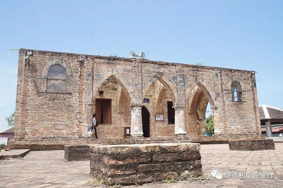
The location of Patani
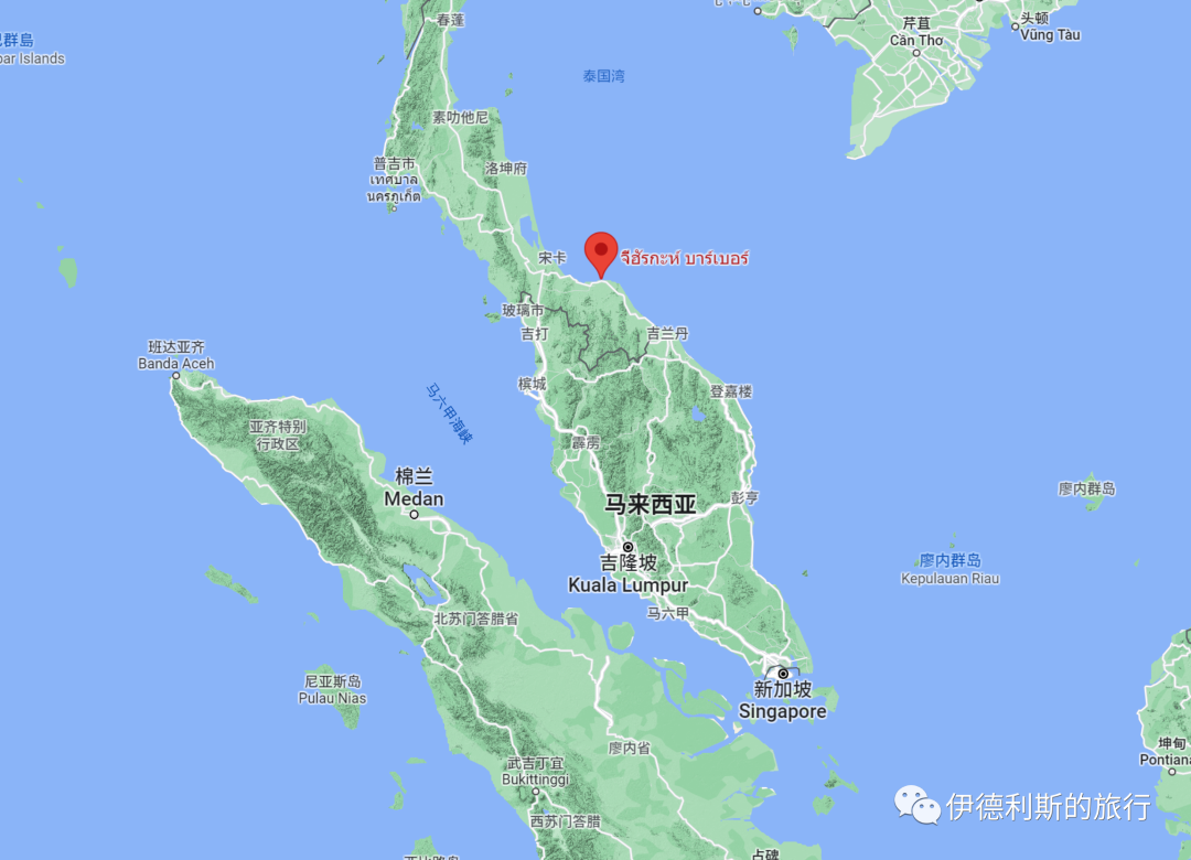
The legacy of the Malacca Sultanate.
Until the end of the 15th century, European spices were obtained through Venice. Venice got them from Arabs and Indians, who in turn got them from Malacca. This process was complex and tedious. Driven by a desire for spices, the King of Portugal ordered his explorers to bypass the Cape of Good Hope to break the trade chain and establish a direct trade route to the East.
In 1509, a Portuguese representative arrived in Malacca with a letter from the King, hoping to establish direct trade. However, because the Portuguese had previously led Catholics against 'infidels' in India, the powerful Indian Tamil Muslim faction in the Malacca court was very hostile toward them. The Sultanate of Malacca eventually decided to arrest the Portuguese representative. He escaped alone, but his companions were imprisoned.
In 1511, the Portuguese governor of India led 18 ships and 1,400 men to Malacca to negotiate the release of the prisoners with the Sultan. After three months of delays, the Portuguese successfully bribed the castle guards to open the main gate. The Portuguese army entered Malacca, and the last Sultan fled.
The Portuguese demolished the original palace, cemeteries, and mosques of the Malacca Sultanate to build the A Famosa fortress.
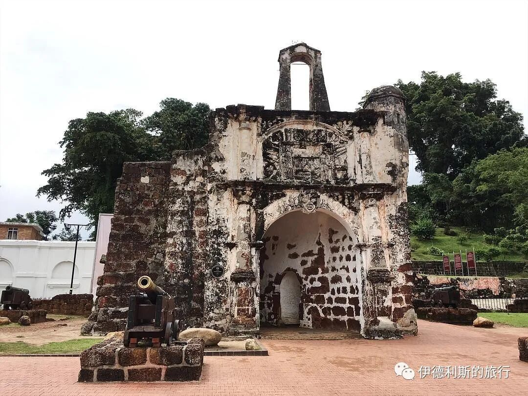
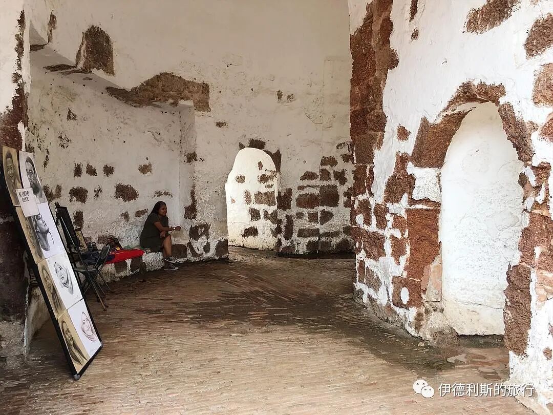
St. Paul's Church, built inside the fortress in 1521, is the oldest church building in Southeast Asia.
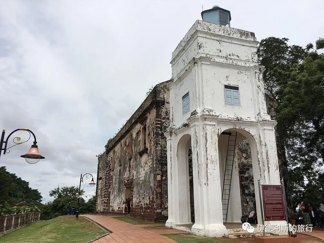
The location of Malacca
After the Portuguese conquered Malacca, the last Sultan, Mahmud Shah, retreated south to Bintan Island, south of Singapore. He established his capital at Tanjungpinang and continued to rule the Malays as Sultan. Between 1515 and 1519, the Sultan led several military campaigns to retake Malacca, but the Portuguese defeated him each time. In 1526, the Portuguese completely destroyed Tanjungpinang. Mahmud Shah fled to Kampar in Riau, where he died in 1528.
The location of Tanjungpinang
After Mahmud Shah died, his two sons established the Sultanate of Perak and the Sultanate of Johor. Along with the Sultanate of Pahang, which had been established earlier by another Malaccan prince, there were three sultanates on the Malay Peninsula ruled by Malaccan princes during this period.
1. The Sultanate of Perak, Malaysia (1528–present)
The Sultanate of Perak is located on the west coast of the Malay Peninsula. It was founded by Muzaffar Shah I, the eldest son of the last Malaccan Sultan, Mahmud Shah. After his father died in 1528, his brother Alauddin established the Sultanate of Johor, while he traveled to Perak and became the Sultan of Perak.
In 1550, the Perak Sultanate was ruled by its second sultan, Mansur Shah I. He began taxing tin mines within Perak, which gradually made the sultanate wealthy. During his reign, the Perak Sultanate was defeated by Siam in the north, forced to pay annual tribute, and had to allow Siam to buy tin tax-free.
The location of Perak.
2. The Pahang Sultanate of Malaysia (1470–1623)
The Pahang Sultanate was a Malay state on the east coast of the Malay Peninsula, founded by a prince from the Malacca Sultanate. The Pahang Sultanate became officially independent after the Portuguese conquered the Malacca Sultanate in 1511. In 1523, the Pahang Sultanate joined forces with the remnants of the Malacca Sultanate in the Johor region to defeat the Portuguese. In retaliation, the Portuguese destroyed all the ships of the Pahang Sultanate and killed over 600 people. In 1540, the Portuguese teamed up with the Pattani Sultanate to attack the Pahang Sultanate, killing the sultan himself.
In 1550, the Pahang Sultanate was ruled by Sultan Zainal Abidin Shah. That year, the three sultanates founded by Malacca princes—Pahang, Johor, and Perak—united to try and retake Malacca from the Portuguese. However, the Portuguese army used a diversionary strategy to harass the ports of Pahang, forcing the Pahang Sultanate's army to withdraw.
The location of Pahang.
3. The Johor Sultanate of Malaysia (1528–present)
After the last sultan of the Malacca Sultanate, Mahmud Shah, passed away, his second son, Alauddin Riayat, established the Johor Sultanate in the upper reaches of Kota Tinggi, Johor, Malaysia. In 1535, the Portuguese twice led 400 soldiers to invade Johor. Alauddin led the Malays in a fierce counterattack, heavily damaging the Portuguese, and eventually signed a peace treaty with them.
After 1540, Alauddin moved the capital of the Johor Sultanate to the mouth of the Johor River, now known as Old Johor (Johor Lama). That same year, he sent troops to defeat the Aceh Sultanate, which had invaded the Aru Kingdom. This battle is hailed as the most glorious victory achieved by the Malays after the fall of the Malacca Sultanate.
The Old Johor Museum introduces this history of the Johor Sultanate; photo taken by Chongkian in 2016.
The location of Old Johor.
Sultanates of Indonesia.
1. The Aceh Sultanate of Indonesia (1496–1903)
The Aceh Sultanate was located in Aceh Province on the northern tip of Sumatra, Indonesia. In the 16th and 17th centuries, it was a major power in the Malay Archipelago, competing with the Johor Sultanate and the Portuguese for control of the Strait of Malacca. At the same time, the court of the Sultan of Aceh was a center for Islamic scholarship.
The Aceh Sultanate began expanding its control over northern Sumatra in the 1520s and started clashing with the Portuguese. In 1521, Sultan Ali led his army to defeat a Portuguese fleet of 200 men, capturing many European cannons. After this, the war between the Aceh Sultanate and the Portuguese continued unabated. Meanwhile, the Aceh Sultanate also took in many Malaccan nobles who had fled after the Portuguese conquered the Malacca Sultanate.
In 1550, the Aceh Sultanate was ruled by its third sultan, Alauddin al-Kahar, who is known as the most powerful warrior in the history of the Aceh Sultanate. Alauddin began conquering southern Sumatra in 1539 and killed the ruler of the Aru Kingdom, but he was pushed back by the Johor Sultanate in 1540. To compete with the Portuguese for control of the Strait of Malacca, Alauddin led an army in a night raid on Malacca in 1547, but he was ultimately defeated. After that, the Aceh Sultanate enjoyed 15 years of peace.
The tomb of Sultan Alauddin al-Kahar; photo taken by Si Gam in 2015.
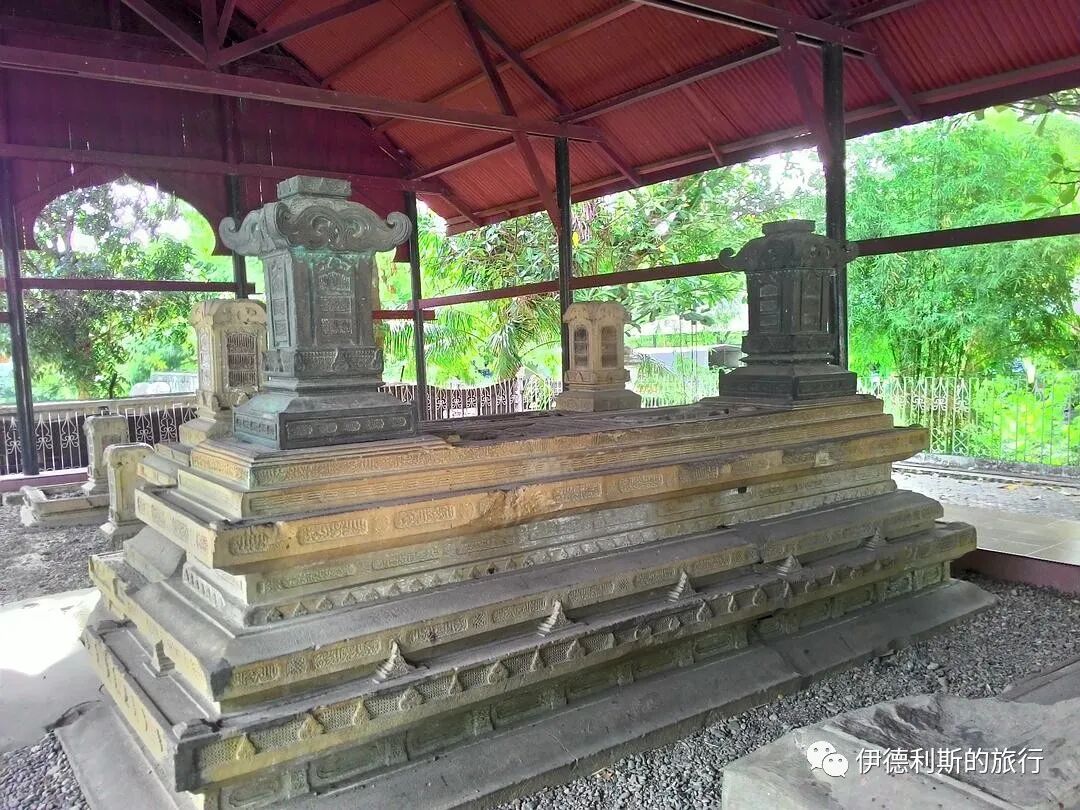
The dark area shows the territory of the Aceh Sultanate in 1524, mapped by Gunawan Kartapranata in 2009.
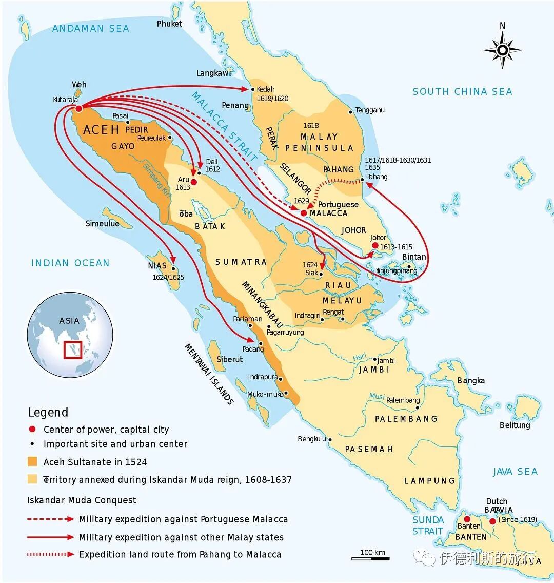
The location of Banda Aceh.
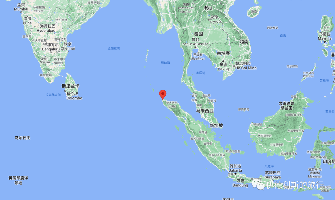
2. The Banten Sultanate of Indonesia (1527–1813).
Banten is on the western tip of Java Island, separated from Sumatra by the Sunda Strait. In the early 16th century, it belonged to the Hindu Sunda Kingdom. The rise of the Cirebon and Demak sultanates on Java threatened the Sunda Kingdom, so the kingdom asked the Portuguese in Malacca for help. In 1522, the Portuguese formed an alliance with the Sunda Kingdom to control the local pepper trade.
However, after the alliance was formed, the Portuguese failed to send troops to help in time. The joint Cirebon-Demak army took the chance to capture the important Sunda Kingdom port of Sunda Kalapa and renamed it Jakarta. After that, the Sunda Kingdom fought the Cirebon-Demak army alone for five years. In 1527, the Cirebon Sultan Sunan Gunung Jati sent his son, Maulana Hasanuddin, to join the Demak Sultanate and capture the important port of Banten. Sunan Gunung Jati then named his son the Sultan of Banten.
Soon after becoming Sultan of Banten, Maulana Hasanuddin began building a new port city at the mouth of the Banten River. By the mid-16th century, Banten had become an important port that could rival Malacca. According to the Portuguese historian João de Barros, Banten was located in the middle of the harbor. A clear river ran through the city, allowing ships to sail into the town center. The city had a brick fortress with a two-story wooden defensive structure. There was a square in the city center used as a market in the morning and for military or artistic events at noon. On the south side of the square was the Sultan's palace, known as the Surosowan Palace, with a tall building next to it where the Sultan met his subjects. On the west side of the square was the Great Mosque, which is the current Great Mosque of Banten.
At that time, only local residents lived inside the city. Foreigners lived by the harbor north of the city, with foreign Muslims in the northeast and foreign non-Muslims in the northwest.
Only ruins remain of the Surosowan Palace built by Maulana Hasanuddin, which served as the residence for generations of Banten sultans. The palace was designed by a Dutchman, so it features the corner bastion structure of a Dutch fortress. The Surosowan Palace currently has two-meter-high walls made of red stone and coral. The most obvious ruin inside is the Sultan's princess's bathing pool, which is similar in structure to the existing pools in the Yogyakarta Sultan's Palace.
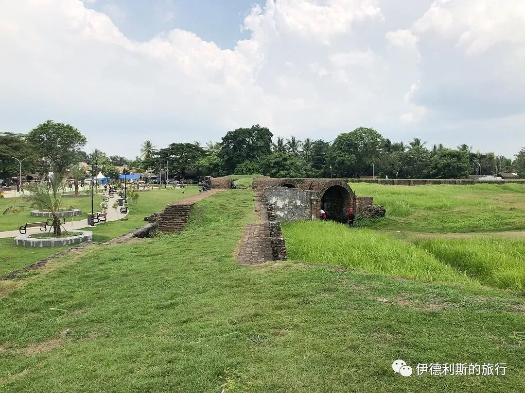
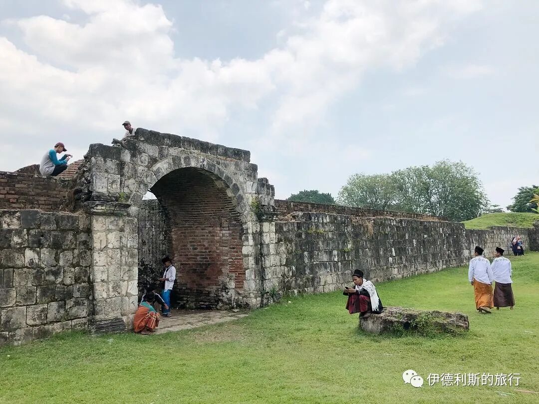
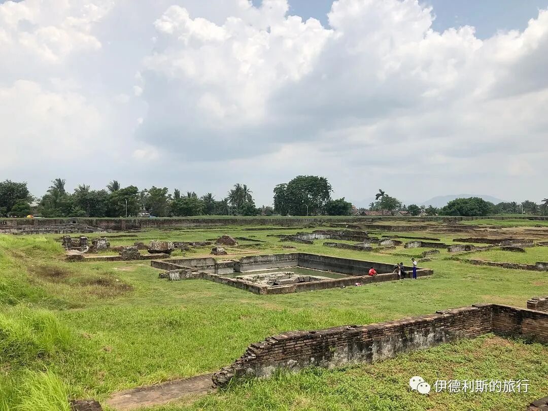
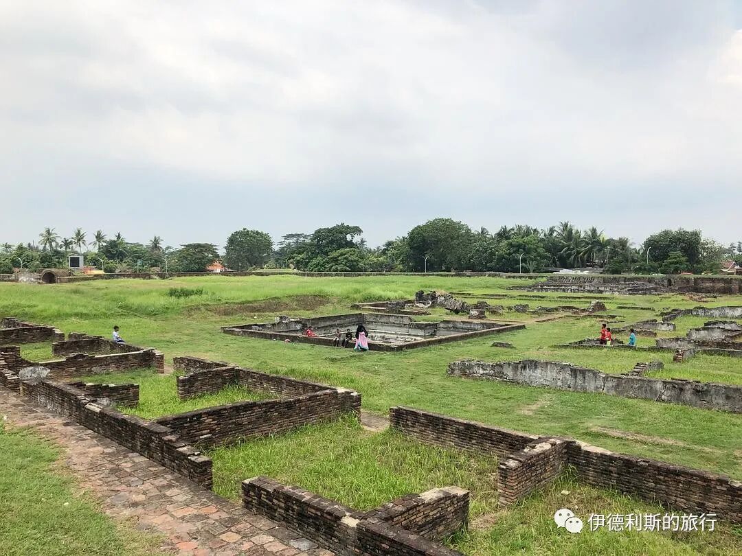
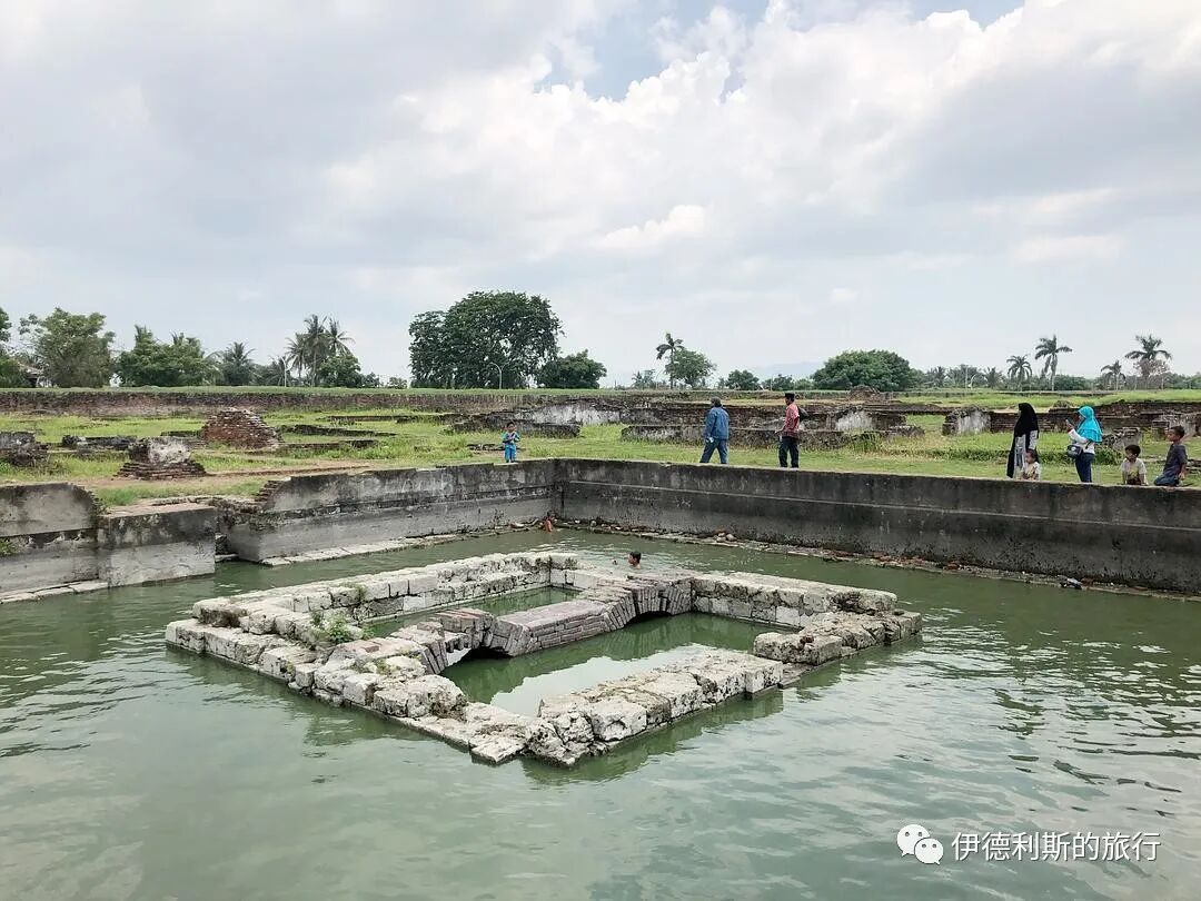
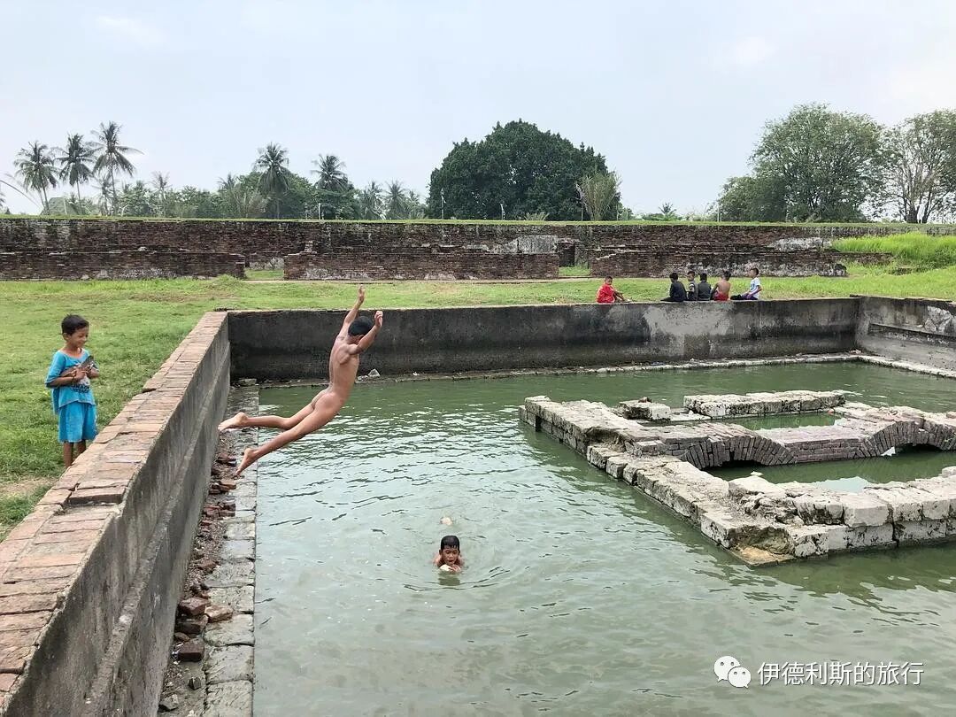
The tomb of Maulana Hasanuddin is right next to the Great Mosque of Banten.
Street view of Banten city.
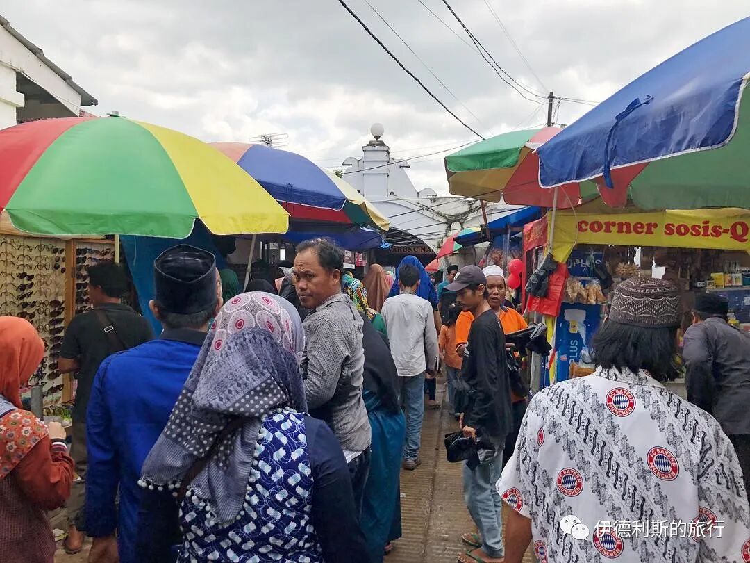
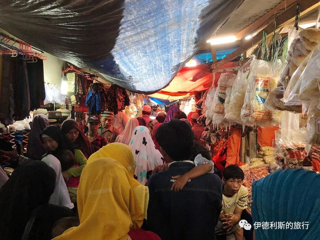

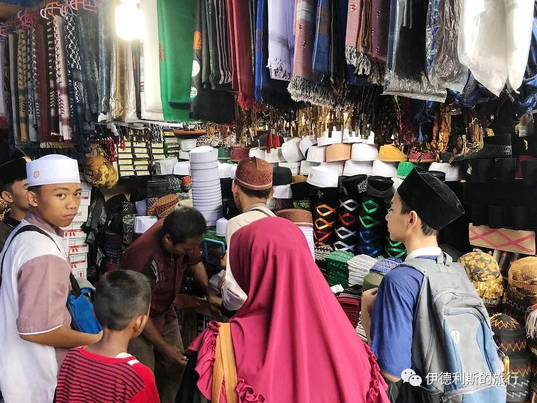
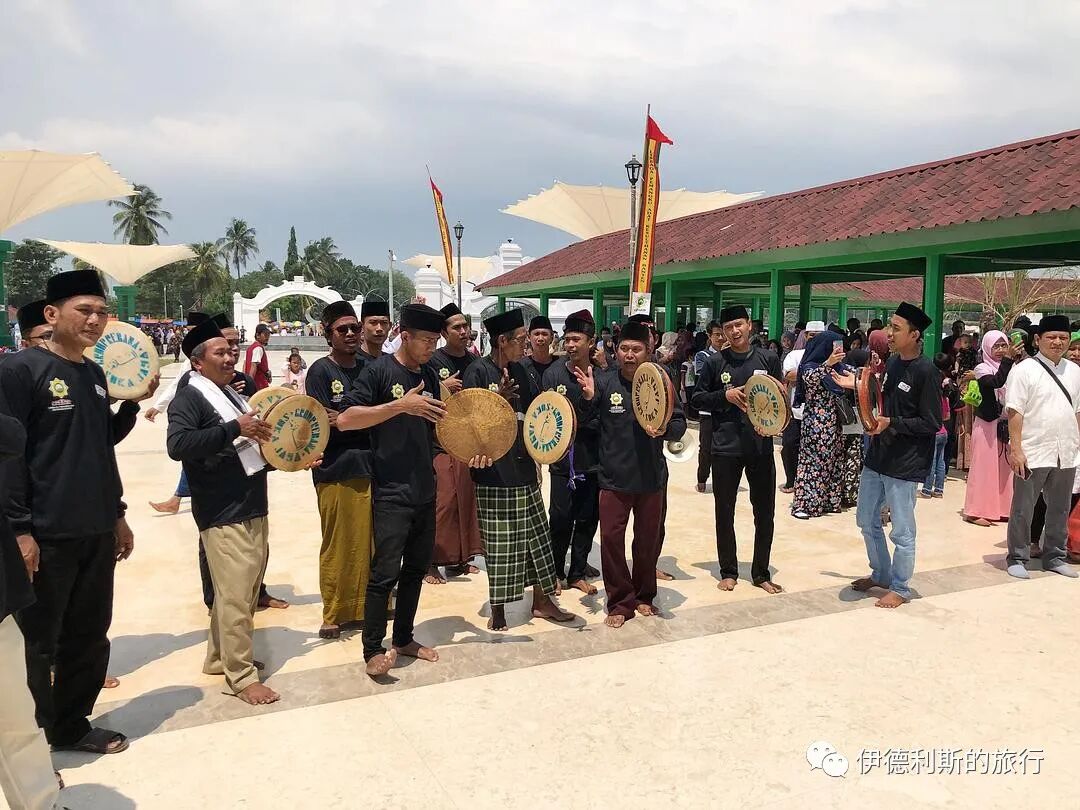
The location of Banten city.
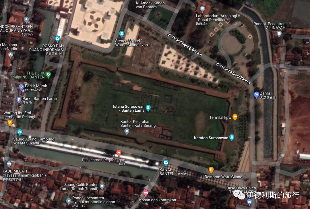
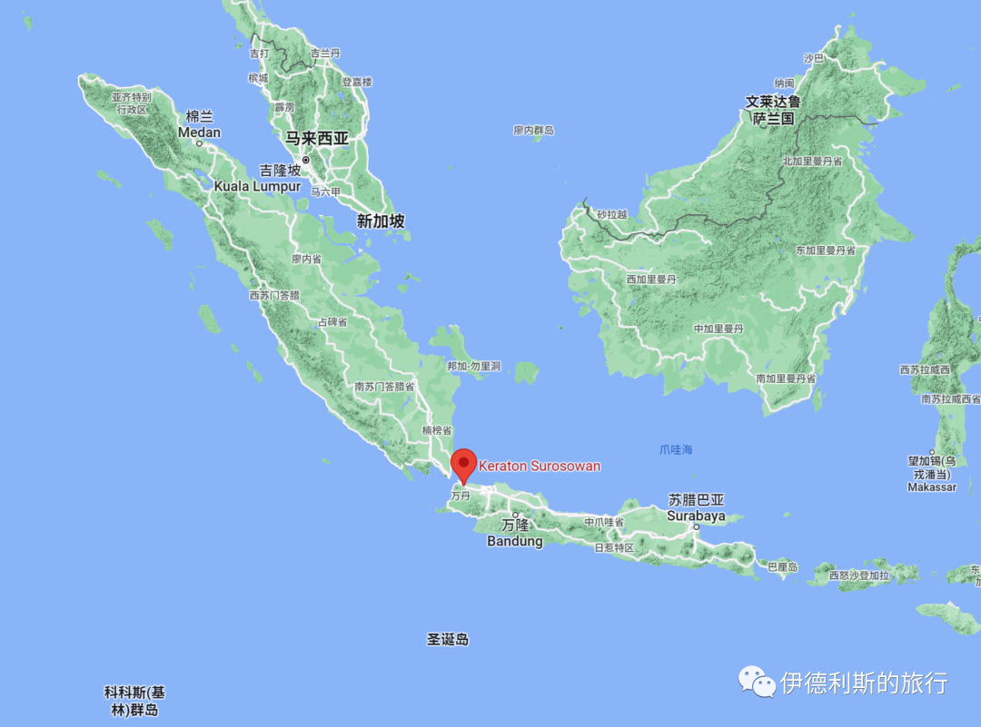
3. The Cirebon Sultanate of Indonesia (1447–1679).
The Cirebon Sultanate was located in western Java and was founded by Prince Cakrabuana of the Hindu Sunda Kingdom. Prince Cakrabuana's mother was a Muslim, and he converted to Islam. Later, the prince studied under a Sufi sheikh from Iran and, at the sheikh's request, established a new settlement called Cirebon.
In 1550, the ruler of the Cirebon Sultanate was Sunan Gunung Jati (reigned 1479–1568), one of the nine saints (Wali Sanga) of Javanese Islam. He was the nephew of the sultanate's founder, Prince Cakrabuana. There are many legends about Sunan Gunung Jati, but some contradict each other, suggesting these stories may combine the experiences of more than one historical figure.
According to legend, Sunan Gunung Jati went on Hajj at age 22 and studied in Mecca, Baghdad, Egypt, and Champa. After returning home to Java, he studied under another one of the nine saints, Sunan Ampel, and served in the court of the Demak Sultanate. After returning to Cirebon, he suggested to his uncle that they establish an Islamic school (pesantren).
After inheriting the throne, he wrote to his grandfather, the King of Sunda, to announce that he would stop paying tribute to the Sunda Kingdom and that it was now an independent sultanate. According to the 1515 book The Suma Oriental of Tomé Pires: An Account of the East, from the Red Sea to China by Portuguese explorer Tomé Pires, the Cirebon Sultanate was already a mature Muslim nation by 1515. During the reign of Sunan Gunung Jati, Cirebon grew into a prosperous port city that attracted many Arab and Chinese merchants. This place was not only a trade hub but also a center for the Islamic faith.
The Great Mosque of Cirebon, built by Sunan Gunung Jati, photographed by Aris Riyanto in 2014.
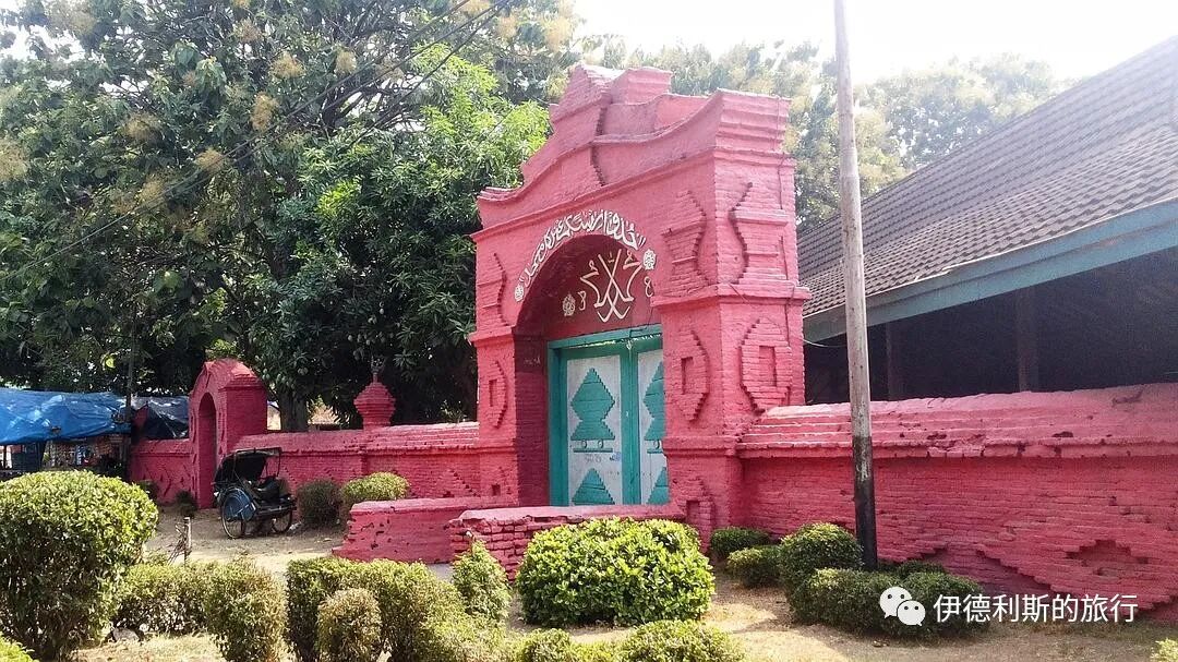
The location of Cirebon.
4. The Demak Sultanate of Indonesia (1475–1568).
The Demak Sultanate was located on the north coast of central Java, a place that was once a port for the Hindu-Buddhist Majapahit Kingdom. After the 15th century, as the Majapahit Kingdom declined, many Muslim merchants from Arabia and India chose to settle on the north coast of Java. In 1475, a Majapahit prince who had converted to Islam began ruling Demak, and he declared himself Sultan after his father died in 1478.
After the Portuguese conquered the Malacca Sultanate in 1511, the Demak Sultanate launched attacks against the Portuguese and the Majapahit Kingdom to protect the spice trade. Although they were defeated at sea by the Portuguese, the Demak Sultanate crushed the Majapahit Kingdom on land, completely ending the once-powerful kingdom in 1527. At its peak, the Demak Sultanate controlled all the trade ports on the north coast of Java and gained control over the ports of Jambi and Palembang in eastern Sumatra, making it a powerful maritime nation at the time.
In 1550, the ruler of the Demak Sultanate was Arya Penangsang, a brave but vicious Sultan who would not hesitate to use cruel methods to achieve his goals. The Sultan's teacher was Sunan Kudus, one of the nine Javanese Islamic saints (Wali Sanga), who helped the Sultan seize the throne in 1549.
A one-hour drive northeast from the city of Demak brings you to Kudus, an important holy city of Islam on Java. Kudus is the only city on Java with an Arabic name. 'Kudus' is actually the Arabic pronunciation of Jerusalem, 'al-Quds,' and it was named after Sunan Kudus, one of the nine Javanese Islamic saints (Wali Sanga). The tomb of Kudus is now an important religious site on Java, and the Al-Aqsa Mosque next to the tomb is world-famous for its unique minaret built in an early traditional Javanese style.
Kudus came from a family of religious scholars, and his father was the imam of the Great Mosque of Demak. Kudus served as an officer in four wars between the Demak Sultanate and the Majapahit Kingdom, but he spent most of his energy on spreading the faith. Kudus studied under Sunan Kalijaga, one of the nine Javanese Islamic saints (Wali Songo) and the founder of the Great Mosque of Demak. Like his teacher, Kudus was very tolerant of traditional Javanese culture. He once tied a cow, which Hindus consider sacred, inside the mosque to attract Hindus, and he forbade people from slaughtering cows. When building the mosque, Kudus also used Javanese Hindu architectural styles.
The Al-Aqsa Mosque of Kudus (Masjid Al Aqsa Menara Kudus) was built by Kudus in 1549 and is known for its unique traditional Javanese architectural style.
The mosque shares its name with the famous Al-Aqsa Mosque in Jerusalem. People say while on his way to perform the Hajj, Kudus helped cure a plague in a city and refused the generous gifts offered by the locals, accepting only a stone from the holy land surrounding the Al-Aqsa Mosque in Jerusalem. After returning to Java, Kudus used the stone in this mosque.
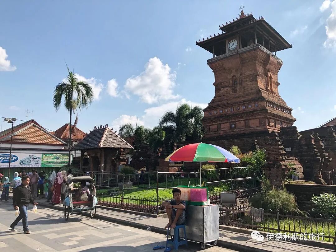
During the 19th century.
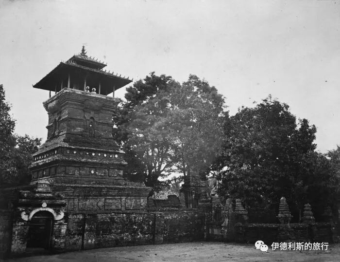
During the early 20th century.
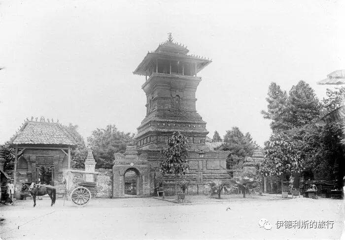
The architectural style of the Al-Aqsa Mosque of Kudus directly inherited Buddhist/Hindu architecture from the Majapahit era, featuring two types of characteristic gates: Candi Bentar and Kori Agung.
A Candi is a type of Hindu/Buddhist mosque architecture found on Java, Bali, and Lombok. Candi Bentar means 'split Candi,' which refers to a Candi that is split symmetrically down the middle to create a path. The split gate (candi bentar) does not actually have doors. It serves as a passage from the secular world into a sacred space, creating a sense of solemnity before you reach the main building.
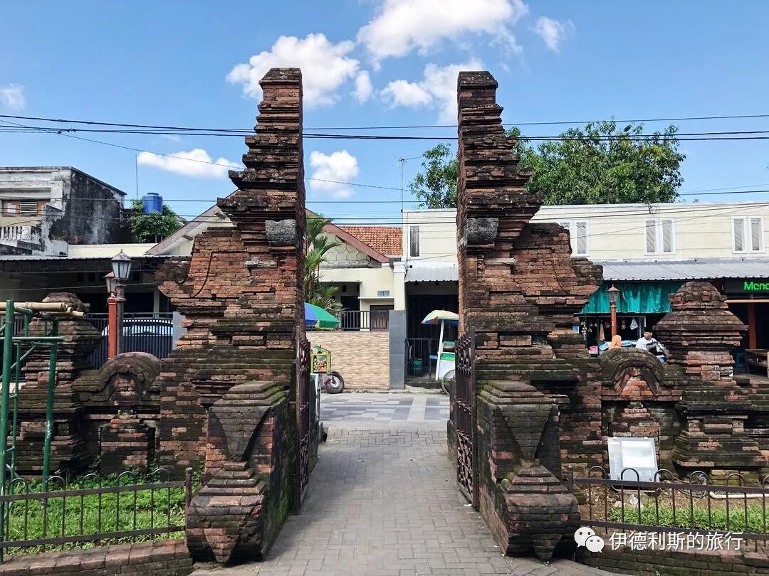
The grand gate (kori agung), also known as the paduraksa gate in Hindu and Buddhist architecture, is the main entrance from the secular world into a sacred space. The grand gate (kori agung) comes from the ancient Hindu gopuram gate. It was widely used in Javanese Hindu and Buddhist temples after the 8th and 9th centuries. After the 15th century, Islamic sultanates adopted it for mosques, palaces, and tombs, though without the complex Hindu and Buddhist decorations.
The grand gate (kori agung) is actually a type of stepped temple (candi) in the Majapahit style. It is built from red brick and features beautiful patterns on its wooden door panels.
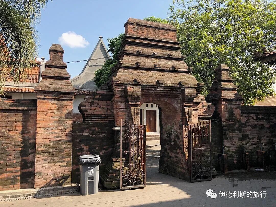
The main prayer hall of the mosque was rebuilt in modern times, but it still preserves two original grand gates (kori agung) inside.
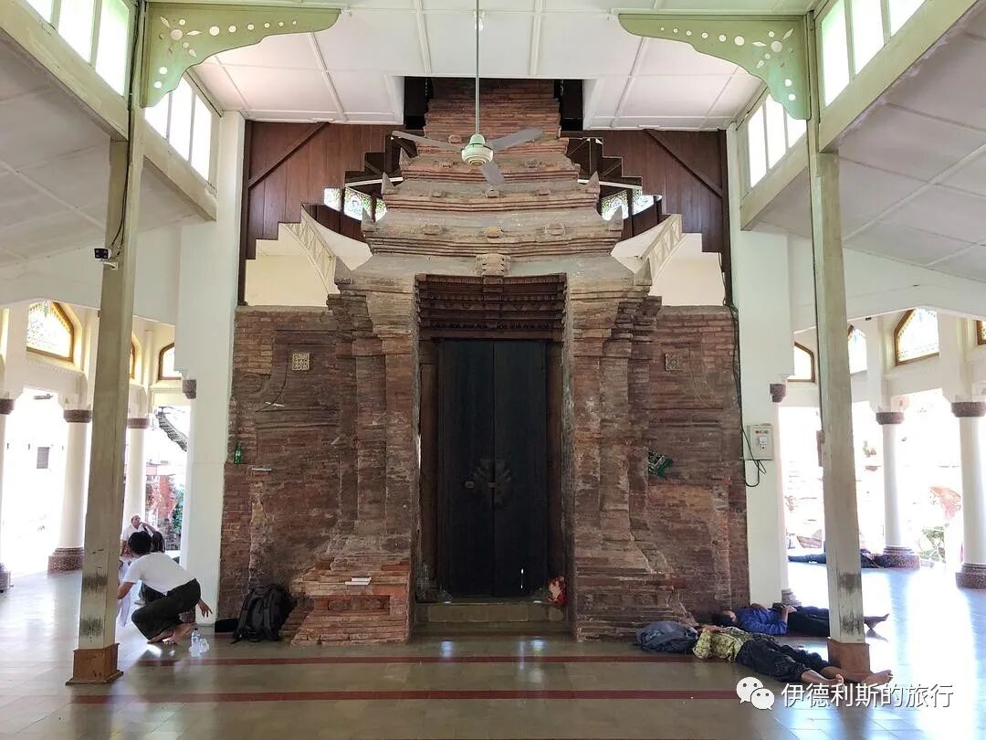
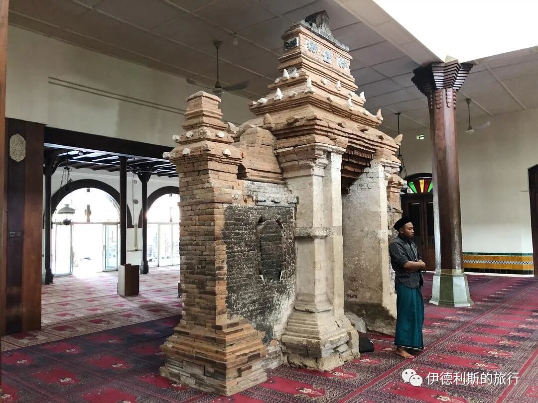
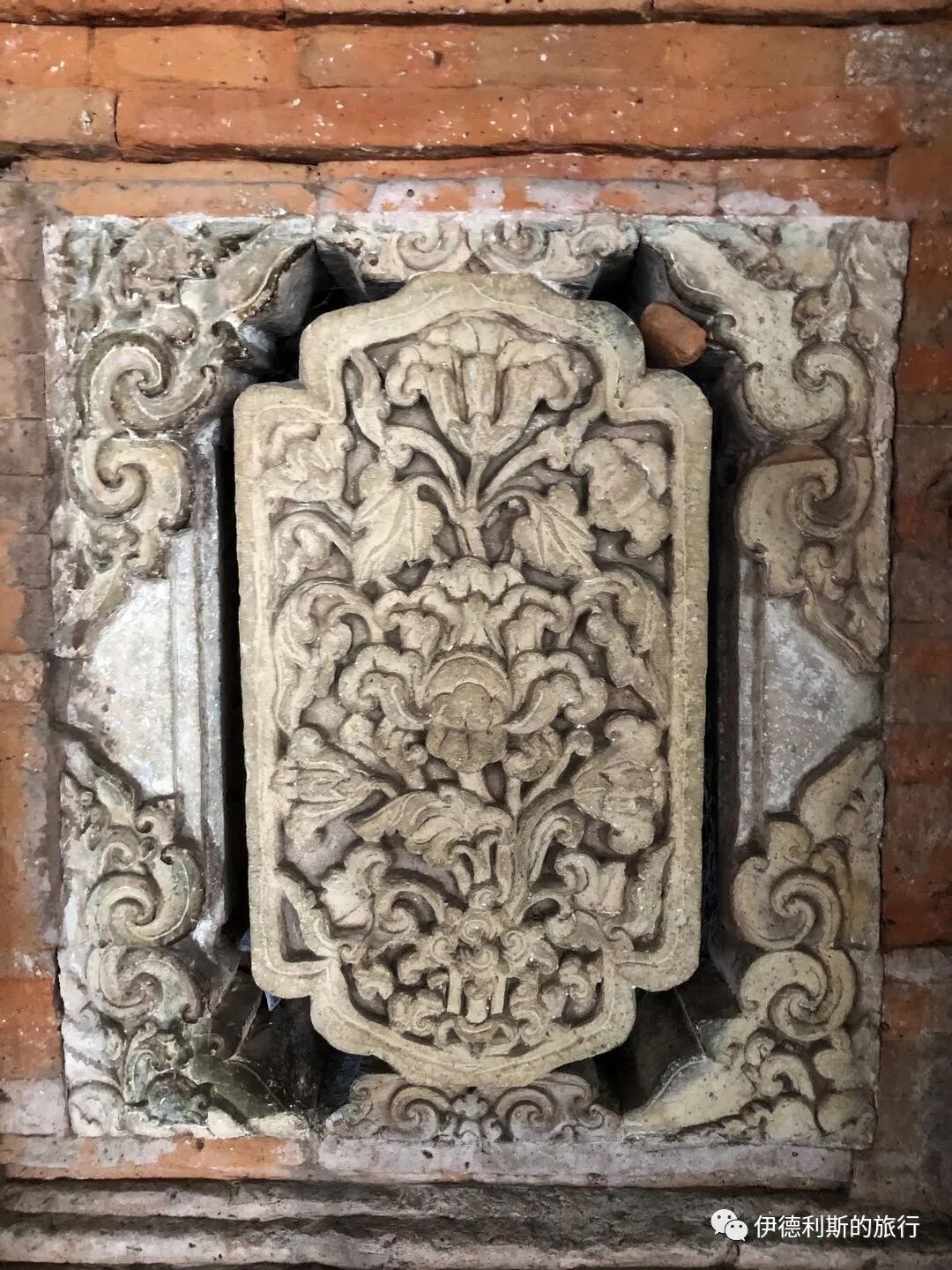
The most famous structure at the Al-Aqsa Mosque is this minaret, which is the oldest in Java and the only one on the island from the 16th century. This tower is not a Persian-style spire at all. It is a traditional Javanese Majapahit-style tower, and a large drum (bedug) used for the call to prayer sits at the top. Today, drum towers (bale kulkul) of the same style still exist in Bali, where they are used to signal attacks, fires, or public events.
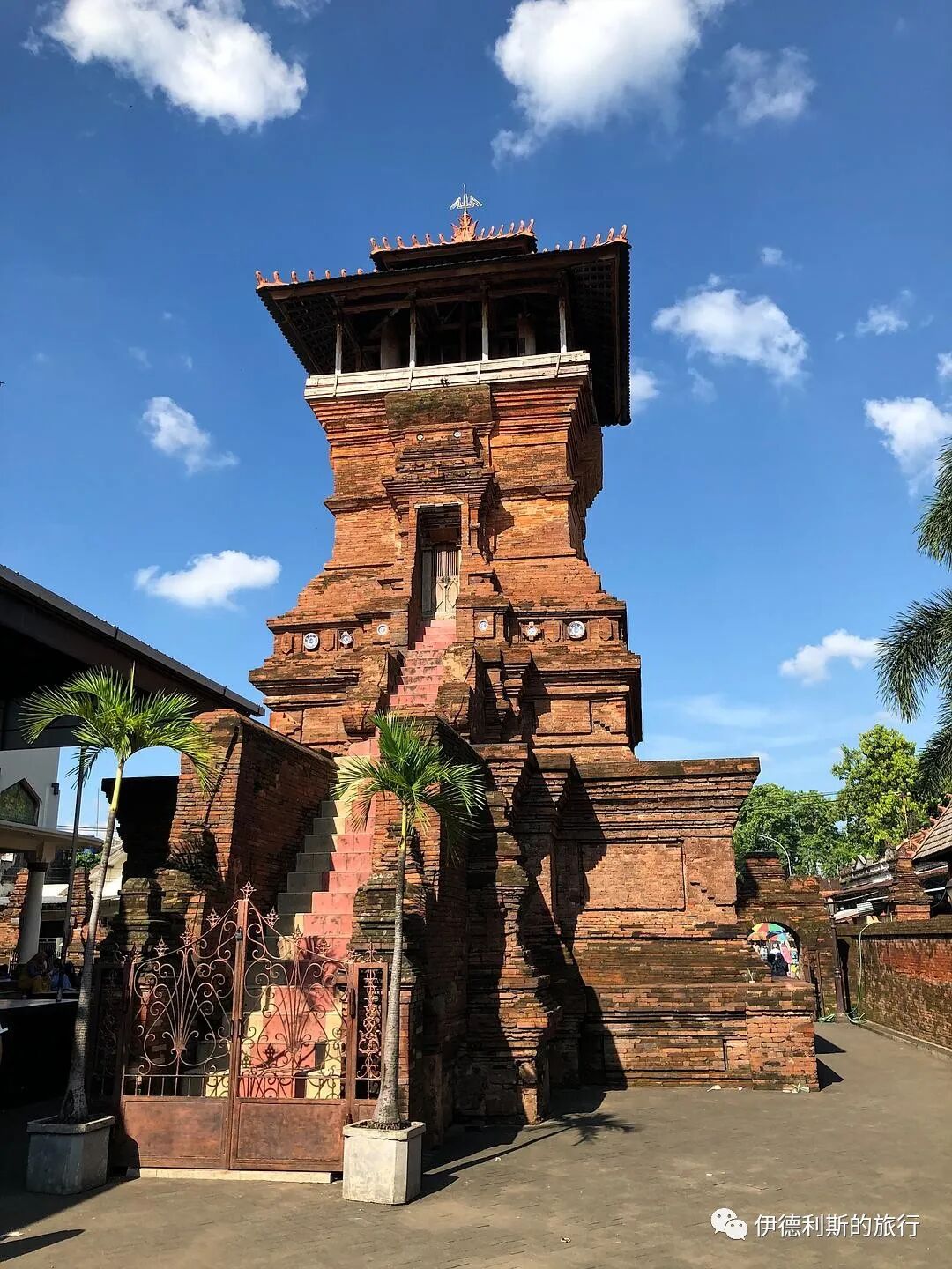
The ablution pool at the Al-Aqsa Mosque is also very unique. Every water tap has a traditional statue next to it. People say Sunan Kudus designed this during the early construction phase to attract local Hindus and Buddhists to come here to clean themselves.
Sunan Kudus passed away in 1550 and is buried in the backyard of the Al-Aqsa Mosque. The holy tomb is also built in the traditional Majapahit architectural style.
The split gate (candi bentar) in the middle of the passage.
During the early 20th century.
Next is another grand gate (kori agung).
Then you enter the bathing area, where people clean their bodies to prepare for entering the holy tomb.
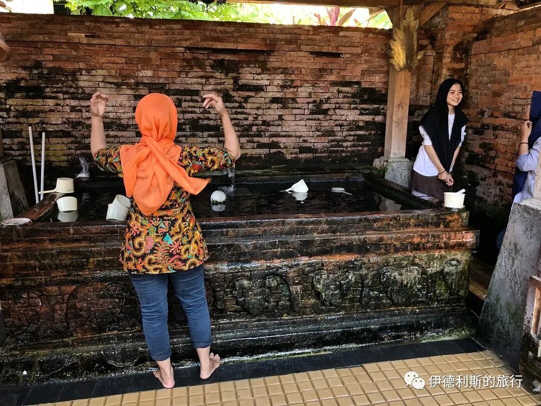
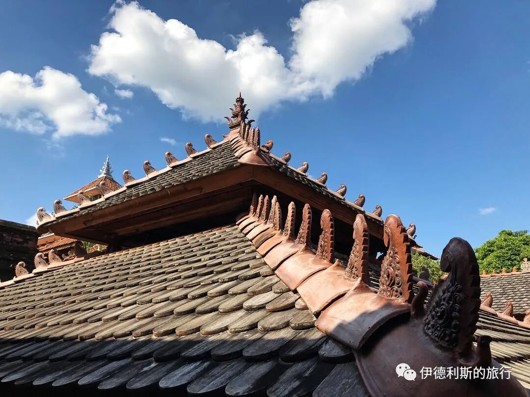
Passing through this split gate (candi bentar) leads you into the outer burial area.
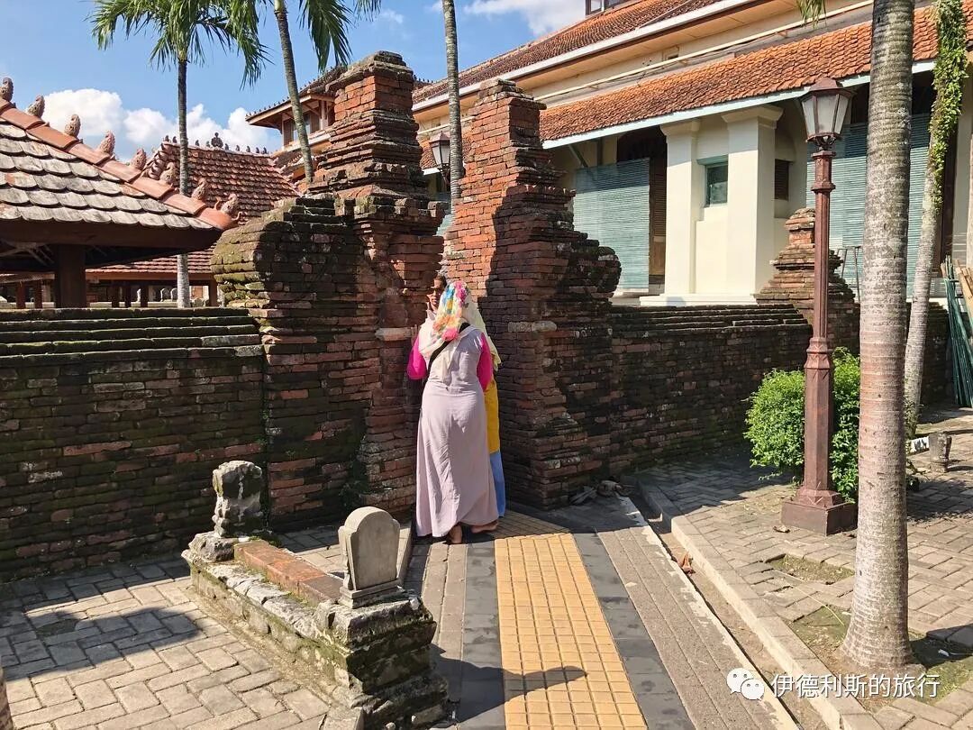
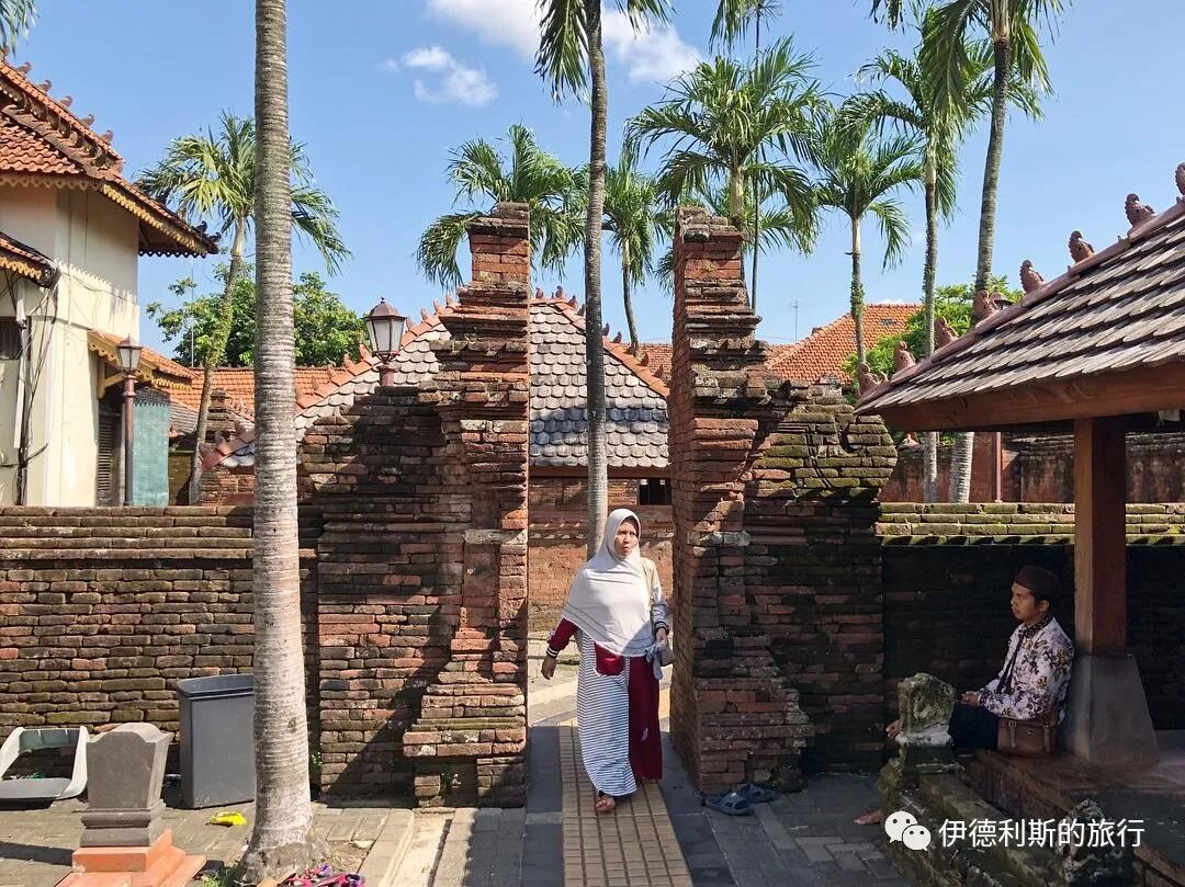
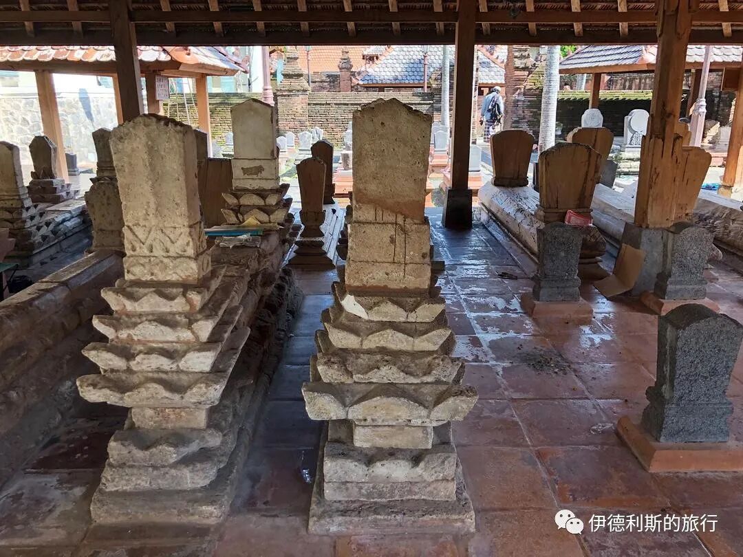
Passing through this grand gate (kori agung) brings you to the actual holy tomb.
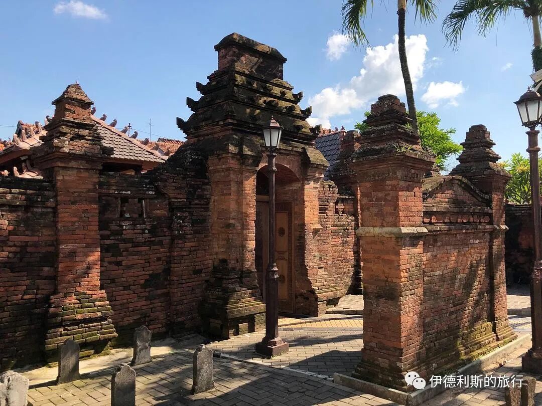
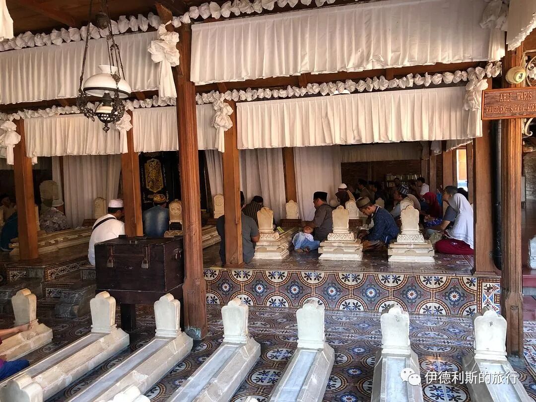
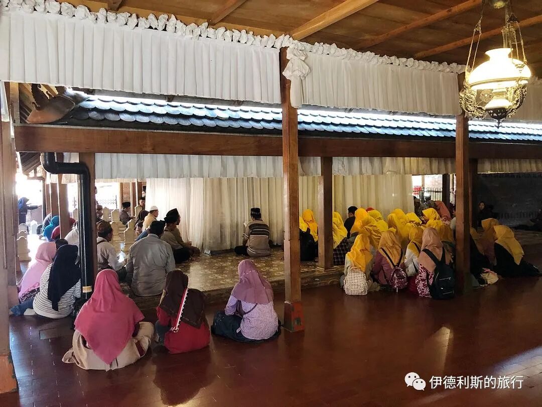
The Langgar Bubrah ruins are in a small alley south of the Al-Aqsa Mosque. They are an important witness to Java's transition from Hinduism to Islam in the 16th century.
People say Prince Pontjowati of the Majapahit Kingdom built Langgar Bubrah in 1533, and it was originally a Hindu temple. Later, Prince Pontjowati converted to Islam under Sunan Kudus and became his student, so the site was converted into a mosque.
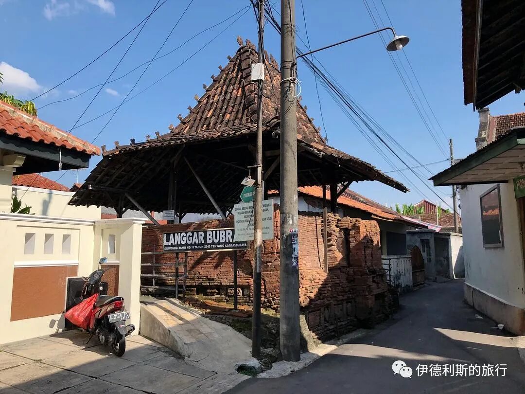
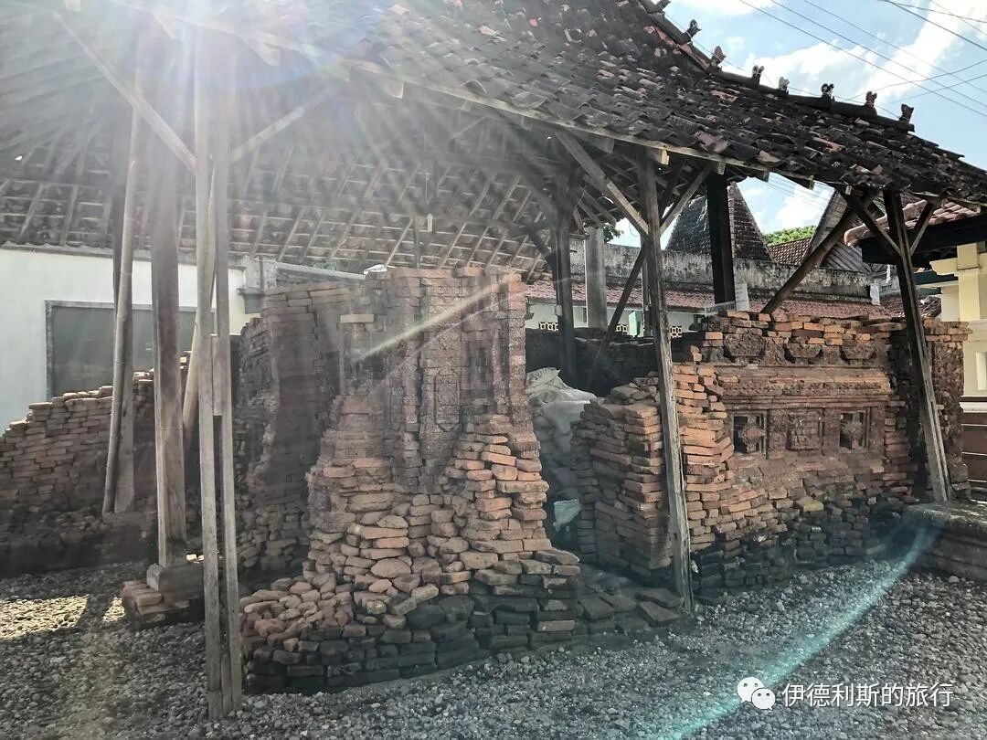
Traditional Majapahit-style brick carvings.
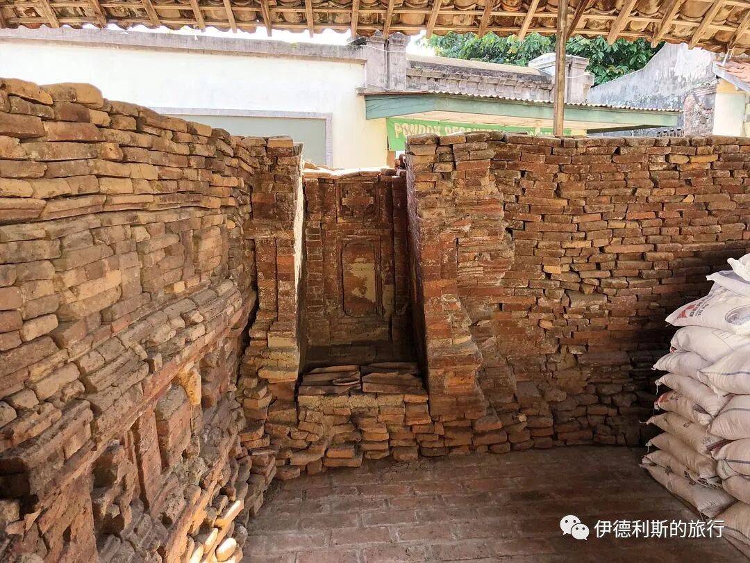
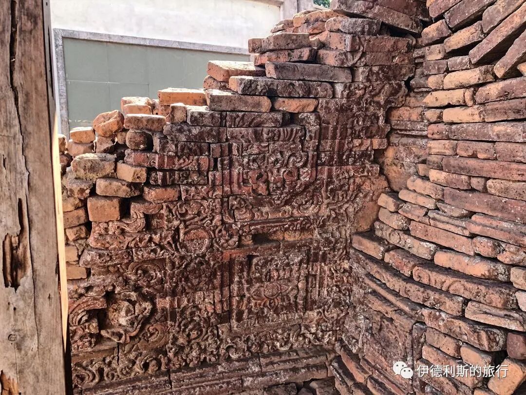
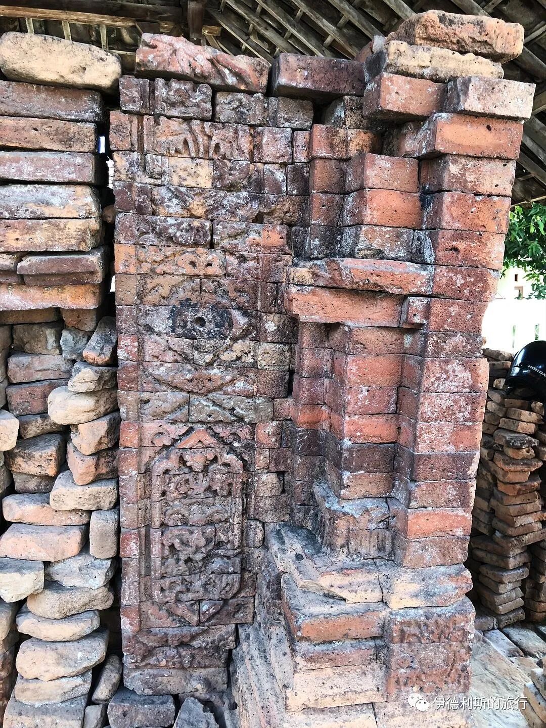
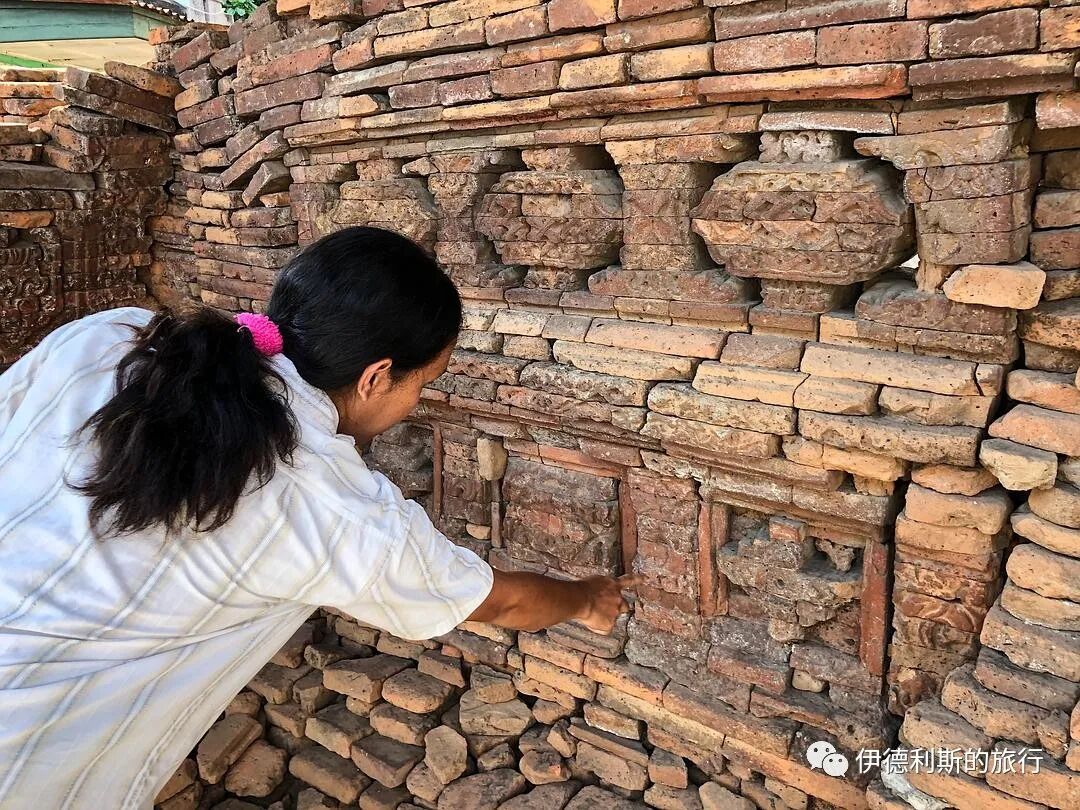
The room once had a roof, but it did not survive. Now, only the stone column bases (umpak) that supported the roof remain. Next to the column bases is a Hindu linga, along with a stone used for grinding herbs.
Beside the ruins, there is also a Hindu stone carving of Shiva.
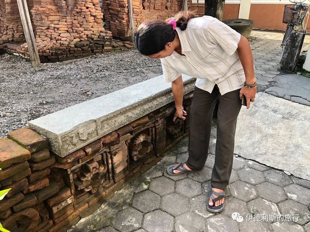
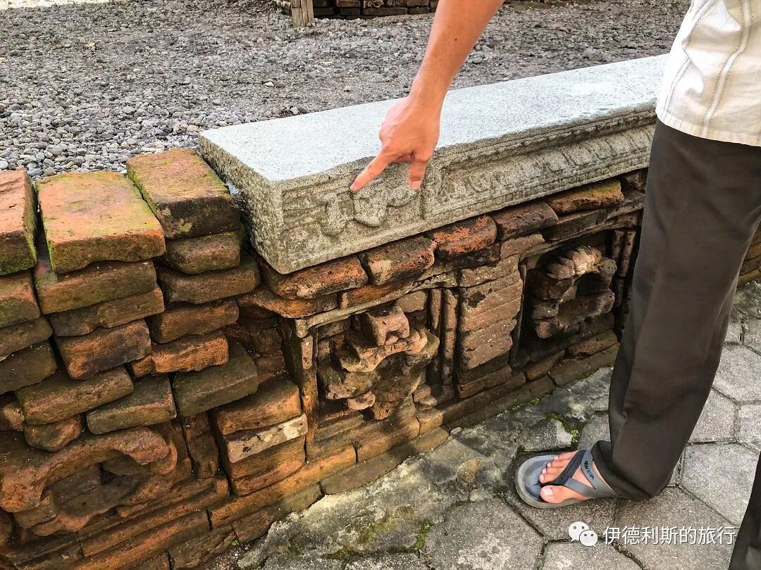
In the city of Demak, there is the tomb of Sunan Kalijaga, one of the nine saints (Wali Songo) of Javanese Islam, built in 1550. He played a major role in the spread of Islam in Java.
When Sunan Kalijaga performed missionary work (da'wah), he used local Javanese culture and art as a medium. He slowly integrated the faith into traditional Javanese customs, which was key to the formation of traditional Javanese Islamic culture.
During his missionary work, Sunan Kalijaga was skilled at using art forms like shadow puppetry (wayang), traditional gamelan music, and carving. He also promoted traditional Javanese Muslim clothing (baju takwa), the Sekaten festival, and the Grebeg Maulud parade.
Legend says Sunan Kalijaga lived to be 100 years old and did not pass away until 1550. During his life, he witnessed the fall of the Majapahit Kingdom and the establishment of the Demak, Cirebon, and Banten sultanates. He eventually passed away in Demak and was buried southeast of the city.
Today, the tomb of Sunan Kalijaga is one of the most important Islamic holy sites in Java, visited by hundreds of people every day.
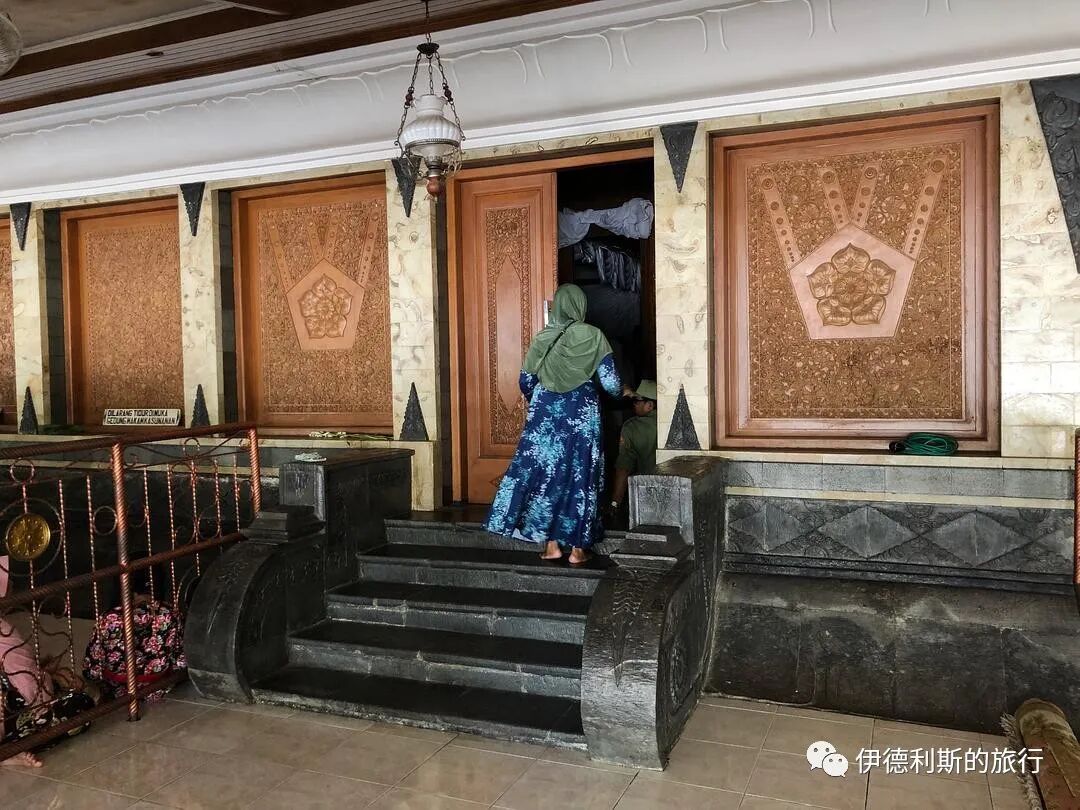
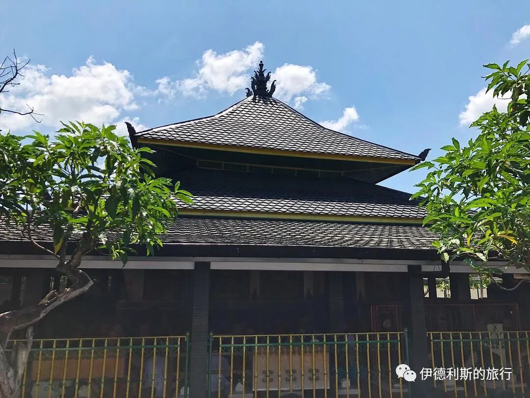
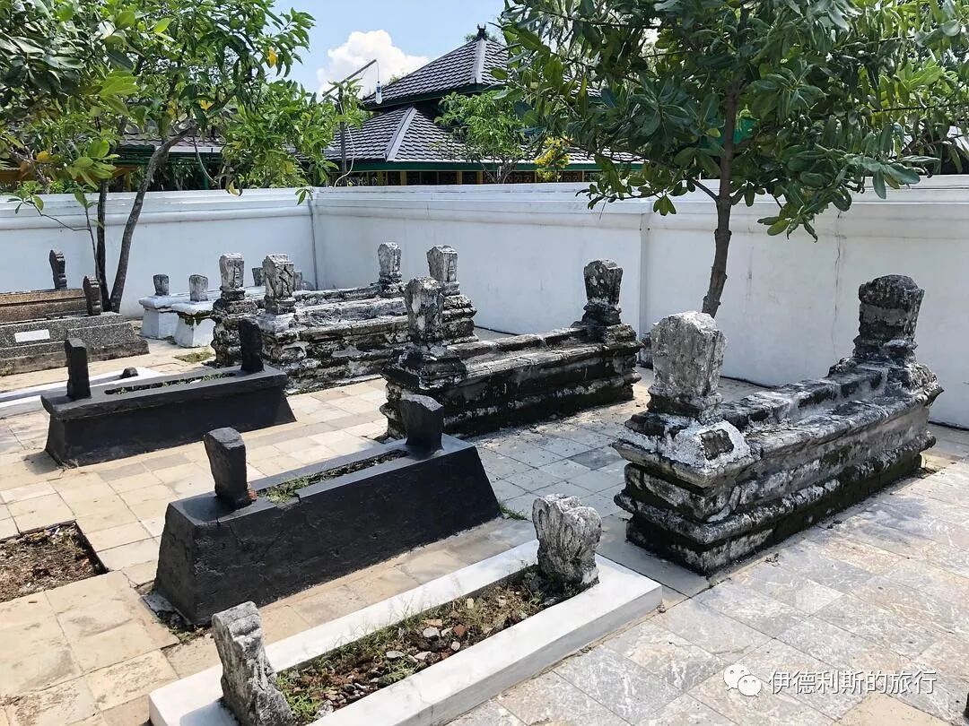
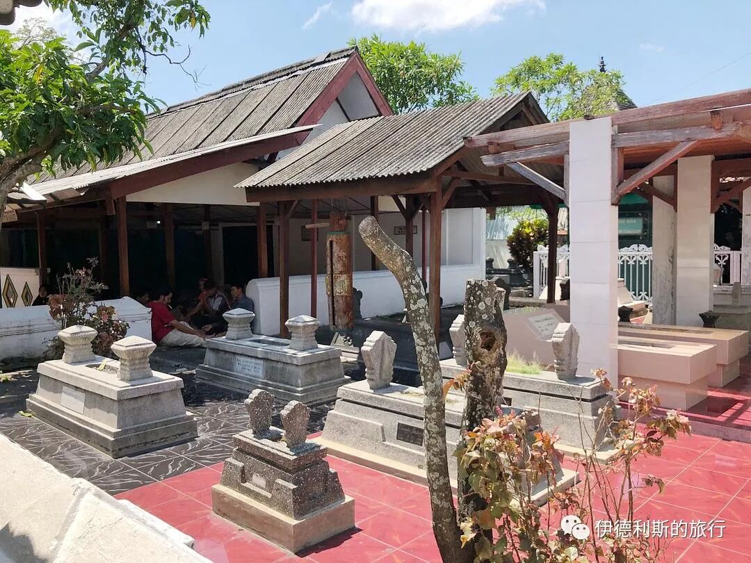
I caught the Friday prayer (Jumu'ah) at the Sunan Kalijaga tomb mosque and saw them use the traditional large drum (Bedug) for the call to prayer. After the Friday prayer, everyone received a popsicle and a snack, and everyone enjoyed them.
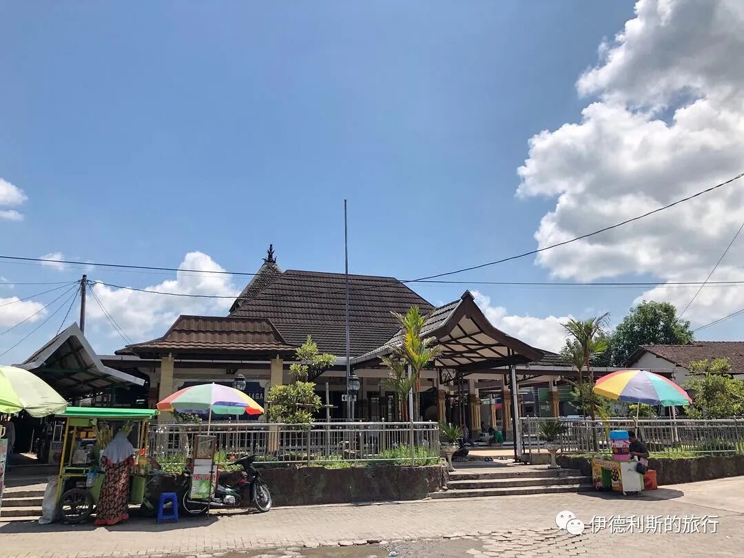
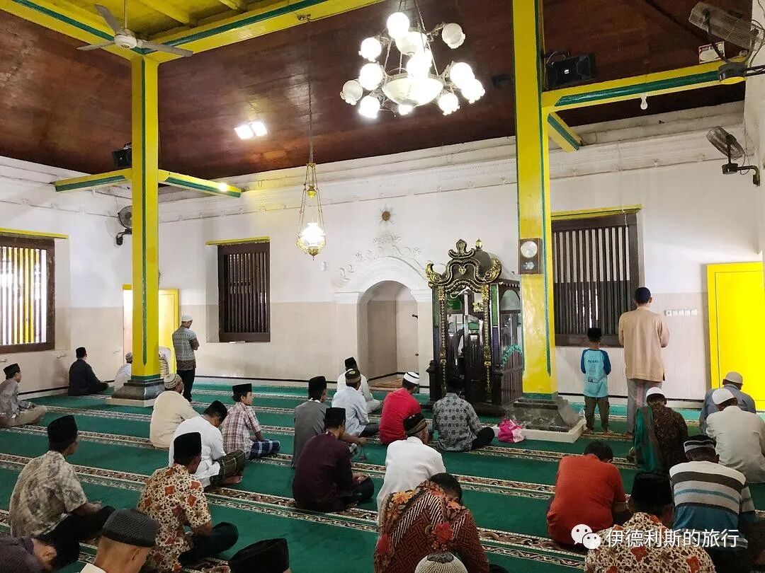
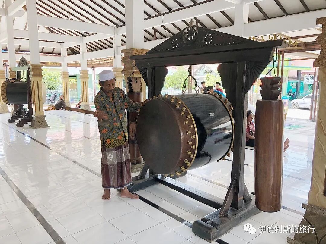
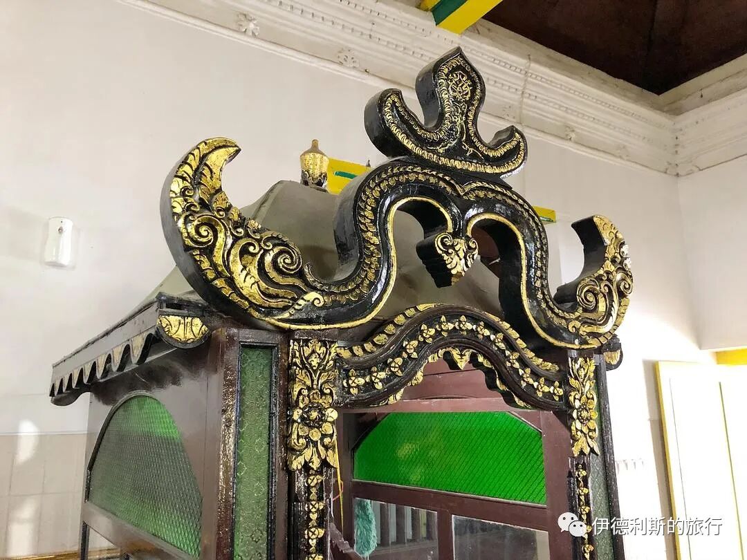
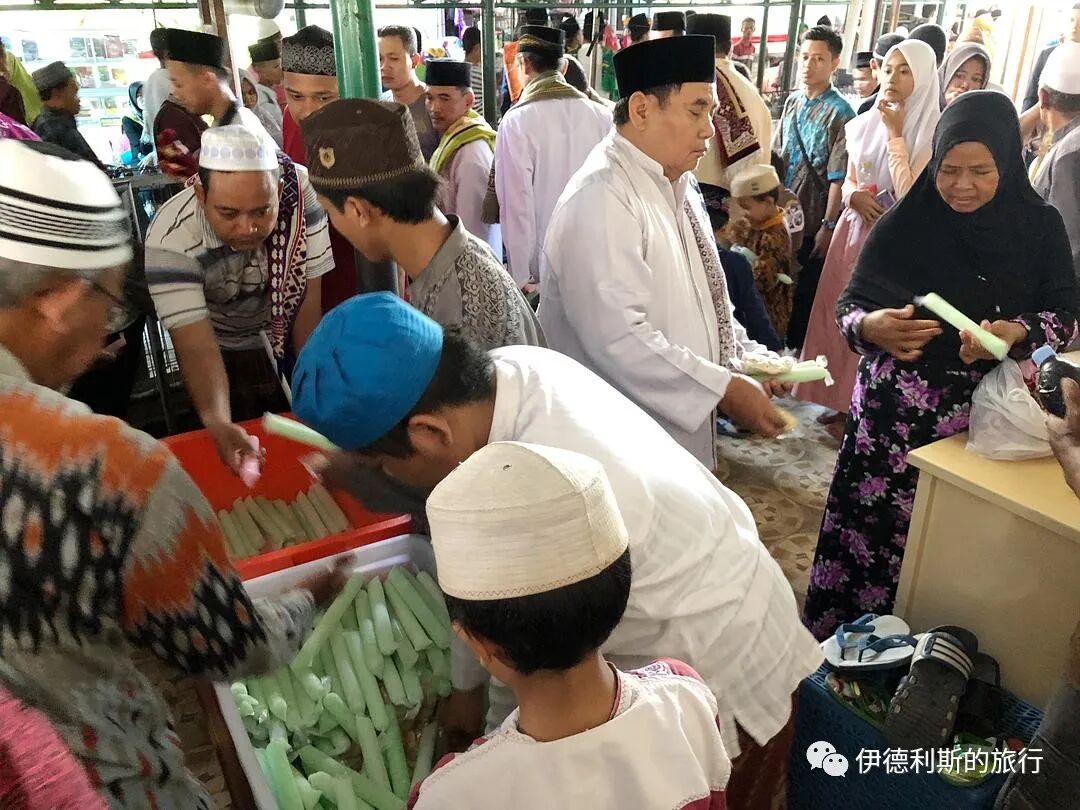
Next to the Sunan Kalijaga tomb is a large bazaar, where many stalls sell T-shirts and pictures featuring the face of the saint Sunan Kalijaga. I bought pictures of the nine saints (Wali Sanga) of Javanese Islam and the saint Sunan Kalijaga. Saint Sunan Kalijaga is the only one among the nine saints who wore traditional Javanese clothing, which shows how he used traditional Javanese culture as a way to spread the faith.
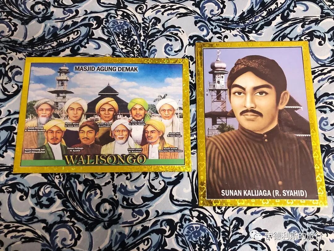
The locations of Demak and Kudus.
The four sultanates of the Spice Islands.
1. The Sultanate of Ternate in Indonesia (1486-1914).
The Sultanate of Ternate ruled parts of eastern Indonesia and the southern Philippines, making it the most powerful of the four sultanates in the Spice Islands. As the only place that produced cloves, Ternate controlled most of the spice trade in the Spice Islands.
Because of the reliance on the spice trade, Islam spread quickly to Ternate after Muslim merchants and Sufi sheikhs brought it to Java in the 15th century, and many people, including the royal family, converted to the faith. In 1486, the King of Ternate officially changed his title from Kolano to Sultan and established the Sultanate of Ternate.
After the Portuguese conquered Malacca in 1511, the spice trade route that used to go through Malacca was temporarily cut off. In 1512, the Portuguese came to Ternate to control the spice trade, and the Sultan of Ternate also hoped to work with them, allowing them to build a fortress in 1522. The Portuguese soon began to control the sultanate, and the bad behavior of the Portuguese garrison and their efforts to spread Catholicism further strained their relationship with the Sultan. In 1535, the people of Ternate attacked a village that had converted to Catholicism, so the Portuguese deposed Sultan Tabariji and sent him to Goa, India, where he converted to Catholicism.
In 1550, Sultan Hairun was the ruler of the Ternate Sultanate. After the Portuguese deposed the old Sultan in 1535, they forcibly took Prince Hairun away to make him a puppet ruler, and Hairun's mother died after falling from a window while resisting them. Hairun was initially forced to live inside the Portuguese fortress, but he was later allowed to move around freely. Because the Portuguese wanted a more controllable Sultan, they decided to depose and exile Hairun to Goa, India, in 1544, while recalling the former Sultan Tabariji, who had already converted to Catholicism in Goa. However, Tabariji died on the way back, and Hairun returned to the throne in 1546.
The Portuguese spent years trying to get Hairun to convert, but their efforts proved useless. Still, to resist the other three sultanates in North Maluku, Hairun chose to keep working with the Portuguese. In 1550, the Sultanate of Jailolo angrily attacked a village that had recently converted to Catholicism. The Portuguese joined forces with the Sultanate of Ternate to conquer the Sultanate of Jailolo, which further increased the power of the Ternate Sultanate.
Residents of Ternate as depicted in the 1540 Portuguese work Códice Casanatense.
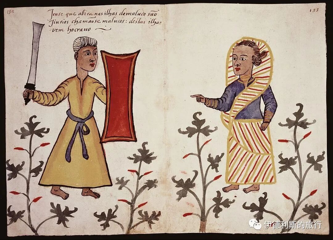
The Benteng Kota Janji, a castle built by the Portuguese on Ternate Island in 1522, which means Castle of Promise. This castle witnessed Sultan Hairun signing a treaty with the Portuguese, but it was also where Sultan Hairun was eventually assassinated by the Portuguese.
Photo by dangdude03.
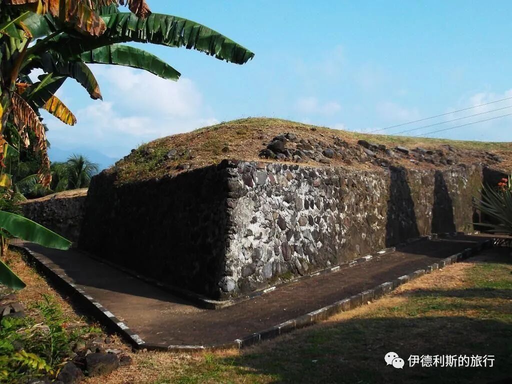
The location of Ternate.
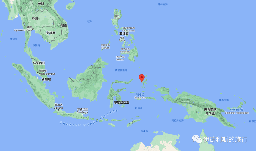
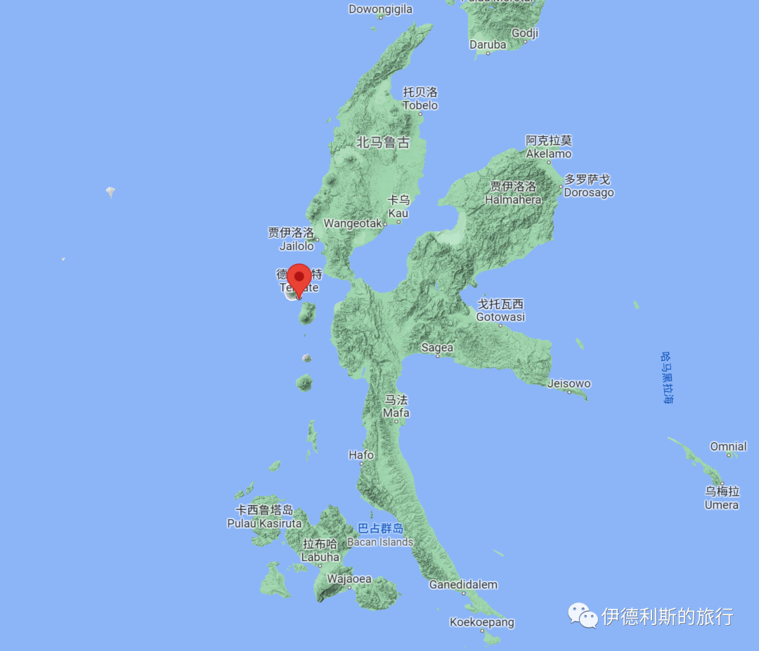
2. The Sultanate of Tidore in Indonesia (1450-1967).
Tidore Island, home to the Sultanate of Tidore, sits right next to Ternate Island. It was the main rival to the Sultanate of Ternate in the spice trade, and people say the very first cloves grew here. Like Ternate, Tidore converted to Islam in the late 15th century after being influenced by Arab Sufi sheikhs, which is when they officially established their sultanate.
When the Portuguese arrived in the Spice Islands in 1512, both the Sultanate of Tidore and the Sultanate of Ternate wanted to work with them. The Ternateans got there first and brought the Portuguese back to their country, so Tidore lost its chance to partner with them.
In 1521, the Sultanate of Tidore hosted Ferdinand Magellan’s Spanish fleet during their voyage around the world. To compete with the alliance between the Portuguese and the Sultanate of Ternate, the Sultanate of Tidore gave the Magellan fleet a warm welcome and filled the Spanish ships with spices.
During the 1520s, the Sultanate of Tidore and the Sultanate of Ternate were constantly at war. The people of Tidore could not beat the Portuguese cannons, so they eventually had to sign a peace treaty.
In 1550, the Sultanate of Tidore was ruled by Sultan Mir. He took the throne in 1526, a time when Tidore was being invaded by the Portuguese, who even burned down the Sultan's palace. Finally, in 1527, the warm welcome Tidore had given Magellan’s fleet six years earlier paid off. A Spanish expedition arrived in Tidore after a three-year voyage. Although only one of the seven original ships remained, the alliance between Tidore and Spain was officially formed.
Because of threats from the Portuguese, the Spanish finally left Tidore in 1546, but the Spanish fort built on Tidore Island still stands today. In 1550, the joint forces of the Portuguese and the Sultanate of Ternate conquered the Sultanate of Jailolo, which made them much stronger. They then pressured the Sultanate of Tidore and forced them to tear down the Spanish fort.
The location of Tidore
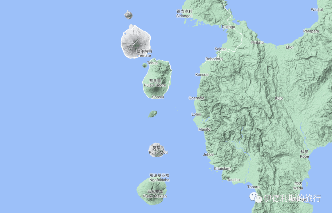
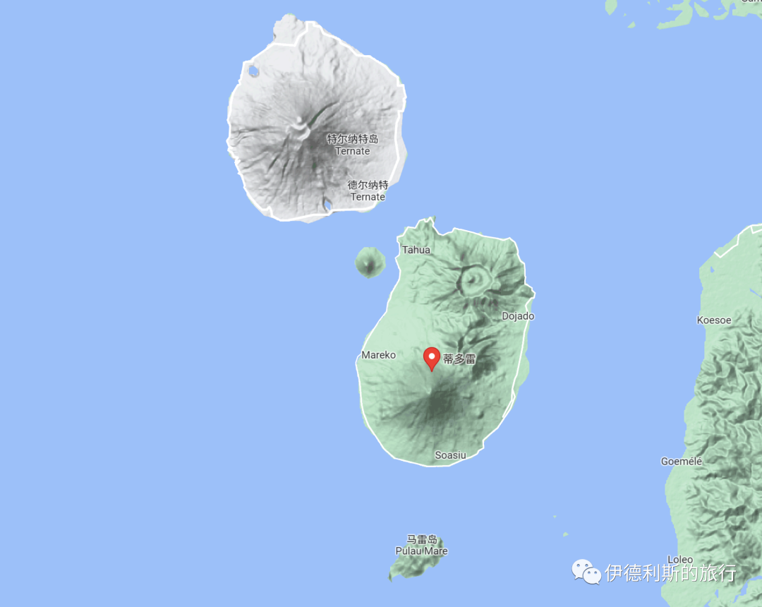
3. The Sultanate of Jailolo in Indonesia (late 15th century–1832)
The Sultanate of Jailolo was on the west coast of Halmahera Island, north of Ternate Island. It also rose to power because of the clove trade and officially became a sultanate after converting to Islam in the late 15th century.
In his 1515 book, The Suma Oriental: An Account of the East, from the Red Sea to China, the Portuguese explorer Tomé Pires recorded that the Sultanate of Jailolo was often at war with the Sultanate of Ternate. Many cloves grew within the sultanate, and although the king was a Muslim, most of the people were not.
In 1550, the ruler of the sultanate was Katarabumi. He was a devout Muslim and the main force resisting the Portuguese at the time. He fiercely attacked the Sultanate of Ternate for its alliance with the Portuguese and invaded villages that had converted to Catholicism, which earned him a high reputation locally.
In 1550, the joint forces of the Portuguese and the Sultanate of Ternate besieged Katarabumi’s fort. After running out of food and supplies, Katarabumi was forced to surrender and was removed from power, and the Sultanate of Jailolo became a vassal state of the Sultanate of Ternate.
The location of Jailolo
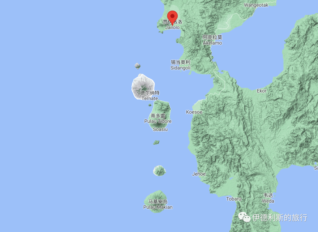
4. The Sultanate of Bacan (late 15th century–1965)
The Sultanate of Bacan was in the Bacan Islands, south of Ternate Island. It also rose to power because of the clove trade and officially became a sultanate after converting to Islam in the late 15th century.
When the Portuguese first entered the Spice Islands in 1512, the Sultanate of Bacan had more people and ships than the other three sultanates in the Spice Islands. Compared to the other three sultanates, Bacan produced very few cloves and relied mainly on trading forest products from the Papua region. In the 1520s, the Sultanate of Bacan was hostile toward the alliance between the Portuguese and the Sultanate of Ternate. They tried to stay away from the Europeans, but the Portuguese eventually attacked their capital in 1534.
By the mid-16th century, the clove production of the Sultanate of Bacan had increased to match Ternate's. It became an important port of call for merchant ships and maintained friendly relations with the chiefs in Papua.
The location of Bacan
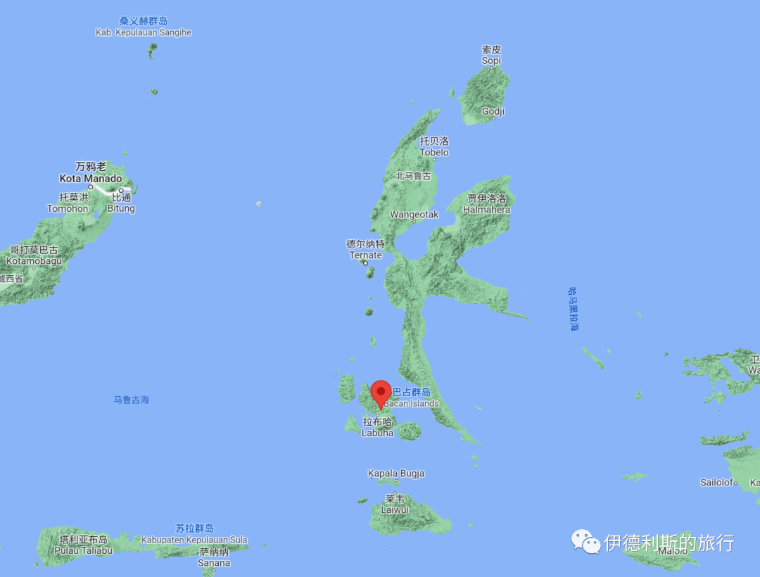
The Sultanate of Brunei in Brunei (1368–1888)
Brunei is located on the north coast of Borneo Island in Southeast Asia. It is made up mostly of Malay people and was part of the Hindu Majapahit Empire in the 14th century. In the 15th century, Indian and Arab merchants brought Islam through trade. Brunei then broke away from the Majapahit Empire, converted to Islam, and became the independent Sultanate of Brunei. From the 15th to the 17th century, the Sultanate of Brunei stretched from northern Borneo to the Sulu Archipelago in the southern Philippines, and even reached Manila in the northern Philippines. After the Portuguese conquered the Malacca Sultanate in 1511, many wealthy Malaccan nobles moved to Brunei, which further strengthened Brunei's power.
In 1521, Magellan's fleet arrived in Brunei. An Italian explorer on the fleet named Antonio Pigafetta left behind valuable records about the Sultanate of Brunei. He saw the main city of the Sultanate of Brunei at the time, Water Village (Kampong Ayer), and compared this city built entirely on water to the Venice of the East. In 1550, the seventh Sultan, Saiful Rijal, ruled Brunei.
Today, Water Village (Kampong Ayer) remains a water city.
The location of Brunei.
The Sultanate of Sulu in the Philippines (1457–1915).
The Sultanate of Sulu is located at the intersection of today's Philippines, Malaysia, and Indonesia. Starting in the late 14th century, Sufi missionaries came to the Sulu Archipelago with Arab merchant caravans to spread the faith. In 1457, the Arab explorer Sharif ul-Hashim officially established the Sultanate of Sulu. He is recorded in his genealogy as a descendant of the Prophet Muhammad.
In 1550, the Sultanate of Sulu was a vassal of the Sultanate of Brunei. They would not become independent from the Sultanate of Brunei until after 1578.
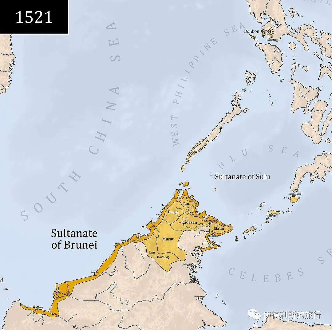
The location of Sulu.
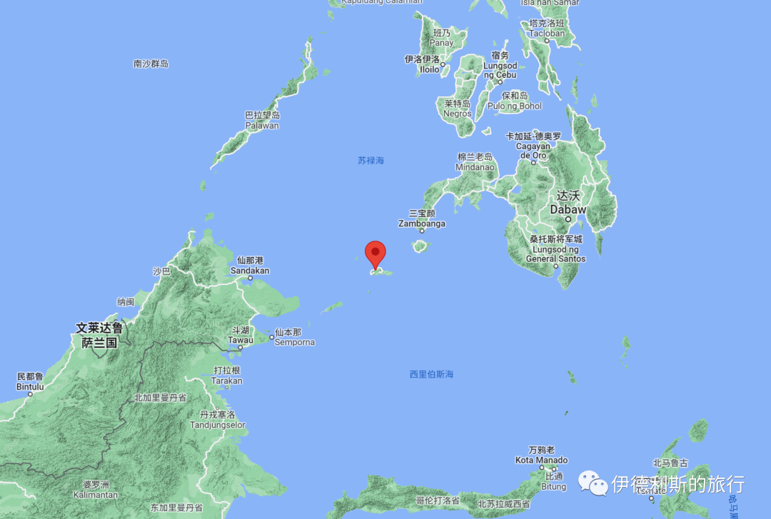
The Sultanate of Maguindanao in the Philippines (1520–1905).
The Sultanate of Maguindanao is located in the southern part of Mindanao Island in the Philippines. Its founder was Shariff Muhammed Kabungsuwan, who traveled from Johor on the Malay Peninsula to Maguindanao to preach. It is said he was a descendant of Imam Hasan.
In 1550, the second Sultan, Sharif Maka-alang, ruled the Sultanate of Maguindanao. The capital of the Sultanate of Maguindanao was Cotabato on Mindanao Island in the Philippines. The Maguindanao people living here are the sixth-largest ethnic group in the Philippines and are skilled at producing various metal tools.
The location of Maguindanao.
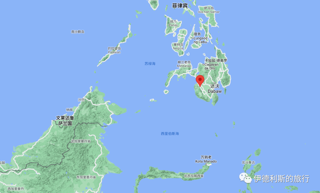
The online journey through 50 Muslim countries in 1550 ends here. Next time, I will choose another time period to continue this online travel.
Islamic World in 1550: South Asia — Sultanates, Mughals and Muslim History
Articles • ali2007fr posted the article • 0 comments • 96 views • 2026-05-18 09:20
Summary: Islamic World in 1550: South Asia — Sultanates, Mughals and Muslim History is presented here as a firsthand travel account in clear English, beginning with this scene: In the first article, "A Journey Through the Islamic World in 1550 (Part 1)," we crossed the African continent, traveled from Egypt into the Ottoman Empire, and then visited Tabriz in Iran. The account keeps its focus on South Asian Islam, Mughal History, Islamic World while preserving the names, places, food, and historical details from the Chinese source.
In the first article, "A Journey Through the Islamic World in 1550 (Part 1)," we crossed the African continent, traveled from Egypt into the Ottoman Empire, and then visited Tabriz in Iran.
In the second article, "A Journey Through the Islamic World in 1550 (Part 2) — The Legacy of the Mongol Empire," we visited 12 countries ruled by descendants of Genghis Khan, moving from Eastern Europe into North and Central Asia, and finally into South Asia.
In the third article, we will experience the Islamic culture of South Asia, traveling from Delhi into Gujarat and central India, then moving to the Deccan Plateau to visit its five sultanates, and finally taking a boat to the Maldives to begin our Indian Ocean journey.
For North India, 1550 is a special point in time. The Mughal Empire and the Bengal Sultanate we are familiar with have disappeared from the map, replaced by the Sur Dynasty, an Afghan Pashtun state stretching from Pakistan and North India through Bengal to the Rakhine State in Myanmar.
The Sur Dynasty (1538-1556) that swept across North India.
The founder of the Sur Dynasty, Sher Shah Suri, came from the Afghan Pashtun Sur tribe and was originally a general in the Mughal Empire. In 1539, the Mughal Emperor Humayun led a large army to conquer Bengal, but he was defeated by Sher Shah. In 1540, Sher Shah followed up his victory and completely crushed Humayun. Humayun fled to Persia, and Sher Shah established the Suri Dynasty in Delhi.
After occupying Delhi, Sher Shah continued building Din Panah, the Mughal capital Humayun had started for himself in 1533, and renamed it Shergarh.
In 1550, the Suri Dynasty was ruled by Sher Shah's son, Islam Shah Suri. He continued his father's policy of strengthening central authority, defeated the counterattack by the Mughal Emperor Humayun, and maintained the Suri Dynasty's rule in North India.
The location of Shergarh city.
The walls of Shergarh are 18 meters high and 1.5 kilometers long, with three city gates. The west gate is the main entrance to the fortress and the tourist area, called Bara Darwaza. The south gate is called Humayun Darwaza. One theory is that Humayun built this gate, while another is that it faces Humayun's Tomb. The north gate is called Talaqi Darwaza, also known as the Forbidden Gate.
All three gates are double-layered sandstone structures with two huge semi-circular towers on either side. The gates have overhanging balconies and small pavilions (chhatris) on top, an architectural style that would be used repeatedly in later Mughal architecture.
The Qila-i-Kuna mosque was built by Sher Shah in 1541 and served as the royal mosque of the Suri Dynasty. This semi-domed mosque is considered an important landmark in the transition of Indian Islamic architecture from the Lodi style to the Mughal style, and it is the largest and most exquisite of the five-arched mosques in India.
The five-arched mosque is an architectural style that developed during the Sayyid and Lodi dynasties of the Delhi Sultanate. The main hall of the mosque is divided into five sections by five arches, and each section has a mihrab. The mihrab inside the central arch is the largest, topped by a Lodi-style semi-circular dome.
Sher Mandal is an octagonal pavilion with a very simple style. This beauty of simplicity comes from a return to Persian style, which is quite different from the architectural forms of the late Lodi dynasty of the Delhi Sultanate, and it is the earliest building of this style in Delhi.
Although it looks like an early Mughal building, it is actually recognized as part of the palace built by Sher Shah, which was later converted by Humayun into a library and observatory. It is also known as the first observatory in Delhi.
Salimgarh Fort is located on the north side of the Red Fort in Delhi and was built in 1546 by Salim Shah, the son of the Suri Dynasty ruler Sher Shah. People say before Humayun recaptured Delhi in 1555, he stayed here for three days.
Salimgarh Fort has many ghost stories, the most famous being that of Zebunnisa, the daughter of the Mughal Emperor Aurangzeb. Legend says she wore a black veil and sang poems she had written herself under the moonlight. Additionally, some people claim to hear the groans of Indian National Army soldiers who were tortured to death here at night.
In 2007, this site became a UNESCO World Heritage site.
Isa Khan was a nobleman of the Sur Empire, coming from the Niazi tribe of the Pashtuns in Afghanistan. Isa Khan died in 1548. Before he passed away, he built his own tomb and mosque in the southern suburbs of Dinpanah, near the shrine of Nizamuddin. Later, this area also became the site of Humayun's tomb. As a prominent figure in the Sur Empire, Isa Khan was one of the last nobles of the dynasty to be buried in an Afghan-style tomb.
On August 5, 2011, the oldest sunken garden in India was discovered during the restoration of the tomb. This is considered the first Indian-style sunken garden attached to a tomb in India, a design that was later further developed at the tomb of Akbar and the Taj Mahal.
The Isa Khan Mosque was built during the same period as the tomb, and its biggest feature is the use of two pavilions instead of a dome. many details in the mosque were further developed in the later Humayun's Tomb.
Legacy of the Delhi Sultanate
We head south from Delhi to Gujarat to look at the state that became independent from the Delhi Sultanate.
1. The Gujarat Sultanate in Western India (1407–1573)
The Gujarat Sultanate was located in the state of Gujarat in western India. Its founder was originally the governor (Nawab) of the Delhi Sultanate in Gujarat, and he became officially independent after Timur invaded the Delhi Sultanate.
In the first half of the 16th century, the Gujarat Sultanate was invaded twice by the Rajputs and the Mughal Empire, but they were eventually driven away. In 1550, the Gujarat Sultanate was ruled by Sultan Mahmud Shah III (reigned 1537–1554).
The Gujarat Sultanate is famous for its elegant Indo-Islamic architecture. They built many unique mosques in their capital, Ahmedabad, which had a great influence on the later development of Mughal architecture. In 2016, the Historic City of Ahmedabad was added to the UNESCO World Heritage List.
The location of Ahmedabad city.
The Rani Sipri Mosque in Ahmedabad, built in 1514, has intricate carvings on its walls.
Photographed in 1874 by the Indian photography studio Bourne & Shepherd.
2. The Khandesh Sultanate in Central India (1382–1601)
The Khandesh Sultanate was located in the Khandesh region of central India. Its founder was originally a nobleman of the Delhi Sultanate who became a general due to his military achievements, and he became an independent sultanate in the late 14th century.
In the early 16th century, the Khandesh Sultanate was caught in wars with the neighboring Gujarat Sultanate and Malwa Sultanate.
The capital of the Khandesh Sultanate was Burhanpur, located in the Indian state of Madhya Pradesh.
Five Deccan Sultanates
Let us continue south into the Deccan Plateau.
In the 14th and 15th centuries, the most powerful state on the Deccan Plateau was the Bahmani Sultanate, which was formed after the Delhi Sultanate's governor in the Deccan region became independent. At the end of the 15th century, the Bahmani Sultanate declined and split into five sultanates, collectively known to later generations as the five Deccan Sultanates.
1. The Berar Sultanate on the Deccan Plateau (1490–1572)
The Berar Sultanate was the first of the five Deccan Sultanates to become independent after the collapse of the Bahmani Sultanate. Its founder was originally a Hindu who converted to Islam after being captured by the Bahmani army.
In 1550, the sultanate was ruled by Darya Imad Shah, who tried to use diplomacy for peaceful rule, which kept the sultanate relatively stable during this period. At the same time, he also built the city of Daryapur and named it after himself.
The location of Daryapur city.
2. The Ahmadnagar Sultanate on the Deccan Plateau (1490–1636)
The Ahmadnagar Sultanate was one of the five Deccan sultanates formed after the Bahmani Sultanate broke apart. It sat southeast of the Gujarat Sultanate, with Ahmadnagar as its capital. Its founder was originally a Brahmin from the Vijayanagara Empire in South India who later converted to Islam.
In 1550, the sultanate was ruled by Burhan Nizam Shah I. He was the first to switch from Sunni to Shia Islam, and the nobles and commoners soon followed his lead. Under his rule, there was religious tolerance, art flourished, and trade went smoothly, though small-scale conflicts with the Mughals and other sultanates continued.
Ahmadnagar city is in the state of Maharashtra in western India. It is a small town now, but it still keeps dozens of architectural ruins from the sultanate era.
The location of Ahmadnagar city.
3. The Golconda Sultanate on the Deccan Plateau (1518–1687)
We head southeast to Hyderabad, the most famous city on the Deccan Plateau.
The founder of the Qutb Shahi dynasty, Quli Qutb Mulk (reigned 1512–1543), was a Turkmen from Hamadan, Iran. He was a descendant of Qara Yusuf, the ruler of the Kara Koyunlu (Black Sheep) dynasty. In the early 16th century, Quli traveled from Iran to India with some relatives and friends. They stayed in Delhi at first, then moved south to the Deccan to serve the Bahmani Sultanate. After the Bahmani Sultanate fell in the 15th century, Quli conquered Golconda Fort and started the Qutb Shahi dynasty. Over the next 60 years, three sultans expanded Golconda Fort into a massive complex, which is why the Qutb Shahi dynasty is also called the Golconda Sultanate.
Golconda had the world's only diamond mines at the time and was a major diamond trading hub. In the West, the name Golconda became a synonym for immense wealth. Golconda Fort is actually made of four castles. Its outer wall is 10 kilometers long and features 87 semicircular bastions, 8 gates, and 4 drawbridges. The inner city sits on a 120-meter-high granite hill. Currently, only the east gate, Bala Hissar Darwaza, is open for visitors. Bala Hissar Darwaza is a huge archway with carvings of lions and peacocks, which are common in Hindu architecture. The gate also has iron spikes designed to stop Mughal war elephants.
The tall, three-story building south of the gate is called the Aslah Khana armory. It held guns and ammunition during the Mughal era. Historians have found that during the Qutb Shahi dynasty, this was actually an office for various officials.
Nakkar Khana is a palace complex where archaeologists have now dug up a series of water channels.
Taramati mosque, built in 1518, sits next to the palace area and was used by the sultan's court and nobles. This mosque has the classic Muslim architectural style of the Deccan region, with small lotus-topped onion domes on its balconies.
Walking further in, you reach the Bhagamati Palace.
Passing through Bhagamati Palace brings you to the Rani Mahal area in the south of the fort, where a light and sound show is held at night. In the middle of the spacious courtyard is a complex metal fountain. During the Qutb Shahi era, the fountain could spray water on its own thanks to hydraulic engineering. When there was no rain, the fort's water system ran using Persian water wheels. Today, a set of clay drainage pipes that have survived for hundreds of years can still be found behind the Rani Mahal. Historians believe the palace now called Rani Mahal should actually be called Dad Mahal. This was the palace where the sultan handled state affairs and listened to the opinions of his subjects and the people.
Behind the Rani Mahal is the Kilwat, the sultan's private bedroom. It is small but decorated beautifully. Those hollow lattices were once inlaid with Golconda's most famous diamonds and other gemstones.
Heading west from the Rani Mahal area, you leave the palace grounds and can see the tall, multiple walls inside the fort. Behind one of these walls stands a mosque called Zanana, which still has its mihrab and courtyard.
After passing through the Zanana mosque, you leave the palace area. A stone staircase leads to the fortress at the top of the hill. Some of the fortress walls are built directly onto giant boulders, and you can look down over the entire palace area from the steps. Once you reach the top, there is a building called Baradari (Darbar Hall), where you can look out over the vast area behind the fort.
Continuing down the hill, you will pass the Ramdas prison.
Next to the main gate of the fort is a Turkish bath (hammam) building. It has pipes at different heights inside to mix scented cold and hot water, but it was not open when I visited. Historians still disagree on whether this bath was for women or for washing the bodies of the deceased.
Two large pavilions outside the fort gate.
The Qutb Shahi tombs are located north of Golconda Fort and contain the tombs of the sultans of the Qutb Shahi dynasty along with their attached mosques. These tombs feature the typical style of Deccan Plateau Muslim architecture. The square base and round top are highlighted by decorative small towers, and the onion-shaped dome sits on a lotus-petal base, showing a blend of Persian and Indian architectural styles.
The tomb of Quli Qutb Mulk (reigned 1512–1543), the founder of the Qutb Shahi dynasty, is the oldest in the cemetery, and the designs of later tombs were all developed from this one. Quli was a Turkmen from Hamadan, Iran, and a descendant of Qara Yusuf (reigned 1380–1420), the ruler of the Black Sheep dynasty.
The tomb of the second sultan, Jamsheed Quli Qutb Shah (reigned 1543–1550), is the only sultan's tomb in the cemetery that does not use black basalt. Its design is also different from the others, consisting of two levels. Jamsheed took the throne in 1543 after assassinating his father. Few records remain of his reign, other than that it was very cruel. Jamsheed died of illness in 1550 and was buried next to his father's tomb.
After the second sultan, Jamsheed, died of illness in 1550, his 7-year-old son, Subhan Quli Qutb Shah, took the throne. However, shortly after, Subhan's uncle, Ibrahim Quli Qutb Shah, rushed back to Golconda Fort to seize the throne. Subhan was deposed and died shortly after. Subhan's tomb is on the same platform as his grandfather, the first sultan Quli Qutb Mulk, and it is the smallest of all the sultan tombs.
4. The Bidar Sultanate of the Deccan Plateau (1492–1619)
The Bidar Sultanate was one of the five Deccan sultanates formed after the collapse of the Bahmani Sultanate. It was the smallest one and was surrounded by the other four. Its founder was originally a Georgian enslaved by the Turks who later became a general in the Bahmani Sultanate.
In 1550, the ruler of the sultanate was Ali Barid Shah I, who loved inviting scholars and craftsmen from all over India to his court.
The Bidar Sultanate expanded Bidar Fort on a large scale. Because they hired Hindu architects, the buildings from this period incorporate many features of Hindu architecture.
A miniature painting of Ali Barid Shah in the collection of the San Diego Museum of Art.
A photo of the tomb of Ali Barid Shah taken by S N Barid in 2015.
5. The Bijapur Sultanate on the Deccan Plateau (1490–1686)
The Bijapur Sultanate was the most southwestern of the five major Deccan sultanates. Its founder was a Georgian slave bought from Iran by the Bahmani Sultanate.
In 1550, the ruler of the sultanate was Ibrahim Adil Shah I, the first Bijapur sultan to hold the title of Shah. After taking the throne, Ibrahim converted from Shia to Sunni. He removed the names of the Twelve Imams from the Friday khutbah, promoted local Deccan Sunni Muslims, and suppressed the Shia faction.
During his reign, Ibrahim constantly formed and broke alliances with the other four Deccan sultanates. Although there were continuous military campaigns, there was little territorial expansion.
During the rule of the Bijapur Sultanate, the city of Bijapur was a center for business, trade, and education on the Deccan Plateau, famous for its unique Bijapur culture.
The location of Bijapur city.
The Sultanate of the Maldives (1153-1968) in the Indian Ocean.
Let us leave the South Asian mainland and take a boat to the Maldives islands in the Indian Ocean.
As Arab merchants grew trade in the Indian Ocean, the Maldives changed from a Buddhist kingdom to an Islamic nation in the 12th century, becoming the Sultanate of the Maldives.
In 1550, the Sultanate of the Maldives was ruled by the Hilaalee dynasty, whose founder likely came from Somalia. In 1551, Sultan Muhammad III, who had only been in power for two years, was assassinated by his brother Hassan. Hassan was also the first Maldivian Sultan to convert to Christianity, but he was soon deposed.
Male, the capital of the Sultanate of the Maldives.
In the next part, we will cross the Bay of Bengal to Southeast Asia to see the Islamic culture there in 1550. view all
Summary: Islamic World in 1550: South Asia — Sultanates, Mughals and Muslim History is presented here as a firsthand travel account in clear English, beginning with this scene: In the first article, "A Journey Through the Islamic World in 1550 (Part 1)," we crossed the African continent, traveled from Egypt into the Ottoman Empire, and then visited Tabriz in Iran. The account keeps its focus on South Asian Islam, Mughal History, Islamic World while preserving the names, places, food, and historical details from the Chinese source.
In the first article, "A Journey Through the Islamic World in 1550 (Part 1)," we crossed the African continent, traveled from Egypt into the Ottoman Empire, and then visited Tabriz in Iran.
In the second article, "A Journey Through the Islamic World in 1550 (Part 2) — The Legacy of the Mongol Empire," we visited 12 countries ruled by descendants of Genghis Khan, moving from Eastern Europe into North and Central Asia, and finally into South Asia.
In the third article, we will experience the Islamic culture of South Asia, traveling from Delhi into Gujarat and central India, then moving to the Deccan Plateau to visit its five sultanates, and finally taking a boat to the Maldives to begin our Indian Ocean journey.
For North India, 1550 is a special point in time. The Mughal Empire and the Bengal Sultanate we are familiar with have disappeared from the map, replaced by the Sur Dynasty, an Afghan Pashtun state stretching from Pakistan and North India through Bengal to the Rakhine State in Myanmar.
The Sur Dynasty (1538-1556) that swept across North India.
The founder of the Sur Dynasty, Sher Shah Suri, came from the Afghan Pashtun Sur tribe and was originally a general in the Mughal Empire. In 1539, the Mughal Emperor Humayun led a large army to conquer Bengal, but he was defeated by Sher Shah. In 1540, Sher Shah followed up his victory and completely crushed Humayun. Humayun fled to Persia, and Sher Shah established the Suri Dynasty in Delhi.
After occupying Delhi, Sher Shah continued building Din Panah, the Mughal capital Humayun had started for himself in 1533, and renamed it Shergarh.
In 1550, the Suri Dynasty was ruled by Sher Shah's son, Islam Shah Suri. He continued his father's policy of strengthening central authority, defeated the counterattack by the Mughal Emperor Humayun, and maintained the Suri Dynasty's rule in North India.
The location of Shergarh city.
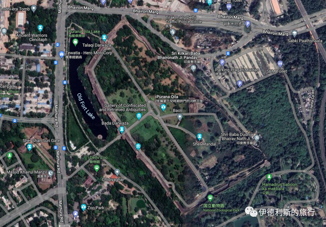
The walls of Shergarh are 18 meters high and 1.5 kilometers long, with three city gates. The west gate is the main entrance to the fortress and the tourist area, called Bara Darwaza. The south gate is called Humayun Darwaza. One theory is that Humayun built this gate, while another is that it faces Humayun's Tomb. The north gate is called Talaqi Darwaza, also known as the Forbidden Gate.
All three gates are double-layered sandstone structures with two huge semi-circular towers on either side. The gates have overhanging balconies and small pavilions (chhatris) on top, an architectural style that would be used repeatedly in later Mughal architecture.
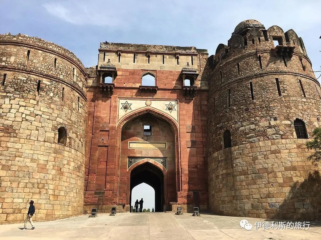
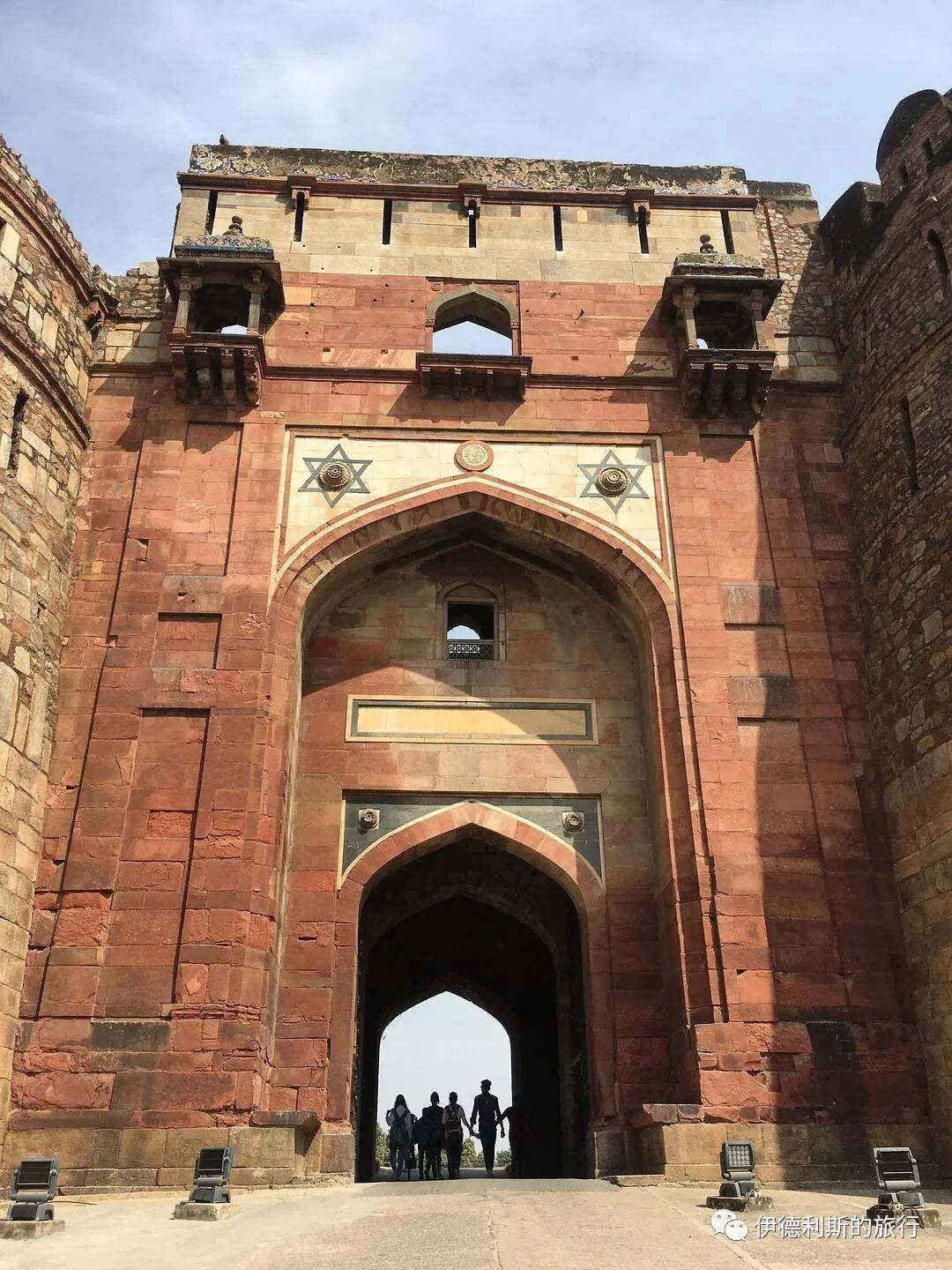
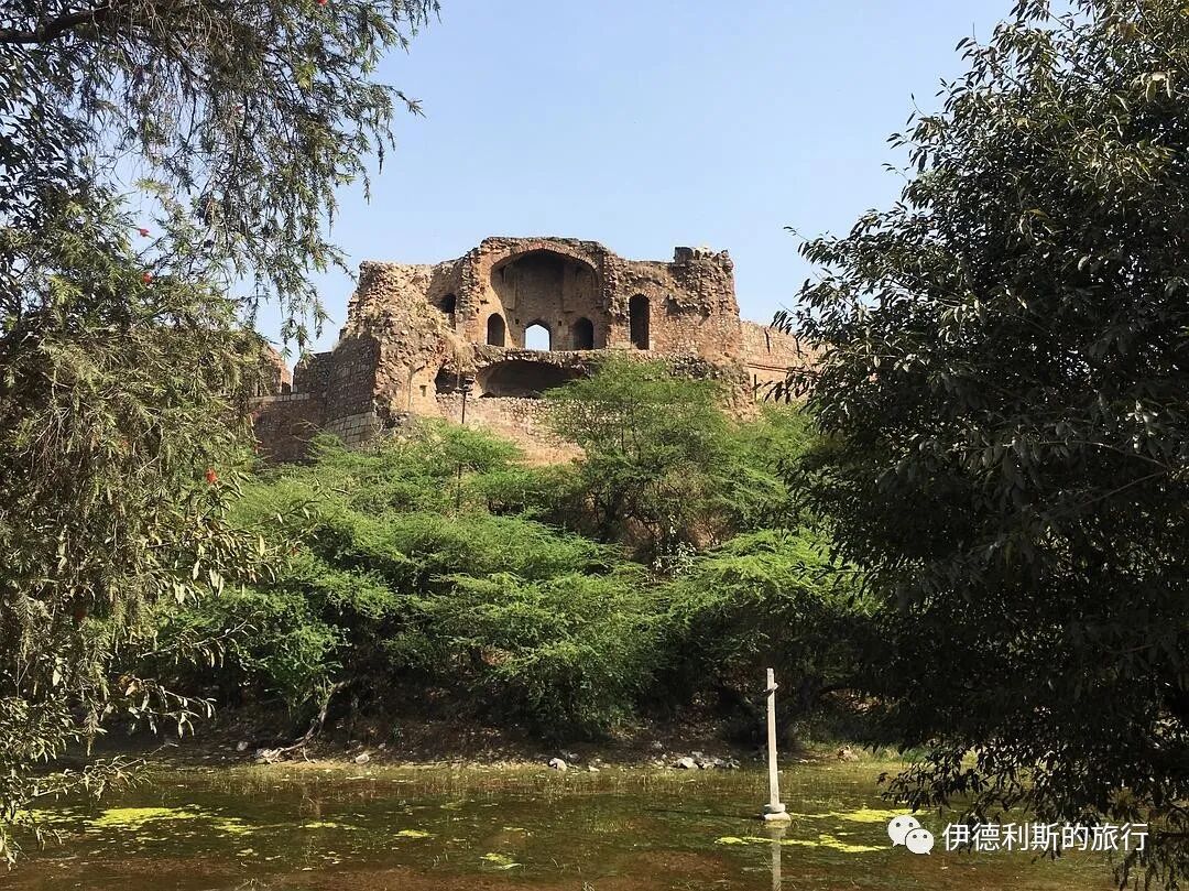
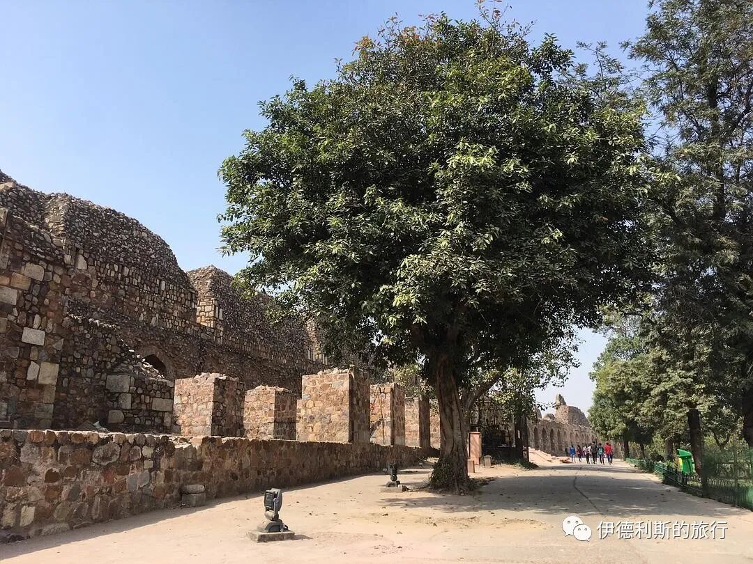
The Qila-i-Kuna mosque was built by Sher Shah in 1541 and served as the royal mosque of the Suri Dynasty. This semi-domed mosque is considered an important landmark in the transition of Indian Islamic architecture from the Lodi style to the Mughal style, and it is the largest and most exquisite of the five-arched mosques in India.
The five-arched mosque is an architectural style that developed during the Sayyid and Lodi dynasties of the Delhi Sultanate. The main hall of the mosque is divided into five sections by five arches, and each section has a mihrab. The mihrab inside the central arch is the largest, topped by a Lodi-style semi-circular dome.
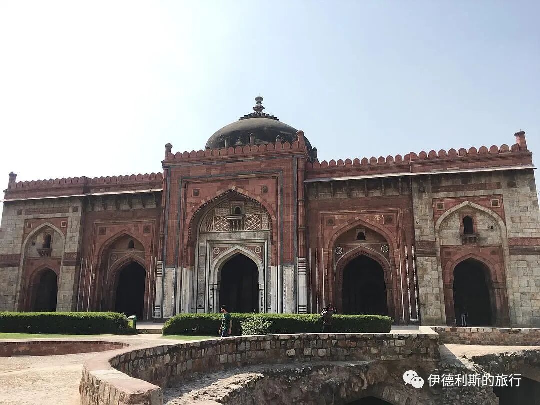
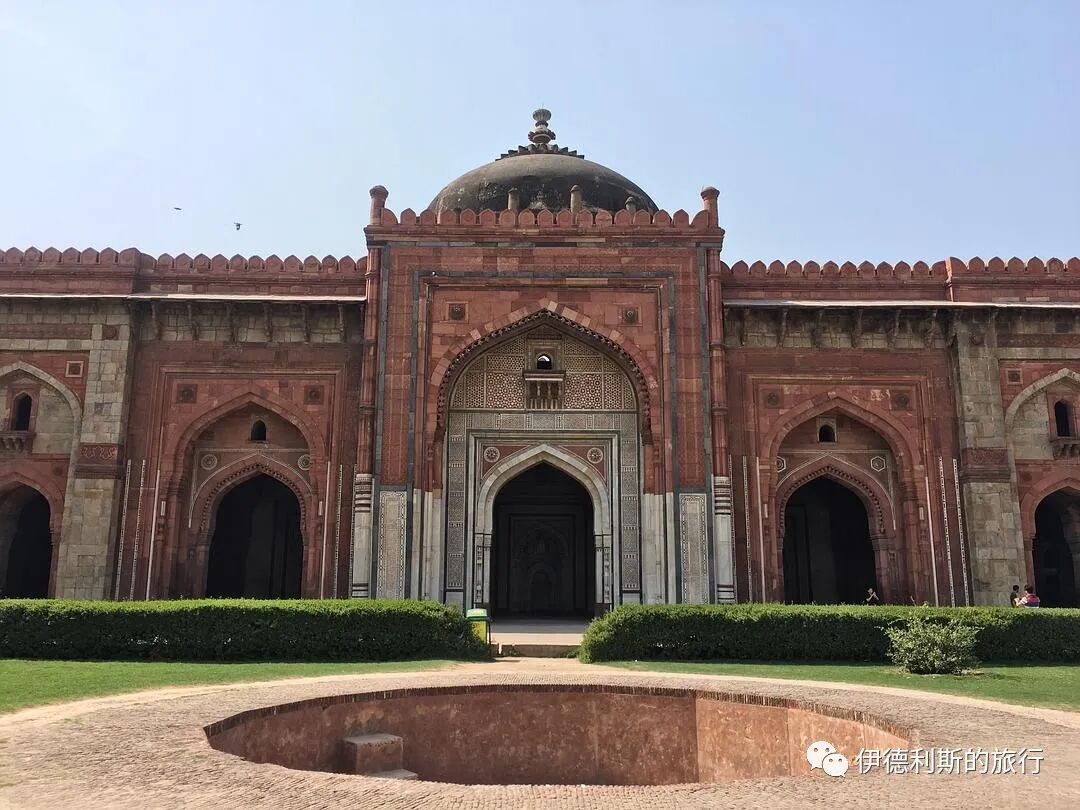
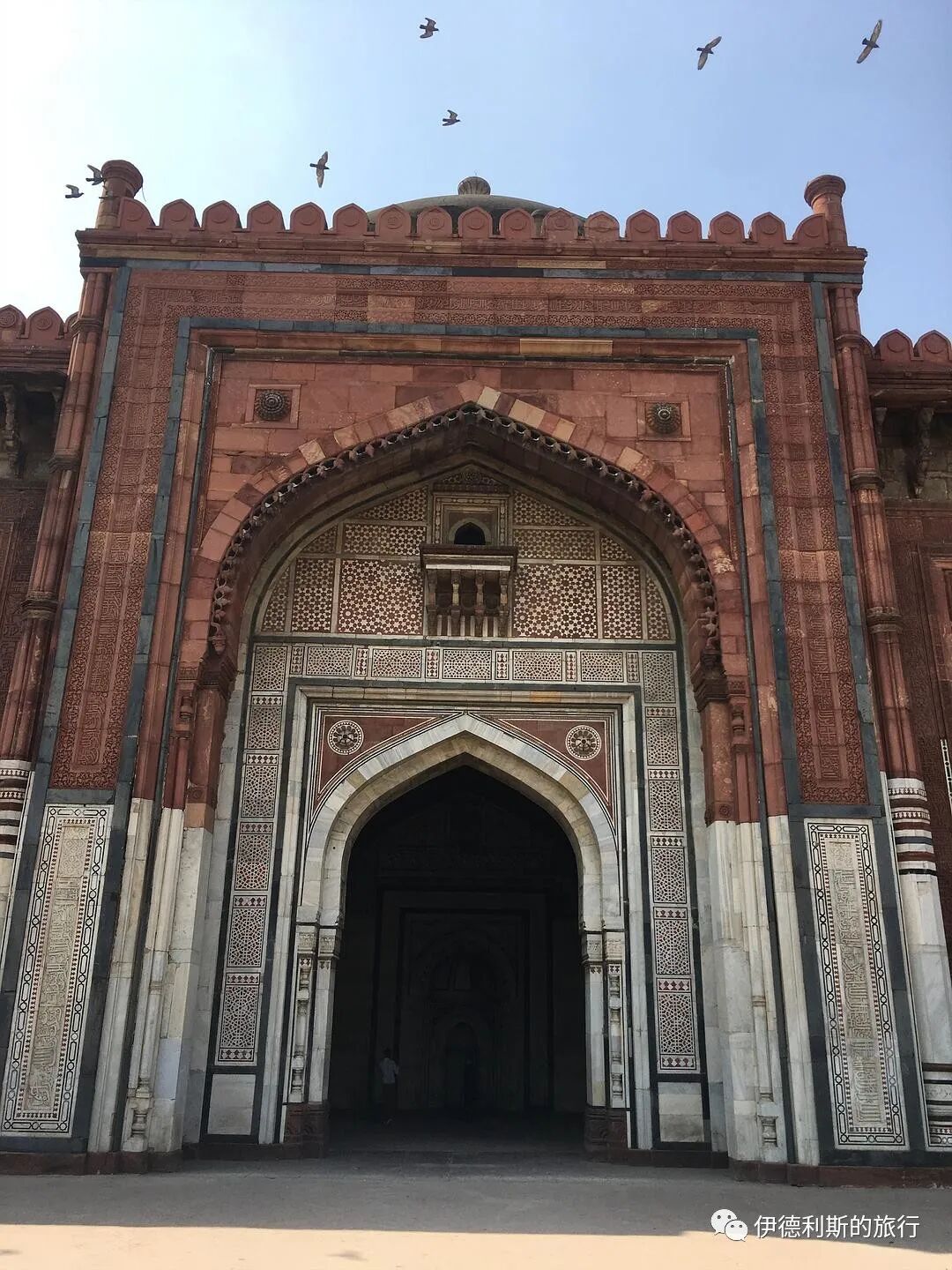
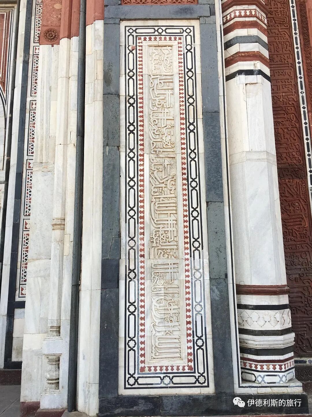
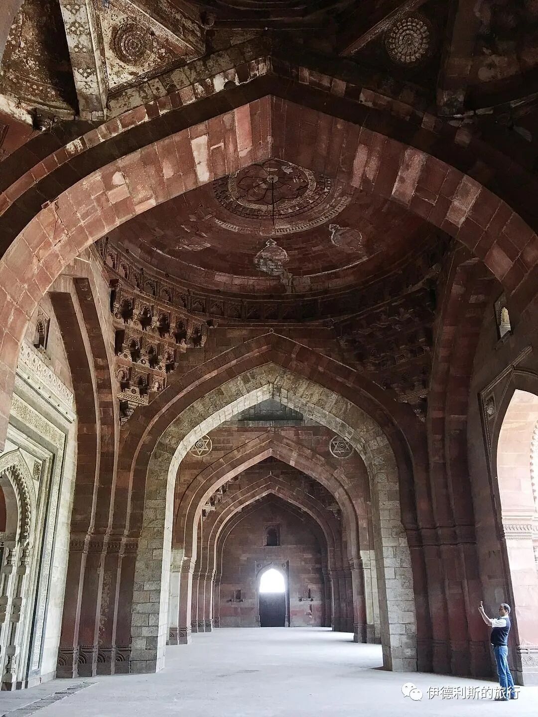
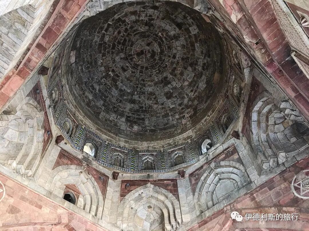
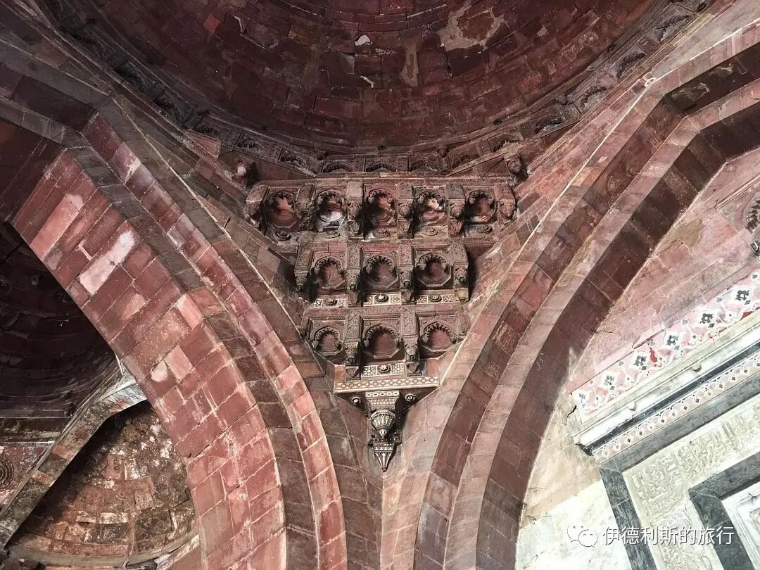
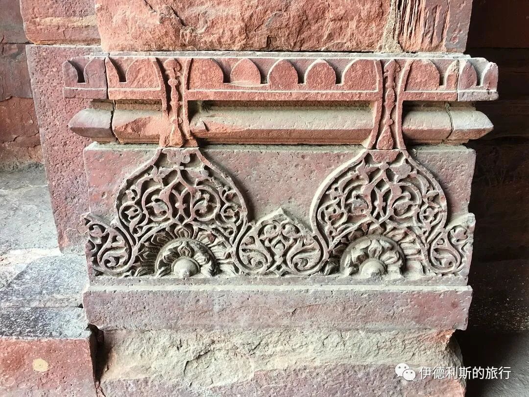
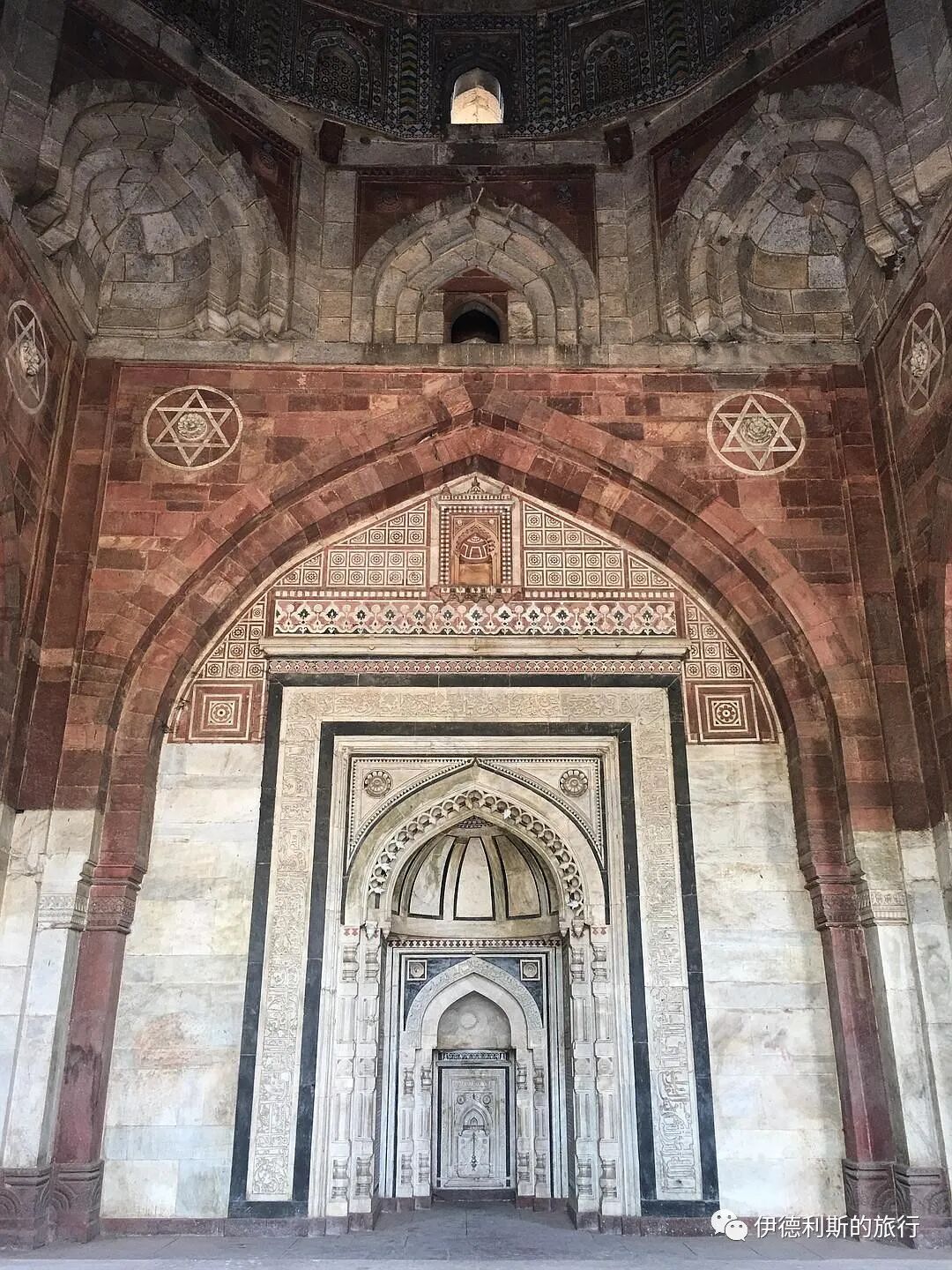
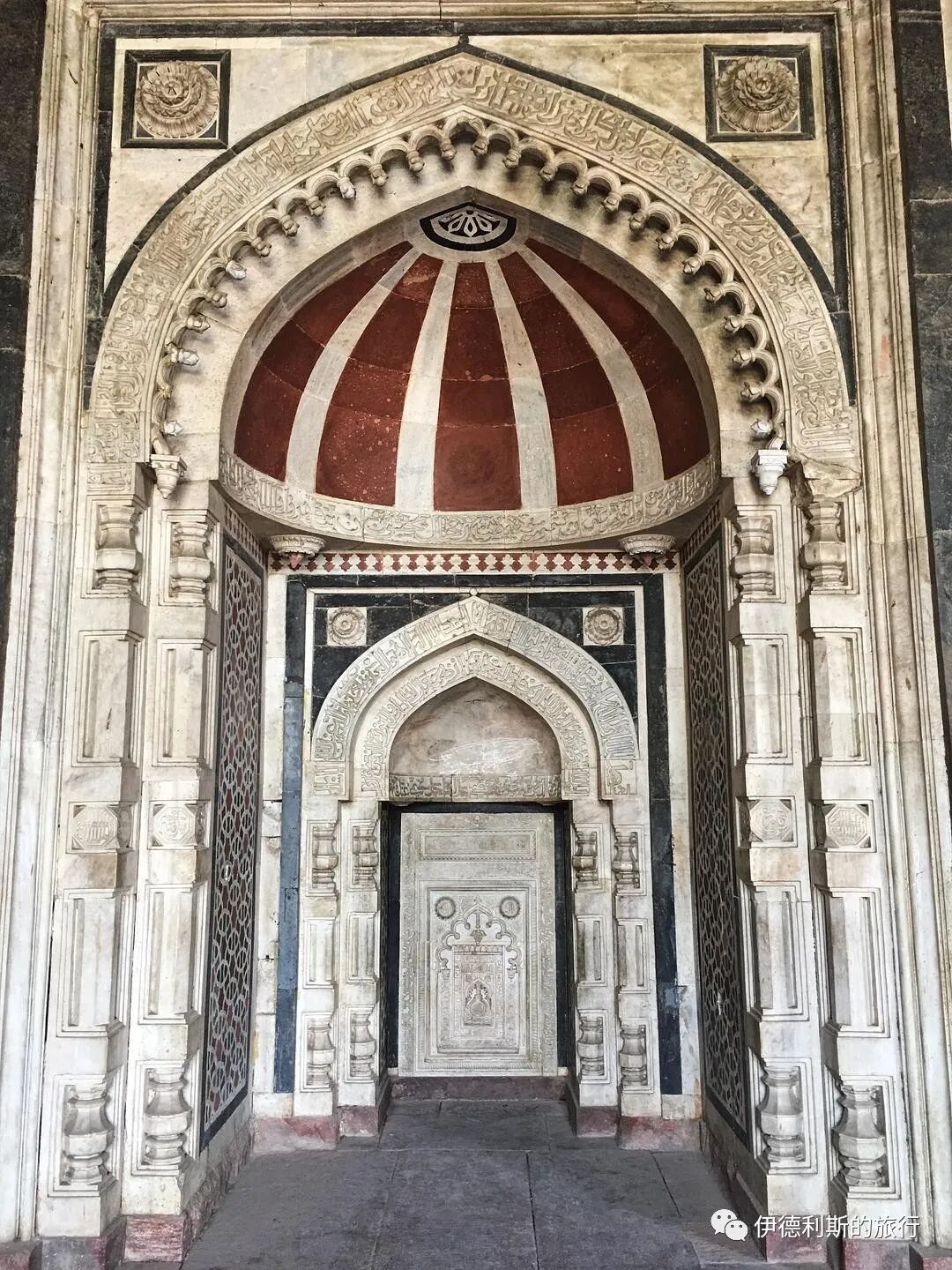
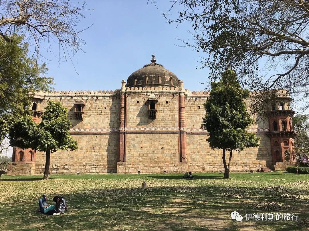
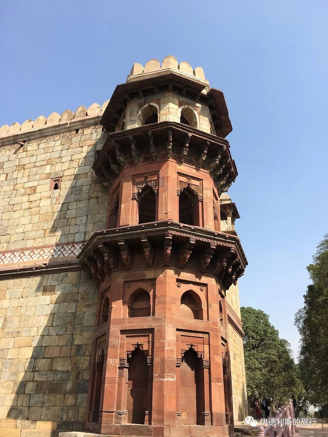
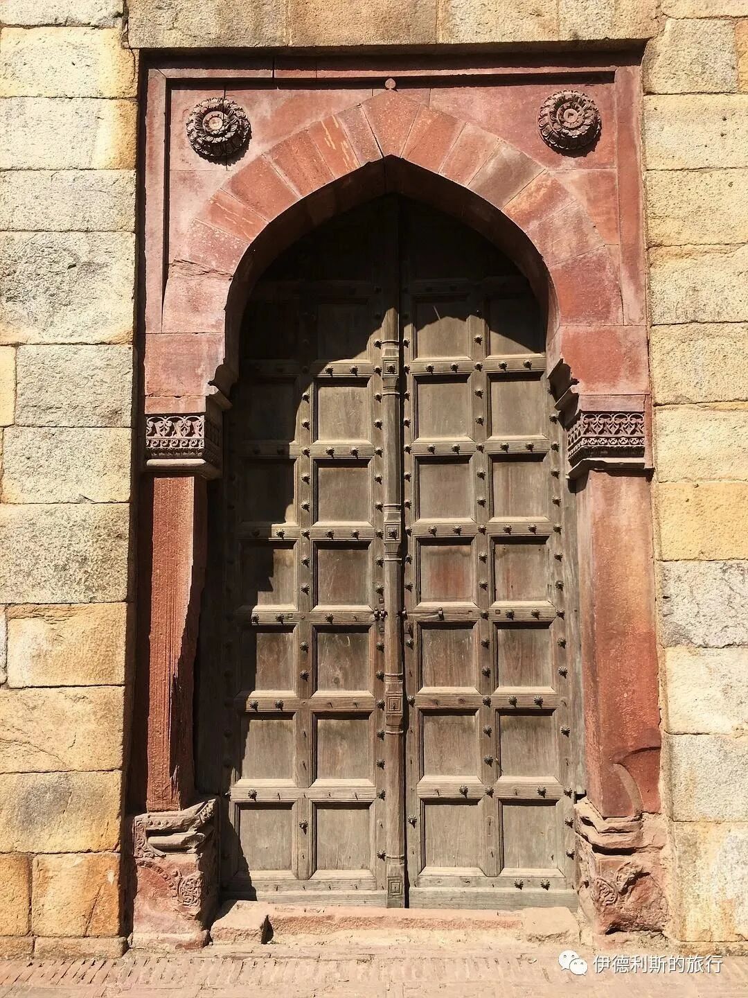
Sher Mandal is an octagonal pavilion with a very simple style. This beauty of simplicity comes from a return to Persian style, which is quite different from the architectural forms of the late Lodi dynasty of the Delhi Sultanate, and it is the earliest building of this style in Delhi.
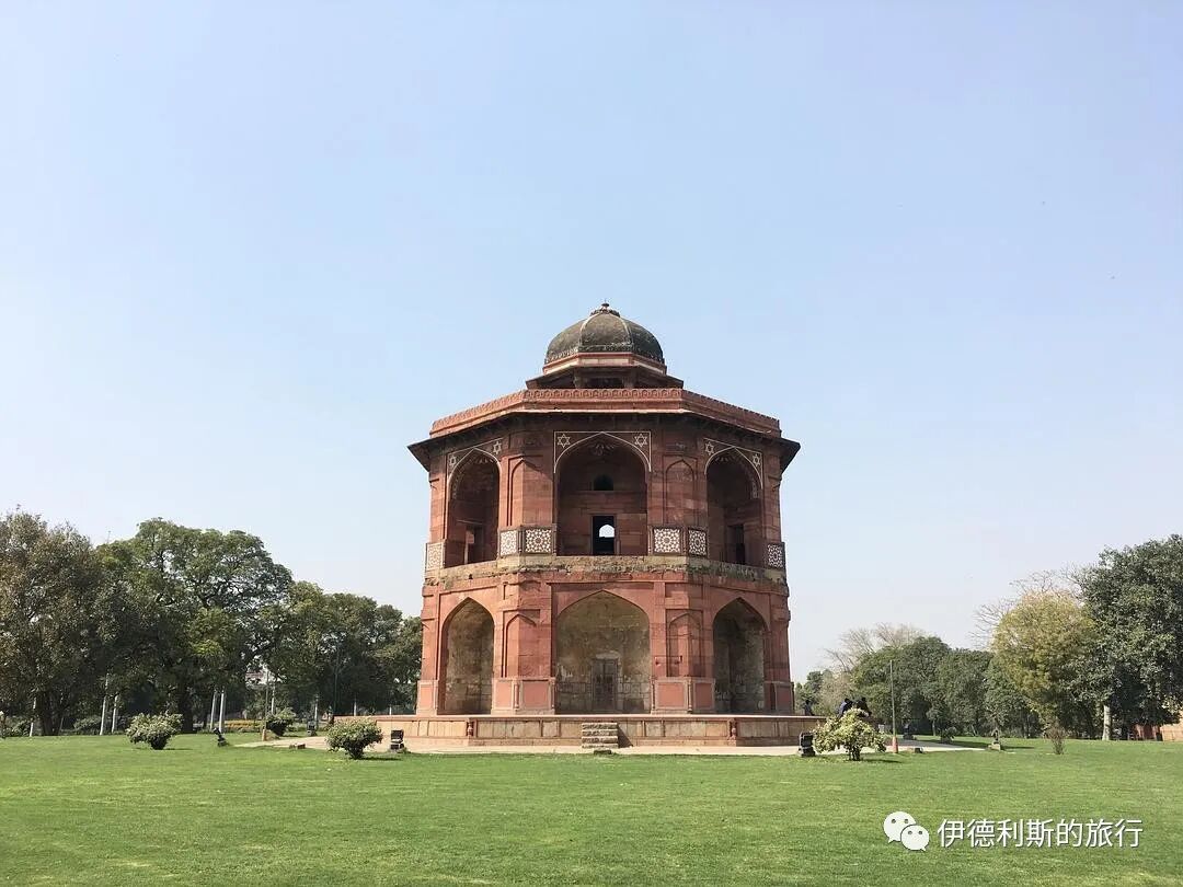
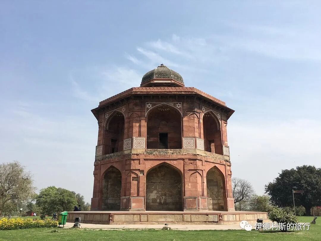
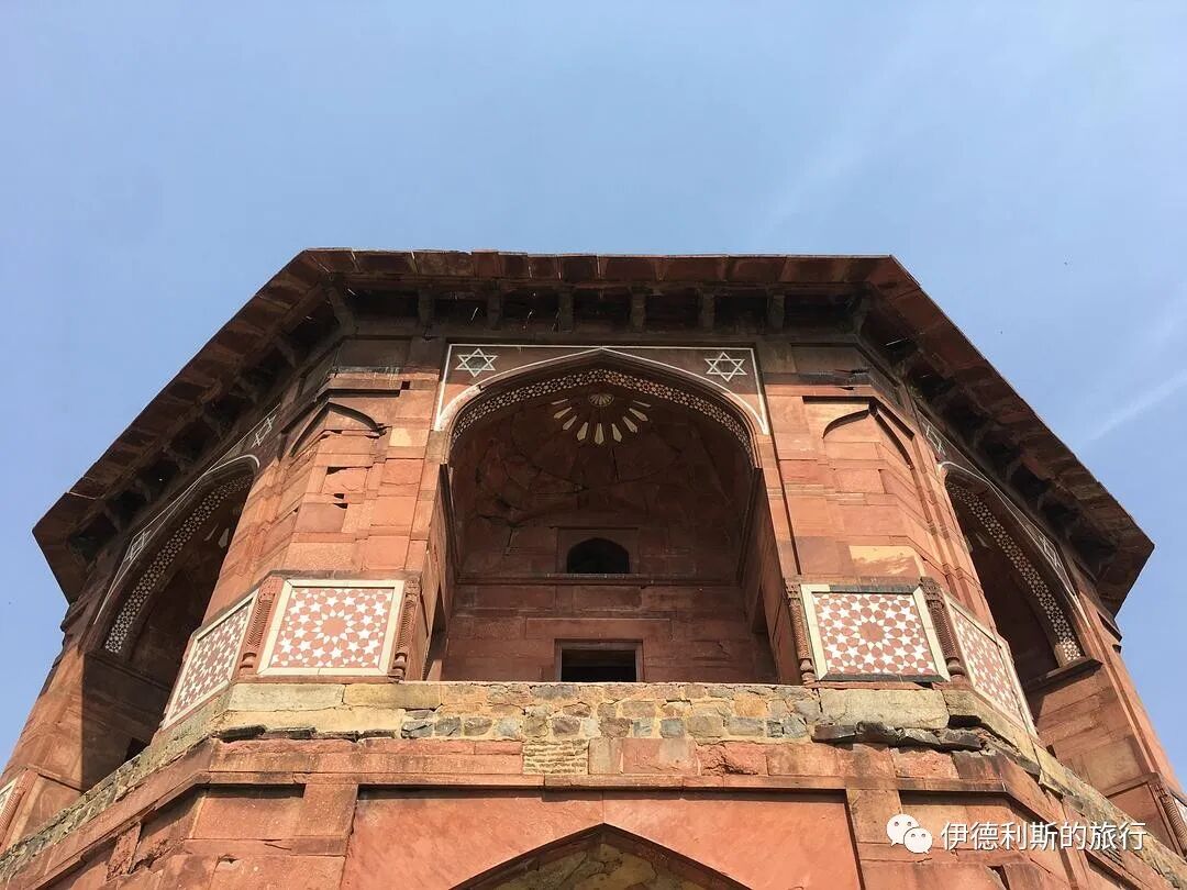
Although it looks like an early Mughal building, it is actually recognized as part of the palace built by Sher Shah, which was later converted by Humayun into a library and observatory. It is also known as the first observatory in Delhi.
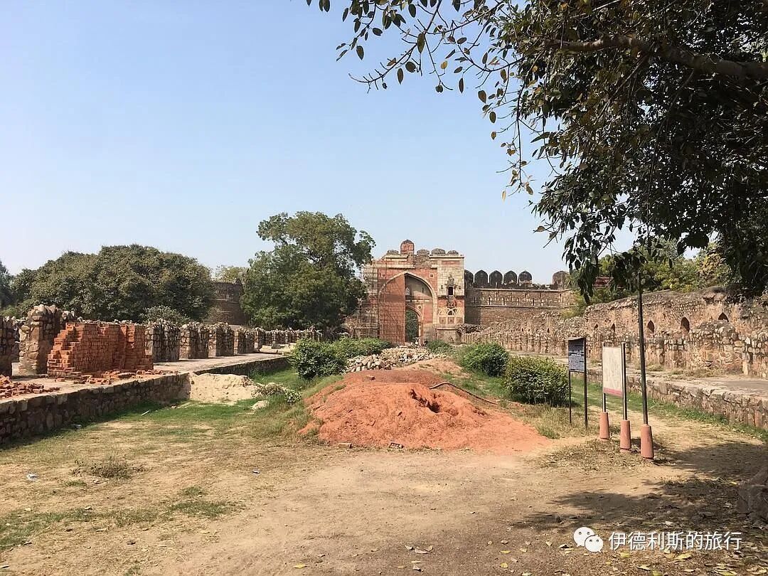
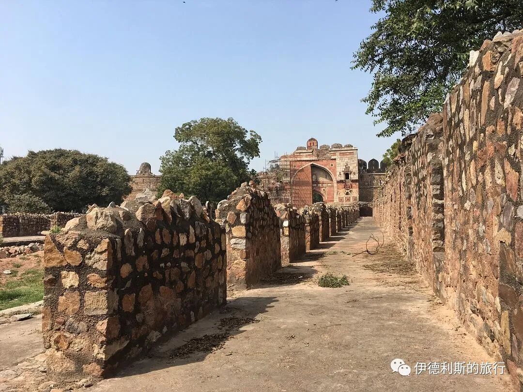
Salimgarh Fort is located on the north side of the Red Fort in Delhi and was built in 1546 by Salim Shah, the son of the Suri Dynasty ruler Sher Shah. People say before Humayun recaptured Delhi in 1555, he stayed here for three days.
Salimgarh Fort has many ghost stories, the most famous being that of Zebunnisa, the daughter of the Mughal Emperor Aurangzeb. Legend says she wore a black veil and sang poems she had written herself under the moonlight. Additionally, some people claim to hear the groans of Indian National Army soldiers who were tortured to death here at night.
In 2007, this site became a UNESCO World Heritage site.
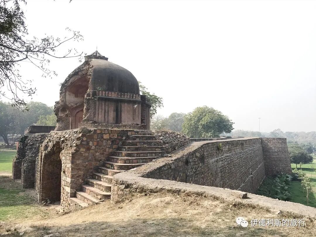
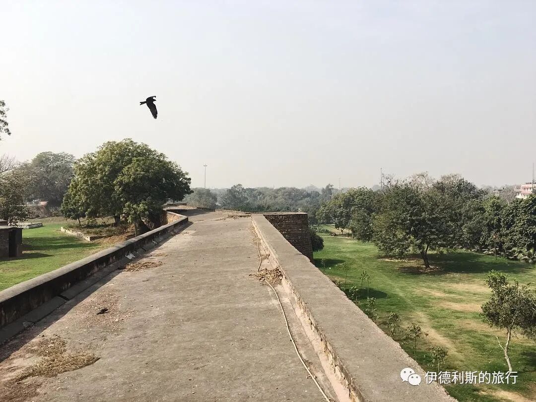
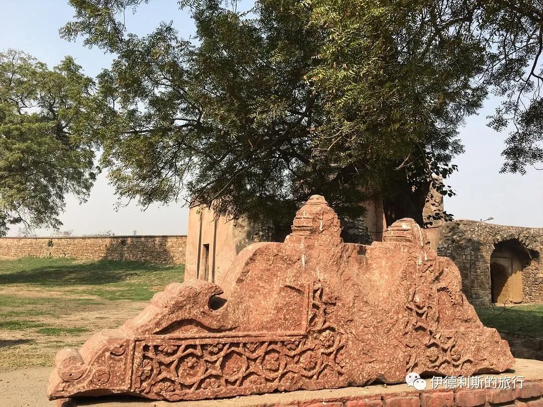
Isa Khan was a nobleman of the Sur Empire, coming from the Niazi tribe of the Pashtuns in Afghanistan. Isa Khan died in 1548. Before he passed away, he built his own tomb and mosque in the southern suburbs of Dinpanah, near the shrine of Nizamuddin. Later, this area also became the site of Humayun's tomb. As a prominent figure in the Sur Empire, Isa Khan was one of the last nobles of the dynasty to be buried in an Afghan-style tomb.
On August 5, 2011, the oldest sunken garden in India was discovered during the restoration of the tomb. This is considered the first Indian-style sunken garden attached to a tomb in India, a design that was later further developed at the tomb of Akbar and the Taj Mahal.
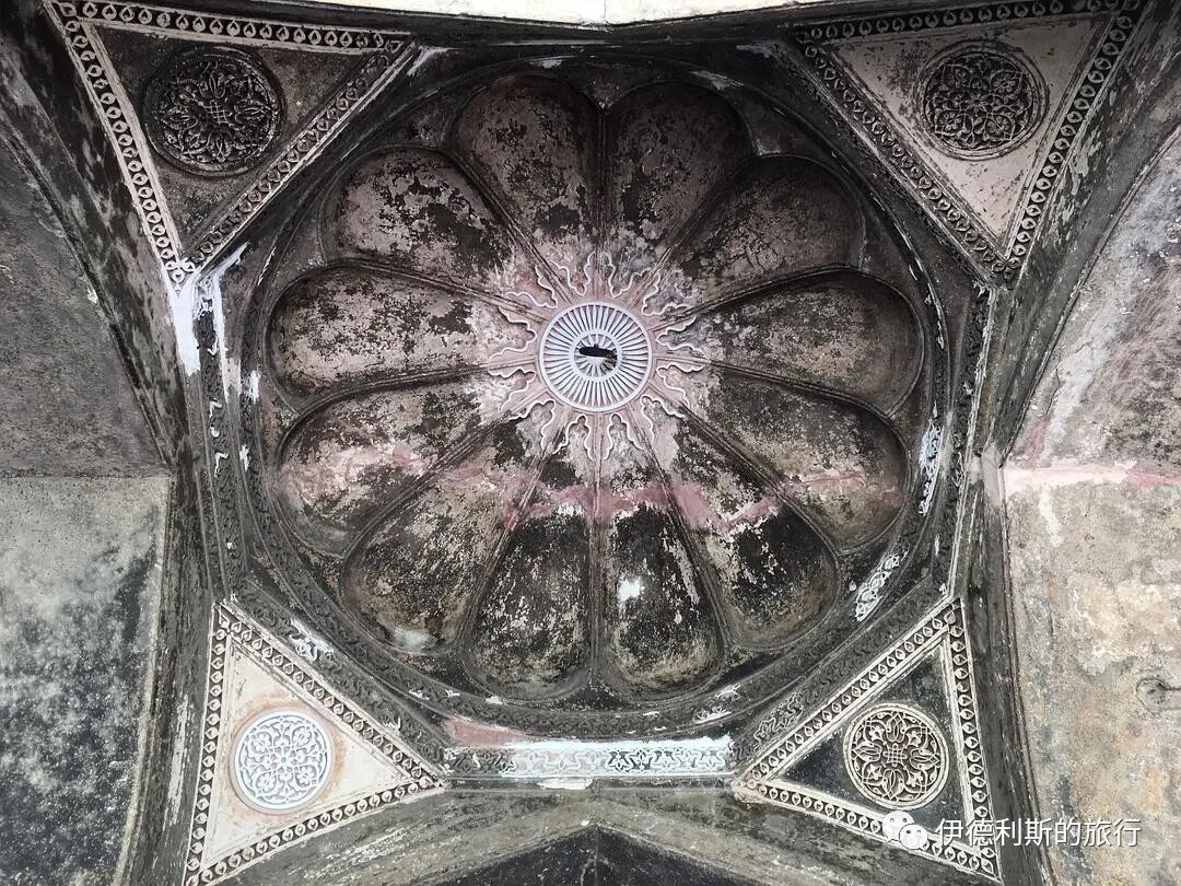
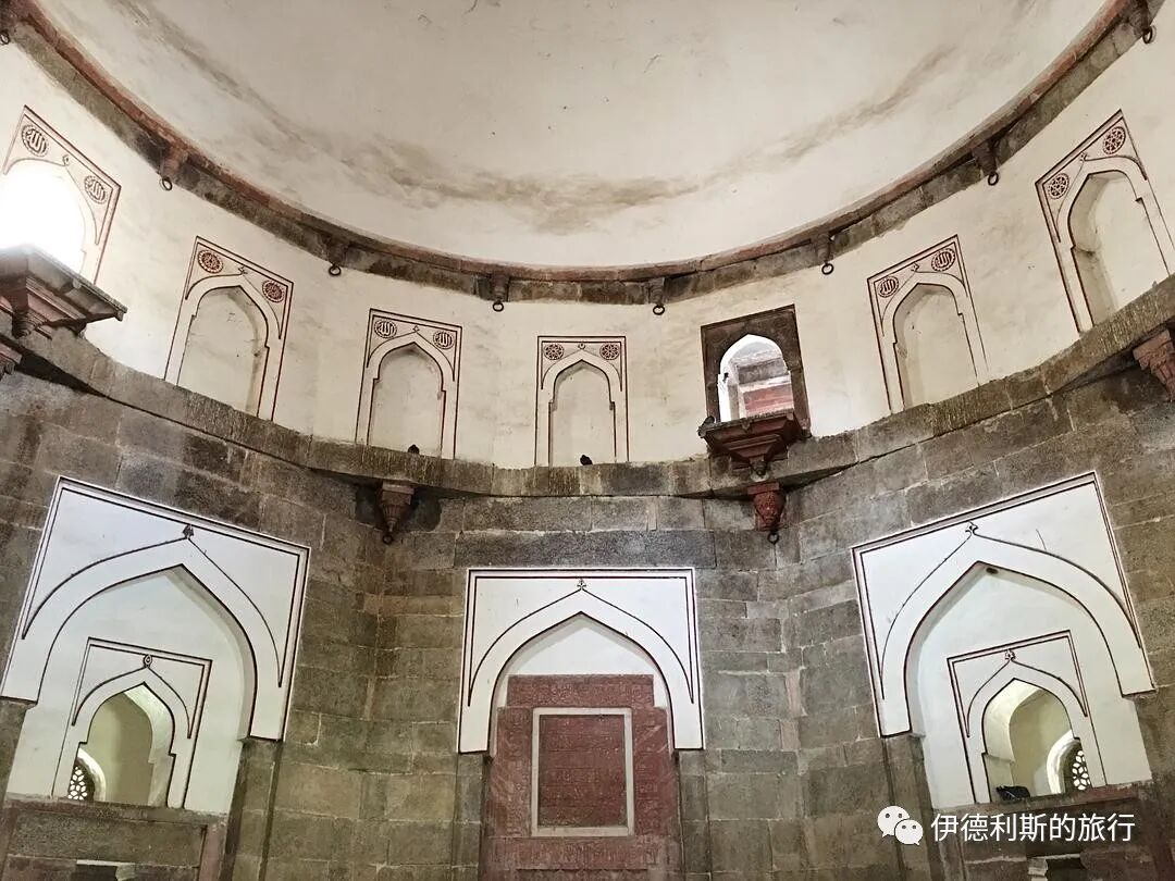
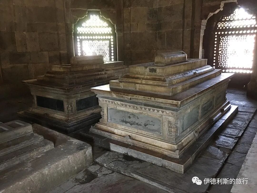
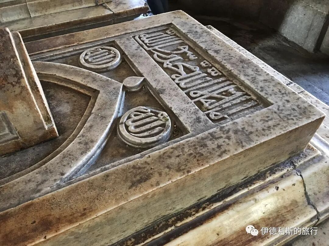
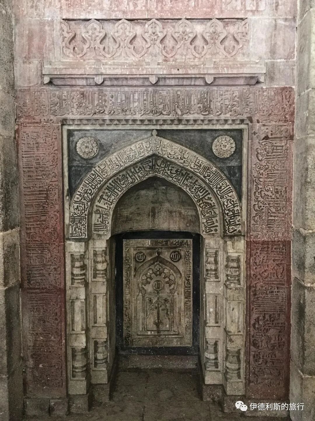
The Isa Khan Mosque was built during the same period as the tomb, and its biggest feature is the use of two pavilions instead of a dome. many details in the mosque were further developed in the later Humayun's Tomb.
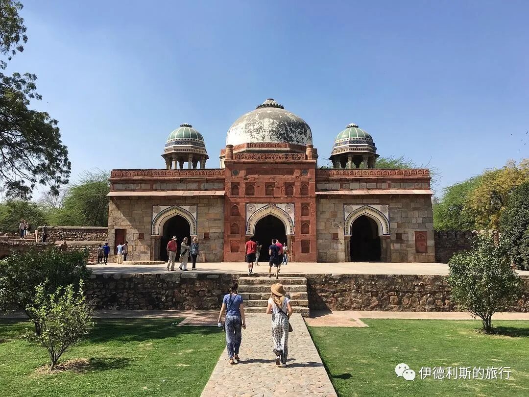
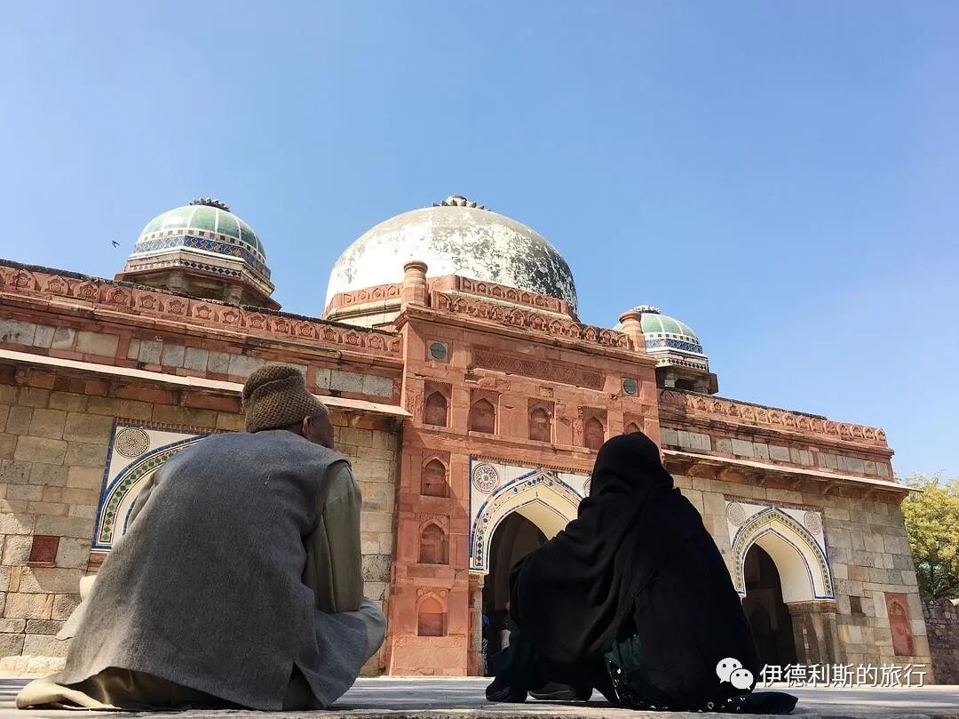
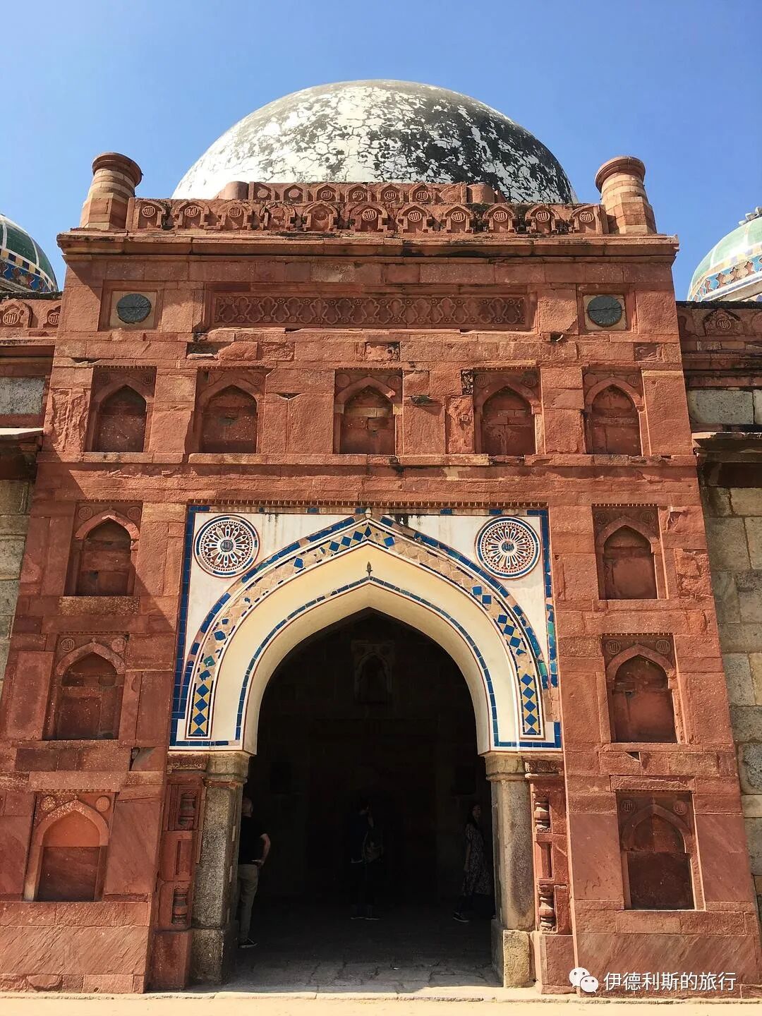
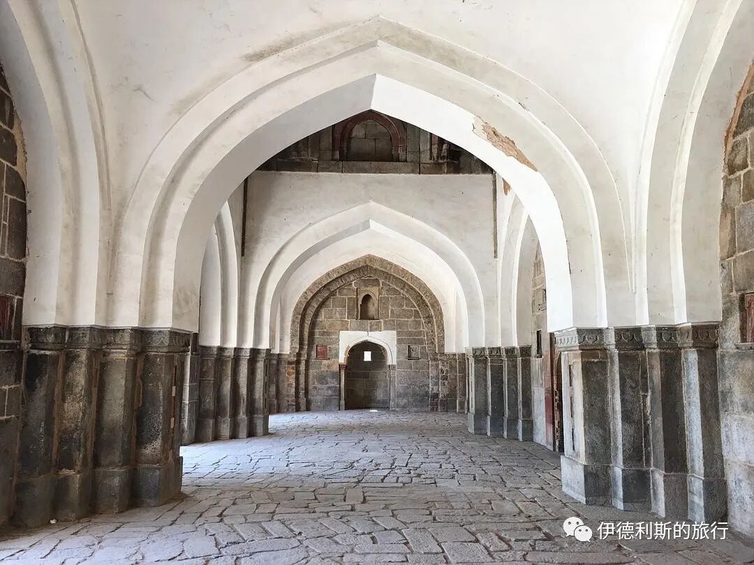
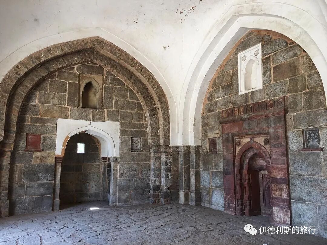
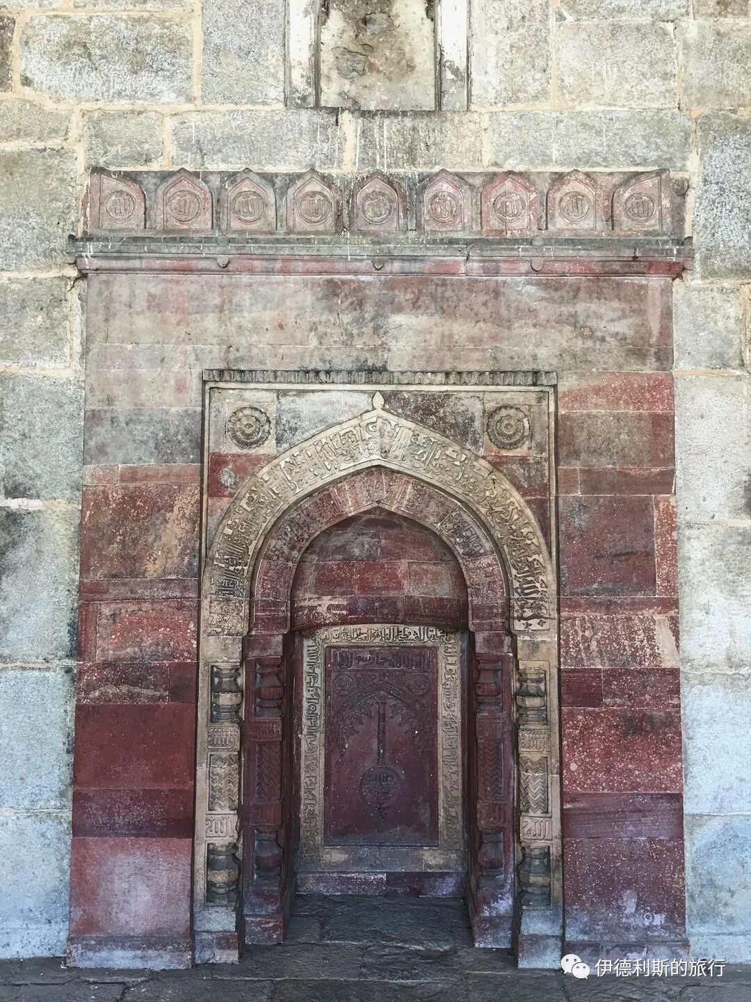
Legacy of the Delhi Sultanate
We head south from Delhi to Gujarat to look at the state that became independent from the Delhi Sultanate.
1. The Gujarat Sultanate in Western India (1407–1573)
The Gujarat Sultanate was located in the state of Gujarat in western India. Its founder was originally the governor (Nawab) of the Delhi Sultanate in Gujarat, and he became officially independent after Timur invaded the Delhi Sultanate.
In the first half of the 16th century, the Gujarat Sultanate was invaded twice by the Rajputs and the Mughal Empire, but they were eventually driven away. In 1550, the Gujarat Sultanate was ruled by Sultan Mahmud Shah III (reigned 1537–1554).
The Gujarat Sultanate is famous for its elegant Indo-Islamic architecture. They built many unique mosques in their capital, Ahmedabad, which had a great influence on the later development of Mughal architecture. In 2016, the Historic City of Ahmedabad was added to the UNESCO World Heritage List.
The location of Ahmedabad city.
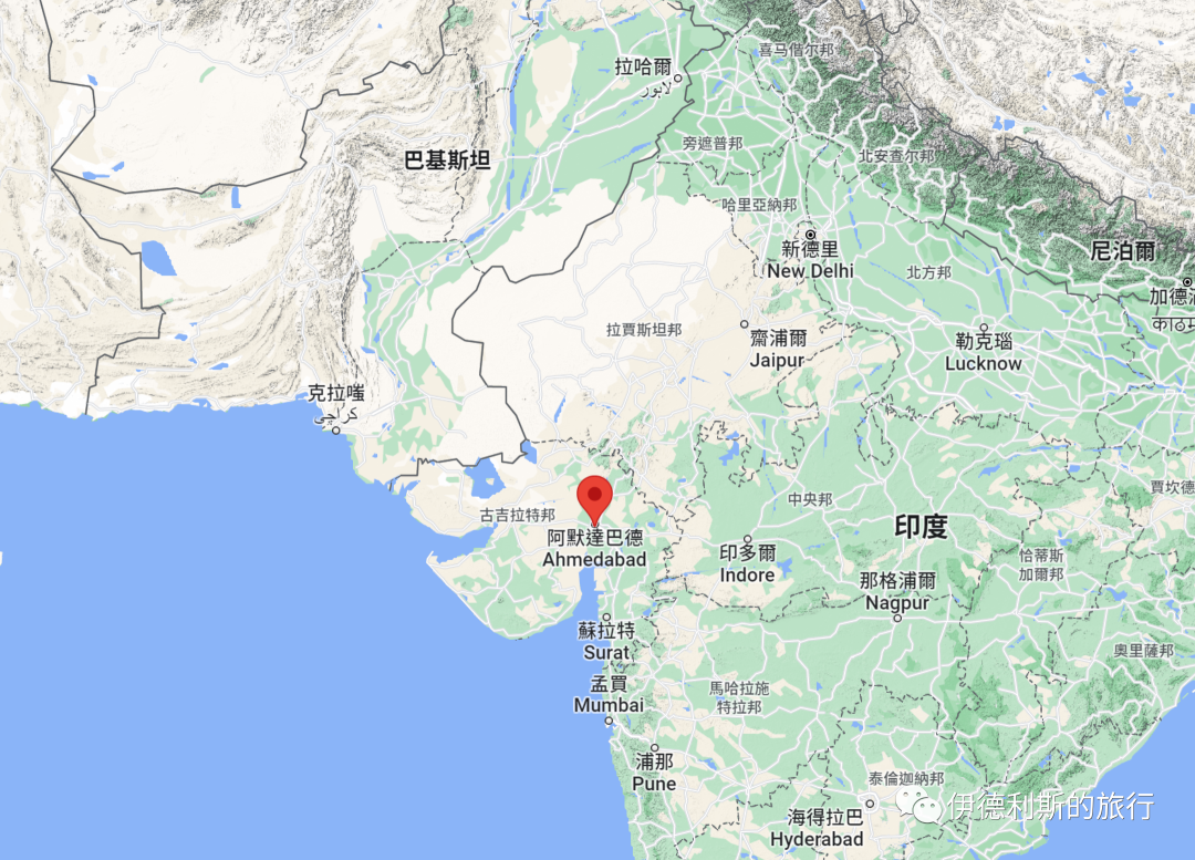
The Rani Sipri Mosque in Ahmedabad, built in 1514, has intricate carvings on its walls.
Photographed in 1874 by the Indian photography studio Bourne & Shepherd.
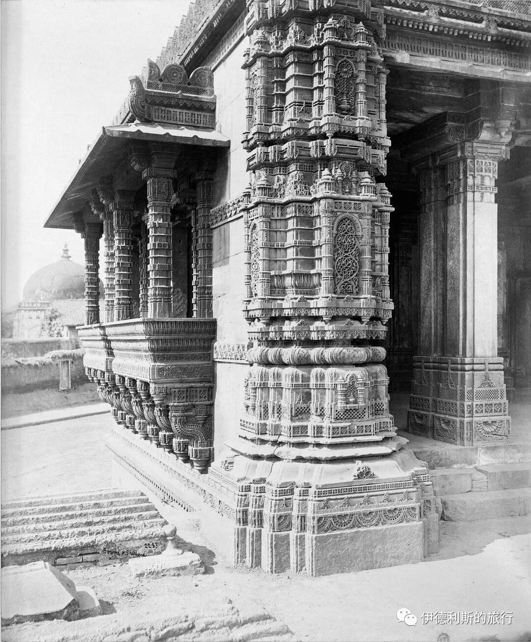
2. The Khandesh Sultanate in Central India (1382–1601)
The Khandesh Sultanate was located in the Khandesh region of central India. Its founder was originally a nobleman of the Delhi Sultanate who became a general due to his military achievements, and he became an independent sultanate in the late 14th century.
In the early 16th century, the Khandesh Sultanate was caught in wars with the neighboring Gujarat Sultanate and Malwa Sultanate.
The capital of the Khandesh Sultanate was Burhanpur, located in the Indian state of Madhya Pradesh.
Five Deccan Sultanates
Let us continue south into the Deccan Plateau.
In the 14th and 15th centuries, the most powerful state on the Deccan Plateau was the Bahmani Sultanate, which was formed after the Delhi Sultanate's governor in the Deccan region became independent. At the end of the 15th century, the Bahmani Sultanate declined and split into five sultanates, collectively known to later generations as the five Deccan Sultanates.
1. The Berar Sultanate on the Deccan Plateau (1490–1572)
The Berar Sultanate was the first of the five Deccan Sultanates to become independent after the collapse of the Bahmani Sultanate. Its founder was originally a Hindu who converted to Islam after being captured by the Bahmani army.
In 1550, the sultanate was ruled by Darya Imad Shah, who tried to use diplomacy for peaceful rule, which kept the sultanate relatively stable during this period. At the same time, he also built the city of Daryapur and named it after himself.
The location of Daryapur city.
2. The Ahmadnagar Sultanate on the Deccan Plateau (1490–1636)
The Ahmadnagar Sultanate was one of the five Deccan sultanates formed after the Bahmani Sultanate broke apart. It sat southeast of the Gujarat Sultanate, with Ahmadnagar as its capital. Its founder was originally a Brahmin from the Vijayanagara Empire in South India who later converted to Islam.
In 1550, the sultanate was ruled by Burhan Nizam Shah I. He was the first to switch from Sunni to Shia Islam, and the nobles and commoners soon followed his lead. Under his rule, there was religious tolerance, art flourished, and trade went smoothly, though small-scale conflicts with the Mughals and other sultanates continued.
Ahmadnagar city is in the state of Maharashtra in western India. It is a small town now, but it still keeps dozens of architectural ruins from the sultanate era.
The location of Ahmadnagar city.
3. The Golconda Sultanate on the Deccan Plateau (1518–1687)
We head southeast to Hyderabad, the most famous city on the Deccan Plateau.
The founder of the Qutb Shahi dynasty, Quli Qutb Mulk (reigned 1512–1543), was a Turkmen from Hamadan, Iran. He was a descendant of Qara Yusuf, the ruler of the Kara Koyunlu (Black Sheep) dynasty. In the early 16th century, Quli traveled from Iran to India with some relatives and friends. They stayed in Delhi at first, then moved south to the Deccan to serve the Bahmani Sultanate. After the Bahmani Sultanate fell in the 15th century, Quli conquered Golconda Fort and started the Qutb Shahi dynasty. Over the next 60 years, three sultans expanded Golconda Fort into a massive complex, which is why the Qutb Shahi dynasty is also called the Golconda Sultanate.
Golconda had the world's only diamond mines at the time and was a major diamond trading hub. In the West, the name Golconda became a synonym for immense wealth. Golconda Fort is actually made of four castles. Its outer wall is 10 kilometers long and features 87 semicircular bastions, 8 gates, and 4 drawbridges. The inner city sits on a 120-meter-high granite hill. Currently, only the east gate, Bala Hissar Darwaza, is open for visitors. Bala Hissar Darwaza is a huge archway with carvings of lions and peacocks, which are common in Hindu architecture. The gate also has iron spikes designed to stop Mughal war elephants.
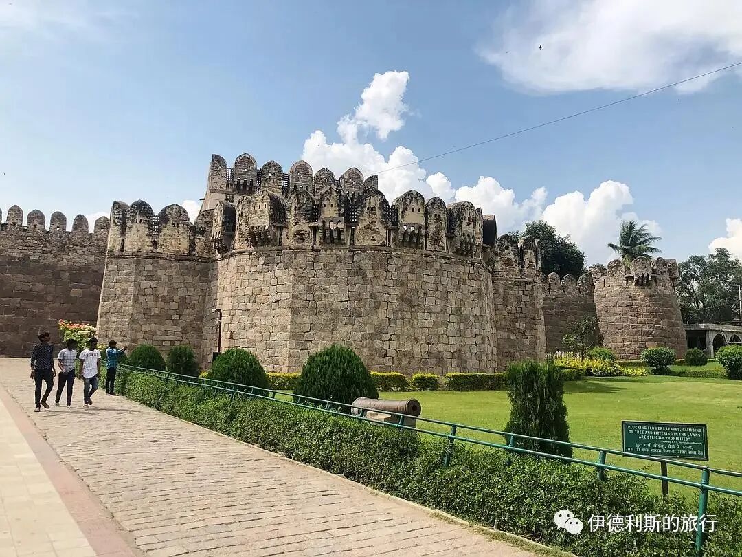
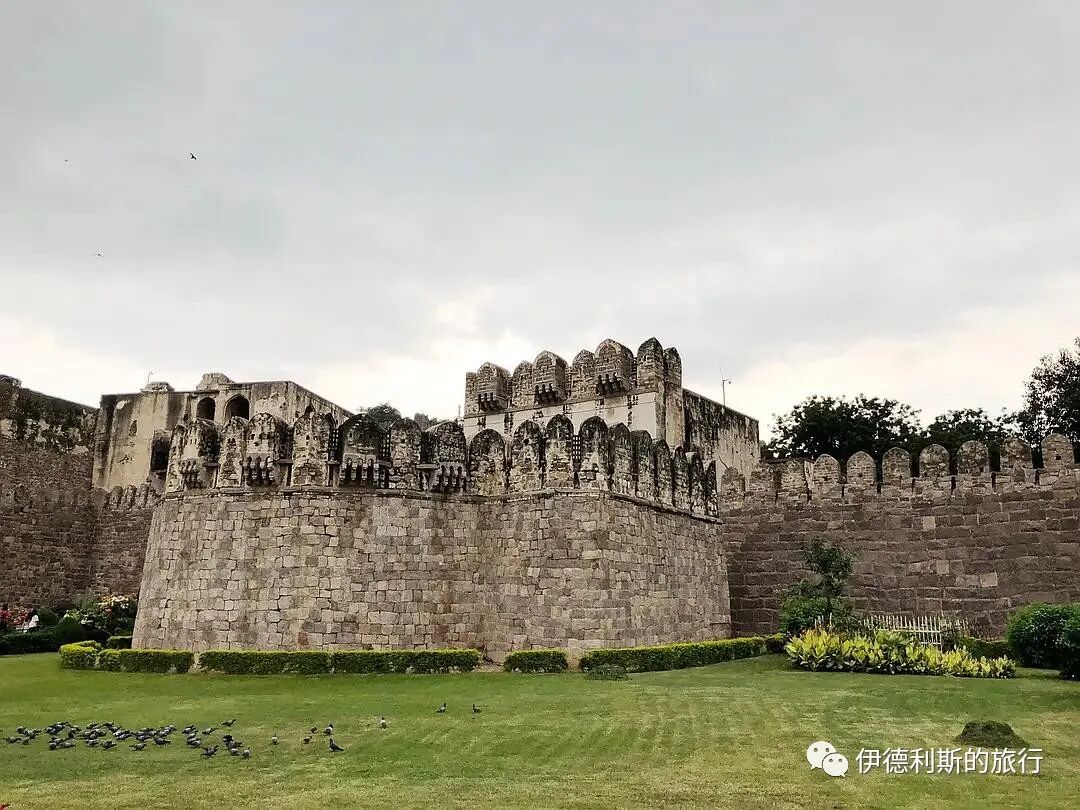
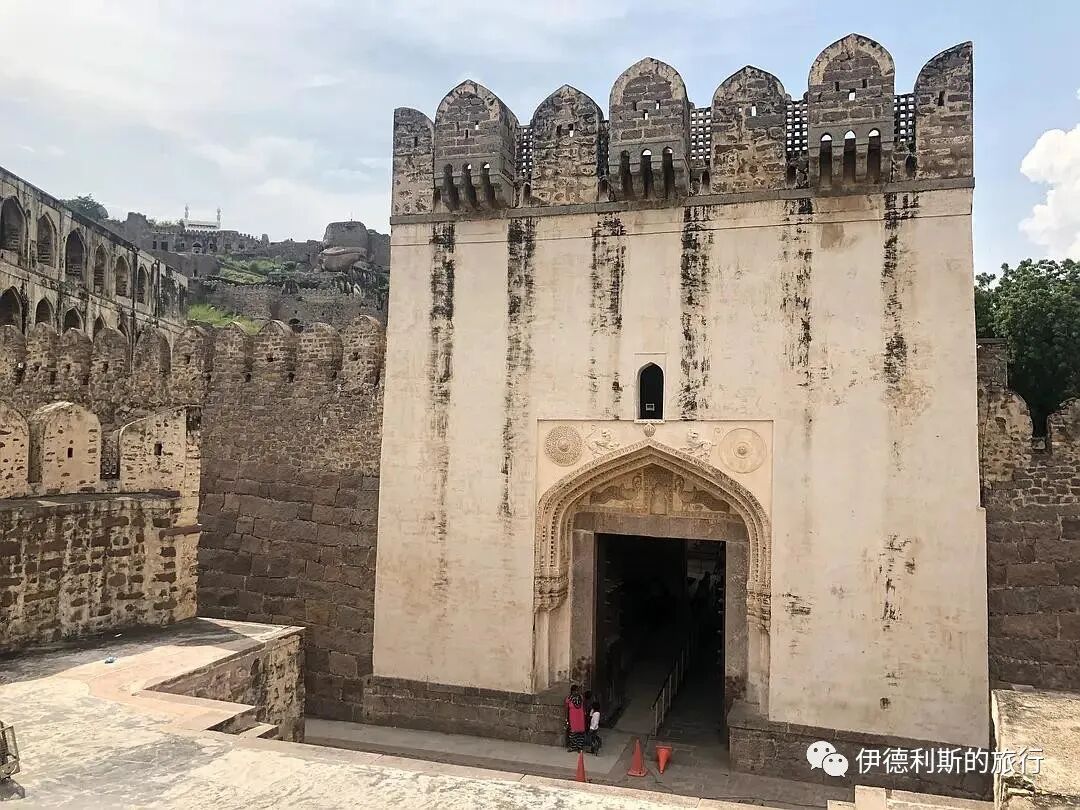
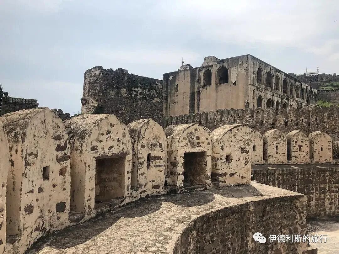
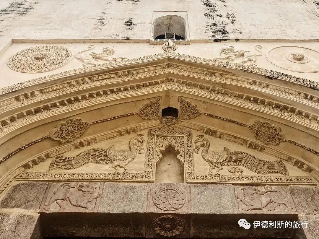
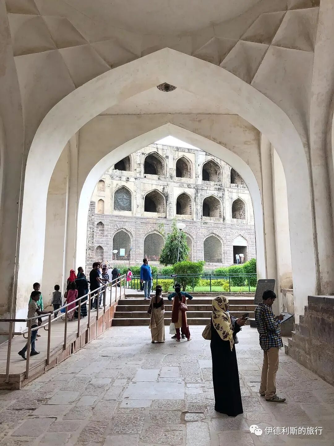
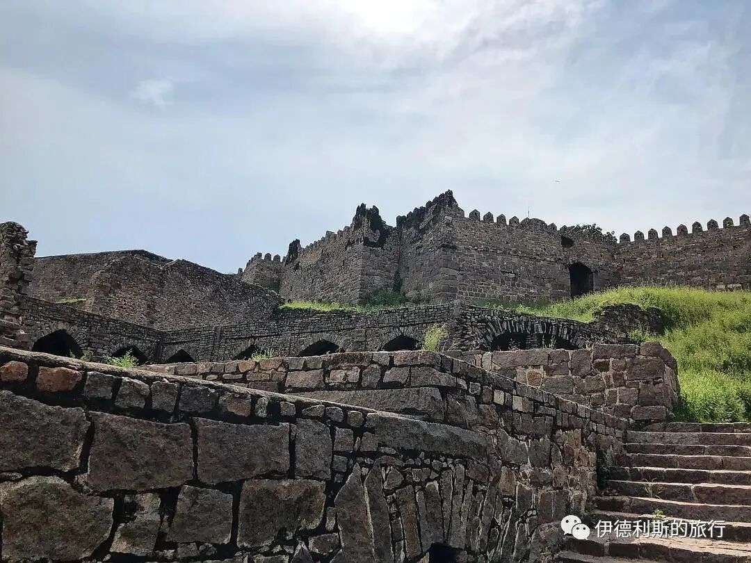
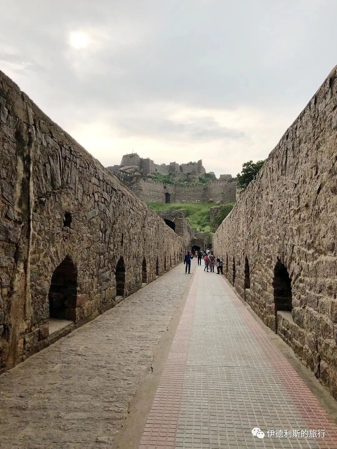
The tall, three-story building south of the gate is called the Aslah Khana armory. It held guns and ammunition during the Mughal era. Historians have found that during the Qutb Shahi dynasty, this was actually an office for various officials.
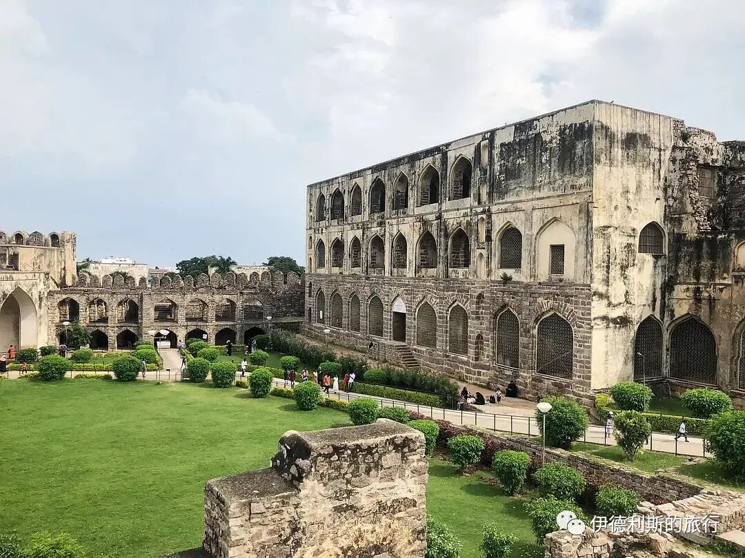
Nakkar Khana is a palace complex where archaeologists have now dug up a series of water channels.
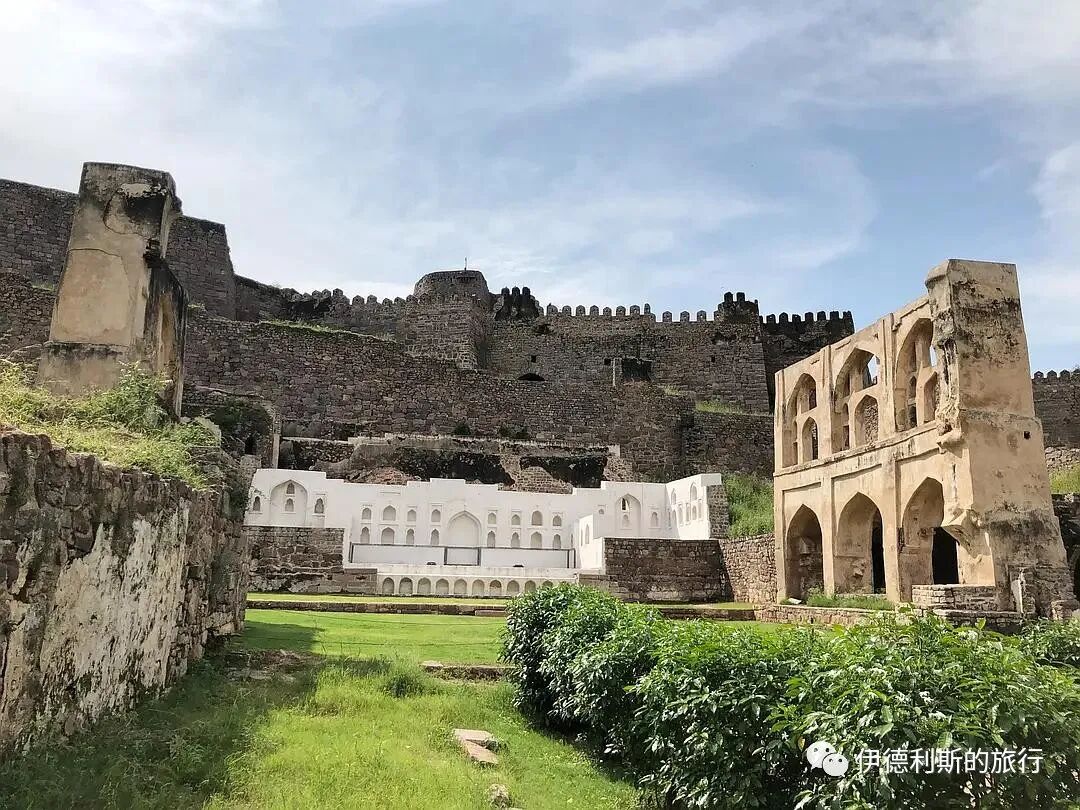
Taramati mosque, built in 1518, sits next to the palace area and was used by the sultan's court and nobles. This mosque has the classic Muslim architectural style of the Deccan region, with small lotus-topped onion domes on its balconies.
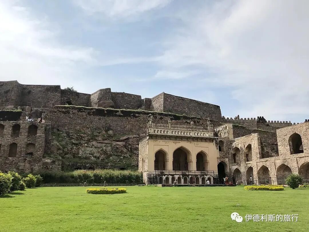
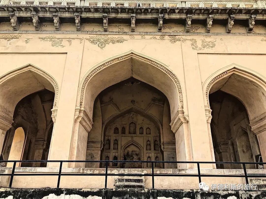
Walking further in, you reach the Bhagamati Palace.
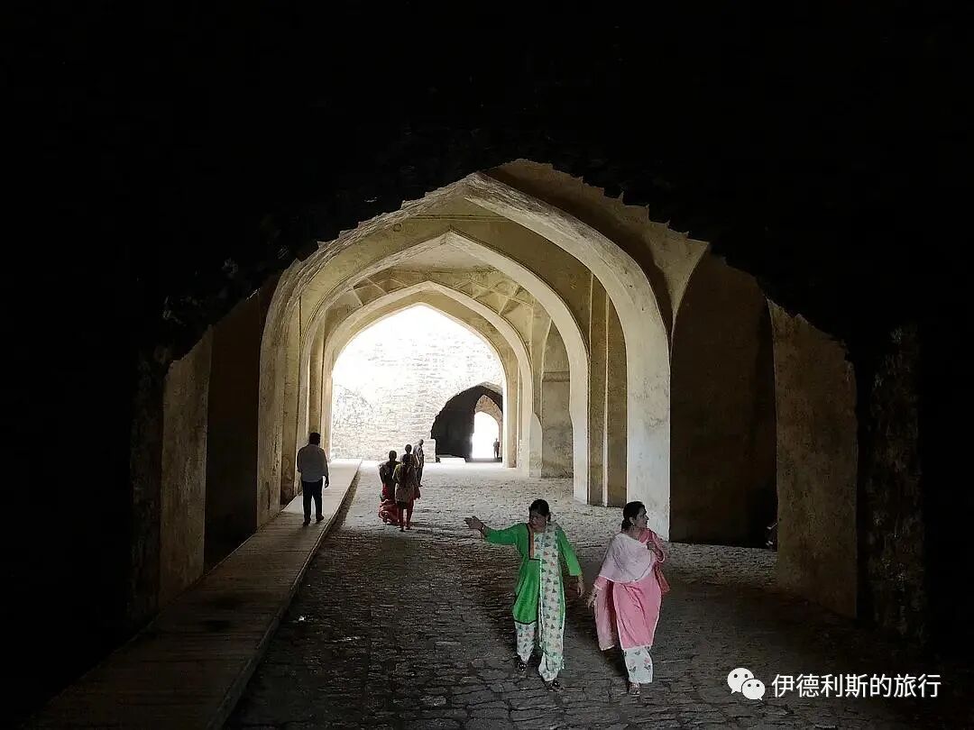
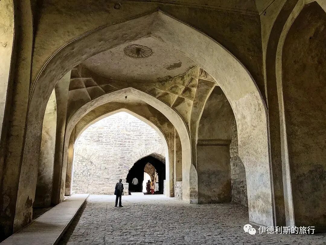
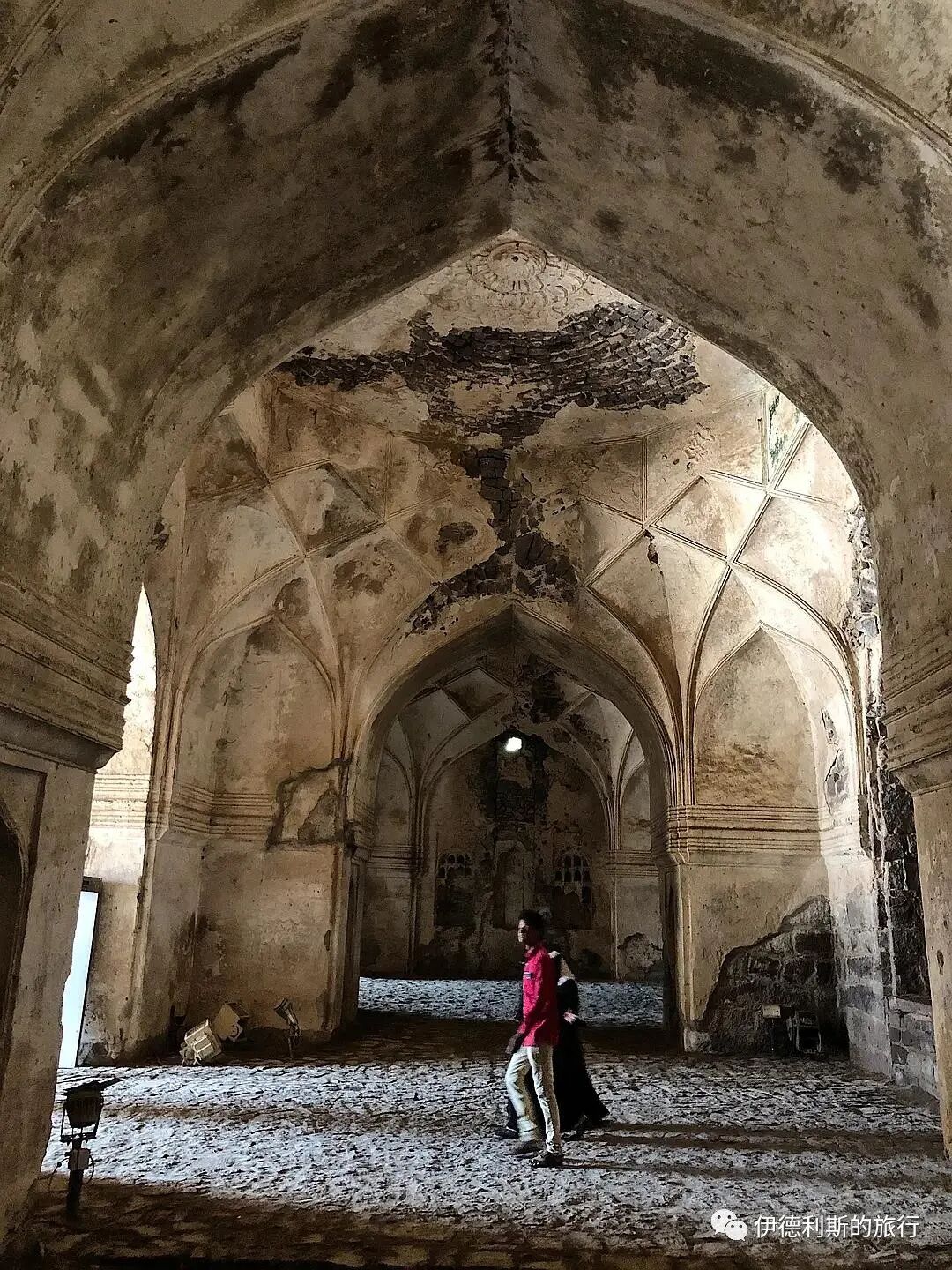
Passing through Bhagamati Palace brings you to the Rani Mahal area in the south of the fort, where a light and sound show is held at night. In the middle of the spacious courtyard is a complex metal fountain. During the Qutb Shahi era, the fountain could spray water on its own thanks to hydraulic engineering. When there was no rain, the fort's water system ran using Persian water wheels. Today, a set of clay drainage pipes that have survived for hundreds of years can still be found behind the Rani Mahal. Historians believe the palace now called Rani Mahal should actually be called Dad Mahal. This was the palace where the sultan handled state affairs and listened to the opinions of his subjects and the people.
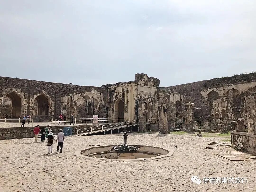
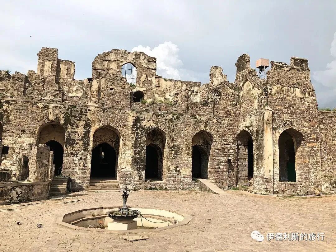
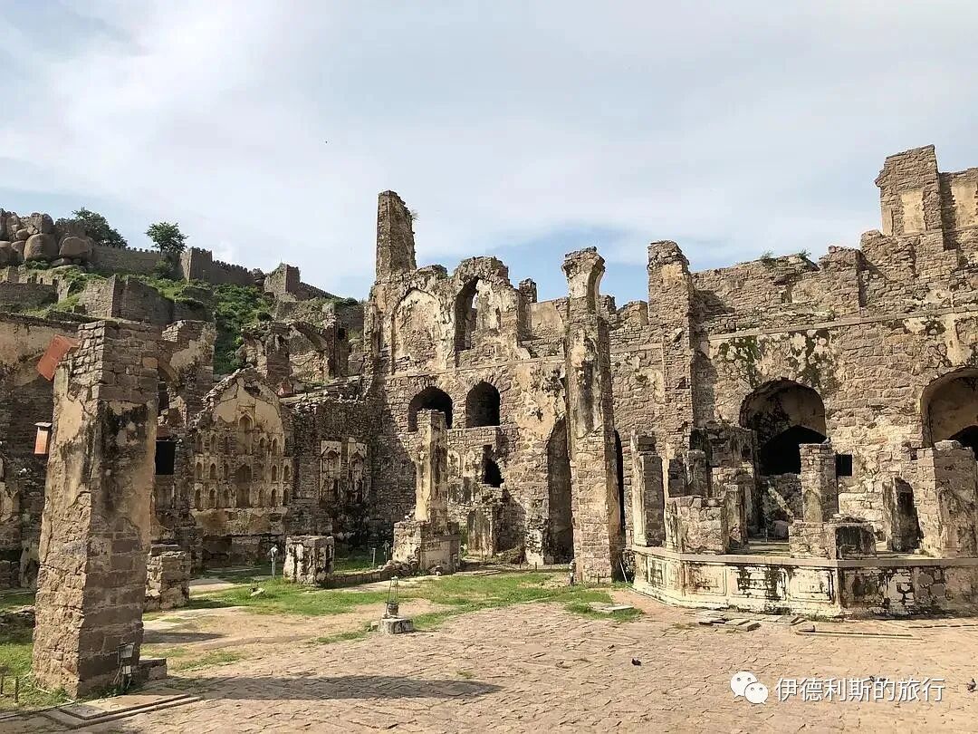
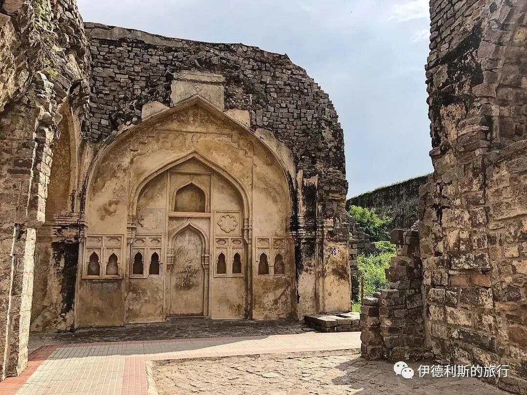
Behind the Rani Mahal is the Kilwat, the sultan's private bedroom. It is small but decorated beautifully. Those hollow lattices were once inlaid with Golconda's most famous diamonds and other gemstones.
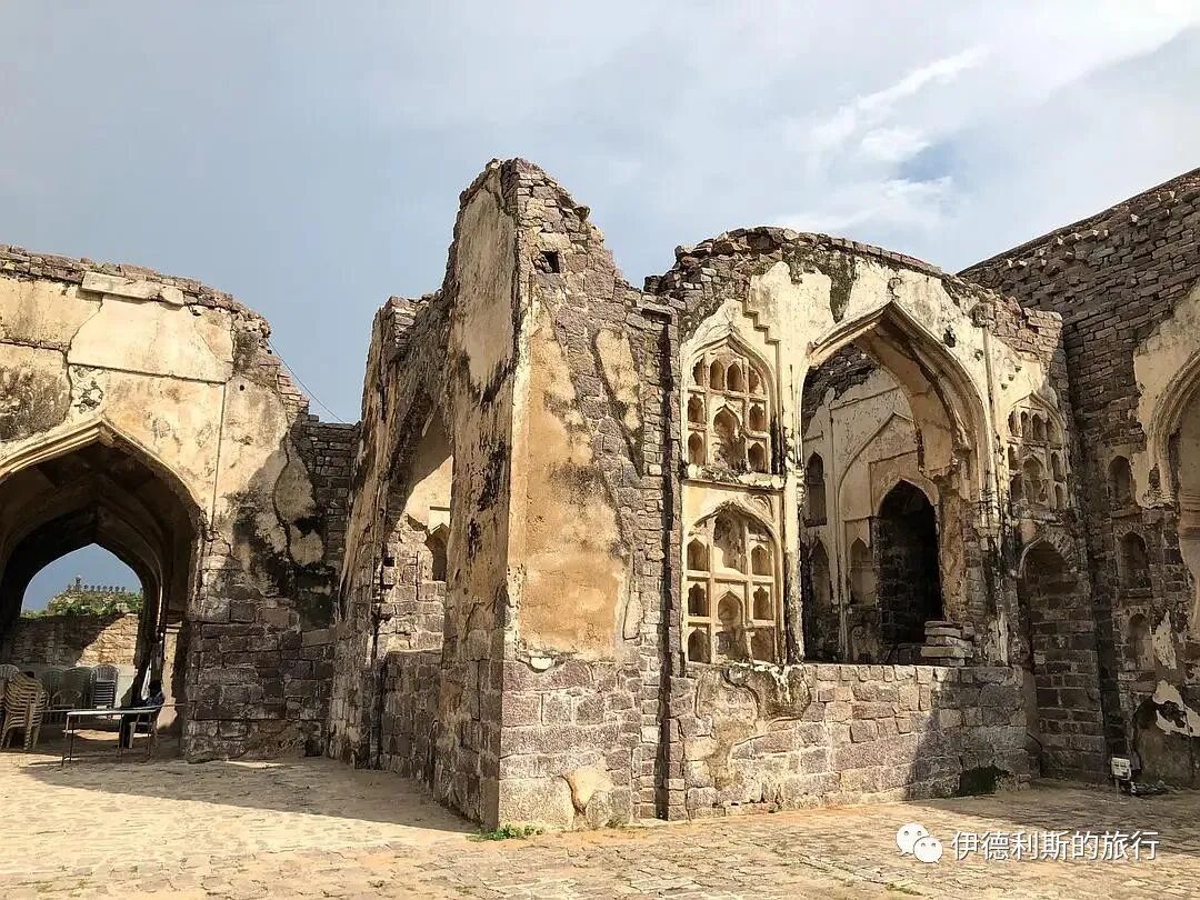
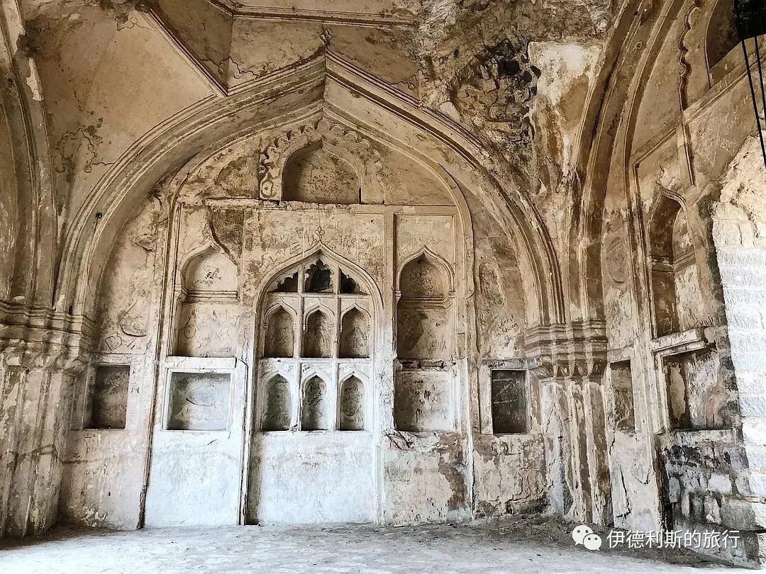
Heading west from the Rani Mahal area, you leave the palace grounds and can see the tall, multiple walls inside the fort. Behind one of these walls stands a mosque called Zanana, which still has its mihrab and courtyard.
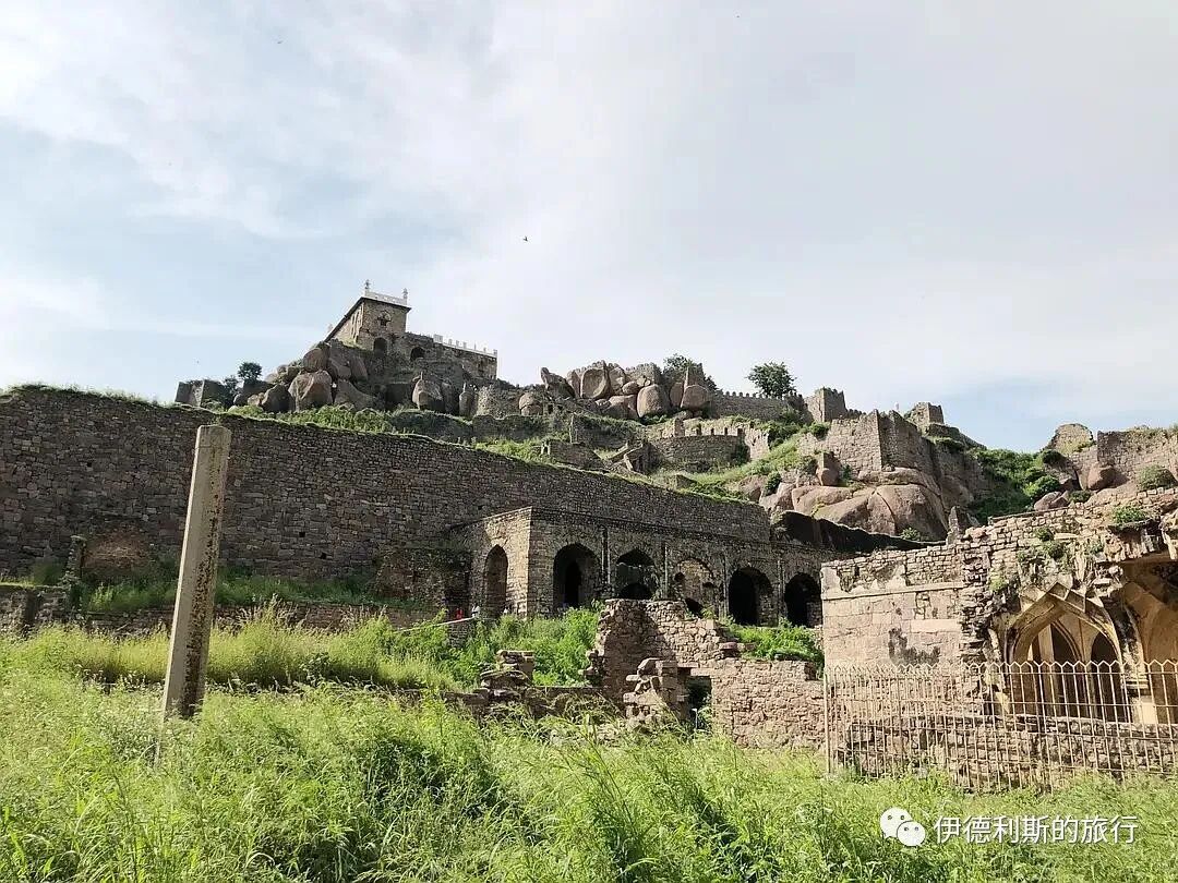
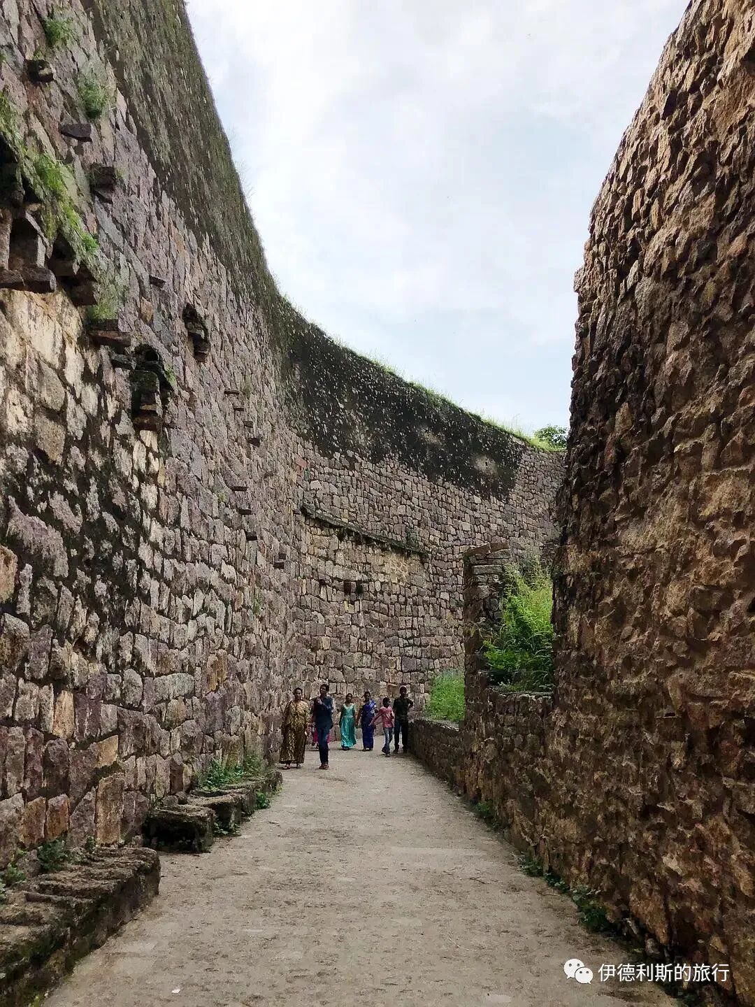
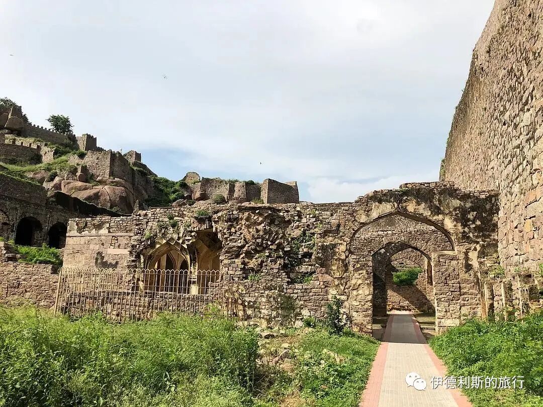
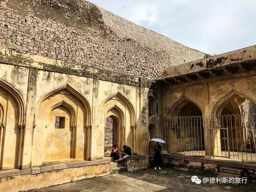
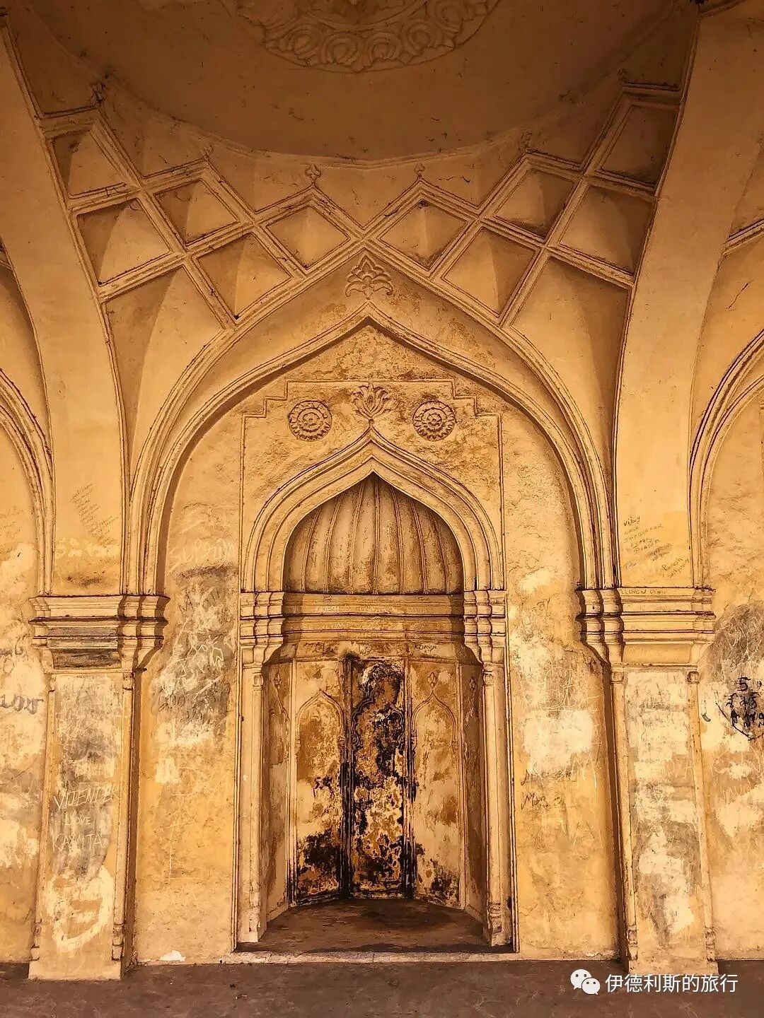
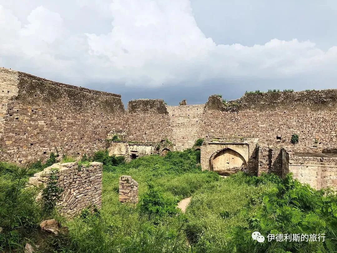
After passing through the Zanana mosque, you leave the palace area. A stone staircase leads to the fortress at the top of the hill. Some of the fortress walls are built directly onto giant boulders, and you can look down over the entire palace area from the steps. Once you reach the top, there is a building called Baradari (Darbar Hall), where you can look out over the vast area behind the fort.
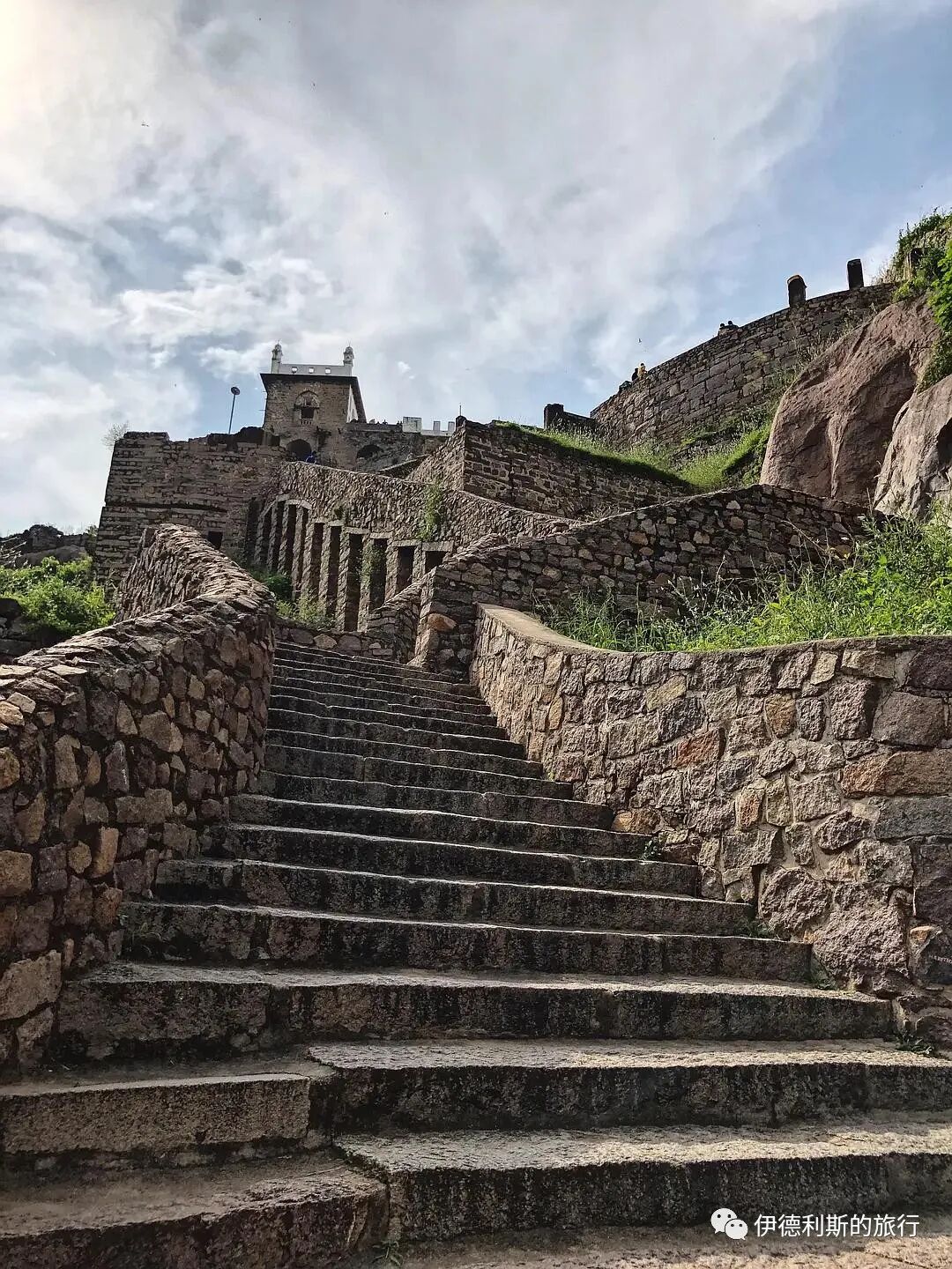
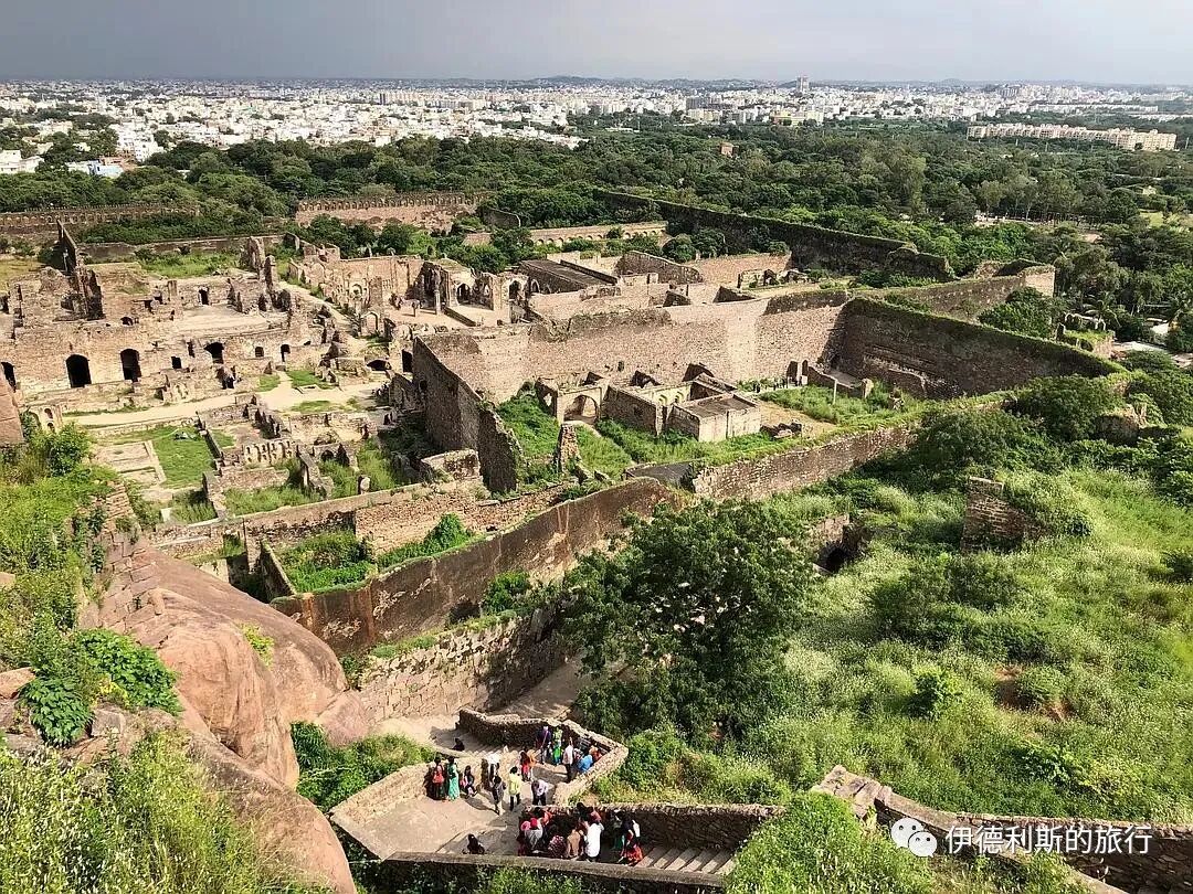
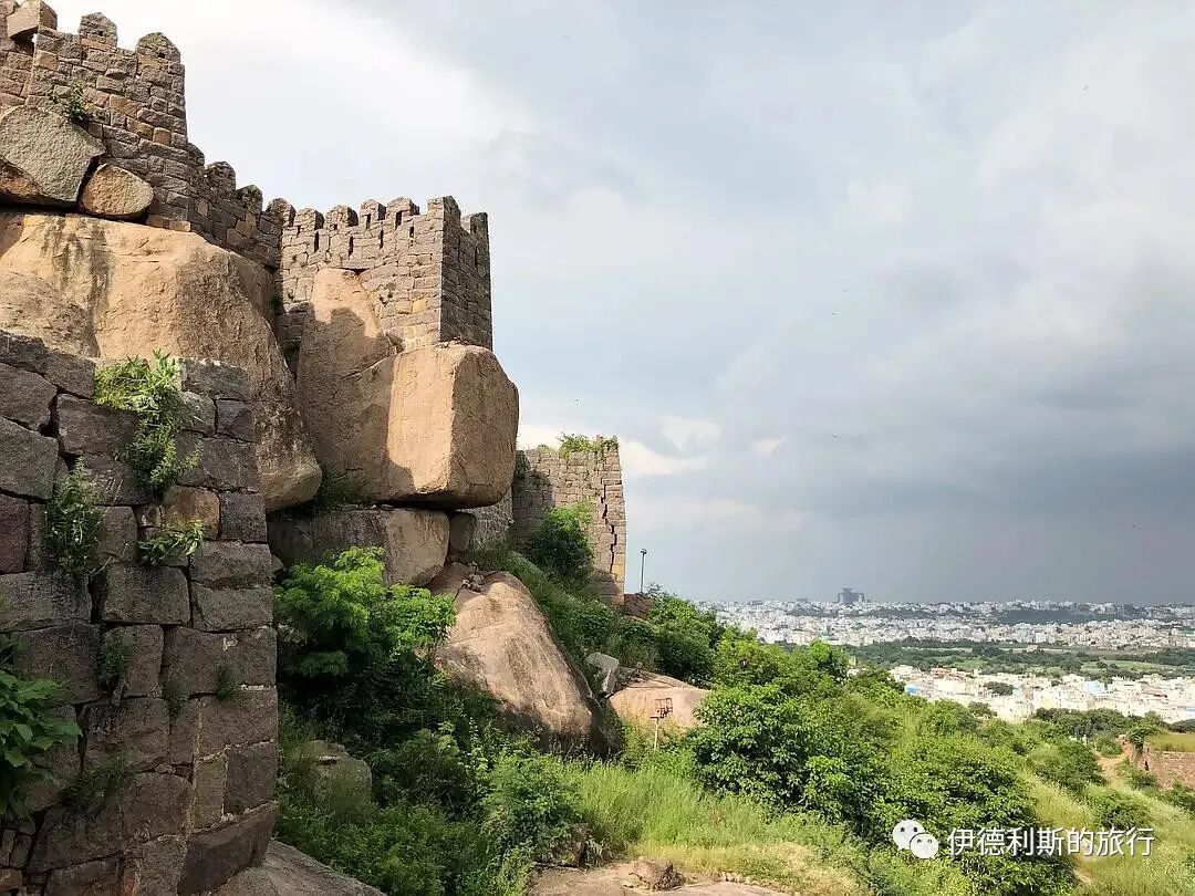
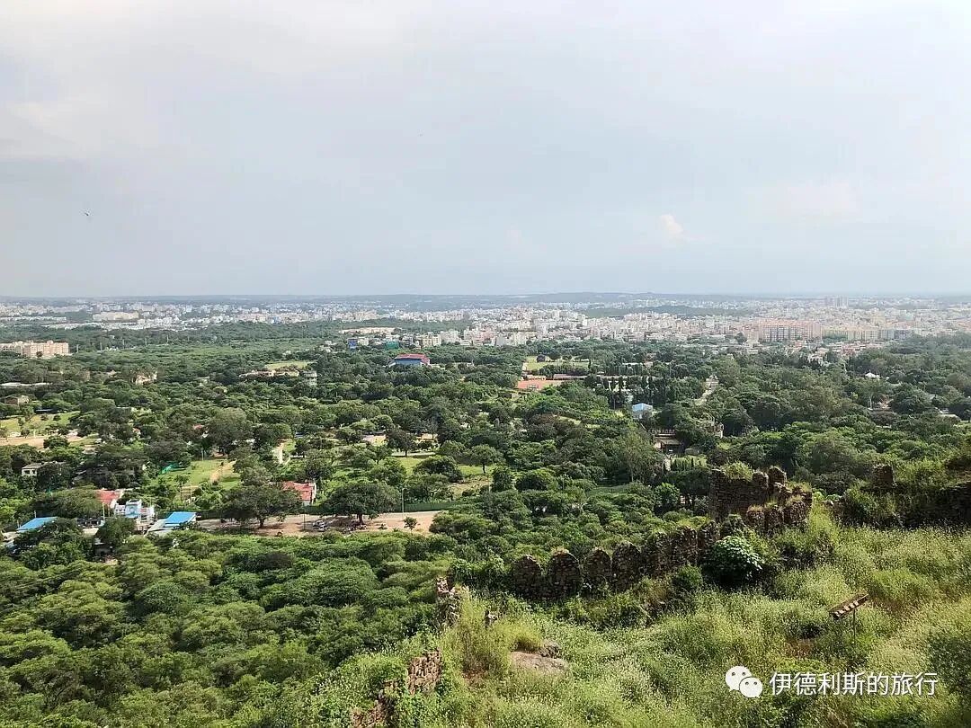
Continuing down the hill, you will pass the Ramdas prison.
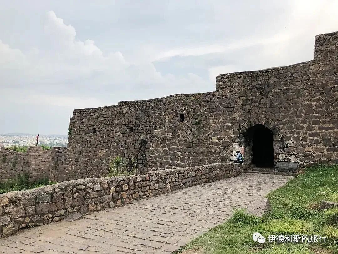
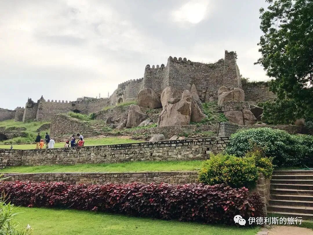
Next to the main gate of the fort is a Turkish bath (hammam) building. It has pipes at different heights inside to mix scented cold and hot water, but it was not open when I visited. Historians still disagree on whether this bath was for women or for washing the bodies of the deceased.
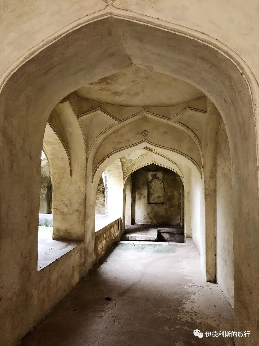
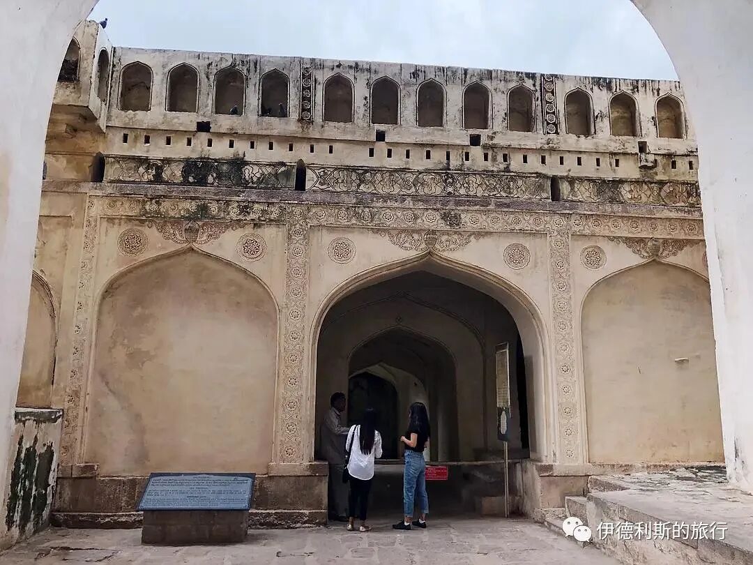
Two large pavilions outside the fort gate.
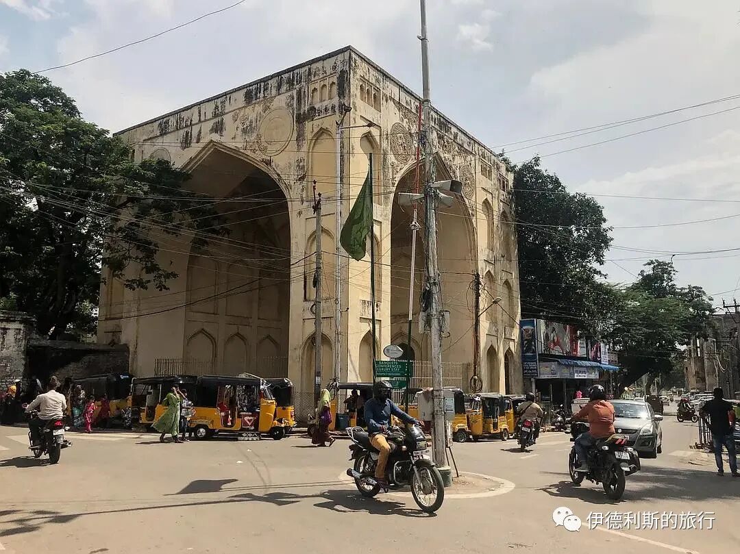
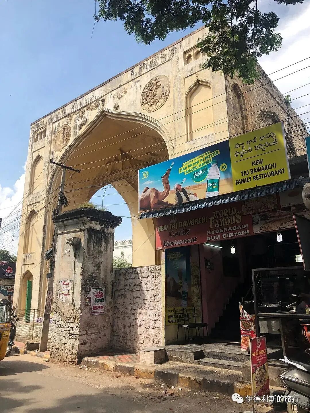
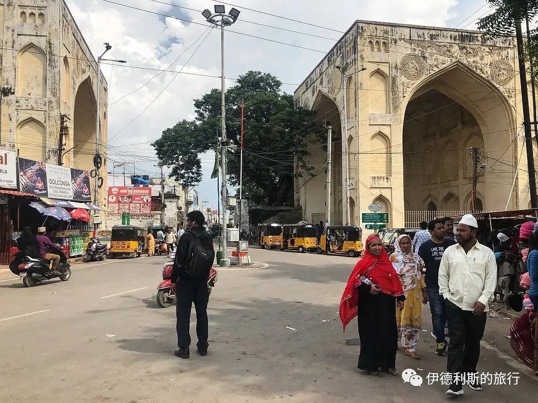
The Qutb Shahi tombs are located north of Golconda Fort and contain the tombs of the sultans of the Qutb Shahi dynasty along with their attached mosques. These tombs feature the typical style of Deccan Plateau Muslim architecture. The square base and round top are highlighted by decorative small towers, and the onion-shaped dome sits on a lotus-petal base, showing a blend of Persian and Indian architectural styles.
The tomb of Quli Qutb Mulk (reigned 1512–1543), the founder of the Qutb Shahi dynasty, is the oldest in the cemetery, and the designs of later tombs were all developed from this one. Quli was a Turkmen from Hamadan, Iran, and a descendant of Qara Yusuf (reigned 1380–1420), the ruler of the Black Sheep dynasty.
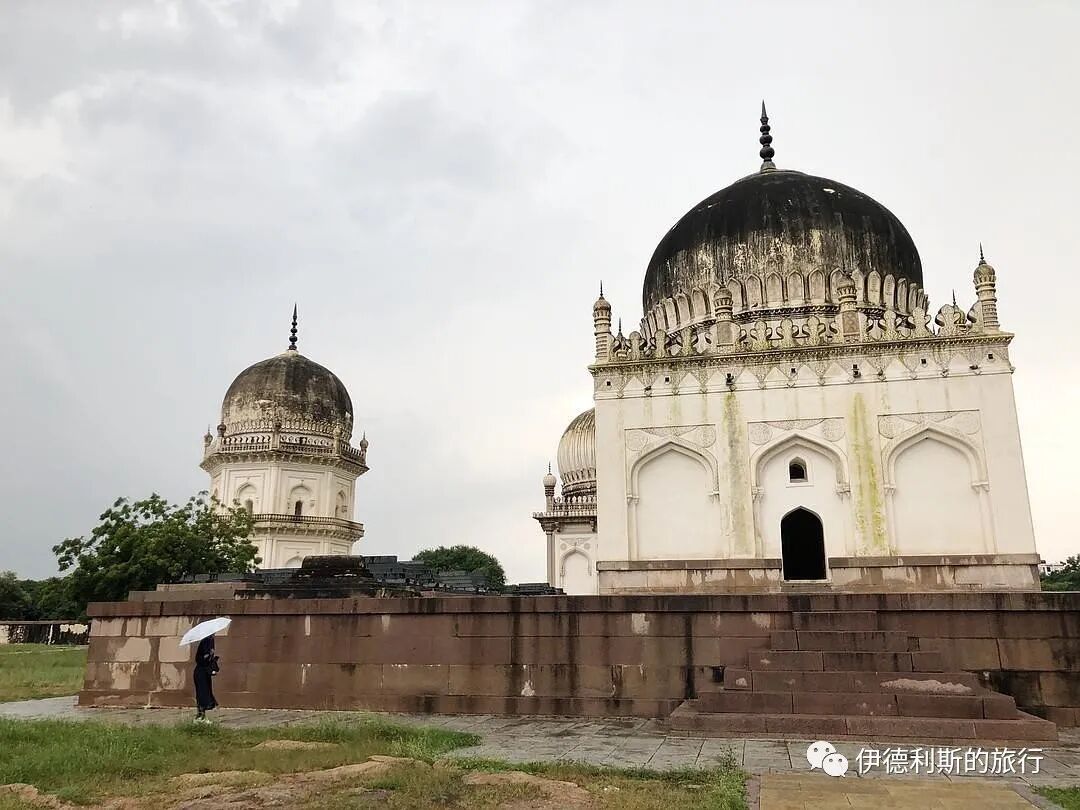
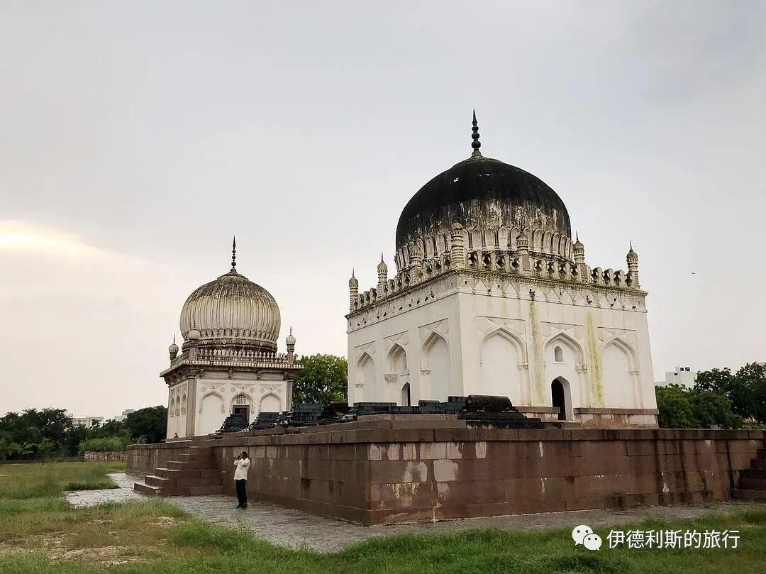
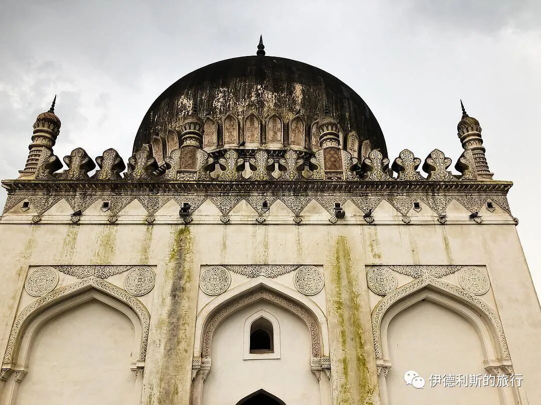
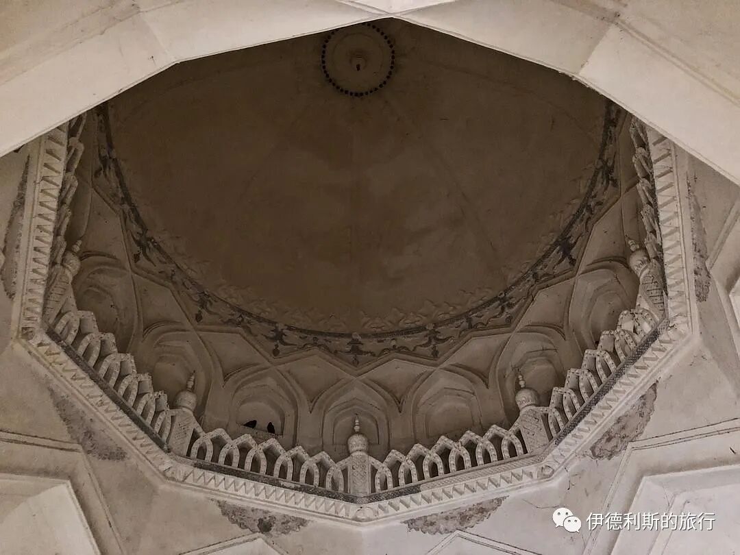
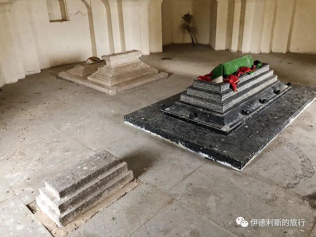
The tomb of the second sultan, Jamsheed Quli Qutb Shah (reigned 1543–1550), is the only sultan's tomb in the cemetery that does not use black basalt. Its design is also different from the others, consisting of two levels. Jamsheed took the throne in 1543 after assassinating his father. Few records remain of his reign, other than that it was very cruel. Jamsheed died of illness in 1550 and was buried next to his father's tomb.
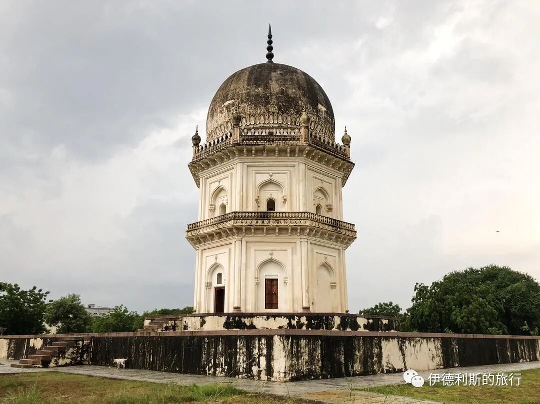
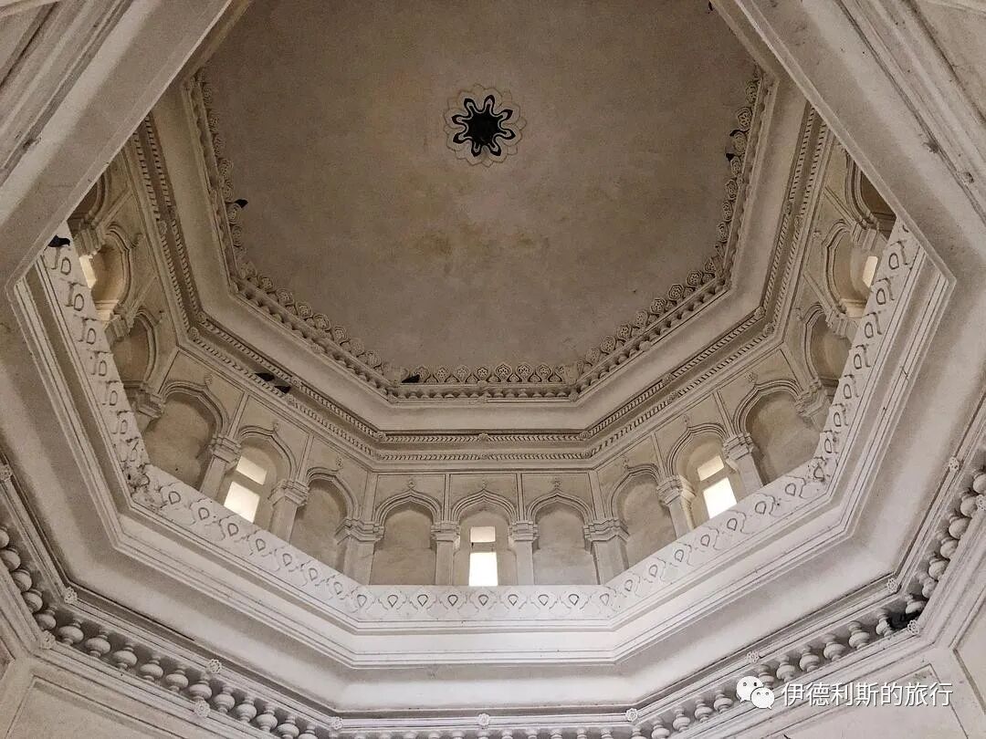
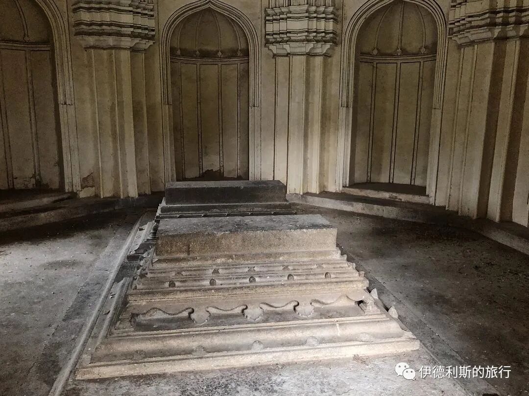
After the second sultan, Jamsheed, died of illness in 1550, his 7-year-old son, Subhan Quli Qutb Shah, took the throne. However, shortly after, Subhan's uncle, Ibrahim Quli Qutb Shah, rushed back to Golconda Fort to seize the throne. Subhan was deposed and died shortly after. Subhan's tomb is on the same platform as his grandfather, the first sultan Quli Qutb Mulk, and it is the smallest of all the sultan tombs.
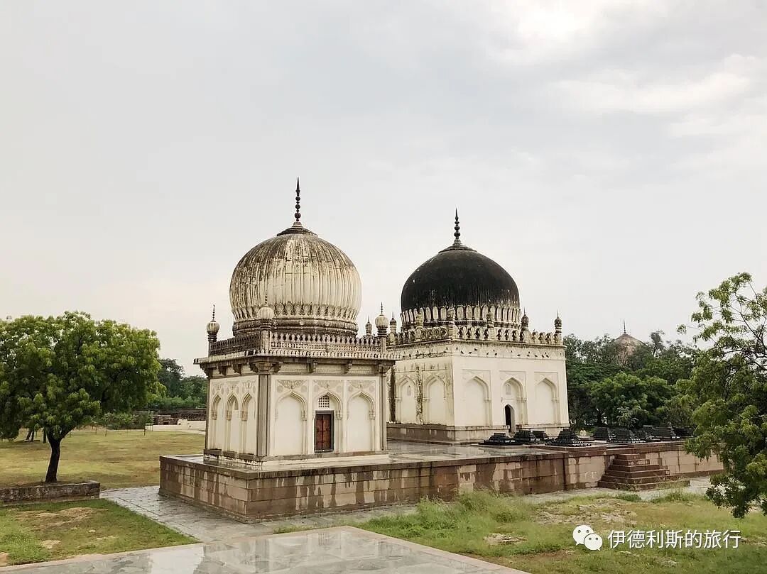
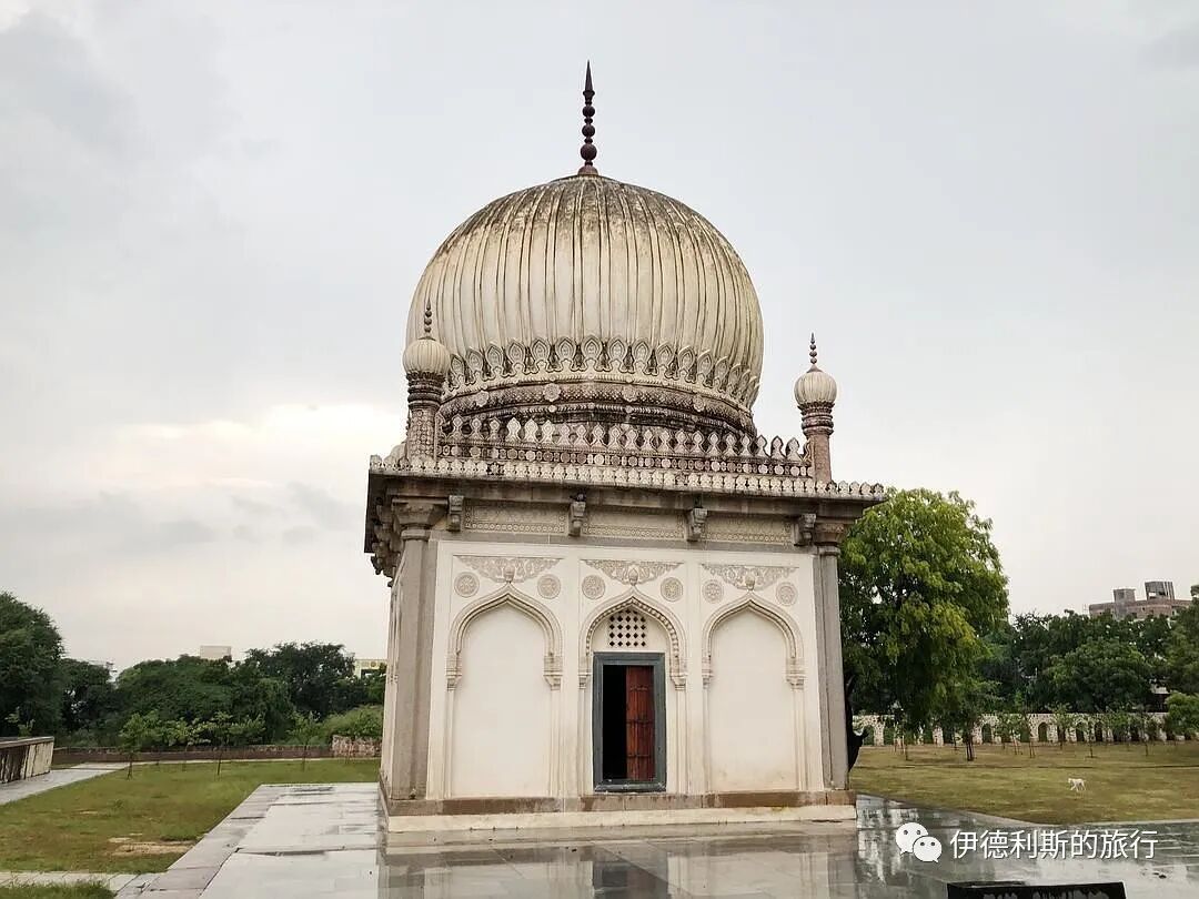
4. The Bidar Sultanate of the Deccan Plateau (1492–1619)
The Bidar Sultanate was one of the five Deccan sultanates formed after the collapse of the Bahmani Sultanate. It was the smallest one and was surrounded by the other four. Its founder was originally a Georgian enslaved by the Turks who later became a general in the Bahmani Sultanate.
In 1550, the ruler of the sultanate was Ali Barid Shah I, who loved inviting scholars and craftsmen from all over India to his court.
The Bidar Sultanate expanded Bidar Fort on a large scale. Because they hired Hindu architects, the buildings from this period incorporate many features of Hindu architecture.
A miniature painting of Ali Barid Shah in the collection of the San Diego Museum of Art.
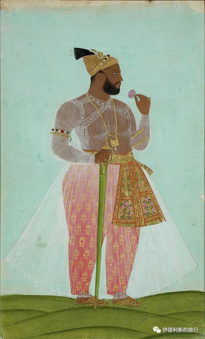
A photo of the tomb of Ali Barid Shah taken by S N Barid in 2015.
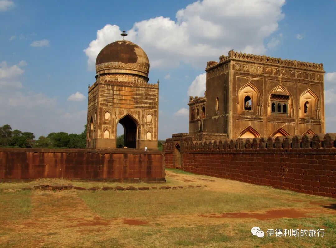
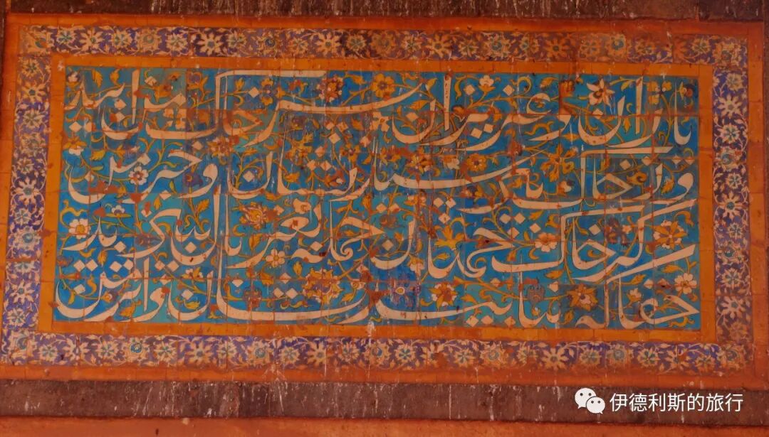
5. The Bijapur Sultanate on the Deccan Plateau (1490–1686)
The Bijapur Sultanate was the most southwestern of the five major Deccan sultanates. Its founder was a Georgian slave bought from Iran by the Bahmani Sultanate.
In 1550, the ruler of the sultanate was Ibrahim Adil Shah I, the first Bijapur sultan to hold the title of Shah. After taking the throne, Ibrahim converted from Shia to Sunni. He removed the names of the Twelve Imams from the Friday khutbah, promoted local Deccan Sunni Muslims, and suppressed the Shia faction.
During his reign, Ibrahim constantly formed and broke alliances with the other four Deccan sultanates. Although there were continuous military campaigns, there was little territorial expansion.
During the rule of the Bijapur Sultanate, the city of Bijapur was a center for business, trade, and education on the Deccan Plateau, famous for its unique Bijapur culture.
The location of Bijapur city.
The Sultanate of the Maldives (1153-1968) in the Indian Ocean.
Let us leave the South Asian mainland and take a boat to the Maldives islands in the Indian Ocean.
As Arab merchants grew trade in the Indian Ocean, the Maldives changed from a Buddhist kingdom to an Islamic nation in the 12th century, becoming the Sultanate of the Maldives.
In 1550, the Sultanate of the Maldives was ruled by the Hilaalee dynasty, whose founder likely came from Somalia. In 1551, Sultan Muhammad III, who had only been in power for two years, was assassinated by his brother Hassan. Hassan was also the first Maldivian Sultan to convert to Christianity, but he was soon deposed.
Male, the capital of the Sultanate of the Maldives.
In the next part, we will cross the Bay of Bengal to Southeast Asia to see the Islamic culture there in 1550.
Islamic World in 1550: Mongol Empire Legacy and Muslim History (Part 2)
Articles • ali2007fr posted the article • 0 comments • 95 views • 2026-05-18 09:20
Summary: Islamic World in 1550: Mongol Empire Legacy and Muslim History is presented here as a firsthand travel account in clear English, beginning with this scene: The Altun Mosque next to the royal tomb is said to have been built in 1533, and it now looks as it did after renovations in 1735. The account keeps its focus on Mongol Empire, Islamic World, Muslim History while preserving the names, places, food, and historical details from the Chinese source.
The Altun Mosque next to the royal tomb is said to have been built in 1533, and it now looks as it did after renovations in 1735.
During the reign of Rashid Khan, foreign wars decreased significantly, but the success rate increased greatly. The national situation stabilized, and social, economic, and cultural life began to recover. According to the History of Musicians (Tavārikh-i mūsīqiyyūn) written in 1853 by the Hotan scholar Mulla Ismutulla Mujizi, during Rashid Khan's reign, Queen Amannisa Khan and the chief court musician Kidirhan organized a group of excellent musicians, singers, and poets to collect and organize the Muqam music circulating in various regions. This effort resulted in the compilation of 16 Muqam suites, including one set of suites processed by Amannisa Khan and another by Kidirhan. During the Yarkand Khanate, Muqam only existed in the form of the grand suite known as Qong Neghma. In 1879, musicians from Kashgar and Yarkand organized the Muqam again, adding the folk narrative poem Dastan and the song-and-dance form Mexirep, which made the structure of the Muqam much larger. In the 1950s, the Cultural Department of the Xinjiang Military District organized the recording of the entire Twelve Muqam as performed by the master Turdi Akhun. After being organized and edited, the musical scores were officially published in 1960, which finalized the Twelve Muqam.
A new tomb for Amannisa Khan was built at the entrance of the Yarkand Royal Tombs in the 1990s.
A statue of Amannisa Khan in the park.
The tomb of Kidirhan is located within the Yarkand Royal Tombs.
11. Haidar of Kashmir (1540-1551)
We head south, crossing the Pamir Mountains into the Kashmir Valley.
Mirza Muhammad Haidar was a Chagatai Mongol noble and a cousin of both Babur, the founder of the Mughal Empire, and Said Khan, the founder of the Yarkand Khanate. In his youth, he followed Said Khan in battle, helped establish the Yarkand Khanate, and was promoted to commander for his military achievements. After Said Khan died in 1533, the successor, Rashid Khan, killed many members of Haidar's family, forcing Haidar to flee to India to seek refuge with the Mughal Emperor Humayun. In 1540, after the Mughal Empire was conquered by the Sur Empire, Haidar led an army to conquer Kashmir, and he ruled it for 11 years in the name of the Mughal Empire.
Haidar spent five years in Kashmir writing the immortal Central Asian history book, The History of Rashid (Tarikh-i-Rashidi). This book is divided into two parts. The first part begins with the accession of Tughluq Timur, the first Khan of the Eastern Chagatai Khanate to convert to Islam, and continues through the reign of Rashid Khan of Yarkand. It spans two centuries and covers politics, economy, culture, and other aspects. The second part contains Haidar's personal experiences and observations, providing a very detailed and rare account of the founding of the Yarkand Khanate. In 1550, a noble rebellion broke out in Kashmir. Haidar was struck by an arrow and died while suppressing the rebellion, and the Shah Mir dynasty restored its rule over Kashmir.
The location of Srinagar, the capital of Kashmir.
My copy of The History of Rashid.
Haidar's tomb is located at Mazar-i-Salatin in Srinagar, and it was restored in 2018.
A photo of Haidar's tomb taken in 2018 by Bulat Sarsenbayev, the former Ambassador of Kazakhstan to India.
12. The Arghun Dynasty of Afghanistan and Pakistan (1520–1591)
We continue south into the Sindh province of Pakistan.
The Arghun dynasty was located between southern Afghanistan and Pakistan's Sindh province, and its rulers claimed to be descendants of the Ilkhanate ruler Arghun Khan. The Arghun family was originally the governor of the Timurid Empire in Kandahar, Afghanistan, and they began to oppose Babur, the founder of the Mughal Empire, in the early 16th century. Feeling threatened by Babur, the Arghun family invaded Sindh in 1520, conquered the local Samma dynasty, and began their rule over the Sindh region. In 1522, after a long siege, Babur captured Kandahar, and the Arghun dynasty officially moved its capital to Bukkur in the Sindh province of Pakistan.
In 1550, the Arghun dynasty was ruled by Shah Husayn. In 1540, the Mughal Emperor Humayun was driven out of India by the Sur Empire. Humayun asked Shah Hussain for help fighting the Sur Empire, but he was refused. Later, Humayun tried to take Sindh province but failed. In 1543, he finally left the Arghun dynasty and headed to Kandahar.
The location of Bhakkar city in Pakistan.
That is the end of the second part of our journey. In the next part, we will go deeper into the South Asian subcontinent to look at the Muslim dynasties there. view all
Summary: Islamic World in 1550: Mongol Empire Legacy and Muslim History is presented here as a firsthand travel account in clear English, beginning with this scene: The Altun Mosque next to the royal tomb is said to have been built in 1533, and it now looks as it did after renovations in 1735. The account keeps its focus on Mongol Empire, Islamic World, Muslim History while preserving the names, places, food, and historical details from the Chinese source.
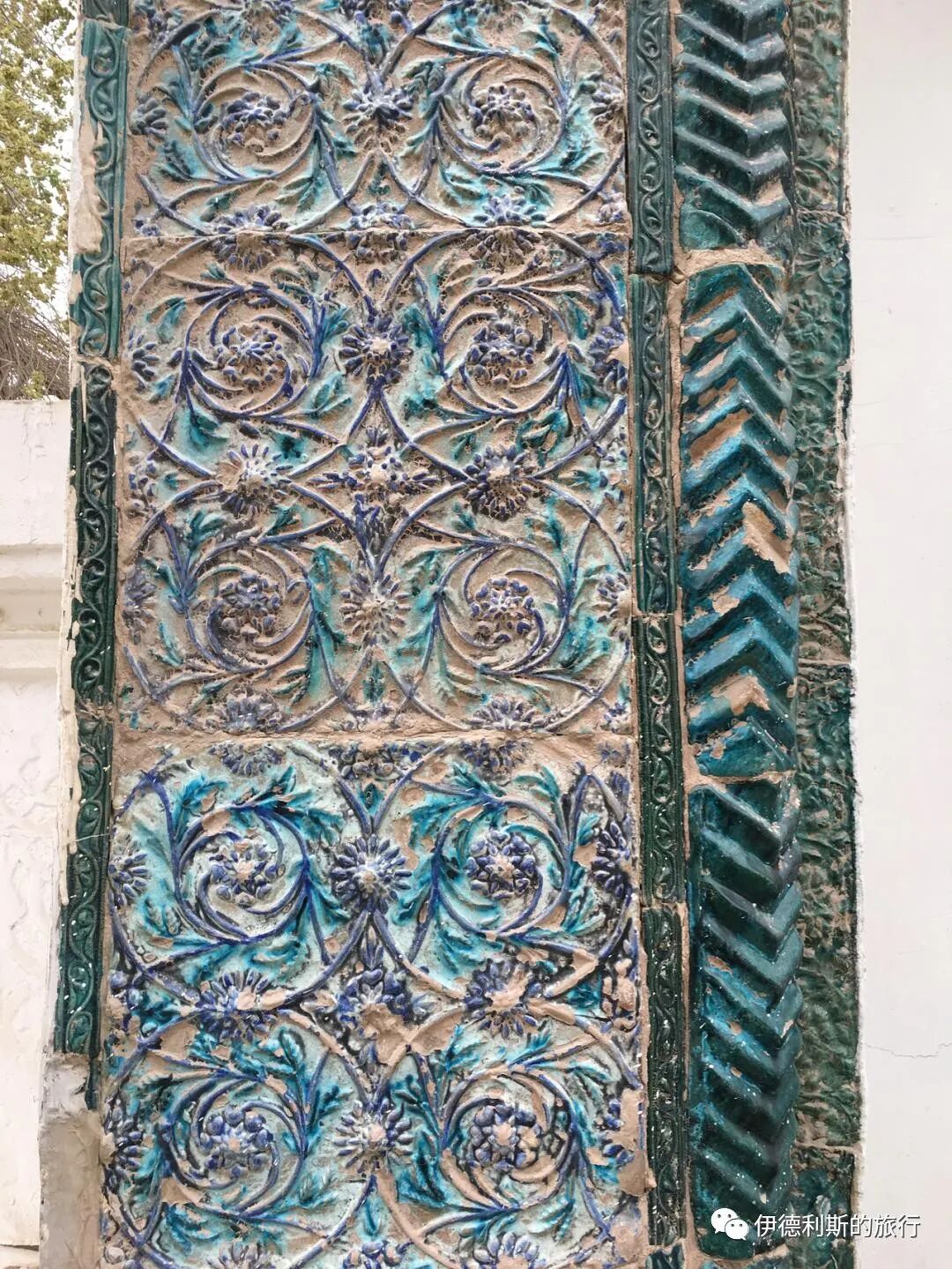
The Altun Mosque next to the royal tomb is said to have been built in 1533, and it now looks as it did after renovations in 1735.
During the reign of Rashid Khan, foreign wars decreased significantly, but the success rate increased greatly. The national situation stabilized, and social, economic, and cultural life began to recover. According to the History of Musicians (Tavārikh-i mūsīqiyyūn) written in 1853 by the Hotan scholar Mulla Ismutulla Mujizi, during Rashid Khan's reign, Queen Amannisa Khan and the chief court musician Kidirhan organized a group of excellent musicians, singers, and poets to collect and organize the Muqam music circulating in various regions. This effort resulted in the compilation of 16 Muqam suites, including one set of suites processed by Amannisa Khan and another by Kidirhan. During the Yarkand Khanate, Muqam only existed in the form of the grand suite known as Qong Neghma. In 1879, musicians from Kashgar and Yarkand organized the Muqam again, adding the folk narrative poem Dastan and the song-and-dance form Mexirep, which made the structure of the Muqam much larger. In the 1950s, the Cultural Department of the Xinjiang Military District organized the recording of the entire Twelve Muqam as performed by the master Turdi Akhun. After being organized and edited, the musical scores were officially published in 1960, which finalized the Twelve Muqam.
A new tomb for Amannisa Khan was built at the entrance of the Yarkand Royal Tombs in the 1990s.
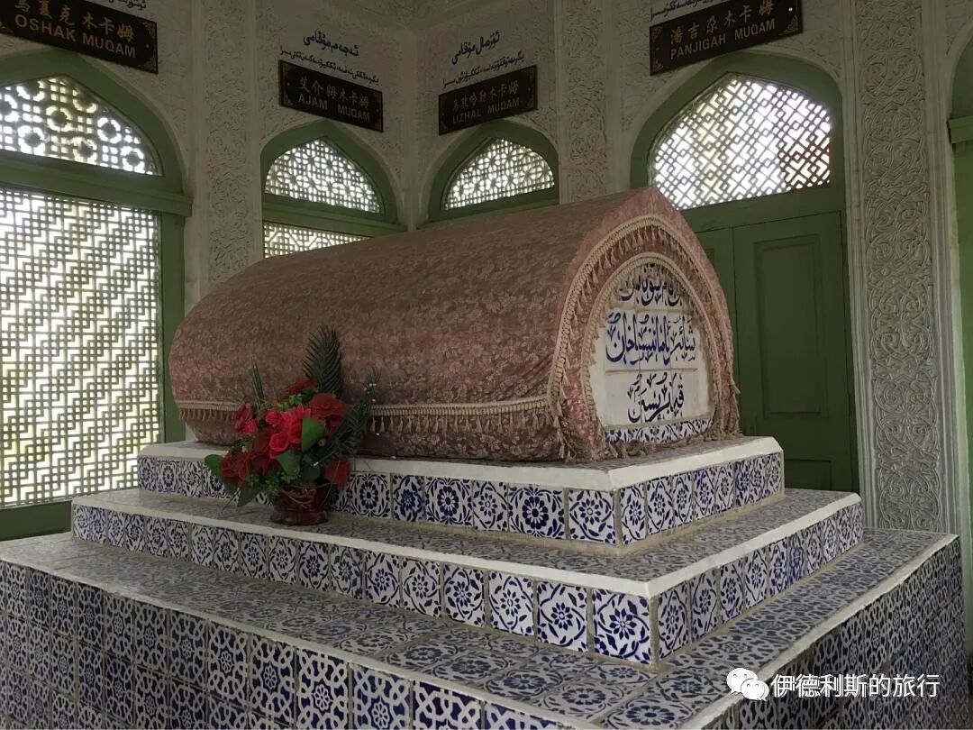
A statue of Amannisa Khan in the park.
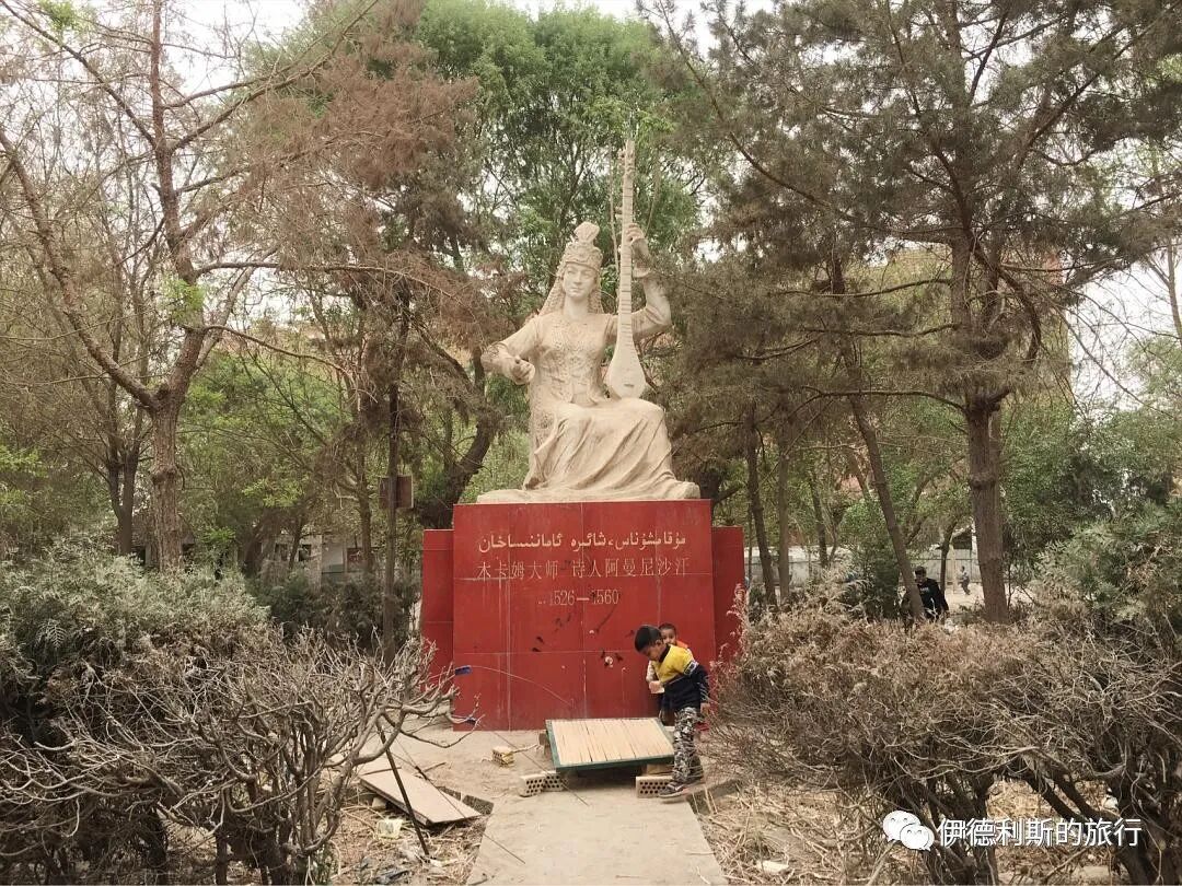
The tomb of Kidirhan is located within the Yarkand Royal Tombs.
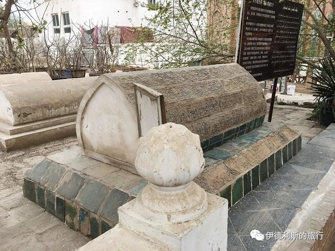
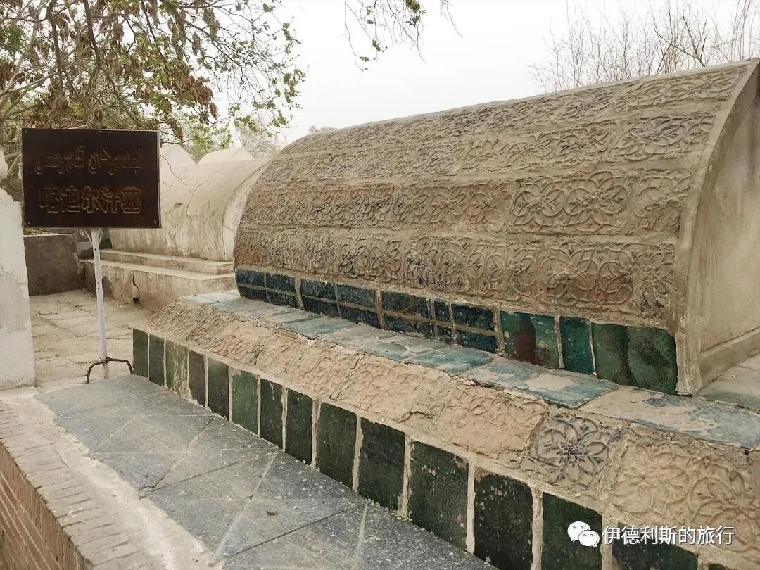
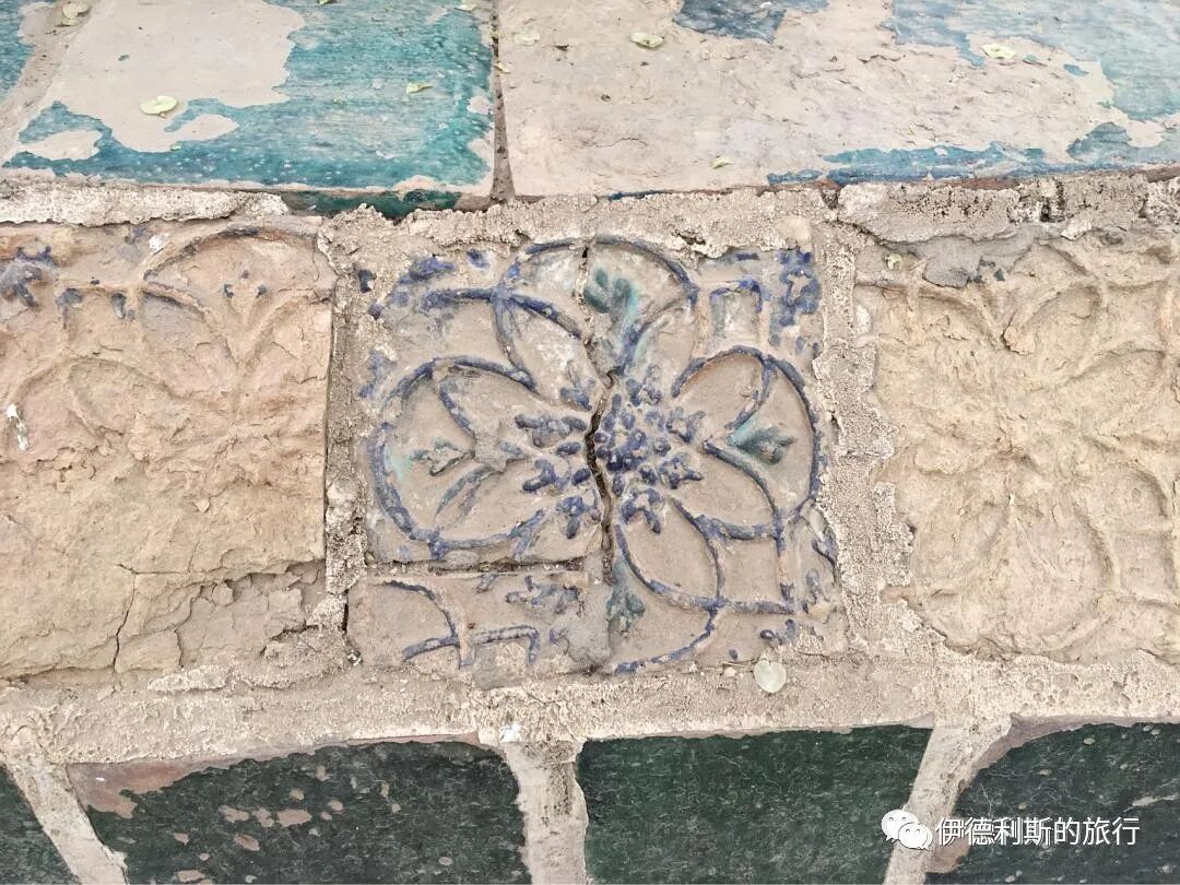
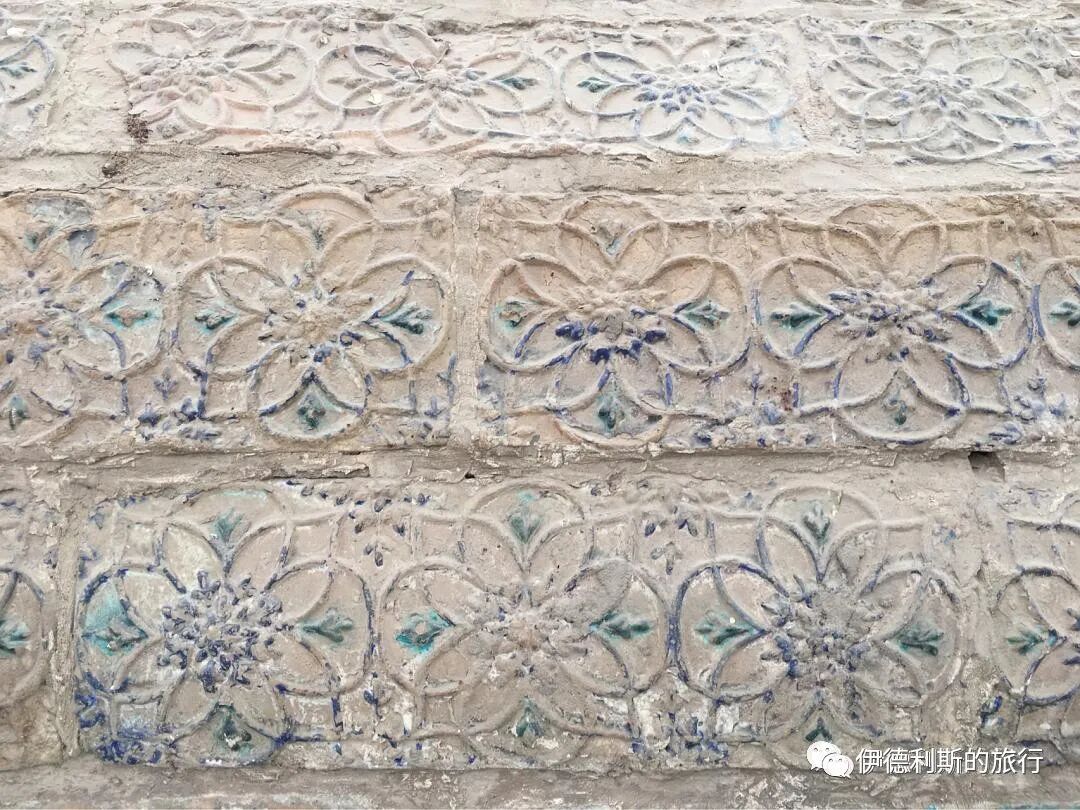
11. Haidar of Kashmir (1540-1551)
We head south, crossing the Pamir Mountains into the Kashmir Valley.
Mirza Muhammad Haidar was a Chagatai Mongol noble and a cousin of both Babur, the founder of the Mughal Empire, and Said Khan, the founder of the Yarkand Khanate. In his youth, he followed Said Khan in battle, helped establish the Yarkand Khanate, and was promoted to commander for his military achievements. After Said Khan died in 1533, the successor, Rashid Khan, killed many members of Haidar's family, forcing Haidar to flee to India to seek refuge with the Mughal Emperor Humayun. In 1540, after the Mughal Empire was conquered by the Sur Empire, Haidar led an army to conquer Kashmir, and he ruled it for 11 years in the name of the Mughal Empire.
Haidar spent five years in Kashmir writing the immortal Central Asian history book, The History of Rashid (Tarikh-i-Rashidi). This book is divided into two parts. The first part begins with the accession of Tughluq Timur, the first Khan of the Eastern Chagatai Khanate to convert to Islam, and continues through the reign of Rashid Khan of Yarkand. It spans two centuries and covers politics, economy, culture, and other aspects. The second part contains Haidar's personal experiences and observations, providing a very detailed and rare account of the founding of the Yarkand Khanate. In 1550, a noble rebellion broke out in Kashmir. Haidar was struck by an arrow and died while suppressing the rebellion, and the Shah Mir dynasty restored its rule over Kashmir.
The location of Srinagar, the capital of Kashmir.
My copy of The History of Rashid.
Haidar's tomb is located at Mazar-i-Salatin in Srinagar, and it was restored in 2018.
A photo of Haidar's tomb taken in 2018 by Bulat Sarsenbayev, the former Ambassador of Kazakhstan to India.
12. The Arghun Dynasty of Afghanistan and Pakistan (1520–1591)
We continue south into the Sindh province of Pakistan.
The Arghun dynasty was located between southern Afghanistan and Pakistan's Sindh province, and its rulers claimed to be descendants of the Ilkhanate ruler Arghun Khan. The Arghun family was originally the governor of the Timurid Empire in Kandahar, Afghanistan, and they began to oppose Babur, the founder of the Mughal Empire, in the early 16th century. Feeling threatened by Babur, the Arghun family invaded Sindh in 1520, conquered the local Samma dynasty, and began their rule over the Sindh region. In 1522, after a long siege, Babur captured Kandahar, and the Arghun dynasty officially moved its capital to Bukkur in the Sindh province of Pakistan.
In 1550, the Arghun dynasty was ruled by Shah Husayn. In 1540, the Mughal Emperor Humayun was driven out of India by the Sur Empire. Humayun asked Shah Hussain for help fighting the Sur Empire, but he was refused. Later, Humayun tried to take Sindh province but failed. In 1543, he finally left the Arghun dynasty and headed to Kandahar.
The location of Bhakkar city in Pakistan.
That is the end of the second part of our journey. In the next part, we will go deeper into the South Asian subcontinent to look at the Muslim dynasties there.
Islamic World in 1550: Africa, Ottoman Lands and Safavid Iran
Articles • ali2007fr posted the article • 0 comments • 112 views • 2026-05-18 09:20
Summary: Islamic World in 1550: Africa, Ottoman Lands and Safavid Iran is presented here as a firsthand travel account in clear English, beginning with this scene: I started staying home in mid-November. I wanted to use this time to do things I had always planned, so I decided to take an online tour of the Islamic world. The account keeps its focus on Islamic World, Ottoman History, Safavid Iran while preserving the names, places, food, and historical details from the Chinese source.
I started staying home in mid-November. I wanted to use this time to do things I had always planned, so I decided to take an online tour of the Islamic world. I chose the year 1550 because my previous travels abroad showed me that many interesting things really happened in the Islamic world during the first half of the 16th century. During my travels, I saw the Ottoman Empire reaching its peak under Suleiman the Magnificent, the Crimean Khanate building a new capital in a valley, the Kazan Khanate about to be conquered by Tsarist Russia, the Bukhara and Yarkent Khanates just being established, the Sur Empire in Afghanistan sweeping through northern India to conquer the Mughal Empire, and the island of Java in Indonesia forming a unique Javanese Islamic culture under the influence of Sufi missionaries. This gave me an idea to see exactly which Islamic countries existed in 1550 and what was happening in them.
After researching, I found that in 1550 there were at least 50 Islamic countries and regimes spanning Africa, West Asia, Central Asia, South Asia, and Southeast Asia, each with its own distinct cultural traditions and history. Out of these 50 countries and regimes, I will detail 9 that I have visited before, including the Ottoman Empire, the Crimean Khanate, the Kazan Khanate, the Bukhara Khanate, the Yarkent Khanate, the Sur Empire, the Golconda Sultanate, the Banten Sultanate, and the Demak Sultanate. I hope this online trip helps everyone imagine the atmosphere of the Islamic world in 1550.
Besides these 50 countries, there are other Islamic nations I did not include this time, and I hope to find more information about them in the future.
Let me briefly introduce the travel route for this trip:
Our journey starts in Morocco in the far northwest of Africa, moves east into Algeria and Tunisia, and then heads south across the Sahara Desert into the savanna. Then we will cross the African continent to the east, enter the Nile River basin, and arrive at the Somali Peninsula by the Indian Ocean. We will sail north, pass through the Gulf of Aden and the Red Sea to reach Egypt, cross the Mediterranean to Istanbul, and then head east to Iran. This is the first part.
In the second part, we will visit 12 countries ruled by the descendants of Genghis Khan. We start from the Crimean Peninsula, head east to the Volga Delta, go north to the Ryazan region of Russia, and then east to the city of Kazan on the Volga River. We continue east to the Irtysh River, then south to the Kazakh steppe, east into the Transoxiana region, cross the Tianshan Mountains into southern Xinjiang, pass through the Pamir Plateau into Kashmir, and finally enter the Sindh region of Pakistan.
In the third part, we will experience the Islamic culture of South Asia. We first arrive in Delhi, then head south into Gujarat and central India. Next, we will enter the Deccan Plateau, visit the 5 sultanates on the plateau, and finally arrive in the Maldives by boat.
In the fourth part, we will cross the Bay of Bengal to Southeast Asia. We first enter the Pattani region of Thailand, then head south along the Malay Peninsula, pass by 3 sultanates founded by princes of Malacca, and then take a boat past Sumatra and Java to visit the most unique Islamic culture there. Then we come to the Spice Islands in eastern Indonesia to see the influence of the Portuguese and Spanish, and finally arrive in Brunei and the southern Philippines. Our 1550 world Islamic tour ends here.
General Table of Contents
The Vast African Continent
1. Saadi Sultanate of Morocco (1510-1659)
2. Kingdom of Tlemcen in Algeria (1235-1556)
3. Ottoman Regency of Algiers in Algeria (1516-1830)
4. Kingdom of Beni Abbas in Algeria (1510-1872)
5. Kingdom of Kuku in Algeria (1515-1638)
6. Hafsid Dynasty of Tunisia (1229-1574)
7. Songhai Empire in West Africa (1464-1591)
8. Mali Empire in West Africa (1230-1672)
9. Funj Sultanate of Sudan (1504-1821)
10. Adal Sultanate in Ethiopia (1415-1577)
11. Ajuran Sultanate in Somalia (13th century-late 17th century)
Ottoman Empire spanning Europe, Asia, and Africa (1299-1922)
12. Ottoman Egypt Province (1517-1867)
13. Istanbul, capital of the Ottoman Empire (1453-1922)
14. Safavid Dynasty in Iran (1501-1736)
Legacy of the Mongol Empire
15. Crimean Khanate in Ukraine (1441-1783)
16. Astrakhan Khanate in Russia (1466-1556)
17. Nogai Khanate in Russia and Kazakhstan (1440-1634)
18. Qasim Khanate in Russia (1452-1681)
19. Kazan Khanate in Russia (1438-1552)
20. Sibir Khanate in Russia (1468-1598)
21. Kazakh Khanate in Kazakhstan (1465-1587)
22. Khanate of Khiva in Turkmenistan (1511-1920)
23. Khanate of Bukhara in Uzbekistan (1500-1785)
24. Yarkent Khanate in China (1514-1680)
25. Haidar in Kashmir (1540-1550)
26. Arghun Dynasty in Afghanistan and Pakistan (1520-1591)
27. Sur Dynasty that swept through northern India (1538-1556)
Legacy of the Delhi Sultanate
28. Gujarat Sultanate in western India (1407-1573)
29. Khandesh Sultanate in central India (1382-1601)
Five Deccan Sultanates
30. Berar Sultanate on the Deccan Plateau (1490-1572)
31. Ahmadnagar Sultanate on the Deccan Plateau (1490-1636)
32. Bidar Sultanate on the Deccan Plateau (1492-1619)
33. Golconda Sultanate on the Deccan Plateau (1518-1687)
34. Bijapur Sultanate on the Deccan Plateau (1490-1686)
35. Maldive Sultanate in the Indian Ocean (1153-1968)
36. Pattani Sultanate in Thailand (1457? -1902)
The legacy of the Malacca Sultanate.
37. Perak Sultanate in Malaysia (1528–present).
38. Pahang Sultanate in Malaysia (1470–1623).
39. Johor Sultanate in Malaysia (1528–present).
Sultanates of Indonesia.
40. Aceh Sultanate in Indonesia (1496–1903).
41. Banten Sultanate in Indonesia (1527–1813).
42. Cirebon Sultanate in Indonesia (1447–1679).
43. Demak Sultanate in Indonesia (1475–1568).
The four sultanates of the Spice Islands.
44. Ternate Sultanate in Indonesia (1486–1914).
45. Tidore Sultanate in Indonesia (1450–1967).
46. Jailolo Sultanate in Indonesia (late 15th century–1832).
47. Bacan Sultanate in Indonesia (late 15th century–1965).
48. Maguindanao Sultanate in the Philippines (1520–1905).
49. Sulu Sultanate in the Philippines (1457–1915).
50. Brunei Sultanate in Brunei (1368–1888).
1. Saadi Sultanate of Morocco (1510-1659)
Our journey through the Islamic world begins in the ancient city of Marrakesh, Morocco.
The sultans of the Saadi Sultanate claimed to be descendants of Imam Hassan, the grandson of the Prophet. They established their sultanate in southern Morocco in the early 16th century to resist the Portuguese invasion. They made Marrakesh their capital in 1524, drove the Portuguese out of Morocco in 1541, and then attacked the Wattasid dynasty of the northern Berber people, capturing their capital, Fez, in 1549.
By 1550, the eastward expansion of the Saadi Sultanate caused friction with the Ottoman Empire. At this time, the Ottoman Empire had already expanded into Algeria and was actively preparing for war against the Saadi Sultanate.
Under Saadi rule, Marrakesh became a commercial hub connecting the Maghreb, the Mediterranean, and sub-Saharan Africa. Today, the city of Marrakesh preserves the gongbei (zawiya) complex of the Sufi sheikh Sidi Muhammad Ben Sliman al-Jazuli, which was built in 1524. Jazuli was highly respected by the Saadi family, so when they made Marrakesh their capital in 1524, they moved his gongbei into the city.
The north side of the tomb of Sidi Muhammad Ben Slimane al-Jazuli, photographed by Robert Prazeres in 2014.
The location of the city of Marrakesh.
2. Kingdom of Tlemcen in Algeria (1235-1556)
We head east from Morocco to the city of Tlemcen in northwestern Algeria.
In the early 16th century, Algeria was ruled by the Tlemcen Kingdom, which was established by the Berbers. At this time, the Tlemcen Kingdom was very weak and was fought over repeatedly by Spain and the Ottomans.
In June 1550, the Saadi Sultanate of Morocco captured the capital of the Tlemcen Kingdom without a fight and decided to continue pushing eastward.
The location of Tlemcen city.
3. Ottoman Regency of Algiers in Algeria (1516-1830)
Let us continue east to Algiers, which was under the control of Ottoman pirates.
In 1516, the Ottoman pirate brothers Barbarossa (Red Beard) captured Algiers from Spanish rule and used it as a pirate base to fight against Spain repeatedly. In 1545, Red Beard was called to Istanbul to retire, and his son Hasan Pasha became the Ottoman governor of Algiers. Hasan Pasha captured Tlemcen in 1545, but it was taken back two years later. In 1548, Ottoman Sultan Suleiman the Magnificent removed him from office and replaced him with the Ottoman naval commander Dragut.
In 1550, Dragut was leading the Ottoman navy on raids across the Mediterranean. That year, he attacked Mediterranean coastal regions including Tunisia, Sardinia, Corsica, Genoa in Italy, and Spain. In September, Dragut was trapped in a lagoon in Tunisia by the fleet of the Knights of Malta. He escaped by quickly digging a canal and laying down greased wooden planks to drag all his ships out of the lagoon, successfully sailing back to Istanbul.
The Death of Dragut, painted by Maltese artist Giuseppe Calì in 1867.
Today in Algiers, you can see the Safir mosque, built in 1534 by Safar bin Abdullah, a general in the Barbarossa fleet. The mosque features Ottoman architectural style.
Photo by Brahimpic in 2014.
The location of Algiers.
4. Kingdom of Beni Abbas in Algeria (1510-1872)
In the mountains east of Algiers, there were two small states established by the Berbers.
The Kingdom of Beni Abbas was a small state of the Kabyle Berbers in the mountains of northern Algeria. It held a key strategic position on the trade route between the Mediterranean and the Sahara Desert. In the 16th century, the Kingdom of Beni Abbas attracted many Andalusians, Christians, and Jews fleeing Spain and Algiers, which enriched the kingdom's cultural diversity.
In 1550, the Ottoman Empire sent troops to attack the Kingdom of Beni Abbas twice, but they were repelled, so the Ottomans signed a treaty with them.
The location of the capital, Kalâa of Ait Abbas.
5. Kingdom of Kuku in Algeria (1515-1638)
The Kingdom of Kuku was another state established by the Kabyle Berbers in the mountains of northern Algeria. It was located east of Algiers and was a rival to the Kingdom of Beni Abbas.
The location of Kuku city.
6. Hafsid Dynasty of Tunisia (1229-1574)
Continue east along the North African coast to reach the city of Tunis.
The Hafsid dynasty was a Berber dynasty that was also caught up in the repeated struggles between Spain and the Ottomans in the early 16th century.
In 1550, the Hafsid dynasty was a vassal state of Spain. They were not completely conquered by the Ottoman Empire until 1573.
Santiago Chikly castle, rebuilt by the Spanish in Tunis between 1546 and 1550. Photo by Imanis in 2013.
The location of Tunis.
7. Songhai Empire in West Africa (1464-1591)
Let us head south along the ancient trade routes across the vast Sahara Desert to reach the ancient city of Gao in Mali.
The Songhai Empire was established by the Songhai people of West Africa. It was located in the semi-arid region between the Sahara Desert and the savanna. At its peak, it was one of the largest countries in Africa, with Timbuktu and Djenné as its main cities.
In 1550, the emperor ruling the Songhai Empire was Askia Daoud (reigned 1549–1582). Under his rule, the Songhai Empire enjoyed peace at home, expanded its borders, and saw its economy thrive. At that time, Timbuktu was the center of Islamic culture in Africa, placing great importance on education and preserving a vast collection of book manuscripts.
The capital of the Songhai Empire was located in Gao, Mali, where the tomb of the Songhai emperor Askia Muhammad I, who died in 1538, stands. It was named a UNESCO World Heritage site in 2004. People say the mud and wood used for this tomb were brought back from Mecca by the emperor himself after his hajj.
The Tomb of Askia, photographed by Our Place for the World Heritage website in 2007.
The location of Gao, the capital of the Songhai Empire.
8. Mali Empire in West Africa (1230-1672)
Let us continue south into the savanna to visit the mysterious Mali Empire.
The Mali Empire was once the largest empire in West Africa, though it was gradually replaced by the Songhai Empire from the north after the 16th century. The economic focus of the Mali Empire shifted from trans-Saharan trade to commerce in coastal regions.
In 1545, the Songhai Empire invaded the capital of the Mali Empire, but they did not actually take control of it. By 1550, the Mali Empire still held onto a certain amount of territory. That year, they attacked a trade center in southern Ghana and seized the gold there.
The region attacked by the Mali Empire in 1550.
9. Funj Sultanate of Sudan (1504-1821)
This time, we will travel a long distance across the African continent to reach Sudan on the upper Nile.
The Funj Sultanate was a state established by the Funj people on the upper Nile. Due to the spread of Sufism along the upper Nile in the 16th century, the founder of the Funj Kingdom, Amara Dunqas, became a Muslim. However, the Funj people still kept many local customs and Christian rituals, gradually forming a unique Sudanese folk Islamic tradition.
To counter the expansion of the Ottoman Empire, the Funj Sultanate formed an alliance with the Ethiopian Empire in the early 16th century and exported horses and camels to them.
Sennar, the capital of the Funj Sultanate.
10. Adal Sultanate in Ethiopia (1415-1577)
Let us continue east into the ancient Ethiopian city of Harar.
The Adal Sultanate was located east of the Funj Sultanate on the northern Somali Peninsula and served as a commercial and political partner to the Ottoman Empire. Between 1529 and 1543, with help from the Ottoman Empire, the Adal Sultanate fought an 11-year war against the Ethiopian Kingdom, which eventually weakened both sides.
In 1550, the Adal Sultanate was ruled by Nur ibn Mujahid, who built a city wall with five gates in the capital, Harar. This walled city, known as Harar Jugol, was named a UNESCO World Heritage site in 2006. Harar is located in eastern Ethiopia and served as the capital of the Adal Sultanate from 1520 to 1577. Historically, this city has been an important African commercial and Islamic center, connecting trade routes from Ethiopia to the Somali Peninsula, the Arabian Peninsula, and the heart of Asia.
The Harar city wall, photographed by Sailko in 2018.
The location of the city of Harar.
11. Ajuran Sultanate in Somalia (13th century-late 17th century)
We continue south to the port city of Mogadishu on the Indian Ocean.
The Ajuran Sultanate was located on the Somali Peninsula, south of the Adal Sultanate. It held a key position in North Indian Ocean trade, with ships traveling between East Asia, South Asia, Europe, and Africa, leaving behind many ancient monuments in Somalia.
As a maritime nation, the Ajuran Sultanate not only allied with the Ottoman Empire but also maintained friendly relations with the Ming Dynasty. They were the first African country to send envoys to the Ming Dynasty.
In the early 16th century, the wealthiest Indian Ocean port city in the Sultanate was Mogadishu, which is the current capital of Somalia. According to the 16th-century Andalusian traveler Leo Africanus, the people of Mogadishu at that time had olive skin, wore white robes and white turbans, and used Arabic as their common language. Mogadishu had stone walls and was equipped with muskets and cannons imported from the Ottoman Empire.
The location of Mogadishu city.
Ottoman Empire spanning Europe, Asia, and Africa (1299-1922)
Let us take a ship from the Indian Ocean port of Mogadishu, sail north along the Somali Peninsula, enter the Red Sea from the Gulf of Aden, and arrive in Cairo, Egypt, under Ottoman rule.
12. Ottoman Egypt Province (1517-1867)
In 1517, the Ottoman Empire conquered the Mamluk Sultanate, which had ruled Egypt for over two hundred years. Although they appointed a series of Egyptian governors, the political structure and cultural arts still continued the traditions of the Mamluk period. In early 16th-century Cairo, Mamluk and Ottoman architectural styles began to merge.
In 1528, the Egyptian governor Hadım Suleiman Pasha built the Suleiman Pasha Mosque for the Ottoman Janissaries stationed in the Cairo Citadel. This was the first Ottoman-style mosque in Egypt.
Suleiman Pasha Mosque photographed by Houssam_Daowd_102 in 2019.
The location of Cairo.
13. Istanbul, capital of the Ottoman Empire (1453-1922)
We cross the Mediterranean Sea and arrive at Istanbul, the capital of the Ottoman Empire. At that time, the eastern Mediterranean had become an inland sea for the Ottoman Empire.
In the first half of the 16th century, the Ottoman Empire entered its Golden Age under the rule of Suleiman the Magnificent (reigned 1520-1566). Ottoman territory continued to expand. They besieged Vienna twice in 1529 and 1532, captured Baghdad in 1535, and defeated the Portuguese to control the Red Sea in 1538.
Meanwhile, under the patronage of Suleiman the Magnificent, various talented craftsmen and artists came to the Ottoman court, leading to great cultural prosperity. Mimar Sinan, the court architect for Suleiman the Magnificent, built a series of structures in Istanbul that became the best witnesses of that era.
The Haseki Hürrem Sultan Complex (Haseki Hürrem Sultan Külliyesi) was commissioned by Suleiman the Magnificent's wife, Hürrem Sultan, and built by Mimar Sinan in 1539. It was the first complex built by Mimar Sinan after he became the royal architect. Hürrem Sultan, known as Roxelana, was the first empress in Ottoman history to receive the title of 'Haseki Sultan' (the Sultan's favorite). She is also known as the most powerful and controversial woman in Ottoman history.
After becoming empress, Hürrem Sultan began building a series of public structures, the first of which was this empress complex. The complex includes a Friday mosque (Jumu'ah mosque), a public kitchen (imaret), a religious school (madrasa), an elementary school (mektep), and a hospital (darüssifa). The mosque was completed in 1539, the religious school and kitchen were finished the following year, and the hospital was not completed until 1550. When designing the entire complex, Sinan arranged the different buildings at various angles, leaving only narrow passages or gaps between them. This arrangement created rich perspective effects that almost never appeared in his later works.
The mosque (1539) is at the southernmost part of the complex, separated from the other parts by a narrow alley. The mosque was originally a simple, traditional single-dome, single-minaret structure made of alternating brick and stone. The porch is supported by six marble columns holding up five small domes. The mosque was expanded in 1612, growing from a single dome to a double dome, which doubled its area. The mosque has no tiles, and the current paintings were added later. During this period, Sinan had not yet started to innovate in mosque architecture.
The madrasa (1540) is directly opposite the mosque and consists of sixteen student rooms and a large lecture hall arranged in a rectangle.
The primary school (1540) is known as the most beautiful primary school built by Mimar Sinan.
The hospital (1550) is in the far north and was built by Hurrem Sultan specifically for women. The hospital courtyard is octagonal, with rooms on three sides and windows facing the street on the fourth side. The two arched gateways (iwan) at the corners of the octagonal courtyard and the dome foreshadowed Sinan's later development of arches and domes.
A diagram of the public kitchen published by Cornelius Gurlitt in 1912.
The Mihrimah Sultan Complex (Mihrimah Sultan Külliyesi) was commissioned in 1543 by Mihrimah Sultan, the daughter of Suleiman the Magnificent and Hurrem Sultan, and built by Mimar Sinan. It is the second complex by Mimar Sinan in Istanbul that still stands today.
Mihrimah Sultan was the wife of the Grand Vizier Rustem Pasha and is known as the most powerful princess in the history of the Ottoman Empire.
The entire complex is cleverly built on a slope extending to the coast. It includes a mosque, a madrasa, a guesthouse, a canteen, a primary school, and some later tombs. The guesthouse and canteen were destroyed by fire in 1772.
The Mihrimah Sultan Mosque is the first semi-domed mosque designed by Mimar Sinan. The mosque consists of one main dome and three semi-domes. This shape expands the interior space, making people feel like they are under the dome as soon as they enter the main hall. Although the mosque itself has limited depth, this design increases the sense of openness. Mimar Sinan added a T-shaped canopy in front of the porch to soften the hardness of the entrance facade.
A diagram of the mosque published by Cornelius Gurlitt in 1912.
The madrasa consists of sixteen student rooms and a large lecture hall in a rectangle. It is now a hospital, and the integrity of the cultural heritage has been damaged.
The Sehzade Complex (Sehzade Külliye) is located on the third hill of the old city of Istanbul. Built between 1543 and 1548, it is considered Mimar Sinan's most important early work and his first masterpiece.
The complex was built by Suleiman the Magnificent to commemorate his beloved son, Prince Mehmed (Sehzade Mehmed), who died young. Prince Mehmed was the son of Suleiman the Magnificent and Hurrem Sultan. He was favored from a young age and was the most likely heir, but he sadly died of smallpox (some say murder) in 1543. After the prince died, Suleiman the Magnificent was heartbroken. Traditionally, princes were buried in Bursa, but the Sultan decided to commission Mimar Sinan to build a tomb for the prince in Istanbul and match it with a complex.
The Sehzade Complex was the first work Mimar Sinan was directly commissioned to build by Suleiman the Magnificent. It was also his most ambitious early work, with a much grander scale and more decoration than his previous projects.
The complex includes a mosque, five tombs, a madrasa, a guesthouse, a hostel, a public canteen, and a primary school. These buildings are freely distributed on flat ground without a deliberate attempt at symmetry. the mosque is not a single unit with the other buildings; the other structures are distributed in the gardens or streets surrounding the mosque.
The mosque (1543-1548) is the second semi-domed mosque designed by Mimar Sinan, consisting of one main dome and four semi-domes. This is both an improvement on Sinan's previous work, the Mihrimah Sultan Mosque with its three semi-domes, and a reinterpretation of designs by predecessors like the Fatih Mosque (1471) and the Bayezid II Mosque (1506). This design isolates the four pillars supporting the central dome, creating a more stunning visual effect. The interior of the mosque is a square that unfolds along a central vertical axis. When people enter, they can immediately feel the dominance of the central dome. the porches on the walls on both sides of the mosque are a bold innovation, which also foreshadows the future direction of Ottoman mosque development. This design softens the flanks of the building and hides the buttresses, allowing the facade to blend in more perfectly. The design of the Sehzade Mosque had gradually moved away from the traditional Ottoman mosque model and began to move toward Sinan's own unique style.
A diagram of the mosque published by Cornelius Gurlitt in 1912.
The Tomb of Prince Mehmed (1543) sits southeast of the mosque. It has an octagonal structure, Persian inscriptions at the entrance, and Cuerda Seca tiles inside.
The madrasa (1546) is outside the garden on the north side of the mosque. It forms a rectangle surrounded by a gallery, with 21 student rooms and one large lecture hall on three sides. The fountain in the middle of the courtyard still keeps its Seljuk-era (11th to 13th century) tomb tower (kumbet) structure.
The public kitchen (1543-1548) is across the street east of the mosque. It consists of two buildings, each with six domes and a courtyard in the middle.
The octagonal tomb of Hüsrev Paşa is in the west of Istanbul. It is known as one of the most beautiful tombs built by Mimar Sinan. Hüsrev Paşa was a vizier of the Ottoman Empire. People called him the Mad Hüsrev Paşa because he had a bad temper. Hüsrev Paşa was born in Bosnia in 1495 and came from the famous Sokollu family. He became the governor of Egypt in 1535 and the Second Vizier in 1538. In 1544, Hüsrev Paşa lost the race for Grand Vizier to Rüstem Paşa. He died of illness shortly after, and Mimar Sinan built his tomb.
The Yavuz Sultan Selim Medrese is in the west of Istanbul. Suleiman the Magnificent commissioned Mimar Sinan to build it, and it is named after the Sultan's father, Selim I. The madrasa consists of 20 student rooms on three sides and one large lecture hall. In 1563, the lecture hall was turned into a prayer hall, and a minaret (banketa) was added. The minaret is now destroyed, and the madrasa has become a hospital.
The Rüstem Paşa Medrese is not far northeast of the Grand Bazaar in Istanbul and was built in 1550. This madrasa is Mimar Sinan's new take on the famous Büyük Ağa Medrese in Amasya, which was built in 1488. The Büyük Ağa Medrese was the first octagonal madrasa in Turkey. Mimar Sinan kept the internal octagonal courtyard but changed the outside to a rectangle, which was a further development in Ottoman madrasa architecture.
14. Safavid Dynasty in Iran (1501-1736)
We headed east from Istanbul, passed through several Kurdish emirates, and arrived in Tabriz in northwestern Iran.
The Safavid dynasty is considered the most important dynasty in Iran since the Sassanid Empire. The Safavid dynasty made Twelver Shia Islam the state religion, which was a major event in Islamic history. The rulers of the Safavid dynasty claimed to be descendants of the Prophet Muhammad, but historians believe they were Turkified Iranians from Iranian Kurdistan.
In 1501, Ismail I captured Tabriz, the capital of the Aq Qoyunlu, and made it the capital of the Safavid dynasty. Tabriz is now the capital of East Azerbaijan Province, and most of its residents are Azerbaijanis.
In 1550, the Safavid dynasty was ruled by Tahmasp I and was in a break between two large-scale wars with the Ottoman Empire. Between 1532 and 1555, the Ottoman Empire led by Suleiman the Magnificent and the Safavid dynasty led by Tahmasp I fought a 23-year war. Between 1548 and 1549, the Safavid dynasty used a scorched-earth policy to level Armenia, but the Ottoman army still pushed deep into the Iranian interior. After occupying the Safavid capital of Tabriz, the Ottoman army looted Hamadan, Qom, and Kashan, reaching as far as Isfahan. Tahmasp I chose not to fight the Ottoman army head-on, and the Ottoman army was forced to retreat because they ran out of food and supplies. Shortly after this in 1555, to avoid attacks from the Ottoman Empire, the Safavid dynasty moved its capital from Tabriz in the northwest to Qazvin, which was further inland.
A miniature painting of Tahmasp I painted in Qazvin, Iran, in 1575.
The location of Tabriz.
That is all for the first part. In the next post, we will visit 12 Islamic countries ruled by the descendants of Genghis Khan. view all
Summary: Islamic World in 1550: Africa, Ottoman Lands and Safavid Iran is presented here as a firsthand travel account in clear English, beginning with this scene: I started staying home in mid-November. I wanted to use this time to do things I had always planned, so I decided to take an online tour of the Islamic world. The account keeps its focus on Islamic World, Ottoman History, Safavid Iran while preserving the names, places, food, and historical details from the Chinese source.
I started staying home in mid-November. I wanted to use this time to do things I had always planned, so I decided to take an online tour of the Islamic world. I chose the year 1550 because my previous travels abroad showed me that many interesting things really happened in the Islamic world during the first half of the 16th century. During my travels, I saw the Ottoman Empire reaching its peak under Suleiman the Magnificent, the Crimean Khanate building a new capital in a valley, the Kazan Khanate about to be conquered by Tsarist Russia, the Bukhara and Yarkent Khanates just being established, the Sur Empire in Afghanistan sweeping through northern India to conquer the Mughal Empire, and the island of Java in Indonesia forming a unique Javanese Islamic culture under the influence of Sufi missionaries. This gave me an idea to see exactly which Islamic countries existed in 1550 and what was happening in them.
After researching, I found that in 1550 there were at least 50 Islamic countries and regimes spanning Africa, West Asia, Central Asia, South Asia, and Southeast Asia, each with its own distinct cultural traditions and history. Out of these 50 countries and regimes, I will detail 9 that I have visited before, including the Ottoman Empire, the Crimean Khanate, the Kazan Khanate, the Bukhara Khanate, the Yarkent Khanate, the Sur Empire, the Golconda Sultanate, the Banten Sultanate, and the Demak Sultanate. I hope this online trip helps everyone imagine the atmosphere of the Islamic world in 1550.
Besides these 50 countries, there are other Islamic nations I did not include this time, and I hope to find more information about them in the future.
Let me briefly introduce the travel route for this trip:
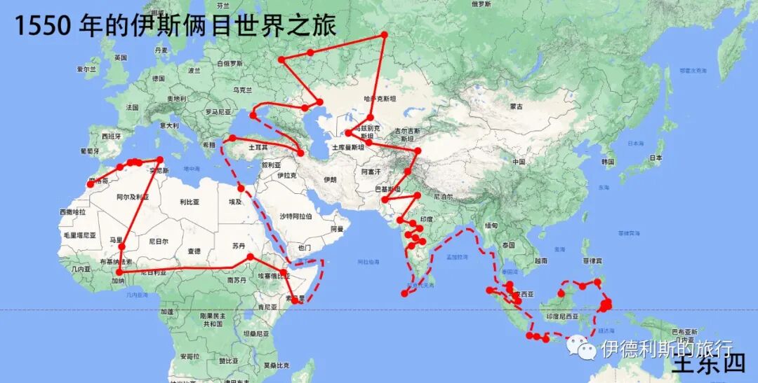
Our journey starts in Morocco in the far northwest of Africa, moves east into Algeria and Tunisia, and then heads south across the Sahara Desert into the savanna. Then we will cross the African continent to the east, enter the Nile River basin, and arrive at the Somali Peninsula by the Indian Ocean. We will sail north, pass through the Gulf of Aden and the Red Sea to reach Egypt, cross the Mediterranean to Istanbul, and then head east to Iran. This is the first part.
In the second part, we will visit 12 countries ruled by the descendants of Genghis Khan. We start from the Crimean Peninsula, head east to the Volga Delta, go north to the Ryazan region of Russia, and then east to the city of Kazan on the Volga River. We continue east to the Irtysh River, then south to the Kazakh steppe, east into the Transoxiana region, cross the Tianshan Mountains into southern Xinjiang, pass through the Pamir Plateau into Kashmir, and finally enter the Sindh region of Pakistan.
In the third part, we will experience the Islamic culture of South Asia. We first arrive in Delhi, then head south into Gujarat and central India. Next, we will enter the Deccan Plateau, visit the 5 sultanates on the plateau, and finally arrive in the Maldives by boat.
In the fourth part, we will cross the Bay of Bengal to Southeast Asia. We first enter the Pattani region of Thailand, then head south along the Malay Peninsula, pass by 3 sultanates founded by princes of Malacca, and then take a boat past Sumatra and Java to visit the most unique Islamic culture there. Then we come to the Spice Islands in eastern Indonesia to see the influence of the Portuguese and Spanish, and finally arrive in Brunei and the southern Philippines. Our 1550 world Islamic tour ends here.
General Table of Contents
The Vast African Continent
1. Saadi Sultanate of Morocco (1510-1659)
2. Kingdom of Tlemcen in Algeria (1235-1556)
3. Ottoman Regency of Algiers in Algeria (1516-1830)
4. Kingdom of Beni Abbas in Algeria (1510-1872)
5. Kingdom of Kuku in Algeria (1515-1638)
6. Hafsid Dynasty of Tunisia (1229-1574)
7. Songhai Empire in West Africa (1464-1591)
8. Mali Empire in West Africa (1230-1672)
9. Funj Sultanate of Sudan (1504-1821)
10. Adal Sultanate in Ethiopia (1415-1577)
11. Ajuran Sultanate in Somalia (13th century-late 17th century)
Ottoman Empire spanning Europe, Asia, and Africa (1299-1922)
12. Ottoman Egypt Province (1517-1867)
13. Istanbul, capital of the Ottoman Empire (1453-1922)
14. Safavid Dynasty in Iran (1501-1736)
Legacy of the Mongol Empire
15. Crimean Khanate in Ukraine (1441-1783)
16. Astrakhan Khanate in Russia (1466-1556)
17. Nogai Khanate in Russia and Kazakhstan (1440-1634)
18. Qasim Khanate in Russia (1452-1681)
19. Kazan Khanate in Russia (1438-1552)
20. Sibir Khanate in Russia (1468-1598)
21. Kazakh Khanate in Kazakhstan (1465-1587)
22. Khanate of Khiva in Turkmenistan (1511-1920)
23. Khanate of Bukhara in Uzbekistan (1500-1785)
24. Yarkent Khanate in China (1514-1680)
25. Haidar in Kashmir (1540-1550)
26. Arghun Dynasty in Afghanistan and Pakistan (1520-1591)
27. Sur Dynasty that swept through northern India (1538-1556)
Legacy of the Delhi Sultanate
28. Gujarat Sultanate in western India (1407-1573)
29. Khandesh Sultanate in central India (1382-1601)
Five Deccan Sultanates
30. Berar Sultanate on the Deccan Plateau (1490-1572)
31. Ahmadnagar Sultanate on the Deccan Plateau (1490-1636)
32. Bidar Sultanate on the Deccan Plateau (1492-1619)
33. Golconda Sultanate on the Deccan Plateau (1518-1687)
34. Bijapur Sultanate on the Deccan Plateau (1490-1686)
35. Maldive Sultanate in the Indian Ocean (1153-1968)
36. Pattani Sultanate in Thailand (1457? -1902)
The legacy of the Malacca Sultanate.
37. Perak Sultanate in Malaysia (1528–present).
38. Pahang Sultanate in Malaysia (1470–1623).
39. Johor Sultanate in Malaysia (1528–present).
Sultanates of Indonesia.
40. Aceh Sultanate in Indonesia (1496–1903).
41. Banten Sultanate in Indonesia (1527–1813).
42. Cirebon Sultanate in Indonesia (1447–1679).
43. Demak Sultanate in Indonesia (1475–1568).
The four sultanates of the Spice Islands.
44. Ternate Sultanate in Indonesia (1486–1914).
45. Tidore Sultanate in Indonesia (1450–1967).
46. Jailolo Sultanate in Indonesia (late 15th century–1832).
47. Bacan Sultanate in Indonesia (late 15th century–1965).
48. Maguindanao Sultanate in the Philippines (1520–1905).
49. Sulu Sultanate in the Philippines (1457–1915).
50. Brunei Sultanate in Brunei (1368–1888).
1. Saadi Sultanate of Morocco (1510-1659)
Our journey through the Islamic world begins in the ancient city of Marrakesh, Morocco.
The sultans of the Saadi Sultanate claimed to be descendants of Imam Hassan, the grandson of the Prophet. They established their sultanate in southern Morocco in the early 16th century to resist the Portuguese invasion. They made Marrakesh their capital in 1524, drove the Portuguese out of Morocco in 1541, and then attacked the Wattasid dynasty of the northern Berber people, capturing their capital, Fez, in 1549.
By 1550, the eastward expansion of the Saadi Sultanate caused friction with the Ottoman Empire. At this time, the Ottoman Empire had already expanded into Algeria and was actively preparing for war against the Saadi Sultanate.
Under Saadi rule, Marrakesh became a commercial hub connecting the Maghreb, the Mediterranean, and sub-Saharan Africa. Today, the city of Marrakesh preserves the gongbei (zawiya) complex of the Sufi sheikh Sidi Muhammad Ben Sliman al-Jazuli, which was built in 1524. Jazuli was highly respected by the Saadi family, so when they made Marrakesh their capital in 1524, they moved his gongbei into the city.
The north side of the tomb of Sidi Muhammad Ben Slimane al-Jazuli, photographed by Robert Prazeres in 2014.
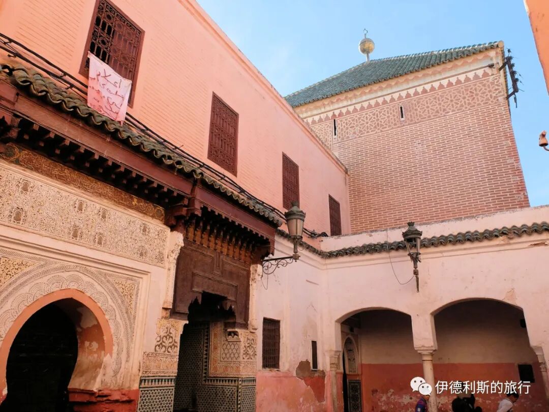
The location of the city of Marrakesh.
2. Kingdom of Tlemcen in Algeria (1235-1556)
We head east from Morocco to the city of Tlemcen in northwestern Algeria.
In the early 16th century, Algeria was ruled by the Tlemcen Kingdom, which was established by the Berbers. At this time, the Tlemcen Kingdom was very weak and was fought over repeatedly by Spain and the Ottomans.
In June 1550, the Saadi Sultanate of Morocco captured the capital of the Tlemcen Kingdom without a fight and decided to continue pushing eastward.
The location of Tlemcen city.
3. Ottoman Regency of Algiers in Algeria (1516-1830)
Let us continue east to Algiers, which was under the control of Ottoman pirates.
In 1516, the Ottoman pirate brothers Barbarossa (Red Beard) captured Algiers from Spanish rule and used it as a pirate base to fight against Spain repeatedly. In 1545, Red Beard was called to Istanbul to retire, and his son Hasan Pasha became the Ottoman governor of Algiers. Hasan Pasha captured Tlemcen in 1545, but it was taken back two years later. In 1548, Ottoman Sultan Suleiman the Magnificent removed him from office and replaced him with the Ottoman naval commander Dragut.
In 1550, Dragut was leading the Ottoman navy on raids across the Mediterranean. That year, he attacked Mediterranean coastal regions including Tunisia, Sardinia, Corsica, Genoa in Italy, and Spain. In September, Dragut was trapped in a lagoon in Tunisia by the fleet of the Knights of Malta. He escaped by quickly digging a canal and laying down greased wooden planks to drag all his ships out of the lagoon, successfully sailing back to Istanbul.
The Death of Dragut, painted by Maltese artist Giuseppe Calì in 1867.
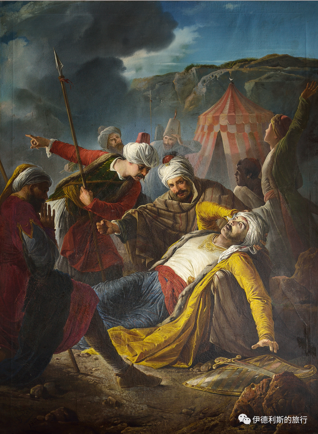
Today in Algiers, you can see the Safir mosque, built in 1534 by Safar bin Abdullah, a general in the Barbarossa fleet. The mosque features Ottoman architectural style.
Photo by Brahimpic in 2014.
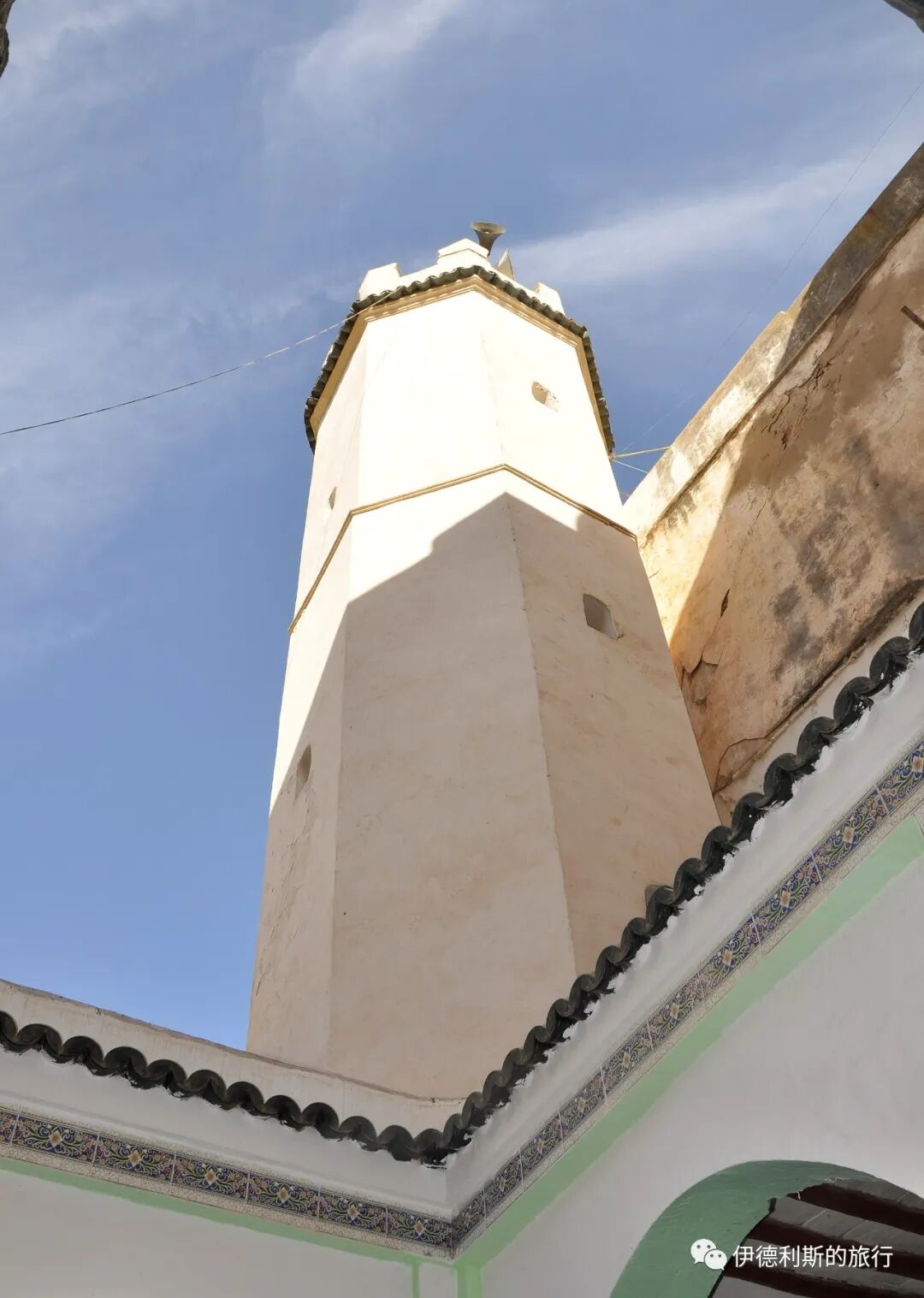
The location of Algiers.
4. Kingdom of Beni Abbas in Algeria (1510-1872)
In the mountains east of Algiers, there were two small states established by the Berbers.
The Kingdom of Beni Abbas was a small state of the Kabyle Berbers in the mountains of northern Algeria. It held a key strategic position on the trade route between the Mediterranean and the Sahara Desert. In the 16th century, the Kingdom of Beni Abbas attracted many Andalusians, Christians, and Jews fleeing Spain and Algiers, which enriched the kingdom's cultural diversity.
In 1550, the Ottoman Empire sent troops to attack the Kingdom of Beni Abbas twice, but they were repelled, so the Ottomans signed a treaty with them.
The location of the capital, Kalâa of Ait Abbas.
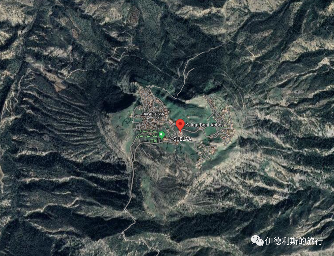
5. Kingdom of Kuku in Algeria (1515-1638)
The Kingdom of Kuku was another state established by the Kabyle Berbers in the mountains of northern Algeria. It was located east of Algiers and was a rival to the Kingdom of Beni Abbas.
The location of Kuku city.
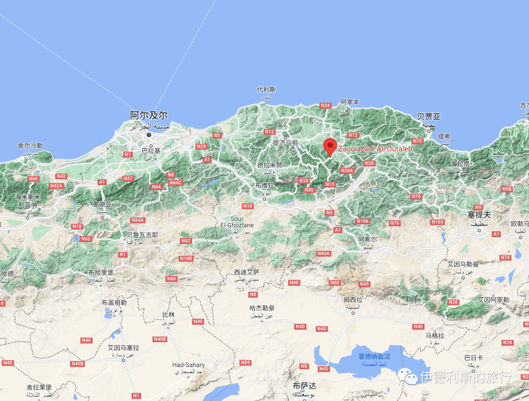
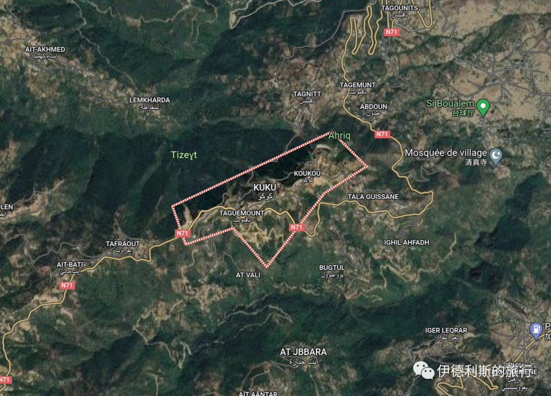
6. Hafsid Dynasty of Tunisia (1229-1574)
Continue east along the North African coast to reach the city of Tunis.
The Hafsid dynasty was a Berber dynasty that was also caught up in the repeated struggles between Spain and the Ottomans in the early 16th century.
In 1550, the Hafsid dynasty was a vassal state of Spain. They were not completely conquered by the Ottoman Empire until 1573.
Santiago Chikly castle, rebuilt by the Spanish in Tunis between 1546 and 1550. Photo by Imanis in 2013.
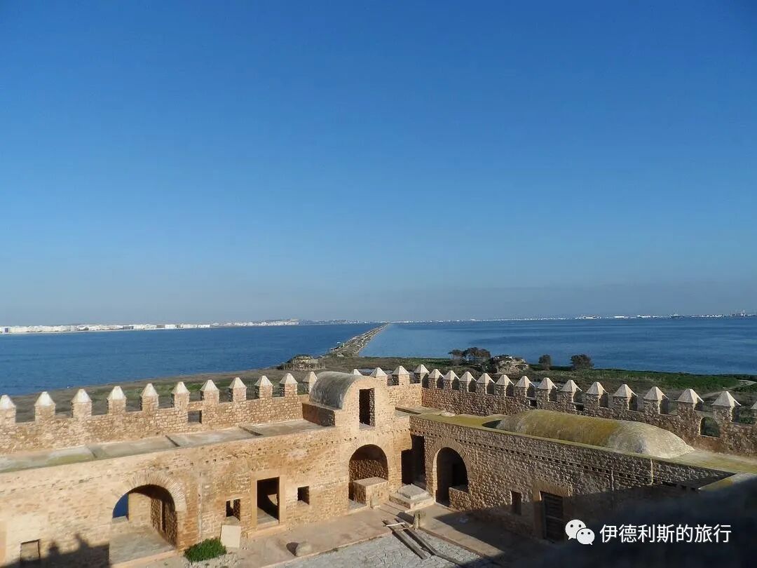
The location of Tunis.
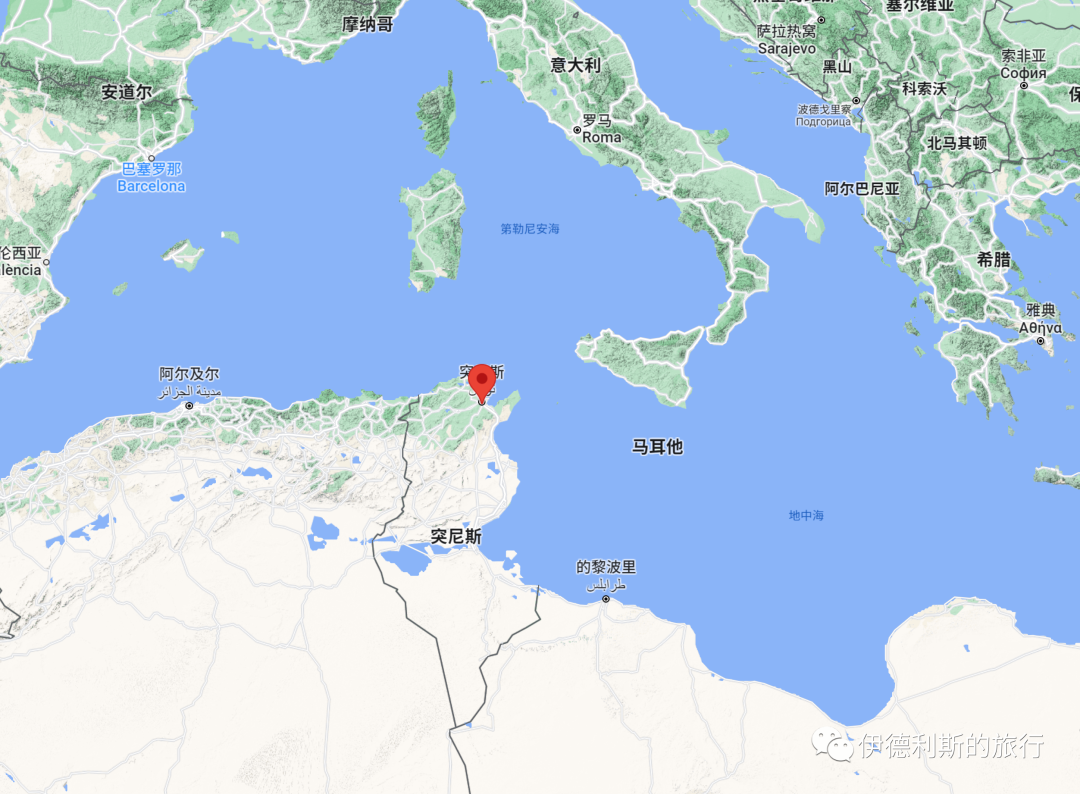
7. Songhai Empire in West Africa (1464-1591)
Let us head south along the ancient trade routes across the vast Sahara Desert to reach the ancient city of Gao in Mali.
The Songhai Empire was established by the Songhai people of West Africa. It was located in the semi-arid region between the Sahara Desert and the savanna. At its peak, it was one of the largest countries in Africa, with Timbuktu and Djenné as its main cities.
In 1550, the emperor ruling the Songhai Empire was Askia Daoud (reigned 1549–1582). Under his rule, the Songhai Empire enjoyed peace at home, expanded its borders, and saw its economy thrive. At that time, Timbuktu was the center of Islamic culture in Africa, placing great importance on education and preserving a vast collection of book manuscripts.
The capital of the Songhai Empire was located in Gao, Mali, where the tomb of the Songhai emperor Askia Muhammad I, who died in 1538, stands. It was named a UNESCO World Heritage site in 2004. People say the mud and wood used for this tomb were brought back from Mecca by the emperor himself after his hajj.
The Tomb of Askia, photographed by Our Place for the World Heritage website in 2007.
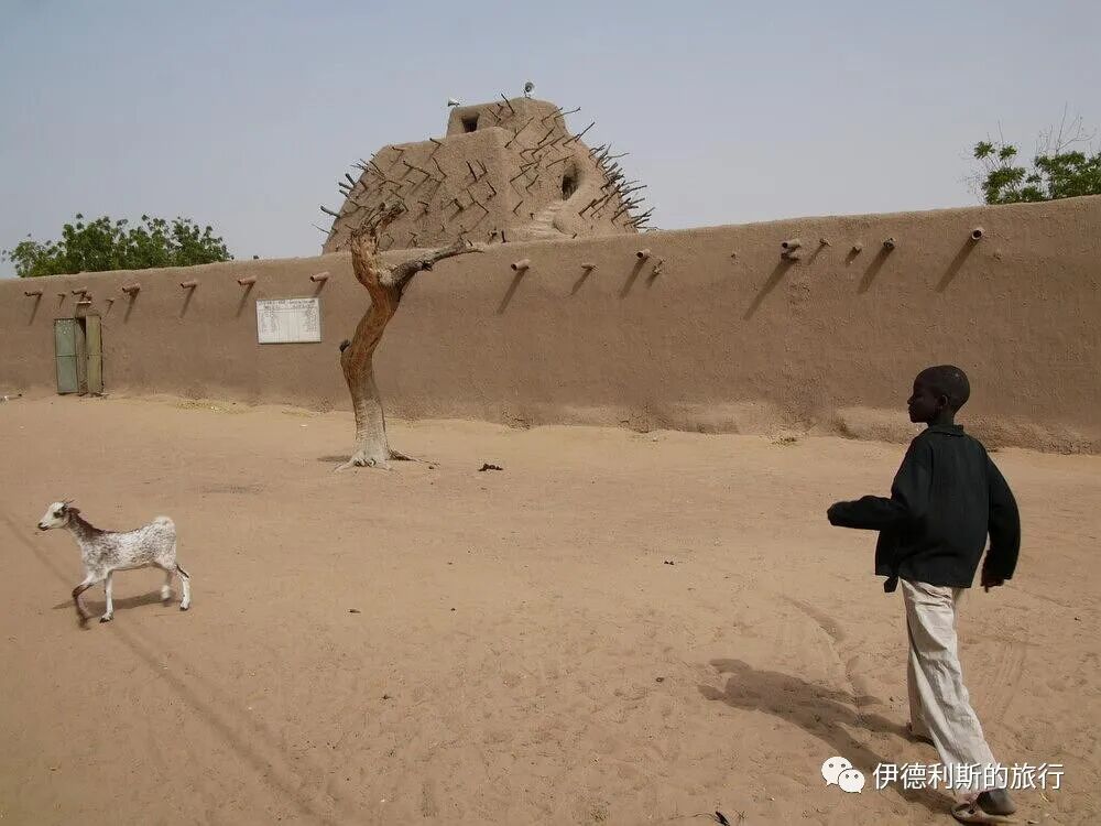
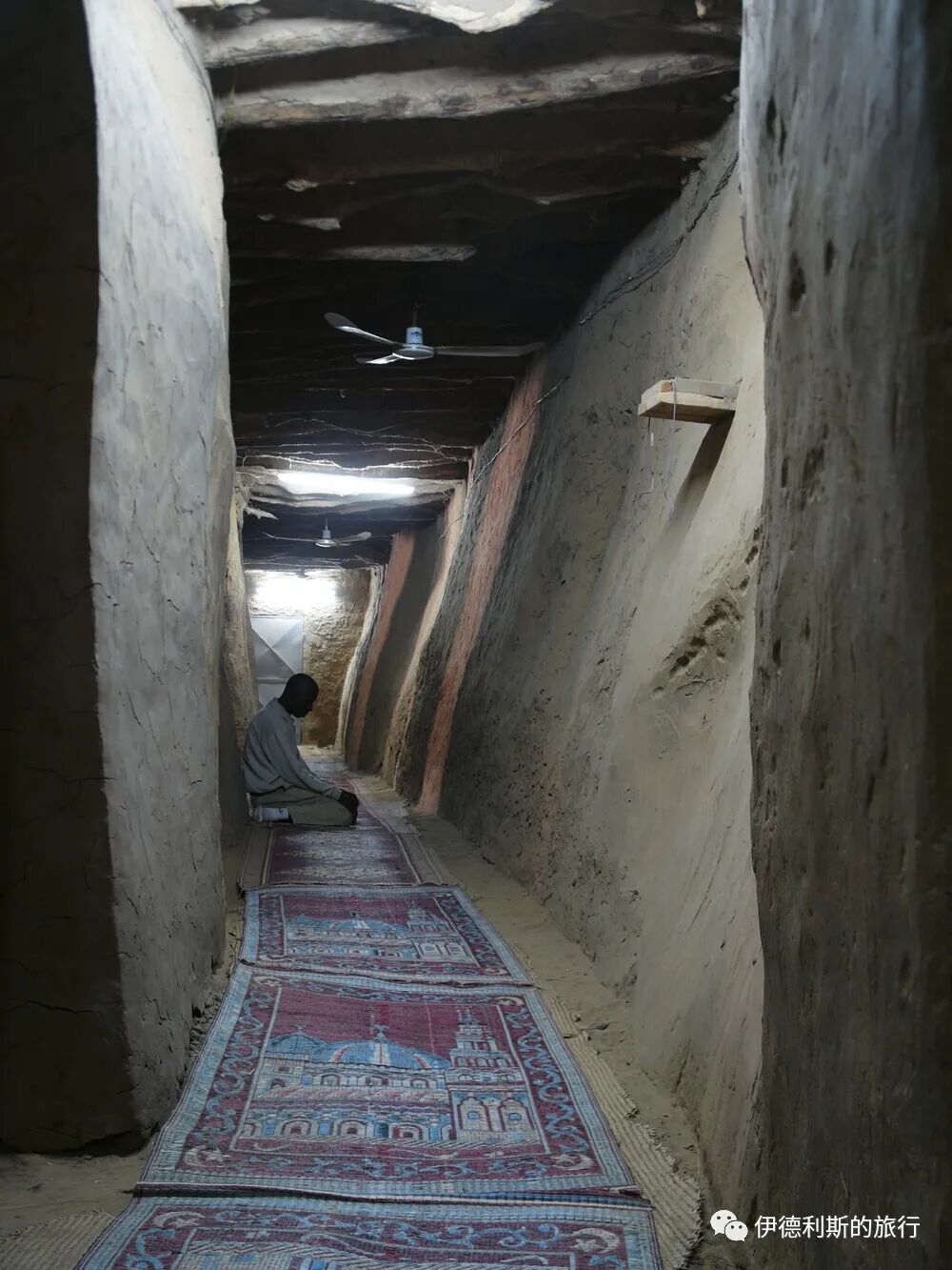
The location of Gao, the capital of the Songhai Empire.
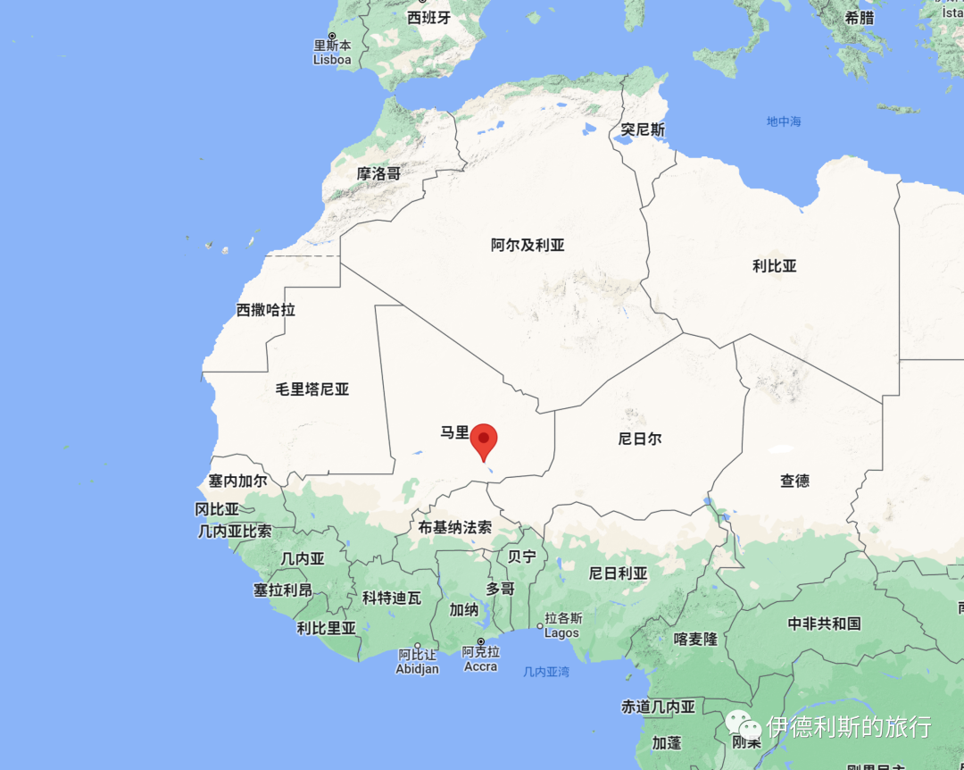
8. Mali Empire in West Africa (1230-1672)
Let us continue south into the savanna to visit the mysterious Mali Empire.
The Mali Empire was once the largest empire in West Africa, though it was gradually replaced by the Songhai Empire from the north after the 16th century. The economic focus of the Mali Empire shifted from trans-Saharan trade to commerce in coastal regions.
In 1545, the Songhai Empire invaded the capital of the Mali Empire, but they did not actually take control of it. By 1550, the Mali Empire still held onto a certain amount of territory. That year, they attacked a trade center in southern Ghana and seized the gold there.
The region attacked by the Mali Empire in 1550.
9. Funj Sultanate of Sudan (1504-1821)
This time, we will travel a long distance across the African continent to reach Sudan on the upper Nile.
The Funj Sultanate was a state established by the Funj people on the upper Nile. Due to the spread of Sufism along the upper Nile in the 16th century, the founder of the Funj Kingdom, Amara Dunqas, became a Muslim. However, the Funj people still kept many local customs and Christian rituals, gradually forming a unique Sudanese folk Islamic tradition.
To counter the expansion of the Ottoman Empire, the Funj Sultanate formed an alliance with the Ethiopian Empire in the early 16th century and exported horses and camels to them.
Sennar, the capital of the Funj Sultanate.
10. Adal Sultanate in Ethiopia (1415-1577)
Let us continue east into the ancient Ethiopian city of Harar.
The Adal Sultanate was located east of the Funj Sultanate on the northern Somali Peninsula and served as a commercial and political partner to the Ottoman Empire. Between 1529 and 1543, with help from the Ottoman Empire, the Adal Sultanate fought an 11-year war against the Ethiopian Kingdom, which eventually weakened both sides.
In 1550, the Adal Sultanate was ruled by Nur ibn Mujahid, who built a city wall with five gates in the capital, Harar. This walled city, known as Harar Jugol, was named a UNESCO World Heritage site in 2006. Harar is located in eastern Ethiopia and served as the capital of the Adal Sultanate from 1520 to 1577. Historically, this city has been an important African commercial and Islamic center, connecting trade routes from Ethiopia to the Somali Peninsula, the Arabian Peninsula, and the heart of Asia.
The Harar city wall, photographed by Sailko in 2018.
The location of the city of Harar.
11. Ajuran Sultanate in Somalia (13th century-late 17th century)
We continue south to the port city of Mogadishu on the Indian Ocean.
The Ajuran Sultanate was located on the Somali Peninsula, south of the Adal Sultanate. It held a key position in North Indian Ocean trade, with ships traveling between East Asia, South Asia, Europe, and Africa, leaving behind many ancient monuments in Somalia.
As a maritime nation, the Ajuran Sultanate not only allied with the Ottoman Empire but also maintained friendly relations with the Ming Dynasty. They were the first African country to send envoys to the Ming Dynasty.
In the early 16th century, the wealthiest Indian Ocean port city in the Sultanate was Mogadishu, which is the current capital of Somalia. According to the 16th-century Andalusian traveler Leo Africanus, the people of Mogadishu at that time had olive skin, wore white robes and white turbans, and used Arabic as their common language. Mogadishu had stone walls and was equipped with muskets and cannons imported from the Ottoman Empire.
The location of Mogadishu city.
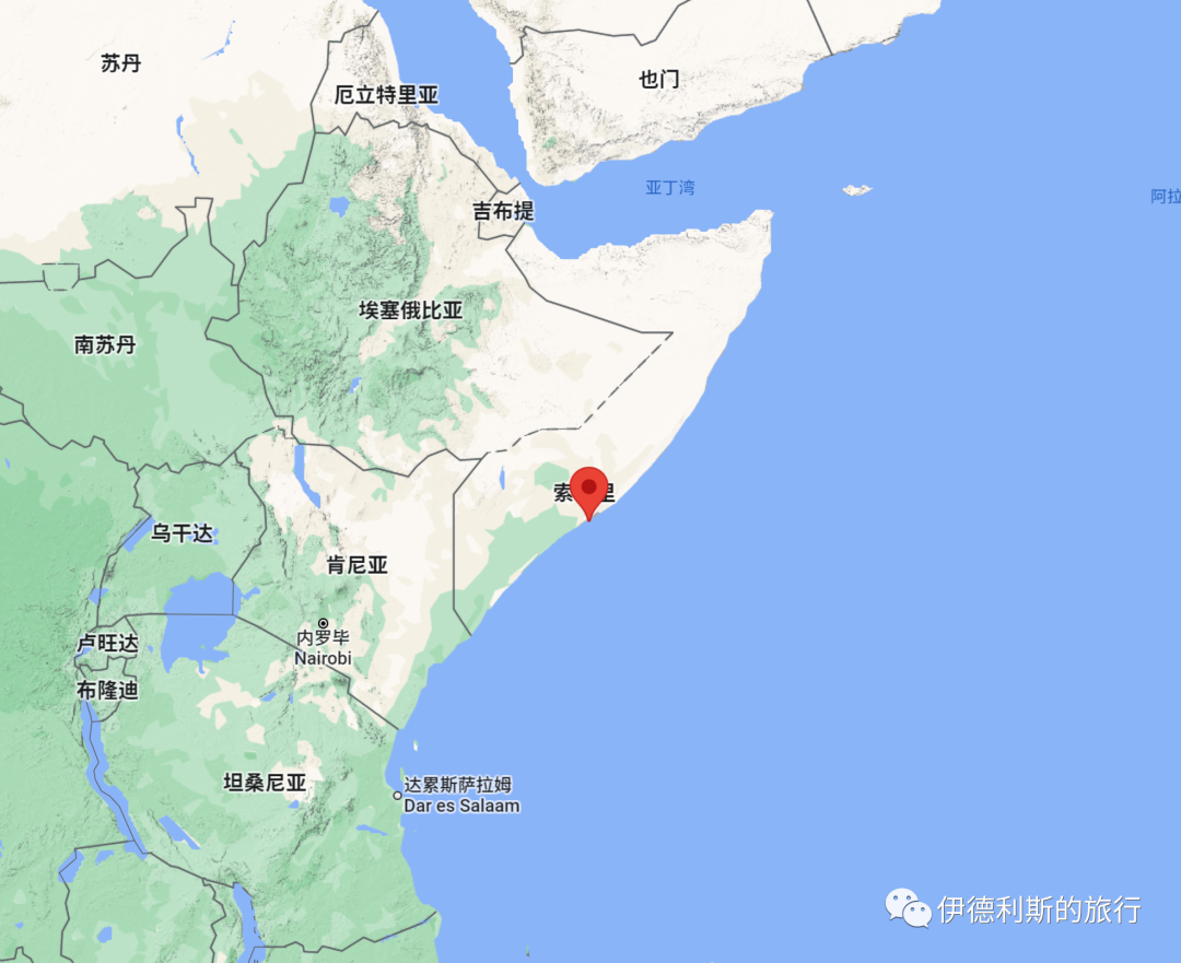
Ottoman Empire spanning Europe, Asia, and Africa (1299-1922)
Let us take a ship from the Indian Ocean port of Mogadishu, sail north along the Somali Peninsula, enter the Red Sea from the Gulf of Aden, and arrive in Cairo, Egypt, under Ottoman rule.
12. Ottoman Egypt Province (1517-1867)
In 1517, the Ottoman Empire conquered the Mamluk Sultanate, which had ruled Egypt for over two hundred years. Although they appointed a series of Egyptian governors, the political structure and cultural arts still continued the traditions of the Mamluk period. In early 16th-century Cairo, Mamluk and Ottoman architectural styles began to merge.
In 1528, the Egyptian governor Hadım Suleiman Pasha built the Suleiman Pasha Mosque for the Ottoman Janissaries stationed in the Cairo Citadel. This was the first Ottoman-style mosque in Egypt.
Suleiman Pasha Mosque photographed by Houssam_Daowd_102 in 2019.
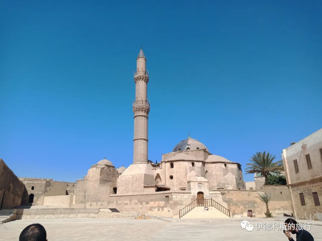
The location of Cairo.
13. Istanbul, capital of the Ottoman Empire (1453-1922)
We cross the Mediterranean Sea and arrive at Istanbul, the capital of the Ottoman Empire. At that time, the eastern Mediterranean had become an inland sea for the Ottoman Empire.
In the first half of the 16th century, the Ottoman Empire entered its Golden Age under the rule of Suleiman the Magnificent (reigned 1520-1566). Ottoman territory continued to expand. They besieged Vienna twice in 1529 and 1532, captured Baghdad in 1535, and defeated the Portuguese to control the Red Sea in 1538.
Meanwhile, under the patronage of Suleiman the Magnificent, various talented craftsmen and artists came to the Ottoman court, leading to great cultural prosperity. Mimar Sinan, the court architect for Suleiman the Magnificent, built a series of structures in Istanbul that became the best witnesses of that era.
The Haseki Hürrem Sultan Complex (Haseki Hürrem Sultan Külliyesi) was commissioned by Suleiman the Magnificent's wife, Hürrem Sultan, and built by Mimar Sinan in 1539. It was the first complex built by Mimar Sinan after he became the royal architect. Hürrem Sultan, known as Roxelana, was the first empress in Ottoman history to receive the title of 'Haseki Sultan' (the Sultan's favorite). She is also known as the most powerful and controversial woman in Ottoman history.
After becoming empress, Hürrem Sultan began building a series of public structures, the first of which was this empress complex. The complex includes a Friday mosque (Jumu'ah mosque), a public kitchen (imaret), a religious school (madrasa), an elementary school (mektep), and a hospital (darüssifa). The mosque was completed in 1539, the religious school and kitchen were finished the following year, and the hospital was not completed until 1550. When designing the entire complex, Sinan arranged the different buildings at various angles, leaving only narrow passages or gaps between them. This arrangement created rich perspective effects that almost never appeared in his later works.
The mosque (1539) is at the southernmost part of the complex, separated from the other parts by a narrow alley. The mosque was originally a simple, traditional single-dome, single-minaret structure made of alternating brick and stone. The porch is supported by six marble columns holding up five small domes. The mosque was expanded in 1612, growing from a single dome to a double dome, which doubled its area. The mosque has no tiles, and the current paintings were added later. During this period, Sinan had not yet started to innovate in mosque architecture.
The madrasa (1540) is directly opposite the mosque and consists of sixteen student rooms and a large lecture hall arranged in a rectangle.
The primary school (1540) is known as the most beautiful primary school built by Mimar Sinan.
The hospital (1550) is in the far north and was built by Hurrem Sultan specifically for women. The hospital courtyard is octagonal, with rooms on three sides and windows facing the street on the fourth side. The two arched gateways (iwan) at the corners of the octagonal courtyard and the dome foreshadowed Sinan's later development of arches and domes.
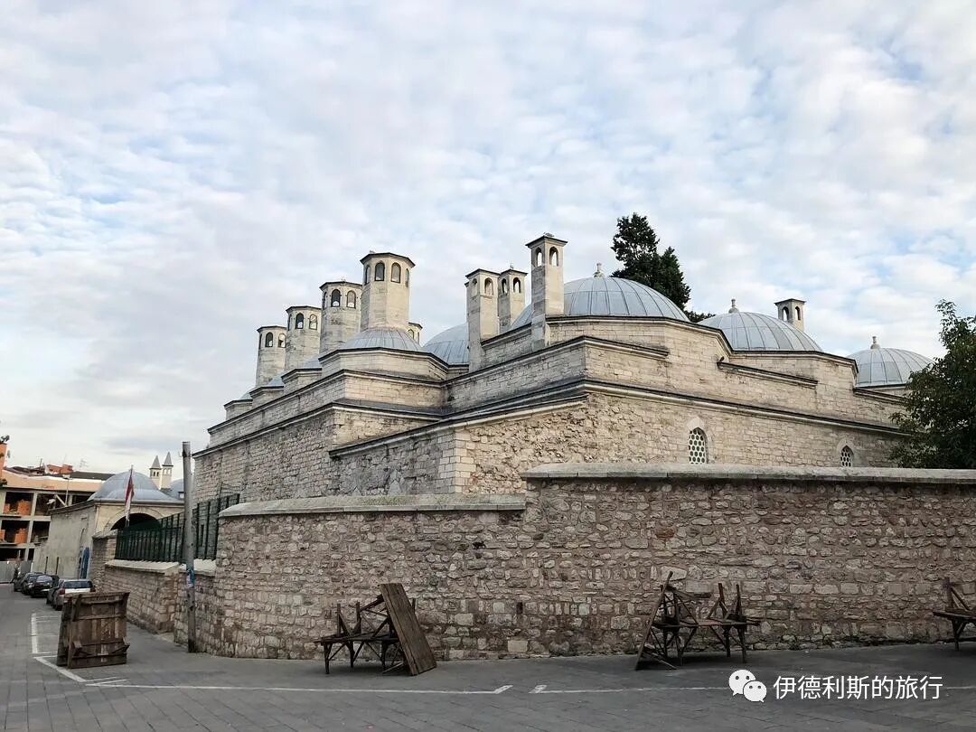
A diagram of the public kitchen published by Cornelius Gurlitt in 1912.
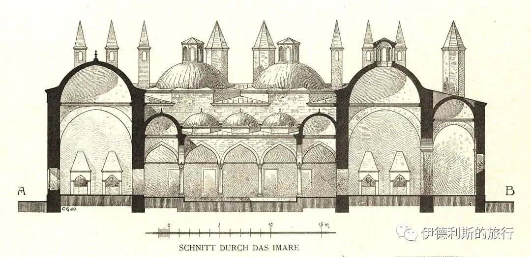
The Mihrimah Sultan Complex (Mihrimah Sultan Külliyesi) was commissioned in 1543 by Mihrimah Sultan, the daughter of Suleiman the Magnificent and Hurrem Sultan, and built by Mimar Sinan. It is the second complex by Mimar Sinan in Istanbul that still stands today.
Mihrimah Sultan was the wife of the Grand Vizier Rustem Pasha and is known as the most powerful princess in the history of the Ottoman Empire.
The entire complex is cleverly built on a slope extending to the coast. It includes a mosque, a madrasa, a guesthouse, a canteen, a primary school, and some later tombs. The guesthouse and canteen were destroyed by fire in 1772.
The Mihrimah Sultan Mosque is the first semi-domed mosque designed by Mimar Sinan. The mosque consists of one main dome and three semi-domes. This shape expands the interior space, making people feel like they are under the dome as soon as they enter the main hall. Although the mosque itself has limited depth, this design increases the sense of openness. Mimar Sinan added a T-shaped canopy in front of the porch to soften the hardness of the entrance facade.
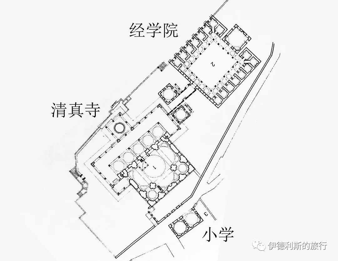
A diagram of the mosque published by Cornelius Gurlitt in 1912.
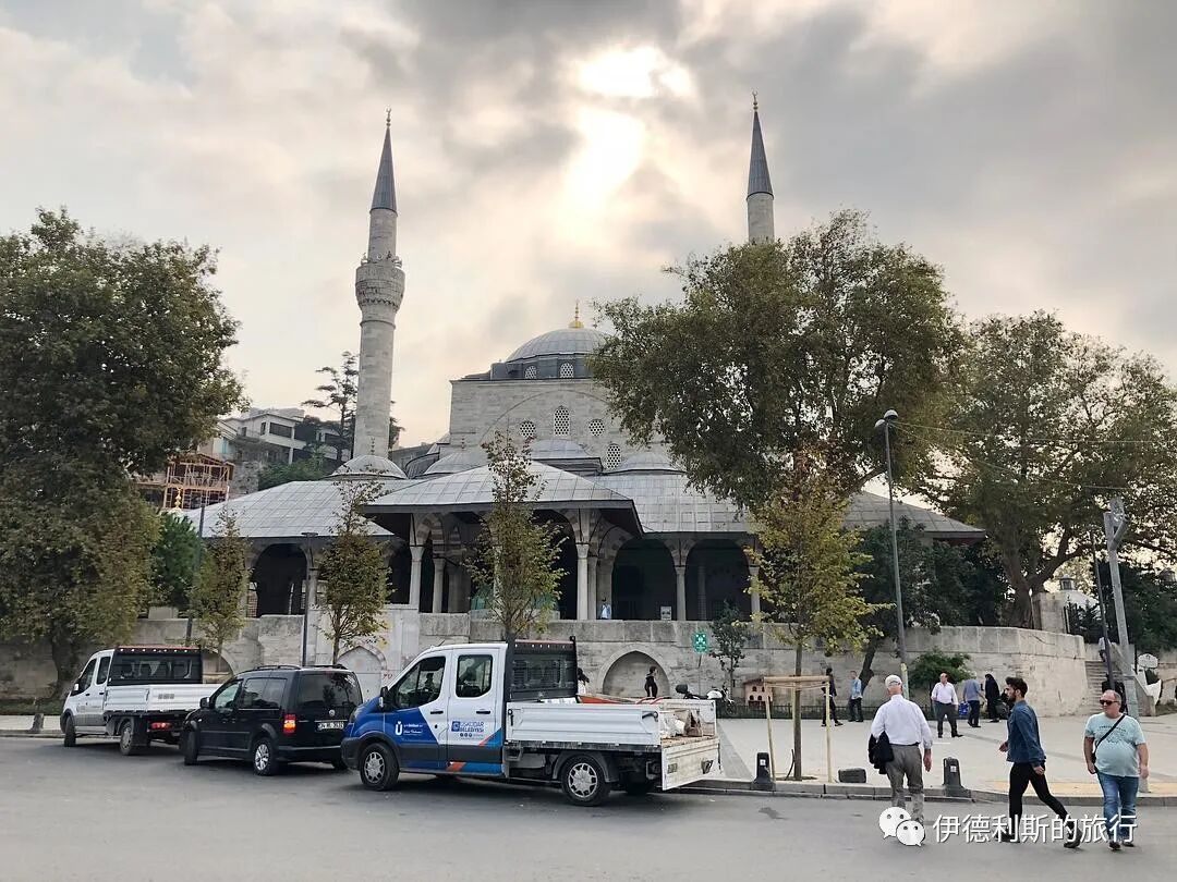
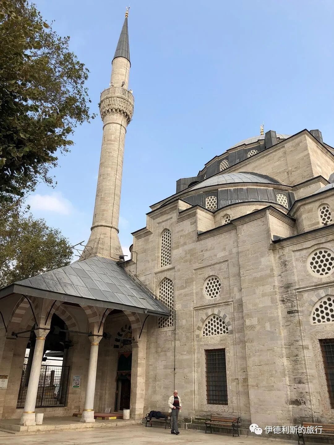
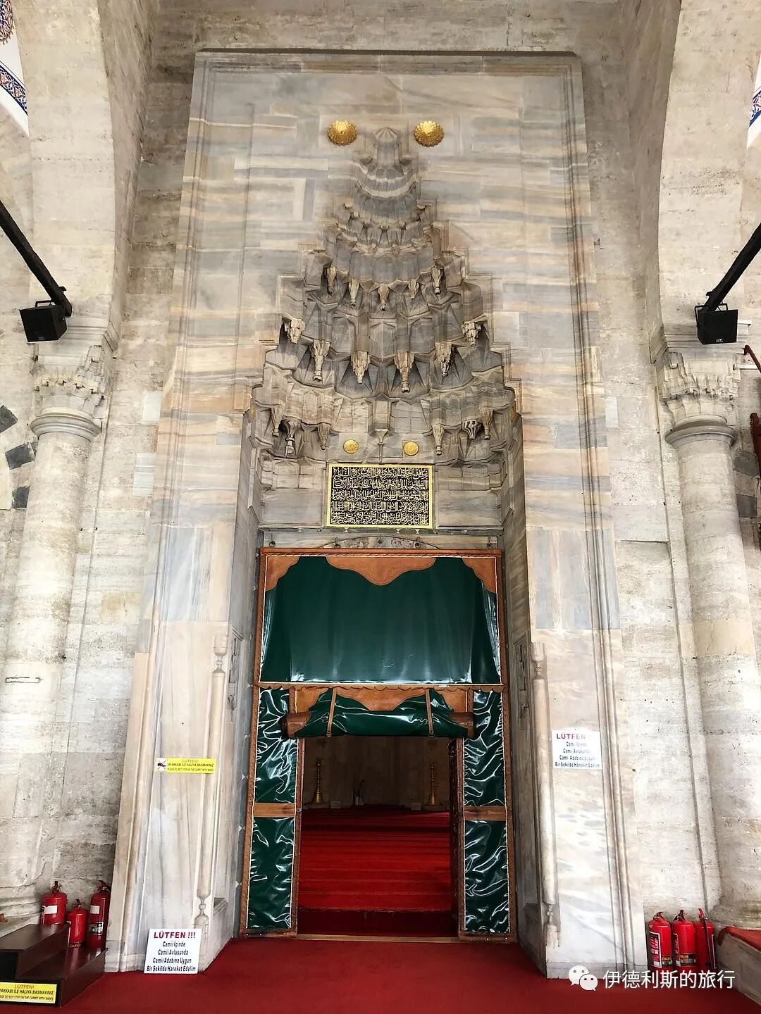
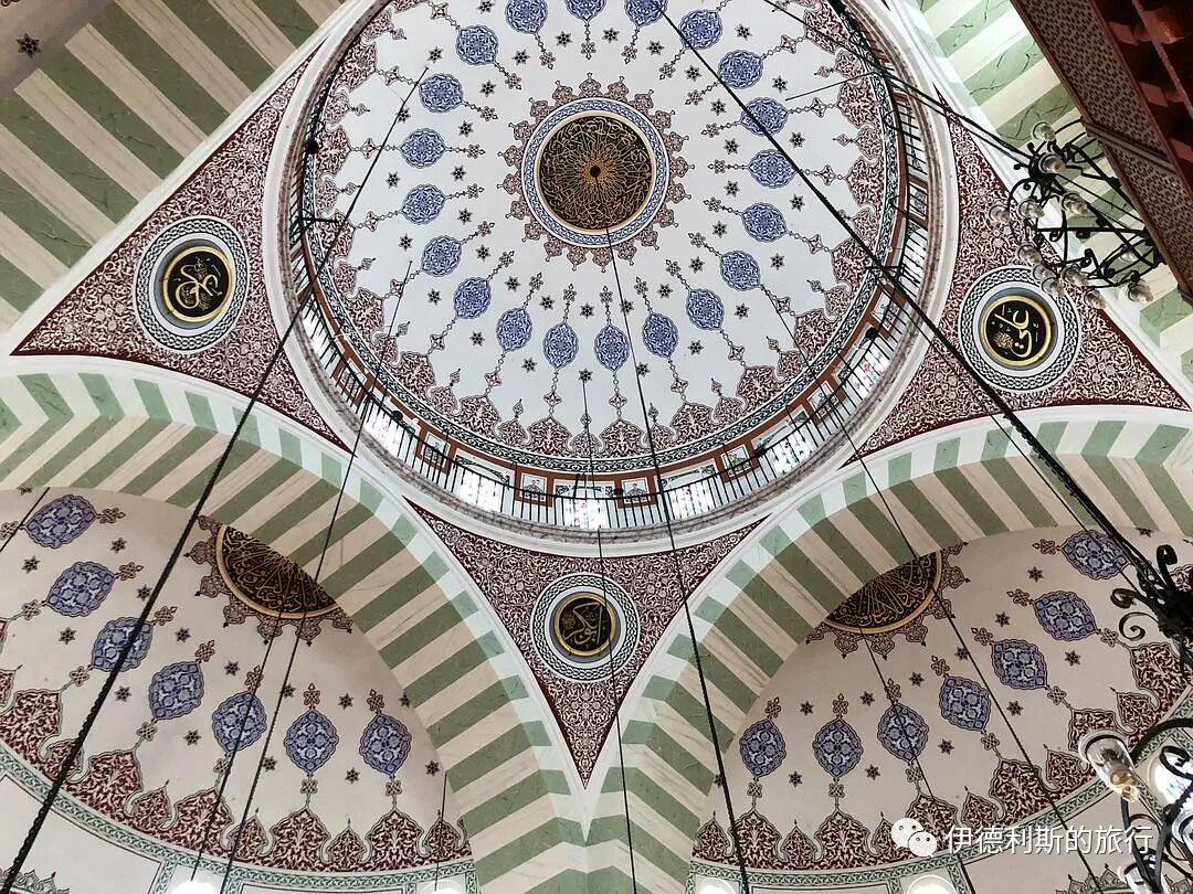
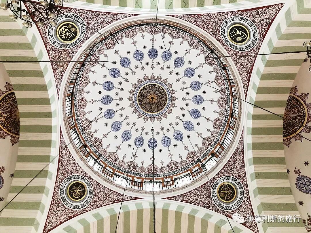
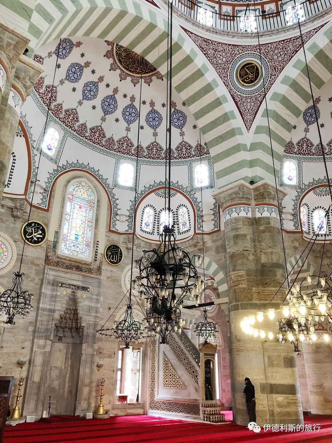
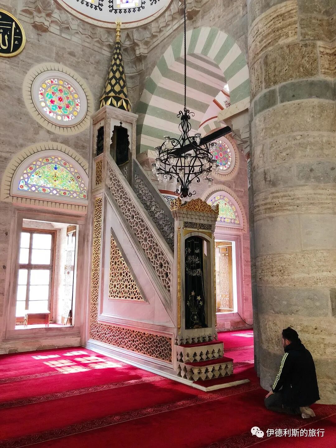
The madrasa consists of sixteen student rooms and a large lecture hall in a rectangle. It is now a hospital, and the integrity of the cultural heritage has been damaged.
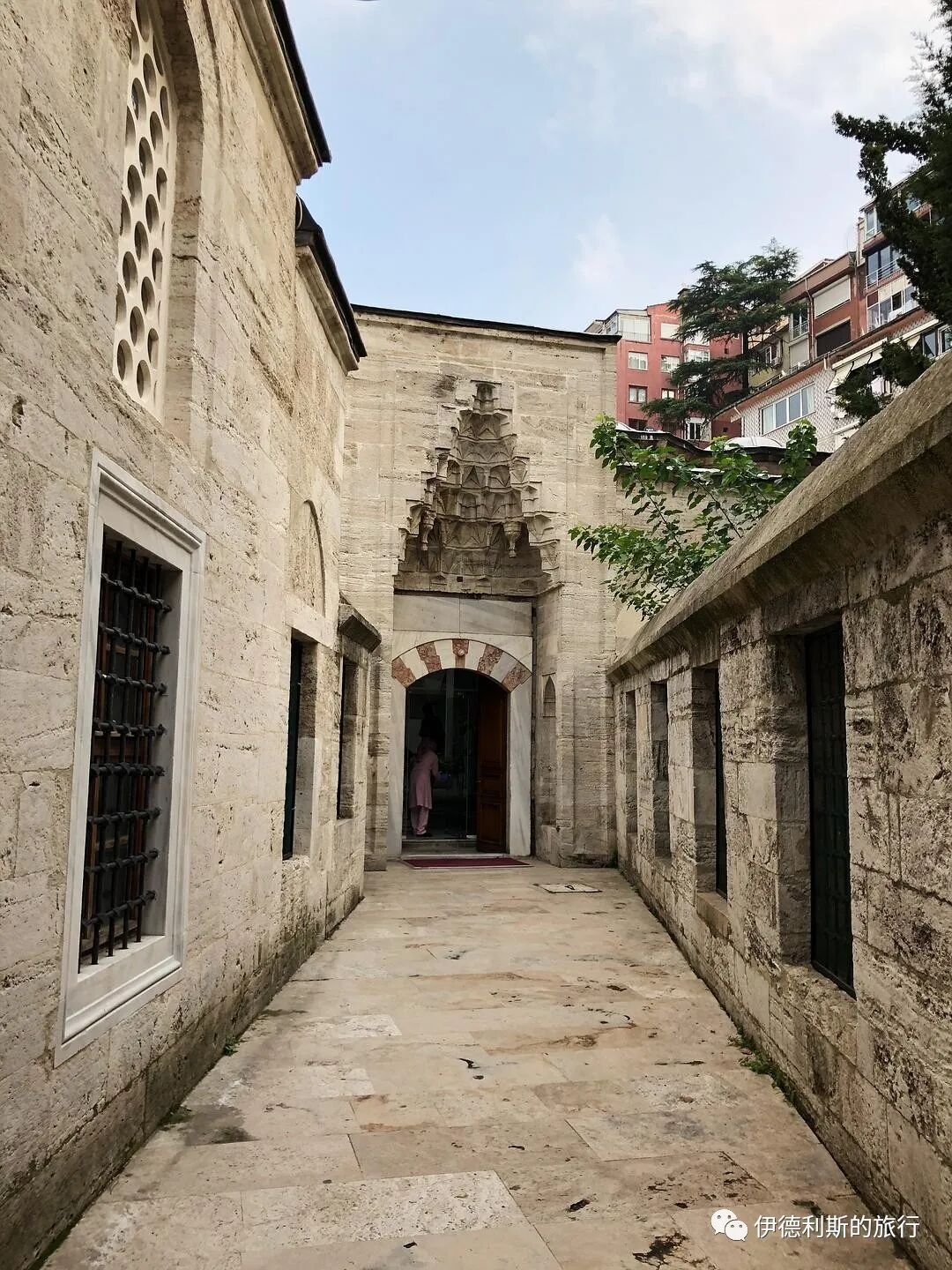
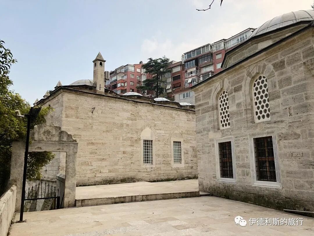
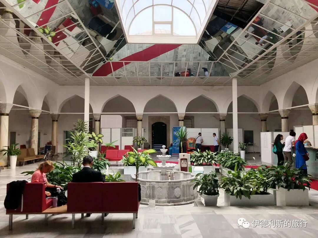
The Sehzade Complex (Sehzade Külliye) is located on the third hill of the old city of Istanbul. Built between 1543 and 1548, it is considered Mimar Sinan's most important early work and his first masterpiece.
The complex was built by Suleiman the Magnificent to commemorate his beloved son, Prince Mehmed (Sehzade Mehmed), who died young. Prince Mehmed was the son of Suleiman the Magnificent and Hurrem Sultan. He was favored from a young age and was the most likely heir, but he sadly died of smallpox (some say murder) in 1543. After the prince died, Suleiman the Magnificent was heartbroken. Traditionally, princes were buried in Bursa, but the Sultan decided to commission Mimar Sinan to build a tomb for the prince in Istanbul and match it with a complex.
The Sehzade Complex was the first work Mimar Sinan was directly commissioned to build by Suleiman the Magnificent. It was also his most ambitious early work, with a much grander scale and more decoration than his previous projects.
The complex includes a mosque, five tombs, a madrasa, a guesthouse, a hostel, a public canteen, and a primary school. These buildings are freely distributed on flat ground without a deliberate attempt at symmetry. the mosque is not a single unit with the other buildings; the other structures are distributed in the gardens or streets surrounding the mosque.
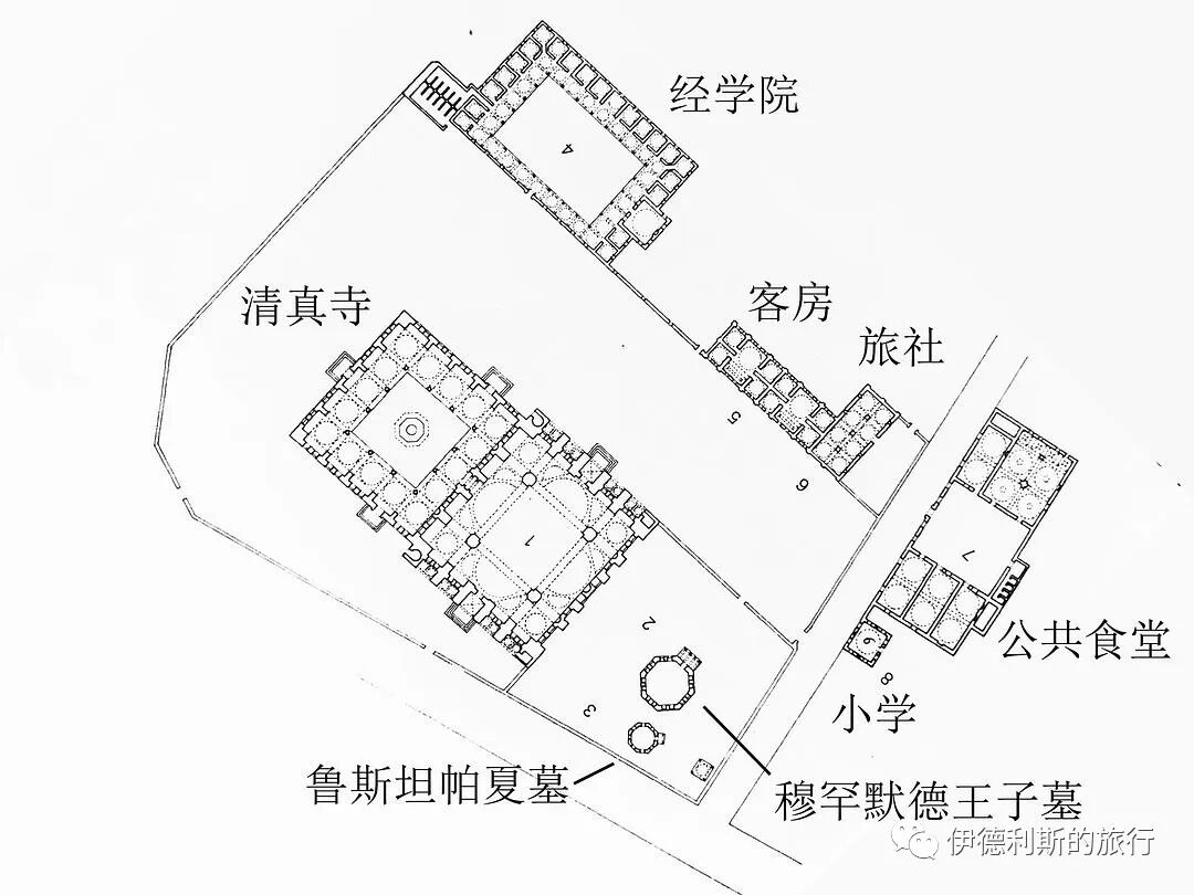
The mosque (1543-1548) is the second semi-domed mosque designed by Mimar Sinan, consisting of one main dome and four semi-domes. This is both an improvement on Sinan's previous work, the Mihrimah Sultan Mosque with its three semi-domes, and a reinterpretation of designs by predecessors like the Fatih Mosque (1471) and the Bayezid II Mosque (1506). This design isolates the four pillars supporting the central dome, creating a more stunning visual effect. The interior of the mosque is a square that unfolds along a central vertical axis. When people enter, they can immediately feel the dominance of the central dome. the porches on the walls on both sides of the mosque are a bold innovation, which also foreshadows the future direction of Ottoman mosque development. This design softens the flanks of the building and hides the buttresses, allowing the facade to blend in more perfectly. The design of the Sehzade Mosque had gradually moved away from the traditional Ottoman mosque model and began to move toward Sinan's own unique style.
A diagram of the mosque published by Cornelius Gurlitt in 1912.
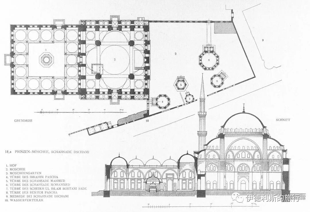
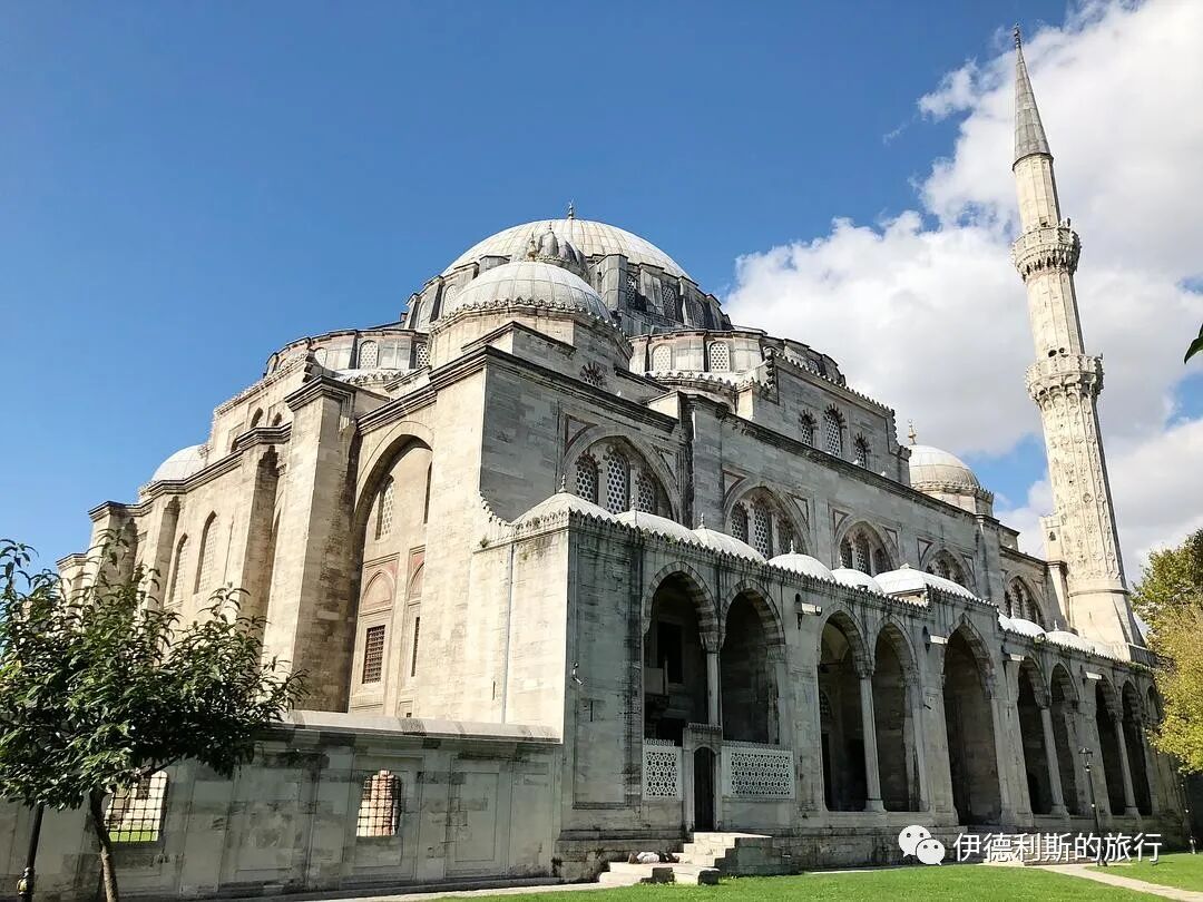
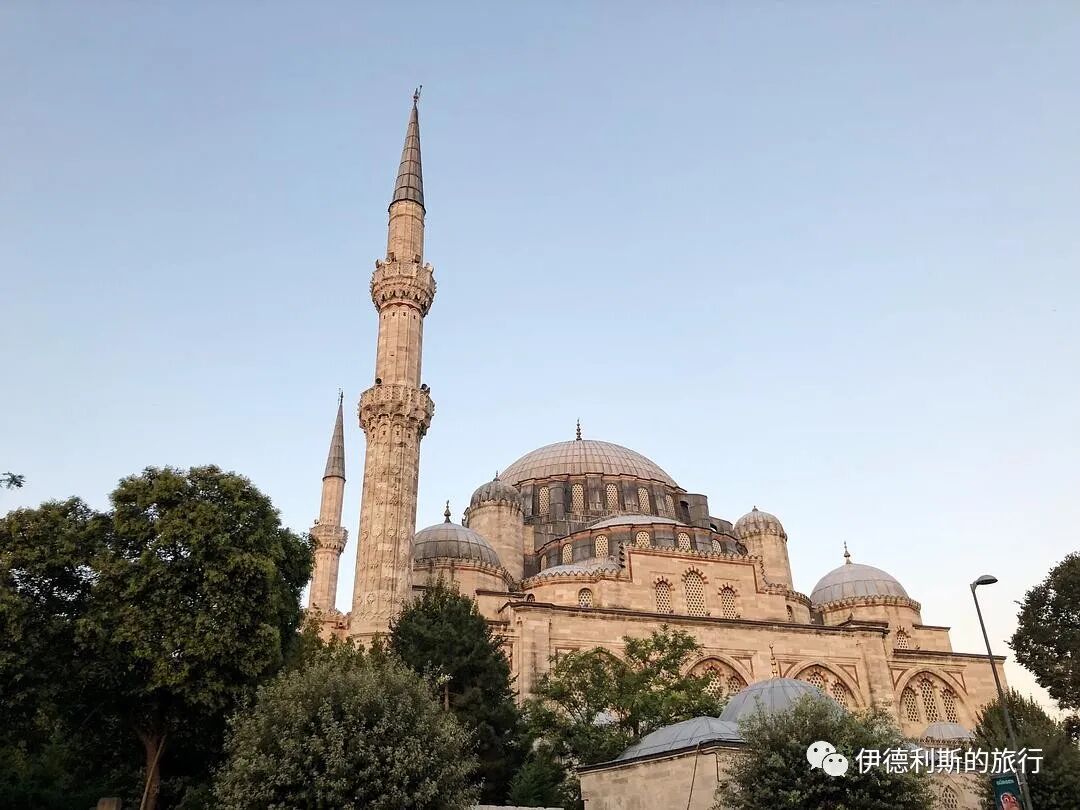
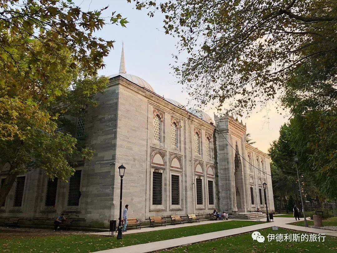
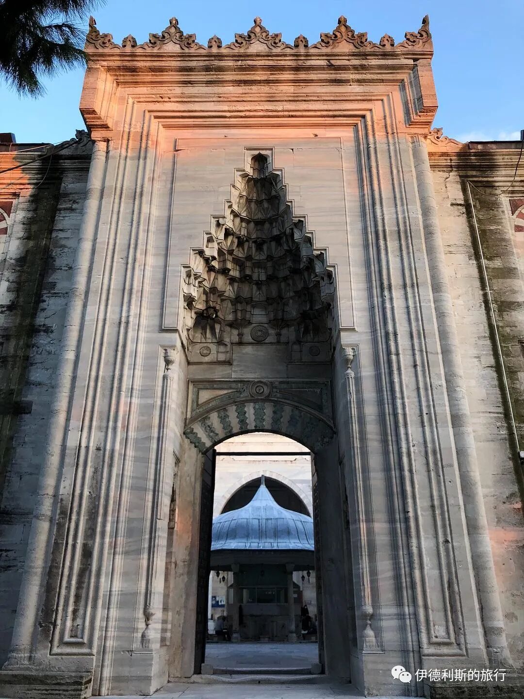
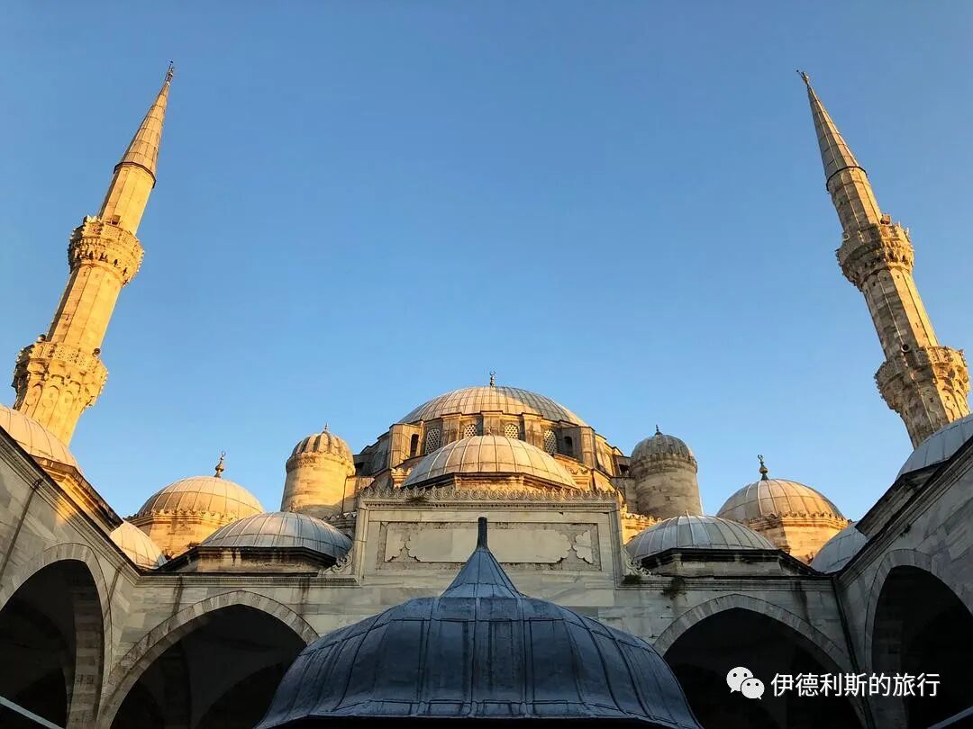
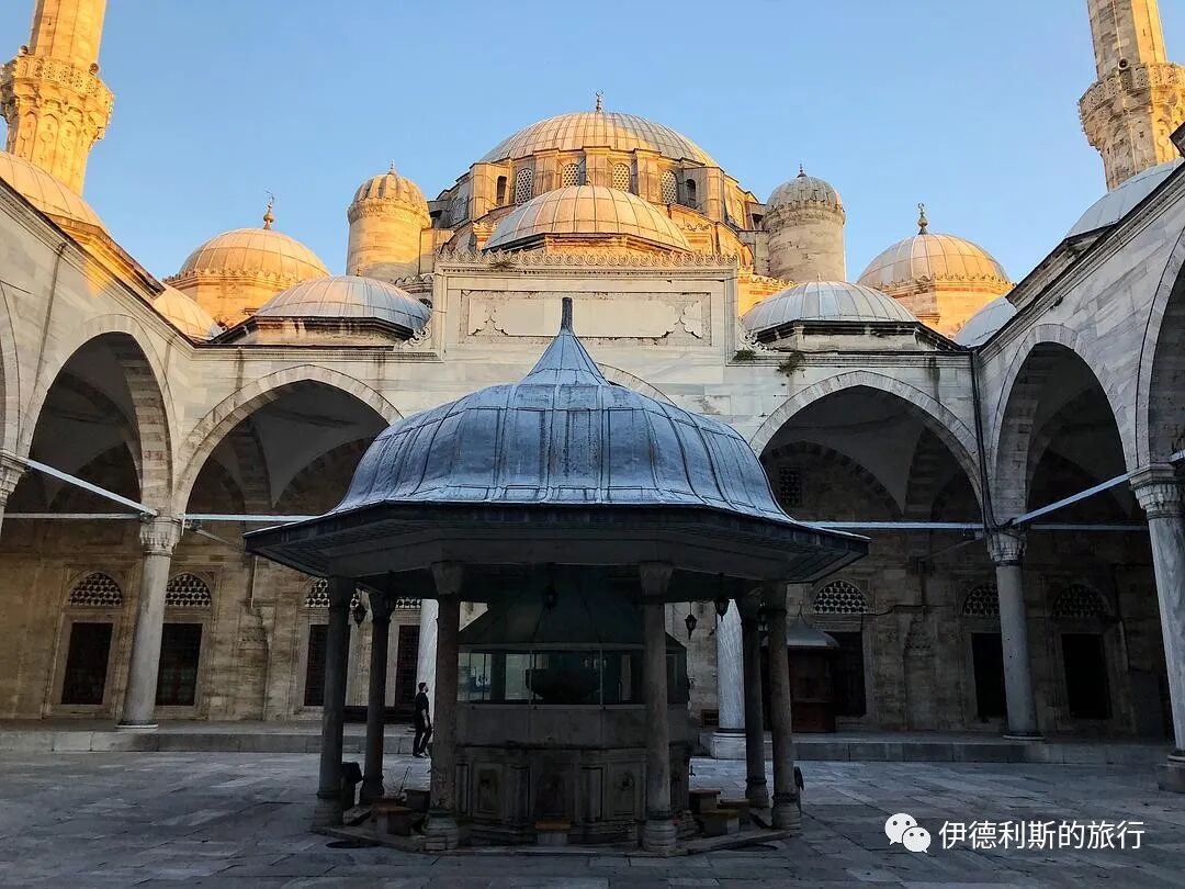
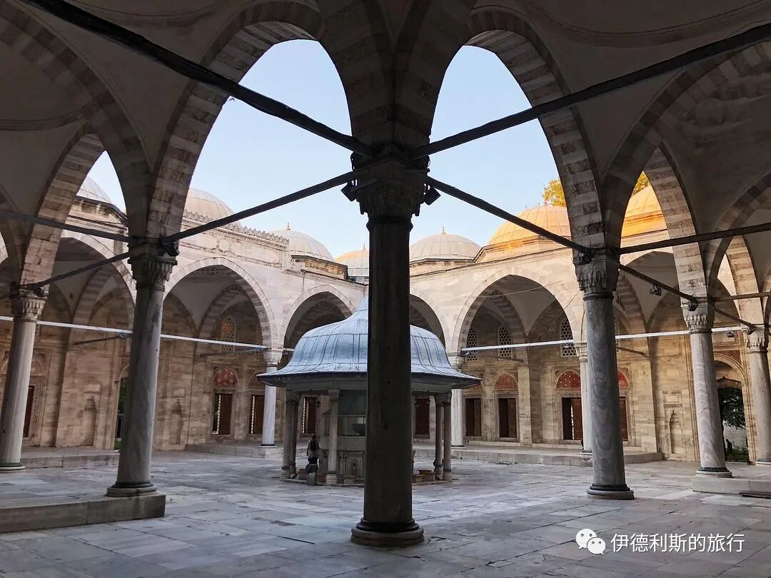
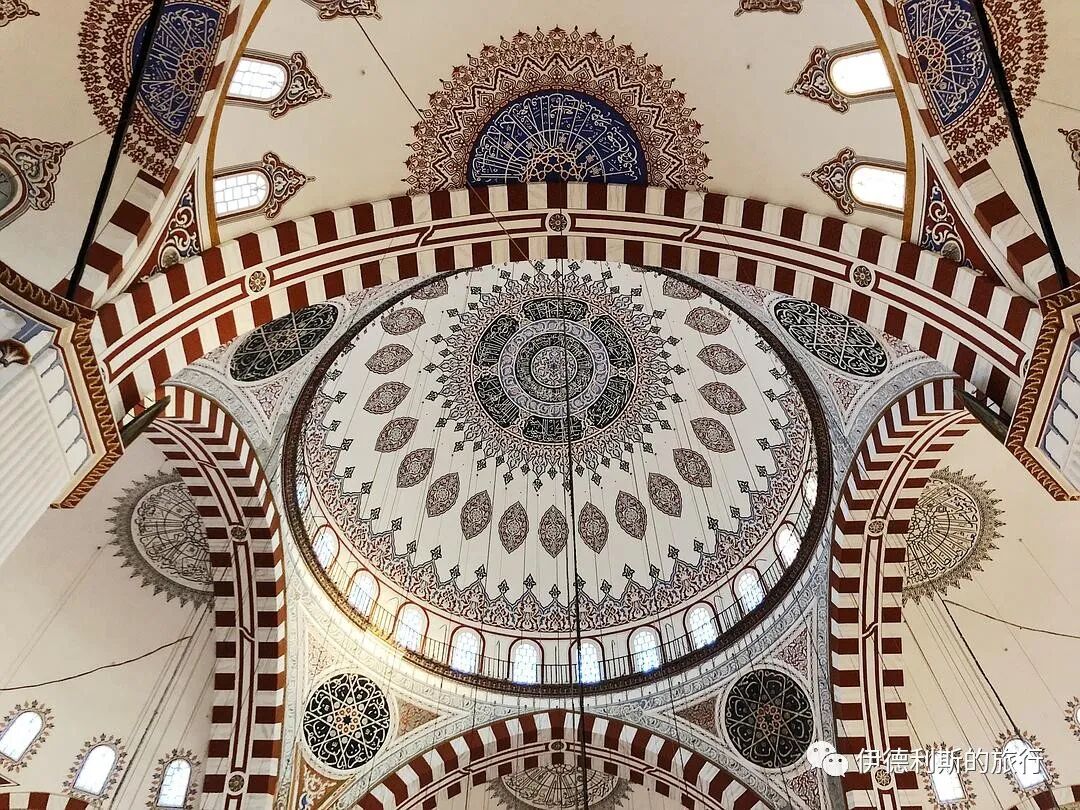
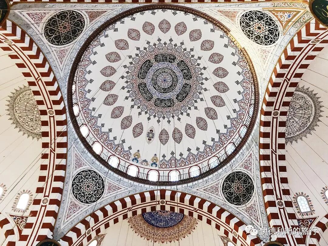
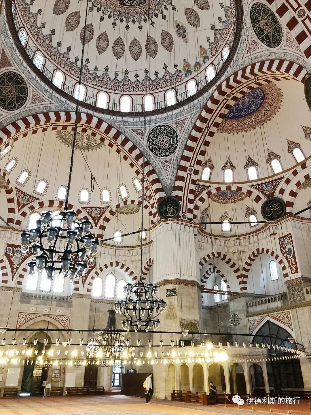
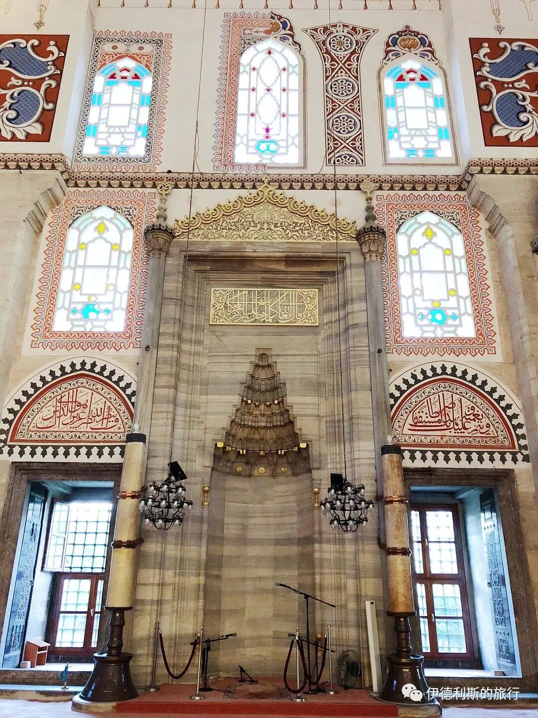
The Tomb of Prince Mehmed (1543) sits southeast of the mosque. It has an octagonal structure, Persian inscriptions at the entrance, and Cuerda Seca tiles inside.
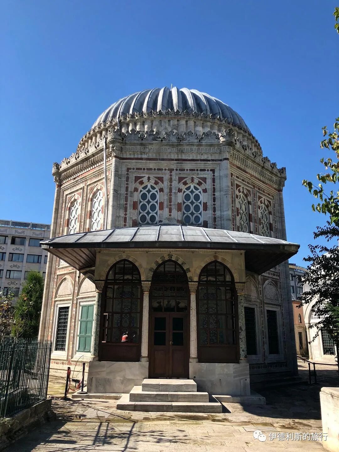
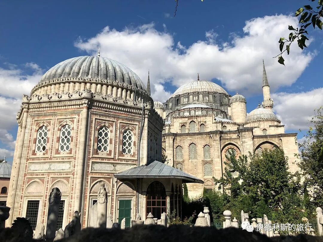
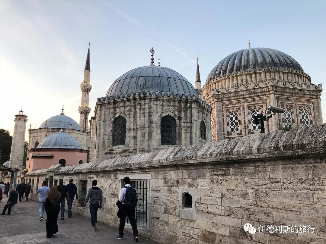
The madrasa (1546) is outside the garden on the north side of the mosque. It forms a rectangle surrounded by a gallery, with 21 student rooms and one large lecture hall on three sides. The fountain in the middle of the courtyard still keeps its Seljuk-era (11th to 13th century) tomb tower (kumbet) structure.
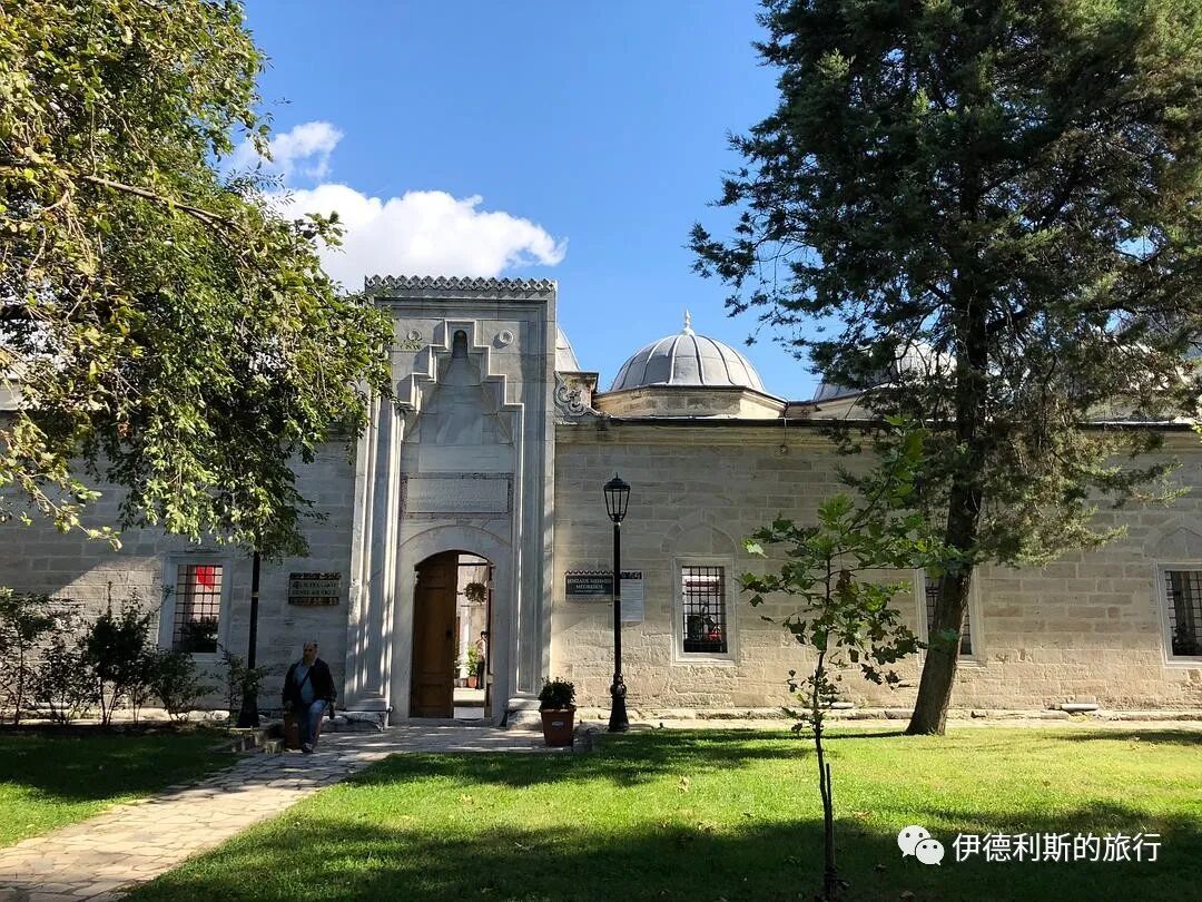
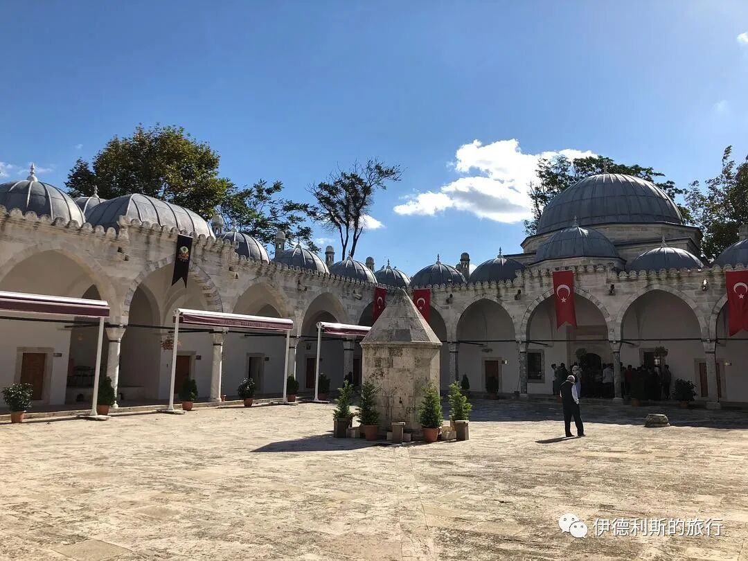
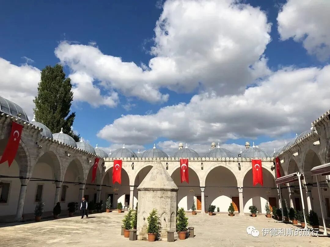
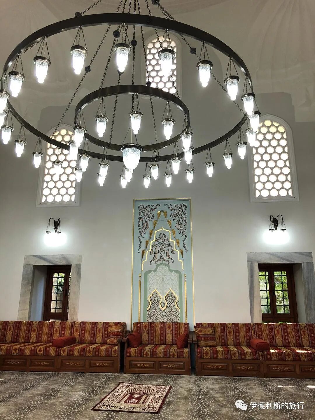
The public kitchen (1543-1548) is across the street east of the mosque. It consists of two buildings, each with six domes and a courtyard in the middle.
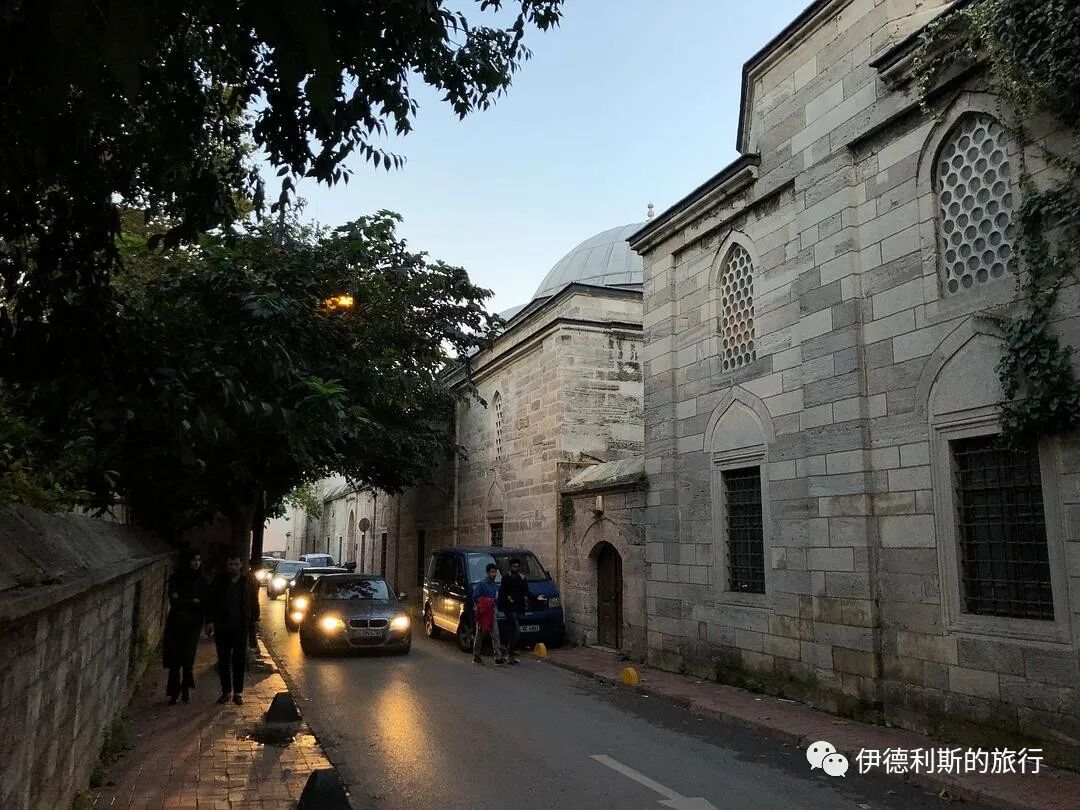
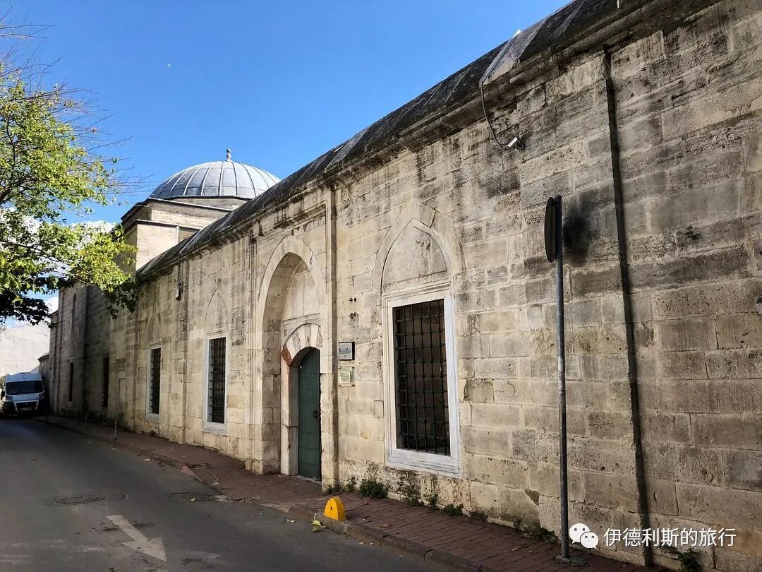
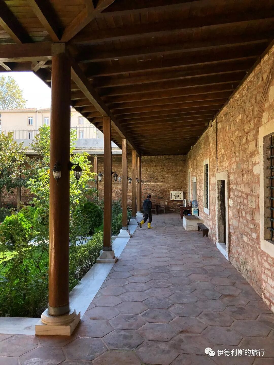
The octagonal tomb of Hüsrev Paşa is in the west of Istanbul. It is known as one of the most beautiful tombs built by Mimar Sinan. Hüsrev Paşa was a vizier of the Ottoman Empire. People called him the Mad Hüsrev Paşa because he had a bad temper. Hüsrev Paşa was born in Bosnia in 1495 and came from the famous Sokollu family. He became the governor of Egypt in 1535 and the Second Vizier in 1538. In 1544, Hüsrev Paşa lost the race for Grand Vizier to Rüstem Paşa. He died of illness shortly after, and Mimar Sinan built his tomb.
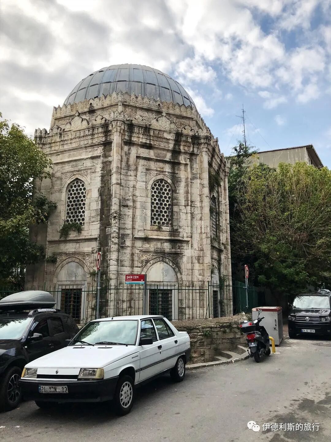
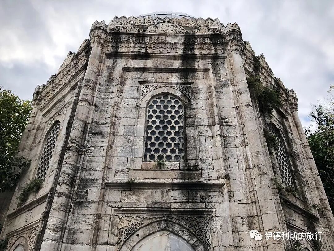
The Yavuz Sultan Selim Medrese is in the west of Istanbul. Suleiman the Magnificent commissioned Mimar Sinan to build it, and it is named after the Sultan's father, Selim I. The madrasa consists of 20 student rooms on three sides and one large lecture hall. In 1563, the lecture hall was turned into a prayer hall, and a minaret (banketa) was added. The minaret is now destroyed, and the madrasa has become a hospital.
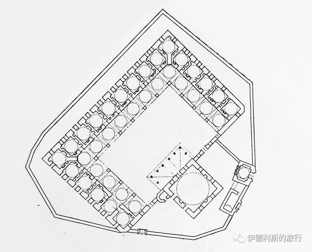
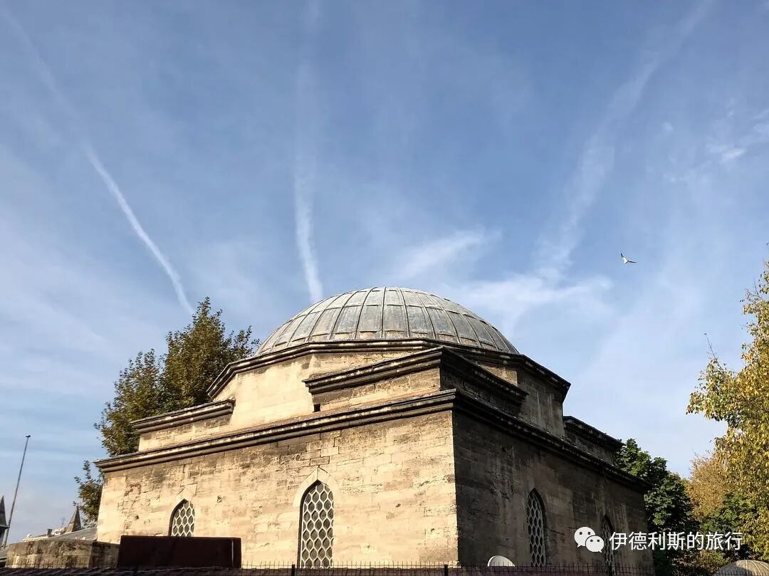
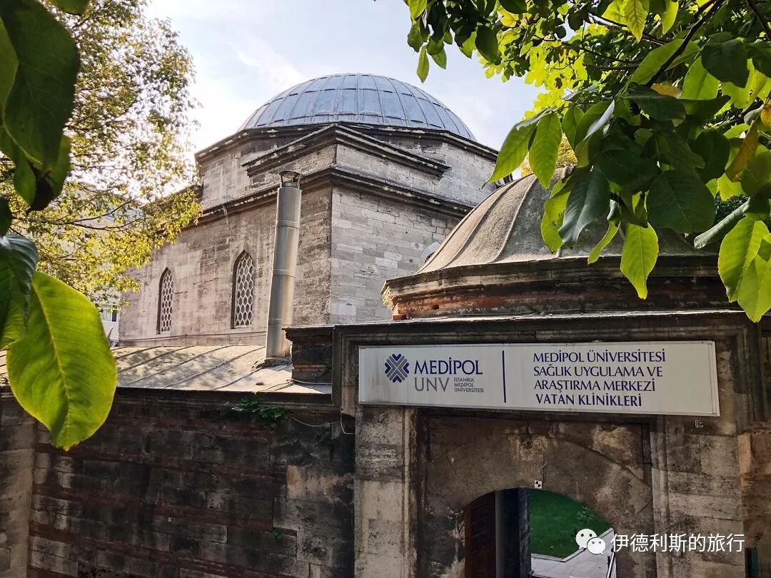
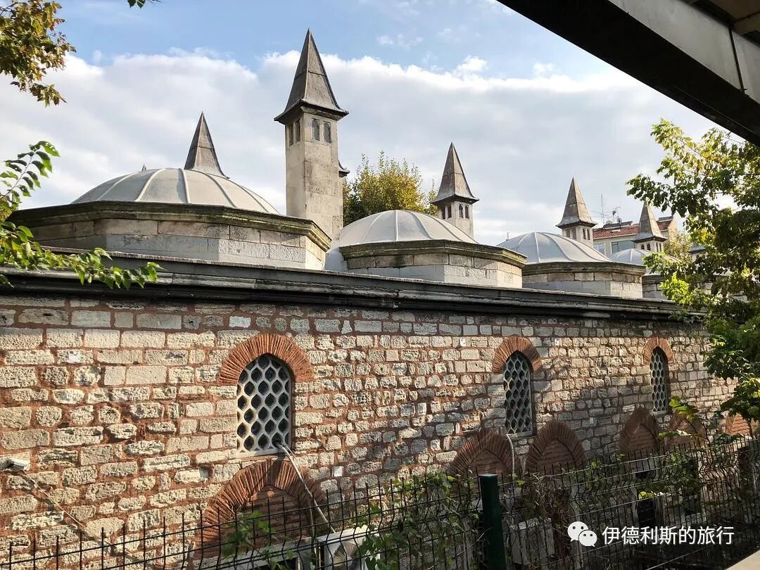

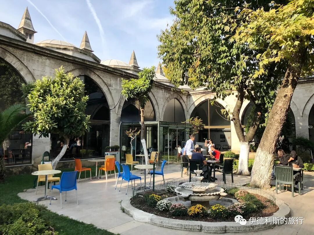
The Rüstem Paşa Medrese is not far northeast of the Grand Bazaar in Istanbul and was built in 1550. This madrasa is Mimar Sinan's new take on the famous Büyük Ağa Medrese in Amasya, which was built in 1488. The Büyük Ağa Medrese was the first octagonal madrasa in Turkey. Mimar Sinan kept the internal octagonal courtyard but changed the outside to a rectangle, which was a further development in Ottoman madrasa architecture.
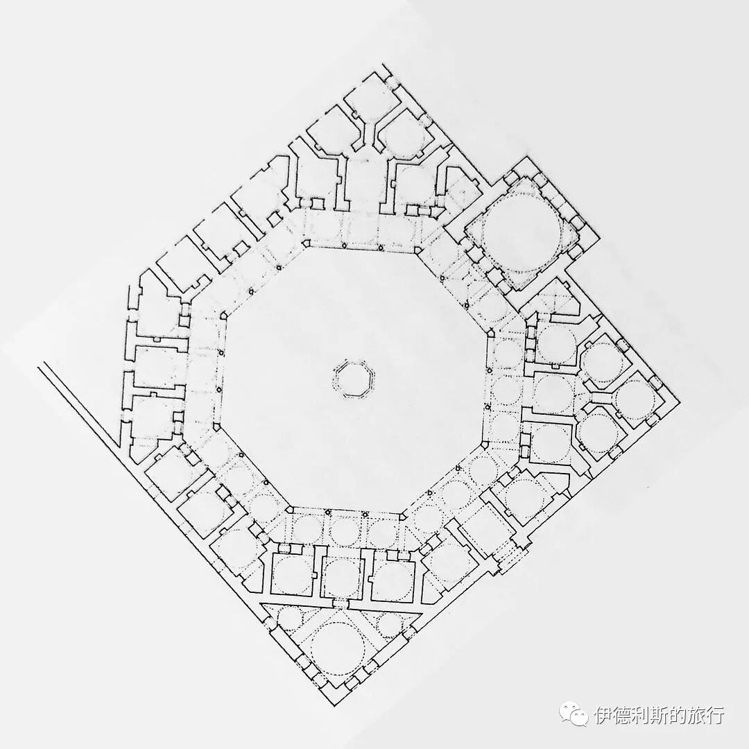
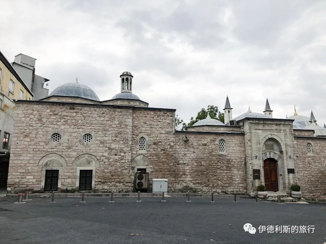
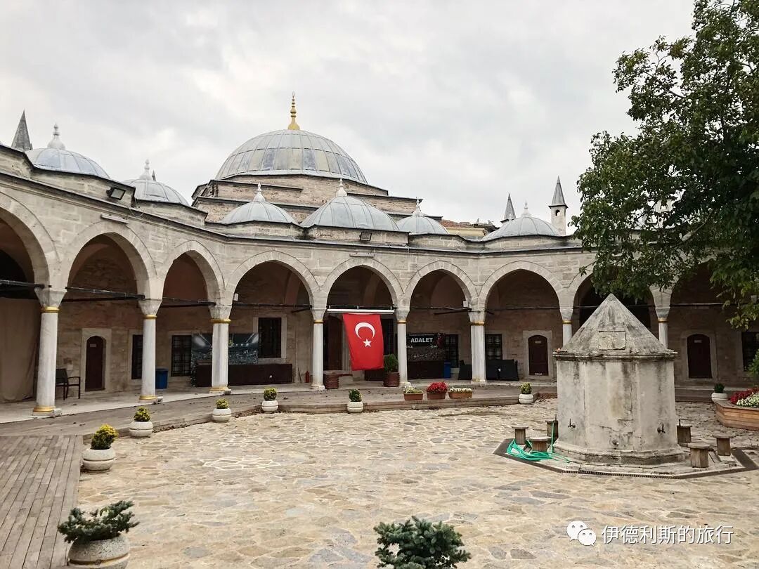
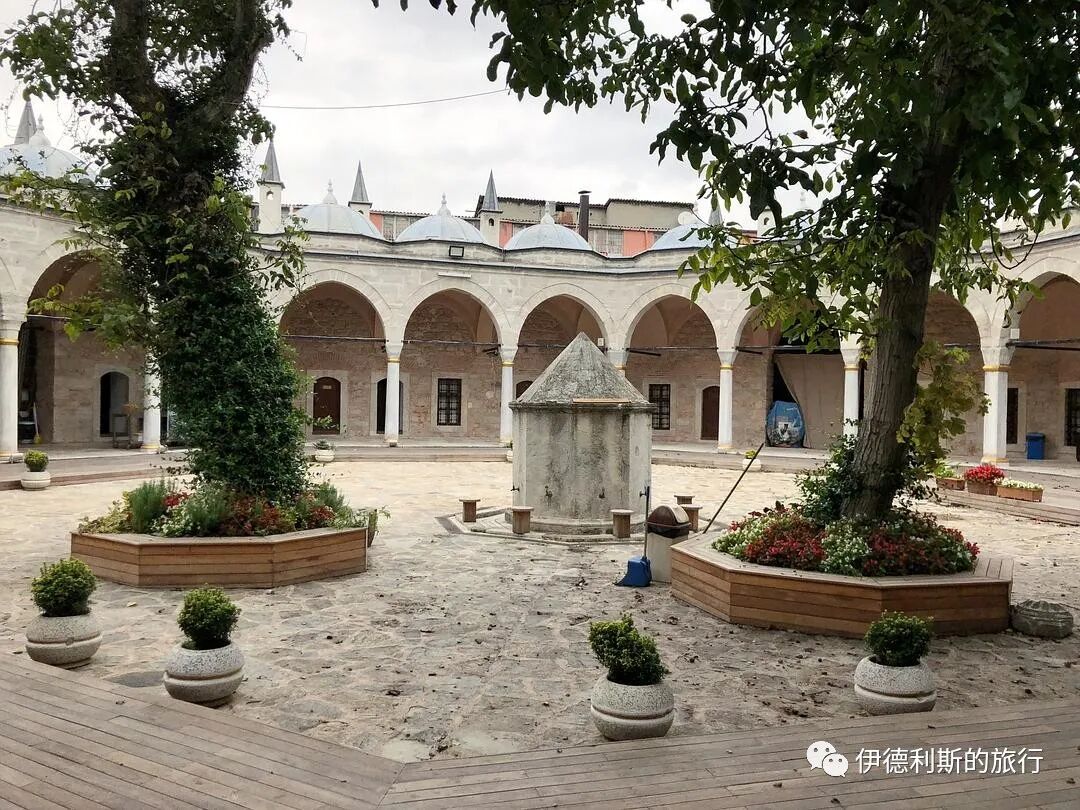
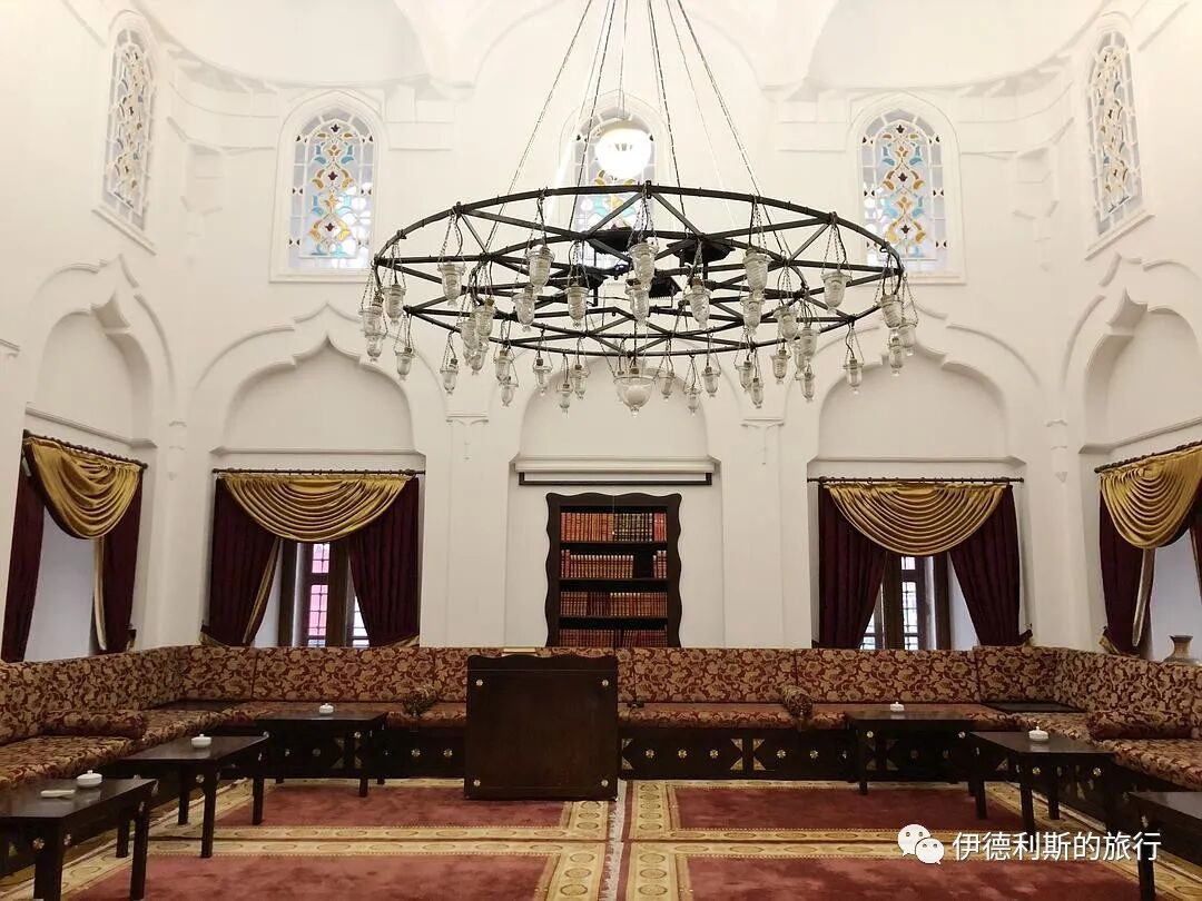
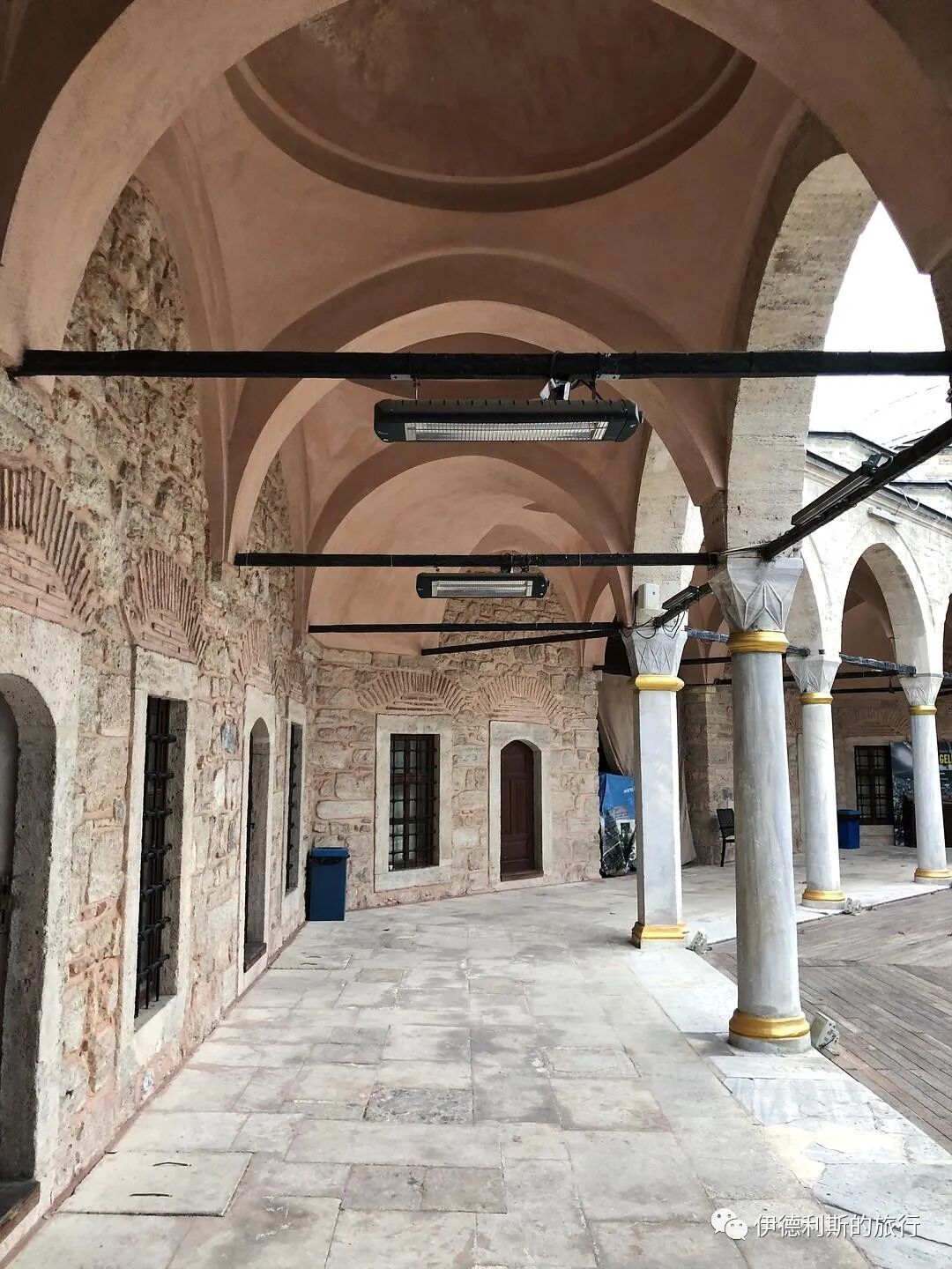
14. Safavid Dynasty in Iran (1501-1736)
We headed east from Istanbul, passed through several Kurdish emirates, and arrived in Tabriz in northwestern Iran.
The Safavid dynasty is considered the most important dynasty in Iran since the Sassanid Empire. The Safavid dynasty made Twelver Shia Islam the state religion, which was a major event in Islamic history. The rulers of the Safavid dynasty claimed to be descendants of the Prophet Muhammad, but historians believe they were Turkified Iranians from Iranian Kurdistan.
In 1501, Ismail I captured Tabriz, the capital of the Aq Qoyunlu, and made it the capital of the Safavid dynasty. Tabriz is now the capital of East Azerbaijan Province, and most of its residents are Azerbaijanis.
In 1550, the Safavid dynasty was ruled by Tahmasp I and was in a break between two large-scale wars with the Ottoman Empire. Between 1532 and 1555, the Ottoman Empire led by Suleiman the Magnificent and the Safavid dynasty led by Tahmasp I fought a 23-year war. Between 1548 and 1549, the Safavid dynasty used a scorched-earth policy to level Armenia, but the Ottoman army still pushed deep into the Iranian interior. After occupying the Safavid capital of Tabriz, the Ottoman army looted Hamadan, Qom, and Kashan, reaching as far as Isfahan. Tahmasp I chose not to fight the Ottoman army head-on, and the Ottoman army was forced to retreat because they ran out of food and supplies. Shortly after this in 1555, to avoid attacks from the Ottoman Empire, the Safavid dynasty moved its capital from Tabriz in the northwest to Qazvin, which was further inland.
A miniature painting of Tahmasp I painted in Qazvin, Iran, in 1575.
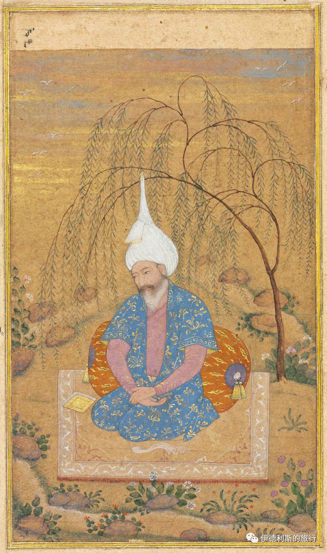
The location of Tabriz.
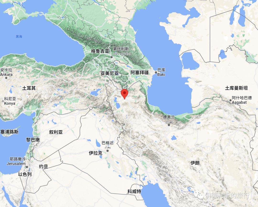
That is all for the first part. In the next post, we will visit 12 Islamic countries ruled by the descendants of Genghis Khan.
Islamic World in 1550: Chain Madrasa in Crimea (Part 1A-1b-1b)
Articles • ali2007fr posted the article • 0 comments • 83 views • 2026-05-18 09:38
Summary: This block continues the Crimean Khanate site and mosque section from Islamic World in 1550, preserving the original order of text and images.
The Chain Madrasa (Zıncırlı Medrese) was built in 1500 by order of the Crimean Khan Meñli I Giray. The name of the madrasa comes from the Turkic word "Zyngyr," which means "chain." A chain hangs above the main gate of the madrasa, so everyone who enters has to lower their head. The madrasa is rectangular with a central courtyard, an entrance on one side, and 11 rooms on the other three sides. At the time, the madrasa taught Turkish and Arabic grammar, calligraphy, arithmetic, ethics, logic, proof theory, fiqh, or Islamic law, theology, and hadith studies. The full course of study took ten years.
In 1909, influenced by the Crimean Tatar Enlightenment movement, Gasprinski built a new two-story madrasa next to the old one. The madrasa closed in 1917 and became the Meñli Giray Research Institute. The institute was abolished in 1923. Later, it served as a teacher's college, a medical school, a wartime sanatorium used by German military personnel, and a mental health clinic after the war. Today, it is managed by the Bakhchysarai History, Culture, and Archaeology Museum.
Block 2 of 2 for Part 1A-1b-1 view all
Summary: This block continues the Crimean Khanate site and mosque section from Islamic World in 1550, preserving the original order of text and images.
The Chain Madrasa (Zıncırlı Medrese) was built in 1500 by order of the Crimean Khan Meñli I Giray. The name of the madrasa comes from the Turkic word "Zyngyr," which means "chain." A chain hangs above the main gate of the madrasa, so everyone who enters has to lower their head. The madrasa is rectangular with a central courtyard, an entrance on one side, and 11 rooms on the other three sides. At the time, the madrasa taught Turkish and Arabic grammar, calligraphy, arithmetic, ethics, logic, proof theory, fiqh, or Islamic law, theology, and hadith studies. The full course of study took ten years.
In 1909, influenced by the Crimean Tatar Enlightenment movement, Gasprinski built a new two-story madrasa next to the old one. The madrasa closed in 1917 and became the Meñli Giray Research Institute. The institute was abolished in 1923. Later, it served as a teacher's college, a medical school, a wartime sanatorium used by German military personnel, and a mental health clinic after the war. Today, it is managed by the Bakhchysarai History, Culture, and Archaeology Museum.
Block 2 of 2 for Part 1A-1b-1
Islamic World in 1550: Mongol Empire Legacy and Muslim History (Part 1)
Articles • ali2007fr posted the article • 0 comments • 84 views • 2026-05-18 09:38
Summary: Islamic World in 1550: Mongol Empire Legacy and Muslim History is presented here as a firsthand travel account in clear English, beginning with this scene: In our last article, "A Journey Through the Islamic World in 1550 (Part 1)," we crossed the African continent, traveled from Egypt into the Ottoman Empire, and visited Tabriz in Iran. The account keeps its focus on Mongol Empire, Islamic World, Muslim History while preserving the names, places, food, and historical details from the Chinese source.
In our last article, "A Journey Through the Islamic World in 1550 (Part 1)," we crossed the African continent, traveled from Egypt into the Ottoman Empire, and visited Tabriz in Iran. This time, we will visit 12 countries ruled by the descendants of Genghis Khan, moving from Eastern Europe into North Asia and Central Asia, and finally into South Asia.
In the early 13th century, as the Mongol Empire expanded, Genghis Khan began dividing his lands among his sons. Orda and Batu, the sons of Genghis Khan's eldest son Jochi, received lands in southern Russia and Kazakhstan, which gradually formed the Golden Horde. Hulagu Khan, the son of Genghis Khan's fourth son Tolui, received lands in Iran, Turkmenistan, Afghanistan, and parts of West Asia, which gradually formed the Ilkhanate. After the Yuan Dynasty was established in 1271, the original families of Ogedei and Chagatai, led by Kaidu, opposed Kublai Khan. This led to the formation of the Ogedei Khanate and the Chagatai Khanate, completing the four great Mongol khanates.
After the 14th century, the territory of the Ogedei Khanate was first divided between the Chagatai Khanate and the Yuan Dynasty, and later the Ilkhanate and the Chagatai Khanate also began to split apart. The Golden Horde was the last to decline, splitting into several khanates in the early 15th century.
In 1550, there were 12 countries and regimes established by descendants of Genghis Khan, ruling a vast area from Russia, Kazakhstan, Uzbekistan, and China's Xinjiang to Afghanistan, Pakistan, and India. They were:
1. The Crimean Khanate ruled the Crimean Peninsula.
2. The Astrakhan Khanate ruled the Volga Delta.
3. The Nogai Horde ruled the region between the Volga and Ural rivers.
4. The Qasim Khanate ruled Kasimov in the modern-day Ryazan Oblast of Russia.
5. The Kazan Khanate ruled the middle Volga region.
6. The Siberian Khanate ruled the area around the Irtysh River.
7. The Kazakh Khanate ruled the Kazakh Steppe.
8. The Khanate of Khiva ruled the Khwarezm region.
9. The Khanate of Bukhara ruled the Transoxiana region of Central Asia.
10. The Yarkent Khanate ruled the southern Xinjiang region.
11. Haidar ruled the Kashmir region.
12. The Arghun dynasty ruled southern Afghanistan and the Sindh region of Pakistan.
Additionally, the Mughal Empire was briefly overthrown at this time, and its second emperor, Humayun, was in exile in Persia.
1. The Crimean Khanate in Ukraine (1441–1783).
We start this journey on the Crimean Peninsula on the northern shore of the Black Sea.
The Khan of the Crimean Khanate was a descendant of Tuka-Timur, the thirteenth son of Jochi, who was Genghis Khan's eldest son. In the 1260s, the Golden Horde gave the Crimean Peninsula to the ancestor of the Crimean Khans, Uran Timur, to rule. The khanate was officially established in 1441.
Around 1500, the Crimean Khan Mengli I Giray built the capital of Salachik. In 1532, Sahib I Giray, the son of Mengli I Giray, established a new capital called Bakhchisarai in a valley two kilometers downstream from Salachik. For the next 250 years, generations of Crimean Khans built palaces and various mosque buildings here.
In 1550, the Khan ruling the Crimean Khanate was Sahib I Giray. He ascended the throne with the help of the Ottoman Empire. Later, he joined forces with the Ottoman Sultan Suleiman the Magnificent to attack the Moldavians, and in 1541, he raided Moscow and brought back spoils of war.
The location of Bakhchisarai, the capital of the Crimean Khanate.
The tomb of Haji I Giray (Dürbe Hacı I Giray) was built in 1501 by Mengli I Giray for his father, the founding Khan of Crimea. It is an octagonal tomb with a lead dome.
Archaeological excavations from 2006 to 2007 examined 18 graves inside the mausoleum, including 13 adults and 5 children. They were wrapped in silk and satin, with some resting on pillows stuffed with fabric scraps and fruit seeds. The mausoleum holds 8 stone sarcophagi covered in velvet, silk, and silver-threaded fabric. These likely include 4 Crimean Khans: Hacı I Giray himself, Meñli I Giray, Nur Devlet—who fought Meñli I Giray for the throne for years before losing—and Sahib I Giray, the son of Meñli I Giray and builder of Bakhchysarai.
After research finished in 2009, these individuals were reburied with Muslim rites.
The Chain Madrasa (Zıncırlı Medrese) was built in 1500 by order of the Crimean Khan Meñli I Giray. The name of the madrasa comes from the Turkic word "Zyngyr," which means "chain." A chain hangs above the main gate of the madrasa, forcing everyone who enters to bow their head. The madrasa is rectangular with a central courtyard, an entrance on one side, and 11 rooms on the other three sides. At the time, the madrasa taught Turkish and Arabic grammar, calligraphy, arithmetic, ethics, logic, proof theory, Islamic law (sharia), theology, and hadith studies. The full course of study took ten years.
In 1909, influenced by the Crimean Tatar Enlightenment movement, Gasprinski built a new two-story madrasa next to the old one. The madrasa closed in 1917 and became the Meñli Giray Research Institute. The institute was abolished in 1923. Later, it served as a teacher's college, a medical school, a sanatorium for German soldiers, and a post-war psychiatric clinic. Today, it is managed by the Bakhchysarai History, Culture, and Archaeology Museum.
The Iron Gate (Demir Qapı) is the oldest structure in the Khan's Palace. It was built between 1503 and 1504 for the Crimean Khan by the architect Aleviz Novy, who had been invited by Ivan the Great to build churches in Moscow. The Iron Gate was likely first built at the Crimean Khan's previous residence, Devlet-Saray, and moved to the main palace building after the Bakhchysarai Khan's Palace was completed in 1532. "Demir Qapı" means "iron gate" in Crimean Tatar. The doorway is made of limestone and features Lombard-Venetian Renaissance decorative styles.
The Great Khan Mosque (Büyük Han Cami) in the Bakhchysarai Khan's Palace was built in 1532 and is one of the earliest structures in the palace. The original mosque had multiple domes, similar to the Seljuk-style mosques popular in the Ottoman Empire during the 15th century. The mosque was destroyed by fire in 1736. It was later restored by Khan Selamet II Giray (who reigned from 1740 to 1743) and converted to a tiled roof.
During the Soviet era, the mosque was closed and turned into an exhibition hall for the archaeological museum. After Russia occupied Crimea in 2014, the mosque underwent repairs, some of which caused damage to the building.
The SaryGuzel Bathhouse was built in 1532 by order of the Crimean Khan Sahib I Giray. Like the Great Khan Mosque, it is one of the earliest buildings in the Bakhchysarai Khan's Palace. In Crimean Tatar, "Sarı" means "yellow or fair-skinned," and "Güzel" means "beautiful." The SaryGuzel Bathhouse is a typical Turkish bath. A furnace in the basement heated the floor with rising hot air, and cold and hot water were supplied through lead pipes. The bathhouse is divided into men's and women's sections, each with its own dome. The domes have star-shaped cutouts for ventilation and light, and there is an indoor courtyard with a fountain at the exit.
The SaryGuzel Bathhouse operated until 1924, when it was closed because it was considered unsafe. It has since been repaired and is now open for exhibitions.
The Khan's cemetery holds the grave of the Crimean Khan Devlet I Giray (reigned 1551–1577). He was appointed Kalga (the second-in-command after the Khan) in 1530. Later, due to court struggles, he went to Istanbul and gradually gained the trust of the Ottoman Sultan Suleiman the Magnificent. In 1551, with the help of Suleiman the Magnificent, he became the Crimean Khan.
2. The Astrakhan Khanate of Russia (1466–1556)
We continue east to the mouth of the Volga River.
The Astrakhan Khanate was located in the Volga Delta. Its founder, Mahmud bin Küchük, was a prince of the Golden Horde. The Astrakhan Khanate was mainly inhabited by Astrakhan Tatars and Nogais. The Khanate's caravans traveled between Moscow, Kazan, Crimea, Central Asia, and the Transcaucasus region. In 1532, the Astrakhan Khanate began to have contact with Russia. After Russia conquered Kazan in 1552, the Astrakhan Khanate could not escape the same fate.
In 1550, the capital of the Astrakhan Khanate was Hajji Tarkhan, located on the right bank of the Volga River, 12 kilometers north of the modern city of Astrakhan. The city of Hajji Tarkhan was built by the Golden Horde in the late 13th century, appeared in the Travels of Ibn Battuta in the 14th century, was destroyed by Timur's army in 1395, and was rebuilt by the Astrakhan Khanate in the 15th century. The city was occupied by the Crimean Khanate in 1547 and was finally burned down by Ivan the Terrible in 1556.
There are currently about 60,000 Astrakhan Tatars in Russia. Most live in the Astrakhan Oblast, with half living in the city of Astrakhan, where they have their own community and several mosques.
The location of the city of Hajji Tarkhan.
The White Mosque in Astrakhan, photographed by Polinadelia in 2014.
3. The Nogai Horde in Russia and Kazakhstan (1440–1634)
Continuing east from the Volga River, you reach the grasslands of the Nogai tribes.
Nogai was the great-grandson of Jochi, the eldest son of Genghis Khan, and an important leader of the Golden Horde who ruled many Turkic-speaking tribes in the 13th century. A century later, the Golden Horde general Edigu ruled a large area from the Volga to the Ural River, and the tribes under his rule were also called the Nogai Horde.
We can find history about the Nogai Horde in the early 16th century in Russian records. In 1521, the Nogai were driven west by the Kazakhs and crossed the Volga River to attack Astrakhan. In 1522, the Kazakhs captured the capital of the Nogai Horde. In 1523, the Nogai Horde defeated the army that had briefly occupied Astrakhan.
In 1550, the Khan of the Kazan Khanate was Yosuf Khan (1549–1555), who had helped Moscow against the Kazan Khanate in 1549.
Saray-Jük was the capital of the Nogai Horde, located on the border of Europe and Asia in western Kazakhstan. This city sat on a trade route between Europe and China and was an important commercial hub during the Golden Horde period. After being destroyed by Timur in 1395, it was rebuilt in the 1430s and 1440s.
The location of Saray-Jük.
The ruins of Saray-Jük, photographed by Yakov Fedorov in 2020.
4. The Qasim Khanate in Russia (1452–1681)
We head north to the modern-day Ryazan Oblast in Russia.
The Qasim Khanate was located in Russia's Ryazan Oblast. Its founder, Qasim Khan, was the son of Ulugh Muhammad, the founder of the Kazan Khanate. The Qasim Khanate served as a buffer state between the Grand Duchy of Moscow and the Kazan Khanate and was under heavy Russian control.
In 1550, the Khan of the Qasim Khanate was Shahghali, who was installed as the Khan of the Kazan Khanate three times as a Russian vassal. In 1546, Shahghali was overthrown by the people of Kazan and fled back to the Qasim Khanate. Between 1547 and 1551, he participated in several Russian attacks on the Kazan Khanate and took part in the final Russian conquest of Kazan in 1552.
The capital of the Qasim Khanate, Qasimov, is located on the left bank of the Oka River in Russia's Ryazan Oblast, where one thousand Tatar-speaking Qasim Tatars still live today. The Khan Mosque in Qasimov was built by Shahghali in the mid-16th century. It was ordered to be demolished by Peter the Great in 1702, but the minaret (bangke ta) was preserved. This minaret is very similar to the Light Tower (Guangta) of the Huaisheng Mosque in Guangzhou.
The Khan Mosque in Qasimov, photographed by Alexander Novikov in 2014.
The location of Qasimov.
5. The Kazan Khanate in Russia (1438–1552)
We headed east to the city of Kazan on the banks of the Volga River.
The Kazan Khanate was founded by Ulugh Muhammad, a descendant of Genghis Khan's eldest son Jochi, who had ruled the Golden Horde twice. He lost control of the Golden Horde in 1436, then led his army to the Volga River and officially established the Kazan Khanate after capturing Kazan in 1438.
In 1521, the Kazan Khanate formed an alliance with the Astrakhan, Crimean, and Nogai Khanates to resist Moscow together. This caused dissatisfaction among pro-Russian factions within the Kazan Khanate, leading the state into internal conflict.
In 1550, the Khan of the Kazan Khanate was the four-year-old Ötemish Giray, though the actual rulers were his mother, Söyembikä, and the prime minister (uğlan) Qoşçaq. Seeing the instability in the Kazan Khanate, Ivan the Terrible of Russia sent a large army to besiege Kazan in February 1550, but the thawing of the Volga River forced the Russians to retreat and only attack the outskirts of the city. Throughout that year, Söyembikä and Qoşçaq fought against the pro-Russian faction, and relations with Russia continued to worsen.
The Kazan Khanate built many homes and public buildings in Kazan, including the Khan's palace, courtyards, mosques, and tombs, with tall minarets defining the city's skyline. In 1552, Ivan the Terrible invaded Kazan, destroyed the Kazan Khanate, and drove all Tatars out of the city, allowing only Russians to settle there. Between 1556 and 1562, Ivan the Terrible ordered the construction of the Kazan Kremlin on the site of the old Kazan Khanate fortress. The mosques, the Kazan Khan's palace, and the tombs were initially used as armories and ammunition depots, but were eventually completely demolished in the 18th century.
In 1977, hydraulic engineers accidentally dug up a grave while laying rainwater pipes at the Kazan Kremlin and immediately contacted the archaeology department. Archaeological excavations lasted for 10 years, eventually uncovering five graves, two of which were confirmed to be those of the actual founders of the Kazan Khanate: Mäxmüd Khan (died 1463 or 1466) and his grandson, Möxämmät Ämin (died 1518). The tomb was originally made of white stone and finally collapsed in the 17th century.
For further research, the remains of the two Kazan Khans, Mäxmüd and Möxämmät Ämin, were kept at the Institute of Archaeology of the Tatarstan Academy of Sciences for 40 years. In May 2017, after continuous efforts by the Tatar Muslims of Kazan, the two Kazan Khans were finally reburied not far from their original graves.
Between 2004 and 2005, the Institute of Archaeology of the Tatarstan Academy of Sciences re-excavated the Kazan Khan tombs and discovered the graves of four more Khans: Xalil (died 1467), İbrahim (died 1478), Safa Giray (died 1549), and Canghali (died 1535). Today, these four Kazan Khan graves are protected under a glass roof. Safa Giray Khan came from the Giray family of the Crimean Khanate and served as the Khan of Kazan three times: from 1524–1531, 1535–1546, and 1546–1549. Safa Giray was an anti-Russian Khan. His first reign ended due to Moscow's attack on Kazan, and he regained the throne four years later after Kazan nobles overthrew the pro-Russian Khan. Eleven years later, due to internal unrest in Kazan, he was overthrown again by a pro-Russian Khan. Safa Giray fled to his father-in-law's Nogai tribe, and a few months later, he returned to Kazan with a Nogai army to become the Khan for the third time. Canghali Khan was originally the Khan of the Qasim Khanate, a vassal state of the Grand Duchy of Moscow. In 1532, Grand Prince Vasily III of Moscow defeated the Kazan Khan Safa Giray and installed the 16-year-old Canghali as the pro-Russian Khan of Kazan. He died in 1535 during a coup by Kazan nobles.
There is a performance about the Siege of Kazan at the entrance of the Kul Sharif Mosque inside the Kazan Kremlin. In 1552, when Ivan the Terrible besieged Kazan, the last imam of the Kazan Khanate, Seid Kul Sharif, led the people in a final resistance and died in the city. Today, Seid Kul Sharif is a national hero for the Kazan Tatars, and the new Kul Sharif Mosque built in 2005 is named after him.
The National Museum of the Republic of Tatarstan houses a letter written in 1523 by the Kazan Khan Sahib I Giray (reigned 1521–1524). A replica of this letter is also inside the Kazan Kremlin. In 1521, to resist the control of the Grand Duchy of Moscow, the Kazan Khanate overthrew the pro-Moscow Khan Shahghali and welcomed Sahib I Giray from Crimea to Kazan to become the new Khan.
6. The Siberian Khanate of Russia (1468-1598)
We continue heading east to the meeting point of the Irtysh River and the Siberian River.
The Siberian (Sibir) Khanate was north of the Kazakh Khanate. It was the northernmost Muslim state in history, reaching all the way to the coast of the Arctic Ocean. In the 16th century, the capital of the Siberian Khanate was Qashliq, located on the right bank of the Irtysh River. Qashliq, also called the City of Siberia, was very prosperous in the early 16th century and had close trade ties with the Kazan Khanate. Later, it was permanently destroyed by the Cossacks, and it is hard to find any traces of it now.
The location of Qashliq city
7. The Kazakh Khanate of Kazakhstan (1465-1847)
Moving south from Siberia, we enter the vast Kazakh steppe.
The founders of the Kazakh Khanate, Janybek Khan and Kerey Khan, were both descendants of Tuqa Temur, the thirteenth son of Jochi, who was the eldest son of Genghis Khan.
In 1550, the Khanate was ruled by Haqnazar Khan (1537-1580). At that time, the Kazakh Khanate had rivals on all sides. He first defeated the Nogai Khanate, then the Khanate of Khiva and the Oirats, and then the Siberian Khanate and the Yarkent Khanate. This made the Kazakh Khanate stronger than ever, earning him the title of King of Turan (Shah-i-Turan).
The capital of the Kazakh Khanate at that time was Sighnaq, located in what is now the Kyzylorda Region of Kazakhstan. This was originally the capital of the Blue Horde and served as an important trade point for steppe tribes to exchange goods with the southern farming regions.
Sighnaq photographed by Azamat Nurlybekov in 2022
The location of Sighnaq
8. The Khanate of Khiva in Turkmenistan (1511–1920)
Continuing southwest, we go deep into the heart of Central Asia.
The Khanate of Khiva was located in the Khwarezm region south of the Aral Sea. It called itself Khwarezm, and its rulers were descendants of Shiban, the fifth son of Jochi, who was the eldest son of Genghis Khan. In the 16th century, the capital of the Khanate of Khiva was Konye-Urgench, located on the border of northern Turkmenistan and Uzbekistan. After the Khanate moved its capital to Khiva in the 17th century, this place was gradually abandoned. It was named a UNESCO World Heritage site in 2005.
Before the Mongol conquest of Khwarezm, Konye-Urgench was one of the wealthiest cities in Central Asia. Most of the current ruins belong to that period, and very few remains from the Khanate of Khiva period have been preserved.
The location of Konye-Urgench
9. The Khanate of Bukhara in Uzbekistan (1500–1785)
Let us continue east into the ancient city of Bukhara.
In the early 16th century, Muhammad Shaybani, a descendant of Shiban (the fifth son of Jochi, Genghis Khan's eldest son), led Uzbek tribes living in the northern Central Asian steppes to overthrow the Timurid dynasty's rule in Transoxiana. He established the Shaybanid Dynasty (1506-1598), opening a new chapter in the history of the Transoxiana region of Central Asia.
The capital of the Shaybanid Dynasty was initially in Samarkand, but it moved to Bukhara after 1533, which is why later generations called it the Khanate of Bukhara. Bukhara served as the capital of the Khanate of Bukhara for 252 years, from 1533 to 1785, and many buildings constructed during that time remain today.
The Mir-i-Arab Madrasa was built in 1535 by order of Ubaidullah, the Khan of the Shaybanid Dynasty (reigned 1533-1539). It was named after the Khan's Sufi mentor, Mir-i-Arab (also known as Sheikh Abdullah Yamani).
To compete for territory, Khan Ubaidullah fought many wars against the Persian Safavid dynasty, the most famous being the siege of the ancient Afghan city of Herat. During many raids on Persia, the Shaybanid Dynasty captured many prisoners. People say the Khan used the money from selling three thousand Persian captives to build the Mir-i-Arab Madrasa.
The Mir-i-Arab Madrasa was built opposite the famous Kalyan mosque in Bukhara, forming a facing structure known as a "kosh."
The Mir-i-Arab Madrasa closed in the 1920s but reopened in 1947. It became the only open madrasa in Bukhara at the time, and almost all the imams of that era were trained at this school.
The Khoja Zaynuddin mosque was built in the first half of the 16th century, located next to an ancient pond (Hauz) in Bukhara. This architectural style is known as a mosque-khanaka (Mosque-Khanaka). It serves as both a mosque and a Sufi center, where people can perform namaz and hold religious gatherings (ermeli).
The Bahouddin Naqshbandi Complex is an important Sufi holy site in Central Asia, often called the 'Little Mecca' of the region. It holds the tomb of Hazrat Muhammad Bahauddin Shah Naqshband, the founder of the famous Naqshbandia Sufi order.
During the Shaybanid dynasty, the Naqshbandia order eventually outperformed other Sufi groups to become the dominant order in the khanate. Unlike other Sufi orders that favored seclusion and leaving the world behind, the Naqshbandia order followed the principles set by its founder: 'solitude in the crowd, travel in the world, caution in action, and enjoyment of the moment.'
In 1544, the Shaybanid Khan Abdulaziz (who reigned from 1539 to 1550) built a Dakhma platform with marble railings at the shrine, along with a Sufi lodge (Khanaqa) nearby. Later, a large cemetery for Bukhara's rulers appeared near the shrine, as every ruler felt honored to be buried close to it.
During the Shaybanid period of the Bukhara Khanate, Tashkent's population and size gradually recovered, making it a commercial and cultural hub along the Silk Road. Most of the historical buildings still standing in Tashkent today were built during this time. Abu Bakr Mohammed Kaffal Shashi was a famous imam and scholar in Tashkent during the Samanid dynasty. After he passed away in 976, he was buried in a garden on the outskirts of Tashkent. The current Kaffal Shashi mausoleum was rebuilt in 1541 during the Shaybanid dynasty. It features the design of a Sufi lodge (Khanaqah), including a tall archway (Iwan) and a dome. Inside, besides Kaffal Shashi, his students are also buried there, including his three main disciples. The mausoleum was once covered in beautiful tiles, but only parts remain today, and they have been restored. Additionally, the window lattices on the mausoleum gate are already 500 years old. According to Tashkent legends, applying dust from this mausoleum to one's face can help a woman become pregnant, which attracts many women who are struggling to conceive.
10. The Yarkent Khanate in China (1514-1680)
We crossed the Tianshan Mountains and arrived at the city of Shache in southern Xinjiang.
The Yarkent (Yarkent) Khanate was a state established in 1514 by Sultan Said Khan, a descendant of the Eastern Chagatai royal family. With Yarkent city (Shache) as its capital, it ruled southern Xinjiang and surrounding areas for over a hundred years until it was annexed by the Dzungar Khanate in 1680.
During the Yarkent Khanate's rule over southern Xinjiang, the Chagatai Mongols eventually shifted from nomadic life to settled living and merged into the Uyghur people. The Uyghurs also gradually developed into a modern ethnic group during this period, and the Twelve Muqam was finalized at this time as well.
'Yarkent Khanate' is actually a name used by modern scholars. In earlier local documents, the Persian word 'Moghuliye' was used, which means 'Mongol State'. Around the same time, Sultan Said Khan's cousin Babur established a state in northern India and also called it 'Moghul'. To distinguish them, Chinese usually translates them as 'Mengwu'er' and 'Mowo'er' respectively.
The founder of the Yarkent Khanate, Said Khan, was the third son of Ahmad Alaq, the ruler of Uyghurstan (modern-day Turpan area) in the eastern part of the Eastern Chagatai Khanate. In 1514, after stabilizing the Transoxiana region, the Uzbek army prepared to wipe out the Chagatai Mongols. After careful thought and discussion, Said Khan decided he could not withstand the Uzbek army's attack, so he left the Fergana Valley, crossed the Tianshan Mountains, and headed toward Yarkent.
In the spring of 1514, Said Khan led his army across the Tianshan Mountains and reached Kashgar via the Torugart Pass. At that time, southern Xinjiang was ruled by Abu Bakr, the leader of the Mongol Dughlat tribe. He was recruiting soldiers in Yarkent city. Said Khan fought a fierce battle outside the city against the Kashgar garrison and defeated the enemy. The enemy closed the gates and refused to come out, so Said Khan could not take the city and turned to attack the city of Yengisar. Said Khan besieged Yengisar for two months and finally captured it after six days of intense fighting.
Hearing that Yengisar had fallen, the Kashgar garrison abandoned the city and fled, so Said Khan marched directly toward Yarkent. When Abu Bakr heard this, he abandoned the city and fled to Hotan, and soon after, Said Khan entered Yarkent city. On September 3, 1514, Said Khan officially ascended the throne and established the Yarkent Khanate.
In 1516, Sultan Said reconciled with his older brother, Mansur Khan, who ruled the eastern part of the Eastern Chagatai Khanate. He agreed to mention Mansur's name during the khutbah (sermon) and to mint coins bearing Mansur's name. Southern Xinjiang welcomed long-awaited peace and order that year. The Tarikh-i-Rashidi describes it this way:
The reconciliation between these two brothers brought safety and prosperity to the residents. Anyone could travel alone between Hami in China and the Fergana region without needing food supplies or fearing robbery.
The location of Yarkand city.
Today, there is a site in the old city of Yarkand called Ordakul, which means royal palace pond. This was likely the location of the Yarkand Khanate's royal palace. The Tarikh-i-Rashidi describes Yarkand city during the early Yarkand Khanate period like this:
They diverted rivers into the city and built gardens. The main roads were lined with poplar trees. People walking around the city could spend half their journey in the shade of these trees, and most of the tree-lined paths had water channels on both sides.
Ordakul Mosque
To the west of Ordakul is the Jami Mosque. Jami is also translated as Jumu'ah, which refers to the weekly Friday congregational prayer. The Jami Mosque was reportedly founded by Sultan Said and later expanded during the reign of Abdullah Khan (reigned 1638–1669).
After settling down in the oases of southern Xinjiang, many Chagatai Mongols began to complain about city life and missed the nomadic life on the steppes of their homeland, Moghulistan. the small pastures in the southern Xinjiang oases could not support the needs of the Mongol army. In 1522, Sultan Said sent his son, Abdurashid Khan, to lead troops into Moghulistan and conquer the Kyrgyz people living there.
In 1526, the Kazakhs entered Moghulistan and joined forces with the Kyrgyz, reaching a total of over 200,000 people. Sultan Said realized his strength was not enough to fight them, so he ordered all the Chagatai Mongols to return to southern Xinjiang. The Chagatai Mongols' five-year attempt to return to their nomadic homeland ultimately ended in failure.
After the failure in the north, Sultan Said turned his attention to attacking the south. In 1529, Sultan Said raided the Badakhshan region, which lay between the Yarkand Khanate and the Mughal Empire. This raid caused conflict between Sultan Said and his cousin, Emperor Babur. Emperor Babur wrote a letter to Sultan Said warning him that if he continued, you will know the rest yourself.
In 1532, Sultan Said personally led an army south to prepare for an expedition to Lhasa. While crossing the Karakoram Mountains, Sultan Said suffered from severe altitude sickness and lost his strength. In 1533, he decided to return to Yarkand to recover, but he died from altitude sickness while crossing the Karakoram Mountains again.
After Sultan Said died in 1533, his son, Abdurashid Khan (reigned 1533–1560), succeeded him. Abdurashid Khan built a mausoleum for his father at the west gate of Yarkand city. Later, this also became the royal mausoleum of the Yarkand Khanate.
The current mausoleum of Sultan Said was rebuilt in 1997. view all
Summary: Islamic World in 1550: Mongol Empire Legacy and Muslim History is presented here as a firsthand travel account in clear English, beginning with this scene: In our last article, "A Journey Through the Islamic World in 1550 (Part 1)," we crossed the African continent, traveled from Egypt into the Ottoman Empire, and visited Tabriz in Iran. The account keeps its focus on Mongol Empire, Islamic World, Muslim History while preserving the names, places, food, and historical details from the Chinese source.
In our last article, "A Journey Through the Islamic World in 1550 (Part 1)," we crossed the African continent, traveled from Egypt into the Ottoman Empire, and visited Tabriz in Iran. This time, we will visit 12 countries ruled by the descendants of Genghis Khan, moving from Eastern Europe into North Asia and Central Asia, and finally into South Asia.
In the early 13th century, as the Mongol Empire expanded, Genghis Khan began dividing his lands among his sons. Orda and Batu, the sons of Genghis Khan's eldest son Jochi, received lands in southern Russia and Kazakhstan, which gradually formed the Golden Horde. Hulagu Khan, the son of Genghis Khan's fourth son Tolui, received lands in Iran, Turkmenistan, Afghanistan, and parts of West Asia, which gradually formed the Ilkhanate. After the Yuan Dynasty was established in 1271, the original families of Ogedei and Chagatai, led by Kaidu, opposed Kublai Khan. This led to the formation of the Ogedei Khanate and the Chagatai Khanate, completing the four great Mongol khanates.
After the 14th century, the territory of the Ogedei Khanate was first divided between the Chagatai Khanate and the Yuan Dynasty, and later the Ilkhanate and the Chagatai Khanate also began to split apart. The Golden Horde was the last to decline, splitting into several khanates in the early 15th century.
In 1550, there were 12 countries and regimes established by descendants of Genghis Khan, ruling a vast area from Russia, Kazakhstan, Uzbekistan, and China's Xinjiang to Afghanistan, Pakistan, and India. They were:
1. The Crimean Khanate ruled the Crimean Peninsula.
2. The Astrakhan Khanate ruled the Volga Delta.
3. The Nogai Horde ruled the region between the Volga and Ural rivers.
4. The Qasim Khanate ruled Kasimov in the modern-day Ryazan Oblast of Russia.
5. The Kazan Khanate ruled the middle Volga region.
6. The Siberian Khanate ruled the area around the Irtysh River.
7. The Kazakh Khanate ruled the Kazakh Steppe.
8. The Khanate of Khiva ruled the Khwarezm region.
9. The Khanate of Bukhara ruled the Transoxiana region of Central Asia.
10. The Yarkent Khanate ruled the southern Xinjiang region.
11. Haidar ruled the Kashmir region.
12. The Arghun dynasty ruled southern Afghanistan and the Sindh region of Pakistan.
Additionally, the Mughal Empire was briefly overthrown at this time, and its second emperor, Humayun, was in exile in Persia.
1. The Crimean Khanate in Ukraine (1441–1783).
We start this journey on the Crimean Peninsula on the northern shore of the Black Sea.
The Khan of the Crimean Khanate was a descendant of Tuka-Timur, the thirteenth son of Jochi, who was Genghis Khan's eldest son. In the 1260s, the Golden Horde gave the Crimean Peninsula to the ancestor of the Crimean Khans, Uran Timur, to rule. The khanate was officially established in 1441.
Around 1500, the Crimean Khan Mengli I Giray built the capital of Salachik. In 1532, Sahib I Giray, the son of Mengli I Giray, established a new capital called Bakhchisarai in a valley two kilometers downstream from Salachik. For the next 250 years, generations of Crimean Khans built palaces and various mosque buildings here.
In 1550, the Khan ruling the Crimean Khanate was Sahib I Giray. He ascended the throne with the help of the Ottoman Empire. Later, he joined forces with the Ottoman Sultan Suleiman the Magnificent to attack the Moldavians, and in 1541, he raided Moscow and brought back spoils of war.
The location of Bakhchisarai, the capital of the Crimean Khanate.
The tomb of Haji I Giray (Dürbe Hacı I Giray) was built in 1501 by Mengli I Giray for his father, the founding Khan of Crimea. It is an octagonal tomb with a lead dome.
Archaeological excavations from 2006 to 2007 examined 18 graves inside the mausoleum, including 13 adults and 5 children. They were wrapped in silk and satin, with some resting on pillows stuffed with fabric scraps and fruit seeds. The mausoleum holds 8 stone sarcophagi covered in velvet, silk, and silver-threaded fabric. These likely include 4 Crimean Khans: Hacı I Giray himself, Meñli I Giray, Nur Devlet—who fought Meñli I Giray for the throne for years before losing—and Sahib I Giray, the son of Meñli I Giray and builder of Bakhchysarai.
After research finished in 2009, these individuals were reburied with Muslim rites.
The Chain Madrasa (Zıncırlı Medrese) was built in 1500 by order of the Crimean Khan Meñli I Giray. The name of the madrasa comes from the Turkic word "Zyngyr," which means "chain." A chain hangs above the main gate of the madrasa, forcing everyone who enters to bow their head. The madrasa is rectangular with a central courtyard, an entrance on one side, and 11 rooms on the other three sides. At the time, the madrasa taught Turkish and Arabic grammar, calligraphy, arithmetic, ethics, logic, proof theory, Islamic law (sharia), theology, and hadith studies. The full course of study took ten years.
In 1909, influenced by the Crimean Tatar Enlightenment movement, Gasprinski built a new two-story madrasa next to the old one. The madrasa closed in 1917 and became the Meñli Giray Research Institute. The institute was abolished in 1923. Later, it served as a teacher's college, a medical school, a sanatorium for German soldiers, and a post-war psychiatric clinic. Today, it is managed by the Bakhchysarai History, Culture, and Archaeology Museum.
The Iron Gate (Demir Qapı) is the oldest structure in the Khan's Palace. It was built between 1503 and 1504 for the Crimean Khan by the architect Aleviz Novy, who had been invited by Ivan the Great to build churches in Moscow. The Iron Gate was likely first built at the Crimean Khan's previous residence, Devlet-Saray, and moved to the main palace building after the Bakhchysarai Khan's Palace was completed in 1532. "Demir Qapı" means "iron gate" in Crimean Tatar. The doorway is made of limestone and features Lombard-Venetian Renaissance decorative styles.
The Great Khan Mosque (Büyük Han Cami) in the Bakhchysarai Khan's Palace was built in 1532 and is one of the earliest structures in the palace. The original mosque had multiple domes, similar to the Seljuk-style mosques popular in the Ottoman Empire during the 15th century. The mosque was destroyed by fire in 1736. It was later restored by Khan Selamet II Giray (who reigned from 1740 to 1743) and converted to a tiled roof.
During the Soviet era, the mosque was closed and turned into an exhibition hall for the archaeological museum. After Russia occupied Crimea in 2014, the mosque underwent repairs, some of which caused damage to the building.
The SaryGuzel Bathhouse was built in 1532 by order of the Crimean Khan Sahib I Giray. Like the Great Khan Mosque, it is one of the earliest buildings in the Bakhchysarai Khan's Palace. In Crimean Tatar, "Sarı" means "yellow or fair-skinned," and "Güzel" means "beautiful." The SaryGuzel Bathhouse is a typical Turkish bath. A furnace in the basement heated the floor with rising hot air, and cold and hot water were supplied through lead pipes. The bathhouse is divided into men's and women's sections, each with its own dome. The domes have star-shaped cutouts for ventilation and light, and there is an indoor courtyard with a fountain at the exit.
The SaryGuzel Bathhouse operated until 1924, when it was closed because it was considered unsafe. It has since been repaired and is now open for exhibitions.
The Khan's cemetery holds the grave of the Crimean Khan Devlet I Giray (reigned 1551–1577). He was appointed Kalga (the second-in-command after the Khan) in 1530. Later, due to court struggles, he went to Istanbul and gradually gained the trust of the Ottoman Sultan Suleiman the Magnificent. In 1551, with the help of Suleiman the Magnificent, he became the Crimean Khan.
2. The Astrakhan Khanate of Russia (1466–1556)
We continue east to the mouth of the Volga River.
The Astrakhan Khanate was located in the Volga Delta. Its founder, Mahmud bin Küchük, was a prince of the Golden Horde. The Astrakhan Khanate was mainly inhabited by Astrakhan Tatars and Nogais. The Khanate's caravans traveled between Moscow, Kazan, Crimea, Central Asia, and the Transcaucasus region. In 1532, the Astrakhan Khanate began to have contact with Russia. After Russia conquered Kazan in 1552, the Astrakhan Khanate could not escape the same fate.
In 1550, the capital of the Astrakhan Khanate was Hajji Tarkhan, located on the right bank of the Volga River, 12 kilometers north of the modern city of Astrakhan. The city of Hajji Tarkhan was built by the Golden Horde in the late 13th century, appeared in the Travels of Ibn Battuta in the 14th century, was destroyed by Timur's army in 1395, and was rebuilt by the Astrakhan Khanate in the 15th century. The city was occupied by the Crimean Khanate in 1547 and was finally burned down by Ivan the Terrible in 1556.
There are currently about 60,000 Astrakhan Tatars in Russia. Most live in the Astrakhan Oblast, with half living in the city of Astrakhan, where they have their own community and several mosques.
The location of the city of Hajji Tarkhan.
The White Mosque in Astrakhan, photographed by Polinadelia in 2014.
3. The Nogai Horde in Russia and Kazakhstan (1440–1634)
Continuing east from the Volga River, you reach the grasslands of the Nogai tribes.
Nogai was the great-grandson of Jochi, the eldest son of Genghis Khan, and an important leader of the Golden Horde who ruled many Turkic-speaking tribes in the 13th century. A century later, the Golden Horde general Edigu ruled a large area from the Volga to the Ural River, and the tribes under his rule were also called the Nogai Horde.
We can find history about the Nogai Horde in the early 16th century in Russian records. In 1521, the Nogai were driven west by the Kazakhs and crossed the Volga River to attack Astrakhan. In 1522, the Kazakhs captured the capital of the Nogai Horde. In 1523, the Nogai Horde defeated the army that had briefly occupied Astrakhan.
In 1550, the Khan of the Kazan Khanate was Yosuf Khan (1549–1555), who had helped Moscow against the Kazan Khanate in 1549.
Saray-Jük was the capital of the Nogai Horde, located on the border of Europe and Asia in western Kazakhstan. This city sat on a trade route between Europe and China and was an important commercial hub during the Golden Horde period. After being destroyed by Timur in 1395, it was rebuilt in the 1430s and 1440s.
The location of Saray-Jük.
The ruins of Saray-Jük, photographed by Yakov Fedorov in 2020.
4. The Qasim Khanate in Russia (1452–1681)
We head north to the modern-day Ryazan Oblast in Russia.
The Qasim Khanate was located in Russia's Ryazan Oblast. Its founder, Qasim Khan, was the son of Ulugh Muhammad, the founder of the Kazan Khanate. The Qasim Khanate served as a buffer state between the Grand Duchy of Moscow and the Kazan Khanate and was under heavy Russian control.
In 1550, the Khan of the Qasim Khanate was Shahghali, who was installed as the Khan of the Kazan Khanate three times as a Russian vassal. In 1546, Shahghali was overthrown by the people of Kazan and fled back to the Qasim Khanate. Between 1547 and 1551, he participated in several Russian attacks on the Kazan Khanate and took part in the final Russian conquest of Kazan in 1552.
The capital of the Qasim Khanate, Qasimov, is located on the left bank of the Oka River in Russia's Ryazan Oblast, where one thousand Tatar-speaking Qasim Tatars still live today. The Khan Mosque in Qasimov was built by Shahghali in the mid-16th century. It was ordered to be demolished by Peter the Great in 1702, but the minaret (bangke ta) was preserved. This minaret is very similar to the Light Tower (Guangta) of the Huaisheng Mosque in Guangzhou.
The Khan Mosque in Qasimov, photographed by Alexander Novikov in 2014.
The location of Qasimov.
5. The Kazan Khanate in Russia (1438–1552)
We headed east to the city of Kazan on the banks of the Volga River.
The Kazan Khanate was founded by Ulugh Muhammad, a descendant of Genghis Khan's eldest son Jochi, who had ruled the Golden Horde twice. He lost control of the Golden Horde in 1436, then led his army to the Volga River and officially established the Kazan Khanate after capturing Kazan in 1438.
In 1521, the Kazan Khanate formed an alliance with the Astrakhan, Crimean, and Nogai Khanates to resist Moscow together. This caused dissatisfaction among pro-Russian factions within the Kazan Khanate, leading the state into internal conflict.
In 1550, the Khan of the Kazan Khanate was the four-year-old Ötemish Giray, though the actual rulers were his mother, Söyembikä, and the prime minister (uğlan) Qoşçaq. Seeing the instability in the Kazan Khanate, Ivan the Terrible of Russia sent a large army to besiege Kazan in February 1550, but the thawing of the Volga River forced the Russians to retreat and only attack the outskirts of the city. Throughout that year, Söyembikä and Qoşçaq fought against the pro-Russian faction, and relations with Russia continued to worsen.
The Kazan Khanate built many homes and public buildings in Kazan, including the Khan's palace, courtyards, mosques, and tombs, with tall minarets defining the city's skyline. In 1552, Ivan the Terrible invaded Kazan, destroyed the Kazan Khanate, and drove all Tatars out of the city, allowing only Russians to settle there. Between 1556 and 1562, Ivan the Terrible ordered the construction of the Kazan Kremlin on the site of the old Kazan Khanate fortress. The mosques, the Kazan Khan's palace, and the tombs were initially used as armories and ammunition depots, but were eventually completely demolished in the 18th century.
In 1977, hydraulic engineers accidentally dug up a grave while laying rainwater pipes at the Kazan Kremlin and immediately contacted the archaeology department. Archaeological excavations lasted for 10 years, eventually uncovering five graves, two of which were confirmed to be those of the actual founders of the Kazan Khanate: Mäxmüd Khan (died 1463 or 1466) and his grandson, Möxämmät Ämin (died 1518). The tomb was originally made of white stone and finally collapsed in the 17th century.
For further research, the remains of the two Kazan Khans, Mäxmüd and Möxämmät Ämin, were kept at the Institute of Archaeology of the Tatarstan Academy of Sciences for 40 years. In May 2017, after continuous efforts by the Tatar Muslims of Kazan, the two Kazan Khans were finally reburied not far from their original graves.
Between 2004 and 2005, the Institute of Archaeology of the Tatarstan Academy of Sciences re-excavated the Kazan Khan tombs and discovered the graves of four more Khans: Xalil (died 1467), İbrahim (died 1478), Safa Giray (died 1549), and Canghali (died 1535). Today, these four Kazan Khan graves are protected under a glass roof. Safa Giray Khan came from the Giray family of the Crimean Khanate and served as the Khan of Kazan three times: from 1524–1531, 1535–1546, and 1546–1549. Safa Giray was an anti-Russian Khan. His first reign ended due to Moscow's attack on Kazan, and he regained the throne four years later after Kazan nobles overthrew the pro-Russian Khan. Eleven years later, due to internal unrest in Kazan, he was overthrown again by a pro-Russian Khan. Safa Giray fled to his father-in-law's Nogai tribe, and a few months later, he returned to Kazan with a Nogai army to become the Khan for the third time. Canghali Khan was originally the Khan of the Qasim Khanate, a vassal state of the Grand Duchy of Moscow. In 1532, Grand Prince Vasily III of Moscow defeated the Kazan Khan Safa Giray and installed the 16-year-old Canghali as the pro-Russian Khan of Kazan. He died in 1535 during a coup by Kazan nobles.
There is a performance about the Siege of Kazan at the entrance of the Kul Sharif Mosque inside the Kazan Kremlin. In 1552, when Ivan the Terrible besieged Kazan, the last imam of the Kazan Khanate, Seid Kul Sharif, led the people in a final resistance and died in the city. Today, Seid Kul Sharif is a national hero for the Kazan Tatars, and the new Kul Sharif Mosque built in 2005 is named after him.
The National Museum of the Republic of Tatarstan houses a letter written in 1523 by the Kazan Khan Sahib I Giray (reigned 1521–1524). A replica of this letter is also inside the Kazan Kremlin. In 1521, to resist the control of the Grand Duchy of Moscow, the Kazan Khanate overthrew the pro-Moscow Khan Shahghali and welcomed Sahib I Giray from Crimea to Kazan to become the new Khan.
6. The Siberian Khanate of Russia (1468-1598)
We continue heading east to the meeting point of the Irtysh River and the Siberian River.
The Siberian (Sibir) Khanate was north of the Kazakh Khanate. It was the northernmost Muslim state in history, reaching all the way to the coast of the Arctic Ocean. In the 16th century, the capital of the Siberian Khanate was Qashliq, located on the right bank of the Irtysh River. Qashliq, also called the City of Siberia, was very prosperous in the early 16th century and had close trade ties with the Kazan Khanate. Later, it was permanently destroyed by the Cossacks, and it is hard to find any traces of it now.
The location of Qashliq city
7. The Kazakh Khanate of Kazakhstan (1465-1847)
Moving south from Siberia, we enter the vast Kazakh steppe.
The founders of the Kazakh Khanate, Janybek Khan and Kerey Khan, were both descendants of Tuqa Temur, the thirteenth son of Jochi, who was the eldest son of Genghis Khan.
In 1550, the Khanate was ruled by Haqnazar Khan (1537-1580). At that time, the Kazakh Khanate had rivals on all sides. He first defeated the Nogai Khanate, then the Khanate of Khiva and the Oirats, and then the Siberian Khanate and the Yarkent Khanate. This made the Kazakh Khanate stronger than ever, earning him the title of King of Turan (Shah-i-Turan).
The capital of the Kazakh Khanate at that time was Sighnaq, located in what is now the Kyzylorda Region of Kazakhstan. This was originally the capital of the Blue Horde and served as an important trade point for steppe tribes to exchange goods with the southern farming regions.
Sighnaq photographed by Azamat Nurlybekov in 2022
The location of Sighnaq
8. The Khanate of Khiva in Turkmenistan (1511–1920)
Continuing southwest, we go deep into the heart of Central Asia.
The Khanate of Khiva was located in the Khwarezm region south of the Aral Sea. It called itself Khwarezm, and its rulers were descendants of Shiban, the fifth son of Jochi, who was the eldest son of Genghis Khan. In the 16th century, the capital of the Khanate of Khiva was Konye-Urgench, located on the border of northern Turkmenistan and Uzbekistan. After the Khanate moved its capital to Khiva in the 17th century, this place was gradually abandoned. It was named a UNESCO World Heritage site in 2005.
Before the Mongol conquest of Khwarezm, Konye-Urgench was one of the wealthiest cities in Central Asia. Most of the current ruins belong to that period, and very few remains from the Khanate of Khiva period have been preserved.
The location of Konye-Urgench
9. The Khanate of Bukhara in Uzbekistan (1500–1785)
Let us continue east into the ancient city of Bukhara.
In the early 16th century, Muhammad Shaybani, a descendant of Shiban (the fifth son of Jochi, Genghis Khan's eldest son), led Uzbek tribes living in the northern Central Asian steppes to overthrow the Timurid dynasty's rule in Transoxiana. He established the Shaybanid Dynasty (1506-1598), opening a new chapter in the history of the Transoxiana region of Central Asia.
The capital of the Shaybanid Dynasty was initially in Samarkand, but it moved to Bukhara after 1533, which is why later generations called it the Khanate of Bukhara. Bukhara served as the capital of the Khanate of Bukhara for 252 years, from 1533 to 1785, and many buildings constructed during that time remain today.
The Mir-i-Arab Madrasa was built in 1535 by order of Ubaidullah, the Khan of the Shaybanid Dynasty (reigned 1533-1539). It was named after the Khan's Sufi mentor, Mir-i-Arab (also known as Sheikh Abdullah Yamani).
To compete for territory, Khan Ubaidullah fought many wars against the Persian Safavid dynasty, the most famous being the siege of the ancient Afghan city of Herat. During many raids on Persia, the Shaybanid Dynasty captured many prisoners. People say the Khan used the money from selling three thousand Persian captives to build the Mir-i-Arab Madrasa.
The Mir-i-Arab Madrasa was built opposite the famous Kalyan mosque in Bukhara, forming a facing structure known as a "kosh."
The Mir-i-Arab Madrasa closed in the 1920s but reopened in 1947. It became the only open madrasa in Bukhara at the time, and almost all the imams of that era were trained at this school.
The Khoja Zaynuddin mosque was built in the first half of the 16th century, located next to an ancient pond (Hauz) in Bukhara. This architectural style is known as a mosque-khanaka (Mosque-Khanaka). It serves as both a mosque and a Sufi center, where people can perform namaz and hold religious gatherings (ermeli).
The Bahouddin Naqshbandi Complex is an important Sufi holy site in Central Asia, often called the 'Little Mecca' of the region. It holds the tomb of Hazrat Muhammad Bahauddin Shah Naqshband, the founder of the famous Naqshbandia Sufi order.
During the Shaybanid dynasty, the Naqshbandia order eventually outperformed other Sufi groups to become the dominant order in the khanate. Unlike other Sufi orders that favored seclusion and leaving the world behind, the Naqshbandia order followed the principles set by its founder: 'solitude in the crowd, travel in the world, caution in action, and enjoyment of the moment.'
In 1544, the Shaybanid Khan Abdulaziz (who reigned from 1539 to 1550) built a Dakhma platform with marble railings at the shrine, along with a Sufi lodge (Khanaqa) nearby. Later, a large cemetery for Bukhara's rulers appeared near the shrine, as every ruler felt honored to be buried close to it.
During the Shaybanid period of the Bukhara Khanate, Tashkent's population and size gradually recovered, making it a commercial and cultural hub along the Silk Road. Most of the historical buildings still standing in Tashkent today were built during this time. Abu Bakr Mohammed Kaffal Shashi was a famous imam and scholar in Tashkent during the Samanid dynasty. After he passed away in 976, he was buried in a garden on the outskirts of Tashkent. The current Kaffal Shashi mausoleum was rebuilt in 1541 during the Shaybanid dynasty. It features the design of a Sufi lodge (Khanaqah), including a tall archway (Iwan) and a dome. Inside, besides Kaffal Shashi, his students are also buried there, including his three main disciples. The mausoleum was once covered in beautiful tiles, but only parts remain today, and they have been restored. Additionally, the window lattices on the mausoleum gate are already 500 years old. According to Tashkent legends, applying dust from this mausoleum to one's face can help a woman become pregnant, which attracts many women who are struggling to conceive.
10. The Yarkent Khanate in China (1514-1680)
We crossed the Tianshan Mountains and arrived at the city of Shache in southern Xinjiang.
The Yarkent (Yarkent) Khanate was a state established in 1514 by Sultan Said Khan, a descendant of the Eastern Chagatai royal family. With Yarkent city (Shache) as its capital, it ruled southern Xinjiang and surrounding areas for over a hundred years until it was annexed by the Dzungar Khanate in 1680.
During the Yarkent Khanate's rule over southern Xinjiang, the Chagatai Mongols eventually shifted from nomadic life to settled living and merged into the Uyghur people. The Uyghurs also gradually developed into a modern ethnic group during this period, and the Twelve Muqam was finalized at this time as well.
'Yarkent Khanate' is actually a name used by modern scholars. In earlier local documents, the Persian word 'Moghuliye' was used, which means 'Mongol State'. Around the same time, Sultan Said Khan's cousin Babur established a state in northern India and also called it 'Moghul'. To distinguish them, Chinese usually translates them as 'Mengwu'er' and 'Mowo'er' respectively.
The founder of the Yarkent Khanate, Said Khan, was the third son of Ahmad Alaq, the ruler of Uyghurstan (modern-day Turpan area) in the eastern part of the Eastern Chagatai Khanate. In 1514, after stabilizing the Transoxiana region, the Uzbek army prepared to wipe out the Chagatai Mongols. After careful thought and discussion, Said Khan decided he could not withstand the Uzbek army's attack, so he left the Fergana Valley, crossed the Tianshan Mountains, and headed toward Yarkent.
In the spring of 1514, Said Khan led his army across the Tianshan Mountains and reached Kashgar via the Torugart Pass. At that time, southern Xinjiang was ruled by Abu Bakr, the leader of the Mongol Dughlat tribe. He was recruiting soldiers in Yarkent city. Said Khan fought a fierce battle outside the city against the Kashgar garrison and defeated the enemy. The enemy closed the gates and refused to come out, so Said Khan could not take the city and turned to attack the city of Yengisar. Said Khan besieged Yengisar for two months and finally captured it after six days of intense fighting.
Hearing that Yengisar had fallen, the Kashgar garrison abandoned the city and fled, so Said Khan marched directly toward Yarkent. When Abu Bakr heard this, he abandoned the city and fled to Hotan, and soon after, Said Khan entered Yarkent city. On September 3, 1514, Said Khan officially ascended the throne and established the Yarkent Khanate.
In 1516, Sultan Said reconciled with his older brother, Mansur Khan, who ruled the eastern part of the Eastern Chagatai Khanate. He agreed to mention Mansur's name during the khutbah (sermon) and to mint coins bearing Mansur's name. Southern Xinjiang welcomed long-awaited peace and order that year. The Tarikh-i-Rashidi describes it this way:
The reconciliation between these two brothers brought safety and prosperity to the residents. Anyone could travel alone between Hami in China and the Fergana region without needing food supplies or fearing robbery.
The location of Yarkand city.
Today, there is a site in the old city of Yarkand called Ordakul, which means royal palace pond. This was likely the location of the Yarkand Khanate's royal palace. The Tarikh-i-Rashidi describes Yarkand city during the early Yarkand Khanate period like this:
They diverted rivers into the city and built gardens. The main roads were lined with poplar trees. People walking around the city could spend half their journey in the shade of these trees, and most of the tree-lined paths had water channels on both sides.
Ordakul Mosque
To the west of Ordakul is the Jami Mosque. Jami is also translated as Jumu'ah, which refers to the weekly Friday congregational prayer. The Jami Mosque was reportedly founded by Sultan Said and later expanded during the reign of Abdullah Khan (reigned 1638–1669).
After settling down in the oases of southern Xinjiang, many Chagatai Mongols began to complain about city life and missed the nomadic life on the steppes of their homeland, Moghulistan. the small pastures in the southern Xinjiang oases could not support the needs of the Mongol army. In 1522, Sultan Said sent his son, Abdurashid Khan, to lead troops into Moghulistan and conquer the Kyrgyz people living there.
In 1526, the Kazakhs entered Moghulistan and joined forces with the Kyrgyz, reaching a total of over 200,000 people. Sultan Said realized his strength was not enough to fight them, so he ordered all the Chagatai Mongols to return to southern Xinjiang. The Chagatai Mongols' five-year attempt to return to their nomadic homeland ultimately ended in failure.
After the failure in the north, Sultan Said turned his attention to attacking the south. In 1529, Sultan Said raided the Badakhshan region, which lay between the Yarkand Khanate and the Mughal Empire. This raid caused conflict between Sultan Said and his cousin, Emperor Babur. Emperor Babur wrote a letter to Sultan Said warning him that if he continued, you will know the rest yourself.
In 1532, Sultan Said personally led an army south to prepare for an expedition to Lhasa. While crossing the Karakoram Mountains, Sultan Said suffered from severe altitude sickness and lost his strength. In 1533, he decided to return to Yarkand to recover, but he died from altitude sickness while crossing the Karakoram Mountains again.
After Sultan Said died in 1533, his son, Abdurashid Khan (reigned 1533–1560), succeeded him. Abdurashid Khan built a mausoleum for his father at the west gate of Yarkand city. Later, this also became the royal mausoleum of the Yarkand Khanate.
The current mausoleum of Sultan Said was rebuilt in 1997.
Islamic World in 1550: Mongol Empire Legacy and Muslim History (Part 1)
Articles • ali2007fr posted the article • 0 comments • 93 views • 2026-05-18 09:38
Summary: Islamic World in 1550: Mongol Empire Legacy and Muslim History is presented here as a firsthand travel account in clear English, beginning with this scene: In our last article, "A Journey Through the Islamic World in 1550 (Part 1)," we crossed the African continent, traveled from Egypt into the Ottoman Empire, and visited Tabriz in Iran. The account keeps its focus on Mongol Empire, Islamic World, Muslim History while preserving the names, places, food, and historical details from the Chinese source.
In our last article, "A Journey Through the Islamic World in 1550 (Part 1)," we crossed the African continent, traveled from Egypt into the Ottoman Empire, and visited Tabriz in Iran. This time, we will visit 12 countries ruled by the descendants of Genghis Khan, moving from Eastern Europe into North Asia and Central Asia, and finally into South Asia.
In the early 13th century, as the Mongol Empire expanded, Genghis Khan began dividing his lands among his sons. Orda and Batu, the sons of Genghis Khan's eldest son Jochi, received lands in southern Russia and Kazakhstan, which gradually formed the Golden Horde. Hulagu Khan, the son of Genghis Khan's fourth son Tolui, received lands in Iran, Turkmenistan, Afghanistan, and parts of West Asia, which gradually formed the Ilkhanate. After the Yuan Dynasty was established in 1271, the original families of Ogedei and Chagatai, led by Kaidu, opposed Kublai Khan. This led to the formation of the Ogedei Khanate and the Chagatai Khanate, completing the four great Mongol khanates.
After the 14th century, the territory of the Ogedei Khanate was first divided between the Chagatai Khanate and the Yuan Dynasty, and later the Ilkhanate and the Chagatai Khanate also began to split apart. The Golden Horde was the last to decline, splitting into several khanates in the early 15th century.
In 1550, there were 12 countries and regimes established by descendants of Genghis Khan, ruling a vast area from Russia, Kazakhstan, Uzbekistan, and China's Xinjiang to Afghanistan, Pakistan, and India. They were:
1. The Crimean Khanate ruled the Crimean Peninsula.
2. The Astrakhan Khanate ruled the Volga Delta.
3. The Nogai Horde ruled the region between the Volga and Ural rivers.
4. The Qasim Khanate ruled Kasimov in the modern-day Ryazan Oblast of Russia.
5. The Kazan Khanate ruled the middle Volga region.
6. The Siberian Khanate ruled the area around the Irtysh River.
7. The Kazakh Khanate ruled the Kazakh Steppe.
8. The Khanate of Khiva ruled the Khwarezm region.
9. The Khanate of Bukhara ruled the Transoxiana region of Central Asia.
10. The Yarkent Khanate ruled the southern Xinjiang region.
11. Haidar ruled the Kashmir region.
12. The Arghun dynasty ruled southern Afghanistan and the Sindh region of Pakistan.
Additionally, the Mughal Empire was briefly overthrown at this time, and its second emperor, Humayun, was in exile in Persia.
1. The Crimean Khanate in Ukraine (1441–1783).
We start this journey on the Crimean Peninsula on the northern shore of the Black Sea.
The Khan of the Crimean Khanate was a descendant of Tuka-Timur, the thirteenth son of Jochi, who was Genghis Khan's eldest son. In the 1260s, the Golden Horde gave the Crimean Peninsula to the ancestor of the Crimean Khans, Uran Timur, to rule. The khanate was officially established in 1441.
Around 1500, the Crimean Khan Mengli I Giray built the capital of Salachik. In 1532, Sahib I Giray, the son of Mengli I Giray, established a new capital called Bakhchisarai in a valley two kilometers downstream from Salachik. For the next 250 years, generations of Crimean Khans built palaces and various mosque buildings here.
In 1550, the Khan ruling the Crimean Khanate was Sahib I Giray. He ascended the throne with the help of the Ottoman Empire. Later, he joined forces with the Ottoman Sultan Suleiman the Magnificent to attack the Moldavians, and in 1541, he raided Moscow and brought back spoils of war.
The location of Bakhchisarai, the capital of the Crimean Khanate.
The tomb of Haji I Giray (Dürbe Hacı I Giray) was built in 1501 by Mengli I Giray for his father, the founding Khan of Crimea. It is an octagonal tomb with a lead dome.
Archaeological excavations from 2006 to 2007 examined 18 graves inside the mausoleum, including 13 adults and 5 children. They were wrapped in silk and satin, with some resting on pillows stuffed with fabric scraps and fruit seeds. The mausoleum holds 8 stone sarcophagi covered in velvet, silk, and silver-threaded fabric. These likely include 4 Crimean Khans: Hacı I Giray himself, Meñli I Giray, Nur Devlet—who fought Meñli I Giray for the throne for years before losing—and Sahib I Giray, the son of Meñli I Giray and builder of Bakhchysarai.
After research finished in 2009, these individuals were reburied with Muslim rites.
The Chain Madrasa (Zıncırlı Medrese) was built in 1500 by order of the Crimean Khan Meñli I Giray. The name of the madrasa comes from the Turkic word "Zyngyr," which means "chain." A chain hangs above the main gate of the madrasa, forcing everyone who enters to bow their head. The madrasa is rectangular with a central courtyard, an entrance on one side, and 11 rooms on the other three sides. At the time, the madrasa taught Turkish and Arabic grammar, calligraphy, arithmetic, ethics, logic, proof theory, Islamic law (sharia), theology, and hadith studies. The full course of study took ten years.
In 1909, influenced by the Crimean Tatar Enlightenment movement, Gasprinski built a new two-story madrasa next to the old one. The madrasa closed in 1917 and became the Meñli Giray Research Institute. The institute was abolished in 1923. Later, it served as a teacher's college, a medical school, a sanatorium for German soldiers, and a post-war psychiatric clinic. Today, it is managed by the Bakhchysarai History, Culture, and Archaeology Museum.
The Iron Gate (Demir Qapı) is the oldest structure in the Khan's Palace. It was built between 1503 and 1504 for the Crimean Khan by the architect Aleviz Novy, who had been invited by Ivan the Great to build churches in Moscow. The Iron Gate was likely first built at the Crimean Khan's previous residence, Devlet-Saray, and moved to the main palace building after the Bakhchysarai Khan's Palace was completed in 1532. "Demir Qapı" means "iron gate" in Crimean Tatar. The doorway is made of limestone and features Lombard-Venetian Renaissance decorative styles.
The Great Khan Mosque (Büyük Han Cami) in the Bakhchysarai Khan's Palace was built in 1532 and is one of the earliest structures in the palace. The original mosque had multiple domes, similar to the Seljuk-style mosques popular in the Ottoman Empire during the 15th century. The mosque was destroyed by fire in 1736. It was later restored by Khan Selamet II Giray (who reigned from 1740 to 1743) and converted to a tiled roof.
During the Soviet era, the mosque was closed and turned into an exhibition hall for the archaeological museum. After Russia occupied Crimea in 2014, the mosque underwent repairs, some of which caused damage to the building.
The SaryGuzel Bathhouse was built in 1532 by order of the Crimean Khan Sahib I Giray. Like the Great Khan Mosque, it is one of the earliest buildings in the Bakhchysarai Khan's Palace. In Crimean Tatar, "Sarı" means "yellow or fair-skinned," and "Güzel" means "beautiful." The SaryGuzel Bathhouse is a typical Turkish bath. A furnace in the basement heated the floor with rising hot air, and cold and hot water were supplied through lead pipes. The bathhouse is divided into men's and women's sections, each with its own dome. The domes have star-shaped cutouts for ventilation and light, and there is an indoor courtyard with a fountain at the exit.
The SaryGuzel Bathhouse operated until 1924, when it was closed because it was considered unsafe. It has since been repaired and is now open for exhibitions.
The Khan's cemetery holds the grave of the Crimean Khan Devlet I Giray (reigned 1551–1577). He was appointed Kalga (the second-in-command after the Khan) in 1530. Later, due to court struggles, he went to Istanbul and gradually gained the trust of the Ottoman Sultan Suleiman the Magnificent. In 1551, with the help of Suleiman the Magnificent, he became the Crimean Khan.
2. The Astrakhan Khanate of Russia (1466–1556)
We continue east to the mouth of the Volga River.
The Astrakhan Khanate was located in the Volga Delta. Its founder, Mahmud bin Küchük, was a prince of the Golden Horde. The Astrakhan Khanate was mainly inhabited by Astrakhan Tatars and Nogais. The Khanate's caravans traveled between Moscow, Kazan, Crimea, Central Asia, and the Transcaucasus region. In 1532, the Astrakhan Khanate began to have contact with Russia. After Russia conquered Kazan in 1552, the Astrakhan Khanate could not escape the same fate.
In 1550, the capital of the Astrakhan Khanate was Hajji Tarkhan, located on the right bank of the Volga River, 12 kilometers north of the modern city of Astrakhan. The city of Hajji Tarkhan was built by the Golden Horde in the late 13th century, appeared in the Travels of Ibn Battuta in the 14th century, was destroyed by Timur's army in 1395, and was rebuilt by the Astrakhan Khanate in the 15th century. The city was occupied by the Crimean Khanate in 1547 and was finally burned down by Ivan the Terrible in 1556.
There are currently about 60,000 Astrakhan Tatars in Russia. Most live in the Astrakhan Oblast, with half living in the city of Astrakhan, where they have their own community and several mosques.
The location of the city of Hajji Tarkhan.
The White Mosque in Astrakhan, photographed by Polinadelia in 2014.
3. The Nogai Horde in Russia and Kazakhstan (1440–1634)
Continuing east from the Volga River, you reach the grasslands of the Nogai tribes.
Nogai was the great-grandson of Jochi, the eldest son of Genghis Khan, and an important leader of the Golden Horde who ruled many Turkic-speaking tribes in the 13th century. A century later, the Golden Horde general Edigu ruled a large area from the Volga to the Ural River, and the tribes under his rule were also called the Nogai Horde.
We can find history about the Nogai Horde in the early 16th century in Russian records. In 1521, the Nogai were driven west by the Kazakhs and crossed the Volga River to attack Astrakhan. In 1522, the Kazakhs captured the capital of the Nogai Horde. In 1523, the Nogai Horde defeated the army that had briefly occupied Astrakhan.
In 1550, the Khan of the Kazan Khanate was Yosuf Khan (1549–1555), who had helped Moscow against the Kazan Khanate in 1549.
Saray-Jük was the capital of the Nogai Horde, located on the border of Europe and Asia in western Kazakhstan. This city sat on a trade route between Europe and China and was an important commercial hub during the Golden Horde period. After being destroyed by Timur in 1395, it was rebuilt in the 1430s and 1440s.
The location of Saray-Jük.
The ruins of Saray-Jük, photographed by Yakov Fedorov in 2020.
4. The Qasim Khanate in Russia (1452–1681)
We head north to the modern-day Ryazan Oblast in Russia.
The Qasim Khanate was located in Russia's Ryazan Oblast. Its founder, Qasim Khan, was the son of Ulugh Muhammad, the founder of the Kazan Khanate. The Qasim Khanate served as a buffer state between the Grand Duchy of Moscow and the Kazan Khanate and was under heavy Russian control.
In 1550, the Khan of the Qasim Khanate was Shahghali, who was installed as the Khan of the Kazan Khanate three times as a Russian vassal. In 1546, Shahghali was overthrown by the people of Kazan and fled back to the Qasim Khanate. Between 1547 and 1551, he participated in several Russian attacks on the Kazan Khanate and took part in the final Russian conquest of Kazan in 1552.
The capital of the Qasim Khanate, Qasimov, is located on the left bank of the Oka River in Russia's Ryazan Oblast, where one thousand Tatar-speaking Qasim Tatars still live today. The Khan Mosque in Qasimov was built by Shahghali in the mid-16th century. It was ordered to be demolished by Peter the Great in 1702, but the minaret (bangke ta) was preserved. This minaret is very similar to the Light Tower (Guangta) of the Huaisheng Mosque in Guangzhou.
The Khan Mosque in Qasimov, photographed by Alexander Novikov in 2014.
The location of Qasimov.
5. The Kazan Khanate in Russia (1438–1552)
We headed east to the city of Kazan on the banks of the Volga River.
The Kazan Khanate was founded by Ulugh Muhammad, a descendant of Genghis Khan's eldest son Jochi, who had ruled the Golden Horde twice. He lost control of the Golden Horde in 1436, then led his army to the Volga River and officially established the Kazan Khanate after capturing Kazan in 1438.
In 1521, the Kazan Khanate formed an alliance with the Astrakhan, Crimean, and Nogai Khanates to resist Moscow together. This caused dissatisfaction among pro-Russian factions within the Kazan Khanate, leading the state into internal conflict.
In 1550, the Khan of the Kazan Khanate was the four-year-old Ötemish Giray, though the actual rulers were his mother, Söyembikä, and the prime minister (uğlan) Qoşçaq. Seeing the instability in the Kazan Khanate, Ivan the Terrible of Russia sent a large army to besiege Kazan in February 1550, but the thawing of the Volga River forced the Russians to retreat and only attack the outskirts of the city. Throughout that year, Söyembikä and Qoşçaq fought against the pro-Russian faction, and relations with Russia continued to worsen.
The Kazan Khanate built many homes and public buildings in Kazan, including the Khan's palace, courtyards, mosques, and tombs, with tall minarets defining the city's skyline. In 1552, Ivan the Terrible invaded Kazan, destroyed the Kazan Khanate, and drove all Tatars out of the city, allowing only Russians to settle there. Between 1556 and 1562, Ivan the Terrible ordered the construction of the Kazan Kremlin on the site of the old Kazan Khanate fortress. The mosques, the Kazan Khan's palace, and the tombs were initially used as armories and ammunition depots, but were eventually completely demolished in the 18th century.
In 1977, hydraulic engineers accidentally dug up a grave while laying rainwater pipes at the Kazan Kremlin and immediately contacted the archaeology department. Archaeological excavations lasted for 10 years, eventually uncovering five graves, two of which were confirmed to be those of the actual founders of the Kazan Khanate: Mäxmüd Khan (died 1463 or 1466) and his grandson, Möxämmät Ämin (died 1518). The tomb was originally made of white stone and finally collapsed in the 17th century.
For further research, the remains of the two Kazan Khans, Mäxmüd and Möxämmät Ämin, were kept at the Institute of Archaeology of the Tatarstan Academy of Sciences for 40 years. In May 2017, after continuous efforts by the Tatar Muslims of Kazan, the two Kazan Khans were finally reburied not far from their original graves.
Between 2004 and 2005, the Institute of Archaeology of the Tatarstan Academy of Sciences re-excavated the Kazan Khan tombs and discovered the graves of four more Khans: Xalil (died 1467), İbrahim (died 1478), Safa Giray (died 1549), and Canghali (died 1535). Today, these four Kazan Khan graves are protected under a glass roof. Safa Giray Khan came from the Giray family of the Crimean Khanate and served as the Khan of Kazan three times: from 1524–1531, 1535–1546, and 1546–1549. Safa Giray was an anti-Russian Khan. His first reign ended due to Moscow's attack on Kazan, and he regained the throne four years later after Kazan nobles overthrew the pro-Russian Khan. Eleven years later, due to internal unrest in Kazan, he was overthrown again by a pro-Russian Khan. Safa Giray fled to his father-in-law's Nogai tribe, and a few months later, he returned to Kazan with a Nogai army to become the Khan for the third time. Canghali Khan was originally the Khan of the Qasim Khanate, a vassal state of the Grand Duchy of Moscow. In 1532, Grand Prince Vasily III of Moscow defeated the Kazan Khan Safa Giray and installed the 16-year-old Canghali as the pro-Russian Khan of Kazan. He died in 1535 during a coup by Kazan nobles.
There is a performance about the Siege of Kazan at the entrance of the Kul Sharif Mosque inside the Kazan Kremlin. In 1552, when Ivan the Terrible besieged Kazan, the last imam of the Kazan Khanate, Seid Kul Sharif, led the people in a final resistance and died in the city. Today, Seid Kul Sharif is a national hero for the Kazan Tatars, and the new Kul Sharif Mosque built in 2005 is named after him.
The National Museum of the Republic of Tatarstan houses a letter written in 1523 by the Kazan Khan Sahib I Giray (reigned 1521–1524). A replica of this letter is also inside the Kazan Kremlin. In 1521, to resist the control of the Grand Duchy of Moscow, the Kazan Khanate overthrew the pro-Moscow Khan Shahghali and welcomed Sahib I Giray from Crimea to Kazan to become the new Khan.
6. The Siberian Khanate of Russia (1468-1598)
We continue heading east to the meeting point of the Irtysh River and the Siberian River.
The Siberian (Sibir) Khanate was north of the Kazakh Khanate. It was the northernmost Muslim state in history, reaching all the way to the coast of the Arctic Ocean. In the 16th century, the capital of the Siberian Khanate was Qashliq, located on the right bank of the Irtysh River. Qashliq, also called the City of Siberia, was very prosperous in the early 16th century and had close trade ties with the Kazan Khanate. Later, it was permanently destroyed by the Cossacks, and it is hard to find any traces of it now.
The location of Qashliq city
7. The Kazakh Khanate of Kazakhstan (1465-1847)
Moving south from Siberia, we enter the vast Kazakh steppe.
The founders of the Kazakh Khanate, Janybek Khan and Kerey Khan, were both descendants of Tuqa Temur, the thirteenth son of Jochi, who was the eldest son of Genghis Khan.
In 1550, the Khanate was ruled by Haqnazar Khan (1537-1580). At that time, the Kazakh Khanate had rivals on all sides. He first defeated the Nogai Khanate, then the Khanate of Khiva and the Oirats, and then the Siberian Khanate and the Yarkent Khanate. This made the Kazakh Khanate stronger than ever, earning him the title of King of Turan (Shah-i-Turan).
The capital of the Kazakh Khanate at that time was Sighnaq, located in what is now the Kyzylorda Region of Kazakhstan. This was originally the capital of the Blue Horde and served as an important trade point for steppe tribes to exchange goods with the southern farming regions.
Sighnaq photographed by Azamat Nurlybekov in 2022
The location of Sighnaq
8. The Khanate of Khiva in Turkmenistan (1511–1920)
Continuing southwest, we go deep into the heart of Central Asia.
The Khanate of Khiva was located in the Khwarezm region south of the Aral Sea. It called itself Khwarezm, and its rulers were descendants of Shiban, the fifth son of Jochi, who was the eldest son of Genghis Khan. In the 16th century, the capital of the Khanate of Khiva was Konye-Urgench, located on the border of northern Turkmenistan and Uzbekistan. After the Khanate moved its capital to Khiva in the 17th century, this place was gradually abandoned. It was named a UNESCO World Heritage site in 2005.
Before the Mongol conquest of Khwarezm, Konye-Urgench was one of the wealthiest cities in Central Asia. Most of the current ruins belong to that period, and very few remains from the Khanate of Khiva period have been preserved.
The location of Konye-Urgench
9. The Khanate of Bukhara in Uzbekistan (1500–1785)
Let us continue east into the ancient city of Bukhara.
In the early 16th century, Muhammad Shaybani, a descendant of Shiban (the fifth son of Jochi, Genghis Khan's eldest son), led Uzbek tribes living in the northern Central Asian steppes to overthrow the Timurid dynasty's rule in Transoxiana. He established the Shaybanid Dynasty (1506-1598), opening a new chapter in the history of the Transoxiana region of Central Asia.
The capital of the Shaybanid Dynasty was initially in Samarkand, but it moved to Bukhara after 1533, which is why later generations called it the Khanate of Bukhara. Bukhara served as the capital of the Khanate of Bukhara for 252 years, from 1533 to 1785, and many buildings constructed during that time remain today.
The Mir-i-Arab Madrasa was built in 1535 by order of Ubaidullah, the Khan of the Shaybanid Dynasty (reigned 1533-1539). It was named after the Khan's Sufi mentor, Mir-i-Arab (also known as Sheikh Abdullah Yamani).
To compete for territory, Khan Ubaidullah fought many wars against the Persian Safavid dynasty, the most famous being the siege of the ancient Afghan city of Herat. During many raids on Persia, the Shaybanid Dynasty captured many prisoners. People say the Khan used the money from selling three thousand Persian captives to build the Mir-i-Arab Madrasa.
The Mir-i-Arab Madrasa was built opposite the famous Kalyan mosque in Bukhara, forming a facing structure known as a "kosh."
The Mir-i-Arab Madrasa closed in the 1920s but reopened in 1947. It became the only open madrasa in Bukhara at the time, and almost all the imams of that era were trained at this school.
The Khoja Zaynuddin mosque was built in the first half of the 16th century, located next to an ancient pond (Hauz) in Bukhara. This architectural style is known as a mosque-khanaka (Mosque-Khanaka). It serves as both a mosque and a Sufi center, where people can perform namaz and hold religious gatherings (ermeli).
The Bahouddin Naqshbandi Complex is an important Sufi holy site in Central Asia, often called the 'Little Mecca' of the region. It holds the tomb of Hazrat Muhammad Bahauddin Shah Naqshband, the founder of the famous Naqshbandia Sufi order.
During the Shaybanid dynasty, the Naqshbandia order eventually outperformed other Sufi groups to become the dominant order in the khanate. Unlike other Sufi orders that favored seclusion and leaving the world behind, the Naqshbandia order followed the principles set by its founder: 'solitude in the crowd, travel in the world, caution in action, and enjoyment of the moment.'
In 1544, the Shaybanid Khan Abdulaziz (who reigned from 1539 to 1550) built a Dakhma platform with marble railings at the shrine, along with a Sufi lodge (Khanaqa) nearby. Later, a large cemetery for Bukhara's rulers appeared near the shrine, as every ruler felt honored to be buried close to it.
During the Shaybanid period of the Bukhara Khanate, Tashkent's population and size gradually recovered, making it a commercial and cultural hub along the Silk Road. Most of the historical buildings still standing in Tashkent today were built during this time. Abu Bakr Mohammed Kaffal Shashi was a famous imam and scholar in Tashkent during the Samanid dynasty. After he passed away in 976, he was buried in a garden on the outskirts of Tashkent. The current Kaffal Shashi mausoleum was rebuilt in 1541 during the Shaybanid dynasty. It features the design of a Sufi lodge (Khanaqah), including a tall archway (Iwan) and a dome. Inside, besides Kaffal Shashi, his students are also buried there, including his three main disciples. The mausoleum was once covered in beautiful tiles, but only parts remain today, and they have been restored. Additionally, the window lattices on the mausoleum gate are already 500 years old. According to Tashkent legends, applying dust from this mausoleum to one's face can help a woman become pregnant, which attracts many women who are struggling to conceive.
10. The Yarkent Khanate in China (1514-1680)
We crossed the Tianshan Mountains and arrived at the city of Shache in southern Xinjiang.
The Yarkent (Yarkent) Khanate was a state established in 1514 by Sultan Said Khan, a descendant of the Eastern Chagatai royal family. With Yarkent city (Shache) as its capital, it ruled southern Xinjiang and surrounding areas for over a hundred years until it was annexed by the Dzungar Khanate in 1680.
During the Yarkent Khanate's rule over southern Xinjiang, the Chagatai Mongols eventually shifted from nomadic life to settled living and merged into the Uyghur people. The Uyghurs also gradually developed into a modern ethnic group during this period, and the Twelve Muqam was finalized at this time as well.
'Yarkent Khanate' is actually a name used by modern scholars. In earlier local documents, the Persian word 'Moghuliye' was used, which means 'Mongol State'. Around the same time, Sultan Said Khan's cousin Babur established a state in northern India and also called it 'Moghul'. To distinguish them, Chinese usually translates them as 'Mengwu'er' and 'Mowo'er' respectively.
The founder of the Yarkent Khanate, Said Khan, was the third son of Ahmad Alaq, the ruler of Uyghurstan (modern-day Turpan area) in the eastern part of the Eastern Chagatai Khanate. In 1514, after stabilizing the Transoxiana region, the Uzbek army prepared to wipe out the Chagatai Mongols. After careful thought and discussion, Said Khan decided he could not withstand the Uzbek army's attack, so he left the Fergana Valley, crossed the Tianshan Mountains, and headed toward Yarkent.
In the spring of 1514, Said Khan led his army across the Tianshan Mountains and reached Kashgar via the Torugart Pass. At that time, southern Xinjiang was ruled by Abu Bakr, the leader of the Mongol Dughlat tribe. He was recruiting soldiers in Yarkent city. Said Khan fought a fierce battle outside the city against the Kashgar garrison and defeated the enemy. The enemy closed the gates and refused to come out, so Said Khan could not take the city and turned to attack the city of Yengisar. Said Khan besieged Yengisar for two months and finally captured it after six days of intense fighting.
Hearing that Yengisar had fallen, the Kashgar garrison abandoned the city and fled, so Said Khan marched directly toward Yarkent. When Abu Bakr heard this, he abandoned the city and fled to Hotan, and soon after, Said Khan entered Yarkent city. On September 3, 1514, Said Khan officially ascended the throne and established the Yarkent Khanate.
In 1516, Sultan Said reconciled with his older brother, Mansur Khan, who ruled the eastern part of the Eastern Chagatai Khanate. He agreed to mention Mansur's name during the khutbah (sermon) and to mint coins bearing Mansur's name. Southern Xinjiang welcomed long-awaited peace and order that year. The Tarikh-i-Rashidi describes it this way:
The reconciliation between these two brothers brought safety and prosperity to the residents. Anyone could travel alone between Hami in China and the Fergana region without needing food supplies or fearing robbery.
The location of Yarkand city.
Today, there is a site in the old city of Yarkand called Ordakul, which means royal palace pond. This was likely the location of the Yarkand Khanate's royal palace. The Tarikh-i-Rashidi describes Yarkand city during the early Yarkand Khanate period like this:
They diverted rivers into the city and built gardens. The main roads were lined with poplar trees. People walking around the city could spend half their journey in the shade of these trees, and most of the tree-lined paths had water channels on both sides.
Ordakul Mosque
To the west of Ordakul is the Jami Mosque. Jami is also translated as Jumu'ah, which refers to the weekly Friday congregational prayer. The Jami Mosque was reportedly founded by Sultan Said and later expanded during the reign of Abdullah Khan (reigned 1638–1669).
After settling down in the oases of southern Xinjiang, many Chagatai Mongols began to complain about city life and missed the nomadic life on the steppes of their homeland, Moghulistan. the small pastures in the southern Xinjiang oases could not support the needs of the Mongol army. In 1522, Sultan Said sent his son, Abdurashid Khan, to lead troops into Moghulistan and conquer the Kyrgyz people living there.
In 1526, the Kazakhs entered Moghulistan and joined forces with the Kyrgyz, reaching a total of over 200,000 people. Sultan Said realized his strength was not enough to fight them, so he ordered all the Chagatai Mongols to return to southern Xinjiang. The Chagatai Mongols' five-year attempt to return to their nomadic homeland ultimately ended in failure.
After the failure in the north, Sultan Said turned his attention to attacking the south. In 1529, Sultan Said raided the Badakhshan region, which lay between the Yarkand Khanate and the Mughal Empire. This raid caused conflict between Sultan Said and his cousin, Emperor Babur. Emperor Babur wrote a letter to Sultan Said warning him that if he continued, you will know the rest yourself.
In 1532, Sultan Said personally led an army south to prepare for an expedition to Lhasa. While crossing the Karakoram Mountains, Sultan Said suffered from severe altitude sickness and lost his strength. In 1533, he decided to return to Yarkand to recover, but he died from altitude sickness while crossing the Karakoram Mountains again.
After Sultan Said died in 1533, his son, Abdurashid Khan (reigned 1533–1560), succeeded him. Abdurashid Khan built a mausoleum for his father at the west gate of Yarkand city. Later, this also became the royal mausoleum of the Yarkand Khanate.
The current mausoleum of Sultan Said was rebuilt in 1997. view all
Summary: Islamic World in 1550: Mongol Empire Legacy and Muslim History is presented here as a firsthand travel account in clear English, beginning with this scene: In our last article, "A Journey Through the Islamic World in 1550 (Part 1)," we crossed the African continent, traveled from Egypt into the Ottoman Empire, and visited Tabriz in Iran. The account keeps its focus on Mongol Empire, Islamic World, Muslim History while preserving the names, places, food, and historical details from the Chinese source.
In our last article, "A Journey Through the Islamic World in 1550 (Part 1)," we crossed the African continent, traveled from Egypt into the Ottoman Empire, and visited Tabriz in Iran. This time, we will visit 12 countries ruled by the descendants of Genghis Khan, moving from Eastern Europe into North Asia and Central Asia, and finally into South Asia.
In the early 13th century, as the Mongol Empire expanded, Genghis Khan began dividing his lands among his sons. Orda and Batu, the sons of Genghis Khan's eldest son Jochi, received lands in southern Russia and Kazakhstan, which gradually formed the Golden Horde. Hulagu Khan, the son of Genghis Khan's fourth son Tolui, received lands in Iran, Turkmenistan, Afghanistan, and parts of West Asia, which gradually formed the Ilkhanate. After the Yuan Dynasty was established in 1271, the original families of Ogedei and Chagatai, led by Kaidu, opposed Kublai Khan. This led to the formation of the Ogedei Khanate and the Chagatai Khanate, completing the four great Mongol khanates.
After the 14th century, the territory of the Ogedei Khanate was first divided between the Chagatai Khanate and the Yuan Dynasty, and later the Ilkhanate and the Chagatai Khanate also began to split apart. The Golden Horde was the last to decline, splitting into several khanates in the early 15th century.
In 1550, there were 12 countries and regimes established by descendants of Genghis Khan, ruling a vast area from Russia, Kazakhstan, Uzbekistan, and China's Xinjiang to Afghanistan, Pakistan, and India. They were:
1. The Crimean Khanate ruled the Crimean Peninsula.
2. The Astrakhan Khanate ruled the Volga Delta.
3. The Nogai Horde ruled the region between the Volga and Ural rivers.
4. The Qasim Khanate ruled Kasimov in the modern-day Ryazan Oblast of Russia.
5. The Kazan Khanate ruled the middle Volga region.
6. The Siberian Khanate ruled the area around the Irtysh River.
7. The Kazakh Khanate ruled the Kazakh Steppe.
8. The Khanate of Khiva ruled the Khwarezm region.
9. The Khanate of Bukhara ruled the Transoxiana region of Central Asia.
10. The Yarkent Khanate ruled the southern Xinjiang region.
11. Haidar ruled the Kashmir region.
12. The Arghun dynasty ruled southern Afghanistan and the Sindh region of Pakistan.
Additionally, the Mughal Empire was briefly overthrown at this time, and its second emperor, Humayun, was in exile in Persia.
1. The Crimean Khanate in Ukraine (1441–1783).
We start this journey on the Crimean Peninsula on the northern shore of the Black Sea.
The Khan of the Crimean Khanate was a descendant of Tuka-Timur, the thirteenth son of Jochi, who was Genghis Khan's eldest son. In the 1260s, the Golden Horde gave the Crimean Peninsula to the ancestor of the Crimean Khans, Uran Timur, to rule. The khanate was officially established in 1441.
Around 1500, the Crimean Khan Mengli I Giray built the capital of Salachik. In 1532, Sahib I Giray, the son of Mengli I Giray, established a new capital called Bakhchisarai in a valley two kilometers downstream from Salachik. For the next 250 years, generations of Crimean Khans built palaces and various mosque buildings here.
In 1550, the Khan ruling the Crimean Khanate was Sahib I Giray. He ascended the throne with the help of the Ottoman Empire. Later, he joined forces with the Ottoman Sultan Suleiman the Magnificent to attack the Moldavians, and in 1541, he raided Moscow and brought back spoils of war.
The location of Bakhchisarai, the capital of the Crimean Khanate.
The tomb of Haji I Giray (Dürbe Hacı I Giray) was built in 1501 by Mengli I Giray for his father, the founding Khan of Crimea. It is an octagonal tomb with a lead dome.
Archaeological excavations from 2006 to 2007 examined 18 graves inside the mausoleum, including 13 adults and 5 children. They were wrapped in silk and satin, with some resting on pillows stuffed with fabric scraps and fruit seeds. The mausoleum holds 8 stone sarcophagi covered in velvet, silk, and silver-threaded fabric. These likely include 4 Crimean Khans: Hacı I Giray himself, Meñli I Giray, Nur Devlet—who fought Meñli I Giray for the throne for years before losing—and Sahib I Giray, the son of Meñli I Giray and builder of Bakhchysarai.
After research finished in 2009, these individuals were reburied with Muslim rites.
The Chain Madrasa (Zıncırlı Medrese) was built in 1500 by order of the Crimean Khan Meñli I Giray. The name of the madrasa comes from the Turkic word "Zyngyr," which means "chain." A chain hangs above the main gate of the madrasa, forcing everyone who enters to bow their head. The madrasa is rectangular with a central courtyard, an entrance on one side, and 11 rooms on the other three sides. At the time, the madrasa taught Turkish and Arabic grammar, calligraphy, arithmetic, ethics, logic, proof theory, Islamic law (sharia), theology, and hadith studies. The full course of study took ten years.
In 1909, influenced by the Crimean Tatar Enlightenment movement, Gasprinski built a new two-story madrasa next to the old one. The madrasa closed in 1917 and became the Meñli Giray Research Institute. The institute was abolished in 1923. Later, it served as a teacher's college, a medical school, a sanatorium for German soldiers, and a post-war psychiatric clinic. Today, it is managed by the Bakhchysarai History, Culture, and Archaeology Museum.
The Iron Gate (Demir Qapı) is the oldest structure in the Khan's Palace. It was built between 1503 and 1504 for the Crimean Khan by the architect Aleviz Novy, who had been invited by Ivan the Great to build churches in Moscow. The Iron Gate was likely first built at the Crimean Khan's previous residence, Devlet-Saray, and moved to the main palace building after the Bakhchysarai Khan's Palace was completed in 1532. "Demir Qapı" means "iron gate" in Crimean Tatar. The doorway is made of limestone and features Lombard-Venetian Renaissance decorative styles.
The Great Khan Mosque (Büyük Han Cami) in the Bakhchysarai Khan's Palace was built in 1532 and is one of the earliest structures in the palace. The original mosque had multiple domes, similar to the Seljuk-style mosques popular in the Ottoman Empire during the 15th century. The mosque was destroyed by fire in 1736. It was later restored by Khan Selamet II Giray (who reigned from 1740 to 1743) and converted to a tiled roof.
During the Soviet era, the mosque was closed and turned into an exhibition hall for the archaeological museum. After Russia occupied Crimea in 2014, the mosque underwent repairs, some of which caused damage to the building.
The SaryGuzel Bathhouse was built in 1532 by order of the Crimean Khan Sahib I Giray. Like the Great Khan Mosque, it is one of the earliest buildings in the Bakhchysarai Khan's Palace. In Crimean Tatar, "Sarı" means "yellow or fair-skinned," and "Güzel" means "beautiful." The SaryGuzel Bathhouse is a typical Turkish bath. A furnace in the basement heated the floor with rising hot air, and cold and hot water were supplied through lead pipes. The bathhouse is divided into men's and women's sections, each with its own dome. The domes have star-shaped cutouts for ventilation and light, and there is an indoor courtyard with a fountain at the exit.
The SaryGuzel Bathhouse operated until 1924, when it was closed because it was considered unsafe. It has since been repaired and is now open for exhibitions.
The Khan's cemetery holds the grave of the Crimean Khan Devlet I Giray (reigned 1551–1577). He was appointed Kalga (the second-in-command after the Khan) in 1530. Later, due to court struggles, he went to Istanbul and gradually gained the trust of the Ottoman Sultan Suleiman the Magnificent. In 1551, with the help of Suleiman the Magnificent, he became the Crimean Khan.
2. The Astrakhan Khanate of Russia (1466–1556)
We continue east to the mouth of the Volga River.
The Astrakhan Khanate was located in the Volga Delta. Its founder, Mahmud bin Küchük, was a prince of the Golden Horde. The Astrakhan Khanate was mainly inhabited by Astrakhan Tatars and Nogais. The Khanate's caravans traveled between Moscow, Kazan, Crimea, Central Asia, and the Transcaucasus region. In 1532, the Astrakhan Khanate began to have contact with Russia. After Russia conquered Kazan in 1552, the Astrakhan Khanate could not escape the same fate.
In 1550, the capital of the Astrakhan Khanate was Hajji Tarkhan, located on the right bank of the Volga River, 12 kilometers north of the modern city of Astrakhan. The city of Hajji Tarkhan was built by the Golden Horde in the late 13th century, appeared in the Travels of Ibn Battuta in the 14th century, was destroyed by Timur's army in 1395, and was rebuilt by the Astrakhan Khanate in the 15th century. The city was occupied by the Crimean Khanate in 1547 and was finally burned down by Ivan the Terrible in 1556.
There are currently about 60,000 Astrakhan Tatars in Russia. Most live in the Astrakhan Oblast, with half living in the city of Astrakhan, where they have their own community and several mosques.
The location of the city of Hajji Tarkhan.
The White Mosque in Astrakhan, photographed by Polinadelia in 2014.
3. The Nogai Horde in Russia and Kazakhstan (1440–1634)
Continuing east from the Volga River, you reach the grasslands of the Nogai tribes.
Nogai was the great-grandson of Jochi, the eldest son of Genghis Khan, and an important leader of the Golden Horde who ruled many Turkic-speaking tribes in the 13th century. A century later, the Golden Horde general Edigu ruled a large area from the Volga to the Ural River, and the tribes under his rule were also called the Nogai Horde.
We can find history about the Nogai Horde in the early 16th century in Russian records. In 1521, the Nogai were driven west by the Kazakhs and crossed the Volga River to attack Astrakhan. In 1522, the Kazakhs captured the capital of the Nogai Horde. In 1523, the Nogai Horde defeated the army that had briefly occupied Astrakhan.
In 1550, the Khan of the Kazan Khanate was Yosuf Khan (1549–1555), who had helped Moscow against the Kazan Khanate in 1549.
Saray-Jük was the capital of the Nogai Horde, located on the border of Europe and Asia in western Kazakhstan. This city sat on a trade route between Europe and China and was an important commercial hub during the Golden Horde period. After being destroyed by Timur in 1395, it was rebuilt in the 1430s and 1440s.
The location of Saray-Jük.
The ruins of Saray-Jük, photographed by Yakov Fedorov in 2020.
4. The Qasim Khanate in Russia (1452–1681)
We head north to the modern-day Ryazan Oblast in Russia.
The Qasim Khanate was located in Russia's Ryazan Oblast. Its founder, Qasim Khan, was the son of Ulugh Muhammad, the founder of the Kazan Khanate. The Qasim Khanate served as a buffer state between the Grand Duchy of Moscow and the Kazan Khanate and was under heavy Russian control.
In 1550, the Khan of the Qasim Khanate was Shahghali, who was installed as the Khan of the Kazan Khanate three times as a Russian vassal. In 1546, Shahghali was overthrown by the people of Kazan and fled back to the Qasim Khanate. Between 1547 and 1551, he participated in several Russian attacks on the Kazan Khanate and took part in the final Russian conquest of Kazan in 1552.
The capital of the Qasim Khanate, Qasimov, is located on the left bank of the Oka River in Russia's Ryazan Oblast, where one thousand Tatar-speaking Qasim Tatars still live today. The Khan Mosque in Qasimov was built by Shahghali in the mid-16th century. It was ordered to be demolished by Peter the Great in 1702, but the minaret (bangke ta) was preserved. This minaret is very similar to the Light Tower (Guangta) of the Huaisheng Mosque in Guangzhou.
The Khan Mosque in Qasimov, photographed by Alexander Novikov in 2014.
The location of Qasimov.
5. The Kazan Khanate in Russia (1438–1552)
We headed east to the city of Kazan on the banks of the Volga River.
The Kazan Khanate was founded by Ulugh Muhammad, a descendant of Genghis Khan's eldest son Jochi, who had ruled the Golden Horde twice. He lost control of the Golden Horde in 1436, then led his army to the Volga River and officially established the Kazan Khanate after capturing Kazan in 1438.
In 1521, the Kazan Khanate formed an alliance with the Astrakhan, Crimean, and Nogai Khanates to resist Moscow together. This caused dissatisfaction among pro-Russian factions within the Kazan Khanate, leading the state into internal conflict.
In 1550, the Khan of the Kazan Khanate was the four-year-old Ötemish Giray, though the actual rulers were his mother, Söyembikä, and the prime minister (uğlan) Qoşçaq. Seeing the instability in the Kazan Khanate, Ivan the Terrible of Russia sent a large army to besiege Kazan in February 1550, but the thawing of the Volga River forced the Russians to retreat and only attack the outskirts of the city. Throughout that year, Söyembikä and Qoşçaq fought against the pro-Russian faction, and relations with Russia continued to worsen.
The Kazan Khanate built many homes and public buildings in Kazan, including the Khan's palace, courtyards, mosques, and tombs, with tall minarets defining the city's skyline. In 1552, Ivan the Terrible invaded Kazan, destroyed the Kazan Khanate, and drove all Tatars out of the city, allowing only Russians to settle there. Between 1556 and 1562, Ivan the Terrible ordered the construction of the Kazan Kremlin on the site of the old Kazan Khanate fortress. The mosques, the Kazan Khan's palace, and the tombs were initially used as armories and ammunition depots, but were eventually completely demolished in the 18th century.
In 1977, hydraulic engineers accidentally dug up a grave while laying rainwater pipes at the Kazan Kremlin and immediately contacted the archaeology department. Archaeological excavations lasted for 10 years, eventually uncovering five graves, two of which were confirmed to be those of the actual founders of the Kazan Khanate: Mäxmüd Khan (died 1463 or 1466) and his grandson, Möxämmät Ämin (died 1518). The tomb was originally made of white stone and finally collapsed in the 17th century.
For further research, the remains of the two Kazan Khans, Mäxmüd and Möxämmät Ämin, were kept at the Institute of Archaeology of the Tatarstan Academy of Sciences for 40 years. In May 2017, after continuous efforts by the Tatar Muslims of Kazan, the two Kazan Khans were finally reburied not far from their original graves.
Between 2004 and 2005, the Institute of Archaeology of the Tatarstan Academy of Sciences re-excavated the Kazan Khan tombs and discovered the graves of four more Khans: Xalil (died 1467), İbrahim (died 1478), Safa Giray (died 1549), and Canghali (died 1535). Today, these four Kazan Khan graves are protected under a glass roof. Safa Giray Khan came from the Giray family of the Crimean Khanate and served as the Khan of Kazan three times: from 1524–1531, 1535–1546, and 1546–1549. Safa Giray was an anti-Russian Khan. His first reign ended due to Moscow's attack on Kazan, and he regained the throne four years later after Kazan nobles overthrew the pro-Russian Khan. Eleven years later, due to internal unrest in Kazan, he was overthrown again by a pro-Russian Khan. Safa Giray fled to his father-in-law's Nogai tribe, and a few months later, he returned to Kazan with a Nogai army to become the Khan for the third time. Canghali Khan was originally the Khan of the Qasim Khanate, a vassal state of the Grand Duchy of Moscow. In 1532, Grand Prince Vasily III of Moscow defeated the Kazan Khan Safa Giray and installed the 16-year-old Canghali as the pro-Russian Khan of Kazan. He died in 1535 during a coup by Kazan nobles.
There is a performance about the Siege of Kazan at the entrance of the Kul Sharif Mosque inside the Kazan Kremlin. In 1552, when Ivan the Terrible besieged Kazan, the last imam of the Kazan Khanate, Seid Kul Sharif, led the people in a final resistance and died in the city. Today, Seid Kul Sharif is a national hero for the Kazan Tatars, and the new Kul Sharif Mosque built in 2005 is named after him.
The National Museum of the Republic of Tatarstan houses a letter written in 1523 by the Kazan Khan Sahib I Giray (reigned 1521–1524). A replica of this letter is also inside the Kazan Kremlin. In 1521, to resist the control of the Grand Duchy of Moscow, the Kazan Khanate overthrew the pro-Moscow Khan Shahghali and welcomed Sahib I Giray from Crimea to Kazan to become the new Khan.
6. The Siberian Khanate of Russia (1468-1598)
We continue heading east to the meeting point of the Irtysh River and the Siberian River.
The Siberian (Sibir) Khanate was north of the Kazakh Khanate. It was the northernmost Muslim state in history, reaching all the way to the coast of the Arctic Ocean. In the 16th century, the capital of the Siberian Khanate was Qashliq, located on the right bank of the Irtysh River. Qashliq, also called the City of Siberia, was very prosperous in the early 16th century and had close trade ties with the Kazan Khanate. Later, it was permanently destroyed by the Cossacks, and it is hard to find any traces of it now.
The location of Qashliq city
7. The Kazakh Khanate of Kazakhstan (1465-1847)
Moving south from Siberia, we enter the vast Kazakh steppe.
The founders of the Kazakh Khanate, Janybek Khan and Kerey Khan, were both descendants of Tuqa Temur, the thirteenth son of Jochi, who was the eldest son of Genghis Khan.
In 1550, the Khanate was ruled by Haqnazar Khan (1537-1580). At that time, the Kazakh Khanate had rivals on all sides. He first defeated the Nogai Khanate, then the Khanate of Khiva and the Oirats, and then the Siberian Khanate and the Yarkent Khanate. This made the Kazakh Khanate stronger than ever, earning him the title of King of Turan (Shah-i-Turan).
The capital of the Kazakh Khanate at that time was Sighnaq, located in what is now the Kyzylorda Region of Kazakhstan. This was originally the capital of the Blue Horde and served as an important trade point for steppe tribes to exchange goods with the southern farming regions.
Sighnaq photographed by Azamat Nurlybekov in 2022
The location of Sighnaq
8. The Khanate of Khiva in Turkmenistan (1511–1920)
Continuing southwest, we go deep into the heart of Central Asia.
The Khanate of Khiva was located in the Khwarezm region south of the Aral Sea. It called itself Khwarezm, and its rulers were descendants of Shiban, the fifth son of Jochi, who was the eldest son of Genghis Khan. In the 16th century, the capital of the Khanate of Khiva was Konye-Urgench, located on the border of northern Turkmenistan and Uzbekistan. After the Khanate moved its capital to Khiva in the 17th century, this place was gradually abandoned. It was named a UNESCO World Heritage site in 2005.
Before the Mongol conquest of Khwarezm, Konye-Urgench was one of the wealthiest cities in Central Asia. Most of the current ruins belong to that period, and very few remains from the Khanate of Khiva period have been preserved.
The location of Konye-Urgench
9. The Khanate of Bukhara in Uzbekistan (1500–1785)
Let us continue east into the ancient city of Bukhara.
In the early 16th century, Muhammad Shaybani, a descendant of Shiban (the fifth son of Jochi, Genghis Khan's eldest son), led Uzbek tribes living in the northern Central Asian steppes to overthrow the Timurid dynasty's rule in Transoxiana. He established the Shaybanid Dynasty (1506-1598), opening a new chapter in the history of the Transoxiana region of Central Asia.
The capital of the Shaybanid Dynasty was initially in Samarkand, but it moved to Bukhara after 1533, which is why later generations called it the Khanate of Bukhara. Bukhara served as the capital of the Khanate of Bukhara for 252 years, from 1533 to 1785, and many buildings constructed during that time remain today.
The Mir-i-Arab Madrasa was built in 1535 by order of Ubaidullah, the Khan of the Shaybanid Dynasty (reigned 1533-1539). It was named after the Khan's Sufi mentor, Mir-i-Arab (also known as Sheikh Abdullah Yamani).
To compete for territory, Khan Ubaidullah fought many wars against the Persian Safavid dynasty, the most famous being the siege of the ancient Afghan city of Herat. During many raids on Persia, the Shaybanid Dynasty captured many prisoners. People say the Khan used the money from selling three thousand Persian captives to build the Mir-i-Arab Madrasa.
The Mir-i-Arab Madrasa was built opposite the famous Kalyan mosque in Bukhara, forming a facing structure known as a "kosh."
The Mir-i-Arab Madrasa closed in the 1920s but reopened in 1947. It became the only open madrasa in Bukhara at the time, and almost all the imams of that era were trained at this school.
The Khoja Zaynuddin mosque was built in the first half of the 16th century, located next to an ancient pond (Hauz) in Bukhara. This architectural style is known as a mosque-khanaka (Mosque-Khanaka). It serves as both a mosque and a Sufi center, where people can perform namaz and hold religious gatherings (ermeli).
The Bahouddin Naqshbandi Complex is an important Sufi holy site in Central Asia, often called the 'Little Mecca' of the region. It holds the tomb of Hazrat Muhammad Bahauddin Shah Naqshband, the founder of the famous Naqshbandia Sufi order.
During the Shaybanid dynasty, the Naqshbandia order eventually outperformed other Sufi groups to become the dominant order in the khanate. Unlike other Sufi orders that favored seclusion and leaving the world behind, the Naqshbandia order followed the principles set by its founder: 'solitude in the crowd, travel in the world, caution in action, and enjoyment of the moment.'
In 1544, the Shaybanid Khan Abdulaziz (who reigned from 1539 to 1550) built a Dakhma platform with marble railings at the shrine, along with a Sufi lodge (Khanaqa) nearby. Later, a large cemetery for Bukhara's rulers appeared near the shrine, as every ruler felt honored to be buried close to it.
During the Shaybanid period of the Bukhara Khanate, Tashkent's population and size gradually recovered, making it a commercial and cultural hub along the Silk Road. Most of the historical buildings still standing in Tashkent today were built during this time. Abu Bakr Mohammed Kaffal Shashi was a famous imam and scholar in Tashkent during the Samanid dynasty. After he passed away in 976, he was buried in a garden on the outskirts of Tashkent. The current Kaffal Shashi mausoleum was rebuilt in 1541 during the Shaybanid dynasty. It features the design of a Sufi lodge (Khanaqah), including a tall archway (Iwan) and a dome. Inside, besides Kaffal Shashi, his students are also buried there, including his three main disciples. The mausoleum was once covered in beautiful tiles, but only parts remain today, and they have been restored. Additionally, the window lattices on the mausoleum gate are already 500 years old. According to Tashkent legends, applying dust from this mausoleum to one's face can help a woman become pregnant, which attracts many women who are struggling to conceive.
10. The Yarkent Khanate in China (1514-1680)
We crossed the Tianshan Mountains and arrived at the city of Shache in southern Xinjiang.
The Yarkent (Yarkent) Khanate was a state established in 1514 by Sultan Said Khan, a descendant of the Eastern Chagatai royal family. With Yarkent city (Shache) as its capital, it ruled southern Xinjiang and surrounding areas for over a hundred years until it was annexed by the Dzungar Khanate in 1680.
During the Yarkent Khanate's rule over southern Xinjiang, the Chagatai Mongols eventually shifted from nomadic life to settled living and merged into the Uyghur people. The Uyghurs also gradually developed into a modern ethnic group during this period, and the Twelve Muqam was finalized at this time as well.
'Yarkent Khanate' is actually a name used by modern scholars. In earlier local documents, the Persian word 'Moghuliye' was used, which means 'Mongol State'. Around the same time, Sultan Said Khan's cousin Babur established a state in northern India and also called it 'Moghul'. To distinguish them, Chinese usually translates them as 'Mengwu'er' and 'Mowo'er' respectively.
The founder of the Yarkent Khanate, Said Khan, was the third son of Ahmad Alaq, the ruler of Uyghurstan (modern-day Turpan area) in the eastern part of the Eastern Chagatai Khanate. In 1514, after stabilizing the Transoxiana region, the Uzbek army prepared to wipe out the Chagatai Mongols. After careful thought and discussion, Said Khan decided he could not withstand the Uzbek army's attack, so he left the Fergana Valley, crossed the Tianshan Mountains, and headed toward Yarkent.
In the spring of 1514, Said Khan led his army across the Tianshan Mountains and reached Kashgar via the Torugart Pass. At that time, southern Xinjiang was ruled by Abu Bakr, the leader of the Mongol Dughlat tribe. He was recruiting soldiers in Yarkent city. Said Khan fought a fierce battle outside the city against the Kashgar garrison and defeated the enemy. The enemy closed the gates and refused to come out, so Said Khan could not take the city and turned to attack the city of Yengisar. Said Khan besieged Yengisar for two months and finally captured it after six days of intense fighting.
Hearing that Yengisar had fallen, the Kashgar garrison abandoned the city and fled, so Said Khan marched directly toward Yarkent. When Abu Bakr heard this, he abandoned the city and fled to Hotan, and soon after, Said Khan entered Yarkent city. On September 3, 1514, Said Khan officially ascended the throne and established the Yarkent Khanate.
In 1516, Sultan Said reconciled with his older brother, Mansur Khan, who ruled the eastern part of the Eastern Chagatai Khanate. He agreed to mention Mansur's name during the khutbah (sermon) and to mint coins bearing Mansur's name. Southern Xinjiang welcomed long-awaited peace and order that year. The Tarikh-i-Rashidi describes it this way:
The reconciliation between these two brothers brought safety and prosperity to the residents. Anyone could travel alone between Hami in China and the Fergana region without needing food supplies or fearing robbery.
The location of Yarkand city.
Today, there is a site in the old city of Yarkand called Ordakul, which means royal palace pond. This was likely the location of the Yarkand Khanate's royal palace. The Tarikh-i-Rashidi describes Yarkand city during the early Yarkand Khanate period like this:
They diverted rivers into the city and built gardens. The main roads were lined with poplar trees. People walking around the city could spend half their journey in the shade of these trees, and most of the tree-lined paths had water channels on both sides.
Ordakul Mosque
To the west of Ordakul is the Jami Mosque. Jami is also translated as Jumu'ah, which refers to the weekly Friday congregational prayer. The Jami Mosque was reportedly founded by Sultan Said and later expanded during the reign of Abdullah Khan (reigned 1638–1669).
After settling down in the oases of southern Xinjiang, many Chagatai Mongols began to complain about city life and missed the nomadic life on the steppes of their homeland, Moghulistan. the small pastures in the southern Xinjiang oases could not support the needs of the Mongol army. In 1522, Sultan Said sent his son, Abdurashid Khan, to lead troops into Moghulistan and conquer the Kyrgyz people living there.
In 1526, the Kazakhs entered Moghulistan and joined forces with the Kyrgyz, reaching a total of over 200,000 people. Sultan Said realized his strength was not enough to fight them, so he ordered all the Chagatai Mongols to return to southern Xinjiang. The Chagatai Mongols' five-year attempt to return to their nomadic homeland ultimately ended in failure.
After the failure in the north, Sultan Said turned his attention to attacking the south. In 1529, Sultan Said raided the Badakhshan region, which lay between the Yarkand Khanate and the Mughal Empire. This raid caused conflict between Sultan Said and his cousin, Emperor Babur. Emperor Babur wrote a letter to Sultan Said warning him that if he continued, you will know the rest yourself.
In 1532, Sultan Said personally led an army south to prepare for an expedition to Lhasa. While crossing the Karakoram Mountains, Sultan Said suffered from severe altitude sickness and lost his strength. In 1533, he decided to return to Yarkand to recover, but he died from altitude sickness while crossing the Karakoram Mountains again.
After Sultan Said died in 1533, his son, Abdurashid Khan (reigned 1533–1560), succeeded him. Abdurashid Khan built a mausoleum for his father at the west gate of Yarkand city. Later, this also became the royal mausoleum of the Yarkand Khanate.
The current mausoleum of Sultan Said was rebuilt in 1997.
Islamic World in 1550: Mongol Empire Legacy and Muslim History (Part 1A)
Articles • ali2007fr posted the article • 0 comments • 94 views • 2026-05-18 09:38
Summary: Islamic World in 1550: Mongol Empire Legacy and Muslim History (Part 1A) is presented here as a firsthand travel account in clear English, beginning with this scene: In our last article, "A Journey Through the Islamic World in 1550 (Part 1)," we crossed the African continent, traveled from Egypt into the Ottoman Empire, and visited Tabriz in Iran. The account keeps its focus on Mongol Empire, Islamic World, Muslim History while preserving the names, places, food, and historical details from the Chinese source.
In our last article, "A Journey Through the Islamic World in 1550 (Part 1)," we crossed the African continent, traveled from Egypt into the Ottoman Empire, and visited Tabriz in Iran. This time, we will visit 12 countries ruled by the descendants of Genghis Khan, moving from Eastern Europe into North Asia and Central Asia, and finally into South Asia.
In the early 13th century, as the Mongol Empire expanded, Genghis Khan began dividing his lands among his sons. Orda and Batu, the sons of Genghis Khan's eldest son Jochi, received lands in southern Russia and Kazakhstan, which gradually formed the Golden Horde. Hulagu Khan, the son of Genghis Khan's fourth son Tolui, received lands in Iran, Turkmenistan, Afghanistan, and parts of West Asia, which gradually formed the Ilkhanate. After the Yuan Dynasty was established in 1271, the original families of Ogedei and Chagatai, led by Kaidu, opposed Kublai Khan. This led to the formation of the Ogedei Khanate and the Chagatai Khanate, completing the four great Mongol khanates.
After the 14th century, the territory of the Ogedei Khanate was first divided between the Chagatai Khanate and the Yuan Dynasty, and later the Ilkhanate and the Chagatai Khanate also began to split apart. The Golden Horde was the last to decline, splitting into several khanates in the early 15th century.
In 1550, there were 12 countries and regimes established by descendants of Genghis Khan, ruling a vast area from Russia, Kazakhstan, Uzbekistan, and China's Xinjiang to Afghanistan, Pakistan, and India. They were:
1. The Crimean Khanate ruled the Crimean Peninsula.
2. The Astrakhan Khanate ruled the Volga Delta.
3. The Nogai Horde ruled the region between the Volga and Ural rivers.
4. The Qasim Khanate ruled Kasimov in the modern-day Ryazan Oblast of Russia.
5. The Kazan Khanate ruled the middle Volga region.
6. The Siberian Khanate ruled the area around the Irtysh River.
7. The Kazakh Khanate ruled the Kazakh Steppe.
8. The Khanate of Khiva ruled the Khwarezm region.
9. The Khanate of Bukhara ruled the Transoxiana region of Central Asia.
10. The Yarkent Khanate ruled the southern Xinjiang region.
11. Haidar ruled the Kashmir region.
12. The Arghun dynasty ruled southern Afghanistan and the Sindh region of Pakistan.
Additionally, the Mughal Empire was briefly overthrown at this time, and its second emperor, Humayun, was in exile in Persia.
1. The Crimean Khanate in Ukraine (1441–1783).
We start this journey on the Crimean Peninsula on the northern shore of the Black Sea.
The Khan of the Crimean Khanate was a descendant of Tuka-Timur, the thirteenth son of Jochi, who was Genghis Khan's eldest son. In the 1260s, the Golden Horde gave the Crimean Peninsula to the ancestor of the Crimean Khans, Uran Timur, to rule. The khanate was officially established in 1441.
Around 1500, the Crimean Khan Mengli I Giray built the capital of Salachik. In 1532, Sahib I Giray, the son of Mengli I Giray, established a new capital called Bakhchisarai in a valley two kilometers downstream from Salachik. For the next 250 years, generations of Crimean Khans built palaces and various mosque buildings here.
In 1550, the Khan ruling the Crimean Khanate was Sahib I Giray. He ascended the throne with the help of the Ottoman Empire. Later, he joined forces with the Ottoman Sultan Suleiman the Magnificent to attack the Moldavians, and in 1541, he raided Moscow and brought back spoils of war.
The location of Bakhchisarai, the capital of the Crimean Khanate.
The tomb of Haji I Giray (Dürbe Hacı I Giray) was built in 1501 by Mengli I Giray for his father, the founding Khan of Crimea. It is an octagonal tomb with a lead dome.
Archaeological excavations from 2006 to 2007 examined 18 graves inside the mausoleum, including 13 adults and 5 children. They were wrapped in silk and satin, with some resting on pillows stuffed with fabric scraps and fruit seeds. The mausoleum holds 8 stone sarcophagi covered in velvet, silk, and silver-threaded fabric. These likely include 4 Crimean Khans: Hacı I Giray himself, Meñli I Giray, Nur Devlet—who fought Meñli I Giray for the throne for years before losing—and Sahib I Giray, the son of Meñli I Giray and builder of Bakhchysarai.
After research finished in 2009, these individuals were reburied with Muslim rites.
The Chain Madrasa (Zıncırlı Medrese) was built in 1500 by order of the Crimean Khan Meñli I Giray. The name of the madrasa comes from the Turkic word "Zyngyr," which means "chain." A chain hangs above the main gate of the madrasa, forcing everyone who enters to bow their head. The madrasa is rectangular with a central courtyard, an entrance on one side, and 11 rooms on the other three sides. At the time, the madrasa taught Turkish and Arabic grammar, calligraphy, arithmetic, ethics, logic, proof theory, Islamic law (sharia), theology, and hadith studies. The full course of study took ten years.
In 1909, influenced by the Crimean Tatar Enlightenment movement, Gasprinski built a new two-story madrasa next to the old one. The madrasa closed in 1917 and became the Meñli Giray Research Institute. The institute was abolished in 1923. Later, it served as a teacher's college, a medical school, a sanatorium for German soldiers, and a post-war psychiatric clinic. Today, it is managed by the Bakhchysarai History, Culture, and Archaeology Museum.
The Iron Gate (Demir Qapı) is the oldest structure in the Khan's Palace. It was built between 1503 and 1504 for the Crimean Khan by the architect Aleviz Novy, who had been invited by Ivan the Great to build churches in Moscow. The Iron Gate was likely first built at the Crimean Khan's previous residence, Devlet-Saray, and moved to the main palace building after the Bakhchysarai Khan's Palace was completed in 1532. "Demir Qapı" means "iron gate" in Crimean Tatar. The doorway is made of limestone and features Lombard-Venetian Renaissance decorative styles.
The Great Khan Mosque (Büyük Han Cami) in the Bakhchysarai Khan's Palace was built in 1532 and is one of the earliest structures in the palace. The original mosque had multiple domes, similar to the Seljuk-style mosques popular in the Ottoman Empire during the 15th century. The mosque was destroyed by fire in 1736. It was later restored by Khan Selamet II Giray (who reigned from 1740 to 1743) and converted to a tiled roof.
During the Soviet era, the mosque was closed and turned into an exhibition hall for the archaeological museum. After Russia occupied Crimea in 2014, the mosque underwent repairs, some of which caused damage to the building.
The SaryGuzel Bathhouse was built in 1532 by order of the Crimean Khan Sahib I Giray. Like the Great Khan Mosque, it is one of the earliest buildings in the Bakhchysarai Khan's Palace. In Crimean Tatar, "Sarı" means "yellow or fair-skinned," and "Güzel" means "beautiful." The SaryGuzel Bathhouse is a typical Turkish bath. A furnace in the basement heated the floor with rising hot air, and cold and hot water were supplied through lead pipes. The bathhouse is divided into men's and women's sections, each with its own dome. The domes have star-shaped cutouts for ventilation and light, and there is an indoor courtyard with a fountain at the exit.
The SaryGuzel Bathhouse operated until 1924, when it was closed because it was considered unsafe. It has since been repaired and is now open for exhibitions.
The Khan's cemetery holds the grave of the Crimean Khan Devlet I Giray (reigned 1551–1577). He was appointed Kalga (the second-in-command after the Khan) in 1530. Later, due to court struggles, he went to Istanbul and gradually gained the trust of the Ottoman Sultan Suleiman the Magnificent. In 1551, with the help of Suleiman the Magnificent, he became the Crimean Khan.
2. The Astrakhan Khanate of Russia (1466–1556)
We continue east to the mouth of the Volga River.
The Astrakhan Khanate was located in the Volga Delta. Its founder, Mahmud bin Küchük, was a prince of the Golden Horde. The Astrakhan Khanate was mainly inhabited by Astrakhan Tatars and Nogais. The Khanate's caravans traveled between Moscow, Kazan, Crimea, Central Asia, and the Transcaucasus region. In 1532, the Astrakhan Khanate began to have contact with Russia. After Russia conquered Kazan in 1552, the Astrakhan Khanate could not escape the same fate.
In 1550, the capital of the Astrakhan Khanate was Hajji Tarkhan, located on the right bank of the Volga River, 12 kilometers north of the modern city of Astrakhan. The city of Hajji Tarkhan was built by the Golden Horde in the late 13th century, appeared in the Travels of Ibn Battuta in the 14th century, was destroyed by Timur's army in 1395, and was rebuilt by the Astrakhan Khanate in the 15th century. The city was occupied by the Crimean Khanate in 1547 and was finally burned down by Ivan the Terrible in 1556.
There are currently about 60,000 Astrakhan Tatars in Russia. Most live in the Astrakhan Oblast, with half living in the city of Astrakhan, where they have their own community and several mosques.
The location of the city of Hajji Tarkhan.
The White Mosque in Astrakhan, photographed by Polinadelia in 2014.
3. The Nogai Horde in Russia and Kazakhstan (1440–1634)
Continuing east from the Volga River, you reach the grasslands of the Nogai tribes.
Nogai was the great-grandson of Jochi, the eldest son of Genghis Khan, and an important leader of the Golden Horde who ruled many Turkic-speaking tribes in the 13th century. A century later, the Golden Horde general Edigu ruled a large area from the Volga to the Ural River, and the tribes under his rule were also called the Nogai Horde.
We can find history about the Nogai Horde in the early 16th century in Russian records. In 1521, the Nogai were driven west by the Kazakhs and crossed the Volga River to attack Astrakhan. In 1522, the Kazakhs captured the capital of the Nogai Horde. In 1523, the Nogai Horde defeated the army that had briefly occupied Astrakhan.
In 1550, the Khan of the Kazan Khanate was Yosuf Khan (1549–1555), who had helped Moscow against the Kazan Khanate in 1549.
Saray-Jük was the capital of the Nogai Horde, located on the border of Europe and Asia in western Kazakhstan. This city sat on a trade route between Europe and China and was an important commercial hub during the Golden Horde period. After being destroyed by Timur in 1395, it was rebuilt in the 1430s and 1440s.
The location of Saray-Jük.
The ruins of Saray-Jük, photographed by Yakov Fedorov in 2020.
4. The Qasim Khanate in Russia (1452–1681)
We head north to the modern-day Ryazan Oblast in Russia.
The Qasim Khanate was located in Russia's Ryazan Oblast. Its founder, Qasim Khan, was the son of Ulugh Muhammad, the founder of the Kazan Khanate. The Qasim Khanate served as a buffer state between the Grand Duchy of Moscow and the Kazan Khanate and was under heavy Russian control.
In 1550, the Khan of the Qasim Khanate was Shahghali, who was installed as the Khan of the Kazan Khanate three times as a Russian vassal. In 1546, Shahghali was overthrown by the people of Kazan and fled back to the Qasim Khanate. Between 1547 and 1551, he participated in several Russian attacks on the Kazan Khanate and took part in the final Russian conquest of Kazan in 1552.
The capital of the Qasim Khanate, Qasimov, is located on the left bank of the Oka River in Russia's Ryazan Oblast, where one thousand Tatar-speaking Qasim Tatars still live today. The Khan Mosque in Qasimov was built by Shahghali in the mid-16th century. It was ordered to be demolished by Peter the Great in 1702, but the minaret (bangke ta) was preserved. This minaret is very similar to the Light Tower (Guangta) of the Huaisheng Mosque in Guangzhou.
The Khan Mosque in Qasimov, photographed by Alexander Novikov in 2014.
The location of Qasimov.
5. The Kazan Khanate in Russia (1438–1552)
We headed east to the city of Kazan on the banks of the Volga River.
The Kazan Khanate was founded by Ulugh Muhammad, a descendant of Genghis Khan's eldest son Jochi, who had ruled the Golden Horde twice. He lost control of the Golden Horde in 1436, then led his army to the Volga River and officially established the Kazan Khanate after capturing Kazan in 1438.
In 1521, the Kazan Khanate formed an alliance with the Astrakhan, Crimean, and Nogai Khanates to resist Moscow together. This caused dissatisfaction among pro-Russian factions within the Kazan Khanate, leading the state into internal conflict.
In 1550, the Khan of the Kazan Khanate was the four-year-old Ötemish Giray, though the actual rulers were his mother, Söyembikä, and the prime minister (uğlan) Qoşçaq. Seeing the instability in the Kazan Khanate, Ivan the Terrible of Russia sent a large army to besiege Kazan in February 1550, but the thawing of the Volga River forced the Russians to retreat and only attack the outskirts of the city. Throughout that year, Söyembikä and Qoşçaq fought against the pro-Russian faction, and relations with Russia continued to worsen.
The Kazan Khanate built many homes and public buildings in Kazan, including the Khan's palace, courtyards, mosques, and tombs, with tall minarets defining the city's skyline. In 1552, Ivan the Terrible invaded Kazan, destroyed the Kazan Khanate, and drove all Tatars out of the city, allowing only Russians to settle there. Between 1556 and 1562, Ivan the Terrible ordered the construction of the Kazan Kremlin on the site of the old Kazan Khanate fortress. The mosques, the Kazan Khan's palace, and the tombs were initially used as armories and ammunition depots, but were eventually completely demolished in the 18th century.
In 1977, hydraulic engineers accidentally dug up a grave while laying rainwater pipes at the Kazan Kremlin and immediately contacted the archaeology department. Archaeological excavations lasted for 10 years, eventually uncovering five graves, two of which were confirmed to be those of the actual founders of the Kazan Khanate: Mäxmüd Khan (died 1463 or 1466) and his grandson, Möxämmät Ämin (died 1518). The tomb was originally made of white stone and finally collapsed in the 17th century.
For further research, the remains of the two Kazan Khans, Mäxmüd and Möxämmät Ämin, were kept at the Institute of Archaeology of the Tatarstan Academy of Sciences for 40 years. In May 2017, after continuous efforts by the Tatar Muslims of Kazan, the two Kazan Khans were finally reburied not far from their original graves.
Between 2004 and 2005, the Institute of Archaeology of the Tatarstan Academy of Sciences re-excavated the Kazan Khan tombs and discovered the graves of four more Khans: Xalil (died 1467), İbrahim (died 1478), Safa Giray (died 1549), and Canghali (died 1535). Today, these four Kazan Khan graves are protected under a glass roof. Safa Giray Khan came from the Giray family of the Crimean Khanate and served as the Khan of Kazan three times: from 1524–1531, 1535–1546, and 1546–1549. Safa Giray was an anti-Russian Khan. His first reign ended due to Moscow's attack on Kazan, and he regained the throne four years later after Kazan nobles overthrew the pro-Russian Khan. Eleven years later, due to internal unrest in Kazan, he was overthrown again by a pro-Russian Khan. Safa Giray fled to his father-in-law's Nogai tribe, and a few months later, he returned to Kazan with a Nogai army to become the Khan for the third time. Canghali Khan was originally the Khan of the Qasim Khanate, a vassal state of the Grand Duchy of Moscow. In 1532, Grand Prince Vasily III of Moscow defeated the Kazan Khan Safa Giray and installed the 16-year-old Canghali as the pro-Russian Khan of Kazan. He died in 1535 during a coup by Kazan nobles.
There is a performance about the Siege of Kazan at the entrance of the Kul Sharif Mosque inside the Kazan Kremlin. In 1552, when Ivan the Terrible besieged Kazan, the last imam of the Kazan Khanate, Seid Kul Sharif, led the people in a final resistance and died in the city. Today, Seid Kul Sharif is a national hero for the Kazan Tatars, and the new Kul Sharif Mosque built in 2005 is named after him.
The National Museum of the Republic of Tatarstan houses a letter written in 1523 by the Kazan Khan Sahib I Giray (reigned 1521–1524). A replica of this letter is also inside the Kazan Kremlin. In 1521, to resist the control of the Grand Duchy of Moscow, the Kazan Khanate overthrew the pro-Moscow Khan Shahghali and welcomed Sahib I Giray from Crimea to Kazan to become the new Khan.
Block 1 of 2 view all
Summary: Islamic World in 1550: Mongol Empire Legacy and Muslim History (Part 1A) is presented here as a firsthand travel account in clear English, beginning with this scene: In our last article, "A Journey Through the Islamic World in 1550 (Part 1)," we crossed the African continent, traveled from Egypt into the Ottoman Empire, and visited Tabriz in Iran. The account keeps its focus on Mongol Empire, Islamic World, Muslim History while preserving the names, places, food, and historical details from the Chinese source.
In our last article, "A Journey Through the Islamic World in 1550 (Part 1)," we crossed the African continent, traveled from Egypt into the Ottoman Empire, and visited Tabriz in Iran. This time, we will visit 12 countries ruled by the descendants of Genghis Khan, moving from Eastern Europe into North Asia and Central Asia, and finally into South Asia.
In the early 13th century, as the Mongol Empire expanded, Genghis Khan began dividing his lands among his sons. Orda and Batu, the sons of Genghis Khan's eldest son Jochi, received lands in southern Russia and Kazakhstan, which gradually formed the Golden Horde. Hulagu Khan, the son of Genghis Khan's fourth son Tolui, received lands in Iran, Turkmenistan, Afghanistan, and parts of West Asia, which gradually formed the Ilkhanate. After the Yuan Dynasty was established in 1271, the original families of Ogedei and Chagatai, led by Kaidu, opposed Kublai Khan. This led to the formation of the Ogedei Khanate and the Chagatai Khanate, completing the four great Mongol khanates.
After the 14th century, the territory of the Ogedei Khanate was first divided between the Chagatai Khanate and the Yuan Dynasty, and later the Ilkhanate and the Chagatai Khanate also began to split apart. The Golden Horde was the last to decline, splitting into several khanates in the early 15th century.
In 1550, there were 12 countries and regimes established by descendants of Genghis Khan, ruling a vast area from Russia, Kazakhstan, Uzbekistan, and China's Xinjiang to Afghanistan, Pakistan, and India. They were:
1. The Crimean Khanate ruled the Crimean Peninsula.
2. The Astrakhan Khanate ruled the Volga Delta.
3. The Nogai Horde ruled the region between the Volga and Ural rivers.
4. The Qasim Khanate ruled Kasimov in the modern-day Ryazan Oblast of Russia.
5. The Kazan Khanate ruled the middle Volga region.
6. The Siberian Khanate ruled the area around the Irtysh River.
7. The Kazakh Khanate ruled the Kazakh Steppe.
8. The Khanate of Khiva ruled the Khwarezm region.
9. The Khanate of Bukhara ruled the Transoxiana region of Central Asia.
10. The Yarkent Khanate ruled the southern Xinjiang region.
11. Haidar ruled the Kashmir region.
12. The Arghun dynasty ruled southern Afghanistan and the Sindh region of Pakistan.
Additionally, the Mughal Empire was briefly overthrown at this time, and its second emperor, Humayun, was in exile in Persia.
1. The Crimean Khanate in Ukraine (1441–1783).
We start this journey on the Crimean Peninsula on the northern shore of the Black Sea.
The Khan of the Crimean Khanate was a descendant of Tuka-Timur, the thirteenth son of Jochi, who was Genghis Khan's eldest son. In the 1260s, the Golden Horde gave the Crimean Peninsula to the ancestor of the Crimean Khans, Uran Timur, to rule. The khanate was officially established in 1441.
Around 1500, the Crimean Khan Mengli I Giray built the capital of Salachik. In 1532, Sahib I Giray, the son of Mengli I Giray, established a new capital called Bakhchisarai in a valley two kilometers downstream from Salachik. For the next 250 years, generations of Crimean Khans built palaces and various mosque buildings here.
In 1550, the Khan ruling the Crimean Khanate was Sahib I Giray. He ascended the throne with the help of the Ottoman Empire. Later, he joined forces with the Ottoman Sultan Suleiman the Magnificent to attack the Moldavians, and in 1541, he raided Moscow and brought back spoils of war.
The location of Bakhchisarai, the capital of the Crimean Khanate.
The tomb of Haji I Giray (Dürbe Hacı I Giray) was built in 1501 by Mengli I Giray for his father, the founding Khan of Crimea. It is an octagonal tomb with a lead dome.
Archaeological excavations from 2006 to 2007 examined 18 graves inside the mausoleum, including 13 adults and 5 children. They were wrapped in silk and satin, with some resting on pillows stuffed with fabric scraps and fruit seeds. The mausoleum holds 8 stone sarcophagi covered in velvet, silk, and silver-threaded fabric. These likely include 4 Crimean Khans: Hacı I Giray himself, Meñli I Giray, Nur Devlet—who fought Meñli I Giray for the throne for years before losing—and Sahib I Giray, the son of Meñli I Giray and builder of Bakhchysarai.
After research finished in 2009, these individuals were reburied with Muslim rites.
The Chain Madrasa (Zıncırlı Medrese) was built in 1500 by order of the Crimean Khan Meñli I Giray. The name of the madrasa comes from the Turkic word "Zyngyr," which means "chain." A chain hangs above the main gate of the madrasa, forcing everyone who enters to bow their head. The madrasa is rectangular with a central courtyard, an entrance on one side, and 11 rooms on the other three sides. At the time, the madrasa taught Turkish and Arabic grammar, calligraphy, arithmetic, ethics, logic, proof theory, Islamic law (sharia), theology, and hadith studies. The full course of study took ten years.
In 1909, influenced by the Crimean Tatar Enlightenment movement, Gasprinski built a new two-story madrasa next to the old one. The madrasa closed in 1917 and became the Meñli Giray Research Institute. The institute was abolished in 1923. Later, it served as a teacher's college, a medical school, a sanatorium for German soldiers, and a post-war psychiatric clinic. Today, it is managed by the Bakhchysarai History, Culture, and Archaeology Museum.
The Iron Gate (Demir Qapı) is the oldest structure in the Khan's Palace. It was built between 1503 and 1504 for the Crimean Khan by the architect Aleviz Novy, who had been invited by Ivan the Great to build churches in Moscow. The Iron Gate was likely first built at the Crimean Khan's previous residence, Devlet-Saray, and moved to the main palace building after the Bakhchysarai Khan's Palace was completed in 1532. "Demir Qapı" means "iron gate" in Crimean Tatar. The doorway is made of limestone and features Lombard-Venetian Renaissance decorative styles.
The Great Khan Mosque (Büyük Han Cami) in the Bakhchysarai Khan's Palace was built in 1532 and is one of the earliest structures in the palace. The original mosque had multiple domes, similar to the Seljuk-style mosques popular in the Ottoman Empire during the 15th century. The mosque was destroyed by fire in 1736. It was later restored by Khan Selamet II Giray (who reigned from 1740 to 1743) and converted to a tiled roof.
During the Soviet era, the mosque was closed and turned into an exhibition hall for the archaeological museum. After Russia occupied Crimea in 2014, the mosque underwent repairs, some of which caused damage to the building.
The SaryGuzel Bathhouse was built in 1532 by order of the Crimean Khan Sahib I Giray. Like the Great Khan Mosque, it is one of the earliest buildings in the Bakhchysarai Khan's Palace. In Crimean Tatar, "Sarı" means "yellow or fair-skinned," and "Güzel" means "beautiful." The SaryGuzel Bathhouse is a typical Turkish bath. A furnace in the basement heated the floor with rising hot air, and cold and hot water were supplied through lead pipes. The bathhouse is divided into men's and women's sections, each with its own dome. The domes have star-shaped cutouts for ventilation and light, and there is an indoor courtyard with a fountain at the exit.
The SaryGuzel Bathhouse operated until 1924, when it was closed because it was considered unsafe. It has since been repaired and is now open for exhibitions.
The Khan's cemetery holds the grave of the Crimean Khan Devlet I Giray (reigned 1551–1577). He was appointed Kalga (the second-in-command after the Khan) in 1530. Later, due to court struggles, he went to Istanbul and gradually gained the trust of the Ottoman Sultan Suleiman the Magnificent. In 1551, with the help of Suleiman the Magnificent, he became the Crimean Khan.
2. The Astrakhan Khanate of Russia (1466–1556)
We continue east to the mouth of the Volga River.
The Astrakhan Khanate was located in the Volga Delta. Its founder, Mahmud bin Küchük, was a prince of the Golden Horde. The Astrakhan Khanate was mainly inhabited by Astrakhan Tatars and Nogais. The Khanate's caravans traveled between Moscow, Kazan, Crimea, Central Asia, and the Transcaucasus region. In 1532, the Astrakhan Khanate began to have contact with Russia. After Russia conquered Kazan in 1552, the Astrakhan Khanate could not escape the same fate.
In 1550, the capital of the Astrakhan Khanate was Hajji Tarkhan, located on the right bank of the Volga River, 12 kilometers north of the modern city of Astrakhan. The city of Hajji Tarkhan was built by the Golden Horde in the late 13th century, appeared in the Travels of Ibn Battuta in the 14th century, was destroyed by Timur's army in 1395, and was rebuilt by the Astrakhan Khanate in the 15th century. The city was occupied by the Crimean Khanate in 1547 and was finally burned down by Ivan the Terrible in 1556.
There are currently about 60,000 Astrakhan Tatars in Russia. Most live in the Astrakhan Oblast, with half living in the city of Astrakhan, where they have their own community and several mosques.
The location of the city of Hajji Tarkhan.
The White Mosque in Astrakhan, photographed by Polinadelia in 2014.
3. The Nogai Horde in Russia and Kazakhstan (1440–1634)
Continuing east from the Volga River, you reach the grasslands of the Nogai tribes.
Nogai was the great-grandson of Jochi, the eldest son of Genghis Khan, and an important leader of the Golden Horde who ruled many Turkic-speaking tribes in the 13th century. A century later, the Golden Horde general Edigu ruled a large area from the Volga to the Ural River, and the tribes under his rule were also called the Nogai Horde.
We can find history about the Nogai Horde in the early 16th century in Russian records. In 1521, the Nogai were driven west by the Kazakhs and crossed the Volga River to attack Astrakhan. In 1522, the Kazakhs captured the capital of the Nogai Horde. In 1523, the Nogai Horde defeated the army that had briefly occupied Astrakhan.
In 1550, the Khan of the Kazan Khanate was Yosuf Khan (1549–1555), who had helped Moscow against the Kazan Khanate in 1549.
Saray-Jük was the capital of the Nogai Horde, located on the border of Europe and Asia in western Kazakhstan. This city sat on a trade route between Europe and China and was an important commercial hub during the Golden Horde period. After being destroyed by Timur in 1395, it was rebuilt in the 1430s and 1440s.
The location of Saray-Jük.
The ruins of Saray-Jük, photographed by Yakov Fedorov in 2020.
4. The Qasim Khanate in Russia (1452–1681)
We head north to the modern-day Ryazan Oblast in Russia.
The Qasim Khanate was located in Russia's Ryazan Oblast. Its founder, Qasim Khan, was the son of Ulugh Muhammad, the founder of the Kazan Khanate. The Qasim Khanate served as a buffer state between the Grand Duchy of Moscow and the Kazan Khanate and was under heavy Russian control.
In 1550, the Khan of the Qasim Khanate was Shahghali, who was installed as the Khan of the Kazan Khanate three times as a Russian vassal. In 1546, Shahghali was overthrown by the people of Kazan and fled back to the Qasim Khanate. Between 1547 and 1551, he participated in several Russian attacks on the Kazan Khanate and took part in the final Russian conquest of Kazan in 1552.
The capital of the Qasim Khanate, Qasimov, is located on the left bank of the Oka River in Russia's Ryazan Oblast, where one thousand Tatar-speaking Qasim Tatars still live today. The Khan Mosque in Qasimov was built by Shahghali in the mid-16th century. It was ordered to be demolished by Peter the Great in 1702, but the minaret (bangke ta) was preserved. This minaret is very similar to the Light Tower (Guangta) of the Huaisheng Mosque in Guangzhou.
The Khan Mosque in Qasimov, photographed by Alexander Novikov in 2014.
The location of Qasimov.
5. The Kazan Khanate in Russia (1438–1552)
We headed east to the city of Kazan on the banks of the Volga River.
The Kazan Khanate was founded by Ulugh Muhammad, a descendant of Genghis Khan's eldest son Jochi, who had ruled the Golden Horde twice. He lost control of the Golden Horde in 1436, then led his army to the Volga River and officially established the Kazan Khanate after capturing Kazan in 1438.
In 1521, the Kazan Khanate formed an alliance with the Astrakhan, Crimean, and Nogai Khanates to resist Moscow together. This caused dissatisfaction among pro-Russian factions within the Kazan Khanate, leading the state into internal conflict.
In 1550, the Khan of the Kazan Khanate was the four-year-old Ötemish Giray, though the actual rulers were his mother, Söyembikä, and the prime minister (uğlan) Qoşçaq. Seeing the instability in the Kazan Khanate, Ivan the Terrible of Russia sent a large army to besiege Kazan in February 1550, but the thawing of the Volga River forced the Russians to retreat and only attack the outskirts of the city. Throughout that year, Söyembikä and Qoşçaq fought against the pro-Russian faction, and relations with Russia continued to worsen.
The Kazan Khanate built many homes and public buildings in Kazan, including the Khan's palace, courtyards, mosques, and tombs, with tall minarets defining the city's skyline. In 1552, Ivan the Terrible invaded Kazan, destroyed the Kazan Khanate, and drove all Tatars out of the city, allowing only Russians to settle there. Between 1556 and 1562, Ivan the Terrible ordered the construction of the Kazan Kremlin on the site of the old Kazan Khanate fortress. The mosques, the Kazan Khan's palace, and the tombs were initially used as armories and ammunition depots, but were eventually completely demolished in the 18th century.
In 1977, hydraulic engineers accidentally dug up a grave while laying rainwater pipes at the Kazan Kremlin and immediately contacted the archaeology department. Archaeological excavations lasted for 10 years, eventually uncovering five graves, two of which were confirmed to be those of the actual founders of the Kazan Khanate: Mäxmüd Khan (died 1463 or 1466) and his grandson, Möxämmät Ämin (died 1518). The tomb was originally made of white stone and finally collapsed in the 17th century.
For further research, the remains of the two Kazan Khans, Mäxmüd and Möxämmät Ämin, were kept at the Institute of Archaeology of the Tatarstan Academy of Sciences for 40 years. In May 2017, after continuous efforts by the Tatar Muslims of Kazan, the two Kazan Khans were finally reburied not far from their original graves.
Between 2004 and 2005, the Institute of Archaeology of the Tatarstan Academy of Sciences re-excavated the Kazan Khan tombs and discovered the graves of four more Khans: Xalil (died 1467), İbrahim (died 1478), Safa Giray (died 1549), and Canghali (died 1535). Today, these four Kazan Khan graves are protected under a glass roof. Safa Giray Khan came from the Giray family of the Crimean Khanate and served as the Khan of Kazan three times: from 1524–1531, 1535–1546, and 1546–1549. Safa Giray was an anti-Russian Khan. His first reign ended due to Moscow's attack on Kazan, and he regained the throne four years later after Kazan nobles overthrew the pro-Russian Khan. Eleven years later, due to internal unrest in Kazan, he was overthrown again by a pro-Russian Khan. Safa Giray fled to his father-in-law's Nogai tribe, and a few months later, he returned to Kazan with a Nogai army to become the Khan for the third time. Canghali Khan was originally the Khan of the Qasim Khanate, a vassal state of the Grand Duchy of Moscow. In 1532, Grand Prince Vasily III of Moscow defeated the Kazan Khan Safa Giray and installed the 16-year-old Canghali as the pro-Russian Khan of Kazan. He died in 1535 during a coup by Kazan nobles.
There is a performance about the Siege of Kazan at the entrance of the Kul Sharif Mosque inside the Kazan Kremlin. In 1552, when Ivan the Terrible besieged Kazan, the last imam of the Kazan Khanate, Seid Kul Sharif, led the people in a final resistance and died in the city. Today, Seid Kul Sharif is a national hero for the Kazan Tatars, and the new Kul Sharif Mosque built in 2005 is named after him.
The National Museum of the Republic of Tatarstan houses a letter written in 1523 by the Kazan Khan Sahib I Giray (reigned 1521–1524). A replica of this letter is also inside the Kazan Kremlin. In 1521, to resist the control of the Grand Duchy of Moscow, the Kazan Khanate overthrew the pro-Moscow Khan Shahghali and welcomed Sahib I Giray from Crimea to Kazan to become the new Khan.
Block 1 of 2
Islamic World in 1550: Mongol Legacy and Muslim History (Part 1A-1)
Articles • ali2007fr posted the article • 0 comments • 92 views • 2026-05-18 09:38
Summary: Islamic World in 1550: Mongol Empire Legacy and Muslim History (Part 1A) is presented here as a firsthand travel account in clear English, beginning with this scene: In our last article, "A Journey Through the Islamic World in 1550 (Part 1)," we crossed the African continent, traveled from Egypt into the Ottoman Empire, and visited Tabriz in Iran. The account keeps its focus on Mongol Empire, Islamic World, Muslim History while preserving the names, places, food, and historical details from the Chinese source.
In our last article, "A Journey Through the Islamic World in 1550 (Part 1)," we crossed the African continent, traveled from Egypt into the Ottoman Empire, and visited Tabriz in Iran. This time, we will visit 12 countries ruled by the descendants of Genghis Khan, moving from Eastern Europe into North Asia and Central Asia, and finally into South Asia.
In the early 13th century, as the Mongol Empire expanded, Genghis Khan began dividing his lands among his sons. Orda and Batu, the sons of Genghis Khan's eldest son Jochi, received lands in southern Russia and Kazakhstan, which gradually formed the Golden Horde. Hulagu Khan, the son of Genghis Khan's fourth son Tolui, received lands in Iran, Turkmenistan, Afghanistan, and parts of West Asia, which gradually formed the Ilkhanate. After the Yuan Dynasty was established in 1271, the original families of Ogedei and Chagatai, led by Kaidu, opposed Kublai Khan. This led to the formation of the Ogedei Khanate and the Chagatai Khanate, completing the four great Mongol khanates.
After the 14th century, the territory of the Ogedei Khanate was first divided between the Chagatai Khanate and the Yuan Dynasty, and later the Ilkhanate and the Chagatai Khanate also began to split apart. The Golden Horde was the last to decline, splitting into several khanates in the early 15th century.
In 1550, there were 12 countries and regimes established by descendants of Genghis Khan, ruling a vast area from Russia, Kazakhstan, Uzbekistan, and China's Xinjiang to Afghanistan, Pakistan, and India. They were:
1. The Crimean Khanate ruled the Crimean Peninsula.
2. The Astrakhan Khanate ruled the Volga Delta.
3. The Nogai Horde ruled the region between the Volga and Ural rivers.
4. The Qasim Khanate ruled Kasimov in the modern-day Ryazan Oblast of Russia.
5. The Kazan Khanate ruled the middle Volga region.
6. The Siberian Khanate ruled the area around the Irtysh River.
7. The Kazakh Khanate ruled the Kazakh Steppe.
8. The Khanate of Khiva ruled the Khwarezm region.
9. The Khanate of Bukhara ruled the Transoxiana region of Central Asia.
10. The Yarkent Khanate ruled the southern Xinjiang region.
11. Haidar ruled the Kashmir region.
12. The Arghun dynasty ruled southern Afghanistan and the Sindh region of Pakistan.
Additionally, the Mughal Empire was briefly overthrown at this time, and its second emperor, Humayun, was in exile in Persia.
1. The Crimean Khanate in Ukraine (1441–1783).
We start this journey on the Crimean Peninsula on the northern shore of the Black Sea.
The Khan of the Crimean Khanate was a descendant of Tuka-Timur, the thirteenth son of Jochi, who was Genghis Khan's eldest son. In the 1260s, the Golden Horde gave the Crimean Peninsula to the ancestor of the Crimean Khans, Uran Timur, to rule. The khanate was officially established in 1441.
Around 1500, the Crimean Khan Mengli I Giray built the capital of Salachik. In 1532, Sahib I Giray, the son of Mengli I Giray, established a new capital called Bakhchisarai in a valley two kilometers downstream from Salachik. For the next 250 years, generations of Crimean Khans built palaces and various mosque buildings here.
In 1550, the Khan ruling the Crimean Khanate was Sahib I Giray. He ascended the throne with the help of the Ottoman Empire. Later, he joined forces with the Ottoman Sultan Suleiman the Magnificent to attack the Moldavians, and in 1541, he raided Moscow and brought back spoils of war.
The location of Bakhchisarai, the capital of the Crimean Khanate.
The tomb of Haji I Giray (Dürbe Hacı I Giray) was built in 1501 by Mengli I Giray for his father, the founding Khan of Crimea. It is an octagonal tomb with a lead dome.
Archaeological excavations from 2006 to 2007 examined 18 graves inside the mausoleum, including 13 adults and 5 children. They were wrapped in silk and satin, with some resting on pillows stuffed with fabric scraps and fruit seeds. The mausoleum holds 8 stone sarcophagi covered in velvet, silk, and silver-threaded fabric. These likely include 4 Crimean Khans: Hacı I Giray himself, Meñli I Giray, Nur Devlet—who fought Meñli I Giray for the throne for years before losing—and Sahib I Giray, the son of Meñli I Giray and builder of Bakhchysarai.
After research finished in 2009, these individuals were reburied with Muslim rites.
The Chain Madrasa (Zıncırlı Medrese) was built in 1500 by order of the Crimean Khan Meñli I Giray. The name of the madrasa comes from the Turkic word "Zyngyr," which means "chain." A chain hangs above the main gate of the madrasa, forcing everyone who enters to bow their head. The madrasa is rectangular with a central courtyard, an entrance on one side, and 11 rooms on the other three sides. At the time, the madrasa taught Turkish and Arabic grammar, calligraphy, arithmetic, ethics, logic, proof theory, Islamic law (sharia), theology, and hadith studies. The full course of study took ten years.
In 1909, influenced by the Crimean Tatar Enlightenment movement, Gasprinski built a new two-story madrasa next to the old one. The madrasa closed in 1917 and became the Meñli Giray Research Institute. The institute was abolished in 1923. Later, it served as a teacher's college, a medical school, a sanatorium for German soldiers, and a post-war psychiatric clinic. Today, it is managed by the Bakhchysarai History, Culture, and Archaeology Museum.
The Iron Gate (Demir Qapı) is the oldest structure in the Khan's Palace. It was built between 1503 and 1504 for the Crimean Khan by the architect Aleviz Novy, who had been invited by Ivan the Great to build churches in Moscow. The Iron Gate was likely first built at the Crimean Khan's previous residence, Devlet-Saray, and moved to the main palace building after the Bakhchysarai Khan's Palace was completed in 1532. "Demir Qapı" means "iron gate" in Crimean Tatar. The doorway is made of limestone and features Lombard-Venetian Renaissance decorative styles.
The Great Khan Mosque (Büyük Han Cami) in the Bakhchysarai Khan's Palace was built in 1532 and is one of the earliest structures in the palace. The original mosque had multiple domes, similar to the Seljuk-style mosques popular in the Ottoman Empire during the 15th century. The mosque was destroyed by fire in 1736. It was later restored by Khan Selamet II Giray (who reigned from 1740 to 1743) and converted to a tiled roof.
During the Soviet era, the mosque was closed and turned into an exhibition hall for the archaeological museum. After Russia occupied Crimea in 2014, the mosque underwent repairs, some of which caused damage to the building.
The SaryGuzel Bathhouse was built in 1532 by order of the Crimean Khan Sahib I Giray. Like the Great Khan Mosque, it is one of the earliest buildings in the Bakhchysarai Khan's Palace. In Crimean Tatar, "Sarı" means "yellow or fair-skinned," and "Güzel" means "beautiful." The SaryGuzel Bathhouse is a typical Turkish bath. A furnace in the basement heated the floor with rising hot air, and cold and hot water were supplied through lead pipes. The bathhouse is divided into men's and women's sections, each with its own dome. The domes have star-shaped cutouts for ventilation and light, and there is an indoor courtyard with a fountain at the exit.
The SaryGuzel Bathhouse operated until 1924, when it was closed because it was considered unsafe. It has since been repaired and is now open for exhibitions.
The Khan's cemetery holds the grave of the Crimean Khan Devlet I Giray (reigned 1551–1577). He was appointed Kalga (the second-in-command after the Khan) in 1530. Later, due to court struggles, he went to Istanbul and gradually gained the trust of the Ottoman Sultan Suleiman the Magnificent. In 1551, with the help of Suleiman the Magnificent, he became the Crimean Khan.
Block 1 of 3 for Part 1A view all
Summary: Islamic World in 1550: Mongol Empire Legacy and Muslim History (Part 1A) is presented here as a firsthand travel account in clear English, beginning with this scene: In our last article, "A Journey Through the Islamic World in 1550 (Part 1)," we crossed the African continent, traveled from Egypt into the Ottoman Empire, and visited Tabriz in Iran. The account keeps its focus on Mongol Empire, Islamic World, Muslim History while preserving the names, places, food, and historical details from the Chinese source.
In our last article, "A Journey Through the Islamic World in 1550 (Part 1)," we crossed the African continent, traveled from Egypt into the Ottoman Empire, and visited Tabriz in Iran. This time, we will visit 12 countries ruled by the descendants of Genghis Khan, moving from Eastern Europe into North Asia and Central Asia, and finally into South Asia.
In the early 13th century, as the Mongol Empire expanded, Genghis Khan began dividing his lands among his sons. Orda and Batu, the sons of Genghis Khan's eldest son Jochi, received lands in southern Russia and Kazakhstan, which gradually formed the Golden Horde. Hulagu Khan, the son of Genghis Khan's fourth son Tolui, received lands in Iran, Turkmenistan, Afghanistan, and parts of West Asia, which gradually formed the Ilkhanate. After the Yuan Dynasty was established in 1271, the original families of Ogedei and Chagatai, led by Kaidu, opposed Kublai Khan. This led to the formation of the Ogedei Khanate and the Chagatai Khanate, completing the four great Mongol khanates.
After the 14th century, the territory of the Ogedei Khanate was first divided between the Chagatai Khanate and the Yuan Dynasty, and later the Ilkhanate and the Chagatai Khanate also began to split apart. The Golden Horde was the last to decline, splitting into several khanates in the early 15th century.
In 1550, there were 12 countries and regimes established by descendants of Genghis Khan, ruling a vast area from Russia, Kazakhstan, Uzbekistan, and China's Xinjiang to Afghanistan, Pakistan, and India. They were:
1. The Crimean Khanate ruled the Crimean Peninsula.
2. The Astrakhan Khanate ruled the Volga Delta.
3. The Nogai Horde ruled the region between the Volga and Ural rivers.
4. The Qasim Khanate ruled Kasimov in the modern-day Ryazan Oblast of Russia.
5. The Kazan Khanate ruled the middle Volga region.
6. The Siberian Khanate ruled the area around the Irtysh River.
7. The Kazakh Khanate ruled the Kazakh Steppe.
8. The Khanate of Khiva ruled the Khwarezm region.
9. The Khanate of Bukhara ruled the Transoxiana region of Central Asia.
10. The Yarkent Khanate ruled the southern Xinjiang region.
11. Haidar ruled the Kashmir region.
12. The Arghun dynasty ruled southern Afghanistan and the Sindh region of Pakistan.
Additionally, the Mughal Empire was briefly overthrown at this time, and its second emperor, Humayun, was in exile in Persia.
1. The Crimean Khanate in Ukraine (1441–1783).
We start this journey on the Crimean Peninsula on the northern shore of the Black Sea.
The Khan of the Crimean Khanate was a descendant of Tuka-Timur, the thirteenth son of Jochi, who was Genghis Khan's eldest son. In the 1260s, the Golden Horde gave the Crimean Peninsula to the ancestor of the Crimean Khans, Uran Timur, to rule. The khanate was officially established in 1441.
Around 1500, the Crimean Khan Mengli I Giray built the capital of Salachik. In 1532, Sahib I Giray, the son of Mengli I Giray, established a new capital called Bakhchisarai in a valley two kilometers downstream from Salachik. For the next 250 years, generations of Crimean Khans built palaces and various mosque buildings here.
In 1550, the Khan ruling the Crimean Khanate was Sahib I Giray. He ascended the throne with the help of the Ottoman Empire. Later, he joined forces with the Ottoman Sultan Suleiman the Magnificent to attack the Moldavians, and in 1541, he raided Moscow and brought back spoils of war.
The location of Bakhchisarai, the capital of the Crimean Khanate.
The tomb of Haji I Giray (Dürbe Hacı I Giray) was built in 1501 by Mengli I Giray for his father, the founding Khan of Crimea. It is an octagonal tomb with a lead dome.
Archaeological excavations from 2006 to 2007 examined 18 graves inside the mausoleum, including 13 adults and 5 children. They were wrapped in silk and satin, with some resting on pillows stuffed with fabric scraps and fruit seeds. The mausoleum holds 8 stone sarcophagi covered in velvet, silk, and silver-threaded fabric. These likely include 4 Crimean Khans: Hacı I Giray himself, Meñli I Giray, Nur Devlet—who fought Meñli I Giray for the throne for years before losing—and Sahib I Giray, the son of Meñli I Giray and builder of Bakhchysarai.
After research finished in 2009, these individuals were reburied with Muslim rites.
The Chain Madrasa (Zıncırlı Medrese) was built in 1500 by order of the Crimean Khan Meñli I Giray. The name of the madrasa comes from the Turkic word "Zyngyr," which means "chain." A chain hangs above the main gate of the madrasa, forcing everyone who enters to bow their head. The madrasa is rectangular with a central courtyard, an entrance on one side, and 11 rooms on the other three sides. At the time, the madrasa taught Turkish and Arabic grammar, calligraphy, arithmetic, ethics, logic, proof theory, Islamic law (sharia), theology, and hadith studies. The full course of study took ten years.
In 1909, influenced by the Crimean Tatar Enlightenment movement, Gasprinski built a new two-story madrasa next to the old one. The madrasa closed in 1917 and became the Meñli Giray Research Institute. The institute was abolished in 1923. Later, it served as a teacher's college, a medical school, a sanatorium for German soldiers, and a post-war psychiatric clinic. Today, it is managed by the Bakhchysarai History, Culture, and Archaeology Museum.
The Iron Gate (Demir Qapı) is the oldest structure in the Khan's Palace. It was built between 1503 and 1504 for the Crimean Khan by the architect Aleviz Novy, who had been invited by Ivan the Great to build churches in Moscow. The Iron Gate was likely first built at the Crimean Khan's previous residence, Devlet-Saray, and moved to the main palace building after the Bakhchysarai Khan's Palace was completed in 1532. "Demir Qapı" means "iron gate" in Crimean Tatar. The doorway is made of limestone and features Lombard-Venetian Renaissance decorative styles.
The Great Khan Mosque (Büyük Han Cami) in the Bakhchysarai Khan's Palace was built in 1532 and is one of the earliest structures in the palace. The original mosque had multiple domes, similar to the Seljuk-style mosques popular in the Ottoman Empire during the 15th century. The mosque was destroyed by fire in 1736. It was later restored by Khan Selamet II Giray (who reigned from 1740 to 1743) and converted to a tiled roof.
During the Soviet era, the mosque was closed and turned into an exhibition hall for the archaeological museum. After Russia occupied Crimea in 2014, the mosque underwent repairs, some of which caused damage to the building.
The SaryGuzel Bathhouse was built in 1532 by order of the Crimean Khan Sahib I Giray. Like the Great Khan Mosque, it is one of the earliest buildings in the Bakhchysarai Khan's Palace. In Crimean Tatar, "Sarı" means "yellow or fair-skinned," and "Güzel" means "beautiful." The SaryGuzel Bathhouse is a typical Turkish bath. A furnace in the basement heated the floor with rising hot air, and cold and hot water were supplied through lead pipes. The bathhouse is divided into men's and women's sections, each with its own dome. The domes have star-shaped cutouts for ventilation and light, and there is an indoor courtyard with a fountain at the exit.
The SaryGuzel Bathhouse operated until 1924, when it was closed because it was considered unsafe. It has since been repaired and is now open for exhibitions.
The Khan's cemetery holds the grave of the Crimean Khan Devlet I Giray (reigned 1551–1577). He was appointed Kalga (the second-in-command after the Khan) in 1530. Later, due to court struggles, he went to Istanbul and gradually gained the trust of the Ottoman Sultan Suleiman the Magnificent. In 1551, with the help of Suleiman the Magnificent, he became the Crimean Khan.
Block 1 of 3 for Part 1A
Islamic World in 1550: Crimean Khanate Sites and Mosques (Part 1A-1b)
Articles • ali2007fr posted the article • 0 comments • 89 views • 2026-05-18 09:38
Summary: This block continues the Crimean Khanate section of Islamic World in 1550, preserving the same site names, captions, mosque details, images, and historical facts from the Chinese source.
The tomb of Haji I Giray (Dürbe Hacı I Giray) was built in 1501 by Mengli I Giray for his father, the founding Khan of Crimea. It is an octagonal tomb with a lead dome.
Archaeological excavations from 2006 to 2007 examined 18 graves inside the mausoleum, including 13 adults and 5 children. They were wrapped in silk and satin, with some resting on pillows stuffed with fabric scraps and fruit seeds. The mausoleum holds 8 stone sarcophagi covered in velvet, silk, and silver-threaded fabric. These likely include 4 Crimean Khans: Hacı I Giray himself, Meñli I Giray, Nur Devlet—who fought Meñli I Giray for the throne for years before losing—and Sahib I Giray, the son of Meñli I Giray and builder of Bakhchysarai.
After research finished in 2009, these individuals were reburied with Muslim rites.
The Chain Madrasa (Zıncırlı Medrese) was built in 1500 by order of the Crimean Khan Meñli I Giray. The name of the madrasa comes from the Turkic word "Zyngyr," which means "chain." A chain hangs above the main gate of the madrasa, forcing everyone who enters to bow their head. The madrasa is rectangular with a central courtyard, an entrance on one side, and 11 rooms on the other three sides. At the time, the madrasa taught Turkish and Arabic grammar, calligraphy, arithmetic, ethics, logic, proof theory, Islamic law (sharia), theology, and hadith studies. The full course of study took ten years.
In 1909, influenced by the Crimean Tatar Enlightenment movement, Gasprinski built a new two-story madrasa next to the old one. The madrasa closed in 1917 and became the Meñli Giray Research Institute. The institute was abolished in 1923. Later, it served as a teacher's college, a medical school, a sanatorium for German soldiers, and a post-war psychiatric clinic. Today, it is managed by the Bakhchysarai History, Culture, and Archaeology Museum.
The Iron Gate (Demir Qapı) is the oldest structure in the Khan's Palace. It was built between 1503 and 1504 for the Crimean Khan by the architect Aleviz Novy, who had been invited by Ivan the Great to build churches in Moscow. The Iron Gate was likely first built at the Crimean Khan's previous residence, Devlet-Saray, and moved to the main palace building after the Bakhchysarai Khan's Palace was completed in 1532. "Demir Qapı" means "iron gate" in Crimean Tatar. The doorway is made of limestone and features Lombard-Venetian Renaissance decorative styles.
The Great Khan Mosque (Büyük Han Cami) in the Bakhchysarai Khan's Palace was built in 1532 and is one of the earliest structures in the palace. The original mosque had multiple domes, similar to the Seljuk-style mosques popular in the Ottoman Empire during the 15th century. The mosque was destroyed by fire in 1736. It was later restored by Khan Selamet II Giray (who reigned from 1740 to 1743) and converted to a tiled roof.
During the Soviet era, the mosque was closed and turned into an exhibition hall for the archaeological museum. After Russia occupied Crimea in 2014, the mosque underwent repairs, some of which caused damage to the building.
The SaryGuzel Bathhouse was built in 1532 by order of the Crimean Khan Sahib I Giray. Like the Great Khan Mosque, it is one of the earliest buildings in the Bakhchysarai Khan's Palace. In Crimean Tatar, "Sarı" means "yellow or fair-skinned," and "Güzel" means "beautiful." The SaryGuzel Bathhouse is a typical Turkish bath. A furnace in the basement heated the floor with rising hot air, and cold and hot water were supplied through lead pipes. The bathhouse is divided into men's and women's sections, each with its own dome. The domes have star-shaped cutouts for ventilation and light, and there is an indoor courtyard with a fountain at the exit.
The SaryGuzel Bathhouse operated until 1924, when it was closed because it was considered unsafe. It has since been repaired and is now open for exhibitions.
The Khan's cemetery holds the grave of the Crimean Khan Devlet I Giray (reigned 1551–1577). He was appointed Kalga (the second-in-command after the Khan) in 1530. Later, due to court struggles, he went to Istanbul and gradually gained the trust of the Ottoman Sultan Suleiman the Magnificent. In 1551, with the help of Suleiman the Magnificent, he became the Crimean Khan.
Block 2 of 2 for Part 1A-1 view all
Summary: This block continues the Crimean Khanate section of Islamic World in 1550, preserving the same site names, captions, mosque details, images, and historical facts from the Chinese source.
The tomb of Haji I Giray (Dürbe Hacı I Giray) was built in 1501 by Mengli I Giray for his father, the founding Khan of Crimea. It is an octagonal tomb with a lead dome.
Archaeological excavations from 2006 to 2007 examined 18 graves inside the mausoleum, including 13 adults and 5 children. They were wrapped in silk and satin, with some resting on pillows stuffed with fabric scraps and fruit seeds. The mausoleum holds 8 stone sarcophagi covered in velvet, silk, and silver-threaded fabric. These likely include 4 Crimean Khans: Hacı I Giray himself, Meñli I Giray, Nur Devlet—who fought Meñli I Giray for the throne for years before losing—and Sahib I Giray, the son of Meñli I Giray and builder of Bakhchysarai.
After research finished in 2009, these individuals were reburied with Muslim rites.
The Chain Madrasa (Zıncırlı Medrese) was built in 1500 by order of the Crimean Khan Meñli I Giray. The name of the madrasa comes from the Turkic word "Zyngyr," which means "chain." A chain hangs above the main gate of the madrasa, forcing everyone who enters to bow their head. The madrasa is rectangular with a central courtyard, an entrance on one side, and 11 rooms on the other three sides. At the time, the madrasa taught Turkish and Arabic grammar, calligraphy, arithmetic, ethics, logic, proof theory, Islamic law (sharia), theology, and hadith studies. The full course of study took ten years.
In 1909, influenced by the Crimean Tatar Enlightenment movement, Gasprinski built a new two-story madrasa next to the old one. The madrasa closed in 1917 and became the Meñli Giray Research Institute. The institute was abolished in 1923. Later, it served as a teacher's college, a medical school, a sanatorium for German soldiers, and a post-war psychiatric clinic. Today, it is managed by the Bakhchysarai History, Culture, and Archaeology Museum.
The Iron Gate (Demir Qapı) is the oldest structure in the Khan's Palace. It was built between 1503 and 1504 for the Crimean Khan by the architect Aleviz Novy, who had been invited by Ivan the Great to build churches in Moscow. The Iron Gate was likely first built at the Crimean Khan's previous residence, Devlet-Saray, and moved to the main palace building after the Bakhchysarai Khan's Palace was completed in 1532. "Demir Qapı" means "iron gate" in Crimean Tatar. The doorway is made of limestone and features Lombard-Venetian Renaissance decorative styles.
The Great Khan Mosque (Büyük Han Cami) in the Bakhchysarai Khan's Palace was built in 1532 and is one of the earliest structures in the palace. The original mosque had multiple domes, similar to the Seljuk-style mosques popular in the Ottoman Empire during the 15th century. The mosque was destroyed by fire in 1736. It was later restored by Khan Selamet II Giray (who reigned from 1740 to 1743) and converted to a tiled roof.
During the Soviet era, the mosque was closed and turned into an exhibition hall for the archaeological museum. After Russia occupied Crimea in 2014, the mosque underwent repairs, some of which caused damage to the building.
The SaryGuzel Bathhouse was built in 1532 by order of the Crimean Khan Sahib I Giray. Like the Great Khan Mosque, it is one of the earliest buildings in the Bakhchysarai Khan's Palace. In Crimean Tatar, "Sarı" means "yellow or fair-skinned," and "Güzel" means "beautiful." The SaryGuzel Bathhouse is a typical Turkish bath. A furnace in the basement heated the floor with rising hot air, and cold and hot water were supplied through lead pipes. The bathhouse is divided into men's and women's sections, each with its own dome. The domes have star-shaped cutouts for ventilation and light, and there is an indoor courtyard with a fountain at the exit.
The SaryGuzel Bathhouse operated until 1924, when it was closed because it was considered unsafe. It has since been repaired and is now open for exhibitions.
The Khan's cemetery holds the grave of the Crimean Khan Devlet I Giray (reigned 1551–1577). He was appointed Kalga (the second-in-command after the Khan) in 1530. Later, due to court struggles, he went to Istanbul and gradually gained the trust of the Ottoman Sultan Suleiman the Magnificent. In 1551, with the help of Suleiman the Magnificent, he became the Crimean Khan.
Block 2 of 2 for Part 1A-1
Islamic World in 1550: Crimean Khanate Sites and Mosques (Part 1A-1b-1)
Articles • ali2007fr posted the article • 0 comments • 92 views • 2026-05-18 09:38
Summary: This block continues the Crimean Khanate section of Islamic World in 1550, preserving the same site names, captions, mosque details, images, and historical facts from the Chinese source.
The tomb of Haji I Giray (Dürbe Hacı I Giray) was built in 1501 by Mengli I Giray for his father, the founding Khan of Crimea. It is an octagonal tomb with a lead dome.
Archaeological excavations from 2006 to 2007 examined 18 graves inside the mausoleum, including 13 adults and 5 children. They were wrapped in silk and satin, with some resting on pillows stuffed with fabric scraps and fruit seeds. The mausoleum holds 8 stone sarcophagi covered in velvet, silk, and silver-threaded fabric. These likely include 4 Crimean Khans: Hacı I Giray himself, Meñli I Giray, Nur Devlet—who fought Meñli I Giray for the throne for years before losing—and Sahib I Giray, the son of Meñli I Giray and builder of Bakhchysarai.
After research finished in 2009, these individuals were reburied with Muslim rites.
The Chain Madrasa (Zıncırlı Medrese) was built in 1500 by order of the Crimean Khan Meñli I Giray. The name of the madrasa comes from the Turkic word "Zyngyr," which means "chain." A chain hangs above the main gate of the madrasa, forcing everyone who enters to bow their head. The madrasa is rectangular with a central courtyard, an entrance on one side, and 11 rooms on the other three sides. At the time, the madrasa taught Turkish and Arabic grammar, calligraphy, arithmetic, ethics, logic, proof theory, Islamic law (sharia), theology, and hadith studies. The full course of study took ten years.
In 1909, influenced by the Crimean Tatar Enlightenment movement, Gasprinski built a new two-story madrasa next to the old one. The madrasa closed in 1917 and became the Meñli Giray Research Institute. The institute was abolished in 1923. Later, it served as a teacher's college, a medical school, a sanatorium for German soldiers, and a post-war psychiatric clinic. Today, it is managed by the Bakhchysarai History, Culture, and Archaeology Museum.
Block 1 of 4 for Part 1A-1b view all
Summary: This block continues the Crimean Khanate section of Islamic World in 1550, preserving the same site names, captions, mosque details, images, and historical facts from the Chinese source.
The tomb of Haji I Giray (Dürbe Hacı I Giray) was built in 1501 by Mengli I Giray for his father, the founding Khan of Crimea. It is an octagonal tomb with a lead dome.
Archaeological excavations from 2006 to 2007 examined 18 graves inside the mausoleum, including 13 adults and 5 children. They were wrapped in silk and satin, with some resting on pillows stuffed with fabric scraps and fruit seeds. The mausoleum holds 8 stone sarcophagi covered in velvet, silk, and silver-threaded fabric. These likely include 4 Crimean Khans: Hacı I Giray himself, Meñli I Giray, Nur Devlet—who fought Meñli I Giray for the throne for years before losing—and Sahib I Giray, the son of Meñli I Giray and builder of Bakhchysarai.
After research finished in 2009, these individuals were reburied with Muslim rites.
The Chain Madrasa (Zıncırlı Medrese) was built in 1500 by order of the Crimean Khan Meñli I Giray. The name of the madrasa comes from the Turkic word "Zyngyr," which means "chain." A chain hangs above the main gate of the madrasa, forcing everyone who enters to bow their head. The madrasa is rectangular with a central courtyard, an entrance on one side, and 11 rooms on the other three sides. At the time, the madrasa taught Turkish and Arabic grammar, calligraphy, arithmetic, ethics, logic, proof theory, Islamic law (sharia), theology, and hadith studies. The full course of study took ten years.
In 1909, influenced by the Crimean Tatar Enlightenment movement, Gasprinski built a new two-story madrasa next to the old one. The madrasa closed in 1917 and became the Meñli Giray Research Institute. The institute was abolished in 1923. Later, it served as a teacher's college, a medical school, a sanatorium for German soldiers, and a post-war psychiatric clinic. Today, it is managed by the Bakhchysarai History, Culture, and Archaeology Museum.
Block 1 of 4 for Part 1A-1b
Islamic World in 1550: Chain Madrasa in Crimea (Part 1A-1b-1b)
Articles • ali2007fr posted the article • 0 comments • 80 views • 2026-05-18 09:38
Summary: This block continues the Crimean Khanate site and mosque section from Islamic World in 1550, preserving the original order of text and images.
The Chain Madrasa (Zıncırlı Medrese) was built in 1500 by order of the Crimean Khan Meñli I Giray. The name of the madrasa comes from the Turkic word "Zyngyr," which means "chain." A chain hangs above the main gate of the madrasa, forcing everyone who enters to bow their head. The madrasa is rectangular with a central courtyard, an entrance on one side, and 11 rooms on the other three sides. At the time, the madrasa taught Turkish and Arabic grammar, calligraphy, arithmetic, ethics, logic, proof theory, Islamic law (sharia), theology, and hadith studies. The full course of study took ten years.
In 1909, influenced by the Crimean Tatar Enlightenment movement, Gasprinski built a new two-story madrasa next to the old one. The madrasa closed in 1917 and became the Meñli Giray Research Institute. The institute was abolished in 1923. Later, it served as a teacher's college, a medical school, a sanatorium for German soldiers, and a post-war psychiatric clinic. Today, it is managed by the Bakhchysarai History, Culture, and Archaeology Museum.
Block 2 of 2 for Part 1A-1b-1 view all
Summary: This block continues the Crimean Khanate site and mosque section from Islamic World in 1550, preserving the original order of text and images.
The Chain Madrasa (Zıncırlı Medrese) was built in 1500 by order of the Crimean Khan Meñli I Giray. The name of the madrasa comes from the Turkic word "Zyngyr," which means "chain." A chain hangs above the main gate of the madrasa, forcing everyone who enters to bow their head. The madrasa is rectangular with a central courtyard, an entrance on one side, and 11 rooms on the other three sides. At the time, the madrasa taught Turkish and Arabic grammar, calligraphy, arithmetic, ethics, logic, proof theory, Islamic law (sharia), theology, and hadith studies. The full course of study took ten years.
In 1909, influenced by the Crimean Tatar Enlightenment movement, Gasprinski built a new two-story madrasa next to the old one. The madrasa closed in 1917 and became the Meñli Giray Research Institute. The institute was abolished in 1923. Later, it served as a teacher's college, a medical school, a sanatorium for German soldiers, and a post-war psychiatric clinic. Today, it is managed by the Bakhchysarai History, Culture, and Archaeology Museum.
Block 2 of 2 for Part 1A-1b-1
Islamic World in 1550: Haji I Giray Tomb and Chain Madrasa in Crimea
Articles • ali2007fr posted the article • 0 comments • 97 views • 2026-05-18 09:31
Summary: This block continues the Crimean Khanate section of Islamic World in 1550, preserving the same site names, captions, mosque details, images, and historical facts from the Chinese source.
The tomb of Haji I Giray (Dürbe Hacı I Giray) was built in 1501 by Mengli I Giray for his father, the founding Khan of Crimea. It is an octagonal tomb with a lead dome.
Archaeological excavations from 2006 to 2007 examined 18 graves inside the mausoleum, including 13 adults and 5 children. They were wrapped in silk and satin, with some resting on pillows stuffed with fabric scraps and fruit seeds. The mausoleum holds 8 stone sarcophagi covered in velvet, silk, and silver-threaded fabric. These likely include 4 Crimean Khans: Hacı I Giray himself, Meñli I Giray, Nur Devlet—who fought Meñli I Giray for the throne for years before losing—and Sahib I Giray, the son of Meñli I Giray and builder of Bakhchysarai.
After research finished in 2009, these individuals were reburied with Muslim rites.
The Chain Madrasa (Zıncırlı Medrese) was built in 1500 by order of the Crimean Khan Meñli I Giray. The name of the madrasa comes from the Turkic word "Zyngyr," which means "chain." A chain hangs above the main gate of the madrasa, so everyone who enters has to lower their head. The madrasa is rectangular with a central courtyard, an entrance on one side, and 11 rooms on the other three sides. At the time, the madrasa taught Turkish and Arabic grammar, calligraphy, arithmetic, ethics, logic, proof theory, fiqh, or Islamic law, theology, and hadith studies. The full course of study took ten years.
In 1909, influenced by the Crimean Tatar Enlightenment movement, Gasprinski built a new two-story madrasa next to the old one. The madrasa closed in 1917 and became the Meñli Giray Research Institute. The institute was abolished in 1923. Later, it served as a teacher's college, a medical school, a wartime sanatorium used by German military personnel, and a mental health clinic after the war. Today, it is managed by the Bakhchysarai History, Culture, and Archaeology Museum.
Block 1 of 2 for Part 1A-1b-1 view all
Summary: This block continues the Crimean Khanate section of Islamic World in 1550, preserving the same site names, captions, mosque details, images, and historical facts from the Chinese source.
The tomb of Haji I Giray (Dürbe Hacı I Giray) was built in 1501 by Mengli I Giray for his father, the founding Khan of Crimea. It is an octagonal tomb with a lead dome.
Archaeological excavations from 2006 to 2007 examined 18 graves inside the mausoleum, including 13 adults and 5 children. They were wrapped in silk and satin, with some resting on pillows stuffed with fabric scraps and fruit seeds. The mausoleum holds 8 stone sarcophagi covered in velvet, silk, and silver-threaded fabric. These likely include 4 Crimean Khans: Hacı I Giray himself, Meñli I Giray, Nur Devlet—who fought Meñli I Giray for the throne for years before losing—and Sahib I Giray, the son of Meñli I Giray and builder of Bakhchysarai.
After research finished in 2009, these individuals were reburied with Muslim rites.
The Chain Madrasa (Zıncırlı Medrese) was built in 1500 by order of the Crimean Khan Meñli I Giray. The name of the madrasa comes from the Turkic word "Zyngyr," which means "chain." A chain hangs above the main gate of the madrasa, so everyone who enters has to lower their head. The madrasa is rectangular with a central courtyard, an entrance on one side, and 11 rooms on the other three sides. At the time, the madrasa taught Turkish and Arabic grammar, calligraphy, arithmetic, ethics, logic, proof theory, fiqh, or Islamic law, theology, and hadith studies. The full course of study took ten years.
In 1909, influenced by the Crimean Tatar Enlightenment movement, Gasprinski built a new two-story madrasa next to the old one. The madrasa closed in 1917 and became the Meñli Giray Research Institute. The institute was abolished in 1923. Later, it served as a teacher's college, a medical school, a wartime sanatorium used by German military personnel, and a mental health clinic after the war. Today, it is managed by the Bakhchysarai History, Culture, and Archaeology Museum.
Block 1 of 2 for Part 1A-1b-1
Islamic World in 1550: Crimean Khanate Sites and Mosques (Part 1A-1b-4)
Articles • ali2007fr posted the article • 0 comments • 93 views • 2026-05-18 09:31
Summary: This block continues the Crimean Khanate site and mosque image section from Islamic World in 1550, preserving the original order of captions, images, and site details.
The Khan's cemetery holds the grave of the Crimean Khan Devlet I Giray (reigned 1551–1577). He was appointed Kalga (the second-in-command after the Khan) in 1530. Later, due to court struggles, he went to Istanbul and gradually gained the trust of the Ottoman Sultan Suleiman the Magnificent. In 1551, with the help of Suleiman the Magnificent, he became the Crimean Khan.
Block 4 of 4 for Part 1A-1b view all
Summary: This block continues the Crimean Khanate site and mosque image section from Islamic World in 1550, preserving the original order of captions, images, and site details.
The Khan's cemetery holds the grave of the Crimean Khan Devlet I Giray (reigned 1551–1577). He was appointed Kalga (the second-in-command after the Khan) in 1530. Later, due to court struggles, he went to Istanbul and gradually gained the trust of the Ottoman Sultan Suleiman the Magnificent. In 1551, with the help of Suleiman the Magnificent, he became the Crimean Khan.
Block 4 of 4 for Part 1A-1b
Islamic World in 1550: Crimean Khanate Sites and Mosques (Part 1A-1b-3)
Articles • ali2007fr posted the article • 0 comments • 101 views • 2026-05-18 09:31
Summary: This block continues the Crimean Khanate site and mosque image section from Islamic World in 1550, preserving the original order of captions, images, and site details.
The SaryGuzel Bathhouse was built in 1532 by order of the Crimean Khan Sahib I Giray. Like the Great Khan Mosque, it is one of the earliest buildings in the Bakhchysarai Khan's Palace. In Crimean Tatar, "Sarı" means "yellow or fair-skinned," and "Güzel" means "beautiful." The SaryGuzel Bathhouse is a typical Turkish bath. A furnace in the basement heated the floor with rising hot air, and cold and hot water were supplied through lead pipes. The bathhouse is divided into men's and women's sections, each with its own dome. The domes have star-shaped cutouts for ventilation and light, and there is an indoor courtyard with a fountain at the exit.
The SaryGuzel Bathhouse operated until 1924, when it was closed because it was considered unsafe. It has since been repaired and is now open for exhibitions.
Block 3 of 4 for Part 1A-1b view all
Summary: This block continues the Crimean Khanate site and mosque image section from Islamic World in 1550, preserving the original order of captions, images, and site details.
The SaryGuzel Bathhouse was built in 1532 by order of the Crimean Khan Sahib I Giray. Like the Great Khan Mosque, it is one of the earliest buildings in the Bakhchysarai Khan's Palace. In Crimean Tatar, "Sarı" means "yellow or fair-skinned," and "Güzel" means "beautiful." The SaryGuzel Bathhouse is a typical Turkish bath. A furnace in the basement heated the floor with rising hot air, and cold and hot water were supplied through lead pipes. The bathhouse is divided into men's and women's sections, each with its own dome. The domes have star-shaped cutouts for ventilation and light, and there is an indoor courtyard with a fountain at the exit.
The SaryGuzel Bathhouse operated until 1924, when it was closed because it was considered unsafe. It has since been repaired and is now open for exhibitions.
Block 3 of 4 for Part 1A-1b
Islamic World in 1550: Crimean Khanate Sites and Mosques (Part 1A-1b-2)
Articles • ali2007fr posted the article • 0 comments • 97 views • 2026-05-18 09:30
Summary: This block continues the Crimean Khanate site and mosque image section from Islamic World in 1550, preserving the original order of captions, images, and site details.
The Iron Gate (Demir Qapı) is the oldest structure in the Khan's Palace. It was built between 1503 and 1504 for the Crimean Khan by the architect Aleviz Novy, who had been invited by Ivan the Great to build churches in Moscow. The Iron Gate was likely first built at the Crimean Khan's previous residence, Devlet-Saray, and moved to the main palace building after the Bakhchysarai Khan's Palace was completed in 1532. "Demir Qapı" means "iron gate" in Crimean Tatar. The doorway is made of limestone and features Lombard-Venetian Renaissance decorative styles.
The Great Khan Mosque (Büyük Han Cami) in the Bakhchysarai Khan's Palace was built in 1532 and is one of the earliest structures in the palace. The original mosque had multiple domes, similar to the Seljuk-style mosques popular in the Ottoman Empire during the 15th century. The mosque was destroyed by fire in 1736. It was later restored by Khan Selamet II Giray (who reigned from 1740 to 1743) and converted to a tiled roof.
During the Soviet era, the mosque was closed and turned into an exhibition hall for the archaeological museum. After Russia occupied Crimea in 2014, the mosque underwent repairs, some of which caused damage to the building.
Block 2 of 4 for Part 1A-1b view all
Summary: This block continues the Crimean Khanate site and mosque image section from Islamic World in 1550, preserving the original order of captions, images, and site details.
The Iron Gate (Demir Qapı) is the oldest structure in the Khan's Palace. It was built between 1503 and 1504 for the Crimean Khan by the architect Aleviz Novy, who had been invited by Ivan the Great to build churches in Moscow. The Iron Gate was likely first built at the Crimean Khan's previous residence, Devlet-Saray, and moved to the main palace building after the Bakhchysarai Khan's Palace was completed in 1532. "Demir Qapı" means "iron gate" in Crimean Tatar. The doorway is made of limestone and features Lombard-Venetian Renaissance decorative styles.
The Great Khan Mosque (Büyük Han Cami) in the Bakhchysarai Khan's Palace was built in 1532 and is one of the earliest structures in the palace. The original mosque had multiple domes, similar to the Seljuk-style mosques popular in the Ottoman Empire during the 15th century. The mosque was destroyed by fire in 1736. It was later restored by Khan Selamet II Giray (who reigned from 1740 to 1743) and converted to a tiled roof.
During the Soviet era, the mosque was closed and turned into an exhibition hall for the archaeological museum. After Russia occupied Crimea in 2014, the mosque underwent repairs, some of which caused damage to the building.
Block 2 of 4 for Part 1A-1b
Islamic World in 1550: Crimean Khanate and Mongol Legacy (Part 1A-1a)
Articles • ali2007fr posted the article • 0 comments • 104 views • 2026-05-18 09:30
Summary: Islamic World in 1550: Mongol Empire Legacy and Muslim History (Part 1A) is presented here as a firsthand travel account in clear English, beginning with this scene: In our last article, "A Journey Through the Islamic World in 1550 (Part 1)," we crossed the African continent, traveled from Egypt into the Ottoman Empire, and visited Tabriz in Iran. The account keeps its focus on Mongol Empire, Islamic World, Muslim History while preserving the names, places, food, and historical details from the Chinese source.
In our last article, "A Journey Through the Islamic World in 1550 (Part 1)," we crossed the African continent, traveled from Egypt into the Ottoman Empire, and visited Tabriz in Iran. This time, we will visit 12 countries ruled by the descendants of Genghis Khan, moving from Eastern Europe into North Asia and Central Asia, and finally into South Asia.
In the early 13th century, as the Mongol Empire expanded, Genghis Khan began dividing his lands among his sons. Orda and Batu, the sons of Genghis Khan's eldest son Jochi, received lands in southern Russia and Kazakhstan, which gradually formed the Golden Horde. Hulagu Khan, the son of Genghis Khan's fourth son Tolui, received lands in Iran, Turkmenistan, Afghanistan, and parts of West Asia, which gradually formed the Ilkhanate. After the Yuan Dynasty was established in 1271, the original families of Ogedei and Chagatai, led by Kaidu, opposed Kublai Khan. This led to the formation of the Ogedei Khanate and the Chagatai Khanate, completing the four great Mongol khanates.
After the 14th century, the territory of the Ogedei Khanate was first divided between the Chagatai Khanate and the Yuan Dynasty, and later the Ilkhanate and the Chagatai Khanate also began to split apart. The Golden Horde was the last to decline, splitting into several khanates in the early 15th century.
In 1550, there were 12 countries and regimes established by descendants of Genghis Khan, ruling a vast area from Russia, Kazakhstan, Uzbekistan, and China's Xinjiang to Afghanistan, Pakistan, and India. They were:
1. The Crimean Khanate ruled the Crimean Peninsula.
2. The Astrakhan Khanate ruled the Volga Delta.
3. The Nogai Horde ruled the region between the Volga and Ural rivers.
4. The Qasim Khanate ruled Kasimov in the modern-day Ryazan Oblast of Russia.
5. The Kazan Khanate ruled the middle Volga region.
6. The Siberian Khanate ruled the area around the Irtysh River.
7. The Kazakh Khanate ruled the Kazakh Steppe.
8. The Khanate of Khiva ruled the Khwarezm region.
9. The Khanate of Bukhara ruled the Transoxiana region of Central Asia.
10. The Yarkent Khanate ruled the southern Xinjiang region.
11. Haidar ruled the Kashmir region.
12. The Arghun dynasty ruled southern Afghanistan and the Sindh region of Pakistan.
Additionally, the Mughal Empire was briefly overthrown at this time, and its second emperor, Humayun, was in exile in Persia.
1. The Crimean Khanate in Ukraine (1441–1783).
We start this journey on the Crimean Peninsula on the northern shore of the Black Sea.
The Khan of the Crimean Khanate was a descendant of Tuka-Timur, the thirteenth son of Jochi, who was Genghis Khan's eldest son. In the 1260s, the Golden Horde gave the Crimean Peninsula to the ancestor of the Crimean Khans, Uran Timur, to rule. The khanate was officially established in 1441.
Around 1500, the Crimean Khan Mengli I Giray built the capital of Salachik. In 1532, Sahib I Giray, the son of Mengli I Giray, established a new capital called Bakhchisarai in a valley two kilometers downstream from Salachik. For the next 250 years, generations of Crimean Khans built palaces and various mosque buildings here.
In 1550, the Khan ruling the Crimean Khanate was Sahib I Giray. He ascended the throne with the help of the Ottoman Empire. Later, he joined forces with the Ottoman Sultan Suleiman the Magnificent to attack the Moldavians, and in 1541, he raided Moscow and brought back spoils of war.
The location of Bakhchisarai, the capital of the Crimean Khanate.
Block 1 of 2 for Part 1A-1 view all
Summary: Islamic World in 1550: Mongol Empire Legacy and Muslim History (Part 1A) is presented here as a firsthand travel account in clear English, beginning with this scene: In our last article, "A Journey Through the Islamic World in 1550 (Part 1)," we crossed the African continent, traveled from Egypt into the Ottoman Empire, and visited Tabriz in Iran. The account keeps its focus on Mongol Empire, Islamic World, Muslim History while preserving the names, places, food, and historical details from the Chinese source.
In our last article, "A Journey Through the Islamic World in 1550 (Part 1)," we crossed the African continent, traveled from Egypt into the Ottoman Empire, and visited Tabriz in Iran. This time, we will visit 12 countries ruled by the descendants of Genghis Khan, moving from Eastern Europe into North Asia and Central Asia, and finally into South Asia.
In the early 13th century, as the Mongol Empire expanded, Genghis Khan began dividing his lands among his sons. Orda and Batu, the sons of Genghis Khan's eldest son Jochi, received lands in southern Russia and Kazakhstan, which gradually formed the Golden Horde. Hulagu Khan, the son of Genghis Khan's fourth son Tolui, received lands in Iran, Turkmenistan, Afghanistan, and parts of West Asia, which gradually formed the Ilkhanate. After the Yuan Dynasty was established in 1271, the original families of Ogedei and Chagatai, led by Kaidu, opposed Kublai Khan. This led to the formation of the Ogedei Khanate and the Chagatai Khanate, completing the four great Mongol khanates.
After the 14th century, the territory of the Ogedei Khanate was first divided between the Chagatai Khanate and the Yuan Dynasty, and later the Ilkhanate and the Chagatai Khanate also began to split apart. The Golden Horde was the last to decline, splitting into several khanates in the early 15th century.
In 1550, there were 12 countries and regimes established by descendants of Genghis Khan, ruling a vast area from Russia, Kazakhstan, Uzbekistan, and China's Xinjiang to Afghanistan, Pakistan, and India. They were:
1. The Crimean Khanate ruled the Crimean Peninsula.
2. The Astrakhan Khanate ruled the Volga Delta.
3. The Nogai Horde ruled the region between the Volga and Ural rivers.
4. The Qasim Khanate ruled Kasimov in the modern-day Ryazan Oblast of Russia.
5. The Kazan Khanate ruled the middle Volga region.
6. The Siberian Khanate ruled the area around the Irtysh River.
7. The Kazakh Khanate ruled the Kazakh Steppe.
8. The Khanate of Khiva ruled the Khwarezm region.
9. The Khanate of Bukhara ruled the Transoxiana region of Central Asia.
10. The Yarkent Khanate ruled the southern Xinjiang region.
11. Haidar ruled the Kashmir region.
12. The Arghun dynasty ruled southern Afghanistan and the Sindh region of Pakistan.
Additionally, the Mughal Empire was briefly overthrown at this time, and its second emperor, Humayun, was in exile in Persia.
1. The Crimean Khanate in Ukraine (1441–1783).
We start this journey on the Crimean Peninsula on the northern shore of the Black Sea.
The Khan of the Crimean Khanate was a descendant of Tuka-Timur, the thirteenth son of Jochi, who was Genghis Khan's eldest son. In the 1260s, the Golden Horde gave the Crimean Peninsula to the ancestor of the Crimean Khans, Uran Timur, to rule. The khanate was officially established in 1441.
Around 1500, the Crimean Khan Mengli I Giray built the capital of Salachik. In 1532, Sahib I Giray, the son of Mengli I Giray, established a new capital called Bakhchisarai in a valley two kilometers downstream from Salachik. For the next 250 years, generations of Crimean Khans built palaces and various mosque buildings here.
In 1550, the Khan ruling the Crimean Khanate was Sahib I Giray. He ascended the throne with the help of the Ottoman Empire. Later, he joined forces with the Ottoman Sultan Suleiman the Magnificent to attack the Moldavians, and in 1541, he raided Moscow and brought back spoils of war.
The location of Bakhchisarai, the capital of the Crimean Khanate.
Block 1 of 2 for Part 1A-1
Islamic World in 1550: Mongol Legacy and Muslim History (Part 1A-3)
Articles • ali2007fr posted the article • 0 comments • 103 views • 2026-05-18 09:29
Summary: This block continues Islamic World in 1550: Mongol Legacy and Muslim History (Part 1A), preserving the same sequence of places, rulers, mosque sites, images, and historical details from the Chinese source.
5. The Kazan Khanate in Russia (1438–1552)
We headed east to the city of Kazan on the banks of the Volga River.
The Kazan Khanate was founded by Ulugh Muhammad, a descendant of Genghis Khan's eldest son Jochi, who had ruled the Golden Horde twice. He lost control of the Golden Horde in 1436, then led his army to the Volga River and officially established the Kazan Khanate after capturing Kazan in 1438.
In 1521, the Kazan Khanate formed an alliance with the Astrakhan, Crimean, and Nogai Khanates to resist Moscow together. This caused dissatisfaction among pro-Russian factions within the Kazan Khanate, leading the state into internal conflict.
In 1550, the Khan of the Kazan Khanate was the four-year-old Ötemish Giray, though the actual rulers were his mother, Söyembikä, and the prime minister (uğlan) Qoşçaq. Seeing the instability in the Kazan Khanate, Ivan the Terrible of Russia sent a large army to besiege Kazan in February 1550, but the thawing of the Volga River forced the Russians to retreat and only attack the outskirts of the city. Throughout that year, Söyembikä and Qoşçaq fought against the pro-Russian faction, and relations with Russia continued to worsen.
The Kazan Khanate built many homes and public buildings in Kazan, including the Khan's palace, courtyards, mosques, and tombs, with tall minarets defining the city's skyline. In 1552, Ivan the Terrible invaded Kazan, destroyed the Kazan Khanate, and drove all Tatars out of the city, allowing only Russians to settle there. Between 1556 and 1562, Ivan the Terrible ordered the construction of the Kazan Kremlin on the site of the old Kazan Khanate fortress. The mosques, the Kazan Khan's palace, and the tombs were initially used as armories and ammunition depots, but were eventually completely demolished in the 18th century.
In 1977, hydraulic engineers accidentally dug up a grave while laying rainwater pipes at the Kazan Kremlin and immediately contacted the archaeology department. Archaeological excavations lasted for 10 years, eventually uncovering five graves, two of which were confirmed to be those of the actual founders of the Kazan Khanate: Mäxmüd Khan (died 1463 or 1466) and his grandson, Möxämmät Ämin (died 1518). The tomb was originally made of white stone and finally collapsed in the 17th century.
For further research, the remains of the two Kazan Khans, Mäxmüd and Möxämmät Ämin, were kept at the Institute of Archaeology of the Tatarstan Academy of Sciences for 40 years. In May 2017, after continuous efforts by the Tatar Muslims of Kazan, the two Kazan Khans were finally reburied not far from their original graves.
Between 2004 and 2005, the Institute of Archaeology of the Tatarstan Academy of Sciences re-excavated the Kazan Khan tombs and discovered the graves of four more Khans: Xalil (died 1467), İbrahim (died 1478), Safa Giray (died 1549), and Canghali (died 1535). Today, these four Kazan Khan graves are protected under a glass roof. Safa Giray Khan came from the Giray family of the Crimean Khanate and served as the Khan of Kazan three times: from 1524–1531, 1535–1546, and 1546–1549. Safa Giray was an anti-Russian Khan. His first reign ended due to Moscow's attack on Kazan, and he regained the throne four years later after Kazan nobles overthrew the pro-Russian Khan. Eleven years later, due to internal unrest in Kazan, he was overthrown again by a pro-Russian Khan. Safa Giray fled to his father-in-law's Nogai tribe, and a few months later, he returned to Kazan with a Nogai army to become the Khan for the third time. Canghali Khan was originally the Khan of the Qasim Khanate, a vassal state of the Grand Duchy of Moscow. In 1532, Grand Prince Vasily III of Moscow defeated the Kazan Khan Safa Giray and installed the 16-year-old Canghali as the pro-Russian Khan of Kazan. He died in 1535 during a coup by Kazan nobles.
There is a performance about the Siege of Kazan at the entrance of the Kul Sharif Mosque inside the Kazan Kremlin. In 1552, when Ivan the Terrible besieged Kazan, the last imam of the Kazan Khanate, Seid Kul Sharif, led the people in a final resistance and died in the city. Today, Seid Kul Sharif is a national hero for the Kazan Tatars, and the new Kul Sharif Mosque built in 2005 is named after him.
The National Museum of the Republic of Tatarstan houses a letter written in 1523 by the Kazan Khan Sahib I Giray (reigned 1521–1524). A replica of this letter is also inside the Kazan Kremlin. In 1521, to resist the control of the Grand Duchy of Moscow, the Kazan Khanate overthrew the pro-Moscow Khan Shahghali and welcomed Sahib I Giray from Crimea to Kazan to become the new Khan.
Block 3 of 3 for Part 1A view all
Summary: This block continues Islamic World in 1550: Mongol Legacy and Muslim History (Part 1A), preserving the same sequence of places, rulers, mosque sites, images, and historical details from the Chinese source.
5. The Kazan Khanate in Russia (1438–1552)
We headed east to the city of Kazan on the banks of the Volga River.
The Kazan Khanate was founded by Ulugh Muhammad, a descendant of Genghis Khan's eldest son Jochi, who had ruled the Golden Horde twice. He lost control of the Golden Horde in 1436, then led his army to the Volga River and officially established the Kazan Khanate after capturing Kazan in 1438.
In 1521, the Kazan Khanate formed an alliance with the Astrakhan, Crimean, and Nogai Khanates to resist Moscow together. This caused dissatisfaction among pro-Russian factions within the Kazan Khanate, leading the state into internal conflict.
In 1550, the Khan of the Kazan Khanate was the four-year-old Ötemish Giray, though the actual rulers were his mother, Söyembikä, and the prime minister (uğlan) Qoşçaq. Seeing the instability in the Kazan Khanate, Ivan the Terrible of Russia sent a large army to besiege Kazan in February 1550, but the thawing of the Volga River forced the Russians to retreat and only attack the outskirts of the city. Throughout that year, Söyembikä and Qoşçaq fought against the pro-Russian faction, and relations with Russia continued to worsen.
The Kazan Khanate built many homes and public buildings in Kazan, including the Khan's palace, courtyards, mosques, and tombs, with tall minarets defining the city's skyline. In 1552, Ivan the Terrible invaded Kazan, destroyed the Kazan Khanate, and drove all Tatars out of the city, allowing only Russians to settle there. Between 1556 and 1562, Ivan the Terrible ordered the construction of the Kazan Kremlin on the site of the old Kazan Khanate fortress. The mosques, the Kazan Khan's palace, and the tombs were initially used as armories and ammunition depots, but were eventually completely demolished in the 18th century.
In 1977, hydraulic engineers accidentally dug up a grave while laying rainwater pipes at the Kazan Kremlin and immediately contacted the archaeology department. Archaeological excavations lasted for 10 years, eventually uncovering five graves, two of which were confirmed to be those of the actual founders of the Kazan Khanate: Mäxmüd Khan (died 1463 or 1466) and his grandson, Möxämmät Ämin (died 1518). The tomb was originally made of white stone and finally collapsed in the 17th century.
For further research, the remains of the two Kazan Khans, Mäxmüd and Möxämmät Ämin, were kept at the Institute of Archaeology of the Tatarstan Academy of Sciences for 40 years. In May 2017, after continuous efforts by the Tatar Muslims of Kazan, the two Kazan Khans were finally reburied not far from their original graves.
Between 2004 and 2005, the Institute of Archaeology of the Tatarstan Academy of Sciences re-excavated the Kazan Khan tombs and discovered the graves of four more Khans: Xalil (died 1467), İbrahim (died 1478), Safa Giray (died 1549), and Canghali (died 1535). Today, these four Kazan Khan graves are protected under a glass roof. Safa Giray Khan came from the Giray family of the Crimean Khanate and served as the Khan of Kazan three times: from 1524–1531, 1535–1546, and 1546–1549. Safa Giray was an anti-Russian Khan. His first reign ended due to Moscow's attack on Kazan, and he regained the throne four years later after Kazan nobles overthrew the pro-Russian Khan. Eleven years later, due to internal unrest in Kazan, he was overthrown again by a pro-Russian Khan. Safa Giray fled to his father-in-law's Nogai tribe, and a few months later, he returned to Kazan with a Nogai army to become the Khan for the third time. Canghali Khan was originally the Khan of the Qasim Khanate, a vassal state of the Grand Duchy of Moscow. In 1532, Grand Prince Vasily III of Moscow defeated the Kazan Khan Safa Giray and installed the 16-year-old Canghali as the pro-Russian Khan of Kazan. He died in 1535 during a coup by Kazan nobles.
There is a performance about the Siege of Kazan at the entrance of the Kul Sharif Mosque inside the Kazan Kremlin. In 1552, when Ivan the Terrible besieged Kazan, the last imam of the Kazan Khanate, Seid Kul Sharif, led the people in a final resistance and died in the city. Today, Seid Kul Sharif is a national hero for the Kazan Tatars, and the new Kul Sharif Mosque built in 2005 is named after him.
The National Museum of the Republic of Tatarstan houses a letter written in 1523 by the Kazan Khan Sahib I Giray (reigned 1521–1524). A replica of this letter is also inside the Kazan Kremlin. In 1521, to resist the control of the Grand Duchy of Moscow, the Kazan Khanate overthrew the pro-Moscow Khan Shahghali and welcomed Sahib I Giray from Crimea to Kazan to become the new Khan.
Block 3 of 3 for Part 1A
Islamic World in 1550: Mongol Legacy and Muslim History (Part 1A-2)
Articles • ali2007fr posted the article • 0 comments • 93 views • 2026-05-18 09:29
Summary: This block continues Islamic World in 1550: Mongol Legacy and Muslim History (Part 1A), preserving the same sequence of places, rulers, mosque sites, images, and historical details from the Chinese source.
2. The Astrakhan Khanate of Russia (1466–1556)
We continue east to the mouth of the Volga River.
The Astrakhan Khanate was located in the Volga Delta. Its founder, Mahmud bin Küchük, was a prince of the Golden Horde. The Astrakhan Khanate was mainly inhabited by Astrakhan Tatars and Nogais. The Khanate's caravans traveled between Moscow, Kazan, Crimea, Central Asia, and the Transcaucasus region. In 1532, the Astrakhan Khanate began to have contact with Russia. After Russia conquered Kazan in 1552, the Astrakhan Khanate could not escape the same fate.
In 1550, the capital of the Astrakhan Khanate was Hajji Tarkhan, located on the right bank of the Volga River, 12 kilometers north of the modern city of Astrakhan. The city of Hajji Tarkhan was built by the Golden Horde in the late 13th century, appeared in the Travels of Ibn Battuta in the 14th century, was destroyed by Timur's army in 1395, and was rebuilt by the Astrakhan Khanate in the 15th century. The city was occupied by the Crimean Khanate in 1547 and was finally burned down by Ivan the Terrible in 1556.
There are currently about 60,000 Astrakhan Tatars in Russia. Most live in the Astrakhan Oblast, with half living in the city of Astrakhan, where they have their own community and several mosques.
The location of the city of Hajji Tarkhan.
The White Mosque in Astrakhan, photographed by Polinadelia in 2014.
3. The Nogai Horde in Russia and Kazakhstan (1440–1634)
Continuing east from the Volga River, you reach the grasslands of the Nogai tribes.
Nogai was the great-grandson of Jochi, the eldest son of Genghis Khan, and an important leader of the Golden Horde who ruled many Turkic-speaking tribes in the 13th century. A century later, the Golden Horde general Edigu ruled a large area from the Volga to the Ural River, and the tribes under his rule were also called the Nogai Horde.
We can find history about the Nogai Horde in the early 16th century in Russian records. In 1521, the Nogai were driven west by the Kazakhs and crossed the Volga River to attack Astrakhan. In 1522, the Kazakhs captured the capital of the Nogai Horde. In 1523, the Nogai Horde defeated the army that had briefly occupied Astrakhan.
In 1550, the Khan of the Kazan Khanate was Yosuf Khan (1549–1555), who had helped Moscow against the Kazan Khanate in 1549.
Saray-Jük was the capital of the Nogai Horde, located on the border of Europe and Asia in western Kazakhstan. This city sat on a trade route between Europe and China and was an important commercial hub during the Golden Horde period. After being destroyed by Timur in 1395, it was rebuilt in the 1430s and 1440s.
The location of Saray-Jük.
The ruins of Saray-Jük, photographed by Yakov Fedorov in 2020.
4. The Qasim Khanate in Russia (1452–1681)
We head north to the modern-day Ryazan Oblast in Russia.
The Qasim Khanate was located in Russia's Ryazan Oblast. Its founder, Qasim Khan, was the son of Ulugh Muhammad, the founder of the Kazan Khanate. The Qasim Khanate served as a buffer state between the Grand Duchy of Moscow and the Kazan Khanate and was under heavy Russian control.
In 1550, the Khan of the Qasim Khanate was Shahghali, who was installed as the Khan of the Kazan Khanate three times as a Russian vassal. In 1546, Shahghali was overthrown by the people of Kazan and fled back to the Qasim Khanate. Between 1547 and 1551, he participated in several Russian attacks on the Kazan Khanate and took part in the final Russian conquest of Kazan in 1552.
The capital of the Qasim Khanate, Qasimov, is located on the left bank of the Oka River in Russia's Ryazan Oblast, where one thousand Tatar-speaking Qasim Tatars still live today. The Khan Mosque in Qasimov was built by Shahghali in the mid-16th century. It was ordered to be demolished by Peter the Great in 1702, but the minaret (bangke ta) was preserved. This minaret is very similar to the Light Tower (Guangta) of the Huaisheng Mosque in Guangzhou.
The Khan Mosque in Qasimov, photographed by Alexander Novikov in 2014.
The location of Qasimov.
Block 2 of 3 for Part 1A view all
Summary: This block continues Islamic World in 1550: Mongol Legacy and Muslim History (Part 1A), preserving the same sequence of places, rulers, mosque sites, images, and historical details from the Chinese source.
2. The Astrakhan Khanate of Russia (1466–1556)
We continue east to the mouth of the Volga River.
The Astrakhan Khanate was located in the Volga Delta. Its founder, Mahmud bin Küchük, was a prince of the Golden Horde. The Astrakhan Khanate was mainly inhabited by Astrakhan Tatars and Nogais. The Khanate's caravans traveled between Moscow, Kazan, Crimea, Central Asia, and the Transcaucasus region. In 1532, the Astrakhan Khanate began to have contact with Russia. After Russia conquered Kazan in 1552, the Astrakhan Khanate could not escape the same fate.
In 1550, the capital of the Astrakhan Khanate was Hajji Tarkhan, located on the right bank of the Volga River, 12 kilometers north of the modern city of Astrakhan. The city of Hajji Tarkhan was built by the Golden Horde in the late 13th century, appeared in the Travels of Ibn Battuta in the 14th century, was destroyed by Timur's army in 1395, and was rebuilt by the Astrakhan Khanate in the 15th century. The city was occupied by the Crimean Khanate in 1547 and was finally burned down by Ivan the Terrible in 1556.
There are currently about 60,000 Astrakhan Tatars in Russia. Most live in the Astrakhan Oblast, with half living in the city of Astrakhan, where they have their own community and several mosques.
The location of the city of Hajji Tarkhan.
The White Mosque in Astrakhan, photographed by Polinadelia in 2014.
3. The Nogai Horde in Russia and Kazakhstan (1440–1634)
Continuing east from the Volga River, you reach the grasslands of the Nogai tribes.
Nogai was the great-grandson of Jochi, the eldest son of Genghis Khan, and an important leader of the Golden Horde who ruled many Turkic-speaking tribes in the 13th century. A century later, the Golden Horde general Edigu ruled a large area from the Volga to the Ural River, and the tribes under his rule were also called the Nogai Horde.
We can find history about the Nogai Horde in the early 16th century in Russian records. In 1521, the Nogai were driven west by the Kazakhs and crossed the Volga River to attack Astrakhan. In 1522, the Kazakhs captured the capital of the Nogai Horde. In 1523, the Nogai Horde defeated the army that had briefly occupied Astrakhan.
In 1550, the Khan of the Kazan Khanate was Yosuf Khan (1549–1555), who had helped Moscow against the Kazan Khanate in 1549.
Saray-Jük was the capital of the Nogai Horde, located on the border of Europe and Asia in western Kazakhstan. This city sat on a trade route between Europe and China and was an important commercial hub during the Golden Horde period. After being destroyed by Timur in 1395, it was rebuilt in the 1430s and 1440s.
The location of Saray-Jük.
The ruins of Saray-Jük, photographed by Yakov Fedorov in 2020.
4. The Qasim Khanate in Russia (1452–1681)
We head north to the modern-day Ryazan Oblast in Russia.
The Qasim Khanate was located in Russia's Ryazan Oblast. Its founder, Qasim Khan, was the son of Ulugh Muhammad, the founder of the Kazan Khanate. The Qasim Khanate served as a buffer state between the Grand Duchy of Moscow and the Kazan Khanate and was under heavy Russian control.
In 1550, the Khan of the Qasim Khanate was Shahghali, who was installed as the Khan of the Kazan Khanate three times as a Russian vassal. In 1546, Shahghali was overthrown by the people of Kazan and fled back to the Qasim Khanate. Between 1547 and 1551, he participated in several Russian attacks on the Kazan Khanate and took part in the final Russian conquest of Kazan in 1552.
The capital of the Qasim Khanate, Qasimov, is located on the left bank of the Oka River in Russia's Ryazan Oblast, where one thousand Tatar-speaking Qasim Tatars still live today. The Khan Mosque in Qasimov was built by Shahghali in the mid-16th century. It was ordered to be demolished by Peter the Great in 1702, but the minaret (bangke ta) was preserved. This minaret is very similar to the Light Tower (Guangta) of the Huaisheng Mosque in Guangzhou.
The Khan Mosque in Qasimov, photographed by Alexander Novikov in 2014.
The location of Qasimov.
Block 2 of 3 for Part 1A
Islamic World in 1550: Mongol Empire Legacy and Muslim History (Part 1B)
Articles • ali2007fr posted the article • 0 comments • 125 views • 2026-05-18 09:27
Summary: Islamic World in 1550: Mongol Empire Legacy and Muslim History (Part 1B) continues the same 1550 journey through the Mongol successor states, preserving the places, rulers, mosque sites, images, and historical details from the Chinese source. This is block 2 of 2.
Block 2 of 2
6. The Siberian Khanate of Russia (1468-1598)
We continue heading east to the meeting point of the Irtysh River and the Siberian River.
The Siberian (Sibir) Khanate was north of the Kazakh Khanate. It was the northernmost Muslim state in history, reaching all the way to the coast of the Arctic Ocean. In the 16th century, the capital of the Siberian Khanate was Qashliq, located on the right bank of the Irtysh River. Qashliq, also called the City of Siberia, was very prosperous in the early 16th century and had close trade ties with the Kazan Khanate. Later, it was permanently destroyed by the Cossacks, and it is hard to find any traces of it now.
The location of Qashliq city
7. The Kazakh Khanate of Kazakhstan (1465-1847)
Moving south from Siberia, we enter the vast Kazakh steppe.
The founders of the Kazakh Khanate, Janybek Khan and Kerey Khan, were both descendants of Tuqa Temur, the thirteenth son of Jochi, who was the eldest son of Genghis Khan.
In 1550, the Khanate was ruled by Haqnazar Khan (1537-1580). At that time, the Kazakh Khanate had rivals on all sides. He first defeated the Nogai Khanate, then the Khanate of Khiva and the Oirats, and then the Siberian Khanate and the Yarkent Khanate. This made the Kazakh Khanate stronger than ever, earning him the title of King of Turan (Shah-i-Turan).
The capital of the Kazakh Khanate at that time was Sighnaq, located in what is now the Kyzylorda Region of Kazakhstan. This was originally the capital of the Blue Horde and served as an important trade point for steppe tribes to exchange goods with the southern farming regions.
Sighnaq photographed by Azamat Nurlybekov in 2022
The location of Sighnaq
8. The Khanate of Khiva in Turkmenistan (1511–1920)
Continuing southwest, we go deep into the heart of Central Asia.
The Khanate of Khiva was located in the Khwarezm region south of the Aral Sea. It called itself Khwarezm, and its rulers were descendants of Shiban, the fifth son of Jochi, who was the eldest son of Genghis Khan. In the 16th century, the capital of the Khanate of Khiva was Konye-Urgench, located on the border of northern Turkmenistan and Uzbekistan. After the Khanate moved its capital to Khiva in the 17th century, this place was gradually abandoned. It was named a UNESCO World Heritage site in 2005.
Before the Mongol conquest of Khwarezm, Konye-Urgench was one of the wealthiest cities in Central Asia. Most of the current ruins belong to that period, and very few remains from the Khanate of Khiva period have been preserved.
The location of Konye-Urgench
9. The Khanate of Bukhara in Uzbekistan (1500–1785)
Let us continue east into the ancient city of Bukhara.
In the early 16th century, Muhammad Shaybani, a descendant of Shiban (the fifth son of Jochi, Genghis Khan's eldest son), led Uzbek tribes living in the northern Central Asian steppes to overthrow the Timurid dynasty's rule in Transoxiana. He established the Shaybanid Dynasty (1506-1598), opening a new chapter in the history of the Transoxiana region of Central Asia.
The capital of the Shaybanid Dynasty was initially in Samarkand, but it moved to Bukhara after 1533, which is why later generations called it the Khanate of Bukhara. Bukhara served as the capital of the Khanate of Bukhara for 252 years, from 1533 to 1785, and many buildings constructed during that time remain today.
The Mir-i-Arab Madrasa was built in 1535 by order of Ubaidullah, the Khan of the Shaybanid Dynasty (reigned 1533-1539). It was named after the Khan's Sufi mentor, Mir-i-Arab (also known as Sheikh Abdullah Yamani).
To compete for territory, Khan Ubaidullah fought many wars against the Persian Safavid dynasty, the most famous being the siege of the ancient Afghan city of Herat. During many raids on Persia, the Shaybanid Dynasty captured many prisoners. People say the Khan used the money from selling three thousand Persian captives to build the Mir-i-Arab Madrasa.
The Mir-i-Arab Madrasa was built opposite the famous Kalyan mosque in Bukhara, forming a facing structure known as a "kosh."
The Mir-i-Arab Madrasa closed in the 1920s but reopened in 1947. It became the only open madrasa in Bukhara at the time, and almost all the imams of that era were trained at this school.
The Khoja Zaynuddin mosque was built in the first half of the 16th century, located next to an ancient pond (Hauz) in Bukhara. This architectural style is known as a mosque-khanaka (Mosque-Khanaka). It serves as both a mosque and a Sufi center, where people can perform namaz and hold religious gatherings (ermeli).
The Bahouddin Naqshbandi Complex is an important Sufi holy site in Central Asia, often called the 'Little Mecca' of the region. It holds the tomb of Hazrat Muhammad Bahauddin Shah Naqshband, the founder of the famous Naqshbandia Sufi order.
During the Shaybanid dynasty, the Naqshbandia order eventually outperformed other Sufi groups to become the dominant order in the khanate. Unlike other Sufi orders that favored seclusion and leaving the world behind, the Naqshbandia order followed the principles set by its founder: 'solitude in the crowd, travel in the world, caution in action, and enjoyment of the moment.'
In 1544, the Shaybanid Khan Abdulaziz (who reigned from 1539 to 1550) built a Dakhma platform with marble railings at the shrine, along with a Sufi lodge (Khanaqa) nearby. Later, a large cemetery for Bukhara's rulers appeared near the shrine, as every ruler felt honored to be buried close to it.
During the Shaybanid period of the Bukhara Khanate, Tashkent's population and size gradually recovered, making it a commercial and cultural hub along the Silk Road. Most of the historical buildings still standing in Tashkent today were built during this time. Abu Bakr Mohammed Kaffal Shashi was a famous imam and scholar in Tashkent during the Samanid dynasty. After he passed away in 976, he was buried in a garden on the outskirts of Tashkent. The current Kaffal Shashi mausoleum was rebuilt in 1541 during the Shaybanid dynasty. It features the design of a Sufi lodge (Khanaqah), including a tall archway (Iwan) and a dome. Inside, besides Kaffal Shashi, his students are also buried there, including his three main disciples. The mausoleum was once covered in beautiful tiles, but only parts remain today, and they have been restored. Additionally, the window lattices on the mausoleum gate are already 500 years old. According to Tashkent legends, applying dust from this mausoleum to one's face can help a woman become pregnant, which attracts many women who are struggling to conceive.
10. The Yarkent Khanate in China (1514-1680)
We crossed the Tianshan Mountains and arrived at the city of Shache in southern Xinjiang.
The Yarkent (Yarkent) Khanate was a state established in 1514 by Sultan Said Khan, a descendant of the Eastern Chagatai royal family. With Yarkent city (Shache) as its capital, it ruled southern Xinjiang and surrounding areas for over a hundred years until it was annexed by the Dzungar Khanate in 1680.
During the Yarkent Khanate's rule over southern Xinjiang, the Chagatai Mongols eventually shifted from nomadic life to settled living and merged into the Uyghur people. The Uyghurs also gradually developed into a modern ethnic group during this period, and the Twelve Muqam was finalized at this time as well.
'Yarkent Khanate' is actually a name used by modern scholars. In earlier local documents, the Persian word 'Moghuliye' was used, which means 'Mongol State'. Around the same time, Sultan Said Khan's cousin Babur established a state in northern India and also called it 'Moghul'. To distinguish them, Chinese usually translates them as 'Mengwu'er' and 'Mowo'er' respectively.
The founder of the Yarkent Khanate, Said Khan, was the third son of Ahmad Alaq, the ruler of Uyghurstan (modern-day Turpan area) in the eastern part of the Eastern Chagatai Khanate. In 1514, after stabilizing the Transoxiana region, the Uzbek army prepared to wipe out the Chagatai Mongols. After careful thought and discussion, Said Khan decided he could not withstand the Uzbek army's attack, so he left the Fergana Valley, crossed the Tianshan Mountains, and headed toward Yarkent.
In the spring of 1514, Said Khan led his army across the Tianshan Mountains and reached Kashgar via the Torugart Pass. At that time, southern Xinjiang was ruled by Abu Bakr, the leader of the Mongol Dughlat tribe. He was recruiting soldiers in Yarkent city. Said Khan fought a fierce battle outside the city against the Kashgar garrison and defeated the enemy. The enemy closed the gates and refused to come out, so Said Khan could not take the city and turned to attack the city of Yengisar. Said Khan besieged Yengisar for two months and finally captured it after six days of intense fighting.
Hearing that Yengisar had fallen, the Kashgar garrison abandoned the city and fled, so Said Khan marched directly toward Yarkent. When Abu Bakr heard this, he abandoned the city and fled to Hotan, and soon after, Said Khan entered Yarkent city. On September 3, 1514, Said Khan officially ascended the throne and established the Yarkent Khanate.
In 1516, Sultan Said reconciled with his older brother, Mansur Khan, who ruled the eastern part of the Eastern Chagatai Khanate. He agreed to mention Mansur's name during the khutbah (sermon) and to mint coins bearing Mansur's name. Southern Xinjiang welcomed long-awaited peace and order that year. The Tarikh-i-Rashidi describes it this way:
The reconciliation between these two brothers brought safety and prosperity to the residents. Anyone could travel alone between Hami in China and the Fergana region without needing food supplies or fearing robbery.
The location of Yarkand city.
Today, there is a site in the old city of Yarkand called Ordakul, which means royal palace pond. This was likely the location of the Yarkand Khanate's royal palace. The Tarikh-i-Rashidi describes Yarkand city during the early Yarkand Khanate period like this:
They diverted rivers into the city and built gardens. The main roads were lined with poplar trees. People walking around the city could spend half their journey in the shade of these trees, and most of the tree-lined paths had water channels on both sides.
Ordakul Mosque
To the west of Ordakul is the Jami Mosque. Jami is also translated as Jumu'ah, which refers to the weekly Friday congregational prayer. The Jami Mosque was reportedly founded by Sultan Said and later expanded during the reign of Abdullah Khan (reigned 1638–1669).
After settling down in the oases of southern Xinjiang, many Chagatai Mongols began to complain about city life and missed the nomadic life on the steppes of their homeland, Moghulistan. the small pastures in the southern Xinjiang oases could not support the needs of the Mongol army. In 1522, Sultan Said sent his son, Abdurashid Khan, to lead troops into Moghulistan and conquer the Kyrgyz people living there.
In 1526, the Kazakhs entered Moghulistan and joined forces with the Kyrgyz, reaching a total of over 200,000 people. Sultan Said realized his strength was not enough to fight them, so he ordered all the Chagatai Mongols to return to southern Xinjiang. The Chagatai Mongols' five-year attempt to return to their nomadic homeland ultimately ended in failure.
After the failure in the north, Sultan Said turned his attention to attacking the south. In 1529, Sultan Said raided the Badakhshan region, which lay between the Yarkand Khanate and the Mughal Empire. This raid caused conflict between Sultan Said and his cousin, Emperor Babur. Emperor Babur wrote a letter to Sultan Said warning him that if he continued, you will know the rest yourself.
In 1532, Sultan Said personally led an army south to prepare for an expedition to Lhasa. While crossing the Karakoram Mountains, Sultan Said suffered from severe altitude sickness and lost his strength. In 1533, he decided to return to Yarkand to recover, but he died from altitude sickness while crossing the Karakoram Mountains again.
After Sultan Said died in 1533, his son, Abdurashid Khan (reigned 1533–1560), succeeded him. Abdurashid Khan built a mausoleum for his father at the west gate of Yarkand city. Later, this also became the royal mausoleum of the Yarkand Khanate.
The current mausoleum of Sultan Said was rebuilt in 1997. view all
Summary: Islamic World in 1550: Mongol Empire Legacy and Muslim History (Part 1B) continues the same 1550 journey through the Mongol successor states, preserving the places, rulers, mosque sites, images, and historical details from the Chinese source. This is block 2 of 2.
Block 2 of 2
6. The Siberian Khanate of Russia (1468-1598)
We continue heading east to the meeting point of the Irtysh River and the Siberian River.
The Siberian (Sibir) Khanate was north of the Kazakh Khanate. It was the northernmost Muslim state in history, reaching all the way to the coast of the Arctic Ocean. In the 16th century, the capital of the Siberian Khanate was Qashliq, located on the right bank of the Irtysh River. Qashliq, also called the City of Siberia, was very prosperous in the early 16th century and had close trade ties with the Kazan Khanate. Later, it was permanently destroyed by the Cossacks, and it is hard to find any traces of it now.
The location of Qashliq city
7. The Kazakh Khanate of Kazakhstan (1465-1847)
Moving south from Siberia, we enter the vast Kazakh steppe.
The founders of the Kazakh Khanate, Janybek Khan and Kerey Khan, were both descendants of Tuqa Temur, the thirteenth son of Jochi, who was the eldest son of Genghis Khan.
In 1550, the Khanate was ruled by Haqnazar Khan (1537-1580). At that time, the Kazakh Khanate had rivals on all sides. He first defeated the Nogai Khanate, then the Khanate of Khiva and the Oirats, and then the Siberian Khanate and the Yarkent Khanate. This made the Kazakh Khanate stronger than ever, earning him the title of King of Turan (Shah-i-Turan).
The capital of the Kazakh Khanate at that time was Sighnaq, located in what is now the Kyzylorda Region of Kazakhstan. This was originally the capital of the Blue Horde and served as an important trade point for steppe tribes to exchange goods with the southern farming regions.
Sighnaq photographed by Azamat Nurlybekov in 2022
The location of Sighnaq
8. The Khanate of Khiva in Turkmenistan (1511–1920)
Continuing southwest, we go deep into the heart of Central Asia.
The Khanate of Khiva was located in the Khwarezm region south of the Aral Sea. It called itself Khwarezm, and its rulers were descendants of Shiban, the fifth son of Jochi, who was the eldest son of Genghis Khan. In the 16th century, the capital of the Khanate of Khiva was Konye-Urgench, located on the border of northern Turkmenistan and Uzbekistan. After the Khanate moved its capital to Khiva in the 17th century, this place was gradually abandoned. It was named a UNESCO World Heritage site in 2005.
Before the Mongol conquest of Khwarezm, Konye-Urgench was one of the wealthiest cities in Central Asia. Most of the current ruins belong to that period, and very few remains from the Khanate of Khiva period have been preserved.
The location of Konye-Urgench
9. The Khanate of Bukhara in Uzbekistan (1500–1785)
Let us continue east into the ancient city of Bukhara.
In the early 16th century, Muhammad Shaybani, a descendant of Shiban (the fifth son of Jochi, Genghis Khan's eldest son), led Uzbek tribes living in the northern Central Asian steppes to overthrow the Timurid dynasty's rule in Transoxiana. He established the Shaybanid Dynasty (1506-1598), opening a new chapter in the history of the Transoxiana region of Central Asia.
The capital of the Shaybanid Dynasty was initially in Samarkand, but it moved to Bukhara after 1533, which is why later generations called it the Khanate of Bukhara. Bukhara served as the capital of the Khanate of Bukhara for 252 years, from 1533 to 1785, and many buildings constructed during that time remain today.
The Mir-i-Arab Madrasa was built in 1535 by order of Ubaidullah, the Khan of the Shaybanid Dynasty (reigned 1533-1539). It was named after the Khan's Sufi mentor, Mir-i-Arab (also known as Sheikh Abdullah Yamani).
To compete for territory, Khan Ubaidullah fought many wars against the Persian Safavid dynasty, the most famous being the siege of the ancient Afghan city of Herat. During many raids on Persia, the Shaybanid Dynasty captured many prisoners. People say the Khan used the money from selling three thousand Persian captives to build the Mir-i-Arab Madrasa.
The Mir-i-Arab Madrasa was built opposite the famous Kalyan mosque in Bukhara, forming a facing structure known as a "kosh."
The Mir-i-Arab Madrasa closed in the 1920s but reopened in 1947. It became the only open madrasa in Bukhara at the time, and almost all the imams of that era were trained at this school.
The Khoja Zaynuddin mosque was built in the first half of the 16th century, located next to an ancient pond (Hauz) in Bukhara. This architectural style is known as a mosque-khanaka (Mosque-Khanaka). It serves as both a mosque and a Sufi center, where people can perform namaz and hold religious gatherings (ermeli).
The Bahouddin Naqshbandi Complex is an important Sufi holy site in Central Asia, often called the 'Little Mecca' of the region. It holds the tomb of Hazrat Muhammad Bahauddin Shah Naqshband, the founder of the famous Naqshbandia Sufi order.
During the Shaybanid dynasty, the Naqshbandia order eventually outperformed other Sufi groups to become the dominant order in the khanate. Unlike other Sufi orders that favored seclusion and leaving the world behind, the Naqshbandia order followed the principles set by its founder: 'solitude in the crowd, travel in the world, caution in action, and enjoyment of the moment.'
In 1544, the Shaybanid Khan Abdulaziz (who reigned from 1539 to 1550) built a Dakhma platform with marble railings at the shrine, along with a Sufi lodge (Khanaqa) nearby. Later, a large cemetery for Bukhara's rulers appeared near the shrine, as every ruler felt honored to be buried close to it.
During the Shaybanid period of the Bukhara Khanate, Tashkent's population and size gradually recovered, making it a commercial and cultural hub along the Silk Road. Most of the historical buildings still standing in Tashkent today were built during this time. Abu Bakr Mohammed Kaffal Shashi was a famous imam and scholar in Tashkent during the Samanid dynasty. After he passed away in 976, he was buried in a garden on the outskirts of Tashkent. The current Kaffal Shashi mausoleum was rebuilt in 1541 during the Shaybanid dynasty. It features the design of a Sufi lodge (Khanaqah), including a tall archway (Iwan) and a dome. Inside, besides Kaffal Shashi, his students are also buried there, including his three main disciples. The mausoleum was once covered in beautiful tiles, but only parts remain today, and they have been restored. Additionally, the window lattices on the mausoleum gate are already 500 years old. According to Tashkent legends, applying dust from this mausoleum to one's face can help a woman become pregnant, which attracts many women who are struggling to conceive.
10. The Yarkent Khanate in China (1514-1680)
We crossed the Tianshan Mountains and arrived at the city of Shache in southern Xinjiang.
The Yarkent (Yarkent) Khanate was a state established in 1514 by Sultan Said Khan, a descendant of the Eastern Chagatai royal family. With Yarkent city (Shache) as its capital, it ruled southern Xinjiang and surrounding areas for over a hundred years until it was annexed by the Dzungar Khanate in 1680.
During the Yarkent Khanate's rule over southern Xinjiang, the Chagatai Mongols eventually shifted from nomadic life to settled living and merged into the Uyghur people. The Uyghurs also gradually developed into a modern ethnic group during this period, and the Twelve Muqam was finalized at this time as well.
'Yarkent Khanate' is actually a name used by modern scholars. In earlier local documents, the Persian word 'Moghuliye' was used, which means 'Mongol State'. Around the same time, Sultan Said Khan's cousin Babur established a state in northern India and also called it 'Moghul'. To distinguish them, Chinese usually translates them as 'Mengwu'er' and 'Mowo'er' respectively.
The founder of the Yarkent Khanate, Said Khan, was the third son of Ahmad Alaq, the ruler of Uyghurstan (modern-day Turpan area) in the eastern part of the Eastern Chagatai Khanate. In 1514, after stabilizing the Transoxiana region, the Uzbek army prepared to wipe out the Chagatai Mongols. After careful thought and discussion, Said Khan decided he could not withstand the Uzbek army's attack, so he left the Fergana Valley, crossed the Tianshan Mountains, and headed toward Yarkent.
In the spring of 1514, Said Khan led his army across the Tianshan Mountains and reached Kashgar via the Torugart Pass. At that time, southern Xinjiang was ruled by Abu Bakr, the leader of the Mongol Dughlat tribe. He was recruiting soldiers in Yarkent city. Said Khan fought a fierce battle outside the city against the Kashgar garrison and defeated the enemy. The enemy closed the gates and refused to come out, so Said Khan could not take the city and turned to attack the city of Yengisar. Said Khan besieged Yengisar for two months and finally captured it after six days of intense fighting.
Hearing that Yengisar had fallen, the Kashgar garrison abandoned the city and fled, so Said Khan marched directly toward Yarkent. When Abu Bakr heard this, he abandoned the city and fled to Hotan, and soon after, Said Khan entered Yarkent city. On September 3, 1514, Said Khan officially ascended the throne and established the Yarkent Khanate.
In 1516, Sultan Said reconciled with his older brother, Mansur Khan, who ruled the eastern part of the Eastern Chagatai Khanate. He agreed to mention Mansur's name during the khutbah (sermon) and to mint coins bearing Mansur's name. Southern Xinjiang welcomed long-awaited peace and order that year. The Tarikh-i-Rashidi describes it this way:
The reconciliation between these two brothers brought safety and prosperity to the residents. Anyone could travel alone between Hami in China and the Fergana region without needing food supplies or fearing robbery.
The location of Yarkand city.
Today, there is a site in the old city of Yarkand called Ordakul, which means royal palace pond. This was likely the location of the Yarkand Khanate's royal palace. The Tarikh-i-Rashidi describes Yarkand city during the early Yarkand Khanate period like this:
They diverted rivers into the city and built gardens. The main roads were lined with poplar trees. People walking around the city could spend half their journey in the shade of these trees, and most of the tree-lined paths had water channels on both sides.
Ordakul Mosque
To the west of Ordakul is the Jami Mosque. Jami is also translated as Jumu'ah, which refers to the weekly Friday congregational prayer. The Jami Mosque was reportedly founded by Sultan Said and later expanded during the reign of Abdullah Khan (reigned 1638–1669).
After settling down in the oases of southern Xinjiang, many Chagatai Mongols began to complain about city life and missed the nomadic life on the steppes of their homeland, Moghulistan. the small pastures in the southern Xinjiang oases could not support the needs of the Mongol army. In 1522, Sultan Said sent his son, Abdurashid Khan, to lead troops into Moghulistan and conquer the Kyrgyz people living there.
In 1526, the Kazakhs entered Moghulistan and joined forces with the Kyrgyz, reaching a total of over 200,000 people. Sultan Said realized his strength was not enough to fight them, so he ordered all the Chagatai Mongols to return to southern Xinjiang. The Chagatai Mongols' five-year attempt to return to their nomadic homeland ultimately ended in failure.
After the failure in the north, Sultan Said turned his attention to attacking the south. In 1529, Sultan Said raided the Badakhshan region, which lay between the Yarkand Khanate and the Mughal Empire. This raid caused conflict between Sultan Said and his cousin, Emperor Babur. Emperor Babur wrote a letter to Sultan Said warning him that if he continued, you will know the rest yourself.
In 1532, Sultan Said personally led an army south to prepare for an expedition to Lhasa. While crossing the Karakoram Mountains, Sultan Said suffered from severe altitude sickness and lost his strength. In 1533, he decided to return to Yarkand to recover, but he died from altitude sickness while crossing the Karakoram Mountains again.
After Sultan Said died in 1533, his son, Abdurashid Khan (reigned 1533–1560), succeeded him. Abdurashid Khan built a mausoleum for his father at the west gate of Yarkand city. Later, this also became the royal mausoleum of the Yarkand Khanate.
The current mausoleum of Sultan Said was rebuilt in 1997.
Islamic World in 1550: Southeast Asia — Sultanates, Trade and Muslim History
Articles • ali2007fr posted the article • 0 comments • 101 views • 2026-05-18 09:21
Summary: Islamic World in 1550: Southeast Asia — Sultanates, Trade and Muslim History is presented here as a firsthand travel account in clear English, beginning with this scene: In the first article, "A Journey Through the Islamic World in 1550 (Part 1)," we crossed the African continent, traveled from Egypt into the Ottoman Empire, and then visited Tabriz in Iran. The account keeps its focus on Southeast Asian Islam, Islamic World, Muslim History while preserving the names, places, food, and historical details from the Chinese source.
In the first article, "A Journey Through the Islamic World in 1550 (Part 1)," we crossed the African continent, traveled from Egypt into the Ottoman Empire, and then visited Tabriz in Iran.
In the second article, "A Journey Through the Islamic World in 1550 (Part 2) — The Legacy of the Mongol Empire," we visited 12 countries ruled by descendants of Genghis Khan, moving from Eastern Europe into North and Central Asia, and finally into South Asia.
In the third part of our series, 'A Journey Through the Islamic World in 1550 (Part 3) — South Asia,' we explore the Islamic culture of South Asia. We travel from Delhi into Gujarat, central India, and the Deccan Plateau. We visit five sultanates on the plateau before boarding a ship to the Maldives to begin our journey across the Indian Ocean.
In this part, we will cross the Bay of Bengal and enter the Islamic world of Southeast Asia.
The Sultanate of Patani in Thailand (1457?) -1902)
The Sultanate of Patani is located on the border of modern-day Thailand and Malaysia. Its early history is unclear, but it likely converted to Islam in the mid-15th century. After the Portuguese conquered the Sultanate of Malacca in 1511, Patani became an important trading port. to a large number of Chinese merchants, hundreds of Portuguese traders settled here.
In 1550, the sultanate was ruled by Sultan Muzaffar Shah. According to the Patani history book 'Hikayat Patani,' the ancient Krue Se mosque in Patani was originally built by Sultan Muzaffar Shah.
Krue Se mosque photographed by Phoowadon Duangmee
The location of Patani
The legacy of the Malacca Sultanate.
Until the end of the 15th century, European spices were obtained through Venice. Venice got them from Arabs and Indians, who in turn got them from Malacca. This process was complex and tedious. Driven by a desire for spices, the King of Portugal ordered his explorers to bypass the Cape of Good Hope to break the trade chain and establish a direct trade route to the East.
In 1509, a Portuguese representative arrived in Malacca with a letter from the King, hoping to establish direct trade. However, because the Portuguese had previously led Catholics against 'infidels' in India, the powerful Indian Tamil Muslim faction in the Malacca court was very hostile toward them. The Sultanate of Malacca eventually decided to arrest the Portuguese representative. He escaped alone, but his companions were imprisoned.
In 1511, the Portuguese governor of India led 18 ships and 1,400 men to Malacca to negotiate the release of the prisoners with the Sultan. After three months of delays, the Portuguese successfully bribed the castle guards to open the main gate. The Portuguese army entered Malacca, and the last Sultan fled.
The Portuguese demolished the original palace, cemeteries, and mosques of the Malacca Sultanate to build the A Famosa fortress.
St. Paul's Church, built inside the fortress in 1521, is the oldest church building in Southeast Asia.
The location of Malacca
After the Portuguese conquered Malacca, the last Sultan, Mahmud Shah, retreated south to Bintan Island, south of Singapore. He established his capital at Tanjungpinang and continued to rule the Malays as Sultan. Between 1515 and 1519, the Sultan led several military campaigns to retake Malacca, but the Portuguese defeated him each time. In 1526, the Portuguese completely destroyed Tanjungpinang. Mahmud Shah fled to Kampar in Riau, where he died in 1528.
The location of Tanjungpinang
After Mahmud Shah died, his two sons established the Sultanate of Perak and the Sultanate of Johor. Along with the Sultanate of Pahang, which had been established earlier by another Malaccan prince, there were three sultanates on the Malay Peninsula ruled by Malaccan princes during this period.
1. The Sultanate of Perak, Malaysia (1528–present)
The Sultanate of Perak is located on the west coast of the Malay Peninsula. It was founded by Muzaffar Shah I, the eldest son of the last Malaccan Sultan, Mahmud Shah. After his father died in 1528, his brother Alauddin established the Sultanate of Johor, while he traveled to Perak and became the Sultan of Perak.
In 1550, the Perak Sultanate was ruled by its second sultan, Mansur Shah I. He began taxing tin mines within Perak, which gradually made the sultanate wealthy. During his reign, the Perak Sultanate was defeated by Siam in the north, forced to pay annual tribute, and had to allow Siam to buy tin tax-free.
The location of Perak.
2. The Pahang Sultanate of Malaysia (1470–1623)
The Pahang Sultanate was a Malay state on the east coast of the Malay Peninsula, founded by a prince from the Malacca Sultanate. The Pahang Sultanate became officially independent after the Portuguese conquered the Malacca Sultanate in 1511. In 1523, the Pahang Sultanate joined forces with the remnants of the Malacca Sultanate in the Johor region to defeat the Portuguese. In retaliation, the Portuguese destroyed all the ships of the Pahang Sultanate and killed over 600 people. In 1540, the Portuguese teamed up with the Pattani Sultanate to attack the Pahang Sultanate, killing the sultan himself.
In 1550, the Pahang Sultanate was ruled by Sultan Zainal Abidin Shah. That year, the three sultanates founded by Malacca princes—Pahang, Johor, and Perak—united to try and retake Malacca from the Portuguese. However, the Portuguese army used a diversionary strategy to harass the ports of Pahang, forcing the Pahang Sultanate's army to withdraw.
The location of Pahang.
3. The Johor Sultanate of Malaysia (1528–present)
After the last sultan of the Malacca Sultanate, Mahmud Shah, passed away, his second son, Alauddin Riayat, established the Johor Sultanate in the upper reaches of Kota Tinggi, Johor, Malaysia. In 1535, the Portuguese twice led 400 soldiers to invade Johor. Alauddin led the Malays in a fierce counterattack, heavily damaging the Portuguese, and eventually signed a peace treaty with them.
After 1540, Alauddin moved the capital of the Johor Sultanate to the mouth of the Johor River, now known as Old Johor (Johor Lama). That same year, he sent troops to defeat the Aceh Sultanate, which had invaded the Aru Kingdom. This battle is hailed as the most glorious victory achieved by the Malays after the fall of the Malacca Sultanate.
The Old Johor Museum introduces this history of the Johor Sultanate; photo taken by Chongkian in 2016.
The location of Old Johor.
Sultanates of Indonesia.
1. The Aceh Sultanate of Indonesia (1496–1903)
The Aceh Sultanate was located in Aceh Province on the northern tip of Sumatra, Indonesia. In the 16th and 17th centuries, it was a major power in the Malay Archipelago, competing with the Johor Sultanate and the Portuguese for control of the Strait of Malacca. At the same time, the court of the Sultan of Aceh was a center for Islamic scholarship.
The Aceh Sultanate began expanding its control over northern Sumatra in the 1520s and started clashing with the Portuguese. In 1521, Sultan Ali led his army to defeat a Portuguese fleet of 200 men, capturing many European cannons. After this, the war between the Aceh Sultanate and the Portuguese continued unabated. Meanwhile, the Aceh Sultanate also took in many Malaccan nobles who had fled after the Portuguese conquered the Malacca Sultanate.
In 1550, the Aceh Sultanate was ruled by its third sultan, Alauddin al-Kahar, who is known as the most powerful warrior in the history of the Aceh Sultanate. Alauddin began conquering southern Sumatra in 1539 and killed the ruler of the Aru Kingdom, but he was pushed back by the Johor Sultanate in 1540. To compete with the Portuguese for control of the Strait of Malacca, Alauddin led an army in a night raid on Malacca in 1547, but he was ultimately defeated. After that, the Aceh Sultanate enjoyed 15 years of peace.
The tomb of Sultan Alauddin al-Kahar; photo taken by Si Gam in 2015.
The dark area shows the territory of the Aceh Sultanate in 1524, mapped by Gunawan Kartapranata in 2009.
The location of Banda Aceh.
2. The Banten Sultanate of Indonesia (1527–1813).
Banten is on the western tip of Java Island, separated from Sumatra by the Sunda Strait. In the early 16th century, it belonged to the Hindu Sunda Kingdom. The rise of the Cirebon and Demak sultanates on Java threatened the Sunda Kingdom, so the kingdom asked the Portuguese in Malacca for help. In 1522, the Portuguese formed an alliance with the Sunda Kingdom to control the local pepper trade.
However, after the alliance was formed, the Portuguese failed to send troops to help in time. The joint Cirebon-Demak army took the chance to capture the important Sunda Kingdom port of Sunda Kalapa and renamed it Jakarta. After that, the Sunda Kingdom fought the Cirebon-Demak army alone for five years. In 1527, the Cirebon Sultan Sunan Gunung Jati sent his son, Maulana Hasanuddin, to join the Demak Sultanate and capture the important port of Banten. Sunan Gunung Jati then named his son the Sultan of Banten.
Soon after becoming Sultan of Banten, Maulana Hasanuddin began building a new port city at the mouth of the Banten River. By the mid-16th century, Banten had become an important port that could rival Malacca. According to the Portuguese historian João de Barros, Banten was located in the middle of the harbor. A clear river ran through the city, allowing ships to sail into the town center. The city had a brick fortress with a two-story wooden defensive structure. There was a square in the city center used as a market in the morning and for military or artistic events at noon. On the south side of the square was the Sultan's palace, known as the Surosowan Palace, with a tall building next to it where the Sultan met his subjects. On the west side of the square was the Great Mosque, which is the current Great Mosque of Banten.
At that time, only local residents lived inside the city. Foreigners lived by the harbor north of the city, with foreign Muslims in the northeast and foreign non-Muslims in the northwest.
Only ruins remain of the Surosowan Palace built by Maulana Hasanuddin, which served as the residence for generations of Banten sultans. The palace was designed by a Dutchman, so it features the corner bastion structure of a Dutch fortress. The Surosowan Palace currently has two-meter-high walls made of red stone and coral. The most obvious ruin inside is the Sultan's princess's bathing pool, which is similar in structure to the existing pools in the Yogyakarta Sultan's Palace.
The tomb of Maulana Hasanuddin is right next to the Great Mosque of Banten.
Street view of Banten city.
The location of Banten city.
3. The Cirebon Sultanate of Indonesia (1447–1679).
The Cirebon Sultanate was located in western Java and was founded by Prince Cakrabuana of the Hindu Sunda Kingdom. Prince Cakrabuana's mother was a Muslim, and he converted to Islam. Later, the prince studied under a Sufi sheikh from Iran and, at the sheikh's request, established a new settlement called Cirebon.
In 1550, the ruler of the Cirebon Sultanate was Sunan Gunung Jati (reigned 1479–1568), one of the nine saints (Wali Sanga) of Javanese Islam. He was the nephew of the sultanate's founder, Prince Cakrabuana. There are many legends about Sunan Gunung Jati, but some contradict each other, suggesting these stories may combine the experiences of more than one historical figure.
According to legend, Sunan Gunung Jati went on Hajj at age 22 and studied in Mecca, Baghdad, Egypt, and Champa. After returning home to Java, he studied under another one of the nine saints, Sunan Ampel, and served in the court of the Demak Sultanate. After returning to Cirebon, he suggested to his uncle that they establish an Islamic school (pesantren).
After inheriting the throne, he wrote to his grandfather, the King of Sunda, to announce that he would stop paying tribute to the Sunda Kingdom and that it was now an independent sultanate. According to the 1515 book The Suma Oriental of Tomé Pires: An Account of the East, from the Red Sea to China by Portuguese explorer Tomé Pires, the Cirebon Sultanate was already a mature Muslim nation by 1515. During the reign of Sunan Gunung Jati, Cirebon grew into a prosperous port city that attracted many Arab and Chinese merchants. This place was not only a trade hub but also a center for the Islamic faith.
The Great Mosque of Cirebon, built by Sunan Gunung Jati, photographed by Aris Riyanto in 2014.
The location of Cirebon.
4. The Demak Sultanate of Indonesia (1475–1568).
The Demak Sultanate was located on the north coast of central Java, a place that was once a port for the Hindu-Buddhist Majapahit Kingdom. After the 15th century, as the Majapahit Kingdom declined, many Muslim merchants from Arabia and India chose to settle on the north coast of Java. In 1475, a Majapahit prince who had converted to Islam began ruling Demak, and he declared himself Sultan after his father died in 1478.
After the Portuguese conquered the Malacca Sultanate in 1511, the Demak Sultanate launched attacks against the Portuguese and the Majapahit Kingdom to protect the spice trade. Although they were defeated at sea by the Portuguese, the Demak Sultanate crushed the Majapahit Kingdom on land, completely ending the once-powerful kingdom in 1527. At its peak, the Demak Sultanate controlled all the trade ports on the north coast of Java and gained control over the ports of Jambi and Palembang in eastern Sumatra, making it a powerful maritime nation at the time.
In 1550, the ruler of the Demak Sultanate was Arya Penangsang, a brave but vicious Sultan who would not hesitate to use cruel methods to achieve his goals. The Sultan's teacher was Sunan Kudus, one of the nine Javanese Islamic saints (Wali Sanga), who helped the Sultan seize the throne in 1549.
A one-hour drive northeast from the city of Demak brings you to Kudus, an important holy city of Islam on Java. Kudus is the only city on Java with an Arabic name. 'Kudus' is actually the Arabic pronunciation of Jerusalem, 'al-Quds,' and it was named after Sunan Kudus, one of the nine Javanese Islamic saints (Wali Sanga). The tomb of Kudus is now an important religious site on Java, and the Al-Aqsa Mosque next to the tomb is world-famous for its unique minaret built in an early traditional Javanese style.
Kudus came from a family of religious scholars, and his father was the imam of the Great Mosque of Demak. Kudus served as an officer in four wars between the Demak Sultanate and the Majapahit Kingdom, but he spent most of his energy on spreading the faith. Kudus studied under Sunan Kalijaga, one of the nine Javanese Islamic saints (Wali Songo) and the founder of the Great Mosque of Demak. Like his teacher, Kudus was very tolerant of traditional Javanese culture. He once tied a cow, which Hindus consider sacred, inside the mosque to attract Hindus, and he forbade people from slaughtering cows. When building the mosque, Kudus also used Javanese Hindu architectural styles.
The Al-Aqsa Mosque of Kudus (Masjid Al Aqsa Menara Kudus) was built by Kudus in 1549 and is known for its unique traditional Javanese architectural style.
The mosque shares its name with the famous Al-Aqsa Mosque in Jerusalem. People say while on his way to perform the Hajj, Kudus helped cure a plague in a city and refused the generous gifts offered by the locals, accepting only a stone from the holy land surrounding the Al-Aqsa Mosque in Jerusalem. After returning to Java, Kudus used the stone in this mosque.
During the 19th century.
During the early 20th century.
The architectural style of the Al-Aqsa Mosque of Kudus directly inherited Buddhist/Hindu architecture from the Majapahit era, featuring two types of characteristic gates: Candi Bentar and Kori Agung.
A Candi is a type of Hindu/Buddhist mosque architecture found on Java, Bali, and Lombok. Candi Bentar means 'split Candi,' which refers to a Candi that is split symmetrically down the middle to create a path. The split gate (candi bentar) does not actually have doors. It serves as a passage from the secular world into a sacred space, creating a sense of solemnity before you reach the main building.
The grand gate (kori agung), also known as the paduraksa gate in Hindu and Buddhist architecture, is the main entrance from the secular world into a sacred space. The grand gate (kori agung) comes from the ancient Hindu gopuram gate. It was widely used in Javanese Hindu and Buddhist temples after the 8th and 9th centuries. After the 15th century, Islamic sultanates adopted it for mosques, palaces, and tombs, though without the complex Hindu and Buddhist decorations.
The grand gate (kori agung) is actually a type of stepped temple (candi) in the Majapahit style. It is built from red brick and features beautiful patterns on its wooden door panels.
The main prayer hall of the mosque was rebuilt in modern times, but it still preserves two original grand gates (kori agung) inside.
The most famous structure at the Al-Aqsa Mosque is this minaret, which is the oldest in Java and the only one on the island from the 16th century. This tower is not a Persian-style spire at all. It is a traditional Javanese Majapahit-style tower, and a large drum (bedug) used for the call to prayer sits at the top. Today, drum towers (bale kulkul) of the same style still exist in Bali, where they are used to signal attacks, fires, or public events.
The ablution pool at the Al-Aqsa Mosque is also very unique. Every water tap has a traditional statue next to it. People say Sunan Kudus designed this during the early construction phase to attract local Hindus and Buddhists to come here to clean themselves.
Sunan Kudus passed away in 1550 and is buried in the backyard of the Al-Aqsa Mosque. The holy tomb is also built in the traditional Majapahit architectural style.
The split gate (candi bentar) in the middle of the passage.
During the early 20th century.
Next is another grand gate (kori agung).
Then you enter the bathing area, where people clean their bodies to prepare for entering the holy tomb.
Passing through this split gate (candi bentar) leads you into the outer burial area.
Passing through this grand gate (kori agung) brings you to the actual holy tomb.
The Langgar Bubrah ruins are in a small alley south of the Al-Aqsa Mosque. They are an important witness to Java's transition from Hinduism to Islam in the 16th century.
People say Prince Pontjowati of the Majapahit Kingdom built Langgar Bubrah in 1533, and it was originally a Hindu temple. Later, Prince Pontjowati converted to Islam under Sunan Kudus and became his student, so the site was converted into a mosque.
Traditional Majapahit-style brick carvings.
The room once had a roof, but it did not survive. Now, only the stone column bases (umpak) that supported the roof remain. Next to the column bases is a Hindu linga, along with a stone used for grinding herbs.
Beside the ruins, there is also a Hindu stone carving of Shiva.
In the city of Demak, there is the tomb of Sunan Kalijaga, one of the nine saints (Wali Songo) of Javanese Islam, built in 1550. He played a major role in the spread of Islam in Java.
When Sunan Kalijaga performed missionary work (da'wah), he used local Javanese culture and art as a medium. He slowly integrated the faith into traditional Javanese customs, which was key to the formation of traditional Javanese Islamic culture.
During his missionary work, Sunan Kalijaga was skilled at using art forms like shadow puppetry (wayang), traditional gamelan music, and carving. He also promoted traditional Javanese Muslim clothing (baju takwa), the Sekaten festival, and the Grebeg Maulud parade.
Legend says Sunan Kalijaga lived to be 100 years old and did not pass away until 1550. During his life, he witnessed the fall of the Majapahit Kingdom and the establishment of the Demak, Cirebon, and Banten sultanates. He eventually passed away in Demak and was buried southeast of the city.
Today, the tomb of Sunan Kalijaga is one of the most important Islamic holy sites in Java, visited by hundreds of people every day.
I caught the Friday prayer (Jumu'ah) at the Sunan Kalijaga tomb mosque and saw them use the traditional large drum (Bedug) for the call to prayer. After the Friday prayer, everyone received a popsicle and a snack, and everyone enjoyed them.
Next to the Sunan Kalijaga tomb is a large bazaar, where many stalls sell T-shirts and pictures featuring the face of the saint Sunan Kalijaga. I bought pictures of the nine saints (Wali Sanga) of Javanese Islam and the saint Sunan Kalijaga. Saint Sunan Kalijaga is the only one among the nine saints who wore traditional Javanese clothing, which shows how he used traditional Javanese culture as a way to spread the faith.
The locations of Demak and Kudus.
The four sultanates of the Spice Islands.
1. The Sultanate of Ternate in Indonesia (1486-1914).
The Sultanate of Ternate ruled parts of eastern Indonesia and the southern Philippines, making it the most powerful of the four sultanates in the Spice Islands. As the only place that produced cloves, Ternate controlled most of the spice trade in the Spice Islands.
Because of the reliance on the spice trade, Islam spread quickly to Ternate after Muslim merchants and Sufi sheikhs brought it to Java in the 15th century, and many people, including the royal family, converted to the faith. In 1486, the King of Ternate officially changed his title from Kolano to Sultan and established the Sultanate of Ternate.
After the Portuguese conquered Malacca in 1511, the spice trade route that used to go through Malacca was temporarily cut off. In 1512, the Portuguese came to Ternate to control the spice trade, and the Sultan of Ternate also hoped to work with them, allowing them to build a fortress in 1522. The Portuguese soon began to control the sultanate, and the bad behavior of the Portuguese garrison and their efforts to spread Catholicism further strained their relationship with the Sultan. In 1535, the people of Ternate attacked a village that had converted to Catholicism, so the Portuguese deposed Sultan Tabariji and sent him to Goa, India, where he converted to Catholicism.
In 1550, Sultan Hairun was the ruler of the Ternate Sultanate. After the Portuguese deposed the old Sultan in 1535, they forcibly took Prince Hairun away to make him a puppet ruler, and Hairun's mother died after falling from a window while resisting them. Hairun was initially forced to live inside the Portuguese fortress, but he was later allowed to move around freely. Because the Portuguese wanted a more controllable Sultan, they decided to depose and exile Hairun to Goa, India, in 1544, while recalling the former Sultan Tabariji, who had already converted to Catholicism in Goa. However, Tabariji died on the way back, and Hairun returned to the throne in 1546.
The Portuguese spent years trying to get Hairun to convert, but their efforts proved useless. Still, to resist the other three sultanates in North Maluku, Hairun chose to keep working with the Portuguese. In 1550, the Sultanate of Jailolo angrily attacked a village that had recently converted to Catholicism. The Portuguese joined forces with the Sultanate of Ternate to conquer the Sultanate of Jailolo, which further increased the power of the Ternate Sultanate.
Residents of Ternate as depicted in the 1540 Portuguese work Códice Casanatense.
The Benteng Kota Janji, a castle built by the Portuguese on Ternate Island in 1522, which means Castle of Promise. This castle witnessed Sultan Hairun signing a treaty with the Portuguese, but it was also where Sultan Hairun was eventually assassinated by the Portuguese.
Photo by dangdude03.
The location of Ternate.
2. The Sultanate of Tidore in Indonesia (1450-1967).
Tidore Island, home to the Sultanate of Tidore, sits right next to Ternate Island. It was the main rival to the Sultanate of Ternate in the spice trade, and people say the very first cloves grew here. Like Ternate, Tidore converted to Islam in the late 15th century after being influenced by Arab Sufi sheikhs, which is when they officially established their sultanate.
When the Portuguese arrived in the Spice Islands in 1512, both the Sultanate of Tidore and the Sultanate of Ternate wanted to work with them. The Ternateans got there first and brought the Portuguese back to their country, so Tidore lost its chance to partner with them.
In 1521, the Sultanate of Tidore hosted Ferdinand Magellan’s Spanish fleet during their voyage around the world. To compete with the alliance between the Portuguese and the Sultanate of Ternate, the Sultanate of Tidore gave the Magellan fleet a warm welcome and filled the Spanish ships with spices.
During the 1520s, the Sultanate of Tidore and the Sultanate of Ternate were constantly at war. The people of Tidore could not beat the Portuguese cannons, so they eventually had to sign a peace treaty.
In 1550, the Sultanate of Tidore was ruled by Sultan Mir. He took the throne in 1526, a time when Tidore was being invaded by the Portuguese, who even burned down the Sultan's palace. Finally, in 1527, the warm welcome Tidore had given Magellan’s fleet six years earlier paid off. A Spanish expedition arrived in Tidore after a three-year voyage. Although only one of the seven original ships remained, the alliance between Tidore and Spain was officially formed.
Because of threats from the Portuguese, the Spanish finally left Tidore in 1546, but the Spanish fort built on Tidore Island still stands today. In 1550, the joint forces of the Portuguese and the Sultanate of Ternate conquered the Sultanate of Jailolo, which made them much stronger. They then pressured the Sultanate of Tidore and forced them to tear down the Spanish fort.
The location of Tidore
3. The Sultanate of Jailolo in Indonesia (late 15th century–1832)
The Sultanate of Jailolo was on the west coast of Halmahera Island, north of Ternate Island. It also rose to power because of the clove trade and officially became a sultanate after converting to Islam in the late 15th century.
In his 1515 book, The Suma Oriental: An Account of the East, from the Red Sea to China, the Portuguese explorer Tomé Pires recorded that the Sultanate of Jailolo was often at war with the Sultanate of Ternate. Many cloves grew within the sultanate, and although the king was a Muslim, most of the people were not.
In 1550, the ruler of the sultanate was Katarabumi. He was a devout Muslim and the main force resisting the Portuguese at the time. He fiercely attacked the Sultanate of Ternate for its alliance with the Portuguese and invaded villages that had converted to Catholicism, which earned him a high reputation locally.
In 1550, the joint forces of the Portuguese and the Sultanate of Ternate besieged Katarabumi’s fort. After running out of food and supplies, Katarabumi was forced to surrender and was removed from power, and the Sultanate of Jailolo became a vassal state of the Sultanate of Ternate.
The location of Jailolo
4. The Sultanate of Bacan (late 15th century–1965)
The Sultanate of Bacan was in the Bacan Islands, south of Ternate Island. It also rose to power because of the clove trade and officially became a sultanate after converting to Islam in the late 15th century.
When the Portuguese first entered the Spice Islands in 1512, the Sultanate of Bacan had more people and ships than the other three sultanates in the Spice Islands. Compared to the other three sultanates, Bacan produced very few cloves and relied mainly on trading forest products from the Papua region. In the 1520s, the Sultanate of Bacan was hostile toward the alliance between the Portuguese and the Sultanate of Ternate. They tried to stay away from the Europeans, but the Portuguese eventually attacked their capital in 1534.
By the mid-16th century, the clove production of the Sultanate of Bacan had increased to match Ternate's. It became an important port of call for merchant ships and maintained friendly relations with the chiefs in Papua.
The location of Bacan
The Sultanate of Brunei in Brunei (1368–1888)
Brunei is located on the north coast of Borneo Island in Southeast Asia. It is made up mostly of Malay people and was part of the Hindu Majapahit Empire in the 14th century. In the 15th century, Indian and Arab merchants brought Islam through trade. Brunei then broke away from the Majapahit Empire, converted to Islam, and became the independent Sultanate of Brunei. From the 15th to the 17th century, the Sultanate of Brunei stretched from northern Borneo to the Sulu Archipelago in the southern Philippines, and even reached Manila in the northern Philippines. After the Portuguese conquered the Malacca Sultanate in 1511, many wealthy Malaccan nobles moved to Brunei, which further strengthened Brunei's power.
In 1521, Magellan's fleet arrived in Brunei. An Italian explorer on the fleet named Antonio Pigafetta left behind valuable records about the Sultanate of Brunei. He saw the main city of the Sultanate of Brunei at the time, Water Village (Kampong Ayer), and compared this city built entirely on water to the Venice of the East. In 1550, the seventh Sultan, Saiful Rijal, ruled Brunei.
Today, Water Village (Kampong Ayer) remains a water city.
The location of Brunei.
The Sultanate of Sulu in the Philippines (1457–1915).
The Sultanate of Sulu is located at the intersection of today's Philippines, Malaysia, and Indonesia. Starting in the late 14th century, Sufi missionaries came to the Sulu Archipelago with Arab merchant caravans to spread the faith. In 1457, the Arab explorer Sharif ul-Hashim officially established the Sultanate of Sulu. He is recorded in his genealogy as a descendant of the Prophet Muhammad.
In 1550, the Sultanate of Sulu was a vassal of the Sultanate of Brunei. They would not become independent from the Sultanate of Brunei until after 1578.
The location of Sulu.
The Sultanate of Maguindanao in the Philippines (1520–1905).
The Sultanate of Maguindanao is located in the southern part of Mindanao Island in the Philippines. Its founder was Shariff Muhammed Kabungsuwan, who traveled from Johor on the Malay Peninsula to Maguindanao to preach. It is said he was a descendant of Imam Hasan.
In 1550, the second Sultan, Sharif Maka-alang, ruled the Sultanate of Maguindanao. The capital of the Sultanate of Maguindanao was Cotabato on Mindanao Island in the Philippines. The Maguindanao people living here are the sixth-largest ethnic group in the Philippines and are skilled at producing various metal tools.
The location of Maguindanao.
The online journey through 50 Muslim countries in 1550 ends here. Next time, I will choose another time period to continue this online travel. view all
Summary: Islamic World in 1550: Southeast Asia — Sultanates, Trade and Muslim History is presented here as a firsthand travel account in clear English, beginning with this scene: In the first article, "A Journey Through the Islamic World in 1550 (Part 1)," we crossed the African continent, traveled from Egypt into the Ottoman Empire, and then visited Tabriz in Iran. The account keeps its focus on Southeast Asian Islam, Islamic World, Muslim History while preserving the names, places, food, and historical details from the Chinese source.
In the first article, "A Journey Through the Islamic World in 1550 (Part 1)," we crossed the African continent, traveled from Egypt into the Ottoman Empire, and then visited Tabriz in Iran.
In the second article, "A Journey Through the Islamic World in 1550 (Part 2) — The Legacy of the Mongol Empire," we visited 12 countries ruled by descendants of Genghis Khan, moving from Eastern Europe into North and Central Asia, and finally into South Asia.
In the third part of our series, 'A Journey Through the Islamic World in 1550 (Part 3) — South Asia,' we explore the Islamic culture of South Asia. We travel from Delhi into Gujarat, central India, and the Deccan Plateau. We visit five sultanates on the plateau before boarding a ship to the Maldives to begin our journey across the Indian Ocean.
In this part, we will cross the Bay of Bengal and enter the Islamic world of Southeast Asia.
The Sultanate of Patani in Thailand (1457?) -1902)
The Sultanate of Patani is located on the border of modern-day Thailand and Malaysia. Its early history is unclear, but it likely converted to Islam in the mid-15th century. After the Portuguese conquered the Sultanate of Malacca in 1511, Patani became an important trading port. to a large number of Chinese merchants, hundreds of Portuguese traders settled here.
In 1550, the sultanate was ruled by Sultan Muzaffar Shah. According to the Patani history book 'Hikayat Patani,' the ancient Krue Se mosque in Patani was originally built by Sultan Muzaffar Shah.
Krue Se mosque photographed by Phoowadon Duangmee
The location of Patani
The legacy of the Malacca Sultanate.
Until the end of the 15th century, European spices were obtained through Venice. Venice got them from Arabs and Indians, who in turn got them from Malacca. This process was complex and tedious. Driven by a desire for spices, the King of Portugal ordered his explorers to bypass the Cape of Good Hope to break the trade chain and establish a direct trade route to the East.
In 1509, a Portuguese representative arrived in Malacca with a letter from the King, hoping to establish direct trade. However, because the Portuguese had previously led Catholics against 'infidels' in India, the powerful Indian Tamil Muslim faction in the Malacca court was very hostile toward them. The Sultanate of Malacca eventually decided to arrest the Portuguese representative. He escaped alone, but his companions were imprisoned.
In 1511, the Portuguese governor of India led 18 ships and 1,400 men to Malacca to negotiate the release of the prisoners with the Sultan. After three months of delays, the Portuguese successfully bribed the castle guards to open the main gate. The Portuguese army entered Malacca, and the last Sultan fled.
The Portuguese demolished the original palace, cemeteries, and mosques of the Malacca Sultanate to build the A Famosa fortress.
St. Paul's Church, built inside the fortress in 1521, is the oldest church building in Southeast Asia.
The location of Malacca
After the Portuguese conquered Malacca, the last Sultan, Mahmud Shah, retreated south to Bintan Island, south of Singapore. He established his capital at Tanjungpinang and continued to rule the Malays as Sultan. Between 1515 and 1519, the Sultan led several military campaigns to retake Malacca, but the Portuguese defeated him each time. In 1526, the Portuguese completely destroyed Tanjungpinang. Mahmud Shah fled to Kampar in Riau, where he died in 1528.
The location of Tanjungpinang
After Mahmud Shah died, his two sons established the Sultanate of Perak and the Sultanate of Johor. Along with the Sultanate of Pahang, which had been established earlier by another Malaccan prince, there were three sultanates on the Malay Peninsula ruled by Malaccan princes during this period.
1. The Sultanate of Perak, Malaysia (1528–present)
The Sultanate of Perak is located on the west coast of the Malay Peninsula. It was founded by Muzaffar Shah I, the eldest son of the last Malaccan Sultan, Mahmud Shah. After his father died in 1528, his brother Alauddin established the Sultanate of Johor, while he traveled to Perak and became the Sultan of Perak.
In 1550, the Perak Sultanate was ruled by its second sultan, Mansur Shah I. He began taxing tin mines within Perak, which gradually made the sultanate wealthy. During his reign, the Perak Sultanate was defeated by Siam in the north, forced to pay annual tribute, and had to allow Siam to buy tin tax-free.
The location of Perak.
2. The Pahang Sultanate of Malaysia (1470–1623)
The Pahang Sultanate was a Malay state on the east coast of the Malay Peninsula, founded by a prince from the Malacca Sultanate. The Pahang Sultanate became officially independent after the Portuguese conquered the Malacca Sultanate in 1511. In 1523, the Pahang Sultanate joined forces with the remnants of the Malacca Sultanate in the Johor region to defeat the Portuguese. In retaliation, the Portuguese destroyed all the ships of the Pahang Sultanate and killed over 600 people. In 1540, the Portuguese teamed up with the Pattani Sultanate to attack the Pahang Sultanate, killing the sultan himself.
In 1550, the Pahang Sultanate was ruled by Sultan Zainal Abidin Shah. That year, the three sultanates founded by Malacca princes—Pahang, Johor, and Perak—united to try and retake Malacca from the Portuguese. However, the Portuguese army used a diversionary strategy to harass the ports of Pahang, forcing the Pahang Sultanate's army to withdraw.
The location of Pahang.
3. The Johor Sultanate of Malaysia (1528–present)
After the last sultan of the Malacca Sultanate, Mahmud Shah, passed away, his second son, Alauddin Riayat, established the Johor Sultanate in the upper reaches of Kota Tinggi, Johor, Malaysia. In 1535, the Portuguese twice led 400 soldiers to invade Johor. Alauddin led the Malays in a fierce counterattack, heavily damaging the Portuguese, and eventually signed a peace treaty with them.
After 1540, Alauddin moved the capital of the Johor Sultanate to the mouth of the Johor River, now known as Old Johor (Johor Lama). That same year, he sent troops to defeat the Aceh Sultanate, which had invaded the Aru Kingdom. This battle is hailed as the most glorious victory achieved by the Malays after the fall of the Malacca Sultanate.
The Old Johor Museum introduces this history of the Johor Sultanate; photo taken by Chongkian in 2016.
The location of Old Johor.
Sultanates of Indonesia.
1. The Aceh Sultanate of Indonesia (1496–1903)
The Aceh Sultanate was located in Aceh Province on the northern tip of Sumatra, Indonesia. In the 16th and 17th centuries, it was a major power in the Malay Archipelago, competing with the Johor Sultanate and the Portuguese for control of the Strait of Malacca. At the same time, the court of the Sultan of Aceh was a center for Islamic scholarship.
The Aceh Sultanate began expanding its control over northern Sumatra in the 1520s and started clashing with the Portuguese. In 1521, Sultan Ali led his army to defeat a Portuguese fleet of 200 men, capturing many European cannons. After this, the war between the Aceh Sultanate and the Portuguese continued unabated. Meanwhile, the Aceh Sultanate also took in many Malaccan nobles who had fled after the Portuguese conquered the Malacca Sultanate.
In 1550, the Aceh Sultanate was ruled by its third sultan, Alauddin al-Kahar, who is known as the most powerful warrior in the history of the Aceh Sultanate. Alauddin began conquering southern Sumatra in 1539 and killed the ruler of the Aru Kingdom, but he was pushed back by the Johor Sultanate in 1540. To compete with the Portuguese for control of the Strait of Malacca, Alauddin led an army in a night raid on Malacca in 1547, but he was ultimately defeated. After that, the Aceh Sultanate enjoyed 15 years of peace.
The tomb of Sultan Alauddin al-Kahar; photo taken by Si Gam in 2015.
The dark area shows the territory of the Aceh Sultanate in 1524, mapped by Gunawan Kartapranata in 2009.
The location of Banda Aceh.
2. The Banten Sultanate of Indonesia (1527–1813).
Banten is on the western tip of Java Island, separated from Sumatra by the Sunda Strait. In the early 16th century, it belonged to the Hindu Sunda Kingdom. The rise of the Cirebon and Demak sultanates on Java threatened the Sunda Kingdom, so the kingdom asked the Portuguese in Malacca for help. In 1522, the Portuguese formed an alliance with the Sunda Kingdom to control the local pepper trade.
However, after the alliance was formed, the Portuguese failed to send troops to help in time. The joint Cirebon-Demak army took the chance to capture the important Sunda Kingdom port of Sunda Kalapa and renamed it Jakarta. After that, the Sunda Kingdom fought the Cirebon-Demak army alone for five years. In 1527, the Cirebon Sultan Sunan Gunung Jati sent his son, Maulana Hasanuddin, to join the Demak Sultanate and capture the important port of Banten. Sunan Gunung Jati then named his son the Sultan of Banten.
Soon after becoming Sultan of Banten, Maulana Hasanuddin began building a new port city at the mouth of the Banten River. By the mid-16th century, Banten had become an important port that could rival Malacca. According to the Portuguese historian João de Barros, Banten was located in the middle of the harbor. A clear river ran through the city, allowing ships to sail into the town center. The city had a brick fortress with a two-story wooden defensive structure. There was a square in the city center used as a market in the morning and for military or artistic events at noon. On the south side of the square was the Sultan's palace, known as the Surosowan Palace, with a tall building next to it where the Sultan met his subjects. On the west side of the square was the Great Mosque, which is the current Great Mosque of Banten.
At that time, only local residents lived inside the city. Foreigners lived by the harbor north of the city, with foreign Muslims in the northeast and foreign non-Muslims in the northwest.
Only ruins remain of the Surosowan Palace built by Maulana Hasanuddin, which served as the residence for generations of Banten sultans. The palace was designed by a Dutchman, so it features the corner bastion structure of a Dutch fortress. The Surosowan Palace currently has two-meter-high walls made of red stone and coral. The most obvious ruin inside is the Sultan's princess's bathing pool, which is similar in structure to the existing pools in the Yogyakarta Sultan's Palace.
The tomb of Maulana Hasanuddin is right next to the Great Mosque of Banten.
Street view of Banten city.
The location of Banten city.
3. The Cirebon Sultanate of Indonesia (1447–1679).
The Cirebon Sultanate was located in western Java and was founded by Prince Cakrabuana of the Hindu Sunda Kingdom. Prince Cakrabuana's mother was a Muslim, and he converted to Islam. Later, the prince studied under a Sufi sheikh from Iran and, at the sheikh's request, established a new settlement called Cirebon.
In 1550, the ruler of the Cirebon Sultanate was Sunan Gunung Jati (reigned 1479–1568), one of the nine saints (Wali Sanga) of Javanese Islam. He was the nephew of the sultanate's founder, Prince Cakrabuana. There are many legends about Sunan Gunung Jati, but some contradict each other, suggesting these stories may combine the experiences of more than one historical figure.
According to legend, Sunan Gunung Jati went on Hajj at age 22 and studied in Mecca, Baghdad, Egypt, and Champa. After returning home to Java, he studied under another one of the nine saints, Sunan Ampel, and served in the court of the Demak Sultanate. After returning to Cirebon, he suggested to his uncle that they establish an Islamic school (pesantren).
After inheriting the throne, he wrote to his grandfather, the King of Sunda, to announce that he would stop paying tribute to the Sunda Kingdom and that it was now an independent sultanate. According to the 1515 book The Suma Oriental of Tomé Pires: An Account of the East, from the Red Sea to China by Portuguese explorer Tomé Pires, the Cirebon Sultanate was already a mature Muslim nation by 1515. During the reign of Sunan Gunung Jati, Cirebon grew into a prosperous port city that attracted many Arab and Chinese merchants. This place was not only a trade hub but also a center for the Islamic faith.
The Great Mosque of Cirebon, built by Sunan Gunung Jati, photographed by Aris Riyanto in 2014.
The location of Cirebon.
4. The Demak Sultanate of Indonesia (1475–1568).
The Demak Sultanate was located on the north coast of central Java, a place that was once a port for the Hindu-Buddhist Majapahit Kingdom. After the 15th century, as the Majapahit Kingdom declined, many Muslim merchants from Arabia and India chose to settle on the north coast of Java. In 1475, a Majapahit prince who had converted to Islam began ruling Demak, and he declared himself Sultan after his father died in 1478.
After the Portuguese conquered the Malacca Sultanate in 1511, the Demak Sultanate launched attacks against the Portuguese and the Majapahit Kingdom to protect the spice trade. Although they were defeated at sea by the Portuguese, the Demak Sultanate crushed the Majapahit Kingdom on land, completely ending the once-powerful kingdom in 1527. At its peak, the Demak Sultanate controlled all the trade ports on the north coast of Java and gained control over the ports of Jambi and Palembang in eastern Sumatra, making it a powerful maritime nation at the time.
In 1550, the ruler of the Demak Sultanate was Arya Penangsang, a brave but vicious Sultan who would not hesitate to use cruel methods to achieve his goals. The Sultan's teacher was Sunan Kudus, one of the nine Javanese Islamic saints (Wali Sanga), who helped the Sultan seize the throne in 1549.
A one-hour drive northeast from the city of Demak brings you to Kudus, an important holy city of Islam on Java. Kudus is the only city on Java with an Arabic name. 'Kudus' is actually the Arabic pronunciation of Jerusalem, 'al-Quds,' and it was named after Sunan Kudus, one of the nine Javanese Islamic saints (Wali Sanga). The tomb of Kudus is now an important religious site on Java, and the Al-Aqsa Mosque next to the tomb is world-famous for its unique minaret built in an early traditional Javanese style.
Kudus came from a family of religious scholars, and his father was the imam of the Great Mosque of Demak. Kudus served as an officer in four wars between the Demak Sultanate and the Majapahit Kingdom, but he spent most of his energy on spreading the faith. Kudus studied under Sunan Kalijaga, one of the nine Javanese Islamic saints (Wali Songo) and the founder of the Great Mosque of Demak. Like his teacher, Kudus was very tolerant of traditional Javanese culture. He once tied a cow, which Hindus consider sacred, inside the mosque to attract Hindus, and he forbade people from slaughtering cows. When building the mosque, Kudus also used Javanese Hindu architectural styles.
The Al-Aqsa Mosque of Kudus (Masjid Al Aqsa Menara Kudus) was built by Kudus in 1549 and is known for its unique traditional Javanese architectural style.
The mosque shares its name with the famous Al-Aqsa Mosque in Jerusalem. People say while on his way to perform the Hajj, Kudus helped cure a plague in a city and refused the generous gifts offered by the locals, accepting only a stone from the holy land surrounding the Al-Aqsa Mosque in Jerusalem. After returning to Java, Kudus used the stone in this mosque.
During the 19th century.
During the early 20th century.
The architectural style of the Al-Aqsa Mosque of Kudus directly inherited Buddhist/Hindu architecture from the Majapahit era, featuring two types of characteristic gates: Candi Bentar and Kori Agung.
A Candi is a type of Hindu/Buddhist mosque architecture found on Java, Bali, and Lombok. Candi Bentar means 'split Candi,' which refers to a Candi that is split symmetrically down the middle to create a path. The split gate (candi bentar) does not actually have doors. It serves as a passage from the secular world into a sacred space, creating a sense of solemnity before you reach the main building.
The grand gate (kori agung), also known as the paduraksa gate in Hindu and Buddhist architecture, is the main entrance from the secular world into a sacred space. The grand gate (kori agung) comes from the ancient Hindu gopuram gate. It was widely used in Javanese Hindu and Buddhist temples after the 8th and 9th centuries. After the 15th century, Islamic sultanates adopted it for mosques, palaces, and tombs, though without the complex Hindu and Buddhist decorations.
The grand gate (kori agung) is actually a type of stepped temple (candi) in the Majapahit style. It is built from red brick and features beautiful patterns on its wooden door panels.
The main prayer hall of the mosque was rebuilt in modern times, but it still preserves two original grand gates (kori agung) inside.
The most famous structure at the Al-Aqsa Mosque is this minaret, which is the oldest in Java and the only one on the island from the 16th century. This tower is not a Persian-style spire at all. It is a traditional Javanese Majapahit-style tower, and a large drum (bedug) used for the call to prayer sits at the top. Today, drum towers (bale kulkul) of the same style still exist in Bali, where they are used to signal attacks, fires, or public events.
The ablution pool at the Al-Aqsa Mosque is also very unique. Every water tap has a traditional statue next to it. People say Sunan Kudus designed this during the early construction phase to attract local Hindus and Buddhists to come here to clean themselves.
Sunan Kudus passed away in 1550 and is buried in the backyard of the Al-Aqsa Mosque. The holy tomb is also built in the traditional Majapahit architectural style.
The split gate (candi bentar) in the middle of the passage.
During the early 20th century.
Next is another grand gate (kori agung).
Then you enter the bathing area, where people clean their bodies to prepare for entering the holy tomb.
Passing through this split gate (candi bentar) leads you into the outer burial area.
Passing through this grand gate (kori agung) brings you to the actual holy tomb.
The Langgar Bubrah ruins are in a small alley south of the Al-Aqsa Mosque. They are an important witness to Java's transition from Hinduism to Islam in the 16th century.
People say Prince Pontjowati of the Majapahit Kingdom built Langgar Bubrah in 1533, and it was originally a Hindu temple. Later, Prince Pontjowati converted to Islam under Sunan Kudus and became his student, so the site was converted into a mosque.
Traditional Majapahit-style brick carvings.
The room once had a roof, but it did not survive. Now, only the stone column bases (umpak) that supported the roof remain. Next to the column bases is a Hindu linga, along with a stone used for grinding herbs.
Beside the ruins, there is also a Hindu stone carving of Shiva.
In the city of Demak, there is the tomb of Sunan Kalijaga, one of the nine saints (Wali Songo) of Javanese Islam, built in 1550. He played a major role in the spread of Islam in Java.
When Sunan Kalijaga performed missionary work (da'wah), he used local Javanese culture and art as a medium. He slowly integrated the faith into traditional Javanese customs, which was key to the formation of traditional Javanese Islamic culture.
During his missionary work, Sunan Kalijaga was skilled at using art forms like shadow puppetry (wayang), traditional gamelan music, and carving. He also promoted traditional Javanese Muslim clothing (baju takwa), the Sekaten festival, and the Grebeg Maulud parade.
Legend says Sunan Kalijaga lived to be 100 years old and did not pass away until 1550. During his life, he witnessed the fall of the Majapahit Kingdom and the establishment of the Demak, Cirebon, and Banten sultanates. He eventually passed away in Demak and was buried southeast of the city.
Today, the tomb of Sunan Kalijaga is one of the most important Islamic holy sites in Java, visited by hundreds of people every day.
I caught the Friday prayer (Jumu'ah) at the Sunan Kalijaga tomb mosque and saw them use the traditional large drum (Bedug) for the call to prayer. After the Friday prayer, everyone received a popsicle and a snack, and everyone enjoyed them.
Next to the Sunan Kalijaga tomb is a large bazaar, where many stalls sell T-shirts and pictures featuring the face of the saint Sunan Kalijaga. I bought pictures of the nine saints (Wali Sanga) of Javanese Islam and the saint Sunan Kalijaga. Saint Sunan Kalijaga is the only one among the nine saints who wore traditional Javanese clothing, which shows how he used traditional Javanese culture as a way to spread the faith.
The locations of Demak and Kudus.
The four sultanates of the Spice Islands.
1. The Sultanate of Ternate in Indonesia (1486-1914).
The Sultanate of Ternate ruled parts of eastern Indonesia and the southern Philippines, making it the most powerful of the four sultanates in the Spice Islands. As the only place that produced cloves, Ternate controlled most of the spice trade in the Spice Islands.
Because of the reliance on the spice trade, Islam spread quickly to Ternate after Muslim merchants and Sufi sheikhs brought it to Java in the 15th century, and many people, including the royal family, converted to the faith. In 1486, the King of Ternate officially changed his title from Kolano to Sultan and established the Sultanate of Ternate.
After the Portuguese conquered Malacca in 1511, the spice trade route that used to go through Malacca was temporarily cut off. In 1512, the Portuguese came to Ternate to control the spice trade, and the Sultan of Ternate also hoped to work with them, allowing them to build a fortress in 1522. The Portuguese soon began to control the sultanate, and the bad behavior of the Portuguese garrison and their efforts to spread Catholicism further strained their relationship with the Sultan. In 1535, the people of Ternate attacked a village that had converted to Catholicism, so the Portuguese deposed Sultan Tabariji and sent him to Goa, India, where he converted to Catholicism.
In 1550, Sultan Hairun was the ruler of the Ternate Sultanate. After the Portuguese deposed the old Sultan in 1535, they forcibly took Prince Hairun away to make him a puppet ruler, and Hairun's mother died after falling from a window while resisting them. Hairun was initially forced to live inside the Portuguese fortress, but he was later allowed to move around freely. Because the Portuguese wanted a more controllable Sultan, they decided to depose and exile Hairun to Goa, India, in 1544, while recalling the former Sultan Tabariji, who had already converted to Catholicism in Goa. However, Tabariji died on the way back, and Hairun returned to the throne in 1546.
The Portuguese spent years trying to get Hairun to convert, but their efforts proved useless. Still, to resist the other three sultanates in North Maluku, Hairun chose to keep working with the Portuguese. In 1550, the Sultanate of Jailolo angrily attacked a village that had recently converted to Catholicism. The Portuguese joined forces with the Sultanate of Ternate to conquer the Sultanate of Jailolo, which further increased the power of the Ternate Sultanate.
Residents of Ternate as depicted in the 1540 Portuguese work Códice Casanatense.
The Benteng Kota Janji, a castle built by the Portuguese on Ternate Island in 1522, which means Castle of Promise. This castle witnessed Sultan Hairun signing a treaty with the Portuguese, but it was also where Sultan Hairun was eventually assassinated by the Portuguese.
Photo by dangdude03.
The location of Ternate.
2. The Sultanate of Tidore in Indonesia (1450-1967).
Tidore Island, home to the Sultanate of Tidore, sits right next to Ternate Island. It was the main rival to the Sultanate of Ternate in the spice trade, and people say the very first cloves grew here. Like Ternate, Tidore converted to Islam in the late 15th century after being influenced by Arab Sufi sheikhs, which is when they officially established their sultanate.
When the Portuguese arrived in the Spice Islands in 1512, both the Sultanate of Tidore and the Sultanate of Ternate wanted to work with them. The Ternateans got there first and brought the Portuguese back to their country, so Tidore lost its chance to partner with them.
In 1521, the Sultanate of Tidore hosted Ferdinand Magellan’s Spanish fleet during their voyage around the world. To compete with the alliance between the Portuguese and the Sultanate of Ternate, the Sultanate of Tidore gave the Magellan fleet a warm welcome and filled the Spanish ships with spices.
During the 1520s, the Sultanate of Tidore and the Sultanate of Ternate were constantly at war. The people of Tidore could not beat the Portuguese cannons, so they eventually had to sign a peace treaty.
In 1550, the Sultanate of Tidore was ruled by Sultan Mir. He took the throne in 1526, a time when Tidore was being invaded by the Portuguese, who even burned down the Sultan's palace. Finally, in 1527, the warm welcome Tidore had given Magellan’s fleet six years earlier paid off. A Spanish expedition arrived in Tidore after a three-year voyage. Although only one of the seven original ships remained, the alliance between Tidore and Spain was officially formed.
Because of threats from the Portuguese, the Spanish finally left Tidore in 1546, but the Spanish fort built on Tidore Island still stands today. In 1550, the joint forces of the Portuguese and the Sultanate of Ternate conquered the Sultanate of Jailolo, which made them much stronger. They then pressured the Sultanate of Tidore and forced them to tear down the Spanish fort.
The location of Tidore
3. The Sultanate of Jailolo in Indonesia (late 15th century–1832)
The Sultanate of Jailolo was on the west coast of Halmahera Island, north of Ternate Island. It also rose to power because of the clove trade and officially became a sultanate after converting to Islam in the late 15th century.
In his 1515 book, The Suma Oriental: An Account of the East, from the Red Sea to China, the Portuguese explorer Tomé Pires recorded that the Sultanate of Jailolo was often at war with the Sultanate of Ternate. Many cloves grew within the sultanate, and although the king was a Muslim, most of the people were not.
In 1550, the ruler of the sultanate was Katarabumi. He was a devout Muslim and the main force resisting the Portuguese at the time. He fiercely attacked the Sultanate of Ternate for its alliance with the Portuguese and invaded villages that had converted to Catholicism, which earned him a high reputation locally.
In 1550, the joint forces of the Portuguese and the Sultanate of Ternate besieged Katarabumi’s fort. After running out of food and supplies, Katarabumi was forced to surrender and was removed from power, and the Sultanate of Jailolo became a vassal state of the Sultanate of Ternate.
The location of Jailolo
4. The Sultanate of Bacan (late 15th century–1965)
The Sultanate of Bacan was in the Bacan Islands, south of Ternate Island. It also rose to power because of the clove trade and officially became a sultanate after converting to Islam in the late 15th century.
When the Portuguese first entered the Spice Islands in 1512, the Sultanate of Bacan had more people and ships than the other three sultanates in the Spice Islands. Compared to the other three sultanates, Bacan produced very few cloves and relied mainly on trading forest products from the Papua region. In the 1520s, the Sultanate of Bacan was hostile toward the alliance between the Portuguese and the Sultanate of Ternate. They tried to stay away from the Europeans, but the Portuguese eventually attacked their capital in 1534.
By the mid-16th century, the clove production of the Sultanate of Bacan had increased to match Ternate's. It became an important port of call for merchant ships and maintained friendly relations with the chiefs in Papua.
The location of Bacan
The Sultanate of Brunei in Brunei (1368–1888)
Brunei is located on the north coast of Borneo Island in Southeast Asia. It is made up mostly of Malay people and was part of the Hindu Majapahit Empire in the 14th century. In the 15th century, Indian and Arab merchants brought Islam through trade. Brunei then broke away from the Majapahit Empire, converted to Islam, and became the independent Sultanate of Brunei. From the 15th to the 17th century, the Sultanate of Brunei stretched from northern Borneo to the Sulu Archipelago in the southern Philippines, and even reached Manila in the northern Philippines. After the Portuguese conquered the Malacca Sultanate in 1511, many wealthy Malaccan nobles moved to Brunei, which further strengthened Brunei's power.
In 1521, Magellan's fleet arrived in Brunei. An Italian explorer on the fleet named Antonio Pigafetta left behind valuable records about the Sultanate of Brunei. He saw the main city of the Sultanate of Brunei at the time, Water Village (Kampong Ayer), and compared this city built entirely on water to the Venice of the East. In 1550, the seventh Sultan, Saiful Rijal, ruled Brunei.
Today, Water Village (Kampong Ayer) remains a water city.
The location of Brunei.
The Sultanate of Sulu in the Philippines (1457–1915).
The Sultanate of Sulu is located at the intersection of today's Philippines, Malaysia, and Indonesia. Starting in the late 14th century, Sufi missionaries came to the Sulu Archipelago with Arab merchant caravans to spread the faith. In 1457, the Arab explorer Sharif ul-Hashim officially established the Sultanate of Sulu. He is recorded in his genealogy as a descendant of the Prophet Muhammad.
In 1550, the Sultanate of Sulu was a vassal of the Sultanate of Brunei. They would not become independent from the Sultanate of Brunei until after 1578.
The location of Sulu.
The Sultanate of Maguindanao in the Philippines (1520–1905).
The Sultanate of Maguindanao is located in the southern part of Mindanao Island in the Philippines. Its founder was Shariff Muhammed Kabungsuwan, who traveled from Johor on the Malay Peninsula to Maguindanao to preach. It is said he was a descendant of Imam Hasan.
In 1550, the second Sultan, Sharif Maka-alang, ruled the Sultanate of Maguindanao. The capital of the Sultanate of Maguindanao was Cotabato on Mindanao Island in the Philippines. The Maguindanao people living here are the sixth-largest ethnic group in the Philippines and are skilled at producing various metal tools.
The location of Maguindanao.
The online journey through 50 Muslim countries in 1550 ends here. Next time, I will choose another time period to continue this online travel.
Islamic World in 1550: South Asia — Sultanates, Mughals and Muslim History
Articles • ali2007fr posted the article • 0 comments • 96 views • 2026-05-18 09:20
Summary: Islamic World in 1550: South Asia — Sultanates, Mughals and Muslim History is presented here as a firsthand travel account in clear English, beginning with this scene: In the first article, "A Journey Through the Islamic World in 1550 (Part 1)," we crossed the African continent, traveled from Egypt into the Ottoman Empire, and then visited Tabriz in Iran. The account keeps its focus on South Asian Islam, Mughal History, Islamic World while preserving the names, places, food, and historical details from the Chinese source.
In the first article, "A Journey Through the Islamic World in 1550 (Part 1)," we crossed the African continent, traveled from Egypt into the Ottoman Empire, and then visited Tabriz in Iran.
In the second article, "A Journey Through the Islamic World in 1550 (Part 2) — The Legacy of the Mongol Empire," we visited 12 countries ruled by descendants of Genghis Khan, moving from Eastern Europe into North and Central Asia, and finally into South Asia.
In the third article, we will experience the Islamic culture of South Asia, traveling from Delhi into Gujarat and central India, then moving to the Deccan Plateau to visit its five sultanates, and finally taking a boat to the Maldives to begin our Indian Ocean journey.
For North India, 1550 is a special point in time. The Mughal Empire and the Bengal Sultanate we are familiar with have disappeared from the map, replaced by the Sur Dynasty, an Afghan Pashtun state stretching from Pakistan and North India through Bengal to the Rakhine State in Myanmar.
The Sur Dynasty (1538-1556) that swept across North India.
The founder of the Sur Dynasty, Sher Shah Suri, came from the Afghan Pashtun Sur tribe and was originally a general in the Mughal Empire. In 1539, the Mughal Emperor Humayun led a large army to conquer Bengal, but he was defeated by Sher Shah. In 1540, Sher Shah followed up his victory and completely crushed Humayun. Humayun fled to Persia, and Sher Shah established the Suri Dynasty in Delhi.
After occupying Delhi, Sher Shah continued building Din Panah, the Mughal capital Humayun had started for himself in 1533, and renamed it Shergarh.
In 1550, the Suri Dynasty was ruled by Sher Shah's son, Islam Shah Suri. He continued his father's policy of strengthening central authority, defeated the counterattack by the Mughal Emperor Humayun, and maintained the Suri Dynasty's rule in North India.
The location of Shergarh city.
The walls of Shergarh are 18 meters high and 1.5 kilometers long, with three city gates. The west gate is the main entrance to the fortress and the tourist area, called Bara Darwaza. The south gate is called Humayun Darwaza. One theory is that Humayun built this gate, while another is that it faces Humayun's Tomb. The north gate is called Talaqi Darwaza, also known as the Forbidden Gate.
All three gates are double-layered sandstone structures with two huge semi-circular towers on either side. The gates have overhanging balconies and small pavilions (chhatris) on top, an architectural style that would be used repeatedly in later Mughal architecture.
The Qila-i-Kuna mosque was built by Sher Shah in 1541 and served as the royal mosque of the Suri Dynasty. This semi-domed mosque is considered an important landmark in the transition of Indian Islamic architecture from the Lodi style to the Mughal style, and it is the largest and most exquisite of the five-arched mosques in India.
The five-arched mosque is an architectural style that developed during the Sayyid and Lodi dynasties of the Delhi Sultanate. The main hall of the mosque is divided into five sections by five arches, and each section has a mihrab. The mihrab inside the central arch is the largest, topped by a Lodi-style semi-circular dome.
Sher Mandal is an octagonal pavilion with a very simple style. This beauty of simplicity comes from a return to Persian style, which is quite different from the architectural forms of the late Lodi dynasty of the Delhi Sultanate, and it is the earliest building of this style in Delhi.
Although it looks like an early Mughal building, it is actually recognized as part of the palace built by Sher Shah, which was later converted by Humayun into a library and observatory. It is also known as the first observatory in Delhi.
Salimgarh Fort is located on the north side of the Red Fort in Delhi and was built in 1546 by Salim Shah, the son of the Suri Dynasty ruler Sher Shah. People say before Humayun recaptured Delhi in 1555, he stayed here for three days.
Salimgarh Fort has many ghost stories, the most famous being that of Zebunnisa, the daughter of the Mughal Emperor Aurangzeb. Legend says she wore a black veil and sang poems she had written herself under the moonlight. Additionally, some people claim to hear the groans of Indian National Army soldiers who were tortured to death here at night.
In 2007, this site became a UNESCO World Heritage site.
Isa Khan was a nobleman of the Sur Empire, coming from the Niazi tribe of the Pashtuns in Afghanistan. Isa Khan died in 1548. Before he passed away, he built his own tomb and mosque in the southern suburbs of Dinpanah, near the shrine of Nizamuddin. Later, this area also became the site of Humayun's tomb. As a prominent figure in the Sur Empire, Isa Khan was one of the last nobles of the dynasty to be buried in an Afghan-style tomb.
On August 5, 2011, the oldest sunken garden in India was discovered during the restoration of the tomb. This is considered the first Indian-style sunken garden attached to a tomb in India, a design that was later further developed at the tomb of Akbar and the Taj Mahal.
The Isa Khan Mosque was built during the same period as the tomb, and its biggest feature is the use of two pavilions instead of a dome. many details in the mosque were further developed in the later Humayun's Tomb.
Legacy of the Delhi Sultanate
We head south from Delhi to Gujarat to look at the state that became independent from the Delhi Sultanate.
1. The Gujarat Sultanate in Western India (1407–1573)
The Gujarat Sultanate was located in the state of Gujarat in western India. Its founder was originally the governor (Nawab) of the Delhi Sultanate in Gujarat, and he became officially independent after Timur invaded the Delhi Sultanate.
In the first half of the 16th century, the Gujarat Sultanate was invaded twice by the Rajputs and the Mughal Empire, but they were eventually driven away. In 1550, the Gujarat Sultanate was ruled by Sultan Mahmud Shah III (reigned 1537–1554).
The Gujarat Sultanate is famous for its elegant Indo-Islamic architecture. They built many unique mosques in their capital, Ahmedabad, which had a great influence on the later development of Mughal architecture. In 2016, the Historic City of Ahmedabad was added to the UNESCO World Heritage List.
The location of Ahmedabad city.
The Rani Sipri Mosque in Ahmedabad, built in 1514, has intricate carvings on its walls.
Photographed in 1874 by the Indian photography studio Bourne & Shepherd.
2. The Khandesh Sultanate in Central India (1382–1601)
The Khandesh Sultanate was located in the Khandesh region of central India. Its founder was originally a nobleman of the Delhi Sultanate who became a general due to his military achievements, and he became an independent sultanate in the late 14th century.
In the early 16th century, the Khandesh Sultanate was caught in wars with the neighboring Gujarat Sultanate and Malwa Sultanate.
The capital of the Khandesh Sultanate was Burhanpur, located in the Indian state of Madhya Pradesh.
Five Deccan Sultanates
Let us continue south into the Deccan Plateau.
In the 14th and 15th centuries, the most powerful state on the Deccan Plateau was the Bahmani Sultanate, which was formed after the Delhi Sultanate's governor in the Deccan region became independent. At the end of the 15th century, the Bahmani Sultanate declined and split into five sultanates, collectively known to later generations as the five Deccan Sultanates.
1. The Berar Sultanate on the Deccan Plateau (1490–1572)
The Berar Sultanate was the first of the five Deccan Sultanates to become independent after the collapse of the Bahmani Sultanate. Its founder was originally a Hindu who converted to Islam after being captured by the Bahmani army.
In 1550, the sultanate was ruled by Darya Imad Shah, who tried to use diplomacy for peaceful rule, which kept the sultanate relatively stable during this period. At the same time, he also built the city of Daryapur and named it after himself.
The location of Daryapur city.
2. The Ahmadnagar Sultanate on the Deccan Plateau (1490–1636)
The Ahmadnagar Sultanate was one of the five Deccan sultanates formed after the Bahmani Sultanate broke apart. It sat southeast of the Gujarat Sultanate, with Ahmadnagar as its capital. Its founder was originally a Brahmin from the Vijayanagara Empire in South India who later converted to Islam.
In 1550, the sultanate was ruled by Burhan Nizam Shah I. He was the first to switch from Sunni to Shia Islam, and the nobles and commoners soon followed his lead. Under his rule, there was religious tolerance, art flourished, and trade went smoothly, though small-scale conflicts with the Mughals and other sultanates continued.
Ahmadnagar city is in the state of Maharashtra in western India. It is a small town now, but it still keeps dozens of architectural ruins from the sultanate era.
The location of Ahmadnagar city.
3. The Golconda Sultanate on the Deccan Plateau (1518–1687)
We head southeast to Hyderabad, the most famous city on the Deccan Plateau.
The founder of the Qutb Shahi dynasty, Quli Qutb Mulk (reigned 1512–1543), was a Turkmen from Hamadan, Iran. He was a descendant of Qara Yusuf, the ruler of the Kara Koyunlu (Black Sheep) dynasty. In the early 16th century, Quli traveled from Iran to India with some relatives and friends. They stayed in Delhi at first, then moved south to the Deccan to serve the Bahmani Sultanate. After the Bahmani Sultanate fell in the 15th century, Quli conquered Golconda Fort and started the Qutb Shahi dynasty. Over the next 60 years, three sultans expanded Golconda Fort into a massive complex, which is why the Qutb Shahi dynasty is also called the Golconda Sultanate.
Golconda had the world's only diamond mines at the time and was a major diamond trading hub. In the West, the name Golconda became a synonym for immense wealth. Golconda Fort is actually made of four castles. Its outer wall is 10 kilometers long and features 87 semicircular bastions, 8 gates, and 4 drawbridges. The inner city sits on a 120-meter-high granite hill. Currently, only the east gate, Bala Hissar Darwaza, is open for visitors. Bala Hissar Darwaza is a huge archway with carvings of lions and peacocks, which are common in Hindu architecture. The gate also has iron spikes designed to stop Mughal war elephants.
The tall, three-story building south of the gate is called the Aslah Khana armory. It held guns and ammunition during the Mughal era. Historians have found that during the Qutb Shahi dynasty, this was actually an office for various officials.
Nakkar Khana is a palace complex where archaeologists have now dug up a series of water channels.
Taramati mosque, built in 1518, sits next to the palace area and was used by the sultan's court and nobles. This mosque has the classic Muslim architectural style of the Deccan region, with small lotus-topped onion domes on its balconies.
Walking further in, you reach the Bhagamati Palace.
Passing through Bhagamati Palace brings you to the Rani Mahal area in the south of the fort, where a light and sound show is held at night. In the middle of the spacious courtyard is a complex metal fountain. During the Qutb Shahi era, the fountain could spray water on its own thanks to hydraulic engineering. When there was no rain, the fort's water system ran using Persian water wheels. Today, a set of clay drainage pipes that have survived for hundreds of years can still be found behind the Rani Mahal. Historians believe the palace now called Rani Mahal should actually be called Dad Mahal. This was the palace where the sultan handled state affairs and listened to the opinions of his subjects and the people.
Behind the Rani Mahal is the Kilwat, the sultan's private bedroom. It is small but decorated beautifully. Those hollow lattices were once inlaid with Golconda's most famous diamonds and other gemstones.
Heading west from the Rani Mahal area, you leave the palace grounds and can see the tall, multiple walls inside the fort. Behind one of these walls stands a mosque called Zanana, which still has its mihrab and courtyard.
After passing through the Zanana mosque, you leave the palace area. A stone staircase leads to the fortress at the top of the hill. Some of the fortress walls are built directly onto giant boulders, and you can look down over the entire palace area from the steps. Once you reach the top, there is a building called Baradari (Darbar Hall), where you can look out over the vast area behind the fort.
Continuing down the hill, you will pass the Ramdas prison.
Next to the main gate of the fort is a Turkish bath (hammam) building. It has pipes at different heights inside to mix scented cold and hot water, but it was not open when I visited. Historians still disagree on whether this bath was for women or for washing the bodies of the deceased.
Two large pavilions outside the fort gate.
The Qutb Shahi tombs are located north of Golconda Fort and contain the tombs of the sultans of the Qutb Shahi dynasty along with their attached mosques. These tombs feature the typical style of Deccan Plateau Muslim architecture. The square base and round top are highlighted by decorative small towers, and the onion-shaped dome sits on a lotus-petal base, showing a blend of Persian and Indian architectural styles.
The tomb of Quli Qutb Mulk (reigned 1512–1543), the founder of the Qutb Shahi dynasty, is the oldest in the cemetery, and the designs of later tombs were all developed from this one. Quli was a Turkmen from Hamadan, Iran, and a descendant of Qara Yusuf (reigned 1380–1420), the ruler of the Black Sheep dynasty.
The tomb of the second sultan, Jamsheed Quli Qutb Shah (reigned 1543–1550), is the only sultan's tomb in the cemetery that does not use black basalt. Its design is also different from the others, consisting of two levels. Jamsheed took the throne in 1543 after assassinating his father. Few records remain of his reign, other than that it was very cruel. Jamsheed died of illness in 1550 and was buried next to his father's tomb.
After the second sultan, Jamsheed, died of illness in 1550, his 7-year-old son, Subhan Quli Qutb Shah, took the throne. However, shortly after, Subhan's uncle, Ibrahim Quli Qutb Shah, rushed back to Golconda Fort to seize the throne. Subhan was deposed and died shortly after. Subhan's tomb is on the same platform as his grandfather, the first sultan Quli Qutb Mulk, and it is the smallest of all the sultan tombs.
4. The Bidar Sultanate of the Deccan Plateau (1492–1619)
The Bidar Sultanate was one of the five Deccan sultanates formed after the collapse of the Bahmani Sultanate. It was the smallest one and was surrounded by the other four. Its founder was originally a Georgian enslaved by the Turks who later became a general in the Bahmani Sultanate.
In 1550, the ruler of the sultanate was Ali Barid Shah I, who loved inviting scholars and craftsmen from all over India to his court.
The Bidar Sultanate expanded Bidar Fort on a large scale. Because they hired Hindu architects, the buildings from this period incorporate many features of Hindu architecture.
A miniature painting of Ali Barid Shah in the collection of the San Diego Museum of Art.
A photo of the tomb of Ali Barid Shah taken by S N Barid in 2015.
5. The Bijapur Sultanate on the Deccan Plateau (1490–1686)
The Bijapur Sultanate was the most southwestern of the five major Deccan sultanates. Its founder was a Georgian slave bought from Iran by the Bahmani Sultanate.
In 1550, the ruler of the sultanate was Ibrahim Adil Shah I, the first Bijapur sultan to hold the title of Shah. After taking the throne, Ibrahim converted from Shia to Sunni. He removed the names of the Twelve Imams from the Friday khutbah, promoted local Deccan Sunni Muslims, and suppressed the Shia faction.
During his reign, Ibrahim constantly formed and broke alliances with the other four Deccan sultanates. Although there were continuous military campaigns, there was little territorial expansion.
During the rule of the Bijapur Sultanate, the city of Bijapur was a center for business, trade, and education on the Deccan Plateau, famous for its unique Bijapur culture.
The location of Bijapur city.
The Sultanate of the Maldives (1153-1968) in the Indian Ocean.
Let us leave the South Asian mainland and take a boat to the Maldives islands in the Indian Ocean.
As Arab merchants grew trade in the Indian Ocean, the Maldives changed from a Buddhist kingdom to an Islamic nation in the 12th century, becoming the Sultanate of the Maldives.
In 1550, the Sultanate of the Maldives was ruled by the Hilaalee dynasty, whose founder likely came from Somalia. In 1551, Sultan Muhammad III, who had only been in power for two years, was assassinated by his brother Hassan. Hassan was also the first Maldivian Sultan to convert to Christianity, but he was soon deposed.
Male, the capital of the Sultanate of the Maldives.
In the next part, we will cross the Bay of Bengal to Southeast Asia to see the Islamic culture there in 1550. view all
Summary: Islamic World in 1550: South Asia — Sultanates, Mughals and Muslim History is presented here as a firsthand travel account in clear English, beginning with this scene: In the first article, "A Journey Through the Islamic World in 1550 (Part 1)," we crossed the African continent, traveled from Egypt into the Ottoman Empire, and then visited Tabriz in Iran. The account keeps its focus on South Asian Islam, Mughal History, Islamic World while preserving the names, places, food, and historical details from the Chinese source.
In the first article, "A Journey Through the Islamic World in 1550 (Part 1)," we crossed the African continent, traveled from Egypt into the Ottoman Empire, and then visited Tabriz in Iran.
In the second article, "A Journey Through the Islamic World in 1550 (Part 2) — The Legacy of the Mongol Empire," we visited 12 countries ruled by descendants of Genghis Khan, moving from Eastern Europe into North and Central Asia, and finally into South Asia.
In the third article, we will experience the Islamic culture of South Asia, traveling from Delhi into Gujarat and central India, then moving to the Deccan Plateau to visit its five sultanates, and finally taking a boat to the Maldives to begin our Indian Ocean journey.
For North India, 1550 is a special point in time. The Mughal Empire and the Bengal Sultanate we are familiar with have disappeared from the map, replaced by the Sur Dynasty, an Afghan Pashtun state stretching from Pakistan and North India through Bengal to the Rakhine State in Myanmar.
The Sur Dynasty (1538-1556) that swept across North India.
The founder of the Sur Dynasty, Sher Shah Suri, came from the Afghan Pashtun Sur tribe and was originally a general in the Mughal Empire. In 1539, the Mughal Emperor Humayun led a large army to conquer Bengal, but he was defeated by Sher Shah. In 1540, Sher Shah followed up his victory and completely crushed Humayun. Humayun fled to Persia, and Sher Shah established the Suri Dynasty in Delhi.
After occupying Delhi, Sher Shah continued building Din Panah, the Mughal capital Humayun had started for himself in 1533, and renamed it Shergarh.
In 1550, the Suri Dynasty was ruled by Sher Shah's son, Islam Shah Suri. He continued his father's policy of strengthening central authority, defeated the counterattack by the Mughal Emperor Humayun, and maintained the Suri Dynasty's rule in North India.
The location of Shergarh city.
The walls of Shergarh are 18 meters high and 1.5 kilometers long, with three city gates. The west gate is the main entrance to the fortress and the tourist area, called Bara Darwaza. The south gate is called Humayun Darwaza. One theory is that Humayun built this gate, while another is that it faces Humayun's Tomb. The north gate is called Talaqi Darwaza, also known as the Forbidden Gate.
All three gates are double-layered sandstone structures with two huge semi-circular towers on either side. The gates have overhanging balconies and small pavilions (chhatris) on top, an architectural style that would be used repeatedly in later Mughal architecture.
The Qila-i-Kuna mosque was built by Sher Shah in 1541 and served as the royal mosque of the Suri Dynasty. This semi-domed mosque is considered an important landmark in the transition of Indian Islamic architecture from the Lodi style to the Mughal style, and it is the largest and most exquisite of the five-arched mosques in India.
The five-arched mosque is an architectural style that developed during the Sayyid and Lodi dynasties of the Delhi Sultanate. The main hall of the mosque is divided into five sections by five arches, and each section has a mihrab. The mihrab inside the central arch is the largest, topped by a Lodi-style semi-circular dome.
Sher Mandal is an octagonal pavilion with a very simple style. This beauty of simplicity comes from a return to Persian style, which is quite different from the architectural forms of the late Lodi dynasty of the Delhi Sultanate, and it is the earliest building of this style in Delhi.
Although it looks like an early Mughal building, it is actually recognized as part of the palace built by Sher Shah, which was later converted by Humayun into a library and observatory. It is also known as the first observatory in Delhi.
Salimgarh Fort is located on the north side of the Red Fort in Delhi and was built in 1546 by Salim Shah, the son of the Suri Dynasty ruler Sher Shah. People say before Humayun recaptured Delhi in 1555, he stayed here for three days.
Salimgarh Fort has many ghost stories, the most famous being that of Zebunnisa, the daughter of the Mughal Emperor Aurangzeb. Legend says she wore a black veil and sang poems she had written herself under the moonlight. Additionally, some people claim to hear the groans of Indian National Army soldiers who were tortured to death here at night.
In 2007, this site became a UNESCO World Heritage site.
Isa Khan was a nobleman of the Sur Empire, coming from the Niazi tribe of the Pashtuns in Afghanistan. Isa Khan died in 1548. Before he passed away, he built his own tomb and mosque in the southern suburbs of Dinpanah, near the shrine of Nizamuddin. Later, this area also became the site of Humayun's tomb. As a prominent figure in the Sur Empire, Isa Khan was one of the last nobles of the dynasty to be buried in an Afghan-style tomb.
On August 5, 2011, the oldest sunken garden in India was discovered during the restoration of the tomb. This is considered the first Indian-style sunken garden attached to a tomb in India, a design that was later further developed at the tomb of Akbar and the Taj Mahal.
The Isa Khan Mosque was built during the same period as the tomb, and its biggest feature is the use of two pavilions instead of a dome. many details in the mosque were further developed in the later Humayun's Tomb.
Legacy of the Delhi Sultanate
We head south from Delhi to Gujarat to look at the state that became independent from the Delhi Sultanate.
1. The Gujarat Sultanate in Western India (1407–1573)
The Gujarat Sultanate was located in the state of Gujarat in western India. Its founder was originally the governor (Nawab) of the Delhi Sultanate in Gujarat, and he became officially independent after Timur invaded the Delhi Sultanate.
In the first half of the 16th century, the Gujarat Sultanate was invaded twice by the Rajputs and the Mughal Empire, but they were eventually driven away. In 1550, the Gujarat Sultanate was ruled by Sultan Mahmud Shah III (reigned 1537–1554).
The Gujarat Sultanate is famous for its elegant Indo-Islamic architecture. They built many unique mosques in their capital, Ahmedabad, which had a great influence on the later development of Mughal architecture. In 2016, the Historic City of Ahmedabad was added to the UNESCO World Heritage List.
The location of Ahmedabad city.
The Rani Sipri Mosque in Ahmedabad, built in 1514, has intricate carvings on its walls.
Photographed in 1874 by the Indian photography studio Bourne & Shepherd.
2. The Khandesh Sultanate in Central India (1382–1601)
The Khandesh Sultanate was located in the Khandesh region of central India. Its founder was originally a nobleman of the Delhi Sultanate who became a general due to his military achievements, and he became an independent sultanate in the late 14th century.
In the early 16th century, the Khandesh Sultanate was caught in wars with the neighboring Gujarat Sultanate and Malwa Sultanate.
The capital of the Khandesh Sultanate was Burhanpur, located in the Indian state of Madhya Pradesh.
Five Deccan Sultanates
Let us continue south into the Deccan Plateau.
In the 14th and 15th centuries, the most powerful state on the Deccan Plateau was the Bahmani Sultanate, which was formed after the Delhi Sultanate's governor in the Deccan region became independent. At the end of the 15th century, the Bahmani Sultanate declined and split into five sultanates, collectively known to later generations as the five Deccan Sultanates.
1. The Berar Sultanate on the Deccan Plateau (1490–1572)
The Berar Sultanate was the first of the five Deccan Sultanates to become independent after the collapse of the Bahmani Sultanate. Its founder was originally a Hindu who converted to Islam after being captured by the Bahmani army.
In 1550, the sultanate was ruled by Darya Imad Shah, who tried to use diplomacy for peaceful rule, which kept the sultanate relatively stable during this period. At the same time, he also built the city of Daryapur and named it after himself.
The location of Daryapur city.
2. The Ahmadnagar Sultanate on the Deccan Plateau (1490–1636)
The Ahmadnagar Sultanate was one of the five Deccan sultanates formed after the Bahmani Sultanate broke apart. It sat southeast of the Gujarat Sultanate, with Ahmadnagar as its capital. Its founder was originally a Brahmin from the Vijayanagara Empire in South India who later converted to Islam.
In 1550, the sultanate was ruled by Burhan Nizam Shah I. He was the first to switch from Sunni to Shia Islam, and the nobles and commoners soon followed his lead. Under his rule, there was religious tolerance, art flourished, and trade went smoothly, though small-scale conflicts with the Mughals and other sultanates continued.
Ahmadnagar city is in the state of Maharashtra in western India. It is a small town now, but it still keeps dozens of architectural ruins from the sultanate era.
The location of Ahmadnagar city.
3. The Golconda Sultanate on the Deccan Plateau (1518–1687)
We head southeast to Hyderabad, the most famous city on the Deccan Plateau.
The founder of the Qutb Shahi dynasty, Quli Qutb Mulk (reigned 1512–1543), was a Turkmen from Hamadan, Iran. He was a descendant of Qara Yusuf, the ruler of the Kara Koyunlu (Black Sheep) dynasty. In the early 16th century, Quli traveled from Iran to India with some relatives and friends. They stayed in Delhi at first, then moved south to the Deccan to serve the Bahmani Sultanate. After the Bahmani Sultanate fell in the 15th century, Quli conquered Golconda Fort and started the Qutb Shahi dynasty. Over the next 60 years, three sultans expanded Golconda Fort into a massive complex, which is why the Qutb Shahi dynasty is also called the Golconda Sultanate.
Golconda had the world's only diamond mines at the time and was a major diamond trading hub. In the West, the name Golconda became a synonym for immense wealth. Golconda Fort is actually made of four castles. Its outer wall is 10 kilometers long and features 87 semicircular bastions, 8 gates, and 4 drawbridges. The inner city sits on a 120-meter-high granite hill. Currently, only the east gate, Bala Hissar Darwaza, is open for visitors. Bala Hissar Darwaza is a huge archway with carvings of lions and peacocks, which are common in Hindu architecture. The gate also has iron spikes designed to stop Mughal war elephants.
The tall, three-story building south of the gate is called the Aslah Khana armory. It held guns and ammunition during the Mughal era. Historians have found that during the Qutb Shahi dynasty, this was actually an office for various officials.
Nakkar Khana is a palace complex where archaeologists have now dug up a series of water channels.
Taramati mosque, built in 1518, sits next to the palace area and was used by the sultan's court and nobles. This mosque has the classic Muslim architectural style of the Deccan region, with small lotus-topped onion domes on its balconies.
Walking further in, you reach the Bhagamati Palace.
Passing through Bhagamati Palace brings you to the Rani Mahal area in the south of the fort, where a light and sound show is held at night. In the middle of the spacious courtyard is a complex metal fountain. During the Qutb Shahi era, the fountain could spray water on its own thanks to hydraulic engineering. When there was no rain, the fort's water system ran using Persian water wheels. Today, a set of clay drainage pipes that have survived for hundreds of years can still be found behind the Rani Mahal. Historians believe the palace now called Rani Mahal should actually be called Dad Mahal. This was the palace where the sultan handled state affairs and listened to the opinions of his subjects and the people.
Behind the Rani Mahal is the Kilwat, the sultan's private bedroom. It is small but decorated beautifully. Those hollow lattices were once inlaid with Golconda's most famous diamonds and other gemstones.
Heading west from the Rani Mahal area, you leave the palace grounds and can see the tall, multiple walls inside the fort. Behind one of these walls stands a mosque called Zanana, which still has its mihrab and courtyard.
After passing through the Zanana mosque, you leave the palace area. A stone staircase leads to the fortress at the top of the hill. Some of the fortress walls are built directly onto giant boulders, and you can look down over the entire palace area from the steps. Once you reach the top, there is a building called Baradari (Darbar Hall), where you can look out over the vast area behind the fort.
Continuing down the hill, you will pass the Ramdas prison.
Next to the main gate of the fort is a Turkish bath (hammam) building. It has pipes at different heights inside to mix scented cold and hot water, but it was not open when I visited. Historians still disagree on whether this bath was for women or for washing the bodies of the deceased.
Two large pavilions outside the fort gate.
The Qutb Shahi tombs are located north of Golconda Fort and contain the tombs of the sultans of the Qutb Shahi dynasty along with their attached mosques. These tombs feature the typical style of Deccan Plateau Muslim architecture. The square base and round top are highlighted by decorative small towers, and the onion-shaped dome sits on a lotus-petal base, showing a blend of Persian and Indian architectural styles.
The tomb of Quli Qutb Mulk (reigned 1512–1543), the founder of the Qutb Shahi dynasty, is the oldest in the cemetery, and the designs of later tombs were all developed from this one. Quli was a Turkmen from Hamadan, Iran, and a descendant of Qara Yusuf (reigned 1380–1420), the ruler of the Black Sheep dynasty.
The tomb of the second sultan, Jamsheed Quli Qutb Shah (reigned 1543–1550), is the only sultan's tomb in the cemetery that does not use black basalt. Its design is also different from the others, consisting of two levels. Jamsheed took the throne in 1543 after assassinating his father. Few records remain of his reign, other than that it was very cruel. Jamsheed died of illness in 1550 and was buried next to his father's tomb.
After the second sultan, Jamsheed, died of illness in 1550, his 7-year-old son, Subhan Quli Qutb Shah, took the throne. However, shortly after, Subhan's uncle, Ibrahim Quli Qutb Shah, rushed back to Golconda Fort to seize the throne. Subhan was deposed and died shortly after. Subhan's tomb is on the same platform as his grandfather, the first sultan Quli Qutb Mulk, and it is the smallest of all the sultan tombs.
4. The Bidar Sultanate of the Deccan Plateau (1492–1619)
The Bidar Sultanate was one of the five Deccan sultanates formed after the collapse of the Bahmani Sultanate. It was the smallest one and was surrounded by the other four. Its founder was originally a Georgian enslaved by the Turks who later became a general in the Bahmani Sultanate.
In 1550, the ruler of the sultanate was Ali Barid Shah I, who loved inviting scholars and craftsmen from all over India to his court.
The Bidar Sultanate expanded Bidar Fort on a large scale. Because they hired Hindu architects, the buildings from this period incorporate many features of Hindu architecture.
A miniature painting of Ali Barid Shah in the collection of the San Diego Museum of Art.
A photo of the tomb of Ali Barid Shah taken by S N Barid in 2015.
5. The Bijapur Sultanate on the Deccan Plateau (1490–1686)
The Bijapur Sultanate was the most southwestern of the five major Deccan sultanates. Its founder was a Georgian slave bought from Iran by the Bahmani Sultanate.
In 1550, the ruler of the sultanate was Ibrahim Adil Shah I, the first Bijapur sultan to hold the title of Shah. After taking the throne, Ibrahim converted from Shia to Sunni. He removed the names of the Twelve Imams from the Friday khutbah, promoted local Deccan Sunni Muslims, and suppressed the Shia faction.
During his reign, Ibrahim constantly formed and broke alliances with the other four Deccan sultanates. Although there were continuous military campaigns, there was little territorial expansion.
During the rule of the Bijapur Sultanate, the city of Bijapur was a center for business, trade, and education on the Deccan Plateau, famous for its unique Bijapur culture.
The location of Bijapur city.
The Sultanate of the Maldives (1153-1968) in the Indian Ocean.
Let us leave the South Asian mainland and take a boat to the Maldives islands in the Indian Ocean.
As Arab merchants grew trade in the Indian Ocean, the Maldives changed from a Buddhist kingdom to an Islamic nation in the 12th century, becoming the Sultanate of the Maldives.
In 1550, the Sultanate of the Maldives was ruled by the Hilaalee dynasty, whose founder likely came from Somalia. In 1551, Sultan Muhammad III, who had only been in power for two years, was assassinated by his brother Hassan. Hassan was also the first Maldivian Sultan to convert to Christianity, but he was soon deposed.
Male, the capital of the Sultanate of the Maldives.
In the next part, we will cross the Bay of Bengal to Southeast Asia to see the Islamic culture there in 1550.
Islamic World in 1550: Mongol Empire Legacy and Muslim History (Part 2)
Articles • ali2007fr posted the article • 0 comments • 95 views • 2026-05-18 09:20
Summary: Islamic World in 1550: Mongol Empire Legacy and Muslim History is presented here as a firsthand travel account in clear English, beginning with this scene: The Altun Mosque next to the royal tomb is said to have been built in 1533, and it now looks as it did after renovations in 1735. The account keeps its focus on Mongol Empire, Islamic World, Muslim History while preserving the names, places, food, and historical details from the Chinese source.
The Altun Mosque next to the royal tomb is said to have been built in 1533, and it now looks as it did after renovations in 1735.
During the reign of Rashid Khan, foreign wars decreased significantly, but the success rate increased greatly. The national situation stabilized, and social, economic, and cultural life began to recover. According to the History of Musicians (Tavārikh-i mūsīqiyyūn) written in 1853 by the Hotan scholar Mulla Ismutulla Mujizi, during Rashid Khan's reign, Queen Amannisa Khan and the chief court musician Kidirhan organized a group of excellent musicians, singers, and poets to collect and organize the Muqam music circulating in various regions. This effort resulted in the compilation of 16 Muqam suites, including one set of suites processed by Amannisa Khan and another by Kidirhan. During the Yarkand Khanate, Muqam only existed in the form of the grand suite known as Qong Neghma. In 1879, musicians from Kashgar and Yarkand organized the Muqam again, adding the folk narrative poem Dastan and the song-and-dance form Mexirep, which made the structure of the Muqam much larger. In the 1950s, the Cultural Department of the Xinjiang Military District organized the recording of the entire Twelve Muqam as performed by the master Turdi Akhun. After being organized and edited, the musical scores were officially published in 1960, which finalized the Twelve Muqam.
A new tomb for Amannisa Khan was built at the entrance of the Yarkand Royal Tombs in the 1990s.
A statue of Amannisa Khan in the park.
The tomb of Kidirhan is located within the Yarkand Royal Tombs.
11. Haidar of Kashmir (1540-1551)
We head south, crossing the Pamir Mountains into the Kashmir Valley.
Mirza Muhammad Haidar was a Chagatai Mongol noble and a cousin of both Babur, the founder of the Mughal Empire, and Said Khan, the founder of the Yarkand Khanate. In his youth, he followed Said Khan in battle, helped establish the Yarkand Khanate, and was promoted to commander for his military achievements. After Said Khan died in 1533, the successor, Rashid Khan, killed many members of Haidar's family, forcing Haidar to flee to India to seek refuge with the Mughal Emperor Humayun. In 1540, after the Mughal Empire was conquered by the Sur Empire, Haidar led an army to conquer Kashmir, and he ruled it for 11 years in the name of the Mughal Empire.
Haidar spent five years in Kashmir writing the immortal Central Asian history book, The History of Rashid (Tarikh-i-Rashidi). This book is divided into two parts. The first part begins with the accession of Tughluq Timur, the first Khan of the Eastern Chagatai Khanate to convert to Islam, and continues through the reign of Rashid Khan of Yarkand. It spans two centuries and covers politics, economy, culture, and other aspects. The second part contains Haidar's personal experiences and observations, providing a very detailed and rare account of the founding of the Yarkand Khanate. In 1550, a noble rebellion broke out in Kashmir. Haidar was struck by an arrow and died while suppressing the rebellion, and the Shah Mir dynasty restored its rule over Kashmir.
The location of Srinagar, the capital of Kashmir.
My copy of The History of Rashid.
Haidar's tomb is located at Mazar-i-Salatin in Srinagar, and it was restored in 2018.
A photo of Haidar's tomb taken in 2018 by Bulat Sarsenbayev, the former Ambassador of Kazakhstan to India.
12. The Arghun Dynasty of Afghanistan and Pakistan (1520–1591)
We continue south into the Sindh province of Pakistan.
The Arghun dynasty was located between southern Afghanistan and Pakistan's Sindh province, and its rulers claimed to be descendants of the Ilkhanate ruler Arghun Khan. The Arghun family was originally the governor of the Timurid Empire in Kandahar, Afghanistan, and they began to oppose Babur, the founder of the Mughal Empire, in the early 16th century. Feeling threatened by Babur, the Arghun family invaded Sindh in 1520, conquered the local Samma dynasty, and began their rule over the Sindh region. In 1522, after a long siege, Babur captured Kandahar, and the Arghun dynasty officially moved its capital to Bukkur in the Sindh province of Pakistan.
In 1550, the Arghun dynasty was ruled by Shah Husayn. In 1540, the Mughal Emperor Humayun was driven out of India by the Sur Empire. Humayun asked Shah Hussain for help fighting the Sur Empire, but he was refused. Later, Humayun tried to take Sindh province but failed. In 1543, he finally left the Arghun dynasty and headed to Kandahar.
The location of Bhakkar city in Pakistan.
That is the end of the second part of our journey. In the next part, we will go deeper into the South Asian subcontinent to look at the Muslim dynasties there. view all
Summary: Islamic World in 1550: Mongol Empire Legacy and Muslim History is presented here as a firsthand travel account in clear English, beginning with this scene: The Altun Mosque next to the royal tomb is said to have been built in 1533, and it now looks as it did after renovations in 1735. The account keeps its focus on Mongol Empire, Islamic World, Muslim History while preserving the names, places, food, and historical details from the Chinese source.
The Altun Mosque next to the royal tomb is said to have been built in 1533, and it now looks as it did after renovations in 1735.
During the reign of Rashid Khan, foreign wars decreased significantly, but the success rate increased greatly. The national situation stabilized, and social, economic, and cultural life began to recover. According to the History of Musicians (Tavārikh-i mūsīqiyyūn) written in 1853 by the Hotan scholar Mulla Ismutulla Mujizi, during Rashid Khan's reign, Queen Amannisa Khan and the chief court musician Kidirhan organized a group of excellent musicians, singers, and poets to collect and organize the Muqam music circulating in various regions. This effort resulted in the compilation of 16 Muqam suites, including one set of suites processed by Amannisa Khan and another by Kidirhan. During the Yarkand Khanate, Muqam only existed in the form of the grand suite known as Qong Neghma. In 1879, musicians from Kashgar and Yarkand organized the Muqam again, adding the folk narrative poem Dastan and the song-and-dance form Mexirep, which made the structure of the Muqam much larger. In the 1950s, the Cultural Department of the Xinjiang Military District organized the recording of the entire Twelve Muqam as performed by the master Turdi Akhun. After being organized and edited, the musical scores were officially published in 1960, which finalized the Twelve Muqam.
A new tomb for Amannisa Khan was built at the entrance of the Yarkand Royal Tombs in the 1990s.
A statue of Amannisa Khan in the park.
The tomb of Kidirhan is located within the Yarkand Royal Tombs.
11. Haidar of Kashmir (1540-1551)
We head south, crossing the Pamir Mountains into the Kashmir Valley.
Mirza Muhammad Haidar was a Chagatai Mongol noble and a cousin of both Babur, the founder of the Mughal Empire, and Said Khan, the founder of the Yarkand Khanate. In his youth, he followed Said Khan in battle, helped establish the Yarkand Khanate, and was promoted to commander for his military achievements. After Said Khan died in 1533, the successor, Rashid Khan, killed many members of Haidar's family, forcing Haidar to flee to India to seek refuge with the Mughal Emperor Humayun. In 1540, after the Mughal Empire was conquered by the Sur Empire, Haidar led an army to conquer Kashmir, and he ruled it for 11 years in the name of the Mughal Empire.
Haidar spent five years in Kashmir writing the immortal Central Asian history book, The History of Rashid (Tarikh-i-Rashidi). This book is divided into two parts. The first part begins with the accession of Tughluq Timur, the first Khan of the Eastern Chagatai Khanate to convert to Islam, and continues through the reign of Rashid Khan of Yarkand. It spans two centuries and covers politics, economy, culture, and other aspects. The second part contains Haidar's personal experiences and observations, providing a very detailed and rare account of the founding of the Yarkand Khanate. In 1550, a noble rebellion broke out in Kashmir. Haidar was struck by an arrow and died while suppressing the rebellion, and the Shah Mir dynasty restored its rule over Kashmir.
The location of Srinagar, the capital of Kashmir.
My copy of The History of Rashid.
Haidar's tomb is located at Mazar-i-Salatin in Srinagar, and it was restored in 2018.
A photo of Haidar's tomb taken in 2018 by Bulat Sarsenbayev, the former Ambassador of Kazakhstan to India.
12. The Arghun Dynasty of Afghanistan and Pakistan (1520–1591)
We continue south into the Sindh province of Pakistan.
The Arghun dynasty was located between southern Afghanistan and Pakistan's Sindh province, and its rulers claimed to be descendants of the Ilkhanate ruler Arghun Khan. The Arghun family was originally the governor of the Timurid Empire in Kandahar, Afghanistan, and they began to oppose Babur, the founder of the Mughal Empire, in the early 16th century. Feeling threatened by Babur, the Arghun family invaded Sindh in 1520, conquered the local Samma dynasty, and began their rule over the Sindh region. In 1522, after a long siege, Babur captured Kandahar, and the Arghun dynasty officially moved its capital to Bukkur in the Sindh province of Pakistan.
In 1550, the Arghun dynasty was ruled by Shah Husayn. In 1540, the Mughal Emperor Humayun was driven out of India by the Sur Empire. Humayun asked Shah Hussain for help fighting the Sur Empire, but he was refused. Later, Humayun tried to take Sindh province but failed. In 1543, he finally left the Arghun dynasty and headed to Kandahar.
The location of Bhakkar city in Pakistan.
That is the end of the second part of our journey. In the next part, we will go deeper into the South Asian subcontinent to look at the Muslim dynasties there.
Islamic World in 1550: Africa, Ottoman Lands and Safavid Iran
Articles • ali2007fr posted the article • 0 comments • 112 views • 2026-05-18 09:20
Summary: Islamic World in 1550: Africa, Ottoman Lands and Safavid Iran is presented here as a firsthand travel account in clear English, beginning with this scene: I started staying home in mid-November. I wanted to use this time to do things I had always planned, so I decided to take an online tour of the Islamic world. The account keeps its focus on Islamic World, Ottoman History, Safavid Iran while preserving the names, places, food, and historical details from the Chinese source.
I started staying home in mid-November. I wanted to use this time to do things I had always planned, so I decided to take an online tour of the Islamic world. I chose the year 1550 because my previous travels abroad showed me that many interesting things really happened in the Islamic world during the first half of the 16th century. During my travels, I saw the Ottoman Empire reaching its peak under Suleiman the Magnificent, the Crimean Khanate building a new capital in a valley, the Kazan Khanate about to be conquered by Tsarist Russia, the Bukhara and Yarkent Khanates just being established, the Sur Empire in Afghanistan sweeping through northern India to conquer the Mughal Empire, and the island of Java in Indonesia forming a unique Javanese Islamic culture under the influence of Sufi missionaries. This gave me an idea to see exactly which Islamic countries existed in 1550 and what was happening in them.
After researching, I found that in 1550 there were at least 50 Islamic countries and regimes spanning Africa, West Asia, Central Asia, South Asia, and Southeast Asia, each with its own distinct cultural traditions and history. Out of these 50 countries and regimes, I will detail 9 that I have visited before, including the Ottoman Empire, the Crimean Khanate, the Kazan Khanate, the Bukhara Khanate, the Yarkent Khanate, the Sur Empire, the Golconda Sultanate, the Banten Sultanate, and the Demak Sultanate. I hope this online trip helps everyone imagine the atmosphere of the Islamic world in 1550.
Besides these 50 countries, there are other Islamic nations I did not include this time, and I hope to find more information about them in the future.
Let me briefly introduce the travel route for this trip:
Our journey starts in Morocco in the far northwest of Africa, moves east into Algeria and Tunisia, and then heads south across the Sahara Desert into the savanna. Then we will cross the African continent to the east, enter the Nile River basin, and arrive at the Somali Peninsula by the Indian Ocean. We will sail north, pass through the Gulf of Aden and the Red Sea to reach Egypt, cross the Mediterranean to Istanbul, and then head east to Iran. This is the first part.
In the second part, we will visit 12 countries ruled by the descendants of Genghis Khan. We start from the Crimean Peninsula, head east to the Volga Delta, go north to the Ryazan region of Russia, and then east to the city of Kazan on the Volga River. We continue east to the Irtysh River, then south to the Kazakh steppe, east into the Transoxiana region, cross the Tianshan Mountains into southern Xinjiang, pass through the Pamir Plateau into Kashmir, and finally enter the Sindh region of Pakistan.
In the third part, we will experience the Islamic culture of South Asia. We first arrive in Delhi, then head south into Gujarat and central India. Next, we will enter the Deccan Plateau, visit the 5 sultanates on the plateau, and finally arrive in the Maldives by boat.
In the fourth part, we will cross the Bay of Bengal to Southeast Asia. We first enter the Pattani region of Thailand, then head south along the Malay Peninsula, pass by 3 sultanates founded by princes of Malacca, and then take a boat past Sumatra and Java to visit the most unique Islamic culture there. Then we come to the Spice Islands in eastern Indonesia to see the influence of the Portuguese and Spanish, and finally arrive in Brunei and the southern Philippines. Our 1550 world Islamic tour ends here.
General Table of Contents
The Vast African Continent
1. Saadi Sultanate of Morocco (1510-1659)
2. Kingdom of Tlemcen in Algeria (1235-1556)
3. Ottoman Regency of Algiers in Algeria (1516-1830)
4. Kingdom of Beni Abbas in Algeria (1510-1872)
5. Kingdom of Kuku in Algeria (1515-1638)
6. Hafsid Dynasty of Tunisia (1229-1574)
7. Songhai Empire in West Africa (1464-1591)
8. Mali Empire in West Africa (1230-1672)
9. Funj Sultanate of Sudan (1504-1821)
10. Adal Sultanate in Ethiopia (1415-1577)
11. Ajuran Sultanate in Somalia (13th century-late 17th century)
Ottoman Empire spanning Europe, Asia, and Africa (1299-1922)
12. Ottoman Egypt Province (1517-1867)
13. Istanbul, capital of the Ottoman Empire (1453-1922)
14. Safavid Dynasty in Iran (1501-1736)
Legacy of the Mongol Empire
15. Crimean Khanate in Ukraine (1441-1783)
16. Astrakhan Khanate in Russia (1466-1556)
17. Nogai Khanate in Russia and Kazakhstan (1440-1634)
18. Qasim Khanate in Russia (1452-1681)
19. Kazan Khanate in Russia (1438-1552)
20. Sibir Khanate in Russia (1468-1598)
21. Kazakh Khanate in Kazakhstan (1465-1587)
22. Khanate of Khiva in Turkmenistan (1511-1920)
23. Khanate of Bukhara in Uzbekistan (1500-1785)
24. Yarkent Khanate in China (1514-1680)
25. Haidar in Kashmir (1540-1550)
26. Arghun Dynasty in Afghanistan and Pakistan (1520-1591)
27. Sur Dynasty that swept through northern India (1538-1556)
Legacy of the Delhi Sultanate
28. Gujarat Sultanate in western India (1407-1573)
29. Khandesh Sultanate in central India (1382-1601)
Five Deccan Sultanates
30. Berar Sultanate on the Deccan Plateau (1490-1572)
31. Ahmadnagar Sultanate on the Deccan Plateau (1490-1636)
32. Bidar Sultanate on the Deccan Plateau (1492-1619)
33. Golconda Sultanate on the Deccan Plateau (1518-1687)
34. Bijapur Sultanate on the Deccan Plateau (1490-1686)
35. Maldive Sultanate in the Indian Ocean (1153-1968)
36. Pattani Sultanate in Thailand (1457? -1902)
The legacy of the Malacca Sultanate.
37. Perak Sultanate in Malaysia (1528–present).
38. Pahang Sultanate in Malaysia (1470–1623).
39. Johor Sultanate in Malaysia (1528–present).
Sultanates of Indonesia.
40. Aceh Sultanate in Indonesia (1496–1903).
41. Banten Sultanate in Indonesia (1527–1813).
42. Cirebon Sultanate in Indonesia (1447–1679).
43. Demak Sultanate in Indonesia (1475–1568).
The four sultanates of the Spice Islands.
44. Ternate Sultanate in Indonesia (1486–1914).
45. Tidore Sultanate in Indonesia (1450–1967).
46. Jailolo Sultanate in Indonesia (late 15th century–1832).
47. Bacan Sultanate in Indonesia (late 15th century–1965).
48. Maguindanao Sultanate in the Philippines (1520–1905).
49. Sulu Sultanate in the Philippines (1457–1915).
50. Brunei Sultanate in Brunei (1368–1888).
1. Saadi Sultanate of Morocco (1510-1659)
Our journey through the Islamic world begins in the ancient city of Marrakesh, Morocco.
The sultans of the Saadi Sultanate claimed to be descendants of Imam Hassan, the grandson of the Prophet. They established their sultanate in southern Morocco in the early 16th century to resist the Portuguese invasion. They made Marrakesh their capital in 1524, drove the Portuguese out of Morocco in 1541, and then attacked the Wattasid dynasty of the northern Berber people, capturing their capital, Fez, in 1549.
By 1550, the eastward expansion of the Saadi Sultanate caused friction with the Ottoman Empire. At this time, the Ottoman Empire had already expanded into Algeria and was actively preparing for war against the Saadi Sultanate.
Under Saadi rule, Marrakesh became a commercial hub connecting the Maghreb, the Mediterranean, and sub-Saharan Africa. Today, the city of Marrakesh preserves the gongbei (zawiya) complex of the Sufi sheikh Sidi Muhammad Ben Sliman al-Jazuli, which was built in 1524. Jazuli was highly respected by the Saadi family, so when they made Marrakesh their capital in 1524, they moved his gongbei into the city.
The north side of the tomb of Sidi Muhammad Ben Slimane al-Jazuli, photographed by Robert Prazeres in 2014.
The location of the city of Marrakesh.
2. Kingdom of Tlemcen in Algeria (1235-1556)
We head east from Morocco to the city of Tlemcen in northwestern Algeria.
In the early 16th century, Algeria was ruled by the Tlemcen Kingdom, which was established by the Berbers. At this time, the Tlemcen Kingdom was very weak and was fought over repeatedly by Spain and the Ottomans.
In June 1550, the Saadi Sultanate of Morocco captured the capital of the Tlemcen Kingdom without a fight and decided to continue pushing eastward.
The location of Tlemcen city.
3. Ottoman Regency of Algiers in Algeria (1516-1830)
Let us continue east to Algiers, which was under the control of Ottoman pirates.
In 1516, the Ottoman pirate brothers Barbarossa (Red Beard) captured Algiers from Spanish rule and used it as a pirate base to fight against Spain repeatedly. In 1545, Red Beard was called to Istanbul to retire, and his son Hasan Pasha became the Ottoman governor of Algiers. Hasan Pasha captured Tlemcen in 1545, but it was taken back two years later. In 1548, Ottoman Sultan Suleiman the Magnificent removed him from office and replaced him with the Ottoman naval commander Dragut.
In 1550, Dragut was leading the Ottoman navy on raids across the Mediterranean. That year, he attacked Mediterranean coastal regions including Tunisia, Sardinia, Corsica, Genoa in Italy, and Spain. In September, Dragut was trapped in a lagoon in Tunisia by the fleet of the Knights of Malta. He escaped by quickly digging a canal and laying down greased wooden planks to drag all his ships out of the lagoon, successfully sailing back to Istanbul.
The Death of Dragut, painted by Maltese artist Giuseppe Calì in 1867.
Today in Algiers, you can see the Safir mosque, built in 1534 by Safar bin Abdullah, a general in the Barbarossa fleet. The mosque features Ottoman architectural style.
Photo by Brahimpic in 2014.
The location of Algiers.
4. Kingdom of Beni Abbas in Algeria (1510-1872)
In the mountains east of Algiers, there were two small states established by the Berbers.
The Kingdom of Beni Abbas was a small state of the Kabyle Berbers in the mountains of northern Algeria. It held a key strategic position on the trade route between the Mediterranean and the Sahara Desert. In the 16th century, the Kingdom of Beni Abbas attracted many Andalusians, Christians, and Jews fleeing Spain and Algiers, which enriched the kingdom's cultural diversity.
In 1550, the Ottoman Empire sent troops to attack the Kingdom of Beni Abbas twice, but they were repelled, so the Ottomans signed a treaty with them.
The location of the capital, Kalâa of Ait Abbas.
5. Kingdom of Kuku in Algeria (1515-1638)
The Kingdom of Kuku was another state established by the Kabyle Berbers in the mountains of northern Algeria. It was located east of Algiers and was a rival to the Kingdom of Beni Abbas.
The location of Kuku city.
6. Hafsid Dynasty of Tunisia (1229-1574)
Continue east along the North African coast to reach the city of Tunis.
The Hafsid dynasty was a Berber dynasty that was also caught up in the repeated struggles between Spain and the Ottomans in the early 16th century.
In 1550, the Hafsid dynasty was a vassal state of Spain. They were not completely conquered by the Ottoman Empire until 1573.
Santiago Chikly castle, rebuilt by the Spanish in Tunis between 1546 and 1550. Photo by Imanis in 2013.
The location of Tunis.
7. Songhai Empire in West Africa (1464-1591)
Let us head south along the ancient trade routes across the vast Sahara Desert to reach the ancient city of Gao in Mali.
The Songhai Empire was established by the Songhai people of West Africa. It was located in the semi-arid region between the Sahara Desert and the savanna. At its peak, it was one of the largest countries in Africa, with Timbuktu and Djenné as its main cities.
In 1550, the emperor ruling the Songhai Empire was Askia Daoud (reigned 1549–1582). Under his rule, the Songhai Empire enjoyed peace at home, expanded its borders, and saw its economy thrive. At that time, Timbuktu was the center of Islamic culture in Africa, placing great importance on education and preserving a vast collection of book manuscripts.
The capital of the Songhai Empire was located in Gao, Mali, where the tomb of the Songhai emperor Askia Muhammad I, who died in 1538, stands. It was named a UNESCO World Heritage site in 2004. People say the mud and wood used for this tomb were brought back from Mecca by the emperor himself after his hajj.
The Tomb of Askia, photographed by Our Place for the World Heritage website in 2007.
The location of Gao, the capital of the Songhai Empire.
8. Mali Empire in West Africa (1230-1672)
Let us continue south into the savanna to visit the mysterious Mali Empire.
The Mali Empire was once the largest empire in West Africa, though it was gradually replaced by the Songhai Empire from the north after the 16th century. The economic focus of the Mali Empire shifted from trans-Saharan trade to commerce in coastal regions.
In 1545, the Songhai Empire invaded the capital of the Mali Empire, but they did not actually take control of it. By 1550, the Mali Empire still held onto a certain amount of territory. That year, they attacked a trade center in southern Ghana and seized the gold there.
The region attacked by the Mali Empire in 1550.
9. Funj Sultanate of Sudan (1504-1821)
This time, we will travel a long distance across the African continent to reach Sudan on the upper Nile.
The Funj Sultanate was a state established by the Funj people on the upper Nile. Due to the spread of Sufism along the upper Nile in the 16th century, the founder of the Funj Kingdom, Amara Dunqas, became a Muslim. However, the Funj people still kept many local customs and Christian rituals, gradually forming a unique Sudanese folk Islamic tradition.
To counter the expansion of the Ottoman Empire, the Funj Sultanate formed an alliance with the Ethiopian Empire in the early 16th century and exported horses and camels to them.
Sennar, the capital of the Funj Sultanate.
10. Adal Sultanate in Ethiopia (1415-1577)
Let us continue east into the ancient Ethiopian city of Harar.
The Adal Sultanate was located east of the Funj Sultanate on the northern Somali Peninsula and served as a commercial and political partner to the Ottoman Empire. Between 1529 and 1543, with help from the Ottoman Empire, the Adal Sultanate fought an 11-year war against the Ethiopian Kingdom, which eventually weakened both sides.
In 1550, the Adal Sultanate was ruled by Nur ibn Mujahid, who built a city wall with five gates in the capital, Harar. This walled city, known as Harar Jugol, was named a UNESCO World Heritage site in 2006. Harar is located in eastern Ethiopia and served as the capital of the Adal Sultanate from 1520 to 1577. Historically, this city has been an important African commercial and Islamic center, connecting trade routes from Ethiopia to the Somali Peninsula, the Arabian Peninsula, and the heart of Asia.
The Harar city wall, photographed by Sailko in 2018.
The location of the city of Harar.
11. Ajuran Sultanate in Somalia (13th century-late 17th century)
We continue south to the port city of Mogadishu on the Indian Ocean.
The Ajuran Sultanate was located on the Somali Peninsula, south of the Adal Sultanate. It held a key position in North Indian Ocean trade, with ships traveling between East Asia, South Asia, Europe, and Africa, leaving behind many ancient monuments in Somalia.
As a maritime nation, the Ajuran Sultanate not only allied with the Ottoman Empire but also maintained friendly relations with the Ming Dynasty. They were the first African country to send envoys to the Ming Dynasty.
In the early 16th century, the wealthiest Indian Ocean port city in the Sultanate was Mogadishu, which is the current capital of Somalia. According to the 16th-century Andalusian traveler Leo Africanus, the people of Mogadishu at that time had olive skin, wore white robes and white turbans, and used Arabic as their common language. Mogadishu had stone walls and was equipped with muskets and cannons imported from the Ottoman Empire.
The location of Mogadishu city.
Ottoman Empire spanning Europe, Asia, and Africa (1299-1922)
Let us take a ship from the Indian Ocean port of Mogadishu, sail north along the Somali Peninsula, enter the Red Sea from the Gulf of Aden, and arrive in Cairo, Egypt, under Ottoman rule.
12. Ottoman Egypt Province (1517-1867)
In 1517, the Ottoman Empire conquered the Mamluk Sultanate, which had ruled Egypt for over two hundred years. Although they appointed a series of Egyptian governors, the political structure and cultural arts still continued the traditions of the Mamluk period. In early 16th-century Cairo, Mamluk and Ottoman architectural styles began to merge.
In 1528, the Egyptian governor Hadım Suleiman Pasha built the Suleiman Pasha Mosque for the Ottoman Janissaries stationed in the Cairo Citadel. This was the first Ottoman-style mosque in Egypt.
Suleiman Pasha Mosque photographed by Houssam_Daowd_102 in 2019.
The location of Cairo.
13. Istanbul, capital of the Ottoman Empire (1453-1922)
We cross the Mediterranean Sea and arrive at Istanbul, the capital of the Ottoman Empire. At that time, the eastern Mediterranean had become an inland sea for the Ottoman Empire.
In the first half of the 16th century, the Ottoman Empire entered its Golden Age under the rule of Suleiman the Magnificent (reigned 1520-1566). Ottoman territory continued to expand. They besieged Vienna twice in 1529 and 1532, captured Baghdad in 1535, and defeated the Portuguese to control the Red Sea in 1538.
Meanwhile, under the patronage of Suleiman the Magnificent, various talented craftsmen and artists came to the Ottoman court, leading to great cultural prosperity. Mimar Sinan, the court architect for Suleiman the Magnificent, built a series of structures in Istanbul that became the best witnesses of that era.
The Haseki Hürrem Sultan Complex (Haseki Hürrem Sultan Külliyesi) was commissioned by Suleiman the Magnificent's wife, Hürrem Sultan, and built by Mimar Sinan in 1539. It was the first complex built by Mimar Sinan after he became the royal architect. Hürrem Sultan, known as Roxelana, was the first empress in Ottoman history to receive the title of 'Haseki Sultan' (the Sultan's favorite). She is also known as the most powerful and controversial woman in Ottoman history.
After becoming empress, Hürrem Sultan began building a series of public structures, the first of which was this empress complex. The complex includes a Friday mosque (Jumu'ah mosque), a public kitchen (imaret), a religious school (madrasa), an elementary school (mektep), and a hospital (darüssifa). The mosque was completed in 1539, the religious school and kitchen were finished the following year, and the hospital was not completed until 1550. When designing the entire complex, Sinan arranged the different buildings at various angles, leaving only narrow passages or gaps between them. This arrangement created rich perspective effects that almost never appeared in his later works.
The mosque (1539) is at the southernmost part of the complex, separated from the other parts by a narrow alley. The mosque was originally a simple, traditional single-dome, single-minaret structure made of alternating brick and stone. The porch is supported by six marble columns holding up five small domes. The mosque was expanded in 1612, growing from a single dome to a double dome, which doubled its area. The mosque has no tiles, and the current paintings were added later. During this period, Sinan had not yet started to innovate in mosque architecture.
The madrasa (1540) is directly opposite the mosque and consists of sixteen student rooms and a large lecture hall arranged in a rectangle.
The primary school (1540) is known as the most beautiful primary school built by Mimar Sinan.
The hospital (1550) is in the far north and was built by Hurrem Sultan specifically for women. The hospital courtyard is octagonal, with rooms on three sides and windows facing the street on the fourth side. The two arched gateways (iwan) at the corners of the octagonal courtyard and the dome foreshadowed Sinan's later development of arches and domes.
A diagram of the public kitchen published by Cornelius Gurlitt in 1912.
The Mihrimah Sultan Complex (Mihrimah Sultan Külliyesi) was commissioned in 1543 by Mihrimah Sultan, the daughter of Suleiman the Magnificent and Hurrem Sultan, and built by Mimar Sinan. It is the second complex by Mimar Sinan in Istanbul that still stands today.
Mihrimah Sultan was the wife of the Grand Vizier Rustem Pasha and is known as the most powerful princess in the history of the Ottoman Empire.
The entire complex is cleverly built on a slope extending to the coast. It includes a mosque, a madrasa, a guesthouse, a canteen, a primary school, and some later tombs. The guesthouse and canteen were destroyed by fire in 1772.
The Mihrimah Sultan Mosque is the first semi-domed mosque designed by Mimar Sinan. The mosque consists of one main dome and three semi-domes. This shape expands the interior space, making people feel like they are under the dome as soon as they enter the main hall. Although the mosque itself has limited depth, this design increases the sense of openness. Mimar Sinan added a T-shaped canopy in front of the porch to soften the hardness of the entrance facade.
A diagram of the mosque published by Cornelius Gurlitt in 1912.
The madrasa consists of sixteen student rooms and a large lecture hall in a rectangle. It is now a hospital, and the integrity of the cultural heritage has been damaged.
The Sehzade Complex (Sehzade Külliye) is located on the third hill of the old city of Istanbul. Built between 1543 and 1548, it is considered Mimar Sinan's most important early work and his first masterpiece.
The complex was built by Suleiman the Magnificent to commemorate his beloved son, Prince Mehmed (Sehzade Mehmed), who died young. Prince Mehmed was the son of Suleiman the Magnificent and Hurrem Sultan. He was favored from a young age and was the most likely heir, but he sadly died of smallpox (some say murder) in 1543. After the prince died, Suleiman the Magnificent was heartbroken. Traditionally, princes were buried in Bursa, but the Sultan decided to commission Mimar Sinan to build a tomb for the prince in Istanbul and match it with a complex.
The Sehzade Complex was the first work Mimar Sinan was directly commissioned to build by Suleiman the Magnificent. It was also his most ambitious early work, with a much grander scale and more decoration than his previous projects.
The complex includes a mosque, five tombs, a madrasa, a guesthouse, a hostel, a public canteen, and a primary school. These buildings are freely distributed on flat ground without a deliberate attempt at symmetry. the mosque is not a single unit with the other buildings; the other structures are distributed in the gardens or streets surrounding the mosque.
The mosque (1543-1548) is the second semi-domed mosque designed by Mimar Sinan, consisting of one main dome and four semi-domes. This is both an improvement on Sinan's previous work, the Mihrimah Sultan Mosque with its three semi-domes, and a reinterpretation of designs by predecessors like the Fatih Mosque (1471) and the Bayezid II Mosque (1506). This design isolates the four pillars supporting the central dome, creating a more stunning visual effect. The interior of the mosque is a square that unfolds along a central vertical axis. When people enter, they can immediately feel the dominance of the central dome. the porches on the walls on both sides of the mosque are a bold innovation, which also foreshadows the future direction of Ottoman mosque development. This design softens the flanks of the building and hides the buttresses, allowing the facade to blend in more perfectly. The design of the Sehzade Mosque had gradually moved away from the traditional Ottoman mosque model and began to move toward Sinan's own unique style.
A diagram of the mosque published by Cornelius Gurlitt in 1912.
The Tomb of Prince Mehmed (1543) sits southeast of the mosque. It has an octagonal structure, Persian inscriptions at the entrance, and Cuerda Seca tiles inside.
The madrasa (1546) is outside the garden on the north side of the mosque. It forms a rectangle surrounded by a gallery, with 21 student rooms and one large lecture hall on three sides. The fountain in the middle of the courtyard still keeps its Seljuk-era (11th to 13th century) tomb tower (kumbet) structure.
The public kitchen (1543-1548) is across the street east of the mosque. It consists of two buildings, each with six domes and a courtyard in the middle.
The octagonal tomb of Hüsrev Paşa is in the west of Istanbul. It is known as one of the most beautiful tombs built by Mimar Sinan. Hüsrev Paşa was a vizier of the Ottoman Empire. People called him the Mad Hüsrev Paşa because he had a bad temper. Hüsrev Paşa was born in Bosnia in 1495 and came from the famous Sokollu family. He became the governor of Egypt in 1535 and the Second Vizier in 1538. In 1544, Hüsrev Paşa lost the race for Grand Vizier to Rüstem Paşa. He died of illness shortly after, and Mimar Sinan built his tomb.
The Yavuz Sultan Selim Medrese is in the west of Istanbul. Suleiman the Magnificent commissioned Mimar Sinan to build it, and it is named after the Sultan's father, Selim I. The madrasa consists of 20 student rooms on three sides and one large lecture hall. In 1563, the lecture hall was turned into a prayer hall, and a minaret (banketa) was added. The minaret is now destroyed, and the madrasa has become a hospital.
The Rüstem Paşa Medrese is not far northeast of the Grand Bazaar in Istanbul and was built in 1550. This madrasa is Mimar Sinan's new take on the famous Büyük Ağa Medrese in Amasya, which was built in 1488. The Büyük Ağa Medrese was the first octagonal madrasa in Turkey. Mimar Sinan kept the internal octagonal courtyard but changed the outside to a rectangle, which was a further development in Ottoman madrasa architecture.
14. Safavid Dynasty in Iran (1501-1736)
We headed east from Istanbul, passed through several Kurdish emirates, and arrived in Tabriz in northwestern Iran.
The Safavid dynasty is considered the most important dynasty in Iran since the Sassanid Empire. The Safavid dynasty made Twelver Shia Islam the state religion, which was a major event in Islamic history. The rulers of the Safavid dynasty claimed to be descendants of the Prophet Muhammad, but historians believe they were Turkified Iranians from Iranian Kurdistan.
In 1501, Ismail I captured Tabriz, the capital of the Aq Qoyunlu, and made it the capital of the Safavid dynasty. Tabriz is now the capital of East Azerbaijan Province, and most of its residents are Azerbaijanis.
In 1550, the Safavid dynasty was ruled by Tahmasp I and was in a break between two large-scale wars with the Ottoman Empire. Between 1532 and 1555, the Ottoman Empire led by Suleiman the Magnificent and the Safavid dynasty led by Tahmasp I fought a 23-year war. Between 1548 and 1549, the Safavid dynasty used a scorched-earth policy to level Armenia, but the Ottoman army still pushed deep into the Iranian interior. After occupying the Safavid capital of Tabriz, the Ottoman army looted Hamadan, Qom, and Kashan, reaching as far as Isfahan. Tahmasp I chose not to fight the Ottoman army head-on, and the Ottoman army was forced to retreat because they ran out of food and supplies. Shortly after this in 1555, to avoid attacks from the Ottoman Empire, the Safavid dynasty moved its capital from Tabriz in the northwest to Qazvin, which was further inland.
A miniature painting of Tahmasp I painted in Qazvin, Iran, in 1575.
The location of Tabriz.
That is all for the first part. In the next post, we will visit 12 Islamic countries ruled by the descendants of Genghis Khan. view all
Summary: Islamic World in 1550: Africa, Ottoman Lands and Safavid Iran is presented here as a firsthand travel account in clear English, beginning with this scene: I started staying home in mid-November. I wanted to use this time to do things I had always planned, so I decided to take an online tour of the Islamic world. The account keeps its focus on Islamic World, Ottoman History, Safavid Iran while preserving the names, places, food, and historical details from the Chinese source.
I started staying home in mid-November. I wanted to use this time to do things I had always planned, so I decided to take an online tour of the Islamic world. I chose the year 1550 because my previous travels abroad showed me that many interesting things really happened in the Islamic world during the first half of the 16th century. During my travels, I saw the Ottoman Empire reaching its peak under Suleiman the Magnificent, the Crimean Khanate building a new capital in a valley, the Kazan Khanate about to be conquered by Tsarist Russia, the Bukhara and Yarkent Khanates just being established, the Sur Empire in Afghanistan sweeping through northern India to conquer the Mughal Empire, and the island of Java in Indonesia forming a unique Javanese Islamic culture under the influence of Sufi missionaries. This gave me an idea to see exactly which Islamic countries existed in 1550 and what was happening in them.
After researching, I found that in 1550 there were at least 50 Islamic countries and regimes spanning Africa, West Asia, Central Asia, South Asia, and Southeast Asia, each with its own distinct cultural traditions and history. Out of these 50 countries and regimes, I will detail 9 that I have visited before, including the Ottoman Empire, the Crimean Khanate, the Kazan Khanate, the Bukhara Khanate, the Yarkent Khanate, the Sur Empire, the Golconda Sultanate, the Banten Sultanate, and the Demak Sultanate. I hope this online trip helps everyone imagine the atmosphere of the Islamic world in 1550.
Besides these 50 countries, there are other Islamic nations I did not include this time, and I hope to find more information about them in the future.
Let me briefly introduce the travel route for this trip:
Our journey starts in Morocco in the far northwest of Africa, moves east into Algeria and Tunisia, and then heads south across the Sahara Desert into the savanna. Then we will cross the African continent to the east, enter the Nile River basin, and arrive at the Somali Peninsula by the Indian Ocean. We will sail north, pass through the Gulf of Aden and the Red Sea to reach Egypt, cross the Mediterranean to Istanbul, and then head east to Iran. This is the first part.
In the second part, we will visit 12 countries ruled by the descendants of Genghis Khan. We start from the Crimean Peninsula, head east to the Volga Delta, go north to the Ryazan region of Russia, and then east to the city of Kazan on the Volga River. We continue east to the Irtysh River, then south to the Kazakh steppe, east into the Transoxiana region, cross the Tianshan Mountains into southern Xinjiang, pass through the Pamir Plateau into Kashmir, and finally enter the Sindh region of Pakistan.
In the third part, we will experience the Islamic culture of South Asia. We first arrive in Delhi, then head south into Gujarat and central India. Next, we will enter the Deccan Plateau, visit the 5 sultanates on the plateau, and finally arrive in the Maldives by boat.
In the fourth part, we will cross the Bay of Bengal to Southeast Asia. We first enter the Pattani region of Thailand, then head south along the Malay Peninsula, pass by 3 sultanates founded by princes of Malacca, and then take a boat past Sumatra and Java to visit the most unique Islamic culture there. Then we come to the Spice Islands in eastern Indonesia to see the influence of the Portuguese and Spanish, and finally arrive in Brunei and the southern Philippines. Our 1550 world Islamic tour ends here.
General Table of Contents
The Vast African Continent
1. Saadi Sultanate of Morocco (1510-1659)
2. Kingdom of Tlemcen in Algeria (1235-1556)
3. Ottoman Regency of Algiers in Algeria (1516-1830)
4. Kingdom of Beni Abbas in Algeria (1510-1872)
5. Kingdom of Kuku in Algeria (1515-1638)
6. Hafsid Dynasty of Tunisia (1229-1574)
7. Songhai Empire in West Africa (1464-1591)
8. Mali Empire in West Africa (1230-1672)
9. Funj Sultanate of Sudan (1504-1821)
10. Adal Sultanate in Ethiopia (1415-1577)
11. Ajuran Sultanate in Somalia (13th century-late 17th century)
Ottoman Empire spanning Europe, Asia, and Africa (1299-1922)
12. Ottoman Egypt Province (1517-1867)
13. Istanbul, capital of the Ottoman Empire (1453-1922)
14. Safavid Dynasty in Iran (1501-1736)
Legacy of the Mongol Empire
15. Crimean Khanate in Ukraine (1441-1783)
16. Astrakhan Khanate in Russia (1466-1556)
17. Nogai Khanate in Russia and Kazakhstan (1440-1634)
18. Qasim Khanate in Russia (1452-1681)
19. Kazan Khanate in Russia (1438-1552)
20. Sibir Khanate in Russia (1468-1598)
21. Kazakh Khanate in Kazakhstan (1465-1587)
22. Khanate of Khiva in Turkmenistan (1511-1920)
23. Khanate of Bukhara in Uzbekistan (1500-1785)
24. Yarkent Khanate in China (1514-1680)
25. Haidar in Kashmir (1540-1550)
26. Arghun Dynasty in Afghanistan and Pakistan (1520-1591)
27. Sur Dynasty that swept through northern India (1538-1556)
Legacy of the Delhi Sultanate
28. Gujarat Sultanate in western India (1407-1573)
29. Khandesh Sultanate in central India (1382-1601)
Five Deccan Sultanates
30. Berar Sultanate on the Deccan Plateau (1490-1572)
31. Ahmadnagar Sultanate on the Deccan Plateau (1490-1636)
32. Bidar Sultanate on the Deccan Plateau (1492-1619)
33. Golconda Sultanate on the Deccan Plateau (1518-1687)
34. Bijapur Sultanate on the Deccan Plateau (1490-1686)
35. Maldive Sultanate in the Indian Ocean (1153-1968)
36. Pattani Sultanate in Thailand (1457? -1902)
The legacy of the Malacca Sultanate.
37. Perak Sultanate in Malaysia (1528–present).
38. Pahang Sultanate in Malaysia (1470–1623).
39. Johor Sultanate in Malaysia (1528–present).
Sultanates of Indonesia.
40. Aceh Sultanate in Indonesia (1496–1903).
41. Banten Sultanate in Indonesia (1527–1813).
42. Cirebon Sultanate in Indonesia (1447–1679).
43. Demak Sultanate in Indonesia (1475–1568).
The four sultanates of the Spice Islands.
44. Ternate Sultanate in Indonesia (1486–1914).
45. Tidore Sultanate in Indonesia (1450–1967).
46. Jailolo Sultanate in Indonesia (late 15th century–1832).
47. Bacan Sultanate in Indonesia (late 15th century–1965).
48. Maguindanao Sultanate in the Philippines (1520–1905).
49. Sulu Sultanate in the Philippines (1457–1915).
50. Brunei Sultanate in Brunei (1368–1888).
1. Saadi Sultanate of Morocco (1510-1659)
Our journey through the Islamic world begins in the ancient city of Marrakesh, Morocco.
The sultans of the Saadi Sultanate claimed to be descendants of Imam Hassan, the grandson of the Prophet. They established their sultanate in southern Morocco in the early 16th century to resist the Portuguese invasion. They made Marrakesh their capital in 1524, drove the Portuguese out of Morocco in 1541, and then attacked the Wattasid dynasty of the northern Berber people, capturing their capital, Fez, in 1549.
By 1550, the eastward expansion of the Saadi Sultanate caused friction with the Ottoman Empire. At this time, the Ottoman Empire had already expanded into Algeria and was actively preparing for war against the Saadi Sultanate.
Under Saadi rule, Marrakesh became a commercial hub connecting the Maghreb, the Mediterranean, and sub-Saharan Africa. Today, the city of Marrakesh preserves the gongbei (zawiya) complex of the Sufi sheikh Sidi Muhammad Ben Sliman al-Jazuli, which was built in 1524. Jazuli was highly respected by the Saadi family, so when they made Marrakesh their capital in 1524, they moved his gongbei into the city.
The north side of the tomb of Sidi Muhammad Ben Slimane al-Jazuli, photographed by Robert Prazeres in 2014.
The location of the city of Marrakesh.
2. Kingdom of Tlemcen in Algeria (1235-1556)
We head east from Morocco to the city of Tlemcen in northwestern Algeria.
In the early 16th century, Algeria was ruled by the Tlemcen Kingdom, which was established by the Berbers. At this time, the Tlemcen Kingdom was very weak and was fought over repeatedly by Spain and the Ottomans.
In June 1550, the Saadi Sultanate of Morocco captured the capital of the Tlemcen Kingdom without a fight and decided to continue pushing eastward.
The location of Tlemcen city.
3. Ottoman Regency of Algiers in Algeria (1516-1830)
Let us continue east to Algiers, which was under the control of Ottoman pirates.
In 1516, the Ottoman pirate brothers Barbarossa (Red Beard) captured Algiers from Spanish rule and used it as a pirate base to fight against Spain repeatedly. In 1545, Red Beard was called to Istanbul to retire, and his son Hasan Pasha became the Ottoman governor of Algiers. Hasan Pasha captured Tlemcen in 1545, but it was taken back two years later. In 1548, Ottoman Sultan Suleiman the Magnificent removed him from office and replaced him with the Ottoman naval commander Dragut.
In 1550, Dragut was leading the Ottoman navy on raids across the Mediterranean. That year, he attacked Mediterranean coastal regions including Tunisia, Sardinia, Corsica, Genoa in Italy, and Spain. In September, Dragut was trapped in a lagoon in Tunisia by the fleet of the Knights of Malta. He escaped by quickly digging a canal and laying down greased wooden planks to drag all his ships out of the lagoon, successfully sailing back to Istanbul.
The Death of Dragut, painted by Maltese artist Giuseppe Calì in 1867.
Today in Algiers, you can see the Safir mosque, built in 1534 by Safar bin Abdullah, a general in the Barbarossa fleet. The mosque features Ottoman architectural style.
Photo by Brahimpic in 2014.
The location of Algiers.
4. Kingdom of Beni Abbas in Algeria (1510-1872)
In the mountains east of Algiers, there were two small states established by the Berbers.
The Kingdom of Beni Abbas was a small state of the Kabyle Berbers in the mountains of northern Algeria. It held a key strategic position on the trade route between the Mediterranean and the Sahara Desert. In the 16th century, the Kingdom of Beni Abbas attracted many Andalusians, Christians, and Jews fleeing Spain and Algiers, which enriched the kingdom's cultural diversity.
In 1550, the Ottoman Empire sent troops to attack the Kingdom of Beni Abbas twice, but they were repelled, so the Ottomans signed a treaty with them.
The location of the capital, Kalâa of Ait Abbas.
5. Kingdom of Kuku in Algeria (1515-1638)
The Kingdom of Kuku was another state established by the Kabyle Berbers in the mountains of northern Algeria. It was located east of Algiers and was a rival to the Kingdom of Beni Abbas.
The location of Kuku city.
6. Hafsid Dynasty of Tunisia (1229-1574)
Continue east along the North African coast to reach the city of Tunis.
The Hafsid dynasty was a Berber dynasty that was also caught up in the repeated struggles between Spain and the Ottomans in the early 16th century.
In 1550, the Hafsid dynasty was a vassal state of Spain. They were not completely conquered by the Ottoman Empire until 1573.
Santiago Chikly castle, rebuilt by the Spanish in Tunis between 1546 and 1550. Photo by Imanis in 2013.
The location of Tunis.
7. Songhai Empire in West Africa (1464-1591)
Let us head south along the ancient trade routes across the vast Sahara Desert to reach the ancient city of Gao in Mali.
The Songhai Empire was established by the Songhai people of West Africa. It was located in the semi-arid region between the Sahara Desert and the savanna. At its peak, it was one of the largest countries in Africa, with Timbuktu and Djenné as its main cities.
In 1550, the emperor ruling the Songhai Empire was Askia Daoud (reigned 1549–1582). Under his rule, the Songhai Empire enjoyed peace at home, expanded its borders, and saw its economy thrive. At that time, Timbuktu was the center of Islamic culture in Africa, placing great importance on education and preserving a vast collection of book manuscripts.
The capital of the Songhai Empire was located in Gao, Mali, where the tomb of the Songhai emperor Askia Muhammad I, who died in 1538, stands. It was named a UNESCO World Heritage site in 2004. People say the mud and wood used for this tomb were brought back from Mecca by the emperor himself after his hajj.
The Tomb of Askia, photographed by Our Place for the World Heritage website in 2007.
The location of Gao, the capital of the Songhai Empire.
8. Mali Empire in West Africa (1230-1672)
Let us continue south into the savanna to visit the mysterious Mali Empire.
The Mali Empire was once the largest empire in West Africa, though it was gradually replaced by the Songhai Empire from the north after the 16th century. The economic focus of the Mali Empire shifted from trans-Saharan trade to commerce in coastal regions.
In 1545, the Songhai Empire invaded the capital of the Mali Empire, but they did not actually take control of it. By 1550, the Mali Empire still held onto a certain amount of territory. That year, they attacked a trade center in southern Ghana and seized the gold there.
The region attacked by the Mali Empire in 1550.
9. Funj Sultanate of Sudan (1504-1821)
This time, we will travel a long distance across the African continent to reach Sudan on the upper Nile.
The Funj Sultanate was a state established by the Funj people on the upper Nile. Due to the spread of Sufism along the upper Nile in the 16th century, the founder of the Funj Kingdom, Amara Dunqas, became a Muslim. However, the Funj people still kept many local customs and Christian rituals, gradually forming a unique Sudanese folk Islamic tradition.
To counter the expansion of the Ottoman Empire, the Funj Sultanate formed an alliance with the Ethiopian Empire in the early 16th century and exported horses and camels to them.
Sennar, the capital of the Funj Sultanate.
10. Adal Sultanate in Ethiopia (1415-1577)
Let us continue east into the ancient Ethiopian city of Harar.
The Adal Sultanate was located east of the Funj Sultanate on the northern Somali Peninsula and served as a commercial and political partner to the Ottoman Empire. Between 1529 and 1543, with help from the Ottoman Empire, the Adal Sultanate fought an 11-year war against the Ethiopian Kingdom, which eventually weakened both sides.
In 1550, the Adal Sultanate was ruled by Nur ibn Mujahid, who built a city wall with five gates in the capital, Harar. This walled city, known as Harar Jugol, was named a UNESCO World Heritage site in 2006. Harar is located in eastern Ethiopia and served as the capital of the Adal Sultanate from 1520 to 1577. Historically, this city has been an important African commercial and Islamic center, connecting trade routes from Ethiopia to the Somali Peninsula, the Arabian Peninsula, and the heart of Asia.
The Harar city wall, photographed by Sailko in 2018.
The location of the city of Harar.
11. Ajuran Sultanate in Somalia (13th century-late 17th century)
We continue south to the port city of Mogadishu on the Indian Ocean.
The Ajuran Sultanate was located on the Somali Peninsula, south of the Adal Sultanate. It held a key position in North Indian Ocean trade, with ships traveling between East Asia, South Asia, Europe, and Africa, leaving behind many ancient monuments in Somalia.
As a maritime nation, the Ajuran Sultanate not only allied with the Ottoman Empire but also maintained friendly relations with the Ming Dynasty. They were the first African country to send envoys to the Ming Dynasty.
In the early 16th century, the wealthiest Indian Ocean port city in the Sultanate was Mogadishu, which is the current capital of Somalia. According to the 16th-century Andalusian traveler Leo Africanus, the people of Mogadishu at that time had olive skin, wore white robes and white turbans, and used Arabic as their common language. Mogadishu had stone walls and was equipped with muskets and cannons imported from the Ottoman Empire.
The location of Mogadishu city.
Ottoman Empire spanning Europe, Asia, and Africa (1299-1922)
Let us take a ship from the Indian Ocean port of Mogadishu, sail north along the Somali Peninsula, enter the Red Sea from the Gulf of Aden, and arrive in Cairo, Egypt, under Ottoman rule.
12. Ottoman Egypt Province (1517-1867)
In 1517, the Ottoman Empire conquered the Mamluk Sultanate, which had ruled Egypt for over two hundred years. Although they appointed a series of Egyptian governors, the political structure and cultural arts still continued the traditions of the Mamluk period. In early 16th-century Cairo, Mamluk and Ottoman architectural styles began to merge.
In 1528, the Egyptian governor Hadım Suleiman Pasha built the Suleiman Pasha Mosque for the Ottoman Janissaries stationed in the Cairo Citadel. This was the first Ottoman-style mosque in Egypt.
Suleiman Pasha Mosque photographed by Houssam_Daowd_102 in 2019.
The location of Cairo.
13. Istanbul, capital of the Ottoman Empire (1453-1922)
We cross the Mediterranean Sea and arrive at Istanbul, the capital of the Ottoman Empire. At that time, the eastern Mediterranean had become an inland sea for the Ottoman Empire.
In the first half of the 16th century, the Ottoman Empire entered its Golden Age under the rule of Suleiman the Magnificent (reigned 1520-1566). Ottoman territory continued to expand. They besieged Vienna twice in 1529 and 1532, captured Baghdad in 1535, and defeated the Portuguese to control the Red Sea in 1538.
Meanwhile, under the patronage of Suleiman the Magnificent, various talented craftsmen and artists came to the Ottoman court, leading to great cultural prosperity. Mimar Sinan, the court architect for Suleiman the Magnificent, built a series of structures in Istanbul that became the best witnesses of that era.
The Haseki Hürrem Sultan Complex (Haseki Hürrem Sultan Külliyesi) was commissioned by Suleiman the Magnificent's wife, Hürrem Sultan, and built by Mimar Sinan in 1539. It was the first complex built by Mimar Sinan after he became the royal architect. Hürrem Sultan, known as Roxelana, was the first empress in Ottoman history to receive the title of 'Haseki Sultan' (the Sultan's favorite). She is also known as the most powerful and controversial woman in Ottoman history.
After becoming empress, Hürrem Sultan began building a series of public structures, the first of which was this empress complex. The complex includes a Friday mosque (Jumu'ah mosque), a public kitchen (imaret), a religious school (madrasa), an elementary school (mektep), and a hospital (darüssifa). The mosque was completed in 1539, the religious school and kitchen were finished the following year, and the hospital was not completed until 1550. When designing the entire complex, Sinan arranged the different buildings at various angles, leaving only narrow passages or gaps between them. This arrangement created rich perspective effects that almost never appeared in his later works.
The mosque (1539) is at the southernmost part of the complex, separated from the other parts by a narrow alley. The mosque was originally a simple, traditional single-dome, single-minaret structure made of alternating brick and stone. The porch is supported by six marble columns holding up five small domes. The mosque was expanded in 1612, growing from a single dome to a double dome, which doubled its area. The mosque has no tiles, and the current paintings were added later. During this period, Sinan had not yet started to innovate in mosque architecture.
The madrasa (1540) is directly opposite the mosque and consists of sixteen student rooms and a large lecture hall arranged in a rectangle.
The primary school (1540) is known as the most beautiful primary school built by Mimar Sinan.
The hospital (1550) is in the far north and was built by Hurrem Sultan specifically for women. The hospital courtyard is octagonal, with rooms on three sides and windows facing the street on the fourth side. The two arched gateways (iwan) at the corners of the octagonal courtyard and the dome foreshadowed Sinan's later development of arches and domes.
A diagram of the public kitchen published by Cornelius Gurlitt in 1912.
The Mihrimah Sultan Complex (Mihrimah Sultan Külliyesi) was commissioned in 1543 by Mihrimah Sultan, the daughter of Suleiman the Magnificent and Hurrem Sultan, and built by Mimar Sinan. It is the second complex by Mimar Sinan in Istanbul that still stands today.
Mihrimah Sultan was the wife of the Grand Vizier Rustem Pasha and is known as the most powerful princess in the history of the Ottoman Empire.
The entire complex is cleverly built on a slope extending to the coast. It includes a mosque, a madrasa, a guesthouse, a canteen, a primary school, and some later tombs. The guesthouse and canteen were destroyed by fire in 1772.
The Mihrimah Sultan Mosque is the first semi-domed mosque designed by Mimar Sinan. The mosque consists of one main dome and three semi-domes. This shape expands the interior space, making people feel like they are under the dome as soon as they enter the main hall. Although the mosque itself has limited depth, this design increases the sense of openness. Mimar Sinan added a T-shaped canopy in front of the porch to soften the hardness of the entrance facade.
A diagram of the mosque published by Cornelius Gurlitt in 1912.
The madrasa consists of sixteen student rooms and a large lecture hall in a rectangle. It is now a hospital, and the integrity of the cultural heritage has been damaged.
The Sehzade Complex (Sehzade Külliye) is located on the third hill of the old city of Istanbul. Built between 1543 and 1548, it is considered Mimar Sinan's most important early work and his first masterpiece.
The complex was built by Suleiman the Magnificent to commemorate his beloved son, Prince Mehmed (Sehzade Mehmed), who died young. Prince Mehmed was the son of Suleiman the Magnificent and Hurrem Sultan. He was favored from a young age and was the most likely heir, but he sadly died of smallpox (some say murder) in 1543. After the prince died, Suleiman the Magnificent was heartbroken. Traditionally, princes were buried in Bursa, but the Sultan decided to commission Mimar Sinan to build a tomb for the prince in Istanbul and match it with a complex.
The Sehzade Complex was the first work Mimar Sinan was directly commissioned to build by Suleiman the Magnificent. It was also his most ambitious early work, with a much grander scale and more decoration than his previous projects.
The complex includes a mosque, five tombs, a madrasa, a guesthouse, a hostel, a public canteen, and a primary school. These buildings are freely distributed on flat ground without a deliberate attempt at symmetry. the mosque is not a single unit with the other buildings; the other structures are distributed in the gardens or streets surrounding the mosque.
The mosque (1543-1548) is the second semi-domed mosque designed by Mimar Sinan, consisting of one main dome and four semi-domes. This is both an improvement on Sinan's previous work, the Mihrimah Sultan Mosque with its three semi-domes, and a reinterpretation of designs by predecessors like the Fatih Mosque (1471) and the Bayezid II Mosque (1506). This design isolates the four pillars supporting the central dome, creating a more stunning visual effect. The interior of the mosque is a square that unfolds along a central vertical axis. When people enter, they can immediately feel the dominance of the central dome. the porches on the walls on both sides of the mosque are a bold innovation, which also foreshadows the future direction of Ottoman mosque development. This design softens the flanks of the building and hides the buttresses, allowing the facade to blend in more perfectly. The design of the Sehzade Mosque had gradually moved away from the traditional Ottoman mosque model and began to move toward Sinan's own unique style.
A diagram of the mosque published by Cornelius Gurlitt in 1912.
The Tomb of Prince Mehmed (1543) sits southeast of the mosque. It has an octagonal structure, Persian inscriptions at the entrance, and Cuerda Seca tiles inside.
The madrasa (1546) is outside the garden on the north side of the mosque. It forms a rectangle surrounded by a gallery, with 21 student rooms and one large lecture hall on three sides. The fountain in the middle of the courtyard still keeps its Seljuk-era (11th to 13th century) tomb tower (kumbet) structure.
The public kitchen (1543-1548) is across the street east of the mosque. It consists of two buildings, each with six domes and a courtyard in the middle.
The octagonal tomb of Hüsrev Paşa is in the west of Istanbul. It is known as one of the most beautiful tombs built by Mimar Sinan. Hüsrev Paşa was a vizier of the Ottoman Empire. People called him the Mad Hüsrev Paşa because he had a bad temper. Hüsrev Paşa was born in Bosnia in 1495 and came from the famous Sokollu family. He became the governor of Egypt in 1535 and the Second Vizier in 1538. In 1544, Hüsrev Paşa lost the race for Grand Vizier to Rüstem Paşa. He died of illness shortly after, and Mimar Sinan built his tomb.
The Yavuz Sultan Selim Medrese is in the west of Istanbul. Suleiman the Magnificent commissioned Mimar Sinan to build it, and it is named after the Sultan's father, Selim I. The madrasa consists of 20 student rooms on three sides and one large lecture hall. In 1563, the lecture hall was turned into a prayer hall, and a minaret (banketa) was added. The minaret is now destroyed, and the madrasa has become a hospital.
The Rüstem Paşa Medrese is not far northeast of the Grand Bazaar in Istanbul and was built in 1550. This madrasa is Mimar Sinan's new take on the famous Büyük Ağa Medrese in Amasya, which was built in 1488. The Büyük Ağa Medrese was the first octagonal madrasa in Turkey. Mimar Sinan kept the internal octagonal courtyard but changed the outside to a rectangle, which was a further development in Ottoman madrasa architecture.
14. Safavid Dynasty in Iran (1501-1736)
We headed east from Istanbul, passed through several Kurdish emirates, and arrived in Tabriz in northwestern Iran.
The Safavid dynasty is considered the most important dynasty in Iran since the Sassanid Empire. The Safavid dynasty made Twelver Shia Islam the state religion, which was a major event in Islamic history. The rulers of the Safavid dynasty claimed to be descendants of the Prophet Muhammad, but historians believe they were Turkified Iranians from Iranian Kurdistan.
In 1501, Ismail I captured Tabriz, the capital of the Aq Qoyunlu, and made it the capital of the Safavid dynasty. Tabriz is now the capital of East Azerbaijan Province, and most of its residents are Azerbaijanis.
In 1550, the Safavid dynasty was ruled by Tahmasp I and was in a break between two large-scale wars with the Ottoman Empire. Between 1532 and 1555, the Ottoman Empire led by Suleiman the Magnificent and the Safavid dynasty led by Tahmasp I fought a 23-year war. Between 1548 and 1549, the Safavid dynasty used a scorched-earth policy to level Armenia, but the Ottoman army still pushed deep into the Iranian interior. After occupying the Safavid capital of Tabriz, the Ottoman army looted Hamadan, Qom, and Kashan, reaching as far as Isfahan. Tahmasp I chose not to fight the Ottoman army head-on, and the Ottoman army was forced to retreat because they ran out of food and supplies. Shortly after this in 1555, to avoid attacks from the Ottoman Empire, the Safavid dynasty moved its capital from Tabriz in the northwest to Qazvin, which was further inland.
A miniature painting of Tahmasp I painted in Qazvin, Iran, in 1575.
The location of Tabriz.
That is all for the first part. In the next post, we will visit 12 Islamic countries ruled by the descendants of Genghis Khan.