

Beijing Southern Muslim Notes — Part 4
Reposted from the web
Summary: Beijing Muslim History: Old Halal Notes from the Southern City is presented here as a firsthand travel account in clear English, beginning with this scene: Chongwen:. The account keeps its focus on Beijing Muslim History, Southern Beijing, Hui Muslims while preserving the names, places, food, and historical details from the Chinese source. This final block is 2 of 2.
Block 2 of 2
In the old days, Beijing did not seem to have slaughterhouses, because sheep were slaughtered right at the door of the mutton stall. At a large mutton stall, early every morning, five or six large sheep would be tied up with a wooden blood basin placed nearby, waiting for the head imam (ahong) to come and recite prayers.
The Muslim imam, wearing a grey cotton robe and a black mandarin jacket (magua), would arrive by rickshaw—since he had to visit many mutton stalls each morning, he traveled by rickshaw to make his rounds—carrying a cloth bag containing the knives for slaughtering the sheep. When he reached the counter, he would take out his knife, mutter a prayer, and with one swift stroke across the sheep's neck held down by two young men, the blood would pour out; the sheep would stretch its legs, twitch a few times, and then go still.
Afterward, they would peel off the skin, cut off the head, chop off the hooves, remove the offal, wash everything clean with water, and hang the meat on a pole using copper meat hooks. Look at how fatty it is!
When it comes to northern sheep, few can compare to them, except for those from the Northwest. In the summer, they graze on green grass, becoming round and plump with thick wool, and their large tails drag behind them like a big pot lid.
If you go to a large mutton stall in the winter to buy meat for hot pot (shuan guozi), they will always take good care of you. There are cuts of meat like the neck (shangnao'er), the leg muscle (huangguatiao), the flank (yaowo), and the brisket (sancha'er); they cut exactly what you point to, and they have everything you could want. Once you leave Beijing, you can find mutton hot pot everywhere, but it is just mutton!
I remember before the war, in the old capital, one silver dollar could buy four jin of good mutton delivered to your door. Add some cabbage and glass noodles (fentiao), and one dollar's worth of meat was enough to feed three or four people. It was warm and satisfying; it was wonderful.
In the summer, every mutton stall sells fried mutton (shao yangrou). The meat, just out of the fryer, is placed on a large copper tray, and the aroma is so strong you can smell it from a mile away.
For an afternoon snack, if you have a few coins, you can buy a pair of sheep hooves or a piece of shank (jianzi), and eat it with two sesame flatbreads (shaobing); it is incredibly delicious. If you bring home a large sheep head, your family can make some pancakes, boil a pot of rice porridge (shui fan), and on a hot day, it is neither greasy nor too heavy, and it really satisfies your cravings. The sheep neck has a bit more meat and is even better to eat than the head.
If your family is small, dinner is easy to put together. Just take a pot to the mutton stall, buy seven or eight mao worth of fried mutton, and tell the shopkeeper, 'Boss, add some extra broth!' Once you get home, bring the pot of meat and broth to a boil, add a few coins' worth of noodles, and you have fried mutton noodles. Forget about leaving Beiping.
Most lamb stalls (yangrou chuangzi) have a separate area to sell lamb buns (yangrou baozi) to go. They squeeze the dough into shape with their hands. In winter, they are filled with lamb and cabbage, and in summer, lamb and chives. Every time a steamer is ready, the apprentice shouts: 'Lamb buns are here!' Fresh from the steamer, get them while they're hot!
Some lamb stalls also sell medicine. They hang a sign nearby that says 'Lamb Liver Eye-Brightening Pills' (yanggan mingmu wan), and they are all tested and approved with a license from the health bureau. Some also sell sesame paste flatbread (zhima jiang shaobing) and brown sugar cakes (tang huoshao), which are made with flour and brown sugar. They are yellowish and stamped with a red mark on top. They also carry honey-glazed fried dough twists (mi mahua), which are extremely sweet. That is the full range of side businesses found at a lamb stall.
Some lamb stalls also sell pickled cabbage (suancai). Whatever amount you buy, they tie it up with a piece of iris grass (malian cao) and hand it to you. If you buy some lamb to go with it, you can make a pot of hot lamb and pickled cabbage noodle soup. It is warm, refreshing, and delicious! Collapse Read »
Summary: Beijing Muslim History: Old Halal Notes from the Southern City is presented here as a firsthand travel account in clear English, beginning with this scene: Chongwen:. The account keeps its focus on Beijing Muslim History, Southern Beijing, Hui Muslims while preserving the names, places, food, and historical details from the Chinese source. This final block is 2 of 2.
Block 2 of 2
In the old days, Beijing did not seem to have slaughterhouses, because sheep were slaughtered right at the door of the mutton stall. At a large mutton stall, early every morning, five or six large sheep would be tied up with a wooden blood basin placed nearby, waiting for the head imam (ahong) to come and recite prayers.
The Muslim imam, wearing a grey cotton robe and a black mandarin jacket (magua), would arrive by rickshaw—since he had to visit many mutton stalls each morning, he traveled by rickshaw to make his rounds—carrying a cloth bag containing the knives for slaughtering the sheep. When he reached the counter, he would take out his knife, mutter a prayer, and with one swift stroke across the sheep's neck held down by two young men, the blood would pour out; the sheep would stretch its legs, twitch a few times, and then go still.
Afterward, they would peel off the skin, cut off the head, chop off the hooves, remove the offal, wash everything clean with water, and hang the meat on a pole using copper meat hooks. Look at how fatty it is!
When it comes to northern sheep, few can compare to them, except for those from the Northwest. In the summer, they graze on green grass, becoming round and plump with thick wool, and their large tails drag behind them like a big pot lid.
If you go to a large mutton stall in the winter to buy meat for hot pot (shuan guozi), they will always take good care of you. There are cuts of meat like the neck (shangnao'er), the leg muscle (huangguatiao), the flank (yaowo), and the brisket (sancha'er); they cut exactly what you point to, and they have everything you could want. Once you leave Beijing, you can find mutton hot pot everywhere, but it is just mutton!
I remember before the war, in the old capital, one silver dollar could buy four jin of good mutton delivered to your door. Add some cabbage and glass noodles (fentiao), and one dollar's worth of meat was enough to feed three or four people. It was warm and satisfying; it was wonderful.
In the summer, every mutton stall sells fried mutton (shao yangrou). The meat, just out of the fryer, is placed on a large copper tray, and the aroma is so strong you can smell it from a mile away.
For an afternoon snack, if you have a few coins, you can buy a pair of sheep hooves or a piece of shank (jianzi), and eat it with two sesame flatbreads (shaobing); it is incredibly delicious. If you bring home a large sheep head, your family can make some pancakes, boil a pot of rice porridge (shui fan), and on a hot day, it is neither greasy nor too heavy, and it really satisfies your cravings. The sheep neck has a bit more meat and is even better to eat than the head.
If your family is small, dinner is easy to put together. Just take a pot to the mutton stall, buy seven or eight mao worth of fried mutton, and tell the shopkeeper, 'Boss, add some extra broth!' Once you get home, bring the pot of meat and broth to a boil, add a few coins' worth of noodles, and you have fried mutton noodles. Forget about leaving Beiping.
Most lamb stalls (yangrou chuangzi) have a separate area to sell lamb buns (yangrou baozi) to go. They squeeze the dough into shape with their hands. In winter, they are filled with lamb and cabbage, and in summer, lamb and chives. Every time a steamer is ready, the apprentice shouts: 'Lamb buns are here!' Fresh from the steamer, get them while they're hot!
Some lamb stalls also sell medicine. They hang a sign nearby that says 'Lamb Liver Eye-Brightening Pills' (yanggan mingmu wan), and they are all tested and approved with a license from the health bureau. Some also sell sesame paste flatbread (zhima jiang shaobing) and brown sugar cakes (tang huoshao), which are made with flour and brown sugar. They are yellowish and stamped with a red mark on top. They also carry honey-glazed fried dough twists (mi mahua), which are extremely sweet. That is the full range of side businesses found at a lamb stall.
Some lamb stalls also sell pickled cabbage (suancai). Whatever amount you buy, they tie it up with a piece of iris grass (malian cao) and hand it to you. If you buy some lamb to go with it, you can make a pot of hot lamb and pickled cabbage noodle soup. It is warm, refreshing, and delicious! Collapse Read »
Beijing Southern Muslim Notes — Part 3
Reposted from the web
Summary: Beijing Muslim History: Old Halal Notes from the Southern City is presented here as a firsthand travel account in clear English, beginning with this scene: Chongwen:. The account keeps its focus on Beijing Muslim History, Southern Beijing, Hui Muslims while preserving the names, places, food, and historical details from the Chinese source. This final block is 3 of 3.
Block 3 of 3
Back then, they did not use plastic bags. Everything was wrapped by hand in paper. The clerk would wrap it however the customer wanted, like buying four liang and splitting it into two two-liang packages. If you bought one jin, they would make two half-jin packages. Of course, some people just bought one package. The clerk's wrapping technique was amazing. They folded the paper into a perfect square that looked very solid. Then they stacked the two packages together, tied them with a paper string in a cross pattern, and made a handle on top so the customer could just hook a finger through and carry it away. That tea package was quite stylish at the time. During holidays when visiting relatives and friends, you would place the tea package on the table, and it looked both grand and traditional.
Memories of Niujie by Chen Chunxi
14. Scalded dough fried cake (tangmian zhagao) at the Hui Muslim breakfast shop a short distance left from the east entrance of Xiangluying Sitiao Hutong outside Xuanwumen
When I think of the hot-water dough fried cake (tangmian zhagao), I don't know why this simple old Beijing snack has disappeared from the streets and restaurants. Actually, in the 1950s and 60s, almost every snack shop run by Hui Muslims sold them. they were an essential snack at temple fairs in the capital back then. Collapse Read »
Summary: Beijing Muslim History: Old Halal Notes from the Southern City is presented here as a firsthand travel account in clear English, beginning with this scene: Chongwen:. The account keeps its focus on Beijing Muslim History, Southern Beijing, Hui Muslims while preserving the names, places, food, and historical details from the Chinese source. This final block is 3 of 3.
Block 3 of 3
Back then, they did not use plastic bags. Everything was wrapped by hand in paper. The clerk would wrap it however the customer wanted, like buying four liang and splitting it into two two-liang packages. If you bought one jin, they would make two half-jin packages. Of course, some people just bought one package. The clerk's wrapping technique was amazing. They folded the paper into a perfect square that looked very solid. Then they stacked the two packages together, tied them with a paper string in a cross pattern, and made a handle on top so the customer could just hook a finger through and carry it away. That tea package was quite stylish at the time. During holidays when visiting relatives and friends, you would place the tea package on the table, and it looked both grand and traditional.
Memories of Niujie by Chen Chunxi
14. Scalded dough fried cake (tangmian zhagao) at the Hui Muslim breakfast shop a short distance left from the east entrance of Xiangluying Sitiao Hutong outside Xuanwumen
When I think of the hot-water dough fried cake (tangmian zhagao), I don't know why this simple old Beijing snack has disappeared from the streets and restaurants. Actually, in the 1950s and 60s, almost every snack shop run by Hui Muslims sold them. they were an essential snack at temple fairs in the capital back then. Collapse Read »
Beijing Southern Muslim Notes — Part 2
Reposted from the web
Summary: Beijing Muslim History: Old Halal Notes from the Southern City is presented here as a firsthand travel account in clear English, beginning with this scene: Chongwen:. The account keeps its focus on Beijing Muslim History, Southern Beijing, Hui Muslims while preserving the names, places, food, and historical details from the Chinese source. This final block is 2 of 3.
Block 2 of 3
At the west entrance of Menkuang Hutong, there was a lamb head meat stall in front of the Yuxing Restaurant that was considered a famous local snack of the area. The vendor arrived every day near dusk. He brought his own light bulb and wire, which he connected to the restaurant's power to light up his stall. He used a special knife, one foot long and five inches wide, to slice the cheek, tongue (xinzi), and eyes for customers to enjoy with their drinks. When he sliced the cheek, he made it so thin it was almost transparent. He laid it on white paper, sprinkled salt and pepper from a long-necked glass bottle, mixed it by hand, and then wrapped it up. It tasted delicious. Customers loved the taste of the meat and admired the vendor's skill. Every night when the lights came on, a crowd would gather at the intersection of Langfang Second Alley and Menkuang Hutong to watch him slice the meat. People traveled from far away to Menkuang Hutong just to eat this lamb head meat. I once asked about that Hui Muslim vendor. I only knew his surname was Ma and he lived on Niujie. He likely passed away after the Cultural Revolution, and I do not know what happened to him.
Ye Zufu Talks About Beijing by Ye Zufu
3. Yitiaolong Mutton Restaurant outside Qianmen
Yitiao Long Lamb Restaurant processes its meat carefully and slices it very thin. After slaughtering and skinning the lamb, they select only the hind legs. They place the meat on a clean surface with natural water, cover it with a reed mat, place an oilcloth over the mat, and put a block of ice on top. This is called pressed meat (yarou). The meat is pressed for a full day and night to draw out the blood and impurities, which makes the meat firm and easy to slice. This pressed meat (ya rou) is better than frozen meat because frozen meat, like frozen cabbage, breaks down the lamb's texture and makes it lose its tender, savory flavor, which makes it taste bad. Yilong is just like Zhengyanglou; they slice the meat thinly and serve it on plates according to the cut. The seasonings are complete.
When eating hot pot lamb (shuan yangrou), people usually eat sesame flatbread (shaobing) as their staple food. The sesame flatbread (shaobing) at Nanhengshun (Wang Dongsi: Yilong's original name is Nanhengshun) is also different from other places; for every basin of dough, they use ten jin of flour, with nine jin of plain flour and one jin of leavened dough. Ten jin of flour requires one jin and two liang of sesame paste. The sesame flatbread (shaobing) is first seared on a griddle, then baked in an oven, searing the bottom first and then the sesame-topped side (just for a quick touch). This kind of sesame flatbread (shaobing) has plenty of sauce, is cooked through, and is perfectly flaky and crisp.
When customers are almost full, they order a bowl of Nanhengshun's homemade, thin and uniform mung bean mixed noodles (lvdou zamian) served dry. Mung bean mixed noodles (lvdou zamian) are great for cutting through the greasiness of meat; a bowl of these noodles absorbs the floating oil from the hot pot and cleanses the palate, making these thin and uniform noodles another specialty of Nanhengshun.
Miscellaneous Talks on Old Beijing by Wang Yongbin.
4. Ai's steamed rice cake (aiwowowo) stall on Menkuang Hutong outside Qianmen
It is currently the first lunar month, the time when ai'ou wowos are on the market. Beijing's ai'ou wowos are similar to Fengtian's cool rice cakes (lianggao) and are both sold during the first lunar month, but ai'ou wowos are soft and delicious, and cannot be compared to cool rice cakes (lianggao). Cool rice cakes (lianggao) are made by steaming glutinous rice flour, using it as a wrapper, filling it with sesame and white sugar, and sprinkling it with rice flour. On the surface, they look like ai'ou wowos, but they are essentially just a variation of sticky rice cakes (niangao); after a while, when the wind blows on them, they still get hard. Collapse Read »
Summary: Beijing Muslim History: Old Halal Notes from the Southern City is presented here as a firsthand travel account in clear English, beginning with this scene: Chongwen:. The account keeps its focus on Beijing Muslim History, Southern Beijing, Hui Muslims while preserving the names, places, food, and historical details from the Chinese source. This final block is 2 of 3.
Block 2 of 3
At the west entrance of Menkuang Hutong, there was a lamb head meat stall in front of the Yuxing Restaurant that was considered a famous local snack of the area. The vendor arrived every day near dusk. He brought his own light bulb and wire, which he connected to the restaurant's power to light up his stall. He used a special knife, one foot long and five inches wide, to slice the cheek, tongue (xinzi), and eyes for customers to enjoy with their drinks. When he sliced the cheek, he made it so thin it was almost transparent. He laid it on white paper, sprinkled salt and pepper from a long-necked glass bottle, mixed it by hand, and then wrapped it up. It tasted delicious. Customers loved the taste of the meat and admired the vendor's skill. Every night when the lights came on, a crowd would gather at the intersection of Langfang Second Alley and Menkuang Hutong to watch him slice the meat. People traveled from far away to Menkuang Hutong just to eat this lamb head meat. I once asked about that Hui Muslim vendor. I only knew his surname was Ma and he lived on Niujie. He likely passed away after the Cultural Revolution, and I do not know what happened to him.
Ye Zufu Talks About Beijing by Ye Zufu
3. Yitiaolong Mutton Restaurant outside Qianmen
Yitiao Long Lamb Restaurant processes its meat carefully and slices it very thin. After slaughtering and skinning the lamb, they select only the hind legs. They place the meat on a clean surface with natural water, cover it with a reed mat, place an oilcloth over the mat, and put a block of ice on top. This is called pressed meat (yarou). The meat is pressed for a full day and night to draw out the blood and impurities, which makes the meat firm and easy to slice. This pressed meat (ya rou) is better than frozen meat because frozen meat, like frozen cabbage, breaks down the lamb's texture and makes it lose its tender, savory flavor, which makes it taste bad. Yilong is just like Zhengyanglou; they slice the meat thinly and serve it on plates according to the cut. The seasonings are complete.
When eating hot pot lamb (shuan yangrou), people usually eat sesame flatbread (shaobing) as their staple food. The sesame flatbread (shaobing) at Nanhengshun (Wang Dongsi: Yilong's original name is Nanhengshun) is also different from other places; for every basin of dough, they use ten jin of flour, with nine jin of plain flour and one jin of leavened dough. Ten jin of flour requires one jin and two liang of sesame paste. The sesame flatbread (shaobing) is first seared on a griddle, then baked in an oven, searing the bottom first and then the sesame-topped side (just for a quick touch). This kind of sesame flatbread (shaobing) has plenty of sauce, is cooked through, and is perfectly flaky and crisp.
When customers are almost full, they order a bowl of Nanhengshun's homemade, thin and uniform mung bean mixed noodles (lvdou zamian) served dry. Mung bean mixed noodles (lvdou zamian) are great for cutting through the greasiness of meat; a bowl of these noodles absorbs the floating oil from the hot pot and cleanses the palate, making these thin and uniform noodles another specialty of Nanhengshun.
Miscellaneous Talks on Old Beijing by Wang Yongbin.
4. Ai's steamed rice cake (aiwowowo) stall on Menkuang Hutong outside Qianmen
It is currently the first lunar month, the time when ai'ou wowos are on the market. Beijing's ai'ou wowos are similar to Fengtian's cool rice cakes (lianggao) and are both sold during the first lunar month, but ai'ou wowos are soft and delicious, and cannot be compared to cool rice cakes (lianggao). Cool rice cakes (lianggao) are made by steaming glutinous rice flour, using it as a wrapper, filling it with sesame and white sugar, and sprinkling it with rice flour. On the surface, they look like ai'ou wowos, but they are essentially just a variation of sticky rice cakes (niangao); after a while, when the wind blows on them, they still get hard. Collapse Read »
Istanbul Halal Food Notes — Part 1
Reposted from the web
Summary: Istanbul — Mosques, Turkish Food and Ottoman Streets is presented here as a firsthand travel account in clear English, beginning with this scene: I spent half a month traveling in Turkey from September to October 2018. While visiting historical sites in Istanbul, I tried some local food and would like to share it with you here. The account keeps its focus on Istanbul Travel, Turkish Food, Ottoman Heritage while preserving the names, places, food, and historical details from the Chinese source. This final block is 2 of 2.
Block 2 of 2
Main course
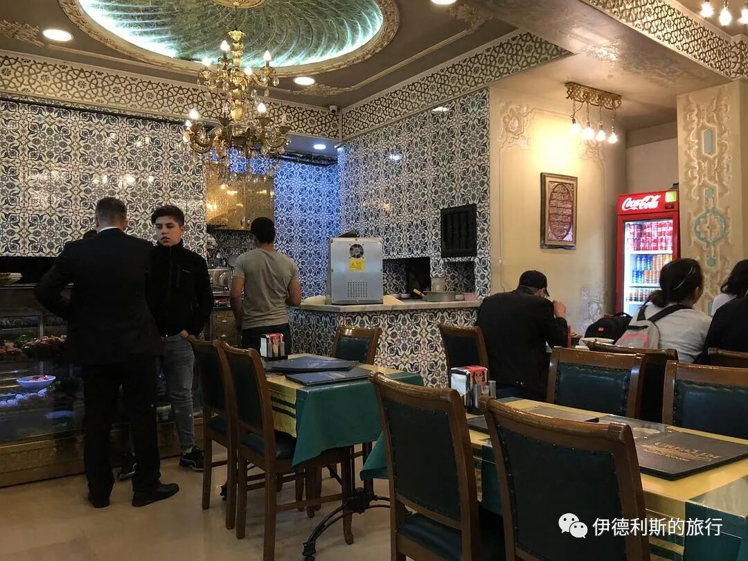
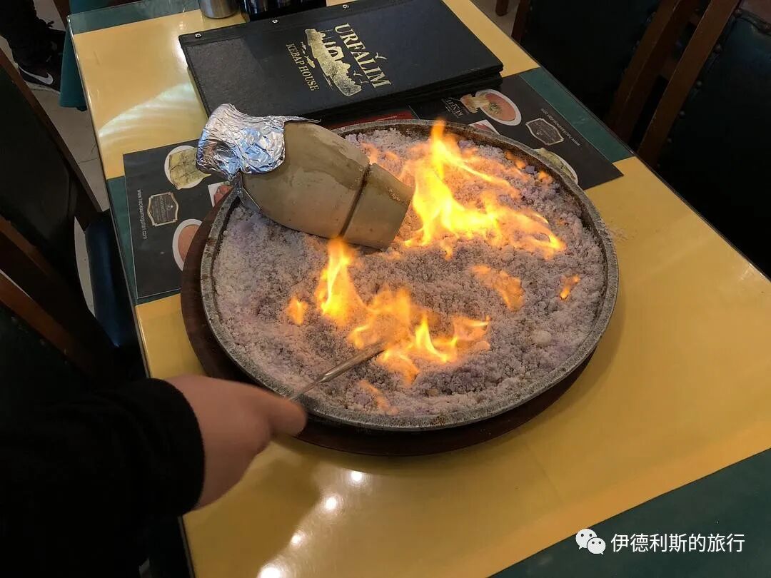
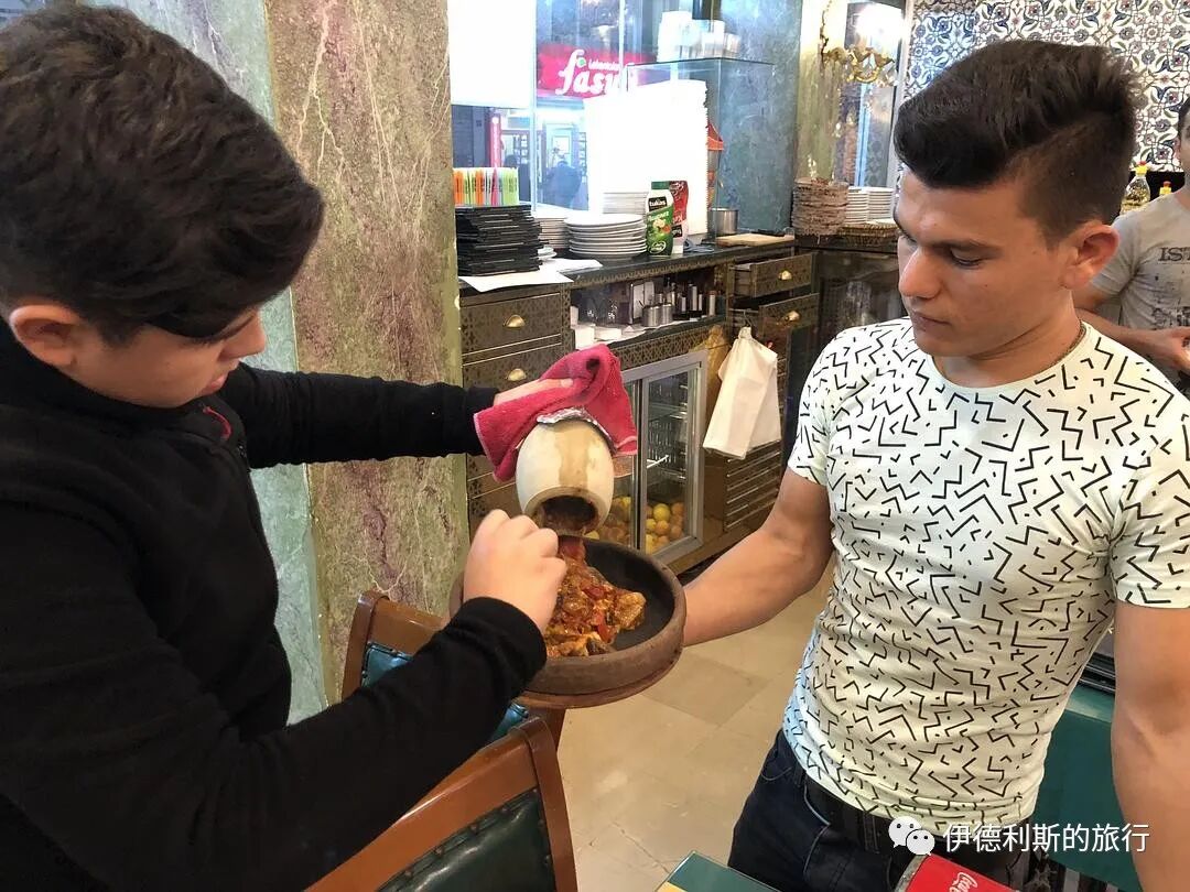
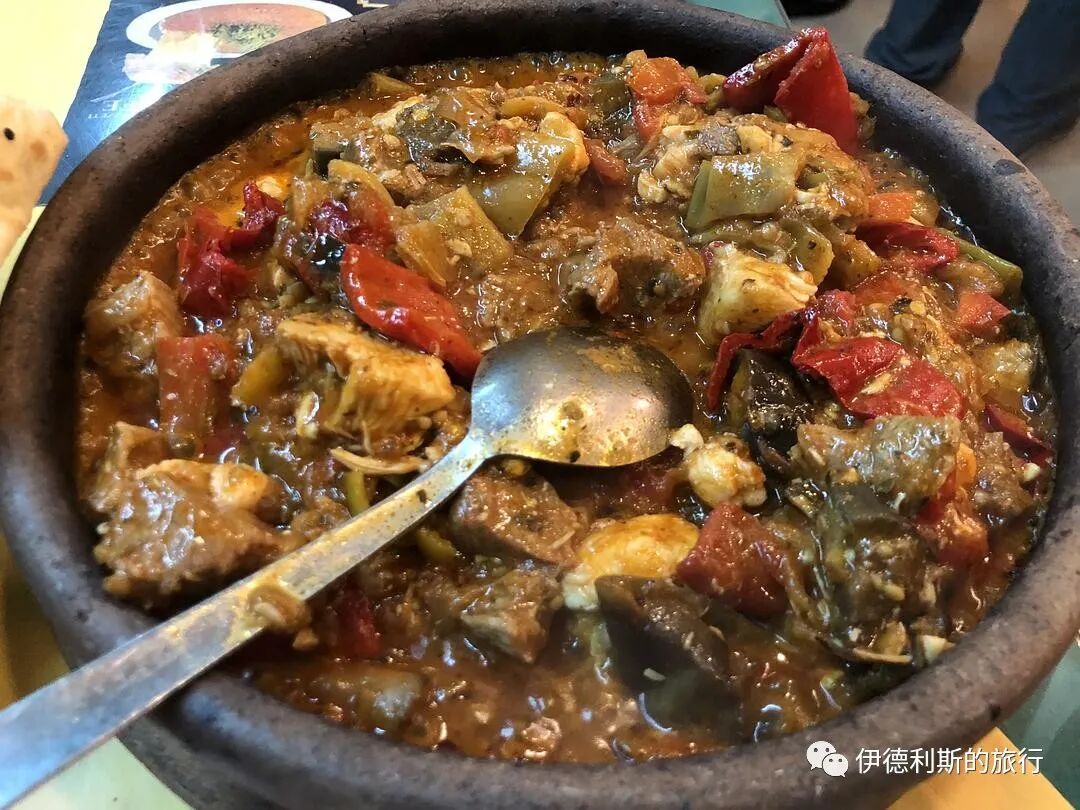
A type of kebab called testi kebab eaten at this restaurant called Urfalim Lahmacun. Testi kebab comes from Central Anatolia and the Black Sea region. Testi means jar or pot in Turkish, and it involves cooking various meats and vegetables in a clay pot.
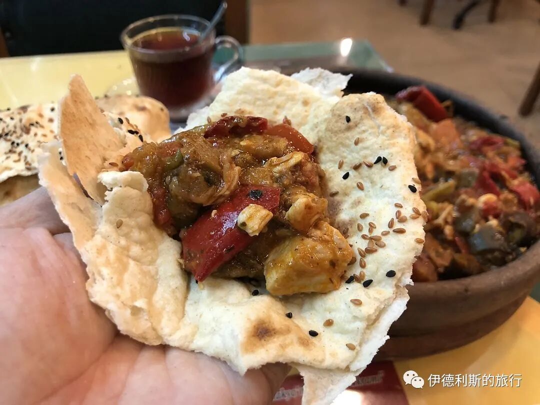
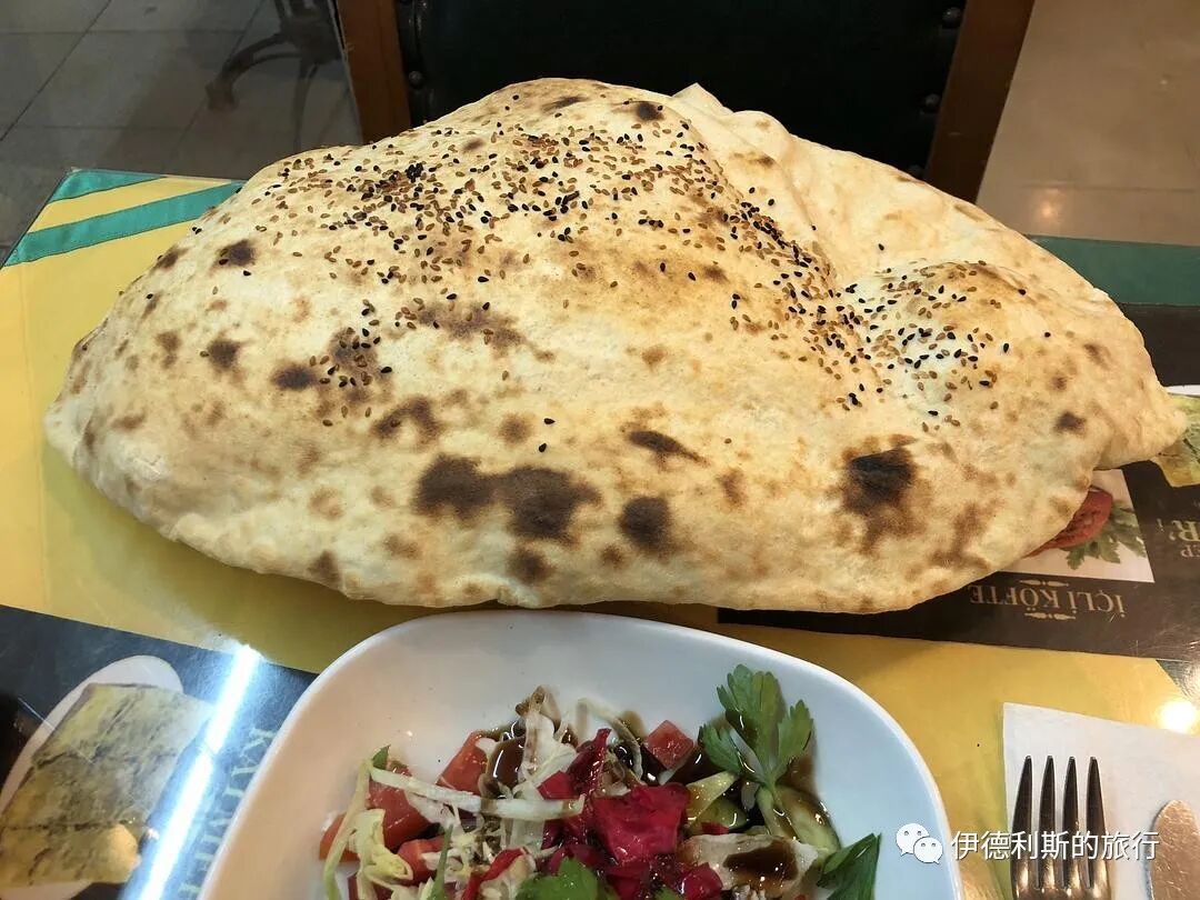
Arabic flatbread, which is very thin.
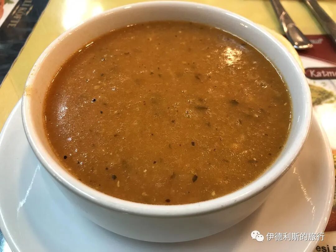
This soup is called ezogelin. It is made from crushed dried wheat and red lentils, with ingredients including rice, olive oil, butter, onions, garlic, tomatoes, chili peppers, dried mint, black pepper, and salt.
I had a dish called patlıcanlı kebab, which translates to eggplant kebab, at a bazaar next to the Rüstem Pasha Mosque in the evening, along with a drink called yayık ayran, which is a honey yogurt drink. Collapse Read »
Summary: Istanbul — Mosques, Turkish Food and Ottoman Streets is presented here as a firsthand travel account in clear English, beginning with this scene: I spent half a month traveling in Turkey from September to October 2018. While visiting historical sites in Istanbul, I tried some local food and would like to share it with you here. The account keeps its focus on Istanbul Travel, Turkish Food, Ottoman Heritage while preserving the names, places, food, and historical details from the Chinese source. This final block is 2 of 2.
Block 2 of 2
Main course
A type of kebab called testi kebab eaten at this restaurant called Urfalim Lahmacun. Testi kebab comes from Central Anatolia and the Black Sea region. Testi means jar or pot in Turkish, and it involves cooking various meats and vegetables in a clay pot.
Arabic flatbread, which is very thin.
This soup is called ezogelin. It is made from crushed dried wheat and red lentils, with ingredients including rice, olive oil, butter, onions, garlic, tomatoes, chili peppers, dried mint, black pepper, and salt.
I had a dish called patlıcanlı kebab, which translates to eggplant kebab, at a bazaar next to the Rüstem Pasha Mosque in the evening, along with a drink called yayık ayran, which is a honey yogurt drink. Collapse Read »
Beijing Muslim History: Old Halal Notes from the Northern City (Part 4 of 6) — Section 2 of 2 — Block 2 of 2
Reposted from the web
Summary: Beijing Muslim History: Old Halal Notes from the Northern City is presented here as a firsthand travel account in clear English, beginning with this scene: East City:. The account keeps its focus on Beijing Muslim History, Northern Beijing, Hui Muslims while preserving the names, places, food, and historical details from the Chinese source. This final block is 2 of 2.
Block 2 of 2
The restaurant has a professionally trained lamb slicer named Master Zhao Delu, who is nicknamed Zhao the One-Knife. He started at the shop in 1981 to learn how to debone, select, and slice lamb, and he has been doing this for over 20 years. He has his own unique skills. He chooses tender young lambs weighing 35 jin, then removes the thin membrane and tendons. After cooling the meat (known in the trade as cold-setting), the blood and meat blend together, making the red and white parts distinct before it can be used. Finally, he slices it into thin, even pieces that look beautiful with their alternating red and white colors. Dip thin slices of meat into a charcoal hot pot (huoguo) that smells of wood, letting the woody scent blend with the meat. The meat stays tender even after long cooking, and the thin slices do not break. Served with carefully prepared seasonings, friends and family sit around the table to enjoy the lively and grand atmosphere. The taste is fresh, fragrant, and wonderful. This is the traditional Beijing-style mutton hot pot (shuan yangrou) from Ruizhenhou.
The Sina blog "A Century of Ruizhenhou" by ruiren491112. The blogger, Chen Junyuan, was born in Beijing in 1949 and has lived there for generations.
One day, Lin Kaimo (noted by Wang Dongsi as a master of Go during the Republic of China era) and Xia Renhu (noted by Wang Dongsi as a famous scholar) were playing Go at Chunming Pavilion in Zhongshan Park. They played for so long that they missed dinner. When the game ended, they had to order a bowl of beef noodles at Ruizhenhou, located north of Chunming Pavilion, to satisfy their hunger. At that time, Ruizhenhou was quite famous and had a branch in Zhongshan Park that sold various noodles and snacks. Back then, the noodles at Ruizhenhou were much better than the California beef noodles popular today. They were hand-pulled noodles (chentiaomian) served hot, with a rich, thick broth and plenty of tender, fragrant meat. I don't remember the exact price per bowl, maybe 70 or 80 cents, but it was very popular.
Ruizhenhou is a halal restaurant that still exists today, located at the Dongsi intersection. In the past, it was famous for its deep-fried lamb tails (zha yangwei), crispy stir-fried mung bean jelly (jiao liu geza), braised meat strips (ba routiao), and stewed beef (men niurou).
Lingering Fragrance: Memories of the Capital by Zhou Shaoliang.
2. Kaorouwan inside Xuanwumen
Kaorouwan as described by Zhang Zhongxing.
I forget who I was with, but it was summer, and we went to Kaorouwan to try the grilled beef. The storefront was very simple, just one large room. To the south is the barbecue area with two grills side by side. They look like millstones, featuring a round platform about the size of a dining table with a foot-high iron ring in the center. A slightly raised iron grate sits on top of the ring. The grate is made of iron strips about a centimeter wide placed side by side. The gaps between them are packed with beef fat from constant use. Four rough benches are placed around the round platform for customers to stand at. To the north is a table holding bowls, chopsticks, chopped green onions, chopped cilantro, sesame paste (majiang), soy sauce, and other seasonings. There is also a cutting board for the beef, which holds the meat, knives, and plates. The man cutting the meat is a big guy around fifty years old, likely the shop owner, Mr. Wan. He is quite heavy and wears only a pair of thin trousers, which sit about an inch below his navel. The owner is very capable. Aside from a teenage boy who helps deliver meat and seasonings, he does everything himself, including seating customers and handling the bills. The meat is said to be hand-picked at the meat market early in the morning, and it is sliced well, thin and even. Collapse Read »
Summary: Beijing Muslim History: Old Halal Notes from the Northern City is presented here as a firsthand travel account in clear English, beginning with this scene: East City:. The account keeps its focus on Beijing Muslim History, Northern Beijing, Hui Muslims while preserving the names, places, food, and historical details from the Chinese source. This final block is 2 of 2.
Block 2 of 2
The restaurant has a professionally trained lamb slicer named Master Zhao Delu, who is nicknamed Zhao the One-Knife. He started at the shop in 1981 to learn how to debone, select, and slice lamb, and he has been doing this for over 20 years. He has his own unique skills. He chooses tender young lambs weighing 35 jin, then removes the thin membrane and tendons. After cooling the meat (known in the trade as cold-setting), the blood and meat blend together, making the red and white parts distinct before it can be used. Finally, he slices it into thin, even pieces that look beautiful with their alternating red and white colors. Dip thin slices of meat into a charcoal hot pot (huoguo) that smells of wood, letting the woody scent blend with the meat. The meat stays tender even after long cooking, and the thin slices do not break. Served with carefully prepared seasonings, friends and family sit around the table to enjoy the lively and grand atmosphere. The taste is fresh, fragrant, and wonderful. This is the traditional Beijing-style mutton hot pot (shuan yangrou) from Ruizhenhou.
The Sina blog "A Century of Ruizhenhou" by ruiren491112. The blogger, Chen Junyuan, was born in Beijing in 1949 and has lived there for generations.
One day, Lin Kaimo (noted by Wang Dongsi as a master of Go during the Republic of China era) and Xia Renhu (noted by Wang Dongsi as a famous scholar) were playing Go at Chunming Pavilion in Zhongshan Park. They played for so long that they missed dinner. When the game ended, they had to order a bowl of beef noodles at Ruizhenhou, located north of Chunming Pavilion, to satisfy their hunger. At that time, Ruizhenhou was quite famous and had a branch in Zhongshan Park that sold various noodles and snacks. Back then, the noodles at Ruizhenhou were much better than the California beef noodles popular today. They were hand-pulled noodles (chentiaomian) served hot, with a rich, thick broth and plenty of tender, fragrant meat. I don't remember the exact price per bowl, maybe 70 or 80 cents, but it was very popular.
Ruizhenhou is a halal restaurant that still exists today, located at the Dongsi intersection. In the past, it was famous for its deep-fried lamb tails (zha yangwei), crispy stir-fried mung bean jelly (jiao liu geza), braised meat strips (ba routiao), and stewed beef (men niurou).
Lingering Fragrance: Memories of the Capital by Zhou Shaoliang.
2. Kaorouwan inside Xuanwumen
Kaorouwan as described by Zhang Zhongxing.
I forget who I was with, but it was summer, and we went to Kaorouwan to try the grilled beef. The storefront was very simple, just one large room. To the south is the barbecue area with two grills side by side. They look like millstones, featuring a round platform about the size of a dining table with a foot-high iron ring in the center. A slightly raised iron grate sits on top of the ring. The grate is made of iron strips about a centimeter wide placed side by side. The gaps between them are packed with beef fat from constant use. Four rough benches are placed around the round platform for customers to stand at. To the north is a table holding bowls, chopsticks, chopped green onions, chopped cilantro, sesame paste (majiang), soy sauce, and other seasonings. There is also a cutting board for the beef, which holds the meat, knives, and plates. The man cutting the meat is a big guy around fifty years old, likely the shop owner, Mr. Wan. He is quite heavy and wears only a pair of thin trousers, which sit about an inch below his navel. The owner is very capable. Aside from a teenage boy who helps deliver meat and seasonings, he does everything himself, including seating customers and handling the bills. The meat is said to be hand-picked at the meat market early in the morning, and it is sliced well, thin and even. Collapse Read »
Beijing Muslim History: Old Halal Notes from the Southern City (Part 4 of 5) — Section 2 of 2 — Block 1 of 2
Reposted from the web
Summary: Beijing Muslim History: Old Halal Notes from the Southern City is presented here as a firsthand travel account in clear English, beginning with this scene: Chongwen:. The account keeps its focus on Beijing Muslim History, Southern Beijing, Hui Muslims while preserving the names, places, food, and historical details from the Chinese source. This final block is 1 of 2.
Block 1 of 2
Mentioning pickled cabbage reminds me of winters in the old capital, when every family used small coal-ball stoves. Impatient people couldn't wait for the fire to catch properly, so they would bring the stove inside while it was still emitting blue flames. The coal gas could suffocate a person. Every winter, quite a few people actually died from this. The special remedy for 'coal gas poisoning' didn't require going to a pharmacy or calling a doctor. You just had to go to a lamb stall, buy a large portion of pickled cabbage, ask for extra broth, and pour the ice-cold, teeth-chattering cabbage soup into the victim's mouth. For mild cases, a few sips of the sour, cool liquid would make them feel better in no time.
Beiping Customs: Lamb Stalls. Chen Hongnian
4. Shopkeeper Hua, who sells beef head meat from a wheelbarrow.
Back then, the street cry went like this: 'Beef liver!' Beef head meat! Beef liver for sale, hey, hey! Beef head meat for sale! The wheelbarrow creaked as it rolled over the fallen leaves of late autumn, sometimes accompanied by a few drifting snowflakes. With the weather turning hot and cold, it is the perfect time for nourishing food. Most families can afford a few ounces of beef head meat, which is reasonably priced and tastes pretty good. My grandmother never bought from strangers; she only trusted the halal shop run by Manager Hua.
Manager Hua told me his ancestors had been doing this for generations. They never opened a storefront, but followed the tradition of walking through the streets and alleys to sell their goods. Manager Hua’s beef head meat was so popular that even if he went as far as Qianmen, he would always sell out completely. Whether they wore long gowns or mandarin jackets, everyone loved this treat. If he ran into military officers or police, he had to bow and scrape, and even offer a little bribe.
Halal means being particular. The slaughter is handled by an imam, who performs the proper rites before the blade draws blood, showing respect for a life. When you think about it, a cow works hard its whole life, only occasionally rolling its eyes or acting stubborn, but it never misses a day of work. Even when it can no longer walk, it gives its life for humans, making it a creature worthy of respect. Halal means being clean. There is not a single flaw, as they always strive for perfection. For so many years, as long as a shop has a halal sign, I trust it. I can eat the meat with peace of mind. Halal means being honest. They do not cheat people, shortchange them, or take advantage of the small, perhaps because these rules have been passed down for so many years. Halal means being loyal. As long as you visit his business often and become a regular customer, he will never overcharge you. Instead, he will always give you a little extra on the house.
Shopkeeper Hua lived in the crowded courtyard behind my grandmother's house, where a dozen families all ran small businesses to make a living. When the northwest wind blew, the smell of meat would drift right into our noses, and we knew for sure Shopkeeper Hua was processing beef head (niutourou)! To be honest, beef head is the only real meat, while everything else is just beef offal (niuzasui). Besides beef liver, he had beef tendon, beef lung, and beef tripe. After Shopkeeper Hua added spices to remove the gamey smell, clear away the bad taste, and bring out the aroma, it smelled so good you wanted to grab a few bites right away to satisfy your cravings. Shopkeeper Hua's beef offal had a unique, fragrant taste, and chatty neighbors often asked him for his secret. It is not any different from what everyone else makes, is it? Shopkeeper Hua just smiled honestly, saying nothing at all. Yellow rice wine, star anise, green onion, ginger, garlic, cardamom, bay leaves, Sichuan peppercorns, and salt—these are all common kitchen spices, but the taste of Shopkeeper Hua's food was different from the usual street stalls. People said he used a few traditional Chinese medicinal herbs that were the secret of the Hua family, passed down through generations and never revealed to outsiders. Shopkeeper Hua's honest smile was just his way of being polite to people. Collapse Read »
Summary: Beijing Muslim History: Old Halal Notes from the Southern City is presented here as a firsthand travel account in clear English, beginning with this scene: Chongwen:. The account keeps its focus on Beijing Muslim History, Southern Beijing, Hui Muslims while preserving the names, places, food, and historical details from the Chinese source. This final block is 1 of 2.
Block 1 of 2
Mentioning pickled cabbage reminds me of winters in the old capital, when every family used small coal-ball stoves. Impatient people couldn't wait for the fire to catch properly, so they would bring the stove inside while it was still emitting blue flames. The coal gas could suffocate a person. Every winter, quite a few people actually died from this. The special remedy for 'coal gas poisoning' didn't require going to a pharmacy or calling a doctor. You just had to go to a lamb stall, buy a large portion of pickled cabbage, ask for extra broth, and pour the ice-cold, teeth-chattering cabbage soup into the victim's mouth. For mild cases, a few sips of the sour, cool liquid would make them feel better in no time.
Beiping Customs: Lamb Stalls. Chen Hongnian
4. Shopkeeper Hua, who sells beef head meat from a wheelbarrow.
Back then, the street cry went like this: 'Beef liver!' Beef head meat! Beef liver for sale, hey, hey! Beef head meat for sale! The wheelbarrow creaked as it rolled over the fallen leaves of late autumn, sometimes accompanied by a few drifting snowflakes. With the weather turning hot and cold, it is the perfect time for nourishing food. Most families can afford a few ounces of beef head meat, which is reasonably priced and tastes pretty good. My grandmother never bought from strangers; she only trusted the halal shop run by Manager Hua.
Manager Hua told me his ancestors had been doing this for generations. They never opened a storefront, but followed the tradition of walking through the streets and alleys to sell their goods. Manager Hua’s beef head meat was so popular that even if he went as far as Qianmen, he would always sell out completely. Whether they wore long gowns or mandarin jackets, everyone loved this treat. If he ran into military officers or police, he had to bow and scrape, and even offer a little bribe.
Halal means being particular. The slaughter is handled by an imam, who performs the proper rites before the blade draws blood, showing respect for a life. When you think about it, a cow works hard its whole life, only occasionally rolling its eyes or acting stubborn, but it never misses a day of work. Even when it can no longer walk, it gives its life for humans, making it a creature worthy of respect. Halal means being clean. There is not a single flaw, as they always strive for perfection. For so many years, as long as a shop has a halal sign, I trust it. I can eat the meat with peace of mind. Halal means being honest. They do not cheat people, shortchange them, or take advantage of the small, perhaps because these rules have been passed down for so many years. Halal means being loyal. As long as you visit his business often and become a regular customer, he will never overcharge you. Instead, he will always give you a little extra on the house.
Shopkeeper Hua lived in the crowded courtyard behind my grandmother's house, where a dozen families all ran small businesses to make a living. When the northwest wind blew, the smell of meat would drift right into our noses, and we knew for sure Shopkeeper Hua was processing beef head (niutourou)! To be honest, beef head is the only real meat, while everything else is just beef offal (niuzasui). Besides beef liver, he had beef tendon, beef lung, and beef tripe. After Shopkeeper Hua added spices to remove the gamey smell, clear away the bad taste, and bring out the aroma, it smelled so good you wanted to grab a few bites right away to satisfy your cravings. Shopkeeper Hua's beef offal had a unique, fragrant taste, and chatty neighbors often asked him for his secret. It is not any different from what everyone else makes, is it? Shopkeeper Hua just smiled honestly, saying nothing at all. Yellow rice wine, star anise, green onion, ginger, garlic, cardamom, bay leaves, Sichuan peppercorns, and salt—these are all common kitchen spices, but the taste of Shopkeeper Hua's food was different from the usual street stalls. People said he used a few traditional Chinese medicinal herbs that were the secret of the Hua family, passed down through generations and never revealed to outsiders. Shopkeeper Hua's honest smile was just his way of being polite to people. Collapse Read »
Beijing Muslim History: Old Halal Notes from the Southern City (Part 4 of 5) — Section 1 of 2 — Block 2 of 2
Reposted from the web
Summary: Beijing Muslim History: Old Halal Notes from the Southern City is presented here as a firsthand travel account in clear English, beginning with this scene: Chongwen:. The account keeps its focus on Beijing Muslim History, Southern Beijing, Hui Muslims while preserving the names, places, food, and historical details from the Chinese source. This final block is 2 of 2.
Block 2 of 2
In the old days, Beijing did not seem to have slaughterhouses, because sheep were slaughtered right at the door of the mutton stall. At a large mutton stall, early every morning, five or six large sheep would be tied up with a wooden blood basin placed nearby, waiting for the head imam (ahong) to come and recite prayers.
The Muslim imam, wearing a grey cotton robe and a black mandarin jacket (magua), would arrive by rickshaw—since he had to visit many mutton stalls each morning, he traveled by rickshaw to make his rounds—carrying a cloth bag containing the knives for slaughtering the sheep. When he reached the counter, he would take out his knife, mutter a prayer, and with one swift stroke across the sheep's neck held down by two young men, the blood would pour out; the sheep would stretch its legs, twitch a few times, and then go still.
Afterward, they would peel off the skin, cut off the head, chop off the hooves, remove the offal, wash everything clean with water, and hang the meat on a pole using copper meat hooks. Look at how fatty it is!
When it comes to northern sheep, few can compare to them, except for those from the Northwest. In the summer, they graze on green grass, becoming round and plump with thick wool, and their large tails drag behind them like a big pot lid.
If you go to a large mutton stall in the winter to buy meat for hot pot (shuan guozi), they will always take good care of you. There are cuts of meat like the neck (shangnao'er), the leg muscle (huangguatiao), the flank (yaowo), and the brisket (sancha'er); they cut exactly what you point to, and they have everything you could want. Once you leave Beijing, you can find mutton hot pot everywhere, but it is just mutton!
I remember before the war, in the old capital, one silver dollar could buy four jin of good mutton delivered to your door. Add some cabbage and glass noodles (fentiao), and one dollar's worth of meat was enough to feed three or four people. It was warm and satisfying; it was wonderful.
In the summer, every mutton stall sells fried mutton (shao yangrou). The meat, just out of the fryer, is placed on a large copper tray, and the aroma is so strong you can smell it from a mile away.
For an afternoon snack, if you have a few coins, you can buy a pair of sheep hooves or a piece of shank (jianzi), and eat it with two sesame flatbreads (shaobing); it is incredibly delicious. If you bring home a large sheep head, your family can make some pancakes, boil a pot of rice porridge (shui fan), and on a hot day, it is neither greasy nor too heavy, and it really satisfies your cravings. The sheep neck has a bit more meat and is even better to eat than the head.
If your family is small, dinner is easy to put together. Just take a pot to the mutton stall, buy seven or eight mao worth of fried mutton, and tell the shopkeeper, 'Boss, add some extra broth!' Once you get home, bring the pot of meat and broth to a boil, add a few coins' worth of noodles, and you have fried mutton noodles. Forget about leaving Beiping.
Most lamb stalls (yangrou chuangzi) have a separate area to sell lamb buns (yangrou baozi) to go. They squeeze the dough into shape with their hands. In winter, they are filled with lamb and cabbage, and in summer, lamb and chives. Every time a steamer is ready, the apprentice shouts: 'Lamb buns are here!' Fresh from the steamer, get them while they're hot!
Some lamb stalls also sell medicine. They hang a sign nearby that says 'Lamb Liver Eye-Brightening Pills' (yanggan mingmu wan), and they are all tested and approved with a license from the health bureau. Some also sell sesame paste flatbread (zhima jiang shaobing) and brown sugar cakes (tang huoshao), which are made with flour and brown sugar. They are yellowish and stamped with a red mark on top. They also carry honey-glazed fried dough twists (mi mahua), which are extremely sweet. That is the full range of side businesses found at a lamb stall.
Some lamb stalls also sell pickled cabbage (suancai). Whatever amount you buy, they tie it up with a piece of iris grass (malian cao) and hand it to you. If you buy some lamb to go with it, you can make a pot of hot lamb and pickled cabbage noodle soup. It is warm, refreshing, and delicious! Collapse Read »
Summary: Beijing Muslim History: Old Halal Notes from the Southern City is presented here as a firsthand travel account in clear English, beginning with this scene: Chongwen:. The account keeps its focus on Beijing Muslim History, Southern Beijing, Hui Muslims while preserving the names, places, food, and historical details from the Chinese source. This final block is 2 of 2.
Block 2 of 2
In the old days, Beijing did not seem to have slaughterhouses, because sheep were slaughtered right at the door of the mutton stall. At a large mutton stall, early every morning, five or six large sheep would be tied up with a wooden blood basin placed nearby, waiting for the head imam (ahong) to come and recite prayers.
The Muslim imam, wearing a grey cotton robe and a black mandarin jacket (magua), would arrive by rickshaw—since he had to visit many mutton stalls each morning, he traveled by rickshaw to make his rounds—carrying a cloth bag containing the knives for slaughtering the sheep. When he reached the counter, he would take out his knife, mutter a prayer, and with one swift stroke across the sheep's neck held down by two young men, the blood would pour out; the sheep would stretch its legs, twitch a few times, and then go still.
Afterward, they would peel off the skin, cut off the head, chop off the hooves, remove the offal, wash everything clean with water, and hang the meat on a pole using copper meat hooks. Look at how fatty it is!
When it comes to northern sheep, few can compare to them, except for those from the Northwest. In the summer, they graze on green grass, becoming round and plump with thick wool, and their large tails drag behind them like a big pot lid.
If you go to a large mutton stall in the winter to buy meat for hot pot (shuan guozi), they will always take good care of you. There are cuts of meat like the neck (shangnao'er), the leg muscle (huangguatiao), the flank (yaowo), and the brisket (sancha'er); they cut exactly what you point to, and they have everything you could want. Once you leave Beijing, you can find mutton hot pot everywhere, but it is just mutton!
I remember before the war, in the old capital, one silver dollar could buy four jin of good mutton delivered to your door. Add some cabbage and glass noodles (fentiao), and one dollar's worth of meat was enough to feed three or four people. It was warm and satisfying; it was wonderful.
In the summer, every mutton stall sells fried mutton (shao yangrou). The meat, just out of the fryer, is placed on a large copper tray, and the aroma is so strong you can smell it from a mile away.
For an afternoon snack, if you have a few coins, you can buy a pair of sheep hooves or a piece of shank (jianzi), and eat it with two sesame flatbreads (shaobing); it is incredibly delicious. If you bring home a large sheep head, your family can make some pancakes, boil a pot of rice porridge (shui fan), and on a hot day, it is neither greasy nor too heavy, and it really satisfies your cravings. The sheep neck has a bit more meat and is even better to eat than the head.
If your family is small, dinner is easy to put together. Just take a pot to the mutton stall, buy seven or eight mao worth of fried mutton, and tell the shopkeeper, 'Boss, add some extra broth!' Once you get home, bring the pot of meat and broth to a boil, add a few coins' worth of noodles, and you have fried mutton noodles. Forget about leaving Beiping.
Most lamb stalls (yangrou chuangzi) have a separate area to sell lamb buns (yangrou baozi) to go. They squeeze the dough into shape with their hands. In winter, they are filled with lamb and cabbage, and in summer, lamb and chives. Every time a steamer is ready, the apprentice shouts: 'Lamb buns are here!' Fresh from the steamer, get them while they're hot!
Some lamb stalls also sell medicine. They hang a sign nearby that says 'Lamb Liver Eye-Brightening Pills' (yanggan mingmu wan), and they are all tested and approved with a license from the health bureau. Some also sell sesame paste flatbread (zhima jiang shaobing) and brown sugar cakes (tang huoshao), which are made with flour and brown sugar. They are yellowish and stamped with a red mark on top. They also carry honey-glazed fried dough twists (mi mahua), which are extremely sweet. That is the full range of side businesses found at a lamb stall.
Some lamb stalls also sell pickled cabbage (suancai). Whatever amount you buy, they tie it up with a piece of iris grass (malian cao) and hand it to you. If you buy some lamb to go with it, you can make a pot of hot lamb and pickled cabbage noodle soup. It is warm, refreshing, and delicious! Collapse Read »
Beijing Muslim History: Old Halal Notes from the Southern City (Part 2 of 5) — Section 2 of 2 — Block 3 of 3
Reposted from the web
Summary: Beijing Muslim History: Old Halal Notes from the Southern City is presented here as a firsthand travel account in clear English, beginning with this scene: Chongwen:. The account keeps its focus on Beijing Muslim History, Southern Beijing, Hui Muslims while preserving the names, places, food, and historical details from the Chinese source. This final block is 3 of 3.
Block 3 of 3
Back then, they did not use plastic bags. Everything was wrapped by hand in paper. The clerk would wrap it however the customer wanted, like buying four liang and splitting it into two two-liang packages. If you bought one jin, they would make two half-jin packages. Of course, some people just bought one package. The clerk's wrapping technique was amazing. They folded the paper into a perfect square that looked very solid. Then they stacked the two packages together, tied them with a paper string in a cross pattern, and made a handle on top so the customer could just hook a finger through and carry it away. That tea package was quite stylish at the time. During holidays when visiting relatives and friends, you would place the tea package on the table, and it looked both grand and traditional.
Memories of Niujie by Chen Chunxi
14. Scalded dough fried cake (tangmian zhagao) at the Hui Muslim breakfast shop a short distance left from the east entrance of Xiangluying Sitiao Hutong outside Xuanwumen
When I think of the hot-water dough fried cake (tangmian zhagao), I don't know why this simple old Beijing snack has disappeared from the streets and restaurants. Actually, in the 1950s and 60s, almost every snack shop run by Hui Muslims sold them. they were an essential snack at temple fairs in the capital back then. Collapse Read »
Summary: Beijing Muslim History: Old Halal Notes from the Southern City is presented here as a firsthand travel account in clear English, beginning with this scene: Chongwen:. The account keeps its focus on Beijing Muslim History, Southern Beijing, Hui Muslims while preserving the names, places, food, and historical details from the Chinese source. This final block is 3 of 3.
Block 3 of 3
Back then, they did not use plastic bags. Everything was wrapped by hand in paper. The clerk would wrap it however the customer wanted, like buying four liang and splitting it into two two-liang packages. If you bought one jin, they would make two half-jin packages. Of course, some people just bought one package. The clerk's wrapping technique was amazing. They folded the paper into a perfect square that looked very solid. Then they stacked the two packages together, tied them with a paper string in a cross pattern, and made a handle on top so the customer could just hook a finger through and carry it away. That tea package was quite stylish at the time. During holidays when visiting relatives and friends, you would place the tea package on the table, and it looked both grand and traditional.
Memories of Niujie by Chen Chunxi
14. Scalded dough fried cake (tangmian zhagao) at the Hui Muslim breakfast shop a short distance left from the east entrance of Xiangluying Sitiao Hutong outside Xuanwumen
When I think of the hot-water dough fried cake (tangmian zhagao), I don't know why this simple old Beijing snack has disappeared from the streets and restaurants. Actually, in the 1950s and 60s, almost every snack shop run by Hui Muslims sold them. they were an essential snack at temple fairs in the capital back then. Collapse Read »
Beijing Muslim History: Old Halal Notes from the Southern City (Part 1 of 5) — Section 2 of 2 — Block 2 of 3
Reposted from the web
Summary: Beijing Muslim History: Old Halal Notes from the Southern City is presented here as a firsthand travel account in clear English, beginning with this scene: Chongwen:. The account keeps its focus on Beijing Muslim History, Southern Beijing, Hui Muslims while preserving the names, places, food, and historical details from the Chinese source. This final block is 2 of 3.
Block 2 of 3
At the west entrance of Menkuang Hutong, there was a lamb head meat stall in front of the Yuxing Restaurant that was considered a famous local snack of the area. The vendor arrived every day near dusk. He brought his own light bulb and wire, which he connected to the restaurant's power to light up his stall. He used a special knife, one foot long and five inches wide, to slice the cheek, tongue (xinzi), and eyes for customers to enjoy with their drinks. When he sliced the cheek, he made it so thin it was almost transparent. He laid it on white paper, sprinkled salt and pepper from a long-necked glass bottle, mixed it by hand, and then wrapped it up. It tasted delicious. Customers loved the taste of the meat and admired the vendor's skill. Every night when the lights came on, a crowd would gather at the intersection of Langfang Second Alley and Menkuang Hutong to watch him slice the meat. People traveled from far away to Menkuang Hutong just to eat this lamb head meat. I once asked about that Hui Muslim vendor. I only knew his surname was Ma and he lived on Niujie. He likely passed away after the Cultural Revolution, and I do not know what happened to him.
Ye Zufu Talks About Beijing by Ye Zufu
3. Yitiaolong Mutton Restaurant outside Qianmen
Yitiao Long Lamb Restaurant processes its meat carefully and slices it very thin. After slaughtering and skinning the lamb, they select only the hind legs. They place the meat on a clean surface with natural water, cover it with a reed mat, place an oilcloth over the mat, and put a block of ice on top. This is called pressed meat (yarou). The meat is pressed for a full day and night to draw out the blood and impurities, which makes the meat firm and easy to slice. This pressed meat (ya rou) is better than frozen meat because frozen meat, like frozen cabbage, breaks down the lamb's texture and makes it lose its tender, savory flavor, which makes it taste bad. Yilong is just like Zhengyanglou; they slice the meat thinly and serve it on plates according to the cut. The seasonings are complete.
When eating hot pot lamb (shuan yangrou), people usually eat sesame flatbread (shaobing) as their staple food. The sesame flatbread (shaobing) at Nanhengshun (Wang Dongsi: Yilong's original name is Nanhengshun) is also different from other places; for every basin of dough, they use ten jin of flour, with nine jin of plain flour and one jin of leavened dough. Ten jin of flour requires one jin and two liang of sesame paste. The sesame flatbread (shaobing) is first seared on a griddle, then baked in an oven, searing the bottom first and then the sesame-topped side (just for a quick touch). This kind of sesame flatbread (shaobing) has plenty of sauce, is cooked through, and is perfectly flaky and crisp.
When customers are almost full, they order a bowl of Nanhengshun's homemade, thin and uniform mung bean mixed noodles (lvdou zamian) served dry. Mung bean mixed noodles (lvdou zamian) are great for cutting through the greasiness of meat; a bowl of these noodles absorbs the floating oil from the hot pot and cleanses the palate, making these thin and uniform noodles another specialty of Nanhengshun.
Miscellaneous Talks on Old Beijing by Wang Yongbin.
4. Ai's steamed rice cake (aiwowowo) stall on Menkuang Hutong outside Qianmen
It is currently the first lunar month, the time when ai'ou wowos are on the market. Beijing's ai'ou wowos are similar to Fengtian's cool rice cakes (lianggao) and are both sold during the first lunar month, but ai'ou wowos are soft and delicious, and cannot be compared to cool rice cakes (lianggao). Cool rice cakes (lianggao) are made by steaming glutinous rice flour, using it as a wrapper, filling it with sesame and white sugar, and sprinkling it with rice flour. On the surface, they look like ai'ou wowos, but they are essentially just a variation of sticky rice cakes (niangao); after a while, when the wind blows on them, they still get hard. Collapse Read »
Summary: Beijing Muslim History: Old Halal Notes from the Southern City is presented here as a firsthand travel account in clear English, beginning with this scene: Chongwen:. The account keeps its focus on Beijing Muslim History, Southern Beijing, Hui Muslims while preserving the names, places, food, and historical details from the Chinese source. This final block is 2 of 3.
Block 2 of 3
At the west entrance of Menkuang Hutong, there was a lamb head meat stall in front of the Yuxing Restaurant that was considered a famous local snack of the area. The vendor arrived every day near dusk. He brought his own light bulb and wire, which he connected to the restaurant's power to light up his stall. He used a special knife, one foot long and five inches wide, to slice the cheek, tongue (xinzi), and eyes for customers to enjoy with their drinks. When he sliced the cheek, he made it so thin it was almost transparent. He laid it on white paper, sprinkled salt and pepper from a long-necked glass bottle, mixed it by hand, and then wrapped it up. It tasted delicious. Customers loved the taste of the meat and admired the vendor's skill. Every night when the lights came on, a crowd would gather at the intersection of Langfang Second Alley and Menkuang Hutong to watch him slice the meat. People traveled from far away to Menkuang Hutong just to eat this lamb head meat. I once asked about that Hui Muslim vendor. I only knew his surname was Ma and he lived on Niujie. He likely passed away after the Cultural Revolution, and I do not know what happened to him.
Ye Zufu Talks About Beijing by Ye Zufu
3. Yitiaolong Mutton Restaurant outside Qianmen
Yitiao Long Lamb Restaurant processes its meat carefully and slices it very thin. After slaughtering and skinning the lamb, they select only the hind legs. They place the meat on a clean surface with natural water, cover it with a reed mat, place an oilcloth over the mat, and put a block of ice on top. This is called pressed meat (yarou). The meat is pressed for a full day and night to draw out the blood and impurities, which makes the meat firm and easy to slice. This pressed meat (ya rou) is better than frozen meat because frozen meat, like frozen cabbage, breaks down the lamb's texture and makes it lose its tender, savory flavor, which makes it taste bad. Yilong is just like Zhengyanglou; they slice the meat thinly and serve it on plates according to the cut. The seasonings are complete.
When eating hot pot lamb (shuan yangrou), people usually eat sesame flatbread (shaobing) as their staple food. The sesame flatbread (shaobing) at Nanhengshun (Wang Dongsi: Yilong's original name is Nanhengshun) is also different from other places; for every basin of dough, they use ten jin of flour, with nine jin of plain flour and one jin of leavened dough. Ten jin of flour requires one jin and two liang of sesame paste. The sesame flatbread (shaobing) is first seared on a griddle, then baked in an oven, searing the bottom first and then the sesame-topped side (just for a quick touch). This kind of sesame flatbread (shaobing) has plenty of sauce, is cooked through, and is perfectly flaky and crisp.
When customers are almost full, they order a bowl of Nanhengshun's homemade, thin and uniform mung bean mixed noodles (lvdou zamian) served dry. Mung bean mixed noodles (lvdou zamian) are great for cutting through the greasiness of meat; a bowl of these noodles absorbs the floating oil from the hot pot and cleanses the palate, making these thin and uniform noodles another specialty of Nanhengshun.
Miscellaneous Talks on Old Beijing by Wang Yongbin.
4. Ai's steamed rice cake (aiwowowo) stall on Menkuang Hutong outside Qianmen
It is currently the first lunar month, the time when ai'ou wowos are on the market. Beijing's ai'ou wowos are similar to Fengtian's cool rice cakes (lianggao) and are both sold during the first lunar month, but ai'ou wowos are soft and delicious, and cannot be compared to cool rice cakes (lianggao). Cool rice cakes (lianggao) are made by steaming glutinous rice flour, using it as a wrapper, filling it with sesame and white sugar, and sprinkling it with rice flour. On the surface, they look like ai'ou wowos, but they are essentially just a variation of sticky rice cakes (niangao); after a while, when the wind blows on them, they still get hard. Collapse Read »
Halal Travel Guide: Istanbul — Mosques, Turkish Food and Ottoman Streets (Part 1 of 3) — Section 2 of 2 — Block 2 of 2
Reposted from the web
Summary: Istanbul — Mosques, Turkish Food and Ottoman Streets is presented here as a firsthand travel account in clear English, beginning with this scene: I spent half a month traveling in Turkey from September to October 2018. While visiting historical sites in Istanbul, I tried some local food and would like to share it with you here. The account keeps its focus on Istanbul Travel, Turkish Food, Ottoman Heritage while preserving the names, places, food, and historical details from the Chinese source. This final block is 2 of 2.
Block 2 of 2
Main course
A type of kebab called testi kebab eaten at this restaurant called Urfalim Lahmacun. Testi kebab comes from Central Anatolia and the Black Sea region. Testi means jar or pot in Turkish, and it involves cooking various meats and vegetables in a clay pot.
Arabic flatbread, which is very thin.
This soup is called ezogelin. It is made from crushed dried wheat and red lentils, with ingredients including rice, olive oil, butter, onions, garlic, tomatoes, chili peppers, dried mint, black pepper, and salt.
I had a dish called patlıcanlı kebab, which translates to eggplant kebab, at a bazaar next to the Rüstem Pasha Mosque in the evening, along with a drink called yayık ayran, which is a honey yogurt drink. Collapse Read »
Summary: Istanbul — Mosques, Turkish Food and Ottoman Streets is presented here as a firsthand travel account in clear English, beginning with this scene: I spent half a month traveling in Turkey from September to October 2018. While visiting historical sites in Istanbul, I tried some local food and would like to share it with you here. The account keeps its focus on Istanbul Travel, Turkish Food, Ottoman Heritage while preserving the names, places, food, and historical details from the Chinese source. This final block is 2 of 2.
Block 2 of 2
Main course
A type of kebab called testi kebab eaten at this restaurant called Urfalim Lahmacun. Testi kebab comes from Central Anatolia and the Black Sea region. Testi means jar or pot in Turkish, and it involves cooking various meats and vegetables in a clay pot.
Arabic flatbread, which is very thin.
This soup is called ezogelin. It is made from crushed dried wheat and red lentils, with ingredients including rice, olive oil, butter, onions, garlic, tomatoes, chili peppers, dried mint, black pepper, and salt.
I had a dish called patlıcanlı kebab, which translates to eggplant kebab, at a bazaar next to the Rüstem Pasha Mosque in the evening, along with a drink called yayık ayran, which is a honey yogurt drink. Collapse Read »
Beijing Muslim History: Old Halal Notes from the Northern City (Part 4 of 6) — Section 2 of 2
Reposted from the web
Summary: Beijing Muslim History: Old Halal Notes from the Northern City is presented here as a firsthand travel account in clear English, beginning with this scene: East City:. The account keeps its focus on Beijing Muslim History, Northern Beijing, Hui Muslims while preserving the names, places, food, and historical details from the Chinese source. This retry section is 2 of 2.
Section 2 of 2
When I was a teenager, I was an apprentice at Zengqingzhai near the Back Gate (Houmen, also known as Di'anmen)... What did we sell? They sold pastries, and in the summer, they sold river produce like lotus root, water caltrops, and eight-treasure lotus seed porridge (babao lianzi zhou). All this river food came from Zengqingzhai, and they also sold ice cream. That is what we made back home. Later, when I made ice cream in Jiuxianqiao, I used what I learned here. Where did we sell it? In the middle of Shichahai, they drove piles into the lake bed, laid down boards, and connected them to build several room-like structures. They sold everything there—all kinds of food like fried dough rings (youzhuozi), eight-treasure lotus seed porridge (babao lianzi zhou), fox nuts (jitoumi), gorgon fruit (qianshimi), lotus seed pods, and all sorts of lotus root, like white lotus root. It was all kinds of cold snacks, really: dried fruit (guozigan), sour plum drink (suanmeitang), ice cream, and shaved ice (xuehualao). I carried everything there on a shoulder pole and set up my stall.
Born in the South of the City: Businesses Run by Hui Muslims—as told by Man Hengliang. Written by Ding Yizhuang.
Xicheng District
1. Ruizhenhou inside Zhongshan Park
Century-old Ruizhenhou
Inside Zhongshan Park, there used to be an old antique shop called Ruizhenhou, which opened in 1917. The name Ruizhenhou has a specific meaning: Rui stands for good luck and the sweet olive flower (ruixiang). Zhen means rare treasures, pearls, jade, and gemstones. Hou means being tolerant and kind, and treating people with honesty. Business was very successful after it opened, and it quickly became famous throughout Beijing. To make it easier to host guests and discuss business, the owner added a tea area and served food in the shop. There is an accurate written record about this: In 1917, the Zhongshan Park Board of Directors built 18 high-ceilinged rooms between Chunming Hall and Shanglinchun, with corridors on the east and west sides, to rent out to shops. One of these was the Ruizhenhou antique shop, which was opened by Hui Muslims.
By 1950, this business was no longer doing well. Owner Ma You'an used his business sense to realize the park lacked a decent halal restaurant, so he turned his antique shop into one. He hired the famous chef Ma Deqi to run the kitchen, and his halal dishes, especially his braised beef (wei niurou), quickly became famous in Beijing. Ma Deqi learned from Chu Lianxiang (known in the industry as Chu Xiang), a master who pioneered Beijing halal cuisine. Chu Xiang was once a royal chef who combined traditional Hui Muslim stir-frying, roasting, and hot pot techniques with cooking styles from both northern and southern China to create a unique Beijing halal flavor. As the top student among Chu Xiang's eight main disciples, Ma Deqi mastered his teacher's skills. The grand banquets Ruizhenhou offered, such as the whole lamb feast (quanyang xi), fish maw feast (yudu xi), and shark fin feast (yuchi xi), were far beyond what ordinary restaurants could prepare. Soon after opening, the restaurant became as famous as the long-standing Han Chinese restaurant Laijinyuxuan, also located in Zhongshan Park, and was always packed with customers. Mr. Ma Lianliang's birthday was on the tenth day of the first lunar month. Every year on this day, he would visit Ruizhenhou. When he was happy, he would personally name his favorite dish 'duck paste bread' (ya ni mian bao) and always ordered it. Because of this, the reputation of Ruizhenhou restaurant grew stronger and stronger.
In the early 1960s, due to a shortage of beef and mutton, Ruizhenhou was forced to become a halal snack shop. Parents visiting Zhongshan Park would always stop by the snack bar to buy something for their children, even if it was just a piece of fried cake (zhagao). When the Cultural Revolution began, the halal snack shops closed down. In the early 1980s, to support ethnic policies, the former Dongcheng Catering Company worked to bring back the famous old brand Ruizhenhou Restaurant. They reopened it at its current location at 1 South Dongsisi Street in 1982 and renamed the halal shop Ruizhenhou Restaurant. Today, third-generation chefs continue to carry on the unique halal flavors of Ruizhenhou.
The restaurant has a professionally trained lamb slicer named Master Zhao Delu, who is nicknamed Zhao the One-Knife. He started at the shop in 1981 to learn how to debone, select, and slice lamb, and he has been doing this for over 20 years. He has his own unique skills. He chooses tender young lambs weighing 35 jin, then removes the thin membrane and tendons. After cooling the meat (known in the trade as cold-setting), the blood and meat blend together, making the red and white parts distinct before it can be used. Finally, he slices it into thin, even pieces that look beautiful with their alternating red and white colors. Dip thin slices of meat into a charcoal hot pot (huoguo) that smells of wood, letting the woody scent blend with the meat. The meat stays tender even after long cooking, and the thin slices do not break. Served with carefully prepared seasonings, friends and family sit around the table to enjoy the lively and grand atmosphere. The taste is fresh, fragrant, and wonderful. This is the traditional Beijing-style mutton hot pot (shuan yangrou) from Ruizhenhou.
The Sina blog "A Century of Ruizhenhou" by ruiren491112. The blogger, Chen Junyuan, was born in Beijing in 1949 and has lived there for generations.
One day, Lin Kaimo (noted by Wang Dongsi as a master of Go during the Republic of China era) and Xia Renhu (noted by Wang Dongsi as a famous scholar) were playing Go at Chunming Pavilion in Zhongshan Park. They played for so long that they missed dinner. When the game ended, they had to order a bowl of beef noodles at Ruizhenhou, located north of Chunming Pavilion, to satisfy their hunger. At that time, Ruizhenhou was quite famous and had a branch in Zhongshan Park that sold various noodles and snacks. Back then, the noodles at Ruizhenhou were much better than the California beef noodles popular today. They were hand-pulled noodles (chentiaomian) served hot, with a rich, thick broth and plenty of tender, fragrant meat. I don't remember the exact price per bowl, maybe 70 or 80 cents, but it was very popular.
Ruizhenhou is a halal restaurant that still exists today, located at the Dongsi intersection. In the past, it was famous for its deep-fried lamb tails (zha yangwei), crispy stir-fried mung bean jelly (jiao liu geza), braised meat strips (ba routiao), and stewed beef (men niurou).
Lingering Fragrance: Memories of the Capital by Zhou Shaoliang.
2. Kaorouwan inside Xuanwumen
Kaorouwan as described by Zhang Zhongxing.
I forget who I was with, but it was summer, and we went to Kaorouwan to try the grilled beef. The storefront was very simple, just one large room. To the south is the barbecue area with two grills side by side. They look like millstones, featuring a round platform about the size of a dining table with a foot-high iron ring in the center. A slightly raised iron grate sits on top of the ring. The grate is made of iron strips about a centimeter wide placed side by side. The gaps between them are packed with beef fat from constant use. Four rough benches are placed around the round platform for customers to stand at. To the north is a table holding bowls, chopsticks, chopped green onions, chopped cilantro, sesame paste (majiang), soy sauce, and other seasonings. There is also a cutting board for the beef, which holds the meat, knives, and plates. The man cutting the meat is a big guy around fifty years old, likely the shop owner, Mr. Wan. He is quite heavy and wears only a pair of thin trousers, which sit about an inch below his navel. The owner is very capable. Aside from a teenage boy who helps deliver meat and seasonings, he does everything himself, including seating customers and handling the bills. The meat is said to be hand-picked at the meat market early in the morning, and it is sliced well, thin and even. Collapse Read »
Summary: Beijing Muslim History: Old Halal Notes from the Northern City is presented here as a firsthand travel account in clear English, beginning with this scene: East City:. The account keeps its focus on Beijing Muslim History, Northern Beijing, Hui Muslims while preserving the names, places, food, and historical details from the Chinese source. This retry section is 2 of 2.
Section 2 of 2
When I was a teenager, I was an apprentice at Zengqingzhai near the Back Gate (Houmen, also known as Di'anmen)... What did we sell? They sold pastries, and in the summer, they sold river produce like lotus root, water caltrops, and eight-treasure lotus seed porridge (babao lianzi zhou). All this river food came from Zengqingzhai, and they also sold ice cream. That is what we made back home. Later, when I made ice cream in Jiuxianqiao, I used what I learned here. Where did we sell it? In the middle of Shichahai, they drove piles into the lake bed, laid down boards, and connected them to build several room-like structures. They sold everything there—all kinds of food like fried dough rings (youzhuozi), eight-treasure lotus seed porridge (babao lianzi zhou), fox nuts (jitoumi), gorgon fruit (qianshimi), lotus seed pods, and all sorts of lotus root, like white lotus root. It was all kinds of cold snacks, really: dried fruit (guozigan), sour plum drink (suanmeitang), ice cream, and shaved ice (xuehualao). I carried everything there on a shoulder pole and set up my stall.
Born in the South of the City: Businesses Run by Hui Muslims—as told by Man Hengliang. Written by Ding Yizhuang.
Xicheng District
1. Ruizhenhou inside Zhongshan Park
Century-old Ruizhenhou
Inside Zhongshan Park, there used to be an old antique shop called Ruizhenhou, which opened in 1917. The name Ruizhenhou has a specific meaning: Rui stands for good luck and the sweet olive flower (ruixiang). Zhen means rare treasures, pearls, jade, and gemstones. Hou means being tolerant and kind, and treating people with honesty. Business was very successful after it opened, and it quickly became famous throughout Beijing. To make it easier to host guests and discuss business, the owner added a tea area and served food in the shop. There is an accurate written record about this: In 1917, the Zhongshan Park Board of Directors built 18 high-ceilinged rooms between Chunming Hall and Shanglinchun, with corridors on the east and west sides, to rent out to shops. One of these was the Ruizhenhou antique shop, which was opened by Hui Muslims.
By 1950, this business was no longer doing well. Owner Ma You'an used his business sense to realize the park lacked a decent halal restaurant, so he turned his antique shop into one. He hired the famous chef Ma Deqi to run the kitchen, and his halal dishes, especially his braised beef (wei niurou), quickly became famous in Beijing. Ma Deqi learned from Chu Lianxiang (known in the industry as Chu Xiang), a master who pioneered Beijing halal cuisine. Chu Xiang was once a royal chef who combined traditional Hui Muslim stir-frying, roasting, and hot pot techniques with cooking styles from both northern and southern China to create a unique Beijing halal flavor. As the top student among Chu Xiang's eight main disciples, Ma Deqi mastered his teacher's skills. The grand banquets Ruizhenhou offered, such as the whole lamb feast (quanyang xi), fish maw feast (yudu xi), and shark fin feast (yuchi xi), were far beyond what ordinary restaurants could prepare. Soon after opening, the restaurant became as famous as the long-standing Han Chinese restaurant Laijinyuxuan, also located in Zhongshan Park, and was always packed with customers. Mr. Ma Lianliang's birthday was on the tenth day of the first lunar month. Every year on this day, he would visit Ruizhenhou. When he was happy, he would personally name his favorite dish 'duck paste bread' (ya ni mian bao) and always ordered it. Because of this, the reputation of Ruizhenhou restaurant grew stronger and stronger.
In the early 1960s, due to a shortage of beef and mutton, Ruizhenhou was forced to become a halal snack shop. Parents visiting Zhongshan Park would always stop by the snack bar to buy something for their children, even if it was just a piece of fried cake (zhagao). When the Cultural Revolution began, the halal snack shops closed down. In the early 1980s, to support ethnic policies, the former Dongcheng Catering Company worked to bring back the famous old brand Ruizhenhou Restaurant. They reopened it at its current location at 1 South Dongsisi Street in 1982 and renamed the halal shop Ruizhenhou Restaurant. Today, third-generation chefs continue to carry on the unique halal flavors of Ruizhenhou.
The restaurant has a professionally trained lamb slicer named Master Zhao Delu, who is nicknamed Zhao the One-Knife. He started at the shop in 1981 to learn how to debone, select, and slice lamb, and he has been doing this for over 20 years. He has his own unique skills. He chooses tender young lambs weighing 35 jin, then removes the thin membrane and tendons. After cooling the meat (known in the trade as cold-setting), the blood and meat blend together, making the red and white parts distinct before it can be used. Finally, he slices it into thin, even pieces that look beautiful with their alternating red and white colors. Dip thin slices of meat into a charcoal hot pot (huoguo) that smells of wood, letting the woody scent blend with the meat. The meat stays tender even after long cooking, and the thin slices do not break. Served with carefully prepared seasonings, friends and family sit around the table to enjoy the lively and grand atmosphere. The taste is fresh, fragrant, and wonderful. This is the traditional Beijing-style mutton hot pot (shuan yangrou) from Ruizhenhou.
The Sina blog "A Century of Ruizhenhou" by ruiren491112. The blogger, Chen Junyuan, was born in Beijing in 1949 and has lived there for generations.
One day, Lin Kaimo (noted by Wang Dongsi as a master of Go during the Republic of China era) and Xia Renhu (noted by Wang Dongsi as a famous scholar) were playing Go at Chunming Pavilion in Zhongshan Park. They played for so long that they missed dinner. When the game ended, they had to order a bowl of beef noodles at Ruizhenhou, located north of Chunming Pavilion, to satisfy their hunger. At that time, Ruizhenhou was quite famous and had a branch in Zhongshan Park that sold various noodles and snacks. Back then, the noodles at Ruizhenhou were much better than the California beef noodles popular today. They were hand-pulled noodles (chentiaomian) served hot, with a rich, thick broth and plenty of tender, fragrant meat. I don't remember the exact price per bowl, maybe 70 or 80 cents, but it was very popular.
Ruizhenhou is a halal restaurant that still exists today, located at the Dongsi intersection. In the past, it was famous for its deep-fried lamb tails (zha yangwei), crispy stir-fried mung bean jelly (jiao liu geza), braised meat strips (ba routiao), and stewed beef (men niurou).
Lingering Fragrance: Memories of the Capital by Zhou Shaoliang.
2. Kaorouwan inside Xuanwumen
Kaorouwan as described by Zhang Zhongxing.
I forget who I was with, but it was summer, and we went to Kaorouwan to try the grilled beef. The storefront was very simple, just one large room. To the south is the barbecue area with two grills side by side. They look like millstones, featuring a round platform about the size of a dining table with a foot-high iron ring in the center. A slightly raised iron grate sits on top of the ring. The grate is made of iron strips about a centimeter wide placed side by side. The gaps between them are packed with beef fat from constant use. Four rough benches are placed around the round platform for customers to stand at. To the north is a table holding bowls, chopsticks, chopped green onions, chopped cilantro, sesame paste (majiang), soy sauce, and other seasonings. There is also a cutting board for the beef, which holds the meat, knives, and plates. The man cutting the meat is a big guy around fifty years old, likely the shop owner, Mr. Wan. He is quite heavy and wears only a pair of thin trousers, which sit about an inch below his navel. The owner is very capable. Aside from a teenage boy who helps deliver meat and seasonings, he does everything himself, including seating customers and handling the bills. The meat is said to be hand-picked at the meat market early in the morning, and it is sliced well, thin and even. Collapse Read »
Beijing Muslim History: Old Halal Notes from the Southern City (Part 4 of 5) — Section 2 of 2
Reposted from the web
Summary: Beijing Muslim History: Old Halal Notes from the Southern City is presented here as a firsthand travel account in clear English, beginning with this scene: Chongwen:. The account keeps its focus on Beijing Muslim History, Southern Beijing, Hui Muslims while preserving the names, places, food, and historical details from the Chinese source. This retry section is 2 of 2.
Section 2 of 2
Mentioning pickled cabbage reminds me of winters in the old capital, when every family used small coal-ball stoves. Impatient people couldn't wait for the fire to catch properly, so they would bring the stove inside while it was still emitting blue flames. The coal gas could suffocate a person. Every winter, quite a few people actually died from this. The special remedy for 'coal gas poisoning' didn't require going to a pharmacy or calling a doctor. You just had to go to a lamb stall, buy a large portion of pickled cabbage, ask for extra broth, and pour the ice-cold, teeth-chattering cabbage soup into the victim's mouth. For mild cases, a few sips of the sour, cool liquid would make them feel better in no time.
Beiping Customs: Lamb Stalls. Chen Hongnian
4. Shopkeeper Hua, who sells beef head meat from a wheelbarrow.
Back then, the street cry went like this: 'Beef liver!' Beef head meat! Beef liver for sale, hey, hey! Beef head meat for sale! The wheelbarrow creaked as it rolled over the fallen leaves of late autumn, sometimes accompanied by a few drifting snowflakes. With the weather turning hot and cold, it is the perfect time for nourishing food. Most families can afford a few ounces of beef head meat, which is reasonably priced and tastes pretty good. My grandmother never bought from strangers; she only trusted the halal shop run by Manager Hua.
Manager Hua told me his ancestors had been doing this for generations. They never opened a storefront, but followed the tradition of walking through the streets and alleys to sell their goods. Manager Hua’s beef head meat was so popular that even if he went as far as Qianmen, he would always sell out completely. Whether they wore long gowns or mandarin jackets, everyone loved this treat. If he ran into military officers or police, he had to bow and scrape, and even offer a little bribe.
Halal means being particular. The slaughter is handled by an imam, who performs the proper rites before the blade draws blood, showing respect for a life. When you think about it, a cow works hard its whole life, only occasionally rolling its eyes or acting stubborn, but it never misses a day of work. Even when it can no longer walk, it gives its life for humans, making it a creature worthy of respect. Halal means being clean. There is not a single flaw, as they always strive for perfection. For so many years, as long as a shop has a halal sign, I trust it. I can eat the meat with peace of mind. Halal means being honest. They do not cheat people, shortchange them, or take advantage of the small, perhaps because these rules have been passed down for so many years. Halal means being loyal. As long as you visit his business often and become a regular customer, he will never overcharge you. Instead, he will always give you a little extra on the house.
Shopkeeper Hua lived in the crowded courtyard behind my grandmother's house, where a dozen families all ran small businesses to make a living. When the northwest wind blew, the smell of meat would drift right into our noses, and we knew for sure Shopkeeper Hua was processing beef head (niutourou)! To be honest, beef head is the only real meat, while everything else is just beef offal (niuzasui). Besides beef liver, he had beef tendon, beef lung, and beef tripe. After Shopkeeper Hua added spices to remove the gamey smell, clear away the bad taste, and bring out the aroma, it smelled so good you wanted to grab a few bites right away to satisfy your cravings. Shopkeeper Hua's beef offal had a unique, fragrant taste, and chatty neighbors often asked him for his secret. It is not any different from what everyone else makes, is it? Shopkeeper Hua just smiled honestly, saying nothing at all. Yellow rice wine, star anise, green onion, ginger, garlic, cardamom, bay leaves, Sichuan peppercorns, and salt—these are all common kitchen spices, but the taste of Shopkeeper Hua's food was different from the usual street stalls. People said he used a few traditional Chinese medicinal herbs that were the secret of the Hua family, passed down through generations and never revealed to outsiders. Shopkeeper Hua's honest smile was just his way of being polite to people.
Shopkeeper Hua's wheelbarrow was very distinctive. It had a wooden wheel with a copper axle, and the wheel was inlaid with shiny copper nails inside and out. The top of the cart was covered in galvanized sheet metal, polished until it shone. The cooked beef head and various types of beef offal were kept in separate round wicker baskets. A long, sharp knife was fixed in one spot to keep it from shaking. A white cloth covered all the cooked food tightly.
When Auntie Zhang saw the cart hadn't moved from the doorway, she quickly greeted him, 'Give me half a jin of beef head, with Sichuan peppercorn salt!' Shopkeeper Hua lifted the cloth, picked up a small piece, and asked, 'How about this piece?' Seeing Auntie Zhang nod, he put it on the scale. It is a generous portion, don't you see? As he spoke, he used a long knife to slice the meat so thin that if you held a piece of paper with writing on it behind the slice, you could still read the words!
Shopkeeper, please put together a pound of mixed offal (zasui), add plenty of tendon (tijin), serve it cold, and put in lots of chili oil! Whenever guests come to Uncle Li's house, they all love this dish with their drinks. While Shopkeeper Hua finished slicing and mixing, Uncle Li quickly popped a piece into his mouth while waiting for his change. To use one word: impatient. His mouth was even more eager than his hands. Just like that, before the wheelbarrow even left the alley, several pounds were already gone.
You might ask, do Shopkeeper Hua's descendants still do this business? To tell you the truth, his sons are all highly educated, and his grandchildren are either studying abroad or working as white-collar professionals in the capital. Selling beef head meat and using a wheelbarrow? That seems to have nothing to do with their life paths. Whenever someone mentions how good the beef tasted when Shopkeeper Hua was alive, no one in the Hua family picks up the conversation. Well! The ancestral flavor of the Hua family just ended right there! People say one white-collar grandson had the intention to change careers, but who could he ask for the secret recipe? What happened then? There was no follow-up. Even if there were a resolution, no one knows. Think about it, the urban jungle is a maze; even in the same building, who really knows anyone else?
Old Beijing Stories 3 by Liu Hui
5. Bai Family Sesame Flatbread Shop (shaobing pu).
Since I dare to say that sesame flatbread (shaobing) shops aren't as good as they used to be, I can give you a hundred reasons why. When I lived in the alleyway (hutong), there was a sesame flatbread (shaobing) shop right next door. The owner was named Bai, a Hui Muslim who always wore a white cap, a white shirt, and a white apron without a single speck of dirt on them. He was about sixty, so I had to call him Grandpa. He never made a big deal about selling authentic Beijing-style sesame flatbread (shaobing), but I heard all the old folks say they grew up eating the Bai family's bread. Thinking about it, I was the same; if the alleyway hadn't been torn down, I would still be eating the bread made by the younger generation of the Bai family.
The Bai Family Sesame Flatbread Shop had a simple sign with white characters on a blue background. The sign marked as halal lets you rest easy knowing that this shop is clean. The Bai family mainly sold pepper-salt baked flatbread (jiaoyan huoshao), spiral-shaped rolls (luosizhuan), brown sugar baked flatbread (hongtang huoshao), and leavened baked flatbread (famian huoshao). The most popular item was the sesame flatbread (shaobing), which had three things in abundance: lots of sesame seeds, lots of sesame paste, and lots of layers. It had two types of crispness: a crispy crust and crispy sesame seeds. It had five types of fragrance: the fragrance of the crust, the sesame seeds, the sesame paste, the inside, and the lingering taste in your mouth. Through all the years, winter or summer, it always tasted the same. One time, my grandmother was waiting in line and casually asked about the secret to his baking, and he replied, "The ingredients must never change; you have to keep a clear conscience." Old Man Bai answered while spreading sesame paste onto the dough. It seemed like he didn't give away the real secret, but when you think about it, it was actually quite clear and he wasn't hiding anything. Collapse Read »
Summary: Beijing Muslim History: Old Halal Notes from the Southern City is presented here as a firsthand travel account in clear English, beginning with this scene: Chongwen:. The account keeps its focus on Beijing Muslim History, Southern Beijing, Hui Muslims while preserving the names, places, food, and historical details from the Chinese source. This retry section is 2 of 2.
Section 2 of 2
Mentioning pickled cabbage reminds me of winters in the old capital, when every family used small coal-ball stoves. Impatient people couldn't wait for the fire to catch properly, so they would bring the stove inside while it was still emitting blue flames. The coal gas could suffocate a person. Every winter, quite a few people actually died from this. The special remedy for 'coal gas poisoning' didn't require going to a pharmacy or calling a doctor. You just had to go to a lamb stall, buy a large portion of pickled cabbage, ask for extra broth, and pour the ice-cold, teeth-chattering cabbage soup into the victim's mouth. For mild cases, a few sips of the sour, cool liquid would make them feel better in no time.
Beiping Customs: Lamb Stalls. Chen Hongnian
4. Shopkeeper Hua, who sells beef head meat from a wheelbarrow.
Back then, the street cry went like this: 'Beef liver!' Beef head meat! Beef liver for sale, hey, hey! Beef head meat for sale! The wheelbarrow creaked as it rolled over the fallen leaves of late autumn, sometimes accompanied by a few drifting snowflakes. With the weather turning hot and cold, it is the perfect time for nourishing food. Most families can afford a few ounces of beef head meat, which is reasonably priced and tastes pretty good. My grandmother never bought from strangers; she only trusted the halal shop run by Manager Hua.
Manager Hua told me his ancestors had been doing this for generations. They never opened a storefront, but followed the tradition of walking through the streets and alleys to sell their goods. Manager Hua’s beef head meat was so popular that even if he went as far as Qianmen, he would always sell out completely. Whether they wore long gowns or mandarin jackets, everyone loved this treat. If he ran into military officers or police, he had to bow and scrape, and even offer a little bribe.
Halal means being particular. The slaughter is handled by an imam, who performs the proper rites before the blade draws blood, showing respect for a life. When you think about it, a cow works hard its whole life, only occasionally rolling its eyes or acting stubborn, but it never misses a day of work. Even when it can no longer walk, it gives its life for humans, making it a creature worthy of respect. Halal means being clean. There is not a single flaw, as they always strive for perfection. For so many years, as long as a shop has a halal sign, I trust it. I can eat the meat with peace of mind. Halal means being honest. They do not cheat people, shortchange them, or take advantage of the small, perhaps because these rules have been passed down for so many years. Halal means being loyal. As long as you visit his business often and become a regular customer, he will never overcharge you. Instead, he will always give you a little extra on the house.
Shopkeeper Hua lived in the crowded courtyard behind my grandmother's house, where a dozen families all ran small businesses to make a living. When the northwest wind blew, the smell of meat would drift right into our noses, and we knew for sure Shopkeeper Hua was processing beef head (niutourou)! To be honest, beef head is the only real meat, while everything else is just beef offal (niuzasui). Besides beef liver, he had beef tendon, beef lung, and beef tripe. After Shopkeeper Hua added spices to remove the gamey smell, clear away the bad taste, and bring out the aroma, it smelled so good you wanted to grab a few bites right away to satisfy your cravings. Shopkeeper Hua's beef offal had a unique, fragrant taste, and chatty neighbors often asked him for his secret. It is not any different from what everyone else makes, is it? Shopkeeper Hua just smiled honestly, saying nothing at all. Yellow rice wine, star anise, green onion, ginger, garlic, cardamom, bay leaves, Sichuan peppercorns, and salt—these are all common kitchen spices, but the taste of Shopkeeper Hua's food was different from the usual street stalls. People said he used a few traditional Chinese medicinal herbs that were the secret of the Hua family, passed down through generations and never revealed to outsiders. Shopkeeper Hua's honest smile was just his way of being polite to people.
Shopkeeper Hua's wheelbarrow was very distinctive. It had a wooden wheel with a copper axle, and the wheel was inlaid with shiny copper nails inside and out. The top of the cart was covered in galvanized sheet metal, polished until it shone. The cooked beef head and various types of beef offal were kept in separate round wicker baskets. A long, sharp knife was fixed in one spot to keep it from shaking. A white cloth covered all the cooked food tightly.
When Auntie Zhang saw the cart hadn't moved from the doorway, she quickly greeted him, 'Give me half a jin of beef head, with Sichuan peppercorn salt!' Shopkeeper Hua lifted the cloth, picked up a small piece, and asked, 'How about this piece?' Seeing Auntie Zhang nod, he put it on the scale. It is a generous portion, don't you see? As he spoke, he used a long knife to slice the meat so thin that if you held a piece of paper with writing on it behind the slice, you could still read the words!
Shopkeeper, please put together a pound of mixed offal (zasui), add plenty of tendon (tijin), serve it cold, and put in lots of chili oil! Whenever guests come to Uncle Li's house, they all love this dish with their drinks. While Shopkeeper Hua finished slicing and mixing, Uncle Li quickly popped a piece into his mouth while waiting for his change. To use one word: impatient. His mouth was even more eager than his hands. Just like that, before the wheelbarrow even left the alley, several pounds were already gone.
You might ask, do Shopkeeper Hua's descendants still do this business? To tell you the truth, his sons are all highly educated, and his grandchildren are either studying abroad or working as white-collar professionals in the capital. Selling beef head meat and using a wheelbarrow? That seems to have nothing to do with their life paths. Whenever someone mentions how good the beef tasted when Shopkeeper Hua was alive, no one in the Hua family picks up the conversation. Well! The ancestral flavor of the Hua family just ended right there! People say one white-collar grandson had the intention to change careers, but who could he ask for the secret recipe? What happened then? There was no follow-up. Even if there were a resolution, no one knows. Think about it, the urban jungle is a maze; even in the same building, who really knows anyone else?
Old Beijing Stories 3 by Liu Hui
5. Bai Family Sesame Flatbread Shop (shaobing pu).
Since I dare to say that sesame flatbread (shaobing) shops aren't as good as they used to be, I can give you a hundred reasons why. When I lived in the alleyway (hutong), there was a sesame flatbread (shaobing) shop right next door. The owner was named Bai, a Hui Muslim who always wore a white cap, a white shirt, and a white apron without a single speck of dirt on them. He was about sixty, so I had to call him Grandpa. He never made a big deal about selling authentic Beijing-style sesame flatbread (shaobing), but I heard all the old folks say they grew up eating the Bai family's bread. Thinking about it, I was the same; if the alleyway hadn't been torn down, I would still be eating the bread made by the younger generation of the Bai family.
The Bai Family Sesame Flatbread Shop had a simple sign with white characters on a blue background. The sign marked as halal lets you rest easy knowing that this shop is clean. The Bai family mainly sold pepper-salt baked flatbread (jiaoyan huoshao), spiral-shaped rolls (luosizhuan), brown sugar baked flatbread (hongtang huoshao), and leavened baked flatbread (famian huoshao). The most popular item was the sesame flatbread (shaobing), which had three things in abundance: lots of sesame seeds, lots of sesame paste, and lots of layers. It had two types of crispness: a crispy crust and crispy sesame seeds. It had five types of fragrance: the fragrance of the crust, the sesame seeds, the sesame paste, the inside, and the lingering taste in your mouth. Through all the years, winter or summer, it always tasted the same. One time, my grandmother was waiting in line and casually asked about the secret to his baking, and he replied, "The ingredients must never change; you have to keep a clear conscience." Old Man Bai answered while spreading sesame paste onto the dough. It seemed like he didn't give away the real secret, but when you think about it, it was actually quite clear and he wasn't hiding anything. Collapse Read »
Beijing Muslim History: Old Halal Notes from the Southern City (Part 4 of 5) — Section 1 of 2
Reposted from the web
Summary: Beijing Muslim History: Old Halal Notes from the Southern City is presented here as a firsthand travel account in clear English, beginning with this scene: Chongwen:. The account keeps its focus on Beijing Muslim History, Southern Beijing, Hui Muslims while preserving the names, places, food, and historical details from the Chinese source. This retry section is 1 of 2.
Section 1 of 2
The front carrying pole holds a large square wooden basin, and a copper plaque reading 'Western Regions Hui Muslim' (Xiyu Huihui) is displayed on the tray. In the center of the tray sits a copper pot filled with a savory sauce made from beef or lamb and button mushrooms (koumo). A long-handled flat copper spoon is used to serve the sauce, and spare bowls, small enamel spoons, and seasonings are placed on the edge of the tray. The rear carrying pole holds a deep, straight-sided pot filled with soft tofu custard (doufunao). The pot is wrapped in a cotton cover to keep it warm, as this tofu custard is much softer than standard firm tofu (laodoufu); eating a bowl of tofu custard topped with savory sauce, with garlic juice or chili oil added to taste, and served with sesame flatbread (shaobing) or baked wheat cake (huoshao), makes for an affordable and delicious meal. The tofu custard vendor does not travel through the alleys but stays parked at the street corner.
The vendor selling starch jelly sheets (fenpi) with sauce arrives, carrying a pot of beef or lamb and button mushroom sauce along with stacks of prepared starch jelly sheets, though some vendors make the sheets fresh on the spot; this is another unique food made by Hui Muslims. Every day after noon, the starch jelly sheet vendor goes out to walk the streets and alleys; some residents in the alleys bring their own bowls to take the food home, while passersby eat right at the stall using the bowls and chopsticks provided by the vendor. On a hot summer day, buying a bowl of sliced starch jelly sheets topped with a handful of shredded cucumber, even with the savory sauce, feels refreshing and light rather than greasy.
'Beef liver, beef!' 'Beef head!' The vendor pushes a single-wheeled cart with a cutting board and round bamboo steamers containing soy-braised beef, soy-braised beef tripe, beef tripe, beef offal, and beef head meat. to selling while walking the streets during the day, they also do business at night. The cart also hangs a 'Western Regions Hui Muslim' (Xiyu Huihui) copper plaque, so at a glance, you know it is a business run by Hui Muslims.
Customs and Anecdotes: Walking the streets and alleys to sell snacks. Liu Jiuru
2. A halal rice cake (niangao) stall at the temple fair.
The halal rice cake (nian gao) stalls at temple fairs change with the seasons and have everything you could want. In summer, they sell iced rice cakes and sticky rice dumplings (zongzi). In spring and autumn, they offer fried cakes (zha gao), cold rice cakes, lotus root with sticky rice (nuomi ou), steamed rice flour cakes (aiwowo), and rolled soybean flour cakes (ludagun). Only the "vegetarian dish" (su cai) is sold for three seasons.
The "vegetarian dish" is a type of honey-preserved tea snack. It is mainly made of fried sweet potato chips, mixed with honey dates, dried apricots, fried lotus root pieces, hawthorn cake, and green plums. It is then tossed in honey syrup and sold by weight. Fried sweet potato chips make up eighty percent of this dish, and they are the tastiest and most popular part. They are crispy, sweet, and crunchy, and the honey is not sticky, so you do not get tired of eating them even if you have a lot. The other ingredients have their own candied flavors and cost more than the sweet potato chips. As a tea snack, it is a top-tier treat. As for why it is called a "vegetarian dish," the reason is not clear.
Fried cakes (zha gao) are also a halal food, made by wrapping red bean paste in yellow millet flour and deep-frying it. They are also sweet, sticky, and crispy, but unlike the "vegetarian dish," they are not only found at temple fair stalls. Fried cakes can be seen everywhere. Products from halal stalls share one common advantage: they are clean and hygienic, which gives people peace of mind.
Memories of Snacks: Jin Yunzhen
3. Mutton stall (yangrou chuangzi).
Look at how clean the larger mutton stalls (yangrou chuangzi) are. The table for the mutton and the poles for hanging the meat are scrubbed until they are spotless. The edges of the table are lined with copper nails that are always polished until they shine.
The scale on the counter has a white copper pan, white copper chains, and a white copper weight. The Hui Muslim shopkeeper always handles it with a loud clatter, banging and crashing it down. He picks it up and drops it several times; I guess that is just the custom at the mutton stall (yangrou chuangzi).
In the old days, Beijing did not seem to have slaughterhouses, because sheep were slaughtered right at the door of the mutton stall. At a large mutton stall, early every morning, five or six large sheep would be tied up with a wooden blood basin placed nearby, waiting for the head imam (ahong) to come and recite prayers.
The Muslim imam, wearing a grey cotton robe and a black mandarin jacket (magua), would arrive by rickshaw—since he had to visit many mutton stalls each morning, he traveled by rickshaw to make his rounds—carrying a cloth bag containing the knives for slaughtering the sheep. When he reached the counter, he would take out his knife, mutter a prayer, and with one swift stroke across the sheep's neck held down by two young men, the blood would pour out; the sheep would stretch its legs, twitch a few times, and then go still.
Afterward, they would peel off the skin, cut off the head, chop off the hooves, remove the offal, wash everything clean with water, and hang the meat on a pole using copper meat hooks. Look at how fatty it is!
When it comes to northern sheep, few can compare to them, except for those from the Northwest. In the summer, they graze on green grass, becoming round and plump with thick wool, and their large tails drag behind them like a big pot lid.
If you go to a large mutton stall in the winter to buy meat for hot pot (shuan guozi), they will always take good care of you. There are cuts of meat like the neck (shangnao'er), the leg muscle (huangguatiao), the flank (yaowo), and the brisket (sancha'er); they cut exactly what you point to, and they have everything you could want. Once you leave Beijing, you can find mutton hot pot everywhere, but it is just mutton!
I remember before the war, in the old capital, one silver dollar could buy four jin of good mutton delivered to your door. Add some cabbage and glass noodles (fentiao), and one dollar's worth of meat was enough to feed three or four people. It was warm and satisfying; it was wonderful.
In the summer, every mutton stall sells fried mutton (shao yangrou). The meat, just out of the fryer, is placed on a large copper tray, and the aroma is so strong you can smell it from a mile away.
For an afternoon snack, if you have a few coins, you can buy a pair of sheep hooves or a piece of shank (jianzi), and eat it with two sesame flatbreads (shaobing); it is incredibly delicious. If you bring home a large sheep head, your family can make some pancakes, boil a pot of rice porridge (shui fan), and on a hot day, it is neither greasy nor too heavy, and it really satisfies your cravings. The sheep neck has a bit more meat and is even better to eat than the head.
If your family is small, dinner is easy to put together. Just take a pot to the mutton stall, buy seven or eight mao worth of fried mutton, and tell the shopkeeper, 'Boss, add some extra broth!' Once you get home, bring the pot of meat and broth to a boil, add a few coins' worth of noodles, and you have fried mutton noodles. Forget about leaving Beiping.
Most lamb stalls (yangrou chuangzi) have a separate area to sell lamb buns (yangrou baozi) to go. They squeeze the dough into shape with their hands. In winter, they are filled with lamb and cabbage, and in summer, lamb and chives. Every time a steamer is ready, the apprentice shouts: 'Lamb buns are here!' Fresh from the steamer, get them while they're hot!
Some lamb stalls also sell medicine. They hang a sign nearby that says 'Lamb Liver Eye-Brightening Pills' (yanggan mingmu wan), and they are all tested and approved with a license from the health bureau. Some also sell sesame paste flatbread (zhima jiang shaobing) and brown sugar cakes (tang huoshao), which are made with flour and brown sugar. They are yellowish and stamped with a red mark on top. They also carry honey-glazed fried dough twists (mi mahua), which are extremely sweet. That is the full range of side businesses found at a lamb stall.
Some lamb stalls also sell pickled cabbage (suancai). Whatever amount you buy, they tie it up with a piece of iris grass (malian cao) and hand it to you. If you buy some lamb to go with it, you can make a pot of hot lamb and pickled cabbage noodle soup. It is warm, refreshing, and delicious! Collapse Read »
Summary: Beijing Muslim History: Old Halal Notes from the Southern City is presented here as a firsthand travel account in clear English, beginning with this scene: Chongwen:. The account keeps its focus on Beijing Muslim History, Southern Beijing, Hui Muslims while preserving the names, places, food, and historical details from the Chinese source. This retry section is 1 of 2.
Section 1 of 2
The front carrying pole holds a large square wooden basin, and a copper plaque reading 'Western Regions Hui Muslim' (Xiyu Huihui) is displayed on the tray. In the center of the tray sits a copper pot filled with a savory sauce made from beef or lamb and button mushrooms (koumo). A long-handled flat copper spoon is used to serve the sauce, and spare bowls, small enamel spoons, and seasonings are placed on the edge of the tray. The rear carrying pole holds a deep, straight-sided pot filled with soft tofu custard (doufunao). The pot is wrapped in a cotton cover to keep it warm, as this tofu custard is much softer than standard firm tofu (laodoufu); eating a bowl of tofu custard topped with savory sauce, with garlic juice or chili oil added to taste, and served with sesame flatbread (shaobing) or baked wheat cake (huoshao), makes for an affordable and delicious meal. The tofu custard vendor does not travel through the alleys but stays parked at the street corner.
The vendor selling starch jelly sheets (fenpi) with sauce arrives, carrying a pot of beef or lamb and button mushroom sauce along with stacks of prepared starch jelly sheets, though some vendors make the sheets fresh on the spot; this is another unique food made by Hui Muslims. Every day after noon, the starch jelly sheet vendor goes out to walk the streets and alleys; some residents in the alleys bring their own bowls to take the food home, while passersby eat right at the stall using the bowls and chopsticks provided by the vendor. On a hot summer day, buying a bowl of sliced starch jelly sheets topped with a handful of shredded cucumber, even with the savory sauce, feels refreshing and light rather than greasy.
'Beef liver, beef!' 'Beef head!' The vendor pushes a single-wheeled cart with a cutting board and round bamboo steamers containing soy-braised beef, soy-braised beef tripe, beef tripe, beef offal, and beef head meat. to selling while walking the streets during the day, they also do business at night. The cart also hangs a 'Western Regions Hui Muslim' (Xiyu Huihui) copper plaque, so at a glance, you know it is a business run by Hui Muslims.
Customs and Anecdotes: Walking the streets and alleys to sell snacks. Liu Jiuru
2. A halal rice cake (niangao) stall at the temple fair.
The halal rice cake (nian gao) stalls at temple fairs change with the seasons and have everything you could want. In summer, they sell iced rice cakes and sticky rice dumplings (zongzi). In spring and autumn, they offer fried cakes (zha gao), cold rice cakes, lotus root with sticky rice (nuomi ou), steamed rice flour cakes (aiwowo), and rolled soybean flour cakes (ludagun). Only the "vegetarian dish" (su cai) is sold for three seasons.
The "vegetarian dish" is a type of honey-preserved tea snack. It is mainly made of fried sweet potato chips, mixed with honey dates, dried apricots, fried lotus root pieces, hawthorn cake, and green plums. It is then tossed in honey syrup and sold by weight. Fried sweet potato chips make up eighty percent of this dish, and they are the tastiest and most popular part. They are crispy, sweet, and crunchy, and the honey is not sticky, so you do not get tired of eating them even if you have a lot. The other ingredients have their own candied flavors and cost more than the sweet potato chips. As a tea snack, it is a top-tier treat. As for why it is called a "vegetarian dish," the reason is not clear.
Fried cakes (zha gao) are also a halal food, made by wrapping red bean paste in yellow millet flour and deep-frying it. They are also sweet, sticky, and crispy, but unlike the "vegetarian dish," they are not only found at temple fair stalls. Fried cakes can be seen everywhere. Products from halal stalls share one common advantage: they are clean and hygienic, which gives people peace of mind.
Memories of Snacks: Jin Yunzhen
3. Mutton stall (yangrou chuangzi).
Look at how clean the larger mutton stalls (yangrou chuangzi) are. The table for the mutton and the poles for hanging the meat are scrubbed until they are spotless. The edges of the table are lined with copper nails that are always polished until they shine.
The scale on the counter has a white copper pan, white copper chains, and a white copper weight. The Hui Muslim shopkeeper always handles it with a loud clatter, banging and crashing it down. He picks it up and drops it several times; I guess that is just the custom at the mutton stall (yangrou chuangzi).
In the old days, Beijing did not seem to have slaughterhouses, because sheep were slaughtered right at the door of the mutton stall. At a large mutton stall, early every morning, five or six large sheep would be tied up with a wooden blood basin placed nearby, waiting for the head imam (ahong) to come and recite prayers.
The Muslim imam, wearing a grey cotton robe and a black mandarin jacket (magua), would arrive by rickshaw—since he had to visit many mutton stalls each morning, he traveled by rickshaw to make his rounds—carrying a cloth bag containing the knives for slaughtering the sheep. When he reached the counter, he would take out his knife, mutter a prayer, and with one swift stroke across the sheep's neck held down by two young men, the blood would pour out; the sheep would stretch its legs, twitch a few times, and then go still.
Afterward, they would peel off the skin, cut off the head, chop off the hooves, remove the offal, wash everything clean with water, and hang the meat on a pole using copper meat hooks. Look at how fatty it is!
When it comes to northern sheep, few can compare to them, except for those from the Northwest. In the summer, they graze on green grass, becoming round and plump with thick wool, and their large tails drag behind them like a big pot lid.
If you go to a large mutton stall in the winter to buy meat for hot pot (shuan guozi), they will always take good care of you. There are cuts of meat like the neck (shangnao'er), the leg muscle (huangguatiao), the flank (yaowo), and the brisket (sancha'er); they cut exactly what you point to, and they have everything you could want. Once you leave Beijing, you can find mutton hot pot everywhere, but it is just mutton!
I remember before the war, in the old capital, one silver dollar could buy four jin of good mutton delivered to your door. Add some cabbage and glass noodles (fentiao), and one dollar's worth of meat was enough to feed three or four people. It was warm and satisfying; it was wonderful.
In the summer, every mutton stall sells fried mutton (shao yangrou). The meat, just out of the fryer, is placed on a large copper tray, and the aroma is so strong you can smell it from a mile away.
For an afternoon snack, if you have a few coins, you can buy a pair of sheep hooves or a piece of shank (jianzi), and eat it with two sesame flatbreads (shaobing); it is incredibly delicious. If you bring home a large sheep head, your family can make some pancakes, boil a pot of rice porridge (shui fan), and on a hot day, it is neither greasy nor too heavy, and it really satisfies your cravings. The sheep neck has a bit more meat and is even better to eat than the head.
If your family is small, dinner is easy to put together. Just take a pot to the mutton stall, buy seven or eight mao worth of fried mutton, and tell the shopkeeper, 'Boss, add some extra broth!' Once you get home, bring the pot of meat and broth to a boil, add a few coins' worth of noodles, and you have fried mutton noodles. Forget about leaving Beiping.
Most lamb stalls (yangrou chuangzi) have a separate area to sell lamb buns (yangrou baozi) to go. They squeeze the dough into shape with their hands. In winter, they are filled with lamb and cabbage, and in summer, lamb and chives. Every time a steamer is ready, the apprentice shouts: 'Lamb buns are here!' Fresh from the steamer, get them while they're hot!
Some lamb stalls also sell medicine. They hang a sign nearby that says 'Lamb Liver Eye-Brightening Pills' (yanggan mingmu wan), and they are all tested and approved with a license from the health bureau. Some also sell sesame paste flatbread (zhima jiang shaobing) and brown sugar cakes (tang huoshao), which are made with flour and brown sugar. They are yellowish and stamped with a red mark on top. They also carry honey-glazed fried dough twists (mi mahua), which are extremely sweet. That is the full range of side businesses found at a lamb stall.
Some lamb stalls also sell pickled cabbage (suancai). Whatever amount you buy, they tie it up with a piece of iris grass (malian cao) and hand it to you. If you buy some lamb to go with it, you can make a pot of hot lamb and pickled cabbage noodle soup. It is warm, refreshing, and delicious! Collapse Read »
Beijing Muslim History: Old Halal Notes from the Southern City (Part 2 of 5) — Section 2 of 2
Reposted from the web
Summary: Beijing Muslim History: Old Halal Notes from the Southern City is presented here as a firsthand travel account in clear English, beginning with this scene: Chongwen:. The account keeps its focus on Beijing Muslim History, Southern Beijing, Hui Muslims while preserving the names, places, food, and historical details from the Chinese source. This retry section is 2 of 2.
Section 2 of 2
In my childhood memories, the snacks sold at Haji Sesame Flatbread Shop, located at the northeast corner of the east entrance of West Liulichang, were the most authentic.
This was a halal sesame flatbread shop opened by five brothers with the surname Ha. Compared to other nearby shops, it had a small storefront but the busiest business. Besides selling soy milk, sesame flatbreads (shaobing), and fried dough cakes (youbing), they also had snacks like top-grade sesame flatbreads (yipin shaobing), thick buns (dun bobo), and fried egg pockets (zha hebao). At that time, my favorite things to eat were thick buns and fried egg pockets.
Thick buns are small and made from leavened dough. They are mixed with lye, white sugar, and sweet osmanthus, then pinched into small pieces, pressed into thick, flat circles, and cooked over low heat on a griddle. After both sides turn yellow, they are baked in an oven until hard, without any burnt bits. After baking, a square or round red dot is stamped on them. The yellow and white colors with the red look beautiful, and they taste sweet, soft, and springy, with a bit of toughness that makes them great to chew. After chewing repeatedly, you can taste the faint wheat aroma from the leavened dough of the thick bun itself. The flavor is unique and makes my mouth water.
When mentioning fried egg pockets, some people might think it is just fried eggs, but that is not the case. Haji's fried egg pockets have a special flavor. They use dough for fried dough cakes, roll out two pieces of similar size, put them together, and pinch three sides shut to form a pocket, or what you could call a pouch shape. They crack an egg, pour it into the pocket, sprinkle a little salt, and then pinch the opening tight. They put it into a pan of oil and control the heat carefully. The fried pockets come out crispy on the outside and tender on the inside, suitable for both the old and the young.
"Our Old Beijing" by Li Weiji
Haji Kite Shop, Haji Restaurant
The location of "Haji Kite Shop" was at the north side of the east entrance of West Liulichang in the southern part of Beijing, which is the northwest corner of the intersection, today on the east side of Hongbaotang. It started as two sheds, then changed into two small storefront rooms. At that time, my grandfather and his fifth brother were local volunteer firefighters. If a fire broke out nearby, someone from the family had to go help put it out. In return, the fire brigade gave the two brothers two small rooms to stay in, and that is where they lived.
Although it was called the Haji Kite Shop, they did not sell kites all the time. Kite flying in Beijing was very seasonal, so they only sold kites from the Spring Festival until the third lunar month. During the other three seasons, they ran a Hui Muslim snack shop called the Haji Eatery. Later, they added a shed outside the rooms to block the wind and rain. It was bigger than the two rooms and served as a place for neighbors near Liulichang and passersby to eat breakfast, lunch, and dinner. This was their main business.
The Haji Eatery sold sesame flatbread (shaobing) and fried dough twists (mahua) in the morning, and beef noodles and other meals at noon and night to support a family of several dozen people. Many neighbors nearby would buy on credit and settle their bills once a month. During the Spring Festival and the months of early spring, the eatery switched to selling kites to support the family.
Haji Kites by Ha Yiqi (Note by Wang Dongsi: The author is the fourth-generation successor of the Haji Kite tradition).
12. Nanlaishun snack shop at Caishikou outside Xuanwumen
Nanlaishun Snack Shop was a spacious hall. Aside from the door, there were snacks all around the perimeter, with rows of dining tables in the middle and square stools for customers to sit on. Let's start from the east door: to the left, from south to north, were all desserts. They mainly sold layered sticky rice cake (qiegao) here. I have loved eating this since I was a child. These cakes were placed on a large wooden board, about 60 centimeters wide, 80 centimeters long, and 10 centimeters thick, with four or five layers of bean paste and glutinous rice. The top of the layered sticky rice cake was decorated with large red dates, which looked very beautiful. Buying two liang (100 grams) of cake cost 8 cents per liang, so 16 cents total, plus two liang of food ration coupons. Even though it was only two liang, the master cutting the cake would use a long knife to slice it in one go, weigh it on a scale, and put it on a plate. The layers were clearly visible, and with white sugar sprinkled on top, it was incredibly tempting. One bite was full of fragrance and sweetness; it was delicious. Besides layered sticky rice cake, they sold various old Beijing sweet snacks, including steamed rice cakes (aiwowo), rolled glutinous rice rolls (lvdagun), honey fried dough twists (mi mahua, also called tang'erduo), sugar-filled baked cakes (tanghuoshao), steamed buns (dun'er bobo), and pea flour cakes (wandouhuang). If you love sweets, you will be satisfied here!
Let's talk about the long counter from east to west. They sold savory snacks here, such as tofu pudding (doufunao), soy milk, fried dough cakes (youbing), fried dough sticks (youtiao), ring-shaped fried dough (jiequan), crispy crackers (baocui), sesame flatbread (shaobing), baked cakes (huoshao), and twisted rolls (luosizhuan). The tofu pudding was authentic; the gravy was a masterpiece, made with minced meat, daylily buds, wood ear mushrooms, and eggs, with a layer of Sichuan peppercorn oil floating on top. It cost one liang of food ration coupons and 8 cents a bowl. When the server scooped up the tender white tofu and poured the gravy over it, then sprinkled a pinch of cilantro on top, a tempting bowl of tofu pudding was handed to you. If you like it spicy, there were chili oil, minced garlic, and vinegar on the table for you to add yourself. If you bought two freshly baked sesame flatbreads and a fried dough cake, hey, you had a complete, delicious breakfast.
After finishing the east-to-west section, let's turn to the counter from north to south. They mainly sold meat pies here, with beef and green onion filling (I don't remember if they had meat-filled pancakes). The meat pies here were another specialty. You could smell the aroma from far away. As you got closer, you could not only smell them but also hear the tempting sizzling sound as they were being pan-fried. You could not only hear it but see it too. The master chef worked right behind the counter, so every customer could watch the whole process of making the meat pie (roubing). When you saw those golden-brown meat pies sizzling with oil and smelling so good, how could you not want to try one?
They also sold red bean porridge (xiaodouzhou) and sticky rice porridge (jiangmizhou). If you came for lunch, you could order two meat pies and a bowl of red bean porridge. With sliced salted vegetables on the table, tell me, doesn't that sound wonderful?
Memories of Niujie by Chen Chunxi
13. Zhengxingde tea house at Caishikou outside Xuanwumen
In the 1950s and 60s, my mother always walked from Niujie to Caishikou to buy tea at the old shop Zhengxingde. It was a halal tea shop, and most Niujie residents went there. She usually bought the tea that cost 40 cents per liang, which smelled quite fragrant when brewed. I often went with my mother to buy tea. As soon as we stepped into the shop, we smelled the jasmine tea. That scent has stayed in my memory ever since.
Back then, they did not use plastic bags. Everything was wrapped by hand in paper. The clerk would wrap it however the customer wanted, like buying four liang and splitting it into two two-liang packages. If you bought one jin, they would make two half-jin packages. Of course, some people just bought one package. The clerk's wrapping technique was amazing. They folded the paper into a perfect square that looked very solid. Then they stacked the two packages together, tied them with a paper string in a cross pattern, and made a handle on top so the customer could just hook a finger through and carry it away. That tea package was quite stylish at the time. During holidays when visiting relatives and friends, you would place the tea package on the table, and it looked both grand and traditional.
Memories of Niujie by Chen Chunxi
14. Scalded dough fried cake (tangmian zhagao) at the Hui Muslim breakfast shop a short distance left from the east entrance of Xiangluying Sitiao Hutong outside Xuanwumen
When I think of the hot-water dough fried cake (tangmian zhagao), I don't know why this simple old Beijing snack has disappeared from the streets and restaurants. Actually, in the 1950s and 60s, almost every snack shop run by Hui Muslims sold them. they were an essential snack at temple fairs in the capital back then. Collapse Read »
Summary: Beijing Muslim History: Old Halal Notes from the Southern City is presented here as a firsthand travel account in clear English, beginning with this scene: Chongwen:. The account keeps its focus on Beijing Muslim History, Southern Beijing, Hui Muslims while preserving the names, places, food, and historical details from the Chinese source. This retry section is 2 of 2.
Section 2 of 2
In my childhood memories, the snacks sold at Haji Sesame Flatbread Shop, located at the northeast corner of the east entrance of West Liulichang, were the most authentic.
This was a halal sesame flatbread shop opened by five brothers with the surname Ha. Compared to other nearby shops, it had a small storefront but the busiest business. Besides selling soy milk, sesame flatbreads (shaobing), and fried dough cakes (youbing), they also had snacks like top-grade sesame flatbreads (yipin shaobing), thick buns (dun bobo), and fried egg pockets (zha hebao). At that time, my favorite things to eat were thick buns and fried egg pockets.
Thick buns are small and made from leavened dough. They are mixed with lye, white sugar, and sweet osmanthus, then pinched into small pieces, pressed into thick, flat circles, and cooked over low heat on a griddle. After both sides turn yellow, they are baked in an oven until hard, without any burnt bits. After baking, a square or round red dot is stamped on them. The yellow and white colors with the red look beautiful, and they taste sweet, soft, and springy, with a bit of toughness that makes them great to chew. After chewing repeatedly, you can taste the faint wheat aroma from the leavened dough of the thick bun itself. The flavor is unique and makes my mouth water.
When mentioning fried egg pockets, some people might think it is just fried eggs, but that is not the case. Haji's fried egg pockets have a special flavor. They use dough for fried dough cakes, roll out two pieces of similar size, put them together, and pinch three sides shut to form a pocket, or what you could call a pouch shape. They crack an egg, pour it into the pocket, sprinkle a little salt, and then pinch the opening tight. They put it into a pan of oil and control the heat carefully. The fried pockets come out crispy on the outside and tender on the inside, suitable for both the old and the young.
"Our Old Beijing" by Li Weiji
Haji Kite Shop, Haji Restaurant
The location of "Haji Kite Shop" was at the north side of the east entrance of West Liulichang in the southern part of Beijing, which is the northwest corner of the intersection, today on the east side of Hongbaotang. It started as two sheds, then changed into two small storefront rooms. At that time, my grandfather and his fifth brother were local volunteer firefighters. If a fire broke out nearby, someone from the family had to go help put it out. In return, the fire brigade gave the two brothers two small rooms to stay in, and that is where they lived.
Although it was called the Haji Kite Shop, they did not sell kites all the time. Kite flying in Beijing was very seasonal, so they only sold kites from the Spring Festival until the third lunar month. During the other three seasons, they ran a Hui Muslim snack shop called the Haji Eatery. Later, they added a shed outside the rooms to block the wind and rain. It was bigger than the two rooms and served as a place for neighbors near Liulichang and passersby to eat breakfast, lunch, and dinner. This was their main business.
The Haji Eatery sold sesame flatbread (shaobing) and fried dough twists (mahua) in the morning, and beef noodles and other meals at noon and night to support a family of several dozen people. Many neighbors nearby would buy on credit and settle their bills once a month. During the Spring Festival and the months of early spring, the eatery switched to selling kites to support the family.
Haji Kites by Ha Yiqi (Note by Wang Dongsi: The author is the fourth-generation successor of the Haji Kite tradition).
12. Nanlaishun snack shop at Caishikou outside Xuanwumen
Nanlaishun Snack Shop was a spacious hall. Aside from the door, there were snacks all around the perimeter, with rows of dining tables in the middle and square stools for customers to sit on. Let's start from the east door: to the left, from south to north, were all desserts. They mainly sold layered sticky rice cake (qiegao) here. I have loved eating this since I was a child. These cakes were placed on a large wooden board, about 60 centimeters wide, 80 centimeters long, and 10 centimeters thick, with four or five layers of bean paste and glutinous rice. The top of the layered sticky rice cake was decorated with large red dates, which looked very beautiful. Buying two liang (100 grams) of cake cost 8 cents per liang, so 16 cents total, plus two liang of food ration coupons. Even though it was only two liang, the master cutting the cake would use a long knife to slice it in one go, weigh it on a scale, and put it on a plate. The layers were clearly visible, and with white sugar sprinkled on top, it was incredibly tempting. One bite was full of fragrance and sweetness; it was delicious. Besides layered sticky rice cake, they sold various old Beijing sweet snacks, including steamed rice cakes (aiwowo), rolled glutinous rice rolls (lvdagun), honey fried dough twists (mi mahua, also called tang'erduo), sugar-filled baked cakes (tanghuoshao), steamed buns (dun'er bobo), and pea flour cakes (wandouhuang). If you love sweets, you will be satisfied here!
Let's talk about the long counter from east to west. They sold savory snacks here, such as tofu pudding (doufunao), soy milk, fried dough cakes (youbing), fried dough sticks (youtiao), ring-shaped fried dough (jiequan), crispy crackers (baocui), sesame flatbread (shaobing), baked cakes (huoshao), and twisted rolls (luosizhuan). The tofu pudding was authentic; the gravy was a masterpiece, made with minced meat, daylily buds, wood ear mushrooms, and eggs, with a layer of Sichuan peppercorn oil floating on top. It cost one liang of food ration coupons and 8 cents a bowl. When the server scooped up the tender white tofu and poured the gravy over it, then sprinkled a pinch of cilantro on top, a tempting bowl of tofu pudding was handed to you. If you like it spicy, there were chili oil, minced garlic, and vinegar on the table for you to add yourself. If you bought two freshly baked sesame flatbreads and a fried dough cake, hey, you had a complete, delicious breakfast.
After finishing the east-to-west section, let's turn to the counter from north to south. They mainly sold meat pies here, with beef and green onion filling (I don't remember if they had meat-filled pancakes). The meat pies here were another specialty. You could smell the aroma from far away. As you got closer, you could not only smell them but also hear the tempting sizzling sound as they were being pan-fried. You could not only hear it but see it too. The master chef worked right behind the counter, so every customer could watch the whole process of making the meat pie (roubing). When you saw those golden-brown meat pies sizzling with oil and smelling so good, how could you not want to try one?
They also sold red bean porridge (xiaodouzhou) and sticky rice porridge (jiangmizhou). If you came for lunch, you could order two meat pies and a bowl of red bean porridge. With sliced salted vegetables on the table, tell me, doesn't that sound wonderful?
Memories of Niujie by Chen Chunxi
13. Zhengxingde tea house at Caishikou outside Xuanwumen
In the 1950s and 60s, my mother always walked from Niujie to Caishikou to buy tea at the old shop Zhengxingde. It was a halal tea shop, and most Niujie residents went there. She usually bought the tea that cost 40 cents per liang, which smelled quite fragrant when brewed. I often went with my mother to buy tea. As soon as we stepped into the shop, we smelled the jasmine tea. That scent has stayed in my memory ever since.
Back then, they did not use plastic bags. Everything was wrapped by hand in paper. The clerk would wrap it however the customer wanted, like buying four liang and splitting it into two two-liang packages. If you bought one jin, they would make two half-jin packages. Of course, some people just bought one package. The clerk's wrapping technique was amazing. They folded the paper into a perfect square that looked very solid. Then they stacked the two packages together, tied them with a paper string in a cross pattern, and made a handle on top so the customer could just hook a finger through and carry it away. That tea package was quite stylish at the time. During holidays when visiting relatives and friends, you would place the tea package on the table, and it looked both grand and traditional.
Memories of Niujie by Chen Chunxi
14. Scalded dough fried cake (tangmian zhagao) at the Hui Muslim breakfast shop a short distance left from the east entrance of Xiangluying Sitiao Hutong outside Xuanwumen
When I think of the hot-water dough fried cake (tangmian zhagao), I don't know why this simple old Beijing snack has disappeared from the streets and restaurants. Actually, in the 1950s and 60s, almost every snack shop run by Hui Muslims sold them. they were an essential snack at temple fairs in the capital back then. Collapse Read »
Beijing Muslim History: Old Halal Notes from the Southern City (Part 1 of 5) — Section 2 of 2
Reposted from the web
Summary: Beijing Muslim History: Old Halal Notes from the Southern City is presented here as a firsthand travel account in clear English, beginning with this scene: Chongwen:. The account keeps its focus on Beijing Muslim History, Southern Beijing, Hui Muslims while preserving the names, places, food, and historical details from the Chinese source. This retry section is 2 of 2.
Section 2 of 2
The place that stays in my memory the most is Jinfang Snack Shop. When I first returned to Beijing, it was winter, and it was still pitch black when I got up early for work. I didn't have time to eat breakfast at home, so I pushed my bike through the underpass and across the railway; down the slope was Baiqiao Street, and further west was Huashi Street. There were few people in the morning, the streetlights were dim, and it was very quiet; the northwest wind blowing head-on was so strong it made it hard to open my mouth. Luckily, after riding a short distance, I could see the bright lights of Jinfang Snack Shop on the north side of the road ahead. I locked my bike and lifted the cotton door curtain to go inside; the heat rushed into my face, and more than half of the chill on my body disappeared at once. My favorite thing to eat in this shop is the millet flour porridge (miancha); it is thick, fragrant, and hot enough to burn your mouth. You cannot rush drinking millet flour porridge; there is a trick to it: regular customers never use chopsticks or spoons, they rotate the bowl and drink from the edge, finishing it until the bottom is clean. With these two crispy fried dough rings (jiaoquan) and a bowl of millet flour porridge in my stomach, my whole body felt warm, and the next 40 minutes of the journey wouldn't leave me frozen with a twisted face and numb hands and feet.
Reading Beijing Figures: Impressions of Huashi (Postscript). Written by Chen Guangzhong.
Xuanwu.
1. Xianbing Porridge Shop at Meishi Bridge outside Qianmen
There are two meat pie and porridge shops at Meishi Bridge, and they are halal restaurants. These two shops have the same owner; one is on the east side of the road and the other is on the west, which is called one owner running two shops. They are open 24 hours a day without interruption; when the east shop puts up its door panels to close, the west shop takes its panels down to open, so customers can always get meat pies and porridge. Since it is a meat pie and porridge shop, the meat pies are naturally their specialty. The meat pies are filled with beef, also known as meat cakes (roubing); they are large, full of filling, and oily, which really satisfies a craving. If a guest asks for a full-sized meat pie (roubing), it is much larger than the standard version, measuring about 1.2 feet in diameter. Even someone with a big appetite cannot finish half of one.
Cuisine of East Beijing by Wu Zhengge
2. Yangtou Ma (Sheep Head Ma) at Langfang Ertiao outside Qianmen
Beijing lamb head is a local specialty. It is sliced as thin as paper and sprinkled with salt and pepper powder. Lamb head meat includes the cheek (lianzi), the tongue and root (xinzi), the roof of the mouth (tianhuaban), the tongue tip (tongtianti), the eyes, the hooves, and the tendons. Aside from the tendons, the cheek meat has the deepest flavor. The sellers of lamb head meat are all Hui Muslims. There was only one halal stall, located at the back door of the Yuxing Restaurant on Langfang Second Alley. The owner was a man named Ma who sold his own goods. Unlike other workshops that sold wholesale without cleaning, his meat was clean. He added five-spice powder to his salt and pepper, making it extra fragrant and clean. He also sold boiled beef tripe (niudu) at a very low price.
The Life of Old Beijingers by Jin Shushen
At the west entrance of Menkuang Hutong, there was a lamb head meat stall in front of the Yuxing Restaurant that was considered a famous local snack of the area. The vendor arrived every day near dusk. He brought his own light bulb and wire, which he connected to the restaurant's power to light up his stall. He used a special knife, one foot long and five inches wide, to slice the cheek, tongue (xinzi), and eyes for customers to enjoy with their drinks. When he sliced the cheek, he made it so thin it was almost transparent. He laid it on white paper, sprinkled salt and pepper from a long-necked glass bottle, mixed it by hand, and then wrapped it up. It tasted delicious. Customers loved the taste of the meat and admired the vendor's skill. Every night when the lights came on, a crowd would gather at the intersection of Langfang Second Alley and Menkuang Hutong to watch him slice the meat. People traveled from far away to Menkuang Hutong just to eat this lamb head meat. I once asked about that Hui Muslim vendor. I only knew his surname was Ma and he lived on Niujie. He likely passed away after the Cultural Revolution, and I do not know what happened to him.
Ye Zufu Talks About Beijing by Ye Zufu
3. Yitiaolong Mutton Restaurant outside Qianmen
Yitiao Long Lamb Restaurant processes its meat carefully and slices it very thin. After slaughtering and skinning the lamb, they select only the hind legs. They place the meat on a clean surface with natural water, cover it with a reed mat, place an oilcloth over the mat, and put a block of ice on top. This is called pressed meat (yarou). The meat is pressed for a full day and night to draw out the blood and impurities, which makes the meat firm and easy to slice. This pressed meat (ya rou) is better than frozen meat because frozen meat, like frozen cabbage, breaks down the lamb's texture and makes it lose its tender, savory flavor, which makes it taste bad. Yilong is just like Zhengyanglou; they slice the meat thinly and serve it on plates according to the cut. The seasonings are complete.
When eating hot pot lamb (shuan yangrou), people usually eat sesame flatbread (shaobing) as their staple food. The sesame flatbread (shaobing) at Nanhengshun (Wang Dongsi: Yilong's original name is Nanhengshun) is also different from other places; for every basin of dough, they use ten jin of flour, with nine jin of plain flour and one jin of leavened dough. Ten jin of flour requires one jin and two liang of sesame paste. The sesame flatbread (shaobing) is first seared on a griddle, then baked in an oven, searing the bottom first and then the sesame-topped side (just for a quick touch). This kind of sesame flatbread (shaobing) has plenty of sauce, is cooked through, and is perfectly flaky and crisp.
When customers are almost full, they order a bowl of Nanhengshun's homemade, thin and uniform mung bean mixed noodles (lvdou zamian) served dry. Mung bean mixed noodles (lvdou zamian) are great for cutting through the greasiness of meat; a bowl of these noodles absorbs the floating oil from the hot pot and cleanses the palate, making these thin and uniform noodles another specialty of Nanhengshun.
Miscellaneous Talks on Old Beijing by Wang Yongbin.
4. Ai's steamed rice cake (aiwowowo) stall on Menkuang Hutong outside Qianmen
It is currently the first lunar month, the time when ai'ou wowos are on the market. Beijing's ai'ou wowos are similar to Fengtian's cool rice cakes (lianggao) and are both sold during the first lunar month, but ai'ou wowos are soft and delicious, and cannot be compared to cool rice cakes (lianggao). Cool rice cakes (lianggao) are made by steaming glutinous rice flour, using it as a wrapper, filling it with sesame and white sugar, and sprinkling it with rice flour. On the surface, they look like ai'ou wowos, but they are essentially just a variation of sticky rice cakes (niangao); after a while, when the wind blows on them, they still get hard.
Ai'ou wowos are made by boiling whole glutinous rice grains until cooked, waiting for all the steam to evaporate, and then putting them in a basin to form a soft, fluffy texture. Using this rice-grain texture, they wrap in various sweet fillings, sprinkle with glutinous rice flour, and add red dots to distinguish the types of fillings. This item is called an ai'ou wowo, which is also a type of cold snack. Isn't the Changdian temple fair happening right now? Ai'ou wowos are a seasonal treat, but for the best-looking and best-tasting ones, go to the entrance of Tongle Teahouse on Menkuang Hutong. There is a small cart there that is kept very clean. A Hui Muslim man sells ai'ou wowos there throughout the year. He uses real glutinous rice and good fillings. Eating a couple of his is a unique experience that you must try.
Beijing Dream Splendor Record by Mu Ruga.
5. Fushunzhai Beef Shop on Menkuang Hutong outside Qianmen.
We must start with the famous Fushunzhai beef shop at the south entrance of the hutong. Its spiced beef (jiang niurou) is tender and delicious, easily matching the spiced lamb (jiang yangrou) from Yueshengzhai. They also use a pot of original beef broth to cook meat for sale every day, with a set amount sold at specific times, and it sells out very quickly. The shopkeeper is a Hui Muslim named Liu. Later, this spiced beef shop moved to Qianmen Street and merged with Yueshengzhai.
Ye Zufu Talks About Beijing by Ye Zufu
6. Baodu Feng in Menkuang Hutong outside Qianmen. Collapse Read »
Summary: Beijing Muslim History: Old Halal Notes from the Southern City is presented here as a firsthand travel account in clear English, beginning with this scene: Chongwen:. The account keeps its focus on Beijing Muslim History, Southern Beijing, Hui Muslims while preserving the names, places, food, and historical details from the Chinese source. This retry section is 2 of 2.
Section 2 of 2
The place that stays in my memory the most is Jinfang Snack Shop. When I first returned to Beijing, it was winter, and it was still pitch black when I got up early for work. I didn't have time to eat breakfast at home, so I pushed my bike through the underpass and across the railway; down the slope was Baiqiao Street, and further west was Huashi Street. There were few people in the morning, the streetlights were dim, and it was very quiet; the northwest wind blowing head-on was so strong it made it hard to open my mouth. Luckily, after riding a short distance, I could see the bright lights of Jinfang Snack Shop on the north side of the road ahead. I locked my bike and lifted the cotton door curtain to go inside; the heat rushed into my face, and more than half of the chill on my body disappeared at once. My favorite thing to eat in this shop is the millet flour porridge (miancha); it is thick, fragrant, and hot enough to burn your mouth. You cannot rush drinking millet flour porridge; there is a trick to it: regular customers never use chopsticks or spoons, they rotate the bowl and drink from the edge, finishing it until the bottom is clean. With these two crispy fried dough rings (jiaoquan) and a bowl of millet flour porridge in my stomach, my whole body felt warm, and the next 40 minutes of the journey wouldn't leave me frozen with a twisted face and numb hands and feet.
Reading Beijing Figures: Impressions of Huashi (Postscript). Written by Chen Guangzhong.
Xuanwu.
1. Xianbing Porridge Shop at Meishi Bridge outside Qianmen
There are two meat pie and porridge shops at Meishi Bridge, and they are halal restaurants. These two shops have the same owner; one is on the east side of the road and the other is on the west, which is called one owner running two shops. They are open 24 hours a day without interruption; when the east shop puts up its door panels to close, the west shop takes its panels down to open, so customers can always get meat pies and porridge. Since it is a meat pie and porridge shop, the meat pies are naturally their specialty. The meat pies are filled with beef, also known as meat cakes (roubing); they are large, full of filling, and oily, which really satisfies a craving. If a guest asks for a full-sized meat pie (roubing), it is much larger than the standard version, measuring about 1.2 feet in diameter. Even someone with a big appetite cannot finish half of one.
Cuisine of East Beijing by Wu Zhengge
2. Yangtou Ma (Sheep Head Ma) at Langfang Ertiao outside Qianmen
Beijing lamb head is a local specialty. It is sliced as thin as paper and sprinkled with salt and pepper powder. Lamb head meat includes the cheek (lianzi), the tongue and root (xinzi), the roof of the mouth (tianhuaban), the tongue tip (tongtianti), the eyes, the hooves, and the tendons. Aside from the tendons, the cheek meat has the deepest flavor. The sellers of lamb head meat are all Hui Muslims. There was only one halal stall, located at the back door of the Yuxing Restaurant on Langfang Second Alley. The owner was a man named Ma who sold his own goods. Unlike other workshops that sold wholesale without cleaning, his meat was clean. He added five-spice powder to his salt and pepper, making it extra fragrant and clean. He also sold boiled beef tripe (niudu) at a very low price.
The Life of Old Beijingers by Jin Shushen
At the west entrance of Menkuang Hutong, there was a lamb head meat stall in front of the Yuxing Restaurant that was considered a famous local snack of the area. The vendor arrived every day near dusk. He brought his own light bulb and wire, which he connected to the restaurant's power to light up his stall. He used a special knife, one foot long and five inches wide, to slice the cheek, tongue (xinzi), and eyes for customers to enjoy with their drinks. When he sliced the cheek, he made it so thin it was almost transparent. He laid it on white paper, sprinkled salt and pepper from a long-necked glass bottle, mixed it by hand, and then wrapped it up. It tasted delicious. Customers loved the taste of the meat and admired the vendor's skill. Every night when the lights came on, a crowd would gather at the intersection of Langfang Second Alley and Menkuang Hutong to watch him slice the meat. People traveled from far away to Menkuang Hutong just to eat this lamb head meat. I once asked about that Hui Muslim vendor. I only knew his surname was Ma and he lived on Niujie. He likely passed away after the Cultural Revolution, and I do not know what happened to him.
Ye Zufu Talks About Beijing by Ye Zufu
3. Yitiaolong Mutton Restaurant outside Qianmen
Yitiao Long Lamb Restaurant processes its meat carefully and slices it very thin. After slaughtering and skinning the lamb, they select only the hind legs. They place the meat on a clean surface with natural water, cover it with a reed mat, place an oilcloth over the mat, and put a block of ice on top. This is called pressed meat (yarou). The meat is pressed for a full day and night to draw out the blood and impurities, which makes the meat firm and easy to slice. This pressed meat (ya rou) is better than frozen meat because frozen meat, like frozen cabbage, breaks down the lamb's texture and makes it lose its tender, savory flavor, which makes it taste bad. Yilong is just like Zhengyanglou; they slice the meat thinly and serve it on plates according to the cut. The seasonings are complete.
When eating hot pot lamb (shuan yangrou), people usually eat sesame flatbread (shaobing) as their staple food. The sesame flatbread (shaobing) at Nanhengshun (Wang Dongsi: Yilong's original name is Nanhengshun) is also different from other places; for every basin of dough, they use ten jin of flour, with nine jin of plain flour and one jin of leavened dough. Ten jin of flour requires one jin and two liang of sesame paste. The sesame flatbread (shaobing) is first seared on a griddle, then baked in an oven, searing the bottom first and then the sesame-topped side (just for a quick touch). This kind of sesame flatbread (shaobing) has plenty of sauce, is cooked through, and is perfectly flaky and crisp.
When customers are almost full, they order a bowl of Nanhengshun's homemade, thin and uniform mung bean mixed noodles (lvdou zamian) served dry. Mung bean mixed noodles (lvdou zamian) are great for cutting through the greasiness of meat; a bowl of these noodles absorbs the floating oil from the hot pot and cleanses the palate, making these thin and uniform noodles another specialty of Nanhengshun.
Miscellaneous Talks on Old Beijing by Wang Yongbin.
4. Ai's steamed rice cake (aiwowowo) stall on Menkuang Hutong outside Qianmen
It is currently the first lunar month, the time when ai'ou wowos are on the market. Beijing's ai'ou wowos are similar to Fengtian's cool rice cakes (lianggao) and are both sold during the first lunar month, but ai'ou wowos are soft and delicious, and cannot be compared to cool rice cakes (lianggao). Cool rice cakes (lianggao) are made by steaming glutinous rice flour, using it as a wrapper, filling it with sesame and white sugar, and sprinkling it with rice flour. On the surface, they look like ai'ou wowos, but they are essentially just a variation of sticky rice cakes (niangao); after a while, when the wind blows on them, they still get hard.
Ai'ou wowos are made by boiling whole glutinous rice grains until cooked, waiting for all the steam to evaporate, and then putting them in a basin to form a soft, fluffy texture. Using this rice-grain texture, they wrap in various sweet fillings, sprinkle with glutinous rice flour, and add red dots to distinguish the types of fillings. This item is called an ai'ou wowo, which is also a type of cold snack. Isn't the Changdian temple fair happening right now? Ai'ou wowos are a seasonal treat, but for the best-looking and best-tasting ones, go to the entrance of Tongle Teahouse on Menkuang Hutong. There is a small cart there that is kept very clean. A Hui Muslim man sells ai'ou wowos there throughout the year. He uses real glutinous rice and good fillings. Eating a couple of his is a unique experience that you must try.
Beijing Dream Splendor Record by Mu Ruga.
5. Fushunzhai Beef Shop on Menkuang Hutong outside Qianmen.
We must start with the famous Fushunzhai beef shop at the south entrance of the hutong. Its spiced beef (jiang niurou) is tender and delicious, easily matching the spiced lamb (jiang yangrou) from Yueshengzhai. They also use a pot of original beef broth to cook meat for sale every day, with a set amount sold at specific times, and it sells out very quickly. The shopkeeper is a Hui Muslim named Liu. Later, this spiced beef shop moved to Qianmen Street and merged with Yueshengzhai.
Ye Zufu Talks About Beijing by Ye Zufu
6. Baodu Feng in Menkuang Hutong outside Qianmen. Collapse Read »
Halal Travel Guide: Istanbul — Mosques, Turkish Food and Ottoman Streets (Part 1 of 3) — Section 2 of 2
Reposted from the web
Summary: Istanbul — Mosques, Turkish Food and Ottoman Streets is presented here as a firsthand travel account in clear English, beginning with this scene: I spent half a month traveling in Turkey from September to October 2018. While visiting historical sites in Istanbul, I tried some local food and would like to share it with you here. The account keeps its focus on Istanbul Travel, Turkish Food, Ottoman Heritage while preserving the names, places, food, and historical details from the Chinese source. This retry section is 2 of 2.
Section 2 of 2
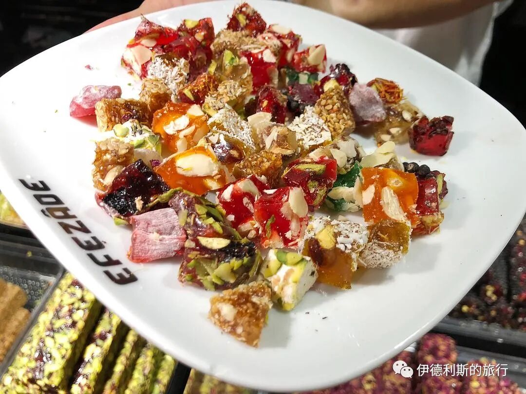
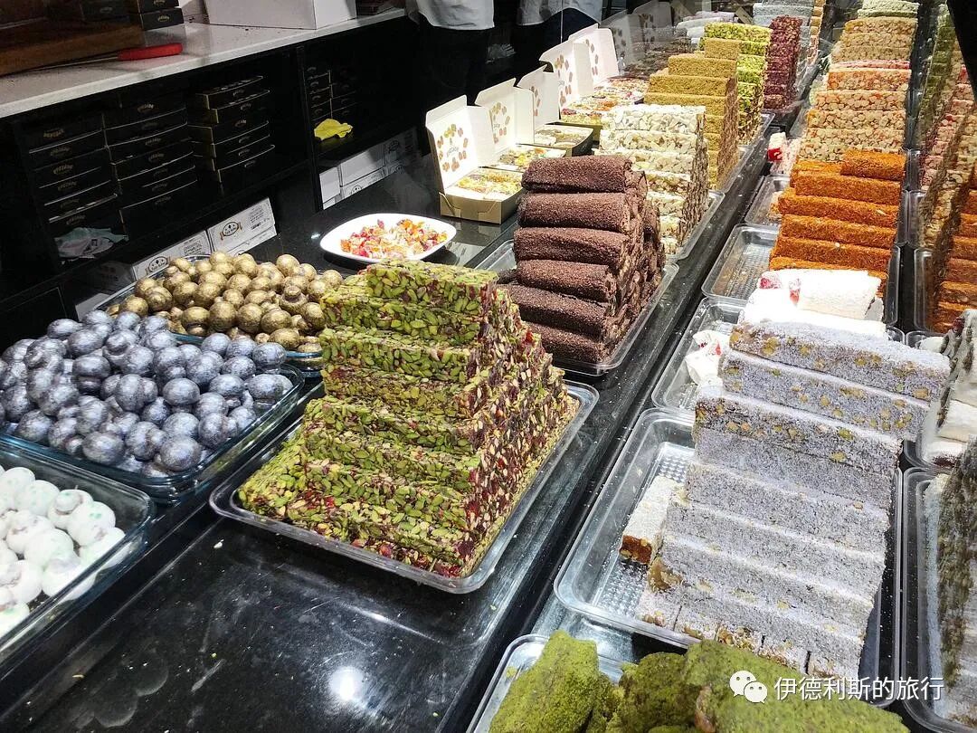
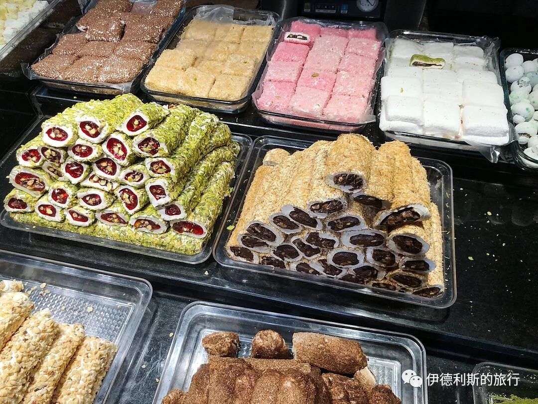
Turkish coffee served with pudding on the street.
In the early Ottoman Empire, strong coffee was banned as a medicine, but the Sultan eventually lifted the ban because it became so popular with the people.
Turkish coffee is recognized by UNESCO as part of Turkey's intangible cultural heritage.
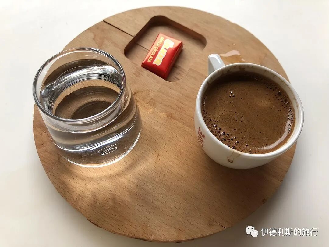
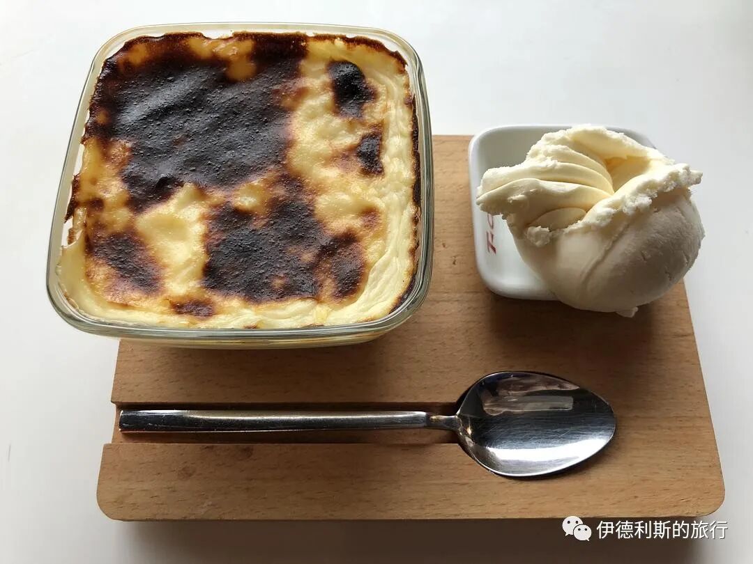
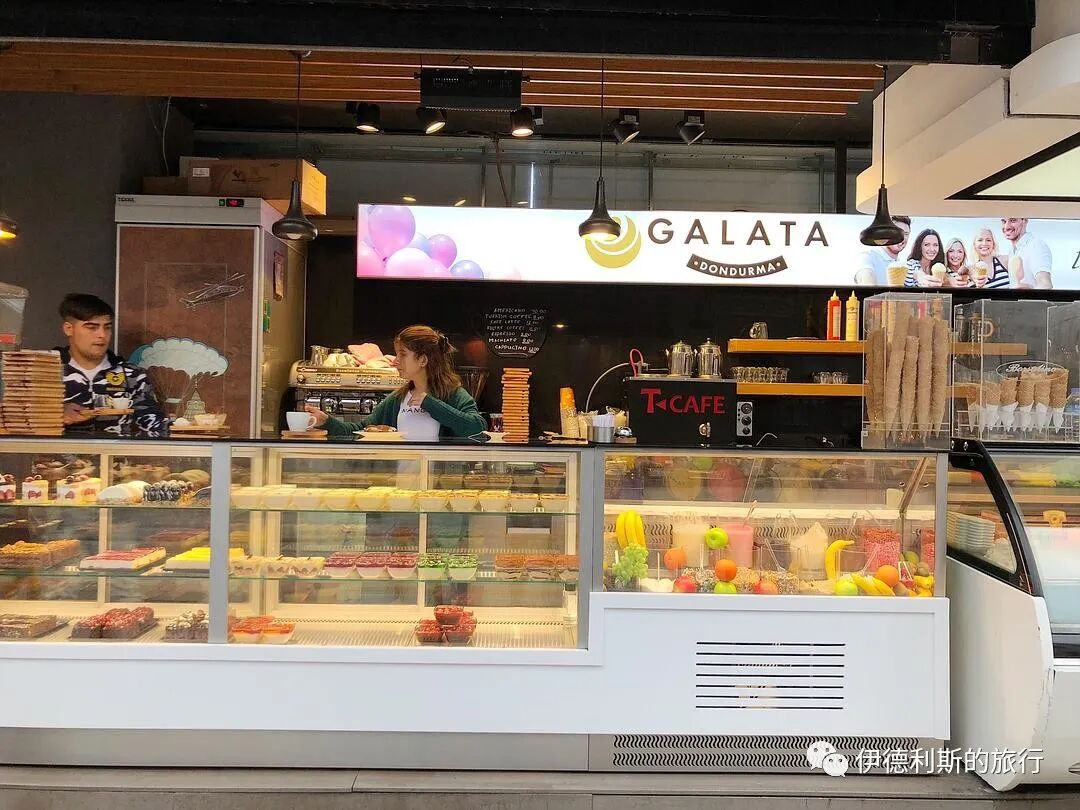
The picture below shows Vefa Bozacisi, the only boza shop in 19th-century Istanbul. It was opened in 1876 by brothers Haci Ibrahim and Haci Sadik in the Vefa district of Istanbul, near the entertainment center of the time, Direklerarası. It is still run by the great-grandchildren of Haci Sadik and Haci Ibrahim today.
Boza is a fermented grain drink popular in Turkey, Iran, the Balkans, Central Asia, and the Caucasus. In Turkey, it is usually made from fermented wheat. It is thick and tastes sweet with a hint of sourness.
In Chagatai Turkic, boza means a drink made from camel milk, while in Persian, büze is used to refer to millet. Central Asian Turkic people began calling fermented grain drinks, usually made from millet, boza in the 10th century. It later spread to the Caucasus and the Balkans and became an important town drink during the Ottoman Empire.
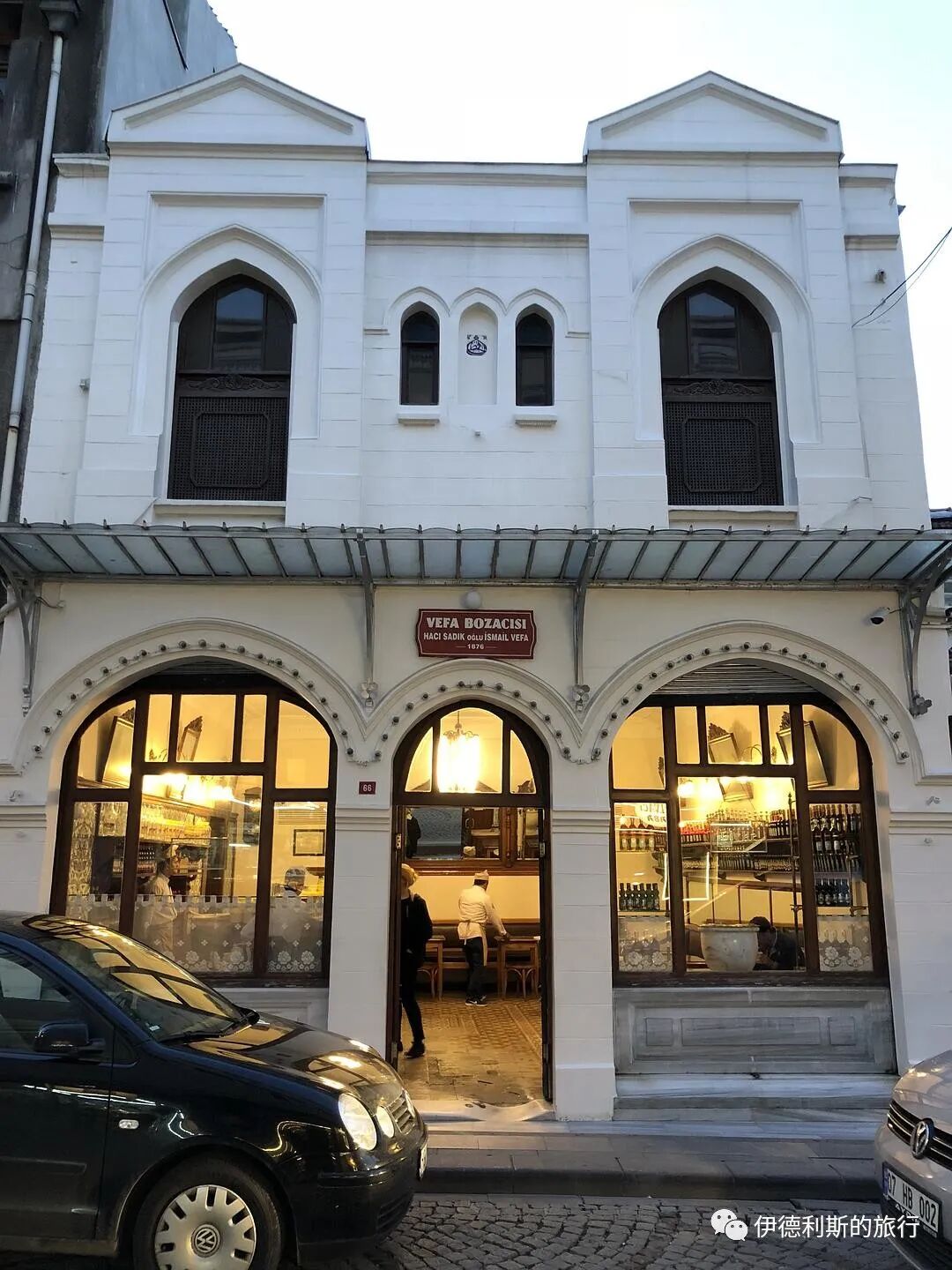
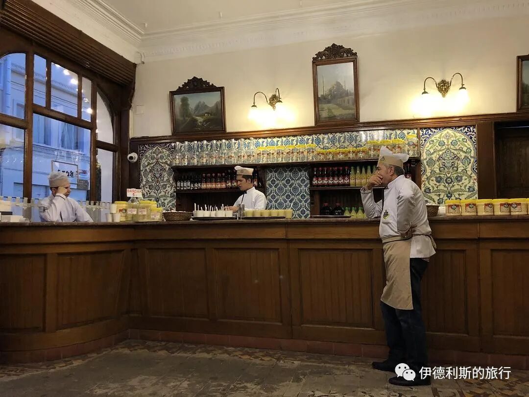
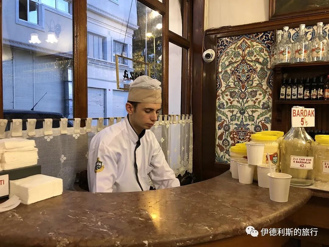
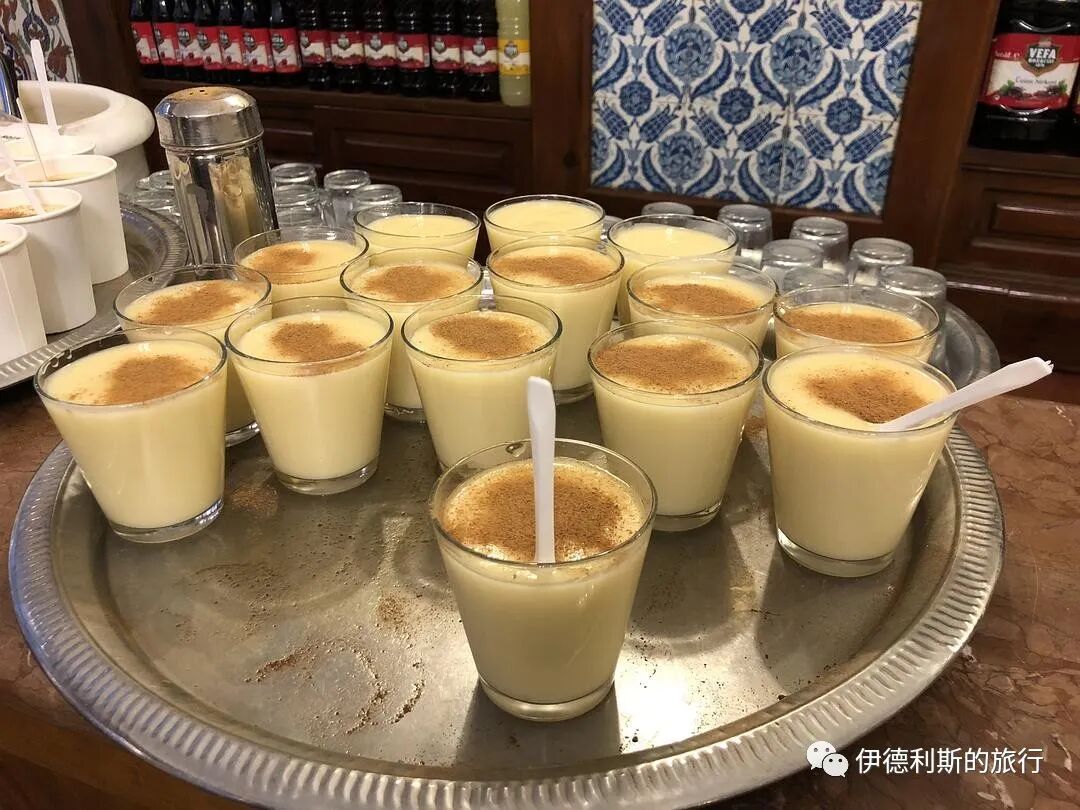
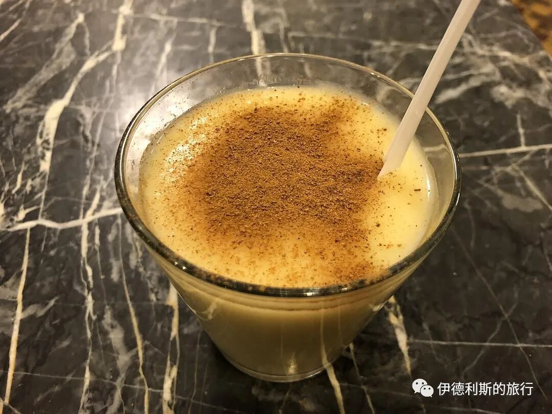
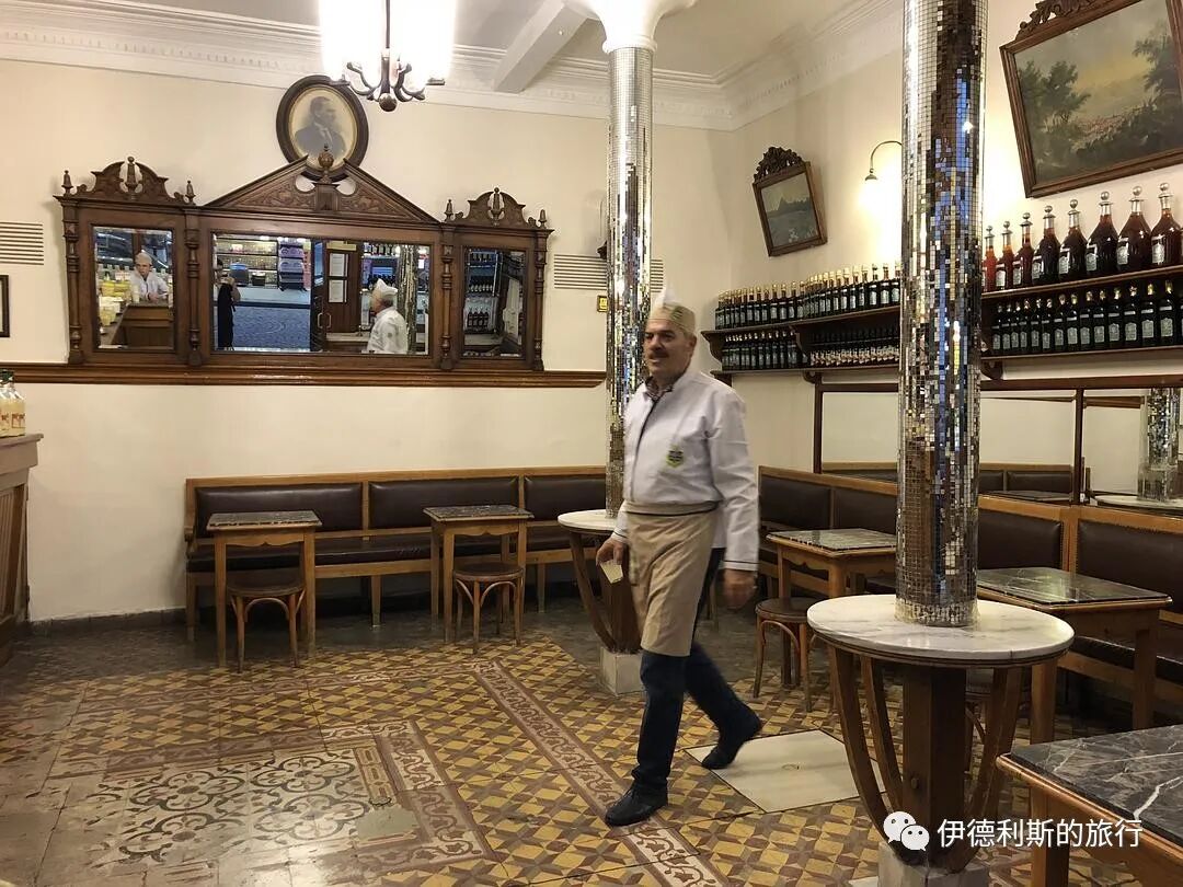
The snack in the picture below is called tulumba tatlısı, which is deep-fried dough soaked in syrup. It is widely popular in former Ottoman regions, including Turkey, the Balkans, and Armenia. It is also called balah alsham in Arab regions and is often eaten during Ramadan.
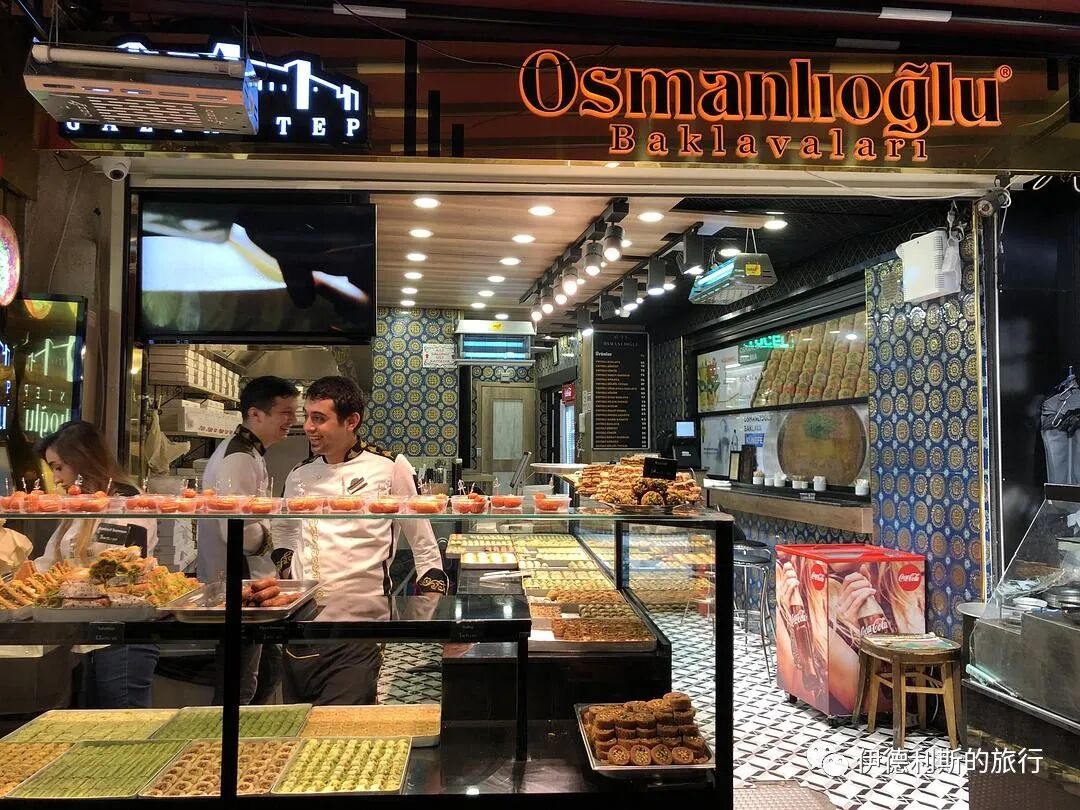
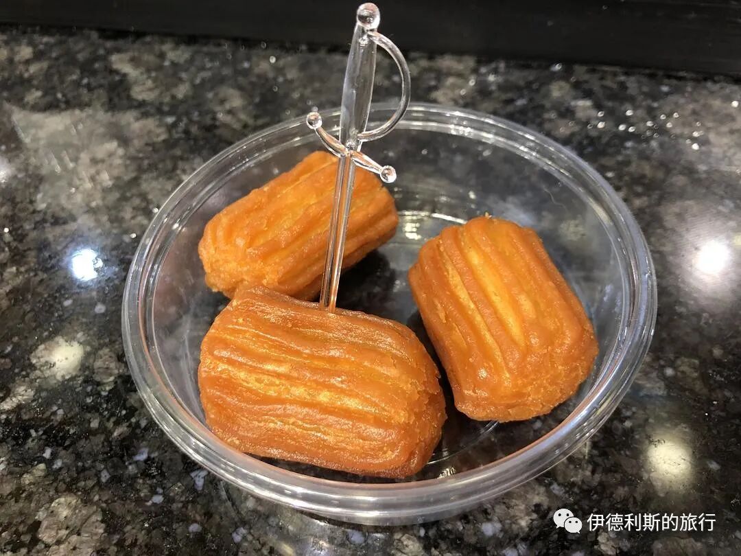
Main course
A type of kebab called testi kebab eaten at this restaurant called Urfalim Lahmacun. Testi kebab comes from Central Anatolia and the Black Sea region. Testi means jar or pot in Turkish, and it involves cooking various meats and vegetables in a clay pot.
Arabic flatbread, which is very thin.
This soup is called ezogelin. It is made from crushed dried wheat and red lentils, with ingredients including rice, olive oil, butter, onions, garlic, tomatoes, chili peppers, dried mint, black pepper, and salt.
I had a dish called patlıcanlı kebab, which translates to eggplant kebab, at a bazaar next to the Rüstem Pasha Mosque in the evening, along with a drink called yayık ayran, which is a honey yogurt drink. Collapse Read »
Summary: Istanbul — Mosques, Turkish Food and Ottoman Streets is presented here as a firsthand travel account in clear English, beginning with this scene: I spent half a month traveling in Turkey from September to October 2018. While visiting historical sites in Istanbul, I tried some local food and would like to share it with you here. The account keeps its focus on Istanbul Travel, Turkish Food, Ottoman Heritage while preserving the names, places, food, and historical details from the Chinese source. This retry section is 2 of 2.
Section 2 of 2
Turkish coffee served with pudding on the street.
In the early Ottoman Empire, strong coffee was banned as a medicine, but the Sultan eventually lifted the ban because it became so popular with the people.
Turkish coffee is recognized by UNESCO as part of Turkey's intangible cultural heritage.
The picture below shows Vefa Bozacisi, the only boza shop in 19th-century Istanbul. It was opened in 1876 by brothers Haci Ibrahim and Haci Sadik in the Vefa district of Istanbul, near the entertainment center of the time, Direklerarası. It is still run by the great-grandchildren of Haci Sadik and Haci Ibrahim today.
Boza is a fermented grain drink popular in Turkey, Iran, the Balkans, Central Asia, and the Caucasus. In Turkey, it is usually made from fermented wheat. It is thick and tastes sweet with a hint of sourness.
In Chagatai Turkic, boza means a drink made from camel milk, while in Persian, büze is used to refer to millet. Central Asian Turkic people began calling fermented grain drinks, usually made from millet, boza in the 10th century. It later spread to the Caucasus and the Balkans and became an important town drink during the Ottoman Empire.
The snack in the picture below is called tulumba tatlısı, which is deep-fried dough soaked in syrup. It is widely popular in former Ottoman regions, including Turkey, the Balkans, and Armenia. It is also called balah alsham in Arab regions and is often eaten during Ramadan.
Main course
A type of kebab called testi kebab eaten at this restaurant called Urfalim Lahmacun. Testi kebab comes from Central Anatolia and the Black Sea region. Testi means jar or pot in Turkish, and it involves cooking various meats and vegetables in a clay pot.
Arabic flatbread, which is very thin.
This soup is called ezogelin. It is made from crushed dried wheat and red lentils, with ingredients including rice, olive oil, butter, onions, garlic, tomatoes, chili peppers, dried mint, black pepper, and salt.
I had a dish called patlıcanlı kebab, which translates to eggplant kebab, at a bazaar next to the Rüstem Pasha Mosque in the evening, along with a drink called yayık ayran, which is a honey yogurt drink. Collapse Read »
Beijing Muslim History: Old Halal Notes from the Northern City (Part 4 of 6)
Reposted from the web
Summary: Beijing Muslim History: Old Halal Notes from the Northern City is presented here as a firsthand travel account in clear English, beginning with this scene: East City:. The account keeps its focus on Beijing Muslim History, Northern Beijing, Hui Muslims while preserving the names, places, food, and historical details from the Chinese source. This is part 4 of 6.
Part 4 of 6
Yueshengzhai, also known as the "Old Ma Family Shop," has been famous in the capital since the Qianlong era for its beef and lamb cooked in a century-old broth that is constantly replenished. The recipe for the stewed meat is a closely guarded secret. People say back then, the aroma drifted into the palace, and even the Emperor would drool when he smelled it, so he specially bestowed a plaque to show his praise. Because it was located next to the Qing Dynasty Ministry of Revenue, the local people commonly called it "the stewed lamb on Hubu Street."
That day, just before the lamps were lit, Meng Zhang brought all his guests to the entrance of Yueshengzhai and found that it was already packed with diners.
As the crowd grew larger, someone inside the old shop shouted loudly, "The pot is open!" Then the windows in the courtyard were all opened at once, and along with a cloud of hot steam, that mouth-watering aroma filled the air. Then a worker dropped large chunks of lamb into a pot of hot oil. As it fried, he used a spoon to skim the foam off the top and tossed it into the stove, which immediately released a different kind of aroma.
He scooped the fried meat out and placed it on a cutting board, then—'Pop! Pop! Pop! '—he chopped it into pieces. You could hear the sizzling and see the crispy outside and tender inside. No one passing by could keep walking.
Children clapped and sang: 'Water buffalo, water buffalo, horns in front and head in back. Your mom and dad bought you fried lamb...' Adults held pots and bowls, rushing to buy some. Those who couldn't afford the meat just asked for two spoonfuls of lamb broth to pour over their noodles, stirred them with chopsticks, and slurped down a whole bowl.
Some rickshaw pullers even took steamed corn buns (wotou) out of their pockets and ate them dry while enjoying the scent filling the street. Before leaving with their rickshaws, they took a few deep breaths of the air to savor it one last time.
These hungry foreign tourists had never seen anything like this. They eagerly asked Mengzhang for food. Just then, the owner of Yueshengzhai came out and waved his hand, and the staff quickly set up tables and chairs. They brought out hot sesame flatbread with lamb (shaobing jia yangrou) and served it with a bowl of thin noodle soup (cu tang mian). Right there in the street, the foreigners started eating. They ate until they were completely stuffed, then held onto the corners of the tables to stand up. They burped and gave a thumbs-up to the front of the Yueshengzhai shop.
Mengzhang found the Japanese man in the crowd. The guy was busy munching on a sesame flatbread (shaobing). He looked a bit embarrassed as he used his meat-sauce-covered hand to pull a meal voucher from his pocket and hand it to Mengzhang. Right in front of him, Mengzhang slowly tore the Grand Hotel (Liuguo Fandian) meal voucher in half and put it back in his pocket. He said, 'I don't have time to take advantage of you!'
Three Generations of Baimen, Bai Ming, Yueshengzhai.
My great-great-grandfather started making spiced lamb (jiang yangrou), but it was during the Jiaqing reign of the Qing Dynasty that my ancestors Ma Yongxiang and Ma Yongfu truly perfected the five-spice spiced lamb (wuxiang jiang yangrou) and sold it across the country. At that time, my ancestors received help from doctors at the Imperial Hospital to improve the original recipe. They used cloves, amomum, cinnamon, and star anise as the main medicinal ingredients, adding soy sauce and salt for flavor. Spiced lamb (jiang yangrou) made with this proper recipe is not only delicious and nutritious, but it also helps stimulate the appetite and aids digestion. A good recipe needs careful, precise cooking techniques. To perfect his craft, my ancestor would often stay in the kitchen all night from the moment the lamb went into the pot until it was finished. After years of practice, he concluded that you must start with the right lamb, and the large white sheep from the West Pass (Xikou) are the best. Back then, these sheep were hard to find; they were either out of stock or too expensive for us to afford. Because of this, my ancestor and his team bought forty or fifty large white sheep from the West Pass, kept them in the backyard of Yueshengzhai, and assigned people to raise them carefully for our use. For our soy-sauce lamb, we only use the front half of the sheep. We have to cut it carefully based on the specific part of the meat; if the pieces are too small, they fall apart, but if they are too big, the flavor does not soak in, so you have to watch the meat as you cut. Second, the seasonings must be high quality. You must carefully select every spice, regardless of the cost, and only use the best raw ingredients. Third, controlling the heat is a key step. The cook must carefully watch how the meat color changes and how strong the fire is. Start by boiling it over high heat for about an hour. Once the pot boils and foam rises to the surface, keep skimming it off with a long-handled ladle, then switch to low heat to simmer for six or seven hours. Boiling over high heat removes gamey smells, impurities, and off-flavors, while simmering over low heat lets the flavors of the spices soak into the meat. Finally, add aged broth (laotang) to deepen the flavor of the meat. Aged broth is what we call leftover stock. After making braised lamb (jiang yangrou) each time, we save some of the thick liquid in a jar to add to the pot for the next batch, which is why our braised lamb is known for its century-old marinade. We are picky about more than just these steps; the tools we use must be wide pots and wide ladles. We especially insist on using only wide pots with three-line markings.
The season for making braised lamb (jiang yangrou) runs from autumn to spring, with the peak period during the three winter months. Every year, once summer arrives, braised lamb enters its off-season. To keep the business running in summer, my ancestor researched and developed a summer food called roasted lamb (shao yangrou). Beijingers love wheat-based foods like steamed buns (mantou), griddle-baked flatbread (laobing), and noodles, especially hand-pulled noodles (chen mian). How people eat noodles changes with the seasons; in winter, they eat hot noodles straight from the pot with soybean paste (zhajiangmian), braised sauce noodles (lumian), or hot soup noodles. After summer starts, people eat cold-water noodles (guoshuimian) to beat the heat, refresh their appetite, and add nutrition. The method for making braised lamb involves reducing the broth, while roasted lamb involves simmering it in a light sauce. Yueshengzhai makes its roasted lamb every day at noon and sells it in the afternoon. Locals use a big bowl, order less meat, and ask for more broth. They pour hot lamb bone broth (yangtang) over cold noodles, add shredded cucumber, and eat. The noodles are cool, the broth is warm, and the taste is fresh. It is a unique summer treat.
The famous old Beijing brand, Yueshengzhai Ma Family Shop. Ma Lin (Wang Dongsi: The author is the fifth-generation descendant of Yueshengzhai).
13. Fusheng Canteen in Dongdan.
For Chinese food, we ate at Xilaishun. For Western food, there was a halal place called Fusheng Canteen near Dongdan, started by a family from outside Hademen. Their Western food was excellent. Later, when my father got older, he only ate a little when we went out, not as much as I did. When I was quite young, I could order two dishes, like steak and fried salmon, plus a soup. Anyway, one day I would have this soup, the next day that soup, and I would eat appetizers and bread before that. I really ate a lot, plus desserts. In winter, I ate chestnut flour, which is all starch and sugar. I could really eat. Back then, the steaks were so big that we would order two for four people, so each person got half, which was just right.
On the east side of the road at Dongdan, there was the Star and Moon Restaurant (Xingyue Canting), which later turned into a bank branch. In the 1940s, when I was in middle school, I would ride my bike there all by myself to eat. I’d have the macaroni with tomato sauce and an ice cream, and that was it. I would just sign my name and have my family pay the bill later. That meal would probably cost over a hundred yuan today. That is why I feel like Western food today just doesn't taste right. It is a real shame that the Fusheng Canteen (Fusheng Shitang) didn't pass down its business, so it is gone forever.
Born in the South of the City (Sheng Zai Cheng Nan): Not Inferior to Men—Oral accounts by Li Bin and Xiao Cheng. Written by Ding Yizhuang (Note by Wang Dongsi: The narrator is the younger sister of the famous conductor Li Delun).
14. Zengqingzhai on Yiliu Hutong outside Di'anmen.
When I was a teenager, I was an apprentice at Zengqingzhai near the Back Gate (Houmen, also known as Di'anmen)... What did we sell? They sold pastries, and in the summer, they sold river produce like lotus root, water caltrops, and eight-treasure lotus seed porridge (babao lianzi zhou). All this river food came from Zengqingzhai, and they also sold ice cream. That is what we made back home. Later, when I made ice cream in Jiuxianqiao, I used what I learned here. Where did we sell it? In the middle of Shichahai, they drove piles into the lake bed, laid down boards, and connected them to build several room-like structures. They sold everything there—all kinds of food like fried dough rings (youzhuozi), eight-treasure lotus seed porridge (babao lianzi zhou), fox nuts (jitoumi), gorgon fruit (qianshimi), lotus seed pods, and all sorts of lotus root, like white lotus root. It was all kinds of cold snacks, really: dried fruit (guozigan), sour plum drink (suanmeitang), ice cream, and shaved ice (xuehualao). I carried everything there on a shoulder pole and set up my stall.
Born in the South of the City: Businesses Run by Hui Muslims—as told by Man Hengliang. Written by Ding Yizhuang.
Xicheng District
1. Ruizhenhou inside Zhongshan Park
Century-old Ruizhenhou
Inside Zhongshan Park, there used to be an old antique shop called Ruizhenhou, which opened in 1917. The name Ruizhenhou has a specific meaning: Rui stands for good luck and the sweet olive flower (ruixiang). Zhen means rare treasures, pearls, jade, and gemstones. Hou means being tolerant and kind, and treating people with honesty. Business was very successful after it opened, and it quickly became famous throughout Beijing. To make it easier to host guests and discuss business, the owner added a tea area and served food in the shop. There is an accurate written record about this: In 1917, the Zhongshan Park Board of Directors built 18 high-ceilinged rooms between Chunming Hall and Shanglinchun, with corridors on the east and west sides, to rent out to shops. One of these was the Ruizhenhou antique shop, which was opened by Hui Muslims.
By 1950, this business was no longer doing well. Owner Ma You'an used his business sense to realize the park lacked a decent halal restaurant, so he turned his antique shop into one. He hired the famous chef Ma Deqi to run the kitchen, and his halal dishes, especially his braised beef (wei niurou), quickly became famous in Beijing. Ma Deqi learned from Chu Lianxiang (known in the industry as Chu Xiang), a master who pioneered Beijing halal cuisine. Chu Xiang was once a royal chef who combined traditional Hui Muslim stir-frying, roasting, and hot pot techniques with cooking styles from both northern and southern China to create a unique Beijing halal flavor. As the top student among Chu Xiang's eight main disciples, Ma Deqi mastered his teacher's skills. The grand banquets Ruizhenhou offered, such as the whole lamb feast (quanyang xi), fish maw feast (yudu xi), and shark fin feast (yuchi xi), were far beyond what ordinary restaurants could prepare. Soon after opening, the restaurant became as famous as the long-standing Han Chinese restaurant Laijinyuxuan, also located in Zhongshan Park, and was always packed with customers. Mr. Ma Lianliang's birthday was on the tenth day of the first lunar month. Every year on this day, he would visit Ruizhenhou. When he was happy, he would personally name his favorite dish 'duck paste bread' (ya ni mian bao) and always ordered it. Because of this, the reputation of Ruizhenhou restaurant grew stronger and stronger.
In the early 1960s, due to a shortage of beef and mutton, Ruizhenhou was forced to become a halal snack shop. Parents visiting Zhongshan Park would always stop by the snack bar to buy something for their children, even if it was just a piece of fried cake (zhagao). When the Cultural Revolution began, the halal snack shops closed down. In the early 1980s, to support ethnic policies, the former Dongcheng Catering Company worked to bring back the famous old brand Ruizhenhou Restaurant. They reopened it at its current location at 1 South Dongsisi Street in 1982 and renamed the halal shop Ruizhenhou Restaurant. Today, third-generation chefs continue to carry on the unique halal flavors of Ruizhenhou.
The restaurant has a professionally trained lamb slicer named Master Zhao Delu, who is nicknamed Zhao the One-Knife. He started at the shop in 1981 to learn how to debone, select, and slice lamb, and he has been doing this for over 20 years. He has his own unique skills. He chooses tender young lambs weighing 35 jin, then removes the thin membrane and tendons. After cooling the meat (known in the trade as cold-setting), the blood and meat blend together, making the red and white parts distinct before it can be used. Finally, he slices it into thin, even pieces that look beautiful with their alternating red and white colors. Dip thin slices of meat into a charcoal hot pot (huoguo) that smells of wood, letting the woody scent blend with the meat. The meat stays tender even after long cooking, and the thin slices do not break. Served with carefully prepared seasonings, friends and family sit around the table to enjoy the lively and grand atmosphere. The taste is fresh, fragrant, and wonderful. This is the traditional Beijing-style mutton hot pot (shuan yangrou) from Ruizhenhou.
The Sina blog "A Century of Ruizhenhou" by ruiren491112. The blogger, Chen Junyuan, was born in Beijing in 1949 and has lived there for generations.
One day, Lin Kaimo (noted by Wang Dongsi as a master of Go during the Republic of China era) and Xia Renhu (noted by Wang Dongsi as a famous scholar) were playing Go at Chunming Pavilion in Zhongshan Park. They played for so long that they missed dinner. When the game ended, they had to order a bowl of beef noodles at Ruizhenhou, located north of Chunming Pavilion, to satisfy their hunger. At that time, Ruizhenhou was quite famous and had a branch in Zhongshan Park that sold various noodles and snacks. Back then, the noodles at Ruizhenhou were much better than the California beef noodles popular today. They were hand-pulled noodles (chentiaomian) served hot, with a rich, thick broth and plenty of tender, fragrant meat. I don't remember the exact price per bowl, maybe 70 or 80 cents, but it was very popular.
Ruizhenhou is a halal restaurant that still exists today, located at the Dongsi intersection. In the past, it was famous for its deep-fried lamb tails (zha yangwei), crispy stir-fried mung bean jelly (jiao liu geza), braised meat strips (ba routiao), and stewed beef (men niurou).
Lingering Fragrance: Memories of the Capital by Zhou Shaoliang.
2. Kaorouwan inside Xuanwumen
Kaorouwan as described by Zhang Zhongxing.
I forget who I was with, but it was summer, and we went to Kaorouwan to try the grilled beef. The storefront was very simple, just one large room. To the south is the barbecue area with two grills side by side. They look like millstones, featuring a round platform about the size of a dining table with a foot-high iron ring in the center. A slightly raised iron grate sits on top of the ring. The grate is made of iron strips about a centimeter wide placed side by side. The gaps between them are packed with beef fat from constant use. Four rough benches are placed around the round platform for customers to stand at. To the north is a table holding bowls, chopsticks, chopped green onions, chopped cilantro, sesame paste (majiang), soy sauce, and other seasonings. There is also a cutting board for the beef, which holds the meat, knives, and plates. The man cutting the meat is a big guy around fifty years old, likely the shop owner, Mr. Wan. He is quite heavy and wears only a pair of thin trousers, which sit about an inch below his navel. The owner is very capable. Aside from a teenage boy who helps deliver meat and seasonings, he does everything himself, including seating customers and handling the bills. The meat is said to be hand-picked at the meat market early in the morning, and it is sliced well, thin and even. Collapse Read »
Summary: Beijing Muslim History: Old Halal Notes from the Northern City is presented here as a firsthand travel account in clear English, beginning with this scene: East City:. The account keeps its focus on Beijing Muslim History, Northern Beijing, Hui Muslims while preserving the names, places, food, and historical details from the Chinese source. This is part 4 of 6.
Part 4 of 6
Yueshengzhai, also known as the "Old Ma Family Shop," has been famous in the capital since the Qianlong era for its beef and lamb cooked in a century-old broth that is constantly replenished. The recipe for the stewed meat is a closely guarded secret. People say back then, the aroma drifted into the palace, and even the Emperor would drool when he smelled it, so he specially bestowed a plaque to show his praise. Because it was located next to the Qing Dynasty Ministry of Revenue, the local people commonly called it "the stewed lamb on Hubu Street."
That day, just before the lamps were lit, Meng Zhang brought all his guests to the entrance of Yueshengzhai and found that it was already packed with diners.
As the crowd grew larger, someone inside the old shop shouted loudly, "The pot is open!" Then the windows in the courtyard were all opened at once, and along with a cloud of hot steam, that mouth-watering aroma filled the air. Then a worker dropped large chunks of lamb into a pot of hot oil. As it fried, he used a spoon to skim the foam off the top and tossed it into the stove, which immediately released a different kind of aroma.
He scooped the fried meat out and placed it on a cutting board, then—'Pop! Pop! Pop! '—he chopped it into pieces. You could hear the sizzling and see the crispy outside and tender inside. No one passing by could keep walking.
Children clapped and sang: 'Water buffalo, water buffalo, horns in front and head in back. Your mom and dad bought you fried lamb...' Adults held pots and bowls, rushing to buy some. Those who couldn't afford the meat just asked for two spoonfuls of lamb broth to pour over their noodles, stirred them with chopsticks, and slurped down a whole bowl.
Some rickshaw pullers even took steamed corn buns (wotou) out of their pockets and ate them dry while enjoying the scent filling the street. Before leaving with their rickshaws, they took a few deep breaths of the air to savor it one last time.
These hungry foreign tourists had never seen anything like this. They eagerly asked Mengzhang for food. Just then, the owner of Yueshengzhai came out and waved his hand, and the staff quickly set up tables and chairs. They brought out hot sesame flatbread with lamb (shaobing jia yangrou) and served it with a bowl of thin noodle soup (cu tang mian). Right there in the street, the foreigners started eating. They ate until they were completely stuffed, then held onto the corners of the tables to stand up. They burped and gave a thumbs-up to the front of the Yueshengzhai shop.
Mengzhang found the Japanese man in the crowd. The guy was busy munching on a sesame flatbread (shaobing). He looked a bit embarrassed as he used his meat-sauce-covered hand to pull a meal voucher from his pocket and hand it to Mengzhang. Right in front of him, Mengzhang slowly tore the Grand Hotel (Liuguo Fandian) meal voucher in half and put it back in his pocket. He said, 'I don't have time to take advantage of you!'
Three Generations of Baimen, Bai Ming, Yueshengzhai.
My great-great-grandfather started making spiced lamb (jiang yangrou), but it was during the Jiaqing reign of the Qing Dynasty that my ancestors Ma Yongxiang and Ma Yongfu truly perfected the five-spice spiced lamb (wuxiang jiang yangrou) and sold it across the country. At that time, my ancestors received help from doctors at the Imperial Hospital to improve the original recipe. They used cloves, amomum, cinnamon, and star anise as the main medicinal ingredients, adding soy sauce and salt for flavor. Spiced lamb (jiang yangrou) made with this proper recipe is not only delicious and nutritious, but it also helps stimulate the appetite and aids digestion. A good recipe needs careful, precise cooking techniques. To perfect his craft, my ancestor would often stay in the kitchen all night from the moment the lamb went into the pot until it was finished. After years of practice, he concluded that you must start with the right lamb, and the large white sheep from the West Pass (Xikou) are the best. Back then, these sheep were hard to find; they were either out of stock or too expensive for us to afford. Because of this, my ancestor and his team bought forty or fifty large white sheep from the West Pass, kept them in the backyard of Yueshengzhai, and assigned people to raise them carefully for our use. For our soy-sauce lamb, we only use the front half of the sheep. We have to cut it carefully based on the specific part of the meat; if the pieces are too small, they fall apart, but if they are too big, the flavor does not soak in, so you have to watch the meat as you cut. Second, the seasonings must be high quality. You must carefully select every spice, regardless of the cost, and only use the best raw ingredients. Third, controlling the heat is a key step. The cook must carefully watch how the meat color changes and how strong the fire is. Start by boiling it over high heat for about an hour. Once the pot boils and foam rises to the surface, keep skimming it off with a long-handled ladle, then switch to low heat to simmer for six or seven hours. Boiling over high heat removes gamey smells, impurities, and off-flavors, while simmering over low heat lets the flavors of the spices soak into the meat. Finally, add aged broth (laotang) to deepen the flavor of the meat. Aged broth is what we call leftover stock. After making braised lamb (jiang yangrou) each time, we save some of the thick liquid in a jar to add to the pot for the next batch, which is why our braised lamb is known for its century-old marinade. We are picky about more than just these steps; the tools we use must be wide pots and wide ladles. We especially insist on using only wide pots with three-line markings.
The season for making braised lamb (jiang yangrou) runs from autumn to spring, with the peak period during the three winter months. Every year, once summer arrives, braised lamb enters its off-season. To keep the business running in summer, my ancestor researched and developed a summer food called roasted lamb (shao yangrou). Beijingers love wheat-based foods like steamed buns (mantou), griddle-baked flatbread (laobing), and noodles, especially hand-pulled noodles (chen mian). How people eat noodles changes with the seasons; in winter, they eat hot noodles straight from the pot with soybean paste (zhajiangmian), braised sauce noodles (lumian), or hot soup noodles. After summer starts, people eat cold-water noodles (guoshuimian) to beat the heat, refresh their appetite, and add nutrition. The method for making braised lamb involves reducing the broth, while roasted lamb involves simmering it in a light sauce. Yueshengzhai makes its roasted lamb every day at noon and sells it in the afternoon. Locals use a big bowl, order less meat, and ask for more broth. They pour hot lamb bone broth (yangtang) over cold noodles, add shredded cucumber, and eat. The noodles are cool, the broth is warm, and the taste is fresh. It is a unique summer treat.
The famous old Beijing brand, Yueshengzhai Ma Family Shop. Ma Lin (Wang Dongsi: The author is the fifth-generation descendant of Yueshengzhai).
13. Fusheng Canteen in Dongdan.
For Chinese food, we ate at Xilaishun. For Western food, there was a halal place called Fusheng Canteen near Dongdan, started by a family from outside Hademen. Their Western food was excellent. Later, when my father got older, he only ate a little when we went out, not as much as I did. When I was quite young, I could order two dishes, like steak and fried salmon, plus a soup. Anyway, one day I would have this soup, the next day that soup, and I would eat appetizers and bread before that. I really ate a lot, plus desserts. In winter, I ate chestnut flour, which is all starch and sugar. I could really eat. Back then, the steaks were so big that we would order two for four people, so each person got half, which was just right.
On the east side of the road at Dongdan, there was the Star and Moon Restaurant (Xingyue Canting), which later turned into a bank branch. In the 1940s, when I was in middle school, I would ride my bike there all by myself to eat. I’d have the macaroni with tomato sauce and an ice cream, and that was it. I would just sign my name and have my family pay the bill later. That meal would probably cost over a hundred yuan today. That is why I feel like Western food today just doesn't taste right. It is a real shame that the Fusheng Canteen (Fusheng Shitang) didn't pass down its business, so it is gone forever.
Born in the South of the City (Sheng Zai Cheng Nan): Not Inferior to Men—Oral accounts by Li Bin and Xiao Cheng. Written by Ding Yizhuang (Note by Wang Dongsi: The narrator is the younger sister of the famous conductor Li Delun).
14. Zengqingzhai on Yiliu Hutong outside Di'anmen.
When I was a teenager, I was an apprentice at Zengqingzhai near the Back Gate (Houmen, also known as Di'anmen)... What did we sell? They sold pastries, and in the summer, they sold river produce like lotus root, water caltrops, and eight-treasure lotus seed porridge (babao lianzi zhou). All this river food came from Zengqingzhai, and they also sold ice cream. That is what we made back home. Later, when I made ice cream in Jiuxianqiao, I used what I learned here. Where did we sell it? In the middle of Shichahai, they drove piles into the lake bed, laid down boards, and connected them to build several room-like structures. They sold everything there—all kinds of food like fried dough rings (youzhuozi), eight-treasure lotus seed porridge (babao lianzi zhou), fox nuts (jitoumi), gorgon fruit (qianshimi), lotus seed pods, and all sorts of lotus root, like white lotus root. It was all kinds of cold snacks, really: dried fruit (guozigan), sour plum drink (suanmeitang), ice cream, and shaved ice (xuehualao). I carried everything there on a shoulder pole and set up my stall.
Born in the South of the City: Businesses Run by Hui Muslims—as told by Man Hengliang. Written by Ding Yizhuang.
Xicheng District
1. Ruizhenhou inside Zhongshan Park
Century-old Ruizhenhou
Inside Zhongshan Park, there used to be an old antique shop called Ruizhenhou, which opened in 1917. The name Ruizhenhou has a specific meaning: Rui stands for good luck and the sweet olive flower (ruixiang). Zhen means rare treasures, pearls, jade, and gemstones. Hou means being tolerant and kind, and treating people with honesty. Business was very successful after it opened, and it quickly became famous throughout Beijing. To make it easier to host guests and discuss business, the owner added a tea area and served food in the shop. There is an accurate written record about this: In 1917, the Zhongshan Park Board of Directors built 18 high-ceilinged rooms between Chunming Hall and Shanglinchun, with corridors on the east and west sides, to rent out to shops. One of these was the Ruizhenhou antique shop, which was opened by Hui Muslims.
By 1950, this business was no longer doing well. Owner Ma You'an used his business sense to realize the park lacked a decent halal restaurant, so he turned his antique shop into one. He hired the famous chef Ma Deqi to run the kitchen, and his halal dishes, especially his braised beef (wei niurou), quickly became famous in Beijing. Ma Deqi learned from Chu Lianxiang (known in the industry as Chu Xiang), a master who pioneered Beijing halal cuisine. Chu Xiang was once a royal chef who combined traditional Hui Muslim stir-frying, roasting, and hot pot techniques with cooking styles from both northern and southern China to create a unique Beijing halal flavor. As the top student among Chu Xiang's eight main disciples, Ma Deqi mastered his teacher's skills. The grand banquets Ruizhenhou offered, such as the whole lamb feast (quanyang xi), fish maw feast (yudu xi), and shark fin feast (yuchi xi), were far beyond what ordinary restaurants could prepare. Soon after opening, the restaurant became as famous as the long-standing Han Chinese restaurant Laijinyuxuan, also located in Zhongshan Park, and was always packed with customers. Mr. Ma Lianliang's birthday was on the tenth day of the first lunar month. Every year on this day, he would visit Ruizhenhou. When he was happy, he would personally name his favorite dish 'duck paste bread' (ya ni mian bao) and always ordered it. Because of this, the reputation of Ruizhenhou restaurant grew stronger and stronger.
In the early 1960s, due to a shortage of beef and mutton, Ruizhenhou was forced to become a halal snack shop. Parents visiting Zhongshan Park would always stop by the snack bar to buy something for their children, even if it was just a piece of fried cake (zhagao). When the Cultural Revolution began, the halal snack shops closed down. In the early 1980s, to support ethnic policies, the former Dongcheng Catering Company worked to bring back the famous old brand Ruizhenhou Restaurant. They reopened it at its current location at 1 South Dongsisi Street in 1982 and renamed the halal shop Ruizhenhou Restaurant. Today, third-generation chefs continue to carry on the unique halal flavors of Ruizhenhou.
The restaurant has a professionally trained lamb slicer named Master Zhao Delu, who is nicknamed Zhao the One-Knife. He started at the shop in 1981 to learn how to debone, select, and slice lamb, and he has been doing this for over 20 years. He has his own unique skills. He chooses tender young lambs weighing 35 jin, then removes the thin membrane and tendons. After cooling the meat (known in the trade as cold-setting), the blood and meat blend together, making the red and white parts distinct before it can be used. Finally, he slices it into thin, even pieces that look beautiful with their alternating red and white colors. Dip thin slices of meat into a charcoal hot pot (huoguo) that smells of wood, letting the woody scent blend with the meat. The meat stays tender even after long cooking, and the thin slices do not break. Served with carefully prepared seasonings, friends and family sit around the table to enjoy the lively and grand atmosphere. The taste is fresh, fragrant, and wonderful. This is the traditional Beijing-style mutton hot pot (shuan yangrou) from Ruizhenhou.
The Sina blog "A Century of Ruizhenhou" by ruiren491112. The blogger, Chen Junyuan, was born in Beijing in 1949 and has lived there for generations.
One day, Lin Kaimo (noted by Wang Dongsi as a master of Go during the Republic of China era) and Xia Renhu (noted by Wang Dongsi as a famous scholar) were playing Go at Chunming Pavilion in Zhongshan Park. They played for so long that they missed dinner. When the game ended, they had to order a bowl of beef noodles at Ruizhenhou, located north of Chunming Pavilion, to satisfy their hunger. At that time, Ruizhenhou was quite famous and had a branch in Zhongshan Park that sold various noodles and snacks. Back then, the noodles at Ruizhenhou were much better than the California beef noodles popular today. They were hand-pulled noodles (chentiaomian) served hot, with a rich, thick broth and plenty of tender, fragrant meat. I don't remember the exact price per bowl, maybe 70 or 80 cents, but it was very popular.
Ruizhenhou is a halal restaurant that still exists today, located at the Dongsi intersection. In the past, it was famous for its deep-fried lamb tails (zha yangwei), crispy stir-fried mung bean jelly (jiao liu geza), braised meat strips (ba routiao), and stewed beef (men niurou).
Lingering Fragrance: Memories of the Capital by Zhou Shaoliang.
2. Kaorouwan inside Xuanwumen
Kaorouwan as described by Zhang Zhongxing.
I forget who I was with, but it was summer, and we went to Kaorouwan to try the grilled beef. The storefront was very simple, just one large room. To the south is the barbecue area with two grills side by side. They look like millstones, featuring a round platform about the size of a dining table with a foot-high iron ring in the center. A slightly raised iron grate sits on top of the ring. The grate is made of iron strips about a centimeter wide placed side by side. The gaps between them are packed with beef fat from constant use. Four rough benches are placed around the round platform for customers to stand at. To the north is a table holding bowls, chopsticks, chopped green onions, chopped cilantro, sesame paste (majiang), soy sauce, and other seasonings. There is also a cutting board for the beef, which holds the meat, knives, and plates. The man cutting the meat is a big guy around fifty years old, likely the shop owner, Mr. Wan. He is quite heavy and wears only a pair of thin trousers, which sit about an inch below his navel. The owner is very capable. Aside from a teenage boy who helps deliver meat and seasonings, he does everything himself, including seating customers and handling the bills. The meat is said to be hand-picked at the meat market early in the morning, and it is sliced well, thin and even. Collapse Read »
Beijing Muslim History: Old Halal Notes from the Southern City (Part 4 of 5)
Reposted from the web
Summary: Beijing Muslim History: Old Halal Notes from the Southern City is presented here as a firsthand travel account in clear English, beginning with this scene: Chongwen:. The account keeps its focus on Beijing Muslim History, Southern Beijing, Hui Muslims while preserving the names, places, food, and historical details from the Chinese source. This is part 4 of 5.
Part 4 of 5
The front carrying pole holds a large square wooden basin, and a copper plaque reading 'Western Regions Hui Muslim' (Xiyu Huihui) is displayed on the tray. In the center of the tray sits a copper pot filled with a savory sauce made from beef or lamb and button mushrooms (koumo). A long-handled flat copper spoon is used to serve the sauce, and spare bowls, small enamel spoons, and seasonings are placed on the edge of the tray. The rear carrying pole holds a deep, straight-sided pot filled with soft tofu custard (doufunao). The pot is wrapped in a cotton cover to keep it warm, as this tofu custard is much softer than standard firm tofu (laodoufu); eating a bowl of tofu custard topped with savory sauce, with garlic juice or chili oil added to taste, and served with sesame flatbread (shaobing) or baked wheat cake (huoshao), makes for an affordable and delicious meal. The tofu custard vendor does not travel through the alleys but stays parked at the street corner.
The vendor selling starch jelly sheets (fenpi) with sauce arrives, carrying a pot of beef or lamb and button mushroom sauce along with stacks of prepared starch jelly sheets, though some vendors make the sheets fresh on the spot; this is another unique food made by Hui Muslims. Every day after noon, the starch jelly sheet vendor goes out to walk the streets and alleys; some residents in the alleys bring their own bowls to take the food home, while passersby eat right at the stall using the bowls and chopsticks provided by the vendor. On a hot summer day, buying a bowl of sliced starch jelly sheets topped with a handful of shredded cucumber, even with the savory sauce, feels refreshing and light rather than greasy.
'Beef liver, beef!' 'Beef head!' The vendor pushes a single-wheeled cart with a cutting board and round bamboo steamers containing soy-braised beef, soy-braised beef tripe, beef tripe, beef offal, and beef head meat. to selling while walking the streets during the day, they also do business at night. The cart also hangs a 'Western Regions Hui Muslim' (Xiyu Huihui) copper plaque, so at a glance, you know it is a business run by Hui Muslims.
Customs and Anecdotes: Walking the streets and alleys to sell snacks. Liu Jiuru
2. A halal rice cake (niangao) stall at the temple fair.
The halal rice cake (nian gao) stalls at temple fairs change with the seasons and have everything you could want. In summer, they sell iced rice cakes and sticky rice dumplings (zongzi). In spring and autumn, they offer fried cakes (zha gao), cold rice cakes, lotus root with sticky rice (nuomi ou), steamed rice flour cakes (aiwowo), and rolled soybean flour cakes (ludagun). Only the "vegetarian dish" (su cai) is sold for three seasons.
The "vegetarian dish" is a type of honey-preserved tea snack. It is mainly made of fried sweet potato chips, mixed with honey dates, dried apricots, fried lotus root pieces, hawthorn cake, and green plums. It is then tossed in honey syrup and sold by weight. Fried sweet potato chips make up eighty percent of this dish, and they are the tastiest and most popular part. They are crispy, sweet, and crunchy, and the honey is not sticky, so you do not get tired of eating them even if you have a lot. The other ingredients have their own candied flavors and cost more than the sweet potato chips. As a tea snack, it is a top-tier treat. As for why it is called a "vegetarian dish," the reason is not clear.
Fried cakes (zha gao) are also a halal food, made by wrapping red bean paste in yellow millet flour and deep-frying it. They are also sweet, sticky, and crispy, but unlike the "vegetarian dish," they are not only found at temple fair stalls. Fried cakes can be seen everywhere. Products from halal stalls share one common advantage: they are clean and hygienic, which gives people peace of mind.
Memories of Snacks: Jin Yunzhen
3. Mutton stall (yangrou chuangzi).
Look at how clean the larger mutton stalls (yangrou chuangzi) are. The table for the mutton and the poles for hanging the meat are scrubbed until they are spotless. The edges of the table are lined with copper nails that are always polished until they shine.
The scale on the counter has a white copper pan, white copper chains, and a white copper weight. The Hui Muslim shopkeeper always handles it with a loud clatter, banging and crashing it down. He picks it up and drops it several times; I guess that is just the custom at the mutton stall (yangrou chuangzi).
In the old days, Beijing did not seem to have slaughterhouses, because sheep were slaughtered right at the door of the mutton stall. At a large mutton stall, early every morning, five or six large sheep would be tied up with a wooden blood basin placed nearby, waiting for the head imam (ahong) to come and recite prayers.
The Muslim imam, wearing a grey cotton robe and a black mandarin jacket (magua), would arrive by rickshaw—since he had to visit many mutton stalls each morning, he traveled by rickshaw to make his rounds—carrying a cloth bag containing the knives for slaughtering the sheep. When he reached the counter, he would take out his knife, mutter a prayer, and with one swift stroke across the sheep's neck held down by two young men, the blood would pour out; the sheep would stretch its legs, twitch a few times, and then go still.
Afterward, they would peel off the skin, cut off the head, chop off the hooves, remove the offal, wash everything clean with water, and hang the meat on a pole using copper meat hooks. Look at how fatty it is!
When it comes to northern sheep, few can compare to them, except for those from the Northwest. In the summer, they graze on green grass, becoming round and plump with thick wool, and their large tails drag behind them like a big pot lid.
If you go to a large mutton stall in the winter to buy meat for hot pot (shuan guozi), they will always take good care of you. There are cuts of meat like the neck (shangnao'er), the leg muscle (huangguatiao), the flank (yaowo), and the brisket (sancha'er); they cut exactly what you point to, and they have everything you could want. Once you leave Beijing, you can find mutton hot pot everywhere, but it is just mutton!
I remember before the war, in the old capital, one silver dollar could buy four jin of good mutton delivered to your door. Add some cabbage and glass noodles (fentiao), and one dollar's worth of meat was enough to feed three or four people. It was warm and satisfying; it was wonderful.
In the summer, every mutton stall sells fried mutton (shao yangrou). The meat, just out of the fryer, is placed on a large copper tray, and the aroma is so strong you can smell it from a mile away.
For an afternoon snack, if you have a few coins, you can buy a pair of sheep hooves or a piece of shank (jianzi), and eat it with two sesame flatbreads (shaobing); it is incredibly delicious. If you bring home a large sheep head, your family can make some pancakes, boil a pot of rice porridge (shui fan), and on a hot day, it is neither greasy nor too heavy, and it really satisfies your cravings. The sheep neck has a bit more meat and is even better to eat than the head.
If your family is small, dinner is easy to put together. Just take a pot to the mutton stall, buy seven or eight mao worth of fried mutton, and tell the shopkeeper, 'Boss, add some extra broth!' Once you get home, bring the pot of meat and broth to a boil, add a few coins' worth of noodles, and you have fried mutton noodles. Forget about leaving Beiping.
Most lamb stalls (yangrou chuangzi) have a separate area to sell lamb buns (yangrou baozi) to go. They squeeze the dough into shape with their hands. In winter, they are filled with lamb and cabbage, and in summer, lamb and chives. Every time a steamer is ready, the apprentice shouts: 'Lamb buns are here!' Fresh from the steamer, get them while they're hot!
Some lamb stalls also sell medicine. They hang a sign nearby that says 'Lamb Liver Eye-Brightening Pills' (yanggan mingmu wan), and they are all tested and approved with a license from the health bureau. Some also sell sesame paste flatbread (zhima jiang shaobing) and brown sugar cakes (tang huoshao), which are made with flour and brown sugar. They are yellowish and stamped with a red mark on top. They also carry honey-glazed fried dough twists (mi mahua), which are extremely sweet. That is the full range of side businesses found at a lamb stall.
Some lamb stalls also sell pickled cabbage (suancai). Whatever amount you buy, they tie it up with a piece of iris grass (malian cao) and hand it to you. If you buy some lamb to go with it, you can make a pot of hot lamb and pickled cabbage noodle soup. It is warm, refreshing, and delicious!
Mentioning pickled cabbage reminds me of winters in the old capital, when every family used small coal-ball stoves. Impatient people couldn't wait for the fire to catch properly, so they would bring the stove inside while it was still emitting blue flames. The coal gas could suffocate a person. Every winter, quite a few people actually died from this. The special remedy for 'coal gas poisoning' didn't require going to a pharmacy or calling a doctor. You just had to go to a lamb stall, buy a large portion of pickled cabbage, ask for extra broth, and pour the ice-cold, teeth-chattering cabbage soup into the victim's mouth. For mild cases, a few sips of the sour, cool liquid would make them feel better in no time.
Beiping Customs: Lamb Stalls. Chen Hongnian
4. Shopkeeper Hua, who sells beef head meat from a wheelbarrow.
Back then, the street cry went like this: 'Beef liver!' Beef head meat! Beef liver for sale, hey, hey! Beef head meat for sale! The wheelbarrow creaked as it rolled over the fallen leaves of late autumn, sometimes accompanied by a few drifting snowflakes. With the weather turning hot and cold, it is the perfect time for nourishing food. Most families can afford a few ounces of beef head meat, which is reasonably priced and tastes pretty good. My grandmother never bought from strangers; she only trusted the halal shop run by Manager Hua.
Manager Hua told me his ancestors had been doing this for generations. They never opened a storefront, but followed the tradition of walking through the streets and alleys to sell their goods. Manager Hua’s beef head meat was so popular that even if he went as far as Qianmen, he would always sell out completely. Whether they wore long gowns or mandarin jackets, everyone loved this treat. If he ran into military officers or police, he had to bow and scrape, and even offer a little bribe.
Halal means being particular. The slaughter is handled by an imam, who performs the proper rites before the blade draws blood, showing respect for a life. When you think about it, a cow works hard its whole life, only occasionally rolling its eyes or acting stubborn, but it never misses a day of work. Even when it can no longer walk, it gives its life for humans, making it a creature worthy of respect. Halal means being clean. There is not a single flaw, as they always strive for perfection. For so many years, as long as a shop has a halal sign, I trust it. I can eat the meat with peace of mind. Halal means being honest. They do not cheat people, shortchange them, or take advantage of the small, perhaps because these rules have been passed down for so many years. Halal means being loyal. As long as you visit his business often and become a regular customer, he will never overcharge you. Instead, he will always give you a little extra on the house.
Shopkeeper Hua lived in the crowded courtyard behind my grandmother's house, where a dozen families all ran small businesses to make a living. When the northwest wind blew, the smell of meat would drift right into our noses, and we knew for sure Shopkeeper Hua was processing beef head (niutourou)! To be honest, beef head is the only real meat, while everything else is just beef offal (niuzasui). Besides beef liver, he had beef tendon, beef lung, and beef tripe. After Shopkeeper Hua added spices to remove the gamey smell, clear away the bad taste, and bring out the aroma, it smelled so good you wanted to grab a few bites right away to satisfy your cravings. Shopkeeper Hua's beef offal had a unique, fragrant taste, and chatty neighbors often asked him for his secret. It is not any different from what everyone else makes, is it? Shopkeeper Hua just smiled honestly, saying nothing at all. Yellow rice wine, star anise, green onion, ginger, garlic, cardamom, bay leaves, Sichuan peppercorns, and salt—these are all common kitchen spices, but the taste of Shopkeeper Hua's food was different from the usual street stalls. People said he used a few traditional Chinese medicinal herbs that were the secret of the Hua family, passed down through generations and never revealed to outsiders. Shopkeeper Hua's honest smile was just his way of being polite to people.
Shopkeeper Hua's wheelbarrow was very distinctive. It had a wooden wheel with a copper axle, and the wheel was inlaid with shiny copper nails inside and out. The top of the cart was covered in galvanized sheet metal, polished until it shone. The cooked beef head and various types of beef offal were kept in separate round wicker baskets. A long, sharp knife was fixed in one spot to keep it from shaking. A white cloth covered all the cooked food tightly.
When Auntie Zhang saw the cart hadn't moved from the doorway, she quickly greeted him, 'Give me half a jin of beef head, with Sichuan peppercorn salt!' Shopkeeper Hua lifted the cloth, picked up a small piece, and asked, 'How about this piece?' Seeing Auntie Zhang nod, he put it on the scale. It is a generous portion, don't you see? As he spoke, he used a long knife to slice the meat so thin that if you held a piece of paper with writing on it behind the slice, you could still read the words!
Shopkeeper, please put together a pound of mixed offal (zasui), add plenty of tendon (tijin), serve it cold, and put in lots of chili oil! Whenever guests come to Uncle Li's house, they all love this dish with their drinks. While Shopkeeper Hua finished slicing and mixing, Uncle Li quickly popped a piece into his mouth while waiting for his change. To use one word: impatient. His mouth was even more eager than his hands. Just like that, before the wheelbarrow even left the alley, several pounds were already gone.
You might ask, do Shopkeeper Hua's descendants still do this business? To tell you the truth, his sons are all highly educated, and his grandchildren are either studying abroad or working as white-collar professionals in the capital. Selling beef head meat and using a wheelbarrow? That seems to have nothing to do with their life paths. Whenever someone mentions how good the beef tasted when Shopkeeper Hua was alive, no one in the Hua family picks up the conversation. Well! The ancestral flavor of the Hua family just ended right there! People say one white-collar grandson had the intention to change careers, but who could he ask for the secret recipe? What happened then? There was no follow-up. Even if there were a resolution, no one knows. Think about it, the urban jungle is a maze; even in the same building, who really knows anyone else?
Old Beijing Stories 3 by Liu Hui
5. Bai Family Sesame Flatbread Shop (shaobing pu).
Since I dare to say that sesame flatbread (shaobing) shops aren't as good as they used to be, I can give you a hundred reasons why. When I lived in the alleyway (hutong), there was a sesame flatbread (shaobing) shop right next door. The owner was named Bai, a Hui Muslim who always wore a white cap, a white shirt, and a white apron without a single speck of dirt on them. He was about sixty, so I had to call him Grandpa. He never made a big deal about selling authentic Beijing-style sesame flatbread (shaobing), but I heard all the old folks say they grew up eating the Bai family's bread. Thinking about it, I was the same; if the alleyway hadn't been torn down, I would still be eating the bread made by the younger generation of the Bai family.
The Bai Family Sesame Flatbread Shop had a simple sign with white characters on a blue background. The sign marked as halal lets you rest easy knowing that this shop is clean. The Bai family mainly sold pepper-salt baked flatbread (jiaoyan huoshao), spiral-shaped rolls (luosizhuan), brown sugar baked flatbread (hongtang huoshao), and leavened baked flatbread (famian huoshao). The most popular item was the sesame flatbread (shaobing), which had three things in abundance: lots of sesame seeds, lots of sesame paste, and lots of layers. It had two types of crispness: a crispy crust and crispy sesame seeds. It had five types of fragrance: the fragrance of the crust, the sesame seeds, the sesame paste, the inside, and the lingering taste in your mouth. Through all the years, winter or summer, it always tasted the same. One time, my grandmother was waiting in line and casually asked about the secret to his baking, and he replied, "The ingredients must never change; you have to keep a clear conscience." Old Man Bai answered while spreading sesame paste onto the dough. It seemed like he didn't give away the real secret, but when you think about it, it was actually quite clear and he wasn't hiding anything. Collapse Read »
Summary: Beijing Muslim History: Old Halal Notes from the Southern City is presented here as a firsthand travel account in clear English, beginning with this scene: Chongwen:. The account keeps its focus on Beijing Muslim History, Southern Beijing, Hui Muslims while preserving the names, places, food, and historical details from the Chinese source. This is part 4 of 5.
Part 4 of 5
The front carrying pole holds a large square wooden basin, and a copper plaque reading 'Western Regions Hui Muslim' (Xiyu Huihui) is displayed on the tray. In the center of the tray sits a copper pot filled with a savory sauce made from beef or lamb and button mushrooms (koumo). A long-handled flat copper spoon is used to serve the sauce, and spare bowls, small enamel spoons, and seasonings are placed on the edge of the tray. The rear carrying pole holds a deep, straight-sided pot filled with soft tofu custard (doufunao). The pot is wrapped in a cotton cover to keep it warm, as this tofu custard is much softer than standard firm tofu (laodoufu); eating a bowl of tofu custard topped with savory sauce, with garlic juice or chili oil added to taste, and served with sesame flatbread (shaobing) or baked wheat cake (huoshao), makes for an affordable and delicious meal. The tofu custard vendor does not travel through the alleys but stays parked at the street corner.
The vendor selling starch jelly sheets (fenpi) with sauce arrives, carrying a pot of beef or lamb and button mushroom sauce along with stacks of prepared starch jelly sheets, though some vendors make the sheets fresh on the spot; this is another unique food made by Hui Muslims. Every day after noon, the starch jelly sheet vendor goes out to walk the streets and alleys; some residents in the alleys bring their own bowls to take the food home, while passersby eat right at the stall using the bowls and chopsticks provided by the vendor. On a hot summer day, buying a bowl of sliced starch jelly sheets topped with a handful of shredded cucumber, even with the savory sauce, feels refreshing and light rather than greasy.
'Beef liver, beef!' 'Beef head!' The vendor pushes a single-wheeled cart with a cutting board and round bamboo steamers containing soy-braised beef, soy-braised beef tripe, beef tripe, beef offal, and beef head meat. to selling while walking the streets during the day, they also do business at night. The cart also hangs a 'Western Regions Hui Muslim' (Xiyu Huihui) copper plaque, so at a glance, you know it is a business run by Hui Muslims.
Customs and Anecdotes: Walking the streets and alleys to sell snacks. Liu Jiuru
2. A halal rice cake (niangao) stall at the temple fair.
The halal rice cake (nian gao) stalls at temple fairs change with the seasons and have everything you could want. In summer, they sell iced rice cakes and sticky rice dumplings (zongzi). In spring and autumn, they offer fried cakes (zha gao), cold rice cakes, lotus root with sticky rice (nuomi ou), steamed rice flour cakes (aiwowo), and rolled soybean flour cakes (ludagun). Only the "vegetarian dish" (su cai) is sold for three seasons.
The "vegetarian dish" is a type of honey-preserved tea snack. It is mainly made of fried sweet potato chips, mixed with honey dates, dried apricots, fried lotus root pieces, hawthorn cake, and green plums. It is then tossed in honey syrup and sold by weight. Fried sweet potato chips make up eighty percent of this dish, and they are the tastiest and most popular part. They are crispy, sweet, and crunchy, and the honey is not sticky, so you do not get tired of eating them even if you have a lot. The other ingredients have their own candied flavors and cost more than the sweet potato chips. As a tea snack, it is a top-tier treat. As for why it is called a "vegetarian dish," the reason is not clear.
Fried cakes (zha gao) are also a halal food, made by wrapping red bean paste in yellow millet flour and deep-frying it. They are also sweet, sticky, and crispy, but unlike the "vegetarian dish," they are not only found at temple fair stalls. Fried cakes can be seen everywhere. Products from halal stalls share one common advantage: they are clean and hygienic, which gives people peace of mind.
Memories of Snacks: Jin Yunzhen
3. Mutton stall (yangrou chuangzi).
Look at how clean the larger mutton stalls (yangrou chuangzi) are. The table for the mutton and the poles for hanging the meat are scrubbed until they are spotless. The edges of the table are lined with copper nails that are always polished until they shine.
The scale on the counter has a white copper pan, white copper chains, and a white copper weight. The Hui Muslim shopkeeper always handles it with a loud clatter, banging and crashing it down. He picks it up and drops it several times; I guess that is just the custom at the mutton stall (yangrou chuangzi).
In the old days, Beijing did not seem to have slaughterhouses, because sheep were slaughtered right at the door of the mutton stall. At a large mutton stall, early every morning, five or six large sheep would be tied up with a wooden blood basin placed nearby, waiting for the head imam (ahong) to come and recite prayers.
The Muslim imam, wearing a grey cotton robe and a black mandarin jacket (magua), would arrive by rickshaw—since he had to visit many mutton stalls each morning, he traveled by rickshaw to make his rounds—carrying a cloth bag containing the knives for slaughtering the sheep. When he reached the counter, he would take out his knife, mutter a prayer, and with one swift stroke across the sheep's neck held down by two young men, the blood would pour out; the sheep would stretch its legs, twitch a few times, and then go still.
Afterward, they would peel off the skin, cut off the head, chop off the hooves, remove the offal, wash everything clean with water, and hang the meat on a pole using copper meat hooks. Look at how fatty it is!
When it comes to northern sheep, few can compare to them, except for those from the Northwest. In the summer, they graze on green grass, becoming round and plump with thick wool, and their large tails drag behind them like a big pot lid.
If you go to a large mutton stall in the winter to buy meat for hot pot (shuan guozi), they will always take good care of you. There are cuts of meat like the neck (shangnao'er), the leg muscle (huangguatiao), the flank (yaowo), and the brisket (sancha'er); they cut exactly what you point to, and they have everything you could want. Once you leave Beijing, you can find mutton hot pot everywhere, but it is just mutton!
I remember before the war, in the old capital, one silver dollar could buy four jin of good mutton delivered to your door. Add some cabbage and glass noodles (fentiao), and one dollar's worth of meat was enough to feed three or four people. It was warm and satisfying; it was wonderful.
In the summer, every mutton stall sells fried mutton (shao yangrou). The meat, just out of the fryer, is placed on a large copper tray, and the aroma is so strong you can smell it from a mile away.
For an afternoon snack, if you have a few coins, you can buy a pair of sheep hooves or a piece of shank (jianzi), and eat it with two sesame flatbreads (shaobing); it is incredibly delicious. If you bring home a large sheep head, your family can make some pancakes, boil a pot of rice porridge (shui fan), and on a hot day, it is neither greasy nor too heavy, and it really satisfies your cravings. The sheep neck has a bit more meat and is even better to eat than the head.
If your family is small, dinner is easy to put together. Just take a pot to the mutton stall, buy seven or eight mao worth of fried mutton, and tell the shopkeeper, 'Boss, add some extra broth!' Once you get home, bring the pot of meat and broth to a boil, add a few coins' worth of noodles, and you have fried mutton noodles. Forget about leaving Beiping.
Most lamb stalls (yangrou chuangzi) have a separate area to sell lamb buns (yangrou baozi) to go. They squeeze the dough into shape with their hands. In winter, they are filled with lamb and cabbage, and in summer, lamb and chives. Every time a steamer is ready, the apprentice shouts: 'Lamb buns are here!' Fresh from the steamer, get them while they're hot!
Some lamb stalls also sell medicine. They hang a sign nearby that says 'Lamb Liver Eye-Brightening Pills' (yanggan mingmu wan), and they are all tested and approved with a license from the health bureau. Some also sell sesame paste flatbread (zhima jiang shaobing) and brown sugar cakes (tang huoshao), which are made with flour and brown sugar. They are yellowish and stamped with a red mark on top. They also carry honey-glazed fried dough twists (mi mahua), which are extremely sweet. That is the full range of side businesses found at a lamb stall.
Some lamb stalls also sell pickled cabbage (suancai). Whatever amount you buy, they tie it up with a piece of iris grass (malian cao) and hand it to you. If you buy some lamb to go with it, you can make a pot of hot lamb and pickled cabbage noodle soup. It is warm, refreshing, and delicious!
Mentioning pickled cabbage reminds me of winters in the old capital, when every family used small coal-ball stoves. Impatient people couldn't wait for the fire to catch properly, so they would bring the stove inside while it was still emitting blue flames. The coal gas could suffocate a person. Every winter, quite a few people actually died from this. The special remedy for 'coal gas poisoning' didn't require going to a pharmacy or calling a doctor. You just had to go to a lamb stall, buy a large portion of pickled cabbage, ask for extra broth, and pour the ice-cold, teeth-chattering cabbage soup into the victim's mouth. For mild cases, a few sips of the sour, cool liquid would make them feel better in no time.
Beiping Customs: Lamb Stalls. Chen Hongnian
4. Shopkeeper Hua, who sells beef head meat from a wheelbarrow.
Back then, the street cry went like this: 'Beef liver!' Beef head meat! Beef liver for sale, hey, hey! Beef head meat for sale! The wheelbarrow creaked as it rolled over the fallen leaves of late autumn, sometimes accompanied by a few drifting snowflakes. With the weather turning hot and cold, it is the perfect time for nourishing food. Most families can afford a few ounces of beef head meat, which is reasonably priced and tastes pretty good. My grandmother never bought from strangers; she only trusted the halal shop run by Manager Hua.
Manager Hua told me his ancestors had been doing this for generations. They never opened a storefront, but followed the tradition of walking through the streets and alleys to sell their goods. Manager Hua’s beef head meat was so popular that even if he went as far as Qianmen, he would always sell out completely. Whether they wore long gowns or mandarin jackets, everyone loved this treat. If he ran into military officers or police, he had to bow and scrape, and even offer a little bribe.
Halal means being particular. The slaughter is handled by an imam, who performs the proper rites before the blade draws blood, showing respect for a life. When you think about it, a cow works hard its whole life, only occasionally rolling its eyes or acting stubborn, but it never misses a day of work. Even when it can no longer walk, it gives its life for humans, making it a creature worthy of respect. Halal means being clean. There is not a single flaw, as they always strive for perfection. For so many years, as long as a shop has a halal sign, I trust it. I can eat the meat with peace of mind. Halal means being honest. They do not cheat people, shortchange them, or take advantage of the small, perhaps because these rules have been passed down for so many years. Halal means being loyal. As long as you visit his business often and become a regular customer, he will never overcharge you. Instead, he will always give you a little extra on the house.
Shopkeeper Hua lived in the crowded courtyard behind my grandmother's house, where a dozen families all ran small businesses to make a living. When the northwest wind blew, the smell of meat would drift right into our noses, and we knew for sure Shopkeeper Hua was processing beef head (niutourou)! To be honest, beef head is the only real meat, while everything else is just beef offal (niuzasui). Besides beef liver, he had beef tendon, beef lung, and beef tripe. After Shopkeeper Hua added spices to remove the gamey smell, clear away the bad taste, and bring out the aroma, it smelled so good you wanted to grab a few bites right away to satisfy your cravings. Shopkeeper Hua's beef offal had a unique, fragrant taste, and chatty neighbors often asked him for his secret. It is not any different from what everyone else makes, is it? Shopkeeper Hua just smiled honestly, saying nothing at all. Yellow rice wine, star anise, green onion, ginger, garlic, cardamom, bay leaves, Sichuan peppercorns, and salt—these are all common kitchen spices, but the taste of Shopkeeper Hua's food was different from the usual street stalls. People said he used a few traditional Chinese medicinal herbs that were the secret of the Hua family, passed down through generations and never revealed to outsiders. Shopkeeper Hua's honest smile was just his way of being polite to people.
Shopkeeper Hua's wheelbarrow was very distinctive. It had a wooden wheel with a copper axle, and the wheel was inlaid with shiny copper nails inside and out. The top of the cart was covered in galvanized sheet metal, polished until it shone. The cooked beef head and various types of beef offal were kept in separate round wicker baskets. A long, sharp knife was fixed in one spot to keep it from shaking. A white cloth covered all the cooked food tightly.
When Auntie Zhang saw the cart hadn't moved from the doorway, she quickly greeted him, 'Give me half a jin of beef head, with Sichuan peppercorn salt!' Shopkeeper Hua lifted the cloth, picked up a small piece, and asked, 'How about this piece?' Seeing Auntie Zhang nod, he put it on the scale. It is a generous portion, don't you see? As he spoke, he used a long knife to slice the meat so thin that if you held a piece of paper with writing on it behind the slice, you could still read the words!
Shopkeeper, please put together a pound of mixed offal (zasui), add plenty of tendon (tijin), serve it cold, and put in lots of chili oil! Whenever guests come to Uncle Li's house, they all love this dish with their drinks. While Shopkeeper Hua finished slicing and mixing, Uncle Li quickly popped a piece into his mouth while waiting for his change. To use one word: impatient. His mouth was even more eager than his hands. Just like that, before the wheelbarrow even left the alley, several pounds were already gone.
You might ask, do Shopkeeper Hua's descendants still do this business? To tell you the truth, his sons are all highly educated, and his grandchildren are either studying abroad or working as white-collar professionals in the capital. Selling beef head meat and using a wheelbarrow? That seems to have nothing to do with their life paths. Whenever someone mentions how good the beef tasted when Shopkeeper Hua was alive, no one in the Hua family picks up the conversation. Well! The ancestral flavor of the Hua family just ended right there! People say one white-collar grandson had the intention to change careers, but who could he ask for the secret recipe? What happened then? There was no follow-up. Even if there were a resolution, no one knows. Think about it, the urban jungle is a maze; even in the same building, who really knows anyone else?
Old Beijing Stories 3 by Liu Hui
5. Bai Family Sesame Flatbread Shop (shaobing pu).
Since I dare to say that sesame flatbread (shaobing) shops aren't as good as they used to be, I can give you a hundred reasons why. When I lived in the alleyway (hutong), there was a sesame flatbread (shaobing) shop right next door. The owner was named Bai, a Hui Muslim who always wore a white cap, a white shirt, and a white apron without a single speck of dirt on them. He was about sixty, so I had to call him Grandpa. He never made a big deal about selling authentic Beijing-style sesame flatbread (shaobing), but I heard all the old folks say they grew up eating the Bai family's bread. Thinking about it, I was the same; if the alleyway hadn't been torn down, I would still be eating the bread made by the younger generation of the Bai family.
The Bai Family Sesame Flatbread Shop had a simple sign with white characters on a blue background. The sign marked as halal lets you rest easy knowing that this shop is clean. The Bai family mainly sold pepper-salt baked flatbread (jiaoyan huoshao), spiral-shaped rolls (luosizhuan), brown sugar baked flatbread (hongtang huoshao), and leavened baked flatbread (famian huoshao). The most popular item was the sesame flatbread (shaobing), which had three things in abundance: lots of sesame seeds, lots of sesame paste, and lots of layers. It had two types of crispness: a crispy crust and crispy sesame seeds. It had five types of fragrance: the fragrance of the crust, the sesame seeds, the sesame paste, the inside, and the lingering taste in your mouth. Through all the years, winter or summer, it always tasted the same. One time, my grandmother was waiting in line and casually asked about the secret to his baking, and he replied, "The ingredients must never change; you have to keep a clear conscience." Old Man Bai answered while spreading sesame paste onto the dough. It seemed like he didn't give away the real secret, but when you think about it, it was actually quite clear and he wasn't hiding anything. Collapse Read »
Beijing Muslim History: Old Halal Notes from the Southern City (Part 2 of 5)
Reposted from the web
Summary: Beijing Muslim History: Old Halal Notes from the Southern City is presented here as a firsthand travel account in clear English, beginning with this scene: Chongwen:. The account keeps its focus on Beijing Muslim History, Southern Beijing, Hui Muslims while preserving the names, places, food, and historical details from the Chinese source. This is part 2 of 5.
Part 2 of 5
Menkuang Hutong is full of individual stalls run by Hui Muslims. They pay attention to the hygiene of their utensils, and their food focuses on color, aroma, and taste, which attracts many customers and has earned them quite a reputation. Take Baodu Feng, which sells quick-boiled tripe (baodu). The lamb tripe and tripe kernels (duren) are cooked to the perfect texture—neither too tough nor too soft. The sauces, including fermented bean curd (jiang furu), chive flower paste (jiucaihua), and sesame paste (zhima jiang), are fresh and tasty, so the stall is full of customers every day who come for their fame.
Ye Zufu Talks About Beijing by Ye Zufu
7. Bai's Tofu Pudding (doufunao) in Menkuang Hutong outside Qianmen.
Bai's Tofu Pudding is run by an elderly man named Bai. The tofu pudding is incredibly white and tender. The mushroom and lamb gravy (koumo zha yangrou lu) smells so good that it makes your mouth water from far away. When you eat it, you add chili oil or garlic sauce, which is truly wonderful. It is no wonder that many financial professionals in suits squeeze into the market, hunching over on small, narrow stools to enjoy this unique tofu pudding.
Bai's Tofu Pudding has a branch stall at the entrance of Guanghe Tower in the meat market, specifically for theatergoers watching Peking opera. Baodu Feng and Bai's Tofu Pudding also sell freshly baked sesame flatbreads (shaobing). Some individual vendors even bring small baskets of these flatbreads here to sell to customers.
Ye Zufu Talks About Beijing by Ye Zufu
8. Niangao Wang (Rice Cake King) on Menkuang Hutong outside Qianmen
Nian Gao Wang sells traditional northern-style rice cakes (niangao). They are made from glutinous rice or glutinous rice flour, with layers of red bean paste in the middle and topped with shredded green or red silk. Sometimes they also sell pea flour cakes (wandouhuang). In the summer, these rice cakes are kept on large blocks of natural ice to keep them cool and refreshing. In the winter, they are steamed in small bamboo steamers (longti) to keep them soft and hot. When selling them in winter, the vendor takes a plate of steaming rice cakes from the steamer and adds a spoonful of white sugar, making them taste even better.
Ye Zufu Talks About Beijing by Ye Zufu
9. Mujiazhai at Zangjia Bridge outside Qianmen
My grandmother's family ran a restaurant outside Qianmen at Zangjiaqiao called Mujiazhai, also known as Guangfuguan. If you ask the elders in the southern part of the city, they usually know it. The stir-fried dough bits (chaogeda) at Guangfuguan were made by my grandmother's family. My great-grandmother was a widow. To make a living, she set up a noodle stall selling rice porridge and flour-based foods to passing porters and laborers. My grandmother was also a widow. She managed my great-grandmother's business and worked incredibly hard to build this small restaurant. Two generations of widows ran the place. The name Guangfu uses homophones for the words meaning 'widow's shop.' People say the Little Prince Gong gave it this name to mark it as a widow's restaurant, and that is how it came to be. They specialized in stir-fried dough bits, and this dish became famous.
I heard from my grandmother that the Little Prince Gong loved listening to the operas of Shang Xiaoyun, so he was very close to him. When Shang Xiaoyun first met my grandmother, he thought she looked just like his own mother, from her height to her facial features. He said, 'Old lady, let me adopt you as my godmother!' After saying that, he knelt down and kowtowed, and from then on, she was his godmother. Shang Xiaoyun loved eating stir-fried dough bits, which influenced the Little Prince Gong. He often told the Prince, 'The stir-fried dough bits at my godmother's place are excellent.' The Prince was convinced, so he sent people to carry their own pots, pans, bowls, and stoves to eat there. He held a banquet at Guangfuguan in the private room on the second floor.
My mother invited Madame Mei Lanfang to dinner. Because my mother inherited my grandmother's skills, her stir-fried dough bits tasted different from everyone else's—they really had my grandmother's flavor. She invited Madame Mei, along with Mr. Shang Xiaoyun and his wife, to eat. Shang Xiaoyun was my grandmother's godson, so he just kept eating and eating. Madame Mei said, 'That is enough, brother, stop eating, you are going to burst.'
Born in the South of the City: Decades of Joy and Sorrow on the Stage—Oral history by the three Ma brothers. Ding Yizhuang
(Note by Wang Dongsi: The speaker is Ma Chongnian, nephew of Peking Opera master Ma Lianliang)
Stir-fried dough bits at Mujiazhai
Mujiazhai was a small shop, but it was crowded every day with customers waiting to eat the dough bits stir-fried by Sister-in-law Mu herself.
To make stir-fried dough bits, you knead the dough, cut it into dice-sized cubes, and then use your thumb to roll them into small shapes, which we Shanxi people call cat ears (maoerduo). First, you boil them, then stir-fry them with mung bean sprouts, shredded meat, and chives. The juices from the meat and vegetables soak into the dough bits, making them taste the best.
People say Sister-in-law Mu, like the Mapo of Chengdu's Mapo Tofu, first served her neighbors for free before her reputation spread and she became a professional.
In winter at Mujiazhai, you could still eat fresh spring and summer vegetables, such as Chinese toon (xiangchun) mixed with tofu, smashed cucumber, sugar and vinegar pickled dandelion greens (qumacaiya), and small radishes with sesame paste. People say the Mu family restaurant even had a special heated cellar (nuandongzi) to grow these fresh vegetables.
Food of the Hometown: Eating in Beiping. Liu Zhenwei
(Note by Wang Dongsi: The author was born in 1934.)
10. Xiangjugong halal pastry shop on Qianmen Street
Wang Dianwen personally oversaw the quality of the pastries (bobo). First, he hired experienced and skilled head pastry chefs (zhang'anren) with high salaries. Second, he insisted on buying high-quality raw materials for making the pastries. Back then, the white flour from Renhe Mill was fine, and the small-mill sesame oil from Xihongmen had a pure flavor; even though they were expensive, Xiangjugong still ordered from them. Sugar and other fruit ingredients were all top-tier products. For example, they paid high prices for the best red and white sugar, bought large thin-skinned walnuts from the Western Hills, sourced locust flower honey, and selected Miyun small dates, Western Hills roses, Shandong pears, Shenzhou honey peaches, and hawthorn jelly (jingao) from Jingao Zhang. Even for eggs, Xiangjugong had specific suppliers. Third, they strictly followed production procedures, from mixing the dough and fruit ingredients to the final baking, being very careful with every step. In the pastry industry, there is a saying: 'Thirty percent making, seventy percent baking.' This means that no matter how carefully or well you do the first few steps, if you do not control the oven fire at the end, the heat might be too high and burn them; or the heat might be too low, and they will not be cooked through. Therefore, in a pastry workshop, besides the head chef, the oven worker is the most important. The head chefs and oven workers hired by Xiangjugong were all highly skilled at the time.
Pastry products are seasonal; in the past, Beijingers ate specific pastries at specific times. For example, people ate sweet rice balls (yuanxiao) on the fifteenth day of the first lunar month, sun cakes (taiyanggao) on the second day of the second month for the 'Dragon Raises Its Head' festival, wisteria cakes (tengluobing) when wisteria bloomed in the third month, sticky rice dumplings (zongzi) and five-poison cakes (wudubing) during the Dragon Boat Festival in the fifth month, mung bean cakes (lvdougao) to beat the heat in the sixth and seventh months, red and white mooncakes during the Mid-Autumn Festival in the eighth month, flower cakes (huagao) for the 'climbing high' custom in the ninth month, and in the cold winter months, wealthy families ate hibiscus cakes (furonggao), while ordinary families ate oven-fired cakes (ganglu)—which were pastries made while testing the oven temperature that had rough, broken edges but were still high quality. Xiangjugong produced and supplied all these pastries on time. for holidays, the fasting month of Ramadan, the Eid al-Fitr celebration, and visiting relatives and friends, it was customary to use large and small gift sets (bajian) as presents. The small and large eight-piece pastries (ba jian) made by Xiangjugong are very famous in the southern part of Beijing.
Miscellaneous Talks on Old Beijing by Wang Yongbin.
11. Ha's sesame flatbread (shaobing) shop at Liulichang outside Hepingmen
Haji Sesame Flatbread Shop (Haji Shaobing Pu)
In my childhood memories, the snacks sold at Haji Sesame Flatbread Shop, located at the northeast corner of the east entrance of West Liulichang, were the most authentic.
This was a halal sesame flatbread shop opened by five brothers with the surname Ha. Compared to other nearby shops, it had a small storefront but the busiest business. Besides selling soy milk, sesame flatbreads (shaobing), and fried dough cakes (youbing), they also had snacks like top-grade sesame flatbreads (yipin shaobing), thick buns (dun bobo), and fried egg pockets (zha hebao). At that time, my favorite things to eat were thick buns and fried egg pockets.
Thick buns are small and made from leavened dough. They are mixed with lye, white sugar, and sweet osmanthus, then pinched into small pieces, pressed into thick, flat circles, and cooked over low heat on a griddle. After both sides turn yellow, they are baked in an oven until hard, without any burnt bits. After baking, a square or round red dot is stamped on them. The yellow and white colors with the red look beautiful, and they taste sweet, soft, and springy, with a bit of toughness that makes them great to chew. After chewing repeatedly, you can taste the faint wheat aroma from the leavened dough of the thick bun itself. The flavor is unique and makes my mouth water.
When mentioning fried egg pockets, some people might think it is just fried eggs, but that is not the case. Haji's fried egg pockets have a special flavor. They use dough for fried dough cakes, roll out two pieces of similar size, put them together, and pinch three sides shut to form a pocket, or what you could call a pouch shape. They crack an egg, pour it into the pocket, sprinkle a little salt, and then pinch the opening tight. They put it into a pan of oil and control the heat carefully. The fried pockets come out crispy on the outside and tender on the inside, suitable for both the old and the young.
"Our Old Beijing" by Li Weiji
Haji Kite Shop, Haji Restaurant
The location of "Haji Kite Shop" was at the north side of the east entrance of West Liulichang in the southern part of Beijing, which is the northwest corner of the intersection, today on the east side of Hongbaotang. It started as two sheds, then changed into two small storefront rooms. At that time, my grandfather and his fifth brother were local volunteer firefighters. If a fire broke out nearby, someone from the family had to go help put it out. In return, the fire brigade gave the two brothers two small rooms to stay in, and that is where they lived.
Although it was called the Haji Kite Shop, they did not sell kites all the time. Kite flying in Beijing was very seasonal, so they only sold kites from the Spring Festival until the third lunar month. During the other three seasons, they ran a Hui Muslim snack shop called the Haji Eatery. Later, they added a shed outside the rooms to block the wind and rain. It was bigger than the two rooms and served as a place for neighbors near Liulichang and passersby to eat breakfast, lunch, and dinner. This was their main business.
The Haji Eatery sold sesame flatbread (shaobing) and fried dough twists (mahua) in the morning, and beef noodles and other meals at noon and night to support a family of several dozen people. Many neighbors nearby would buy on credit and settle their bills once a month. During the Spring Festival and the months of early spring, the eatery switched to selling kites to support the family.
Haji Kites by Ha Yiqi (Note by Wang Dongsi: The author is the fourth-generation successor of the Haji Kite tradition).
12. Nanlaishun snack shop at Caishikou outside Xuanwumen
Nanlaishun Snack Shop was a spacious hall. Aside from the door, there were snacks all around the perimeter, with rows of dining tables in the middle and square stools for customers to sit on. Let's start from the east door: to the left, from south to north, were all desserts. They mainly sold layered sticky rice cake (qiegao) here. I have loved eating this since I was a child. These cakes were placed on a large wooden board, about 60 centimeters wide, 80 centimeters long, and 10 centimeters thick, with four or five layers of bean paste and glutinous rice. The top of the layered sticky rice cake was decorated with large red dates, which looked very beautiful. Buying two liang (100 grams) of cake cost 8 cents per liang, so 16 cents total, plus two liang of food ration coupons. Even though it was only two liang, the master cutting the cake would use a long knife to slice it in one go, weigh it on a scale, and put it on a plate. The layers were clearly visible, and with white sugar sprinkled on top, it was incredibly tempting. One bite was full of fragrance and sweetness; it was delicious. Besides layered sticky rice cake, they sold various old Beijing sweet snacks, including steamed rice cakes (aiwowo), rolled glutinous rice rolls (lvdagun), honey fried dough twists (mi mahua, also called tang'erduo), sugar-filled baked cakes (tanghuoshao), steamed buns (dun'er bobo), and pea flour cakes (wandouhuang). If you love sweets, you will be satisfied here!
Let's talk about the long counter from east to west. They sold savory snacks here, such as tofu pudding (doufunao), soy milk, fried dough cakes (youbing), fried dough sticks (youtiao), ring-shaped fried dough (jiequan), crispy crackers (baocui), sesame flatbread (shaobing), baked cakes (huoshao), and twisted rolls (luosizhuan). The tofu pudding was authentic; the gravy was a masterpiece, made with minced meat, daylily buds, wood ear mushrooms, and eggs, with a layer of Sichuan peppercorn oil floating on top. It cost one liang of food ration coupons and 8 cents a bowl. When the server scooped up the tender white tofu and poured the gravy over it, then sprinkled a pinch of cilantro on top, a tempting bowl of tofu pudding was handed to you. If you like it spicy, there were chili oil, minced garlic, and vinegar on the table for you to add yourself. If you bought two freshly baked sesame flatbreads and a fried dough cake, hey, you had a complete, delicious breakfast.
After finishing the east-to-west section, let's turn to the counter from north to south. They mainly sold meat pies here, with beef and green onion filling (I don't remember if they had meat-filled pancakes). The meat pies here were another specialty. You could smell the aroma from far away. As you got closer, you could not only smell them but also hear the tempting sizzling sound as they were being pan-fried. You could not only hear it but see it too. The master chef worked right behind the counter, so every customer could watch the whole process of making the meat pie (roubing). When you saw those golden-brown meat pies sizzling with oil and smelling so good, how could you not want to try one?
They also sold red bean porridge (xiaodouzhou) and sticky rice porridge (jiangmizhou). If you came for lunch, you could order two meat pies and a bowl of red bean porridge. With sliced salted vegetables on the table, tell me, doesn't that sound wonderful?
Memories of Niujie by Chen Chunxi
13. Zhengxingde tea house at Caishikou outside Xuanwumen
In the 1950s and 60s, my mother always walked from Niujie to Caishikou to buy tea at the old shop Zhengxingde. It was a halal tea shop, and most Niujie residents went there. She usually bought the tea that cost 40 cents per liang, which smelled quite fragrant when brewed. I often went with my mother to buy tea. As soon as we stepped into the shop, we smelled the jasmine tea. That scent has stayed in my memory ever since.
Back then, they did not use plastic bags. Everything was wrapped by hand in paper. The clerk would wrap it however the customer wanted, like buying four liang and splitting it into two two-liang packages. If you bought one jin, they would make two half-jin packages. Of course, some people just bought one package. The clerk's wrapping technique was amazing. They folded the paper into a perfect square that looked very solid. Then they stacked the two packages together, tied them with a paper string in a cross pattern, and made a handle on top so the customer could just hook a finger through and carry it away. That tea package was quite stylish at the time. During holidays when visiting relatives and friends, you would place the tea package on the table, and it looked both grand and traditional.
Memories of Niujie by Chen Chunxi
14. Scalded dough fried cake (tangmian zhagao) at the Hui Muslim breakfast shop a short distance left from the east entrance of Xiangluying Sitiao Hutong outside Xuanwumen
When I think of the hot-water dough fried cake (tangmian zhagao), I don't know why this simple old Beijing snack has disappeared from the streets and restaurants. Actually, in the 1950s and 60s, almost every snack shop run by Hui Muslims sold them. they were an essential snack at temple fairs in the capital back then. Collapse Read »
Summary: Beijing Muslim History: Old Halal Notes from the Southern City is presented here as a firsthand travel account in clear English, beginning with this scene: Chongwen:. The account keeps its focus on Beijing Muslim History, Southern Beijing, Hui Muslims while preserving the names, places, food, and historical details from the Chinese source. This is part 2 of 5.
Part 2 of 5
Menkuang Hutong is full of individual stalls run by Hui Muslims. They pay attention to the hygiene of their utensils, and their food focuses on color, aroma, and taste, which attracts many customers and has earned them quite a reputation. Take Baodu Feng, which sells quick-boiled tripe (baodu). The lamb tripe and tripe kernels (duren) are cooked to the perfect texture—neither too tough nor too soft. The sauces, including fermented bean curd (jiang furu), chive flower paste (jiucaihua), and sesame paste (zhima jiang), are fresh and tasty, so the stall is full of customers every day who come for their fame.
Ye Zufu Talks About Beijing by Ye Zufu
7. Bai's Tofu Pudding (doufunao) in Menkuang Hutong outside Qianmen.
Bai's Tofu Pudding is run by an elderly man named Bai. The tofu pudding is incredibly white and tender. The mushroom and lamb gravy (koumo zha yangrou lu) smells so good that it makes your mouth water from far away. When you eat it, you add chili oil or garlic sauce, which is truly wonderful. It is no wonder that many financial professionals in suits squeeze into the market, hunching over on small, narrow stools to enjoy this unique tofu pudding.
Bai's Tofu Pudding has a branch stall at the entrance of Guanghe Tower in the meat market, specifically for theatergoers watching Peking opera. Baodu Feng and Bai's Tofu Pudding also sell freshly baked sesame flatbreads (shaobing). Some individual vendors even bring small baskets of these flatbreads here to sell to customers.
Ye Zufu Talks About Beijing by Ye Zufu
8. Niangao Wang (Rice Cake King) on Menkuang Hutong outside Qianmen
Nian Gao Wang sells traditional northern-style rice cakes (niangao). They are made from glutinous rice or glutinous rice flour, with layers of red bean paste in the middle and topped with shredded green or red silk. Sometimes they also sell pea flour cakes (wandouhuang). In the summer, these rice cakes are kept on large blocks of natural ice to keep them cool and refreshing. In the winter, they are steamed in small bamboo steamers (longti) to keep them soft and hot. When selling them in winter, the vendor takes a plate of steaming rice cakes from the steamer and adds a spoonful of white sugar, making them taste even better.
Ye Zufu Talks About Beijing by Ye Zufu
9. Mujiazhai at Zangjia Bridge outside Qianmen
My grandmother's family ran a restaurant outside Qianmen at Zangjiaqiao called Mujiazhai, also known as Guangfuguan. If you ask the elders in the southern part of the city, they usually know it. The stir-fried dough bits (chaogeda) at Guangfuguan were made by my grandmother's family. My great-grandmother was a widow. To make a living, she set up a noodle stall selling rice porridge and flour-based foods to passing porters and laborers. My grandmother was also a widow. She managed my great-grandmother's business and worked incredibly hard to build this small restaurant. Two generations of widows ran the place. The name Guangfu uses homophones for the words meaning 'widow's shop.' People say the Little Prince Gong gave it this name to mark it as a widow's restaurant, and that is how it came to be. They specialized in stir-fried dough bits, and this dish became famous.
I heard from my grandmother that the Little Prince Gong loved listening to the operas of Shang Xiaoyun, so he was very close to him. When Shang Xiaoyun first met my grandmother, he thought she looked just like his own mother, from her height to her facial features. He said, 'Old lady, let me adopt you as my godmother!' After saying that, he knelt down and kowtowed, and from then on, she was his godmother. Shang Xiaoyun loved eating stir-fried dough bits, which influenced the Little Prince Gong. He often told the Prince, 'The stir-fried dough bits at my godmother's place are excellent.' The Prince was convinced, so he sent people to carry their own pots, pans, bowls, and stoves to eat there. He held a banquet at Guangfuguan in the private room on the second floor.
My mother invited Madame Mei Lanfang to dinner. Because my mother inherited my grandmother's skills, her stir-fried dough bits tasted different from everyone else's—they really had my grandmother's flavor. She invited Madame Mei, along with Mr. Shang Xiaoyun and his wife, to eat. Shang Xiaoyun was my grandmother's godson, so he just kept eating and eating. Madame Mei said, 'That is enough, brother, stop eating, you are going to burst.'
Born in the South of the City: Decades of Joy and Sorrow on the Stage—Oral history by the three Ma brothers. Ding Yizhuang
(Note by Wang Dongsi: The speaker is Ma Chongnian, nephew of Peking Opera master Ma Lianliang)
Stir-fried dough bits at Mujiazhai
Mujiazhai was a small shop, but it was crowded every day with customers waiting to eat the dough bits stir-fried by Sister-in-law Mu herself.
To make stir-fried dough bits, you knead the dough, cut it into dice-sized cubes, and then use your thumb to roll them into small shapes, which we Shanxi people call cat ears (maoerduo). First, you boil them, then stir-fry them with mung bean sprouts, shredded meat, and chives. The juices from the meat and vegetables soak into the dough bits, making them taste the best.
People say Sister-in-law Mu, like the Mapo of Chengdu's Mapo Tofu, first served her neighbors for free before her reputation spread and she became a professional.
In winter at Mujiazhai, you could still eat fresh spring and summer vegetables, such as Chinese toon (xiangchun) mixed with tofu, smashed cucumber, sugar and vinegar pickled dandelion greens (qumacaiya), and small radishes with sesame paste. People say the Mu family restaurant even had a special heated cellar (nuandongzi) to grow these fresh vegetables.
Food of the Hometown: Eating in Beiping. Liu Zhenwei
(Note by Wang Dongsi: The author was born in 1934.)
10. Xiangjugong halal pastry shop on Qianmen Street
Wang Dianwen personally oversaw the quality of the pastries (bobo). First, he hired experienced and skilled head pastry chefs (zhang'anren) with high salaries. Second, he insisted on buying high-quality raw materials for making the pastries. Back then, the white flour from Renhe Mill was fine, and the small-mill sesame oil from Xihongmen had a pure flavor; even though they were expensive, Xiangjugong still ordered from them. Sugar and other fruit ingredients were all top-tier products. For example, they paid high prices for the best red and white sugar, bought large thin-skinned walnuts from the Western Hills, sourced locust flower honey, and selected Miyun small dates, Western Hills roses, Shandong pears, Shenzhou honey peaches, and hawthorn jelly (jingao) from Jingao Zhang. Even for eggs, Xiangjugong had specific suppliers. Third, they strictly followed production procedures, from mixing the dough and fruit ingredients to the final baking, being very careful with every step. In the pastry industry, there is a saying: 'Thirty percent making, seventy percent baking.' This means that no matter how carefully or well you do the first few steps, if you do not control the oven fire at the end, the heat might be too high and burn them; or the heat might be too low, and they will not be cooked through. Therefore, in a pastry workshop, besides the head chef, the oven worker is the most important. The head chefs and oven workers hired by Xiangjugong were all highly skilled at the time.
Pastry products are seasonal; in the past, Beijingers ate specific pastries at specific times. For example, people ate sweet rice balls (yuanxiao) on the fifteenth day of the first lunar month, sun cakes (taiyanggao) on the second day of the second month for the 'Dragon Raises Its Head' festival, wisteria cakes (tengluobing) when wisteria bloomed in the third month, sticky rice dumplings (zongzi) and five-poison cakes (wudubing) during the Dragon Boat Festival in the fifth month, mung bean cakes (lvdougao) to beat the heat in the sixth and seventh months, red and white mooncakes during the Mid-Autumn Festival in the eighth month, flower cakes (huagao) for the 'climbing high' custom in the ninth month, and in the cold winter months, wealthy families ate hibiscus cakes (furonggao), while ordinary families ate oven-fired cakes (ganglu)—which were pastries made while testing the oven temperature that had rough, broken edges but were still high quality. Xiangjugong produced and supplied all these pastries on time. for holidays, the fasting month of Ramadan, the Eid al-Fitr celebration, and visiting relatives and friends, it was customary to use large and small gift sets (bajian) as presents. The small and large eight-piece pastries (ba jian) made by Xiangjugong are very famous in the southern part of Beijing.
Miscellaneous Talks on Old Beijing by Wang Yongbin.
11. Ha's sesame flatbread (shaobing) shop at Liulichang outside Hepingmen
Haji Sesame Flatbread Shop (Haji Shaobing Pu)
In my childhood memories, the snacks sold at Haji Sesame Flatbread Shop, located at the northeast corner of the east entrance of West Liulichang, were the most authentic.
This was a halal sesame flatbread shop opened by five brothers with the surname Ha. Compared to other nearby shops, it had a small storefront but the busiest business. Besides selling soy milk, sesame flatbreads (shaobing), and fried dough cakes (youbing), they also had snacks like top-grade sesame flatbreads (yipin shaobing), thick buns (dun bobo), and fried egg pockets (zha hebao). At that time, my favorite things to eat were thick buns and fried egg pockets.
Thick buns are small and made from leavened dough. They are mixed with lye, white sugar, and sweet osmanthus, then pinched into small pieces, pressed into thick, flat circles, and cooked over low heat on a griddle. After both sides turn yellow, they are baked in an oven until hard, without any burnt bits. After baking, a square or round red dot is stamped on them. The yellow and white colors with the red look beautiful, and they taste sweet, soft, and springy, with a bit of toughness that makes them great to chew. After chewing repeatedly, you can taste the faint wheat aroma from the leavened dough of the thick bun itself. The flavor is unique and makes my mouth water.
When mentioning fried egg pockets, some people might think it is just fried eggs, but that is not the case. Haji's fried egg pockets have a special flavor. They use dough for fried dough cakes, roll out two pieces of similar size, put them together, and pinch three sides shut to form a pocket, or what you could call a pouch shape. They crack an egg, pour it into the pocket, sprinkle a little salt, and then pinch the opening tight. They put it into a pan of oil and control the heat carefully. The fried pockets come out crispy on the outside and tender on the inside, suitable for both the old and the young.
"Our Old Beijing" by Li Weiji
Haji Kite Shop, Haji Restaurant
The location of "Haji Kite Shop" was at the north side of the east entrance of West Liulichang in the southern part of Beijing, which is the northwest corner of the intersection, today on the east side of Hongbaotang. It started as two sheds, then changed into two small storefront rooms. At that time, my grandfather and his fifth brother were local volunteer firefighters. If a fire broke out nearby, someone from the family had to go help put it out. In return, the fire brigade gave the two brothers two small rooms to stay in, and that is where they lived.
Although it was called the Haji Kite Shop, they did not sell kites all the time. Kite flying in Beijing was very seasonal, so they only sold kites from the Spring Festival until the third lunar month. During the other three seasons, they ran a Hui Muslim snack shop called the Haji Eatery. Later, they added a shed outside the rooms to block the wind and rain. It was bigger than the two rooms and served as a place for neighbors near Liulichang and passersby to eat breakfast, lunch, and dinner. This was their main business.
The Haji Eatery sold sesame flatbread (shaobing) and fried dough twists (mahua) in the morning, and beef noodles and other meals at noon and night to support a family of several dozen people. Many neighbors nearby would buy on credit and settle their bills once a month. During the Spring Festival and the months of early spring, the eatery switched to selling kites to support the family.
Haji Kites by Ha Yiqi (Note by Wang Dongsi: The author is the fourth-generation successor of the Haji Kite tradition).
12. Nanlaishun snack shop at Caishikou outside Xuanwumen
Nanlaishun Snack Shop was a spacious hall. Aside from the door, there were snacks all around the perimeter, with rows of dining tables in the middle and square stools for customers to sit on. Let's start from the east door: to the left, from south to north, were all desserts. They mainly sold layered sticky rice cake (qiegao) here. I have loved eating this since I was a child. These cakes were placed on a large wooden board, about 60 centimeters wide, 80 centimeters long, and 10 centimeters thick, with four or five layers of bean paste and glutinous rice. The top of the layered sticky rice cake was decorated with large red dates, which looked very beautiful. Buying two liang (100 grams) of cake cost 8 cents per liang, so 16 cents total, plus two liang of food ration coupons. Even though it was only two liang, the master cutting the cake would use a long knife to slice it in one go, weigh it on a scale, and put it on a plate. The layers were clearly visible, and with white sugar sprinkled on top, it was incredibly tempting. One bite was full of fragrance and sweetness; it was delicious. Besides layered sticky rice cake, they sold various old Beijing sweet snacks, including steamed rice cakes (aiwowo), rolled glutinous rice rolls (lvdagun), honey fried dough twists (mi mahua, also called tang'erduo), sugar-filled baked cakes (tanghuoshao), steamed buns (dun'er bobo), and pea flour cakes (wandouhuang). If you love sweets, you will be satisfied here!
Let's talk about the long counter from east to west. They sold savory snacks here, such as tofu pudding (doufunao), soy milk, fried dough cakes (youbing), fried dough sticks (youtiao), ring-shaped fried dough (jiequan), crispy crackers (baocui), sesame flatbread (shaobing), baked cakes (huoshao), and twisted rolls (luosizhuan). The tofu pudding was authentic; the gravy was a masterpiece, made with minced meat, daylily buds, wood ear mushrooms, and eggs, with a layer of Sichuan peppercorn oil floating on top. It cost one liang of food ration coupons and 8 cents a bowl. When the server scooped up the tender white tofu and poured the gravy over it, then sprinkled a pinch of cilantro on top, a tempting bowl of tofu pudding was handed to you. If you like it spicy, there were chili oil, minced garlic, and vinegar on the table for you to add yourself. If you bought two freshly baked sesame flatbreads and a fried dough cake, hey, you had a complete, delicious breakfast.
After finishing the east-to-west section, let's turn to the counter from north to south. They mainly sold meat pies here, with beef and green onion filling (I don't remember if they had meat-filled pancakes). The meat pies here were another specialty. You could smell the aroma from far away. As you got closer, you could not only smell them but also hear the tempting sizzling sound as they were being pan-fried. You could not only hear it but see it too. The master chef worked right behind the counter, so every customer could watch the whole process of making the meat pie (roubing). When you saw those golden-brown meat pies sizzling with oil and smelling so good, how could you not want to try one?
They also sold red bean porridge (xiaodouzhou) and sticky rice porridge (jiangmizhou). If you came for lunch, you could order two meat pies and a bowl of red bean porridge. With sliced salted vegetables on the table, tell me, doesn't that sound wonderful?
Memories of Niujie by Chen Chunxi
13. Zhengxingde tea house at Caishikou outside Xuanwumen
In the 1950s and 60s, my mother always walked from Niujie to Caishikou to buy tea at the old shop Zhengxingde. It was a halal tea shop, and most Niujie residents went there. She usually bought the tea that cost 40 cents per liang, which smelled quite fragrant when brewed. I often went with my mother to buy tea. As soon as we stepped into the shop, we smelled the jasmine tea. That scent has stayed in my memory ever since.
Back then, they did not use plastic bags. Everything was wrapped by hand in paper. The clerk would wrap it however the customer wanted, like buying four liang and splitting it into two two-liang packages. If you bought one jin, they would make two half-jin packages. Of course, some people just bought one package. The clerk's wrapping technique was amazing. They folded the paper into a perfect square that looked very solid. Then they stacked the two packages together, tied them with a paper string in a cross pattern, and made a handle on top so the customer could just hook a finger through and carry it away. That tea package was quite stylish at the time. During holidays when visiting relatives and friends, you would place the tea package on the table, and it looked both grand and traditional.
Memories of Niujie by Chen Chunxi
14. Scalded dough fried cake (tangmian zhagao) at the Hui Muslim breakfast shop a short distance left from the east entrance of Xiangluying Sitiao Hutong outside Xuanwumen
When I think of the hot-water dough fried cake (tangmian zhagao), I don't know why this simple old Beijing snack has disappeared from the streets and restaurants. Actually, in the 1950s and 60s, almost every snack shop run by Hui Muslims sold them. they were an essential snack at temple fairs in the capital back then. Collapse Read »
Beijing Muslim History: Old Halal Notes from the Southern City (Part 1 of 5)
Reposted from the web
Summary: Beijing Muslim History: Old Halal Notes from the Southern City is presented here as a firsthand travel account in clear English, beginning with this scene: Chongwen:. The account keeps its focus on Beijing Muslim History, Southern Beijing, Hui Muslims while preserving the names, places, food, and historical details from the Chinese source. This is part 1 of 5.
Part 1 of 5
Table of Contents
Chongwen:
1. Douzhi Ding (Jinxin Douzhi Shop) at Huashi outside Chongwenmen
2. Rongxiangcheng Hui Muslim snack shop (Jinfang Snack Shop) outside Chongwenmen
Xuanwu:
1. Xianbing Porridge Shop at Meishi Bridge outside Qianmen
2. Yangtou Ma (Sheep Head Ma) at Langfang Ertiao outside Qianmen
3. Yitiaolong Mutton Restaurant outside Qianmen
4. Ai's steamed rice cake (aiwowowo) stall on Menkuang Hutong outside Qianmen
5. Fushunzhai spiced beef shop at the south entrance of Menkuang Hutong outside Qianmen
6. Bai's tofu pudding (doufunao) on Menkuang Hutong outside Qianmen
7. Baodu Feng (quick-boiled tripe) on Menkuang Hutong outside Qianmen
8. Niangao Wang (Rice Cake King) on Menkuang Hutong outside Qianmen
9. Mujiazhai at Zangjia Bridge outside Qianmen
10. Xiangjugong halal pastry shop on Qianmen Street
11. Ha's sesame flatbread (shaobing) shop at Liulichang outside Hepingmen
12. Nanlaishun snack shop at Caishikou outside Xuanwumen
13. Zhengxingde tea house at Caishikou outside Xuanwumen
14. Scalded dough fried cake (tangmian zhagao) at the Hui Muslim breakfast shop a short distance left from the east entrance of Xiangluying Sitiao Hutong outside Xuanwumen
15. Jubaoyuan on Niujie
16. The large halal canteen at the north entrance of Niujie Street.
17. A child selling malt sugar sticks (maiyatang) on Niujie Street.
18. A vendor selling sticky rice cake (qiegao) on Niujie Street.
19. Steamed corn buns (wotou) from the old neighbors of Niujie Street.
20. Soybean paste noodles (zhajiangmian) from the old neighbors of Niujie Street.
21. The Barbecue King (Kaorou Wang) at Tianqiao.
Others:
1. Hui Muslim businesses roaming the streets and alleys.
2. A halal rice cake (niangao) stall at the temple fair.
3. Mutton stall (yangrou chuangzi).
4. Shopkeeper Hua, who sells beef head meat from a wheelbarrow.
5. Bai Family Sesame Flatbread Shop (shaobing pu).
6. A roasted mutton stall in the hutong.
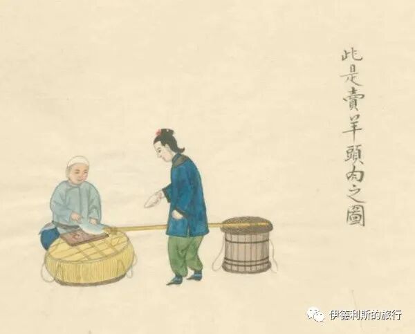
Chongwen.
1. Douzhi Ding (Jinxin Douzhi Shop) at Huashi outside Chongwenmen
Douzhi Ding's stall is in front of the Fire God Temple (Huoshen Miao) on the north side of the road, in the middle-west section of Xihuashi.
The owner of Douzhi Ding's stall is naturally surnamed Ding; he is a Hui Muslim named Ding Derui. His stall is unique. It features a large table over three meters long and one meter wide, with long benches lined up in front. On the table are two glass covers; one protects various pickled vegetables and spicy shredded salted vegetables, while the other holds sesame flatbreads (shaobing), crispy fried dough rings (jiaoquan), and other staples. There are also two wooden signs on the table, carved with eight large characters: 'Hui Muslims from the Western Regions, Douzhi Ding's Shop'. Ding Derui follows old traditions to boil the mung bean milk (douzhi). He uses a large clay pot and a betel nut ladle (binglang shao), simmering it over a low fire while adding raw mung bean milk to the pot as it cooks. He makes his mung bean milk (douzhir) with the perfect thickness, so it does not settle or become watery. It tastes sour, fragrant, and sweet, making it very delicious and addictive.
Outside Hademen by Zhang Fan
The stall is located to the left of the Fire God Temple gate in West Huashi. It has tables facing west and opens every day at noon. The table is over 10 feet long with benches in front. Two large glass covers sit on top, protecting large fruit plates filled with pickled cabbage, pickled cucumbers, small pickled radishes, and pickled asparagus. Spicy mustard greens are served with the mung bean milk. In spring, they serve quick-pickled kohlrabi, and in winter, they serve spicy dried radish cubes. Customers who buy fine pickles get chili oil. The food includes sesame flatbread (shaobing) and fried dough rings (jiaoquan).
The owner, surnamed Ding, is a Hui Muslim. He keeps two wooden signs on his table with eight green-painted characters: Western Region Hui, Ding's Mung Bean Milk. Most customers are regulars who visit every day at the same time. On market days, the benches are full, and business is booming. In January 1958, food stalls were merged into cooperatives. Ding's Mung Bean Milk moved to Suanshikou and is now the Jinxin Mung Bean Milk Shop, which still follows the traditions of Ding's Mung Bean Milk.
Reminiscing about Hademen by Niu Qingshan
Ding's Mung Bean Milk started as a shoulder-pole business. He was the first to sell it, and he was already famous in Beijing during the Qing Dynasty. People called this Hui Muslim man and his carrying pole Ding's Mung Bean Milk. It was not until 1910 that the third generation of Ding's Mung Bean Milk set up a stall in front of the Fire God Temple in the middle of Huashi Street. They finally had a long table and a permanent large pot. For a mung bean milk business, this was considered very successful. That was a famous open-air snack street in Beijing, second only to Menkuang Hutong. At that time, various stalls lined up in front of the Fire God Temple, stretching east all the way to Yangshikou.
Blues in the South of the City by Xiao Fuxing
2. Rongxiangcheng Hui Muslim snack shop (Jinfang Snack Shop) outside Chongwenmen
Rongxiangcheng Snack Shop, located at 17 Hademen Outer Street, is a well-known eatery in the Chongwenmen area.
The shop opened in the early Republic of China period. The owner was Man Leting, known as Man Liu, a Hui Muslim from Shandong. The manager was Ai Lianying. The shop's sign, Rongxiangcheng, was inscribed by the famous scholar Jiang Chaozong.
Inside the shop, there is another plaque, Cangzhen, inscribed by the Zhili clique warlord Wu Peifu. The shop started by selling beef and mutton. By the 1940s, business improved significantly, and it expanded from two storefronts to four. As the business grew, they changed their strategy to combine the mutton trade with the snack trade (qin hang).
In the past, Beijing mutton shops were called mutton trades (yang hang), and their business was very seasonal. Since spring and summer are the growing seasons for sheep, they could not be slaughtered until after autumn. Because of this, people in the trade said, 'The mutton business is idle for half the year.' Old Beijingers also said, 'When visiting graves at Qingming, the mutton sellers close their doors.' To change this idle period, the shop adapted to market needs by buying Japanese refrigeration equipment. During spring and summer, they sold homemade popsicles, soda, and other frozen foods (leng shi). In autumn and winter, they focused on mutton again. This change kept them busy all year and made the shop's name increasingly famous.
In Beijing, this combined business model was common, with different terms: two shops under one manager was called 'four edges' (si ba bian), and renting out a portion to others was called 'carrying a robe' (tiao pao). Rongxiangcheng was the former, and their snack section focused on frozen foods, which was quite new at the time.
Just before the liberation, war blocked mutton shipments from Inner Mongolia to Beijing. The mutton trade plummeted, and Rongxiangcheng was no exception. At this time, Man Kaiqi, a fellow townsman of Man Leting, came to the shop. He came from a background in a traditional pastry shop (bobo pu). In the old snack trade, a pastry shop was considered lower in status than a bakery but higher than a restaurant. Rongxiangcheng simply stopped selling mutton and switched to snacks and frozen foods. Man Kaiqi's skills were put to good use. Under his management, they offered up to 20 varieties of snacks: sticky rice cake (qiegao), fried cake (zhagao), sesame ball (matuan), fried dough twist (mahua), sweet rice ball (yuanxiao), sugar ear (tangerduo), steamed rice cake (aiwowo), soybean flour cake (lvdagun), apricot tea (xingcha), millet porridge (miancha), tofu pudding (doufunao), sesame flatbread (shaobing), fried dough cake (youbing), and bean paste bun (doubao). This made Rongxiangcheng a famous Hui Muslim snack shop in the Chongwai area.
After the Cultural Revolution, Rongxiangcheng was renamed Jinfang Snack Shop. In the mid-1990s, due to the expansion of Chongwai Street, the shop moved to the Tianqiao intersection for a time. Its current location is on the east side of the south entrance of Chongwai Street. This time-honored shop in the South City has started its glorious journey once again.
Reminiscing about Hademen by Niu Qingshan
The place that stays in my memory the most is Jinfang Snack Shop. When I first returned to Beijing, it was winter, and it was still pitch black when I got up early for work. I didn't have time to eat breakfast at home, so I pushed my bike through the underpass and across the railway; down the slope was Baiqiao Street, and further west was Huashi Street. There were few people in the morning, the streetlights were dim, and it was very quiet; the northwest wind blowing head-on was so strong it made it hard to open my mouth. Luckily, after riding a short distance, I could see the bright lights of Jinfang Snack Shop on the north side of the road ahead. I locked my bike and lifted the cotton door curtain to go inside; the heat rushed into my face, and more than half of the chill on my body disappeared at once. My favorite thing to eat in this shop is the millet flour porridge (miancha); it is thick, fragrant, and hot enough to burn your mouth. You cannot rush drinking millet flour porridge; there is a trick to it: regular customers never use chopsticks or spoons, they rotate the bowl and drink from the edge, finishing it until the bottom is clean. With these two crispy fried dough rings (jiaoquan) and a bowl of millet flour porridge in my stomach, my whole body felt warm, and the next 40 minutes of the journey wouldn't leave me frozen with a twisted face and numb hands and feet.
Reading Beijing Figures: Impressions of Huashi (Postscript). Written by Chen Guangzhong.
Xuanwu.
1. Xianbing Porridge Shop at Meishi Bridge outside Qianmen
There are two meat pie and porridge shops at Meishi Bridge, and they are halal restaurants. These two shops have the same owner; one is on the east side of the road and the other is on the west, which is called one owner running two shops. They are open 24 hours a day without interruption; when the east shop puts up its door panels to close, the west shop takes its panels down to open, so customers can always get meat pies and porridge. Since it is a meat pie and porridge shop, the meat pies are naturally their specialty. The meat pies are filled with beef, also known as meat cakes (roubing); they are large, full of filling, and oily, which really satisfies a craving. If a guest asks for a full-sized meat pie (roubing), it is much larger than the standard version, measuring about 1.2 feet in diameter. Even someone with a big appetite cannot finish half of one.
Cuisine of East Beijing by Wu Zhengge
2. Yangtou Ma (Sheep Head Ma) at Langfang Ertiao outside Qianmen
Beijing lamb head is a local specialty. It is sliced as thin as paper and sprinkled with salt and pepper powder. Lamb head meat includes the cheek (lianzi), the tongue and root (xinzi), the roof of the mouth (tianhuaban), the tongue tip (tongtianti), the eyes, the hooves, and the tendons. Aside from the tendons, the cheek meat has the deepest flavor. The sellers of lamb head meat are all Hui Muslims. There was only one halal stall, located at the back door of the Yuxing Restaurant on Langfang Second Alley. The owner was a man named Ma who sold his own goods. Unlike other workshops that sold wholesale without cleaning, his meat was clean. He added five-spice powder to his salt and pepper, making it extra fragrant and clean. He also sold boiled beef tripe (niudu) at a very low price.
The Life of Old Beijingers by Jin Shushen
At the west entrance of Menkuang Hutong, there was a lamb head meat stall in front of the Yuxing Restaurant that was considered a famous local snack of the area. The vendor arrived every day near dusk. He brought his own light bulb and wire, which he connected to the restaurant's power to light up his stall. He used a special knife, one foot long and five inches wide, to slice the cheek, tongue (xinzi), and eyes for customers to enjoy with their drinks. When he sliced the cheek, he made it so thin it was almost transparent. He laid it on white paper, sprinkled salt and pepper from a long-necked glass bottle, mixed it by hand, and then wrapped it up. It tasted delicious. Customers loved the taste of the meat and admired the vendor's skill. Every night when the lights came on, a crowd would gather at the intersection of Langfang Second Alley and Menkuang Hutong to watch him slice the meat. People traveled from far away to Menkuang Hutong just to eat this lamb head meat. I once asked about that Hui Muslim vendor. I only knew his surname was Ma and he lived on Niujie. He likely passed away after the Cultural Revolution, and I do not know what happened to him.
Ye Zufu Talks About Beijing by Ye Zufu
3. Yitiaolong Mutton Restaurant outside Qianmen
Yitiao Long Lamb Restaurant processes its meat carefully and slices it very thin. After slaughtering and skinning the lamb, they select only the hind legs. They place the meat on a clean surface with natural water, cover it with a reed mat, place an oilcloth over the mat, and put a block of ice on top. This is called pressed meat (yarou). The meat is pressed for a full day and night to draw out the blood and impurities, which makes the meat firm and easy to slice. This pressed meat (ya rou) is better than frozen meat because frozen meat, like frozen cabbage, breaks down the lamb's texture and makes it lose its tender, savory flavor, which makes it taste bad. Yilong is just like Zhengyanglou; they slice the meat thinly and serve it on plates according to the cut. The seasonings are complete.
When eating hot pot lamb (shuan yangrou), people usually eat sesame flatbread (shaobing) as their staple food. The sesame flatbread (shaobing) at Nanhengshun (Wang Dongsi: Yilong's original name is Nanhengshun) is also different from other places; for every basin of dough, they use ten jin of flour, with nine jin of plain flour and one jin of leavened dough. Ten jin of flour requires one jin and two liang of sesame paste. The sesame flatbread (shaobing) is first seared on a griddle, then baked in an oven, searing the bottom first and then the sesame-topped side (just for a quick touch). This kind of sesame flatbread (shaobing) has plenty of sauce, is cooked through, and is perfectly flaky and crisp.
When customers are almost full, they order a bowl of Nanhengshun's homemade, thin and uniform mung bean mixed noodles (lvdou zamian) served dry. Mung bean mixed noodles (lvdou zamian) are great for cutting through the greasiness of meat; a bowl of these noodles absorbs the floating oil from the hot pot and cleanses the palate, making these thin and uniform noodles another specialty of Nanhengshun.
Miscellaneous Talks on Old Beijing by Wang Yongbin.
4. Ai's steamed rice cake (aiwowowo) stall on Menkuang Hutong outside Qianmen
It is currently the first lunar month, the time when ai'ou wowos are on the market. Beijing's ai'ou wowos are similar to Fengtian's cool rice cakes (lianggao) and are both sold during the first lunar month, but ai'ou wowos are soft and delicious, and cannot be compared to cool rice cakes (lianggao). Cool rice cakes (lianggao) are made by steaming glutinous rice flour, using it as a wrapper, filling it with sesame and white sugar, and sprinkling it with rice flour. On the surface, they look like ai'ou wowos, but they are essentially just a variation of sticky rice cakes (niangao); after a while, when the wind blows on them, they still get hard.
Ai'ou wowos are made by boiling whole glutinous rice grains until cooked, waiting for all the steam to evaporate, and then putting them in a basin to form a soft, fluffy texture. Using this rice-grain texture, they wrap in various sweet fillings, sprinkle with glutinous rice flour, and add red dots to distinguish the types of fillings. This item is called an ai'ou wowo, which is also a type of cold snack. Isn't the Changdian temple fair happening right now? Ai'ou wowos are a seasonal treat, but for the best-looking and best-tasting ones, go to the entrance of Tongle Teahouse on Menkuang Hutong. There is a small cart there that is kept very clean. A Hui Muslim man sells ai'ou wowos there throughout the year. He uses real glutinous rice and good fillings. Eating a couple of his is a unique experience that you must try.
Beijing Dream Splendor Record by Mu Ruga.
5. Fushunzhai Beef Shop on Menkuang Hutong outside Qianmen.
We must start with the famous Fushunzhai beef shop at the south entrance of the hutong. Its spiced beef (jiang niurou) is tender and delicious, easily matching the spiced lamb (jiang yangrou) from Yueshengzhai. They also use a pot of original beef broth to cook meat for sale every day, with a set amount sold at specific times, and it sells out very quickly. The shopkeeper is a Hui Muslim named Liu. Later, this spiced beef shop moved to Qianmen Street and merged with Yueshengzhai.
Ye Zufu Talks About Beijing by Ye Zufu
6. Baodu Feng in Menkuang Hutong outside Qianmen. Collapse Read »
Summary: Beijing Muslim History: Old Halal Notes from the Southern City is presented here as a firsthand travel account in clear English, beginning with this scene: Chongwen:. The account keeps its focus on Beijing Muslim History, Southern Beijing, Hui Muslims while preserving the names, places, food, and historical details from the Chinese source. This is part 1 of 5.
Part 1 of 5
Table of Contents
Chongwen:
1. Douzhi Ding (Jinxin Douzhi Shop) at Huashi outside Chongwenmen
2. Rongxiangcheng Hui Muslim snack shop (Jinfang Snack Shop) outside Chongwenmen
Xuanwu:
1. Xianbing Porridge Shop at Meishi Bridge outside Qianmen
2. Yangtou Ma (Sheep Head Ma) at Langfang Ertiao outside Qianmen
3. Yitiaolong Mutton Restaurant outside Qianmen
4. Ai's steamed rice cake (aiwowowo) stall on Menkuang Hutong outside Qianmen
5. Fushunzhai spiced beef shop at the south entrance of Menkuang Hutong outside Qianmen
6. Bai's tofu pudding (doufunao) on Menkuang Hutong outside Qianmen
7. Baodu Feng (quick-boiled tripe) on Menkuang Hutong outside Qianmen
8. Niangao Wang (Rice Cake King) on Menkuang Hutong outside Qianmen
9. Mujiazhai at Zangjia Bridge outside Qianmen
10. Xiangjugong halal pastry shop on Qianmen Street
11. Ha's sesame flatbread (shaobing) shop at Liulichang outside Hepingmen
12. Nanlaishun snack shop at Caishikou outside Xuanwumen
13. Zhengxingde tea house at Caishikou outside Xuanwumen
14. Scalded dough fried cake (tangmian zhagao) at the Hui Muslim breakfast shop a short distance left from the east entrance of Xiangluying Sitiao Hutong outside Xuanwumen
15. Jubaoyuan on Niujie
16. The large halal canteen at the north entrance of Niujie Street.
17. A child selling malt sugar sticks (maiyatang) on Niujie Street.
18. A vendor selling sticky rice cake (qiegao) on Niujie Street.
19. Steamed corn buns (wotou) from the old neighbors of Niujie Street.
20. Soybean paste noodles (zhajiangmian) from the old neighbors of Niujie Street.
21. The Barbecue King (Kaorou Wang) at Tianqiao.
Others:
1. Hui Muslim businesses roaming the streets and alleys.
2. A halal rice cake (niangao) stall at the temple fair.
3. Mutton stall (yangrou chuangzi).
4. Shopkeeper Hua, who sells beef head meat from a wheelbarrow.
5. Bai Family Sesame Flatbread Shop (shaobing pu).
6. A roasted mutton stall in the hutong.
Chongwen.
1. Douzhi Ding (Jinxin Douzhi Shop) at Huashi outside Chongwenmen
Douzhi Ding's stall is in front of the Fire God Temple (Huoshen Miao) on the north side of the road, in the middle-west section of Xihuashi.
The owner of Douzhi Ding's stall is naturally surnamed Ding; he is a Hui Muslim named Ding Derui. His stall is unique. It features a large table over three meters long and one meter wide, with long benches lined up in front. On the table are two glass covers; one protects various pickled vegetables and spicy shredded salted vegetables, while the other holds sesame flatbreads (shaobing), crispy fried dough rings (jiaoquan), and other staples. There are also two wooden signs on the table, carved with eight large characters: 'Hui Muslims from the Western Regions, Douzhi Ding's Shop'. Ding Derui follows old traditions to boil the mung bean milk (douzhi). He uses a large clay pot and a betel nut ladle (binglang shao), simmering it over a low fire while adding raw mung bean milk to the pot as it cooks. He makes his mung bean milk (douzhir) with the perfect thickness, so it does not settle or become watery. It tastes sour, fragrant, and sweet, making it very delicious and addictive.
Outside Hademen by Zhang Fan
The stall is located to the left of the Fire God Temple gate in West Huashi. It has tables facing west and opens every day at noon. The table is over 10 feet long with benches in front. Two large glass covers sit on top, protecting large fruit plates filled with pickled cabbage, pickled cucumbers, small pickled radishes, and pickled asparagus. Spicy mustard greens are served with the mung bean milk. In spring, they serve quick-pickled kohlrabi, and in winter, they serve spicy dried radish cubes. Customers who buy fine pickles get chili oil. The food includes sesame flatbread (shaobing) and fried dough rings (jiaoquan).
The owner, surnamed Ding, is a Hui Muslim. He keeps two wooden signs on his table with eight green-painted characters: Western Region Hui, Ding's Mung Bean Milk. Most customers are regulars who visit every day at the same time. On market days, the benches are full, and business is booming. In January 1958, food stalls were merged into cooperatives. Ding's Mung Bean Milk moved to Suanshikou and is now the Jinxin Mung Bean Milk Shop, which still follows the traditions of Ding's Mung Bean Milk.
Reminiscing about Hademen by Niu Qingshan
Ding's Mung Bean Milk started as a shoulder-pole business. He was the first to sell it, and he was already famous in Beijing during the Qing Dynasty. People called this Hui Muslim man and his carrying pole Ding's Mung Bean Milk. It was not until 1910 that the third generation of Ding's Mung Bean Milk set up a stall in front of the Fire God Temple in the middle of Huashi Street. They finally had a long table and a permanent large pot. For a mung bean milk business, this was considered very successful. That was a famous open-air snack street in Beijing, second only to Menkuang Hutong. At that time, various stalls lined up in front of the Fire God Temple, stretching east all the way to Yangshikou.
Blues in the South of the City by Xiao Fuxing
2. Rongxiangcheng Hui Muslim snack shop (Jinfang Snack Shop) outside Chongwenmen
Rongxiangcheng Snack Shop, located at 17 Hademen Outer Street, is a well-known eatery in the Chongwenmen area.
The shop opened in the early Republic of China period. The owner was Man Leting, known as Man Liu, a Hui Muslim from Shandong. The manager was Ai Lianying. The shop's sign, Rongxiangcheng, was inscribed by the famous scholar Jiang Chaozong.
Inside the shop, there is another plaque, Cangzhen, inscribed by the Zhili clique warlord Wu Peifu. The shop started by selling beef and mutton. By the 1940s, business improved significantly, and it expanded from two storefronts to four. As the business grew, they changed their strategy to combine the mutton trade with the snack trade (qin hang).
In the past, Beijing mutton shops were called mutton trades (yang hang), and their business was very seasonal. Since spring and summer are the growing seasons for sheep, they could not be slaughtered until after autumn. Because of this, people in the trade said, 'The mutton business is idle for half the year.' Old Beijingers also said, 'When visiting graves at Qingming, the mutton sellers close their doors.' To change this idle period, the shop adapted to market needs by buying Japanese refrigeration equipment. During spring and summer, they sold homemade popsicles, soda, and other frozen foods (leng shi). In autumn and winter, they focused on mutton again. This change kept them busy all year and made the shop's name increasingly famous.
In Beijing, this combined business model was common, with different terms: two shops under one manager was called 'four edges' (si ba bian), and renting out a portion to others was called 'carrying a robe' (tiao pao). Rongxiangcheng was the former, and their snack section focused on frozen foods, which was quite new at the time.
Just before the liberation, war blocked mutton shipments from Inner Mongolia to Beijing. The mutton trade plummeted, and Rongxiangcheng was no exception. At this time, Man Kaiqi, a fellow townsman of Man Leting, came to the shop. He came from a background in a traditional pastry shop (bobo pu). In the old snack trade, a pastry shop was considered lower in status than a bakery but higher than a restaurant. Rongxiangcheng simply stopped selling mutton and switched to snacks and frozen foods. Man Kaiqi's skills were put to good use. Under his management, they offered up to 20 varieties of snacks: sticky rice cake (qiegao), fried cake (zhagao), sesame ball (matuan), fried dough twist (mahua), sweet rice ball (yuanxiao), sugar ear (tangerduo), steamed rice cake (aiwowo), soybean flour cake (lvdagun), apricot tea (xingcha), millet porridge (miancha), tofu pudding (doufunao), sesame flatbread (shaobing), fried dough cake (youbing), and bean paste bun (doubao). This made Rongxiangcheng a famous Hui Muslim snack shop in the Chongwai area.
After the Cultural Revolution, Rongxiangcheng was renamed Jinfang Snack Shop. In the mid-1990s, due to the expansion of Chongwai Street, the shop moved to the Tianqiao intersection for a time. Its current location is on the east side of the south entrance of Chongwai Street. This time-honored shop in the South City has started its glorious journey once again.
Reminiscing about Hademen by Niu Qingshan
The place that stays in my memory the most is Jinfang Snack Shop. When I first returned to Beijing, it was winter, and it was still pitch black when I got up early for work. I didn't have time to eat breakfast at home, so I pushed my bike through the underpass and across the railway; down the slope was Baiqiao Street, and further west was Huashi Street. There were few people in the morning, the streetlights were dim, and it was very quiet; the northwest wind blowing head-on was so strong it made it hard to open my mouth. Luckily, after riding a short distance, I could see the bright lights of Jinfang Snack Shop on the north side of the road ahead. I locked my bike and lifted the cotton door curtain to go inside; the heat rushed into my face, and more than half of the chill on my body disappeared at once. My favorite thing to eat in this shop is the millet flour porridge (miancha); it is thick, fragrant, and hot enough to burn your mouth. You cannot rush drinking millet flour porridge; there is a trick to it: regular customers never use chopsticks or spoons, they rotate the bowl and drink from the edge, finishing it until the bottom is clean. With these two crispy fried dough rings (jiaoquan) and a bowl of millet flour porridge in my stomach, my whole body felt warm, and the next 40 minutes of the journey wouldn't leave me frozen with a twisted face and numb hands and feet.
Reading Beijing Figures: Impressions of Huashi (Postscript). Written by Chen Guangzhong.
Xuanwu.
1. Xianbing Porridge Shop at Meishi Bridge outside Qianmen
There are two meat pie and porridge shops at Meishi Bridge, and they are halal restaurants. These two shops have the same owner; one is on the east side of the road and the other is on the west, which is called one owner running two shops. They are open 24 hours a day without interruption; when the east shop puts up its door panels to close, the west shop takes its panels down to open, so customers can always get meat pies and porridge. Since it is a meat pie and porridge shop, the meat pies are naturally their specialty. The meat pies are filled with beef, also known as meat cakes (roubing); they are large, full of filling, and oily, which really satisfies a craving. If a guest asks for a full-sized meat pie (roubing), it is much larger than the standard version, measuring about 1.2 feet in diameter. Even someone with a big appetite cannot finish half of one.
Cuisine of East Beijing by Wu Zhengge
2. Yangtou Ma (Sheep Head Ma) at Langfang Ertiao outside Qianmen
Beijing lamb head is a local specialty. It is sliced as thin as paper and sprinkled with salt and pepper powder. Lamb head meat includes the cheek (lianzi), the tongue and root (xinzi), the roof of the mouth (tianhuaban), the tongue tip (tongtianti), the eyes, the hooves, and the tendons. Aside from the tendons, the cheek meat has the deepest flavor. The sellers of lamb head meat are all Hui Muslims. There was only one halal stall, located at the back door of the Yuxing Restaurant on Langfang Second Alley. The owner was a man named Ma who sold his own goods. Unlike other workshops that sold wholesale without cleaning, his meat was clean. He added five-spice powder to his salt and pepper, making it extra fragrant and clean. He also sold boiled beef tripe (niudu) at a very low price.
The Life of Old Beijingers by Jin Shushen
At the west entrance of Menkuang Hutong, there was a lamb head meat stall in front of the Yuxing Restaurant that was considered a famous local snack of the area. The vendor arrived every day near dusk. He brought his own light bulb and wire, which he connected to the restaurant's power to light up his stall. He used a special knife, one foot long and five inches wide, to slice the cheek, tongue (xinzi), and eyes for customers to enjoy with their drinks. When he sliced the cheek, he made it so thin it was almost transparent. He laid it on white paper, sprinkled salt and pepper from a long-necked glass bottle, mixed it by hand, and then wrapped it up. It tasted delicious. Customers loved the taste of the meat and admired the vendor's skill. Every night when the lights came on, a crowd would gather at the intersection of Langfang Second Alley and Menkuang Hutong to watch him slice the meat. People traveled from far away to Menkuang Hutong just to eat this lamb head meat. I once asked about that Hui Muslim vendor. I only knew his surname was Ma and he lived on Niujie. He likely passed away after the Cultural Revolution, and I do not know what happened to him.
Ye Zufu Talks About Beijing by Ye Zufu
3. Yitiaolong Mutton Restaurant outside Qianmen
Yitiao Long Lamb Restaurant processes its meat carefully and slices it very thin. After slaughtering and skinning the lamb, they select only the hind legs. They place the meat on a clean surface with natural water, cover it with a reed mat, place an oilcloth over the mat, and put a block of ice on top. This is called pressed meat (yarou). The meat is pressed for a full day and night to draw out the blood and impurities, which makes the meat firm and easy to slice. This pressed meat (ya rou) is better than frozen meat because frozen meat, like frozen cabbage, breaks down the lamb's texture and makes it lose its tender, savory flavor, which makes it taste bad. Yilong is just like Zhengyanglou; they slice the meat thinly and serve it on plates according to the cut. The seasonings are complete.
When eating hot pot lamb (shuan yangrou), people usually eat sesame flatbread (shaobing) as their staple food. The sesame flatbread (shaobing) at Nanhengshun (Wang Dongsi: Yilong's original name is Nanhengshun) is also different from other places; for every basin of dough, they use ten jin of flour, with nine jin of plain flour and one jin of leavened dough. Ten jin of flour requires one jin and two liang of sesame paste. The sesame flatbread (shaobing) is first seared on a griddle, then baked in an oven, searing the bottom first and then the sesame-topped side (just for a quick touch). This kind of sesame flatbread (shaobing) has plenty of sauce, is cooked through, and is perfectly flaky and crisp.
When customers are almost full, they order a bowl of Nanhengshun's homemade, thin and uniform mung bean mixed noodles (lvdou zamian) served dry. Mung bean mixed noodles (lvdou zamian) are great for cutting through the greasiness of meat; a bowl of these noodles absorbs the floating oil from the hot pot and cleanses the palate, making these thin and uniform noodles another specialty of Nanhengshun.
Miscellaneous Talks on Old Beijing by Wang Yongbin.
4. Ai's steamed rice cake (aiwowowo) stall on Menkuang Hutong outside Qianmen
It is currently the first lunar month, the time when ai'ou wowos are on the market. Beijing's ai'ou wowos are similar to Fengtian's cool rice cakes (lianggao) and are both sold during the first lunar month, but ai'ou wowos are soft and delicious, and cannot be compared to cool rice cakes (lianggao). Cool rice cakes (lianggao) are made by steaming glutinous rice flour, using it as a wrapper, filling it with sesame and white sugar, and sprinkling it with rice flour. On the surface, they look like ai'ou wowos, but they are essentially just a variation of sticky rice cakes (niangao); after a while, when the wind blows on them, they still get hard.
Ai'ou wowos are made by boiling whole glutinous rice grains until cooked, waiting for all the steam to evaporate, and then putting them in a basin to form a soft, fluffy texture. Using this rice-grain texture, they wrap in various sweet fillings, sprinkle with glutinous rice flour, and add red dots to distinguish the types of fillings. This item is called an ai'ou wowo, which is also a type of cold snack. Isn't the Changdian temple fair happening right now? Ai'ou wowos are a seasonal treat, but for the best-looking and best-tasting ones, go to the entrance of Tongle Teahouse on Menkuang Hutong. There is a small cart there that is kept very clean. A Hui Muslim man sells ai'ou wowos there throughout the year. He uses real glutinous rice and good fillings. Eating a couple of his is a unique experience that you must try.
Beijing Dream Splendor Record by Mu Ruga.
5. Fushunzhai Beef Shop on Menkuang Hutong outside Qianmen.
We must start with the famous Fushunzhai beef shop at the south entrance of the hutong. Its spiced beef (jiang niurou) is tender and delicious, easily matching the spiced lamb (jiang yangrou) from Yueshengzhai. They also use a pot of original beef broth to cook meat for sale every day, with a set amount sold at specific times, and it sells out very quickly. The shopkeeper is a Hui Muslim named Liu. Later, this spiced beef shop moved to Qianmen Street and merged with Yueshengzhai.
Ye Zufu Talks About Beijing by Ye Zufu
6. Baodu Feng in Menkuang Hutong outside Qianmen. Collapse Read »
Halal Travel Guide: Istanbul — Mosques, Turkish Food and Ottoman Streets (Part 1 of 3)
Reposted from the web
Summary: Istanbul — Mosques, Turkish Food and Ottoman Streets is presented here as a firsthand travel account in clear English, beginning with this scene: I spent half a month traveling in Turkey from September to October 2018. While visiting historical sites in Istanbul, I tried some local food and would like to share it with you here. The account keeps its focus on Istanbul Travel, Turkish Food, Ottoman Heritage while preserving the names, places, food, and historical details from the Chinese source. This is part 1 of 3.
Part 1 of 3
I spent half a month traveling in Turkey from September to October 2018. While visiting historical sites in Istanbul, I tried some local food and would like to share it with you here.
Street food.
Simit is a type of bread ring popular in the former Ottoman territories and the Middle East, and it is a common street snack in Istanbul.
The word simit comes from the Arabic word samīd, which means white bread or fine flour. The earliest records of simit bread rings in Istanbul date back to 1525. By 1594, Istanbul had established the first regulations for the weight and price of simit bread rings. According to the famous 17th-century Ottoman traveler Evliya Çelebi, there were 70 simit bakeries in Istanbul in the 1630s.
Because of its low price, simit has become an important symbol for the working class in Turkey.
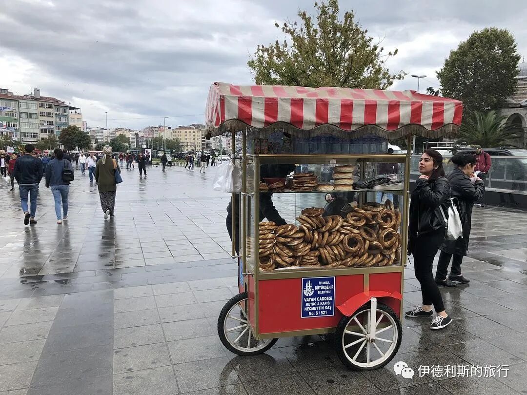
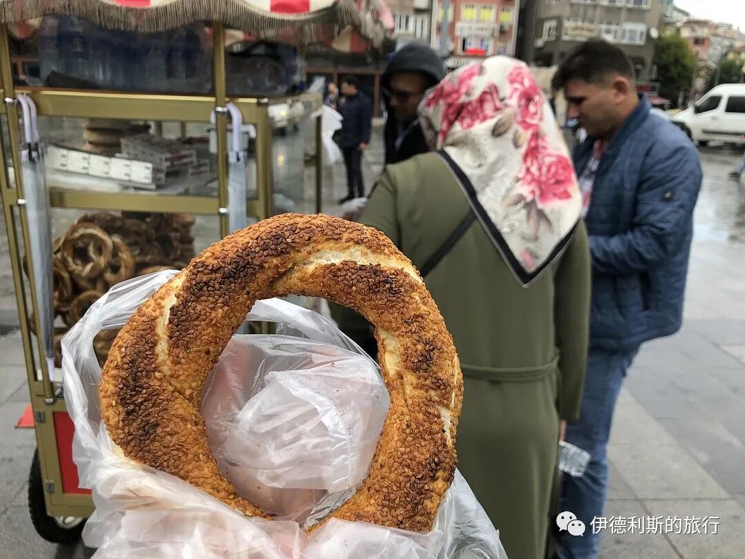
Roasted corn and boiled corn are street snacks just as common as the bread rings.
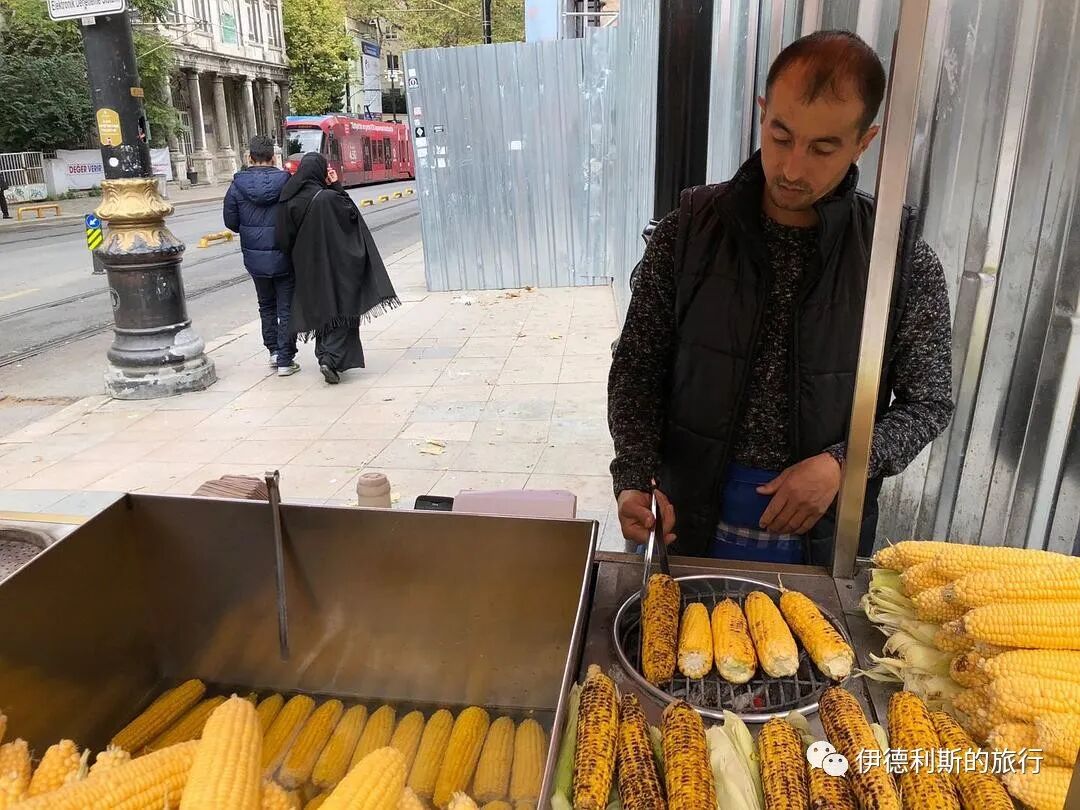
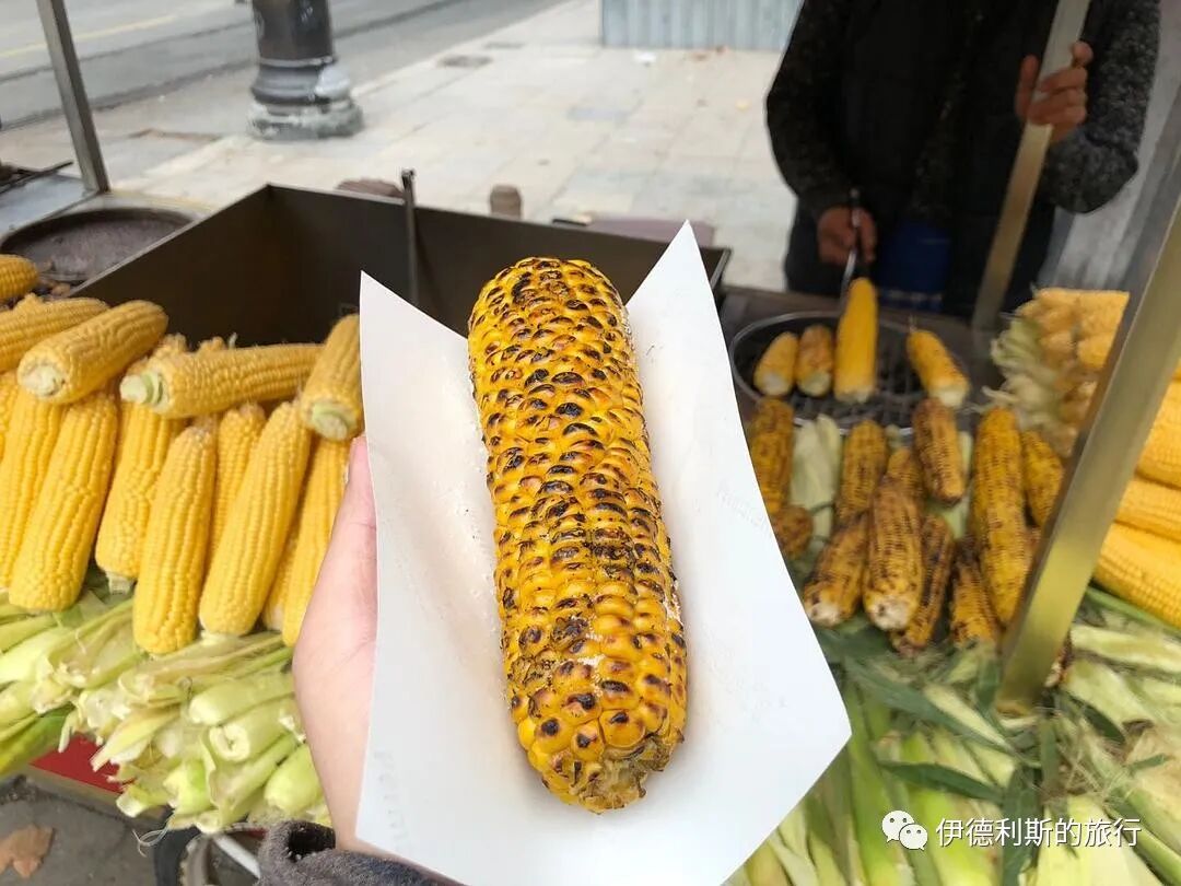
There are also various kinds of freshly squeezed fruit juices on the streets of Istanbul, and this time I had fresh pomegranate juice.
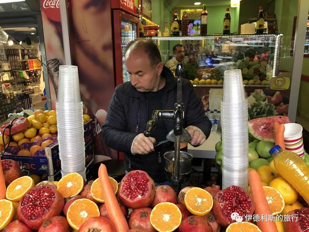
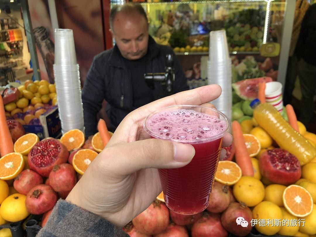
Autumn is the season for eating roasted chestnuts.
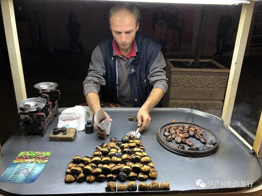
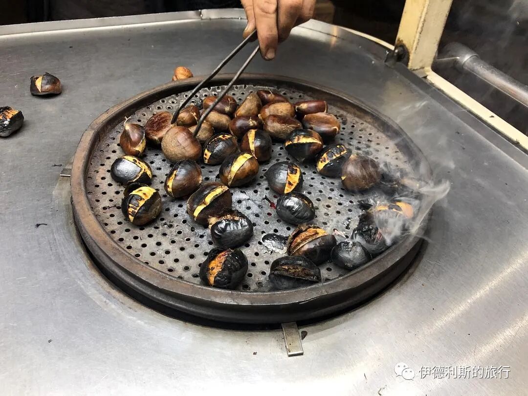
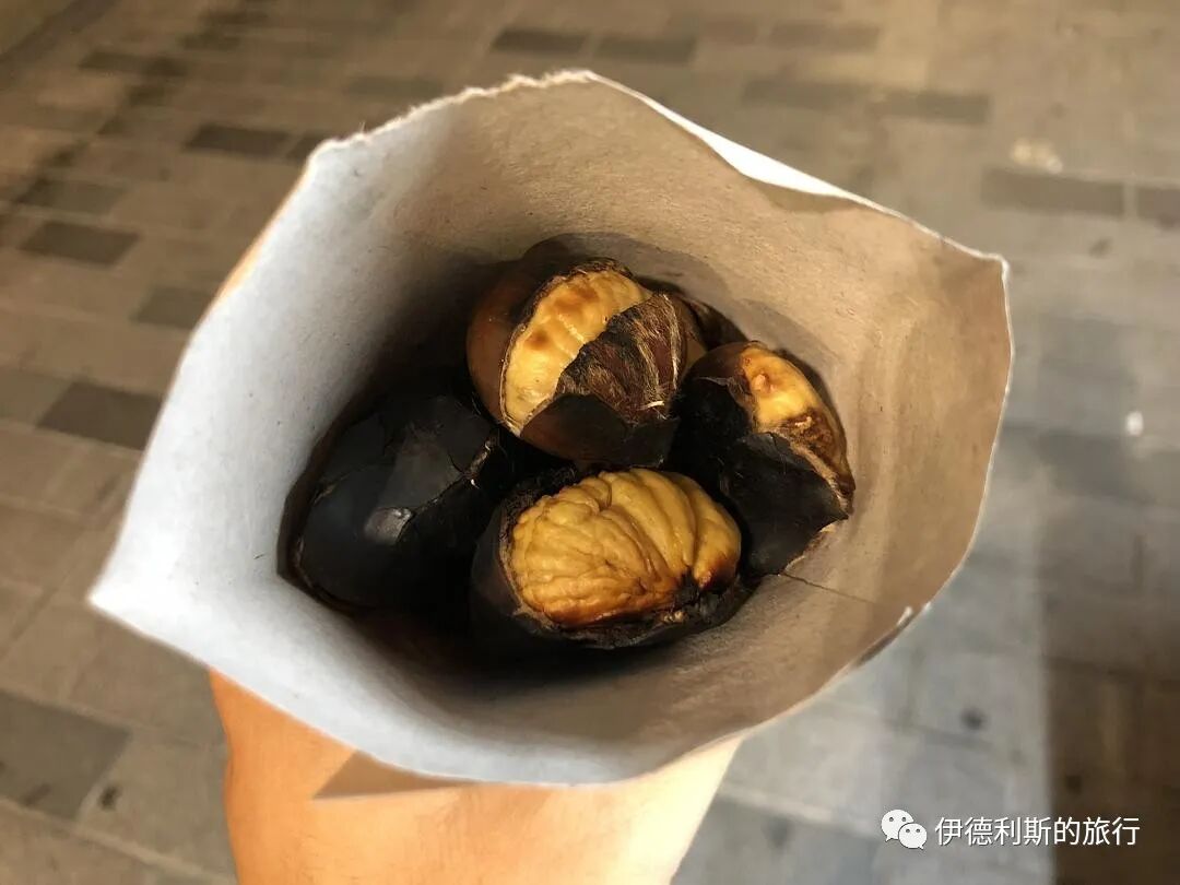
There are all kinds of ice cream shops on the streets of Istanbul. I had never eaten this black mulberry flavor before, and the young lady selling the ice cream was very sweet.
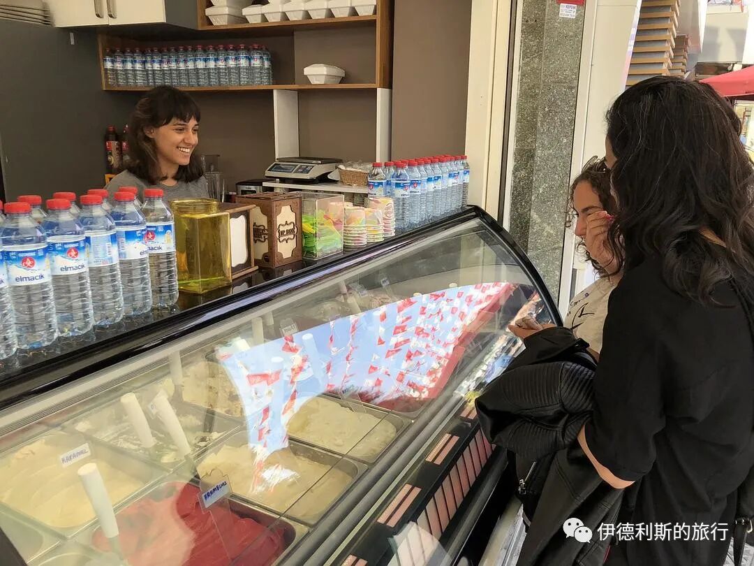
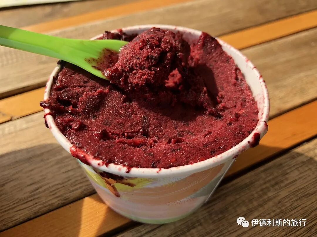
Desserts
1. Ashure porridge
There are many dessert shops in Istanbul with a wide variety of traditional sweets, and there are many on Istiklal Avenue alone. I had Turkish Ashure porridge at a dessert shop called Taxim Süitiş.
The Turkish word Ashure comes from the Arabic word Āshūrā, which means tenth. On the tenth day of the first month (Muharram) of the Islamic calendar in the year 61, the family of the Prophet's grandson, Husayn, died while fleeing Mecca due to the pursuit of the Umayyad dynasty. This day has become an important memorial day for Shia and some Sunni Muslims. For Sunni Muslims, the Day of Ashura is also an important memorial day for many events, such as when the Prophet Musa (Moses) was pursued by the Pharaoh to the Red Sea and the sea parted to create a path for them to escape, when the Prophet Nuh (Noah) left the ark, and when the Prophet Muhammad arrived in Medina.
Ashure porridge was popularized in Turkey by the Alevis. To commemorate the martyrdom of the saint Ali, the Alevis do not eat meat on this day, but instead eat Ashure porridge made from grains, fruits, dried fruits, and nuts.
The Alevis respect the saint Ali just like the Shia, but their rituals are completely different from the Shia. The Alevis are actually an Islamic sect that blends Shia and Sufi beliefs, native Turkish animism, and some Sunni elements. They are more used to expressing their faith through music and dance in a gathering hall (cemevi).
For traditional Sunni Muslims in Turkey, people share Ashura porridge (ashure) with friends, relatives, neighbors, colleagues, and classmates on the Day of Ashura, regardless of their religious beliefs. Legend says that on the Day of Ashura, after the Prophet Nuh (Noah) landed his ark, his family prepared a meal to celebrate. Because their supplies were almost gone, they mixed the remaining grains and dried fruits together to make Ashura porridge.
The recipe for Ashura porridge is not fixed; traditionally it has at least 7 ingredients, and some people use 10 to match the theme of the tenth day. The Alevis always use 12 ingredients.
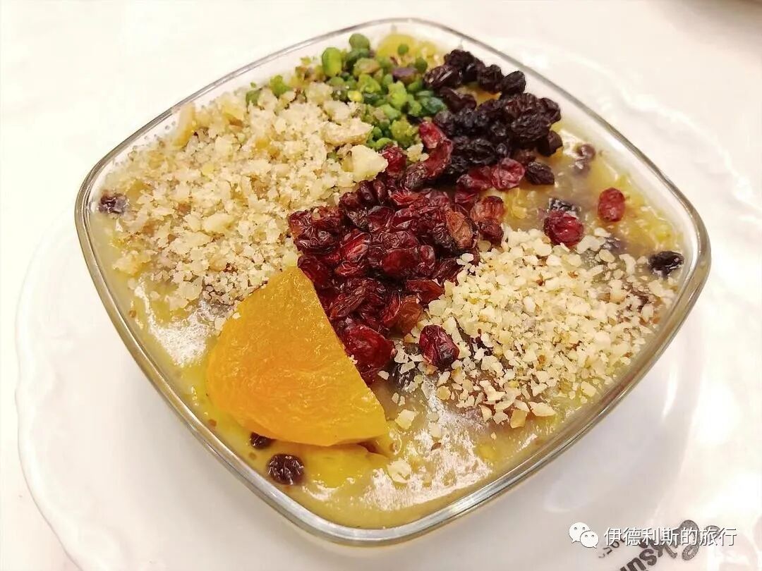
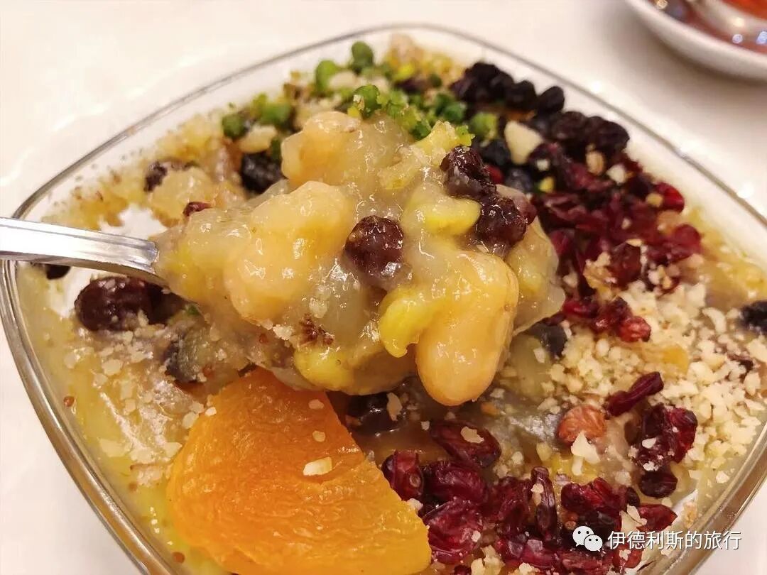
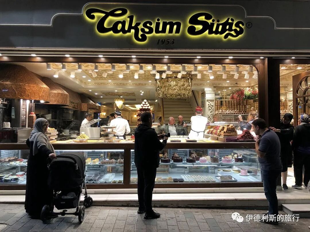
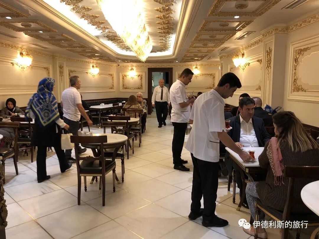
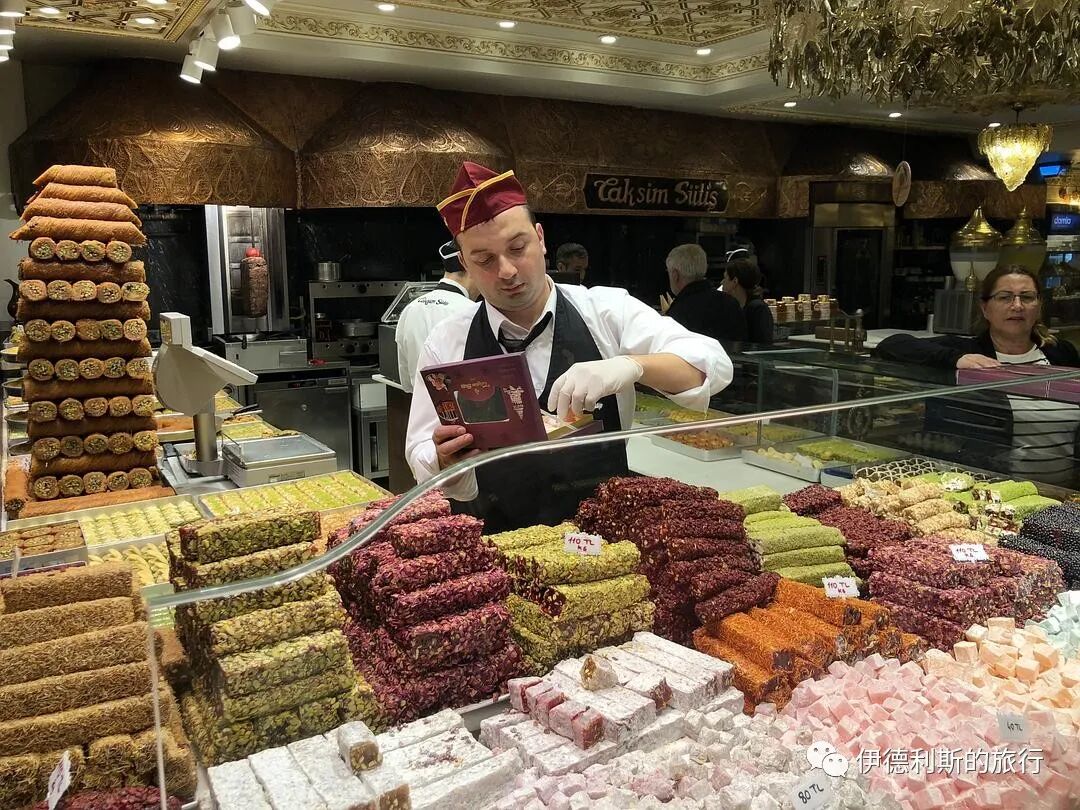
I bought a box of Turkish delight (lokum) as a gift at Hakki Zade, an old Ottoman brand and chain store on Istiklal Avenue.
The dessert shop below, called Efezade, is not far southwest of the old Ottoman palace, and the words Baklava & Lokum above the shop name refer to Turkish pastries and Turkish delight.
Modern Turkish nut-filled pastry (baklava) is said to have come from the Ottoman court, where the Ottoman Sultan would distribute baklava on trays to the Janissaries during a procession on the 15th of Ramadan, a ceremony known as the Baklava Procession (Baklava Alayı).
There is no final conclusion about the origin of baklava in the pre-Ottoman era, but there are three mainstream views: the Byzantine Placenta pastry inherited from Rome, the layered pastry tradition of Central Asian Turks, and the Persian Lauzinaq pastry.
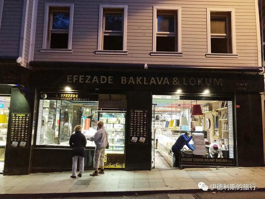
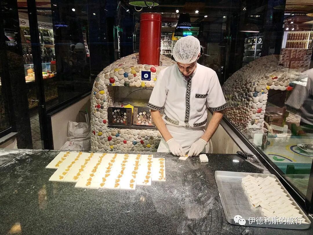
This young man was very enthusiastic and kept pestering me to teach him Chinese.
A diagram of various Turkish pastries.
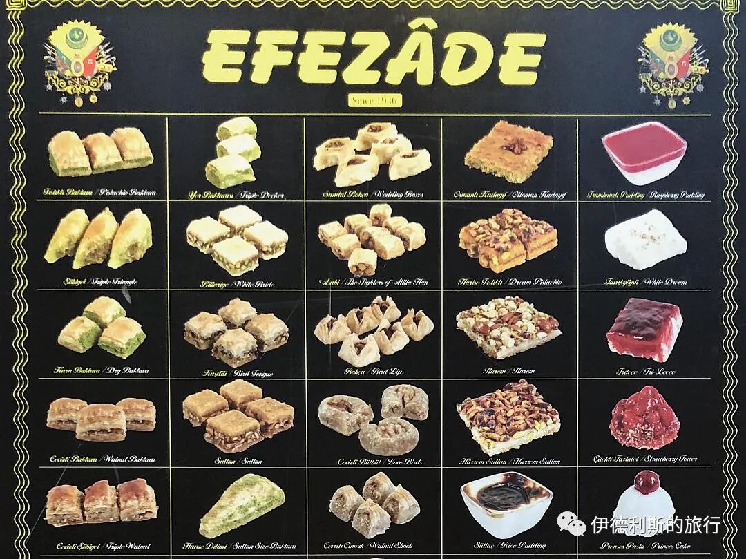
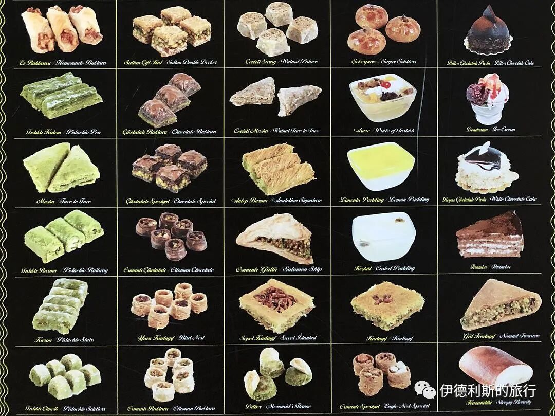
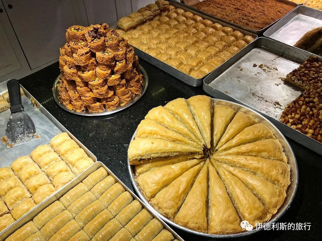
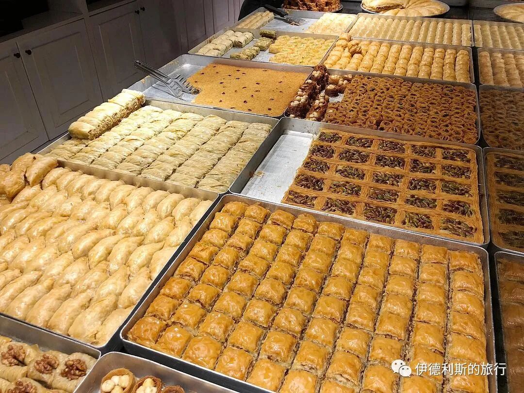
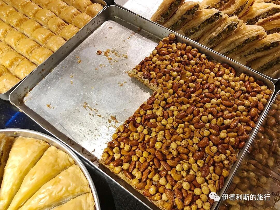
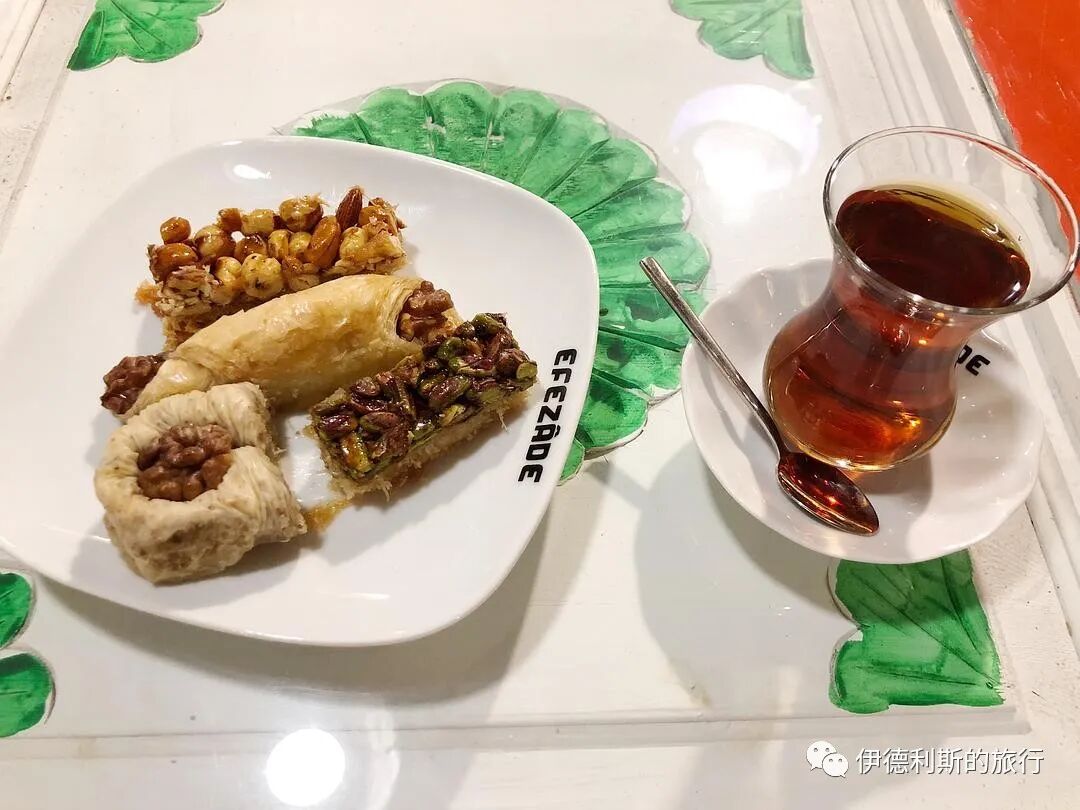
The pastry in the bottom left of the picture below is called nightingale's nest (bülbül yuvası), which translates literally to 'nightingale's nest'.
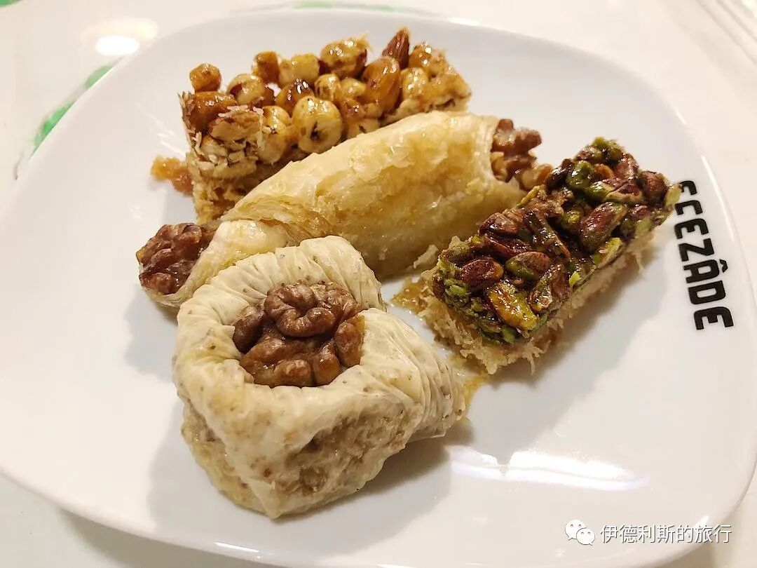
There are also various types of Turkish delight (lokum). The word lokum comes from the Arabic 'al-halkum'. Arabs call Turkish delight 'rāḥatal-ḥulqūm', which means 'throat comfort'.
According to the Hacı Bekir company, Turkish delight was brought to Istanbul from his hometown of Kastamonu by the founder, Hacı Bekir, in 1777. Some historians question this claim because similar soft candies made from starch and sugar appeared in Arab and Persian lands centuries earlier.
Turkish coffee served with pudding on the street.
In the early Ottoman Empire, strong coffee was banned as a medicine, but the Sultan eventually lifted the ban because it became so popular with the people.
Turkish coffee is recognized by UNESCO as part of Turkey's intangible cultural heritage.
The picture below shows Vefa Bozacisi, the only boza shop in 19th-century Istanbul. It was opened in 1876 by brothers Haci Ibrahim and Haci Sadik in the Vefa district of Istanbul, near the entertainment center of the time, Direklerarası. It is still run by the great-grandchildren of Haci Sadik and Haci Ibrahim today.
Boza is a fermented grain drink popular in Turkey, Iran, the Balkans, Central Asia, and the Caucasus. In Turkey, it is usually made from fermented wheat. It is thick and tastes sweet with a hint of sourness.
In Chagatai Turkic, boza means a drink made from camel milk, while in Persian, büze is used to refer to millet. Central Asian Turkic people began calling fermented grain drinks, usually made from millet, boza in the 10th century. It later spread to the Caucasus and the Balkans and became an important town drink during the Ottoman Empire.
The snack in the picture below is called tulumba tatlısı, which is deep-fried dough soaked in syrup. It is widely popular in former Ottoman regions, including Turkey, the Balkans, and Armenia. It is also called balah alsham in Arab regions and is often eaten during Ramadan.
Main course
A type of kebab called testi kebab eaten at this restaurant called Urfalim Lahmacun. Testi kebab comes from Central Anatolia and the Black Sea region. Testi means jar or pot in Turkish, and it involves cooking various meats and vegetables in a clay pot.
Arabic flatbread, which is very thin.
This soup is called ezogelin. It is made from crushed dried wheat and red lentils, with ingredients including rice, olive oil, butter, onions, garlic, tomatoes, chili peppers, dried mint, black pepper, and salt.
I had a dish called patlıcanlı kebab, which translates to eggplant kebab, at a bazaar next to the Rüstem Pasha Mosque in the evening, along with a drink called yayık ayran, which is a honey yogurt drink. Collapse Read »
Summary: Istanbul — Mosques, Turkish Food and Ottoman Streets is presented here as a firsthand travel account in clear English, beginning with this scene: I spent half a month traveling in Turkey from September to October 2018. While visiting historical sites in Istanbul, I tried some local food and would like to share it with you here. The account keeps its focus on Istanbul Travel, Turkish Food, Ottoman Heritage while preserving the names, places, food, and historical details from the Chinese source. This is part 1 of 3.
Part 1 of 3
I spent half a month traveling in Turkey from September to October 2018. While visiting historical sites in Istanbul, I tried some local food and would like to share it with you here.
Street food.
Simit is a type of bread ring popular in the former Ottoman territories and the Middle East, and it is a common street snack in Istanbul.
The word simit comes from the Arabic word samīd, which means white bread or fine flour. The earliest records of simit bread rings in Istanbul date back to 1525. By 1594, Istanbul had established the first regulations for the weight and price of simit bread rings. According to the famous 17th-century Ottoman traveler Evliya Çelebi, there were 70 simit bakeries in Istanbul in the 1630s.
Because of its low price, simit has become an important symbol for the working class in Turkey.
Roasted corn and boiled corn are street snacks just as common as the bread rings.
There are also various kinds of freshly squeezed fruit juices on the streets of Istanbul, and this time I had fresh pomegranate juice.
Autumn is the season for eating roasted chestnuts.
There are all kinds of ice cream shops on the streets of Istanbul. I had never eaten this black mulberry flavor before, and the young lady selling the ice cream was very sweet.
Desserts
1. Ashure porridge
There are many dessert shops in Istanbul with a wide variety of traditional sweets, and there are many on Istiklal Avenue alone. I had Turkish Ashure porridge at a dessert shop called Taxim Süitiş.
The Turkish word Ashure comes from the Arabic word Āshūrā, which means tenth. On the tenth day of the first month (Muharram) of the Islamic calendar in the year 61, the family of the Prophet's grandson, Husayn, died while fleeing Mecca due to the pursuit of the Umayyad dynasty. This day has become an important memorial day for Shia and some Sunni Muslims. For Sunni Muslims, the Day of Ashura is also an important memorial day for many events, such as when the Prophet Musa (Moses) was pursued by the Pharaoh to the Red Sea and the sea parted to create a path for them to escape, when the Prophet Nuh (Noah) left the ark, and when the Prophet Muhammad arrived in Medina.
Ashure porridge was popularized in Turkey by the Alevis. To commemorate the martyrdom of the saint Ali, the Alevis do not eat meat on this day, but instead eat Ashure porridge made from grains, fruits, dried fruits, and nuts.
The Alevis respect the saint Ali just like the Shia, but their rituals are completely different from the Shia. The Alevis are actually an Islamic sect that blends Shia and Sufi beliefs, native Turkish animism, and some Sunni elements. They are more used to expressing their faith through music and dance in a gathering hall (cemevi).
For traditional Sunni Muslims in Turkey, people share Ashura porridge (ashure) with friends, relatives, neighbors, colleagues, and classmates on the Day of Ashura, regardless of their religious beliefs. Legend says that on the Day of Ashura, after the Prophet Nuh (Noah) landed his ark, his family prepared a meal to celebrate. Because their supplies were almost gone, they mixed the remaining grains and dried fruits together to make Ashura porridge.
The recipe for Ashura porridge is not fixed; traditionally it has at least 7 ingredients, and some people use 10 to match the theme of the tenth day. The Alevis always use 12 ingredients.
I bought a box of Turkish delight (lokum) as a gift at Hakki Zade, an old Ottoman brand and chain store on Istiklal Avenue.
The dessert shop below, called Efezade, is not far southwest of the old Ottoman palace, and the words Baklava & Lokum above the shop name refer to Turkish pastries and Turkish delight.
Modern Turkish nut-filled pastry (baklava) is said to have come from the Ottoman court, where the Ottoman Sultan would distribute baklava on trays to the Janissaries during a procession on the 15th of Ramadan, a ceremony known as the Baklava Procession (Baklava Alayı).
There is no final conclusion about the origin of baklava in the pre-Ottoman era, but there are three mainstream views: the Byzantine Placenta pastry inherited from Rome, the layered pastry tradition of Central Asian Turks, and the Persian Lauzinaq pastry.
This young man was very enthusiastic and kept pestering me to teach him Chinese.
A diagram of various Turkish pastries.
The pastry in the bottom left of the picture below is called nightingale's nest (bülbül yuvası), which translates literally to 'nightingale's nest'.
There are also various types of Turkish delight (lokum). The word lokum comes from the Arabic 'al-halkum'. Arabs call Turkish delight 'rāḥatal-ḥulqūm', which means 'throat comfort'.
According to the Hacı Bekir company, Turkish delight was brought to Istanbul from his hometown of Kastamonu by the founder, Hacı Bekir, in 1777. Some historians question this claim because similar soft candies made from starch and sugar appeared in Arab and Persian lands centuries earlier.
Turkish coffee served with pudding on the street.
In the early Ottoman Empire, strong coffee was banned as a medicine, but the Sultan eventually lifted the ban because it became so popular with the people.
Turkish coffee is recognized by UNESCO as part of Turkey's intangible cultural heritage.
The picture below shows Vefa Bozacisi, the only boza shop in 19th-century Istanbul. It was opened in 1876 by brothers Haci Ibrahim and Haci Sadik in the Vefa district of Istanbul, near the entertainment center of the time, Direklerarası. It is still run by the great-grandchildren of Haci Sadik and Haci Ibrahim today.
Boza is a fermented grain drink popular in Turkey, Iran, the Balkans, Central Asia, and the Caucasus. In Turkey, it is usually made from fermented wheat. It is thick and tastes sweet with a hint of sourness.
In Chagatai Turkic, boza means a drink made from camel milk, while in Persian, büze is used to refer to millet. Central Asian Turkic people began calling fermented grain drinks, usually made from millet, boza in the 10th century. It later spread to the Caucasus and the Balkans and became an important town drink during the Ottoman Empire.
The snack in the picture below is called tulumba tatlısı, which is deep-fried dough soaked in syrup. It is widely popular in former Ottoman regions, including Turkey, the Balkans, and Armenia. It is also called balah alsham in Arab regions and is often eaten during Ramadan.
Main course
A type of kebab called testi kebab eaten at this restaurant called Urfalim Lahmacun. Testi kebab comes from Central Anatolia and the Black Sea region. Testi means jar or pot in Turkish, and it involves cooking various meats and vegetables in a clay pot.
Arabic flatbread, which is very thin.
This soup is called ezogelin. It is made from crushed dried wheat and red lentils, with ingredients including rice, olive oil, butter, onions, garlic, tomatoes, chili peppers, dried mint, black pepper, and salt.
I had a dish called patlıcanlı kebab, which translates to eggplant kebab, at a bazaar next to the Rüstem Pasha Mosque in the evening, along with a drink called yayık ayran, which is a honey yogurt drink. Collapse Read »
Beijing Muslim History: Old Halal Notes from the Northern City (Part 4 of 6) — Section 2 of 2 — Block 1 of 2
Reposted from the web
Summary: Beijing Muslim History: Old Halal Notes from the Northern City is presented here as a firsthand travel account in clear English, beginning with this scene: East City:. The account keeps its focus on Beijing Muslim History, Northern Beijing, Hui Muslims while preserving the names, places, food, and historical details from the Chinese source. This public article combines adjacent translated blocks from the same source section.
Block 1 of 2
When I was a teenager, I was an apprentice at Zengqingzhai near the Back Gate (Houmen, also known as Di'anmen)... What did we sell? They sold pastries, and in the summer, they sold river produce like lotus root, water caltrops, and eight-treasure lotus seed porridge (babao lianzi zhou). All this river food came from Zengqingzhai, and they also sold ice cream. That is what we made back home. Later, when I made ice cream in Jiuxianqiao, I used what I learned here. Where did we sell it? In the middle of Shichahai, they drove piles into the lake bed, laid down boards, and connected them to build several room-like structures. They sold everything there—all kinds of food like fried dough rings (youzhuozi), eight-treasure lotus seed porridge (babao lianzi zhou), fox nuts (jitoumi), gorgon fruit (qianshimi), lotus seed pods, and all sorts of lotus root, like white lotus root. It was all kinds of cold snacks, really: dried fruit (guozigan), sour plum drink (suanmeitang), ice cream, and shaved ice (xuehualao). I carried everything there on a shoulder pole and set up my stall.
Born in the South of the City: Businesses Run by Hui Muslims—as told by Man Hengliang. Written by Ding Yizhuang.
Xicheng District
1. Ruizhenhou inside Zhongshan Park
Century-old Ruizhenhou
Inside Zhongshan Park, there used to be an old antique shop called Ruizhenhou, which opened in 1917. The name Ruizhenhou has a specific meaning: Rui stands for good luck and the sweet olive flower (ruixiang). Zhen means rare treasures, pearls, jade, and gemstones. Hou means being tolerant and kind, and treating people with honesty. Business was very successful after it opened, and it quickly became famous throughout Beijing. To make it easier to host guests and discuss business, the owner added a tea area and served food in the shop. There is an accurate written record about this: In 1917, the Zhongshan Park Board of Directors built 18 high-ceilinged rooms between Chunming Hall and Shanglinchun, with corridors on the east and west sides, to rent out to shops. One of these was the Ruizhenhou antique shop, which was opened by Hui Muslims.
By 1950, this business was no longer doing well. Owner Ma You'an used his business sense to realize the park lacked a decent halal restaurant, so he turned his antique shop into one. He hired the famous chef Ma Deqi to run the kitchen, and his halal dishes, especially his braised beef (wei niurou), quickly became famous in Beijing. Ma Deqi learned from Chu Lianxiang (known in the industry as Chu Xiang), a master who pioneered Beijing halal cuisine. Chu Xiang was once a royal chef who combined traditional Hui Muslim stir-frying, roasting, and hot pot techniques with cooking styles from both northern and southern China to create a unique Beijing halal flavor. As the top student among Chu Xiang's eight main disciples, Ma Deqi mastered his teacher's skills. The grand banquets Ruizhenhou offered, such as the whole lamb feast (quanyang xi), fish maw feast (yudu xi), and shark fin feast (yuchi xi), were far beyond what ordinary restaurants could prepare. Soon after opening, the restaurant became as famous as the long-standing Han Chinese restaurant Laijinyuxuan, also located in Zhongshan Park, and was always packed with customers. Mr. Ma Lianliang's birthday was on the tenth day of the first lunar month. Every year on this day, he would visit Ruizhenhou. When he was happy, he would personally name his favorite dish 'duck paste bread' (ya ni mian bao) and always ordered it. Because of this, the reputation of Ruizhenhou restaurant grew stronger and stronger.
In the early 1960s, due to a shortage of beef and mutton, Ruizhenhou was forced to become a halal snack shop. Parents visiting Zhongshan Park would always stop by the snack bar to buy something for their children, even if it was just a piece of fried cake (zhagao). When the Cultural Revolution began, the halal snack shops closed down. In the early 1980s, to support ethnic policies, the former Dongcheng Catering Company worked to bring back the famous old brand Ruizhenhou Restaurant. They reopened it at its current location at 1 South Dongsisi Street in 1982 and renamed the halal shop Ruizhenhou Restaurant. Today, third-generation chefs continue to carry on the unique halal flavors of Ruizhenhou.
The restaurant has a professionally trained lamb slicer named Master Zhao Delu, who is nicknamed Zhao the One-Knife. He started at the shop in 1981 to learn how to debone, select, and slice lamb, and he has been doing this for over 20 years. He has his own unique skills. He chooses tender young lambs weighing 35 jin, then removes the thin membrane and tendons. After cooling the meat (known in the trade as cold-setting), the blood and meat blend together, making the red and white parts distinct before it can be used. Finally, he slices it into thin, even pieces that look beautiful with their alternating red and white colors. Dip thin slices of meat into a charcoal hot pot (huoguo) that smells of wood, letting the woody scent blend with the meat. The meat stays tender even after long cooking, and the thin slices do not break. Served with carefully prepared seasonings, friends and family sit around the table to enjoy the lively and grand atmosphere. The taste is fresh, fragrant, and wonderful. This is the traditional Beijing-style mutton hot pot (shuan yangrou) from Ruizhenhou.
The Sina blog "A Century of Ruizhenhou" by ruiren491112. The blogger, Chen Junyuan, was born in Beijing in 1949 and has lived there for generations.
One day, Lin Kaimo (noted by Wang Dongsi as a master of Go during the Republic of China era) and Xia Renhu (noted by Wang Dongsi as a famous scholar) were playing Go at Chunming Pavilion in Zhongshan Park. They played for so long that they missed dinner. When the game ended, they had to order a bowl of beef noodles at Ruizhenhou, located north of Chunming Pavilion, to satisfy their hunger. At that time, Ruizhenhou was quite famous and had a branch in Zhongshan Park that sold various noodles and snacks. Back then, the noodles at Ruizhenhou were much better than the California beef noodles popular today. They were hand-pulled noodles (chentiaomian) served hot, with a rich, thick broth and plenty of tender, fragrant meat. I don't remember the exact price per bowl, maybe 70 or 80 cents, but it was very popular.
Ruizhenhou is a halal restaurant that still exists today, located at the Dongsi intersection. In the past, it was famous for its deep-fried lamb tails (zha yangwei), crispy stir-fried mung bean jelly (jiao liu geza), braised meat strips (ba routiao), and stewed beef (men niurou).
Lingering Fragrance: Memories of the Capital by Zhou Shaoliang.
2. Kaorouwan inside Xuanwumen
Kaorouwan as described by Zhang Zhongxing.
I forget who I was with, but it was summer, and we went to Kaorouwan to try the grilled beef. The storefront was very simple, just one large room. To the south is the barbecue area with two grills side by side. They look like millstones, featuring a round platform about the size of a dining table with a foot-high iron ring in the center. A slightly raised iron grate sits on top of the ring. The grate is made of iron strips about a centimeter wide placed side by side. The gaps between them are packed with beef fat from constant use. Four rough benches are placed around the round platform for customers to stand at. To the north is a table holding bowls, chopsticks, chopped green onions, chopped cilantro, sesame paste (majiang), soy sauce, and other seasonings. There is also a cutting board for the beef, which holds the meat, knives, and plates. The man cutting the meat is a big guy around fifty years old, likely the shop owner, Mr. Wan. He is quite heavy and wears only a pair of thin trousers, which sit about an inch below his navel. The owner is very capable. Aside from a teenage boy who helps deliver meat and seasonings, he does everything himself, including seating customers and handling the bills. The meat is said to be hand-picked at the meat market early in the morning, and it is sliced well, thin and even. Collapse Read »
Summary: Beijing Muslim History: Old Halal Notes from the Northern City is presented here as a firsthand travel account in clear English, beginning with this scene: East City:. The account keeps its focus on Beijing Muslim History, Northern Beijing, Hui Muslims while preserving the names, places, food, and historical details from the Chinese source. This public article combines adjacent translated blocks from the same source section.
Block 1 of 2
When I was a teenager, I was an apprentice at Zengqingzhai near the Back Gate (Houmen, also known as Di'anmen)... What did we sell? They sold pastries, and in the summer, they sold river produce like lotus root, water caltrops, and eight-treasure lotus seed porridge (babao lianzi zhou). All this river food came from Zengqingzhai, and they also sold ice cream. That is what we made back home. Later, when I made ice cream in Jiuxianqiao, I used what I learned here. Where did we sell it? In the middle of Shichahai, they drove piles into the lake bed, laid down boards, and connected them to build several room-like structures. They sold everything there—all kinds of food like fried dough rings (youzhuozi), eight-treasure lotus seed porridge (babao lianzi zhou), fox nuts (jitoumi), gorgon fruit (qianshimi), lotus seed pods, and all sorts of lotus root, like white lotus root. It was all kinds of cold snacks, really: dried fruit (guozigan), sour plum drink (suanmeitang), ice cream, and shaved ice (xuehualao). I carried everything there on a shoulder pole and set up my stall.
Born in the South of the City: Businesses Run by Hui Muslims—as told by Man Hengliang. Written by Ding Yizhuang.
Xicheng District
1. Ruizhenhou inside Zhongshan Park
Century-old Ruizhenhou
Inside Zhongshan Park, there used to be an old antique shop called Ruizhenhou, which opened in 1917. The name Ruizhenhou has a specific meaning: Rui stands for good luck and the sweet olive flower (ruixiang). Zhen means rare treasures, pearls, jade, and gemstones. Hou means being tolerant and kind, and treating people with honesty. Business was very successful after it opened, and it quickly became famous throughout Beijing. To make it easier to host guests and discuss business, the owner added a tea area and served food in the shop. There is an accurate written record about this: In 1917, the Zhongshan Park Board of Directors built 18 high-ceilinged rooms between Chunming Hall and Shanglinchun, with corridors on the east and west sides, to rent out to shops. One of these was the Ruizhenhou antique shop, which was opened by Hui Muslims.
By 1950, this business was no longer doing well. Owner Ma You'an used his business sense to realize the park lacked a decent halal restaurant, so he turned his antique shop into one. He hired the famous chef Ma Deqi to run the kitchen, and his halal dishes, especially his braised beef (wei niurou), quickly became famous in Beijing. Ma Deqi learned from Chu Lianxiang (known in the industry as Chu Xiang), a master who pioneered Beijing halal cuisine. Chu Xiang was once a royal chef who combined traditional Hui Muslim stir-frying, roasting, and hot pot techniques with cooking styles from both northern and southern China to create a unique Beijing halal flavor. As the top student among Chu Xiang's eight main disciples, Ma Deqi mastered his teacher's skills. The grand banquets Ruizhenhou offered, such as the whole lamb feast (quanyang xi), fish maw feast (yudu xi), and shark fin feast (yuchi xi), were far beyond what ordinary restaurants could prepare. Soon after opening, the restaurant became as famous as the long-standing Han Chinese restaurant Laijinyuxuan, also located in Zhongshan Park, and was always packed with customers. Mr. Ma Lianliang's birthday was on the tenth day of the first lunar month. Every year on this day, he would visit Ruizhenhou. When he was happy, he would personally name his favorite dish 'duck paste bread' (ya ni mian bao) and always ordered it. Because of this, the reputation of Ruizhenhou restaurant grew stronger and stronger.
In the early 1960s, due to a shortage of beef and mutton, Ruizhenhou was forced to become a halal snack shop. Parents visiting Zhongshan Park would always stop by the snack bar to buy something for their children, even if it was just a piece of fried cake (zhagao). When the Cultural Revolution began, the halal snack shops closed down. In the early 1980s, to support ethnic policies, the former Dongcheng Catering Company worked to bring back the famous old brand Ruizhenhou Restaurant. They reopened it at its current location at 1 South Dongsisi Street in 1982 and renamed the halal shop Ruizhenhou Restaurant. Today, third-generation chefs continue to carry on the unique halal flavors of Ruizhenhou.
The restaurant has a professionally trained lamb slicer named Master Zhao Delu, who is nicknamed Zhao the One-Knife. He started at the shop in 1981 to learn how to debone, select, and slice lamb, and he has been doing this for over 20 years. He has his own unique skills. He chooses tender young lambs weighing 35 jin, then removes the thin membrane and tendons. After cooling the meat (known in the trade as cold-setting), the blood and meat blend together, making the red and white parts distinct before it can be used. Finally, he slices it into thin, even pieces that look beautiful with their alternating red and white colors. Dip thin slices of meat into a charcoal hot pot (huoguo) that smells of wood, letting the woody scent blend with the meat. The meat stays tender even after long cooking, and the thin slices do not break. Served with carefully prepared seasonings, friends and family sit around the table to enjoy the lively and grand atmosphere. The taste is fresh, fragrant, and wonderful. This is the traditional Beijing-style mutton hot pot (shuan yangrou) from Ruizhenhou.
The Sina blog "A Century of Ruizhenhou" by ruiren491112. The blogger, Chen Junyuan, was born in Beijing in 1949 and has lived there for generations.
One day, Lin Kaimo (noted by Wang Dongsi as a master of Go during the Republic of China era) and Xia Renhu (noted by Wang Dongsi as a famous scholar) were playing Go at Chunming Pavilion in Zhongshan Park. They played for so long that they missed dinner. When the game ended, they had to order a bowl of beef noodles at Ruizhenhou, located north of Chunming Pavilion, to satisfy their hunger. At that time, Ruizhenhou was quite famous and had a branch in Zhongshan Park that sold various noodles and snacks. Back then, the noodles at Ruizhenhou were much better than the California beef noodles popular today. They were hand-pulled noodles (chentiaomian) served hot, with a rich, thick broth and plenty of tender, fragrant meat. I don't remember the exact price per bowl, maybe 70 or 80 cents, but it was very popular.
Ruizhenhou is a halal restaurant that still exists today, located at the Dongsi intersection. In the past, it was famous for its deep-fried lamb tails (zha yangwei), crispy stir-fried mung bean jelly (jiao liu geza), braised meat strips (ba routiao), and stewed beef (men niurou).
Lingering Fragrance: Memories of the Capital by Zhou Shaoliang.
2. Kaorouwan inside Xuanwumen
Kaorouwan as described by Zhang Zhongxing.
I forget who I was with, but it was summer, and we went to Kaorouwan to try the grilled beef. The storefront was very simple, just one large room. To the south is the barbecue area with two grills side by side. They look like millstones, featuring a round platform about the size of a dining table with a foot-high iron ring in the center. A slightly raised iron grate sits on top of the ring. The grate is made of iron strips about a centimeter wide placed side by side. The gaps between them are packed with beef fat from constant use. Four rough benches are placed around the round platform for customers to stand at. To the north is a table holding bowls, chopsticks, chopped green onions, chopped cilantro, sesame paste (majiang), soy sauce, and other seasonings. There is also a cutting board for the beef, which holds the meat, knives, and plates. The man cutting the meat is a big guy around fifty years old, likely the shop owner, Mr. Wan. He is quite heavy and wears only a pair of thin trousers, which sit about an inch below his navel. The owner is very capable. Aside from a teenage boy who helps deliver meat and seasonings, he does everything himself, including seating customers and handling the bills. The meat is said to be hand-picked at the meat market early in the morning, and it is sliced well, thin and even. Collapse Read »
Beijing Muslim History: Old Halal Notes from the Southern City (Part 4 of 5) — Section 2 of 2 — Block 2 of 2
Reposted from the web
Summary: Beijing Muslim History: Old Halal Notes from the Southern City is presented here as a firsthand travel account in clear English, beginning with this scene: Chongwen:. The account keeps its focus on Beijing Muslim History, Southern Beijing, Hui Muslims while preserving the names, places, food, and historical details from the Chinese source. This public article combines adjacent translated blocks from the same source section.
Block 2 of 2
Mentioning pickled cabbage reminds me of winters in the old capital, when every family used small coal-ball stoves. Impatient people couldn't wait for the fire to catch properly, so they would bring the stove inside while it was still emitting blue flames. The coal gas could suffocate a person. Every winter, quite a few people actually died from this. The special remedy for 'coal gas poisoning' didn't require going to a pharmacy or calling a doctor. You just had to go to a lamb stall, buy a large portion of pickled cabbage, ask for extra broth, and pour the ice-cold, teeth-chattering cabbage soup into the victim's mouth. For mild cases, a few sips of the sour, cool liquid would make them feel better in no time.
Beiping Customs: Lamb Stalls. Chen Hongnian
4. Shopkeeper Hua, who sells beef head meat from a wheelbarrow.
Back then, the street cry went like this: 'Beef liver!' Beef head meat! Beef liver for sale, hey, hey! Beef head meat for sale! The wheelbarrow creaked as it rolled over the fallen leaves of late autumn, sometimes accompanied by a few drifting snowflakes. With the weather turning hot and cold, it is the perfect time for nourishing food. Most families can afford a few ounces of beef head meat, which is reasonably priced and tastes pretty good. My grandmother never bought from strangers; she only trusted the halal shop run by Manager Hua.
Manager Hua told me his ancestors had been doing this for generations. They never opened a storefront, but followed the tradition of walking through the streets and alleys to sell their goods. Manager Hua’s beef head meat was so popular that even if he went as far as Qianmen, he would always sell out completely. Whether they wore long gowns or mandarin jackets, everyone loved this treat. If he ran into military officers or police, he had to bow and scrape, and even offer a little bribe.
Halal means being particular. The slaughter is handled by an imam, who performs the proper rites before the blade draws blood, showing respect for a life. When you think about it, a cow works hard its whole life, only occasionally rolling its eyes or acting stubborn, but it never misses a day of work. Even when it can no longer walk, it gives its life for humans, making it a creature worthy of respect. Halal means being clean. There is not a single flaw, as they always strive for perfection. For so many years, as long as a shop has a halal sign, I trust it. I can eat the meat with peace of mind. Halal means being honest. They do not cheat people, shortchange them, or take advantage of the small, perhaps because these rules have been passed down for so many years. Halal means being loyal. As long as you visit his business often and become a regular customer, he will never overcharge you. Instead, he will always give you a little extra on the house.
Shopkeeper Hua lived in the crowded courtyard behind my grandmother's house, where a dozen families all ran small businesses to make a living. When the northwest wind blew, the smell of meat would drift right into our noses, and we knew for sure Shopkeeper Hua was processing beef head (niutourou)! To be honest, beef head is the only real meat, while everything else is just beef offal (niuzasui). Besides beef liver, he had beef tendon, beef lung, and beef tripe. After Shopkeeper Hua added spices to remove the gamey smell, clear away the bad taste, and bring out the aroma, it smelled so good you wanted to grab a few bites right away to satisfy your cravings. Shopkeeper Hua's beef offal had a unique, fragrant taste, and chatty neighbors often asked him for his secret. It is not any different from what everyone else makes, is it? Shopkeeper Hua just smiled honestly, saying nothing at all. Yellow rice wine, star anise, green onion, ginger, garlic, cardamom, bay leaves, Sichuan peppercorns, and salt—these are all common kitchen spices, but the taste of Shopkeeper Hua's food was different from the usual street stalls. People said he used a few traditional Chinese medicinal herbs that were the secret of the Hua family, passed down through generations and never revealed to outsiders. Shopkeeper Hua's honest smile was just his way of being polite to people.
Shopkeeper Hua's wheelbarrow was very distinctive. It had a wooden wheel with a copper axle, and the wheel was inlaid with shiny copper nails inside and out. The top of the cart was covered in galvanized sheet metal, polished until it shone. The cooked beef head and various types of beef offal were kept in separate round wicker baskets. A long, sharp knife was fixed in one spot to keep it from shaking. A white cloth covered all the cooked food tightly.
When Auntie Zhang saw the cart hadn't moved from the doorway, she quickly greeted him, 'Give me half a jin of beef head, with Sichuan peppercorn salt!' Shopkeeper Hua lifted the cloth, picked up a small piece, and asked, 'How about this piece?' Seeing Auntie Zhang nod, he put it on the scale. It is a generous portion, don't you see? As he spoke, he used a long knife to slice the meat so thin that if you held a piece of paper with writing on it behind the slice, you could still read the words!
Shopkeeper, please put together a pound of mixed offal (zasui), add plenty of tendon (tijin), serve it cold, and put in lots of chili oil! Whenever guests come to Uncle Li's house, they all love this dish with their drinks. While Shopkeeper Hua finished slicing and mixing, Uncle Li quickly popped a piece into his mouth while waiting for his change. To use one word: impatient. His mouth was even more eager than his hands. Just like that, before the wheelbarrow even left the alley, several pounds were already gone.
You might ask, do Shopkeeper Hua's descendants still do this business? To tell you the truth, his sons are all highly educated, and his grandchildren are either studying abroad or working as white-collar professionals in the capital. Selling beef head meat and using a wheelbarrow? That seems to have nothing to do with their life paths. Whenever someone mentions how good the beef tasted when Shopkeeper Hua was alive, no one in the Hua family picks up the conversation. Well! The ancestral flavor of the Hua family just ended right there! People say one white-collar grandson had the intention to change careers, but who could he ask for the secret recipe? What happened then? There was no follow-up. Even if there were a resolution, no one knows. Think about it, the urban jungle is a maze; even in the same building, who really knows anyone else?
Old Beijing Stories 3 by Liu Hui
5. Bai Family Sesame Flatbread Shop (shaobing pu).
Since I dare to say that sesame flatbread (shaobing) shops aren't as good as they used to be, I can give you a hundred reasons why. When I lived in the alleyway (hutong), there was a sesame flatbread (shaobing) shop right next door. The owner was named Bai, a Hui Muslim who always wore a white cap, a white shirt, and a white apron without a single speck of dirt on them. He was about sixty, so I had to call him Grandpa. He never made a big deal about selling authentic Beijing-style sesame flatbread (shaobing), but I heard all the old folks say they grew up eating the Bai family's bread. Thinking about it, I was the same; if the alleyway hadn't been torn down, I would still be eating the bread made by the younger generation of the Bai family.
The Bai Family Sesame Flatbread Shop had a simple sign with white characters on a blue background. The sign marked as halal lets you rest easy knowing that this shop is clean. The Bai family mainly sold pepper-salt baked flatbread (jiaoyan huoshao), spiral-shaped rolls (luosizhuan), brown sugar baked flatbread (hongtang huoshao), and leavened baked flatbread (famian huoshao). The most popular item was the sesame flatbread (shaobing), which had three things in abundance: lots of sesame seeds, lots of sesame paste, and lots of layers. It had two types of crispness: a crispy crust and crispy sesame seeds. It had five types of fragrance: the fragrance of the crust, the sesame seeds, the sesame paste, the inside, and the lingering taste in your mouth. Through all the years, winter or summer, it always tasted the same. One time, my grandmother was waiting in line and casually asked about the secret to his baking, and he replied, "The ingredients must never change; you have to keep a clear conscience." Old Man Bai answered while spreading sesame paste onto the dough. It seemed like he didn't give away the real secret, but when you think about it, it was actually quite clear and he wasn't hiding anything. Collapse Read »
Summary: Beijing Muslim History: Old Halal Notes from the Southern City is presented here as a firsthand travel account in clear English, beginning with this scene: Chongwen:. The account keeps its focus on Beijing Muslim History, Southern Beijing, Hui Muslims while preserving the names, places, food, and historical details from the Chinese source. This public article combines adjacent translated blocks from the same source section.
Block 2 of 2
Mentioning pickled cabbage reminds me of winters in the old capital, when every family used small coal-ball stoves. Impatient people couldn't wait for the fire to catch properly, so they would bring the stove inside while it was still emitting blue flames. The coal gas could suffocate a person. Every winter, quite a few people actually died from this. The special remedy for 'coal gas poisoning' didn't require going to a pharmacy or calling a doctor. You just had to go to a lamb stall, buy a large portion of pickled cabbage, ask for extra broth, and pour the ice-cold, teeth-chattering cabbage soup into the victim's mouth. For mild cases, a few sips of the sour, cool liquid would make them feel better in no time.
Beiping Customs: Lamb Stalls. Chen Hongnian
4. Shopkeeper Hua, who sells beef head meat from a wheelbarrow.
Back then, the street cry went like this: 'Beef liver!' Beef head meat! Beef liver for sale, hey, hey! Beef head meat for sale! The wheelbarrow creaked as it rolled over the fallen leaves of late autumn, sometimes accompanied by a few drifting snowflakes. With the weather turning hot and cold, it is the perfect time for nourishing food. Most families can afford a few ounces of beef head meat, which is reasonably priced and tastes pretty good. My grandmother never bought from strangers; she only trusted the halal shop run by Manager Hua.
Manager Hua told me his ancestors had been doing this for generations. They never opened a storefront, but followed the tradition of walking through the streets and alleys to sell their goods. Manager Hua’s beef head meat was so popular that even if he went as far as Qianmen, he would always sell out completely. Whether they wore long gowns or mandarin jackets, everyone loved this treat. If he ran into military officers or police, he had to bow and scrape, and even offer a little bribe.
Halal means being particular. The slaughter is handled by an imam, who performs the proper rites before the blade draws blood, showing respect for a life. When you think about it, a cow works hard its whole life, only occasionally rolling its eyes or acting stubborn, but it never misses a day of work. Even when it can no longer walk, it gives its life for humans, making it a creature worthy of respect. Halal means being clean. There is not a single flaw, as they always strive for perfection. For so many years, as long as a shop has a halal sign, I trust it. I can eat the meat with peace of mind. Halal means being honest. They do not cheat people, shortchange them, or take advantage of the small, perhaps because these rules have been passed down for so many years. Halal means being loyal. As long as you visit his business often and become a regular customer, he will never overcharge you. Instead, he will always give you a little extra on the house.
Shopkeeper Hua lived in the crowded courtyard behind my grandmother's house, where a dozen families all ran small businesses to make a living. When the northwest wind blew, the smell of meat would drift right into our noses, and we knew for sure Shopkeeper Hua was processing beef head (niutourou)! To be honest, beef head is the only real meat, while everything else is just beef offal (niuzasui). Besides beef liver, he had beef tendon, beef lung, and beef tripe. After Shopkeeper Hua added spices to remove the gamey smell, clear away the bad taste, and bring out the aroma, it smelled so good you wanted to grab a few bites right away to satisfy your cravings. Shopkeeper Hua's beef offal had a unique, fragrant taste, and chatty neighbors often asked him for his secret. It is not any different from what everyone else makes, is it? Shopkeeper Hua just smiled honestly, saying nothing at all. Yellow rice wine, star anise, green onion, ginger, garlic, cardamom, bay leaves, Sichuan peppercorns, and salt—these are all common kitchen spices, but the taste of Shopkeeper Hua's food was different from the usual street stalls. People said he used a few traditional Chinese medicinal herbs that were the secret of the Hua family, passed down through generations and never revealed to outsiders. Shopkeeper Hua's honest smile was just his way of being polite to people.
Shopkeeper Hua's wheelbarrow was very distinctive. It had a wooden wheel with a copper axle, and the wheel was inlaid with shiny copper nails inside and out. The top of the cart was covered in galvanized sheet metal, polished until it shone. The cooked beef head and various types of beef offal were kept in separate round wicker baskets. A long, sharp knife was fixed in one spot to keep it from shaking. A white cloth covered all the cooked food tightly.
When Auntie Zhang saw the cart hadn't moved from the doorway, she quickly greeted him, 'Give me half a jin of beef head, with Sichuan peppercorn salt!' Shopkeeper Hua lifted the cloth, picked up a small piece, and asked, 'How about this piece?' Seeing Auntie Zhang nod, he put it on the scale. It is a generous portion, don't you see? As he spoke, he used a long knife to slice the meat so thin that if you held a piece of paper with writing on it behind the slice, you could still read the words!
Shopkeeper, please put together a pound of mixed offal (zasui), add plenty of tendon (tijin), serve it cold, and put in lots of chili oil! Whenever guests come to Uncle Li's house, they all love this dish with their drinks. While Shopkeeper Hua finished slicing and mixing, Uncle Li quickly popped a piece into his mouth while waiting for his change. To use one word: impatient. His mouth was even more eager than his hands. Just like that, before the wheelbarrow even left the alley, several pounds were already gone.
You might ask, do Shopkeeper Hua's descendants still do this business? To tell you the truth, his sons are all highly educated, and his grandchildren are either studying abroad or working as white-collar professionals in the capital. Selling beef head meat and using a wheelbarrow? That seems to have nothing to do with their life paths. Whenever someone mentions how good the beef tasted when Shopkeeper Hua was alive, no one in the Hua family picks up the conversation. Well! The ancestral flavor of the Hua family just ended right there! People say one white-collar grandson had the intention to change careers, but who could he ask for the secret recipe? What happened then? There was no follow-up. Even if there were a resolution, no one knows. Think about it, the urban jungle is a maze; even in the same building, who really knows anyone else?
Old Beijing Stories 3 by Liu Hui
5. Bai Family Sesame Flatbread Shop (shaobing pu).
Since I dare to say that sesame flatbread (shaobing) shops aren't as good as they used to be, I can give you a hundred reasons why. When I lived in the alleyway (hutong), there was a sesame flatbread (shaobing) shop right next door. The owner was named Bai, a Hui Muslim who always wore a white cap, a white shirt, and a white apron without a single speck of dirt on them. He was about sixty, so I had to call him Grandpa. He never made a big deal about selling authentic Beijing-style sesame flatbread (shaobing), but I heard all the old folks say they grew up eating the Bai family's bread. Thinking about it, I was the same; if the alleyway hadn't been torn down, I would still be eating the bread made by the younger generation of the Bai family.
The Bai Family Sesame Flatbread Shop had a simple sign with white characters on a blue background. The sign marked as halal lets you rest easy knowing that this shop is clean. The Bai family mainly sold pepper-salt baked flatbread (jiaoyan huoshao), spiral-shaped rolls (luosizhuan), brown sugar baked flatbread (hongtang huoshao), and leavened baked flatbread (famian huoshao). The most popular item was the sesame flatbread (shaobing), which had three things in abundance: lots of sesame seeds, lots of sesame paste, and lots of layers. It had two types of crispness: a crispy crust and crispy sesame seeds. It had five types of fragrance: the fragrance of the crust, the sesame seeds, the sesame paste, the inside, and the lingering taste in your mouth. Through all the years, winter or summer, it always tasted the same. One time, my grandmother was waiting in line and casually asked about the secret to his baking, and he replied, "The ingredients must never change; you have to keep a clear conscience." Old Man Bai answered while spreading sesame paste onto the dough. It seemed like he didn't give away the real secret, but when you think about it, it was actually quite clear and he wasn't hiding anything. Collapse Read »
Beijing Muslim History: Old Halal Notes from the Southern City (Part 4 of 5) — Section 1 of 2 — Block 1 of 2
Reposted from the web
Summary: Beijing Muslim History: Old Halal Notes from the Southern City is presented here as a firsthand travel account in clear English, beginning with this scene: Chongwen:. The account keeps its focus on Beijing Muslim History, Southern Beijing, Hui Muslims while preserving the names, places, food, and historical details from the Chinese source. This public article combines adjacent translated blocks from the same source section.
Block 1 of 2
The front carrying pole holds a large square wooden basin, and a copper plaque reading 'Western Regions Hui Muslim' (Xiyu Huihui) is displayed on the tray. In the center of the tray sits a copper pot filled with a savory sauce made from beef or lamb and button mushrooms (koumo). A long-handled flat copper spoon is used to serve the sauce, and spare bowls, small enamel spoons, and seasonings are placed on the edge of the tray. The rear carrying pole holds a deep, straight-sided pot filled with soft tofu custard (doufunao). The pot is wrapped in a cotton cover to keep it warm, as this tofu custard is much softer than standard firm tofu (laodoufu); eating a bowl of tofu custard topped with savory sauce, with garlic juice or chili oil added to taste, and served with sesame flatbread (shaobing) or baked wheat cake (huoshao), makes for an affordable and delicious meal. The tofu custard vendor does not travel through the alleys but stays parked at the street corner.
The vendor selling starch jelly sheets (fenpi) with sauce arrives, carrying a pot of beef or lamb and button mushroom sauce along with stacks of prepared starch jelly sheets, though some vendors make the sheets fresh on the spot; this is another unique food made by Hui Muslims. Every day after noon, the starch jelly sheet vendor goes out to walk the streets and alleys; some residents in the alleys bring their own bowls to take the food home, while passersby eat right at the stall using the bowls and chopsticks provided by the vendor. On a hot summer day, buying a bowl of sliced starch jelly sheets topped with a handful of shredded cucumber, even with the savory sauce, feels refreshing and light rather than greasy.
'Beef liver, beef!' 'Beef head!' The vendor pushes a single-wheeled cart with a cutting board and round bamboo steamers containing soy-braised beef, soy-braised beef tripe, beef tripe, beef offal, and beef head meat. to selling while walking the streets during the day, they also do business at night. The cart also hangs a 'Western Regions Hui Muslim' (Xiyu Huihui) copper plaque, so at a glance, you know it is a business run by Hui Muslims.
Customs and Anecdotes: Walking the streets and alleys to sell snacks. Liu Jiuru
2. A halal rice cake (niangao) stall at the temple fair.
The halal rice cake (nian gao) stalls at temple fairs change with the seasons and have everything you could want. In summer, they sell iced rice cakes and sticky rice dumplings (zongzi). In spring and autumn, they offer fried cakes (zha gao), cold rice cakes, lotus root with sticky rice (nuomi ou), steamed rice flour cakes (aiwowo), and rolled soybean flour cakes (ludagun). Only the "vegetarian dish" (su cai) is sold for three seasons.
The "vegetarian dish" is a type of honey-preserved tea snack. It is mainly made of fried sweet potato chips, mixed with honey dates, dried apricots, fried lotus root pieces, hawthorn cake, and green plums. It is then tossed in honey syrup and sold by weight. Fried sweet potato chips make up eighty percent of this dish, and they are the tastiest and most popular part. They are crispy, sweet, and crunchy, and the honey is not sticky, so you do not get tired of eating them even if you have a lot. The other ingredients have their own candied flavors and cost more than the sweet potato chips. As a tea snack, it is a top-tier treat. As for why it is called a "vegetarian dish," the reason is not clear.
Fried cakes (zha gao) are also a halal food, made by wrapping red bean paste in yellow millet flour and deep-frying it. They are also sweet, sticky, and crispy, but unlike the "vegetarian dish," they are not only found at temple fair stalls. Fried cakes can be seen everywhere. Products from halal stalls share one common advantage: they are clean and hygienic, which gives people peace of mind.
Memories of Snacks: Jin Yunzhen
3. Mutton stall (yangrou chuangzi).
Look at how clean the larger mutton stalls (yangrou chuangzi) are. The table for the mutton and the poles for hanging the meat are scrubbed until they are spotless. The edges of the table are lined with copper nails that are always polished until they shine.
The scale on the counter has a white copper pan, white copper chains, and a white copper weight. The Hui Muslim shopkeeper always handles it with a loud clatter, banging and crashing it down. He picks it up and drops it several times; I guess that is just the custom at the mutton stall (yangrou chuangzi).
In the old days, Beijing did not seem to have slaughterhouses, because sheep were slaughtered right at the door of the mutton stall. At a large mutton stall, early every morning, five or six large sheep would be tied up with a wooden blood basin placed nearby, waiting for the head imam (ahong) to come and recite prayers.
The Muslim imam, wearing a grey cotton robe and a black mandarin jacket (magua), would arrive by rickshaw—since he had to visit many mutton stalls each morning, he traveled by rickshaw to make his rounds—carrying a cloth bag containing the knives for slaughtering the sheep. When he reached the counter, he would take out his knife, mutter a prayer, and with one swift stroke across the sheep's neck held down by two young men, the blood would pour out; the sheep would stretch its legs, twitch a few times, and then go still.
Afterward, they would peel off the skin, cut off the head, chop off the hooves, remove the offal, wash everything clean with water, and hang the meat on a pole using copper meat hooks. Look at how fatty it is!
When it comes to northern sheep, few can compare to them, except for those from the Northwest. In the summer, they graze on green grass, becoming round and plump with thick wool, and their large tails drag behind them like a big pot lid.
If you go to a large mutton stall in the winter to buy meat for hot pot (shuan guozi), they will always take good care of you. There are cuts of meat like the neck (shangnao'er), the leg muscle (huangguatiao), the flank (yaowo), and the brisket (sancha'er); they cut exactly what you point to, and they have everything you could want. Once you leave Beijing, you can find mutton hot pot everywhere, but it is just mutton!
I remember before the war, in the old capital, one silver dollar could buy four jin of good mutton delivered to your door. Add some cabbage and glass noodles (fentiao), and one dollar's worth of meat was enough to feed three or four people. It was warm and satisfying; it was wonderful.
In the summer, every mutton stall sells fried mutton (shao yangrou). The meat, just out of the fryer, is placed on a large copper tray, and the aroma is so strong you can smell it from a mile away.
For an afternoon snack, if you have a few coins, you can buy a pair of sheep hooves or a piece of shank (jianzi), and eat it with two sesame flatbreads (shaobing); it is incredibly delicious. If you bring home a large sheep head, your family can make some pancakes, boil a pot of rice porridge (shui fan), and on a hot day, it is neither greasy nor too heavy, and it really satisfies your cravings. The sheep neck has a bit more meat and is even better to eat than the head.
If your family is small, dinner is easy to put together. Just take a pot to the mutton stall, buy seven or eight mao worth of fried mutton, and tell the shopkeeper, 'Boss, add some extra broth!' Once you get home, bring the pot of meat and broth to a boil, add a few coins' worth of noodles, and you have fried mutton noodles. Forget about leaving Beiping.
Most lamb stalls (yangrou chuangzi) have a separate area to sell lamb buns (yangrou baozi) to go. They squeeze the dough into shape with their hands. In winter, they are filled with lamb and cabbage, and in summer, lamb and chives. Every time a steamer is ready, the apprentice shouts: 'Lamb buns are here!' Fresh from the steamer, get them while they're hot!
Some lamb stalls also sell medicine. They hang a sign nearby that says 'Lamb Liver Eye-Brightening Pills' (yanggan mingmu wan), and they are all tested and approved with a license from the health bureau. Some also sell sesame paste flatbread (zhima jiang shaobing) and brown sugar cakes (tang huoshao), which are made with flour and brown sugar. They are yellowish and stamped with a red mark on top. They also carry honey-glazed fried dough twists (mi mahua), which are extremely sweet. That is the full range of side businesses found at a lamb stall.
Some lamb stalls also sell pickled cabbage (suancai). Whatever amount you buy, they tie it up with a piece of iris grass (malian cao) and hand it to you. If you buy some lamb to go with it, you can make a pot of hot lamb and pickled cabbage noodle soup. It is warm, refreshing, and delicious! Collapse Read »
Summary: Beijing Muslim History: Old Halal Notes from the Southern City is presented here as a firsthand travel account in clear English, beginning with this scene: Chongwen:. The account keeps its focus on Beijing Muslim History, Southern Beijing, Hui Muslims while preserving the names, places, food, and historical details from the Chinese source. This public article combines adjacent translated blocks from the same source section.
Block 1 of 2
The front carrying pole holds a large square wooden basin, and a copper plaque reading 'Western Regions Hui Muslim' (Xiyu Huihui) is displayed on the tray. In the center of the tray sits a copper pot filled with a savory sauce made from beef or lamb and button mushrooms (koumo). A long-handled flat copper spoon is used to serve the sauce, and spare bowls, small enamel spoons, and seasonings are placed on the edge of the tray. The rear carrying pole holds a deep, straight-sided pot filled with soft tofu custard (doufunao). The pot is wrapped in a cotton cover to keep it warm, as this tofu custard is much softer than standard firm tofu (laodoufu); eating a bowl of tofu custard topped with savory sauce, with garlic juice or chili oil added to taste, and served with sesame flatbread (shaobing) or baked wheat cake (huoshao), makes for an affordable and delicious meal. The tofu custard vendor does not travel through the alleys but stays parked at the street corner.
The vendor selling starch jelly sheets (fenpi) with sauce arrives, carrying a pot of beef or lamb and button mushroom sauce along with stacks of prepared starch jelly sheets, though some vendors make the sheets fresh on the spot; this is another unique food made by Hui Muslims. Every day after noon, the starch jelly sheet vendor goes out to walk the streets and alleys; some residents in the alleys bring their own bowls to take the food home, while passersby eat right at the stall using the bowls and chopsticks provided by the vendor. On a hot summer day, buying a bowl of sliced starch jelly sheets topped with a handful of shredded cucumber, even with the savory sauce, feels refreshing and light rather than greasy.
'Beef liver, beef!' 'Beef head!' The vendor pushes a single-wheeled cart with a cutting board and round bamboo steamers containing soy-braised beef, soy-braised beef tripe, beef tripe, beef offal, and beef head meat. to selling while walking the streets during the day, they also do business at night. The cart also hangs a 'Western Regions Hui Muslim' (Xiyu Huihui) copper plaque, so at a glance, you know it is a business run by Hui Muslims.
Customs and Anecdotes: Walking the streets and alleys to sell snacks. Liu Jiuru
2. A halal rice cake (niangao) stall at the temple fair.
The halal rice cake (nian gao) stalls at temple fairs change with the seasons and have everything you could want. In summer, they sell iced rice cakes and sticky rice dumplings (zongzi). In spring and autumn, they offer fried cakes (zha gao), cold rice cakes, lotus root with sticky rice (nuomi ou), steamed rice flour cakes (aiwowo), and rolled soybean flour cakes (ludagun). Only the "vegetarian dish" (su cai) is sold for three seasons.
The "vegetarian dish" is a type of honey-preserved tea snack. It is mainly made of fried sweet potato chips, mixed with honey dates, dried apricots, fried lotus root pieces, hawthorn cake, and green plums. It is then tossed in honey syrup and sold by weight. Fried sweet potato chips make up eighty percent of this dish, and they are the tastiest and most popular part. They are crispy, sweet, and crunchy, and the honey is not sticky, so you do not get tired of eating them even if you have a lot. The other ingredients have their own candied flavors and cost more than the sweet potato chips. As a tea snack, it is a top-tier treat. As for why it is called a "vegetarian dish," the reason is not clear.
Fried cakes (zha gao) are also a halal food, made by wrapping red bean paste in yellow millet flour and deep-frying it. They are also sweet, sticky, and crispy, but unlike the "vegetarian dish," they are not only found at temple fair stalls. Fried cakes can be seen everywhere. Products from halal stalls share one common advantage: they are clean and hygienic, which gives people peace of mind.
Memories of Snacks: Jin Yunzhen
3. Mutton stall (yangrou chuangzi).
Look at how clean the larger mutton stalls (yangrou chuangzi) are. The table for the mutton and the poles for hanging the meat are scrubbed until they are spotless. The edges of the table are lined with copper nails that are always polished until they shine.
The scale on the counter has a white copper pan, white copper chains, and a white copper weight. The Hui Muslim shopkeeper always handles it with a loud clatter, banging and crashing it down. He picks it up and drops it several times; I guess that is just the custom at the mutton stall (yangrou chuangzi).
In the old days, Beijing did not seem to have slaughterhouses, because sheep were slaughtered right at the door of the mutton stall. At a large mutton stall, early every morning, five or six large sheep would be tied up with a wooden blood basin placed nearby, waiting for the head imam (ahong) to come and recite prayers.
The Muslim imam, wearing a grey cotton robe and a black mandarin jacket (magua), would arrive by rickshaw—since he had to visit many mutton stalls each morning, he traveled by rickshaw to make his rounds—carrying a cloth bag containing the knives for slaughtering the sheep. When he reached the counter, he would take out his knife, mutter a prayer, and with one swift stroke across the sheep's neck held down by two young men, the blood would pour out; the sheep would stretch its legs, twitch a few times, and then go still.
Afterward, they would peel off the skin, cut off the head, chop off the hooves, remove the offal, wash everything clean with water, and hang the meat on a pole using copper meat hooks. Look at how fatty it is!
When it comes to northern sheep, few can compare to them, except for those from the Northwest. In the summer, they graze on green grass, becoming round and plump with thick wool, and their large tails drag behind them like a big pot lid.
If you go to a large mutton stall in the winter to buy meat for hot pot (shuan guozi), they will always take good care of you. There are cuts of meat like the neck (shangnao'er), the leg muscle (huangguatiao), the flank (yaowo), and the brisket (sancha'er); they cut exactly what you point to, and they have everything you could want. Once you leave Beijing, you can find mutton hot pot everywhere, but it is just mutton!
I remember before the war, in the old capital, one silver dollar could buy four jin of good mutton delivered to your door. Add some cabbage and glass noodles (fentiao), and one dollar's worth of meat was enough to feed three or four people. It was warm and satisfying; it was wonderful.
In the summer, every mutton stall sells fried mutton (shao yangrou). The meat, just out of the fryer, is placed on a large copper tray, and the aroma is so strong you can smell it from a mile away.
For an afternoon snack, if you have a few coins, you can buy a pair of sheep hooves or a piece of shank (jianzi), and eat it with two sesame flatbreads (shaobing); it is incredibly delicious. If you bring home a large sheep head, your family can make some pancakes, boil a pot of rice porridge (shui fan), and on a hot day, it is neither greasy nor too heavy, and it really satisfies your cravings. The sheep neck has a bit more meat and is even better to eat than the head.
If your family is small, dinner is easy to put together. Just take a pot to the mutton stall, buy seven or eight mao worth of fried mutton, and tell the shopkeeper, 'Boss, add some extra broth!' Once you get home, bring the pot of meat and broth to a boil, add a few coins' worth of noodles, and you have fried mutton noodles. Forget about leaving Beiping.
Most lamb stalls (yangrou chuangzi) have a separate area to sell lamb buns (yangrou baozi) to go. They squeeze the dough into shape with their hands. In winter, they are filled with lamb and cabbage, and in summer, lamb and chives. Every time a steamer is ready, the apprentice shouts: 'Lamb buns are here!' Fresh from the steamer, get them while they're hot!
Some lamb stalls also sell medicine. They hang a sign nearby that says 'Lamb Liver Eye-Brightening Pills' (yanggan mingmu wan), and they are all tested and approved with a license from the health bureau. Some also sell sesame paste flatbread (zhima jiang shaobing) and brown sugar cakes (tang huoshao), which are made with flour and brown sugar. They are yellowish and stamped with a red mark on top. They also carry honey-glazed fried dough twists (mi mahua), which are extremely sweet. That is the full range of side businesses found at a lamb stall.
Some lamb stalls also sell pickled cabbage (suancai). Whatever amount you buy, they tie it up with a piece of iris grass (malian cao) and hand it to you. If you buy some lamb to go with it, you can make a pot of hot lamb and pickled cabbage noodle soup. It is warm, refreshing, and delicious! Collapse Read »
Beijing Muslim History: Old Halal Notes from the Southern City (Part 2 of 5) — Section 2 of 2 — Block 2 of 3
Reposted from the web
Summary: Beijing Muslim History: Old Halal Notes from the Southern City is presented here as a firsthand travel account in clear English, beginning with this scene: Chongwen:. The account keeps its focus on Beijing Muslim History, Southern Beijing, Hui Muslims while preserving the names, places, food, and historical details from the Chinese source. This public article combines adjacent translated blocks from the same source section.
Block 2 of 3
Nanlaishun Snack Shop was a spacious hall. Aside from the door, there were snacks all around the perimeter, with rows of dining tables in the middle and square stools for customers to sit on. Let's start from the east door: to the left, from south to north, were all desserts. They mainly sold layered sticky rice cake (qiegao) here. I have loved eating this since I was a child. These cakes were placed on a large wooden board, about 60 centimeters wide, 80 centimeters long, and 10 centimeters thick, with four or five layers of bean paste and glutinous rice. The top of the layered sticky rice cake was decorated with large red dates, which looked very beautiful. Buying two liang (100 grams) of cake cost 8 cents per liang, so 16 cents total, plus two liang of food ration coupons. Even though it was only two liang, the master cutting the cake would use a long knife to slice it in one go, weigh it on a scale, and put it on a plate. The layers were clearly visible, and with white sugar sprinkled on top, it was incredibly tempting. One bite was full of fragrance and sweetness; it was delicious. Besides layered sticky rice cake, they sold various old Beijing sweet snacks, including steamed rice cakes (aiwowo), rolled glutinous rice rolls (lvdagun), honey fried dough twists (mi mahua, also called tang'erduo), sugar-filled baked cakes (tanghuoshao), steamed buns (dun'er bobo), and pea flour cakes (wandouhuang). If you love sweets, you will be satisfied here!
Let's talk about the long counter from east to west. They sold savory snacks here, such as tofu pudding (doufunao), soy milk, fried dough cakes (youbing), fried dough sticks (youtiao), ring-shaped fried dough (jiequan), crispy crackers (baocui), sesame flatbread (shaobing), baked cakes (huoshao), and twisted rolls (luosizhuan). The tofu pudding was authentic; the gravy was a masterpiece, made with minced meat, daylily buds, wood ear mushrooms, and eggs, with a layer of Sichuan peppercorn oil floating on top. It cost one liang of food ration coupons and 8 cents a bowl. When the server scooped up the tender white tofu and poured the gravy over it, then sprinkled a pinch of cilantro on top, a tempting bowl of tofu pudding was handed to you. If you like it spicy, there were chili oil, minced garlic, and vinegar on the table for you to add yourself. If you bought two freshly baked sesame flatbreads and a fried dough cake, hey, you had a complete, delicious breakfast.
After finishing the east-to-west section, let's turn to the counter from north to south. They mainly sold meat pies here, with beef and green onion filling (I don't remember if they had meat-filled pancakes). The meat pies here were another specialty. You could smell the aroma from far away. As you got closer, you could not only smell them but also hear the tempting sizzling sound as they were being pan-fried. You could not only hear it but see it too. The master chef worked right behind the counter, so every customer could watch the whole process of making the meat pie (roubing). When you saw those golden-brown meat pies sizzling with oil and smelling so good, how could you not want to try one?
They also sold red bean porridge (xiaodouzhou) and sticky rice porridge (jiangmizhou). If you came for lunch, you could order two meat pies and a bowl of red bean porridge. With sliced salted vegetables on the table, tell me, doesn't that sound wonderful?
Memories of Niujie by Chen Chunxi
13. Zhengxingde tea house at Caishikou outside Xuanwumen
In the 1950s and 60s, my mother always walked from Niujie to Caishikou to buy tea at the old shop Zhengxingde. It was a halal tea shop, and most Niujie residents went there. She usually bought the tea that cost 40 cents per liang, which smelled quite fragrant when brewed. I often went with my mother to buy tea. As soon as we stepped into the shop, we smelled the jasmine tea. That scent has stayed in my memory ever since.
Back then, they did not use plastic bags. Everything was wrapped by hand in paper. The clerk would wrap it however the customer wanted, like buying four liang and splitting it into two two-liang packages. If you bought one jin, they would make two half-jin packages. Of course, some people just bought one package. The clerk's wrapping technique was amazing. They folded the paper into a perfect square that looked very solid. Then they stacked the two packages together, tied them with a paper string in a cross pattern, and made a handle on top so the customer could just hook a finger through and carry it away. That tea package was quite stylish at the time. During holidays when visiting relatives and friends, you would place the tea package on the table, and it looked both grand and traditional.
Memories of Niujie by Chen Chunxi
14. Scalded dough fried cake (tangmian zhagao) at the Hui Muslim breakfast shop a short distance left from the east entrance of Xiangluying Sitiao Hutong outside Xuanwumen
When I think of the hot-water dough fried cake (tangmian zhagao), I don't know why this simple old Beijing snack has disappeared from the streets and restaurants. Actually, in the 1950s and 60s, almost every snack shop run by Hui Muslims sold them. they were an essential snack at temple fairs in the capital back then. Collapse Read »
Summary: Beijing Muslim History: Old Halal Notes from the Southern City is presented here as a firsthand travel account in clear English, beginning with this scene: Chongwen:. The account keeps its focus on Beijing Muslim History, Southern Beijing, Hui Muslims while preserving the names, places, food, and historical details from the Chinese source. This public article combines adjacent translated blocks from the same source section.
Block 2 of 3
Nanlaishun Snack Shop was a spacious hall. Aside from the door, there were snacks all around the perimeter, with rows of dining tables in the middle and square stools for customers to sit on. Let's start from the east door: to the left, from south to north, were all desserts. They mainly sold layered sticky rice cake (qiegao) here. I have loved eating this since I was a child. These cakes were placed on a large wooden board, about 60 centimeters wide, 80 centimeters long, and 10 centimeters thick, with four or five layers of bean paste and glutinous rice. The top of the layered sticky rice cake was decorated with large red dates, which looked very beautiful. Buying two liang (100 grams) of cake cost 8 cents per liang, so 16 cents total, plus two liang of food ration coupons. Even though it was only two liang, the master cutting the cake would use a long knife to slice it in one go, weigh it on a scale, and put it on a plate. The layers were clearly visible, and with white sugar sprinkled on top, it was incredibly tempting. One bite was full of fragrance and sweetness; it was delicious. Besides layered sticky rice cake, they sold various old Beijing sweet snacks, including steamed rice cakes (aiwowo), rolled glutinous rice rolls (lvdagun), honey fried dough twists (mi mahua, also called tang'erduo), sugar-filled baked cakes (tanghuoshao), steamed buns (dun'er bobo), and pea flour cakes (wandouhuang). If you love sweets, you will be satisfied here!
Let's talk about the long counter from east to west. They sold savory snacks here, such as tofu pudding (doufunao), soy milk, fried dough cakes (youbing), fried dough sticks (youtiao), ring-shaped fried dough (jiequan), crispy crackers (baocui), sesame flatbread (shaobing), baked cakes (huoshao), and twisted rolls (luosizhuan). The tofu pudding was authentic; the gravy was a masterpiece, made with minced meat, daylily buds, wood ear mushrooms, and eggs, with a layer of Sichuan peppercorn oil floating on top. It cost one liang of food ration coupons and 8 cents a bowl. When the server scooped up the tender white tofu and poured the gravy over it, then sprinkled a pinch of cilantro on top, a tempting bowl of tofu pudding was handed to you. If you like it spicy, there were chili oil, minced garlic, and vinegar on the table for you to add yourself. If you bought two freshly baked sesame flatbreads and a fried dough cake, hey, you had a complete, delicious breakfast.
After finishing the east-to-west section, let's turn to the counter from north to south. They mainly sold meat pies here, with beef and green onion filling (I don't remember if they had meat-filled pancakes). The meat pies here were another specialty. You could smell the aroma from far away. As you got closer, you could not only smell them but also hear the tempting sizzling sound as they were being pan-fried. You could not only hear it but see it too. The master chef worked right behind the counter, so every customer could watch the whole process of making the meat pie (roubing). When you saw those golden-brown meat pies sizzling with oil and smelling so good, how could you not want to try one?
They also sold red bean porridge (xiaodouzhou) and sticky rice porridge (jiangmizhou). If you came for lunch, you could order two meat pies and a bowl of red bean porridge. With sliced salted vegetables on the table, tell me, doesn't that sound wonderful?
Memories of Niujie by Chen Chunxi
13. Zhengxingde tea house at Caishikou outside Xuanwumen
In the 1950s and 60s, my mother always walked from Niujie to Caishikou to buy tea at the old shop Zhengxingde. It was a halal tea shop, and most Niujie residents went there. She usually bought the tea that cost 40 cents per liang, which smelled quite fragrant when brewed. I often went with my mother to buy tea. As soon as we stepped into the shop, we smelled the jasmine tea. That scent has stayed in my memory ever since.
Back then, they did not use plastic bags. Everything was wrapped by hand in paper. The clerk would wrap it however the customer wanted, like buying four liang and splitting it into two two-liang packages. If you bought one jin, they would make two half-jin packages. Of course, some people just bought one package. The clerk's wrapping technique was amazing. They folded the paper into a perfect square that looked very solid. Then they stacked the two packages together, tied them with a paper string in a cross pattern, and made a handle on top so the customer could just hook a finger through and carry it away. That tea package was quite stylish at the time. During holidays when visiting relatives and friends, you would place the tea package on the table, and it looked both grand and traditional.
Memories of Niujie by Chen Chunxi
14. Scalded dough fried cake (tangmian zhagao) at the Hui Muslim breakfast shop a short distance left from the east entrance of Xiangluying Sitiao Hutong outside Xuanwumen
When I think of the hot-water dough fried cake (tangmian zhagao), I don't know why this simple old Beijing snack has disappeared from the streets and restaurants. Actually, in the 1950s and 60s, almost every snack shop run by Hui Muslims sold them. they were an essential snack at temple fairs in the capital back then. Collapse Read »
Beijing Muslim History: Old Halal Notes from the Southern City (Part 2 of 5) — Section 2 of 2 — Block 1 of 3
Reposted from the web
Summary: Beijing Muslim History: Old Halal Notes from the Southern City is presented here as a firsthand travel account in clear English, beginning with this scene: Chongwen:. The account keeps its focus on Beijing Muslim History, Southern Beijing, Hui Muslims while preserving the names, places, food, and historical details from the Chinese source. This final block is 1 of 3.
Block 1 of 3
In my childhood memories, the snacks sold at Haji Sesame Flatbread Shop, located at the northeast corner of the east entrance of West Liulichang, were the most authentic.
This was a halal sesame flatbread shop opened by five brothers with the surname Ha. Compared to other nearby shops, it had a small storefront but the busiest business. Besides selling soy milk, sesame flatbreads (shaobing), and fried dough cakes (youbing), they also had snacks like top-grade sesame flatbreads (yipin shaobing), thick buns (dun bobo), and fried egg pockets (zha hebao). At that time, my favorite things to eat were thick buns and fried egg pockets.
Thick buns are small and made from leavened dough. They are mixed with lye, white sugar, and sweet osmanthus, then pinched into small pieces, pressed into thick, flat circles, and cooked over low heat on a griddle. After both sides turn yellow, they are baked in an oven until hard, without any burnt bits. After baking, a square or round red dot is stamped on them. The yellow and white colors with the red look beautiful, and they taste sweet, soft, and springy, with a bit of toughness that makes them great to chew. After chewing repeatedly, you can taste the faint wheat aroma from the leavened dough of the thick bun itself. The flavor is unique and makes my mouth water.
When mentioning fried egg pockets, some people might think it is just fried eggs, but that is not the case. Haji's fried egg pockets have a special flavor. They use dough for fried dough cakes, roll out two pieces of similar size, put them together, and pinch three sides shut to form a pocket, or what you could call a pouch shape. They crack an egg, pour it into the pocket, sprinkle a little salt, and then pinch the opening tight. They put it into a pan of oil and control the heat carefully. The fried pockets come out crispy on the outside and tender on the inside, suitable for both the old and the young.
"Our Old Beijing" by Li Weiji
Haji Kite Shop, Haji Restaurant
The location of "Haji Kite Shop" was at the north side of the east entrance of West Liulichang in the southern part of Beijing, which is the northwest corner of the intersection, today on the east side of Hongbaotang. It started as two sheds, then changed into two small storefront rooms. At that time, my grandfather and his fifth brother were local volunteer firefighters. If a fire broke out nearby, someone from the family had to go help put it out. In return, the fire brigade gave the two brothers two small rooms to stay in, and that is where they lived.
Although it was called the Haji Kite Shop, they did not sell kites all the time. Kite flying in Beijing was very seasonal, so they only sold kites from the Spring Festival until the third lunar month. During the other three seasons, they ran a Hui Muslim snack shop called the Haji Eatery. Later, they added a shed outside the rooms to block the wind and rain. It was bigger than the two rooms and served as a place for neighbors near Liulichang and passersby to eat breakfast, lunch, and dinner. This was their main business.
The Haji Eatery sold sesame flatbread (shaobing) and fried dough twists (mahua) in the morning, and beef noodles and other meals at noon and night to support a family of several dozen people. Many neighbors nearby would buy on credit and settle their bills once a month. During the Spring Festival and the months of early spring, the eatery switched to selling kites to support the family.
Haji Kites by Ha Yiqi (Note by Wang Dongsi: The author is the fourth-generation successor of the Haji Kite tradition).
12. Nanlaishun snack shop at Caishikou outside Xuanwumen Collapse Read »
Summary: Beijing Muslim History: Old Halal Notes from the Southern City is presented here as a firsthand travel account in clear English, beginning with this scene: Chongwen:. The account keeps its focus on Beijing Muslim History, Southern Beijing, Hui Muslims while preserving the names, places, food, and historical details from the Chinese source. This final block is 1 of 3.
Block 1 of 3
In my childhood memories, the snacks sold at Haji Sesame Flatbread Shop, located at the northeast corner of the east entrance of West Liulichang, were the most authentic.
This was a halal sesame flatbread shop opened by five brothers with the surname Ha. Compared to other nearby shops, it had a small storefront but the busiest business. Besides selling soy milk, sesame flatbreads (shaobing), and fried dough cakes (youbing), they also had snacks like top-grade sesame flatbreads (yipin shaobing), thick buns (dun bobo), and fried egg pockets (zha hebao). At that time, my favorite things to eat were thick buns and fried egg pockets.
Thick buns are small and made from leavened dough. They are mixed with lye, white sugar, and sweet osmanthus, then pinched into small pieces, pressed into thick, flat circles, and cooked over low heat on a griddle. After both sides turn yellow, they are baked in an oven until hard, without any burnt bits. After baking, a square or round red dot is stamped on them. The yellow and white colors with the red look beautiful, and they taste sweet, soft, and springy, with a bit of toughness that makes them great to chew. After chewing repeatedly, you can taste the faint wheat aroma from the leavened dough of the thick bun itself. The flavor is unique and makes my mouth water.
When mentioning fried egg pockets, some people might think it is just fried eggs, but that is not the case. Haji's fried egg pockets have a special flavor. They use dough for fried dough cakes, roll out two pieces of similar size, put them together, and pinch three sides shut to form a pocket, or what you could call a pouch shape. They crack an egg, pour it into the pocket, sprinkle a little salt, and then pinch the opening tight. They put it into a pan of oil and control the heat carefully. The fried pockets come out crispy on the outside and tender on the inside, suitable for both the old and the young.
"Our Old Beijing" by Li Weiji
Haji Kite Shop, Haji Restaurant
The location of "Haji Kite Shop" was at the north side of the east entrance of West Liulichang in the southern part of Beijing, which is the northwest corner of the intersection, today on the east side of Hongbaotang. It started as two sheds, then changed into two small storefront rooms. At that time, my grandfather and his fifth brother were local volunteer firefighters. If a fire broke out nearby, someone from the family had to go help put it out. In return, the fire brigade gave the two brothers two small rooms to stay in, and that is where they lived.
Although it was called the Haji Kite Shop, they did not sell kites all the time. Kite flying in Beijing was very seasonal, so they only sold kites from the Spring Festival until the third lunar month. During the other three seasons, they ran a Hui Muslim snack shop called the Haji Eatery. Later, they added a shed outside the rooms to block the wind and rain. It was bigger than the two rooms and served as a place for neighbors near Liulichang and passersby to eat breakfast, lunch, and dinner. This was their main business.
The Haji Eatery sold sesame flatbread (shaobing) and fried dough twists (mahua) in the morning, and beef noodles and other meals at noon and night to support a family of several dozen people. Many neighbors nearby would buy on credit and settle their bills once a month. During the Spring Festival and the months of early spring, the eatery switched to selling kites to support the family.
Haji Kites by Ha Yiqi (Note by Wang Dongsi: The author is the fourth-generation successor of the Haji Kite tradition).
12. Nanlaishun snack shop at Caishikou outside Xuanwumen Collapse Read »
Beijing Muslim History: Old Halal Notes from the Southern City (Part 1 of 5) — Section 2 of 2 — Block 3 of 3
Reposted from the web
Summary: Beijing Muslim History: Old Halal Notes from the Southern City is presented here as a firsthand travel account in clear English, beginning with this scene: Chongwen:. The account keeps its focus on Beijing Muslim History, Southern Beijing, Hui Muslims while preserving the names, places, food, and historical details from the Chinese source. This final block is 3 of 3.
Block 3 of 3
Ai'ou wowos are made by boiling whole glutinous rice grains until cooked, waiting for all the steam to evaporate, and then putting them in a basin to form a soft, fluffy texture. Using this rice-grain texture, they wrap in various sweet fillings, sprinkle with glutinous rice flour, and add red dots to distinguish the types of fillings. This item is called an ai'ou wowo, which is also a type of cold snack. Isn't the Changdian temple fair happening right now? Ai'ou wowos are a seasonal treat, but for the best-looking and best-tasting ones, go to the entrance of Tongle Teahouse on Menkuang Hutong. There is a small cart there that is kept very clean. A Hui Muslim man sells ai'ou wowos there throughout the year. He uses real glutinous rice and good fillings. Eating a couple of his is a unique experience that you must try.
Beijing Dream Splendor Record by Mu Ruga.
5. Fushunzhai Beef Shop on Menkuang Hutong outside Qianmen.
We must start with the famous Fushunzhai beef shop at the south entrance of the hutong. Its spiced beef (jiang niurou) is tender and delicious, easily matching the spiced lamb (jiang yangrou) from Yueshengzhai. They also use a pot of original beef broth to cook meat for sale every day, with a set amount sold at specific times, and it sells out very quickly. The shopkeeper is a Hui Muslim named Liu. Later, this spiced beef shop moved to Qianmen Street and merged with Yueshengzhai.
Ye Zufu Talks About Beijing by Ye Zufu
6. Baodu Feng in Menkuang Hutong outside Qianmen. Collapse Read »
Summary: Beijing Muslim History: Old Halal Notes from the Southern City is presented here as a firsthand travel account in clear English, beginning with this scene: Chongwen:. The account keeps its focus on Beijing Muslim History, Southern Beijing, Hui Muslims while preserving the names, places, food, and historical details from the Chinese source. This final block is 3 of 3.
Block 3 of 3
Ai'ou wowos are made by boiling whole glutinous rice grains until cooked, waiting for all the steam to evaporate, and then putting them in a basin to form a soft, fluffy texture. Using this rice-grain texture, they wrap in various sweet fillings, sprinkle with glutinous rice flour, and add red dots to distinguish the types of fillings. This item is called an ai'ou wowo, which is also a type of cold snack. Isn't the Changdian temple fair happening right now? Ai'ou wowos are a seasonal treat, but for the best-looking and best-tasting ones, go to the entrance of Tongle Teahouse on Menkuang Hutong. There is a small cart there that is kept very clean. A Hui Muslim man sells ai'ou wowos there throughout the year. He uses real glutinous rice and good fillings. Eating a couple of his is a unique experience that you must try.
Beijing Dream Splendor Record by Mu Ruga.
5. Fushunzhai Beef Shop on Menkuang Hutong outside Qianmen.
We must start with the famous Fushunzhai beef shop at the south entrance of the hutong. Its spiced beef (jiang niurou) is tender and delicious, easily matching the spiced lamb (jiang yangrou) from Yueshengzhai. They also use a pot of original beef broth to cook meat for sale every day, with a set amount sold at specific times, and it sells out very quickly. The shopkeeper is a Hui Muslim named Liu. Later, this spiced beef shop moved to Qianmen Street and merged with Yueshengzhai.
Ye Zufu Talks About Beijing by Ye Zufu
6. Baodu Feng in Menkuang Hutong outside Qianmen. Collapse Read »
Beijing Muslim History: Old Halal Notes from the Southern City (Part 1 of 5) — Section 2 of 2 — Block 1 of 3
Reposted from the web
Summary: Beijing Muslim History: Old Halal Notes from the Southern City is presented here as a firsthand travel account in clear English, beginning with this scene: Chongwen:. The account keeps its focus on Beijing Muslim History, Southern Beijing, Hui Muslims while preserving the names, places, food, and historical details from the Chinese source. This public article combines adjacent translated blocks from the same source section.
Block 1 of 3
The place that stays in my memory the most is Jinfang Snack Shop. When I first returned to Beijing, it was winter, and it was still pitch black when I got up early for work. I didn't have time to eat breakfast at home, so I pushed my bike through the underpass and across the railway; down the slope was Baiqiao Street, and further west was Huashi Street. There were few people in the morning, the streetlights were dim, and it was very quiet; the northwest wind blowing head-on was so strong it made it hard to open my mouth. Luckily, after riding a short distance, I could see the bright lights of Jinfang Snack Shop on the north side of the road ahead. I locked my bike and lifted the cotton door curtain to go inside; the heat rushed into my face, and more than half of the chill on my body disappeared at once. My favorite thing to eat in this shop is the millet flour porridge (miancha); it is thick, fragrant, and hot enough to burn your mouth. You cannot rush drinking millet flour porridge; there is a trick to it: regular customers never use chopsticks or spoons, they rotate the bowl and drink from the edge, finishing it until the bottom is clean. With these two crispy fried dough rings (jiaoquan) and a bowl of millet flour porridge in my stomach, my whole body felt warm, and the next 40 minutes of the journey wouldn't leave me frozen with a twisted face and numb hands and feet.
Reading Beijing Figures: Impressions of Huashi (Postscript). Written by Chen Guangzhong.
Xuanwu.
1. Xianbing Porridge Shop at Meishi Bridge outside Qianmen
There are two meat pie and porridge shops at Meishi Bridge, and they are halal restaurants. These two shops have the same owner; one is on the east side of the road and the other is on the west, which is called one owner running two shops. They are open 24 hours a day without interruption; when the east shop puts up its door panels to close, the west shop takes its panels down to open, so customers can always get meat pies and porridge. Since it is a meat pie and porridge shop, the meat pies are naturally their specialty. The meat pies are filled with beef, also known as meat cakes (roubing); they are large, full of filling, and oily, which really satisfies a craving. If a guest asks for a full-sized meat pie (roubing), it is much larger than the standard version, measuring about 1.2 feet in diameter. Even someone with a big appetite cannot finish half of one.
Cuisine of East Beijing by Wu Zhengge
2. Yangtou Ma (Sheep Head Ma) at Langfang Ertiao outside Qianmen
Beijing lamb head is a local specialty. It is sliced as thin as paper and sprinkled with salt and pepper powder. Lamb head meat includes the cheek (lianzi), the tongue and root (xinzi), the roof of the mouth (tianhuaban), the tongue tip (tongtianti), the eyes, the hooves, and the tendons. Aside from the tendons, the cheek meat has the deepest flavor. The sellers of lamb head meat are all Hui Muslims. There was only one halal stall, located at the back door of the Yuxing Restaurant on Langfang Second Alley. The owner was a man named Ma who sold his own goods. Unlike other workshops that sold wholesale without cleaning, his meat was clean. He added five-spice powder to his salt and pepper, making it extra fragrant and clean. He also sold boiled beef tripe (niudu) at a very low price.
The Life of Old Beijingers by Jin Shushen
At the west entrance of Menkuang Hutong, there was a lamb head meat stall in front of the Yuxing Restaurant that was considered a famous local snack of the area. The vendor arrived every day near dusk. He brought his own light bulb and wire, which he connected to the restaurant's power to light up his stall. He used a special knife, one foot long and five inches wide, to slice the cheek, tongue (xinzi), and eyes for customers to enjoy with their drinks. When he sliced the cheek, he made it so thin it was almost transparent. He laid it on white paper, sprinkled salt and pepper from a long-necked glass bottle, mixed it by hand, and then wrapped it up. It tasted delicious. Customers loved the taste of the meat and admired the vendor's skill. Every night when the lights came on, a crowd would gather at the intersection of Langfang Second Alley and Menkuang Hutong to watch him slice the meat. People traveled from far away to Menkuang Hutong just to eat this lamb head meat. I once asked about that Hui Muslim vendor. I only knew his surname was Ma and he lived on Niujie. He likely passed away after the Cultural Revolution, and I do not know what happened to him.
Ye Zufu Talks About Beijing by Ye Zufu
3. Yitiaolong Mutton Restaurant outside Qianmen
Yitiao Long Lamb Restaurant processes its meat carefully and slices it very thin. After slaughtering and skinning the lamb, they select only the hind legs. They place the meat on a clean surface with natural water, cover it with a reed mat, place an oilcloth over the mat, and put a block of ice on top. This is called pressed meat (yarou). The meat is pressed for a full day and night to draw out the blood and impurities, which makes the meat firm and easy to slice. This pressed meat (ya rou) is better than frozen meat because frozen meat, like frozen cabbage, breaks down the lamb's texture and makes it lose its tender, savory flavor, which makes it taste bad. Yilong is just like Zhengyanglou; they slice the meat thinly and serve it on plates according to the cut. The seasonings are complete.
When eating hot pot lamb (shuan yangrou), people usually eat sesame flatbread (shaobing) as their staple food. The sesame flatbread (shaobing) at Nanhengshun (Wang Dongsi: Yilong's original name is Nanhengshun) is also different from other places; for every basin of dough, they use ten jin of flour, with nine jin of plain flour and one jin of leavened dough. Ten jin of flour requires one jin and two liang of sesame paste. The sesame flatbread (shaobing) is first seared on a griddle, then baked in an oven, searing the bottom first and then the sesame-topped side (just for a quick touch). This kind of sesame flatbread (shaobing) has plenty of sauce, is cooked through, and is perfectly flaky and crisp.
When customers are almost full, they order a bowl of Nanhengshun's homemade, thin and uniform mung bean mixed noodles (lvdou zamian) served dry. Mung bean mixed noodles (lvdou zamian) are great for cutting through the greasiness of meat; a bowl of these noodles absorbs the floating oil from the hot pot and cleanses the palate, making these thin and uniform noodles another specialty of Nanhengshun.
Miscellaneous Talks on Old Beijing by Wang Yongbin.
4. Ai's steamed rice cake (aiwowowo) stall on Menkuang Hutong outside Qianmen
It is currently the first lunar month, the time when ai'ou wowos are on the market. Beijing's ai'ou wowos are similar to Fengtian's cool rice cakes (lianggao) and are both sold during the first lunar month, but ai'ou wowos are soft and delicious, and cannot be compared to cool rice cakes (lianggao). Cool rice cakes (lianggao) are made by steaming glutinous rice flour, using it as a wrapper, filling it with sesame and white sugar, and sprinkling it with rice flour. On the surface, they look like ai'ou wowos, but they are essentially just a variation of sticky rice cakes (niangao); after a while, when the wind blows on them, they still get hard. Collapse Read »
Summary: Beijing Muslim History: Old Halal Notes from the Southern City is presented here as a firsthand travel account in clear English, beginning with this scene: Chongwen:. The account keeps its focus on Beijing Muslim History, Southern Beijing, Hui Muslims while preserving the names, places, food, and historical details from the Chinese source. This public article combines adjacent translated blocks from the same source section.
Block 1 of 3
The place that stays in my memory the most is Jinfang Snack Shop. When I first returned to Beijing, it was winter, and it was still pitch black when I got up early for work. I didn't have time to eat breakfast at home, so I pushed my bike through the underpass and across the railway; down the slope was Baiqiao Street, and further west was Huashi Street. There were few people in the morning, the streetlights were dim, and it was very quiet; the northwest wind blowing head-on was so strong it made it hard to open my mouth. Luckily, after riding a short distance, I could see the bright lights of Jinfang Snack Shop on the north side of the road ahead. I locked my bike and lifted the cotton door curtain to go inside; the heat rushed into my face, and more than half of the chill on my body disappeared at once. My favorite thing to eat in this shop is the millet flour porridge (miancha); it is thick, fragrant, and hot enough to burn your mouth. You cannot rush drinking millet flour porridge; there is a trick to it: regular customers never use chopsticks or spoons, they rotate the bowl and drink from the edge, finishing it until the bottom is clean. With these two crispy fried dough rings (jiaoquan) and a bowl of millet flour porridge in my stomach, my whole body felt warm, and the next 40 minutes of the journey wouldn't leave me frozen with a twisted face and numb hands and feet.
Reading Beijing Figures: Impressions of Huashi (Postscript). Written by Chen Guangzhong.
Xuanwu.
1. Xianbing Porridge Shop at Meishi Bridge outside Qianmen
There are two meat pie and porridge shops at Meishi Bridge, and they are halal restaurants. These two shops have the same owner; one is on the east side of the road and the other is on the west, which is called one owner running two shops. They are open 24 hours a day without interruption; when the east shop puts up its door panels to close, the west shop takes its panels down to open, so customers can always get meat pies and porridge. Since it is a meat pie and porridge shop, the meat pies are naturally their specialty. The meat pies are filled with beef, also known as meat cakes (roubing); they are large, full of filling, and oily, which really satisfies a craving. If a guest asks for a full-sized meat pie (roubing), it is much larger than the standard version, measuring about 1.2 feet in diameter. Even someone with a big appetite cannot finish half of one.
Cuisine of East Beijing by Wu Zhengge
2. Yangtou Ma (Sheep Head Ma) at Langfang Ertiao outside Qianmen
Beijing lamb head is a local specialty. It is sliced as thin as paper and sprinkled with salt and pepper powder. Lamb head meat includes the cheek (lianzi), the tongue and root (xinzi), the roof of the mouth (tianhuaban), the tongue tip (tongtianti), the eyes, the hooves, and the tendons. Aside from the tendons, the cheek meat has the deepest flavor. The sellers of lamb head meat are all Hui Muslims. There was only one halal stall, located at the back door of the Yuxing Restaurant on Langfang Second Alley. The owner was a man named Ma who sold his own goods. Unlike other workshops that sold wholesale without cleaning, his meat was clean. He added five-spice powder to his salt and pepper, making it extra fragrant and clean. He also sold boiled beef tripe (niudu) at a very low price.
The Life of Old Beijingers by Jin Shushen
At the west entrance of Menkuang Hutong, there was a lamb head meat stall in front of the Yuxing Restaurant that was considered a famous local snack of the area. The vendor arrived every day near dusk. He brought his own light bulb and wire, which he connected to the restaurant's power to light up his stall. He used a special knife, one foot long and five inches wide, to slice the cheek, tongue (xinzi), and eyes for customers to enjoy with their drinks. When he sliced the cheek, he made it so thin it was almost transparent. He laid it on white paper, sprinkled salt and pepper from a long-necked glass bottle, mixed it by hand, and then wrapped it up. It tasted delicious. Customers loved the taste of the meat and admired the vendor's skill. Every night when the lights came on, a crowd would gather at the intersection of Langfang Second Alley and Menkuang Hutong to watch him slice the meat. People traveled from far away to Menkuang Hutong just to eat this lamb head meat. I once asked about that Hui Muslim vendor. I only knew his surname was Ma and he lived on Niujie. He likely passed away after the Cultural Revolution, and I do not know what happened to him.
Ye Zufu Talks About Beijing by Ye Zufu
3. Yitiaolong Mutton Restaurant outside Qianmen
Yitiao Long Lamb Restaurant processes its meat carefully and slices it very thin. After slaughtering and skinning the lamb, they select only the hind legs. They place the meat on a clean surface with natural water, cover it with a reed mat, place an oilcloth over the mat, and put a block of ice on top. This is called pressed meat (yarou). The meat is pressed for a full day and night to draw out the blood and impurities, which makes the meat firm and easy to slice. This pressed meat (ya rou) is better than frozen meat because frozen meat, like frozen cabbage, breaks down the lamb's texture and makes it lose its tender, savory flavor, which makes it taste bad. Yilong is just like Zhengyanglou; they slice the meat thinly and serve it on plates according to the cut. The seasonings are complete.
When eating hot pot lamb (shuan yangrou), people usually eat sesame flatbread (shaobing) as their staple food. The sesame flatbread (shaobing) at Nanhengshun (Wang Dongsi: Yilong's original name is Nanhengshun) is also different from other places; for every basin of dough, they use ten jin of flour, with nine jin of plain flour and one jin of leavened dough. Ten jin of flour requires one jin and two liang of sesame paste. The sesame flatbread (shaobing) is first seared on a griddle, then baked in an oven, searing the bottom first and then the sesame-topped side (just for a quick touch). This kind of sesame flatbread (shaobing) has plenty of sauce, is cooked through, and is perfectly flaky and crisp.
When customers are almost full, they order a bowl of Nanhengshun's homemade, thin and uniform mung bean mixed noodles (lvdou zamian) served dry. Mung bean mixed noodles (lvdou zamian) are great for cutting through the greasiness of meat; a bowl of these noodles absorbs the floating oil from the hot pot and cleanses the palate, making these thin and uniform noodles another specialty of Nanhengshun.
Miscellaneous Talks on Old Beijing by Wang Yongbin.
4. Ai's steamed rice cake (aiwowowo) stall on Menkuang Hutong outside Qianmen
It is currently the first lunar month, the time when ai'ou wowos are on the market. Beijing's ai'ou wowos are similar to Fengtian's cool rice cakes (lianggao) and are both sold during the first lunar month, but ai'ou wowos are soft and delicious, and cannot be compared to cool rice cakes (lianggao). Cool rice cakes (lianggao) are made by steaming glutinous rice flour, using it as a wrapper, filling it with sesame and white sugar, and sprinkling it with rice flour. On the surface, they look like ai'ou wowos, but they are essentially just a variation of sticky rice cakes (niangao); after a while, when the wind blows on them, they still get hard. Collapse Read »
Halal Travel Guide: Istanbul — Mosques, Turkish Food and Ottoman Streets (Part 1 of 3) — Section 2 of 2 — Block 1 of 2
Reposted from the web
Summary: Istanbul — Mosques, Turkish Food and Ottoman Streets is presented here as a firsthand travel account in clear English, beginning with this scene: I spent half a month traveling in Turkey from September to October 2018. While visiting historical sites in Istanbul, I tried some local food and would like to share it with you here. The account keeps its focus on Istanbul Travel, Turkish Food, Ottoman Heritage while preserving the names, places, food, and historical details from the Chinese source. This public article combines adjacent translated blocks from the same source section.
Block 1 of 2
Turkish coffee served with pudding on the street.
In the early Ottoman Empire, strong coffee was banned as a medicine, but the Sultan eventually lifted the ban because it became so popular with the people.
Turkish coffee is recognized by UNESCO as part of Turkey's intangible cultural heritage.
The picture below shows Vefa Bozacisi, the only boza shop in 19th-century Istanbul. It was opened in 1876 by brothers Haci Ibrahim and Haci Sadik in the Vefa district of Istanbul, near the entertainment center of the time, Direklerarası. It is still run by the great-grandchildren of Haci Sadik and Haci Ibrahim today.
Boza is a fermented grain drink popular in Turkey, Iran, the Balkans, Central Asia, and the Caucasus. In Turkey, it is usually made from fermented wheat. It is thick and tastes sweet with a hint of sourness.
In Chagatai Turkic, boza means a drink made from camel milk, while in Persian, büze is used to refer to millet. Central Asian Turkic people began calling fermented grain drinks, usually made from millet, boza in the 10th century. It later spread to the Caucasus and the Balkans and became an important town drink during the Ottoman Empire.
The snack in the picture below is called tulumba tatlısı, which is deep-fried dough soaked in syrup. It is widely popular in former Ottoman regions, including Turkey, the Balkans, and Armenia. It is also called balah alsham in Arab regions and is often eaten during Ramadan.
Main course
A type of kebab called testi kebab eaten at this restaurant called Urfalim Lahmacun. Testi kebab comes from Central Anatolia and the Black Sea region. Testi means jar or pot in Turkish, and it involves cooking various meats and vegetables in a clay pot.
Arabic flatbread, which is very thin.
This soup is called ezogelin. It is made from crushed dried wheat and red lentils, with ingredients including rice, olive oil, butter, onions, garlic, tomatoes, chili peppers, dried mint, black pepper, and salt.
I had a dish called patlıcanlı kebab, which translates to eggplant kebab, at a bazaar next to the Rüstem Pasha Mosque in the evening, along with a drink called yayık ayran, which is a honey yogurt drink. Collapse Read »
Summary: Istanbul — Mosques, Turkish Food and Ottoman Streets is presented here as a firsthand travel account in clear English, beginning with this scene: I spent half a month traveling in Turkey from September to October 2018. While visiting historical sites in Istanbul, I tried some local food and would like to share it with you here. The account keeps its focus on Istanbul Travel, Turkish Food, Ottoman Heritage while preserving the names, places, food, and historical details from the Chinese source. This public article combines adjacent translated blocks from the same source section.
Block 1 of 2
Turkish coffee served with pudding on the street.
In the early Ottoman Empire, strong coffee was banned as a medicine, but the Sultan eventually lifted the ban because it became so popular with the people.
Turkish coffee is recognized by UNESCO as part of Turkey's intangible cultural heritage.
The picture below shows Vefa Bozacisi, the only boza shop in 19th-century Istanbul. It was opened in 1876 by brothers Haci Ibrahim and Haci Sadik in the Vefa district of Istanbul, near the entertainment center of the time, Direklerarası. It is still run by the great-grandchildren of Haci Sadik and Haci Ibrahim today.
Boza is a fermented grain drink popular in Turkey, Iran, the Balkans, Central Asia, and the Caucasus. In Turkey, it is usually made from fermented wheat. It is thick and tastes sweet with a hint of sourness.
In Chagatai Turkic, boza means a drink made from camel milk, while in Persian, büze is used to refer to millet. Central Asian Turkic people began calling fermented grain drinks, usually made from millet, boza in the 10th century. It later spread to the Caucasus and the Balkans and became an important town drink during the Ottoman Empire.
The snack in the picture below is called tulumba tatlısı, which is deep-fried dough soaked in syrup. It is widely popular in former Ottoman regions, including Turkey, the Balkans, and Armenia. It is also called balah alsham in Arab regions and is often eaten during Ramadan.
Main course
A type of kebab called testi kebab eaten at this restaurant called Urfalim Lahmacun. Testi kebab comes from Central Anatolia and the Black Sea region. Testi means jar or pot in Turkish, and it involves cooking various meats and vegetables in a clay pot.
Arabic flatbread, which is very thin.
This soup is called ezogelin. It is made from crushed dried wheat and red lentils, with ingredients including rice, olive oil, butter, onions, garlic, tomatoes, chili peppers, dried mint, black pepper, and salt.
I had a dish called patlıcanlı kebab, which translates to eggplant kebab, at a bazaar next to the Rüstem Pasha Mosque in the evening, along with a drink called yayık ayran, which is a honey yogurt drink. Collapse Read »
Beijing Muslim History: Old Halal Notes from the Northern City (Part 4 of 6) — Section 1 of 2
Reposted from the web
Summary: Beijing Muslim History: Old Halal Notes from the Northern City is presented here as a firsthand travel account in clear English, beginning with this scene: East City:. The account keeps its focus on Beijing Muslim History, Northern Beijing, Hui Muslims while preserving the names, places, food, and historical details from the Chinese source. This retry section is 1 of 2.
Section 1 of 2
Yueshengzhai, also known as the "Old Ma Family Shop," has been famous in the capital since the Qianlong era for its beef and lamb cooked in a century-old broth that is constantly replenished. The recipe for the stewed meat is a closely guarded secret. People say back then, the aroma drifted into the palace, and even the Emperor would drool when he smelled it, so he specially bestowed a plaque to show his praise. Because it was located next to the Qing Dynasty Ministry of Revenue, the local people commonly called it "the stewed lamb on Hubu Street."
That day, just before the lamps were lit, Meng Zhang brought all his guests to the entrance of Yueshengzhai and found that it was already packed with diners.
As the crowd grew larger, someone inside the old shop shouted loudly, "The pot is open!" Then the windows in the courtyard were all opened at once, and along with a cloud of hot steam, that mouth-watering aroma filled the air. Then a worker dropped large chunks of lamb into a pot of hot oil. As it fried, he used a spoon to skim the foam off the top and tossed it into the stove, which immediately released a different kind of aroma.
He scooped the fried meat out and placed it on a cutting board, then—'Pop! Pop! Pop! '—he chopped it into pieces. You could hear the sizzling and see the crispy outside and tender inside. No one passing by could keep walking.
Children clapped and sang: 'Water buffalo, water buffalo, horns in front and head in back. Your mom and dad bought you fried lamb...' Adults held pots and bowls, rushing to buy some. Those who couldn't afford the meat just asked for two spoonfuls of lamb broth to pour over their noodles, stirred them with chopsticks, and slurped down a whole bowl.
Some rickshaw pullers even took steamed corn buns (wotou) out of their pockets and ate them dry while enjoying the scent filling the street. Before leaving with their rickshaws, they took a few deep breaths of the air to savor it one last time.
These hungry foreign tourists had never seen anything like this. They eagerly asked Mengzhang for food. Just then, the owner of Yueshengzhai came out and waved his hand, and the staff quickly set up tables and chairs. They brought out hot sesame flatbread with lamb (shaobing jia yangrou) and served it with a bowl of thin noodle soup (cu tang mian). Right there in the street, the foreigners started eating. They ate until they were completely stuffed, then held onto the corners of the tables to stand up. They burped and gave a thumbs-up to the front of the Yueshengzhai shop.
Mengzhang found the Japanese man in the crowd. The guy was busy munching on a sesame flatbread (shaobing). He looked a bit embarrassed as he used his meat-sauce-covered hand to pull a meal voucher from his pocket and hand it to Mengzhang. Right in front of him, Mengzhang slowly tore the Grand Hotel (Liuguo Fandian) meal voucher in half and put it back in his pocket. He said, 'I don't have time to take advantage of you!'
Three Generations of Baimen, Bai Ming, Yueshengzhai.
My great-great-grandfather started making spiced lamb (jiang yangrou), but it was during the Jiaqing reign of the Qing Dynasty that my ancestors Ma Yongxiang and Ma Yongfu truly perfected the five-spice spiced lamb (wuxiang jiang yangrou) and sold it across the country. At that time, my ancestors received help from doctors at the Imperial Hospital to improve the original recipe. They used cloves, amomum, cinnamon, and star anise as the main medicinal ingredients, adding soy sauce and salt for flavor. Spiced lamb (jiang yangrou) made with this proper recipe is not only delicious and nutritious, but it also helps stimulate the appetite and aids digestion. A good recipe needs careful, precise cooking techniques. To perfect his craft, my ancestor would often stay in the kitchen all night from the moment the lamb went into the pot until it was finished. After years of practice, he concluded that you must start with the right lamb, and the large white sheep from the West Pass (Xikou) are the best. Back then, these sheep were hard to find; they were either out of stock or too expensive for us to afford. Because of this, my ancestor and his team bought forty or fifty large white sheep from the West Pass, kept them in the backyard of Yueshengzhai, and assigned people to raise them carefully for our use. For our soy-sauce lamb, we only use the front half of the sheep. We have to cut it carefully based on the specific part of the meat; if the pieces are too small, they fall apart, but if they are too big, the flavor does not soak in, so you have to watch the meat as you cut. Second, the seasonings must be high quality. You must carefully select every spice, regardless of the cost, and only use the best raw ingredients. Third, controlling the heat is a key step. The cook must carefully watch how the meat color changes and how strong the fire is. Start by boiling it over high heat for about an hour. Once the pot boils and foam rises to the surface, keep skimming it off with a long-handled ladle, then switch to low heat to simmer for six or seven hours. Boiling over high heat removes gamey smells, impurities, and off-flavors, while simmering over low heat lets the flavors of the spices soak into the meat. Finally, add aged broth (laotang) to deepen the flavor of the meat. Aged broth is what we call leftover stock. After making braised lamb (jiang yangrou) each time, we save some of the thick liquid in a jar to add to the pot for the next batch, which is why our braised lamb is known for its century-old marinade. We are picky about more than just these steps; the tools we use must be wide pots and wide ladles. We especially insist on using only wide pots with three-line markings.
The season for making braised lamb (jiang yangrou) runs from autumn to spring, with the peak period during the three winter months. Every year, once summer arrives, braised lamb enters its off-season. To keep the business running in summer, my ancestor researched and developed a summer food called roasted lamb (shao yangrou). Beijingers love wheat-based foods like steamed buns (mantou), griddle-baked flatbread (laobing), and noodles, especially hand-pulled noodles (chen mian). How people eat noodles changes with the seasons; in winter, they eat hot noodles straight from the pot with soybean paste (zhajiangmian), braised sauce noodles (lumian), or hot soup noodles. After summer starts, people eat cold-water noodles (guoshuimian) to beat the heat, refresh their appetite, and add nutrition. The method for making braised lamb involves reducing the broth, while roasted lamb involves simmering it in a light sauce. Yueshengzhai makes its roasted lamb every day at noon and sells it in the afternoon. Locals use a big bowl, order less meat, and ask for more broth. They pour hot lamb bone broth (yangtang) over cold noodles, add shredded cucumber, and eat. The noodles are cool, the broth is warm, and the taste is fresh. It is a unique summer treat.
The famous old Beijing brand, Yueshengzhai Ma Family Shop. Ma Lin (Wang Dongsi: The author is the fifth-generation descendant of Yueshengzhai).
13. Fusheng Canteen in Dongdan.
For Chinese food, we ate at Xilaishun. For Western food, there was a halal place called Fusheng Canteen near Dongdan, started by a family from outside Hademen. Their Western food was excellent. Later, when my father got older, he only ate a little when we went out, not as much as I did. When I was quite young, I could order two dishes, like steak and fried salmon, plus a soup. Anyway, one day I would have this soup, the next day that soup, and I would eat appetizers and bread before that. I really ate a lot, plus desserts. In winter, I ate chestnut flour, which is all starch and sugar. I could really eat. Back then, the steaks were so big that we would order two for four people, so each person got half, which was just right.
On the east side of the road at Dongdan, there was the Star and Moon Restaurant (Xingyue Canting), which later turned into a bank branch. In the 1940s, when I was in middle school, I would ride my bike there all by myself to eat. I’d have the macaroni with tomato sauce and an ice cream, and that was it. I would just sign my name and have my family pay the bill later. That meal would probably cost over a hundred yuan today. That is why I feel like Western food today just doesn't taste right. It is a real shame that the Fusheng Canteen (Fusheng Shitang) didn't pass down its business, so it is gone forever.
Born in the South of the City (Sheng Zai Cheng Nan): Not Inferior to Men—Oral accounts by Li Bin and Xiao Cheng. Written by Ding Yizhuang (Note by Wang Dongsi: The narrator is the younger sister of the famous conductor Li Delun).
14. Zengqingzhai on Yiliu Hutong outside Di'anmen. Collapse Read »
Summary: Beijing Muslim History: Old Halal Notes from the Northern City is presented here as a firsthand travel account in clear English, beginning with this scene: East City:. The account keeps its focus on Beijing Muslim History, Northern Beijing, Hui Muslims while preserving the names, places, food, and historical details from the Chinese source. This retry section is 1 of 2.
Section 1 of 2
Yueshengzhai, also known as the "Old Ma Family Shop," has been famous in the capital since the Qianlong era for its beef and lamb cooked in a century-old broth that is constantly replenished. The recipe for the stewed meat is a closely guarded secret. People say back then, the aroma drifted into the palace, and even the Emperor would drool when he smelled it, so he specially bestowed a plaque to show his praise. Because it was located next to the Qing Dynasty Ministry of Revenue, the local people commonly called it "the stewed lamb on Hubu Street."
That day, just before the lamps were lit, Meng Zhang brought all his guests to the entrance of Yueshengzhai and found that it was already packed with diners.
As the crowd grew larger, someone inside the old shop shouted loudly, "The pot is open!" Then the windows in the courtyard were all opened at once, and along with a cloud of hot steam, that mouth-watering aroma filled the air. Then a worker dropped large chunks of lamb into a pot of hot oil. As it fried, he used a spoon to skim the foam off the top and tossed it into the stove, which immediately released a different kind of aroma.
He scooped the fried meat out and placed it on a cutting board, then—'Pop! Pop! Pop! '—he chopped it into pieces. You could hear the sizzling and see the crispy outside and tender inside. No one passing by could keep walking.
Children clapped and sang: 'Water buffalo, water buffalo, horns in front and head in back. Your mom and dad bought you fried lamb...' Adults held pots and bowls, rushing to buy some. Those who couldn't afford the meat just asked for two spoonfuls of lamb broth to pour over their noodles, stirred them with chopsticks, and slurped down a whole bowl.
Some rickshaw pullers even took steamed corn buns (wotou) out of their pockets and ate them dry while enjoying the scent filling the street. Before leaving with their rickshaws, they took a few deep breaths of the air to savor it one last time.
These hungry foreign tourists had never seen anything like this. They eagerly asked Mengzhang for food. Just then, the owner of Yueshengzhai came out and waved his hand, and the staff quickly set up tables and chairs. They brought out hot sesame flatbread with lamb (shaobing jia yangrou) and served it with a bowl of thin noodle soup (cu tang mian). Right there in the street, the foreigners started eating. They ate until they were completely stuffed, then held onto the corners of the tables to stand up. They burped and gave a thumbs-up to the front of the Yueshengzhai shop.
Mengzhang found the Japanese man in the crowd. The guy was busy munching on a sesame flatbread (shaobing). He looked a bit embarrassed as he used his meat-sauce-covered hand to pull a meal voucher from his pocket and hand it to Mengzhang. Right in front of him, Mengzhang slowly tore the Grand Hotel (Liuguo Fandian) meal voucher in half and put it back in his pocket. He said, 'I don't have time to take advantage of you!'
Three Generations of Baimen, Bai Ming, Yueshengzhai.
My great-great-grandfather started making spiced lamb (jiang yangrou), but it was during the Jiaqing reign of the Qing Dynasty that my ancestors Ma Yongxiang and Ma Yongfu truly perfected the five-spice spiced lamb (wuxiang jiang yangrou) and sold it across the country. At that time, my ancestors received help from doctors at the Imperial Hospital to improve the original recipe. They used cloves, amomum, cinnamon, and star anise as the main medicinal ingredients, adding soy sauce and salt for flavor. Spiced lamb (jiang yangrou) made with this proper recipe is not only delicious and nutritious, but it also helps stimulate the appetite and aids digestion. A good recipe needs careful, precise cooking techniques. To perfect his craft, my ancestor would often stay in the kitchen all night from the moment the lamb went into the pot until it was finished. After years of practice, he concluded that you must start with the right lamb, and the large white sheep from the West Pass (Xikou) are the best. Back then, these sheep were hard to find; they were either out of stock or too expensive for us to afford. Because of this, my ancestor and his team bought forty or fifty large white sheep from the West Pass, kept them in the backyard of Yueshengzhai, and assigned people to raise them carefully for our use. For our soy-sauce lamb, we only use the front half of the sheep. We have to cut it carefully based on the specific part of the meat; if the pieces are too small, they fall apart, but if they are too big, the flavor does not soak in, so you have to watch the meat as you cut. Second, the seasonings must be high quality. You must carefully select every spice, regardless of the cost, and only use the best raw ingredients. Third, controlling the heat is a key step. The cook must carefully watch how the meat color changes and how strong the fire is. Start by boiling it over high heat for about an hour. Once the pot boils and foam rises to the surface, keep skimming it off with a long-handled ladle, then switch to low heat to simmer for six or seven hours. Boiling over high heat removes gamey smells, impurities, and off-flavors, while simmering over low heat lets the flavors of the spices soak into the meat. Finally, add aged broth (laotang) to deepen the flavor of the meat. Aged broth is what we call leftover stock. After making braised lamb (jiang yangrou) each time, we save some of the thick liquid in a jar to add to the pot for the next batch, which is why our braised lamb is known for its century-old marinade. We are picky about more than just these steps; the tools we use must be wide pots and wide ladles. We especially insist on using only wide pots with three-line markings.
The season for making braised lamb (jiang yangrou) runs from autumn to spring, with the peak period during the three winter months. Every year, once summer arrives, braised lamb enters its off-season. To keep the business running in summer, my ancestor researched and developed a summer food called roasted lamb (shao yangrou). Beijingers love wheat-based foods like steamed buns (mantou), griddle-baked flatbread (laobing), and noodles, especially hand-pulled noodles (chen mian). How people eat noodles changes with the seasons; in winter, they eat hot noodles straight from the pot with soybean paste (zhajiangmian), braised sauce noodles (lumian), or hot soup noodles. After summer starts, people eat cold-water noodles (guoshuimian) to beat the heat, refresh their appetite, and add nutrition. The method for making braised lamb involves reducing the broth, while roasted lamb involves simmering it in a light sauce. Yueshengzhai makes its roasted lamb every day at noon and sells it in the afternoon. Locals use a big bowl, order less meat, and ask for more broth. They pour hot lamb bone broth (yangtang) over cold noodles, add shredded cucumber, and eat. The noodles are cool, the broth is warm, and the taste is fresh. It is a unique summer treat.
The famous old Beijing brand, Yueshengzhai Ma Family Shop. Ma Lin (Wang Dongsi: The author is the fifth-generation descendant of Yueshengzhai).
13. Fusheng Canteen in Dongdan.
For Chinese food, we ate at Xilaishun. For Western food, there was a halal place called Fusheng Canteen near Dongdan, started by a family from outside Hademen. Their Western food was excellent. Later, when my father got older, he only ate a little when we went out, not as much as I did. When I was quite young, I could order two dishes, like steak and fried salmon, plus a soup. Anyway, one day I would have this soup, the next day that soup, and I would eat appetizers and bread before that. I really ate a lot, plus desserts. In winter, I ate chestnut flour, which is all starch and sugar. I could really eat. Back then, the steaks were so big that we would order two for four people, so each person got half, which was just right.
On the east side of the road at Dongdan, there was the Star and Moon Restaurant (Xingyue Canting), which later turned into a bank branch. In the 1940s, when I was in middle school, I would ride my bike there all by myself to eat. I’d have the macaroni with tomato sauce and an ice cream, and that was it. I would just sign my name and have my family pay the bill later. That meal would probably cost over a hundred yuan today. That is why I feel like Western food today just doesn't taste right. It is a real shame that the Fusheng Canteen (Fusheng Shitang) didn't pass down its business, so it is gone forever.
Born in the South of the City (Sheng Zai Cheng Nan): Not Inferior to Men—Oral accounts by Li Bin and Xiao Cheng. Written by Ding Yizhuang (Note by Wang Dongsi: The narrator is the younger sister of the famous conductor Li Delun).
14. Zengqingzhai on Yiliu Hutong outside Di'anmen. Collapse Read »
